June 17, 2026 Wednesday Late Spring Weather
Remnants of Tropical Storm Arthur will drench the Deep South into Friday
June 2026 was the 18th-warmest June in the 132-year national record (1895–2026), at 70.6°F against a 1991–2020 normal of 69.5°F (+1.2°F).
June 2026 was the 32nd-wettest June in the 132-year national record (1895–2026), at 3.3in against a 1991–2020 normal of 3.1in (+0.2in).
NOAA/NCEI Climate at a Glance, contiguous United States. This is the observed record for the month, not a score of anything said in this piece — the forecast ledger begins 2026-08-17 and cannot reach earlier posts.

Help support this newsletter (nearing post 1,000!) —> June 2026 Coupon
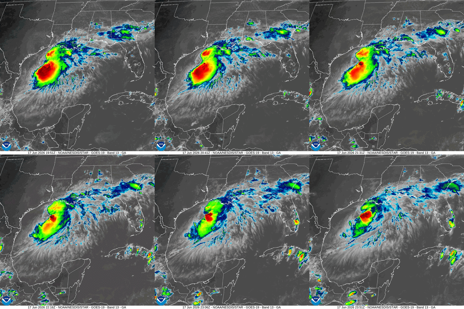
Tropical Storm Arthur was named at 11 AM ET on Wednesday, briefly intensified to 40-knots, and now has moved inland again around Galveston, Texas.
The system is highly wind sheared so quite asymmetric and disorganized. However, Arthur is generating deep convection with embedded gusty winds > 40-knots over the open waters of the Gulf of America. All of that moisture will move inland ahead of the storm into Louisiana and then merge with a stationary frontal boundary.
—> Tropical moisture plume + Arthur + frontal boundary & upper-level jet —> quite a significant rainfall event for several states:
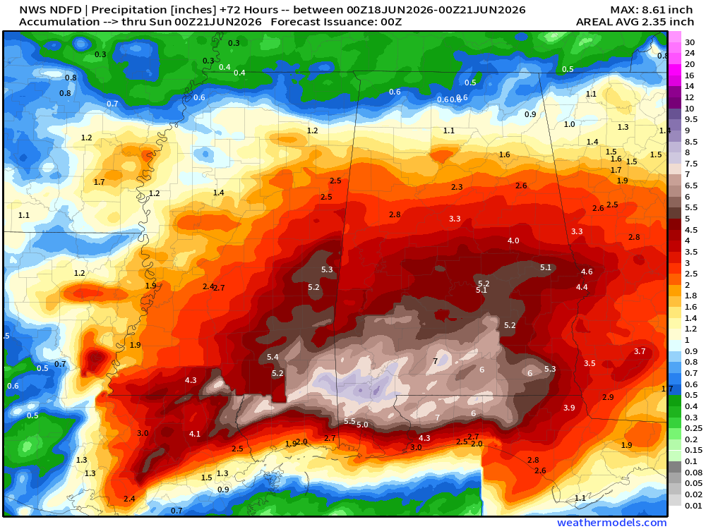
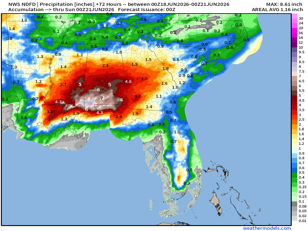
NWS Precipitation Next 72-hours —> Saturday Evening
We could see localized amounts of over 8” in Mississippi … and 4”-6” into Alabama over the next 48 to 72-hours
2” around Atlanta, 3” in Macon
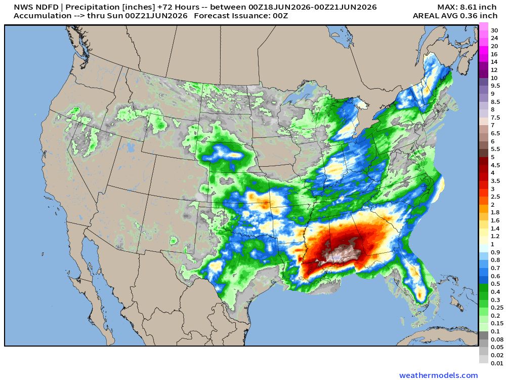
NHC moved Arthur inland — and will write it off by early Thursday as a post-tropical system
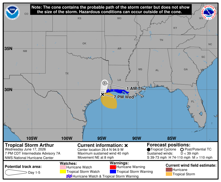
Arthur’s Second Act?
I think the remnants of Tropical Storm Arthur will maintain coherence and identity throughout its overland trip through the Southeast -- maybe even intensifying with assistance from jet stream. A second act is possible this weekend off the North Carolina coast --> out to sea.
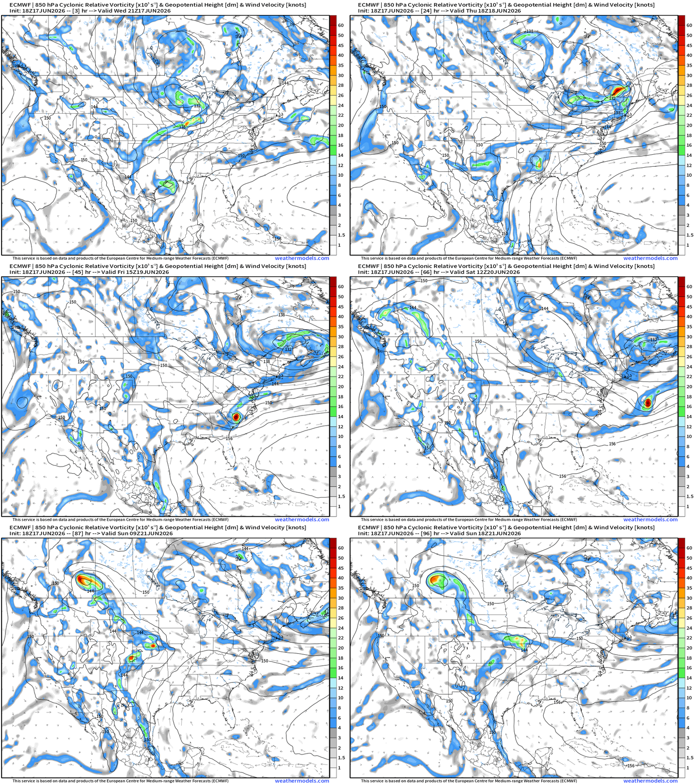
My favorite parameter — next 48-hours of HRRR Precipitable Water
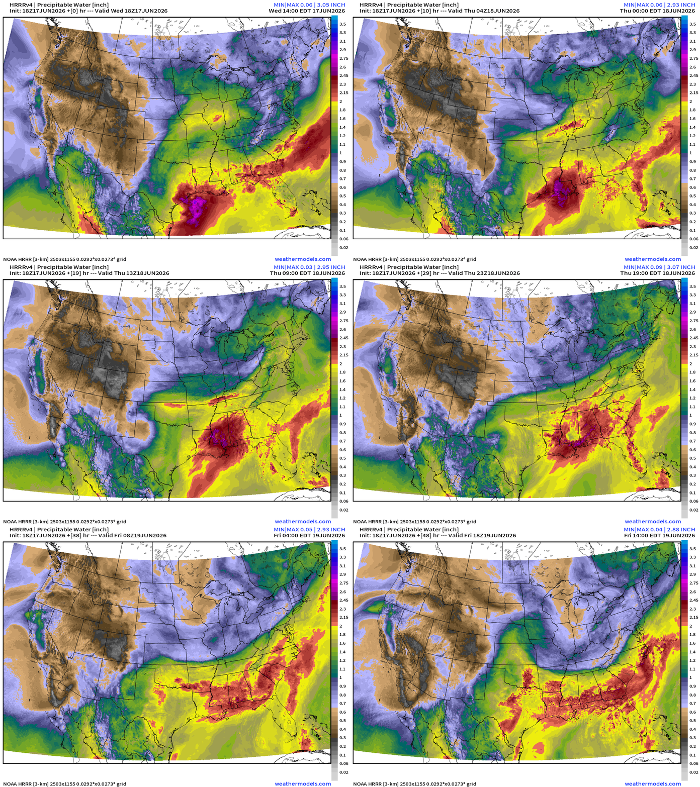
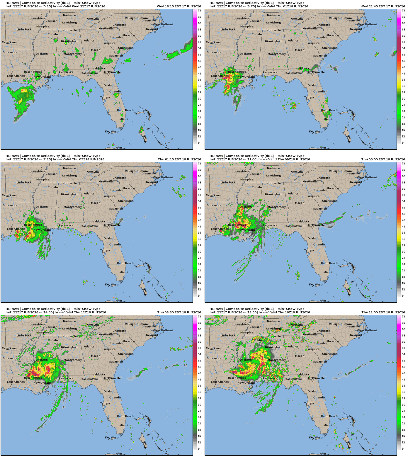
Post-tropical Arthur will look very healthy tomorrow morning swirling into Louisiana and Mississippi
Weather Into Thursday Morning — Severe Weather Outbreak Continues

HRRR Forecast Radar into Thursday Noon ET
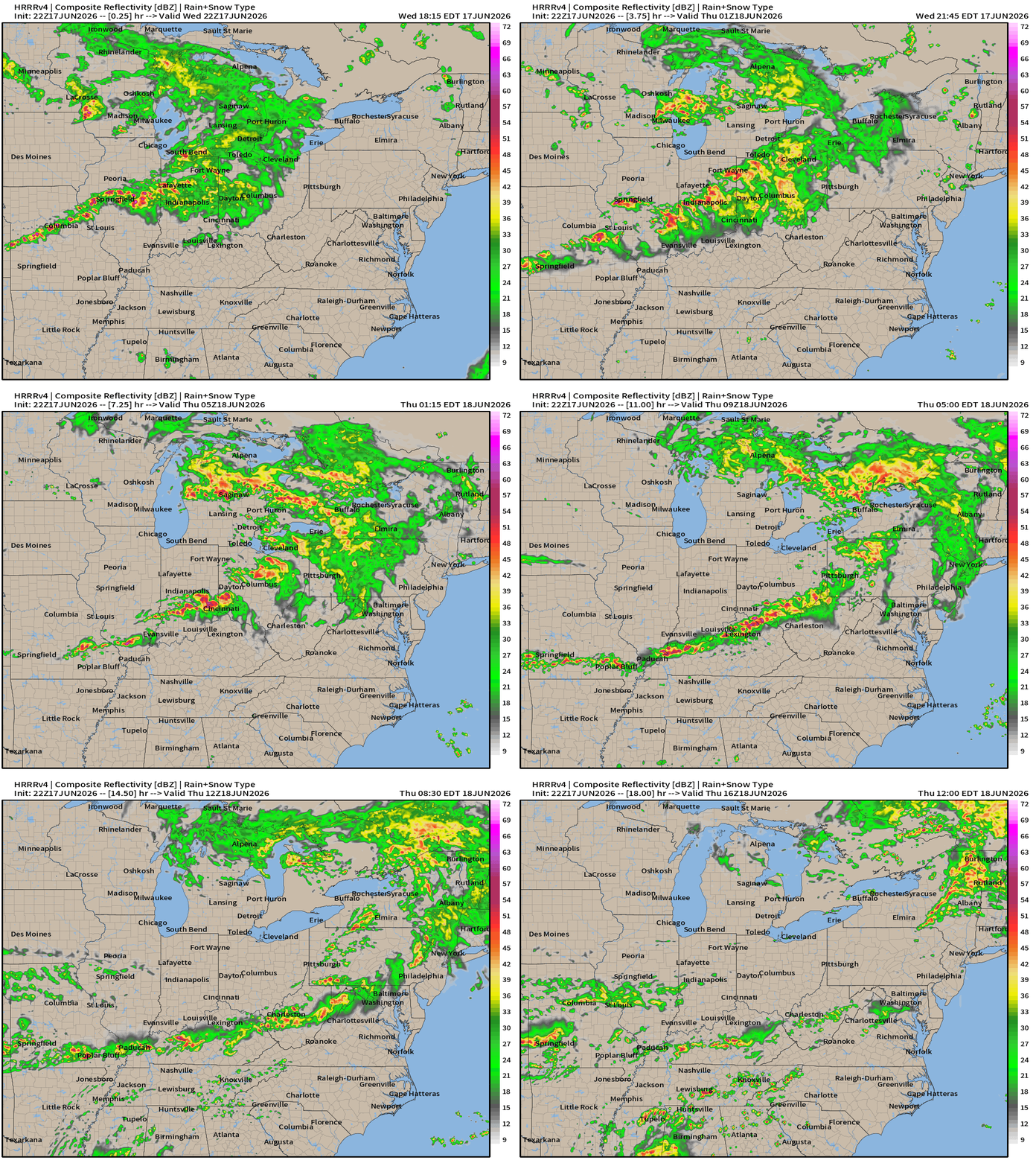
Current Convective Situation — Severe Thunderstorms Within Moderate Risk
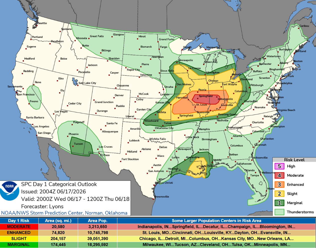
Numerous severe thunderstorms remain likely this afternoon into tonight, with the peak threat centered over Illinois and Indiana. Intense tornadoes, swaths of damaging gusts over 75 mph and damaging wind-driven large hail will all be possible.
Radar Observed to 9:04 PM ET — please use NWS/favorite app for updates
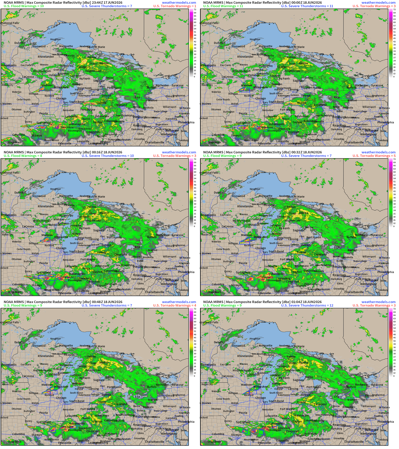
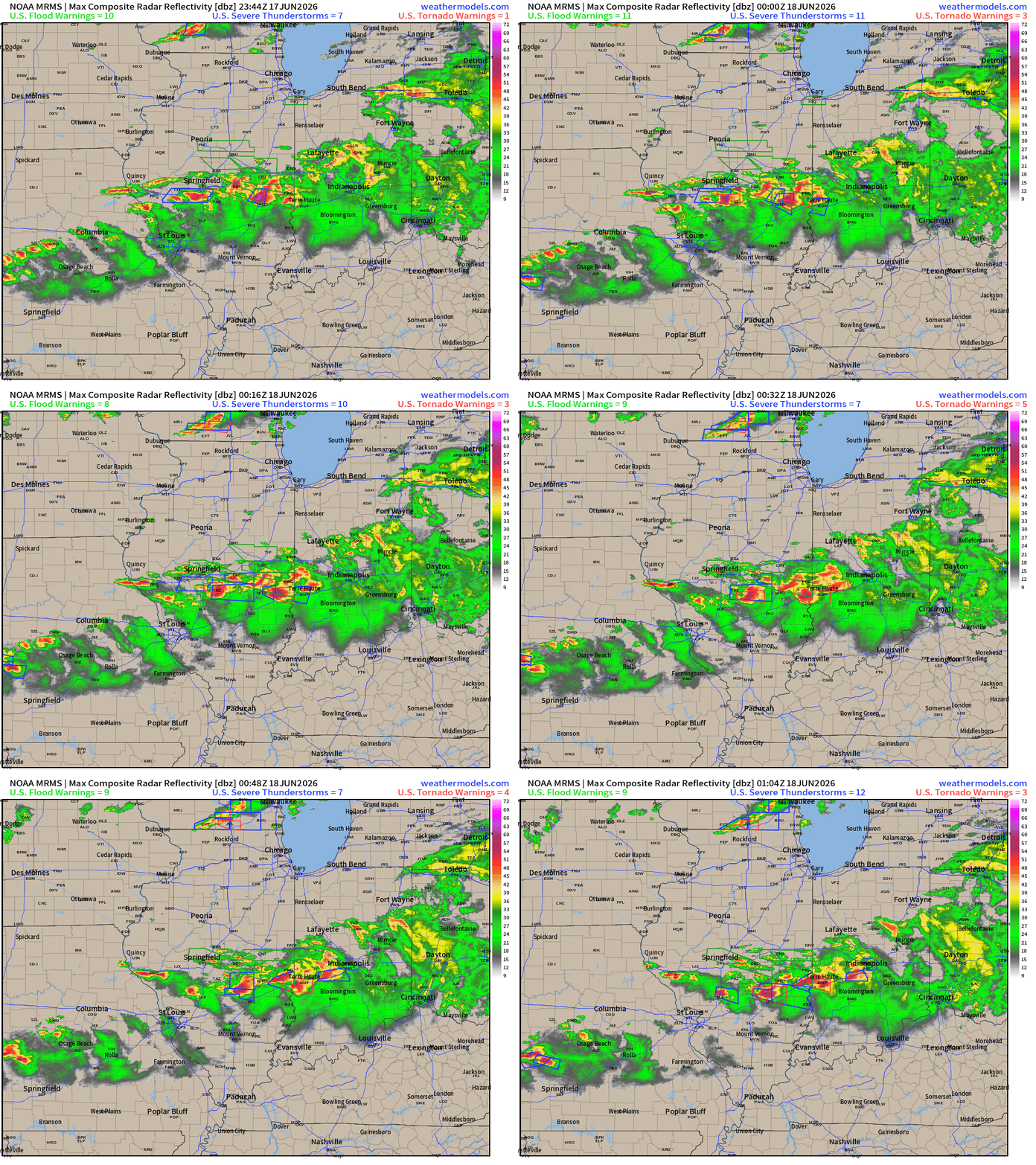
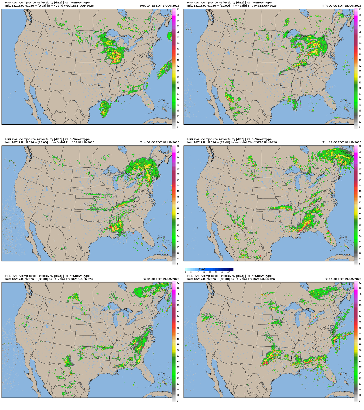
HRRR Next 48-hours simulated Radar through Friday 2 PM ET
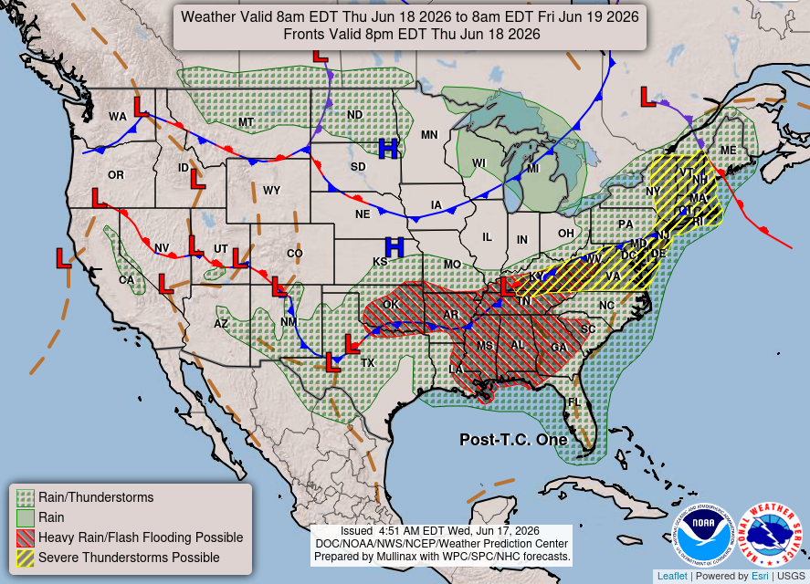
Weather on Thursday — strong storm system moves into Quebec (980s mb low pressure) + remnants of Arthur combine with frontal boundary
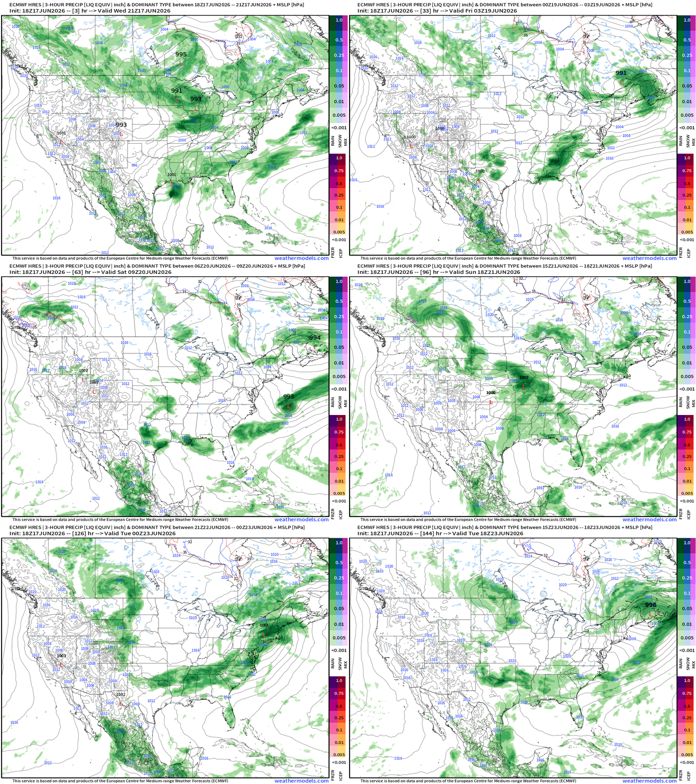
ECMWF 18z | Precipitation + MSLP | Next 6-days
Boatloads of Rainfall still on the way
Blend of Models —> Precipitation Next 9-days
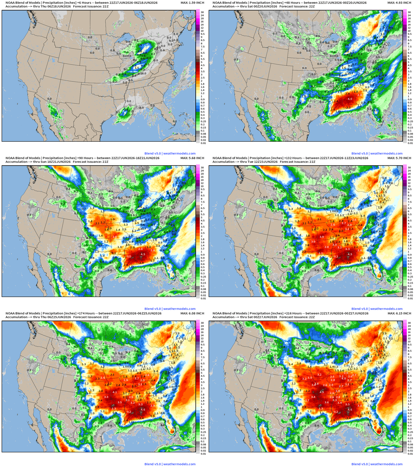
Much of the Eastern U.S. will see 2”-4”+ of rainfall — into last week of June
Help support this newsletter (nearing post 1,000!) —> June 2026 Coupon
Flagship model: ECMWF AIFS 18z —> Integrated Vapor Transport next 10-days
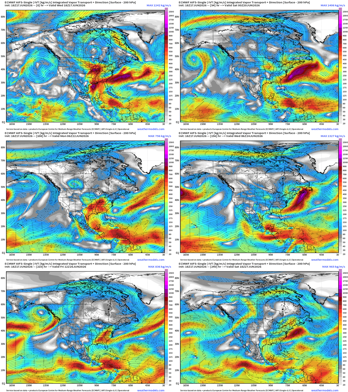
On the periphery of the trough across Canada, storm systems track through the Great Lakes and collect the tropical moisture coming out of the Gulf of America into the warm sector conveyor belt to fuel thunderstorms.
The deep layer moisture plume from the Caribbean into the Gulf of America is shut down into later next week as a ridge forms over Florida and drifts westward to Texas —> subtle pattern shift, but signs it will return flow into the U.S. again
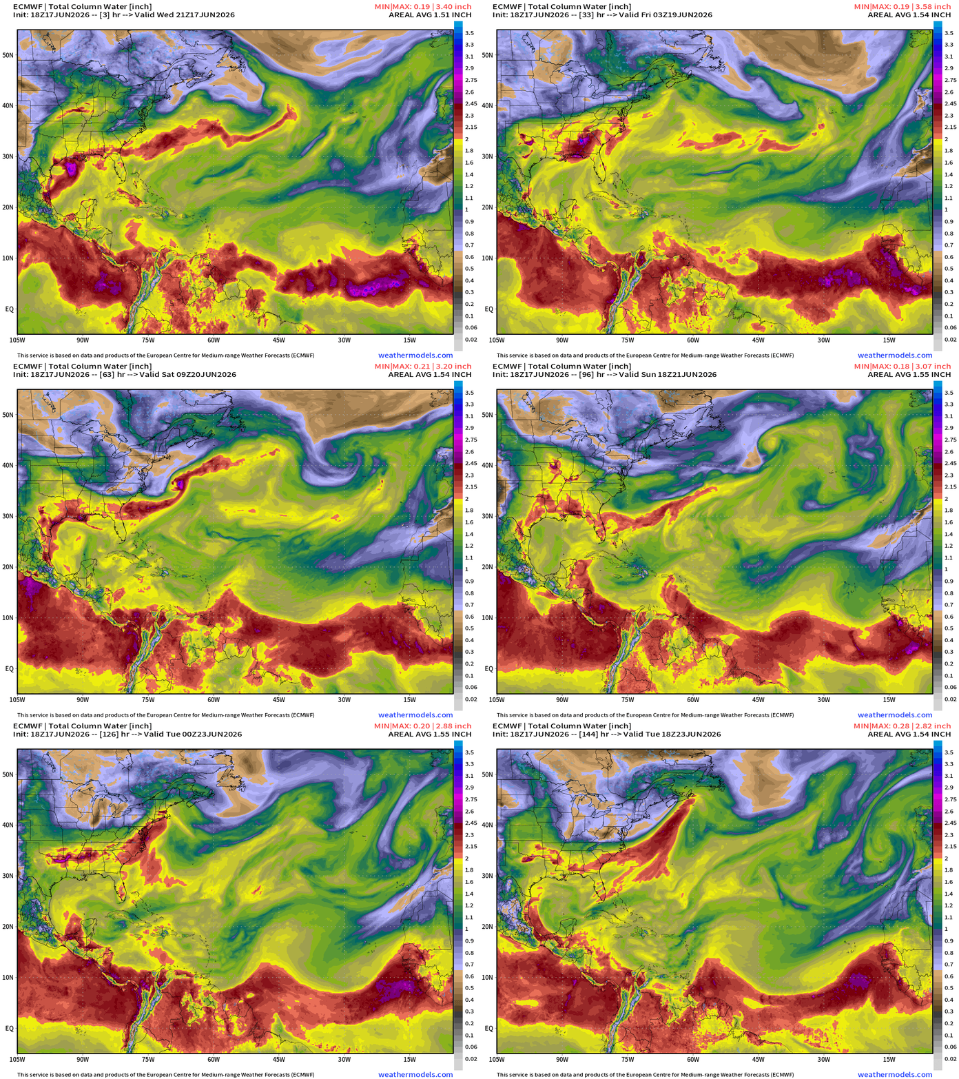
ECMWF 18z | Precipitable Water | My Favorite Parameter
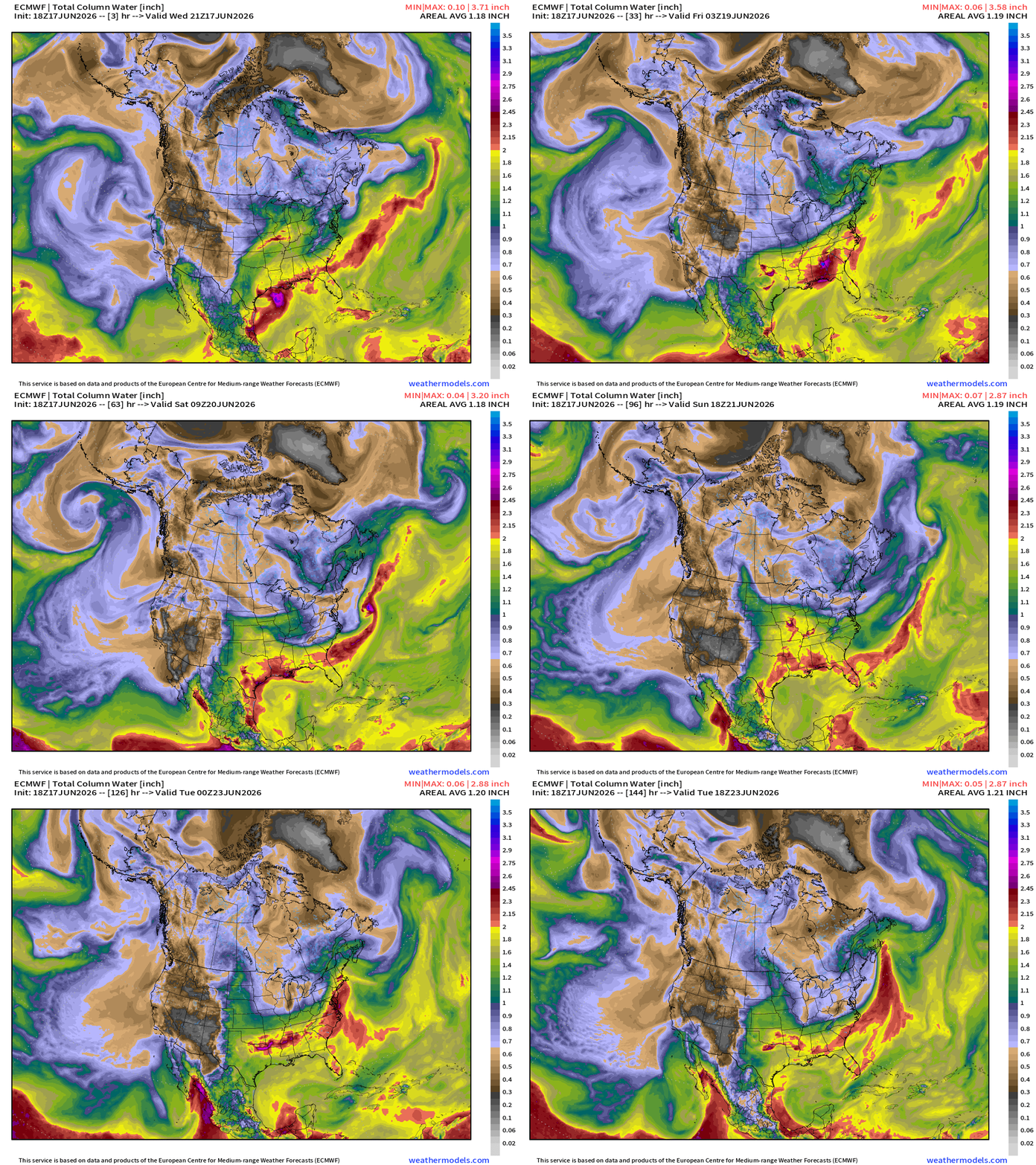
The main source of high precipitable water air is the Gulf of America, and surges northward into storm systems tracking through the Midwest and Great Lakes.
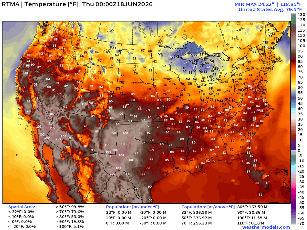
Temperature Analysis | RTMA | 8:00 PM ET
Temperature Anomaly | RTMA | 8:00 PM ET
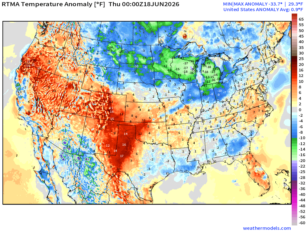
Lower 48 was +0.9°F above normal
High Temperatures Next 8-Days —> Friday June 26th
Trying a video upload option rather than GIF — to see how they play in the app, and how much control there is to the user + email integration.
Low Temperatures on Thursday
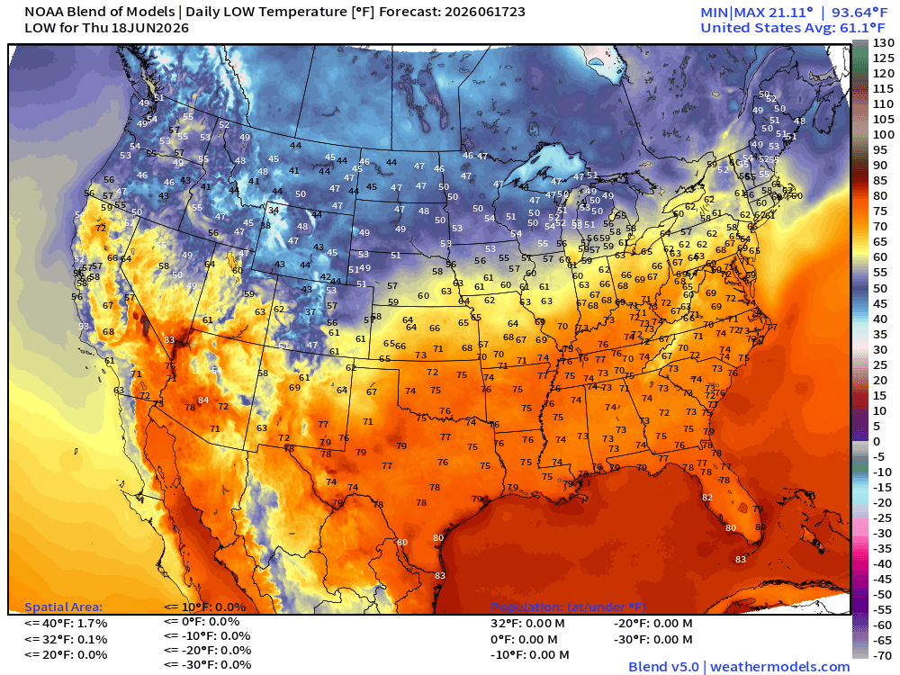
Nice and cool across the Northern Rockies and Midwest
High Temperatures on Thursday
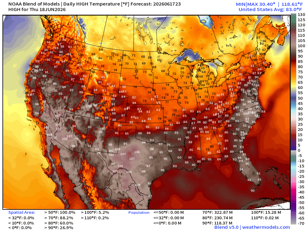
118 million Americans at least 90°F — Texas, Carolinas, Florida, D.C. to NYC add up a lot of population into a smaller area
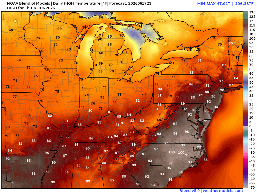
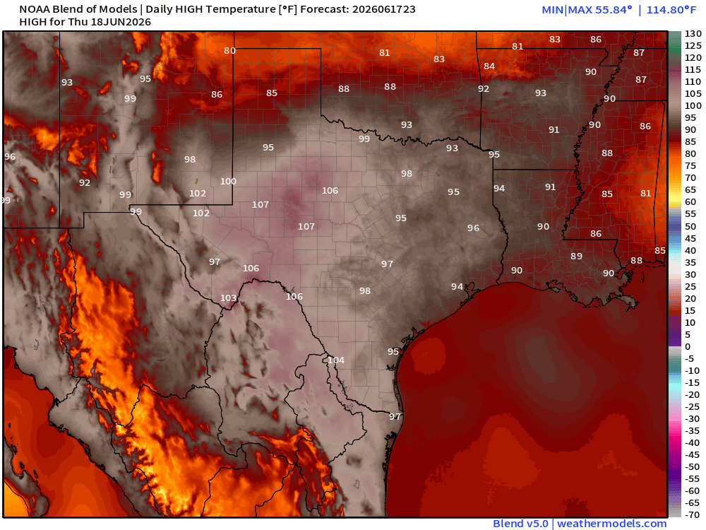
Maybe 110°F in West Central Texas
High Temperatures on Friday
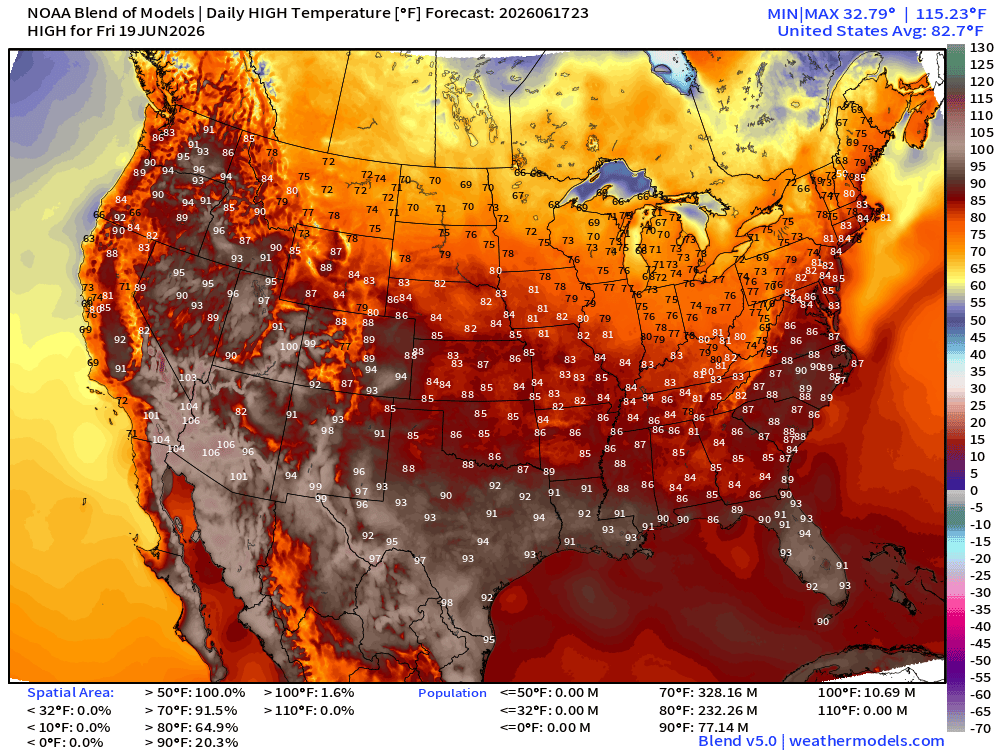
77 million at least 90°F … lost them in the Southeast with the rain & clouds from Arthur
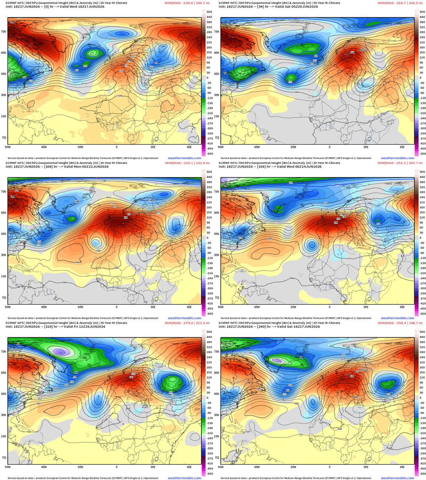
Upper-Level Height Anomaly | AIFS-Single Next 10-days
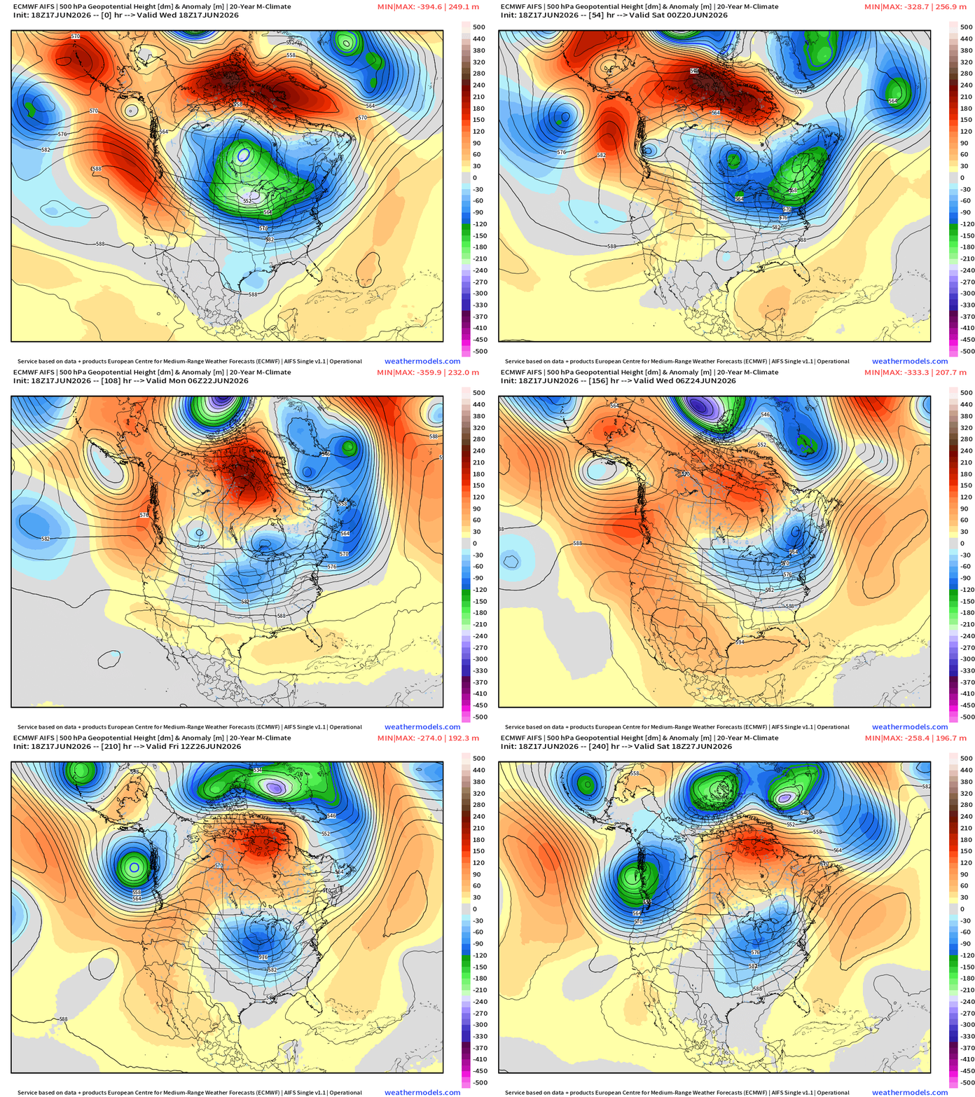
The persistent trough over Ontario and the Great Lakes eventually breaks down and progresses in the Atlantic. However, multiple short-waves spin out of Alaska/Western Canada with the storm track. This limits “heat dome” ridge formation over the Eastern U.S. almost completely through end of June with most abnormal heat confined to the Western U.S.
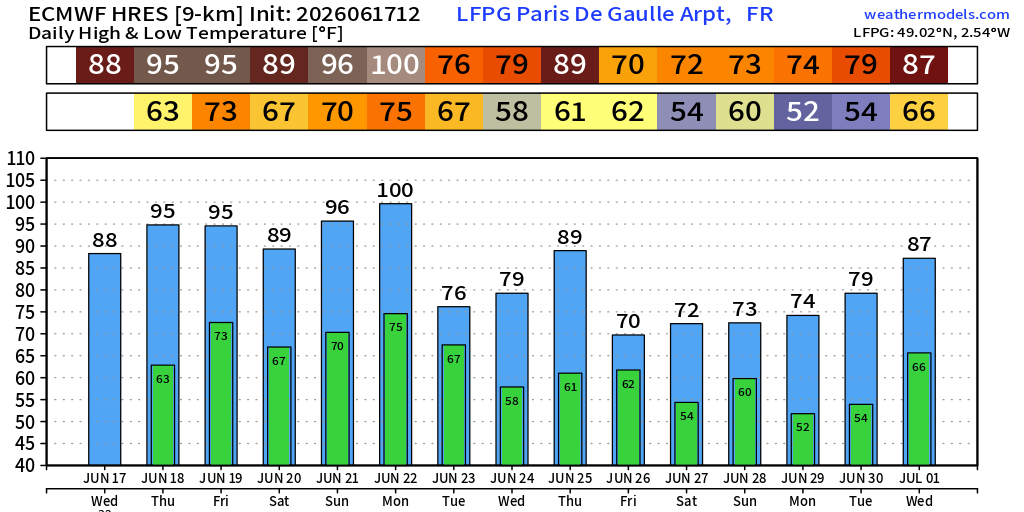
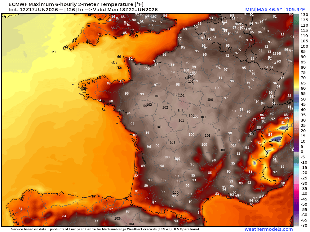
European Heat Dome Next 10-days centered upon France
100°F in Paris on Monday?
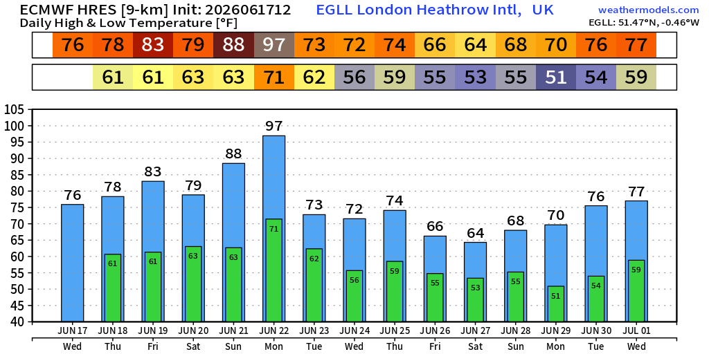
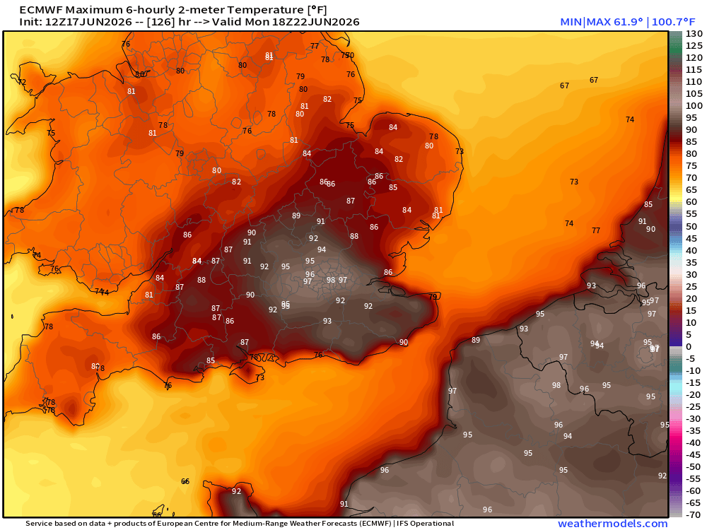
How about 97°F in London on Monday?
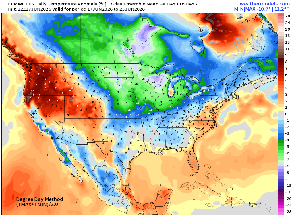
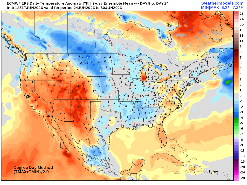
ECMWF Flagship Ensemble Mean Temperature Anomaly next 15-days
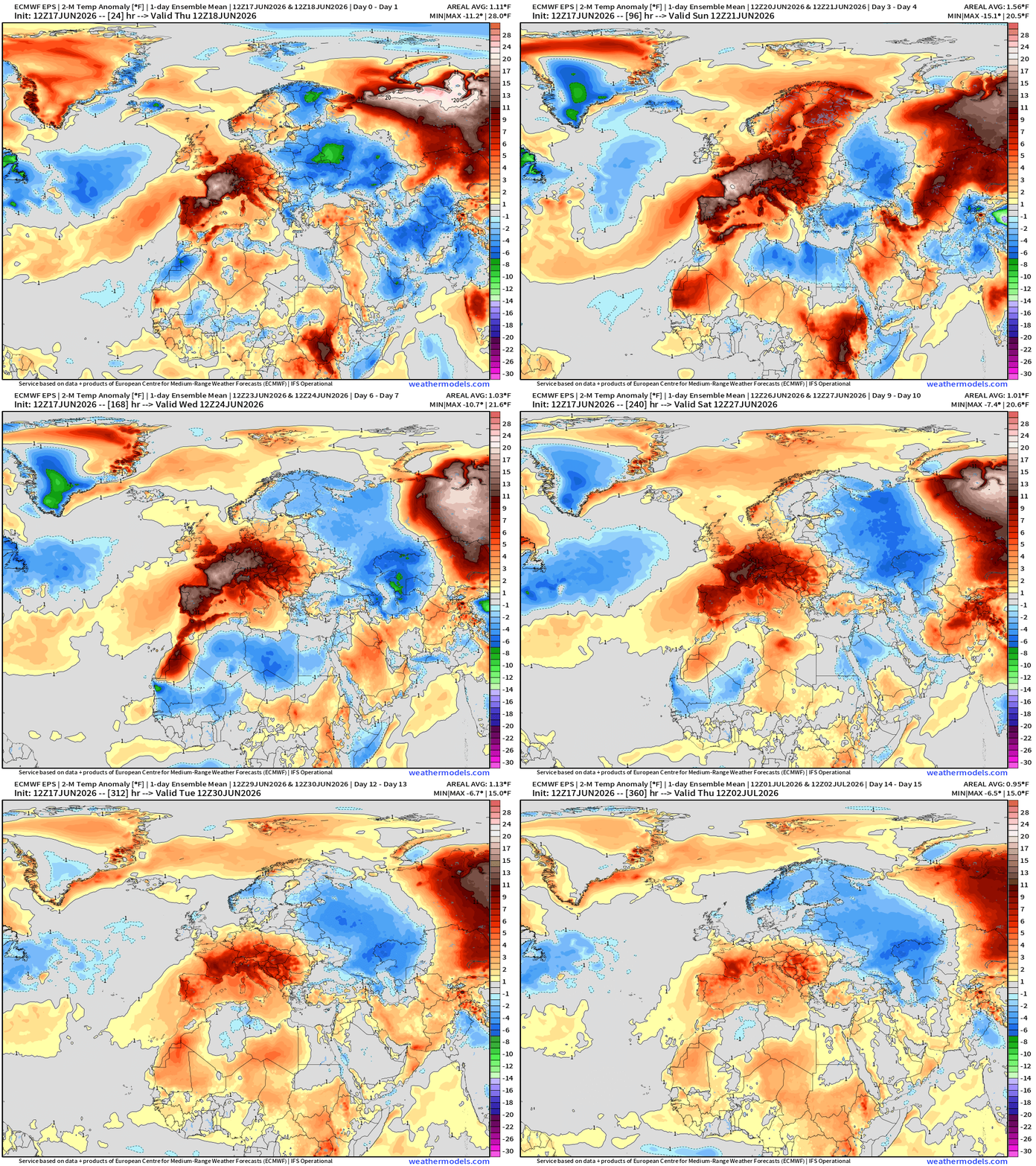
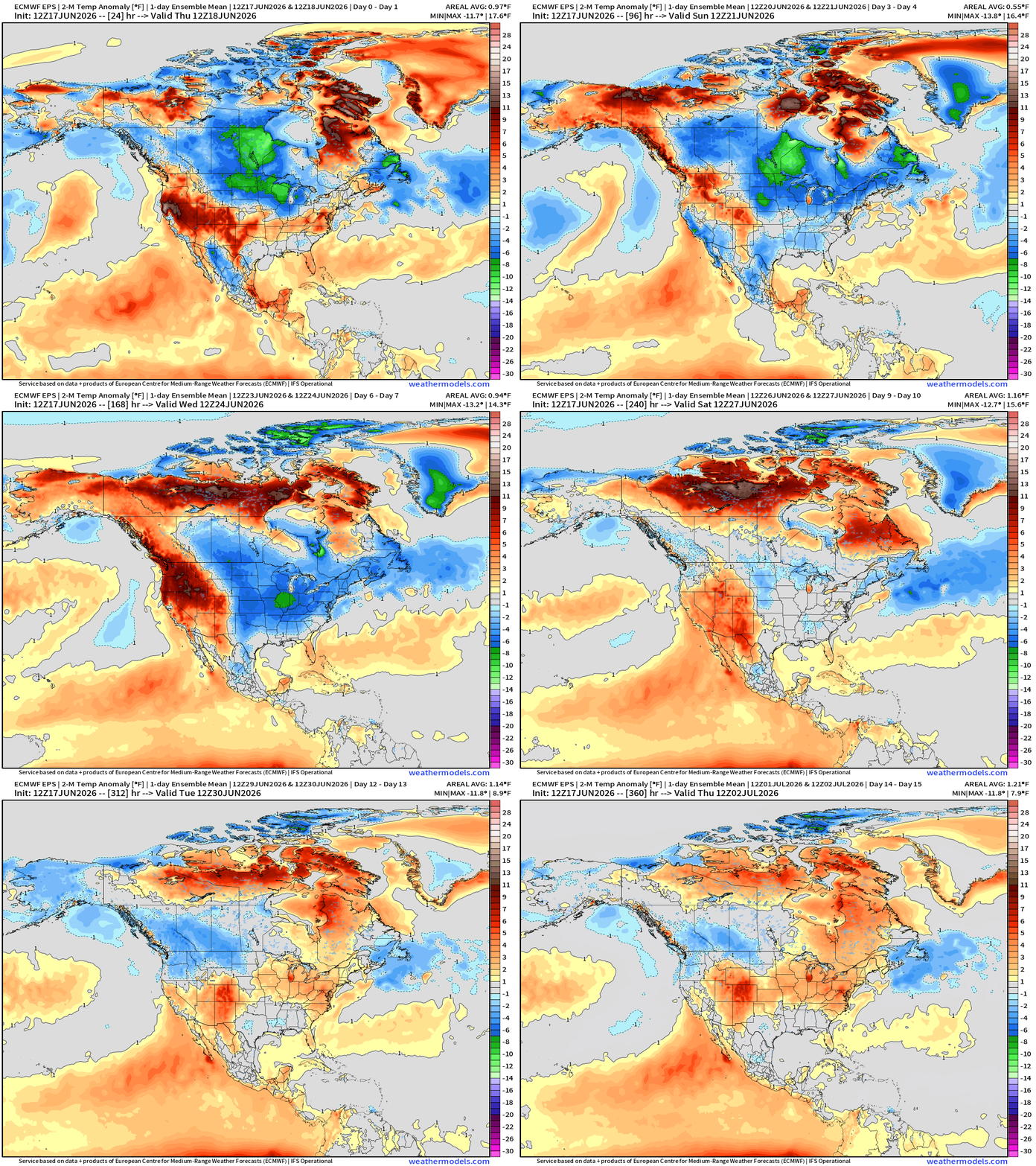
Week 1 —> June 17 to June 23
Week 2 —> June 24 to June 30
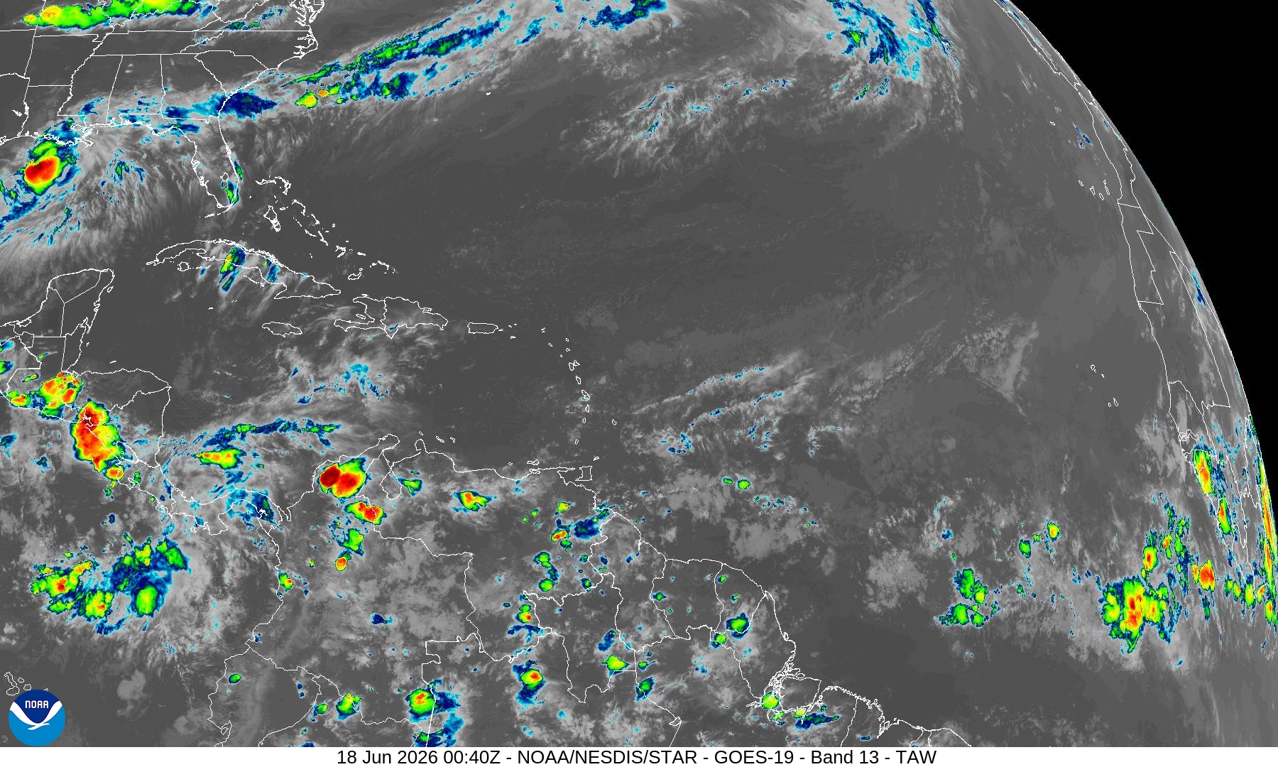
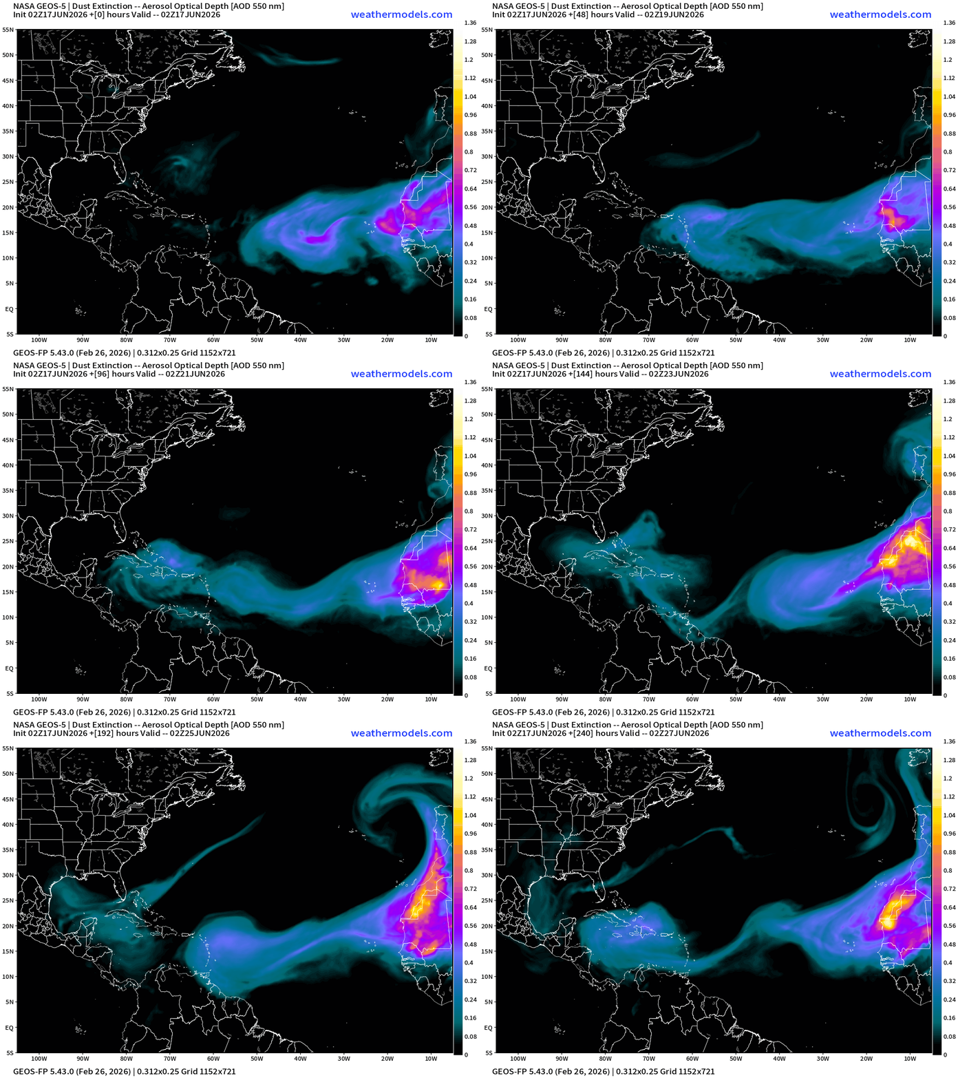
Aside from Arthur, the Atlantic basin is very quiet under control of Saharan Air + Dust Layers
Dust Forecast | NASA GEOS-5 Model Next 10-days
Thank you for reaching the end of this post! Hopefully you enjoyed the beautiful weather maps. Please help increase the visibility of Weather Trader on Substack: Share or Like!
Help support this newsletter (nearing post 1,000!) —> June 2026 Coupon
Maps sourced from weathermodels.com designed and innovated by yours truly! Please subscribe there for real-time access to the newest maps, charts from all of the weather models including ECMWF and AIFS, and NOAA GFS/GEFS, HRRR/RRFS and Blend of Models (NBM). NOAA WPC and SPC for fronts/convective outlooks.
My Atlantic Hurricane Season Forecast (2026)
From April 7, 2026: Atlantic Seasonal Hurricane Forecast: (11/5/2)
9-13 Named Storms (11 most likely)
4-7 Hurricanes (5 or 6 most likely)
1-3 Major Hurricanes (2 most likely)
Accumulated Cyclone Energy: 75-85 (well below normal)
NOAA 2026 Atlantic Hurricane Season Forecast
- Milepost
- 962 · laid 2026-06-18T01:46:19.432000Z
- Source
- https://weather.substack.com/p/june-17-2026-wednesday-late-spring
- Digest
- c77ab2c70e8733f7720a392f8c517c0d3741f900a7c7cdb2f08436c5242a1c4a
- Machine
- JSON