May 31, 2026 Sunday Spring Weather
Omega block patterns limiting rainfall to eastern U.S. with repeated troughs
June 2026 was the 18th-warmest June in the 132-year national record (1895–2026), at 70.6°F against a 1991–2020 normal of 69.5°F (+1.2°F).
June 2026 was the 32nd-wettest June in the 132-year national record (1895–2026), at 3.3in against a 1991–2020 normal of 3.1in (+0.2in).
NOAA/NCEI Climate at a Glance, contiguous United States. This is the observed record for the month, not a score of anything said in this piece — the forecast ledger begins 2026-08-17 and cannot reach earlier posts.

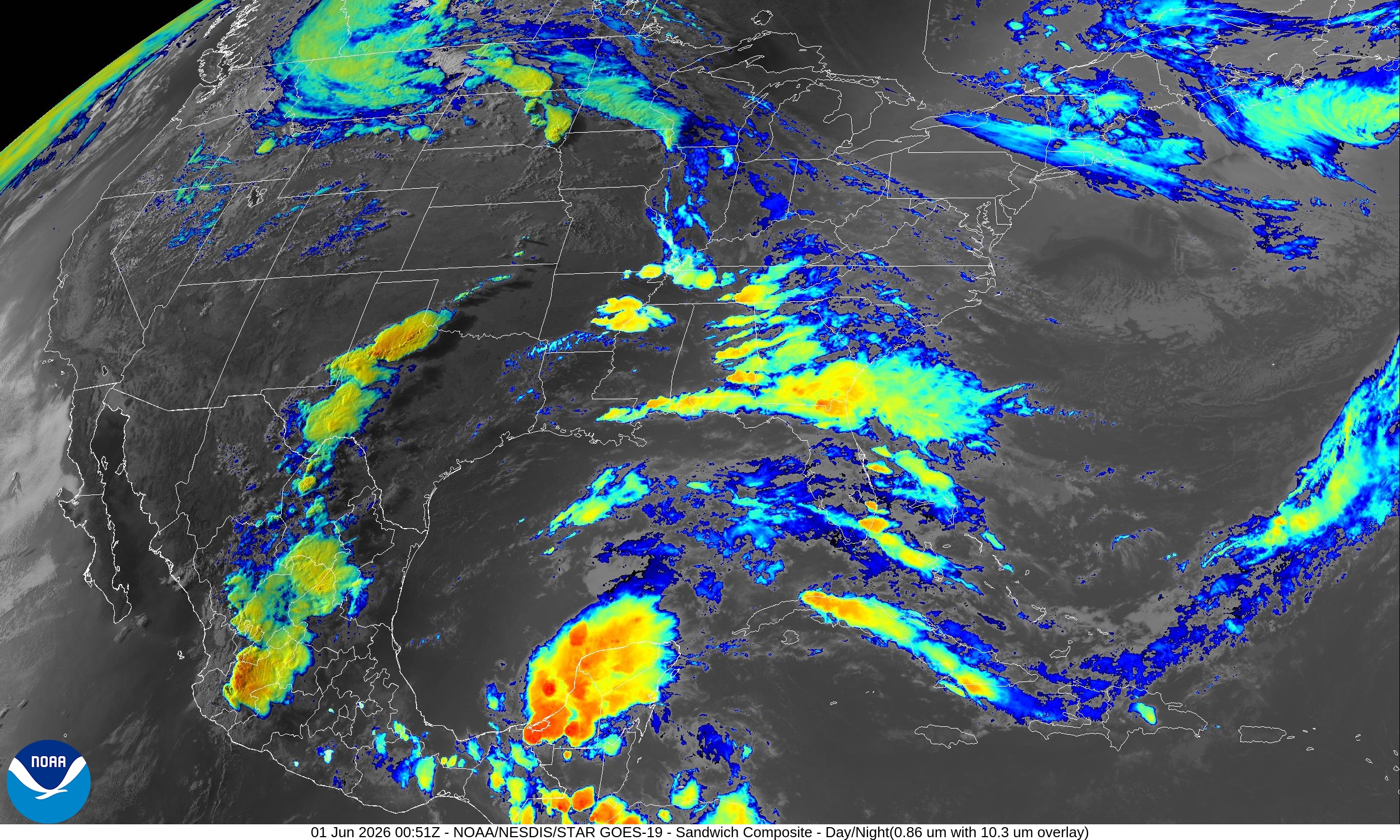
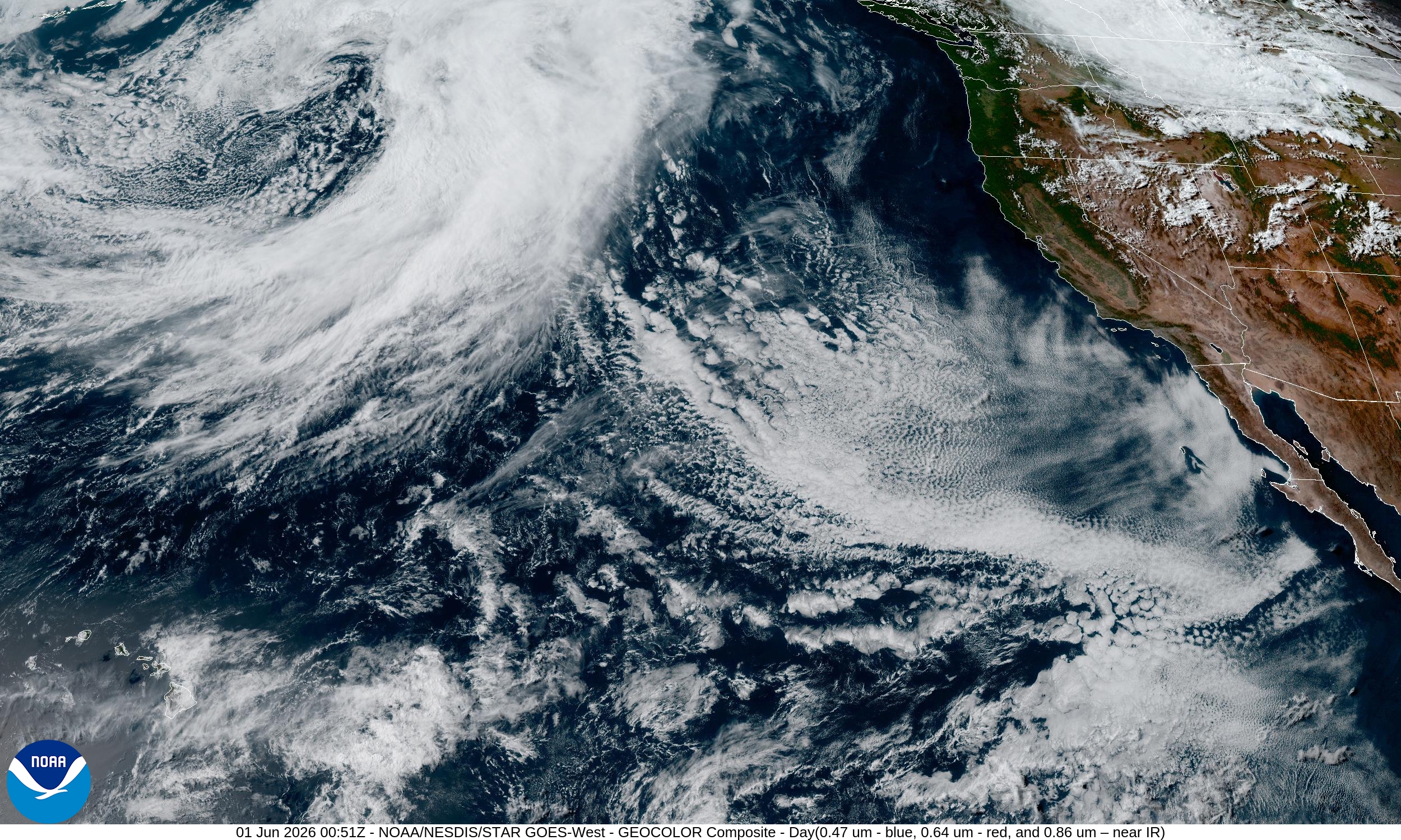
.ECMWF 18z | Forecast 6-days of Precipitable Water (my favorite parameter!)
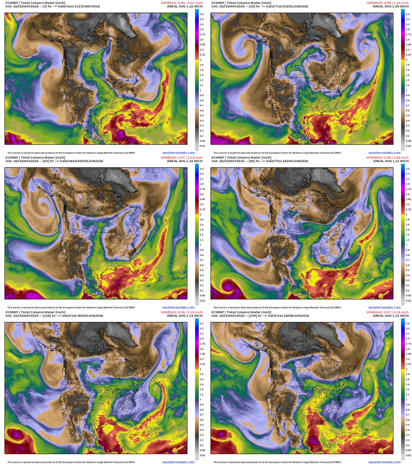
Yet another back-door cold front with a trough will travel southward through the Northeast, Mid-Atlantic, and into the Southeast into Thursday with dry, easterly winds.
In the middle of the Lower 48, a moisture plume out of the Gulf of Mexico reaches Canada but the main event arrives into end of the week with much heavier “tropical” moisture into Texas.
West Coast also will see a strong cut-off or shortwave trough dipping out of the Gulf of Alaska.
Omega Block Pattern | Next 6-days of troughs and ridges
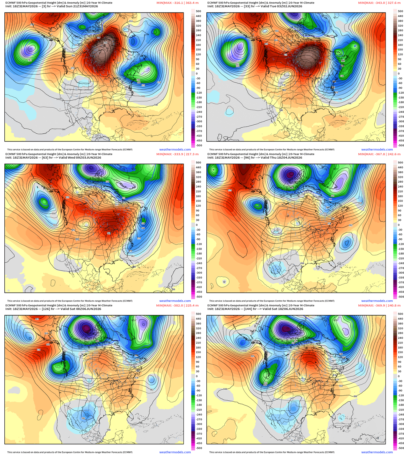
Monster mid-level trough over the Arctic — highly anomalous — keeping the polar regions over the Arctic Ice continued cold, and not allowing any warmth more moisture from the oceans or land to intrude upon its precious real estate.
Temperature Anomaly Next 6-days — into Monday Afternoon
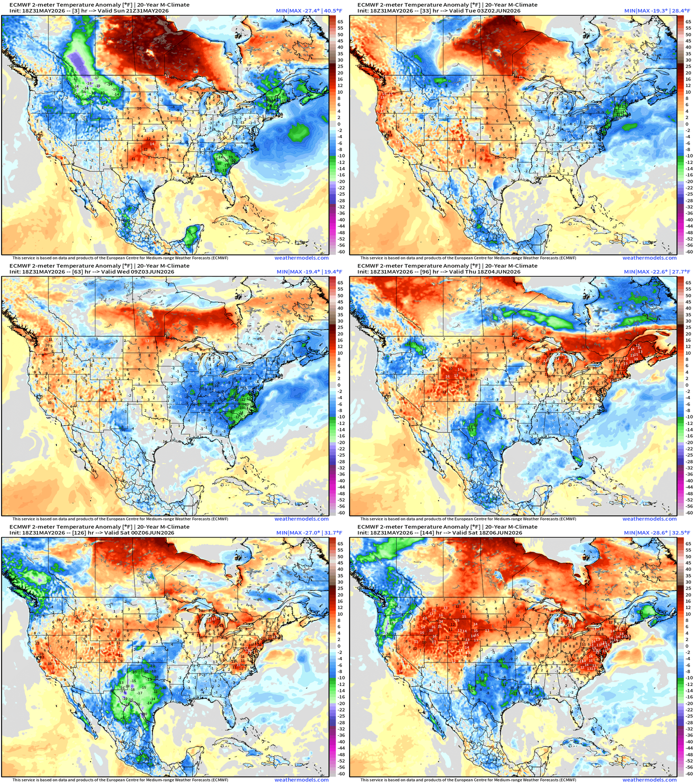
More cooler air for the Northeast and Mid-Atlantic into the Southeast — then Texas during the next week.
However, there is some “red” and much above normal warmth/heat = 80s and 90s that will build across the Midwest into the Great Lakes, and then Northeast by the weekend.
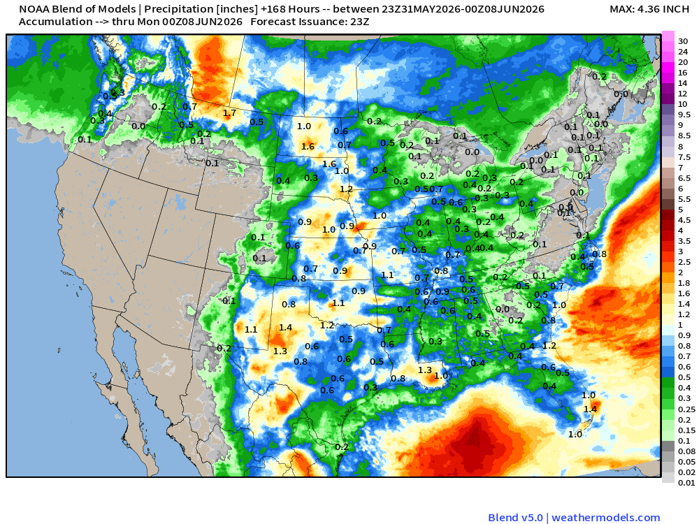
Precipitation Next 10-days | Blend of Models (v5.0)
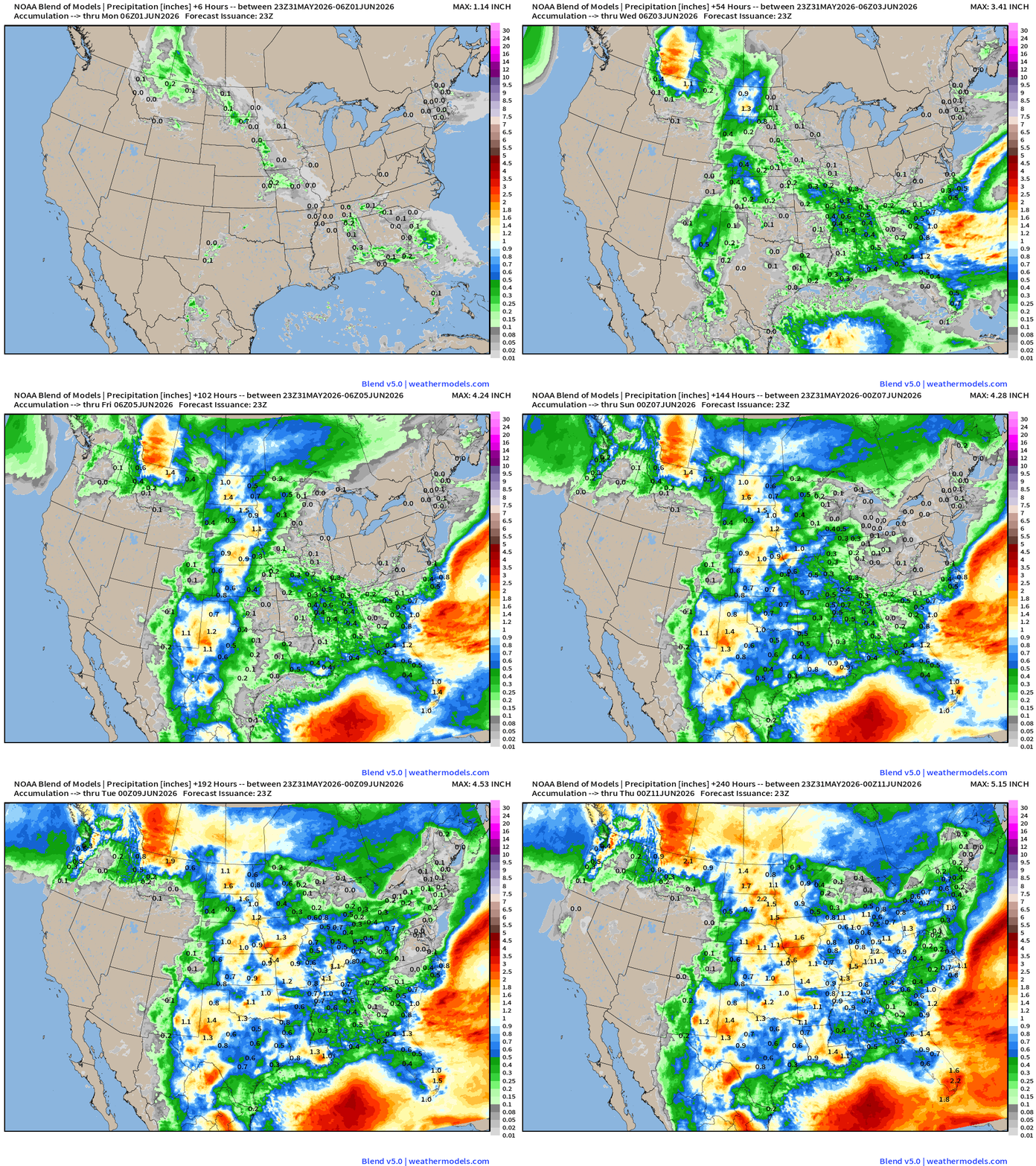
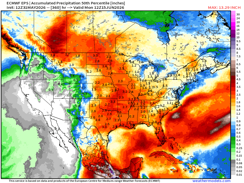
An inch of rainfall east of the Rockies might be generous over the next week with scant amounts in the Great Lakes and Northeast until after next weekend.
Overall, this is rather dry in terms of what’s expected with heat and humidity in early June. However, the influence of the Canadian Arctic from the troughs spun off from the Omega block ridge will keep things drier than normal.
High Temperatures Next 9-days until Tuesday, June 9th
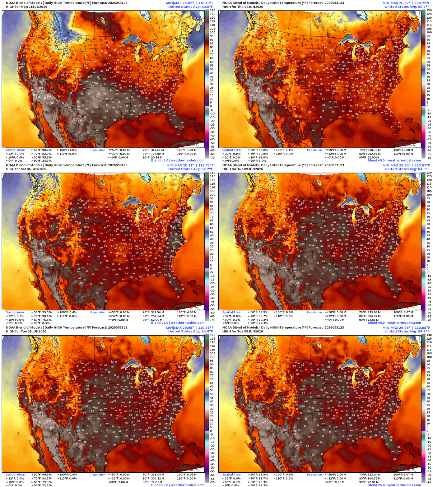
Comfortable temperatures in the 70s and 80s for the next few days, and then we add a few more into the 80s and 90s by the weekend into the following week.
While we go over 300 million Americans for 80°F+ … only 73 million at least 90°F.
ECMWF 18z | Precipitation Type + MSLP | Next 6-days
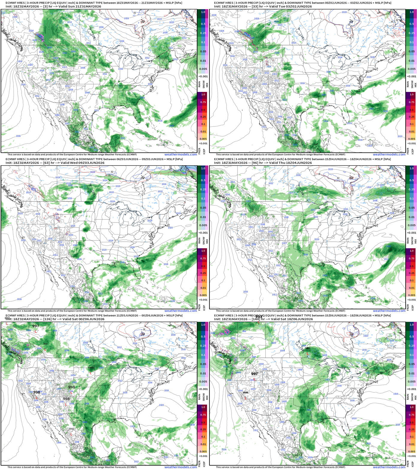
High pressure dominates the Mid-Atlantic through the weekend with the most active weather from Texas northward into the Plains and lower/mid Mississippi River Valley.
ECMWF Flagship Ensemble Temperature Outlook
Temperature Anomaly | Next 15-days | ECMWF EPS 12z Ensemble Mean
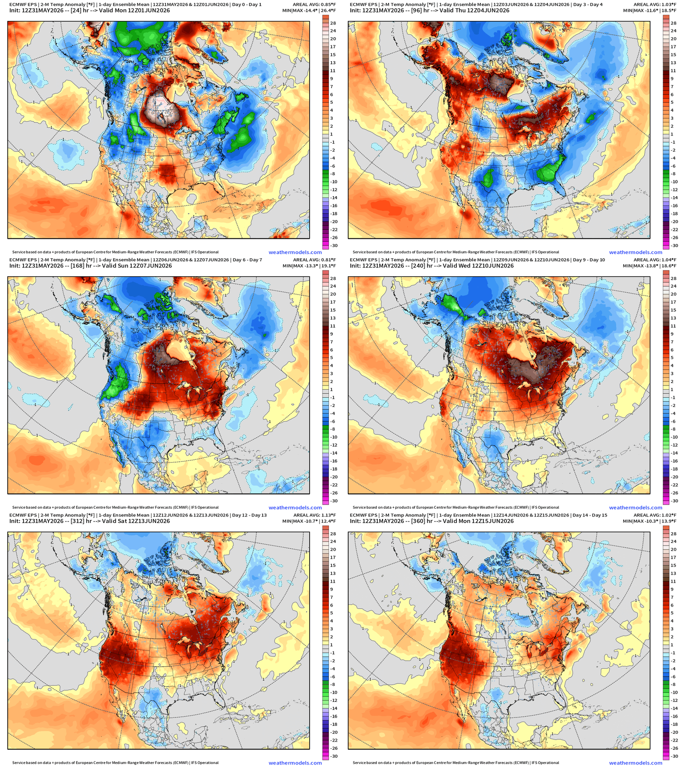
Trend toward more HEAT into mid-June across the Western U.S. and then centered on the Great Lakes and Northeast once we ditch these pesky troughs out of Canada.
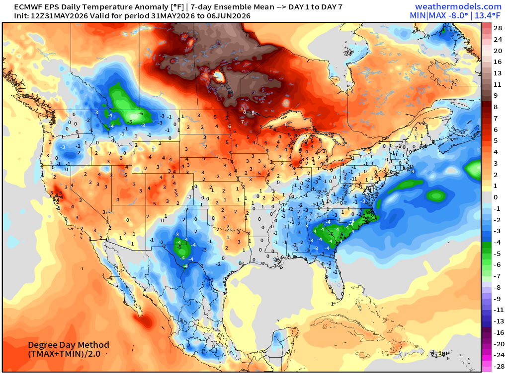
Week #1 | Temperature Anomaly | May 31 - June 6
Week #2 | Temperature Anomaly | June 7 - June 13
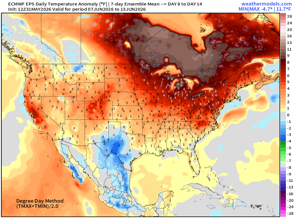
Except for Texas, plenty of RED and even dark red centered on Michigan and Ontario = heat wave into the 80s and 90s.
Integrated Vapor Transport | Next 10-days
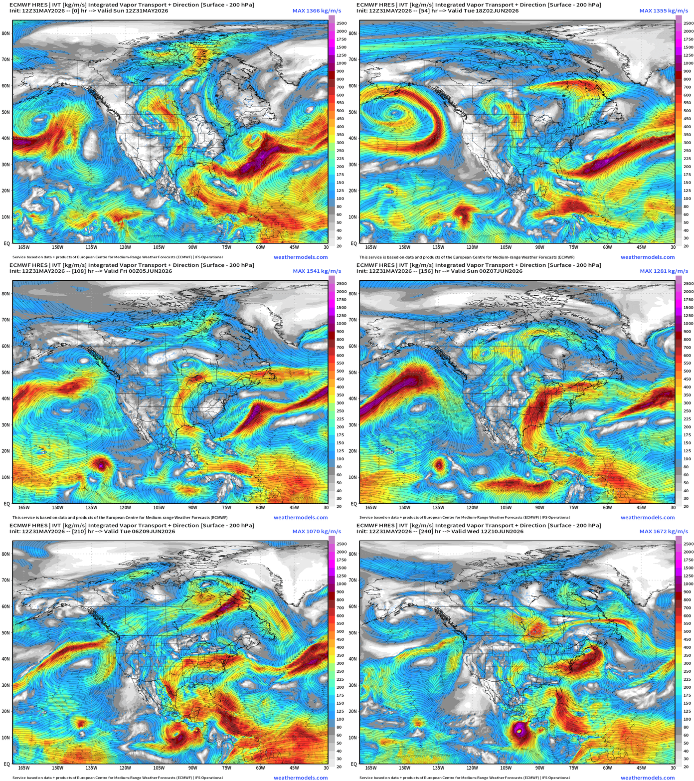
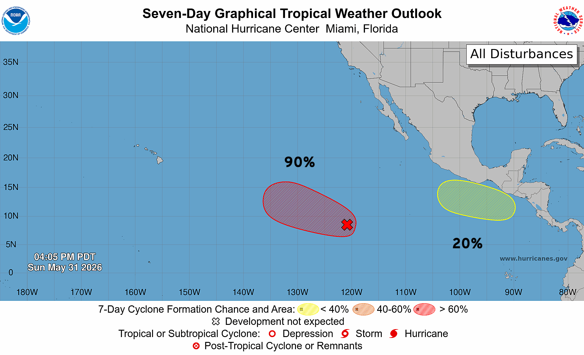
2 Eastern Pacific tropical storms possible … one way out there almost into the Central Pacific, and Day 7-10 formation along the coast of Mexico.
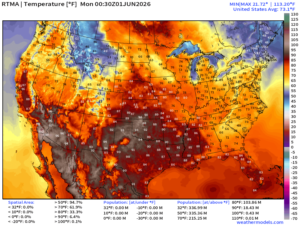
RTMA Current Temperature Analysis | 8:30 PM ET
RTMA Current Temperature Anomaly Analysis | 8:00 PM ET
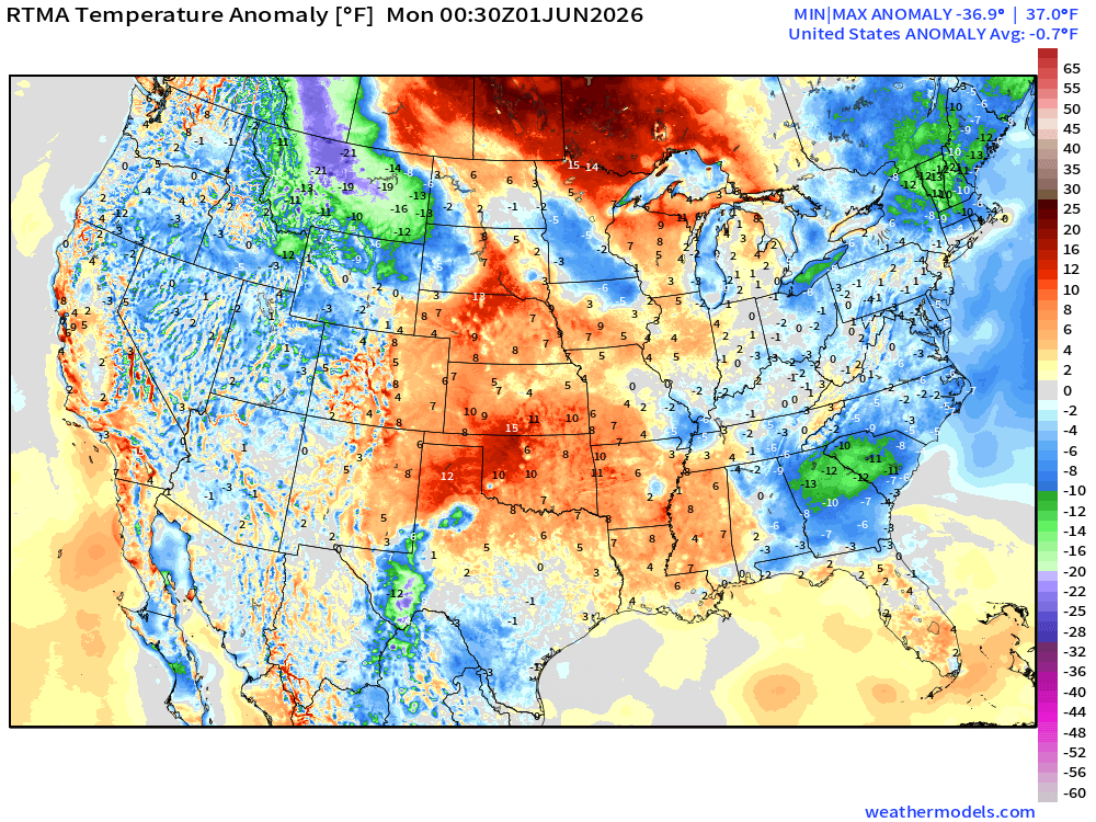
Lower 48 was -0.7°F BELOW normal
Low Temperatures Monday Morning
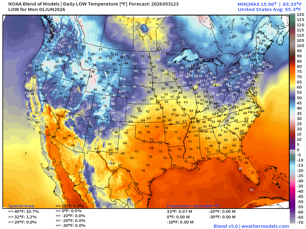
40s for the Great Lakes and Northeast, and 30s in Maine.
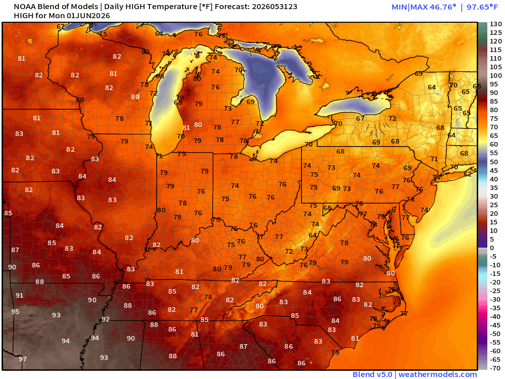
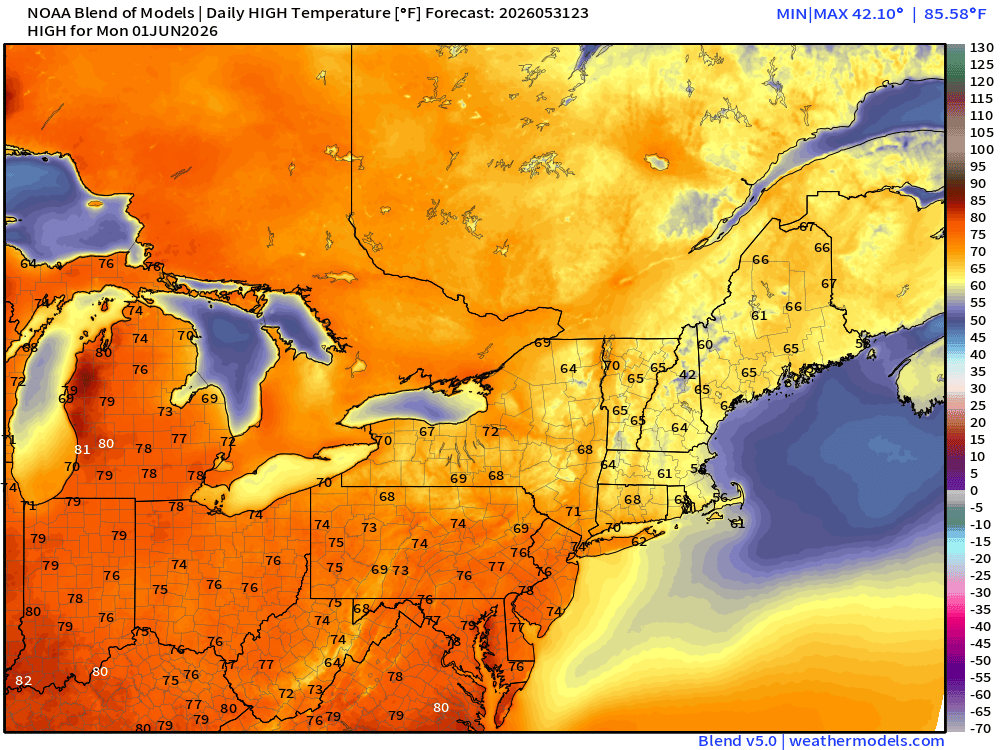
High Temperatures on Monday
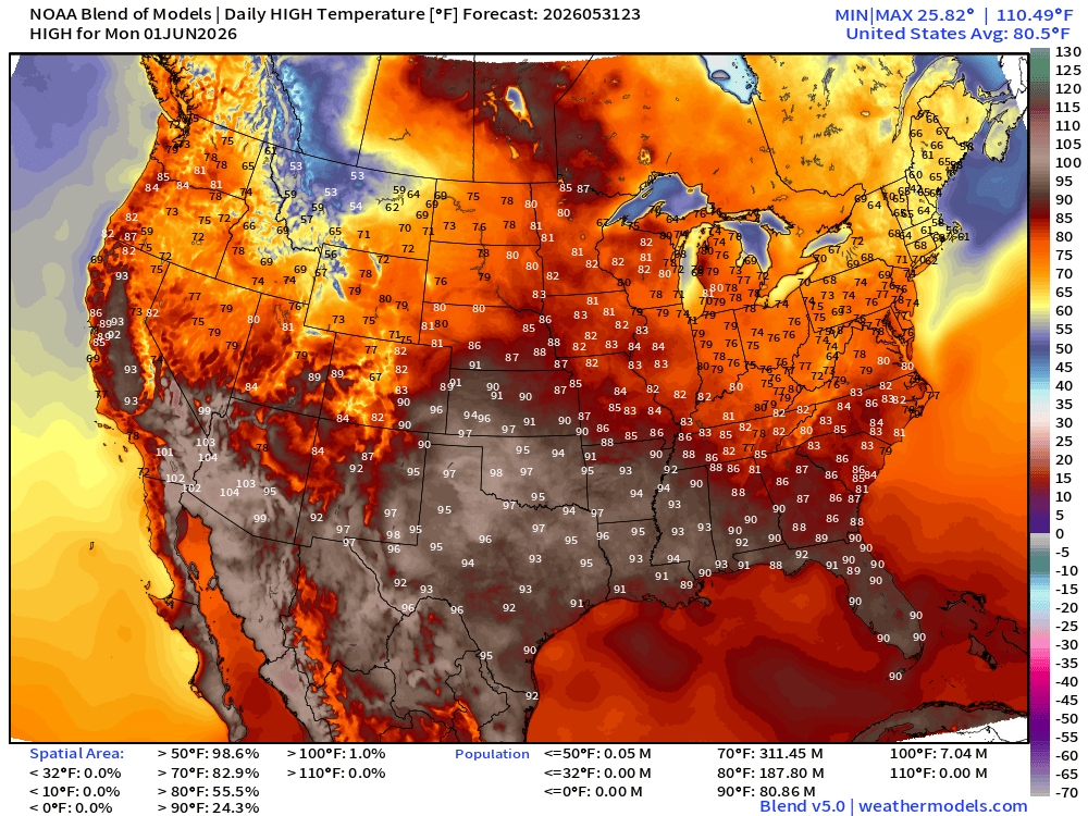
81 million at least 90°F … 60s and 70s in New England. 70s in the Great Lakes. Perfect weather to start meteorological summer.
Lower 48 Weather This Evening into Monday Morning
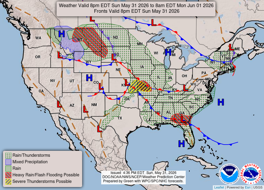
Still dealing with this weak frontal boundary sprawled across the Mississippi River into the Southeast with some disorganized showers and storms. Not expecting any major severe weather threats
HRRR 18z — Radar Simulation Next 48-hours to Tuesday 2 PM ET
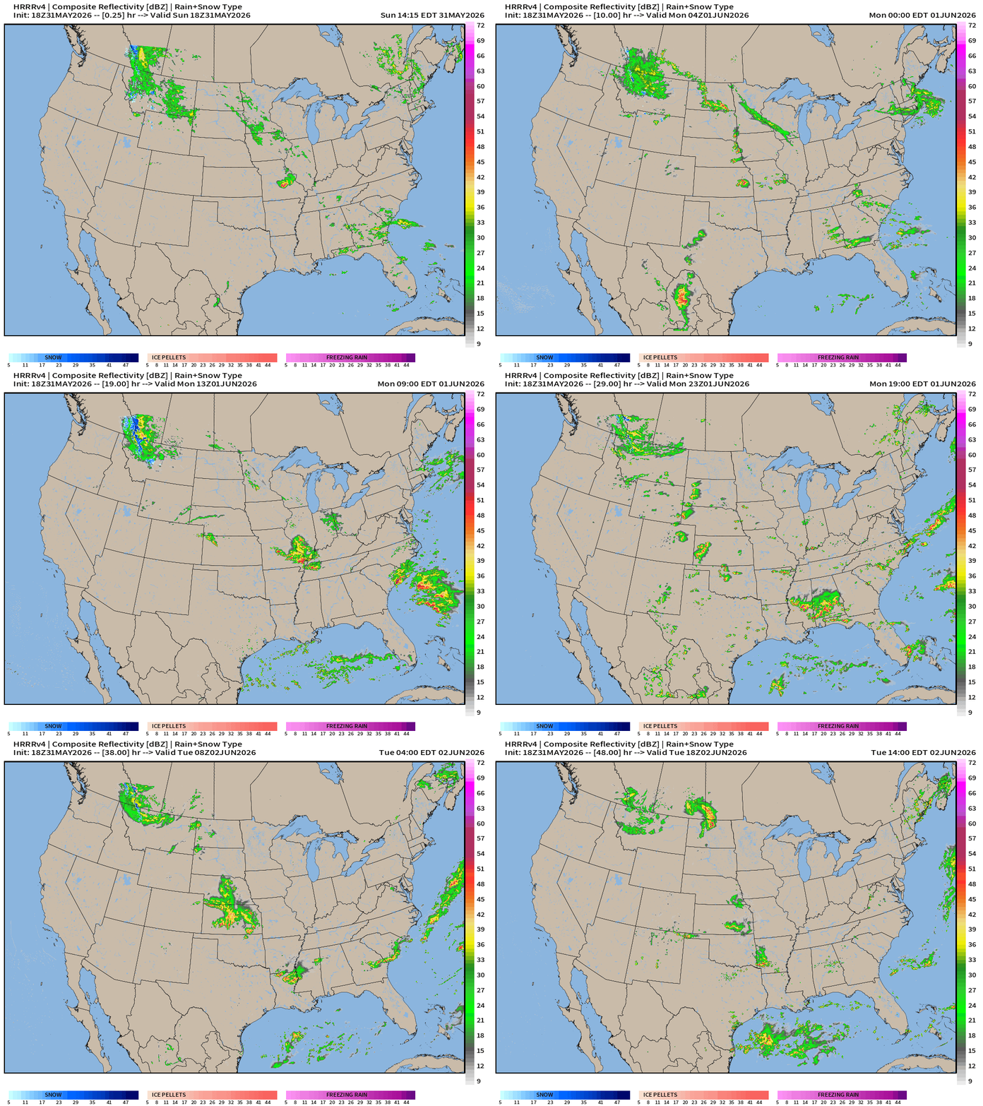
Weather on Monday
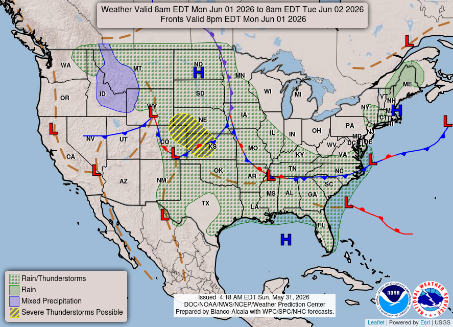
Similar synoptic setup with a backdoor cold front draped along the southern Tennessee line, some scattered showers with daytime heating.
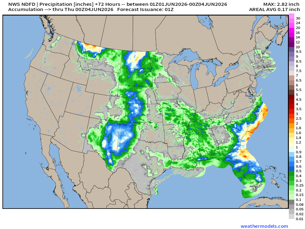
NDFD NWS Total Precipitation Next 72-hours through Wednesday Evening
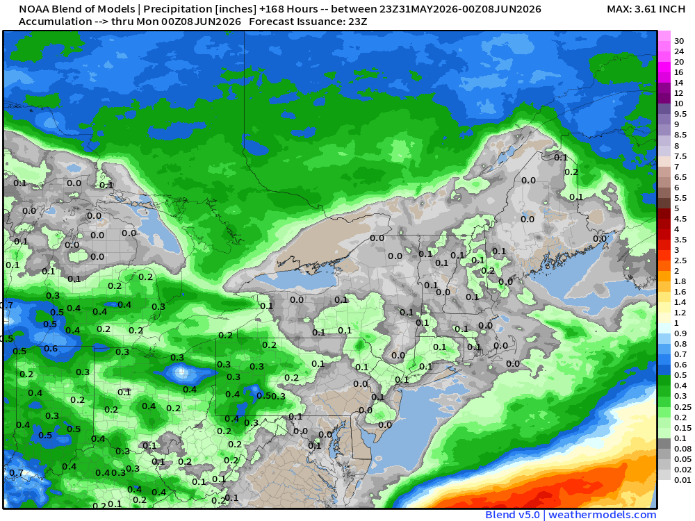
7-Day Total Precipitation | Blend of Models | Through next Sunday Evening
Not much rain at all through 7-days for the Mid-Atlantic and Northeast. Might be none.
Upper-Level Circulation Pattern
ECMWF AIFS-Single 18z | 500 mb Height Anomaly Next 10-days
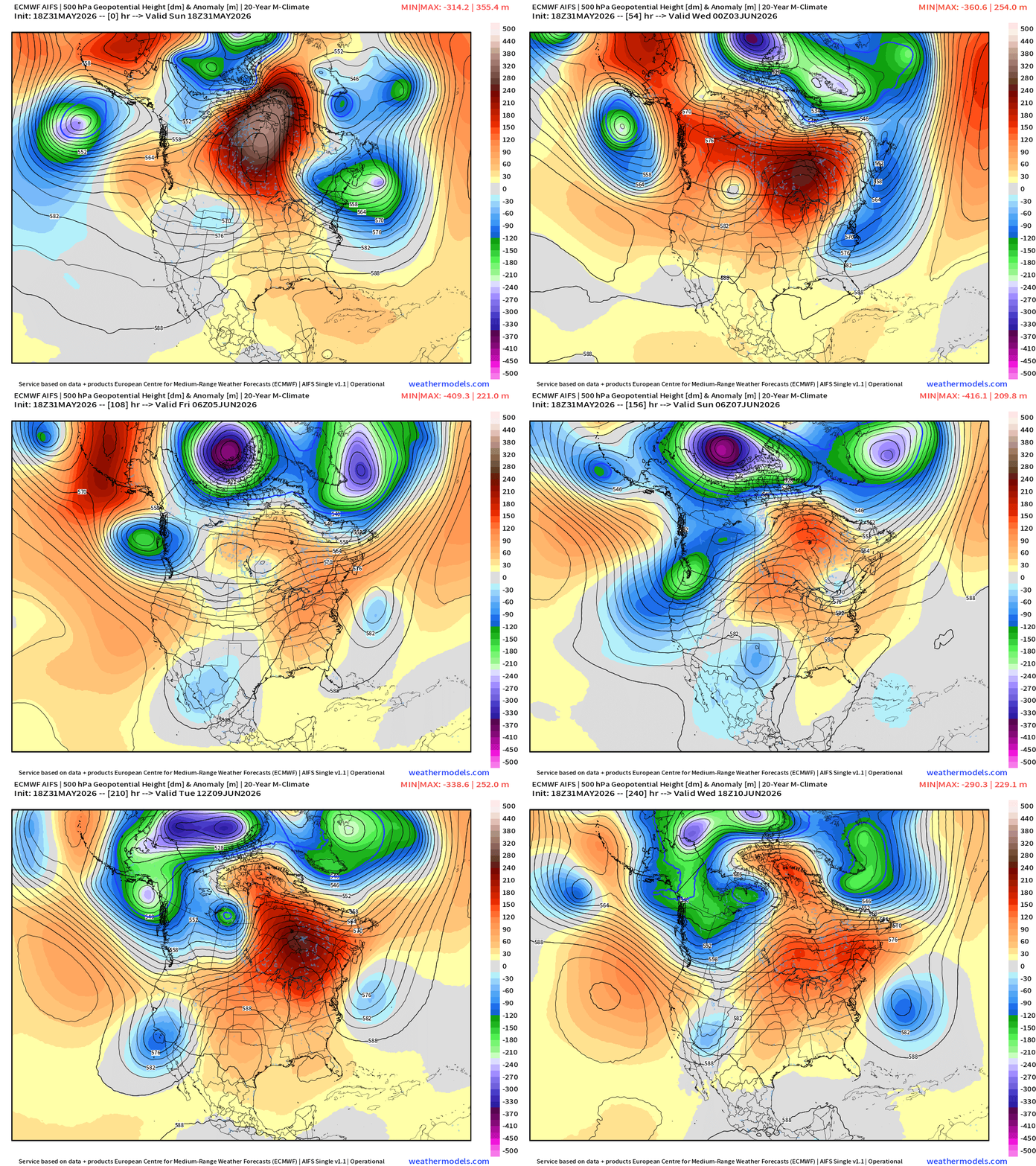
Omega block breaks down in 2-3 days, and then rebuilds/repeats into 2nd week of June
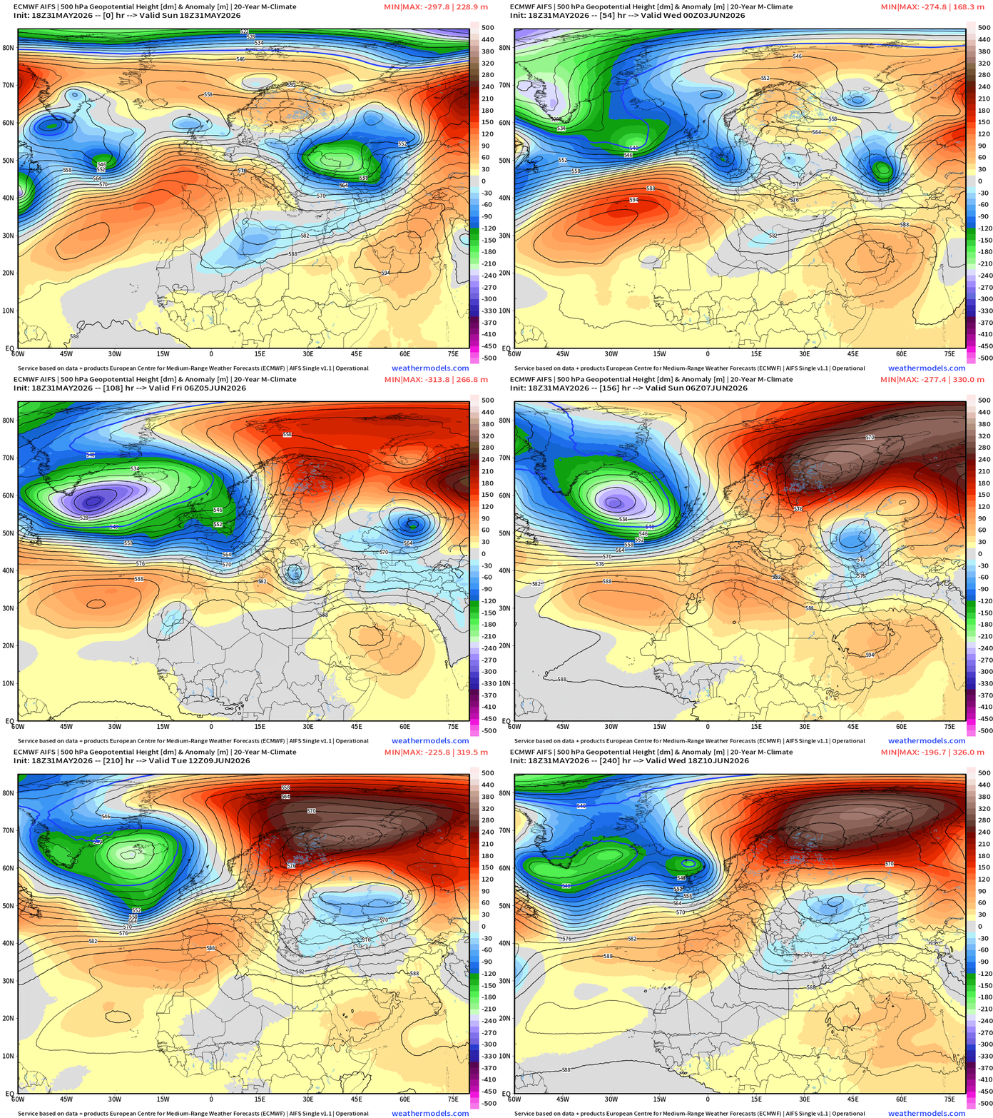
Europe Upper-Level Pattern
15-day Ensemble Median Precipitation | ECMWF 12z
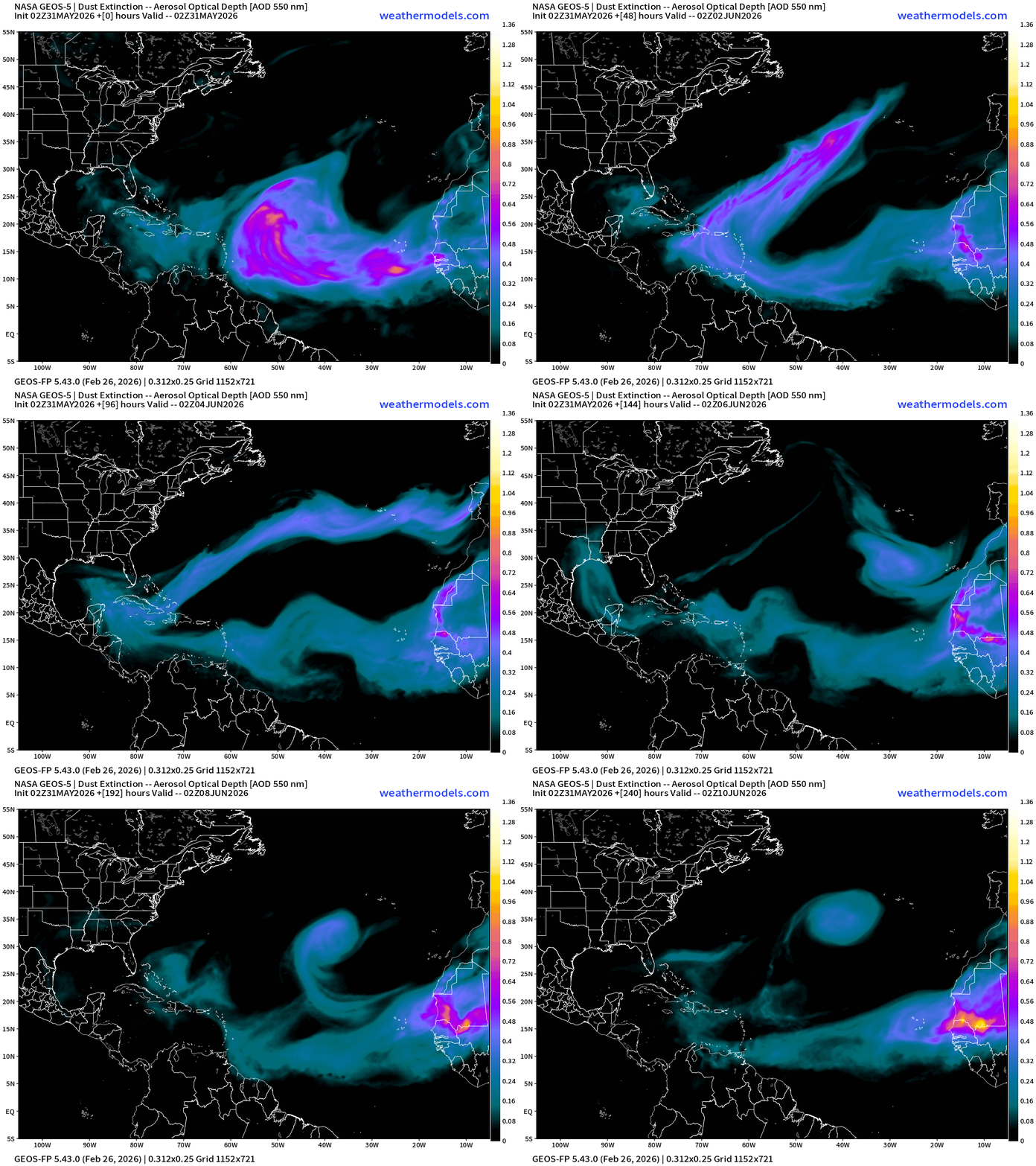
Atlantic Dust | NASA GEOS-5 next 10-days
Eastern Pacific Tropical Update — More tomorrow morning with start of Atlantic Season
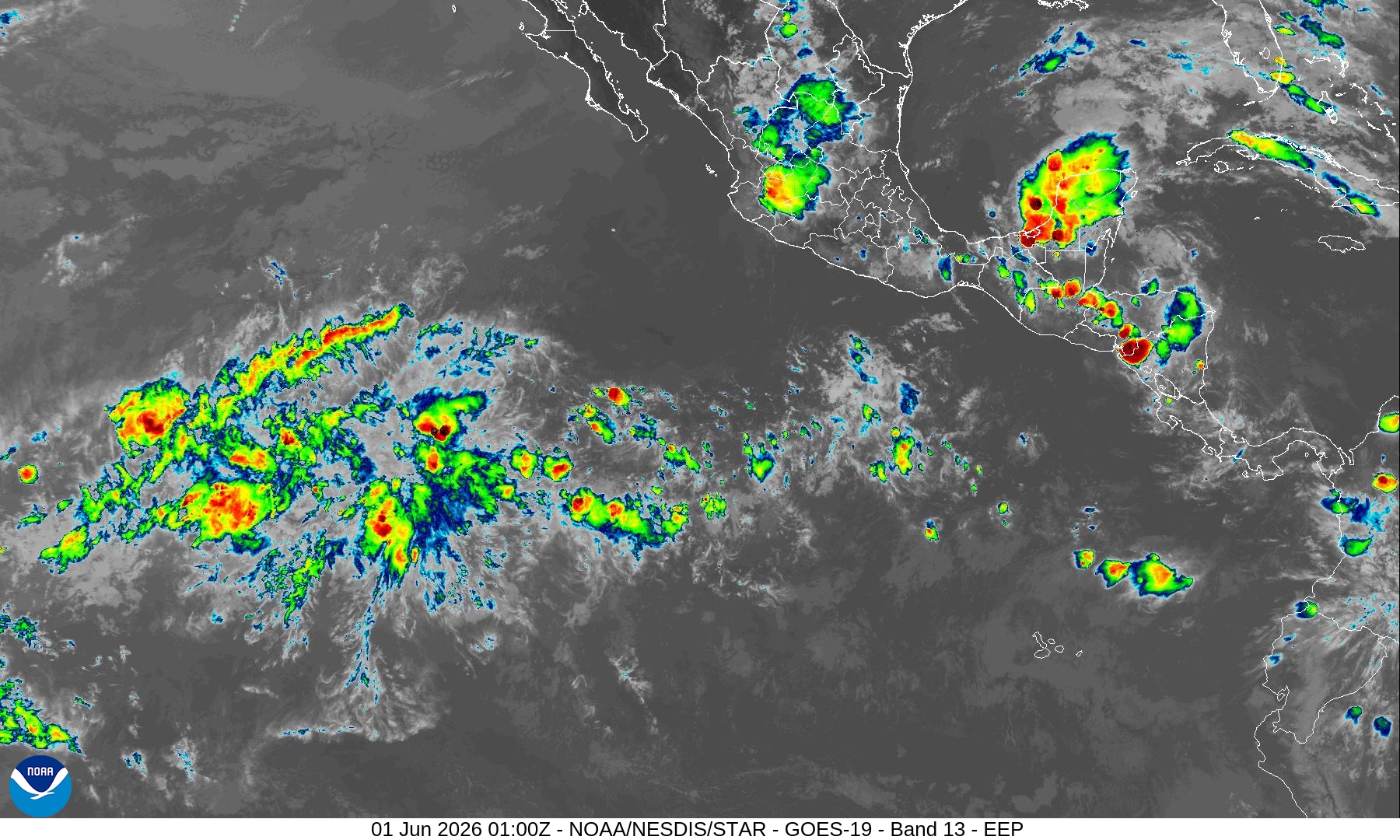
First system of the EPAC season has a 90% chance of coming online this week + another well down the road into next week.
April 7, 2026: Atlantic Seasonal Hurricane Forecast: 11/5/2
9-13 Named Storms (11 most likely)
4-7 Hurricanes (5 or 6 most likely)
1-3 Major Hurricanes (2 most likely)
ACE: 75-85
Maps sourced from weathermodels.com designed and innovated by yours truly! Please subscribe there for real-time access to the newest maps, charts from all of the weather models including ECMWF and AIFS, and NOAA GFS/GEFS, HRRR/RRFS and Blend of Models (NBM). NOAA WPC and SPC for fronts/convective outlooks.
- Milepost
- 947 · laid 2026-06-01T01:39:02.048000Z
- Source
- https://weather.substack.com/p/may-31-2026-sunday-spring-weather
- Digest
- ca2a7147c8e8239fff8e46cda18197bb18eb04125d945e1bb65b6ed2572f4c39
- Machine
- JSON