May 26, 2026 Tuesday Spring Weather
Very wet pattern continues in the Deep South with Florida soon focus of heavy rains
May 2026 was the 29th-warmest May in the 132-year national record (1895–2026), at 61.7°F against a 1991–2020 normal of 61.0°F (+0.6°F).
May 2026 was the 63rd-driest May in the 132-year national record (1895–2026), at 2.9in against a 1991–2020 normal of 3.1in (-0.2in).
NOAA/NCEI Climate at a Glance, contiguous United States. This is the observed record for the month, not a score of anything said in this piece — the forecast ledger begins 2026-08-17 and cannot reach earlier posts.

Very moist / tropical airmass from Texas into the Southeast fueling thunderstorms and heavy downpours.
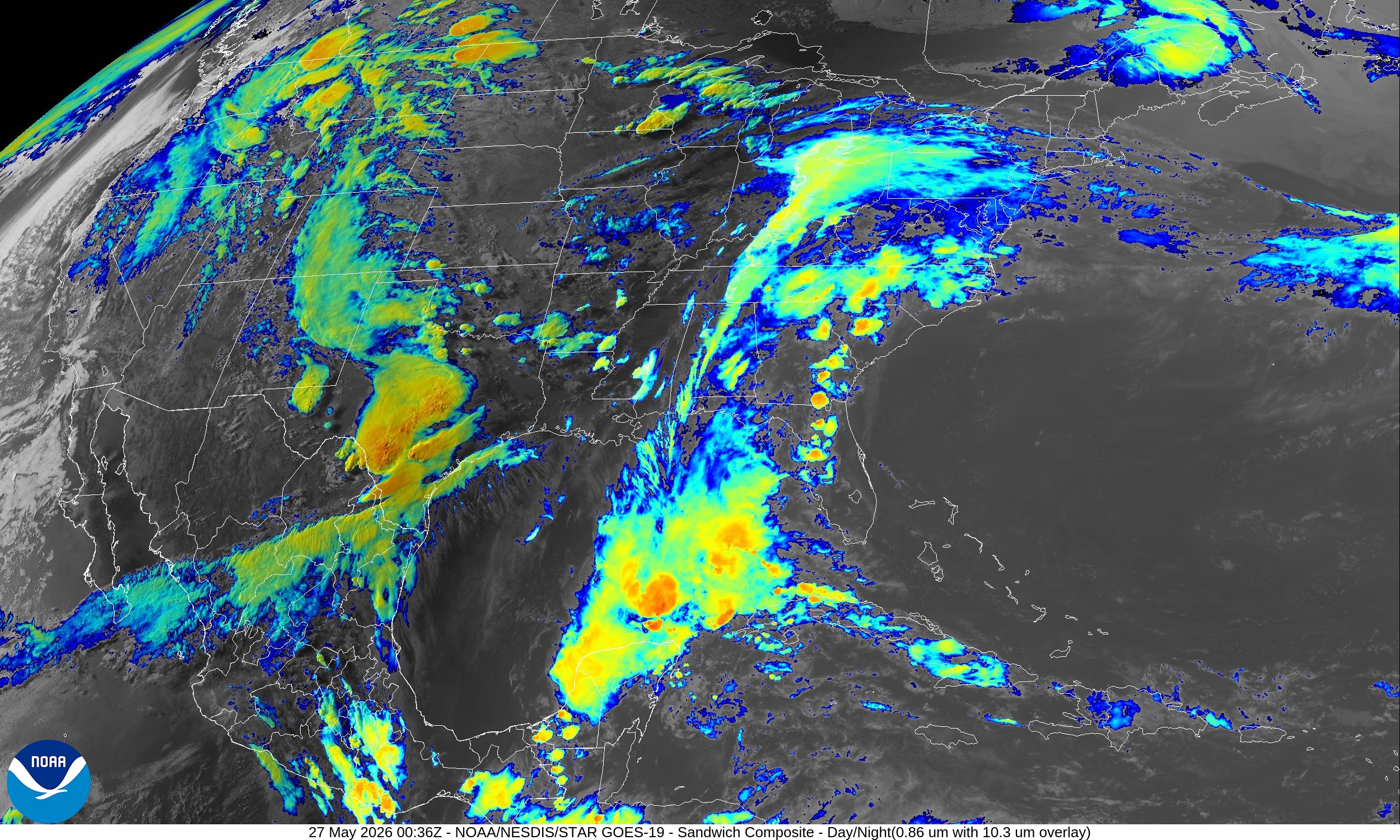
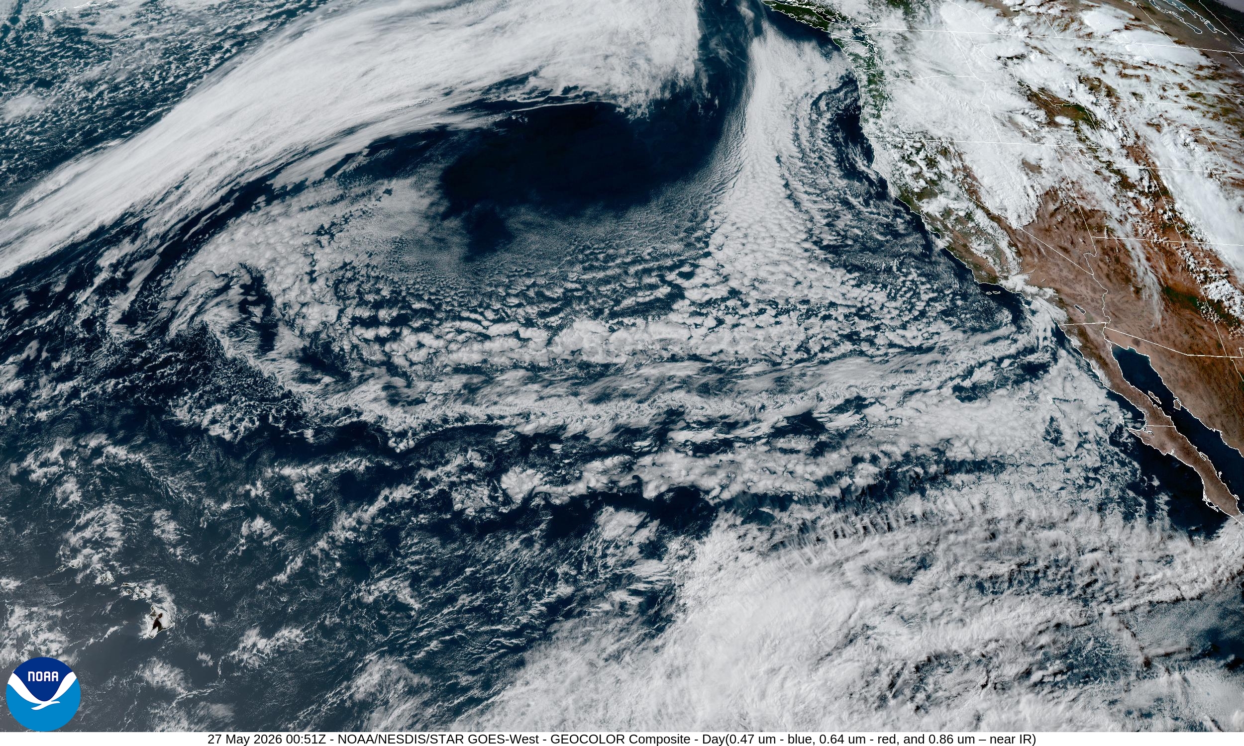
On the West Coast, a rather chilly air mass from the Pacific Northwest is sinking southward behind a rather potent mid-level trough of low pressure leading to showers across northern California.
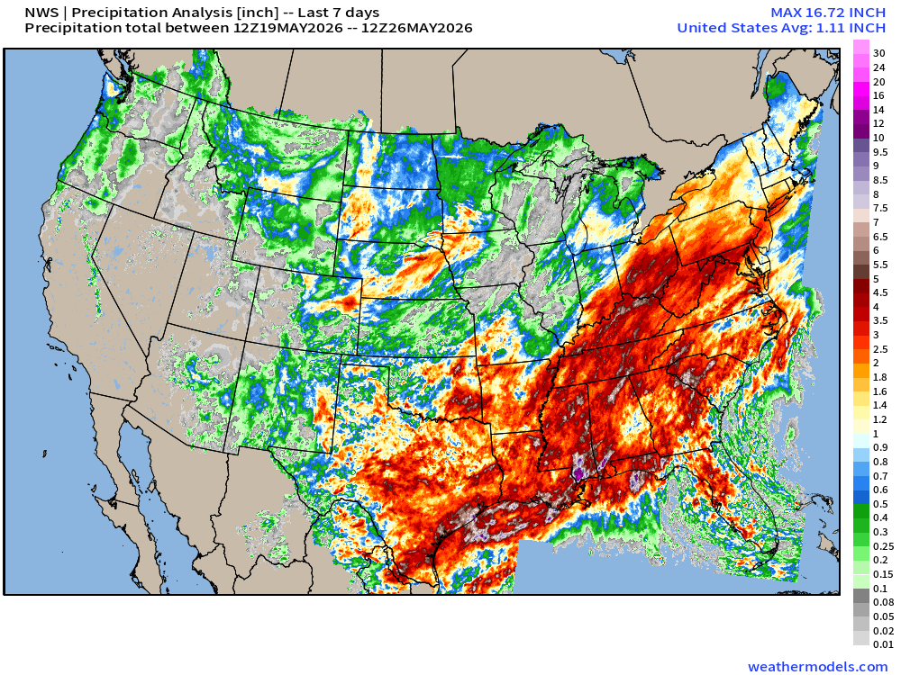
Pattern Shifted — Boatloads of Rainfall Over the Past 7-days
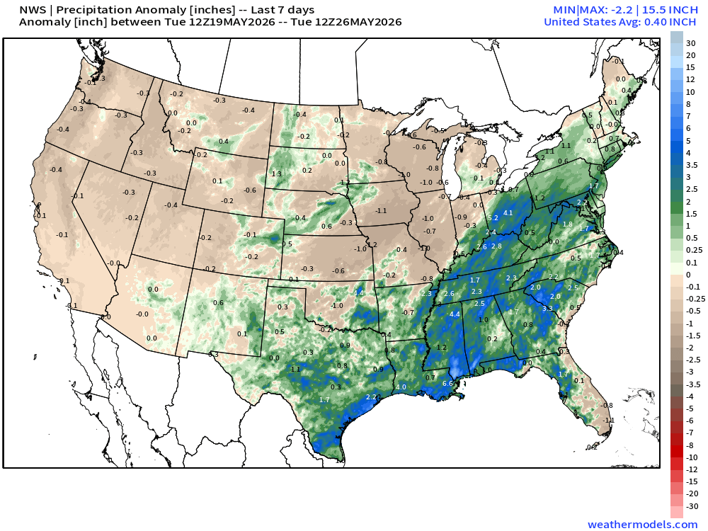
Compared to climatology — shows the very welcome rain for some drought relief.
ECMWF 18z | Forecast 6-days of Precipitable Water (my favorite parameter!)
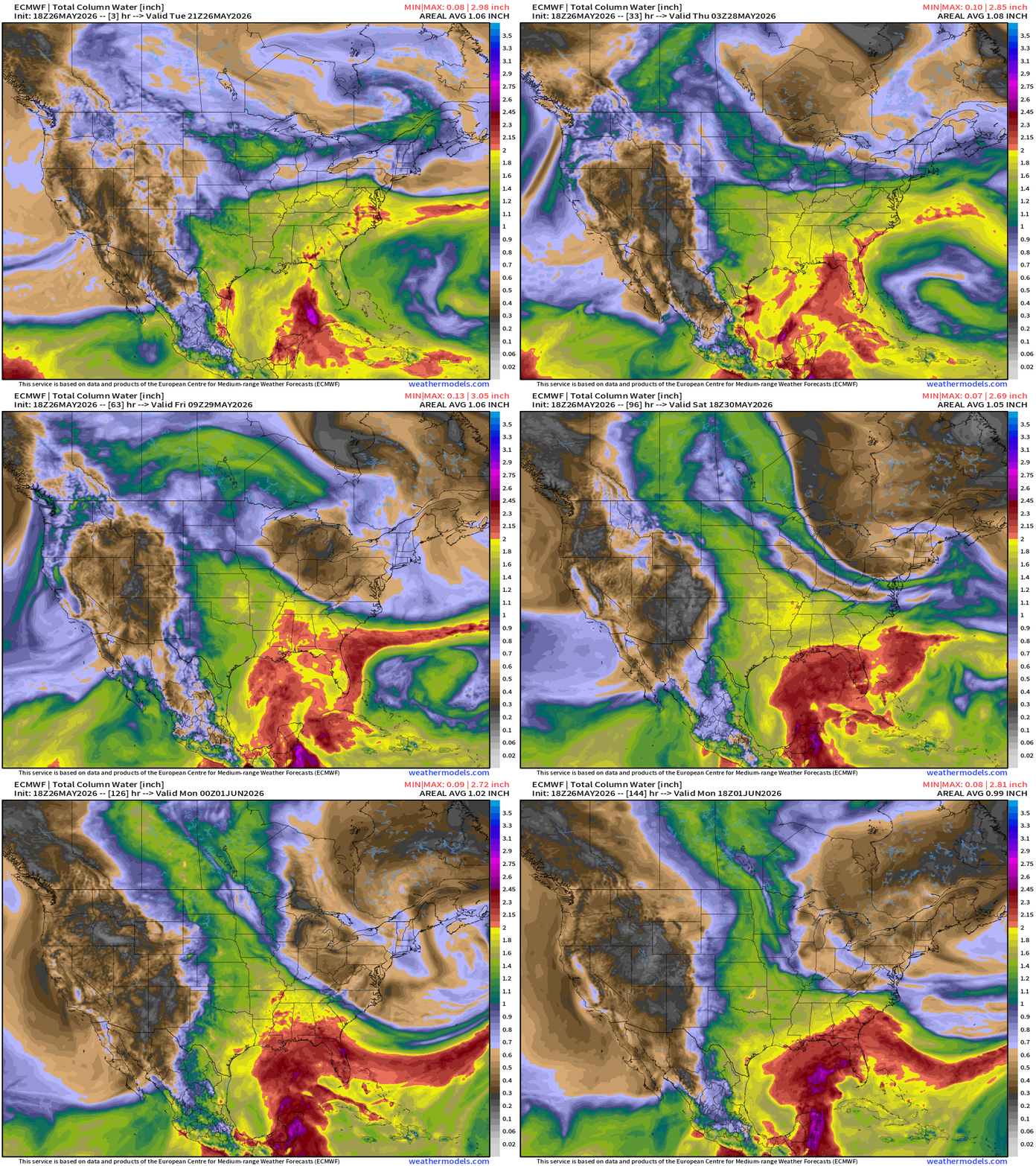
A lot of red (> 2” PWAT) showing up out of the Gulf of Mexico = deep tropical moisture plume accumulates over the next 6-days+
Troughs on either side of the Omega block = dry Canadian or Arctic air
Omega Block Pattern | Next 6-days of troughs and ridges
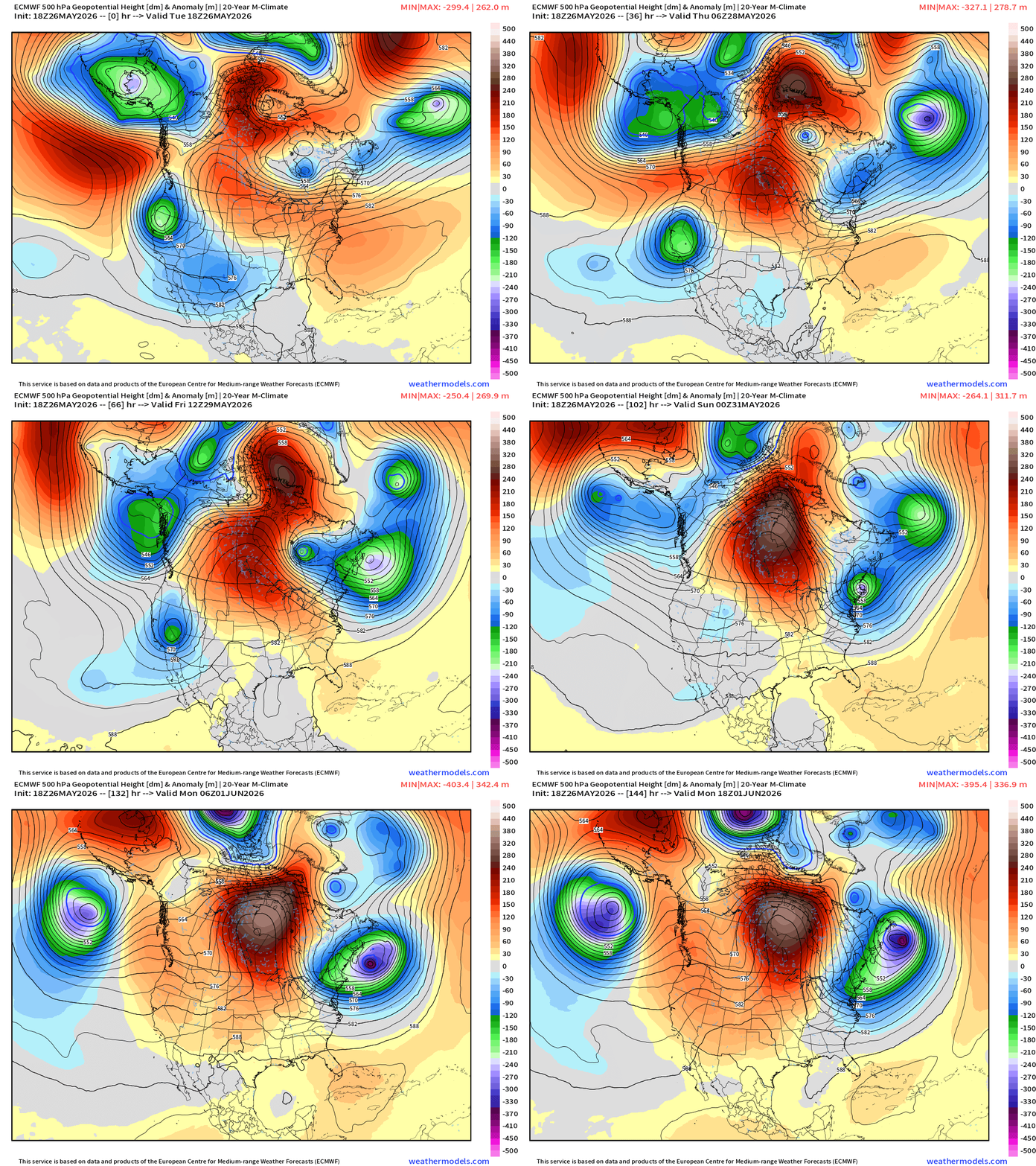
The blocking pattern ridge is centered over Hudson Bay Canada with the Northeast really unlucky again with persistent troughing. The Western U.S. recovers from a cut-off low with a warming trend.
Temperature Anomaly Next 6-days — into Monday Afternoon
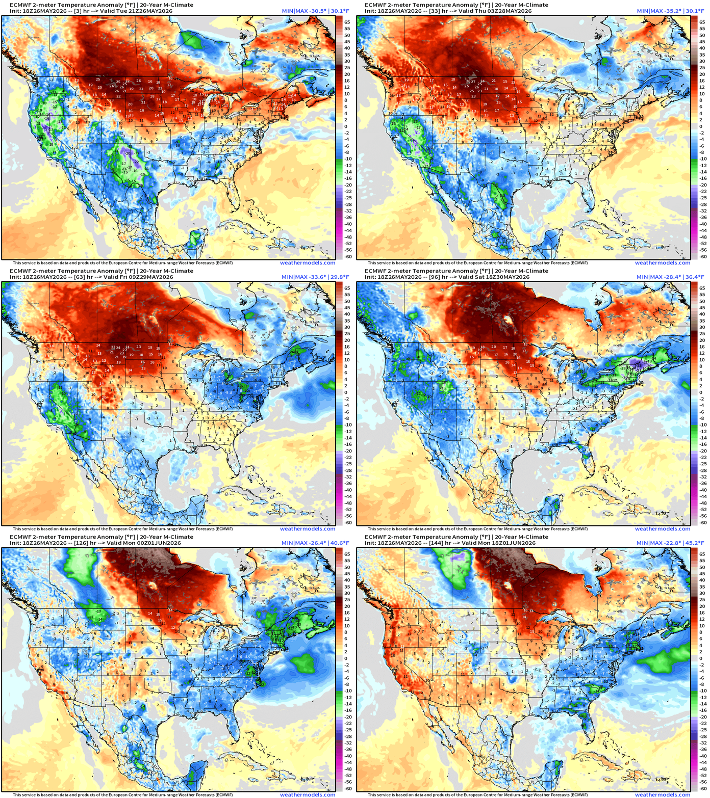
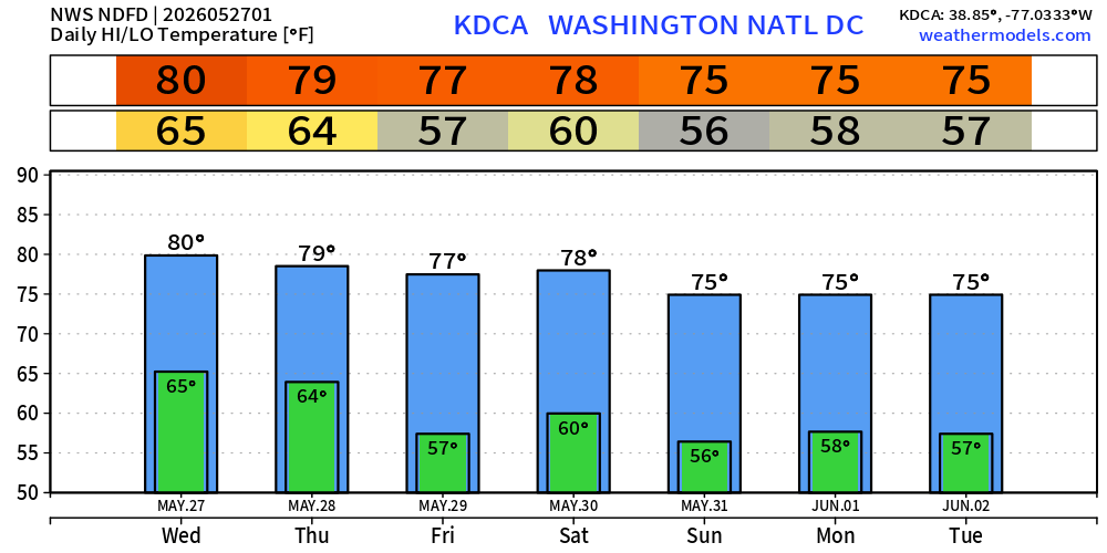
Cooler than normal air across the Northeast … comfortable to start June in NYC and D.C with mainly mid-70s.
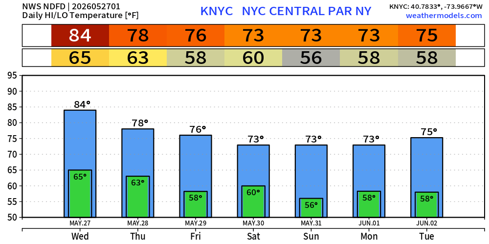
Quick Trip Across the Pond to “Baking Western Europe and the United Kingdom”
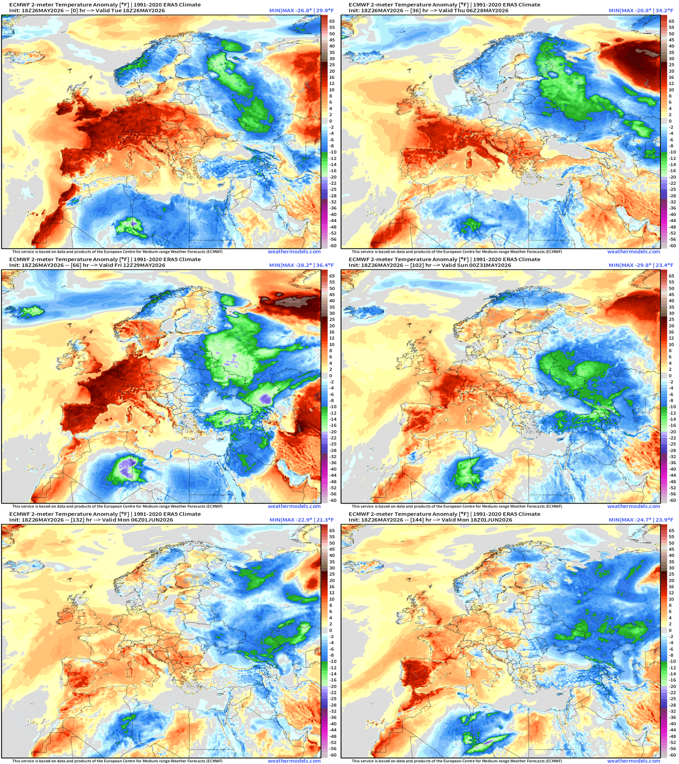
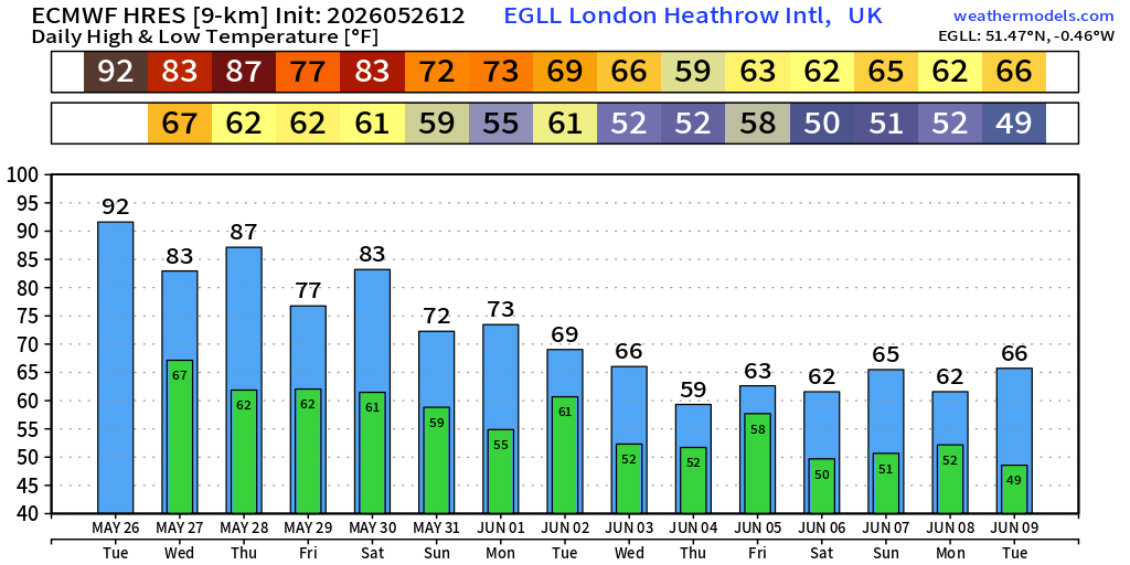
Yet another day in the 80s and 90s around the English Channel with London and Paris in the 80s on Wednesday … maybe a bit hotter on Thursday.
Then, back to the 50s and 60s — more typical Atlantic fresh air in London
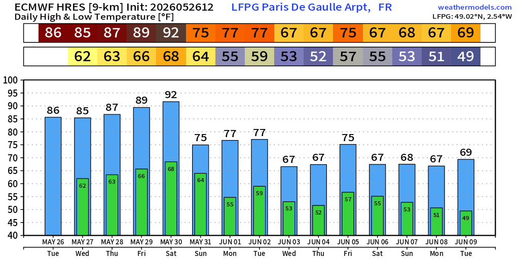
Similar story for Paris — 90s for Saturday and then back to typical comfortable early-June 60s and 70s.
Precipitation Next 10-days | Blend of Models (v5.0)
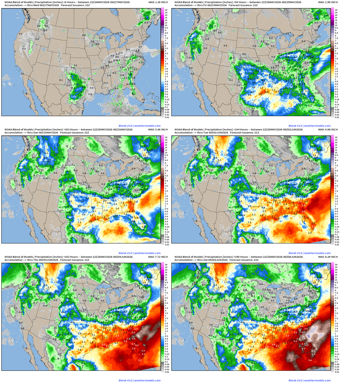
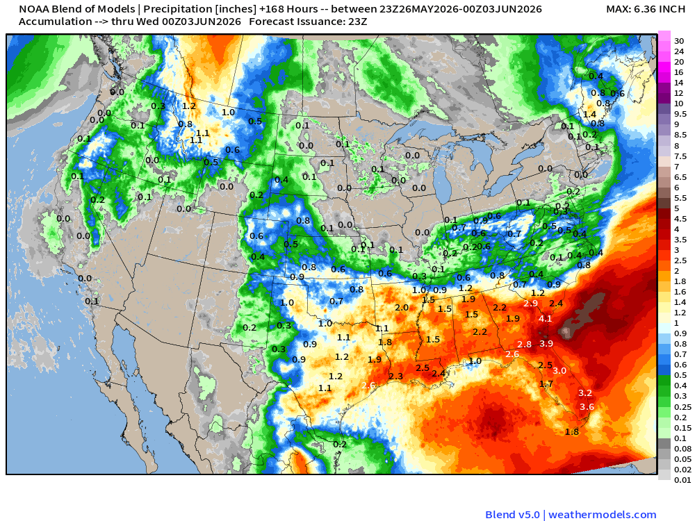
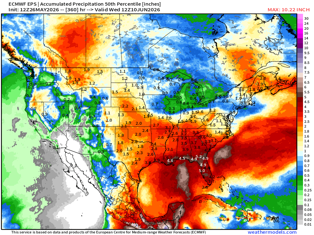
Very wet pattern continues across the Southeast — with focus on Florida!
High Temperatures Next 9-days until Thursday, June 4th
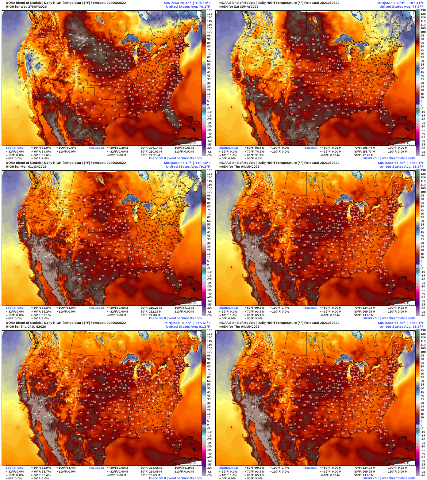
70s and 80s dominate into early June with only minimal population in 90s. No heat dome across the Eastern U.S.
ECMWF 18z | Precipitation Type + MSLP | Next 6-days
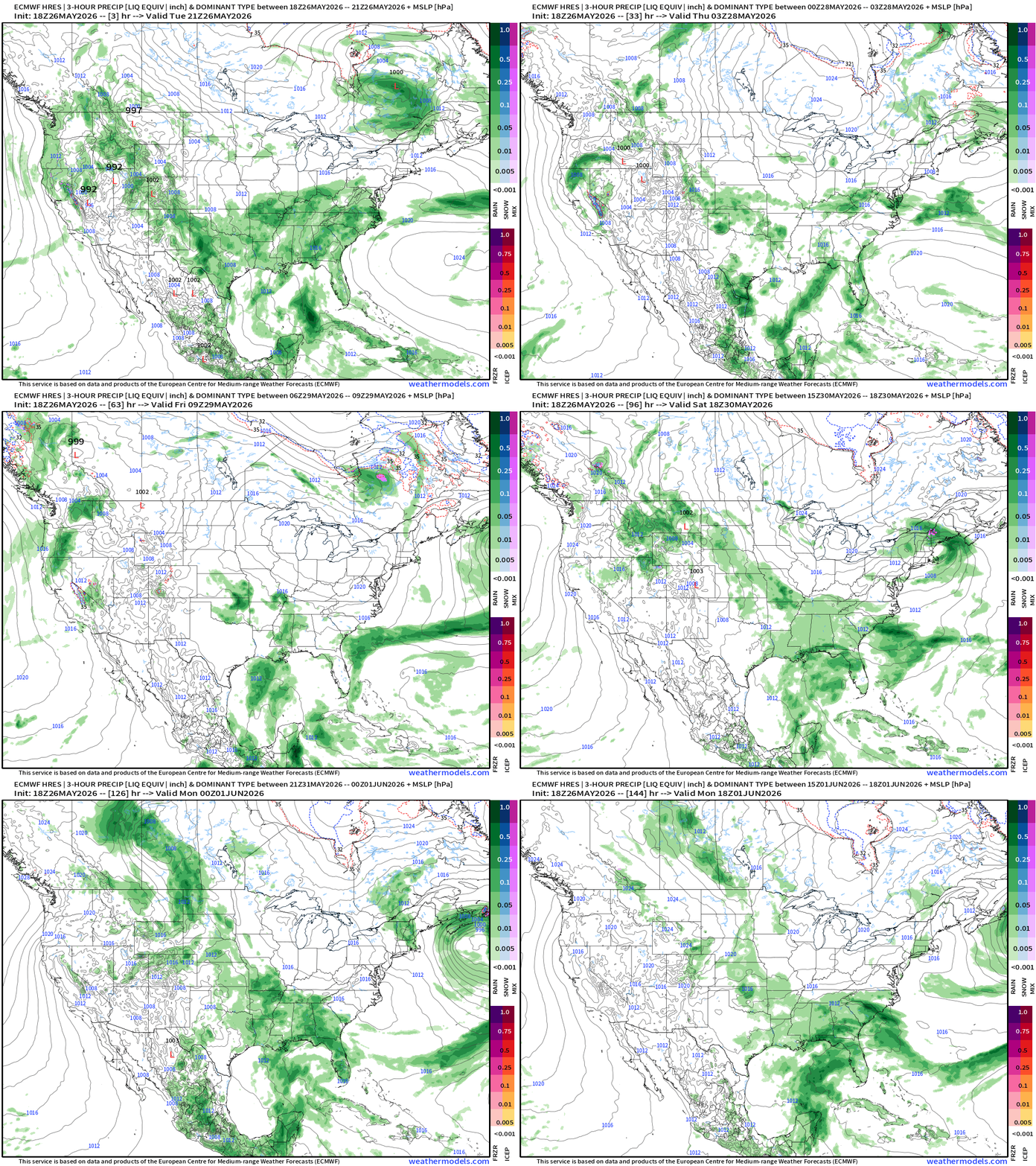
Not seeing a break in the daily showers from Texas to the Southeast with the southerly / moist flow = a lot MORE rain
ECMWF Flagship Ensemble Temperature Outlook
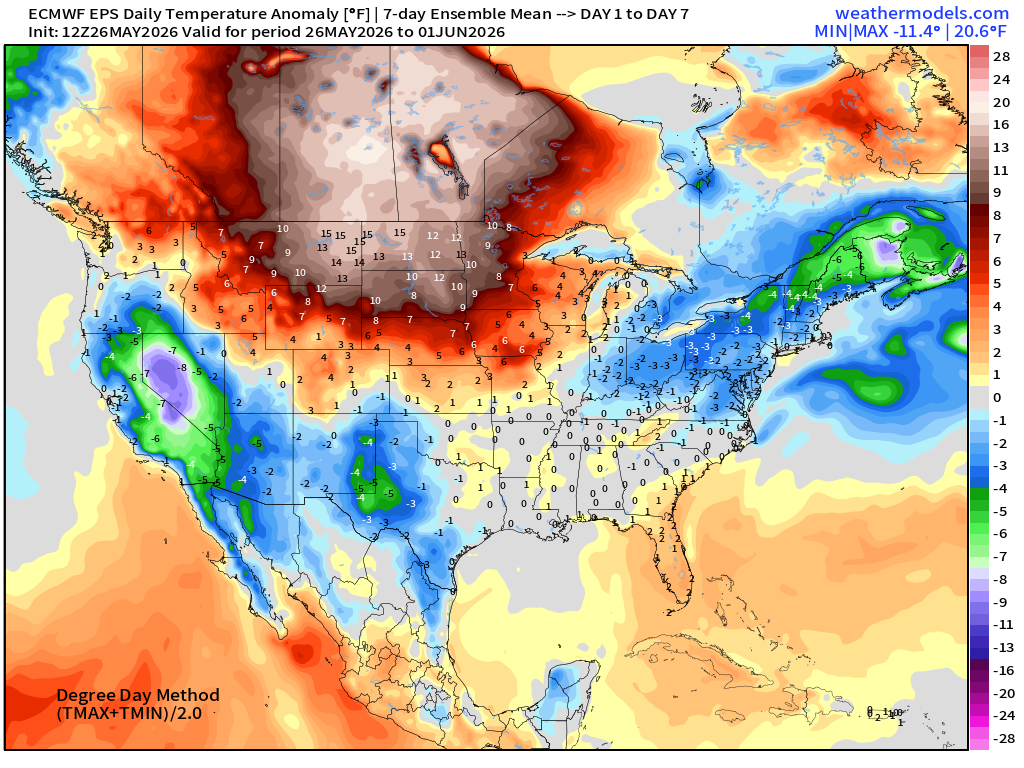
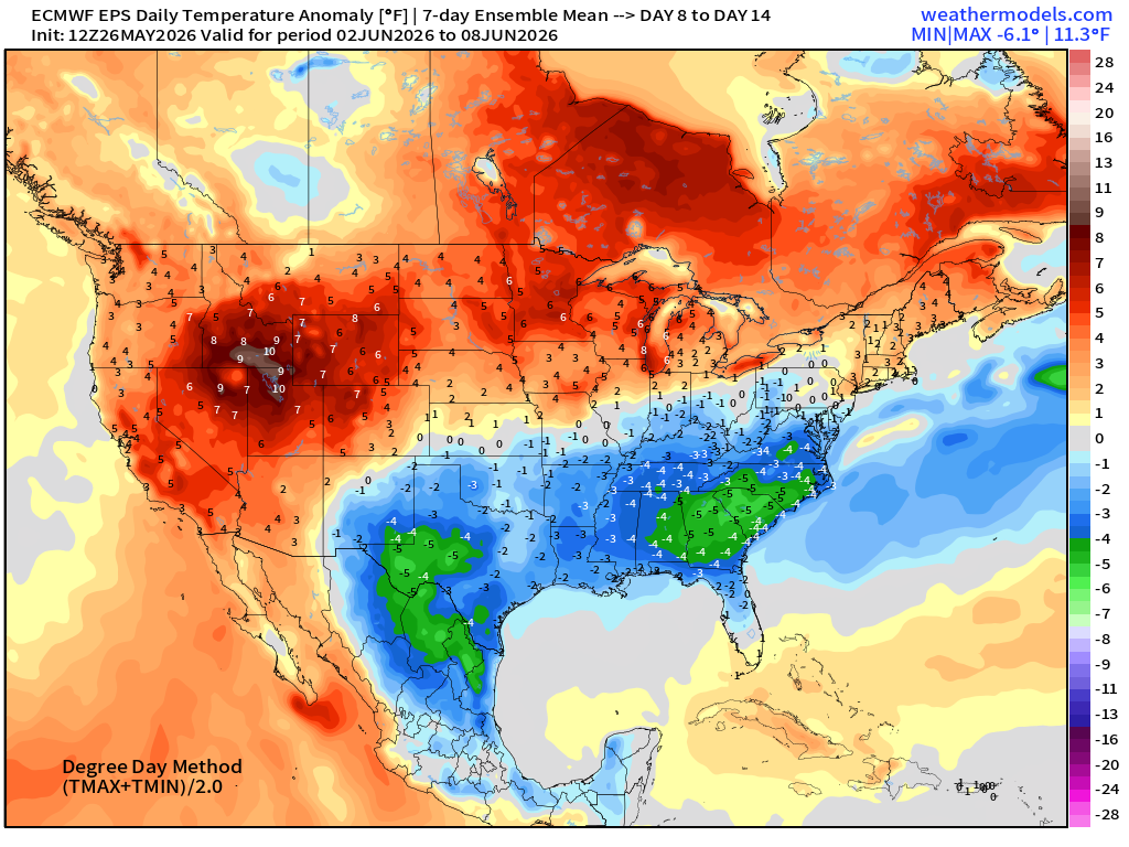
Temperature Anomaly | Next 15-days | ECMWF EPS 12z Ensemble Mean
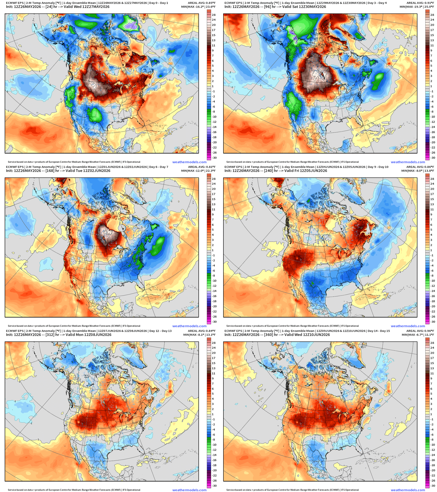
The Omega block warms up Canada finally after a very long winter … and the moisture / clouds from Texas into Southeast —> keep things cooler.
Week #1 | Temperature Anomaly | May 26 - June 2
Week #2 | Temperature Anomaly | June 2 - June 8
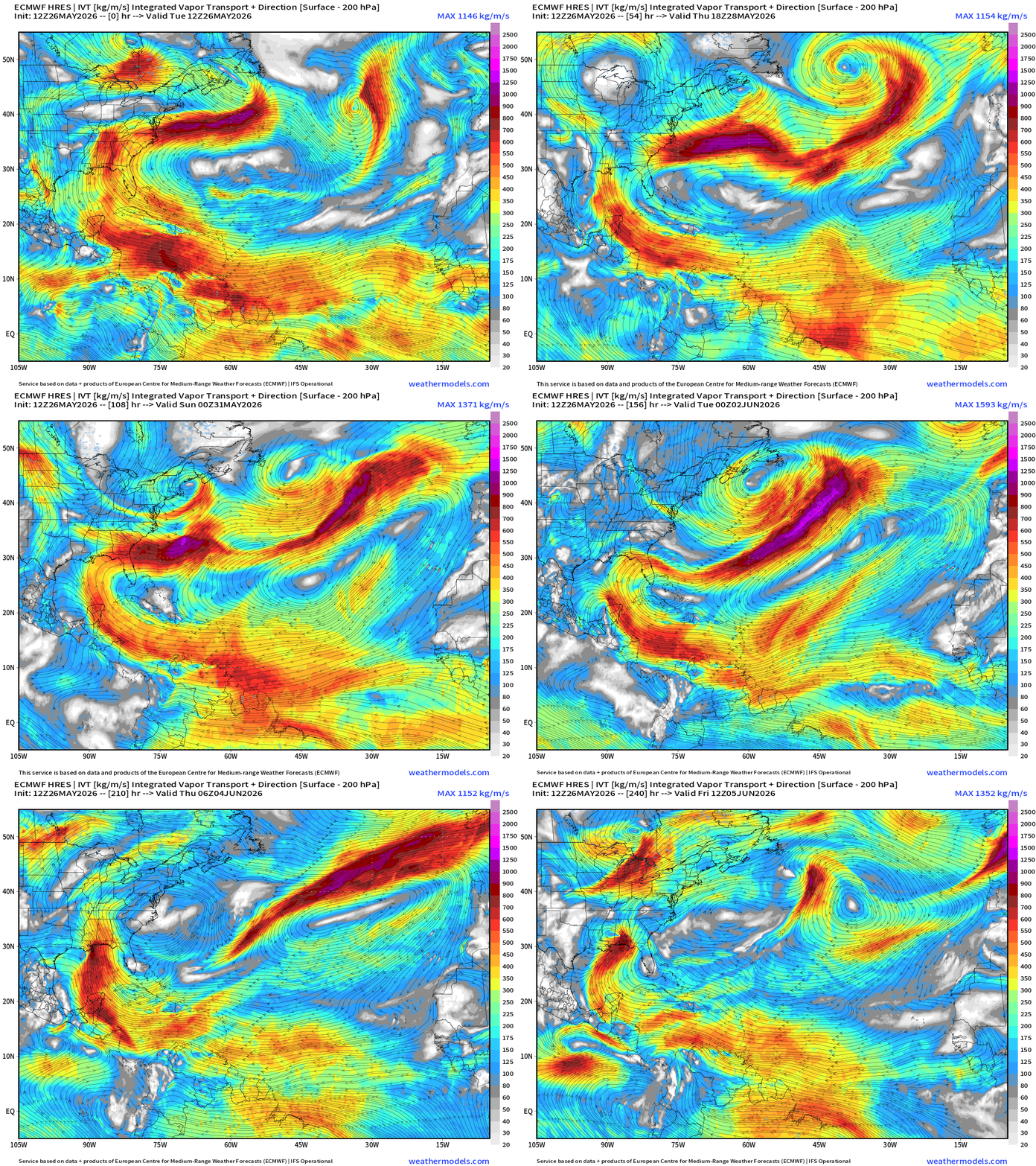
Integrated Vapor Transport | Next 10-days
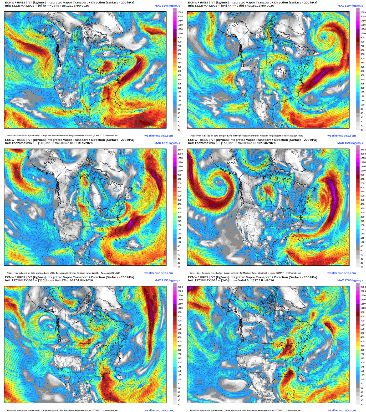
Persistent pattern continues for the south from Texas into the Southeast with strong southerly flow around the Bermuda / subtropical high / ridge anchored off the Eastern U.S. —> boatloads of moisture/rainfall for Texas into the Lower Mississippi River Valley and Florida.
Watching longer range into next week for a potential tropical system in the Gulf of Mexico.
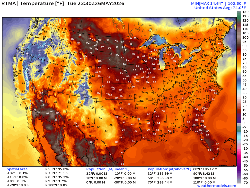
RTMA Current Temperature Analysis | 7:30 PM ET
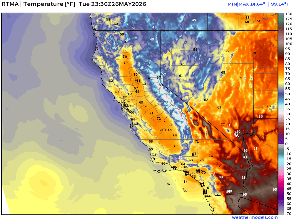
RTMA Current Temperature Anomaly Analysis | 7:30 PM ET
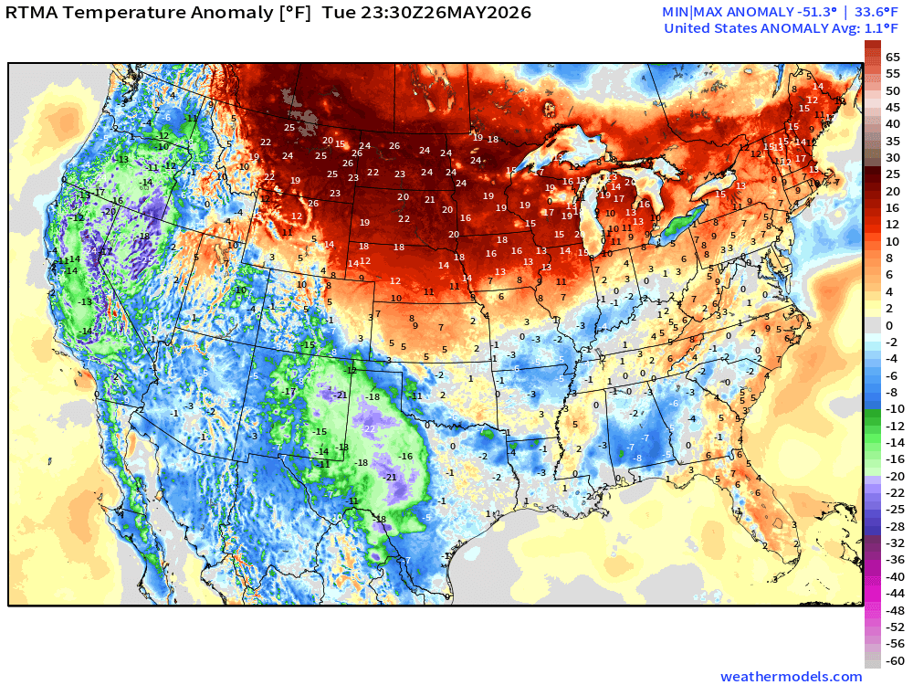
Lower 48 was 1.1°F above normal
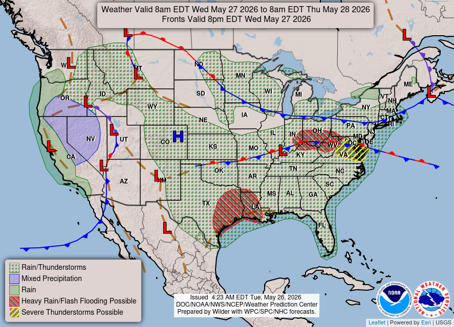
Lower 48 Weather This Evening into Wednesday Morning
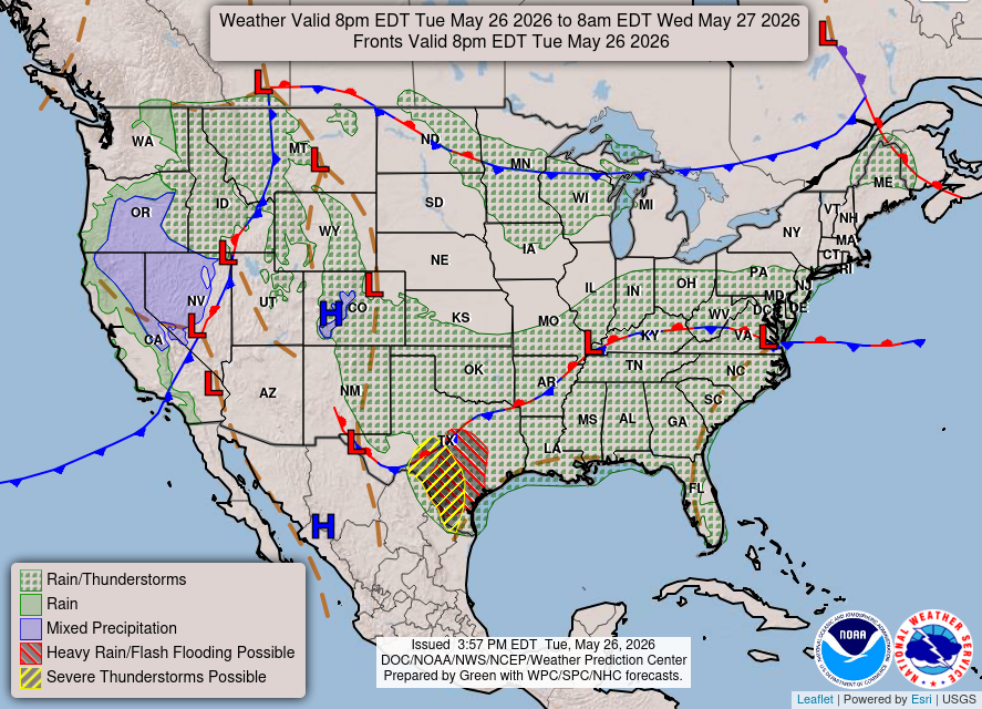
Trough + storm system across northern California moves into the Rockies
Frontal boundary + moisture continues to fire showers from Texas into the Mid-Atlantic
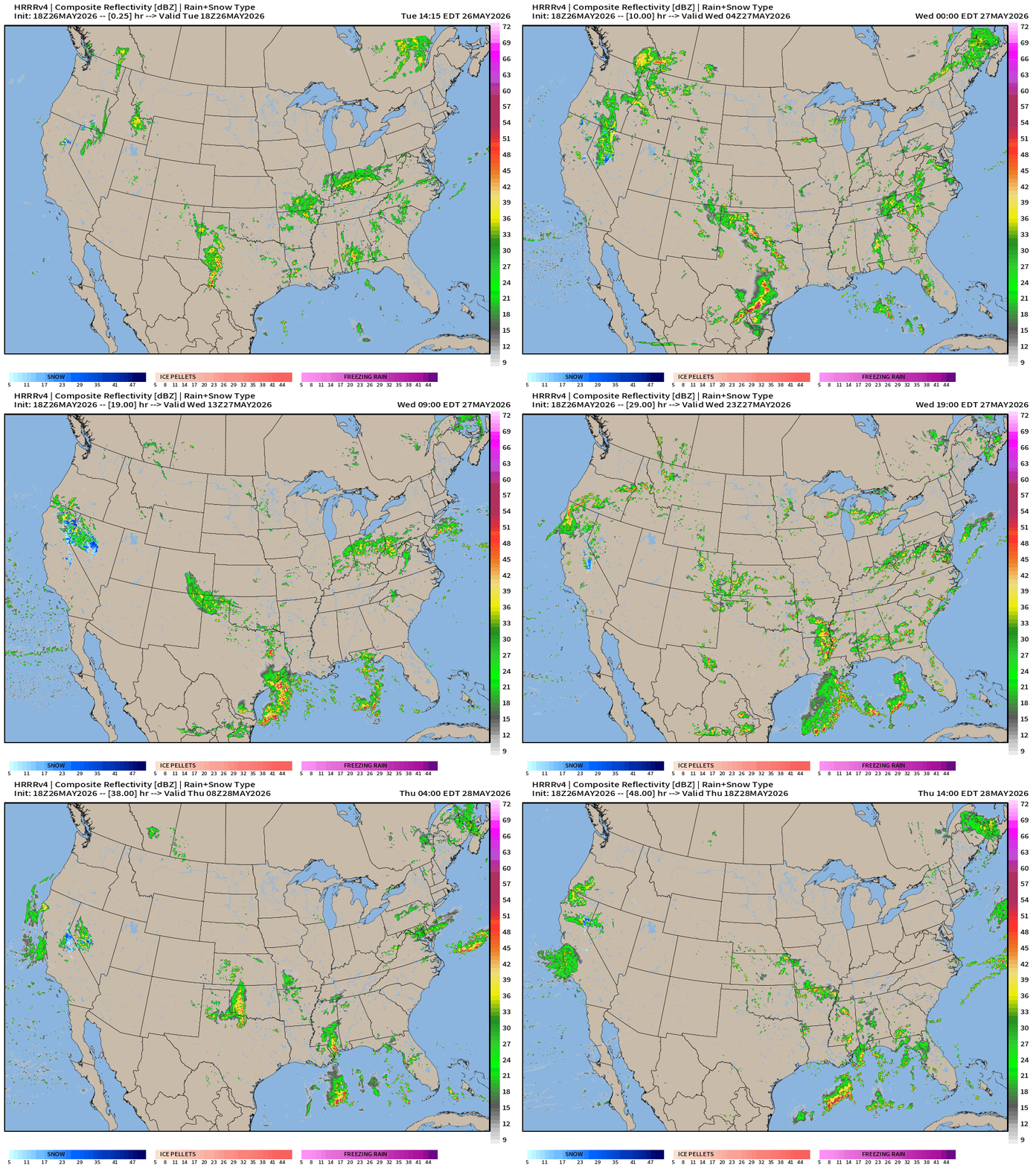
HRRR 18z — Radar Simulation Next 48-hours to Thursday 2 PM ET
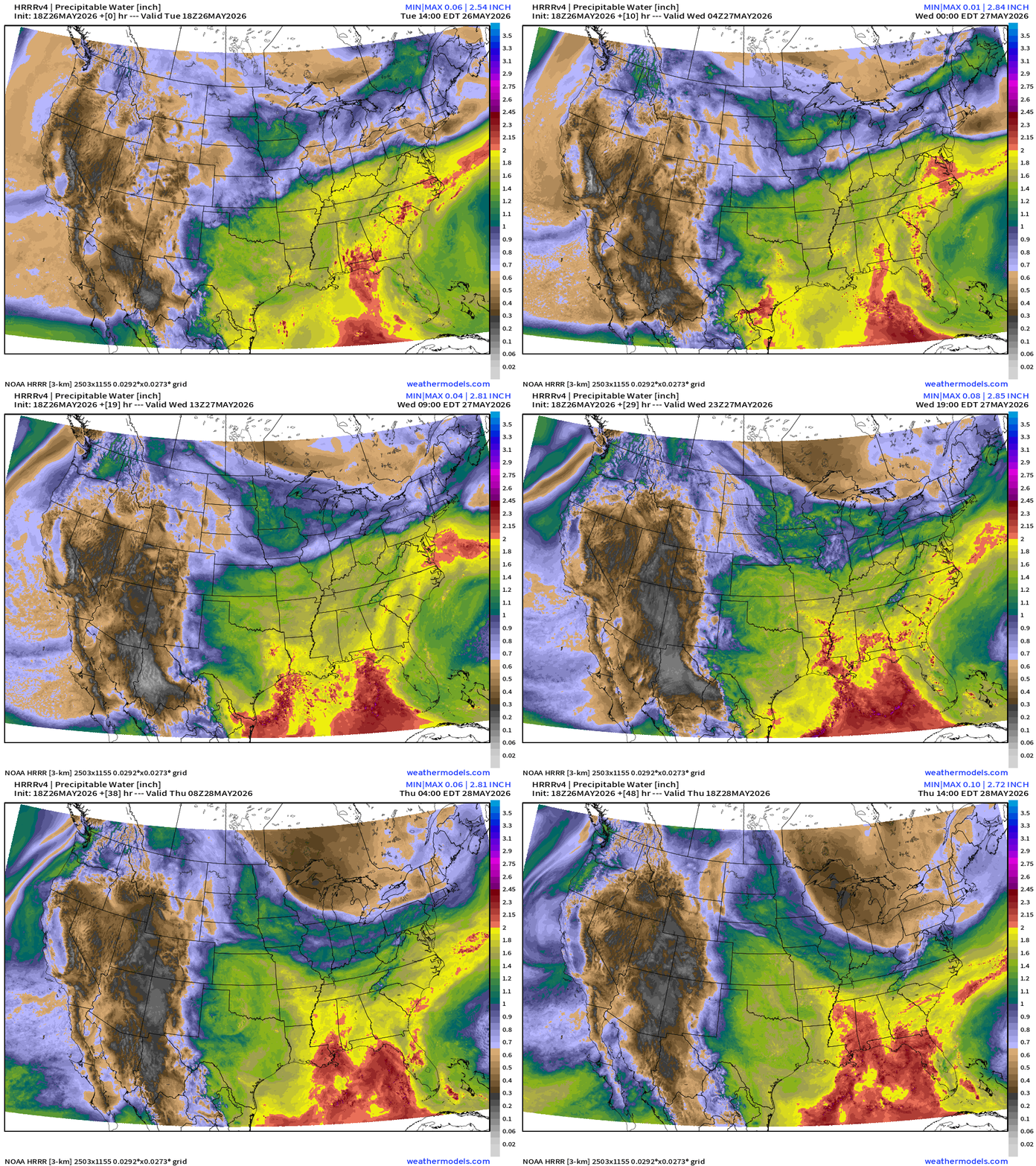
HRRR Precipitable Water — high resolution version of my favorite parameter
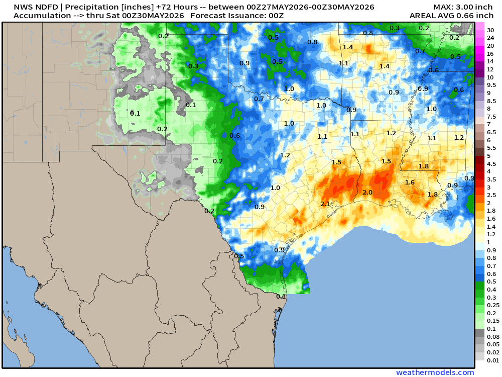
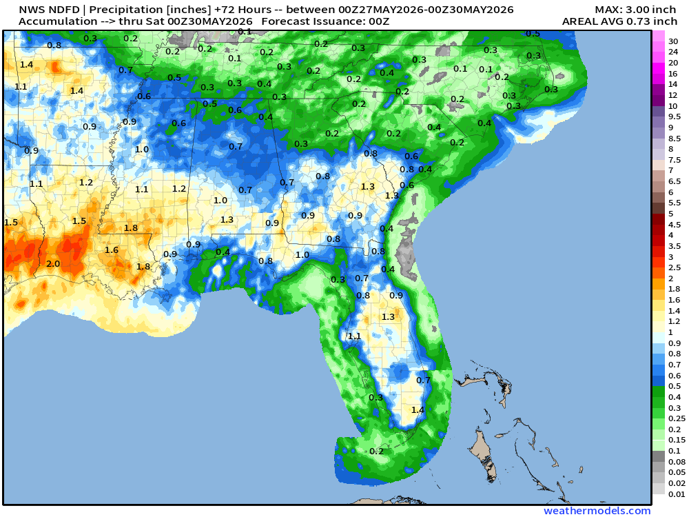
Weather on Wednesday | Unsettled just about everywhere
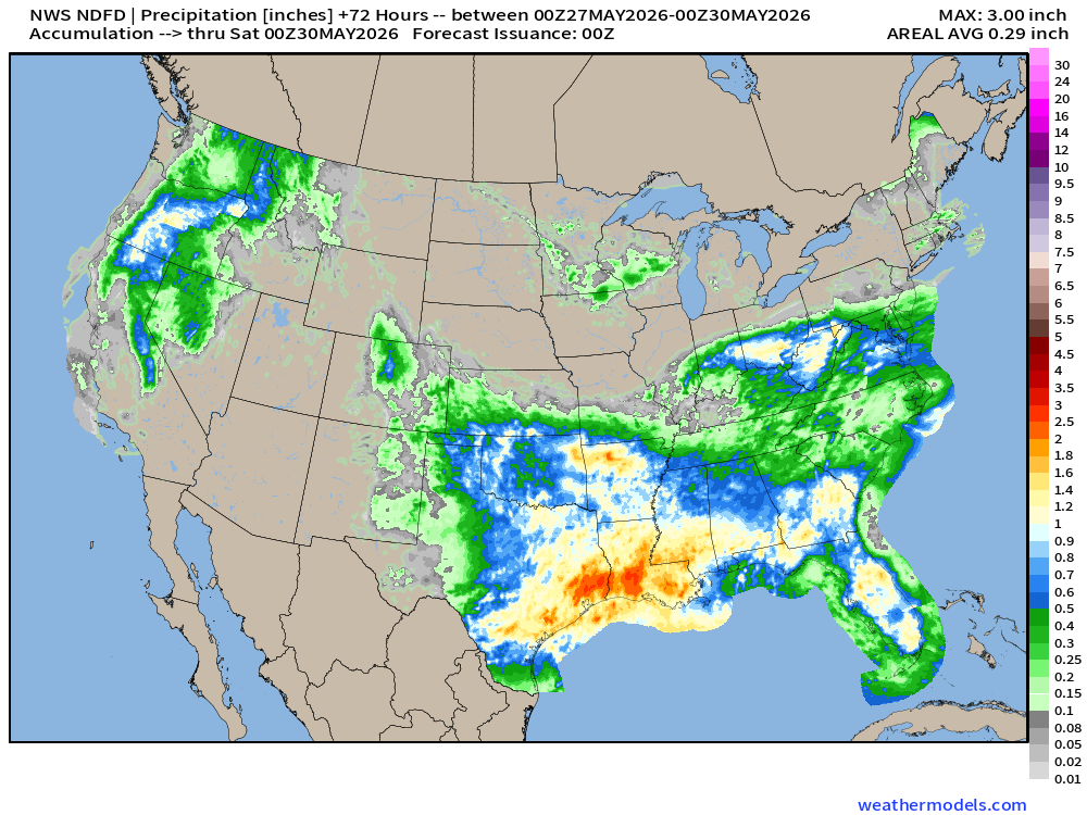
NDFD NWS Total Precipitation Next 72-hours through Friday Evening
7-Day Total Precipitation | Blend of Models | Through next Tuesday Evening
Upper-Level Circulation Pattern
ECMWF AIFS-Single 18z | 500 mb Height Anomaly Next 10-days
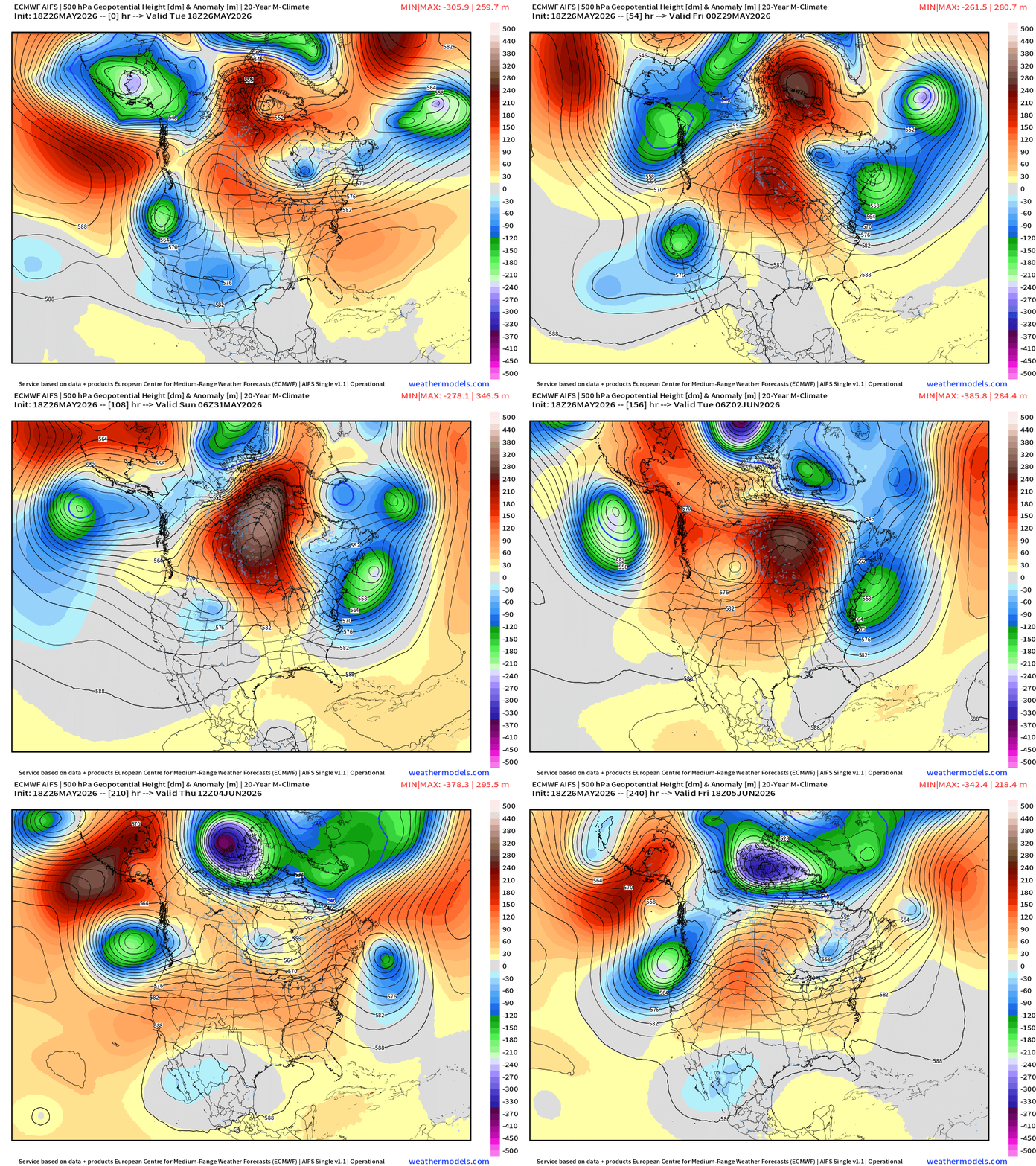
Blocking pattern sets up with the ridge axis centered along Hudson Bay and Ontario with troughs on either side … Western U.S. and Northeast cooler than normal, and allow the moisture flow out of the Gulf to sustain the ridge on the backside.
Europe Upper-Level Pattern
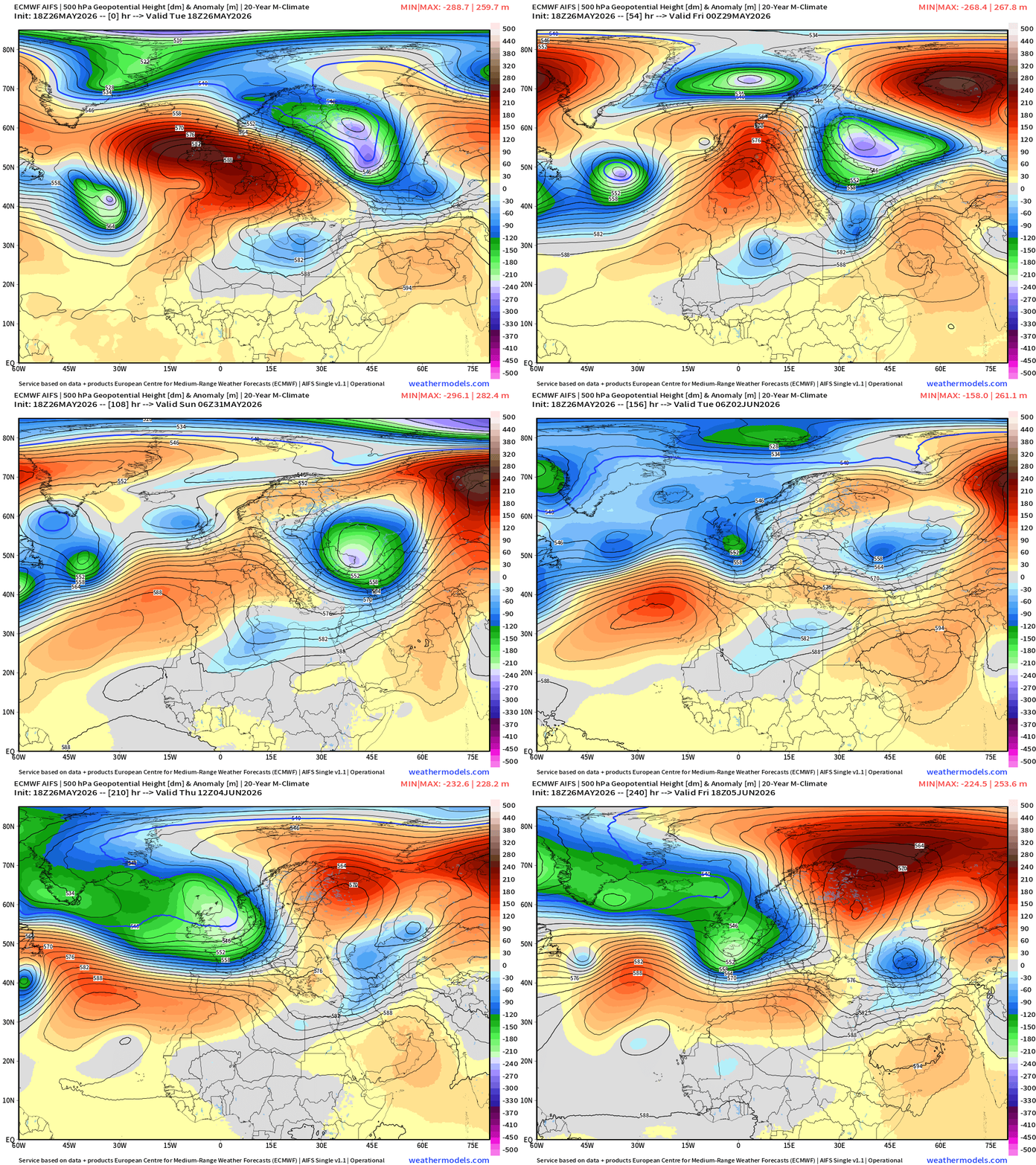
The ridge breaks down by this weekend — and much cooler air arrives from the Atlantic and Iceland/Greenland for Europe.
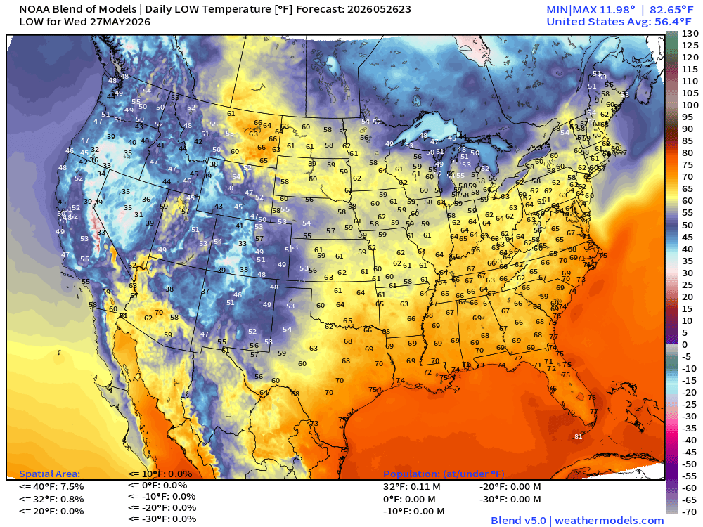
Low Temperatures Wednesday Morning
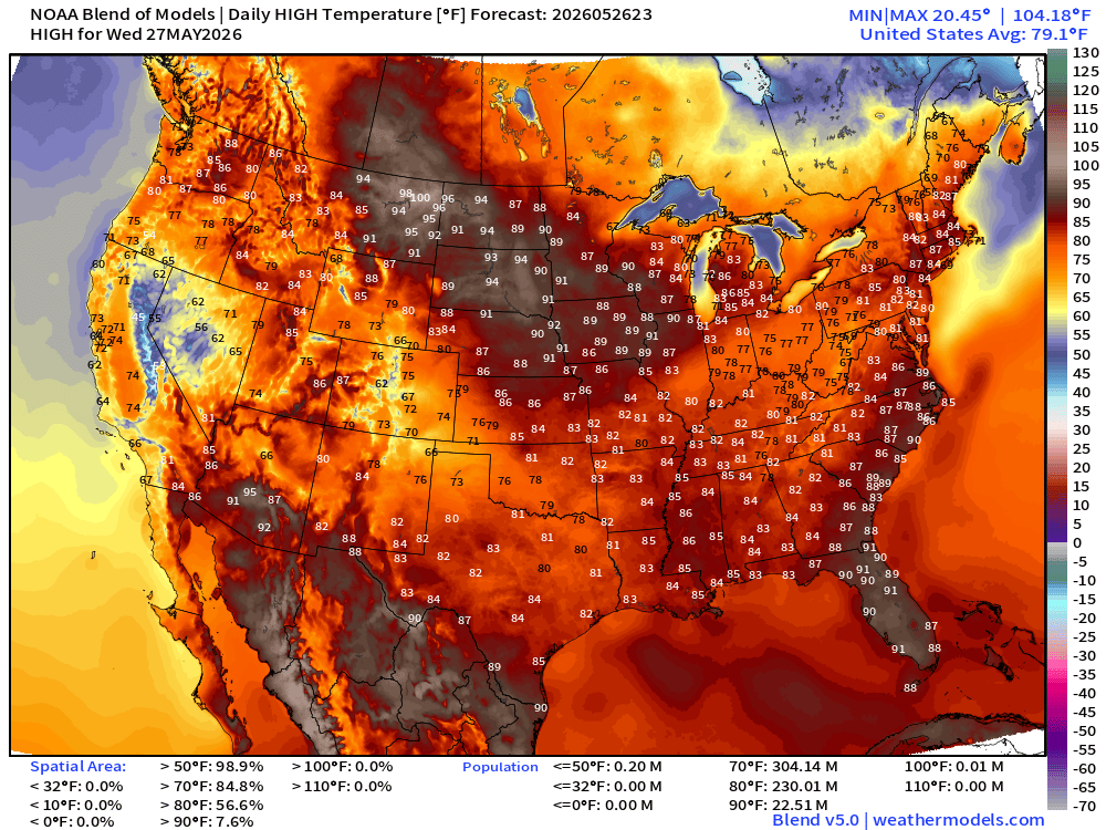
High Temperatures on Wednesday
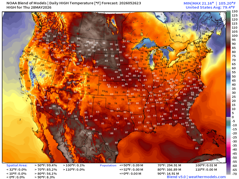
High Temperatures on Thursday
15-day Ensemble Median Precipitation | ECMWF 12z
More seasonal information at yesterday’s Tropical Update — May 25, 2026
April 7, 2026: Atlantic Seasonal Hurricane Forecast: 11/5/2
9-13 Named Storms (11 most likely)
4-7 Hurricanes (5 or 6 most likely)
1-3 Major Hurricanes (2 most likely)
ACE: 75-85
Maps sourced from weathermodels.com designed and innovated by yours truly! Please subscribe there for real-time access to the newest maps, charts from all of the weather models including ECMWF and AIFS, and NOAA GFS/GEFS, HRRR/RRFS and Blend of Models (NBM). NOAA WPC and SPC for fronts/convective outlooks.
- Milepost
- 943 · laid 2026-05-27T01:32:48.076000Z
- Source
- https://weather.substack.com/p/may-26-2026-tuesday-spring-weather
- Digest
- f51feae1be5f4cf7474939b6ace7e816a46ad30c0bbe8d9750baa46e70907cb0
- Machine
- JSON