April 27, 2026 Monday Spring Weather
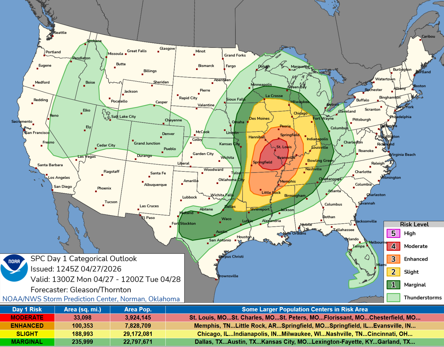
Moderate Risk [4/5] Severe Weather centered on St. Louis with potential of strong tornadoes
April 2026 was the 3rd-warmest April in the 132-year national record (1895–2026), at 54.7°F against a 1991–2020 normal of 51.8°F (+2.9°F).
April 2026 was the 46th-wettest April in the 132-year national record (1895–2026), at 2.7in against a 1991–2020 normal of 2.7in (+0.0in).
NOAA/NCEI Climate at a Glance, contiguous United States. This is the observed record for the month, not a score of anything said in this piece — the forecast ledger begins 2026-08-17 and cannot reach earlier posts.

This Morning’s Satellite Imagery
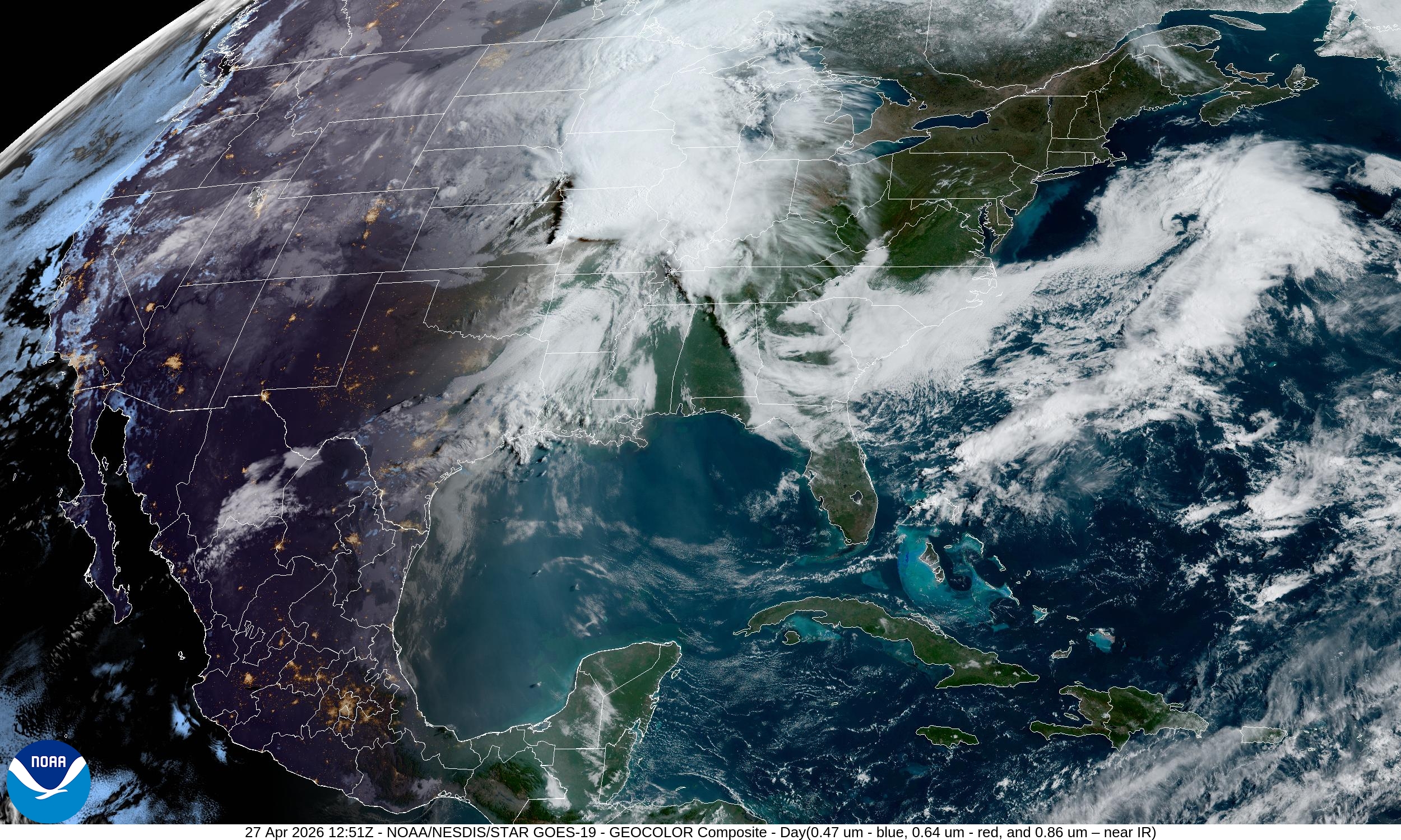
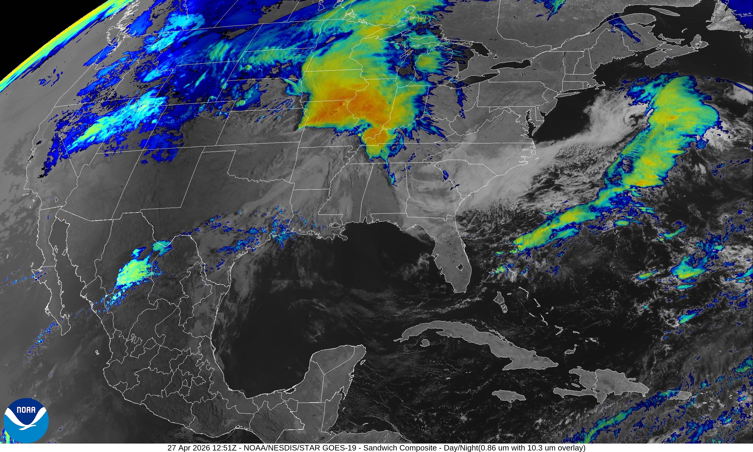
Strong low pressure system centered on the Corn Belt with ongoing severe thunderstorms within the warm sector.
SPC: Moderate Risk of Severe Weather — 4 out of 5 centered on St. Louis
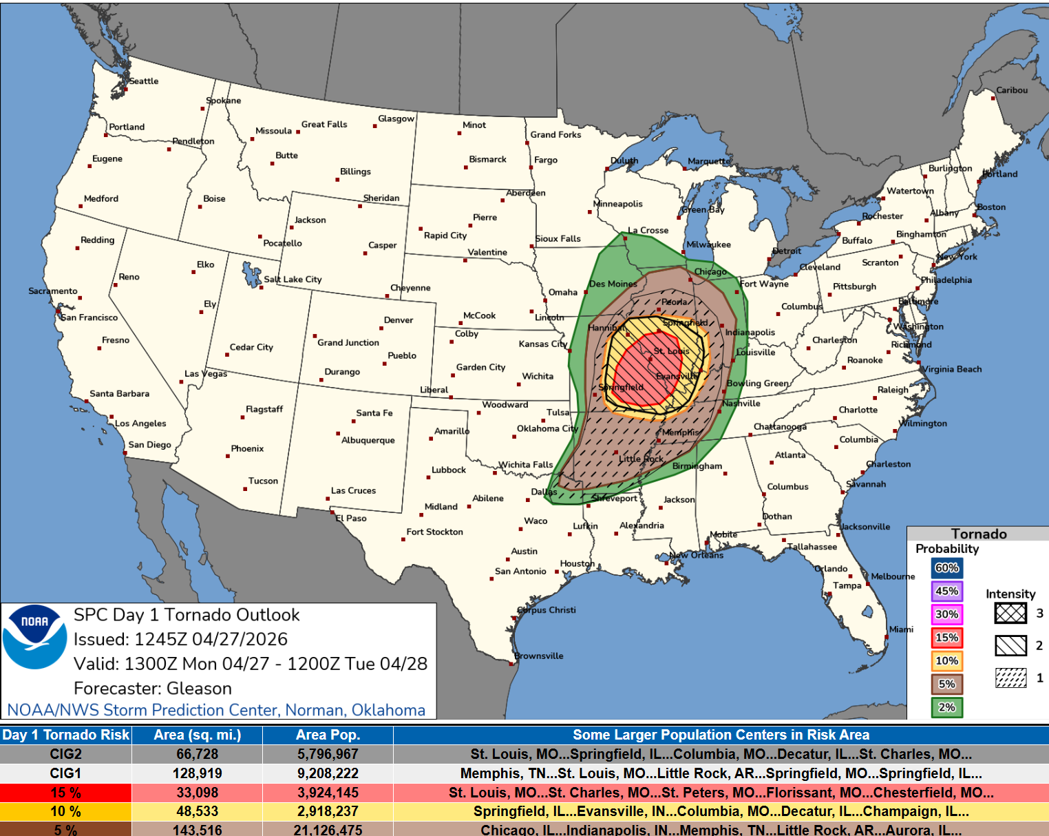
Numerous severe thunderstorms are expected from the mid Mississippi/lower Ohio Valleys into the Mid-South through this evening, with a threat for multiple strong to intense tornadoes (EF-3+), widespread severe/damaging wind gusts, and scattered large to very large hail.
Tornado Potential — 15% + CIG2 = chance of strong/intense tornadoes highest over Missouri and Illinois including St. Louis and Decatur, Illinois
Lower 48 Weather Today | Monday
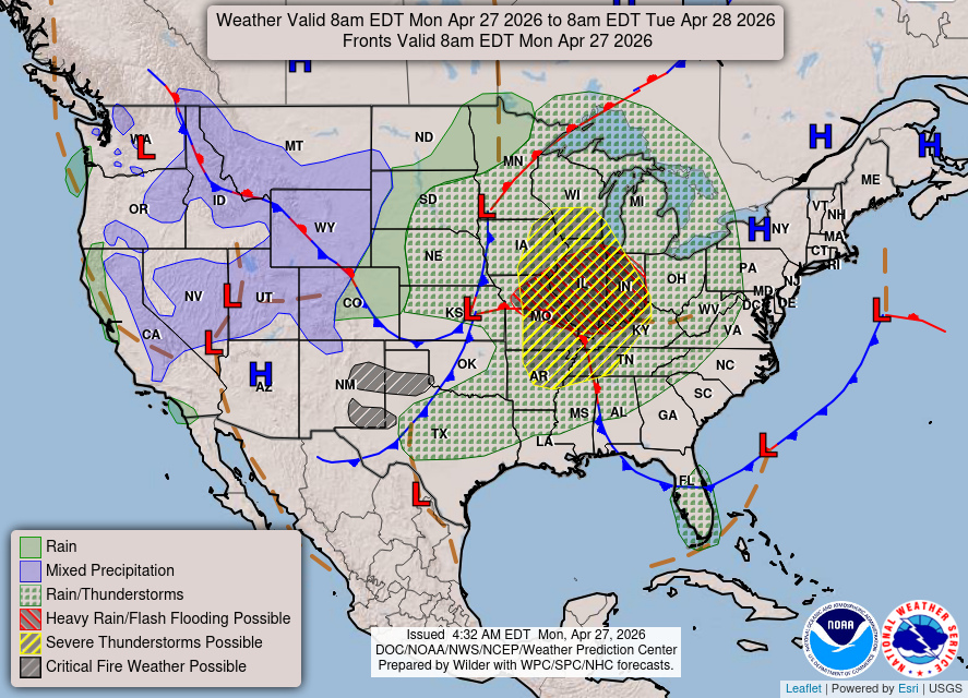
WPC Short Range Discussion:
Developing lee-side cyclone centered over southern Kansas is forecast to lift northeastward into the Upper Midwest, while an associated cold front sweeps across the Nation's mid-section.
A plume of very moist and unstable air continues to surge northward ahead of
the front, which will set the stage for several days of severe weather and
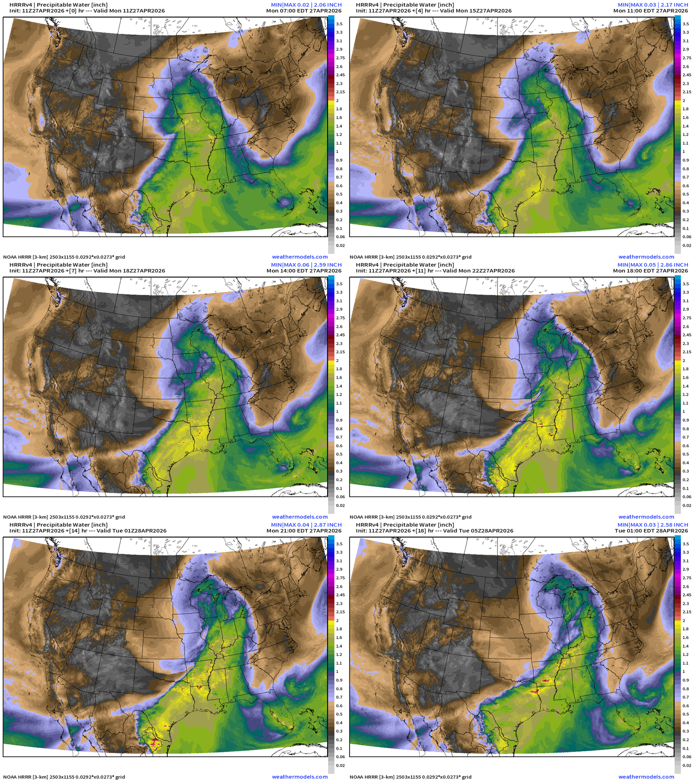
heavy rainfall across the Mid to Lower Mississippi Valleys and Mid-South. HRRR precipitable water next 18-hours:
Current Radar: 8:54 AM ET
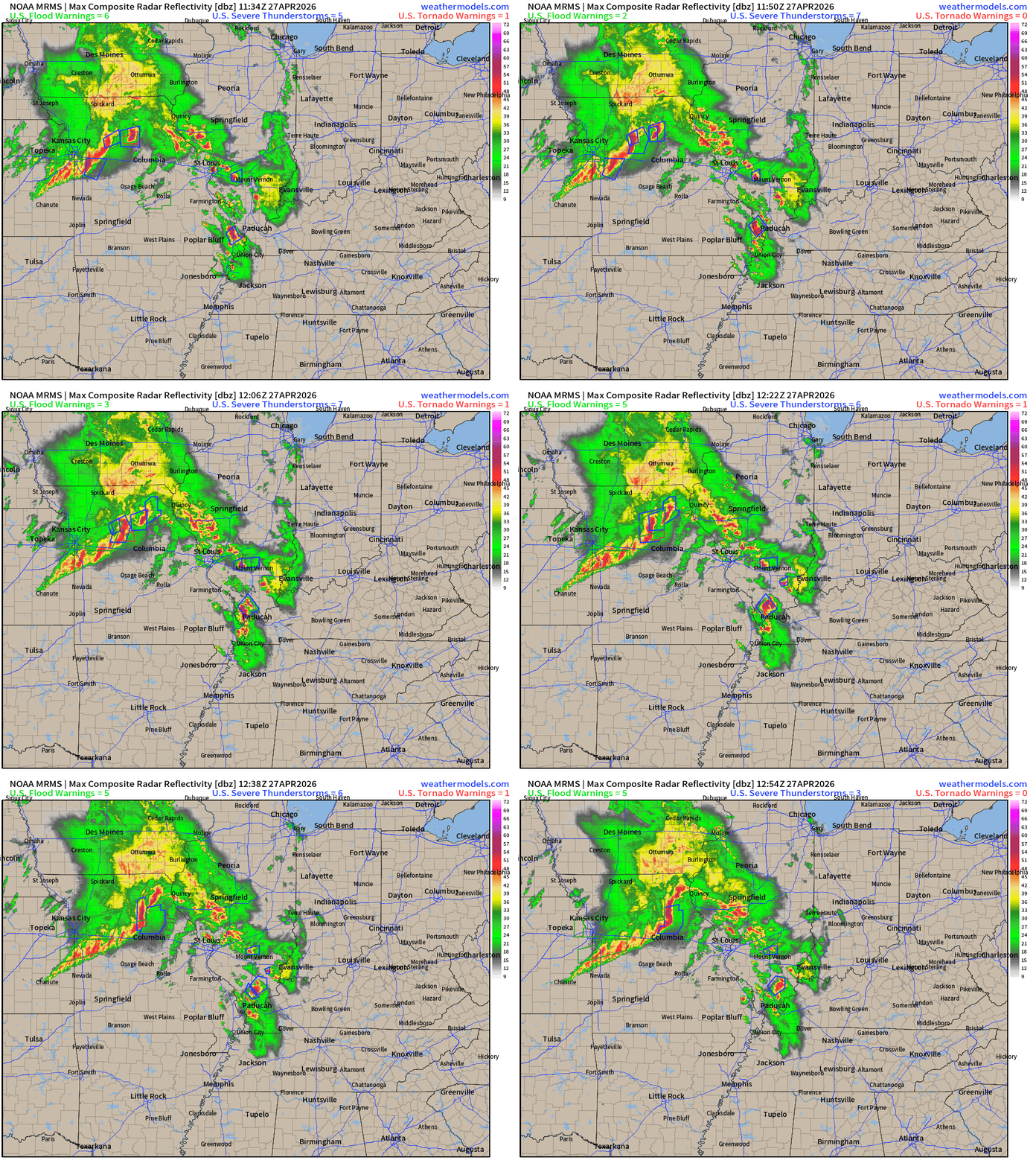
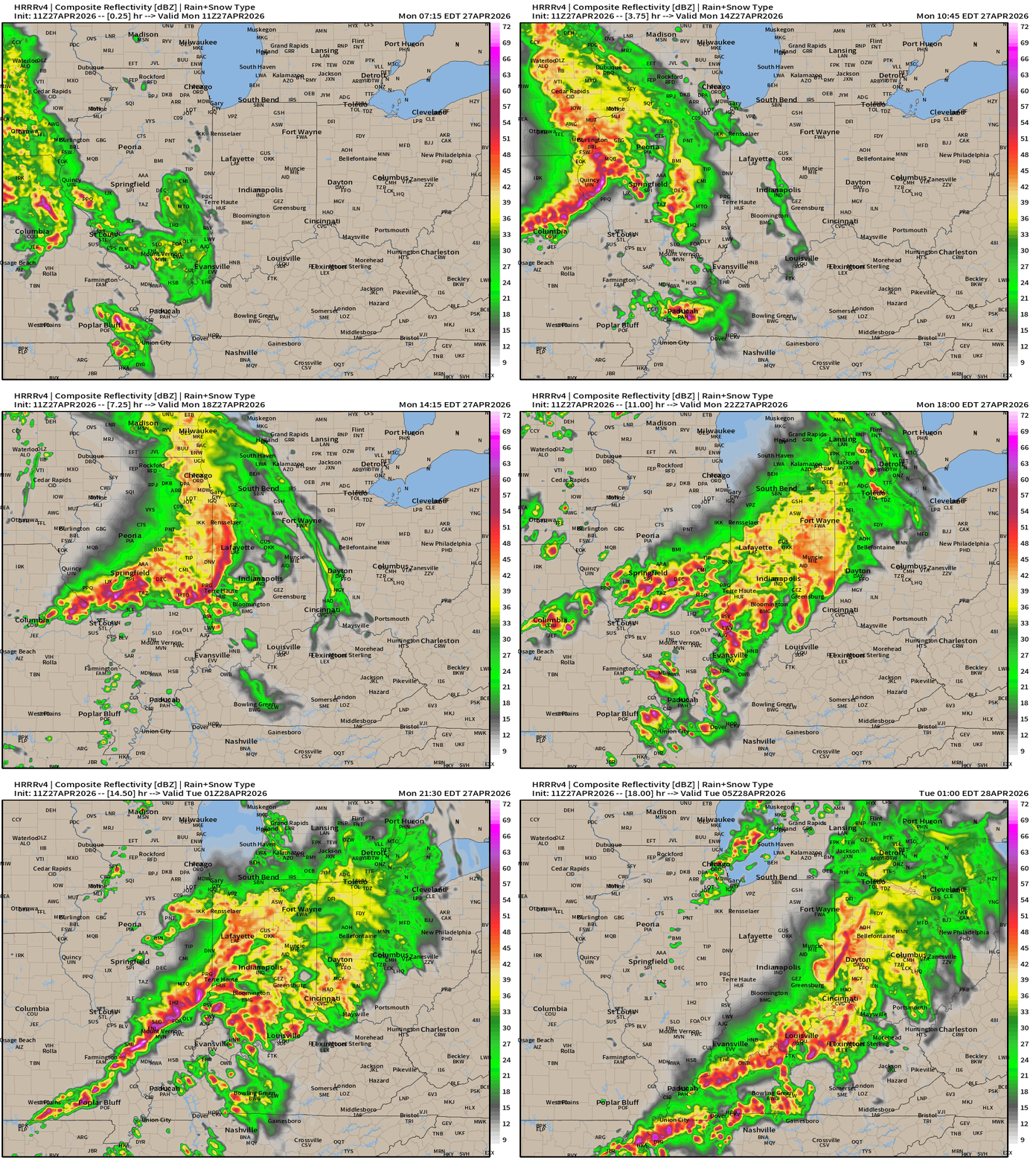
Fewer severe level storms heading into the morning but heavy rain (not needed) across northern Missouri and eastern Iowa.
Radar next 18-hours —> Tuesday early morning 1 AM ET
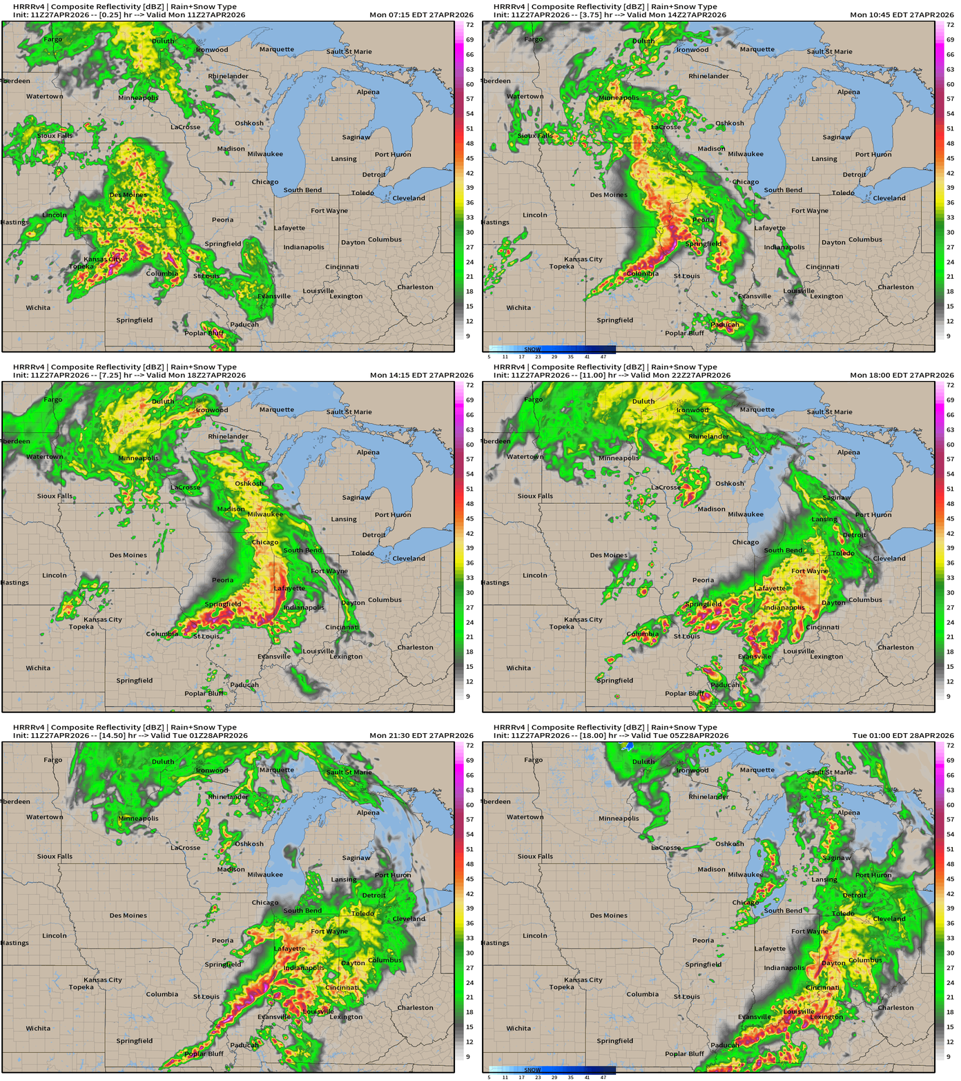
HRRR 06z — Radar Simulation Next 48-hours to Wednesday 2 AM ET
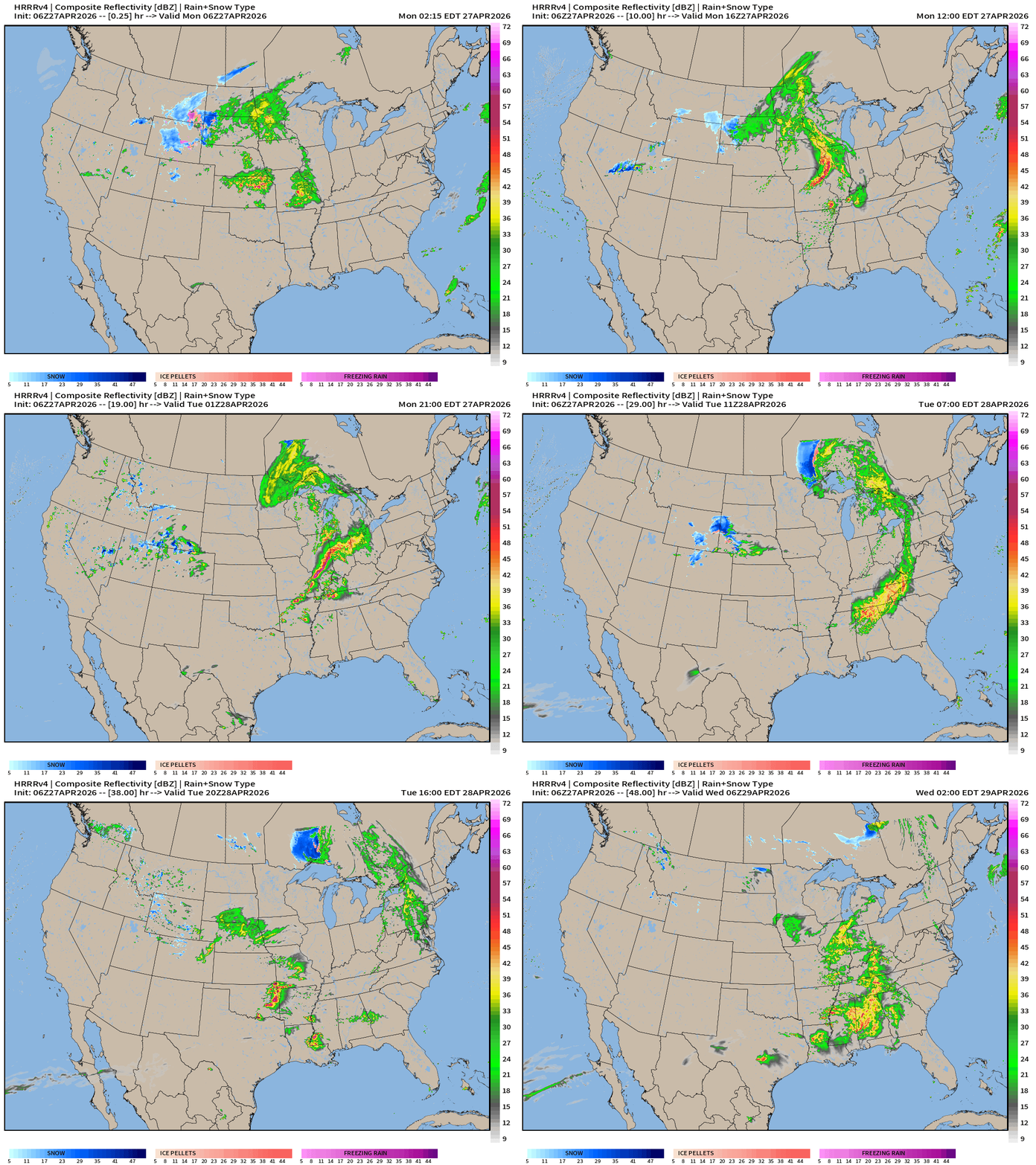
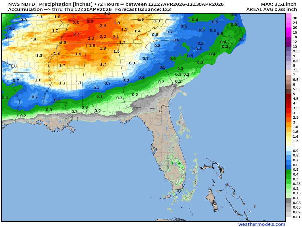
The initial wave of rain with the cold front fizzles out early Tuesday but thankfully another surge of moisture arrives in the Deep South —> Southeast heading into Wednesday for very welcome rainfall > 1” across most areas.
Below normal temperatures next 10-days+
ECMWF AIFS 06z | 500 mb Height Anomaly Next 10-days
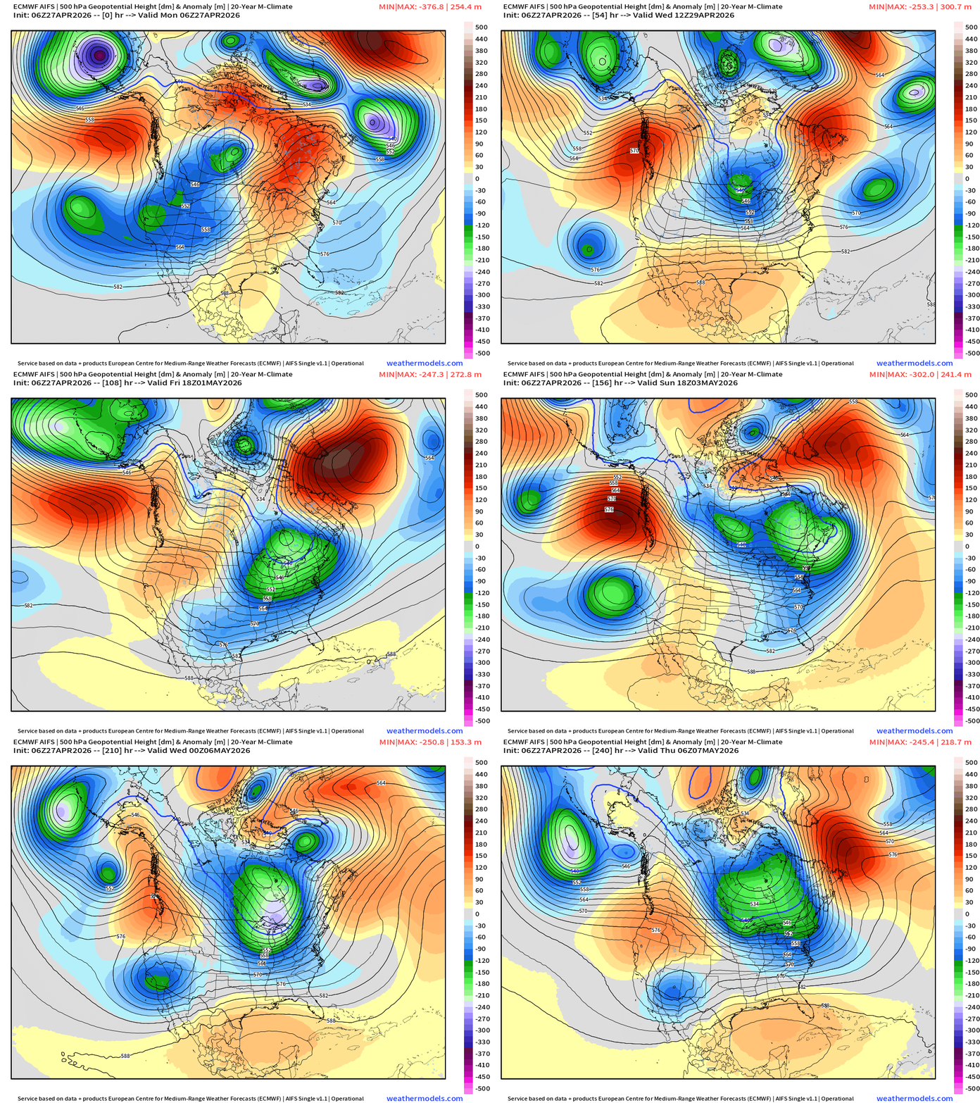
A cool and unsettled pattern from the northern Rockies into the Great Lakes and Northeast for the next 10-days with significant / persistent troughing connecting to the cooler Canadian Arctic pool of air mainly out of the north (still snow covered ground).
10 day Precipitation Forecast | New Blend of Models v5.0
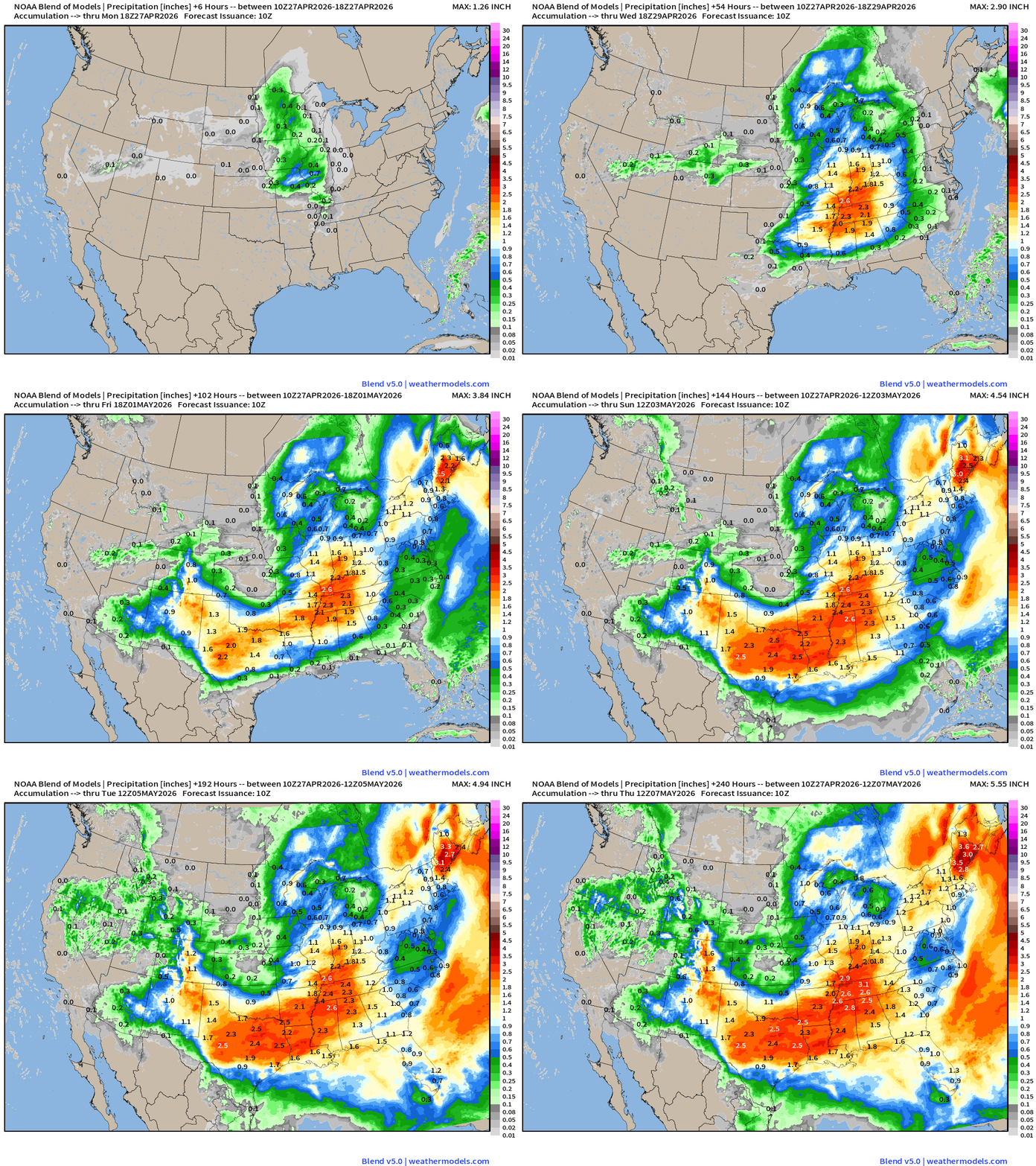
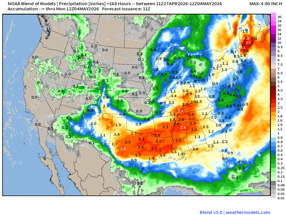
Several bouts of rainfall across the Southern U.S. from Texas to Florida — good news for the next 1-2 weeks as May starts out wet and cool.
ECMWF 06z Precipitation Type + Intensity | Next 6-days
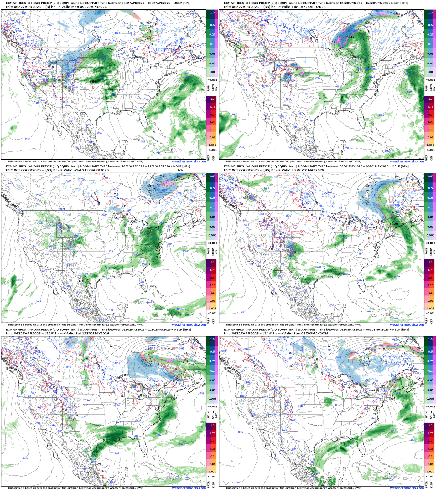
Today into Tuesday: powerful low pressure system tracks through the Great Lakes into Ontario with severe weather along the cold front
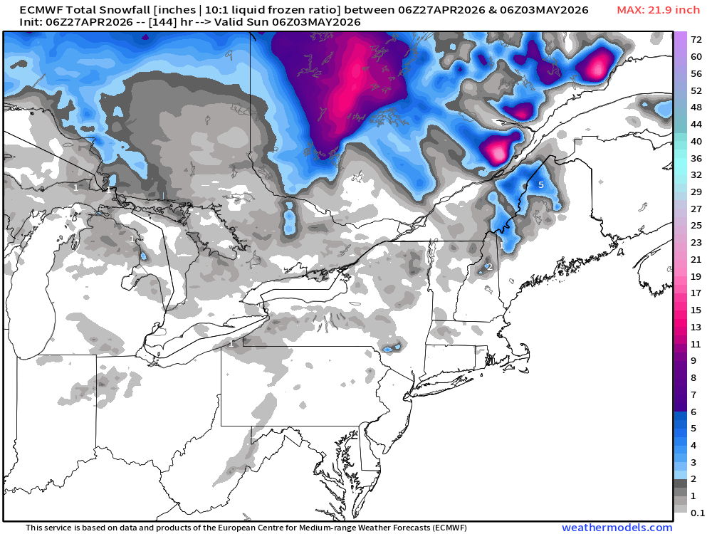
Rest of week: general cyclonic flow over the Great Lakes and Northeast taps into cooler Canadian air mass — with moisture could be come snowfall in higher elevations of New England into the weekend.
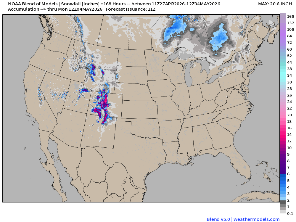
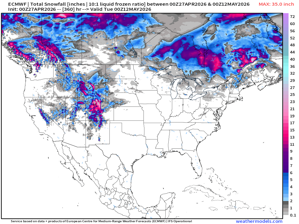
Total next 6-days snowfall: Light amounts overall, but amazing to see “May snowfall”
Temperature Anomaly Next 6-days
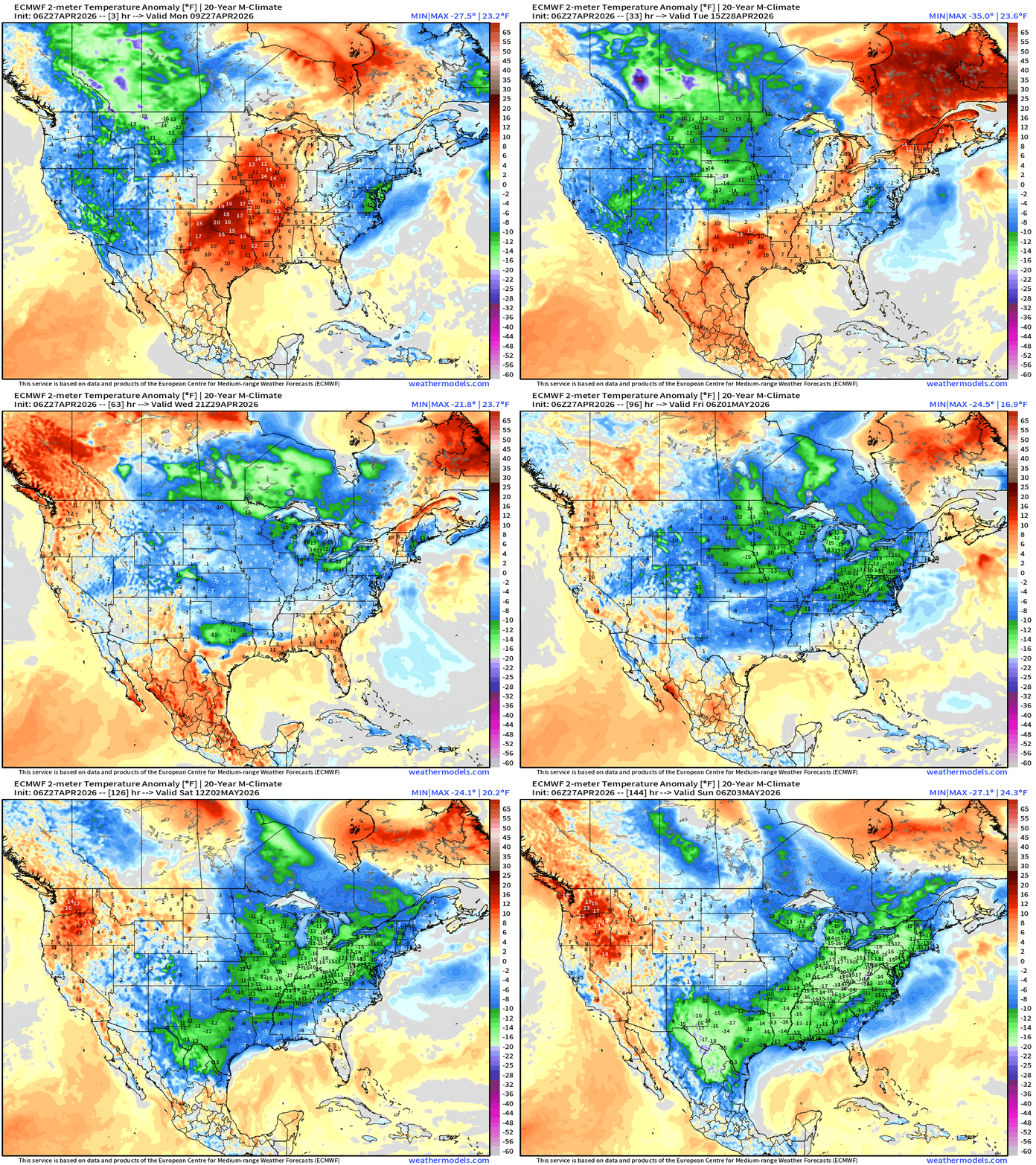
Plenty of cool green and even purple (10°F to 20°F below normal) with Texas seeing the most abnormally chilly air to begin May.
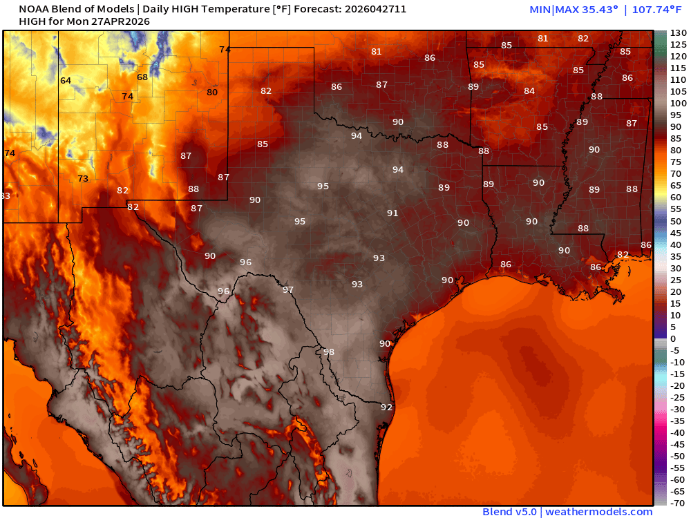
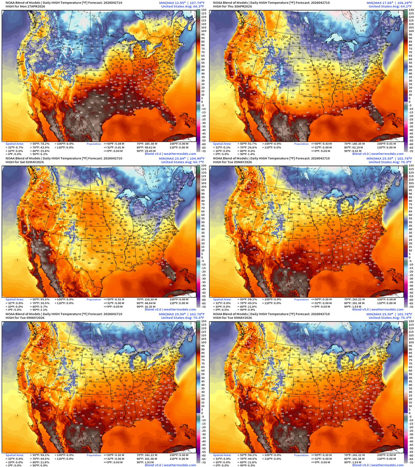
High Temperatures Monday
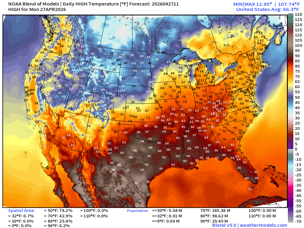
Hot across Texas with 90s (25 million population) with 70s across the Eastern U.S. including NYC and Boston. Comfortable / beautiful day!
94°F in Dallas — maybe 100°F along the Rio Grande
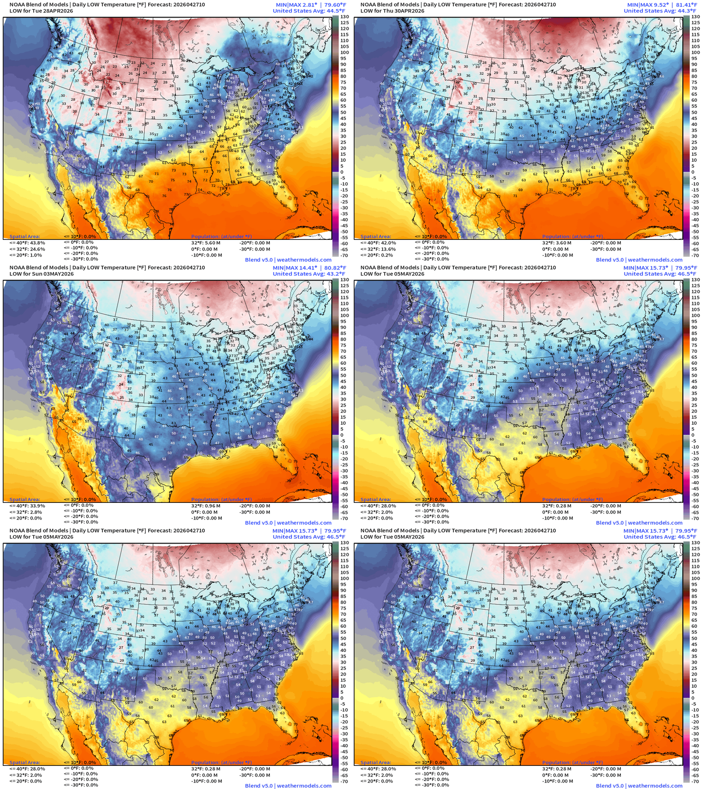
Low Temperatures Tuesday Morning
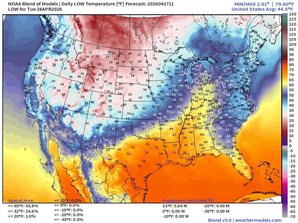
Still well below freezing across the Rockies and upper-Midwest … population is only 5.6 million but the real estate is 25% of the Lower 48. 30s and 40s in the Northeast
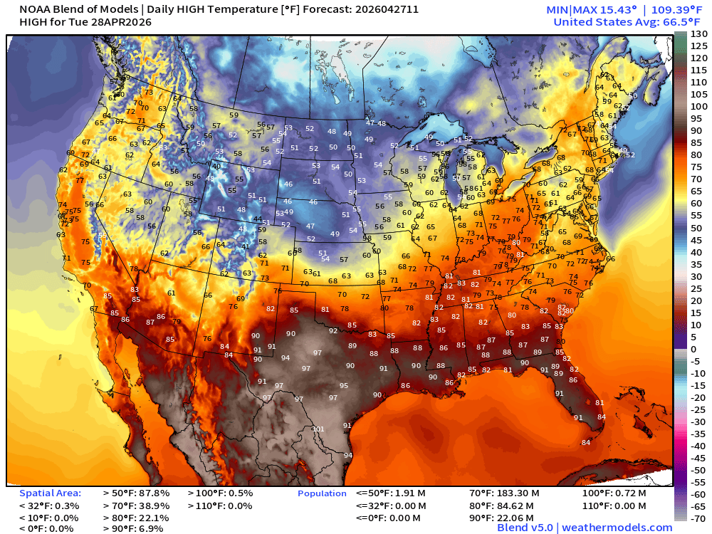
High Temperatures Tuesday
RTMA Current Temperature Analysis | 8:00 AM ET
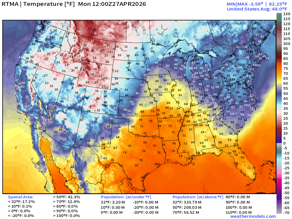
Lower 48 average was 48.0°F at 8 AM ET
RTMA Current Temperature Anomaly Analysis | 8:00 AM ET
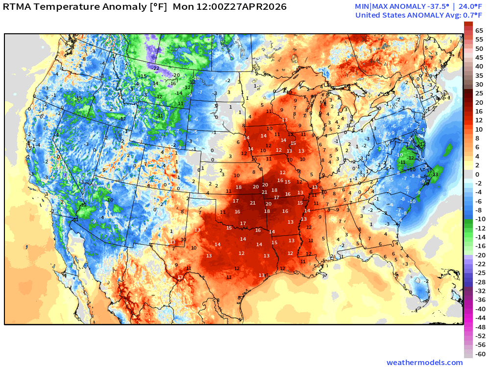
Lower 48 was only 0.7°F ABOVE normal
Weather on Tuesday
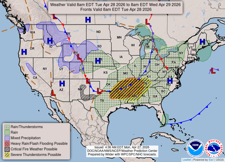
Slight risk of severe weather along cold front sagging into the middle and southern Mississippi River Valley
NDFD NWS Total Precipitation Next 72-hours through Thursday Morning
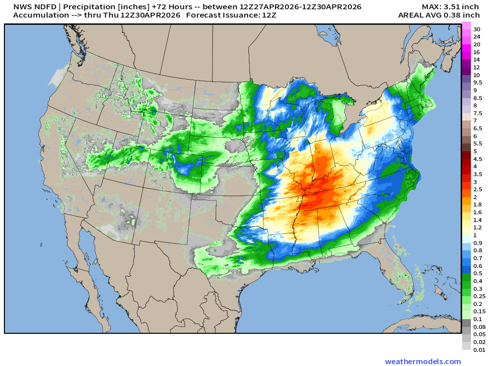
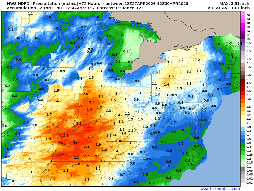
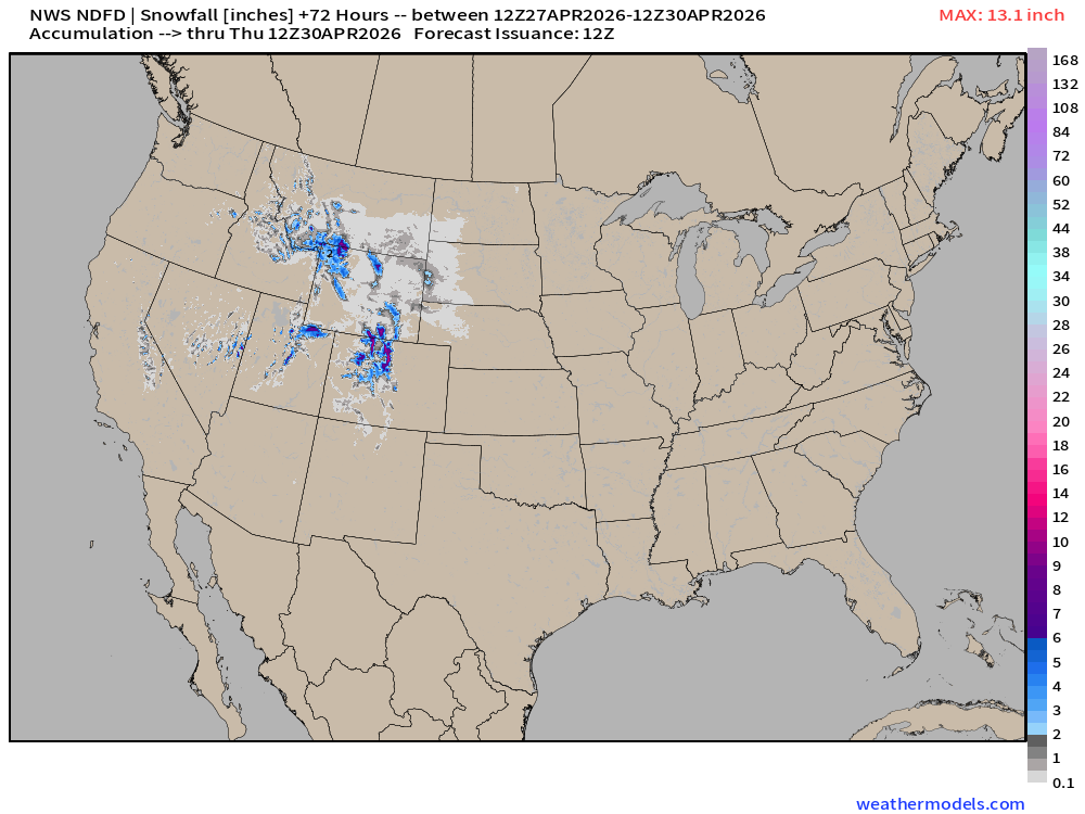
NWS Snowfall Next 72-hours — through Thursday Morning
ECMWF 06z | Forecast 6-days of Precipitable Water (my favorite parameter!)
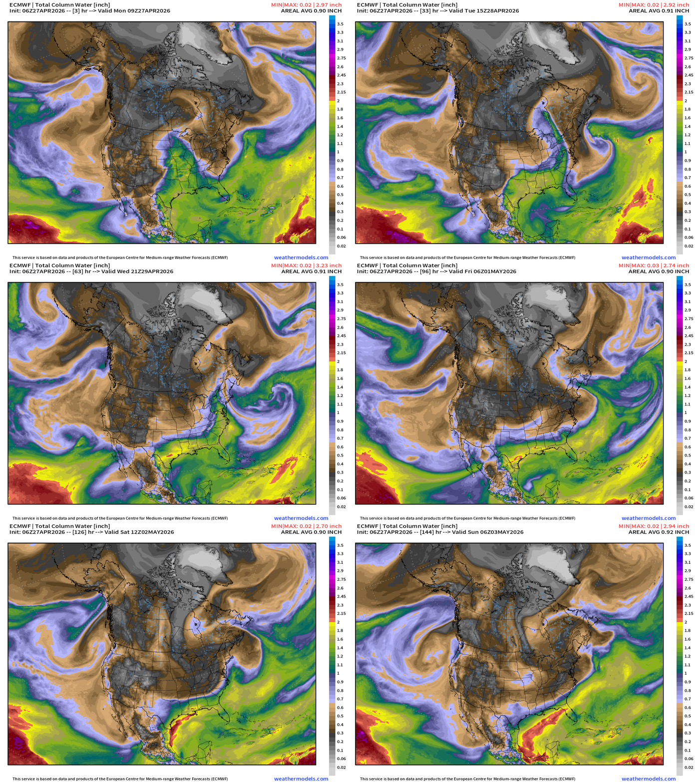
Northerly flow behind cold front = dry Canadian air almost to the Gulf coast by this weekend
ECMWF 00z | Moisture Transport (IVT) next 10-days
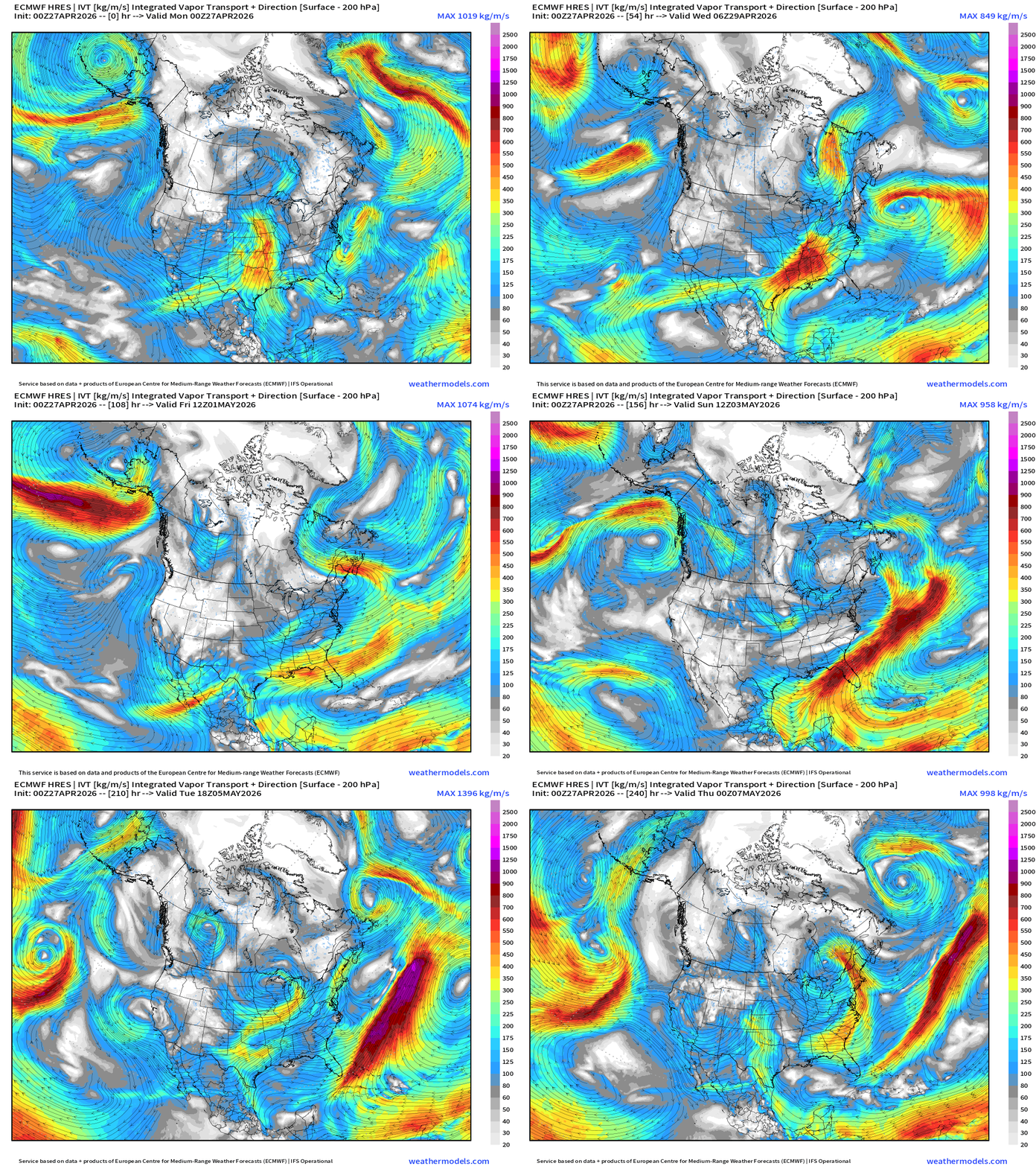
Limited southerly flow over next 10-days after today’s storm and cold front exit into Canada = dry and cool start to month of May
Total Precipitation Next 7-days | Blend of Models
Blend of Models | Total Snowfall Next 7-Days
Blend of Models Temperatures | Highs through Tuesday, May 5th
Blend of Models Temperatures | Lows through Tuesday, May 5th
Snowfall from ECMWF HRES (15-days)
Temperature Anomaly | Next 15-days | ECMWF EPS 00z Ensemble Mean
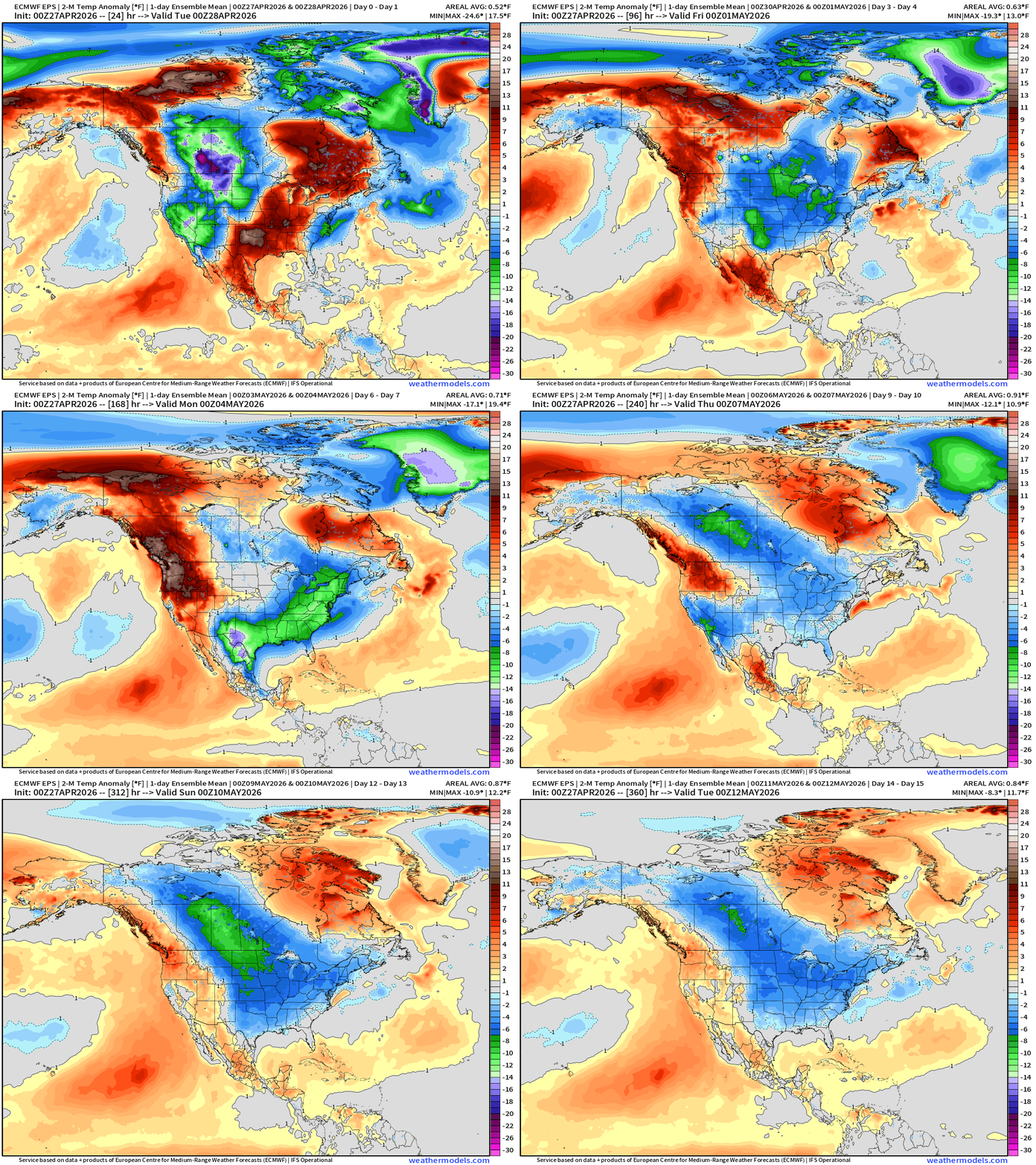
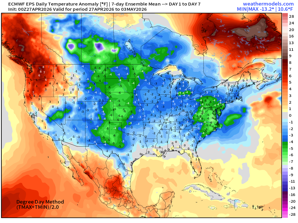
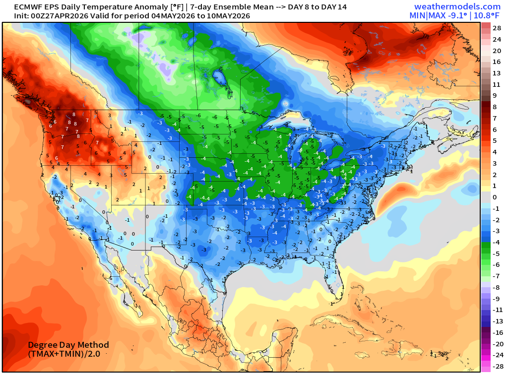
Extended period of “below normal” temperatures dips into the Lower 48 east of the Rockies extending back into northwest Canada through first 2-weeks of May. Where’s the heat dome? Nope!
Week #1 | Temperature Anomaly | April 27 - May 3
Week #2 | Temperature Anomaly | May 4 - May 10
April 7: 2026 Atlantic Seasonal Hurricane Forecast: 11/5/2
9-13 Named Storms (11 most likely)
4-7 Hurricanes (5 or 6 most likely)
1-3 Major Hurricanes (2 most likely)
ACE: 75-85
Maps sourced from weathermodels.com designed and innovated by yours truly! Please subscribe there for real-time access to the newest maps, charts from all of the weather models including ECMWF and AIFS, and NOAA GFS/GEFS. NOAA WPC and SPC for fronts/convective outlooks.
- Milepost
- 926 · laid 2026-04-27T13:35:33.069000Z
- Source
- https://weather.substack.com/p/april-27-2026-monday-spring-weather
- Digest
- 9db8700dc9970cb52490b3a31ed8085274c780b5eee0259da7372a6b92b6e4c5
- Machine
- JSON