April 20, 2026 Monday Spring Weather
Chilly day across Great Lakes and Northeast but warming trend through week
April 2026 was the 3rd-warmest April in the 132-year national record (1895–2026), at 54.7°F against a 1991–2020 normal of 51.8°F (+2.9°F).
April 2026 was the 46th-wettest April in the 132-year national record (1895–2026), at 2.7in against a 1991–2020 normal of 2.7in (+0.0in).
NOAA/NCEI Climate at a Glance, contiguous United States. This is the observed record for the month, not a score of anything said in this piece — the forecast ledger begins 2026-08-17 and cannot reach earlier posts.

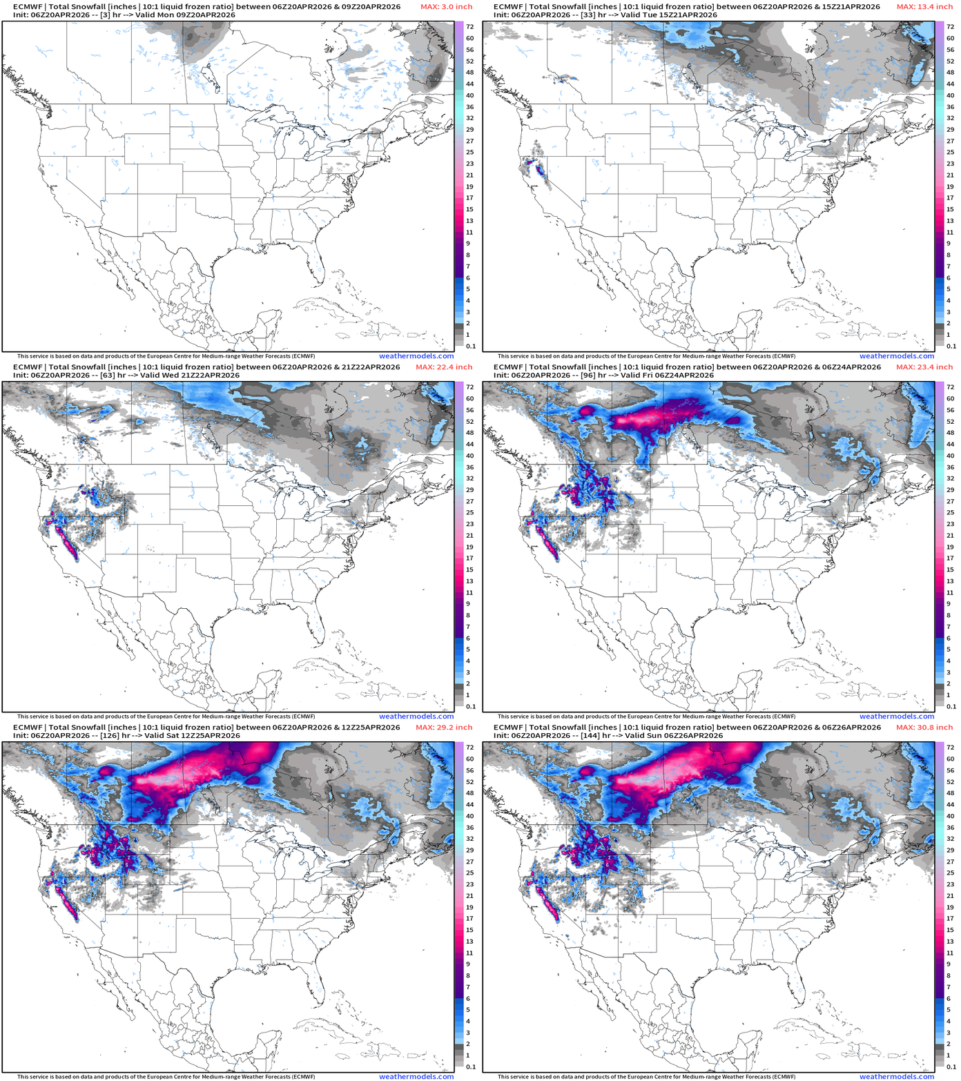
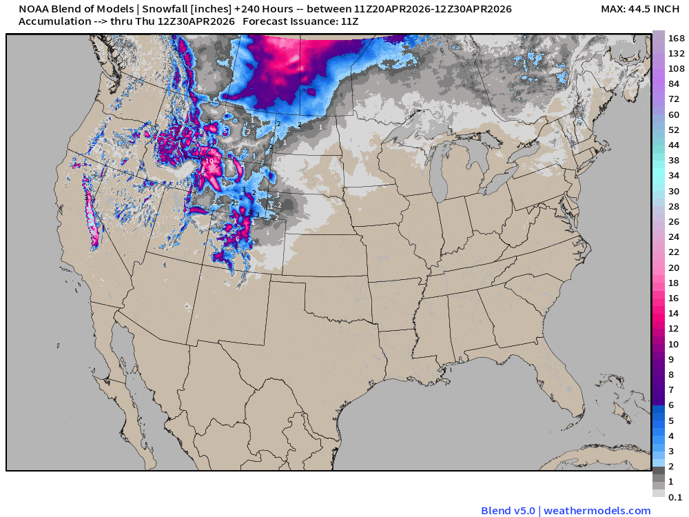
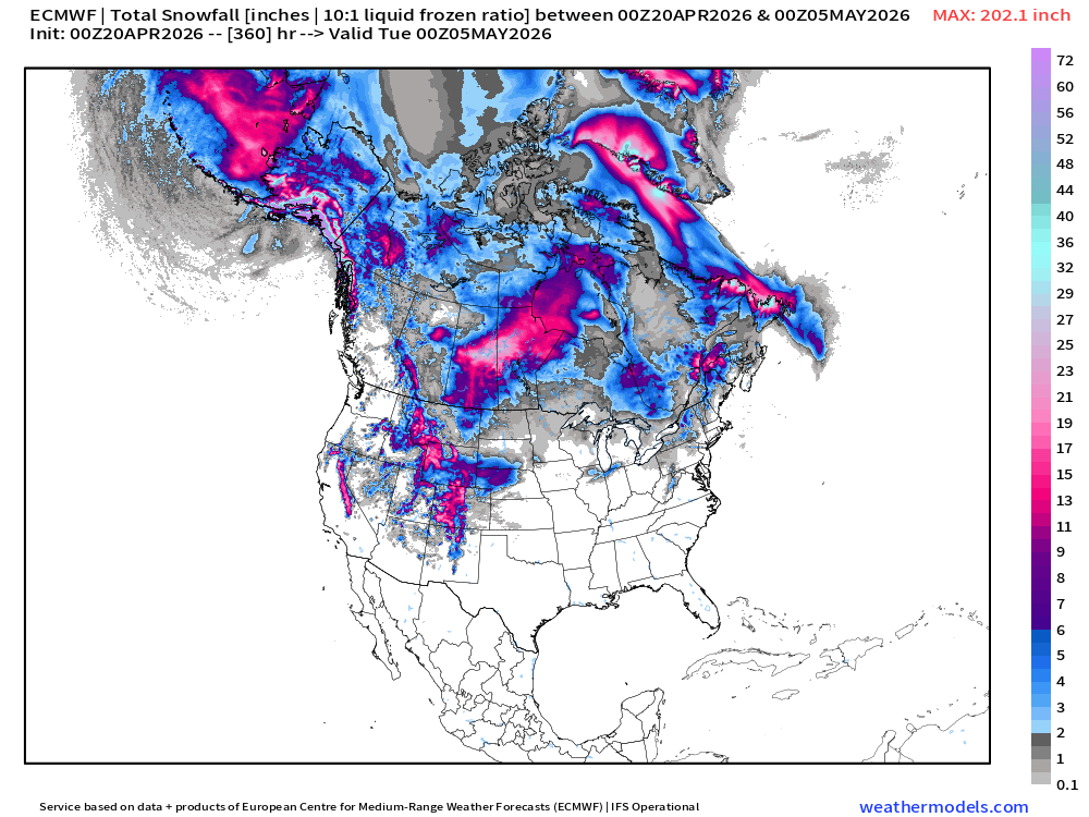
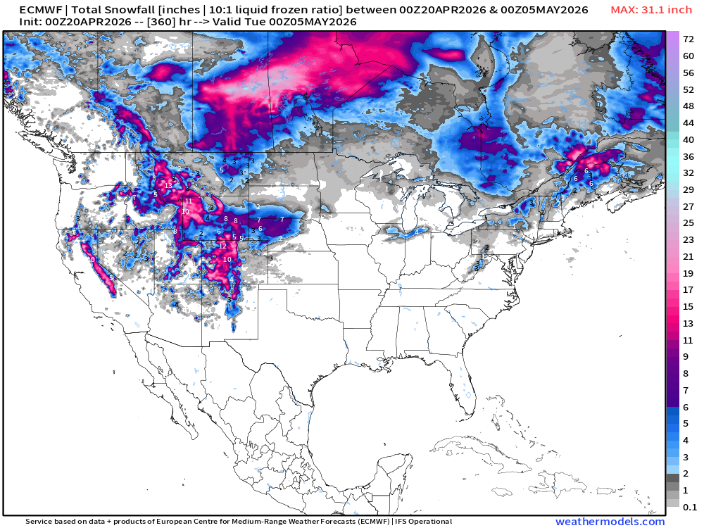
Yes, it’s still snowing a LOT across the Rockies and Canada as Pacific moisture encounters the still powerful Arctic “polar vortex” spinning over Hudson Bay. Some of that light snowfall will reach New England during the week, too. Upwards of 2-feet of snow in Saskatchewan!
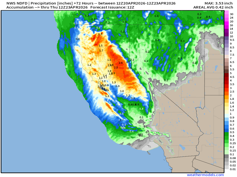
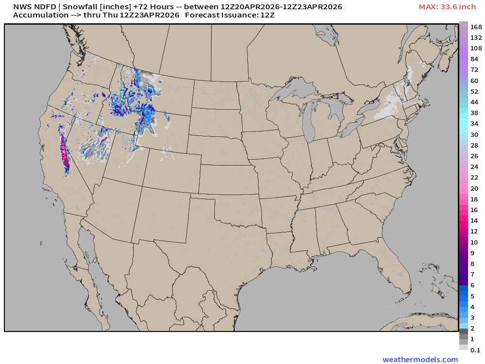
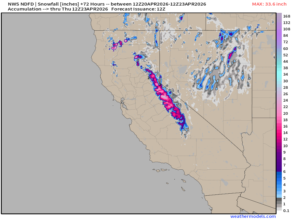
Good news is that the California Sierra and the Great Basin of the Western U.S. needs whatever precipitation comes whether it’s rain or snow.
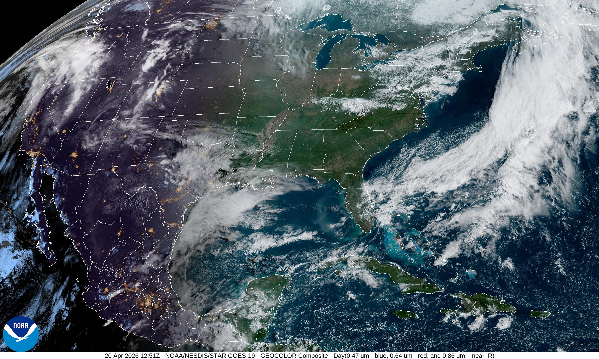
Beautiful — sunny and crips morning across the Southeast, Great Lakes, and central Mississippi River Valley!
High Temperatures Today | Monday April 20, 2026
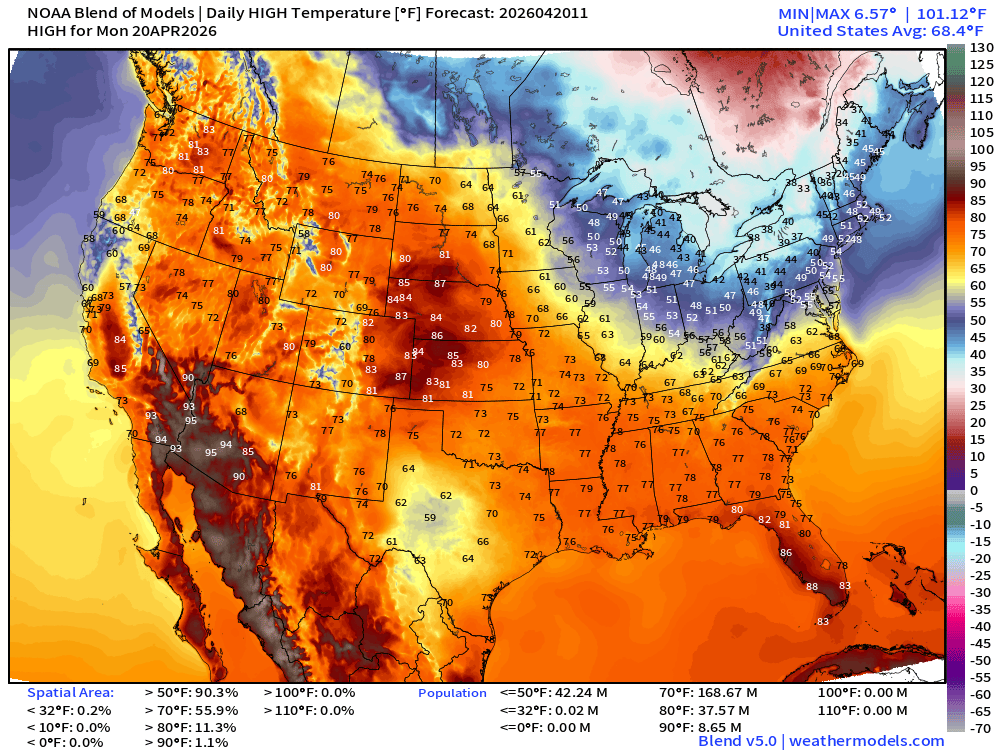
169 million at least 70°F … but the Great Lakes and Northeast remains chilly mainly in the 40s
Low Temperatures on Tuesday
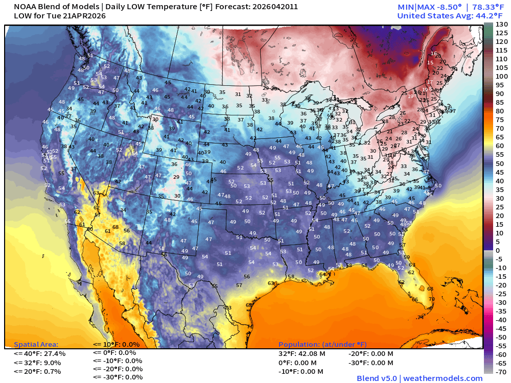
Still 42 million below freezing with only 20s in Pennsylvania, around NYC, and into New England. Brrr!
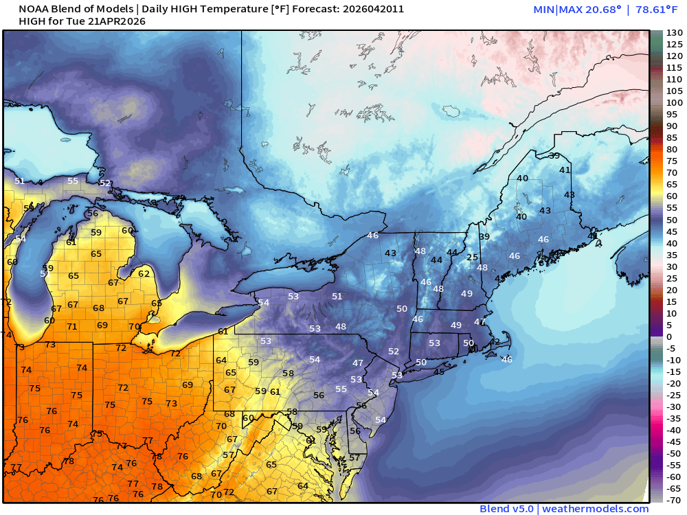
High Temperatures Tuesday Morning | Warming Trend!
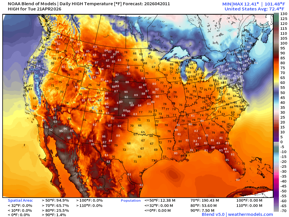
Widespread 70s for 2/3 of the Lower 48 (66% real estate) … but population of Northeast not participating with 40s and 50s (still)
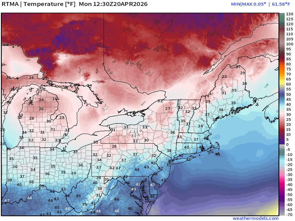
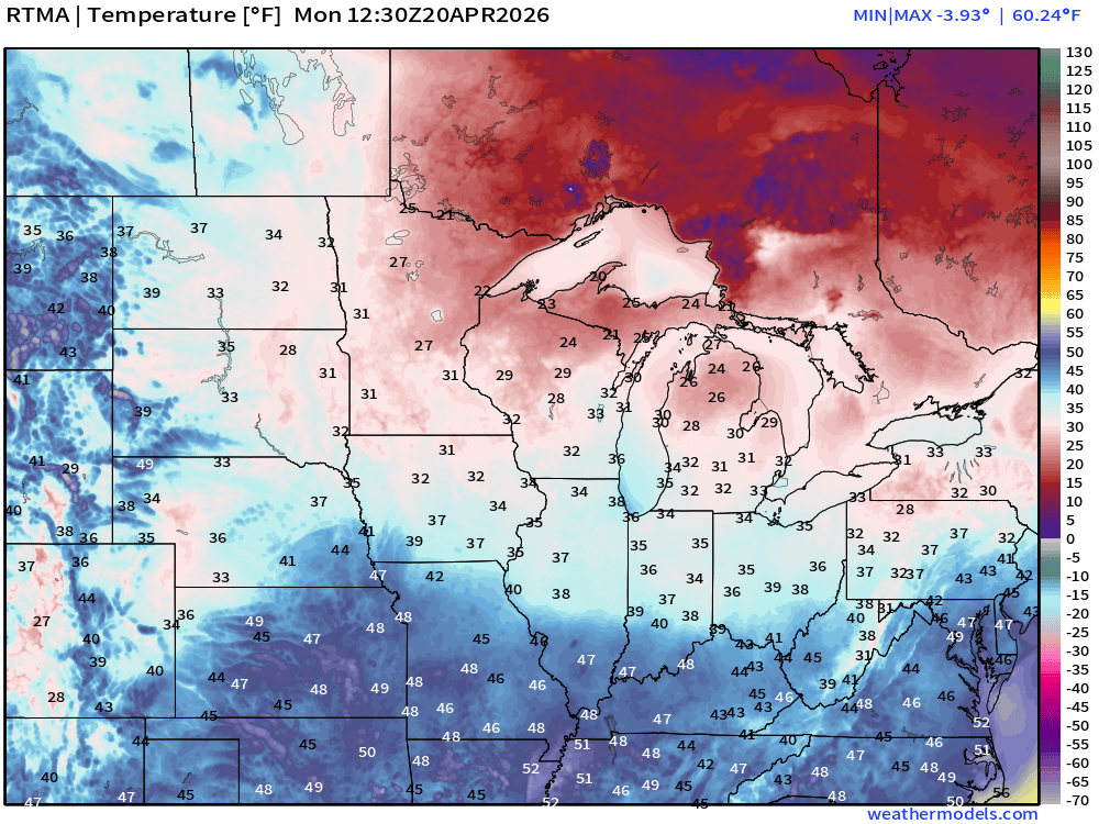
RTMA Current Temperature Analysis | 8:30 AM ET
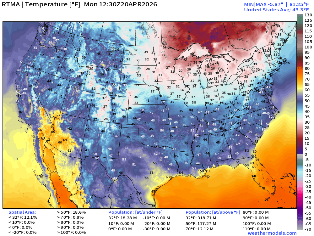
Lower 48 average was only 43.3°F
RTMA Current Temperature Anomaly Analysis | 8:30 AM ET
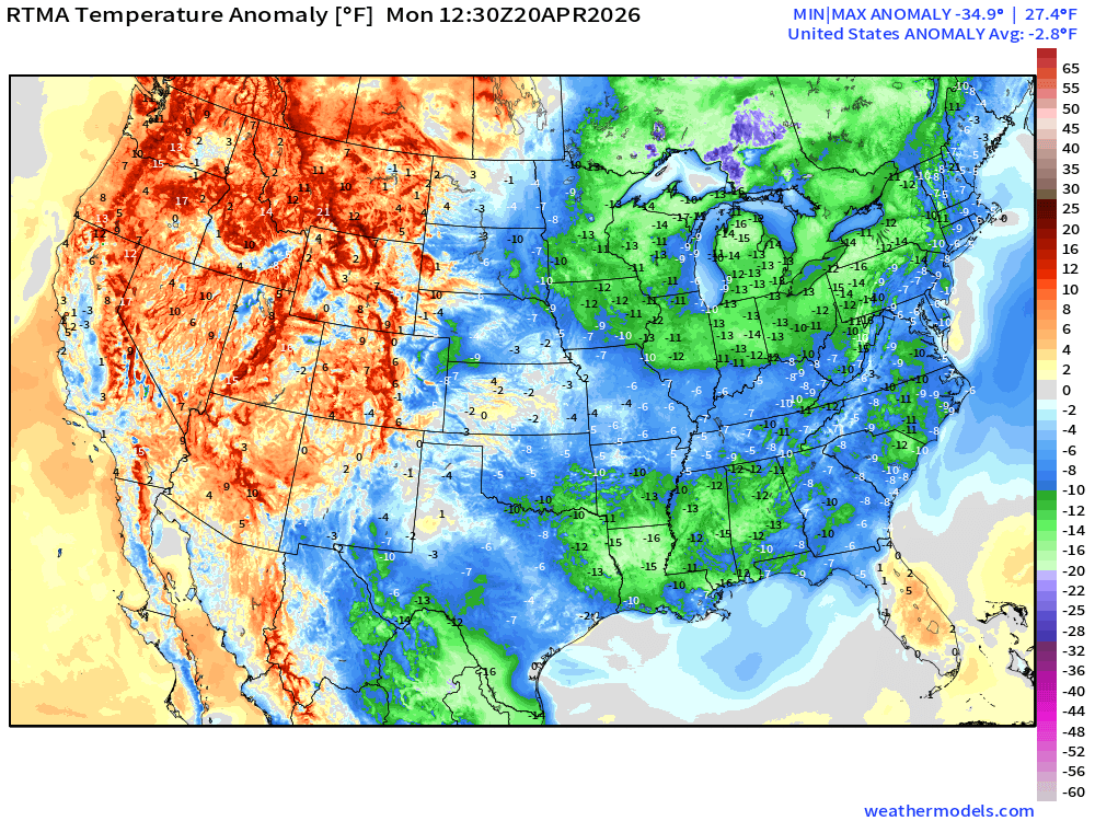
Lower 48 was -2.8°F BELOW normal with eastern U.S. cool / chilly
Quick Tropical Update | Atlantic Basin | Next 6-days Precipitable Water
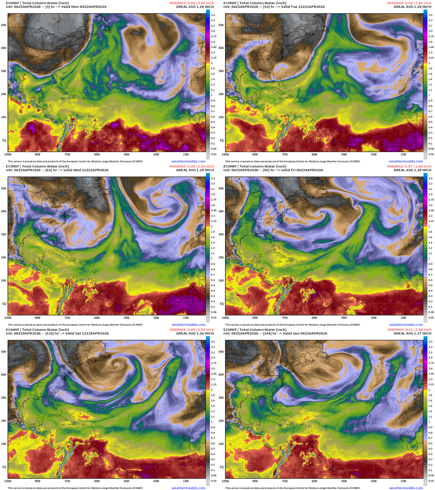
Cold fronts still reaching well into the Atlantic including Bahamas with dry air to about 25°N latitude. The ITCZ is depressed to the equator or 5°N latitude into the end of April climatologically, so we don’t expect any tropical waves to develop out in the Main Development Region (MDR) until late June or early July.
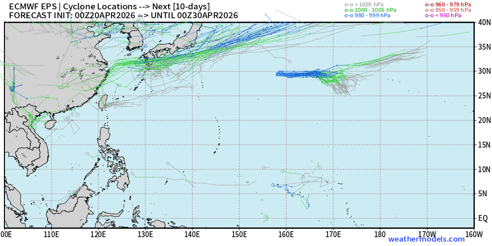
The Western Pacific is quiet again after massive Super Typhoon Sinlaku has become post-tropical and merged with the mid-latitude westerlies.
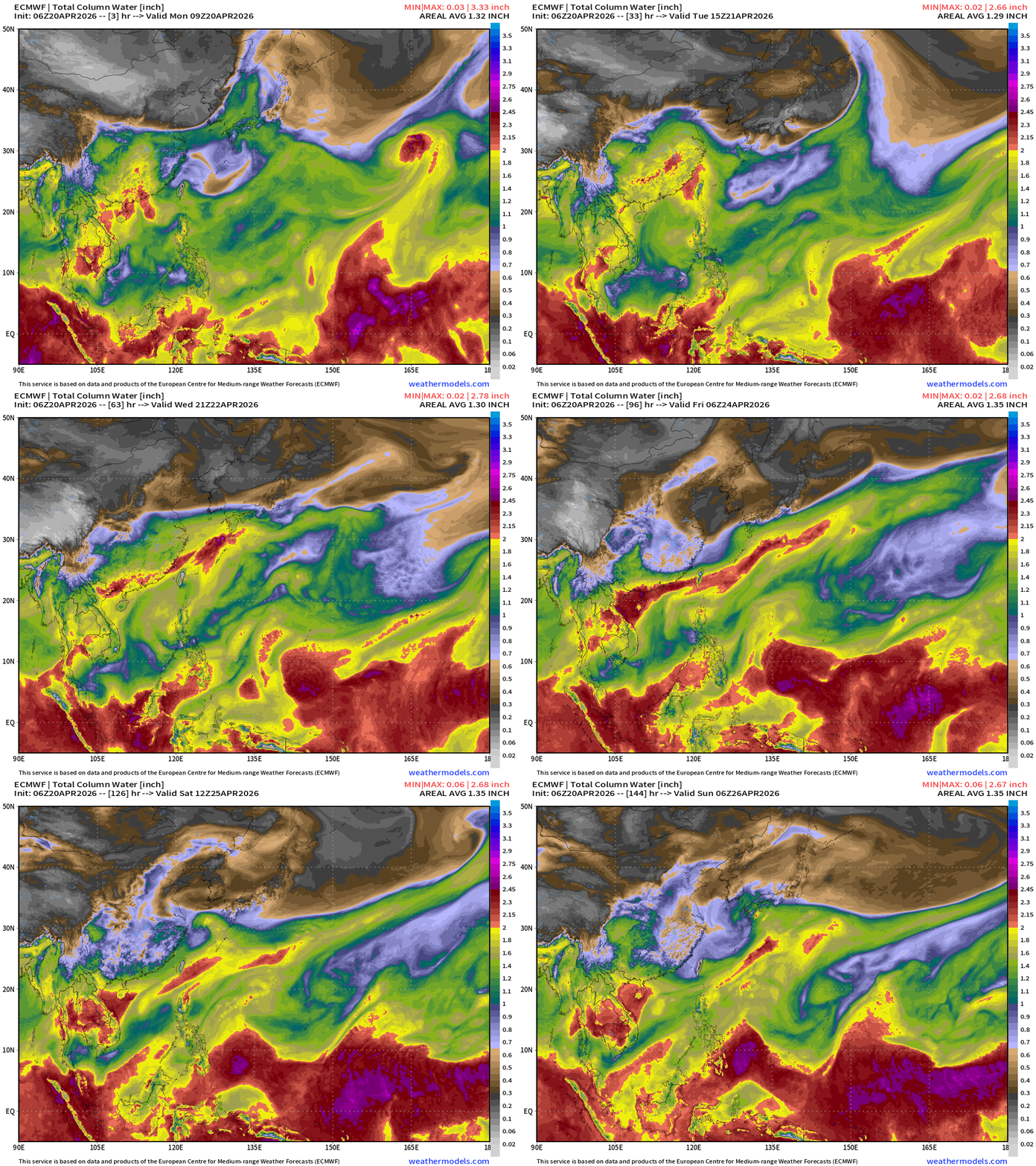
Nothing else on the horizon for next 10-days+ in the Western Pacific
Lower 48 Weather Today | Monday
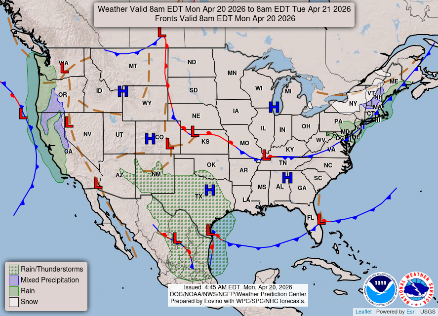
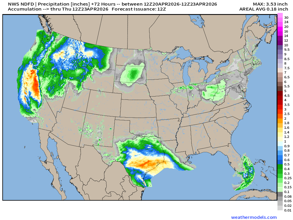
3 main areas of precipitation today: California, Texas, and New England, but no severe weather is expected — good news for April 20th.
HRRR 06z — Radar Simulation Next 48-hours to Wednesday 2 AM ET
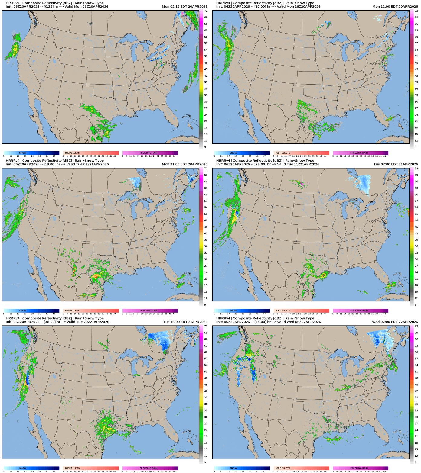
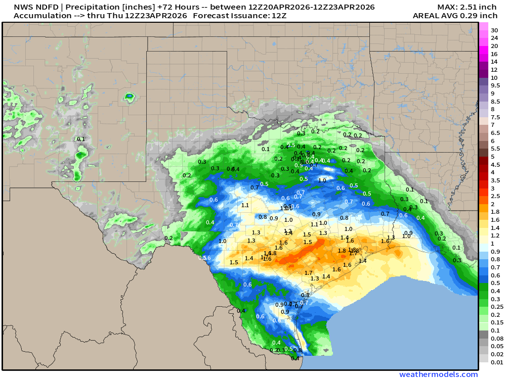
More very welcome rainfall across Texas. Same for California — should also be heavy snowfall in the Sierra. Scattered light rain or snow showers in New England this evening!
HRRR 06z Precipitable Water Next 48-hours (my favorite parameter)
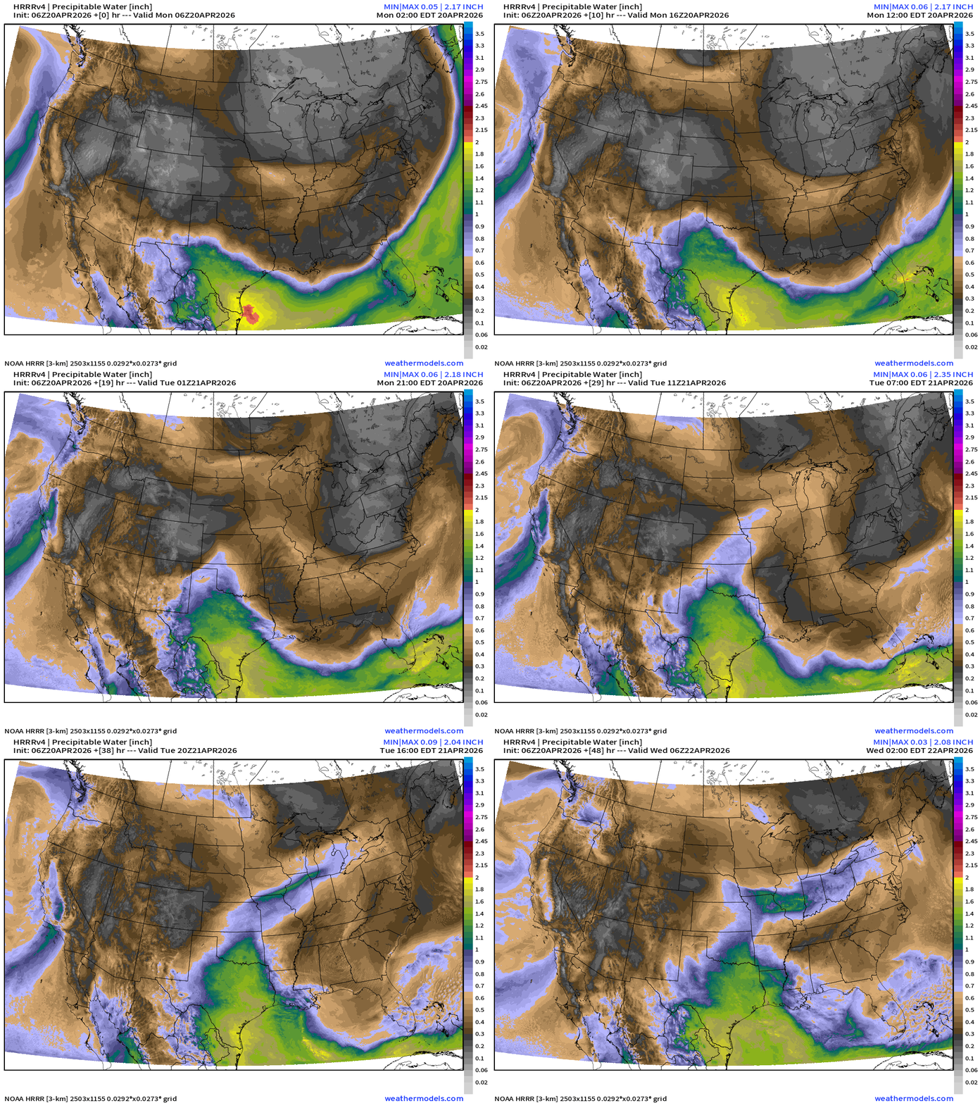
Cold front actually entirely clears South Florida with easterly flow across the peninsula. Cold and dry air pushes from the Great Lakes through the Northeast into Tuesday.
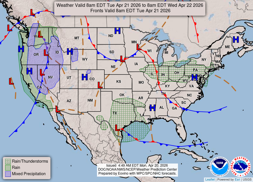
Weather on Tuesday — unsettled across the Western U.S.
Warming trend across the Great Lakes, and soon the Northeast with warmer southerly flow replacing the Arctic “polar vortex” influenced weather pattern
NDFD NWS Total Precipitation Next 72-hours through Thursday Morning
NWS Snowfall Next 72-hours — through Thursday Morning
ECMWF 06z | Forecast 6-days of Precipitable Water (my favorite parameter!)
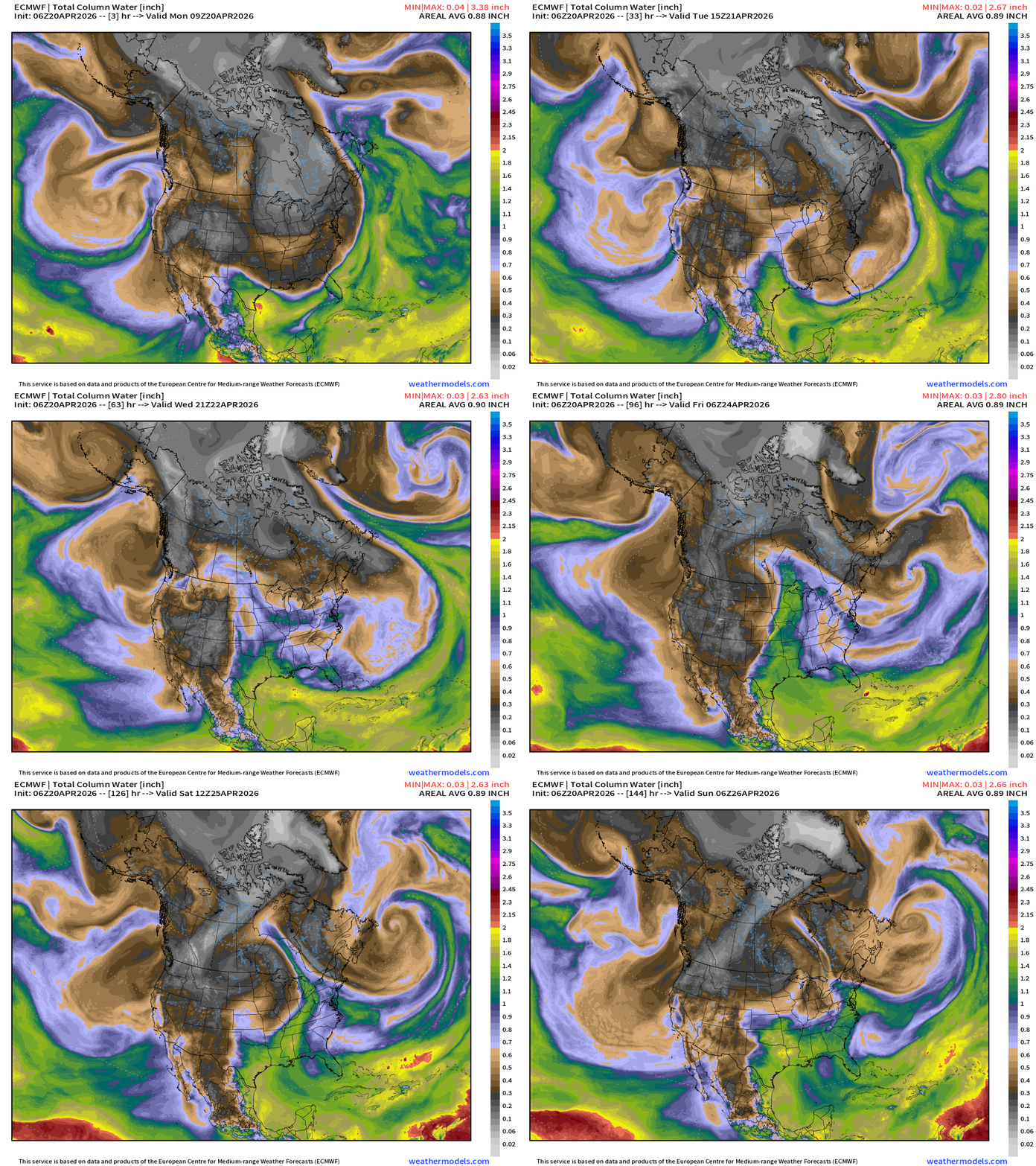
Atmospheric river impacting the California coast into Wednesday (welcome precipitation)
Southerly flow picks up steam during week with much warmer air out of the Gulf of Mexico = convection/storms.
The next major storm on Friday tracks out of the Dakotas into Canada with heavy snow on the backside around Saskatoon.
ECMWF 06z Precipitation Type + Intensity | Next 6-days
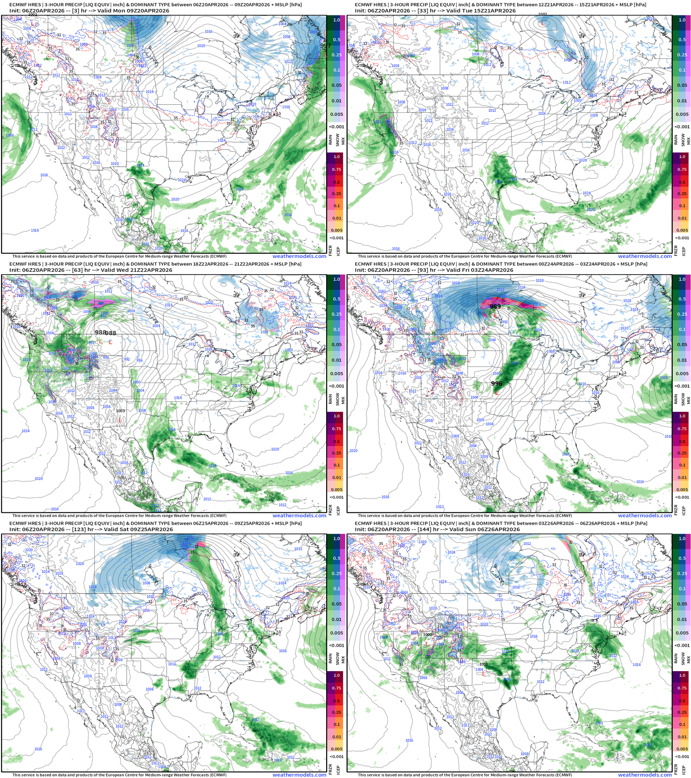
Strong “winter weather” storm systems for Canada but the lows tracking so far northward means little dynamics/energy for the trailing cold fronts —> lack of rainfall and storms for the Southeast where we need the moisture badly.
Moisture Transport (IVT) next 10-days
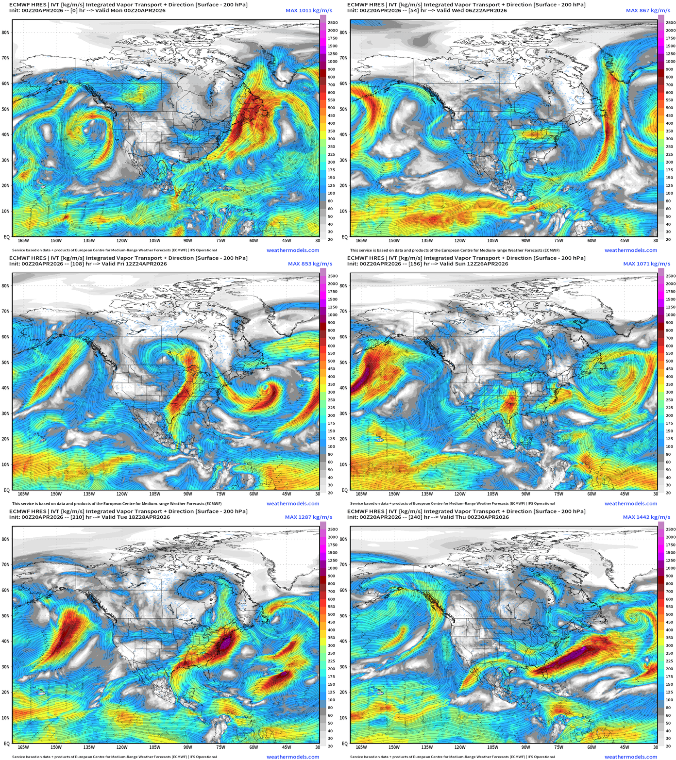
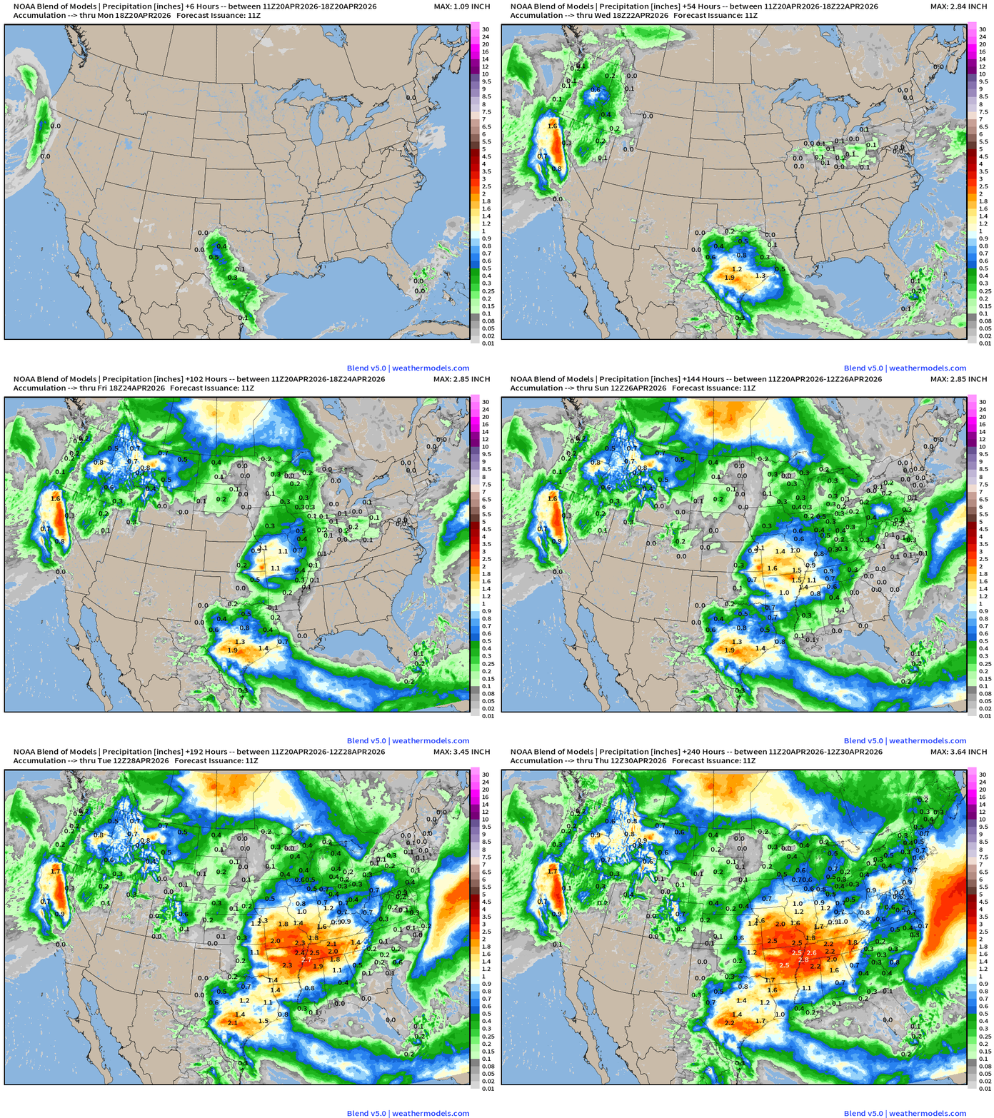
Next best chance for heavy rain in the Deep South and Southeast will be early next week, but that won’t cover the ongoing and growing deficit (and drought)
Total Precipitation Next 10-days | Blend of Models
Blend of Models | Total Snowfall Next 10-Days
ECMWF AIFS 06z next 10-days of 500 mb Height Anomaly
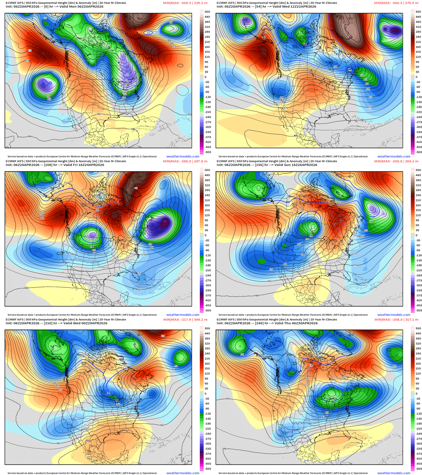
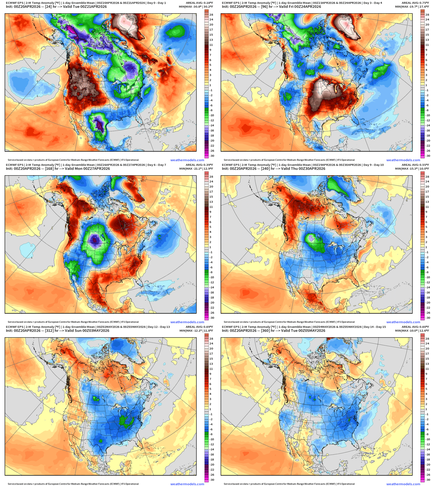
Certainly no sustained “heat domes” going into May … instead we have multiple mobile troughs influencing the Lower 48 from coast to coast = unsettled and cooler to the north with typical spring warmth and humidity in Texas and the Southeast.
Blend of Models Temperatures | Highs through Tuesday, April 28
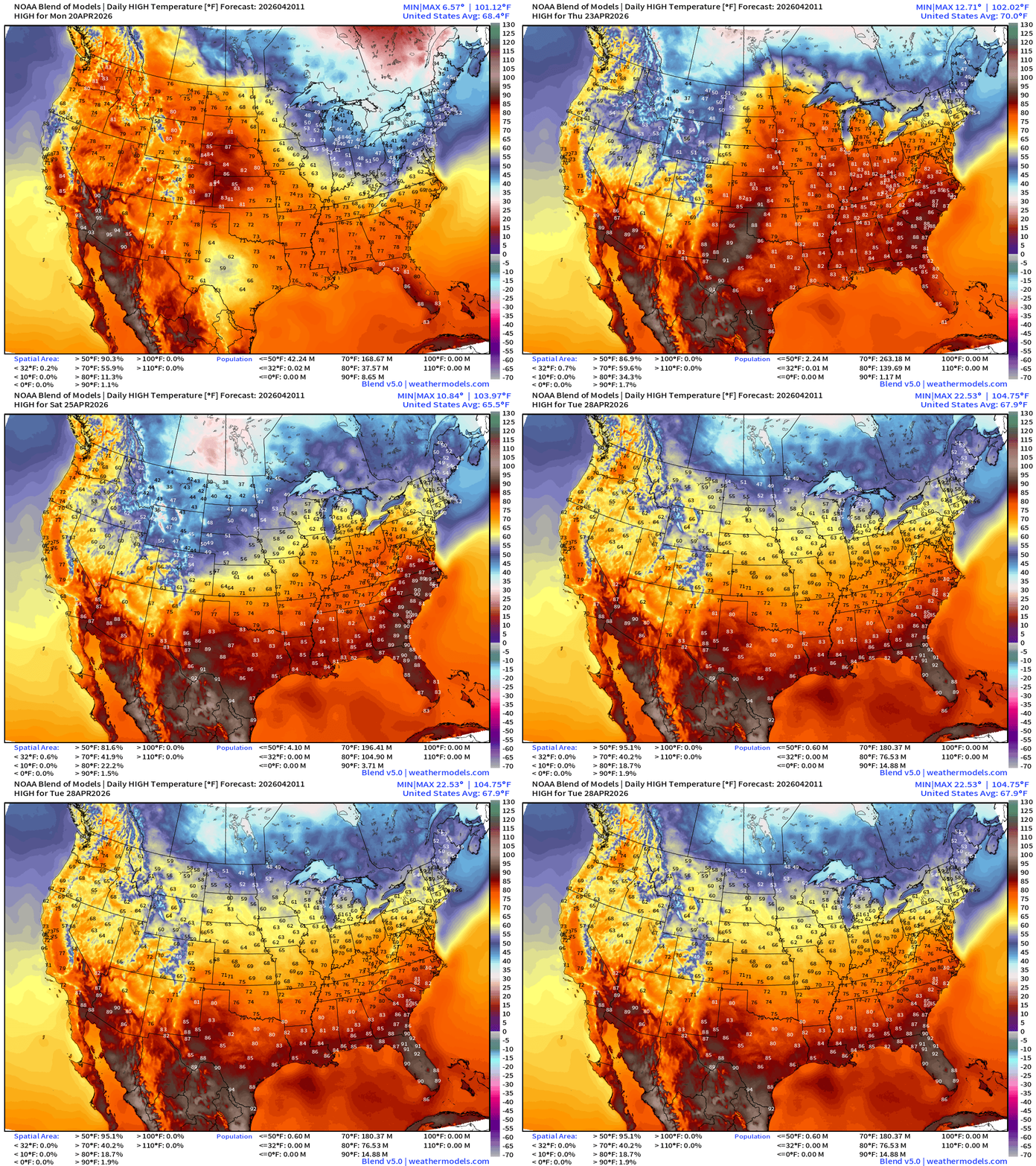
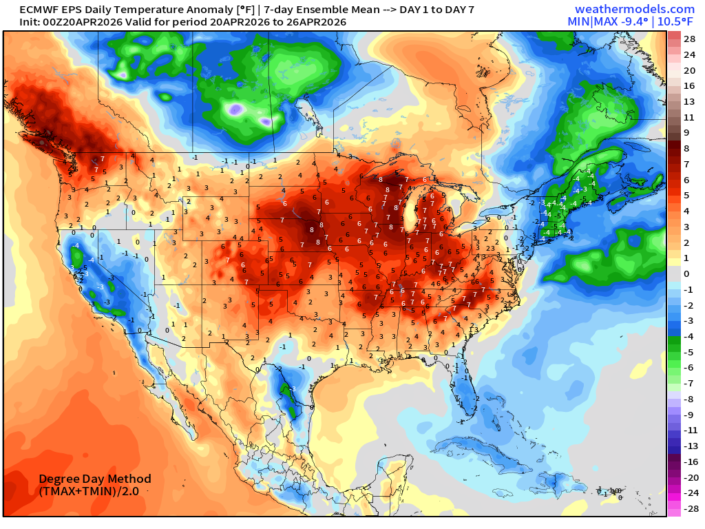
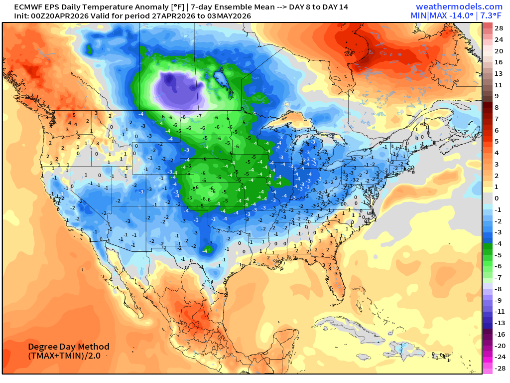
Warming trend through this week before another brief cool down with next passing front … comfortable heading into end of April.
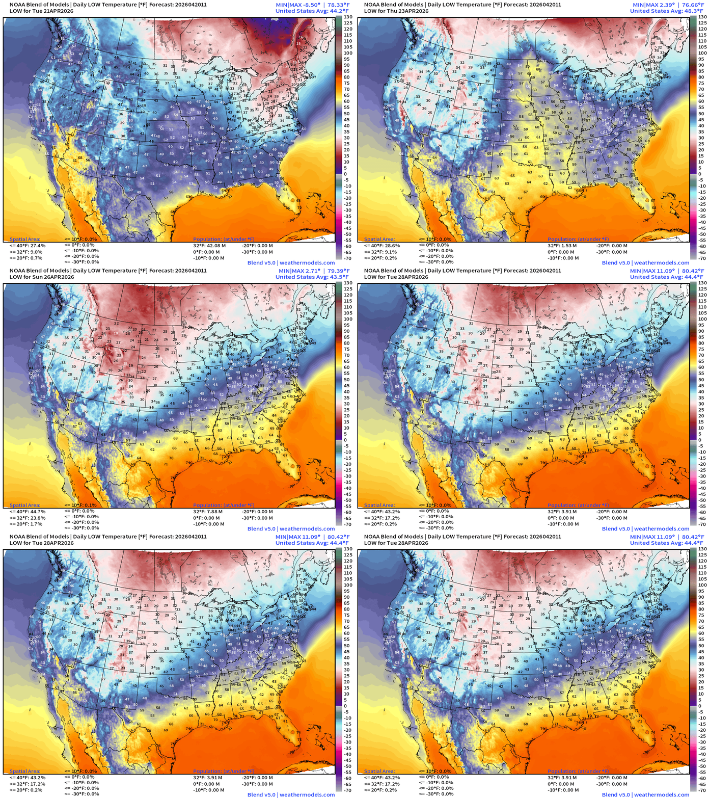
Blend of Models Temperatures | Lows through Tuesday, April 28
ECMWF AIFS 06z | Temperature at 500 mb | Next 10-days
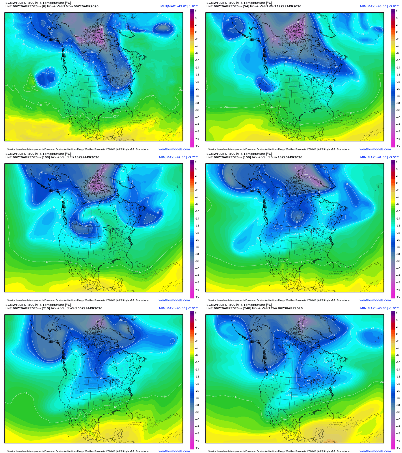
The tropospheric polar vortex is still showing -40°C contour over Arctic Canada through end of April — impressive! Lobes are pulled southward with passing trough/shortwave disturbances = unsettled and cooler pattern ahead.
Snowfall from ECMWF HRES (15-days)
Temperature Anomaly | Next 15-days | ECMWF EPS 00z Ensemble Mean
Week #1 | Temperature Anomaly | April 20 - April 26
Week #2 | Temperature Anomaly | April 27 - May 3
April 7: 2026 Atlantic Seasonal Hurricane Forecast: 11/5/2 9-13 Named Storms (11 most likely)
4-7 Hurricanes (5 or 6 most likely)
1-3 Major Hurricanes (2 most likely)
ACE: 75-85
Maps sourced from weathermodels.com designed and innovated by yours truly! Please subscribe there for real-time access to the newest maps, charts from all of the weather models including ECMWF and AIFS, and NOAA GFS/GEFS. NOAA WPC and SPC for fronts/convective outlooks.
- Milepost
- 922 · laid 2026-04-20T13:34:25.273000Z
- Source
- https://weather.substack.com/p/april-20-2026-monday-spring-weather
- Digest
- 48f12d9e1e6304df07c5bf94e73b6d9ec3e9bd754a70cc9f65bf519e298317d3
- Machine
- JSON