April 18, 2026 Saturday Spring Weather
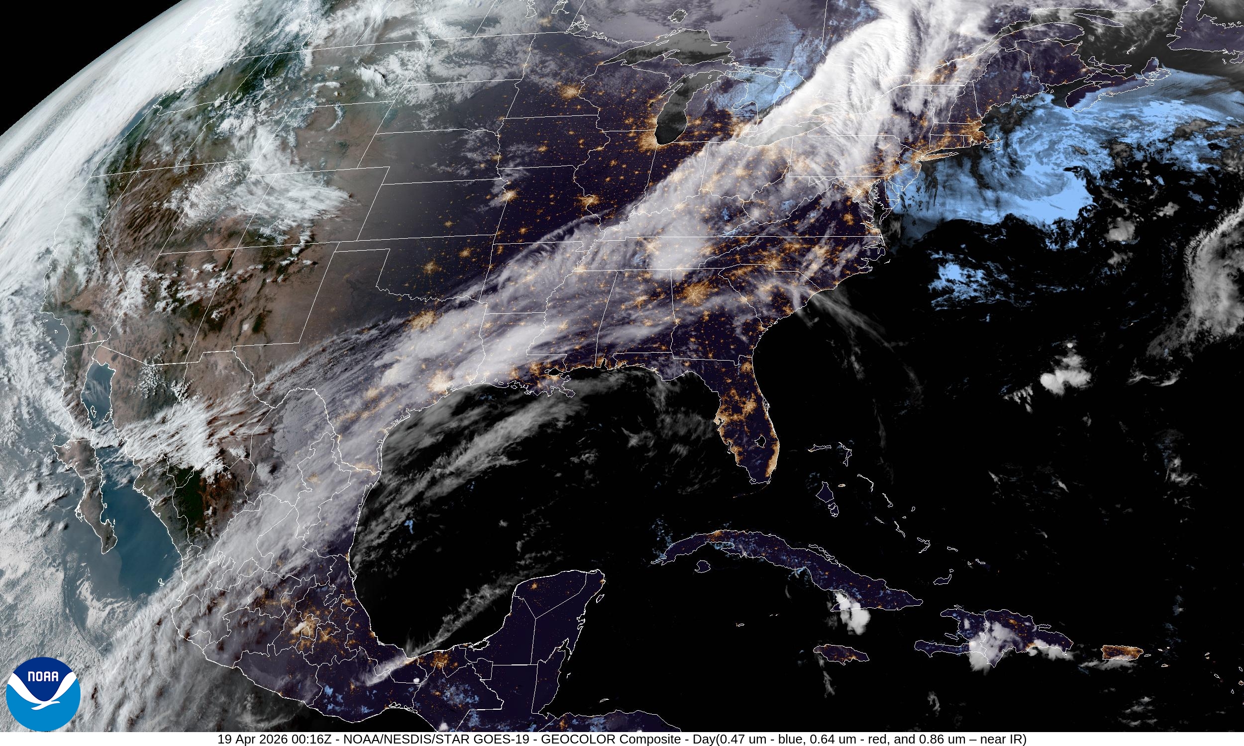
Snowfall in the Great Lakes and Northeast behind strong cold front
April 2026 was the 3rd-warmest April in the 132-year national record (1895–2026), at 54.7°F against a 1991–2020 normal of 51.8°F (+2.9°F).
April 2026 was the 46th-wettest April in the 132-year national record (1895–2026), at 2.7in against a 1991–2020 normal of 2.7in (+0.0in).
NOAA/NCEI Climate at a Glance, contiguous United States. This is the observed record for the month, not a score of anything said in this piece — the forecast ledger begins 2026-08-17 and cannot reach earlier posts.

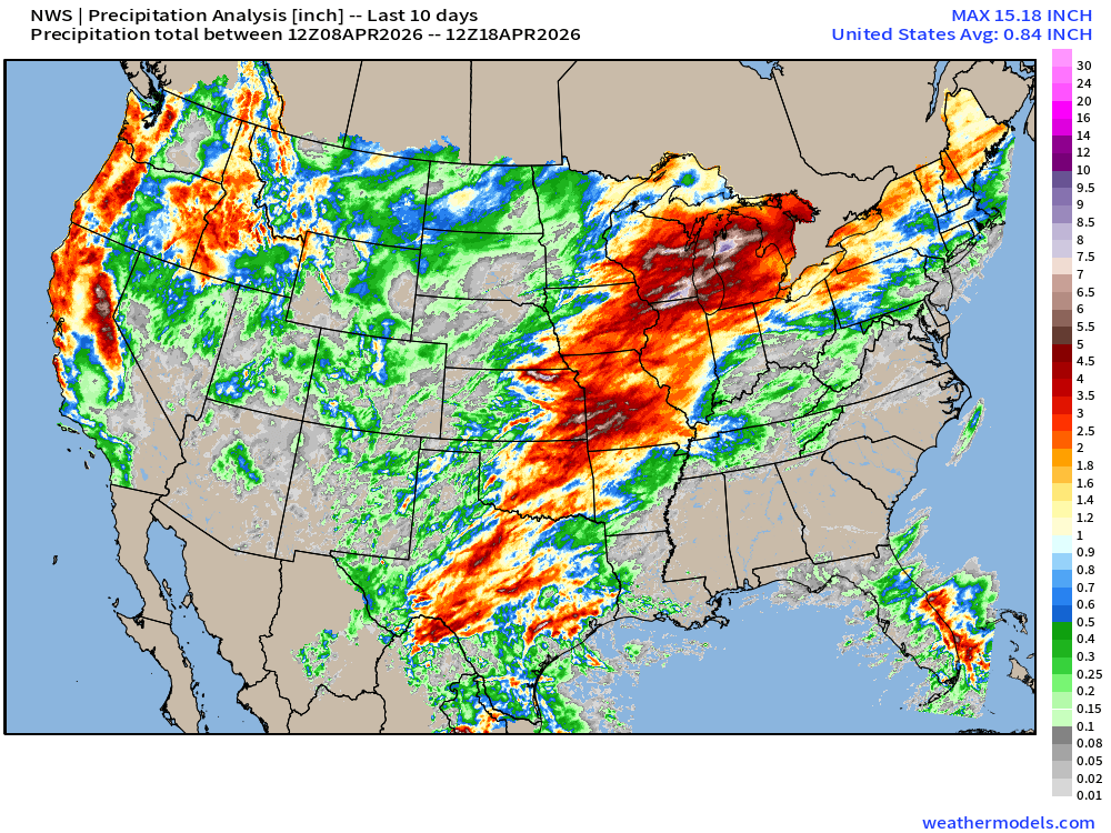
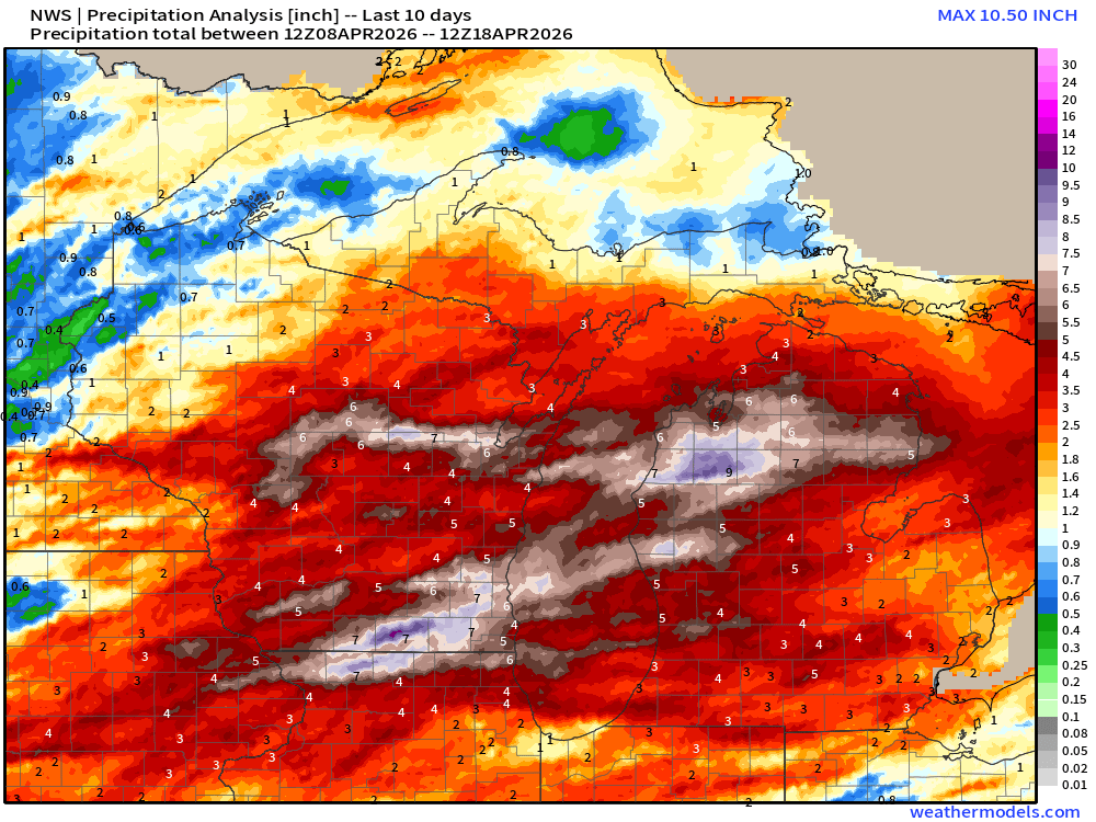
Last 10-days of precipitation (rain + snow) shows the pattern nicely: ridge of high pressure over the Eastern U.S. with return flow out of the south out of the Gulf of Mexico into Texas, the mid-Mississippi River Valley, and Great Lakes. Wisconsin and Michigan were hammered with flood-level rains!
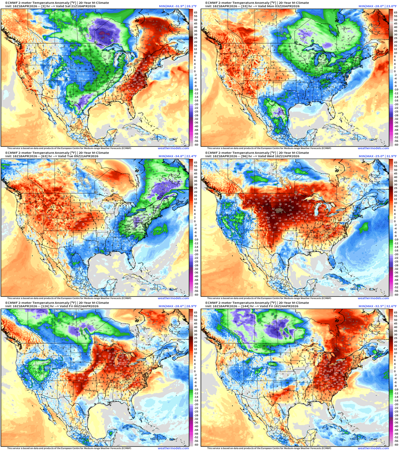
Temperature Anomaly next 6-days | Quite chilly for mid-April behind this cold front and then a warming trend into middle of next week.
RTMA Current Temperature Analysis | 7:30 PM ET
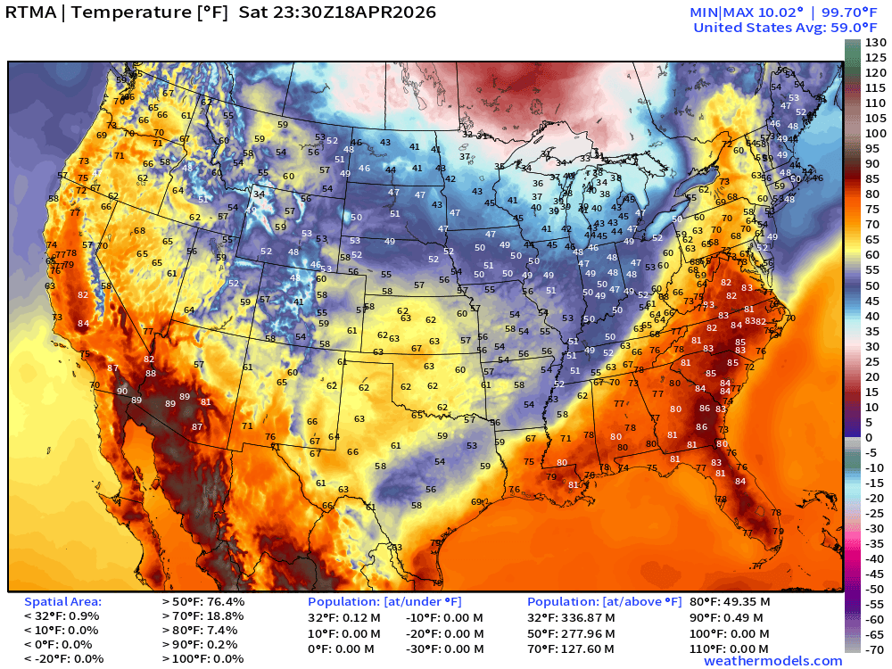
Lower 48 average was 59.0°F
RTMA Current Temperature Anomaly Analysis | 7:30 PM ET
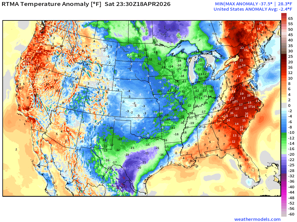
Lower 48 was -2.4°F BELOW normal with the center of the U.S. significantly cooler than yesterday
RTMA Current Temperature 24-hour Change | 7:30 PM ET
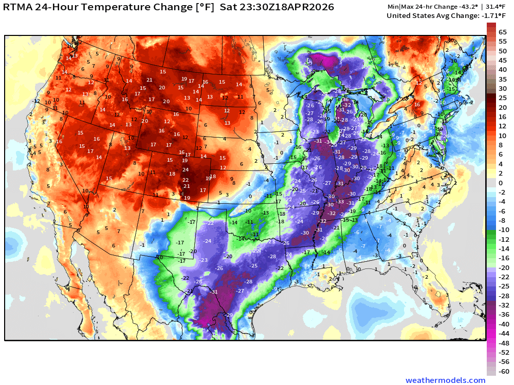
More than 30° or 40°F cooler from Michigan down the Mississippi into South Texas
Quick Tropical Update | Atlantic Basin | Next 6-days
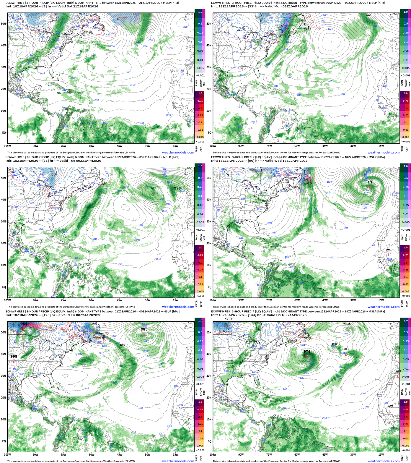
Typical convection / showers along the ITCZ near the Equator from northern South America to the coast of Africa. Way too far south for any development — until at least end of June.
North Atlantic African Dust | Next 10-days
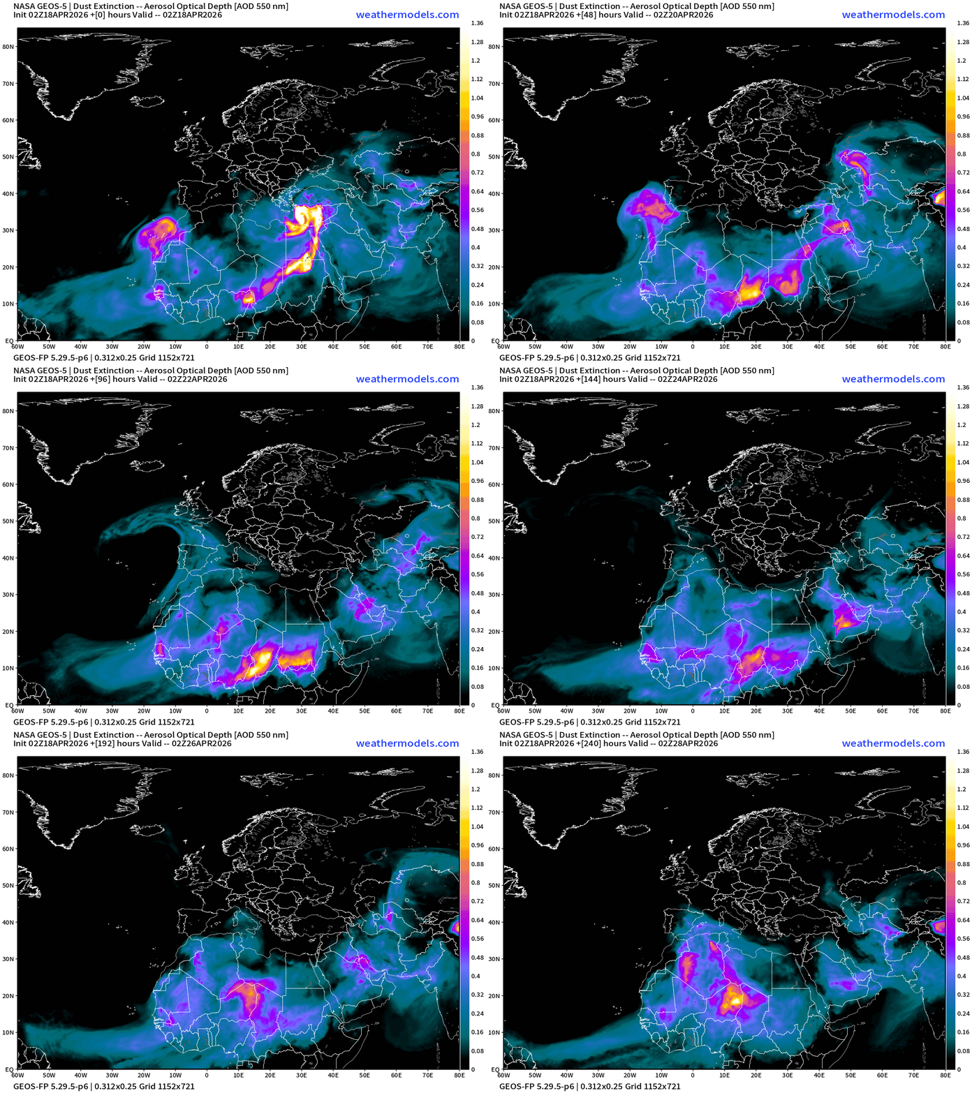
Dust over the north Atlantic and Africa — as any early season tropical waves will be wiped out by dust. We’ll also get a sense of the activity into June by the circulation pattern in the Eastern MDR of the Atlantic, and how dust flows over the ocean.
HRRR 18z — Radar Simulation Next 48-hours to Monday 2 PM ET
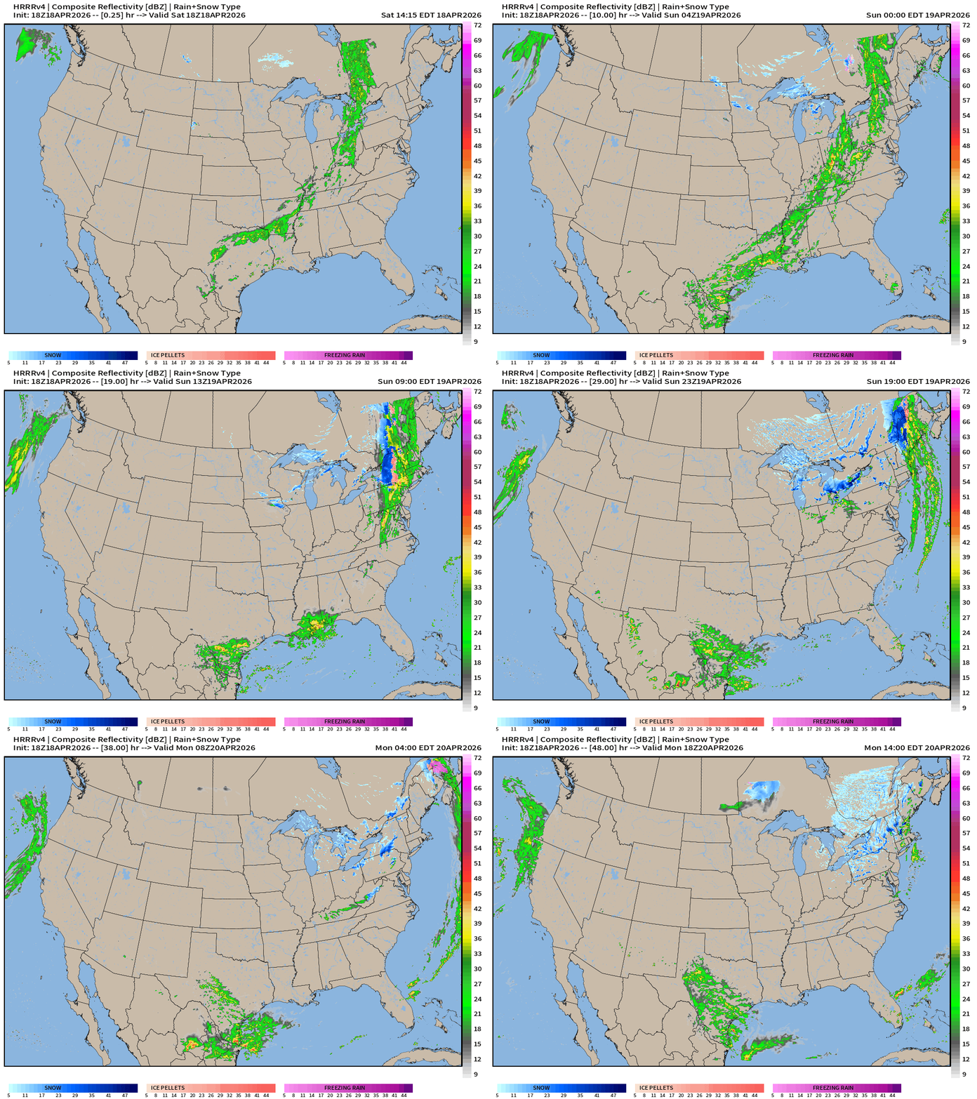
Welcome rainfall across South Texas … but nothing survives with the cold front into the parched Southeast. Snowfall (!) around area of Low Pressure in Canada … with Michigan seeing snowflakes, as well as New York.
HRRR 18z Precipitable Water Next 48-hours (my favorite parameter)
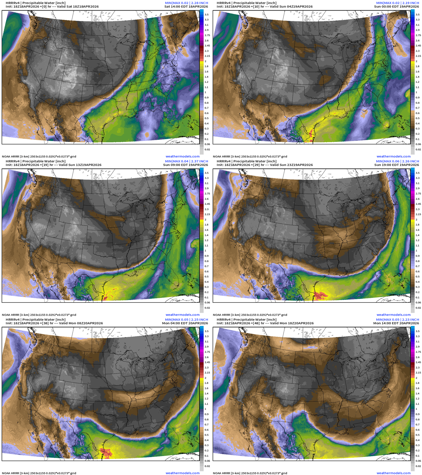
Weather on Sunday — Cold front Blasts off the East Coast … gets hung up across central Florida … secondary shot of cool/dry air finally clears out the Midwest and Great Lakes —> very chilly Monday and Tuesday mornings.
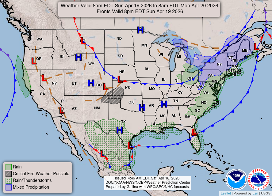
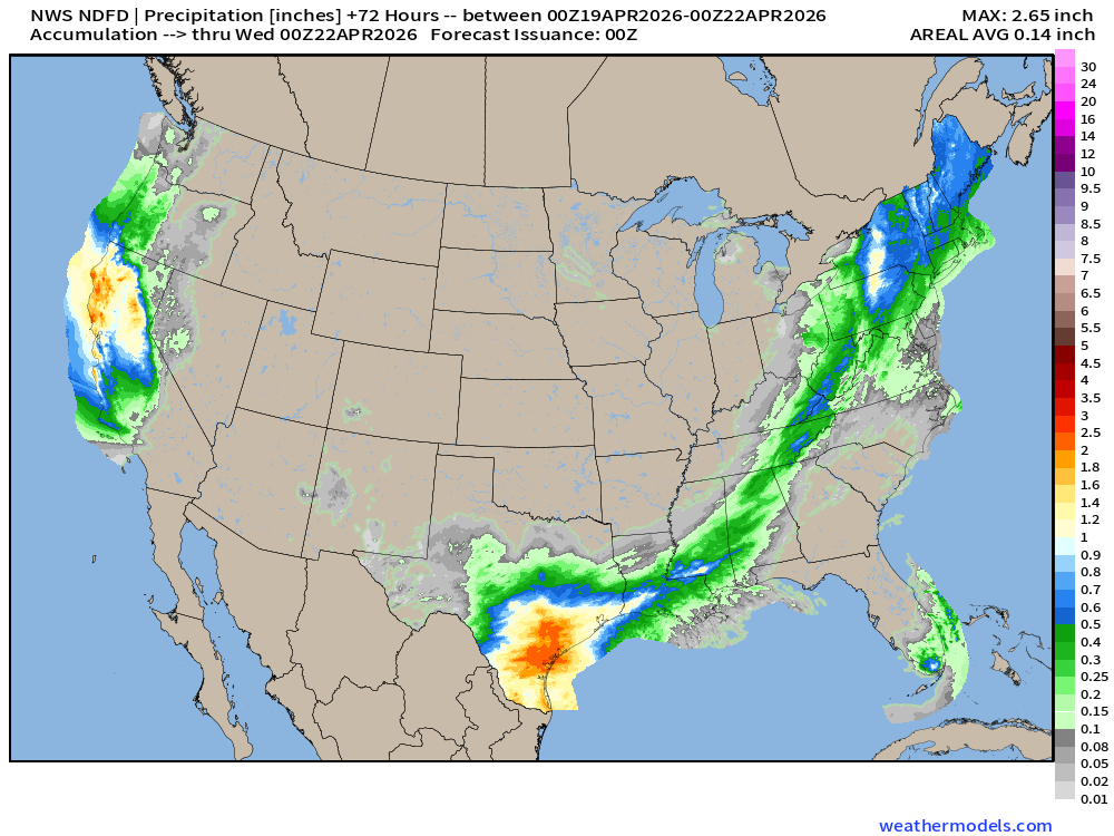
NDFD NWS Total Precipitation Next 72-hours through Tuesday Evening
NWS Snowfall Next 72-hours — through Tuesday Evening
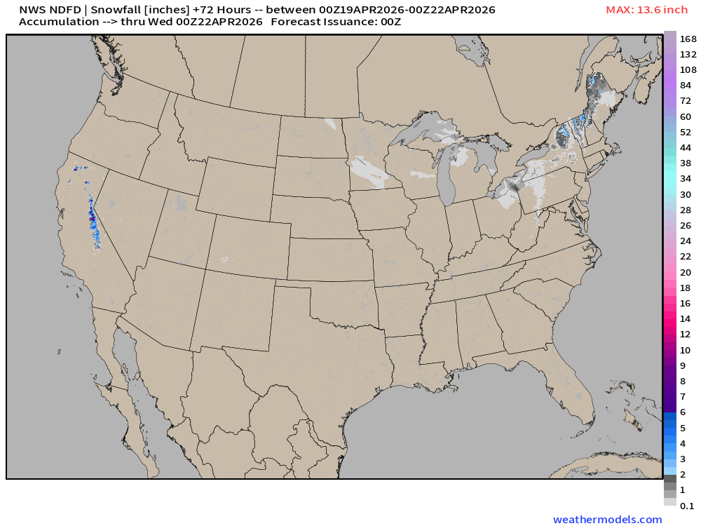
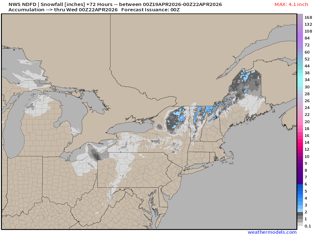
Maybe 2-4” of snow in higher elevations of upstate New York and northern New England.
ECMWF 18z | Forecast 6-days of Precipitable Water (my favorite parameter!)
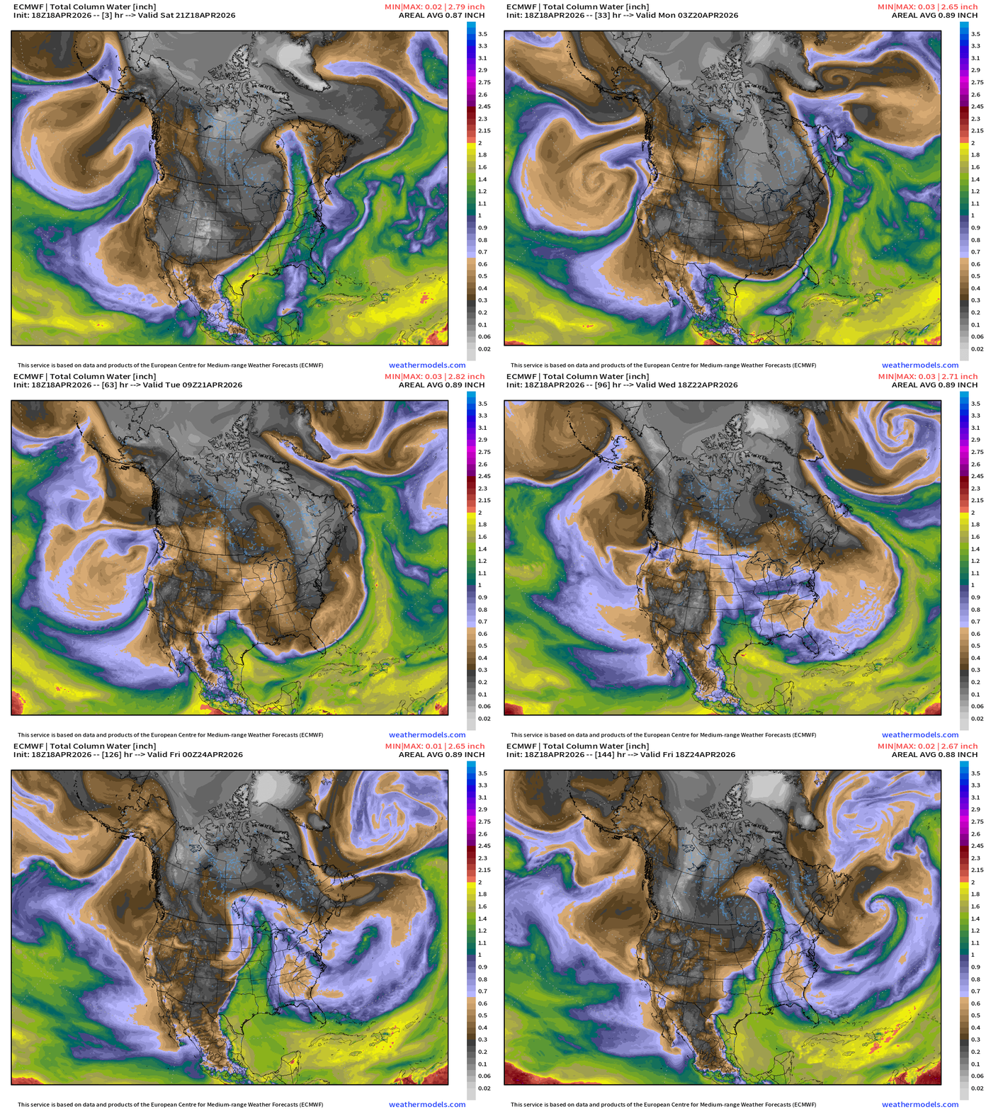
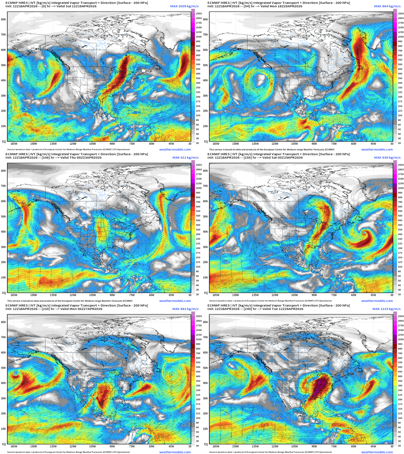
Cold front blasts off the East Coast — but moisture quickly returns out of the Gulf of Mexico with a highly progressive (busy) weather pattern.
ECMWF 18z Precipitation Type + Intensity | Next 6-days
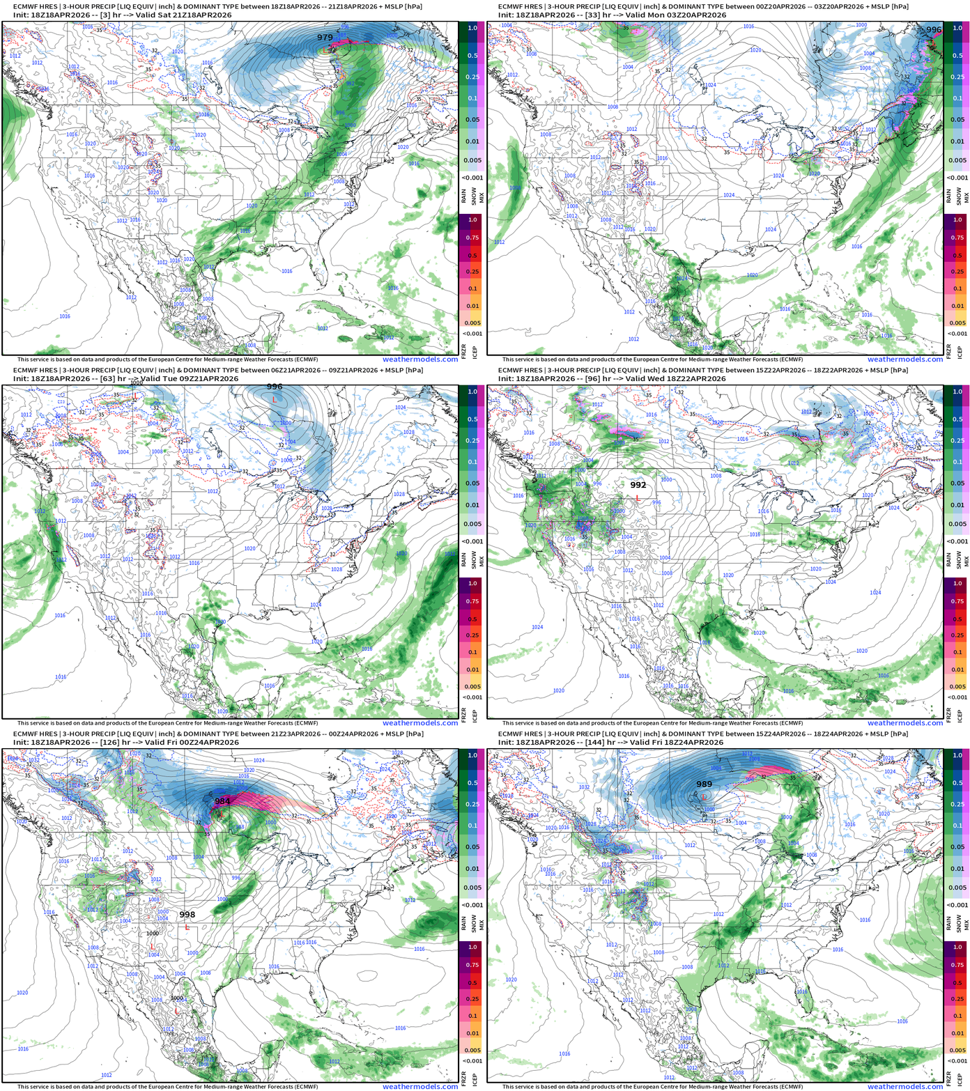
Strong “winter weather” storm systems for Canada … maybe a blizzard developing for Manitoba by Thurs/Fri next week.
The snowfall in the Great Lakes and Northeast on Sunday is from a low pressure centered way up over Hudson Bay.
Moisture Transport (IVT) next 10-days
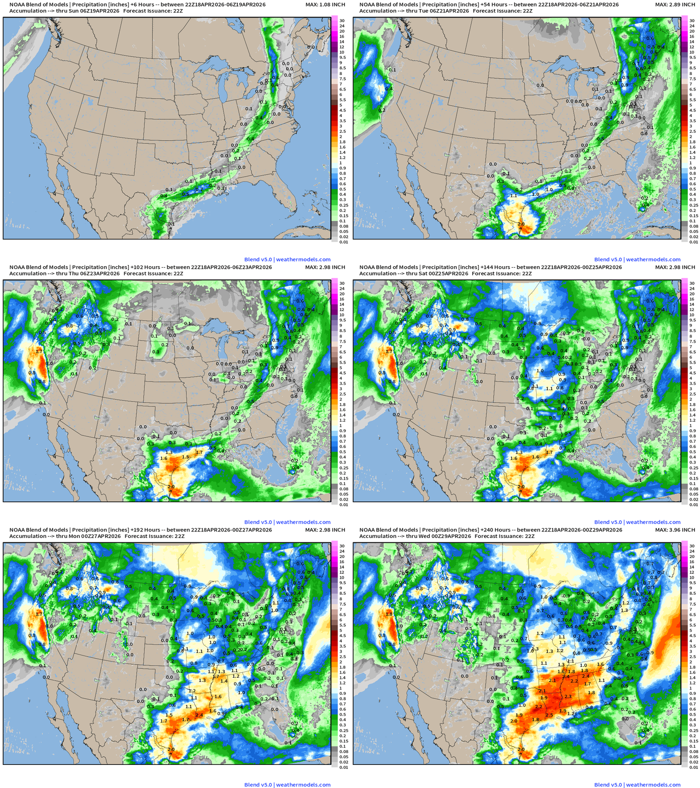
Total Precipitation Next 10-days | Blend of Models
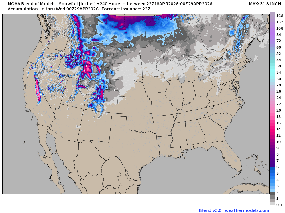
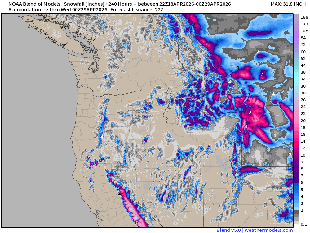
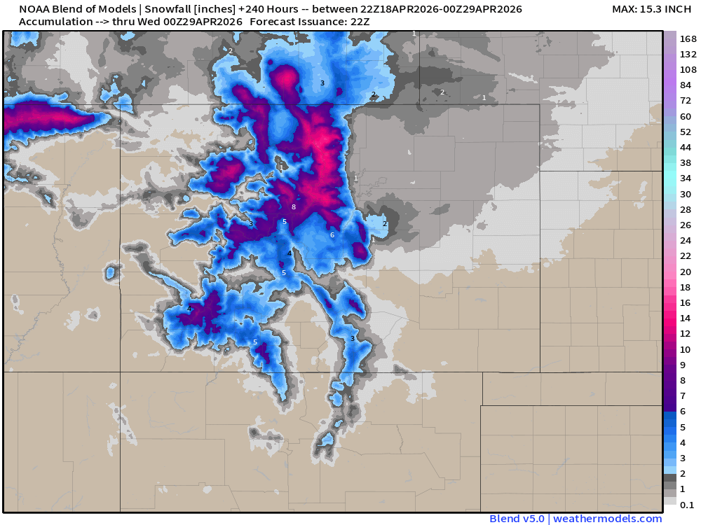
Blend of Models | Total Snowfall Next 10-Days
ECMWF AIFS 18z next 10-days of 500 mb Height Anomaly
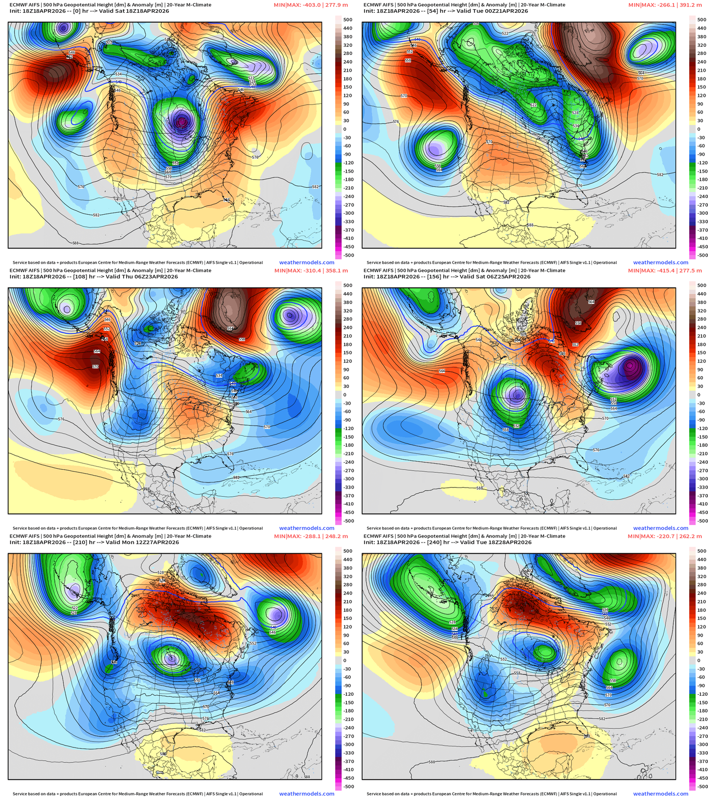
AIFS 18z evolves into a sequence of troughs … stretched out beneath high-latitude blocking ridge. This is a cool and unsettled pattern into early May. Still plenty of cool/cold air in Canada that can dump out into the Lower 48.
Blend of Models Temperatures | Highs through Monday, April 27
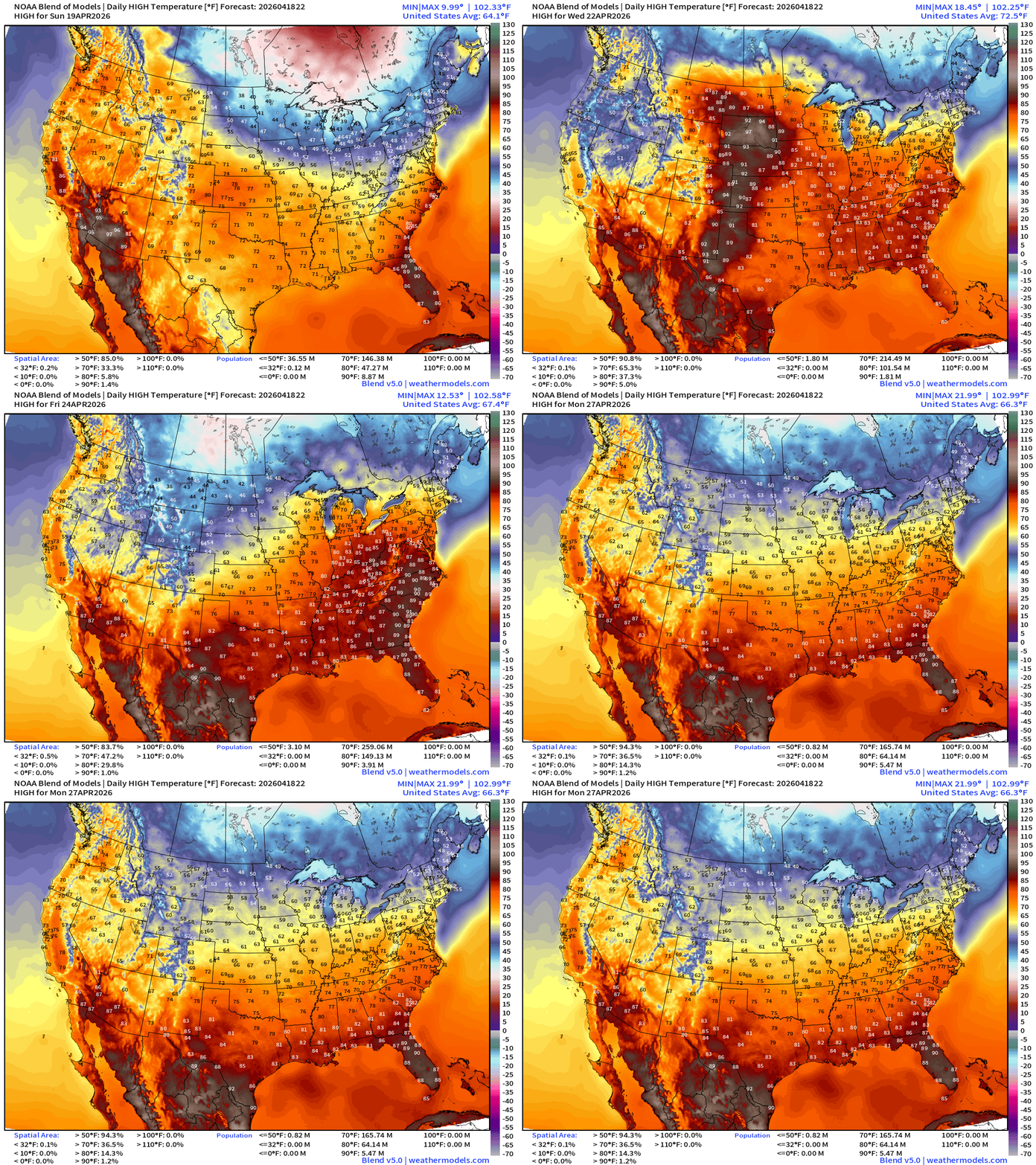
Warming trend into later next week before another brief cool down with next passing front … comfortable heading into end of April.
Blend of Models Temperatures | Lows through Monday, April 27
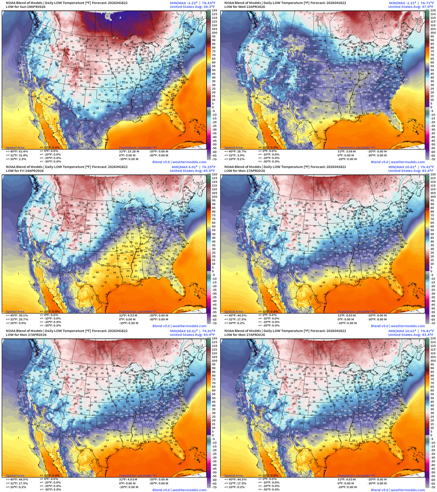
Low Temperatures Sunday
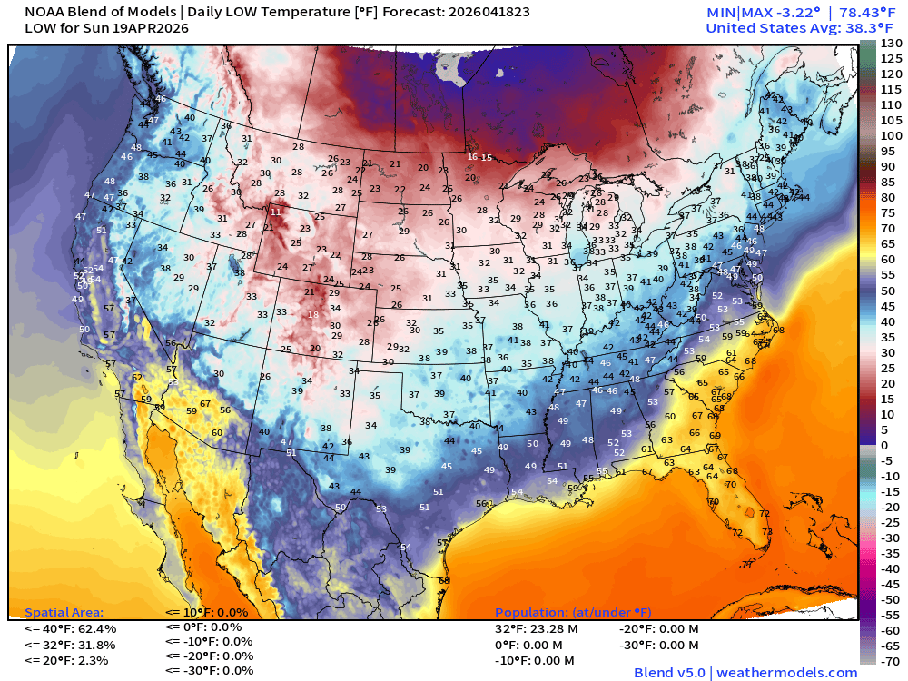
32% of the Lower 48 below freezing … but only 23 million population
High Temperatures on Sunday
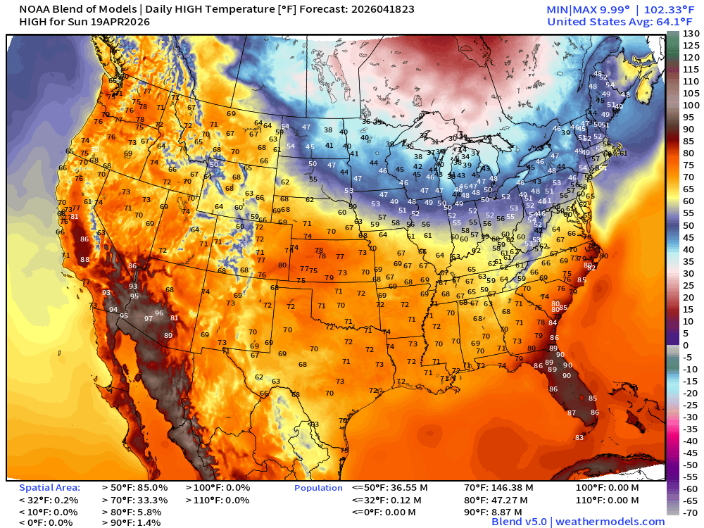
146 million at least 70°F … mostly lost the 90s — only 9 million
Low Temperatures on Monday
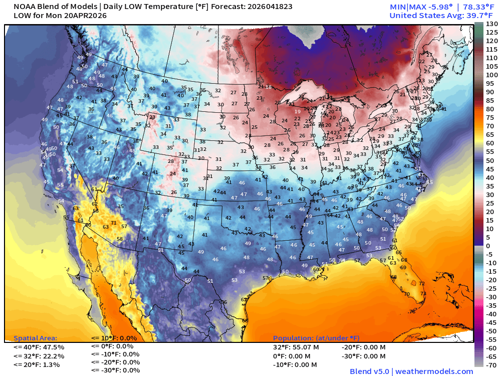
Still 55 million below freezing!
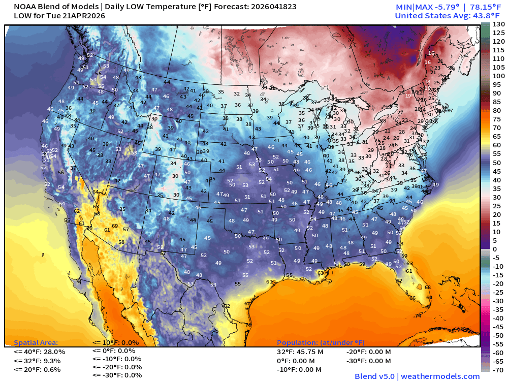
Low Temperatures Tuesday Morning
ECMWF AIFS 18z | Temperature at 500 mb | Next 10-days
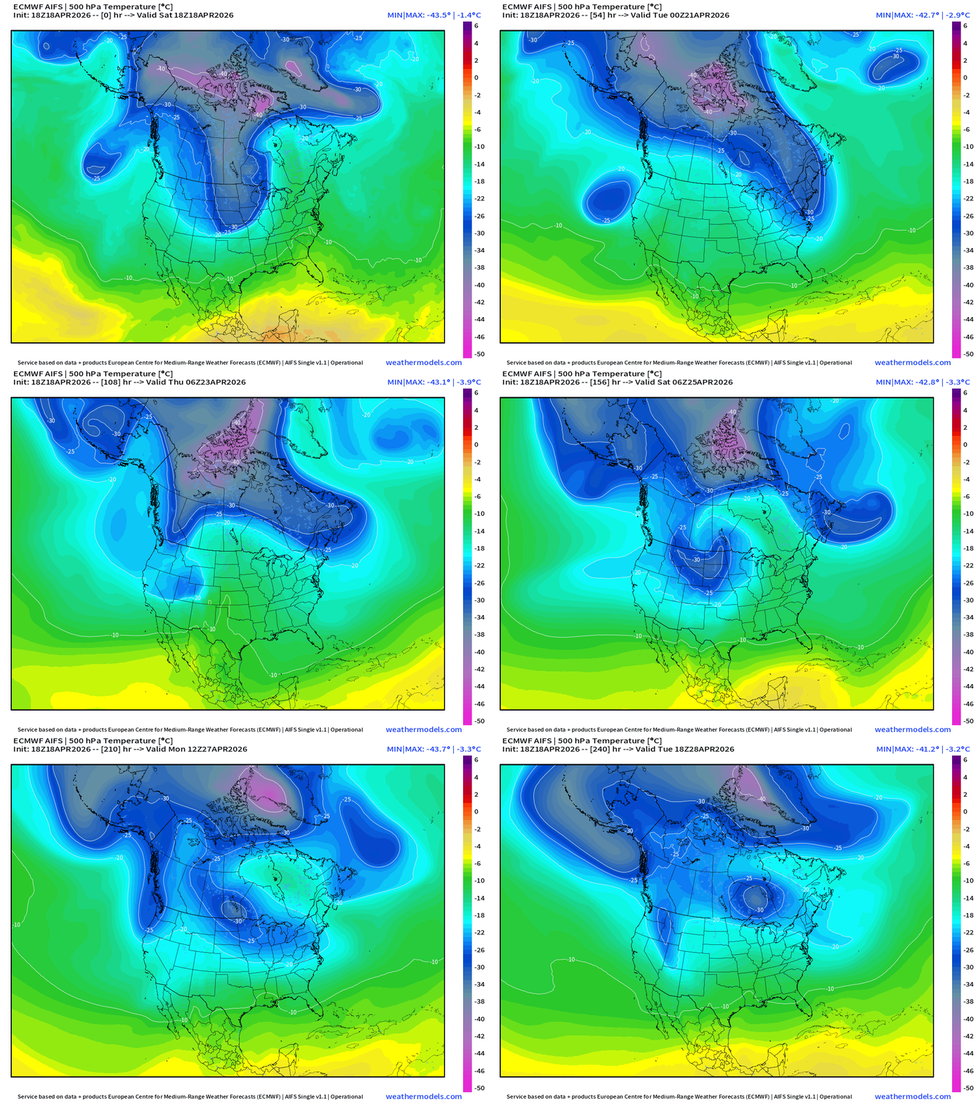
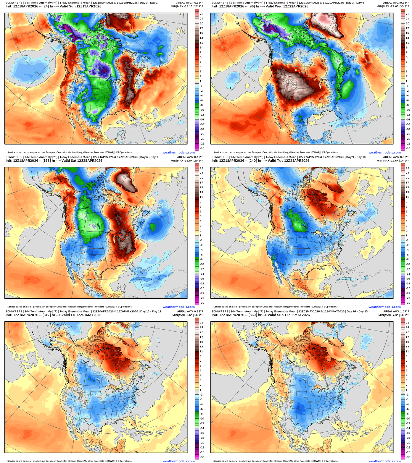
The tropospheric polar vortex is still showing -40°C contour over Arctic Canada through end of April — impressive! Lobes are pulled southward with passing trough/shortwave disturbances = unsettled and cooler pattern ahead.
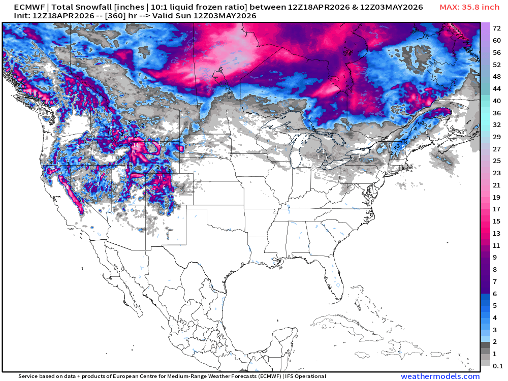
Snowfall from ECMWF HRES (15-days)
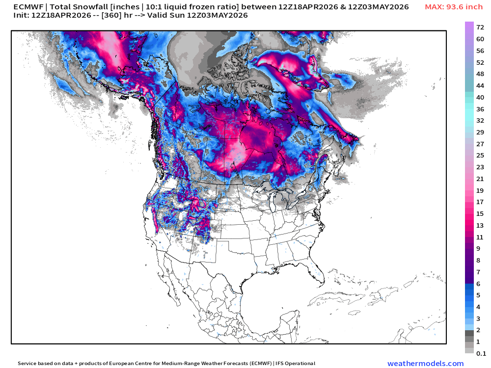
This map could be from January — wouldn’t be out of bounds!
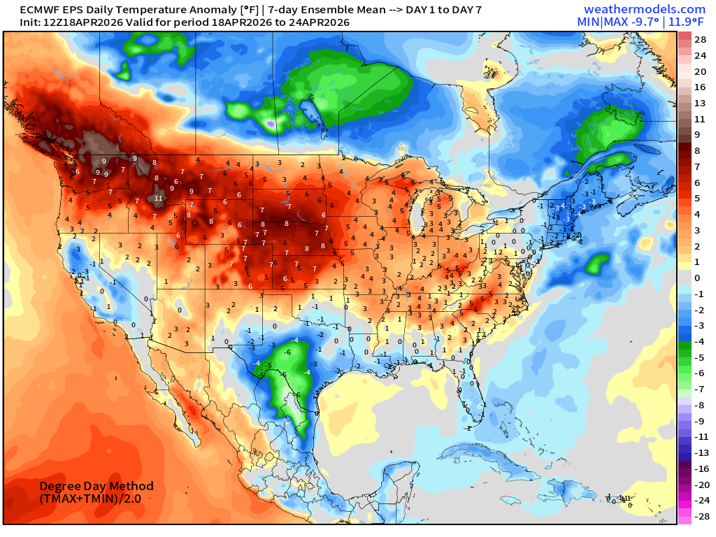
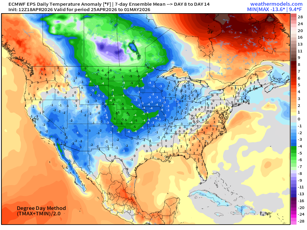
Temperature Anomaly | Next 15-days | ECMWF EPS 12z Ensemble Mean
Week #1 | Temperature Anomaly | April 18 - April 24
Week #2 | Temperature Anomaly | April 25 - May 1
April 7: 2026 Atlantic Seasonal Hurricane Forecast: 11/5/2 9-13 Named Storms (11 most likely)
4-7 Hurricanes (5 or 6 most likely)
1-3 Major Hurricanes (2 most likely)
ACE: 75-85
Maps sourced from weathermodels.com designed and innovated by yours truly! Please subscribe there for real-time access to the newest maps, charts from all of the weather models including ECMWF and AIFS, and NOAA GFS/GEFS. NOAA WPC and SPC for fronts/convective outlooks.
- Milepost
- 921 · laid 2026-04-19T01:07:18.142000Z
- Source
- https://weather.substack.com/p/april-18-2026-saturday-spring-weather
- Digest
- c8f153c032afc5f364c3985284096739c3218991d246b7d6498c9db329c44e7f
- Machine
- JSON