April 16, 2026 Thursday Spring Weather
Another beautiful spring day across much of the Lower 48. Watching weekend cold front
April 2026 was the 3rd-warmest April in the 132-year national record (1895–2026), at 54.7°F against a 1991–2020 normal of 51.8°F (+2.9°F).
April 2026 was the 46th-wettest April in the 132-year national record (1895–2026), at 2.7in against a 1991–2020 normal of 2.7in (+0.0in).
NOAA/NCEI Climate at a Glance, contiguous United States. This is the observed record for the month, not a score of anything said in this piece — the forecast ledger begins 2026-08-17 and cannot reach earlier posts.

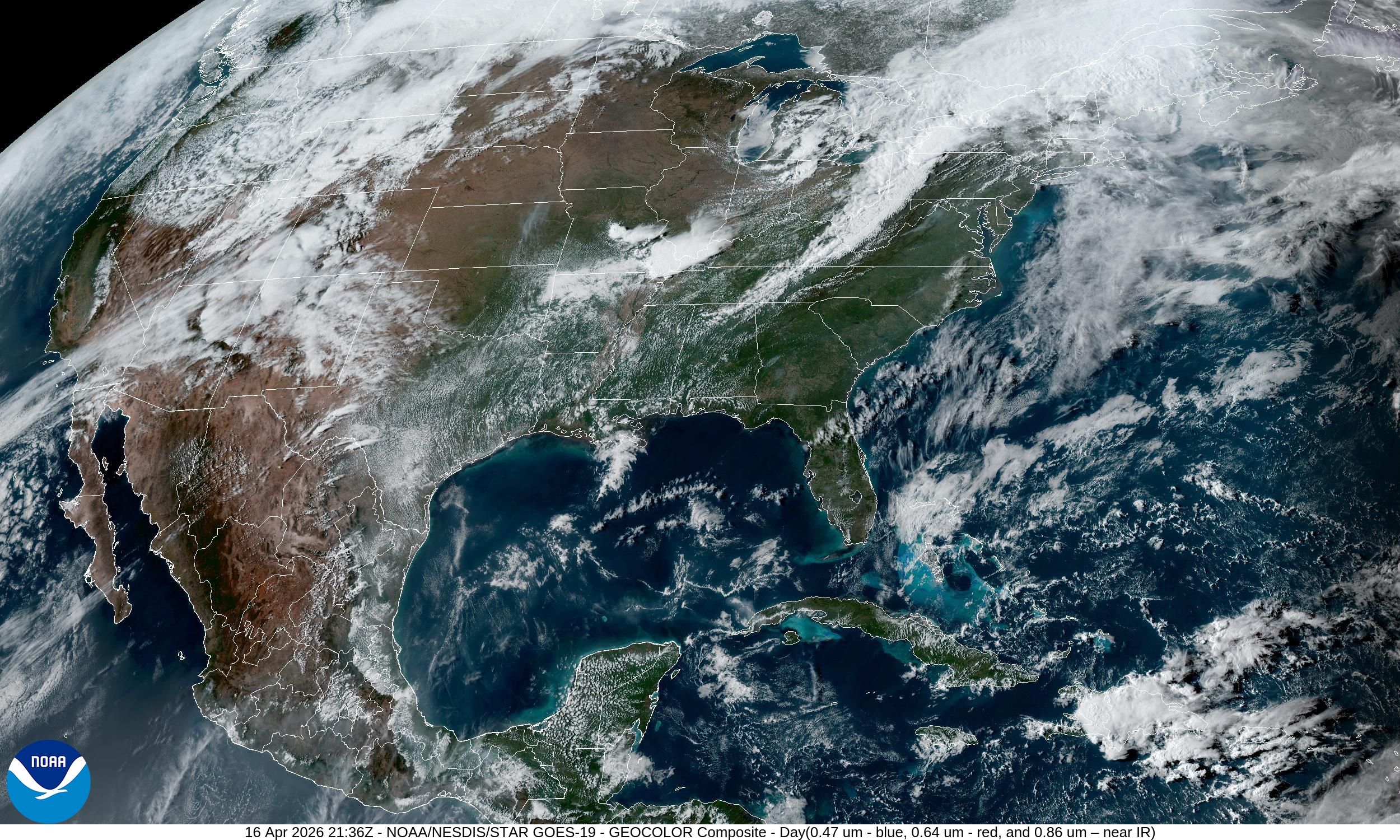
Sunshine and dry air + exceptional warmth = perfect Spring day for vast majority of U.S. east of the Rockies. Low humidity not helping the drought situation …
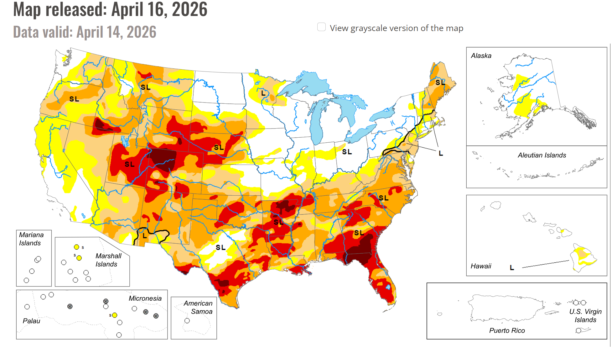
Drought Monitor updated today (April 16)
Extreme Drought (red) in many locations including Colorado, Texas, Arkansas, and Georgia + Florida into the Carolinas.

Last 60-days Precipitation % of Normal
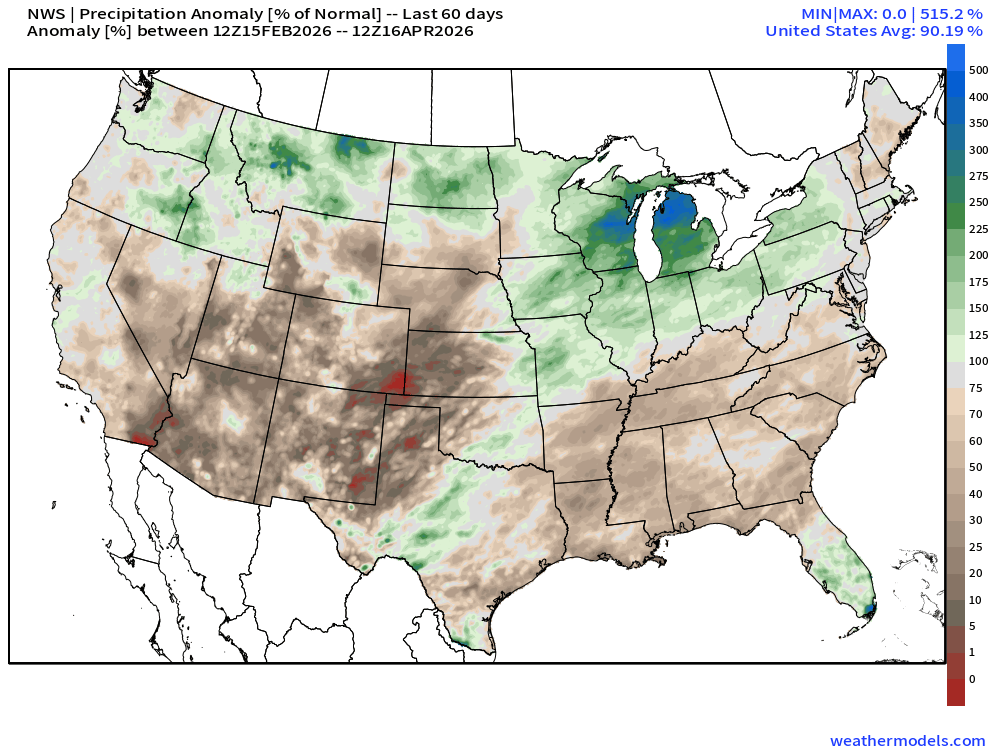
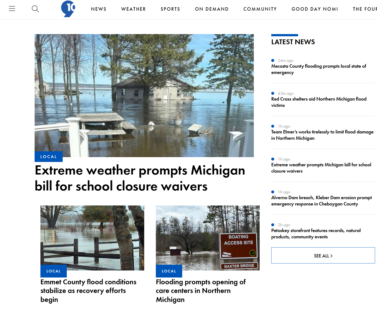
The Great Lakes … especially Michigan is very wet (snowy) and now seeing flooding!
High Temperatures on Friday
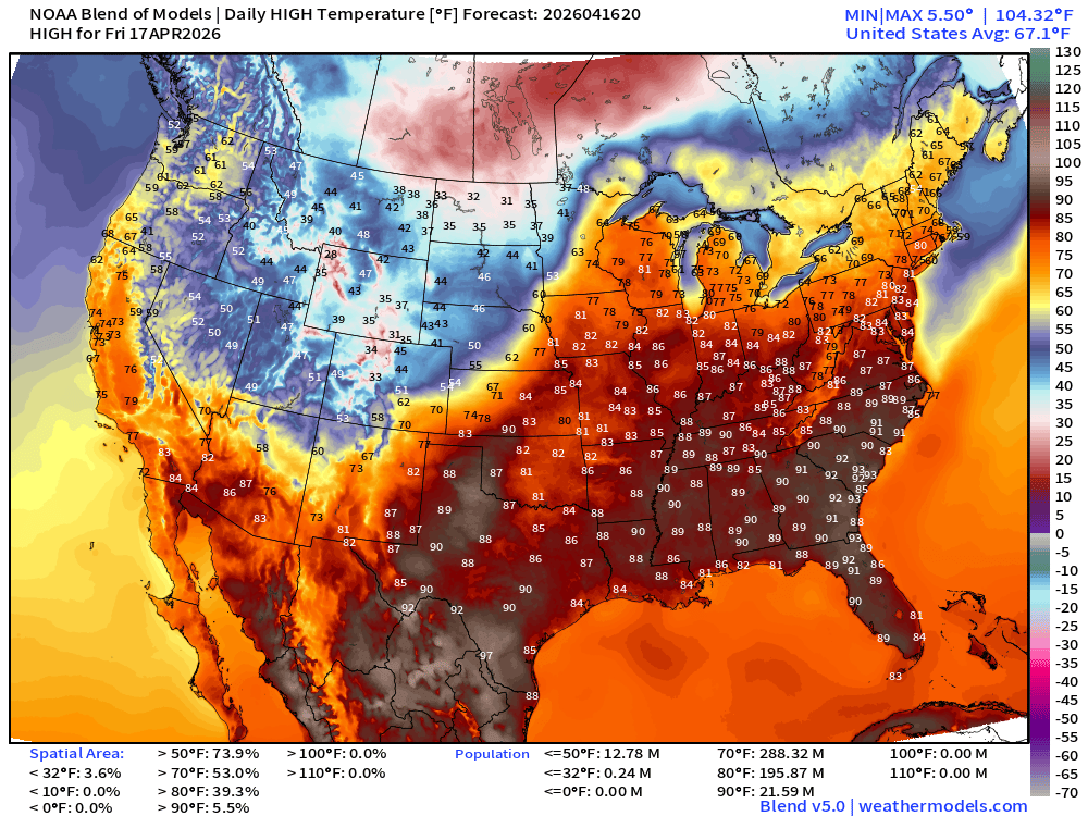
80s for 196 million population from central Plains into Mid-Atlantic … and over 21 million at least 90°F
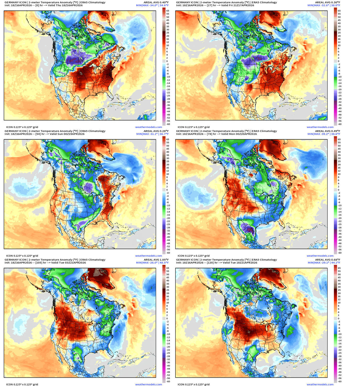
A major Canadian cold front is on the way … this weekend!
Temperature Anomaly next 5-days (Germany ICON)
This is post number 920: Good Evening! Day 106 of 2026.
Author: Dr. Ryan Maue (X @RyanMaue X @weathertrader)
It helps immensely to SHARE this post to expand the reach and viewers of this newsletter. We’re approaching 1,000 posts before July 1st.
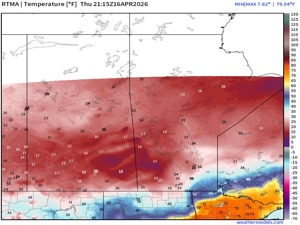
RTMA Current Temperature Analysis | 5:15 PM ET
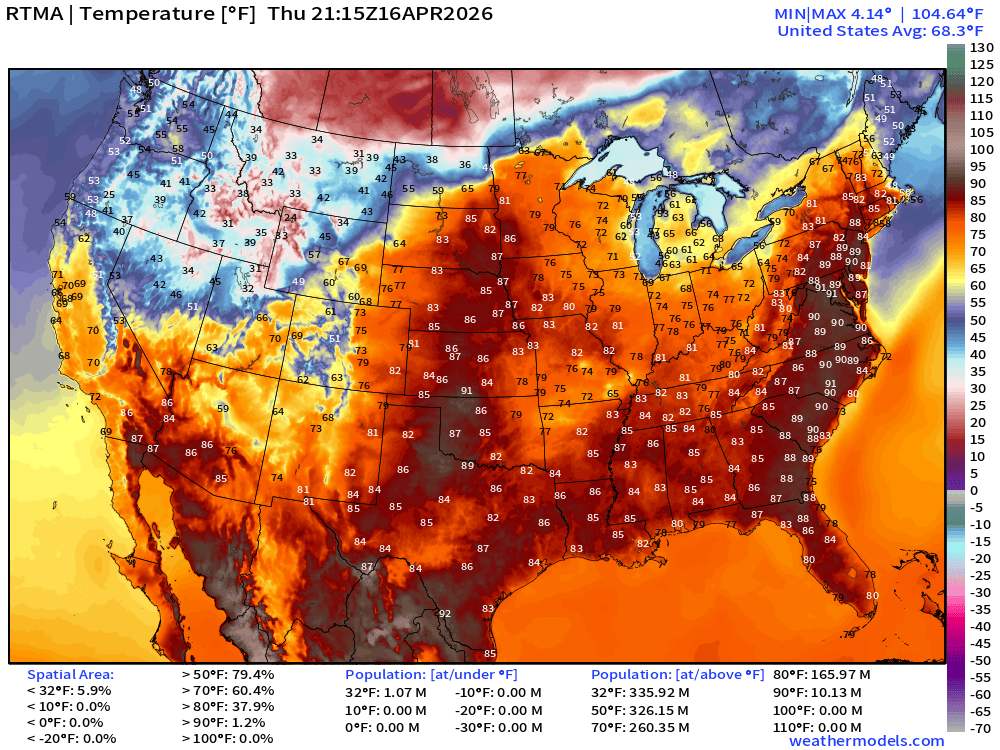
Lower 48 average was 68.3°F with 166 million at least 80°F
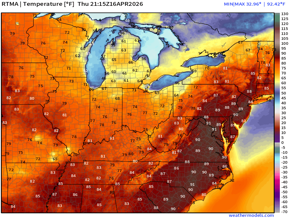
Temperatures only in the teens in Canada across the border.
RTMA Current Temperature Anomaly Analysis | 5:15 PM ET
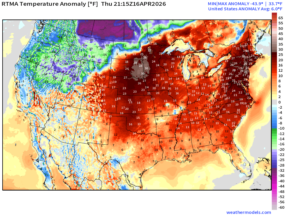
Lower 48 was 6.0°F ABOVE normal with -44°F in Canada and +30°F just to the south in Dakotas/Minnesota, and in Northeast including Washington D.C. and NYC
Tropical Update: North Western Pacific and Indian Ocean
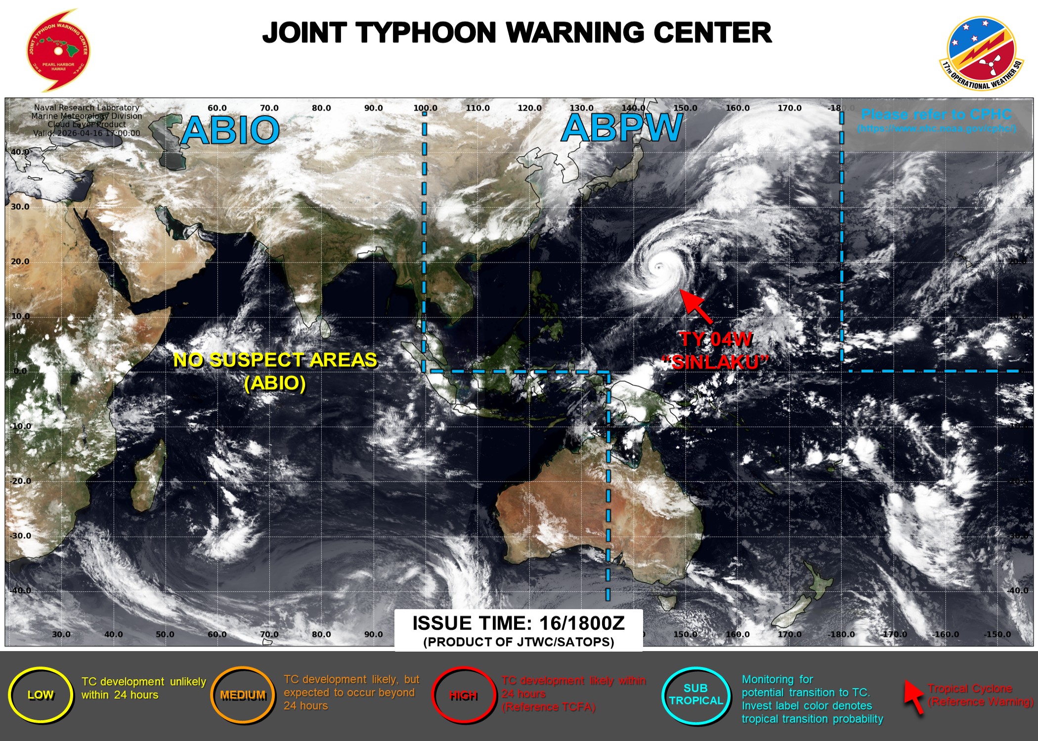
Typhoon Sinlaku is nearing the end of the road as it crosses over much cooler ocean waters, and encounters the middle-latitude westerlies. The storm will become post-tropical and the moisture will merge with a cold front in next 3-4 days. No other tropical systems expected in the next 2-weeks.
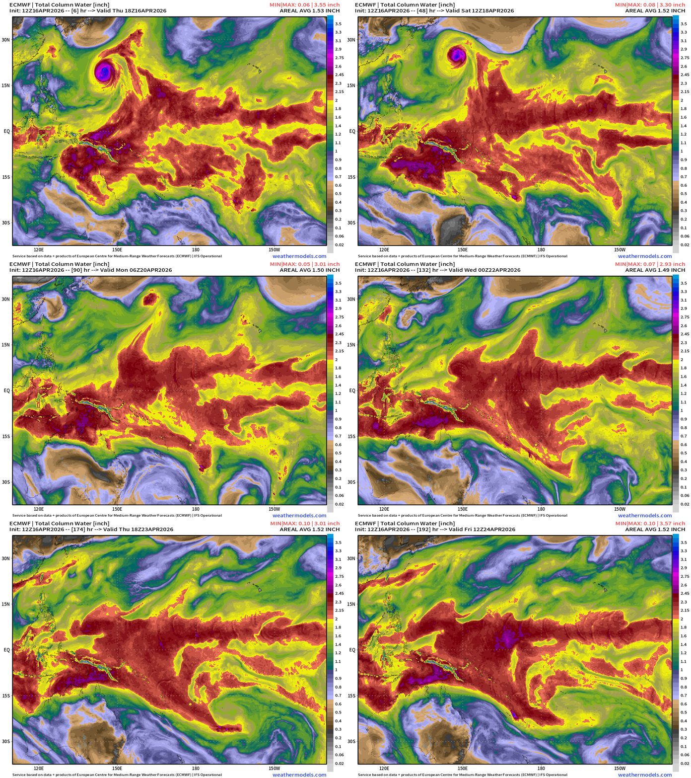
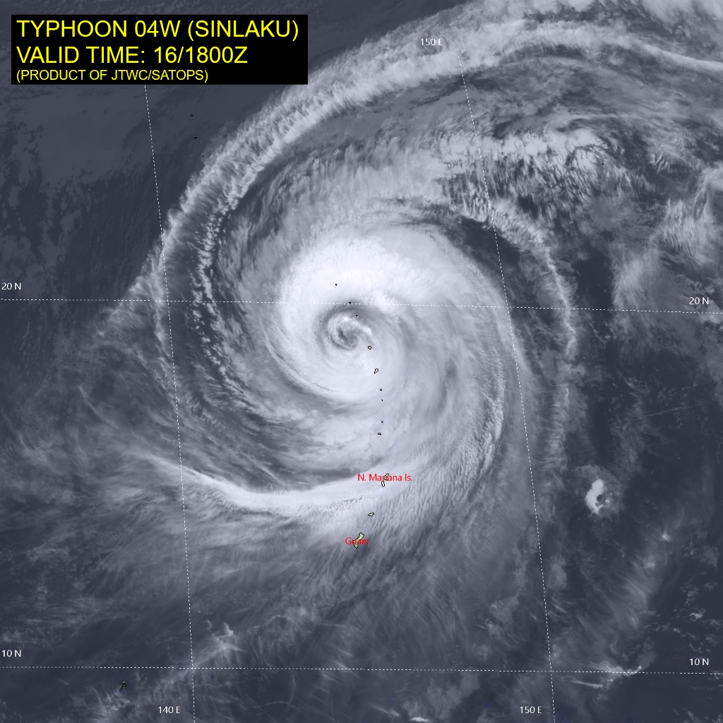
Sinlaku is very large with a beautiful spiral cloud pattern … a textbook former Super Typhoon. The storm will turn NE this weekend.
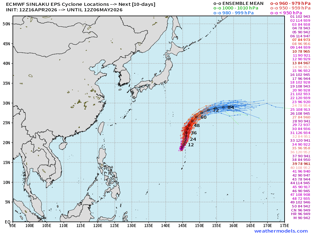
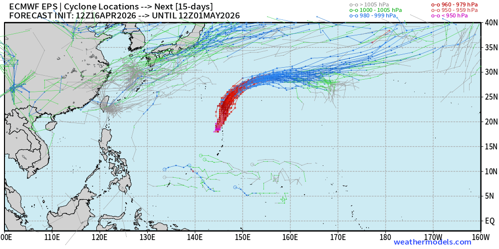
Next 15-days Ensemble Spaghetti — nothing much else through end of April, and that’s not unexpected.
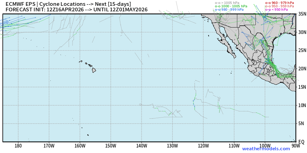
Eastern Pacific Tropical Storm Spaghetti next 15-days — quiet.
Atlantic Basin | Next 8-days
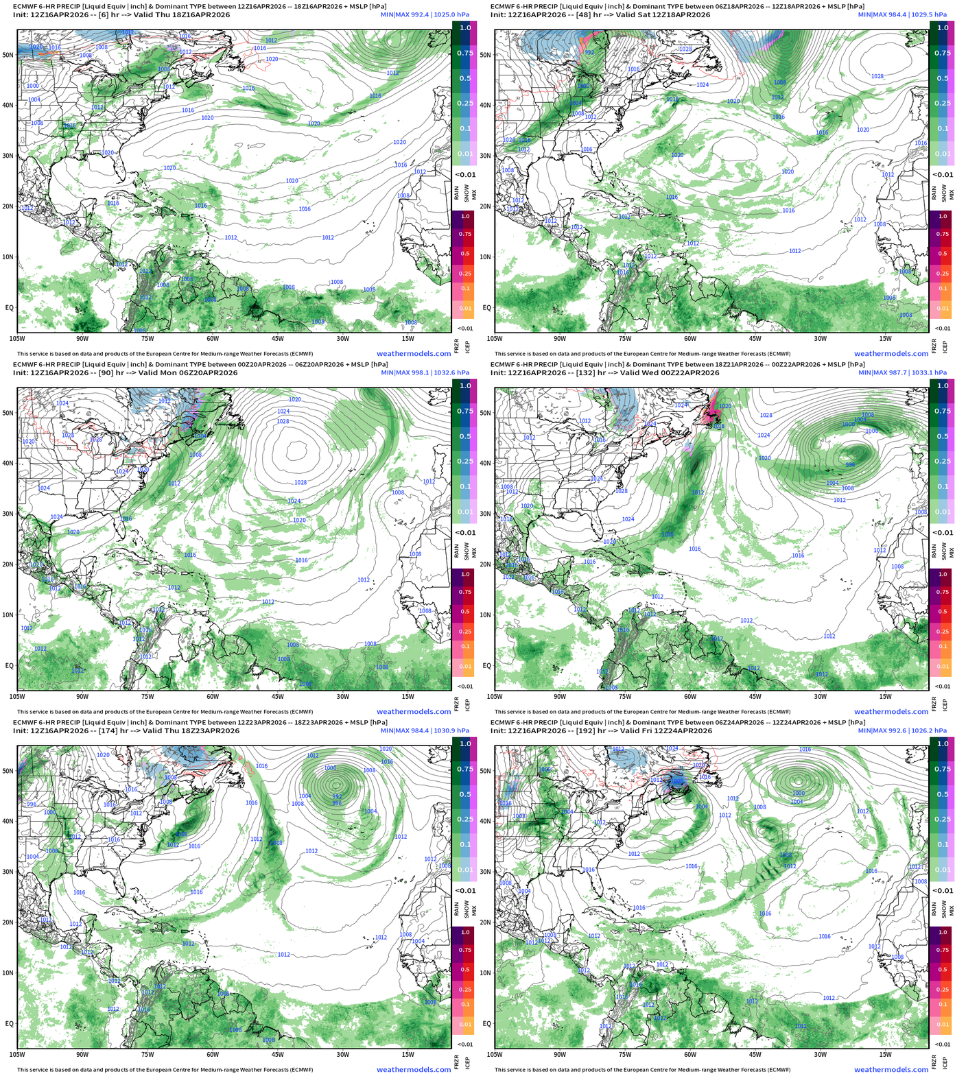
Typical trade wind showers in the Caribbean … the ITCZ remains way too far south for any worry about tropical waves or storm development, until at least mid-June.
North Atlantic African Dust | Next 10-days
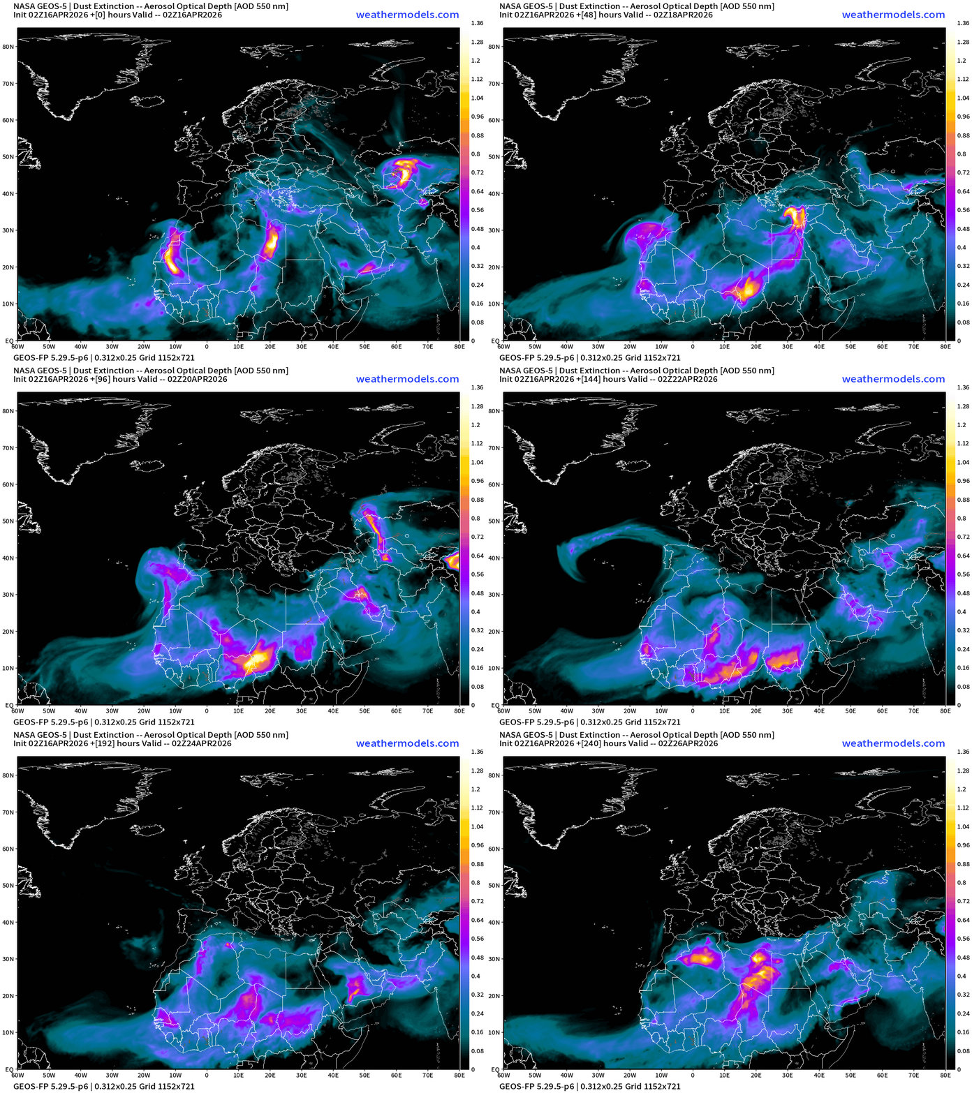
Dust over the north Atlantic and Africa — as any early season tropical waves will be wiped out by dust. We’ll also get a sense of the activity into June by the circulation pattern in the Eastern MDR of the Atlantic, and how dust flows over the ocean.
Lower 48 Weather into Friday Morning
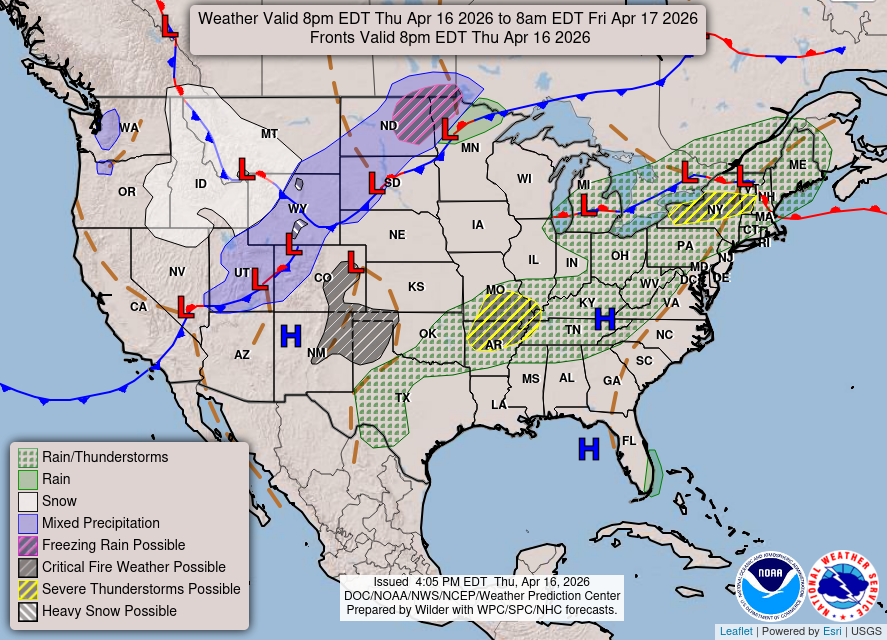
Only a slight chance of severe weather in AR/MO, and in New York State.
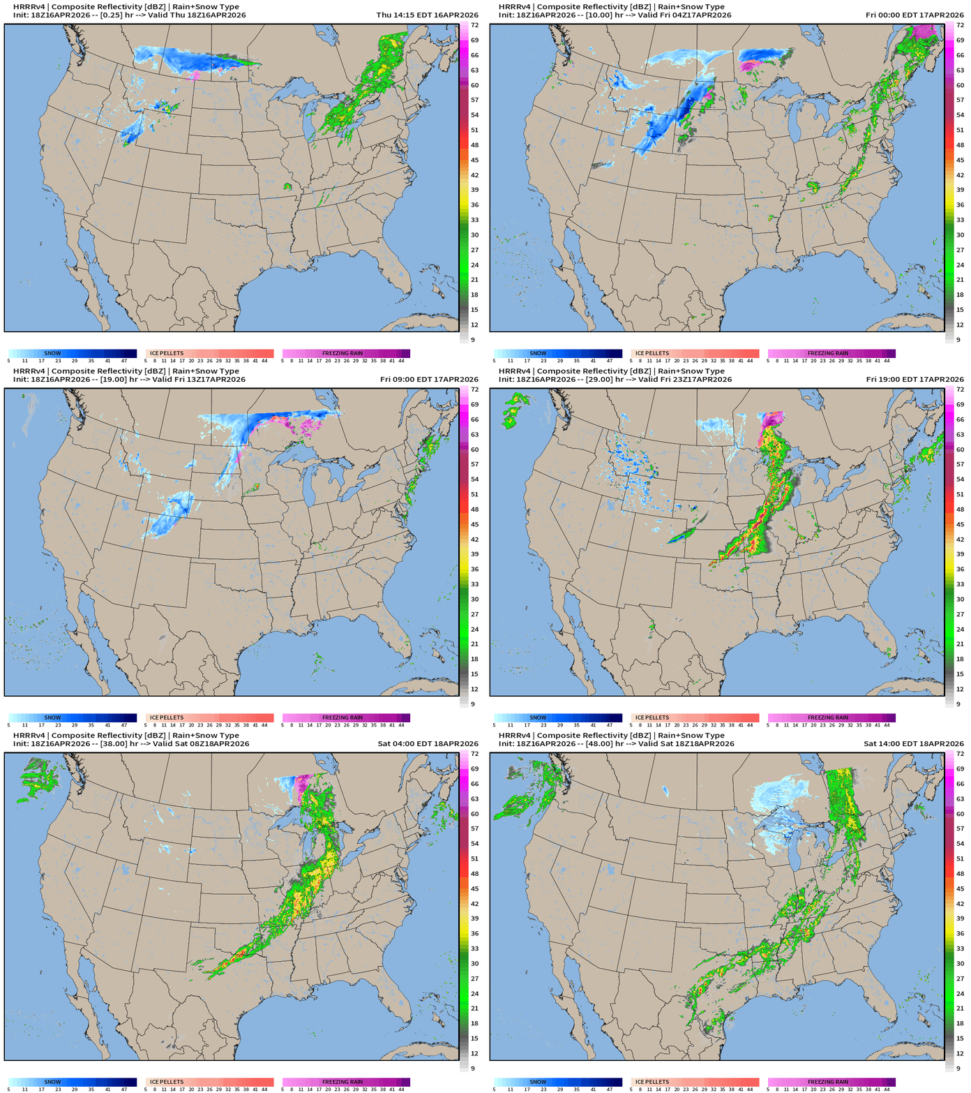
HRRR 12z — Radar Simulation Next 48-hours to Saturday 2 PM ET
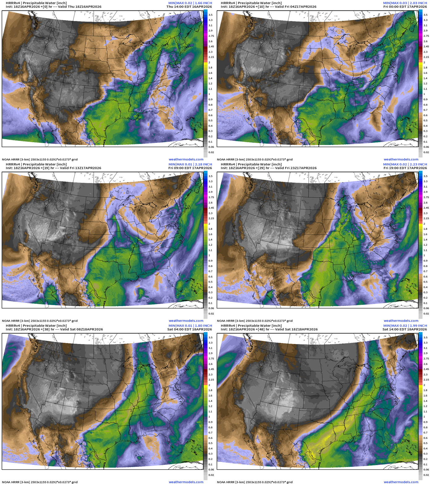
HRRR 18z Precipitable Water Next 48-hours (my favorite parameter)
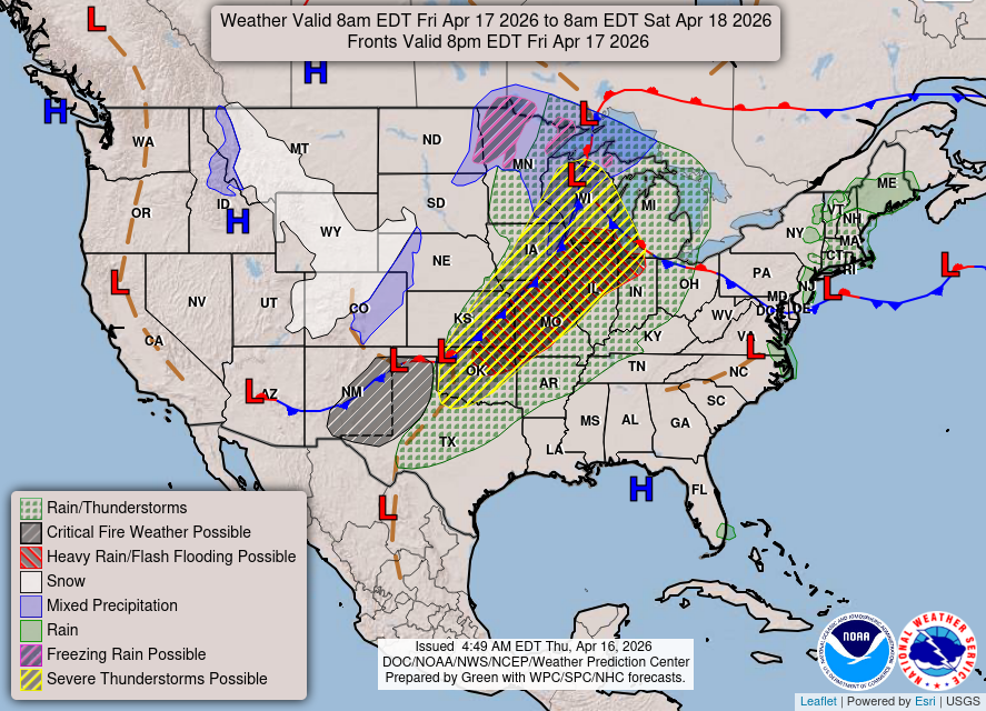
Weather on Friday: Enhanced risk of severe weather along cold front attached to strong area of Low Pressure in the Great Lakes.
Enhanced Risk — all modes of severe weather possible.
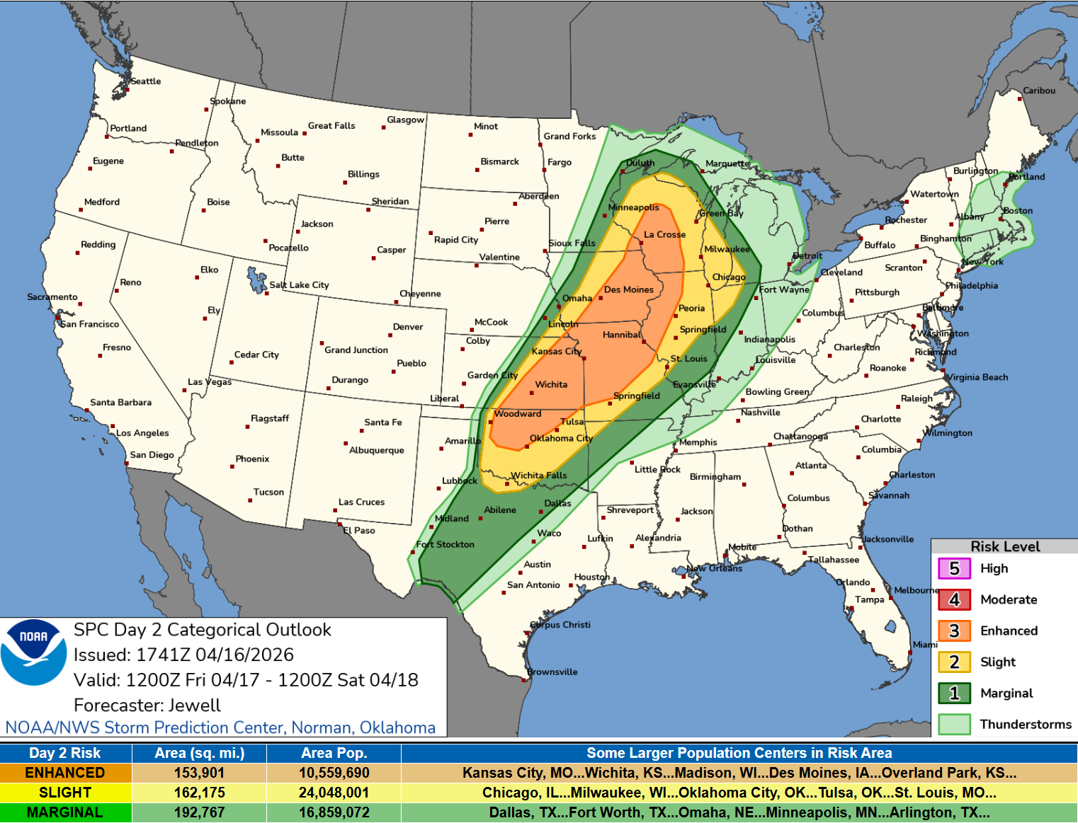
   ...SUMMARY...
   Widespread severe thunderstorms are expected from parts of the
   southern Plains to the Middle and Upper Mississippi Valley vicinity
   Friday into Friday night. Tornadoes, possibly strong, very large
   hail, and swaths of damaging winds will be possible.
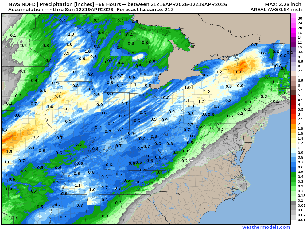
NDFD NWS Total Precipitation Next 66-hours through Sunday Morning
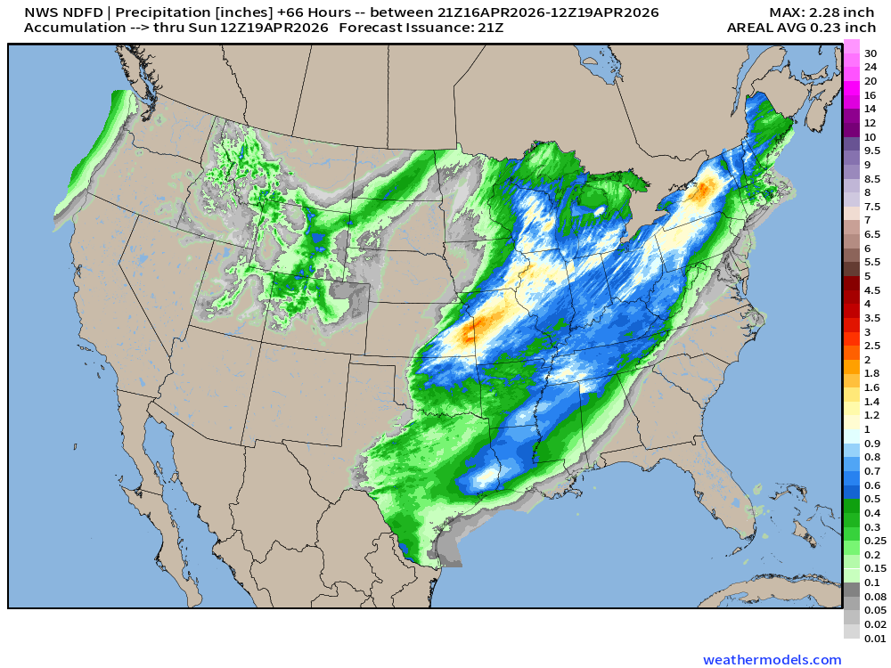
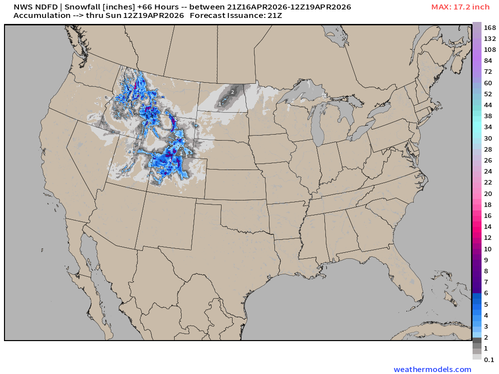
NWS Snowfall Next 66-hours — through Sunday Morning
ECMWF 12z | Forecast 6-days of Precipitable Water (my favorite parameter)
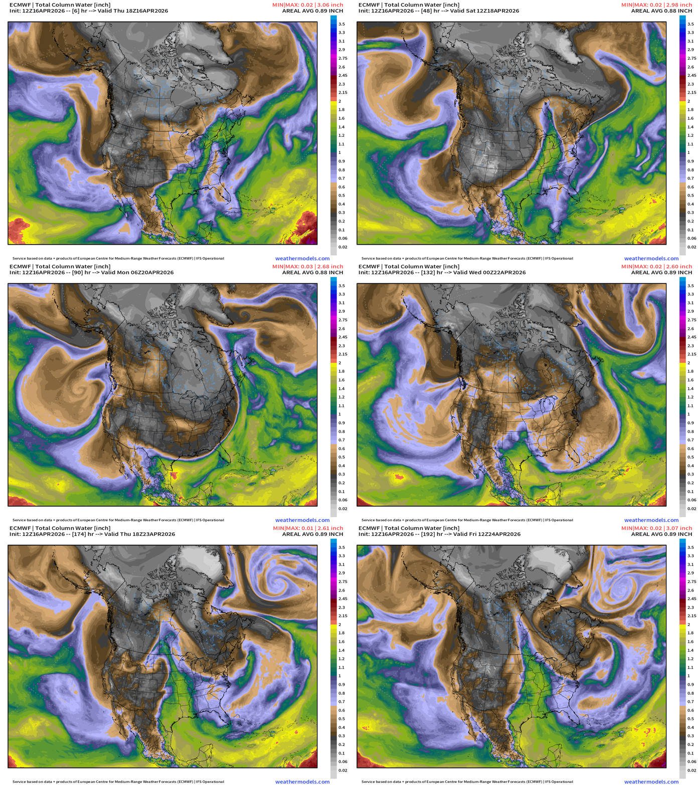
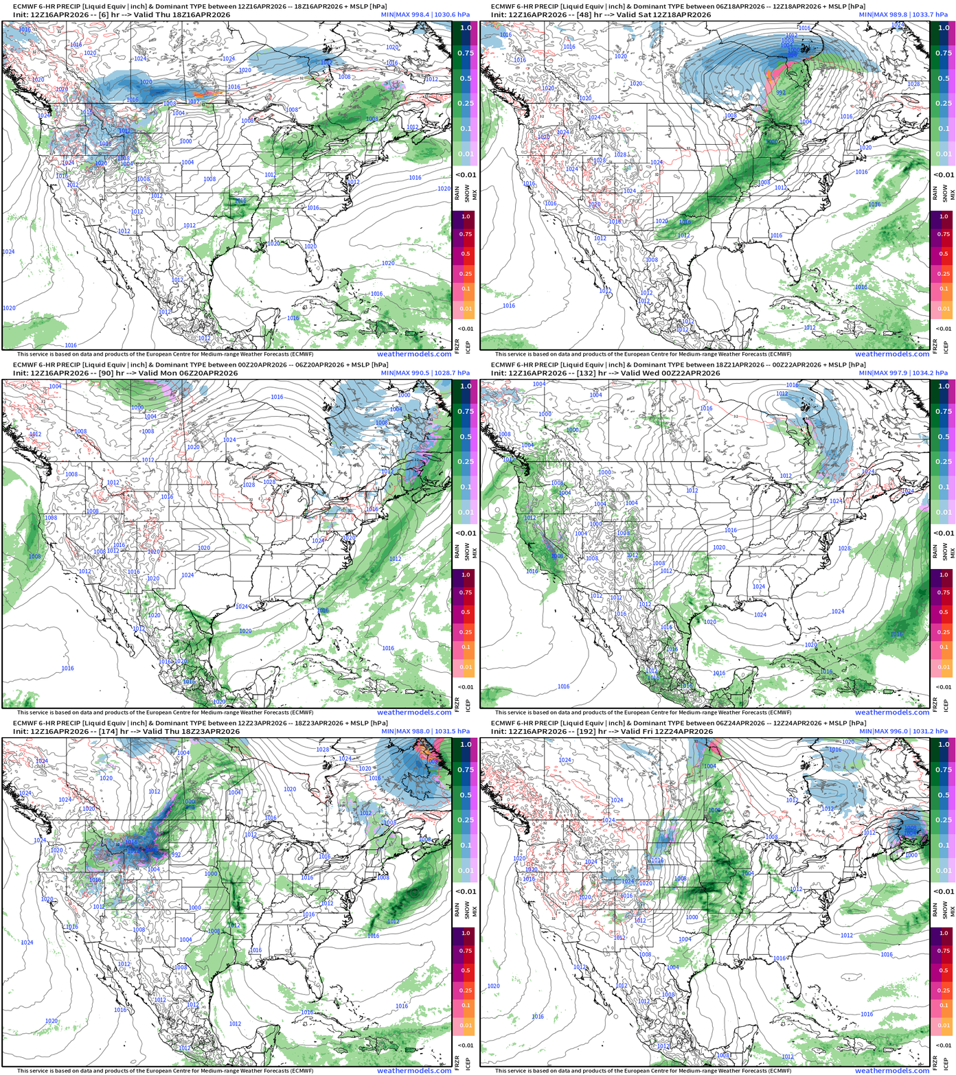
A strong cold front blasts through the central and Eastern U.S. this weekend but moisture quickly returns out of the Gulf of Mexico with a highly progressive (busy) weather pattern.
ECMWF 12z Precipitation Type + Intensity | Next 8-days
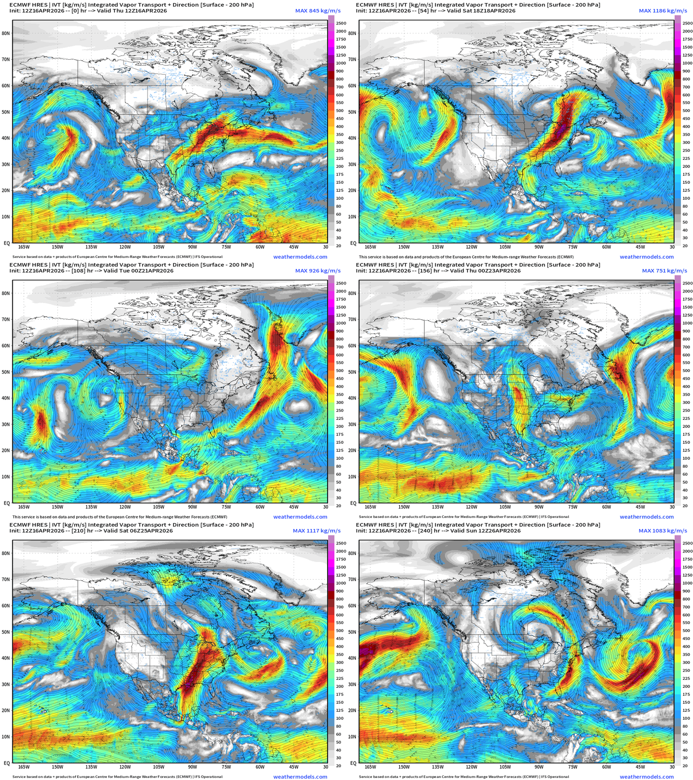
Moisture Transport (IVT) next 10-days
Total Precipitation Next 7-days | Blend of Models
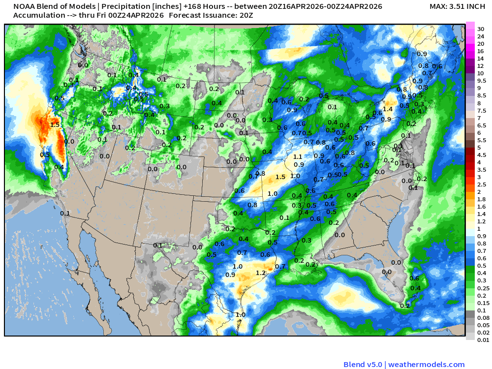
Nice to see even more rain in California … but really could use something in the Southeast. No luck for a week at least.
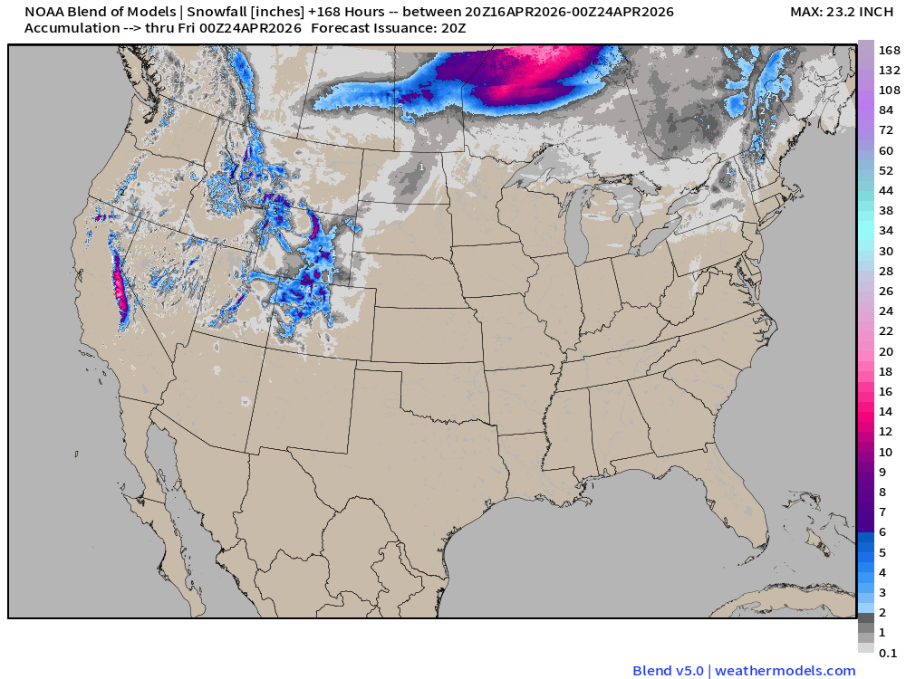
Blend of Models | Total Snowfall Next 7-Days
ECMWF AIFS 12z next 10-days of 500 mb Height Anomaly
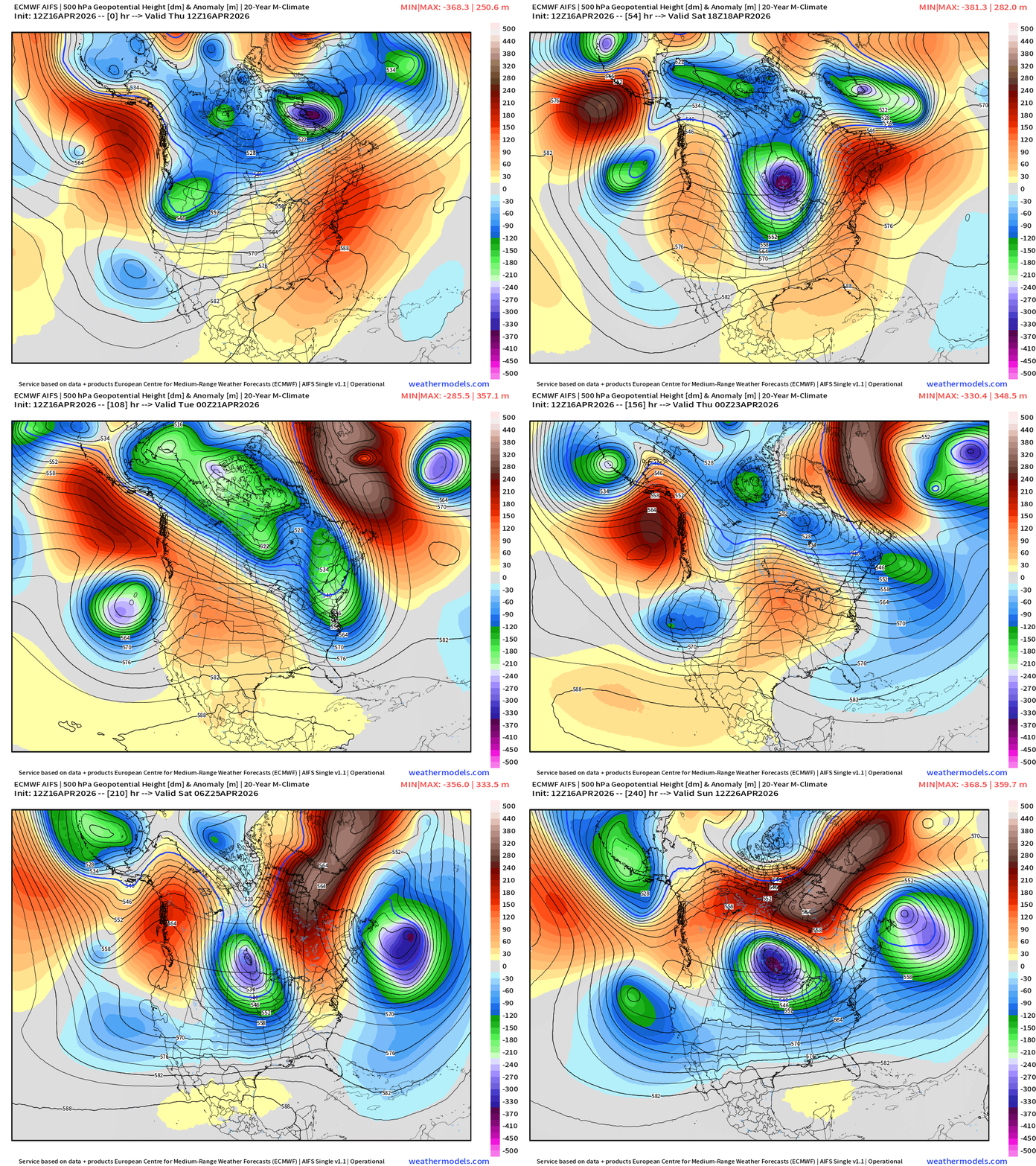
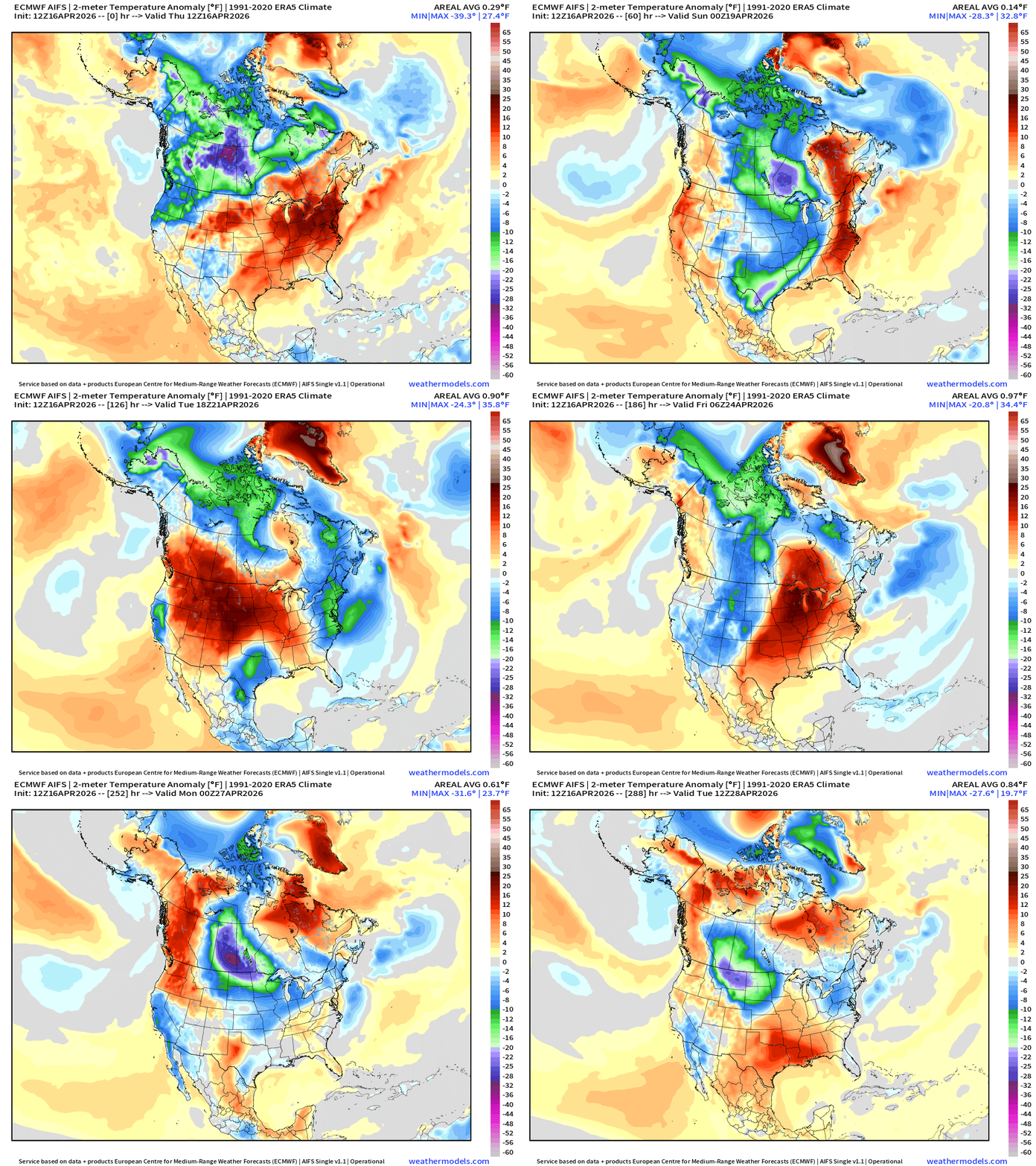
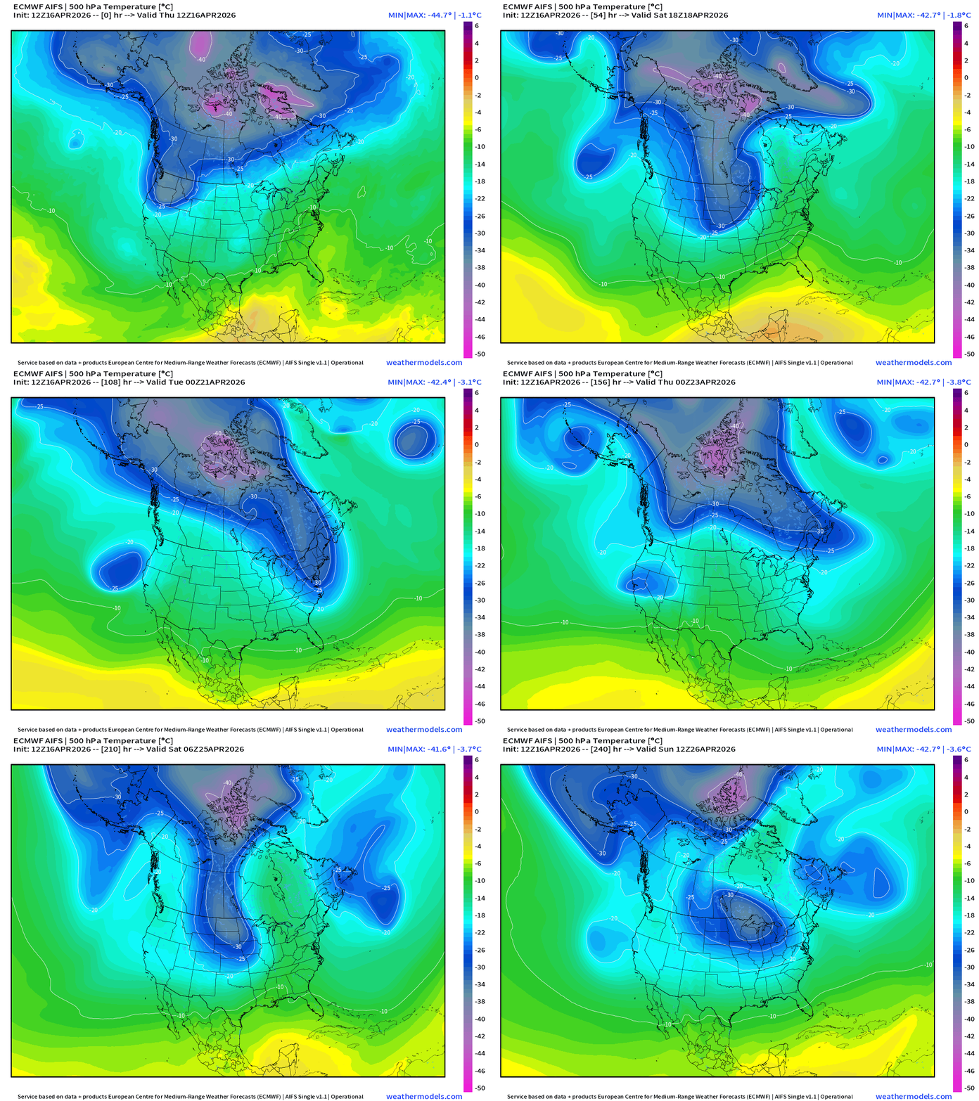
AIFS 12z evolves into a sequence of troughs … stretched out beneath high-latitude blocking ridge. This is a cool and unsettled pattern into early May. Still plenty of cool/cold air in Canada that can dump out into the Lower 48.
Temperature Anomaly into April 28th — next 12-days
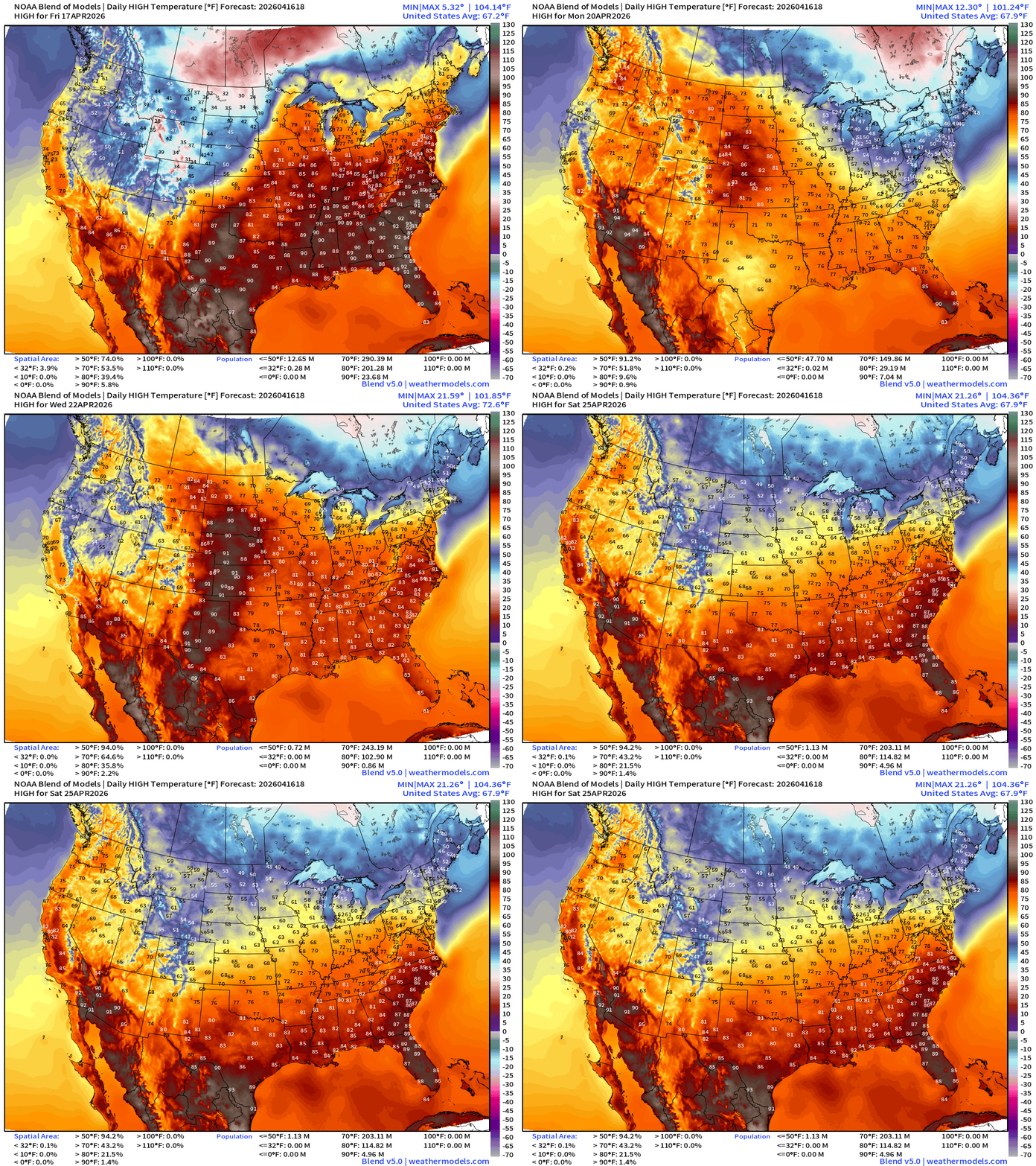
Blend of Models Temperatures | Highs through Saturday, April 25
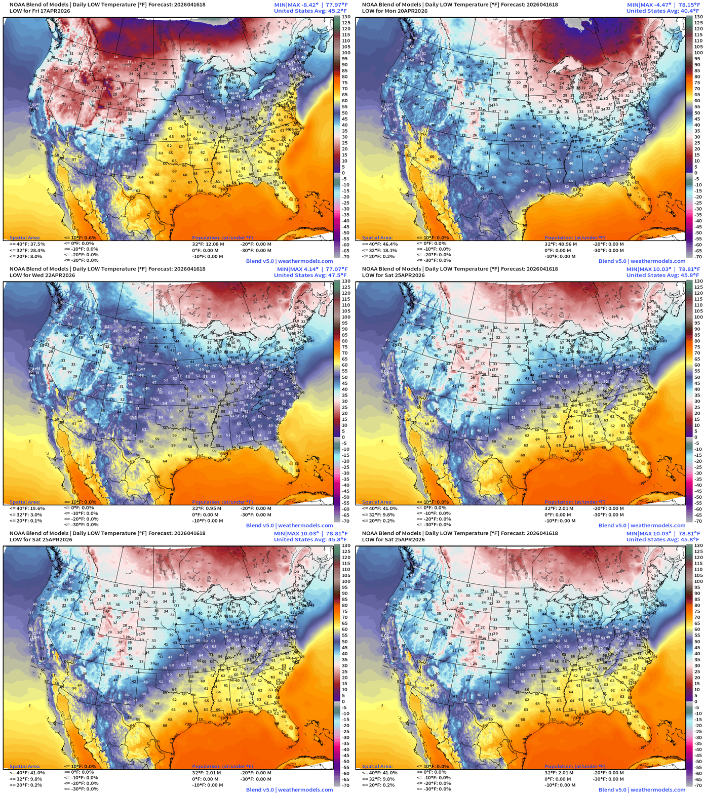
Blend of Models Temperatures | Lows through Saturday, April 25
Low Temperatures Friday
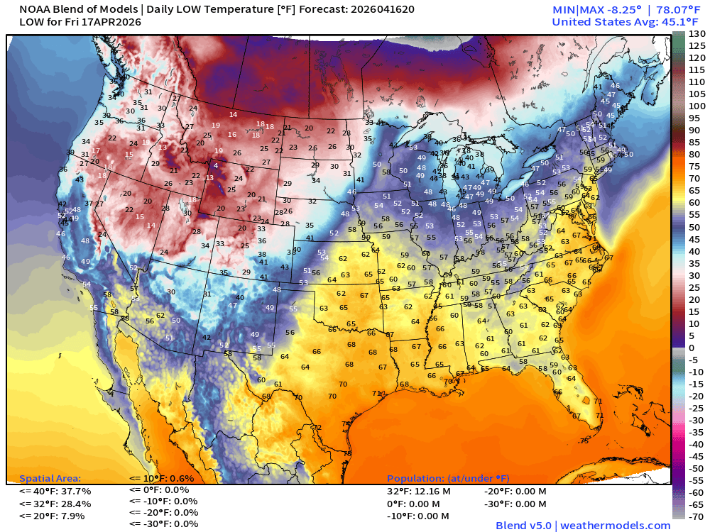
Only 12.2 million below freezing
High Temperatures on Saturday
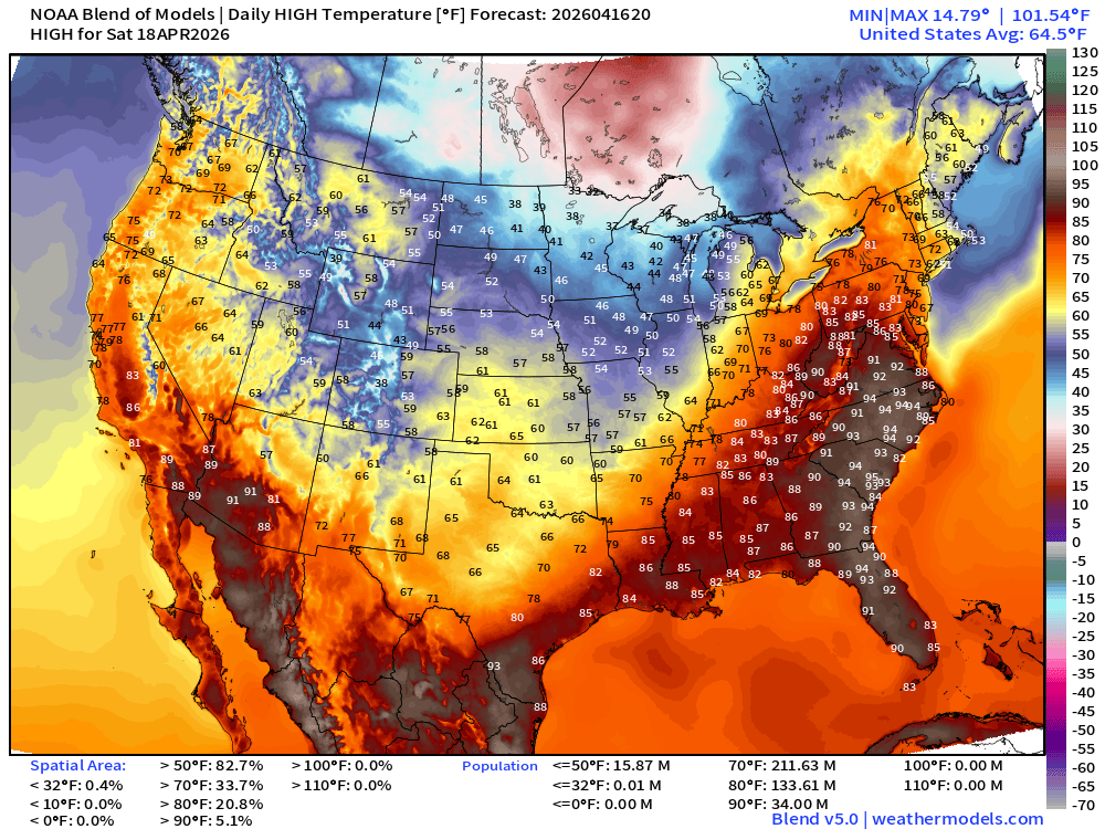
Still 212 million at least 70°F, and look at those 90s — 34 million from Virginia to Florida.
High Temperatures on Sunday
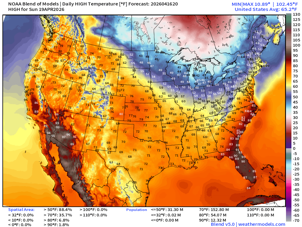
Much cooler as the cold front reaches the Southeast … but Florida hangs onto some 90s. Only in the 30s and 40s across the Great Lakes.
ECMWF AIFS 12z | Temperature at 500 mb | Next 10-days
Snowfall from ECMWF HRES (15-days)
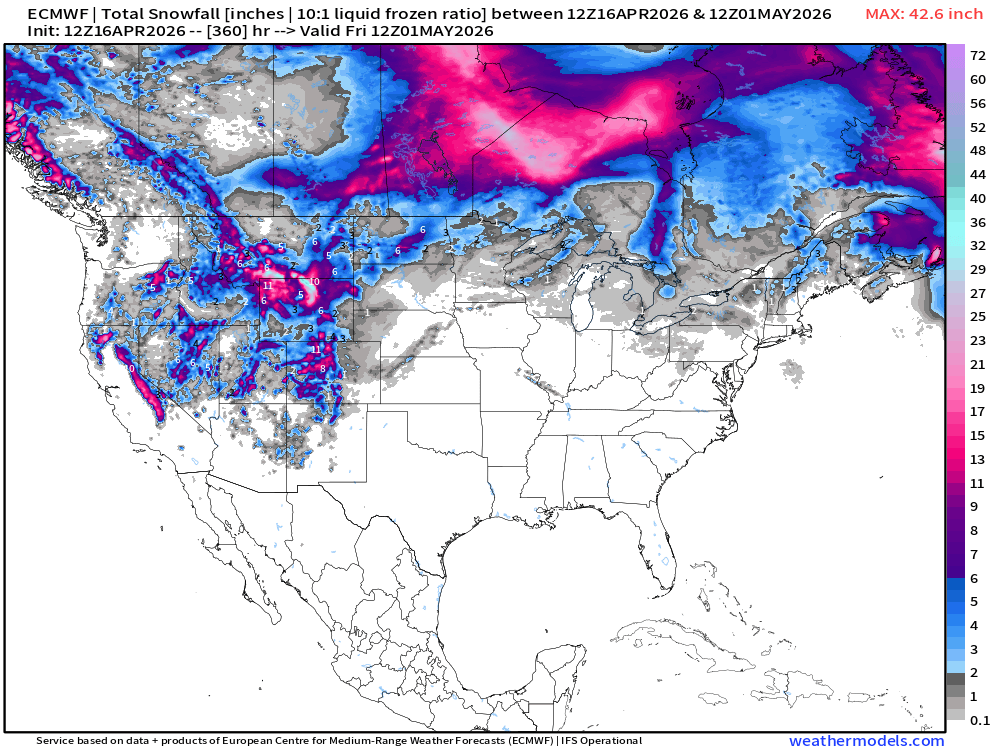
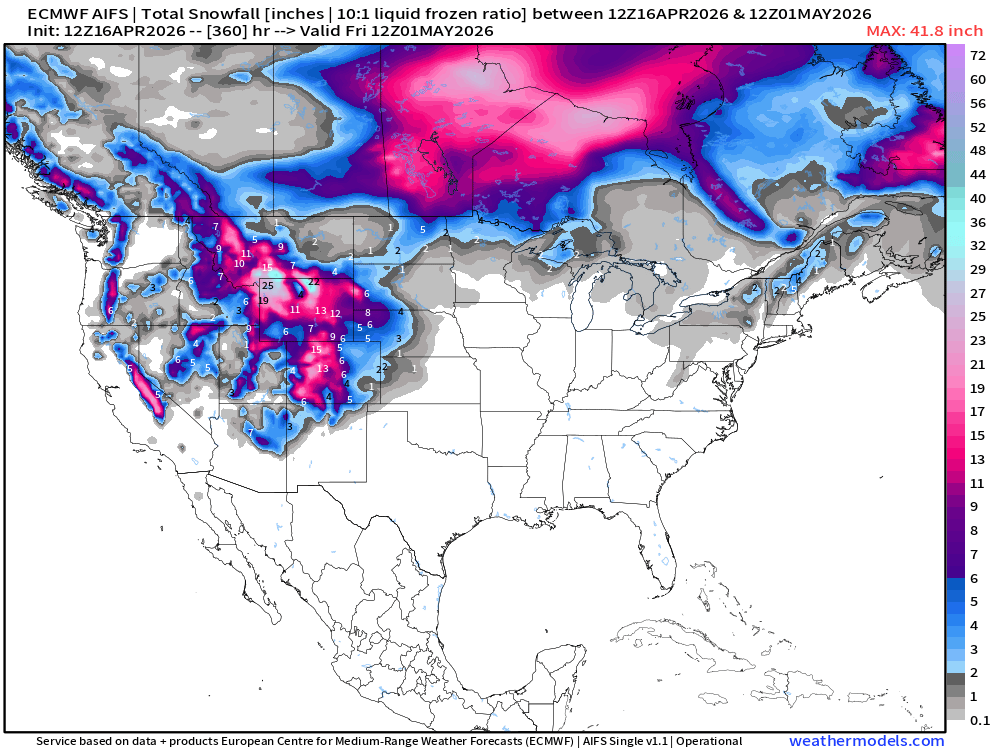
Snowfall from ECMWF AIFS-Single (12z) next 15-days
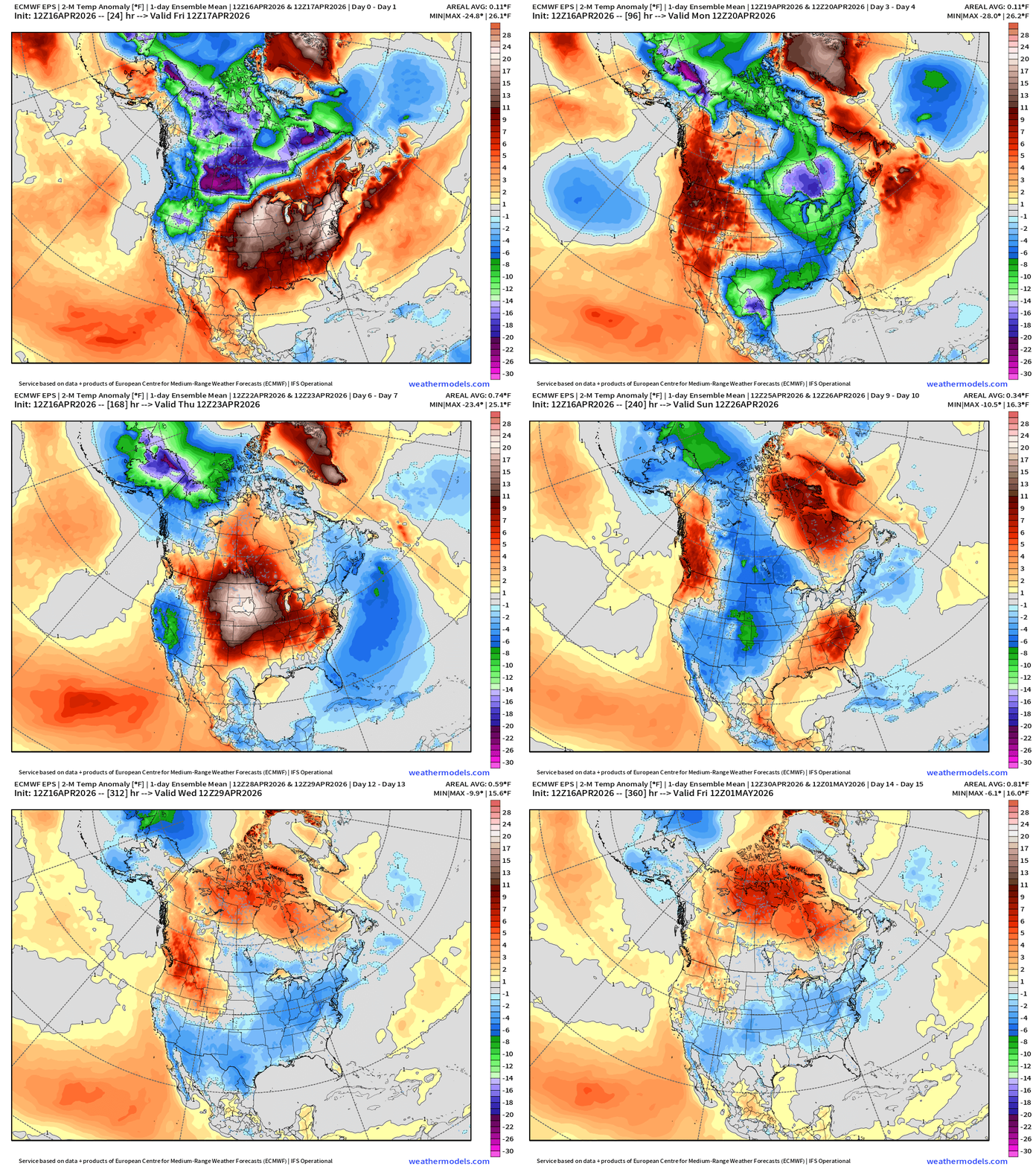
Temperature Anomaly | Next 15-days | ECMWF EPS 12z Ensemble Mean
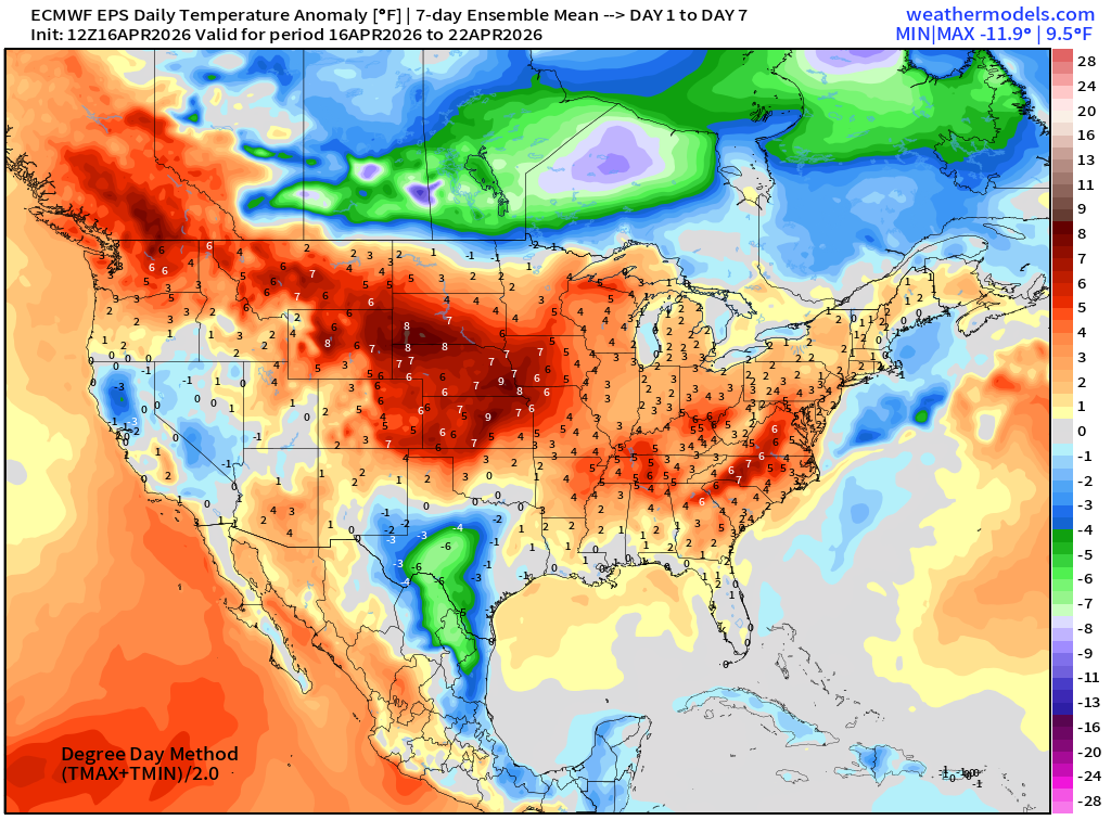
Week #1 | Temperature Anomaly | April 16 - April 22
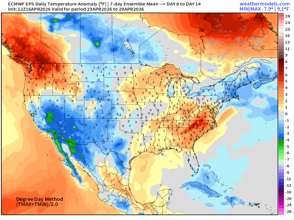
Week #2 | Temperature Anomaly | April 23 - April 29
April 7: 2026 Atlantic Seasonal Hurricane Forecast: 11/5/2
9-13 Named Storms (11 most likely)
4-7 Hurricanes (5 or 6 most likely)
1-3 Major Hurricanes (2 most likely)
ACE: 75-85
Maps sourced from weathermodels.com designed and innovated by yours truly! Please subscribe there for real-time access to the newest maps, charts from all of the weather models including ECMWF and AIFS, and NOAA GFS/GEFS. NOAA WPC and SPC for fronts/convective outlooks.
- Milepost
- 920 · laid 2026-04-16T22:37:38.963000Z
- Source
- https://weather.substack.com/p/april-16-2026-thursday-spring-weather
- Digest
- f64d2b08674ffe0656269fb4f102271a3ced6d3351d791503f5e5d042d1058a8
- Machine
- JSON