April 14, 2026 Tuesday Spring Weather
Very warm across Eastern U.S. with storms along a ring of fire
April 2026 was the 3rd-warmest April in the 132-year national record (1895–2026), at 54.7°F against a 1991–2020 normal of 51.8°F (+2.9°F).
April 2026 was the 46th-wettest April in the 132-year national record (1895–2026), at 2.7in against a 1991–2020 normal of 2.7in (+0.0in).
NOAA/NCEI Climate at a Glance, contiguous United States. This is the observed record for the month, not a score of anything said in this piece — the forecast ledger begins 2026-08-17 and cannot reach earlier posts.

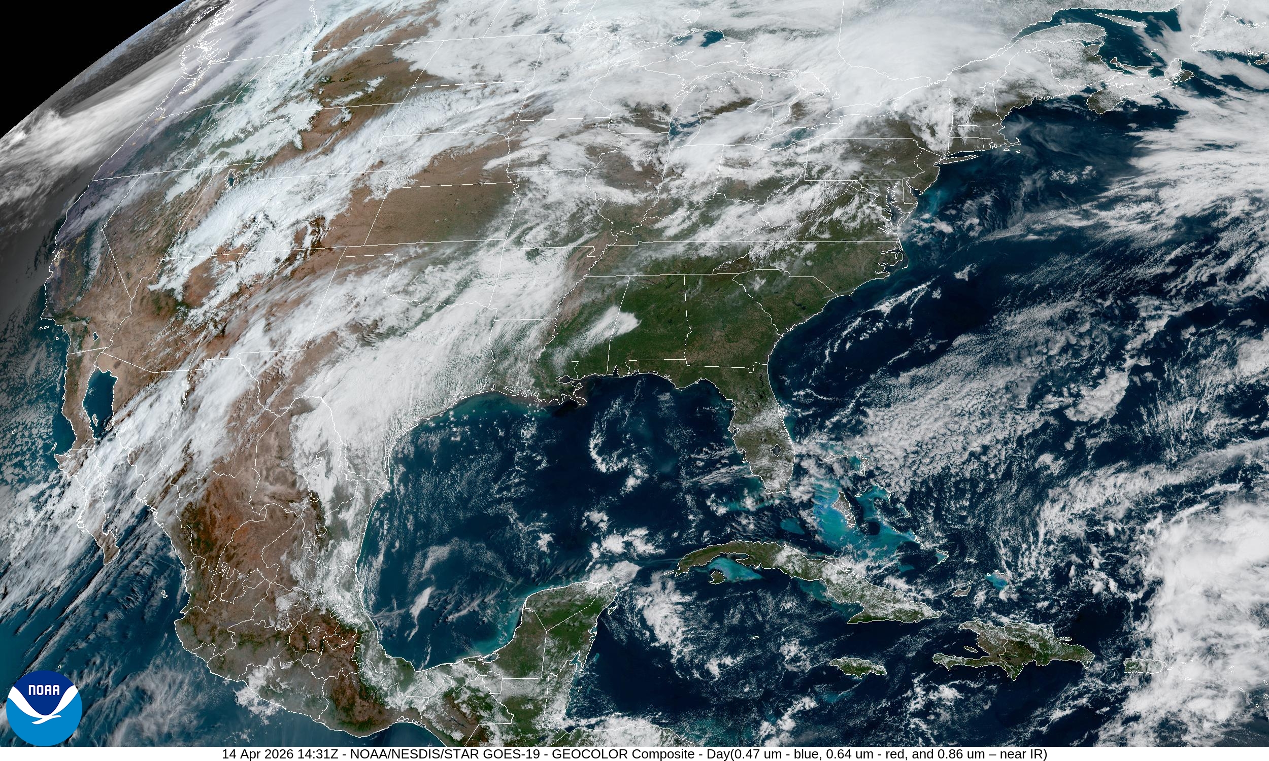
Beautiful morning today across the Southeast and mid-Atlantic with temperatures soaring into the 80s and even 90s this afternoon.
High Temperatures on Tuesday
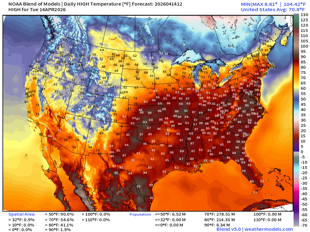
80s for 214 million population from central Plains into Mid-Atlantic … and over 8 million at least 90°F
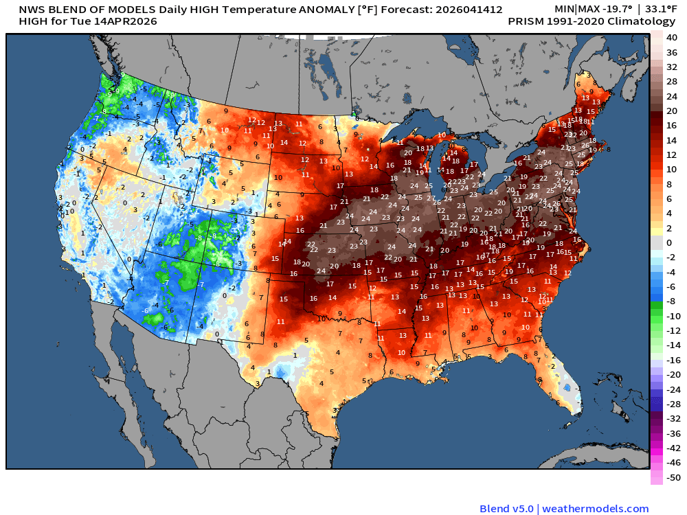
The air mass is 20-25°F much above normal for mid-April … averages should be in the 60s instead of the 80s and 90s. Much, much better and preferable to 25°F below normal, of course.
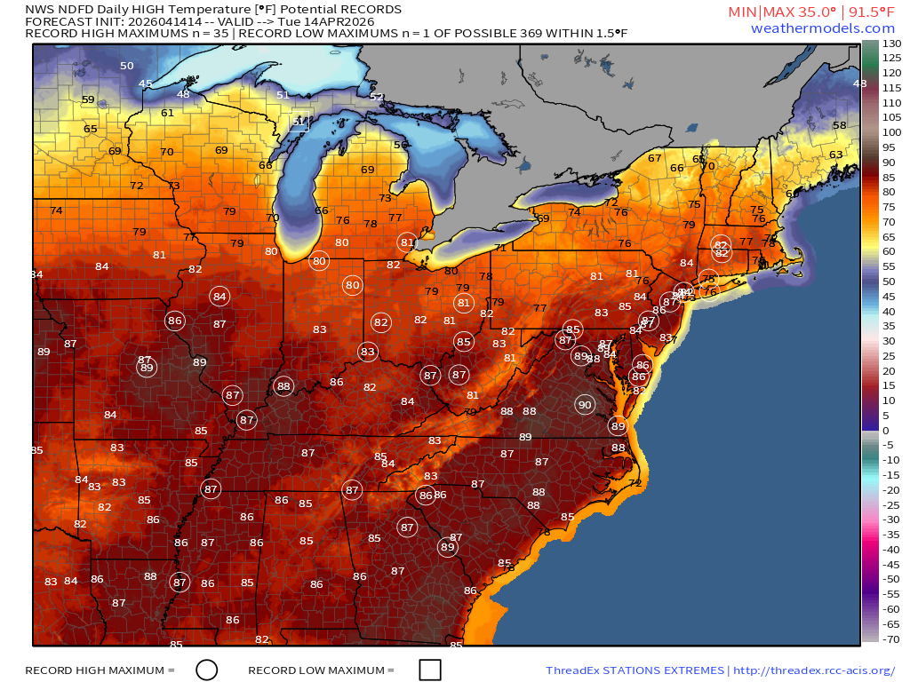
We should see many daily record highs based upon the current forecasts for heat this afternoon. Record highs forecast today:
RTMA Current Temperature Analysis | 9:30 AM ET
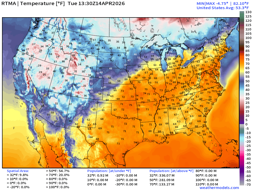
Lower 48 average was 53.3°F with 133 million already at least 70°F
RTMA Current Temperature Anomaly Analysis | 9:30 AM ET
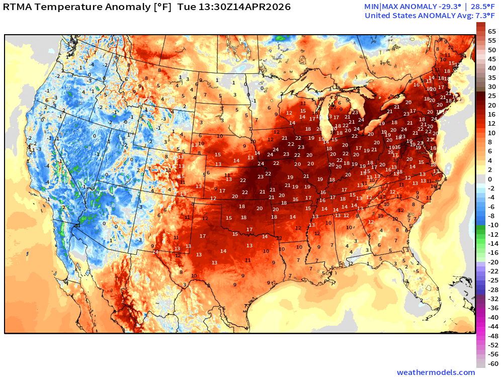
Lower 48 was 7.3°F ABOVE normal
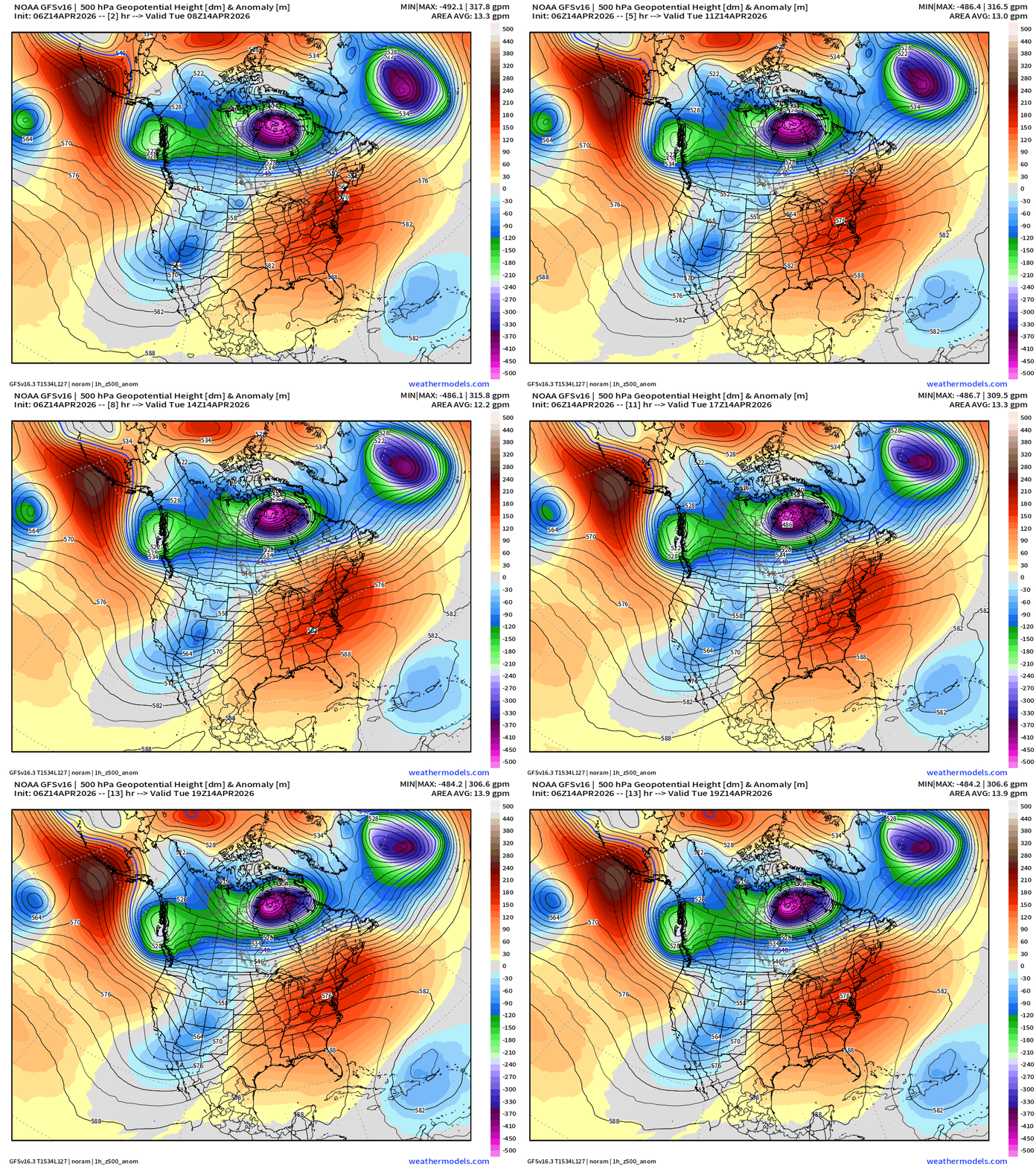
North American Analysis from GFS 06z
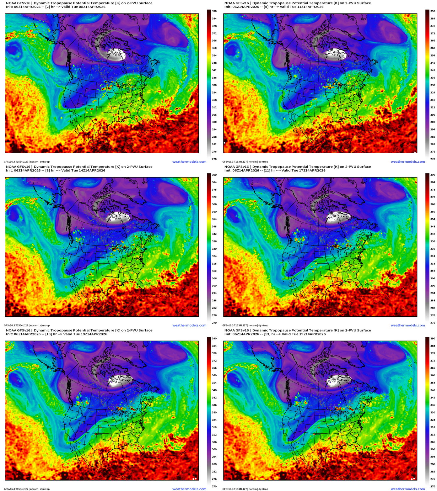
Amazingly, the polar vortex (tropospheric) is happily spinning away at maximum intensity of mid-winter over Hudson Bay. This is a pattern more typical of mid-February rather than mid-April except there is much more warmth/heat available out of the subtropics to fuel storms in the central U.S.
The height anomaly at 500 mb shows the extreme negative depression of the PV trough right over Arctic Canada … north of the strong ridge keeping the central and eastern U.S. very toasty
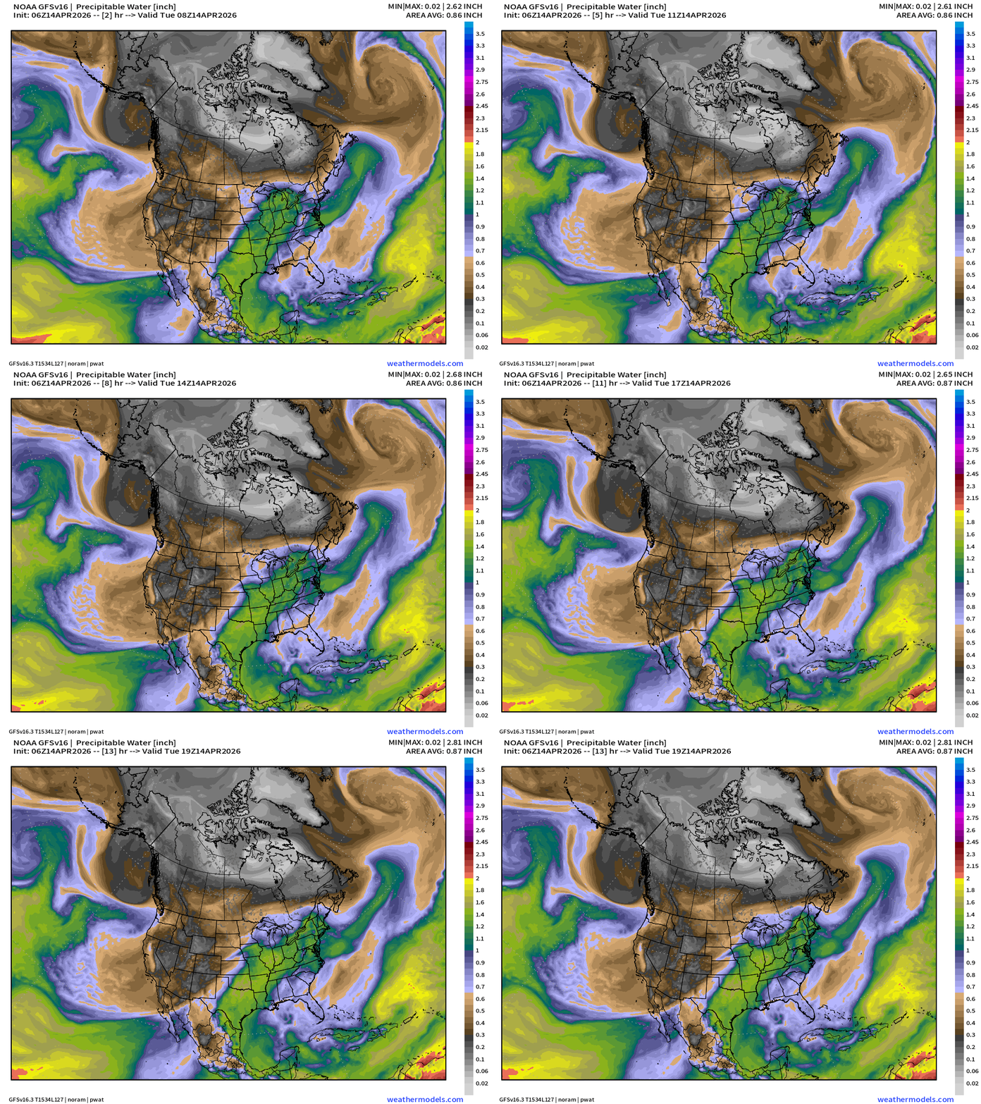
Precipitable Water (my favorite parameter)
Moisture stream out of the Gulf of Mexico —> open for business = ring of fire for storms to billow up in the central Plains, Midwest, and into the Great Lakes.
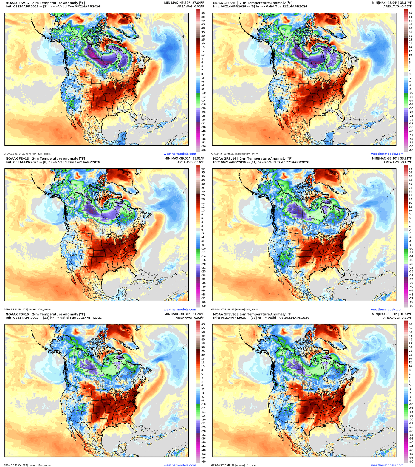
Temperature Anomaly: still extremely cold over Arctic Canada … but thankfully bottled up from dipping into the U.S.
Tropical Update: North Western Pacific
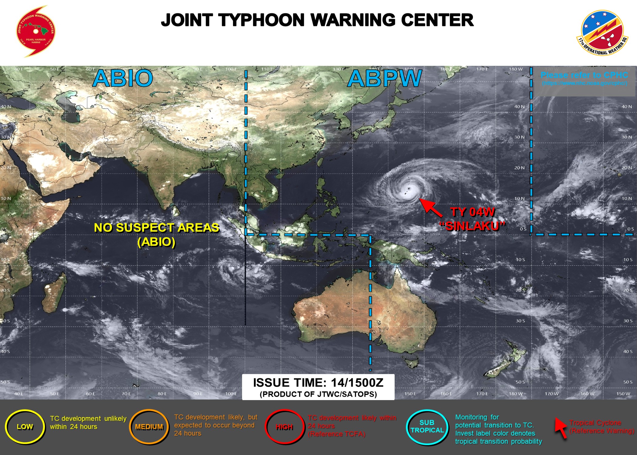
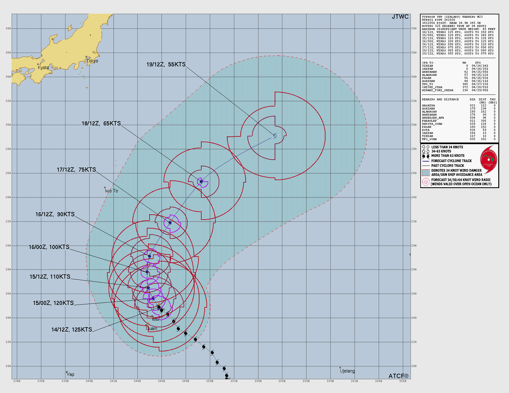
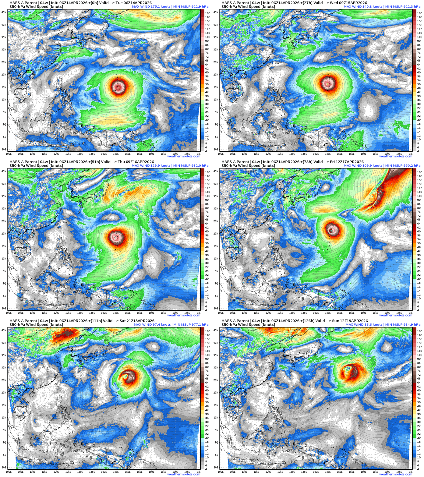
Massive Typhoon Sinkalu (04W) is moving through the northern Mariana Islands today with winds 125-knots equivalent to a powerful Category 4 hurricane
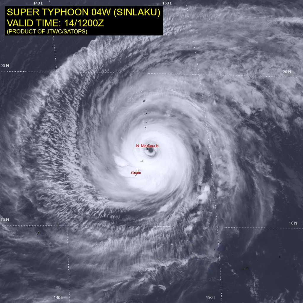
JTWC official forecast for Sinlaku curves it northward along 140°E with slow but steady weakening over cooler ocean waters
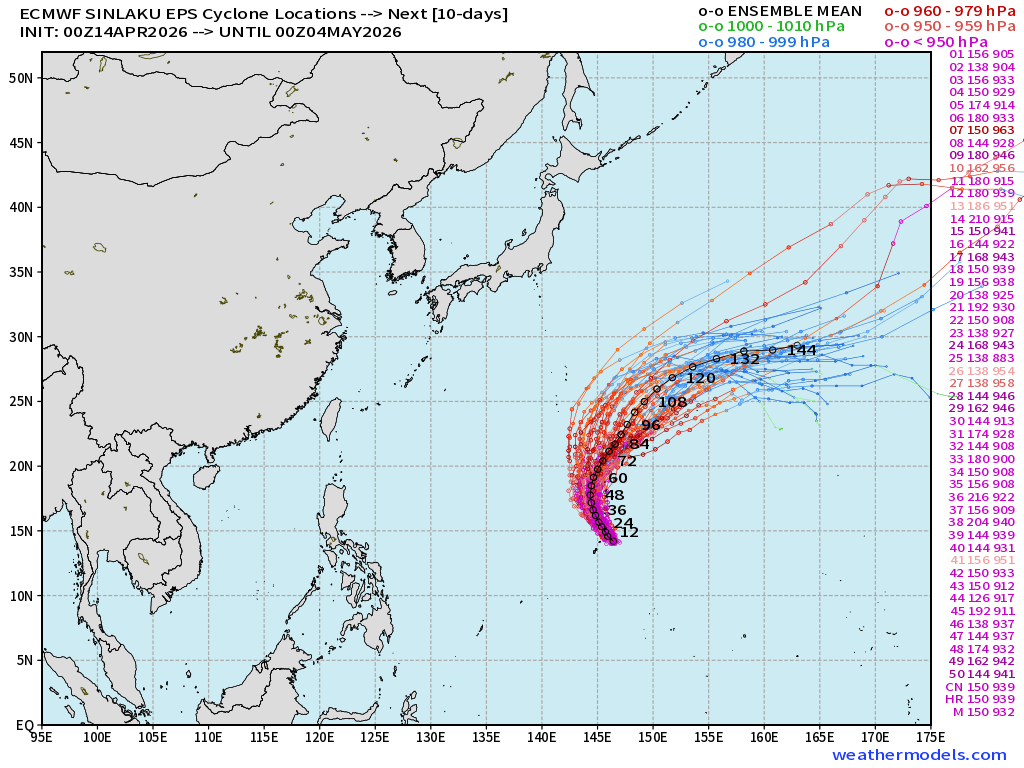
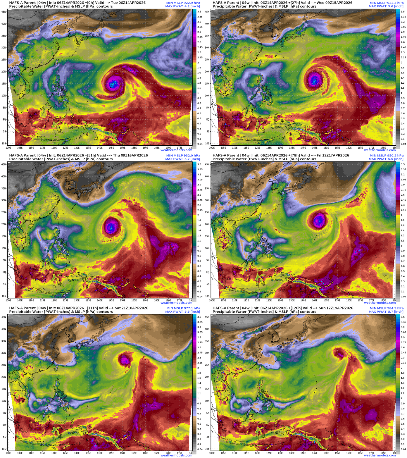
HAFS 06z Precipitable Water (my favorite parameter) through 5-days shows Sinlaku turning northward and weakening as it encounters dryer air, cooler SSTs, and upper-level westerlies —> extratropical transition process.
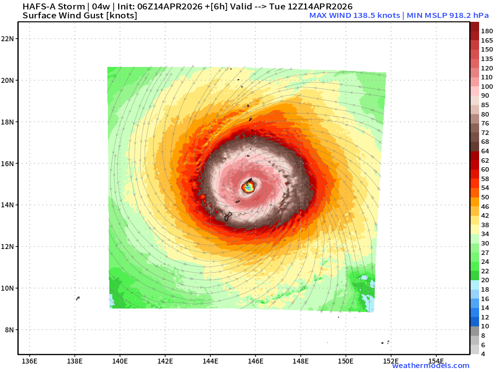
HAFS-A (06z mesoscale hurricane model) for Sinlaku (04W) shows the“behemoth” over Tinian and Saipan.
Ocean temperatures quickly fall into the 26°C to 27°C range above 20°N latitude so Sinlaku will quickly transition into a post-tropical system and merge with the westerlies.
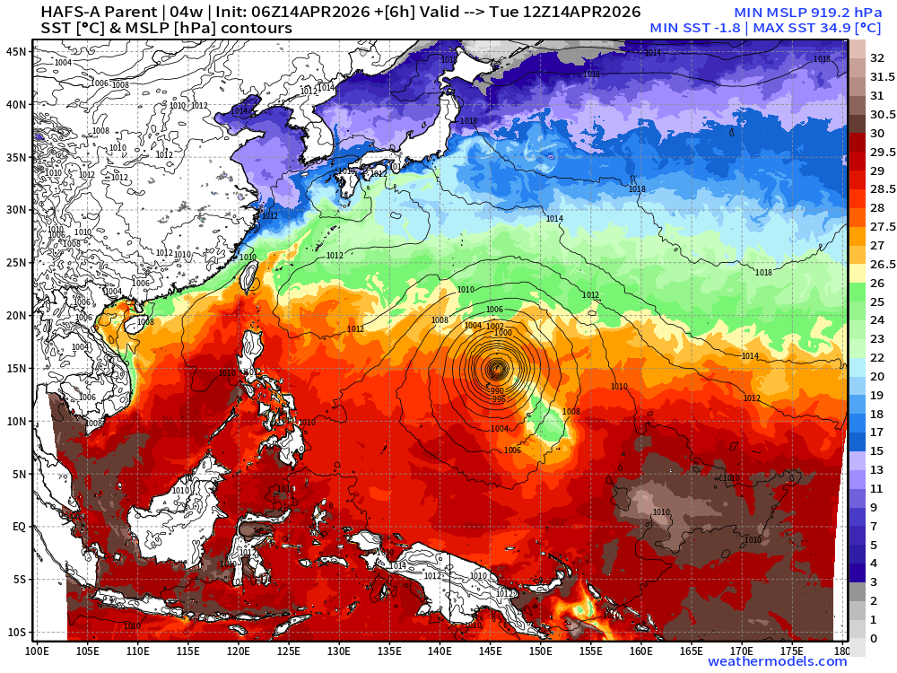
Sinlaku’s wind field will detach from the “equatorial westerly wind burst” channel and energize the jet stream —> aiding downstream development of cyclones with a more amplified jet stream.
Atlantic Basin | Next 6-days
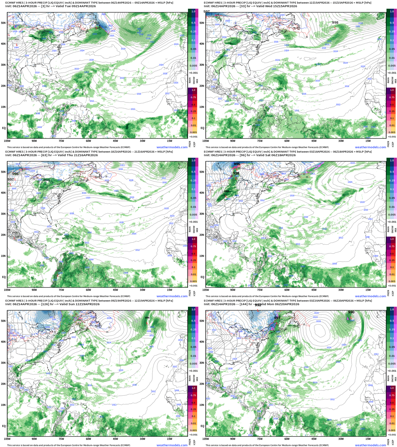
The ITCZ remains quite far south in the Atlantic near the Equator in mid-April so plenty of moisture and convection, but nothing can organize out here until June or July.
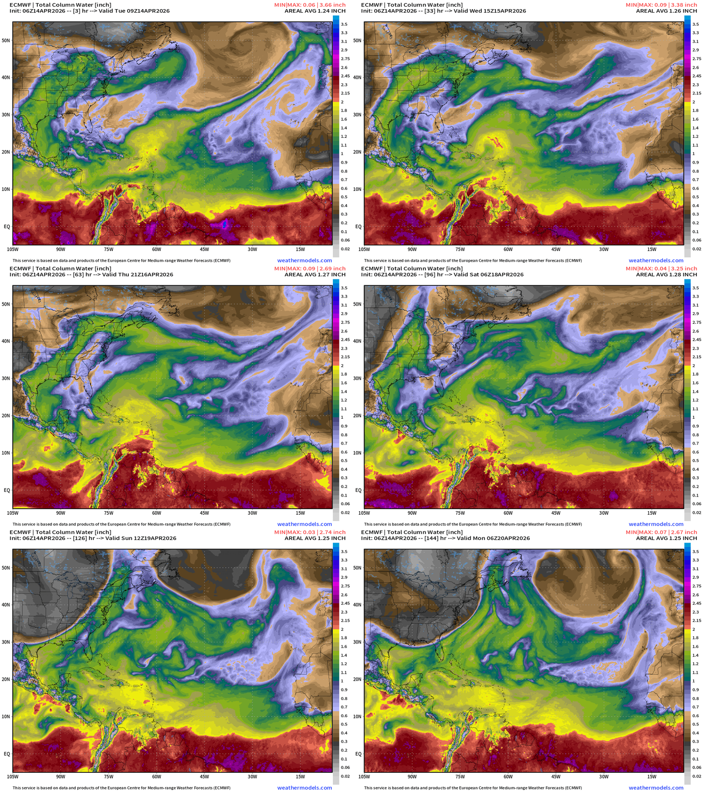
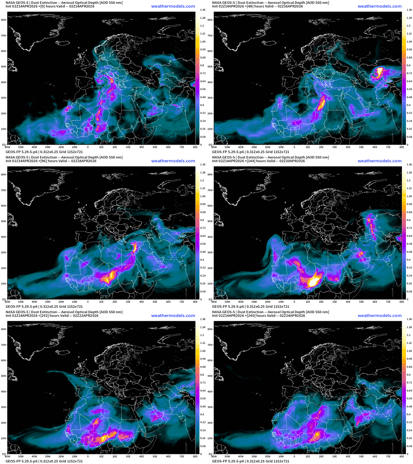
North Atlantic African Dust | Next 10-days
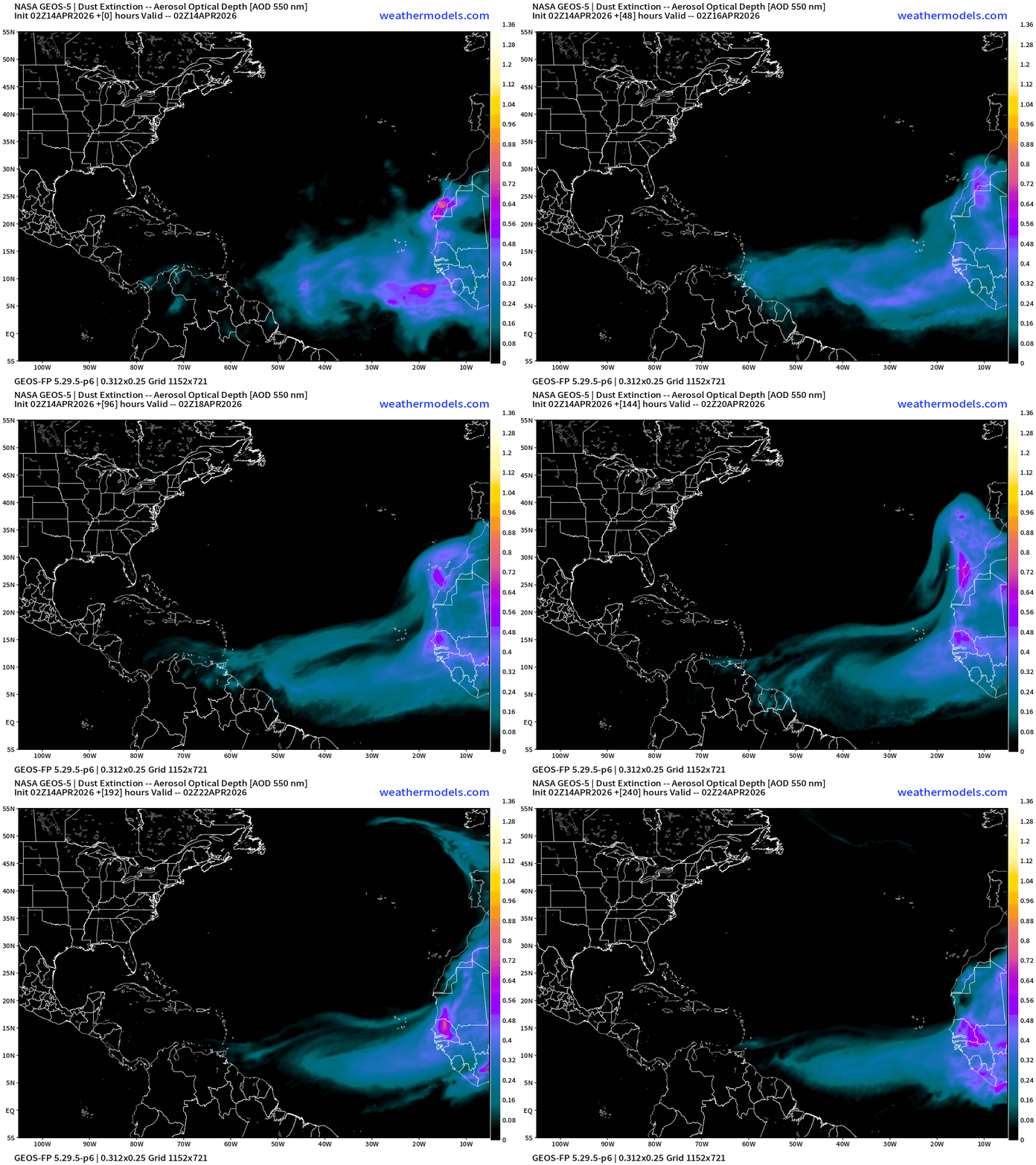
Dust over the north Atlantic and Africa — as any early season tropical waves will be wiped out by dust. We’ll also get a sense of the activity into June by the circulation pattern in the Eastern MDR of the Atlantic, and how dust flows over the ocean.
Lower 48 Weather into Wednesday Morning
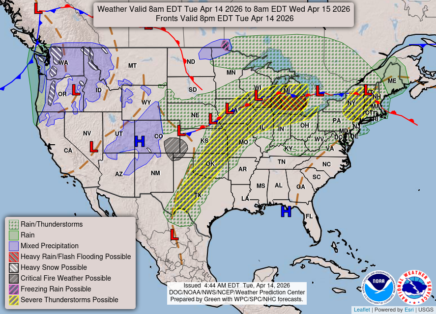
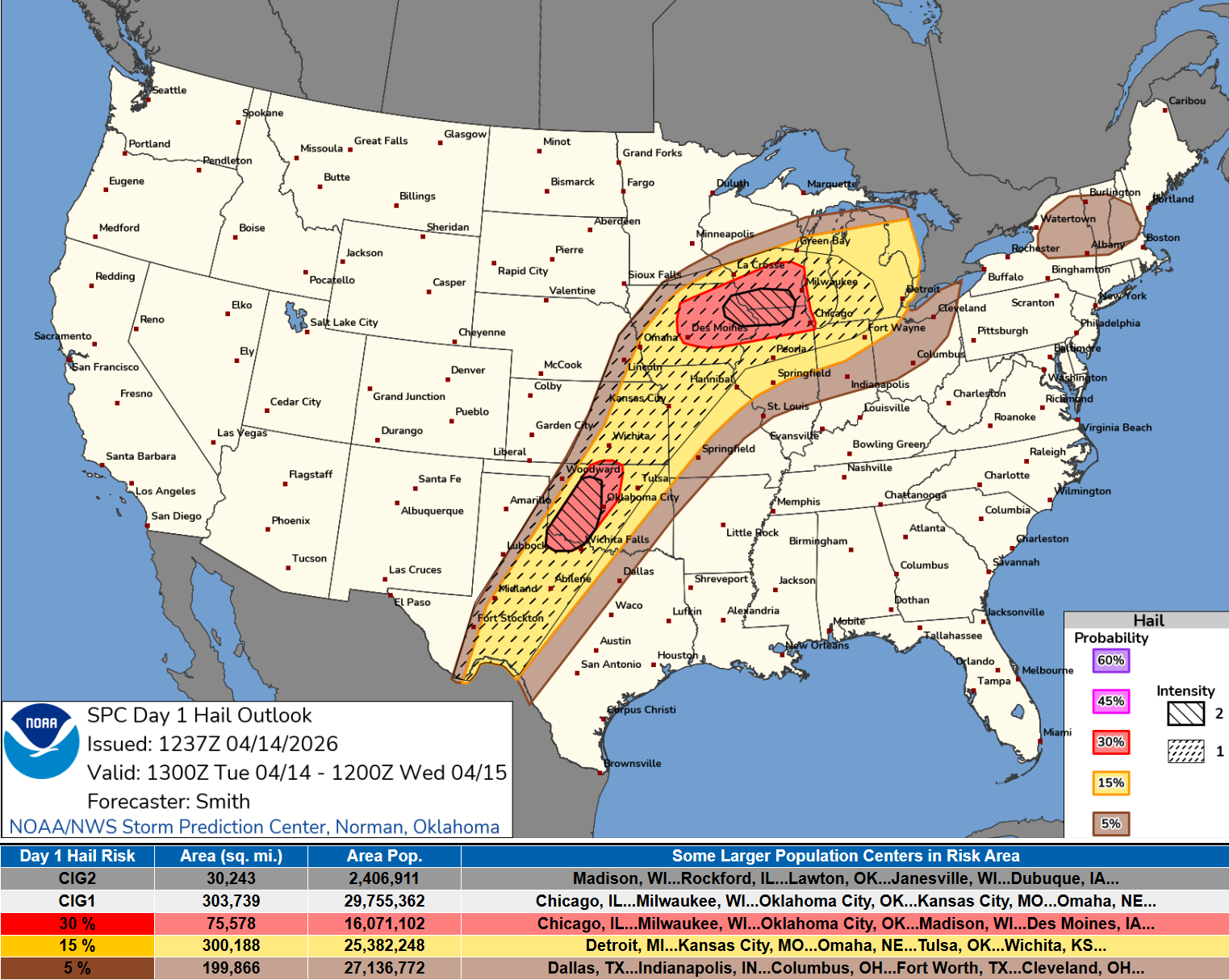
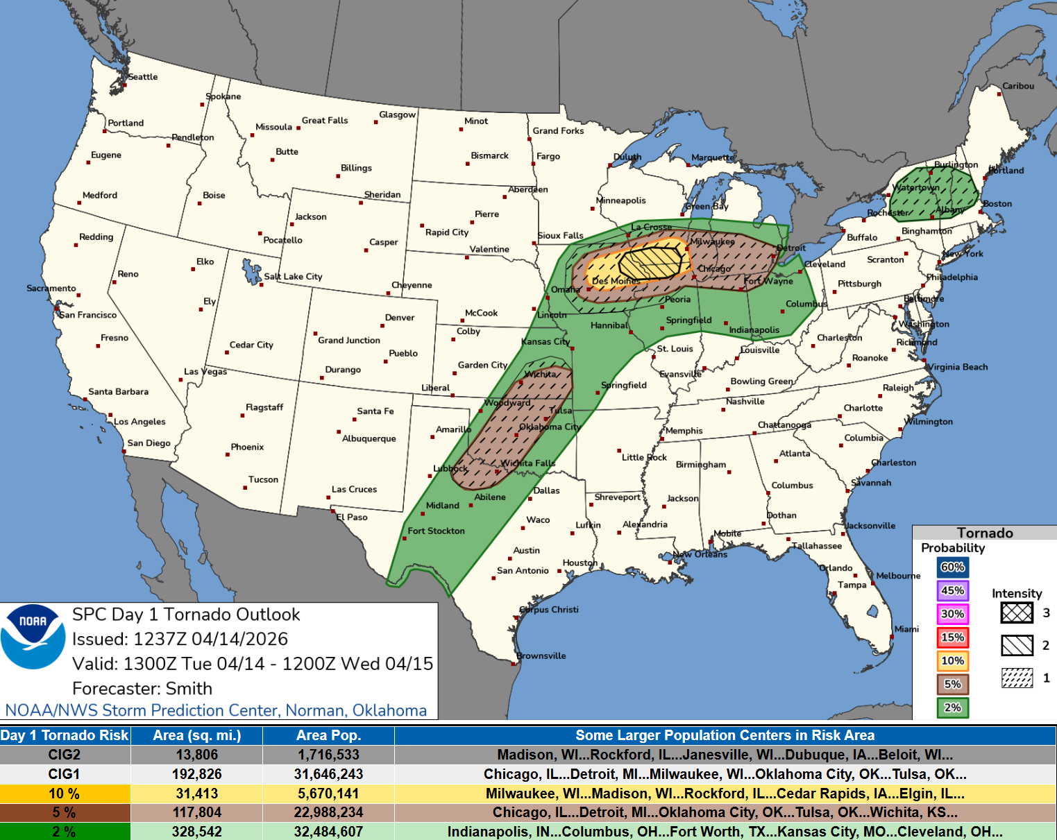
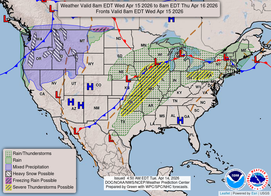
Storms will fire today from Texas into Michigan with “enhanced risk” embedded in Oklahoma, and then from Des Moines to Detroit.
Convective Outlook until Wednesday morning
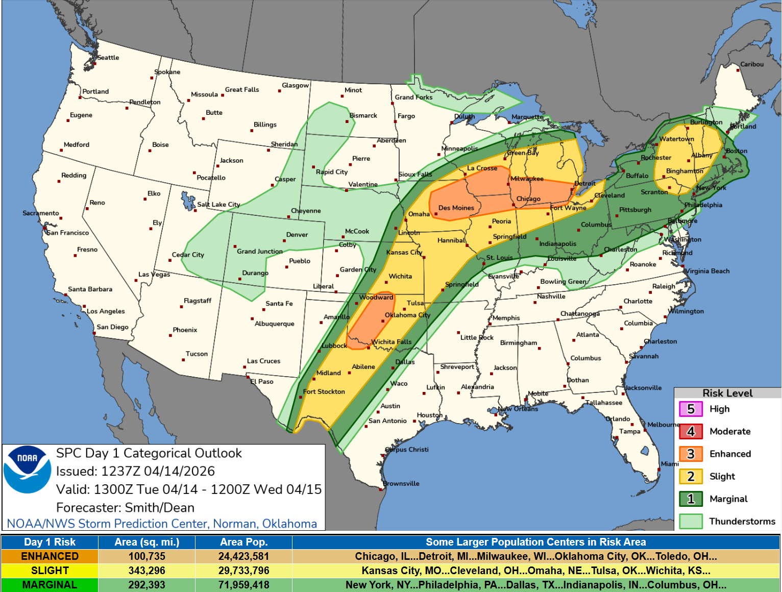
   Severe thunderstorms are expected this afternoon through tonight
   from the southern Plains into the Midwest.  Large to giant hail,
   several tornadoes (some strong), and severe gusts will be possible,
   particularly from Iowa into the southern Great Lakes.
Large to giant size hail
Tornado Threat most elevated in Iowa and along Wisconsin/Illinois line
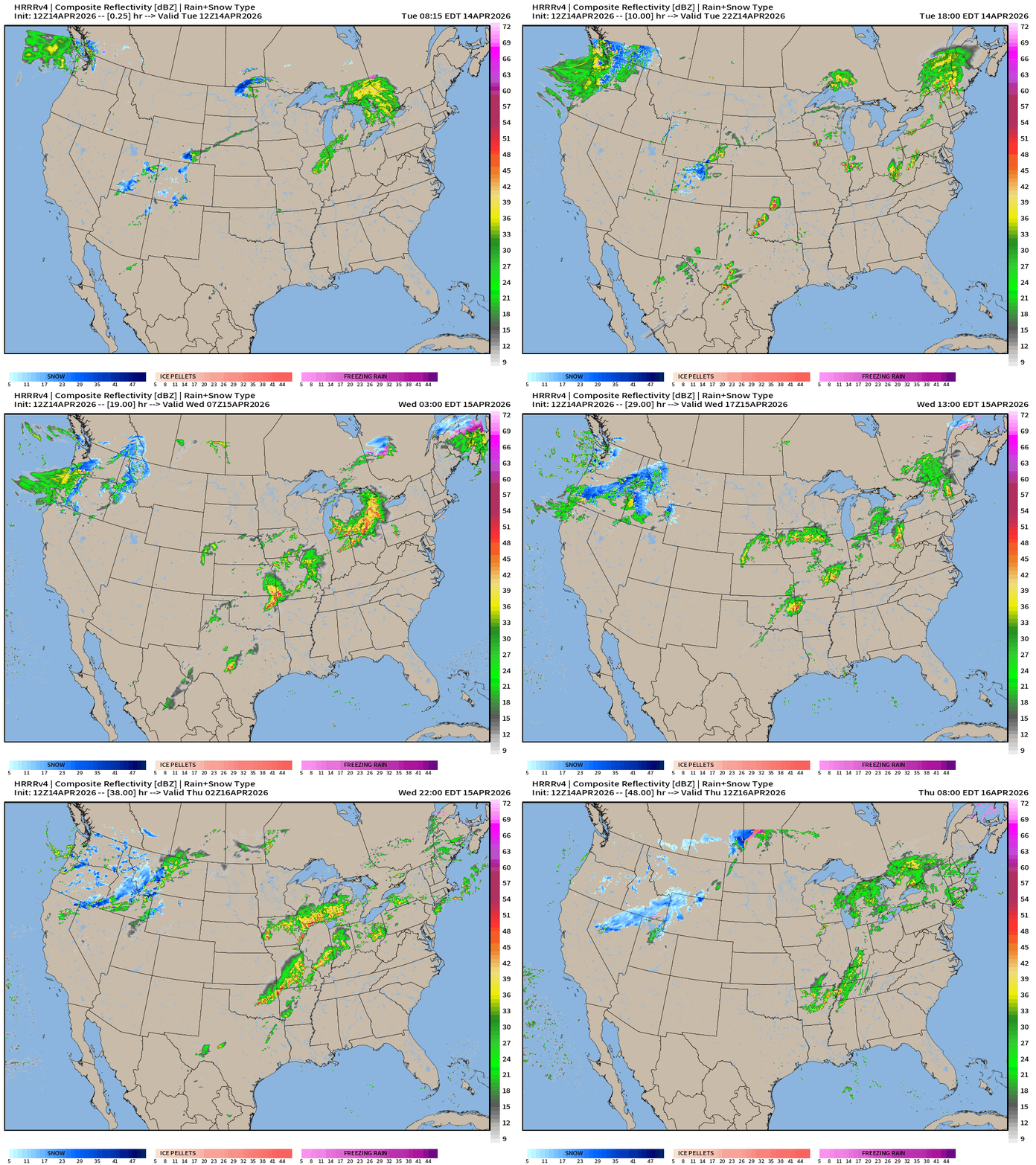
HRRR 12z — Radar Simulation Next 48-hours to Thursday 8 AM ET
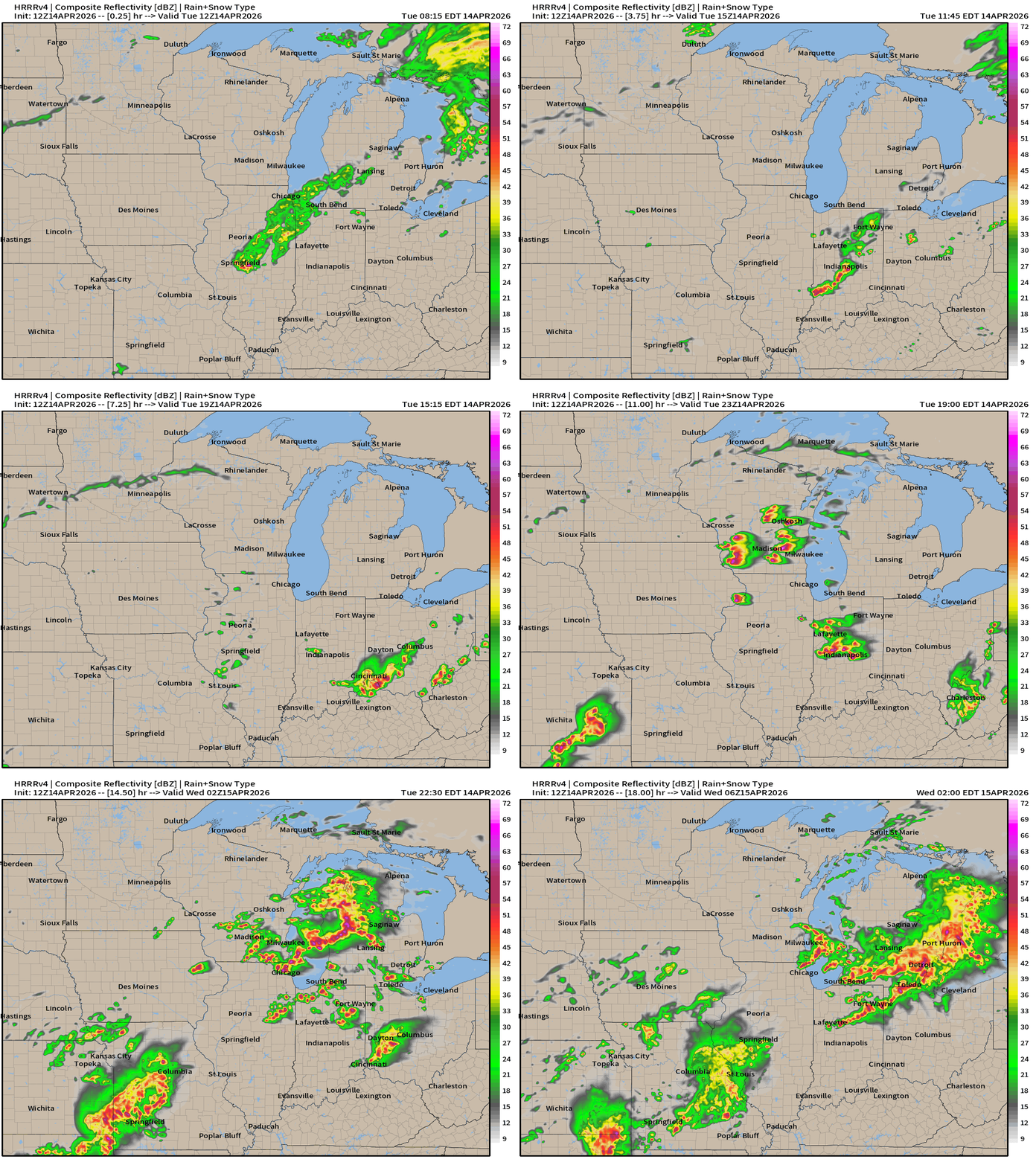
Supercells will fire into the Evening out of Iowa and push east into Lower Michigan overnight.
HRRR 12z Precipitable Water Next 48-hours (my favorite parameter)
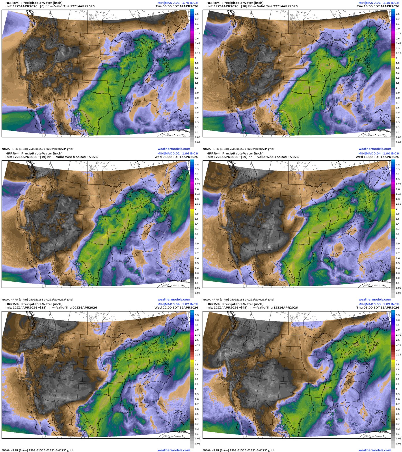
Weather on Wednesday: similar story as today with the frontal boundary and low pressure systems blocked from pushing east by the strong ridge hung up on the East Coast
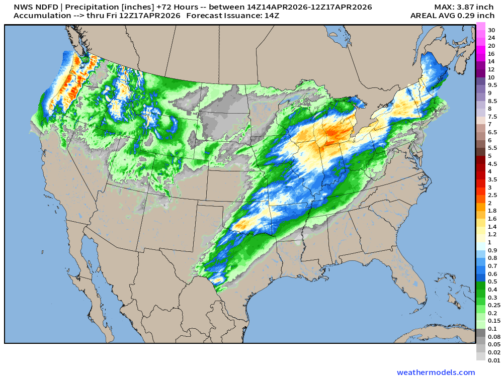
NDFD NWS Total Precipitation Next 72-hours through Friday Morning
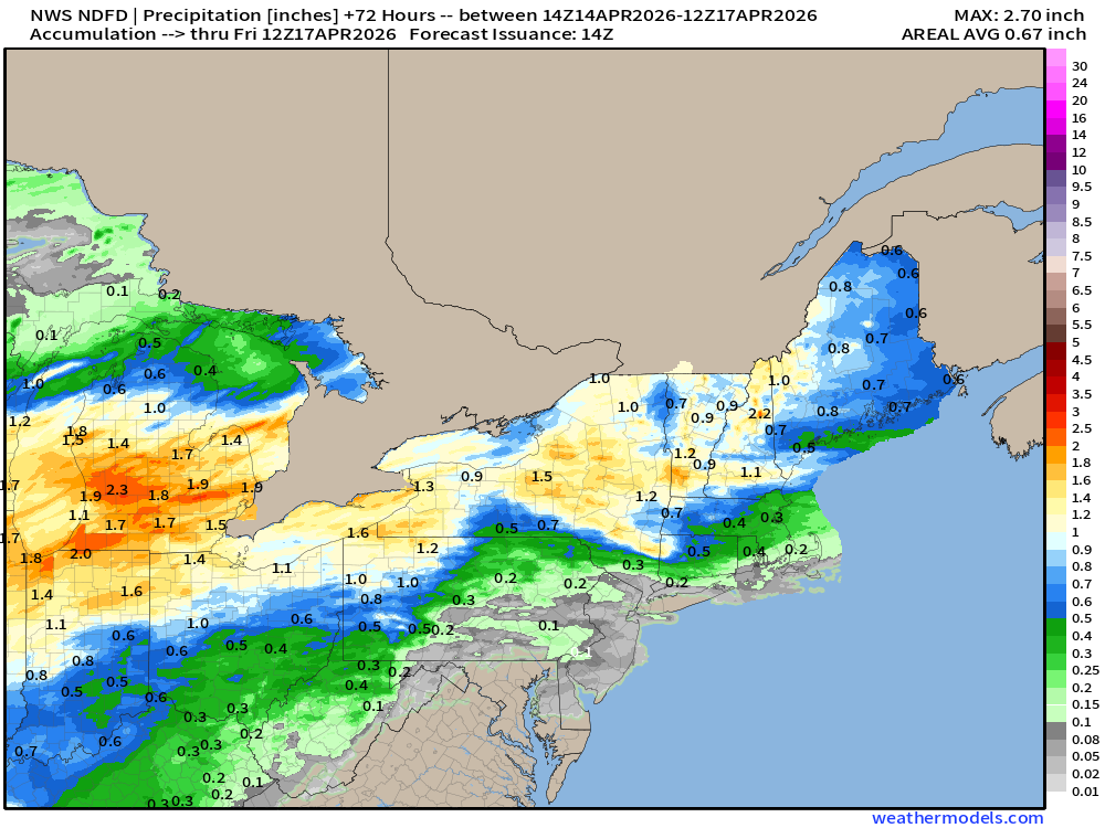
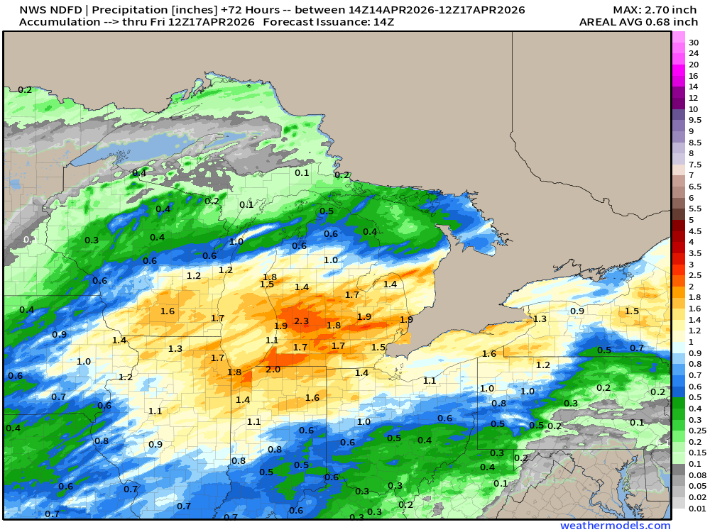
NWS Snowfall Next 72-hours — through Friday Morning
ECMWF 06z | Forecast 6-days of Precipitable Water (my favorite parameter)
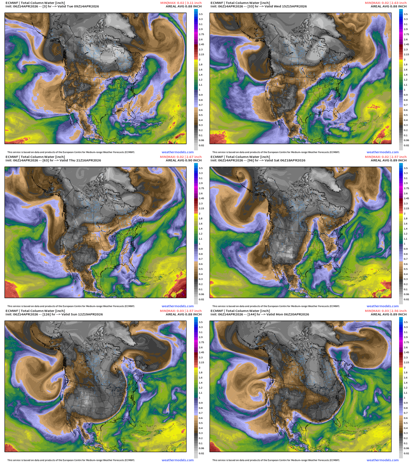
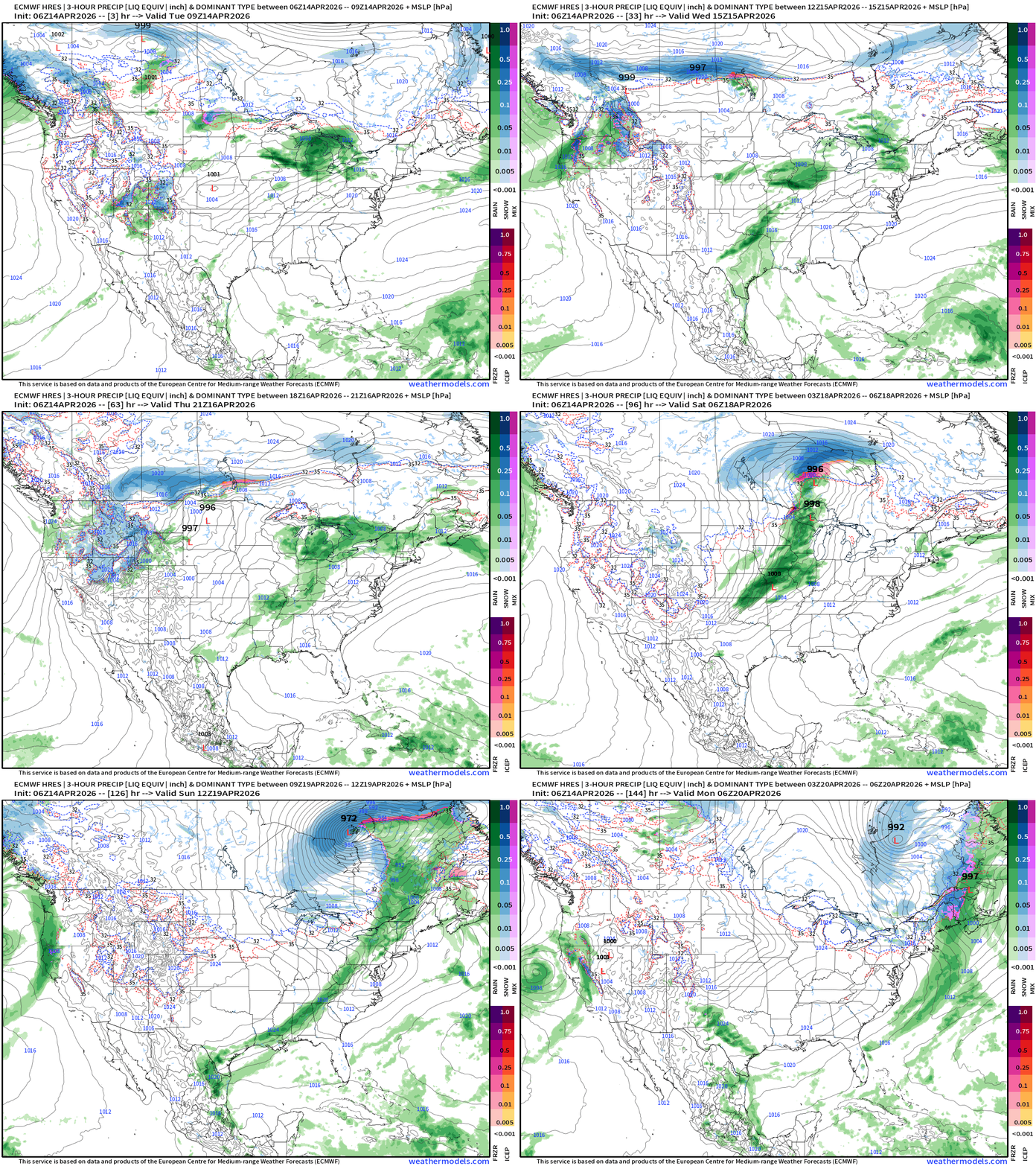
A strong cold front blasts through the central and Eastern U.S. this weekend
ECMWF 06z Precipitation Type + Intensity | Next 6-days
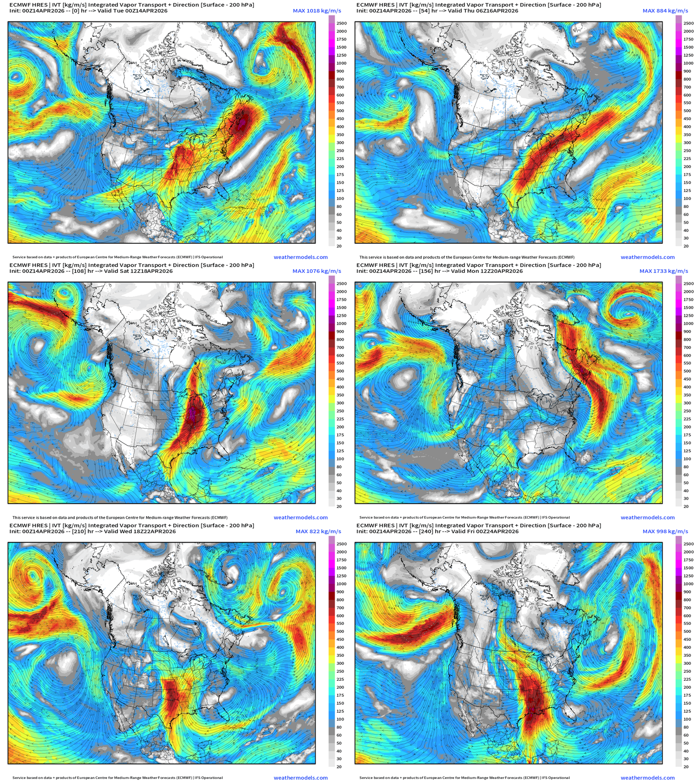
Moisture Transport (IVT) next 10-days
Total Precipitation Next 10-days | Blend of Models
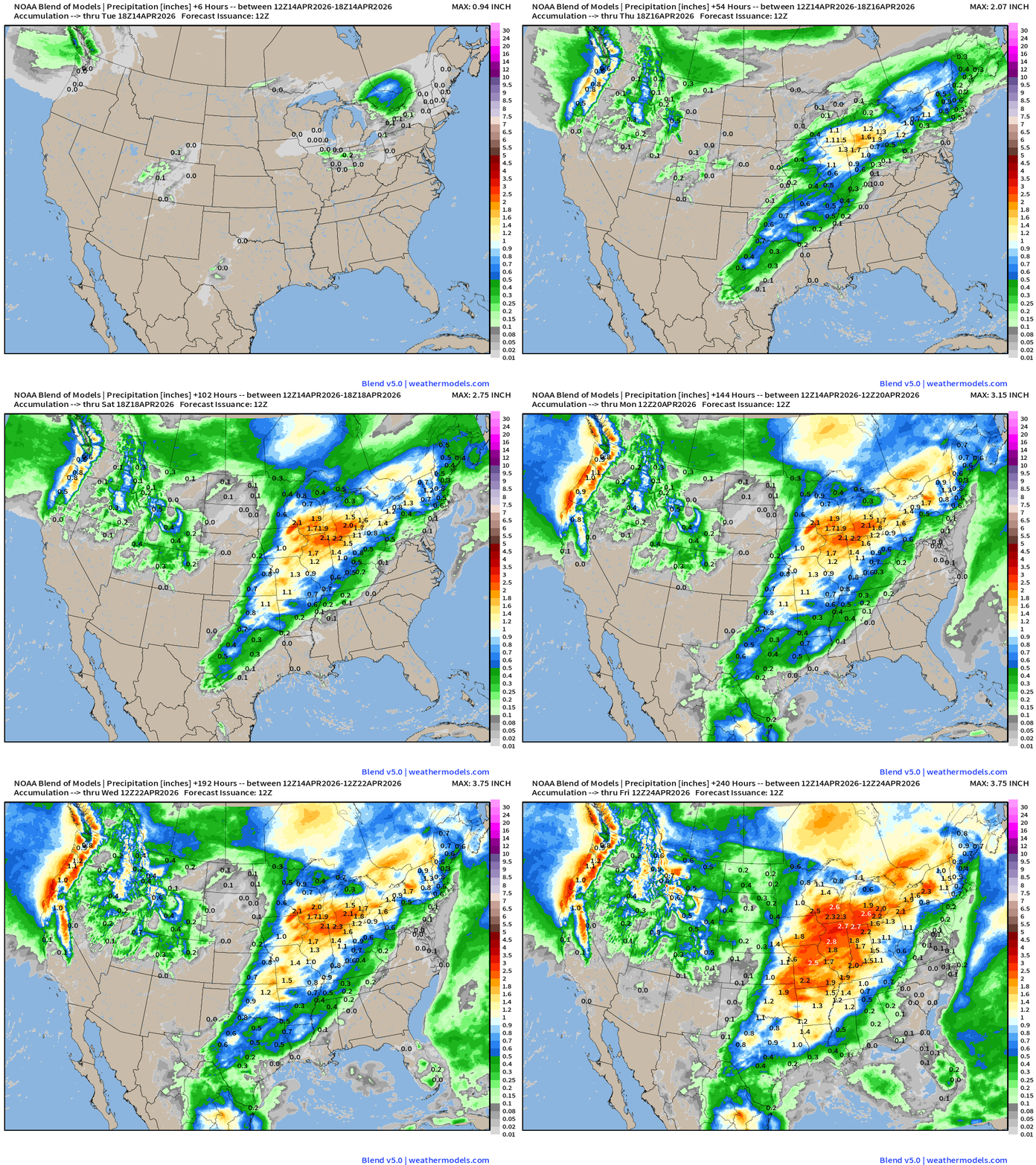
Ring of fire pattern with zip/zero rainfall across the Southeast.
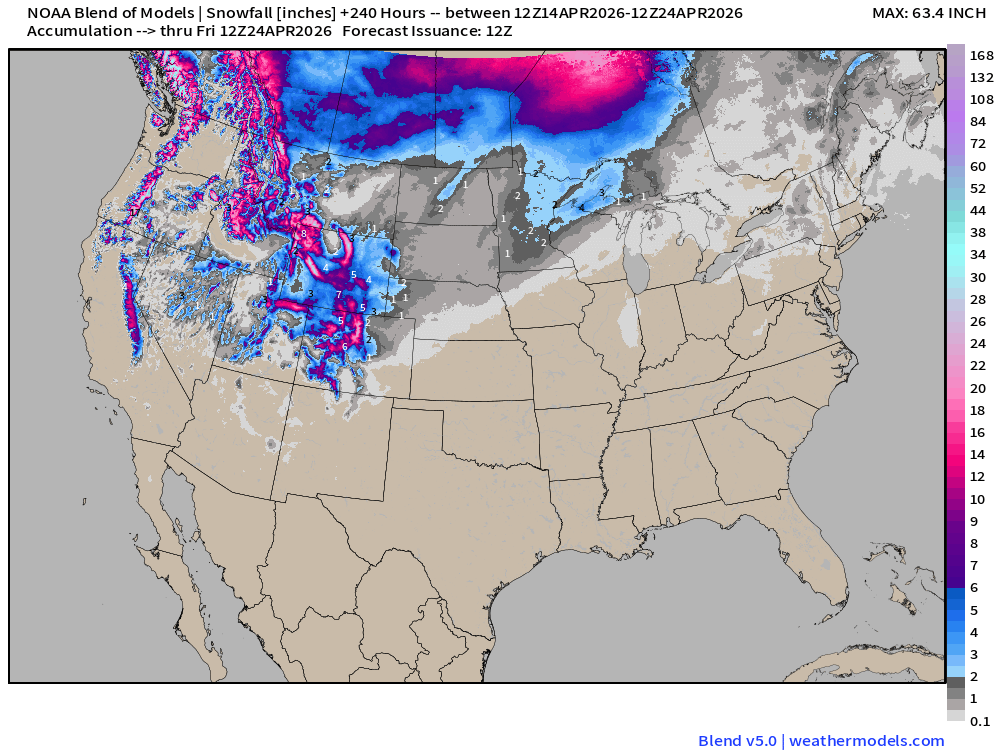
Blend of Models | Total Snowfall Next 10-Days
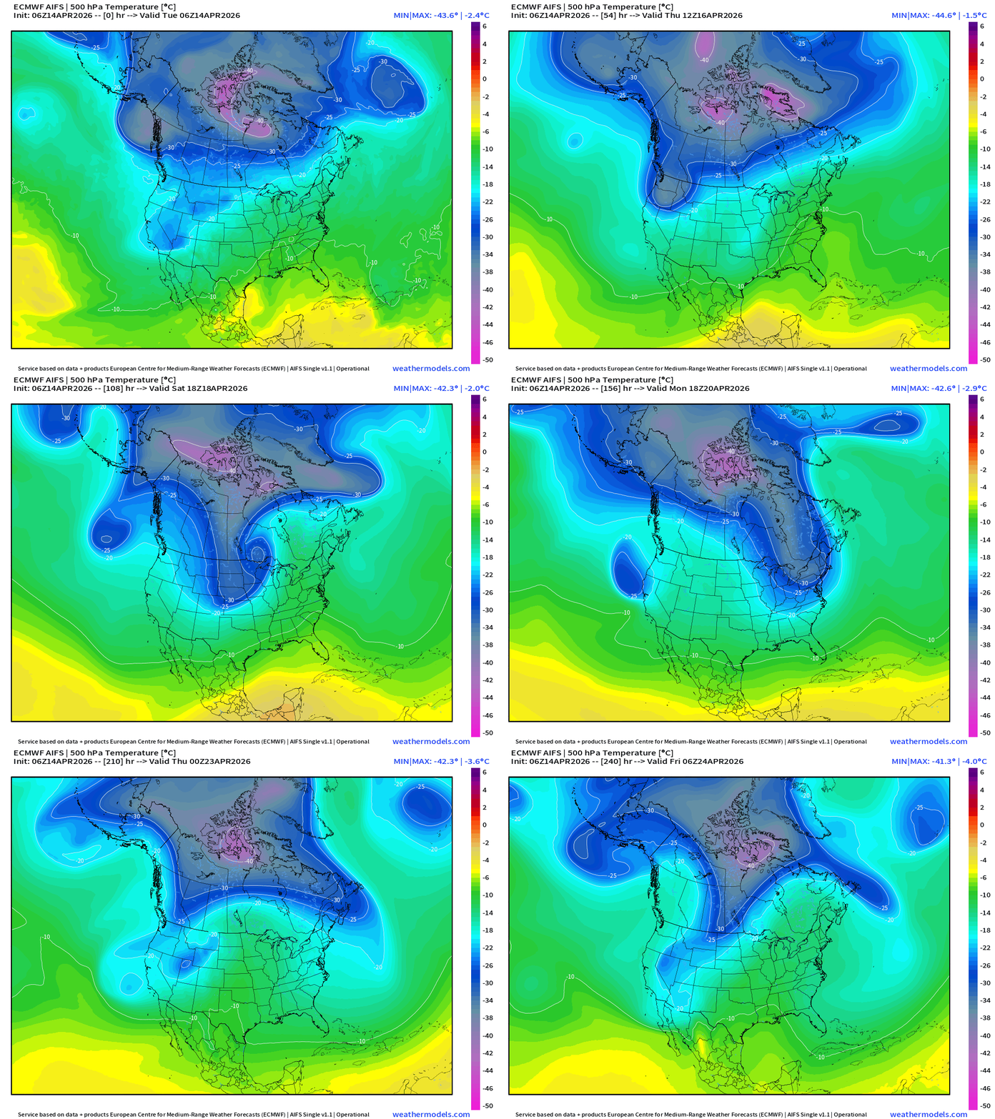
ECMWF AIFS 06z next 10-days of 500 mb Height Anomaly
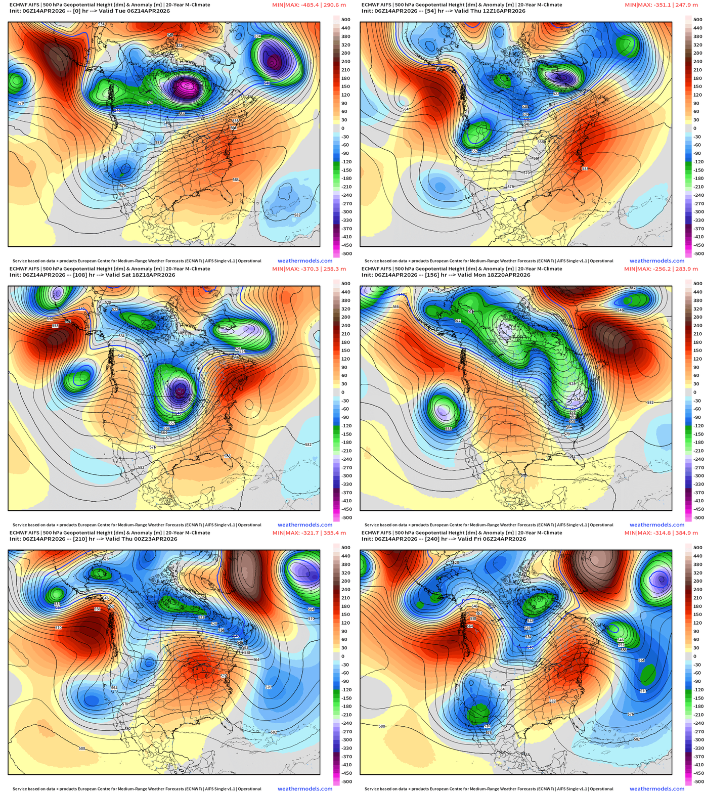
The Hudson Bay Polar Vortex continues to spin for a few more days before moving on into the Atlantic. This happens at same time as the Eastern US ridge breaking down this weekend with a trough, and then we repeat the process with another mobile ridge moving across the Eastern U.S.
Blend of Models Temperatures | Highs through Wednesday, April 22
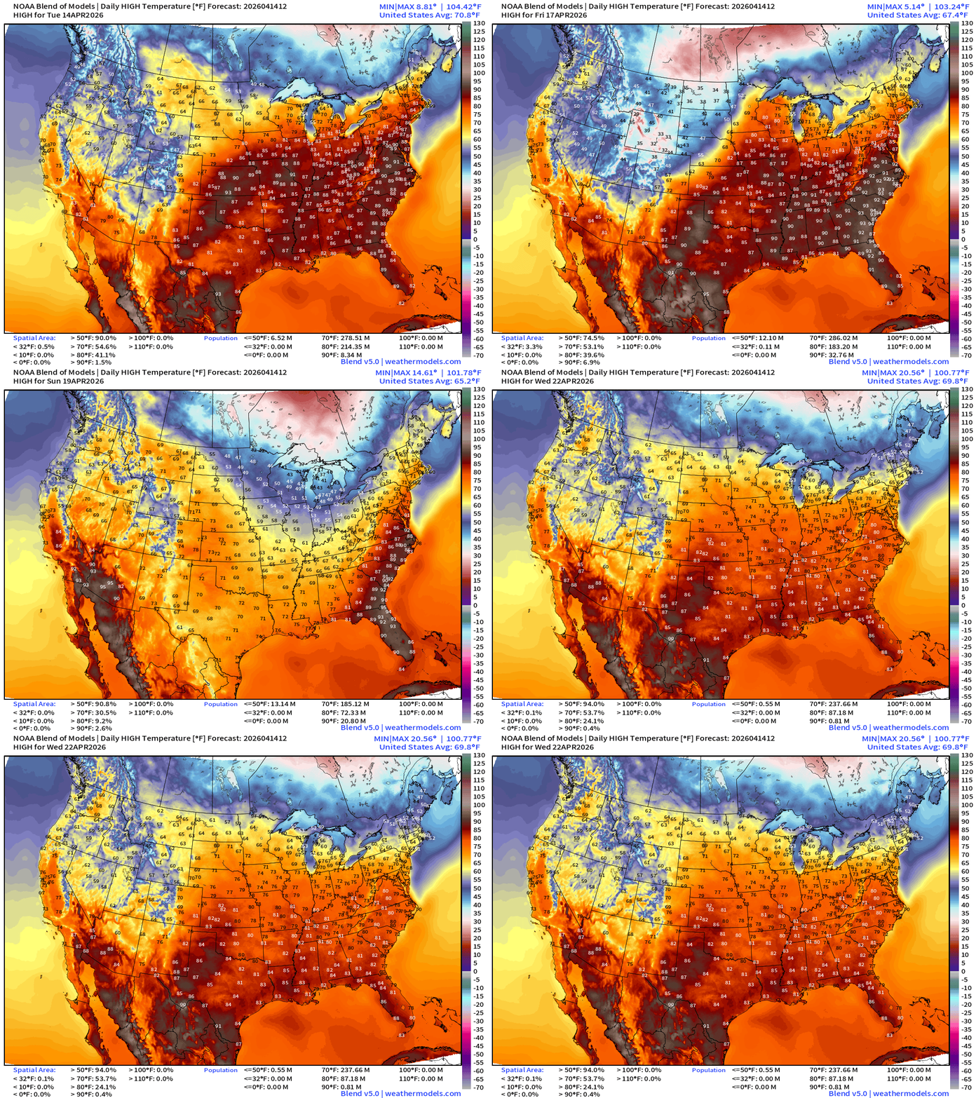
Blend of Models Temperatures | Lows through Wednesday, April 22
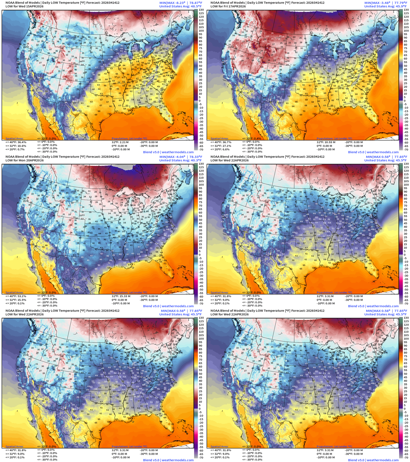
Low Temperatures Wednesday
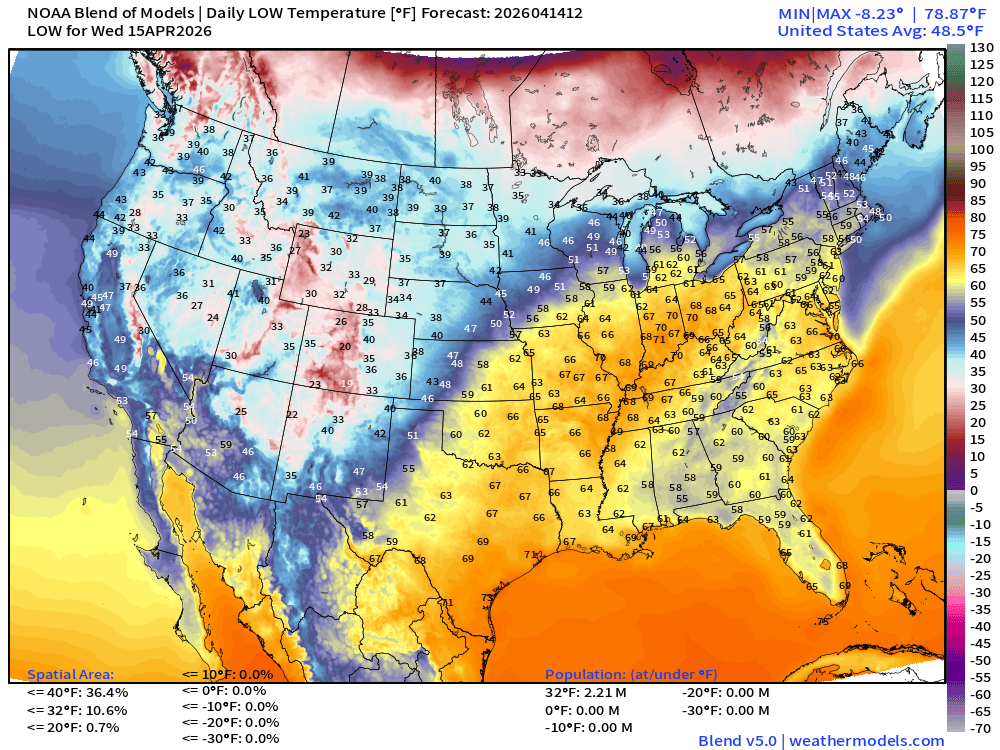
Only 2.2 million below freezing
High Temperatures on Wednesday
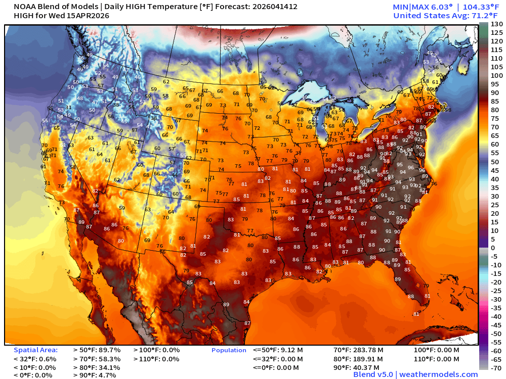
189 million at least 80°F and now over 40 million at least 90°F —> western U.S. cool!
ECMWF AIFS 06z | Temperature at 500 mb | Next 10-days
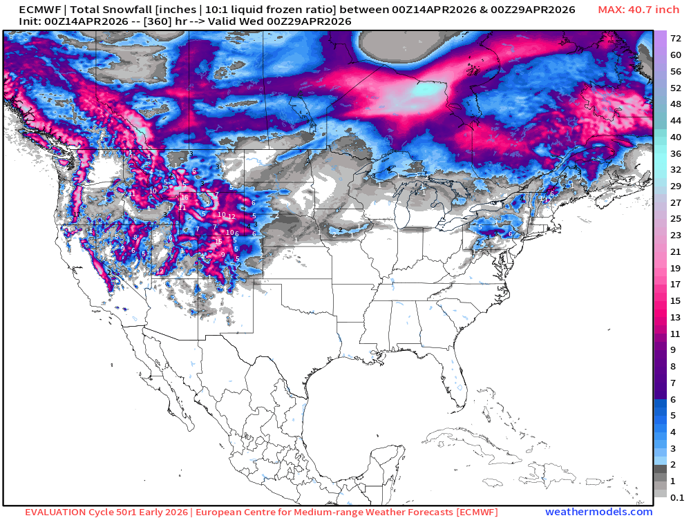
Snowfall from ECMWF HRES (15-days) | New Cycle 50r1 (May 12th upgrade)
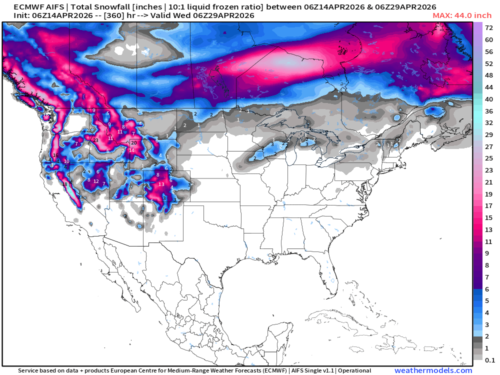
Snowfall from ECMWF AIFS-Single (06z) next 15-days
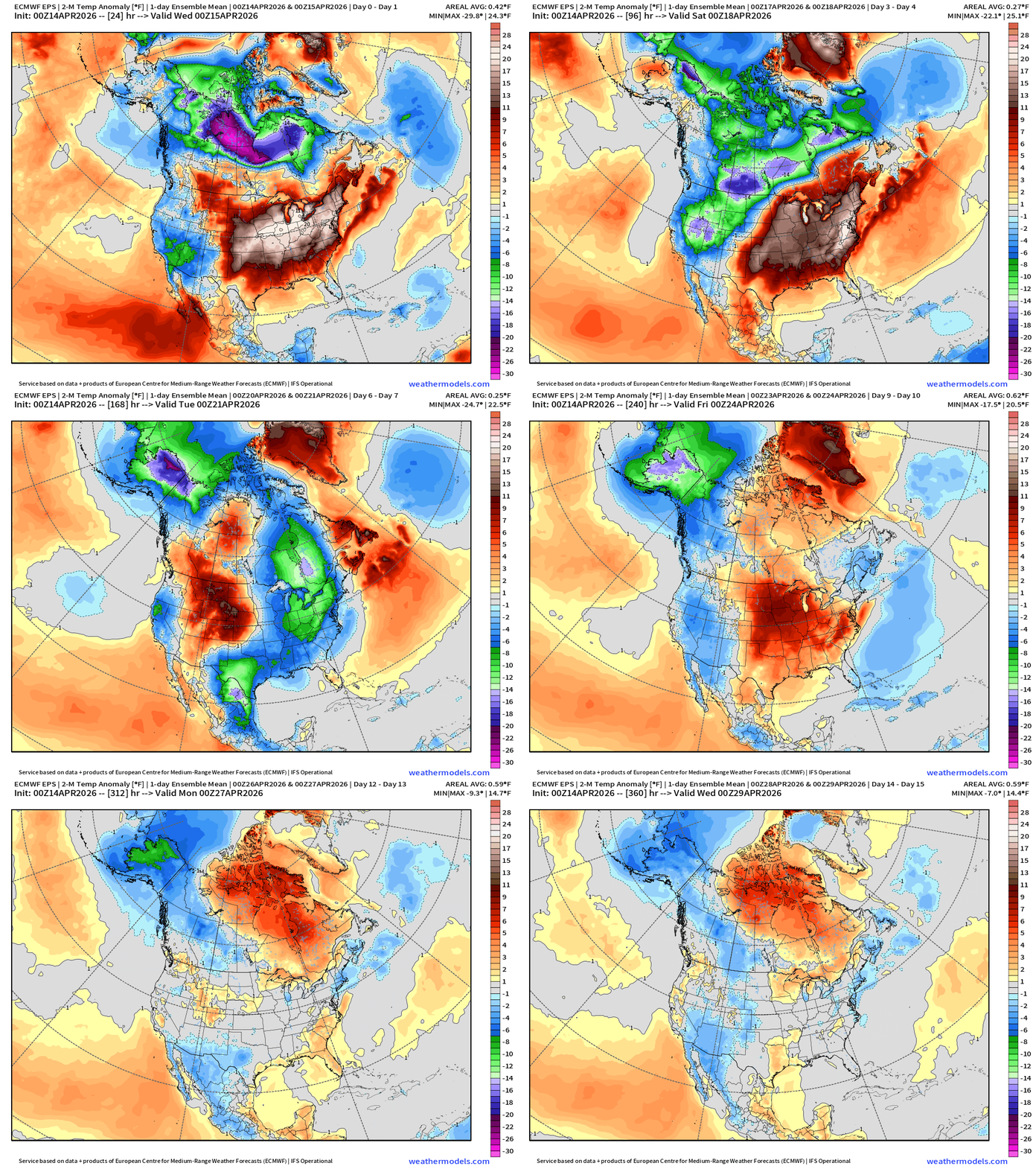
Temperature Anomaly | Next 15-days | ECMWF EPS 00z Ensemble Mean
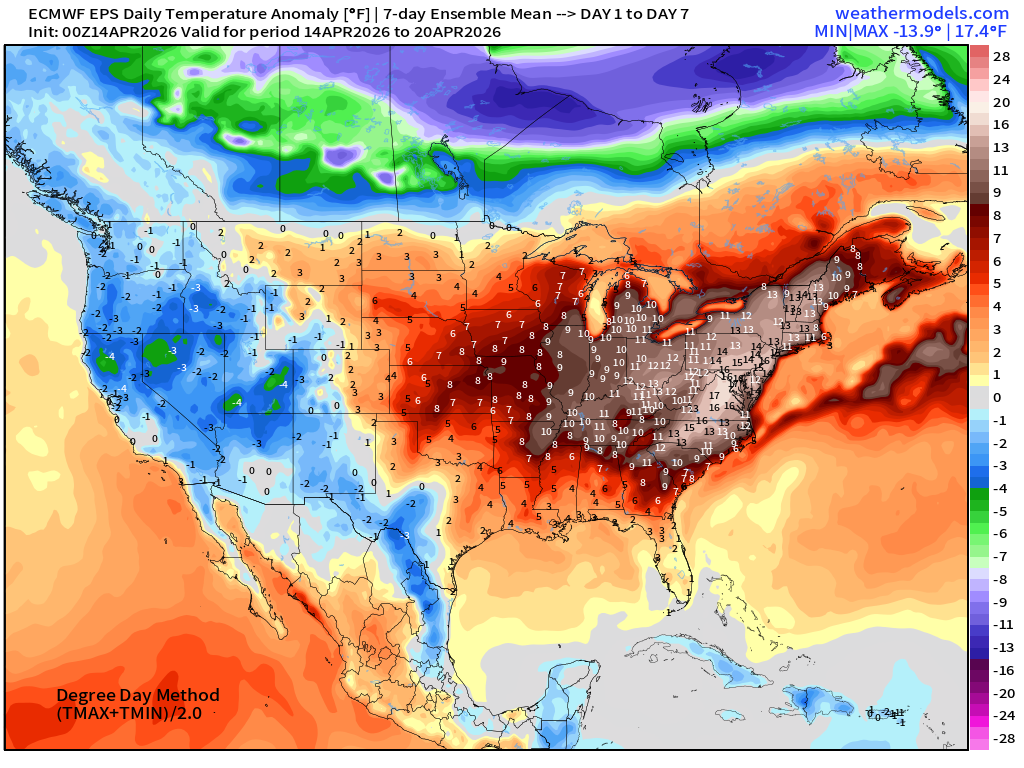
Week #1 | Temperature Anomaly | April 14 - April 20
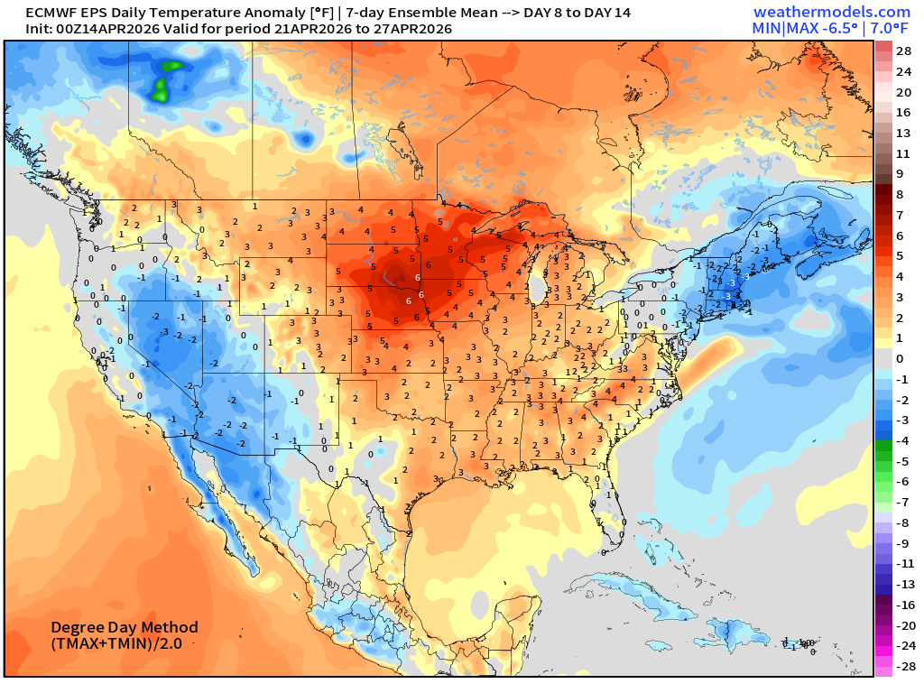
Week #2 | Temperature Anomaly | April 21 - April 27
April 7: 2026 Atlantic Seasonal Hurricane Forecast: 11/5/2
9-13 Named Storms (11 most likely)
4-7 Hurricanes (5 or 6 most likely)
1-3 Major Hurricanes (2 most likely)
ACE: 75-85
Maps sourced from weathermodels.com designed and innovated by yours truly! Please subscribe there for real-time access to the newest maps, charts from all of the weather models including ECMWF and AIFS, and NOAA GFS/GEFS. NOAA WPC and SPC for fronts/convective outlooks.
- Milepost
- 918 · laid 2026-04-14T15:11:03.682000Z
- Source
- https://weather.substack.com/p/april-14-2026-tuesday-spring-weather
- Digest
- 7cddbf42a5f2638da55890fc280f8c39793a19ff4d3484e5c1df448f4e3c797d
- Machine
- JSON