April 6, 2026 Monday Spring Weather
Super Typhoon in Western Pacific on the way + two Southwest Pacific cyclones
April 2026 was the 3rd-warmest April in the 132-year national record (1895–2026), at 54.7°F against a 1991–2020 normal of 51.8°F (+2.9°F).
April 2026 was the 46th-wettest April in the 132-year national record (1895–2026), at 2.7in against a 1991–2020 normal of 2.7in (+0.0in).
NOAA/NCEI Climate at a Glance, contiguous United States. This is the observed record for the month, not a score of anything said in this piece — the forecast ledger begins 2026-08-17 and cannot reach earlier posts.

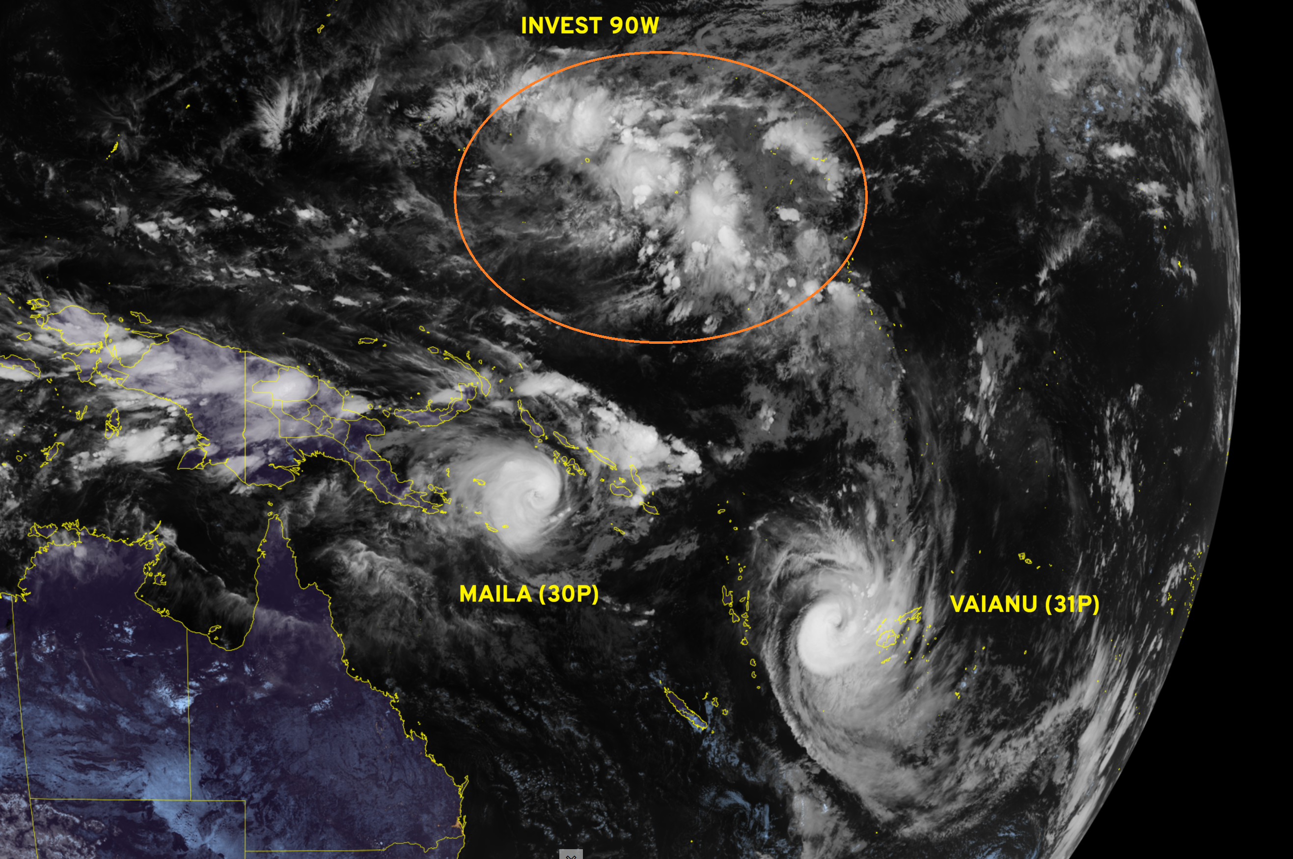
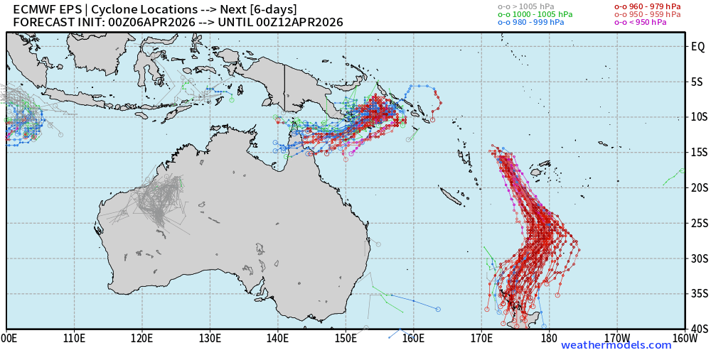
Western Pacific busy on Monday with 2 named Southern Hemisphere Tropical Cyclones (Maila and Vaianu) and Invest 90W on the northern side of Equator.
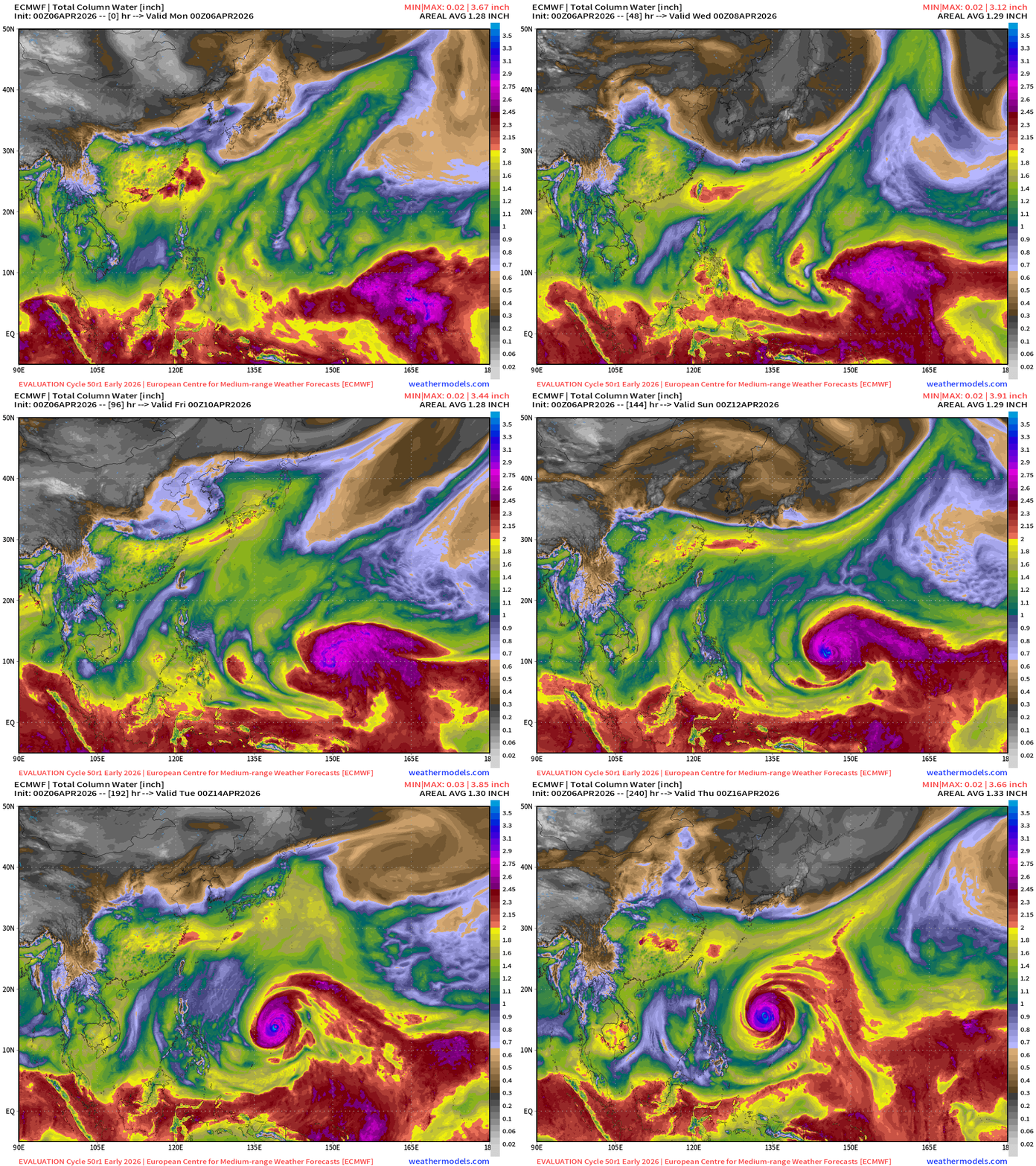
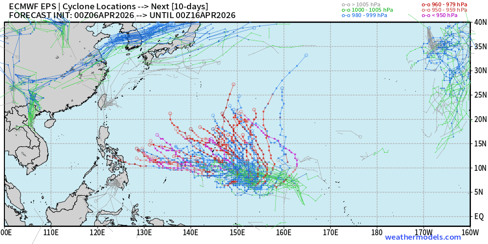
The new ECMWF Cycle 50r1 (HRES) parallel shows formation of "Sinlaku” by later this week and likely intensification to Category 4+ (Super Typhoon is 130-knots) over the warm ocean waters of the Western Pacific MDR runway. Precipitable Water next 10-days:
Weather Trader is an entirely reader-supported publication. To receive all new posts [daily] via email or the Substack App, and support our work, consider becoming a paid subscriber (April Coupon) — ALL content is generated by Ryan (not A.I.) including the maps. Thank you to new (and renewing) subscribers in March (free and paid) who support this newsletter and development behind the scenes.
Tropical Update: South West Pacific and North West Pacific
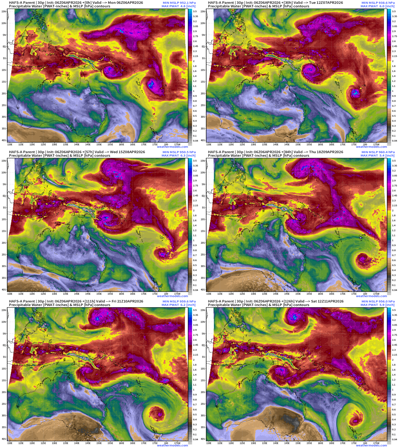
HAFS-A (mesoscale hurricane model) parent domain of Maila (30P) shows all three systems in various stages of their lifecycle. Neither of these systems rapidly intensified to Category 5 … and I’m a little surprised considering the very warm ocean conditions. However, the Southwest Pacific is apparently hostile with strong wind shear in early April.
Maila near Papua New Guinea has sputtered due to wind shear and stationary movement (cooler water upwelling) but will soon move WSW to northern Australia in 5-days but weakening.
Vaianu (31P) will safely pass west of Fiji and begin extratropical transition on way to New Zealand. There would be significant impacts to Wellington as the system wind field greatly expands!
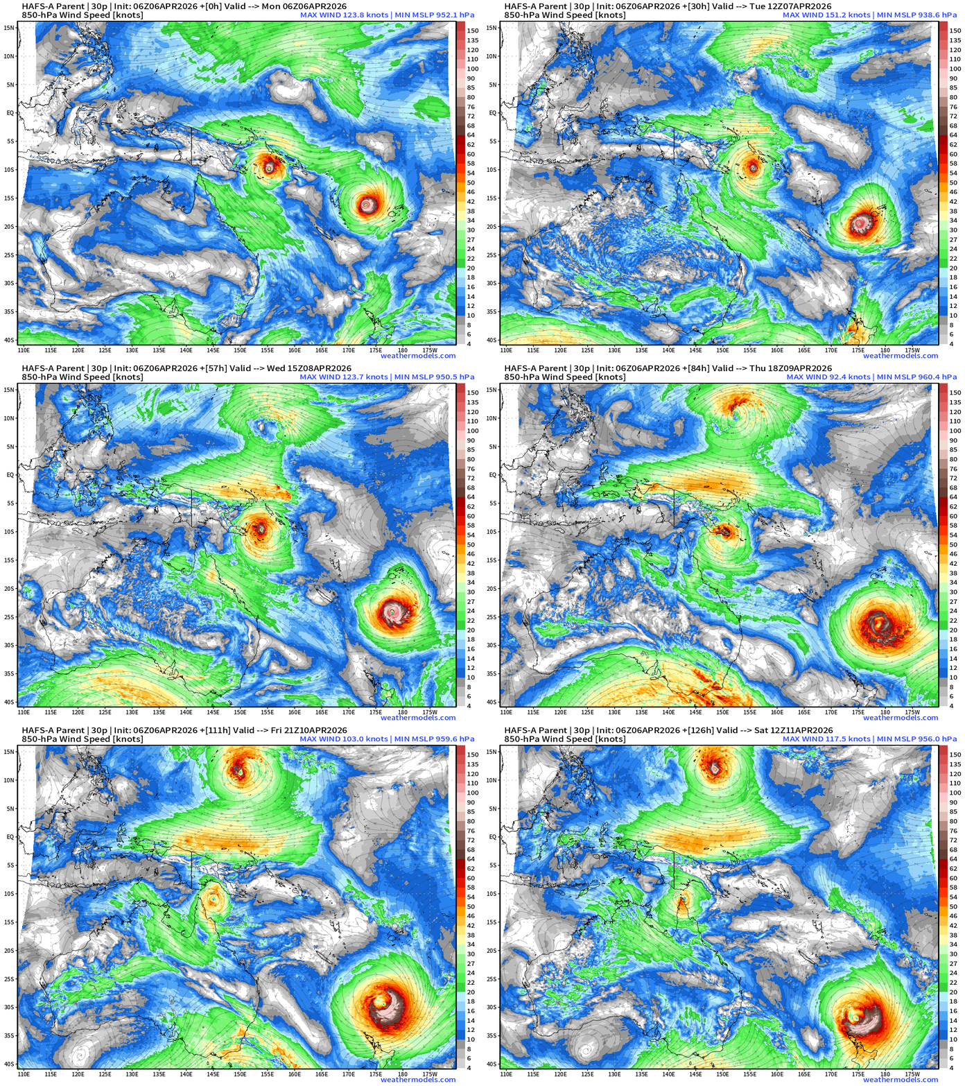
Maila (30P) | Category 2-3 | 95-knots
Vaianu (31P) | Category 2-3 | 95-knots
ECMWF Ensemble Tracks | Spaghetti 00z
ECMWF 06z | Sunday 06z — in 6-days —> Sinlaku (04W)
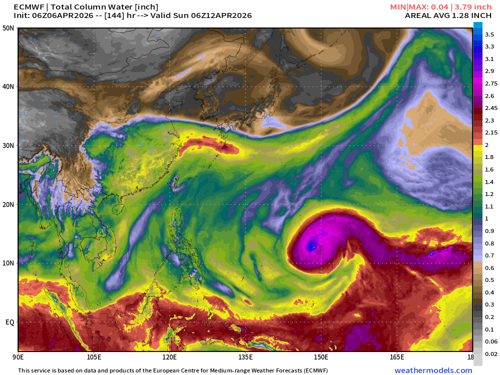
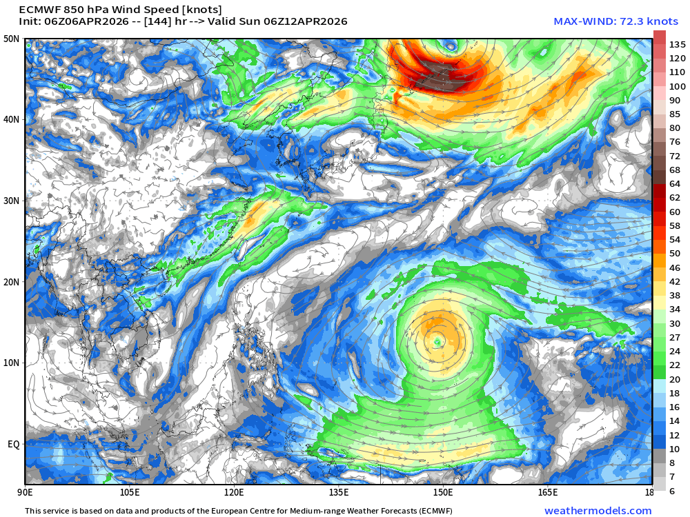
Uncertainty about track is large, of course, as it is a function of intensity. Next 10-days spaghetti:
Lower 48 Weather
HRRR 13z Radar Simulation next 18-hours into Tuesday 3 AM ET
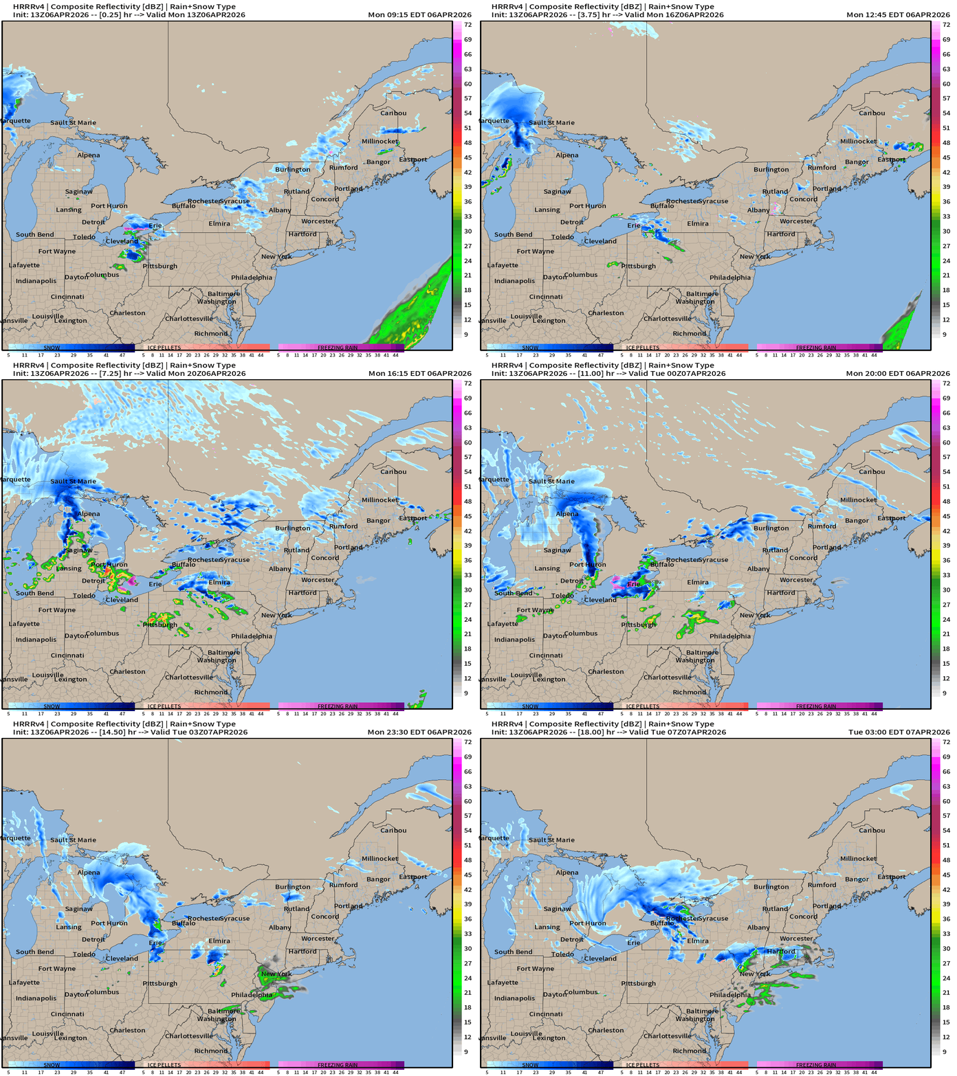
Snowfall across the Great Lakes into the Northeast today with a Clipper system for April 6th. Yikes!
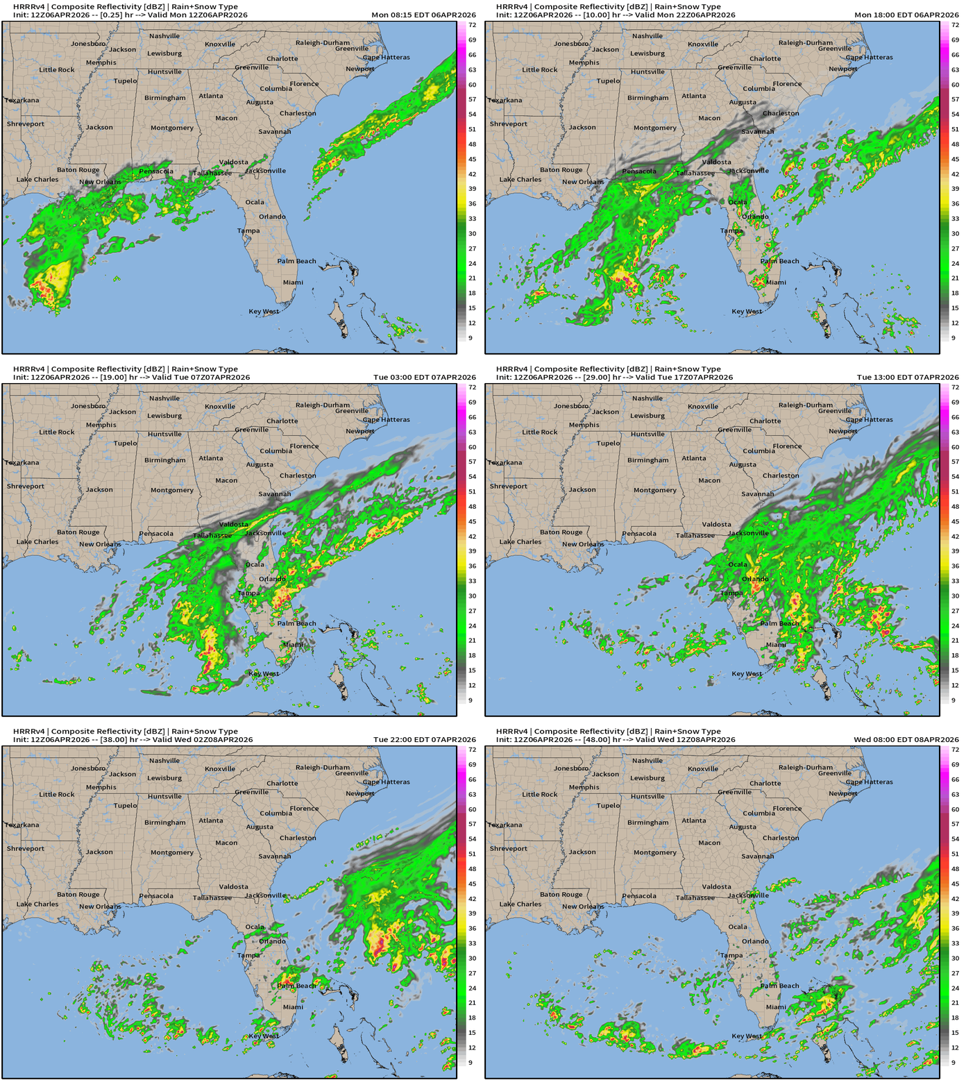
HRRR 12z — Radar Simulation Next 48-hours to Wednesday 8 AM ET
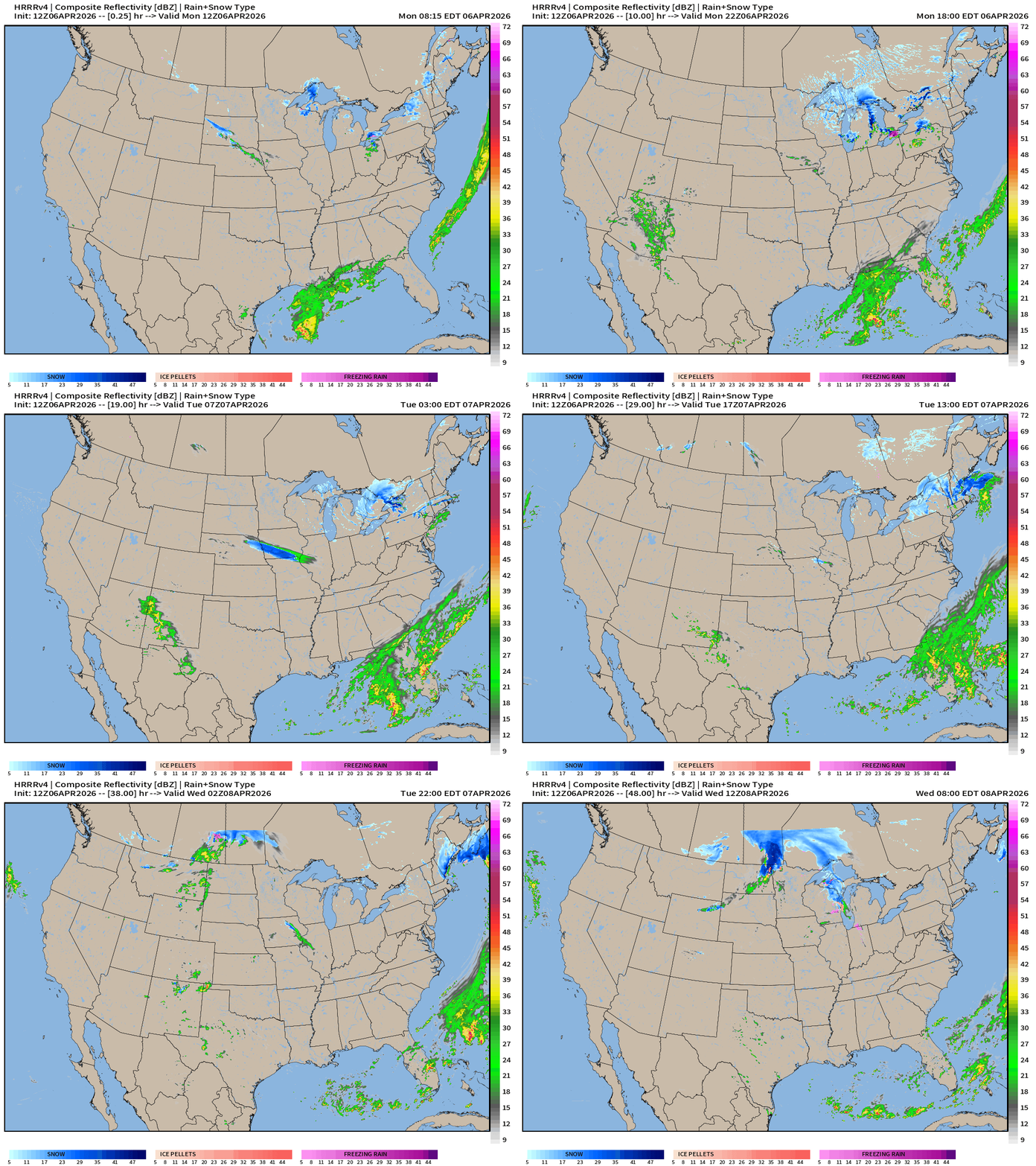
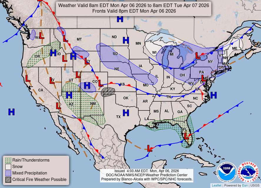
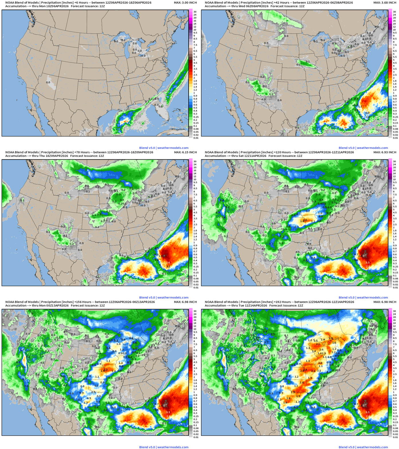
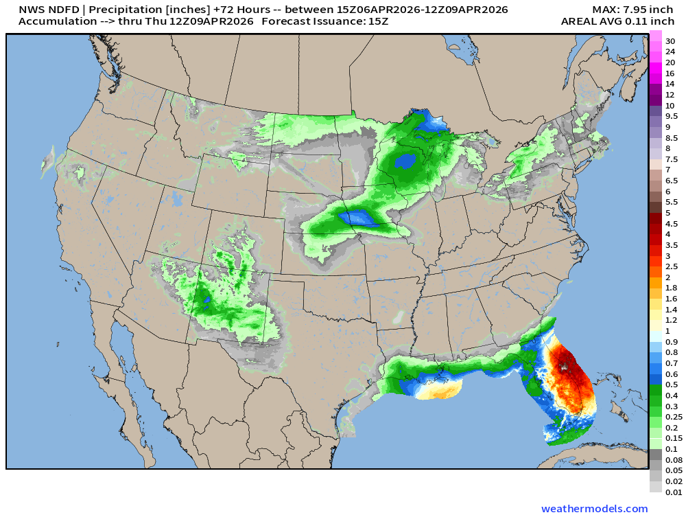
Heavy rainfall across Florida (very welcome) with hung up frontal boundary and low-pressure forming along it. Another Clipper system arrives into the Midwest and western Great Lakes early Wednesday.
Weather on Monday into Tuesday Morning
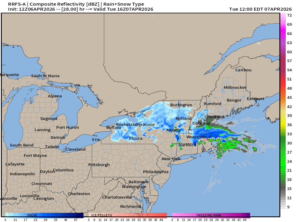
Snowfall (light) in Boston Tuesday around Noon? RRFS-A (12z)
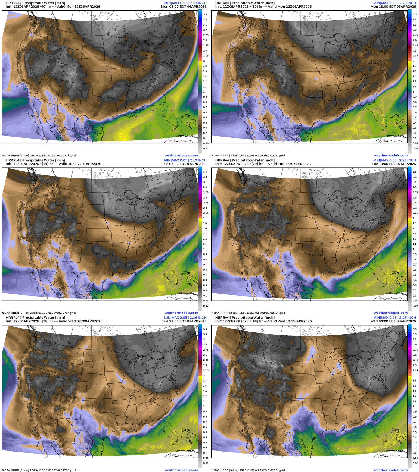
HRRR 12z Precipitable Water Next 48-hours (my favorite parameter)
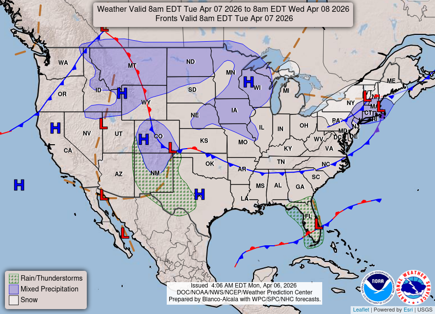
Cold front with return easterly flow around low pressure center on eastern Atlantic coast of Florida
Cold and dry Canadian Arctic “polar vortex” infused air mass across Great Lakes into the Northeast
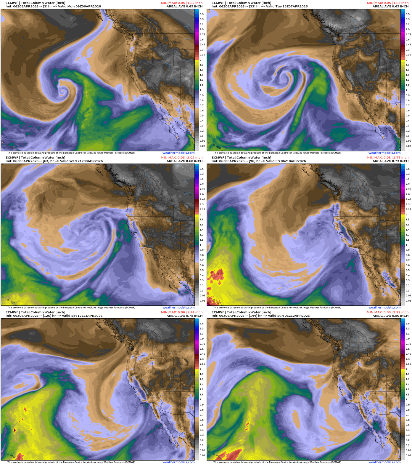
ECMWF 06z | Forecast model 6-days of Precipitable Water (my favorite parameter)
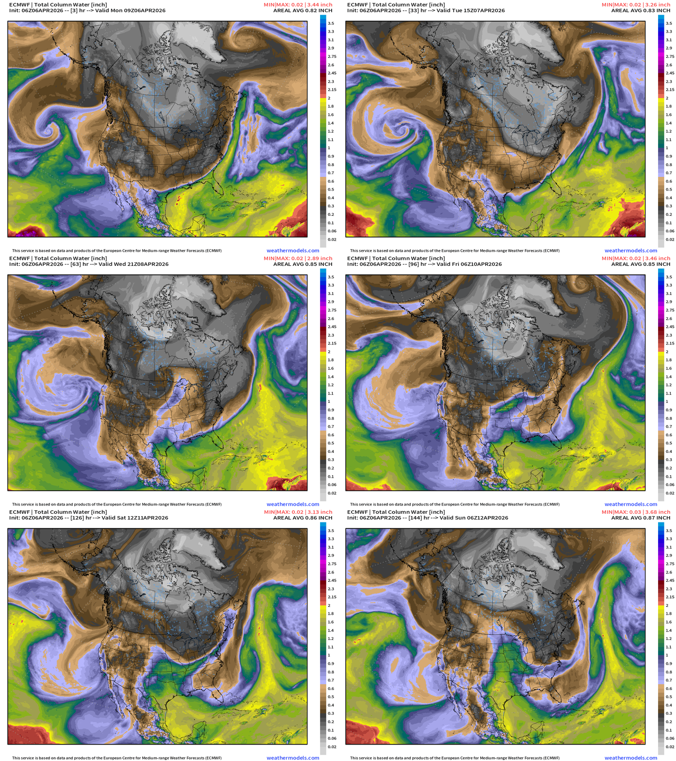
We are still not done with winter across Canada with the main “polar vortex” still cranking away over Hudson Bay … and passing storm systems along the Canadian border can grab some of that chilly air and bring it southward — enough for some light snowfall into mid-April.
Western U.S. low pressure spins well offshore but moisture in a weak atmospheric river eventually reaches the coast on Wednesday.
ECMWF 06z Precipitation Type + Intensity | Next 6-days
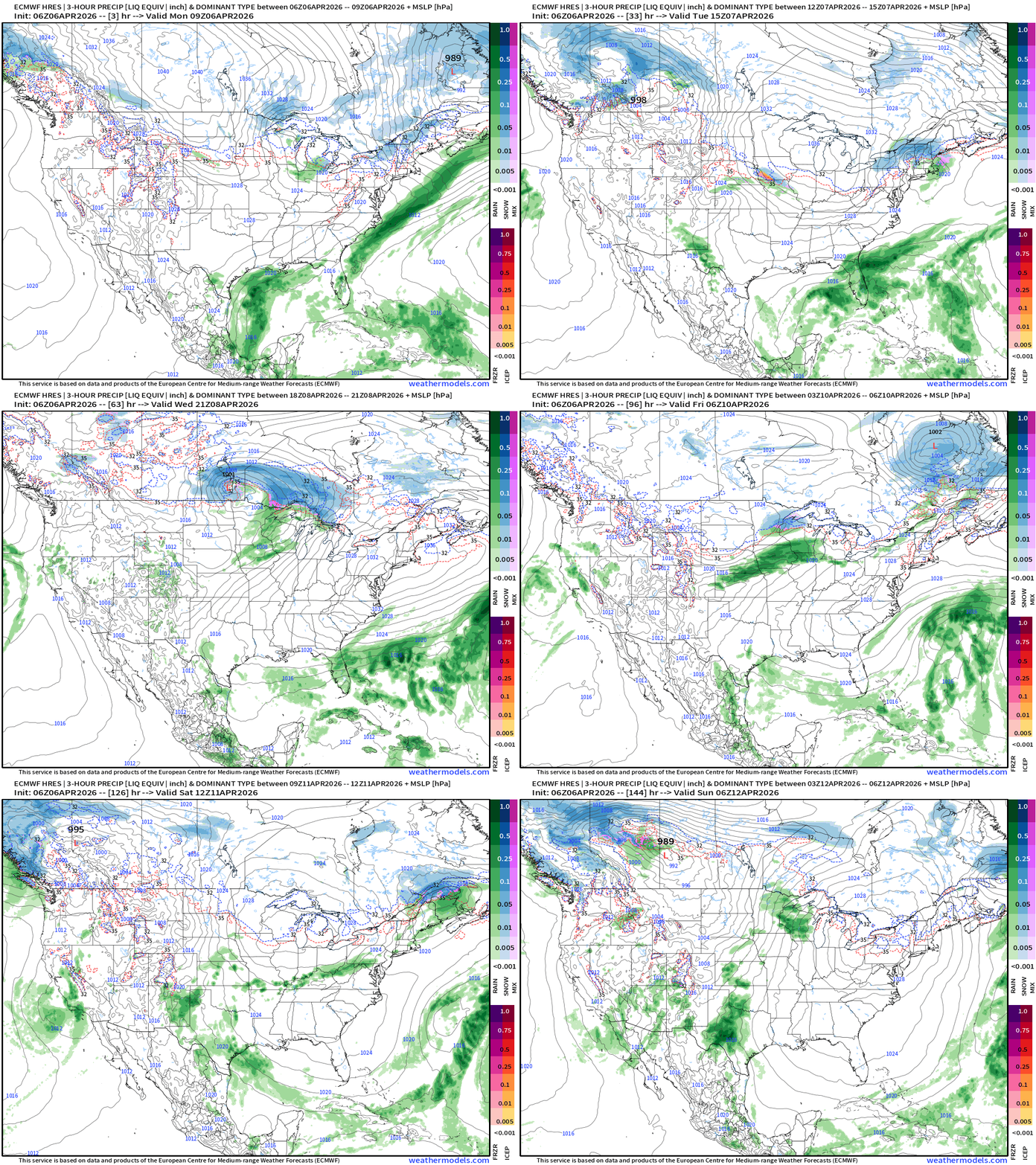
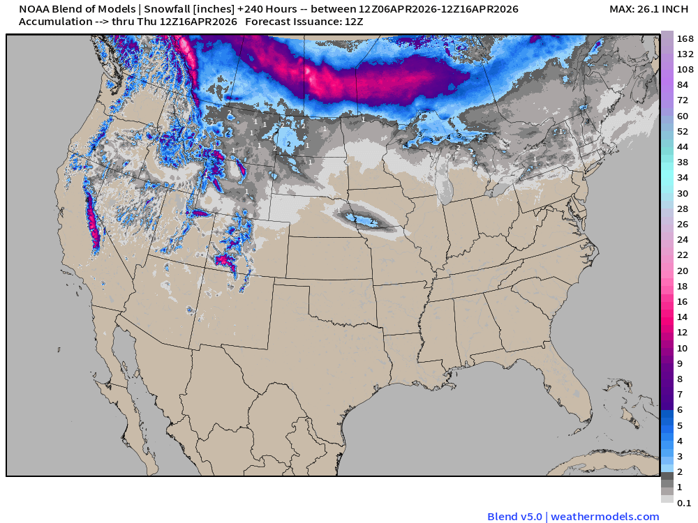
I count 3 Clipper Systems racing across the Midwest into the Great Lakes and Northeast during the next 6-days with unsettled / cooler weather including some snowfall.
Florida rainfall on eastern Atlantic coast, and some moisture across the Western U.S.
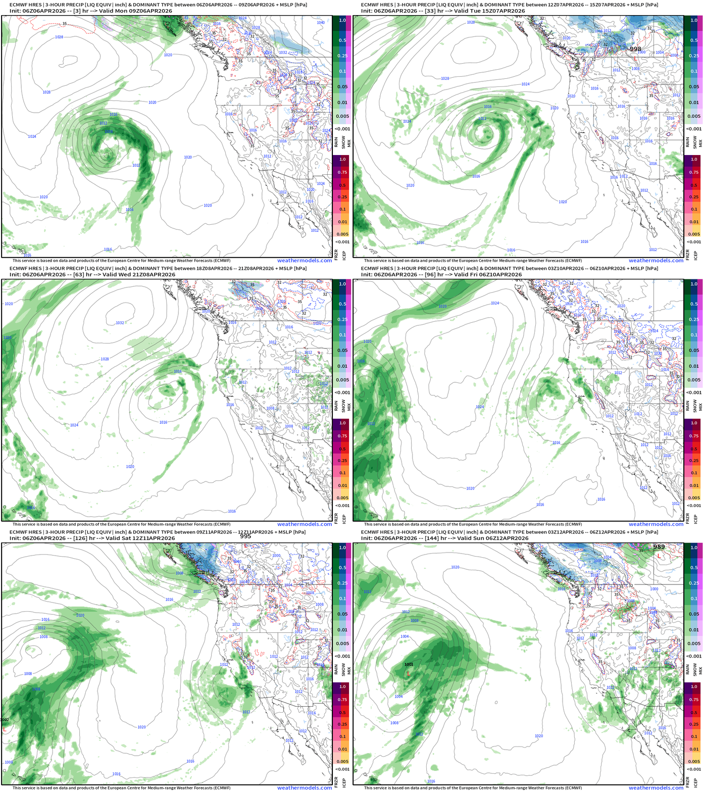
Not seeing any organized severe weather for the next 6-days with the “polar vortex” running the show across the Lower 48.
Looking at Moisture Transport (IVT) next 12-days for reopening of the Gulf of Mexico and southerly flow (moist and warm)
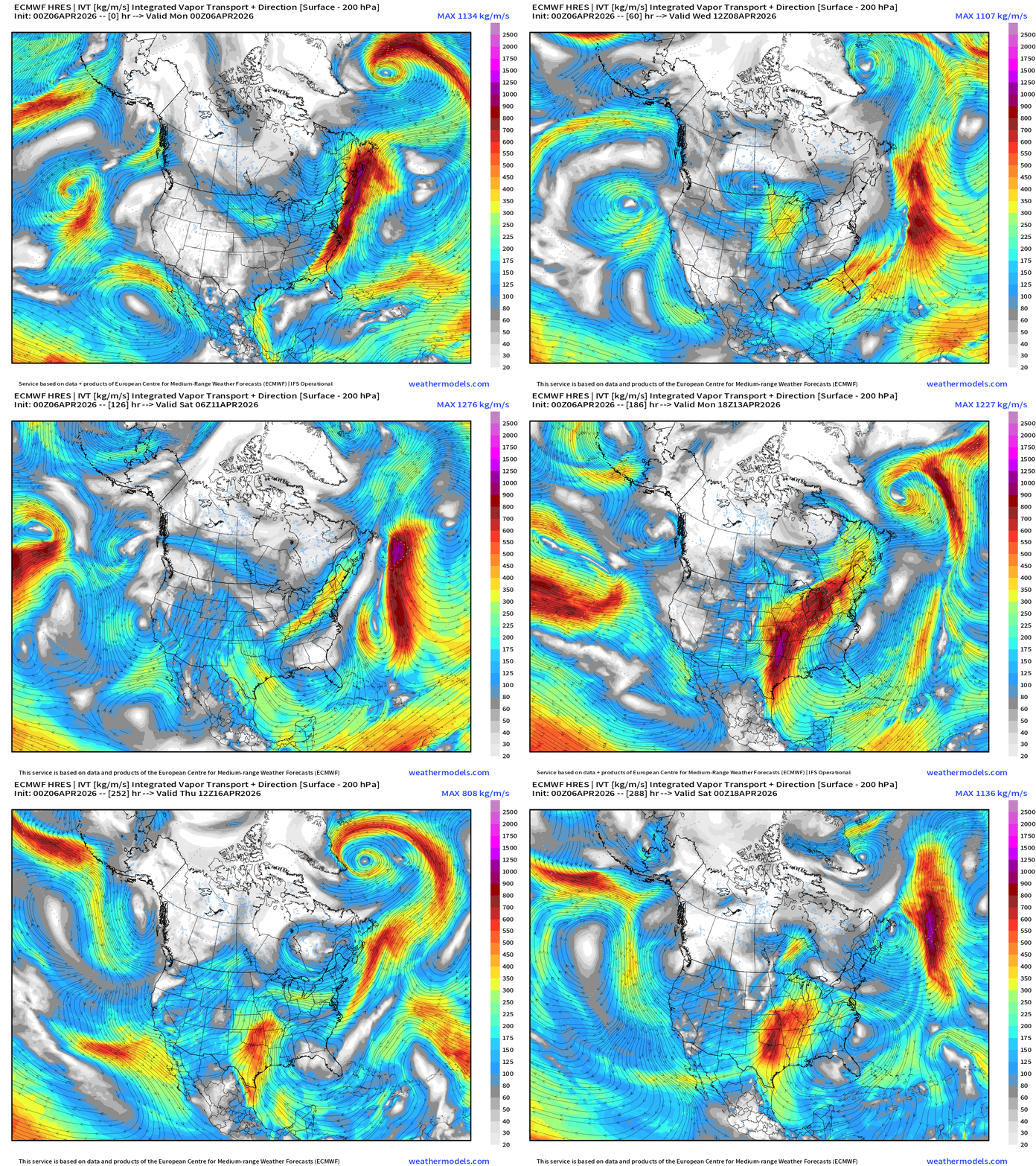
Next Monday — Tuesday —> next pattern shift to warm, southerly flow = convective threat
RTMA Current Temperature Analysis | 10:45 AM ET
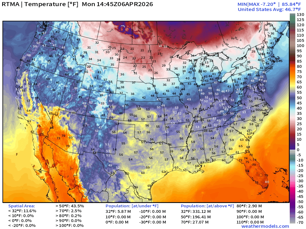
Lower 48 average was 46.7°F
RTMA Current Temperature Anomaly Analysis | 10:45 AM ET
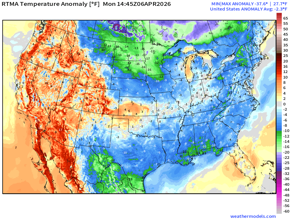
Lower 48 was 2.3°F BELOW normal
Model Predictions | ECMWF AIFS 06z next 10-days of 500 mb Height Anomaly
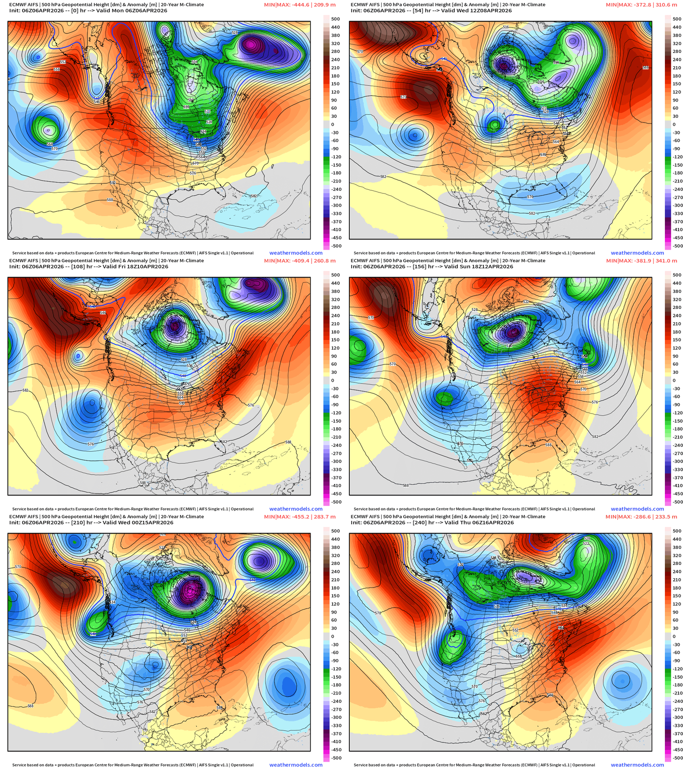
Amazing to see — the Hudson Bay Polar Vortex continues to spin for the next 7-10 days … and any Gulf of Alaska / Pacific shortwave disturbances are collected back into the fold over Canada. Ridging will finally arrive for weekend into next week = significant warming trend across Eastern U.S.
North America Temperature Anomaly Next 6-days
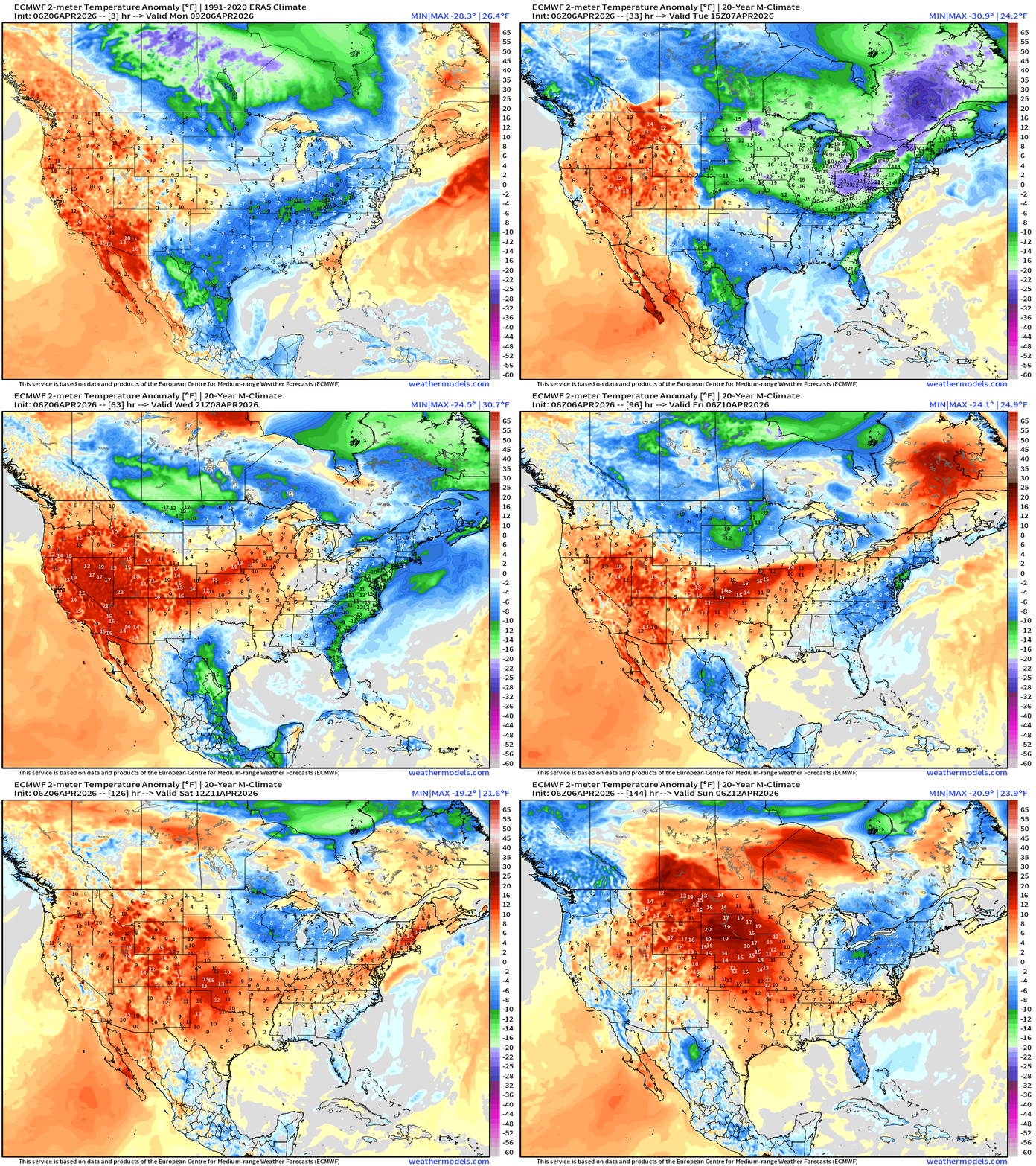
A lot of green/blue for the next 6-days settles across the Great Lakes and Northeast
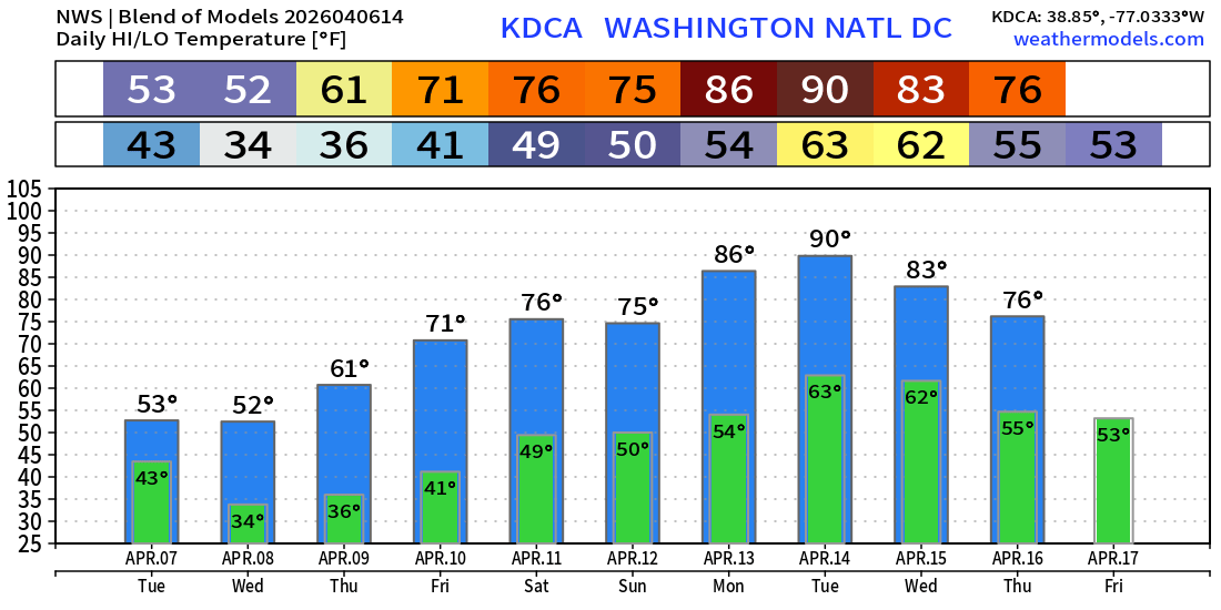
Blend of Models Temperatures | Highs through Tuesday, April 14
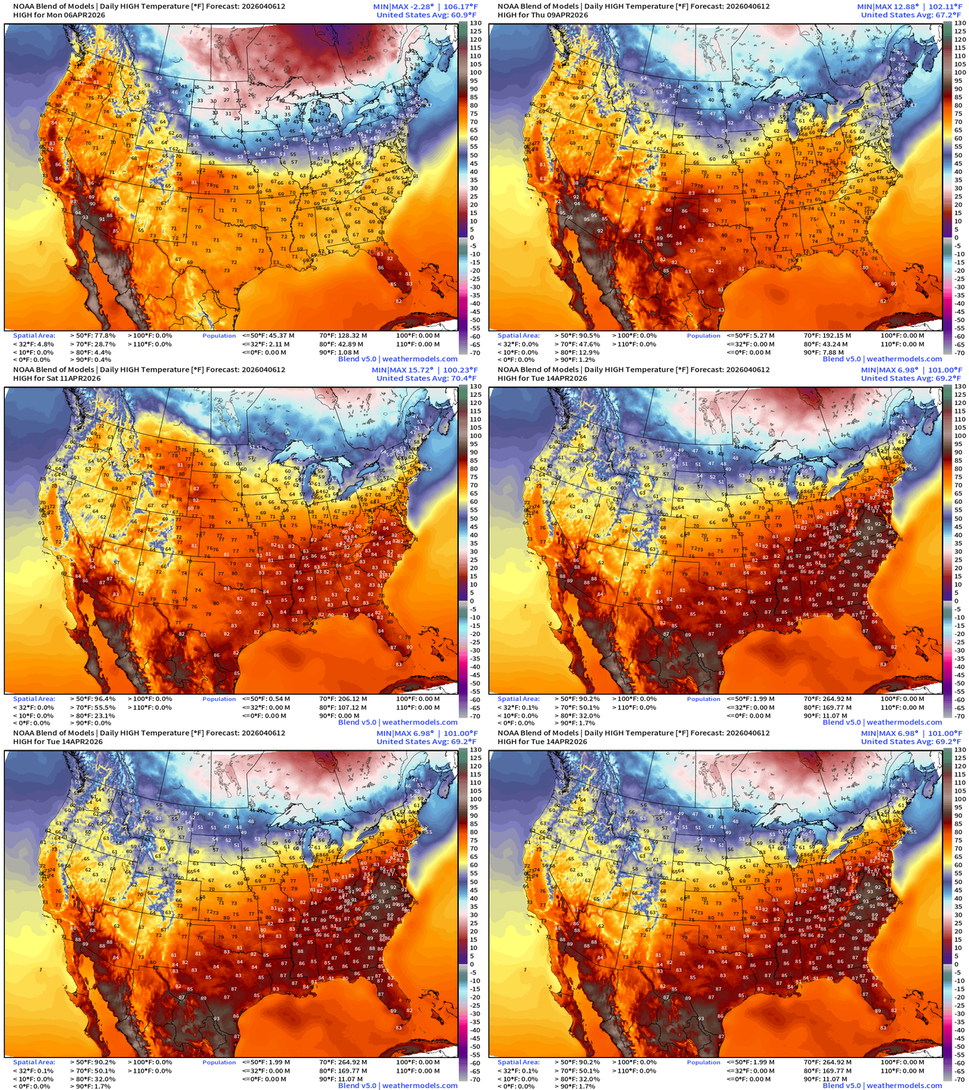
Much hotter into next week with 90s appearing in the Mid-Atlantic
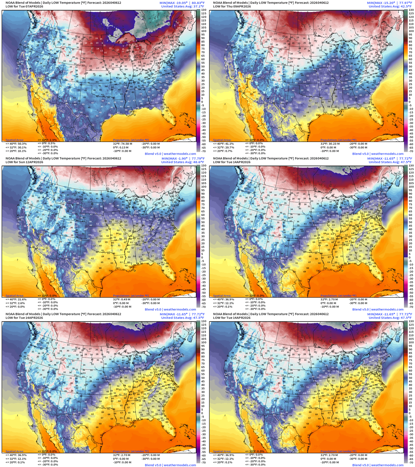
Blend of Models Temperatures | Lows through Tuesday, April 14
Blend of Models | Total Snowfall Next 10-Days
Blend of Models | 8-Days Precipitation Total
NDFD NWS Total Precipitation Next 72-hours through Thursday Morning
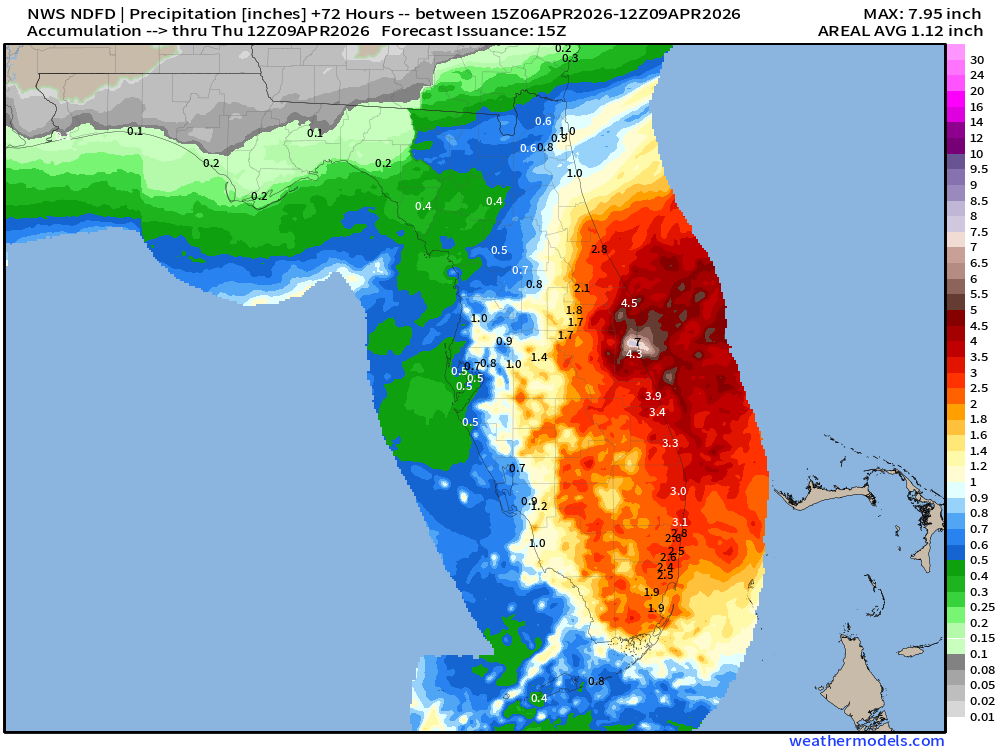
NWS Snowfall Next 72-hours — through Thursday Morning
High Temperatures Today | Monday
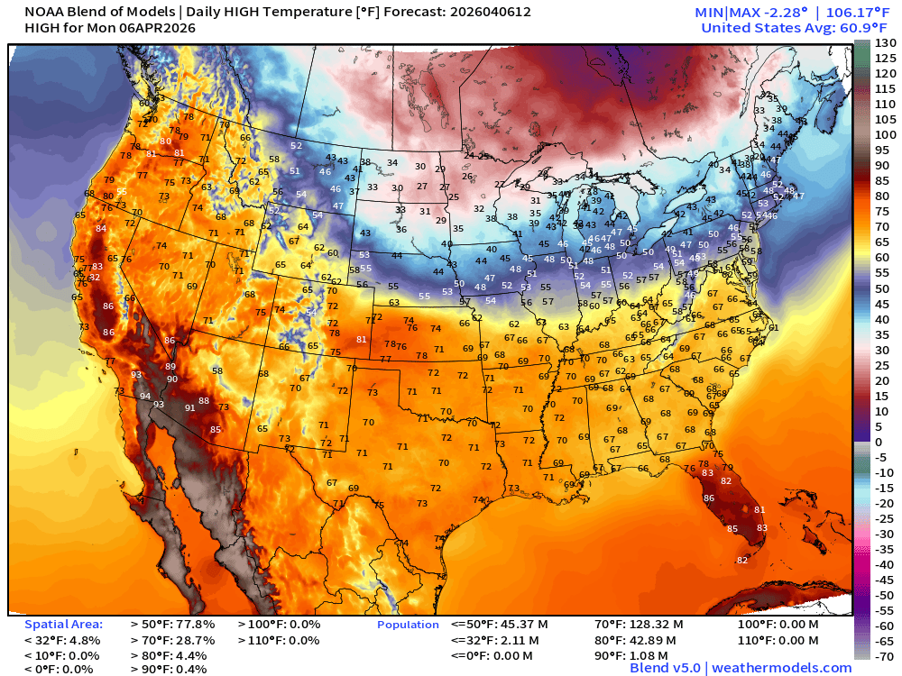
Significantly cooler this week across Eastern U.S. … only 128 million at least 70°F
Low Temperatures Tuesday
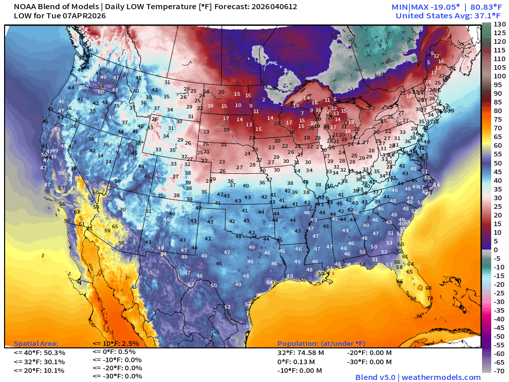
Over 74 million below freezing — cold across Great Lakes and New England! Subzero in northern Minnesota!
High Temperatures on Tuesday
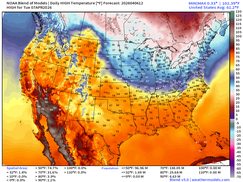
Not very warm across the Great Lakes, at all.
ECMWF AIFS 068z | Temperature at 500 mb | Next 10-days
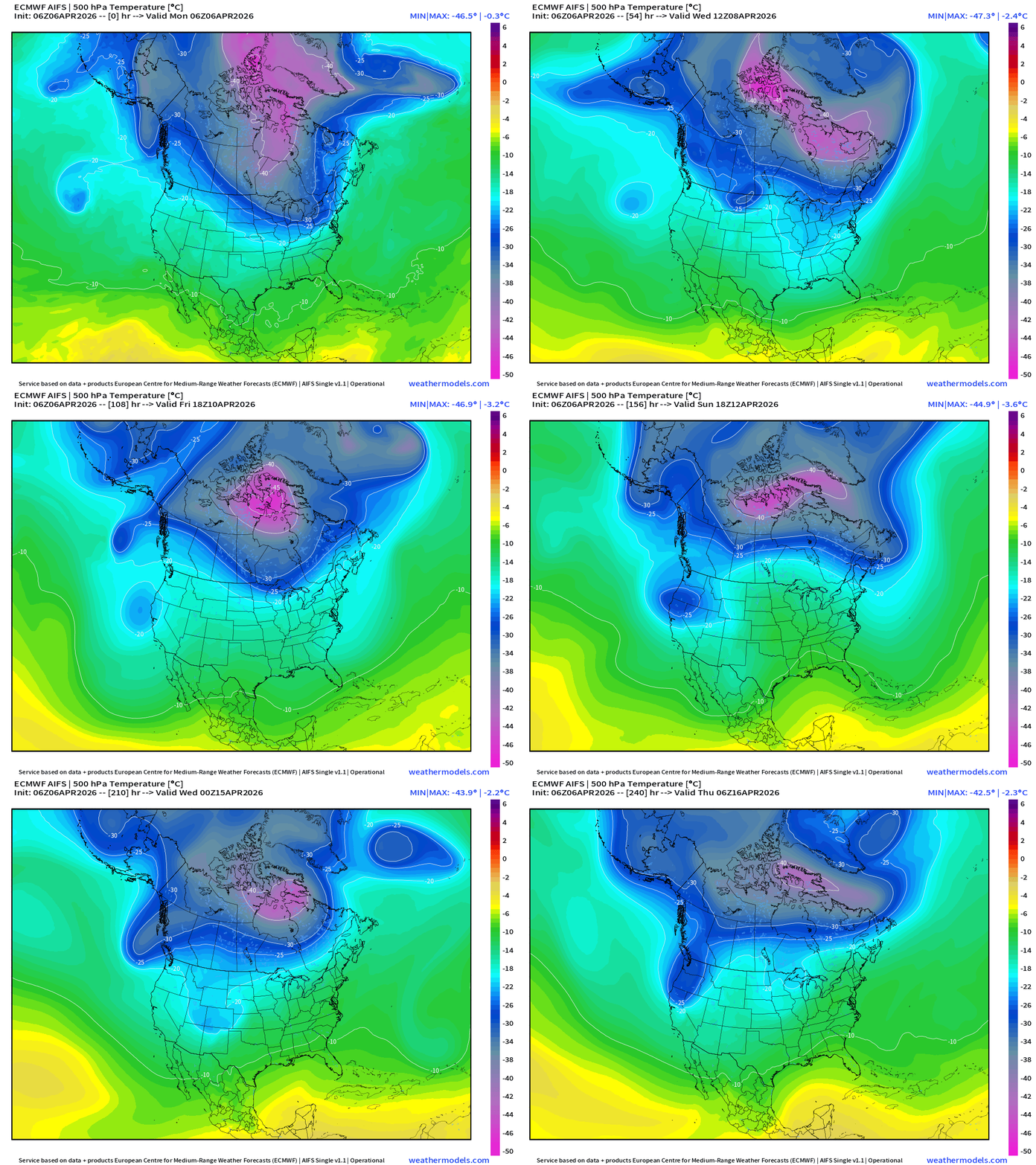
There’s STILL a -45°C contour of the polar vortex at 500 mb holding on for dear life in Canada — but eventually weakens/washes out to -40°C in 10-days.
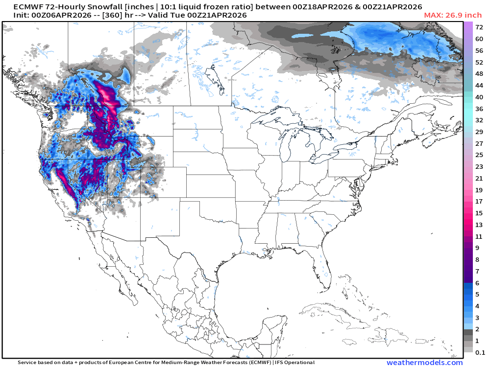
Snowfall from ECMWF HRES (15-days)
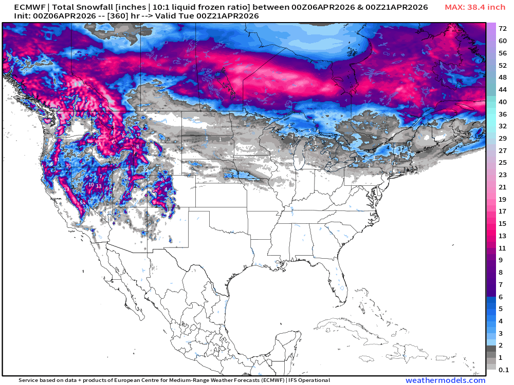
3-day snowfall total April 18, 19, 20th
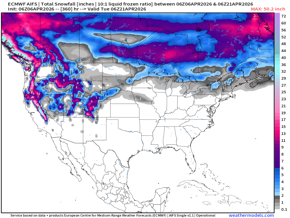
Snowfall from ECMWF AIFS-Single (06z) next 15-days
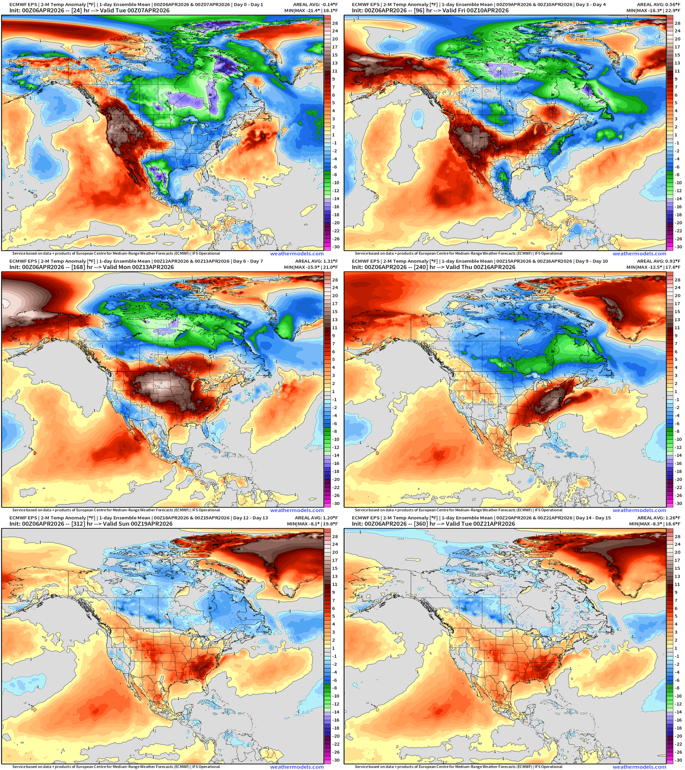
Temperature Anomaly | Next 15-days | ECMWF EPS 12z Ensemble Mean
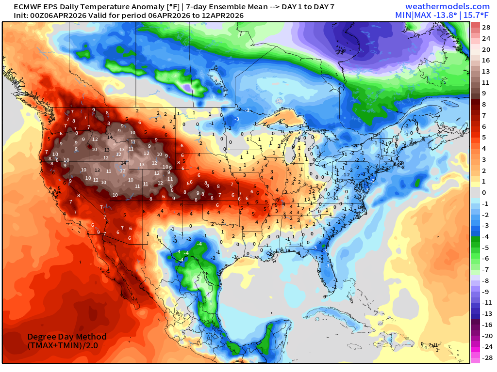
Week #1 | Temperature Anomaly | April 6 - April 12
Week #2 | Temperature Anomaly | April 13 - April 19
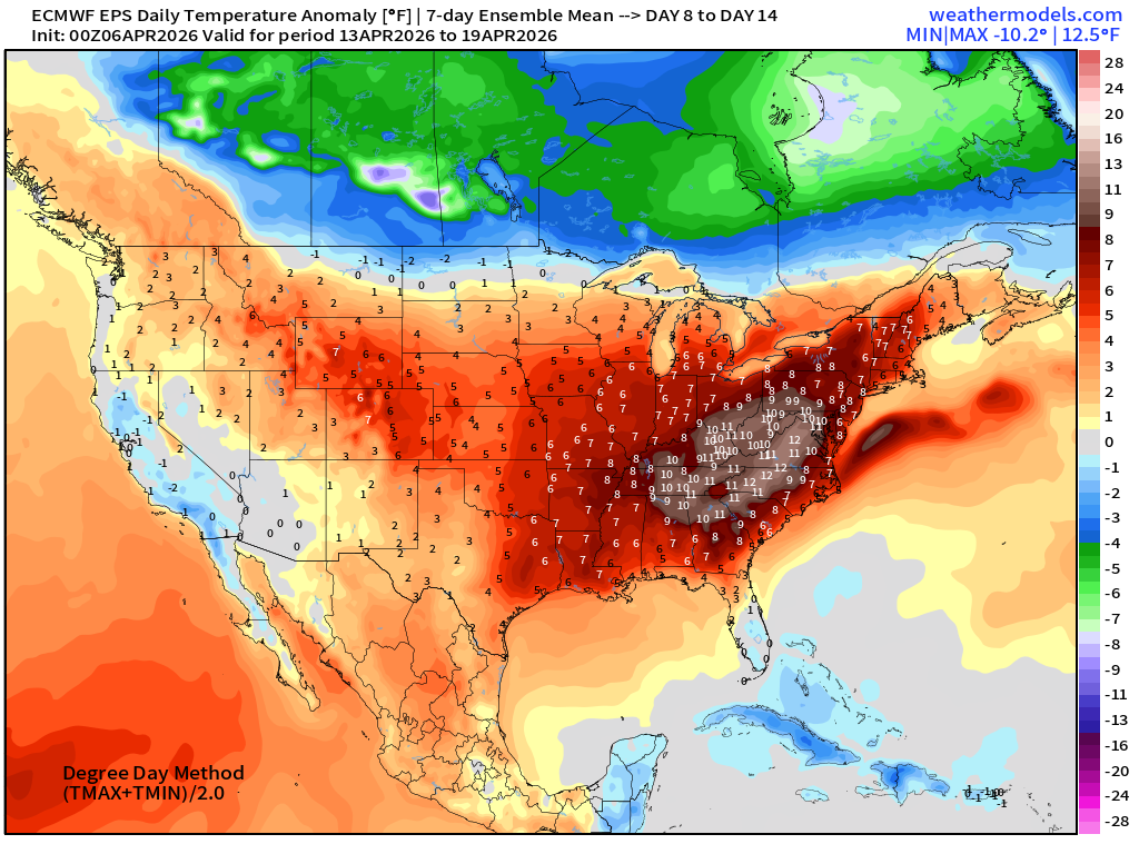
Significant warmth in week 2 with 10°F to 12°F above normal east of the Mississippi!
Maps sourced from weathermodels.com designed and innovated by yours truly! Please subscribe there for real-time access to the newest maps, charts from all of the weather models including ECMWF and AIFS, and NOAA GFS/GEFS. NOAA WPC and SPC for fronts/convective outlooks.
- Milepost
- 912 · laid 2026-04-06T15:56:49.832000Z
- Source
- https://weather.substack.com/p/april-6-2026-monday-spring-weather
- Digest
- a00060f4e44574edc1c04eb0e767160ebc71e3b4581f9aabdea4a1618705db4d
- Machine
- JSON