March 14, 2026 Saturday Blizzard Watch
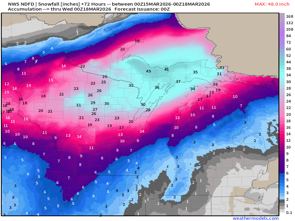
4 feet of snow in the Upper Peninsula of Michigan
March 2026 was the warmest March in the 132-year national record (1895–2026), at 50.8°F against a 1991–2020 normal of 43.6°F (+7.3°F).
March 2026 was the 8th-driest March in the 132-year national record (1895–2026), at 1.8in against a 1991–2020 normal of 2.5in (-0.7in).
NOAA/NCEI Climate at a Glance, contiguous United States. This is the observed record for the month, not a score of anything said in this piece — the forecast ledger begins 2026-08-17 and cannot reach earlier posts.

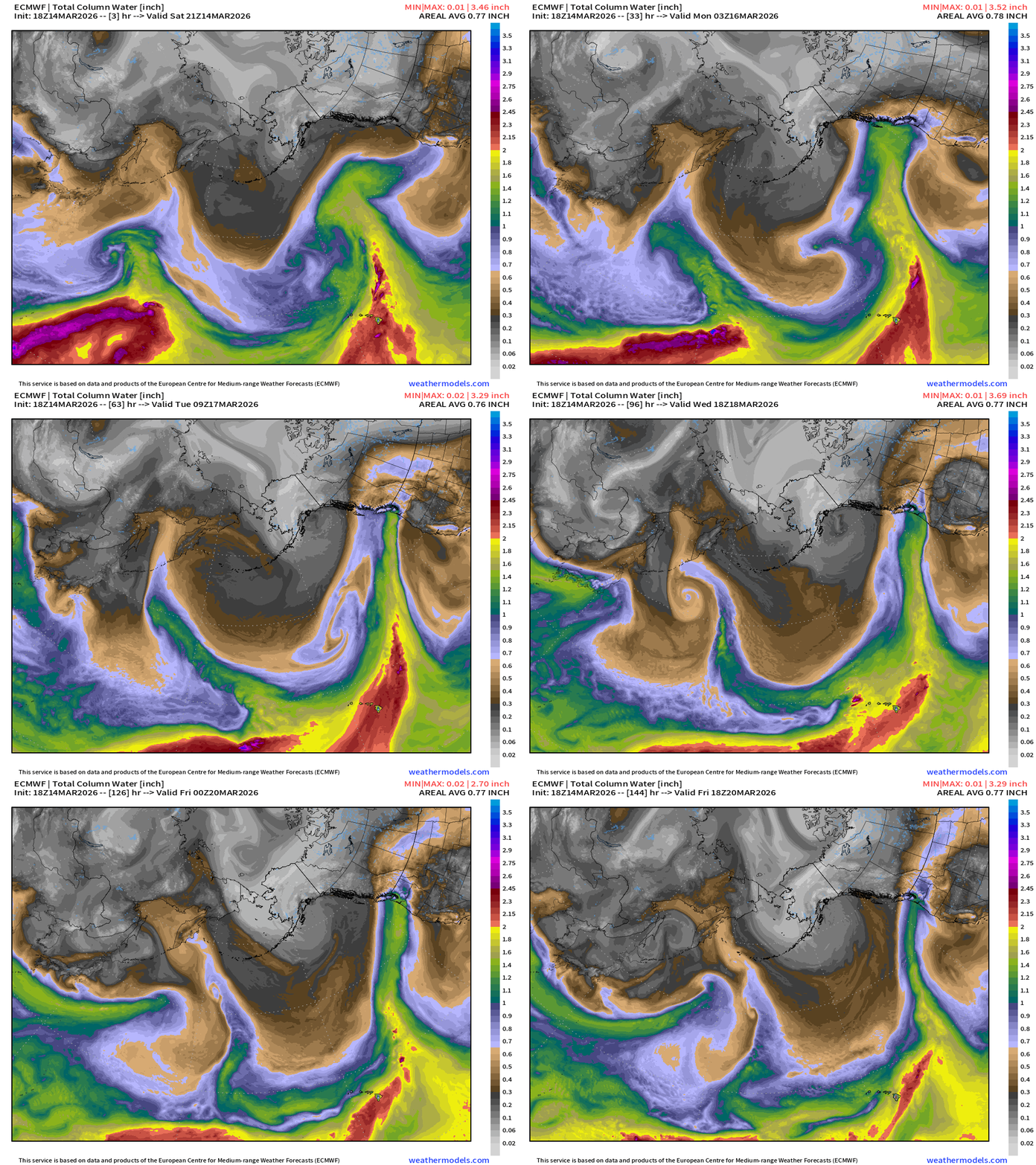
49th and 50th States: Extensive Kona Low “atmospheric river flow” across the central Pacific streaming into the Pacific Northwest … polar vortex (cold) swirling over Alaska.
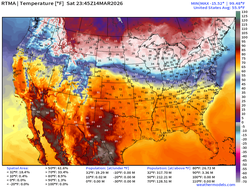
RTMA Current Temperature Analysis | 7:45 PM ET
RTMA Current Temperature Anomaly Analysis | 7:45 PM ET
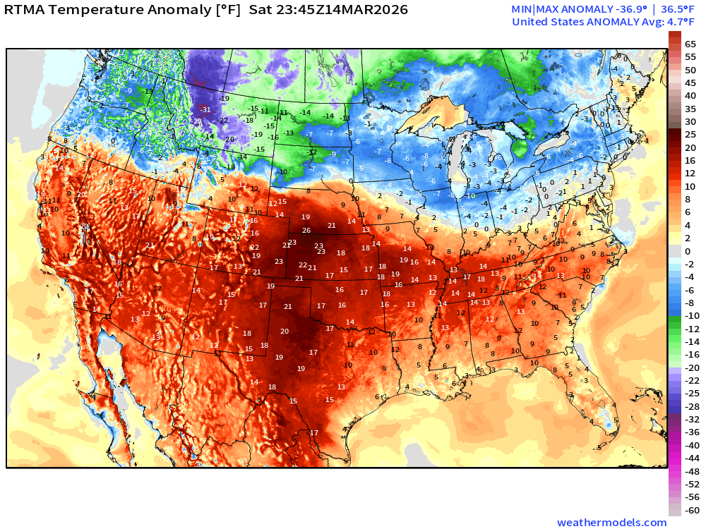
Lower 48 is 4.7°F above normal
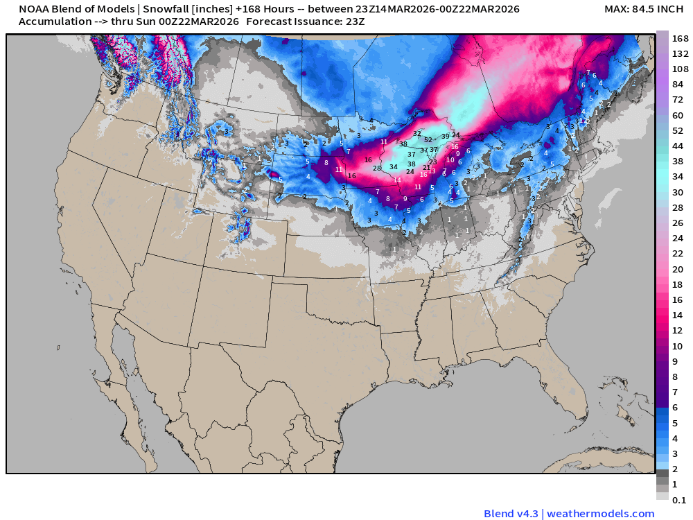
Blend of Models | Total Snowfall Next 7-Days
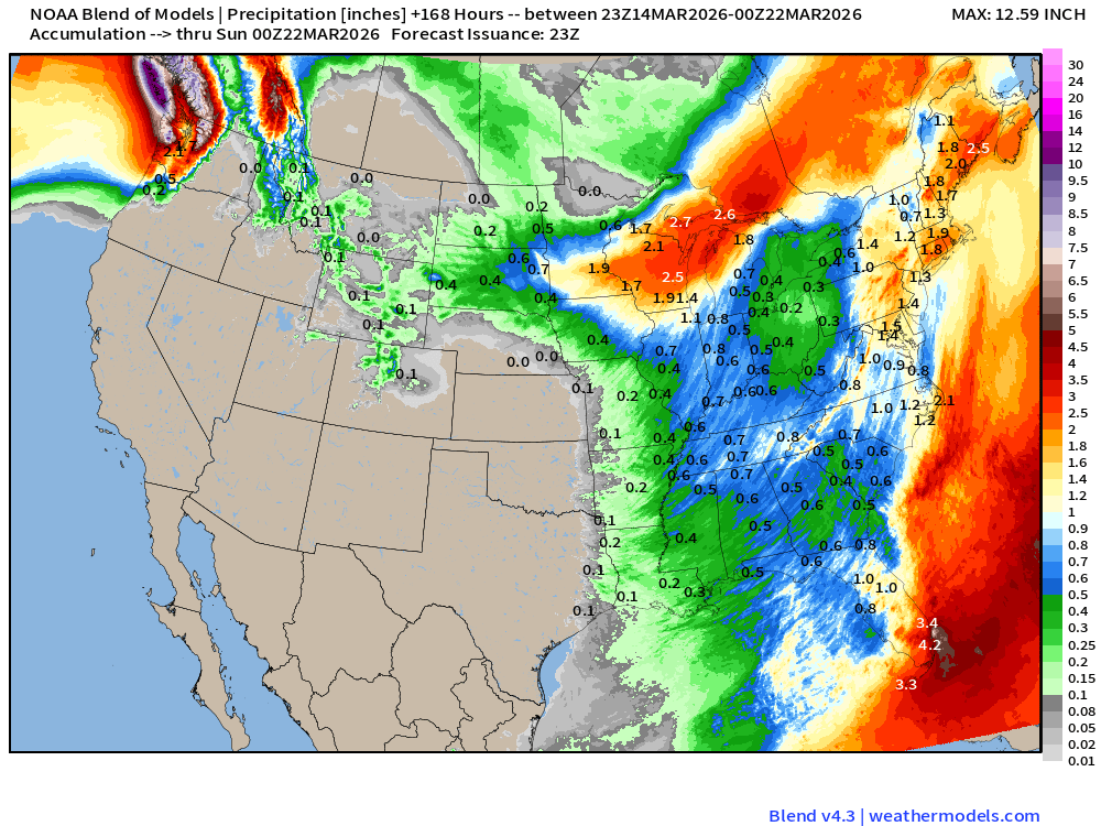
Blend of Models | 7 Days Precipitation Total
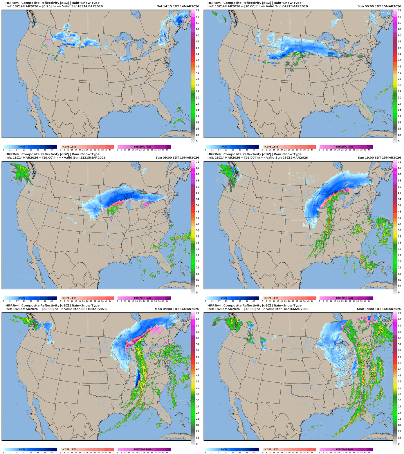
HRRR 18z — Radar Simulation Next 48-hours to Monday 2 PM ET
Sunday Convective Outlook —> Enhanced Risk of Severe Weather along long cold front extending from Blizzard … from SPC
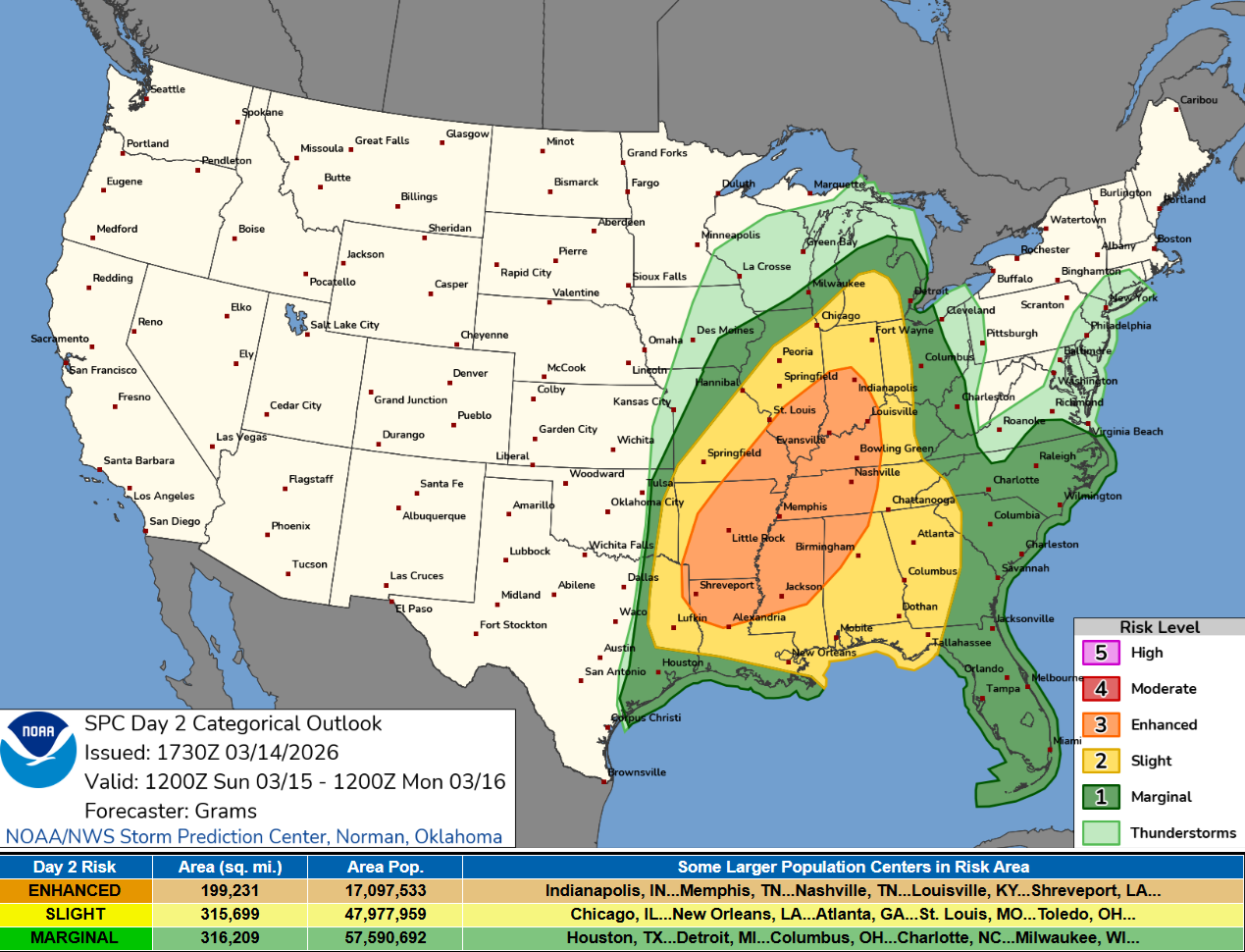
   ...SUMMARY...
   Scattered to widespread damaging winds along with tornadoes should
   develop on Sunday afternoon, persisting through Sunday night across
   a large portion of the South-Central/Southeast States into the
   Midwest/Ohio Valley. The greatest strong tornado and significant
   severe wind threats appear to be from the Ark-La-Miss to the Lower
   Ohio Valley on Sunday evening.
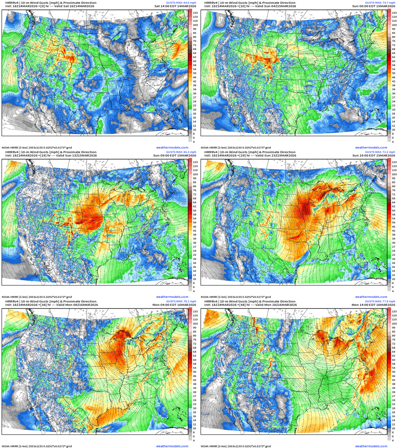
Wind Gusts —> Next 48-hours
ECMWF 18z Precipitation Type + Intensity | Next 6-days
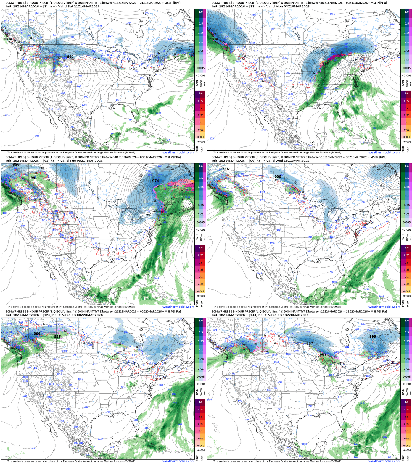
“Bomb Cyclone” —> MASSIVE blizzard Sunday into Monday for Midwest and Great Lakes
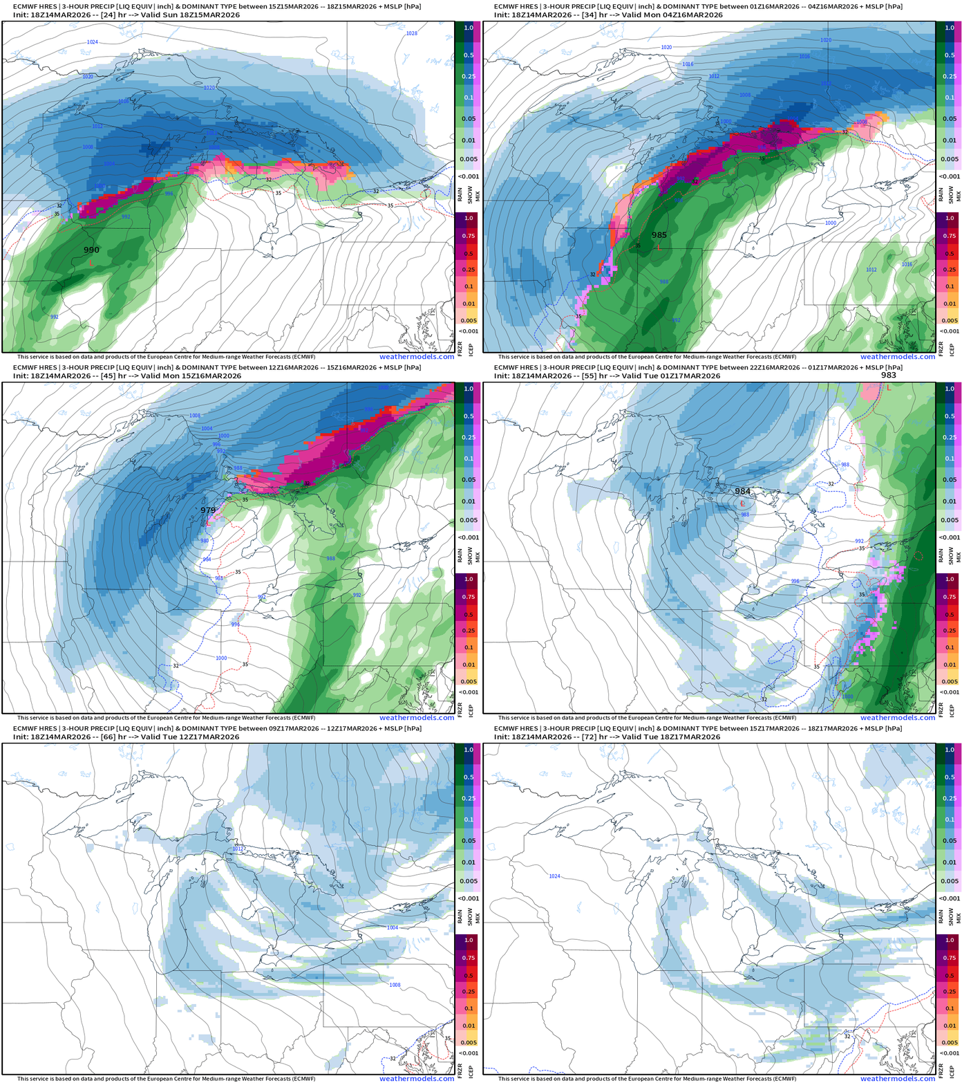
Western U.S. | Heat Dome in charge w/moisture going to north
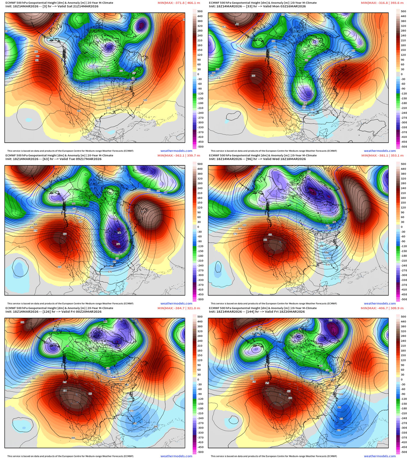
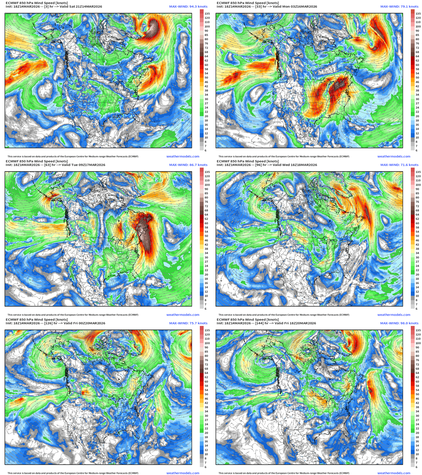
Temperature Anomaly Next 6-days
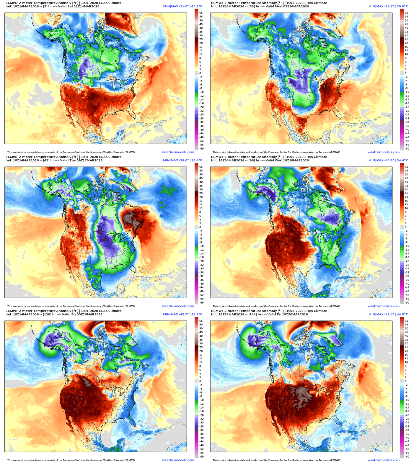
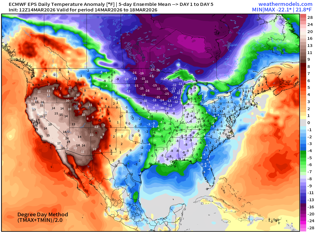
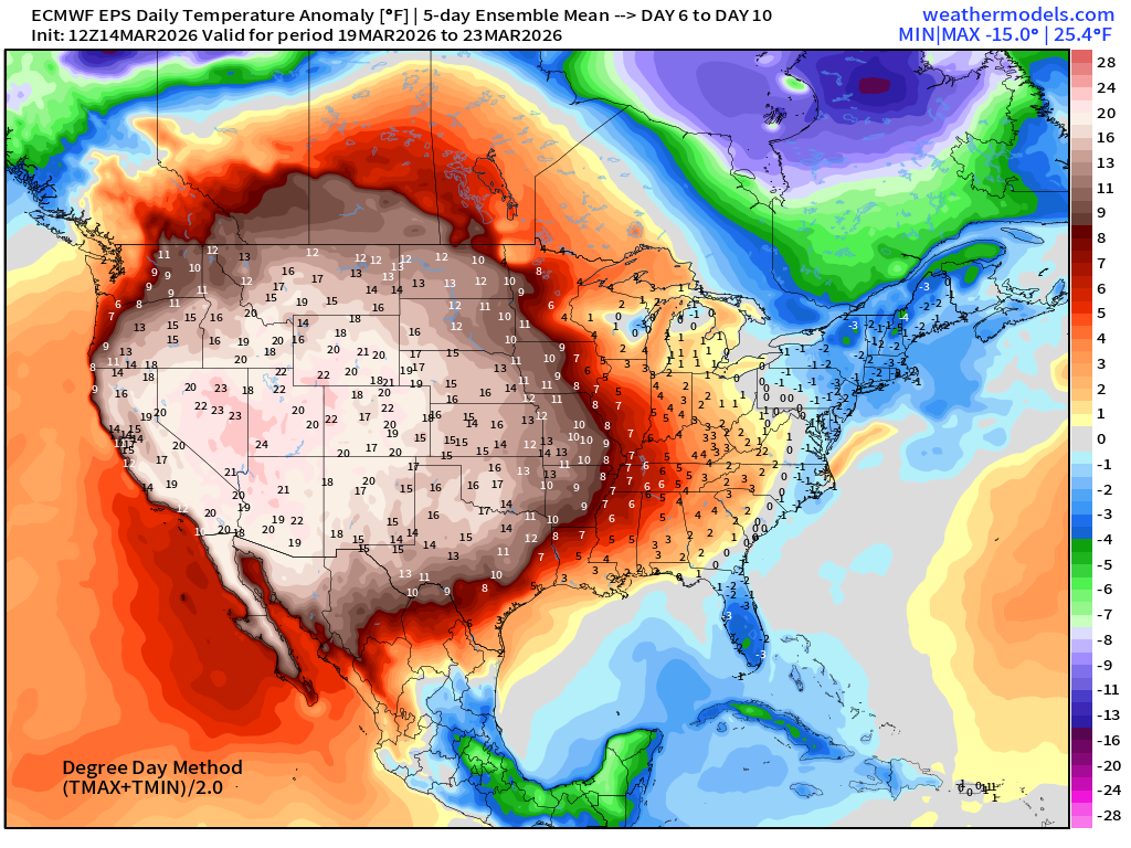
Arctic blast east of the Rockies + Alaska (stuck in deep freeze) vs. Heat Dome and record heat across the West
Blend of Models Temperatures | Highs through Monday, March 23
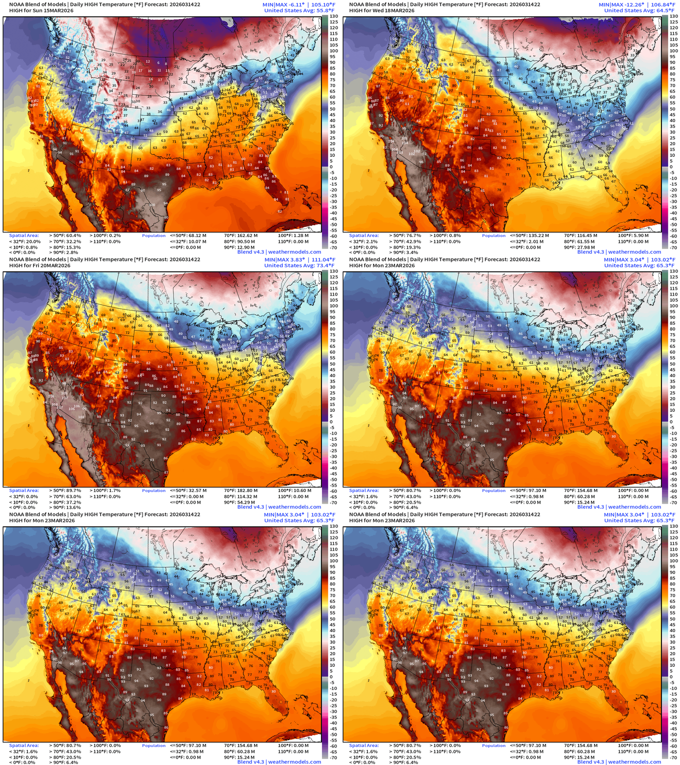
100s take over the Southwest vs. below freezing highs / coldest on Tuesday across Great Lakes into Ohio River Valley
Blend of Models Temperatures | Low through Monday, March 23
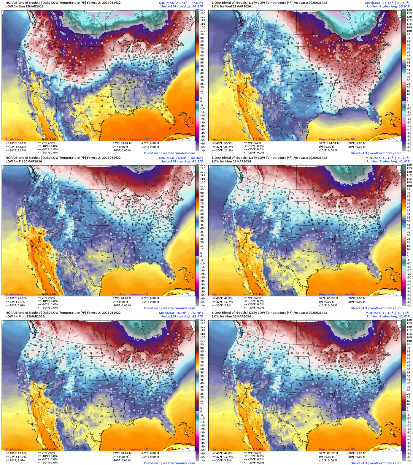
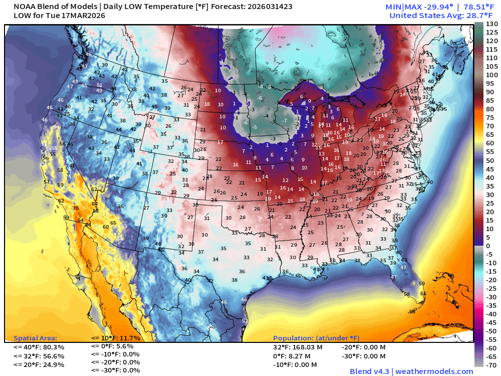
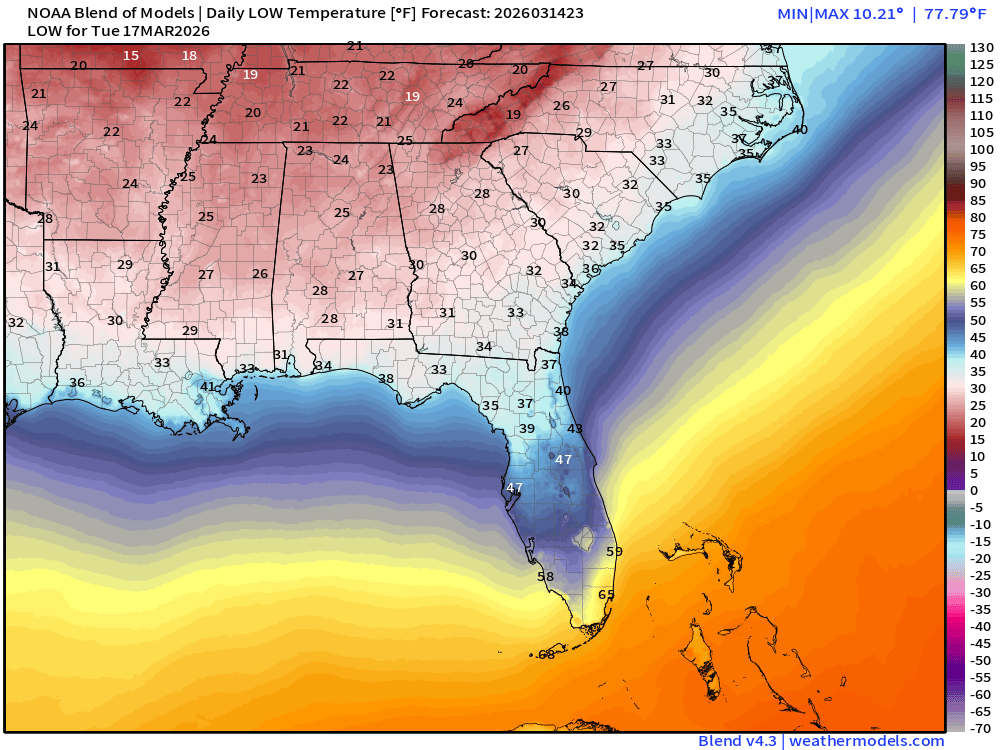
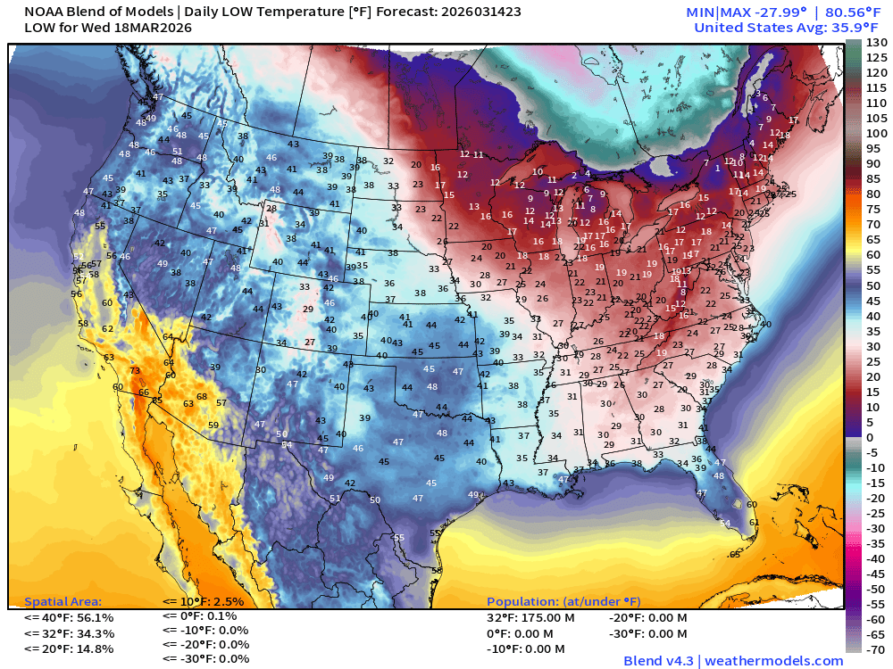
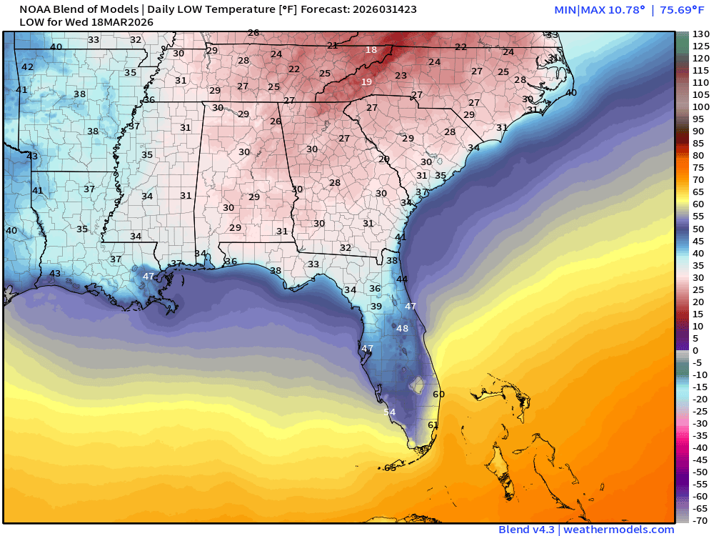
Freeze to the Gulf Coast on Tuesday and Wednesday
Next 6-days of Precipitable Water (my favorite parameter)
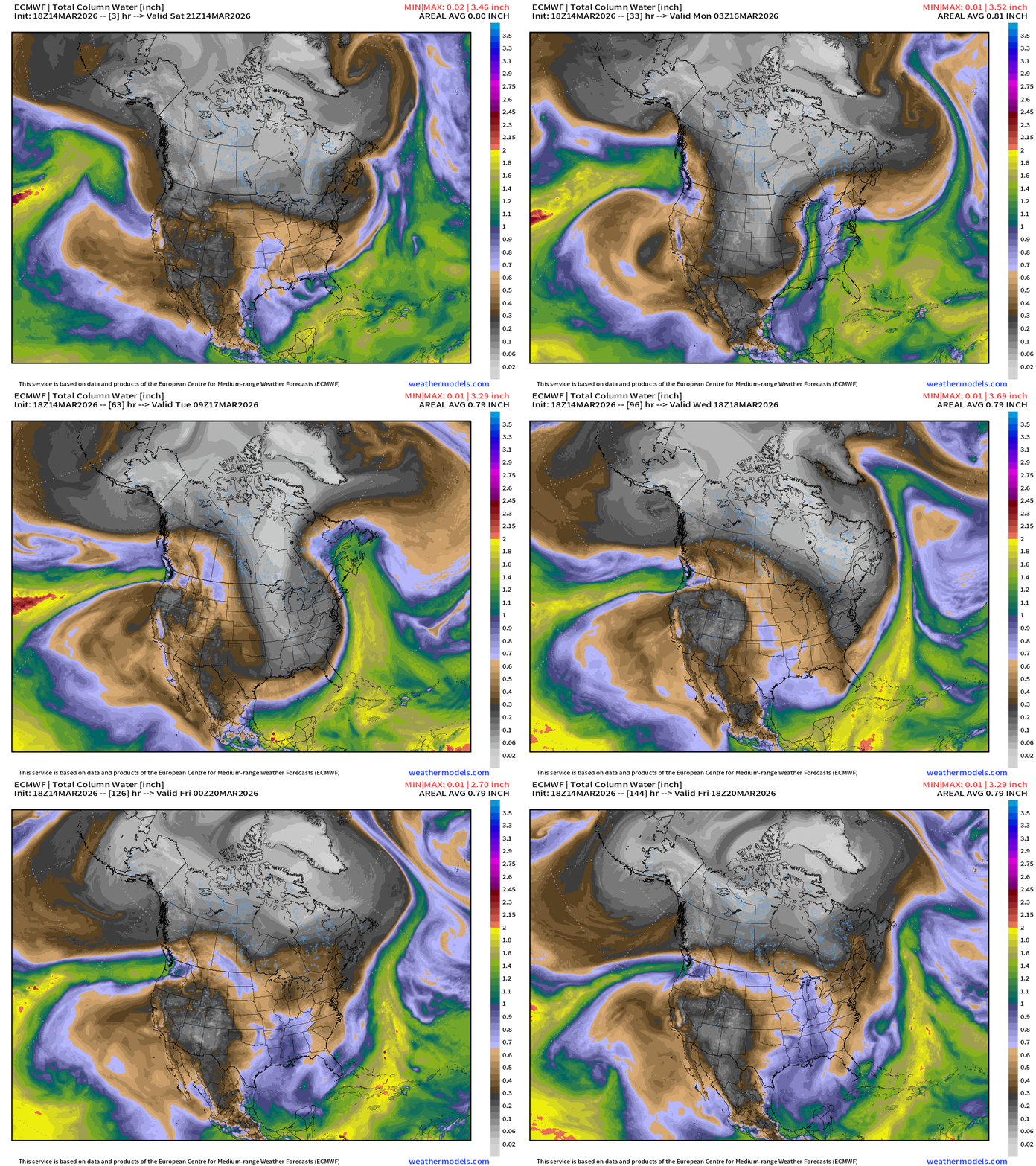
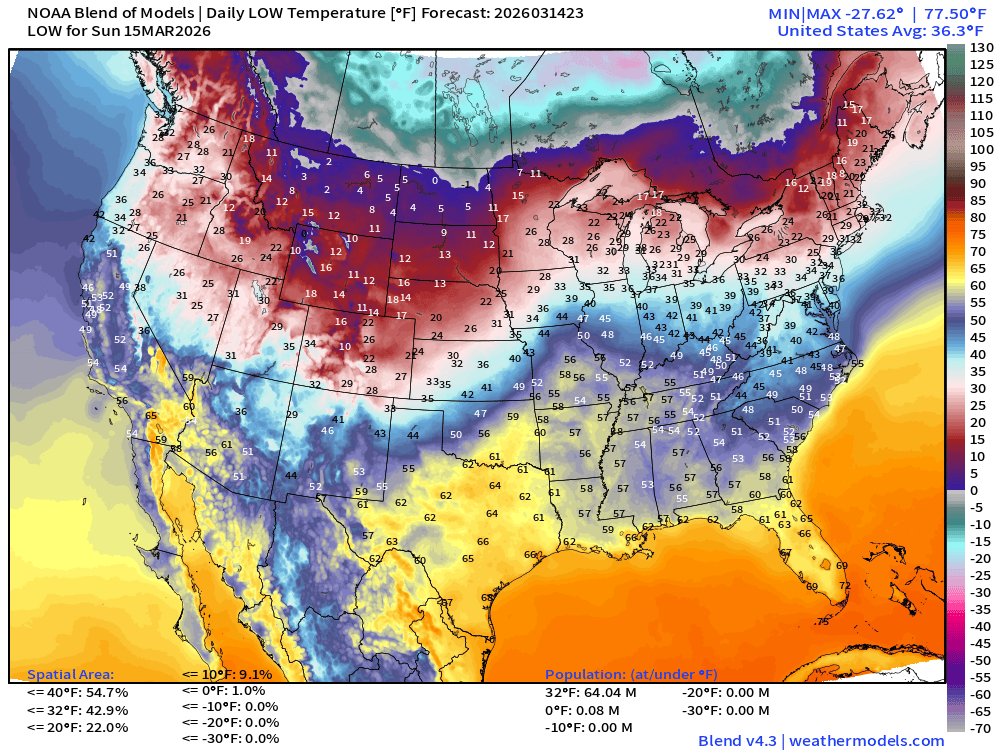
Low Temperatures on Sunday
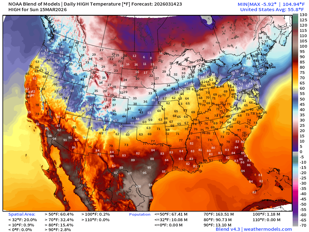
High Temperatures on Sunday
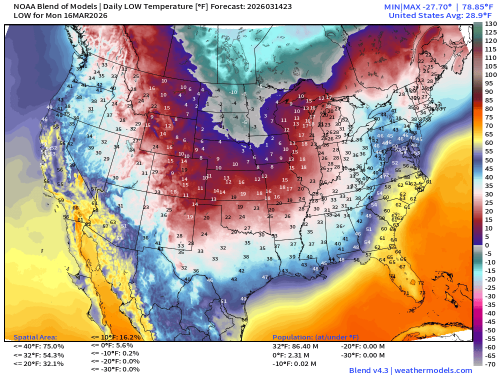
Low Temperatures on Monday
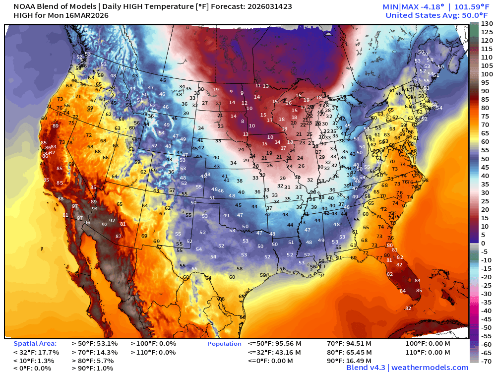
High Temperatures on Monday
Tuesday Low Temperatures
Wednesday Low Temperatures
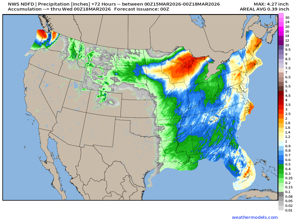
NDFD NWS Total Precipitation Next 72-hours through Tuesday early Afternoon
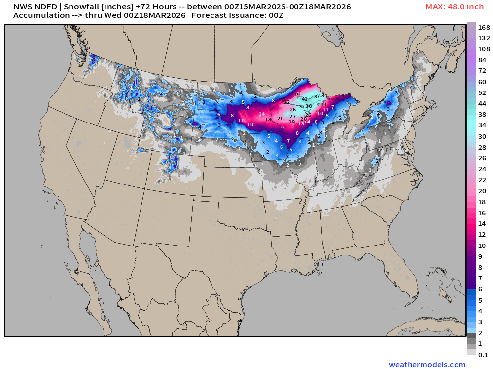
NWS Snowfall Next 72-hours — through Tuesday early Afternoon
Maximum 4-feet in U.P. of Michigan near Marquette. No thanks!
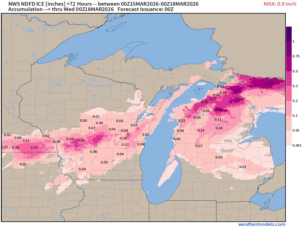
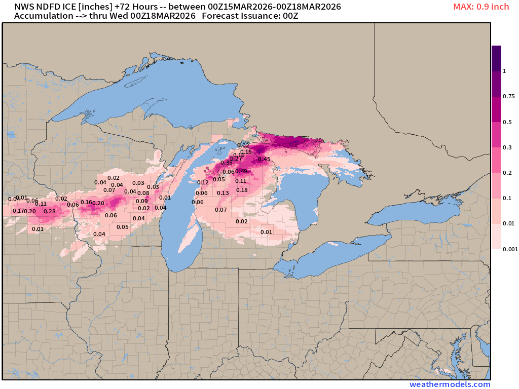
Ice accumulation | NWS next 72-hours
ECMWF AIFS 18z | Temperature at 500 mb | Next 10-days
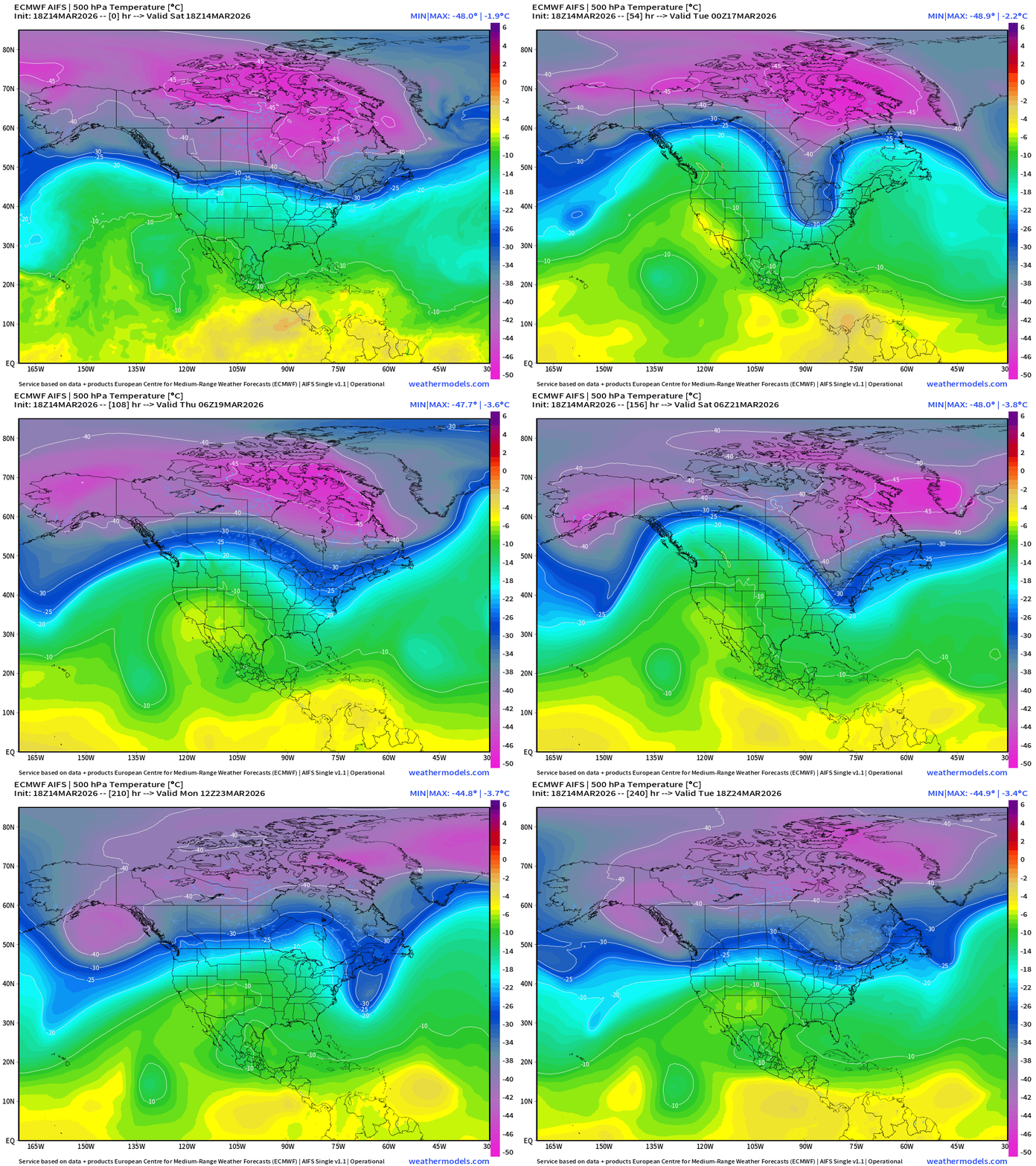
Major Polar Vortex lobe dips out of Canada to fuel the massive blizzard. The core cold pool remains at -45°C before breaking down into first days of Spring.
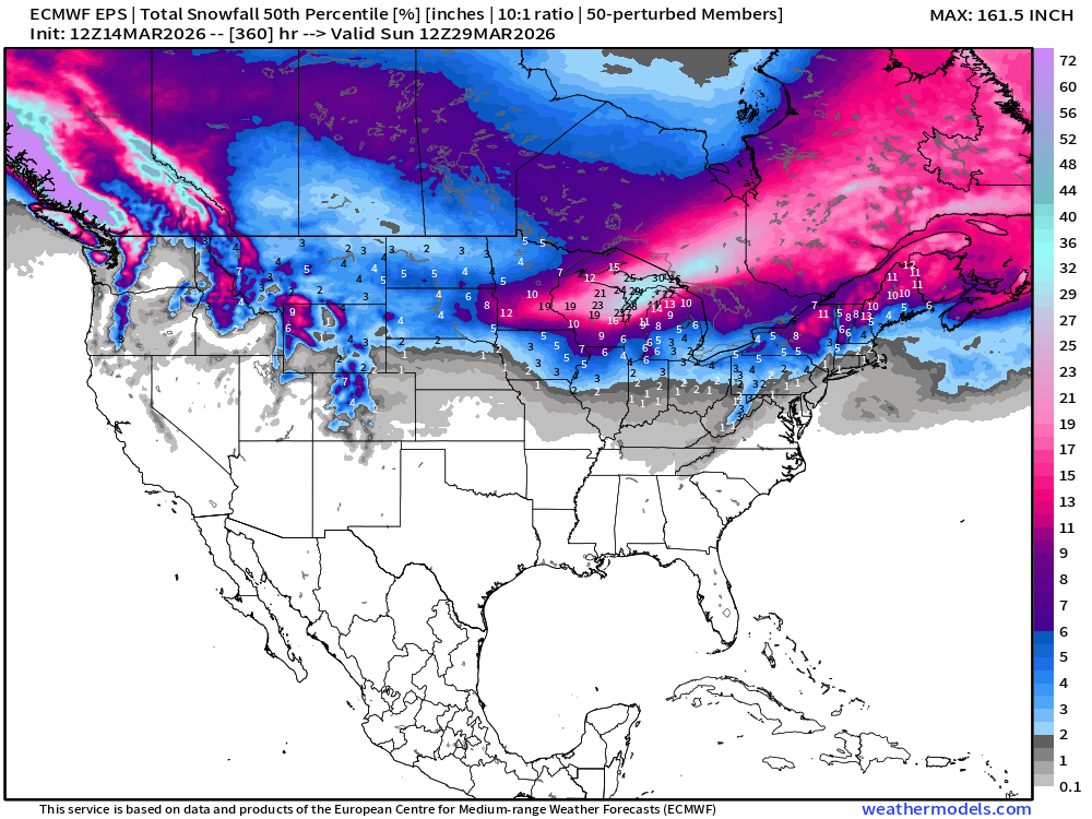
Snowfall | Median of ECMWF Ensembles at 12z | Next 15-days
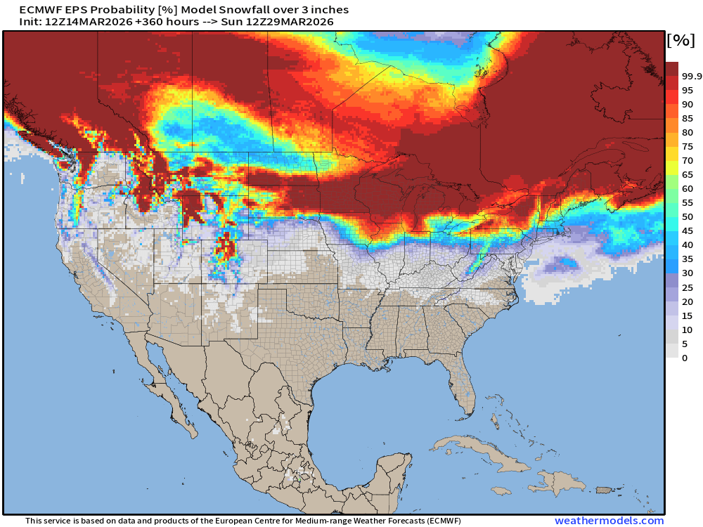
Probability of at least 3” of Snowfall Next 15-days
Temperature Anomaly | Next 15-days | ECMWF EPS 12z Ensemble Mean Flagship
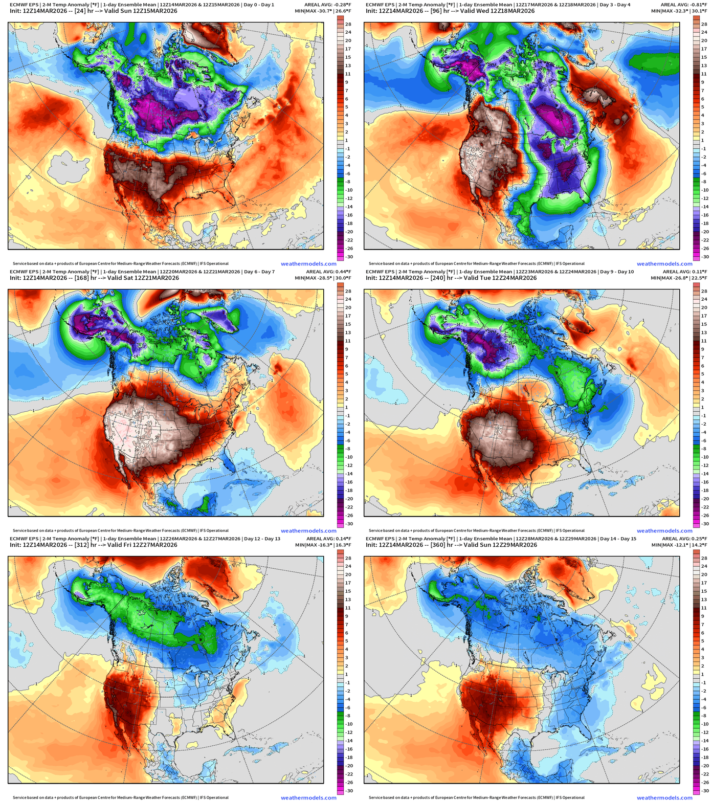
Ridge —> A major heat dome develops across the Western U.S.
Trough —> Very cold air for mid-March blasts out of Canada into the eastern U.S.
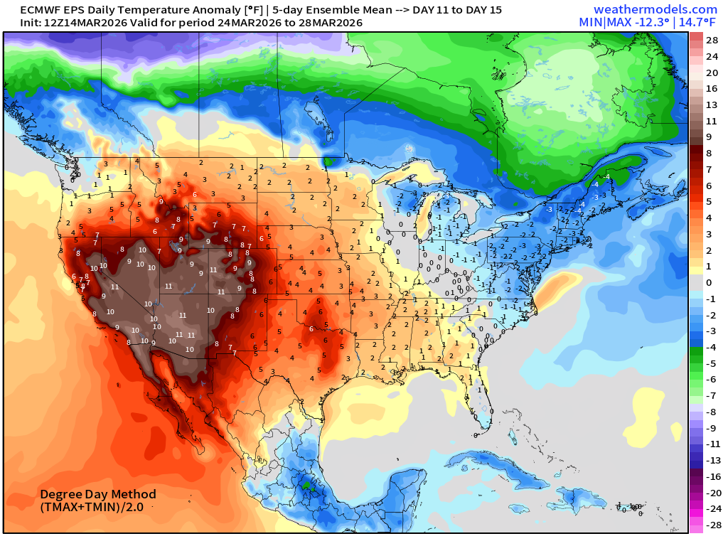
Extreme cold over Alaska continues through Week 2
5-Day Chunk #1 | Temperature Anomaly | March 14 - March 18
5-Day Chunk #2 | Temperature Anomaly | March 19 - March 23
5-Day Chunk #3 | Temperature Anomaly | March 24 - March 28
Maps sourced from weathermodels.com designed and innovated by yours truly! Please subscribe there for real-time access to the newest maps, charts from all of the weather models including ECMWF and AIFS, and NOAA GFS/GEFS. NOAA WPC and SPC for fronts/convective outlooks.
- Milepost
- 896 · laid 2026-03-15T01:09:41.994000Z
- Source
- https://weather.substack.com/p/march-14-2026-saturday-blizzard-watch
- Digest
- cf1ff8cda6aea0a448e10ba9cc2e7af5b98f2b27c88f113b8764d961a591b85b
- Machine
- JSON