March 7, 2026 Saturday Weather After Dark
Eastern U.S. experiencing early Spring warmth with plenty of rain
March 2026 was the warmest March in the 132-year national record (1895–2026), at 50.8°F against a 1991–2020 normal of 43.6°F (+7.3°F).
March 2026 was the 8th-driest March in the 132-year national record (1895–2026), at 1.8in against a 1991–2020 normal of 2.5in (-0.7in).
NOAA/NCEI Climate at a Glance, contiguous United States. This is the observed record for the month, not a score of anything said in this piece — the forecast ledger begins 2026-08-17 and cannot reach earlier posts.

ECMWF 18z Precipitation Type + Intensity | Next 6-days
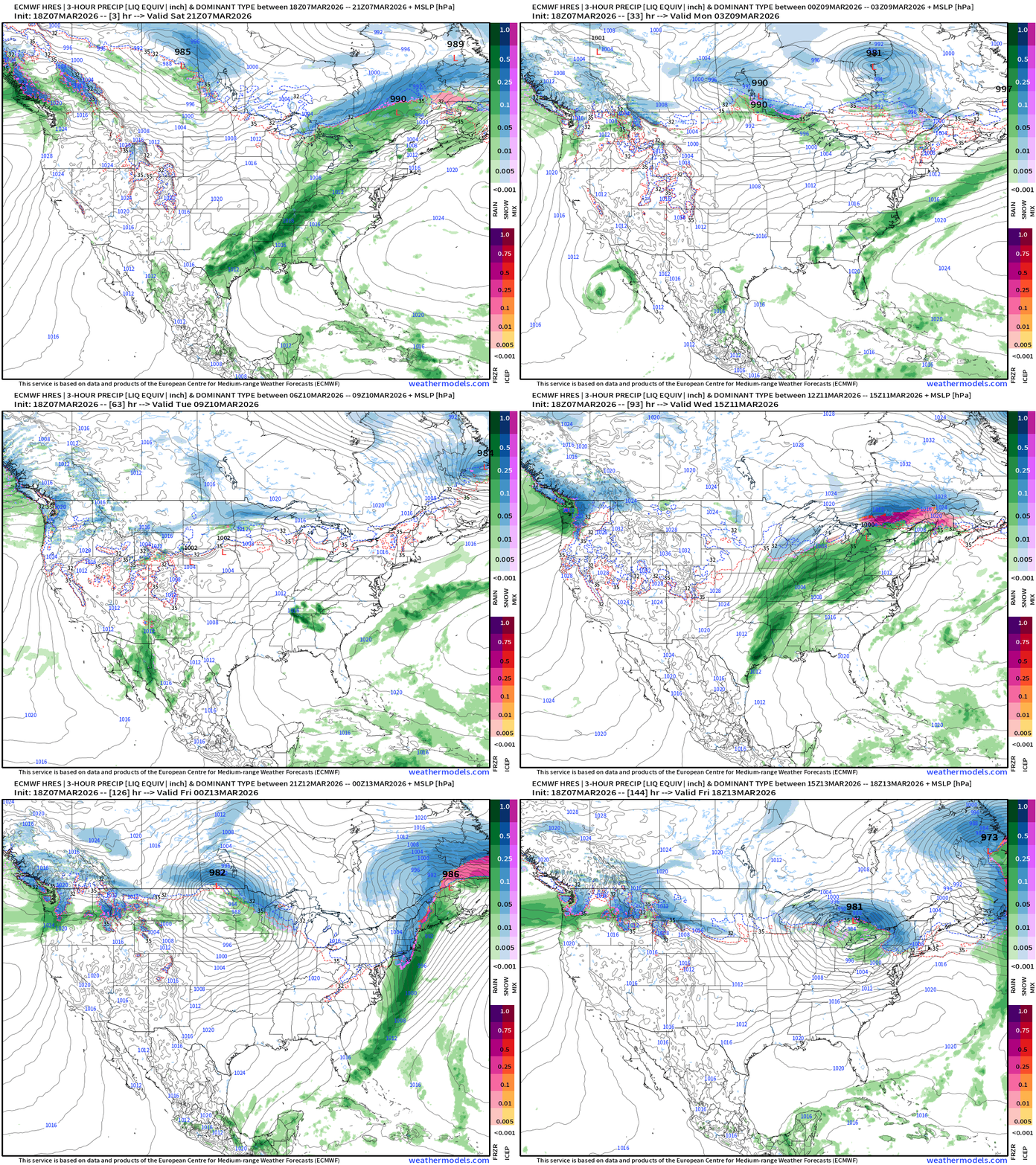
Main story into next week will be a strong cold front that ushers in much colder Arctic air across the Midwest and Great Lakes into the Northeast by next weekend. Then, another Clipper System on its heels … with rather low central pressure in the 980 mb range. The storm track will be on the periphery of a still very strong tropospheric polar vortex churning away in Canada — which will stretch southward and dip its lobes into the Lower 48 into mid-March.
Just maps this evening — more on Sunday!
Daily High Temperatures to Monday March 16th
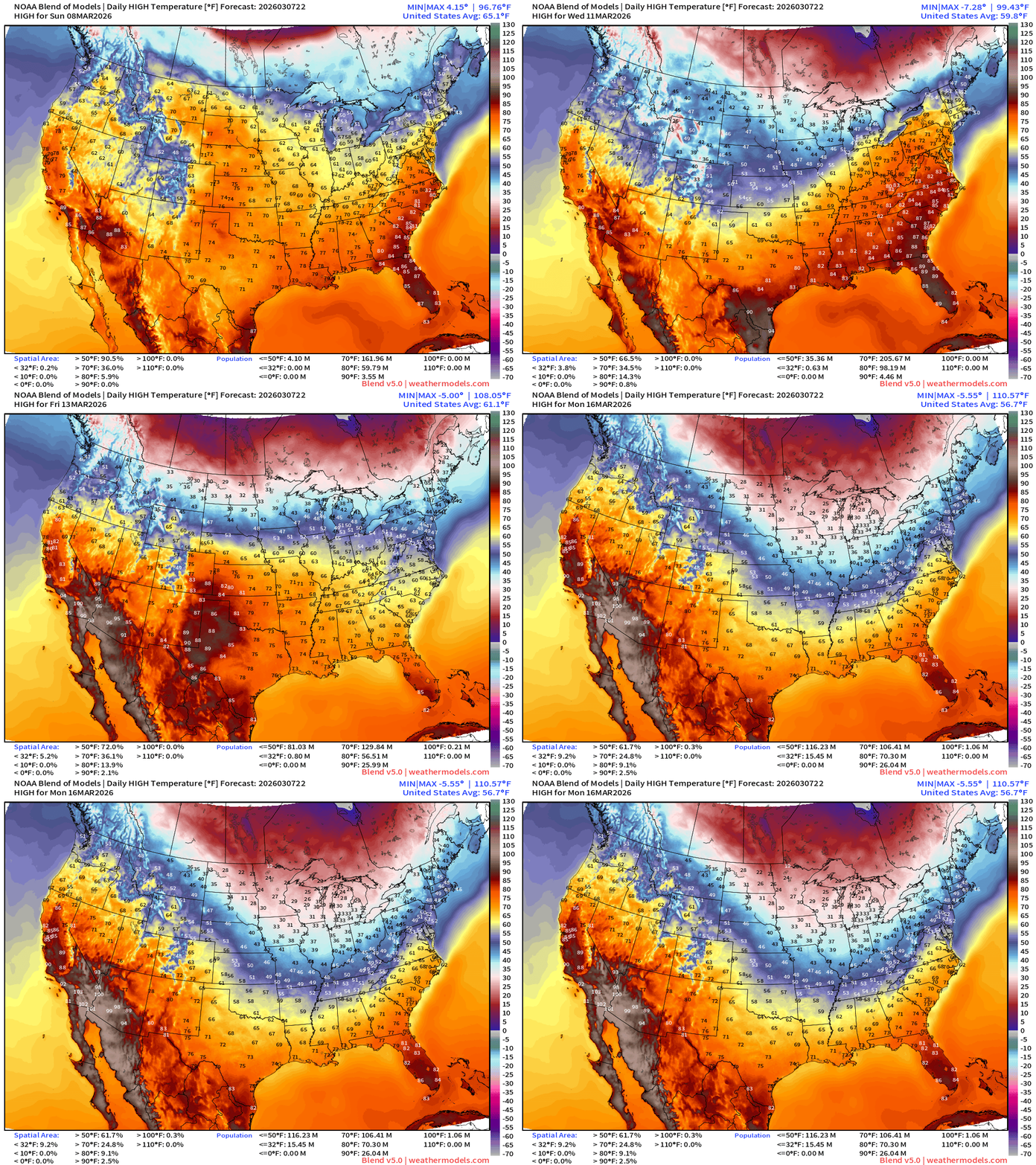
First cold front Thurs-Friday before even colder air into next weekend and the following days. Thankfully, we’re into mid-March so the “cold” is relative to early spring and not as intense as Jan/Feb.
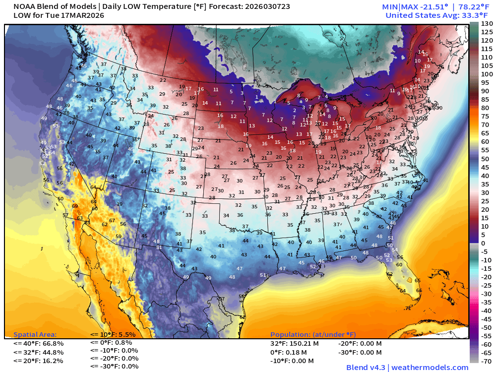
Lows Next Tuesday March 17 — still plenty cold enough
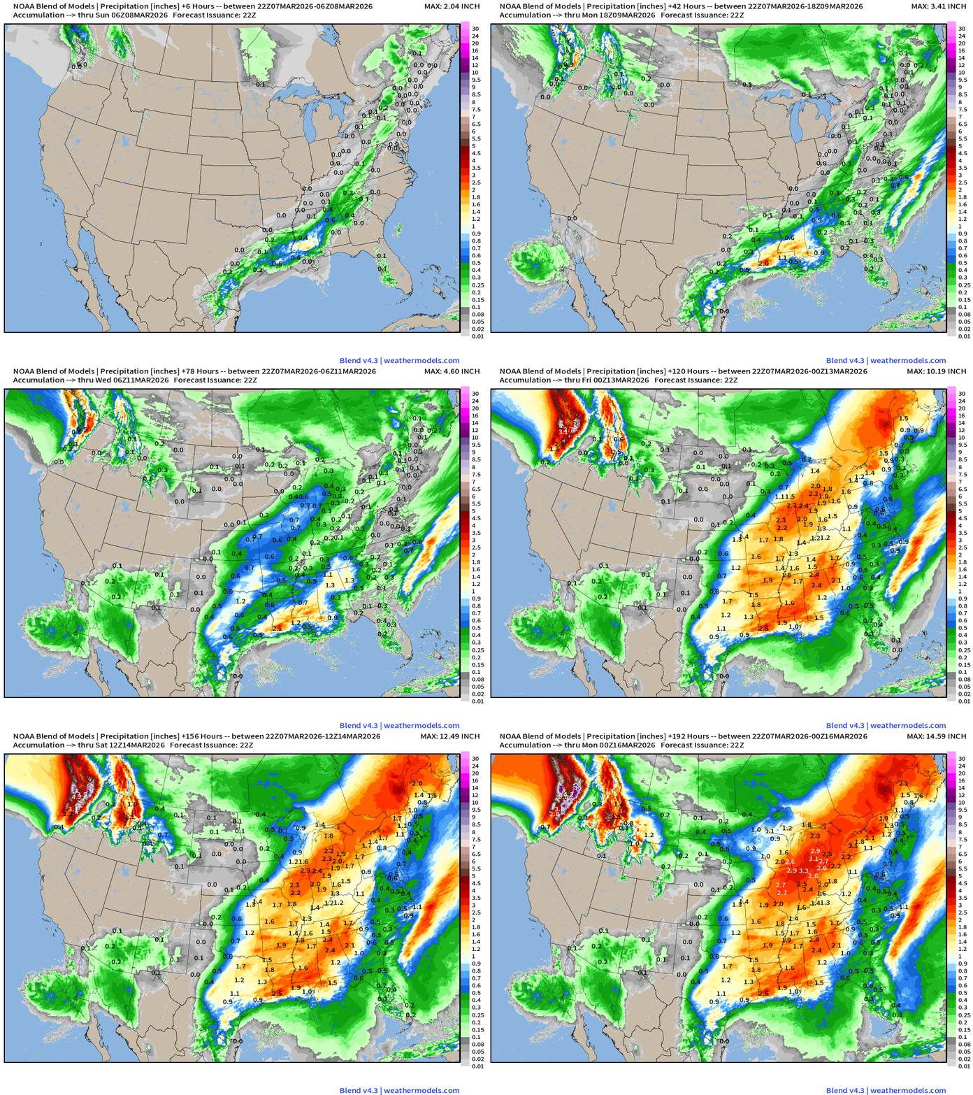
Boatloads of precipitation / heavy rainfall for next 8-days+
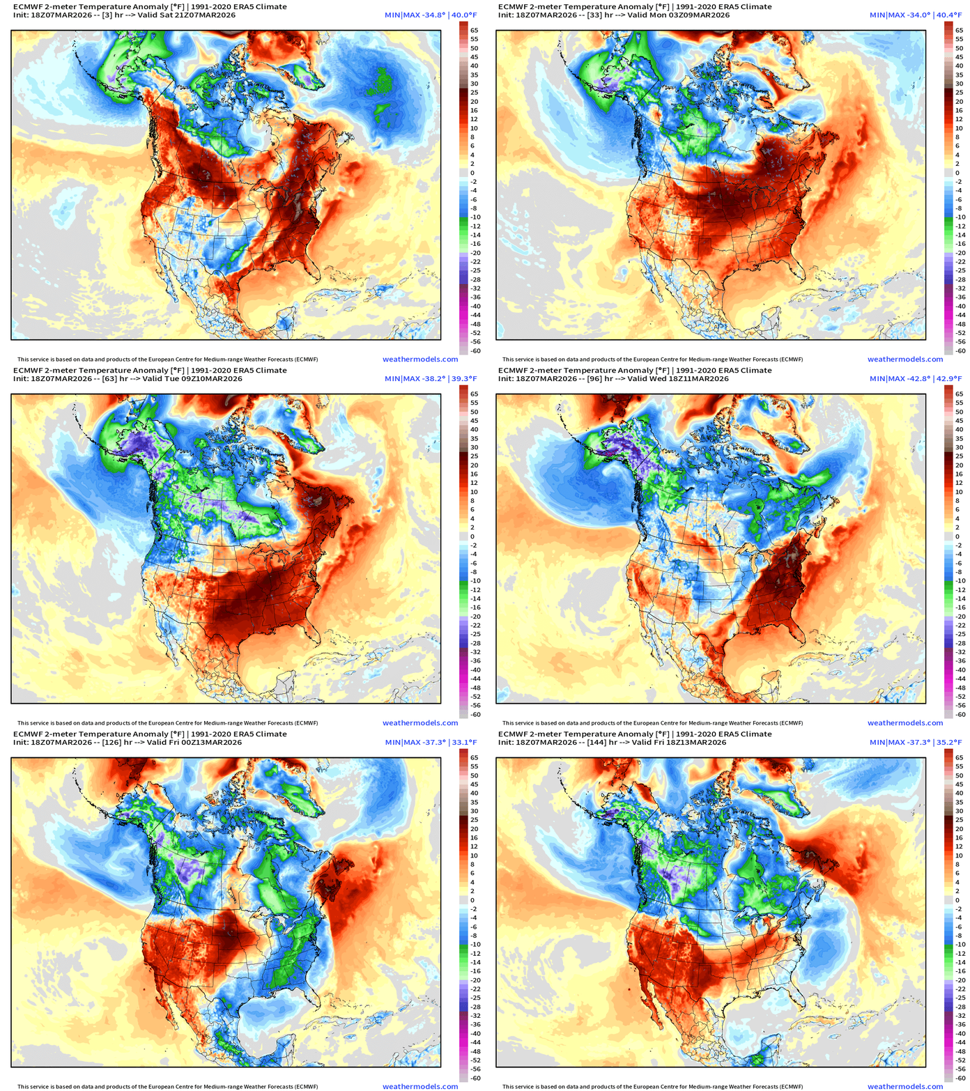
Temperature Anomaly Next 6-days —> Much above normal temperatures across much of the Lower 48 with warm, southerly flow, but the Canadian Arctic fights back later next week.
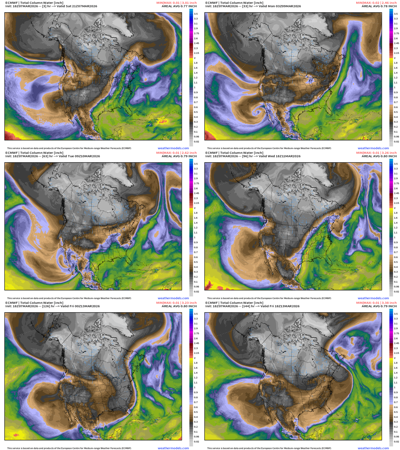
Next 6-days of Precipitable Water (my favorite parameter)
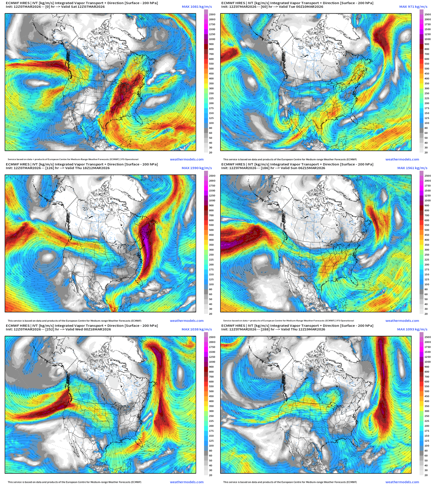
Next 12-days of Integrated Vapor Transport (ECMWF 12z)
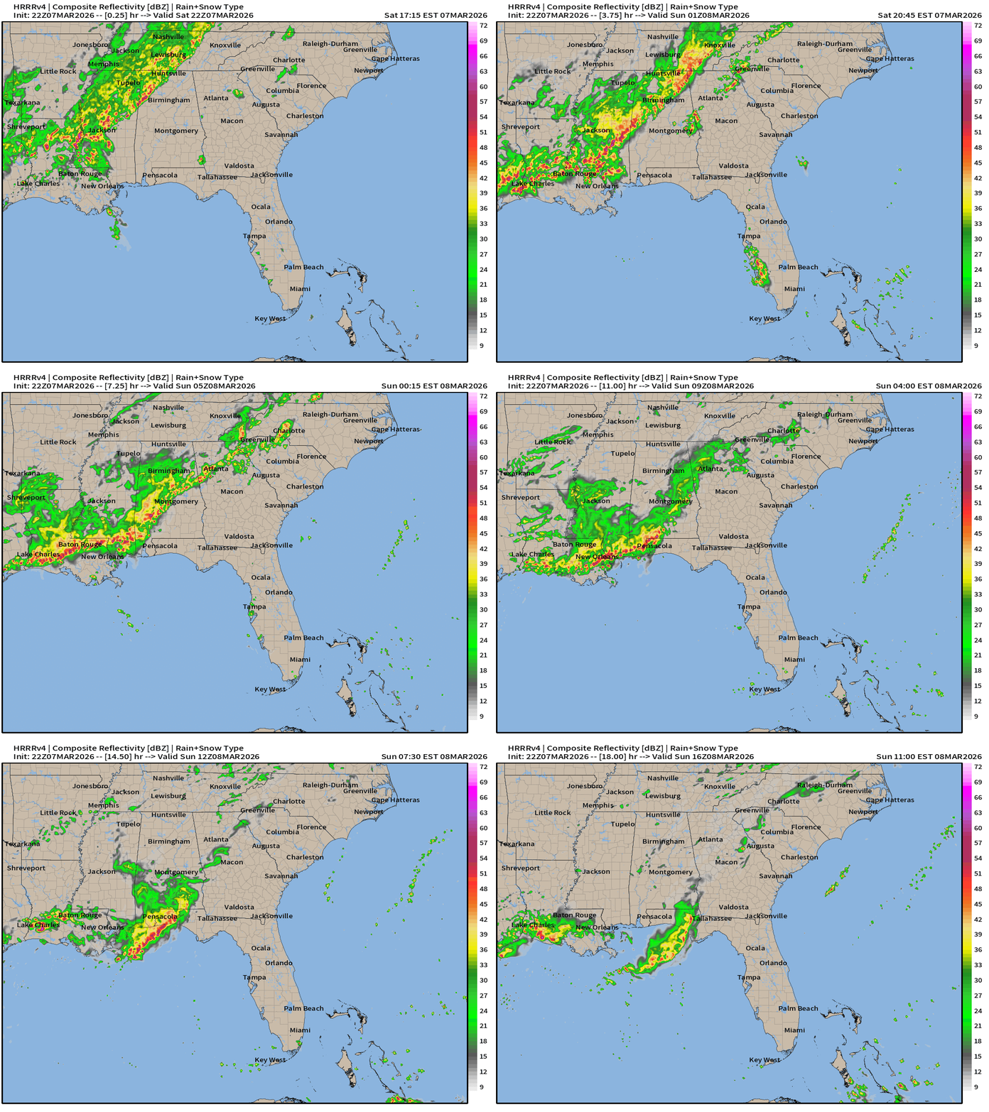
Weather into Sunday morning — still a slight chance of severe weather along this cold front with hail in south Texas being the most serious risk
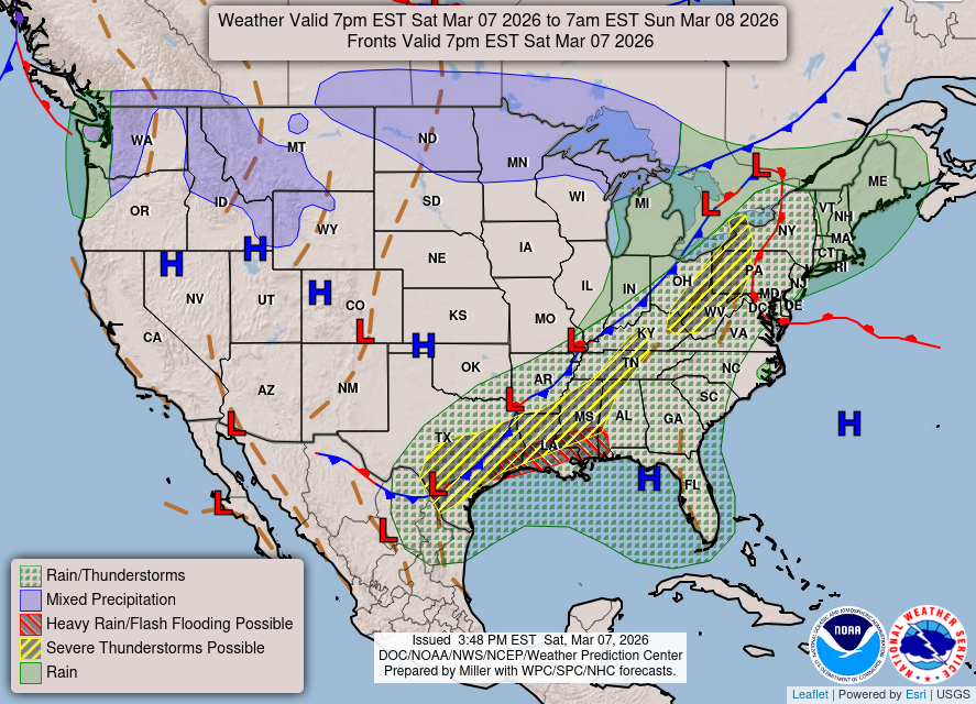
Rain and storms largely fizzle out along the Gulf coast and Southeast into Sunday morning, but could be some gusty winds in New Orleans
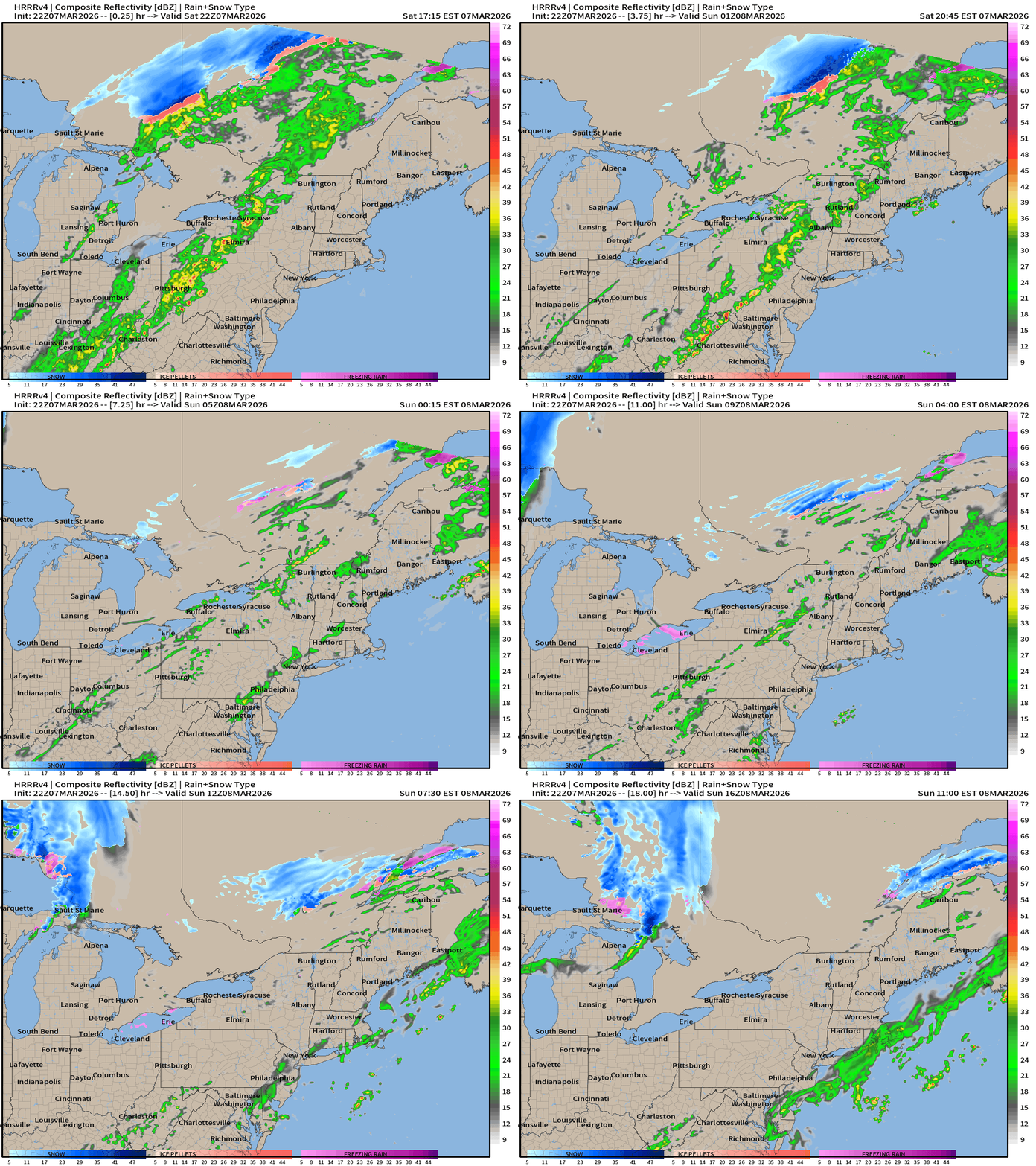
Fast moving showers … snow in Canada.
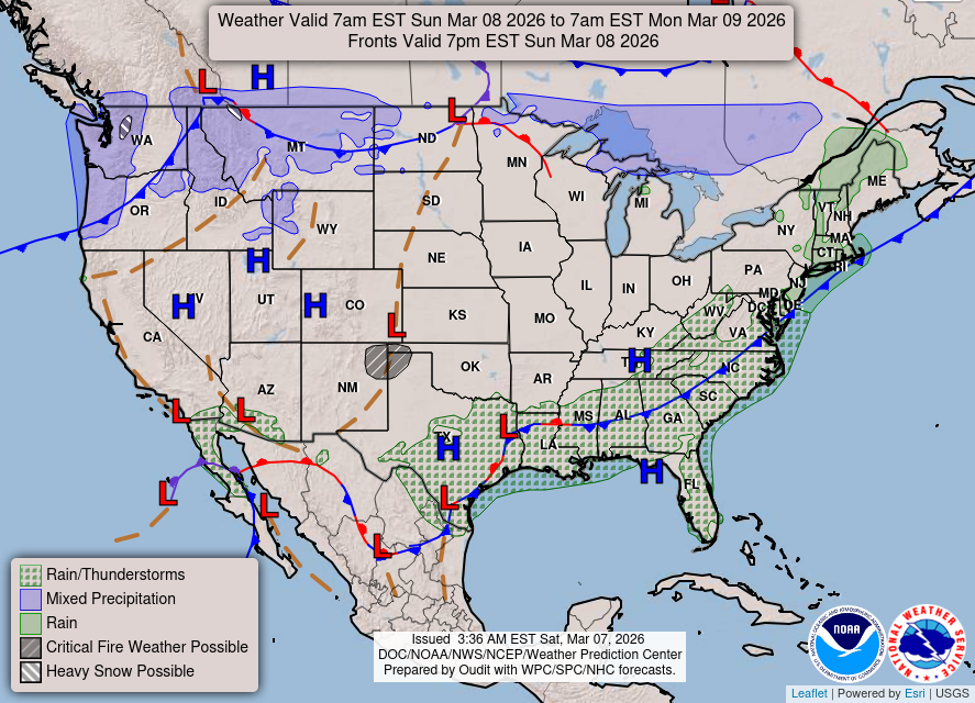
Weather on Sunday
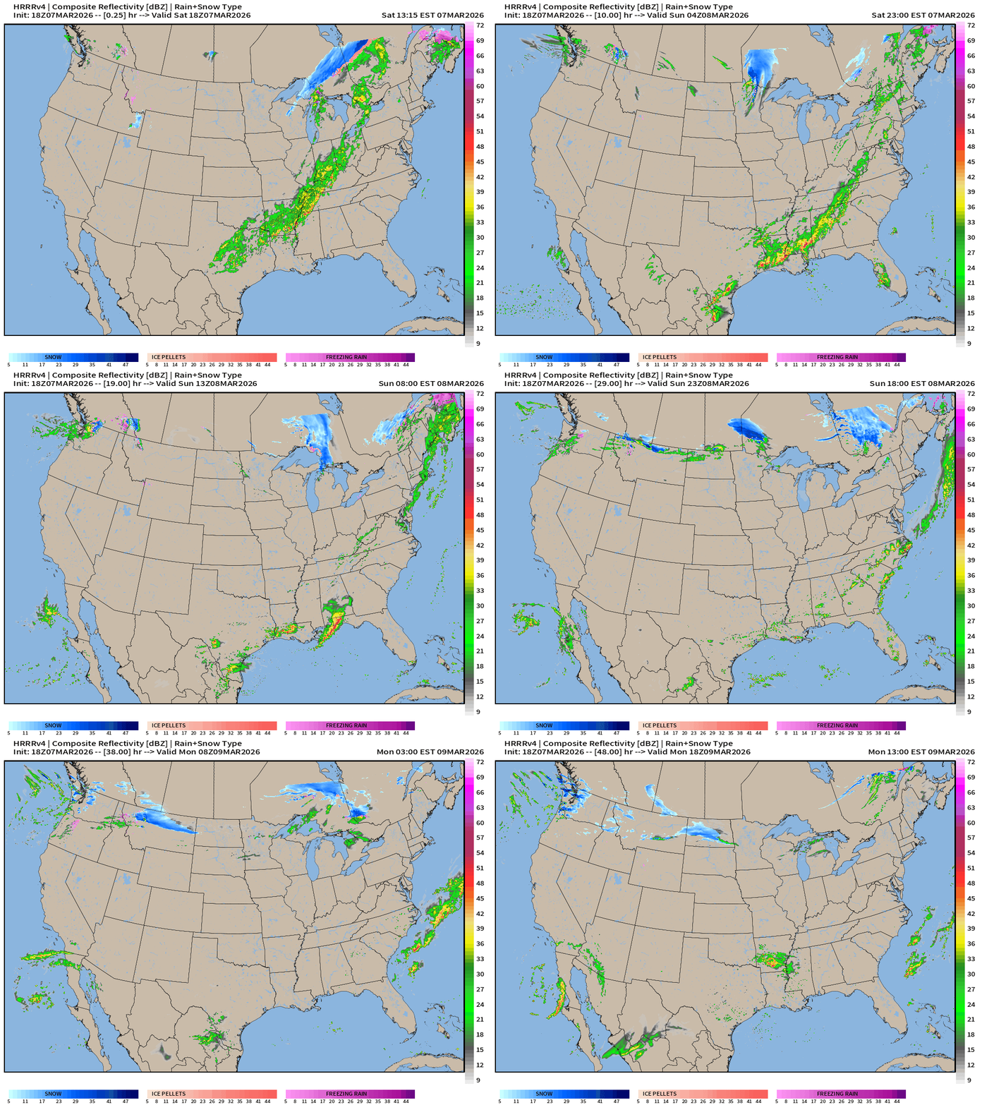
HRRR 18z — Radar Simulation Next 48-hours to Monday 1 PM ET
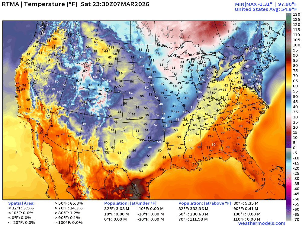
RTMA Current Temperature Analysis | 6:30 PM ET
RTMA Current Temperature Anomaly Analysis | 6:30 PM ET
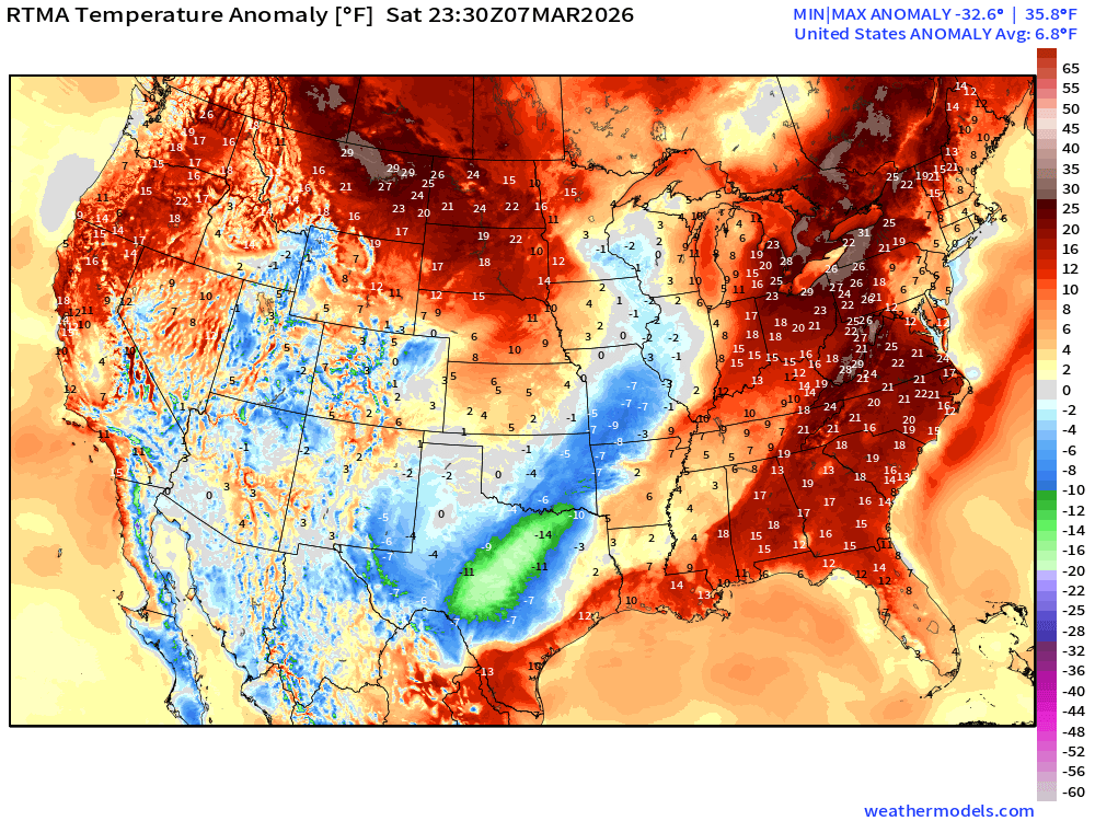
Lower 48 is a whopping 6.8°F above normal
Low Temperatures on Sunday
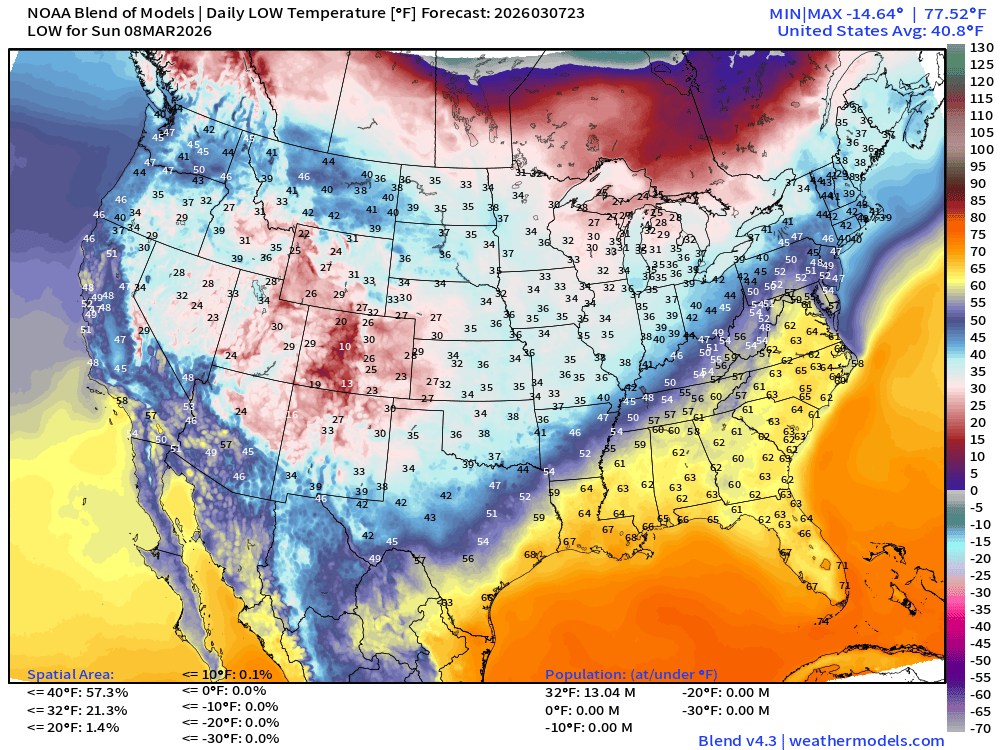
Only 13 million below freezing including the Great Lakes and around Denver
High Temperatures on Sunday
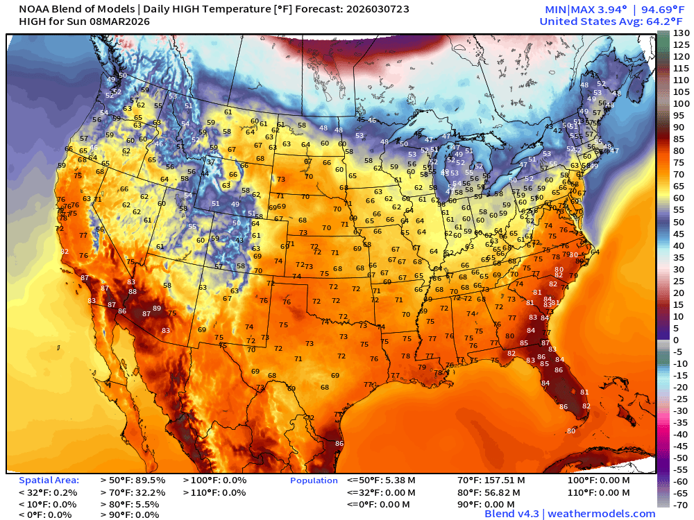
157 Million at least 70°F and 57 million at least 80°F
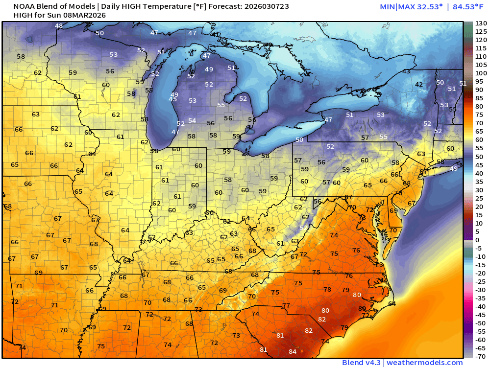
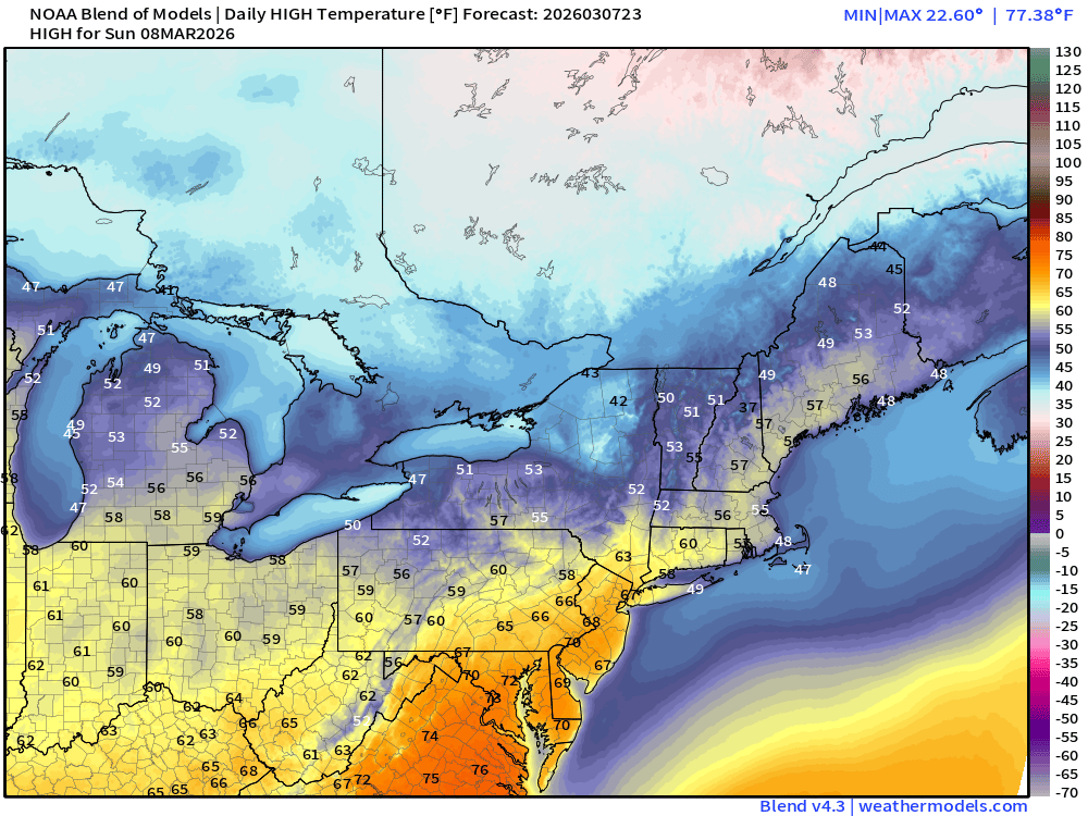
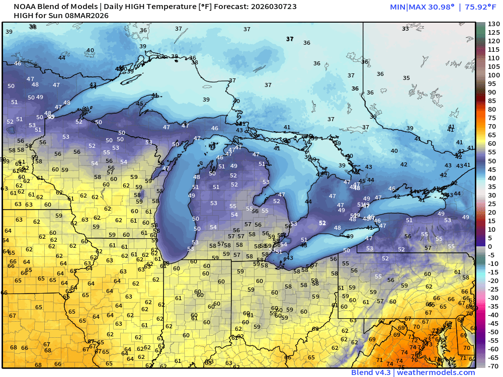
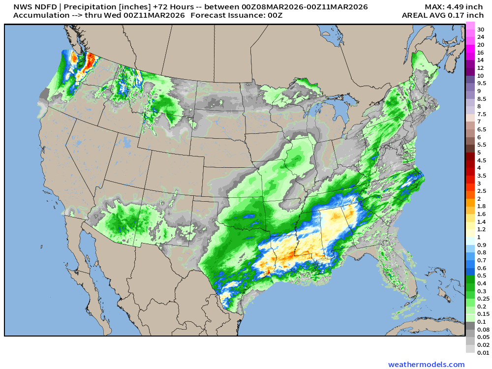
NDFD NWS Total Precipitation Next 72-hours through Tuesday Evening
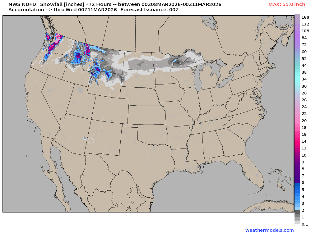
NWS Snowfall Next 72-hours — through Tuesday Evening
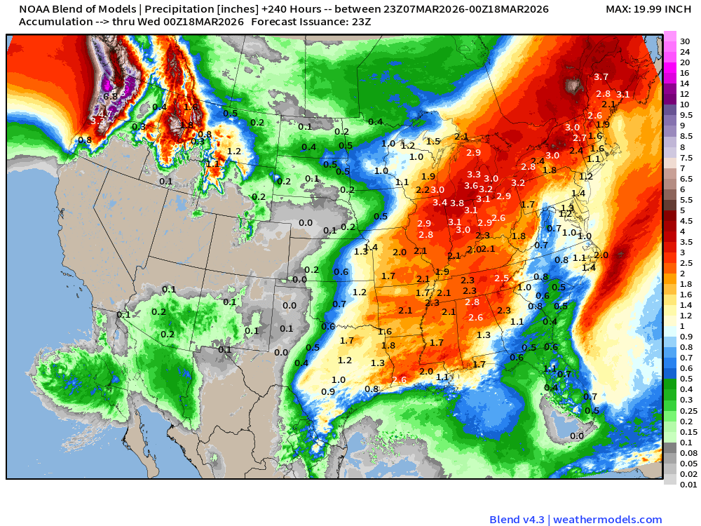
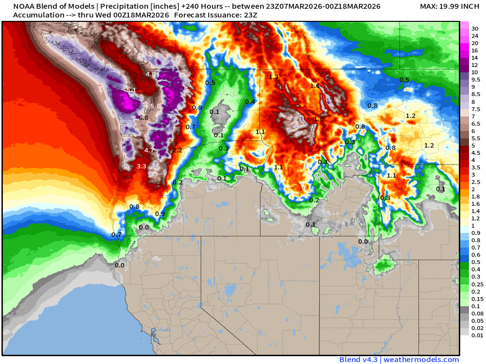
Blend of Models | 10 Days Precipitation Total
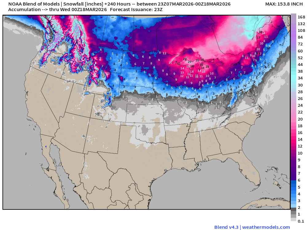
Blend of Models | Total Snowfall Next 10-Days
ECMWF AIFS 18z | Temperature at 500 mb | Next 10-days
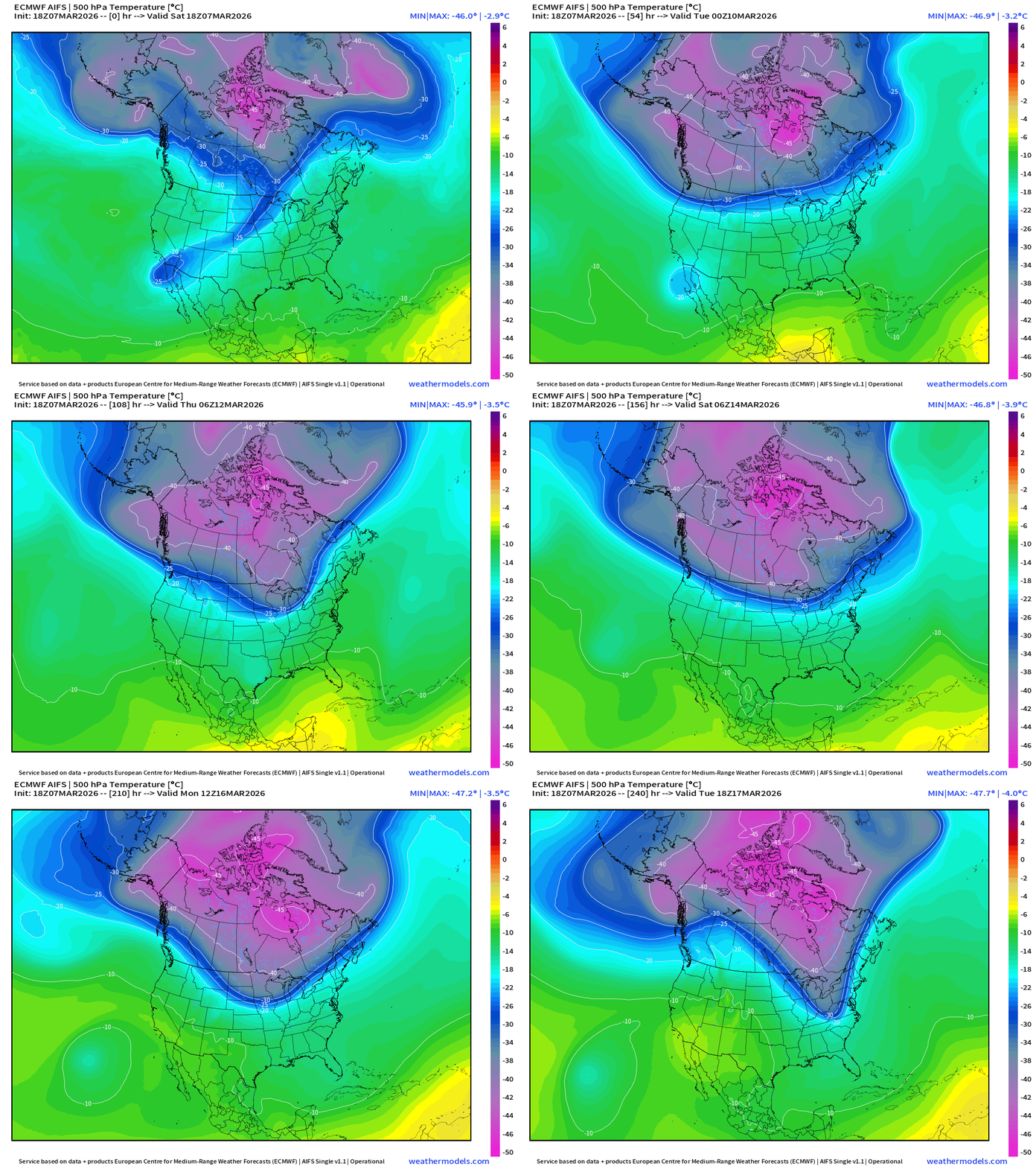
You can see the entire PV descend / stretch southward … and plenty cold with the centroid at -45°C at 500 mb … with a lobe into Great Lakes / Northeast at Days 8-10. If this happens — then we’re in for a brief but major Arctic blast for mid-March.
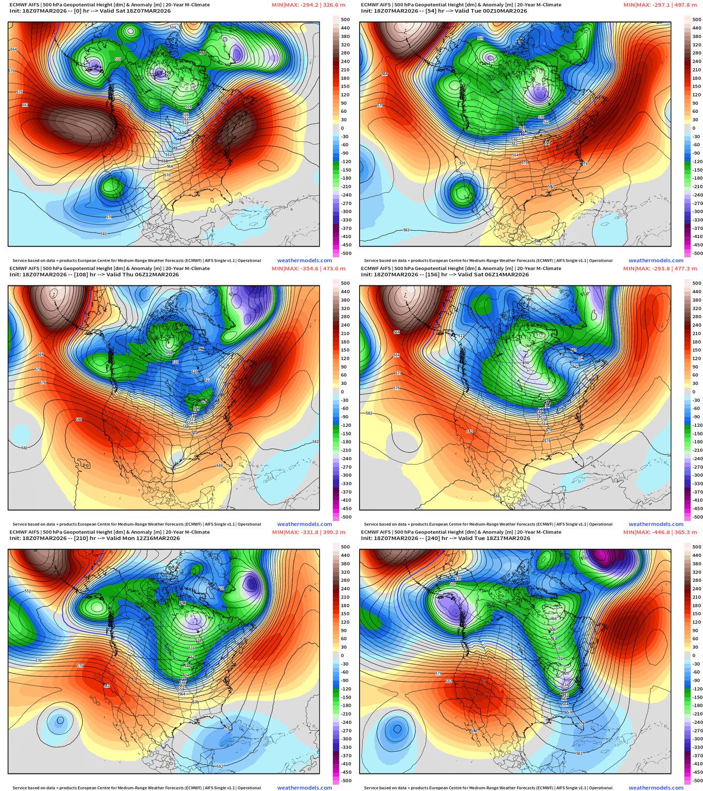
ECMWF AIFS 18z | Height Anomaly at 500 mb | Next 10-days
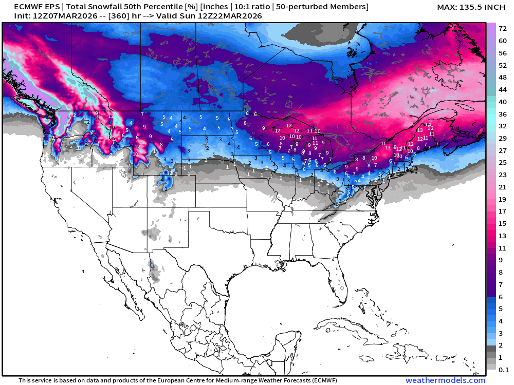
Snowfall | Median of ECMWF Ensembles at 12z | Next 15-days
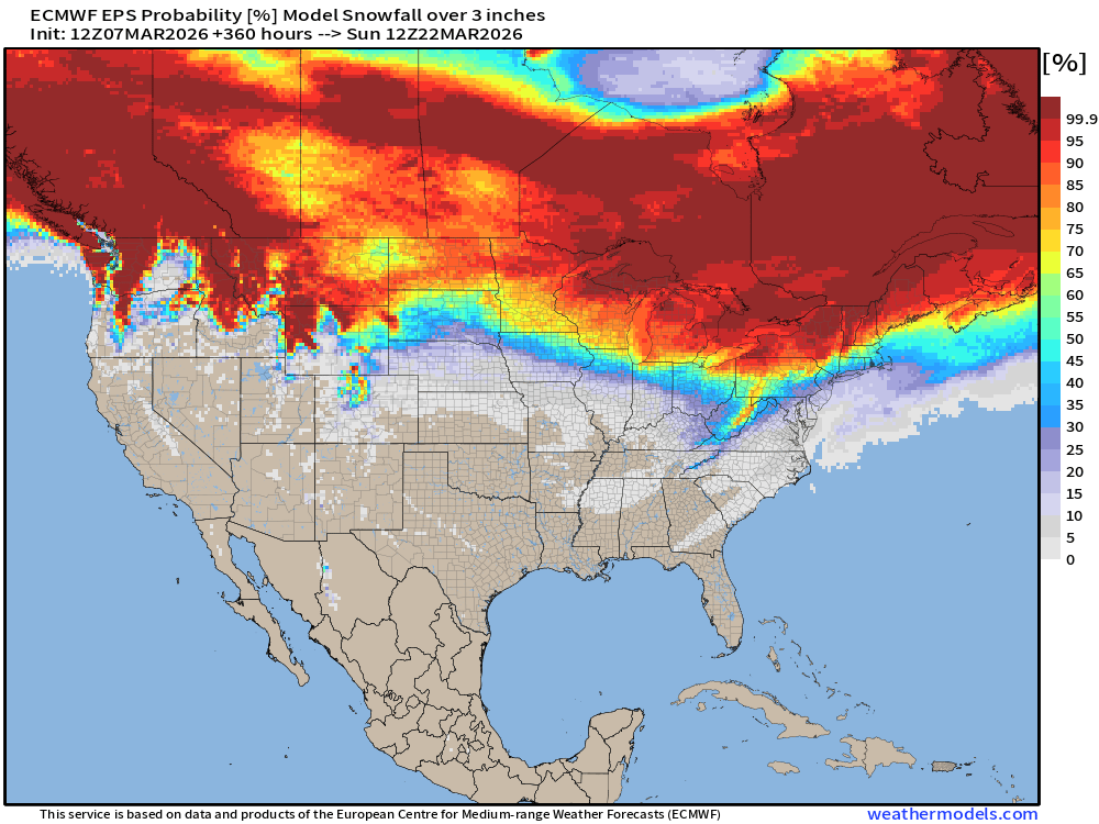
Probability of at least 3” of Snowfall Next 15-days
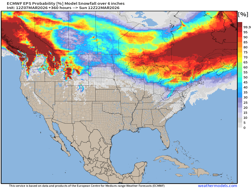
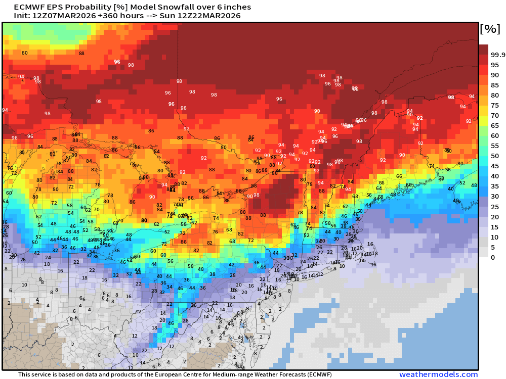
Probability of at least 6” of Snowfall Next 15-days
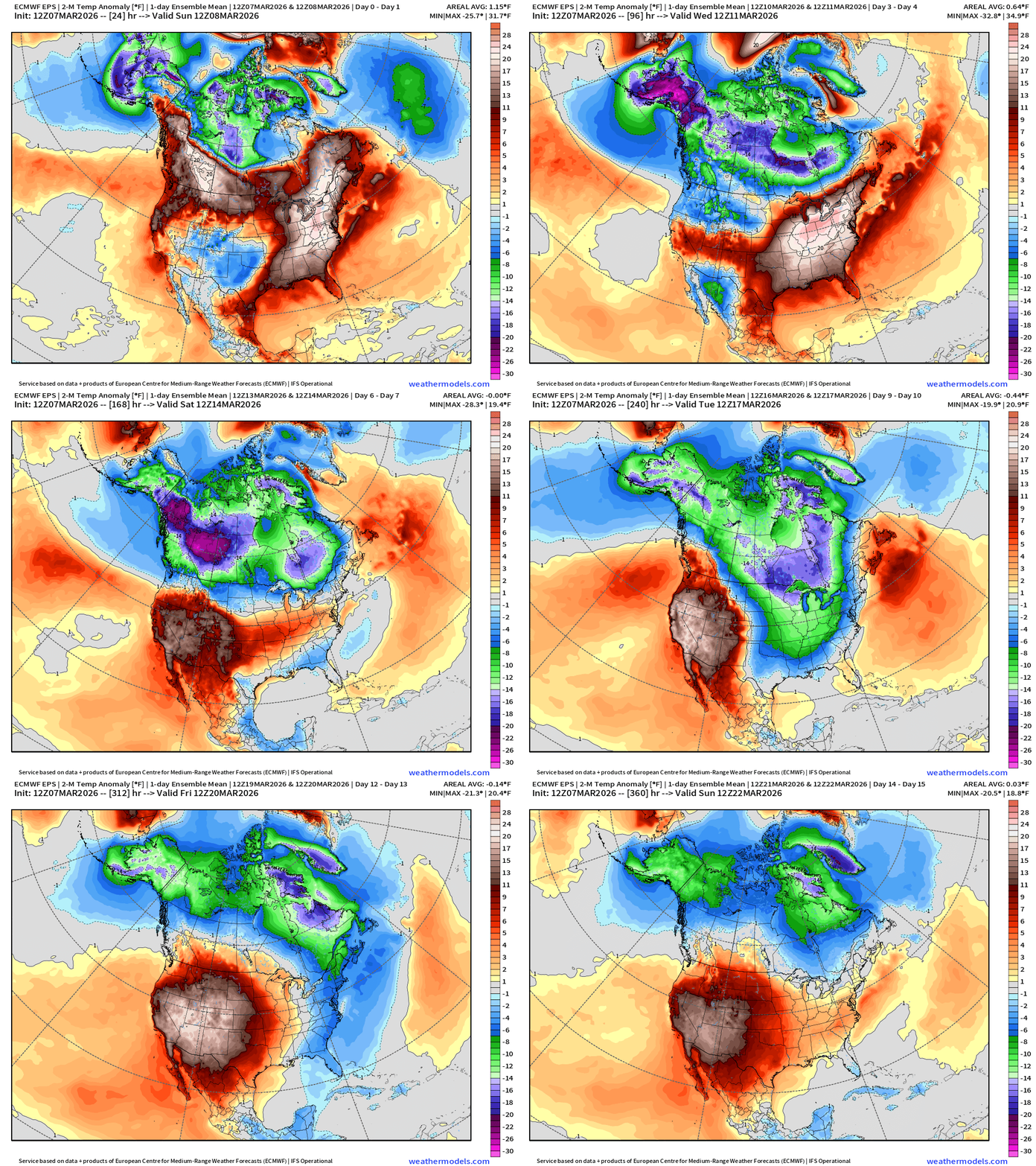
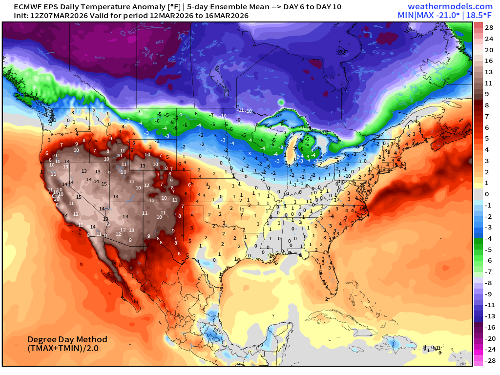
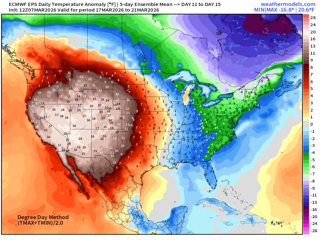
Temperature Anomaly | Next 15-days | ECMWF EPS 12z Ensemble Mean Flagship
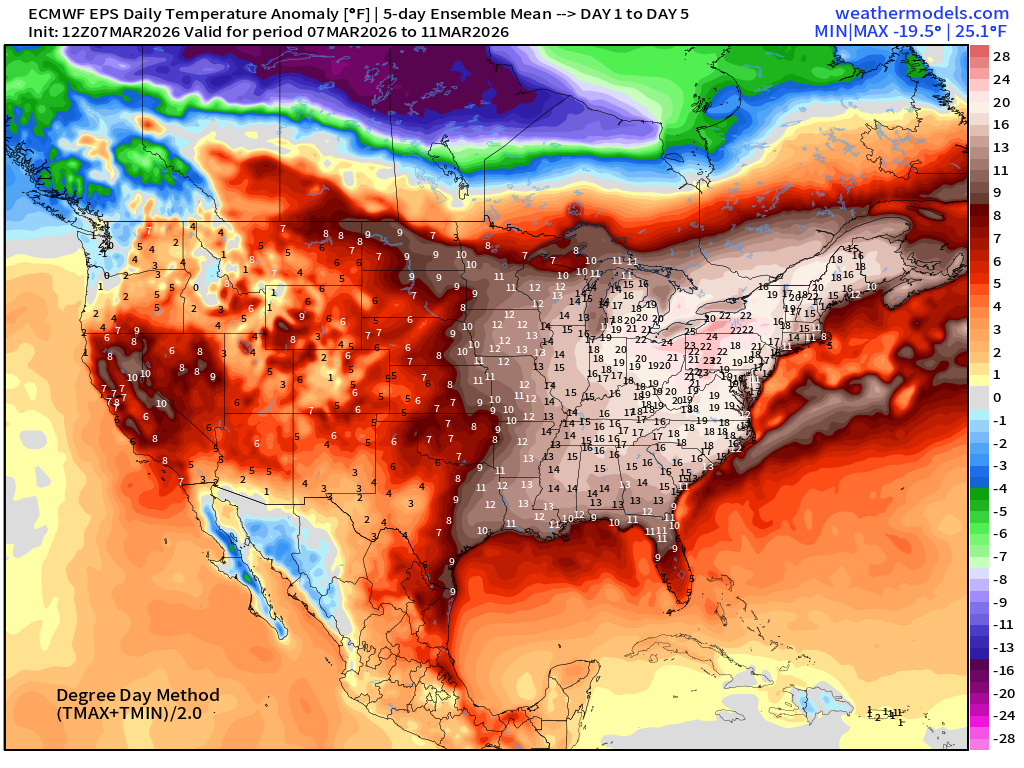
5-Day Chunk #1 | Temperature Anomaly | March 7 - March 11
5-Day Chunk #2 | Temperature Anomaly | March 12 - March 16
5-Day Chunk #3 | Temperature Anomaly | March 17 - March 21
Maps sourced from weathermodels.com designed and innovated by yours truly! Please subscribe there for real-time access to the newest maps, charts from all of the weather models including ECMWF and AIFS, and NOAA GFS/GEFS. NOAA WPC and SPC for fronts/convective outlooks.
- Milepost
- 890 · laid 2026-03-08T01:45:09.819000Z
- Source
- https://weather.substack.com/p/march-7-2026-saturday-weather-after
- Digest
- c76614aaf99650b74a98f28147c34bee78a4da85bb0991ecf0ef78fab9a22a1a
- Machine
- JSON