February 21, 2026 Saturday Evening Winter Weather
Arctic blast follows behind blockbuster blizzard into early next week, more cold on the way?
February 2026 was the 4th-warmest February in the 132-year national record (1895–2026), at 40.3°F against a 1991–2020 normal of 35.6°F (+4.6°F).
February 2026 was the 5th-driest February in the 132-year national record (1895–2026), at 1.4in against a 1991–2020 normal of 2.1in (-0.7in).
NOAA/NCEI Climate at a Glance, contiguous United States. This is the observed record for the month, not a score of anything said in this piece — the forecast ledger begins 2026-08-17 and cannot reach earlier posts.

Saturday Evening Headline: Blockbuster Blizzard!
Not much to update from the earlier this morning — a powerful cyclone will “bomb out” right along the Mid-Atlantic coast, and then track northeast near the tip of southeast New England.
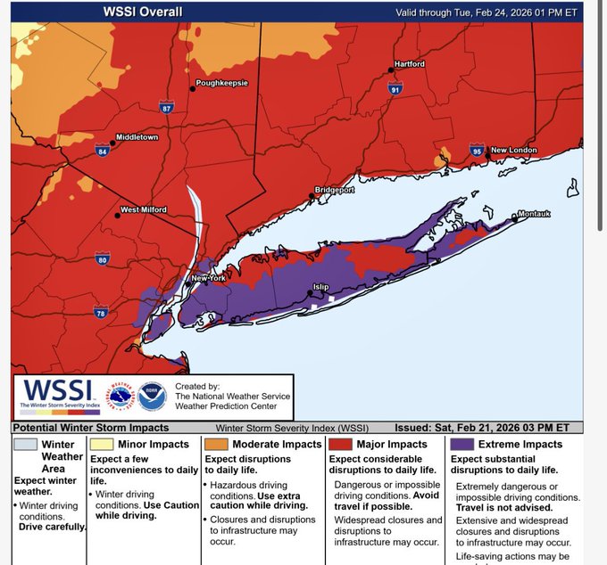
Impacts will be major/extreme to crippling especially on Long Island and along the immediate coast + 50-miles inland with hurricane force wind gusts and 2” to 4” per hour snowfall rates.
Extreme Impacts from the Winter Storm Severity Impacts (WSSI) on Long Island and in New York City proper
850 mb Wind Speed —> dynamical machine!
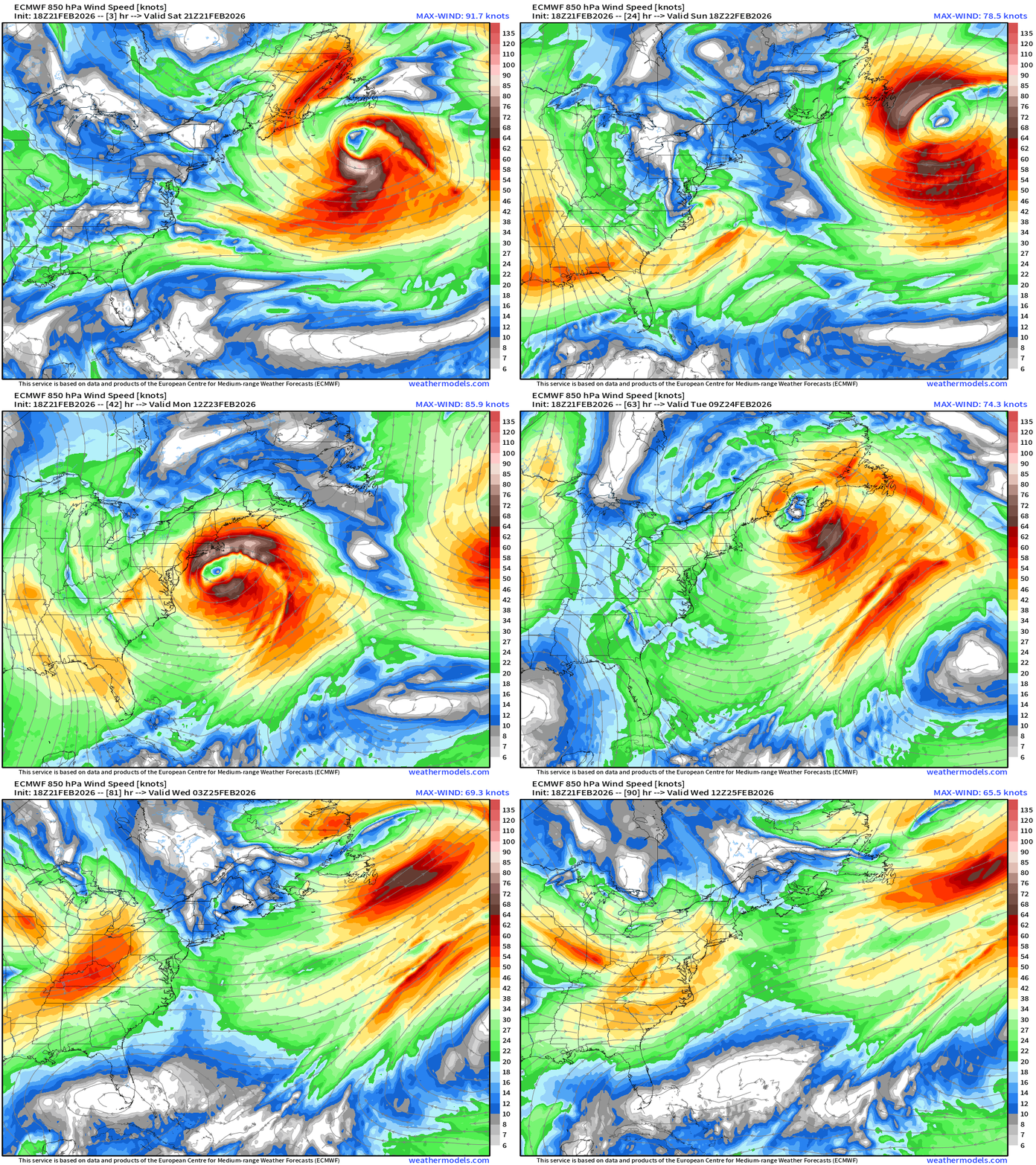
ECMWF 18z shows the low pressure center dancing along the immediate coast within the upper-level “treble clef” trough
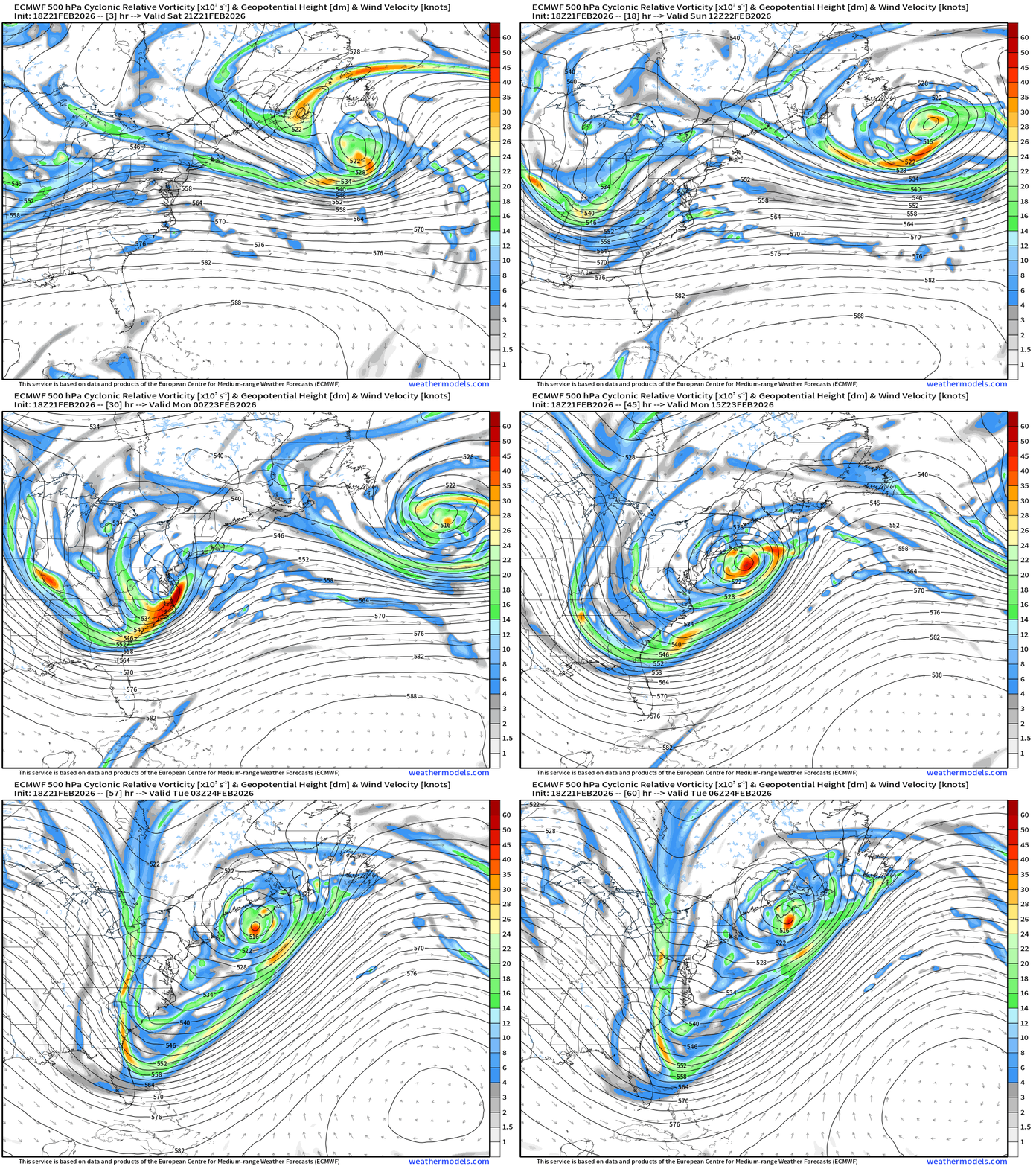
ECMWF 18z 500 mb Vorticity shows the impressive “rapid intensification” within 24-hours goes from 1000 mb to 970 mb
HRRR Maximum Wind Gusts through Monday Afternoon (1 PM ET)
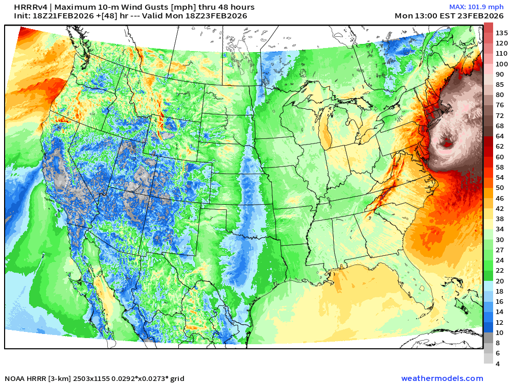
You could be forgiven for thinking a major hurricane is lurking off the East Coast!
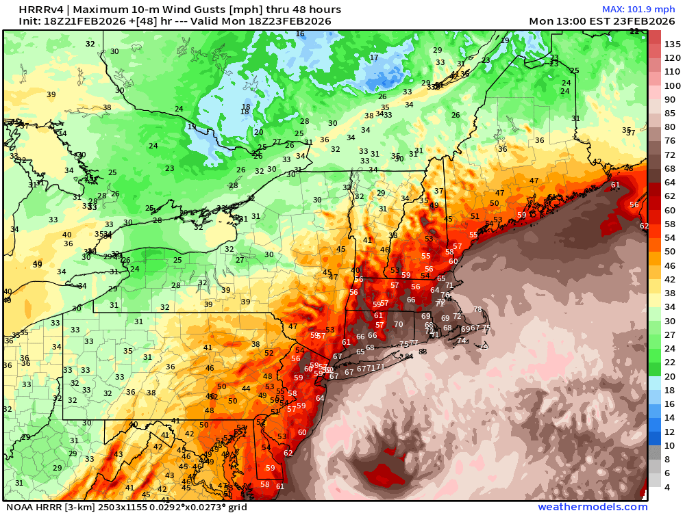
60s and 70s mph = near hurricane force / maybe above from NJ through NYC into Boston. 50 - 60 mph wind gusts well inland!
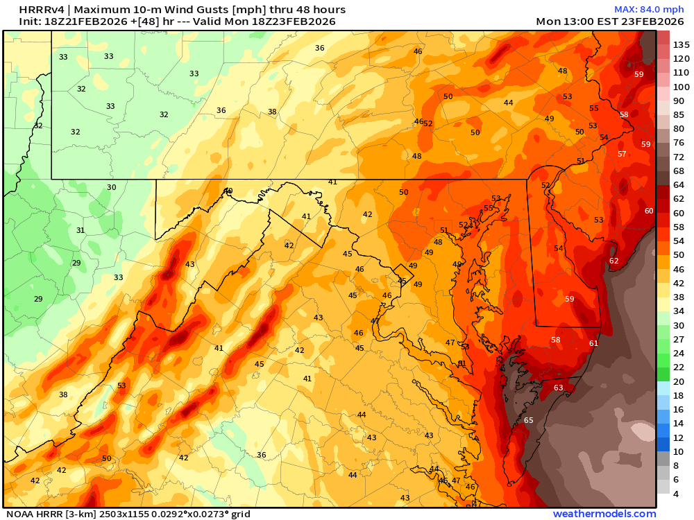
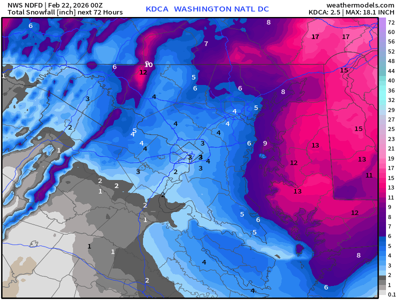
Still 45-50 mph wind gusts into Washington D.C.
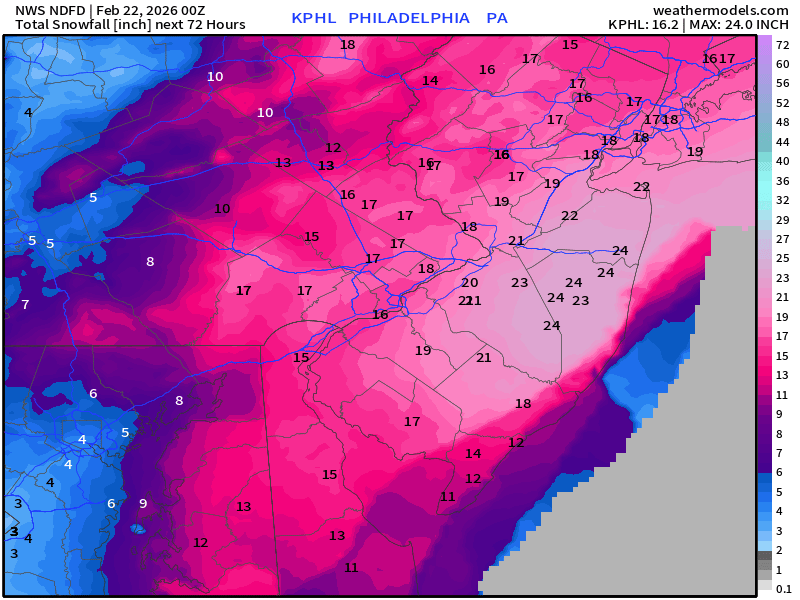
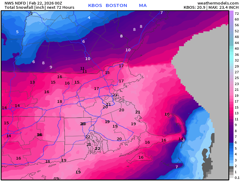
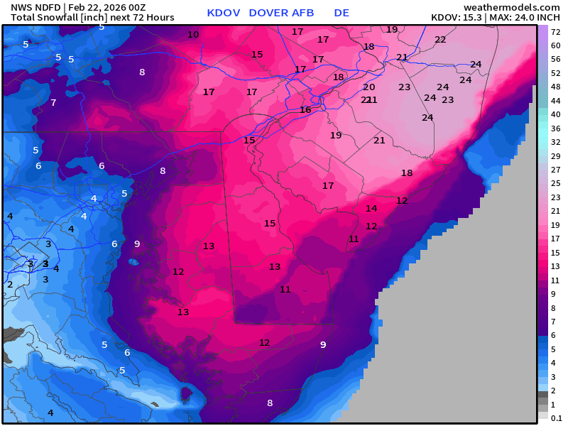
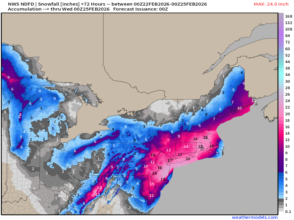
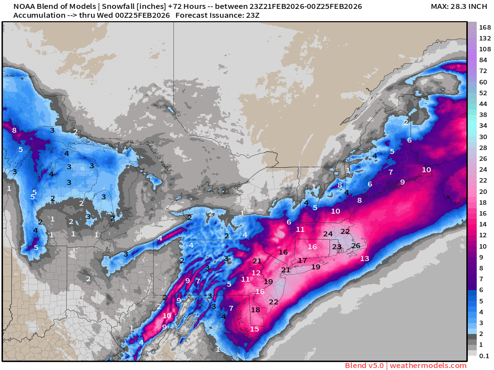
Official National Weather Service Forecast | Snowfall for entire Blizzard (Valid from 00Z Sunday)
New York City: 17.2” Central Park with a row of 20” along Long Island.
Up to 24” east of Trenton down I-195 in New Jersey
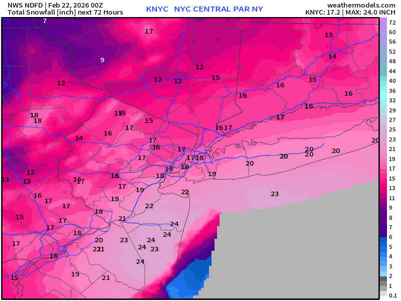
Philadelphia: 16.2”
Boston: 20.9”
Dover, Delaware: 15.3”
Washington D.C. only 2.5” — doubtful many are complaining.
Overall Map for the Northeast — work of art by NWS for collaboration!
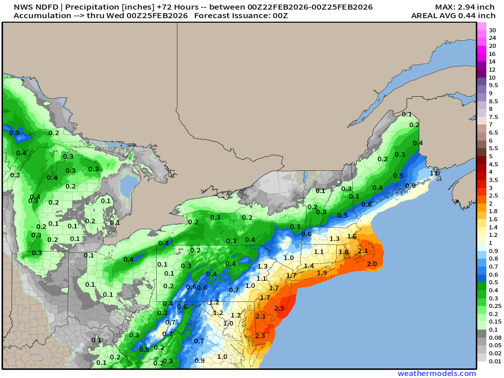
NDFD NWS Total Precipitation Next 72-hours
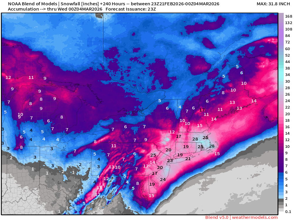
For Reference: Blend of Models v5.0 Snowfall
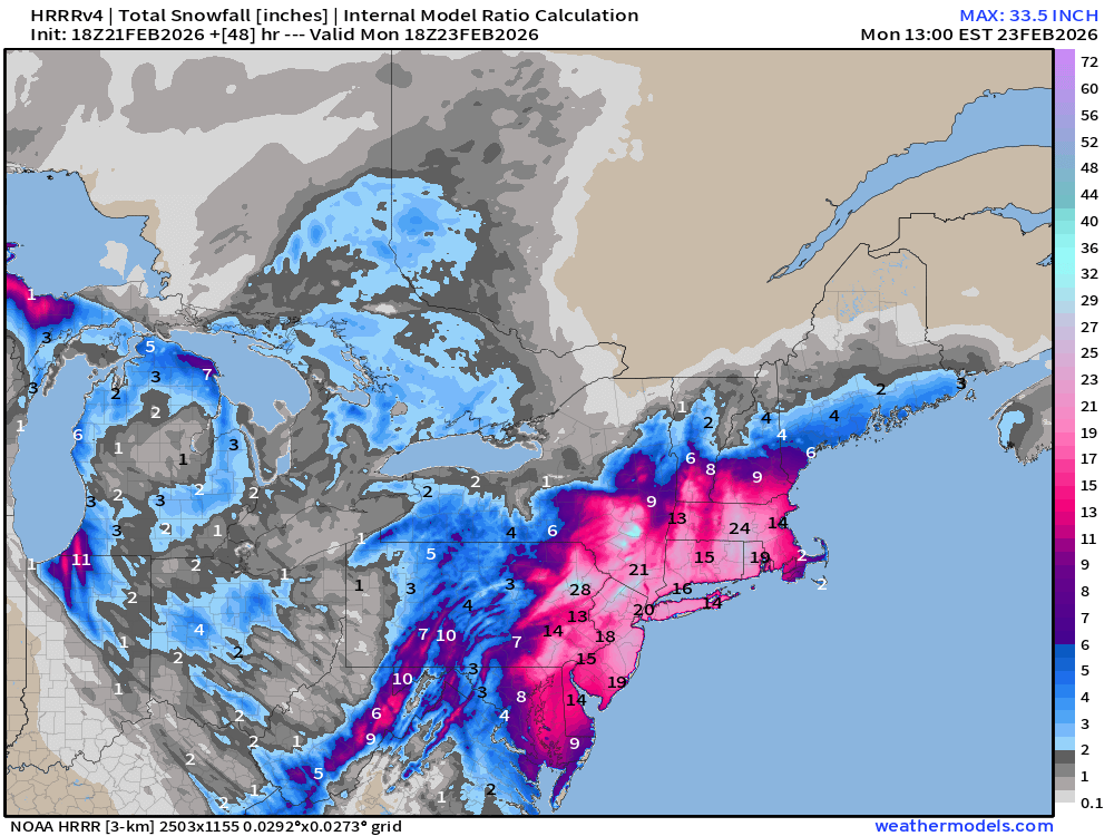
For Reference: HRRR 48-hour Total Snowfall
Total QPF from HRRR 18z for 48-hours
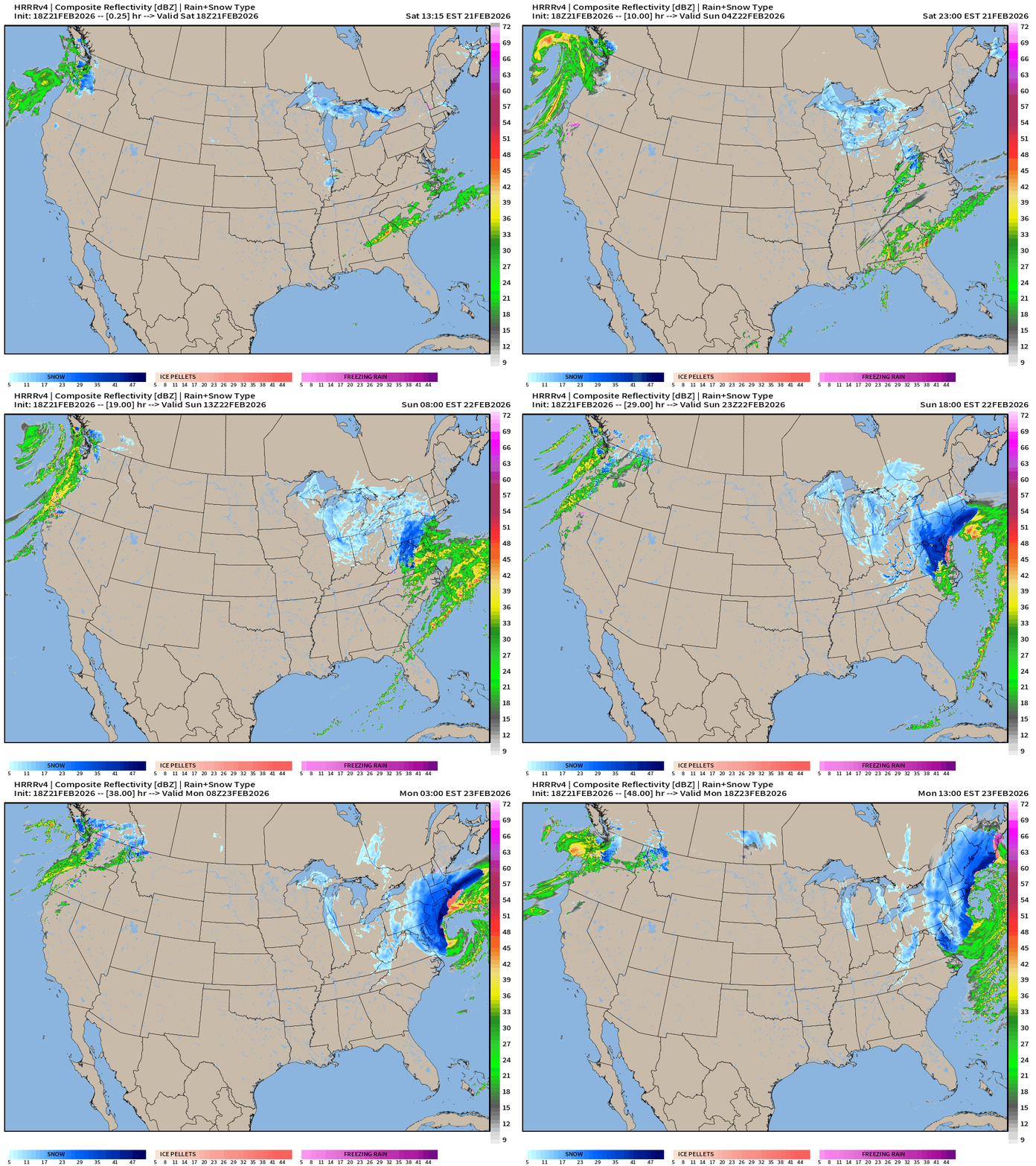
HRRR 18z — Radar Simulation Next 48-hours of the blizzard — not quite the entire event
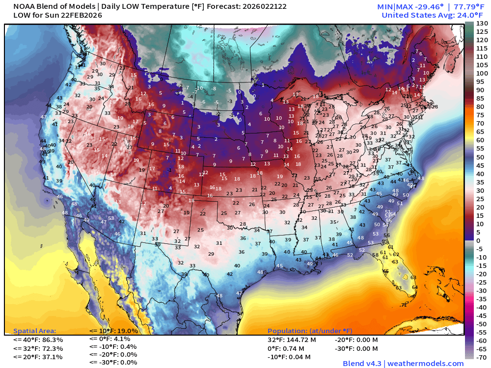
Arctic Cold on way back into Eastern U.S. through Florida into early next week
Low Temperatures on Sunday
High Temperatures on Sunday
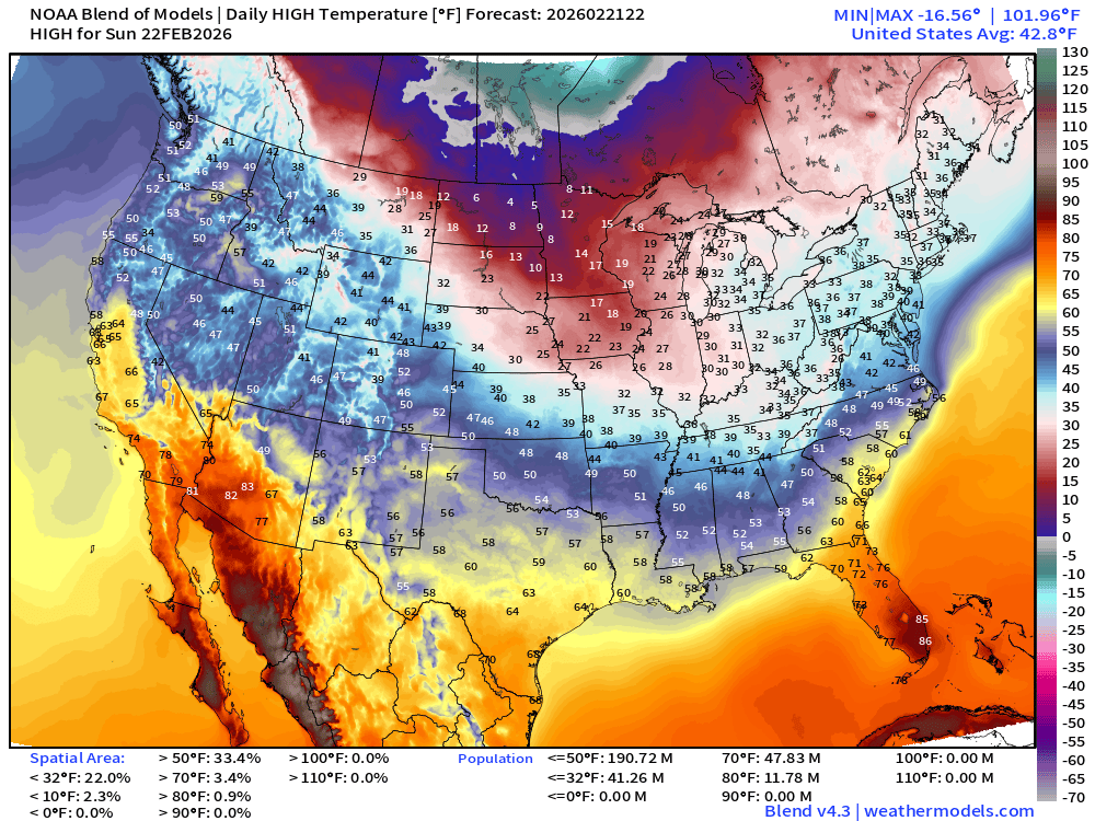
191 million below freezing
Low Temperatures on Monday
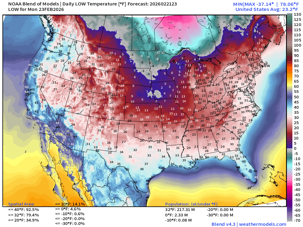
217 million below freezing
Low Temperatures on Tuesday
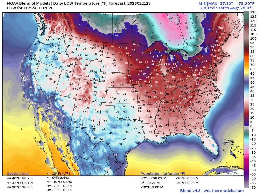
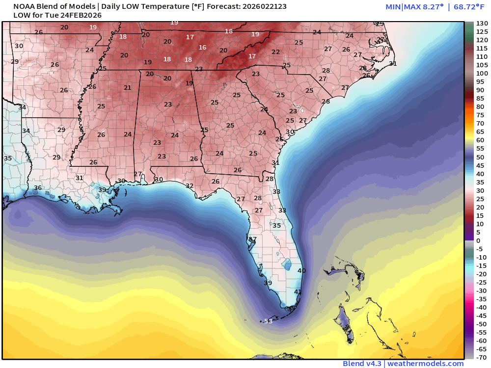
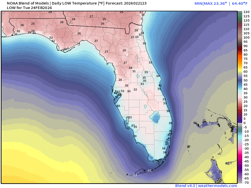
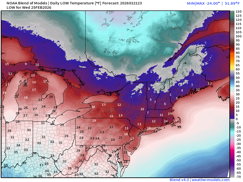
Low Temperatures on Wednesday
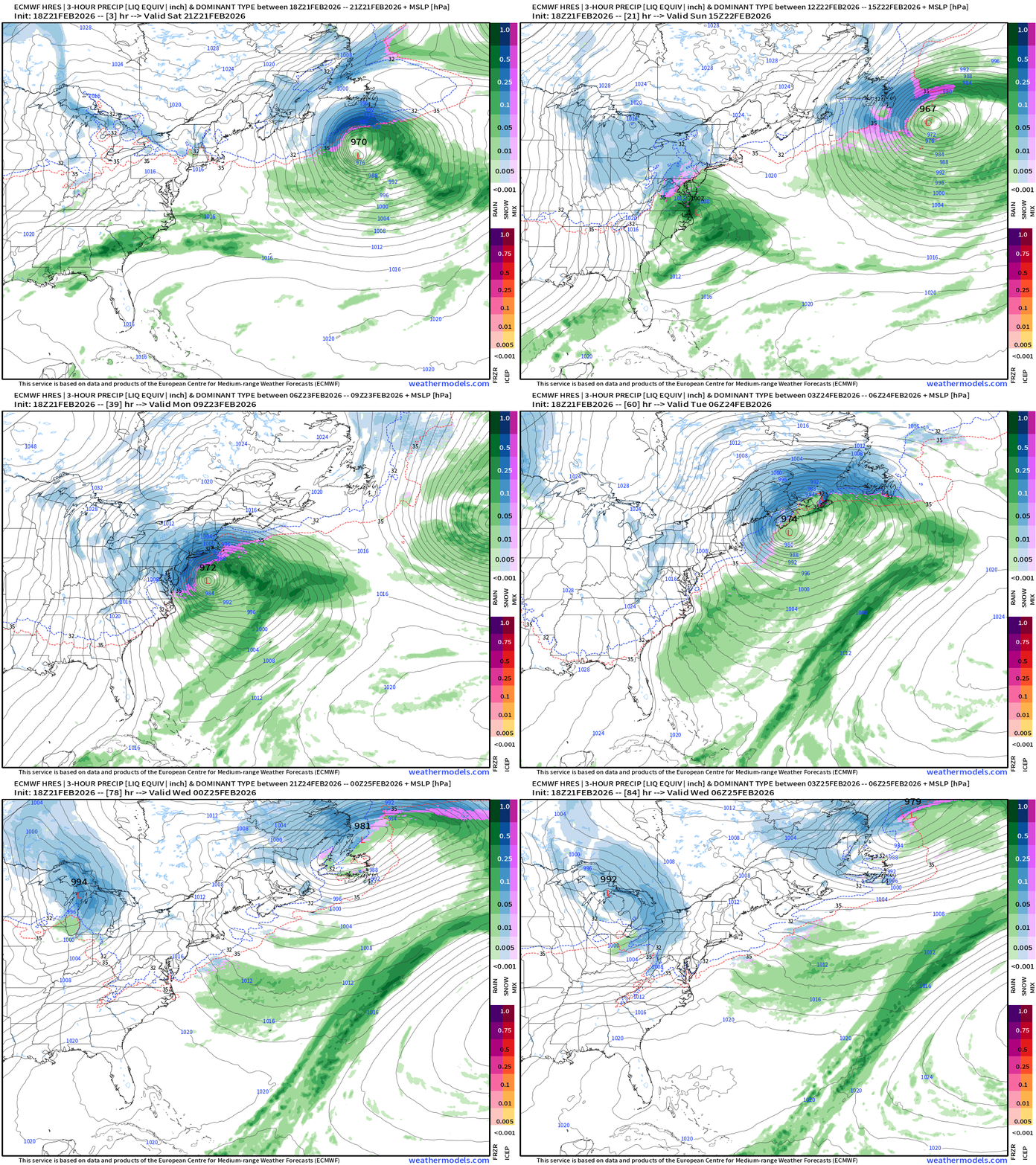
ECMWF 18z Precipitation Type + Intensity | Next 6-days
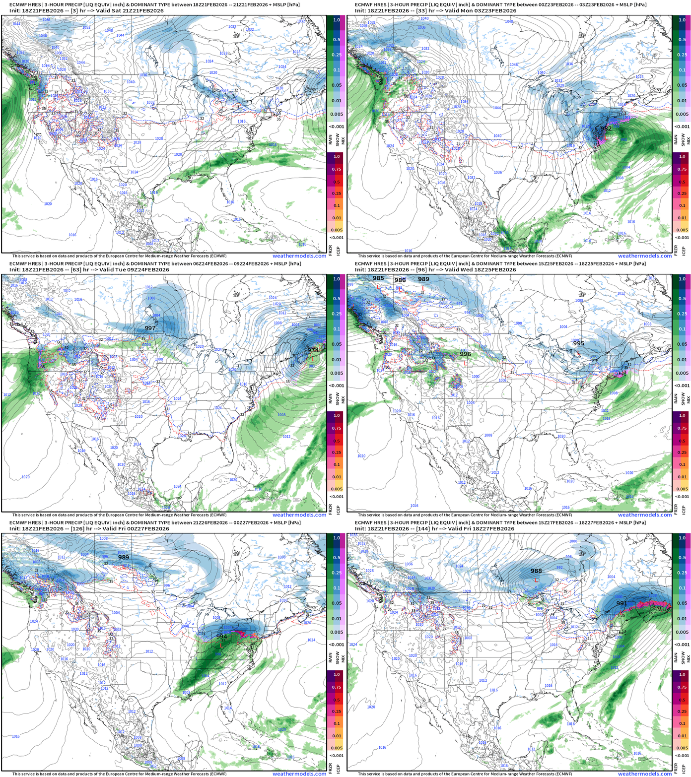
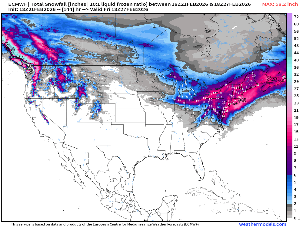
More storms on the way across the Great Lakes and into the Northeast into late next week, but looks warmer for the big cities … and heaviest snow will be in Canada and northern New England.
Snowfall Next 6-days
Eastern U.S. Next 6-days storm systems | ECMWF 18z
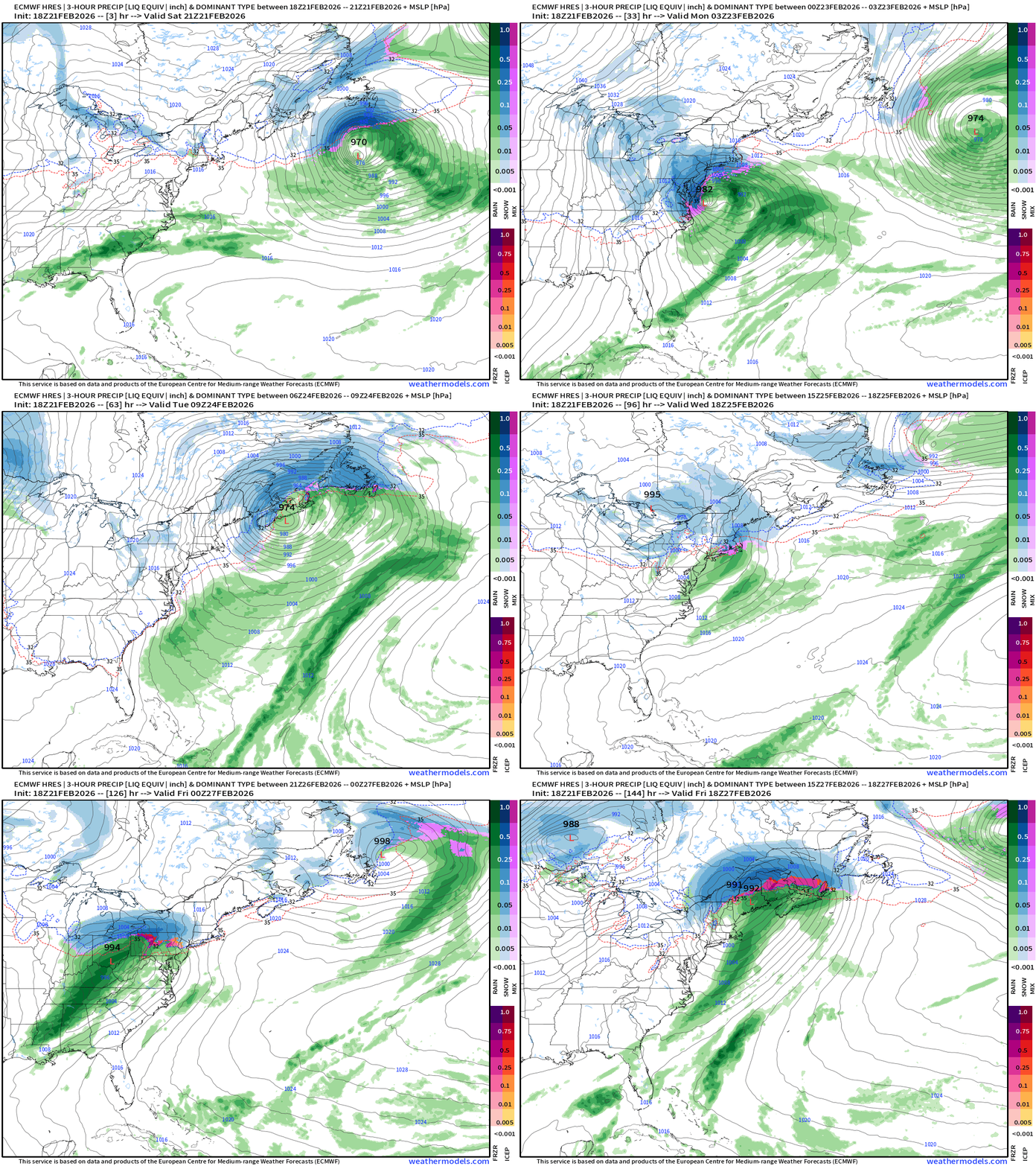
Next Friday, we end up with a low pressure centered over northern New York and New England — mostly rain on the bottom side — for now!
Western U.S. Storm Systems — next 6-days
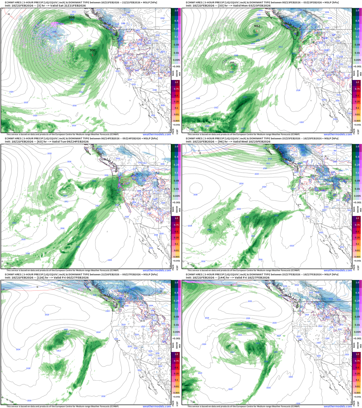
The predominant flow is again out of the Southeast next week — much warmer and less snowfall potential for the mountains.
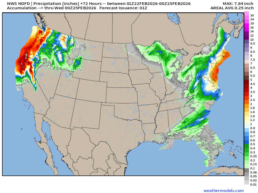
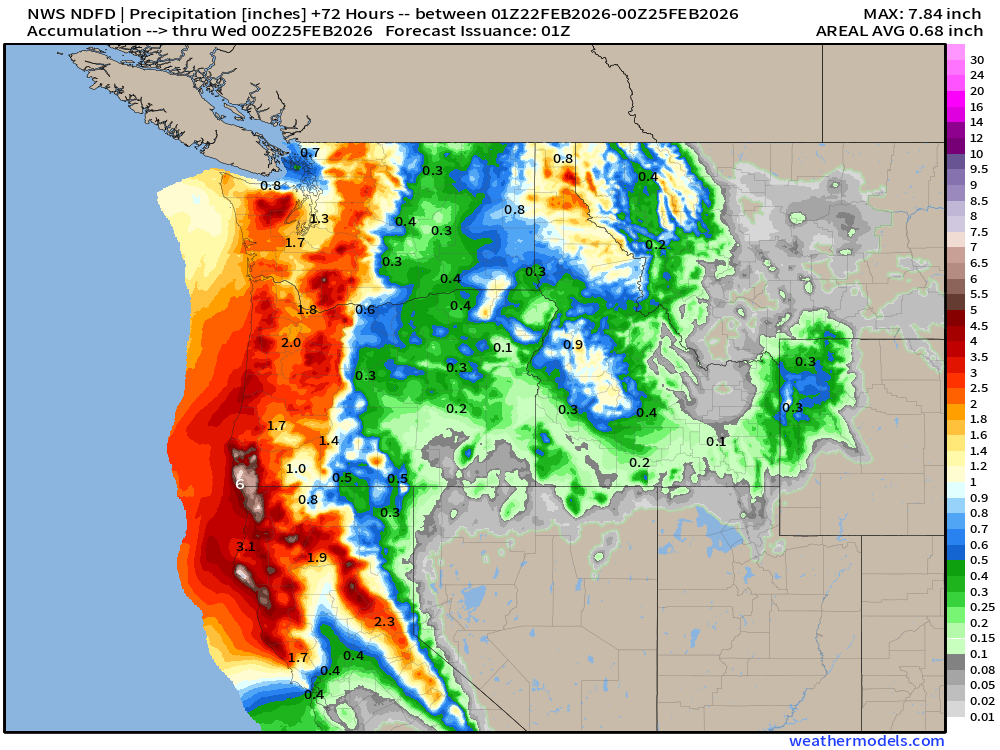
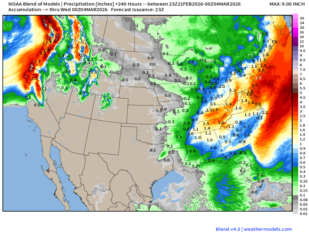
Blend of Models | 10 Days Precipitation Total
Blend of Models | Total Snowfall Next 10-Days
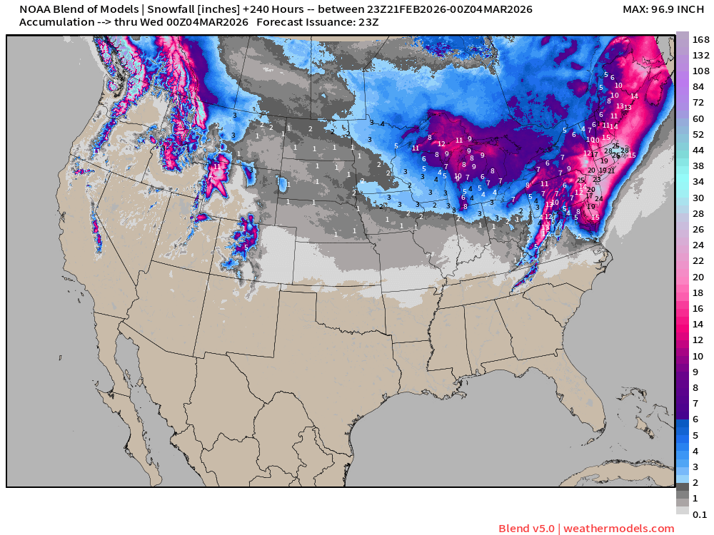
Sierra Nevada snowfall looks done — not much in the Great Basin or Colorado Rockies. Yikes! Meanwhile, the Great Lakes and Northeast continue to go bonkers.
Arctic Blast Temperature Anomaly Next 6-days
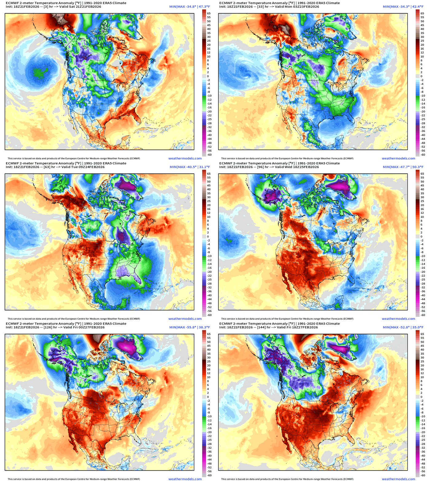
Stunning temperature anomaly 50 below normal for Alaska and Greenland at 2-meters (near the surface) with a pool of that Canadian cold air dumping out into the eastern U.S. behind the blizzard.
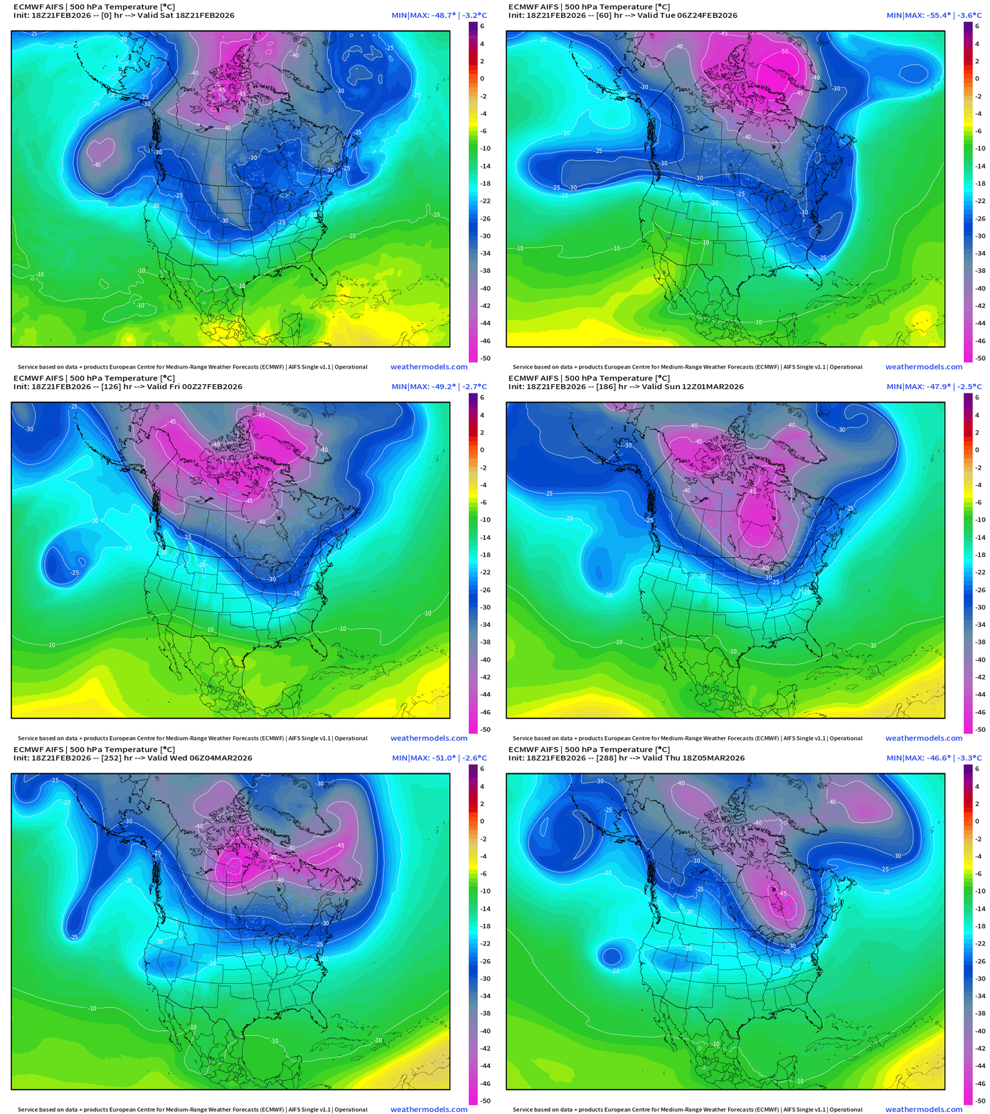
Unpresented (?) Intensity Tropospheric Polar Vortex up by Greenland
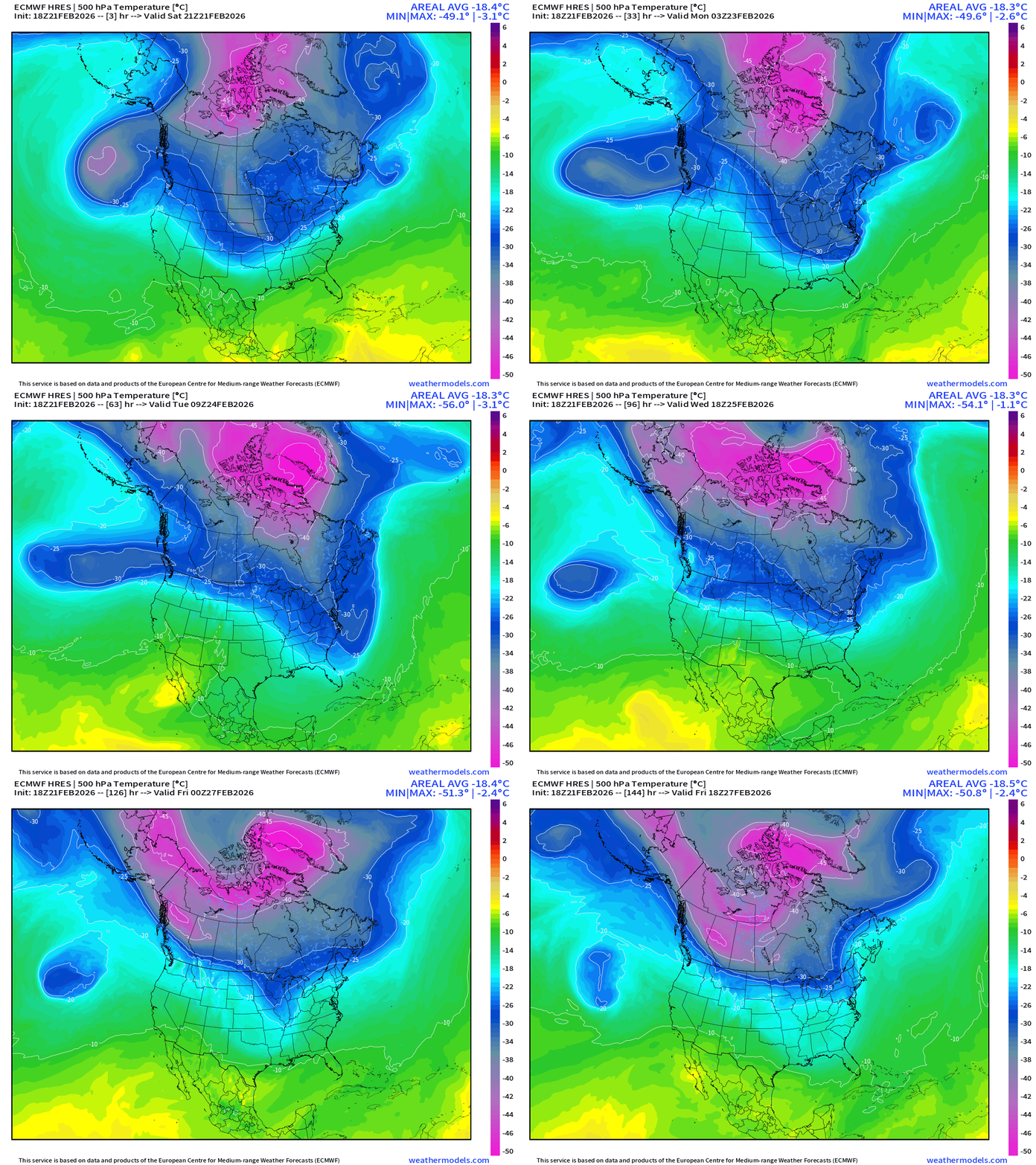
I’ve never seen -57°C at 500 mb — not really sure how that is possible. Extremely intense — maybe Roger Sr. can chime in here
Dynamic Tropopause from GFS next 7-days
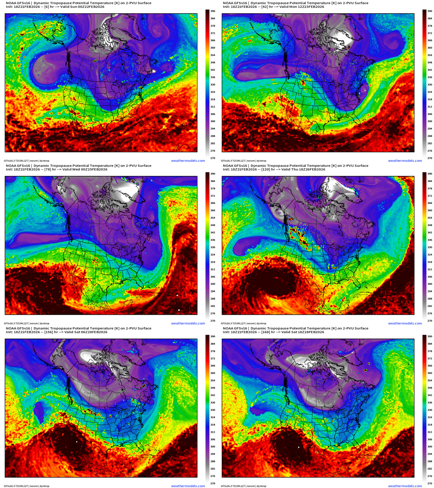
Truly massive “white fuzzball” smashes into/over Greenland and then breaks westward back toward Alaska with little loss of coherence.
Next 10-days at 500 mb from ECMWF AIFS 18z … to monitor what this extremely cold PV is going to do into early March —> additional Lower 48 Arctic cold outbreaks?
Temperature Anomaly Next 15-days | ECMWF EPS 12z Ensemble Mean
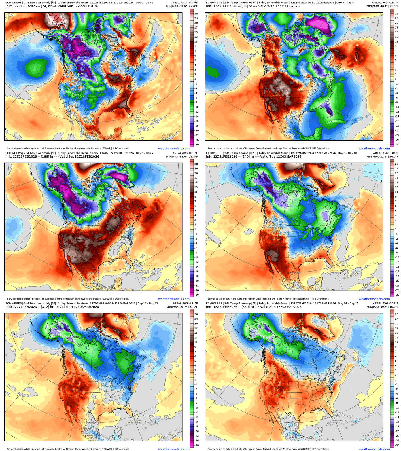
Temperature Anomaly | Next 15-days | ECMWF EPS 12z
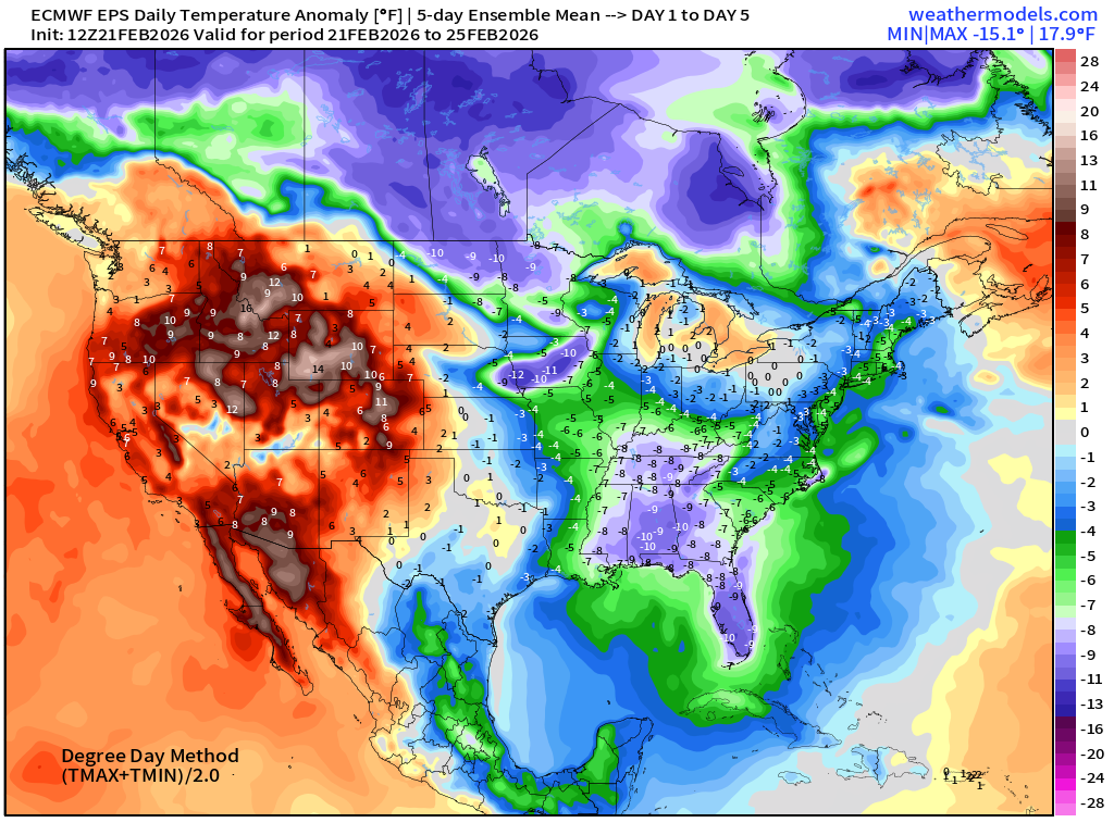
5-Day Chunk #1 | Temperature Anomaly | Feb 21 - Feb 25
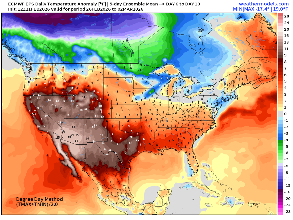
5-Day Chunk #2 | Temperature Anomaly | Feb 26 - March 2
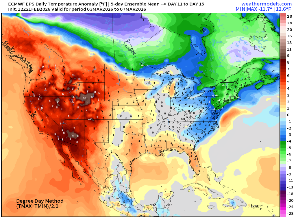
5-Day Chunk #3 | Temperature Anomaly | March 3 - March 7
Maps sourced from weathermodels.com designed and innovated by yours truly! Please subscribe there for real-time access to the newest maps, charts from all of the weather models including ECMWF and AIFS, and NOAA GFS/GEFS.
- Milepost
- 879 · laid 2026-02-22T01:24:52.548000Z
- Source
- https://weather.substack.com/p/february-21-2026-saturday-evening
- Digest
- 0d98477d2fd5f040b73094a58cc837a38d3833dbbdaec95626656b8f179d46c9
- Machine
- JSON