February 21, 2026 Blockbuster Blizzard Warning
Heavy snowfall and near hurricane forecast wind gusts for large swath of coastline
February 2026 was the 4th-warmest February in the 132-year national record (1895–2026), at 40.3°F against a 1991–2020 normal of 35.6°F (+4.6°F).
February 2026 was the 5th-driest February in the 132-year national record (1895–2026), at 1.4in against a 1991–2020 normal of 2.1in (-0.7in).
NOAA/NCEI Climate at a Glance, contiguous United States. This is the observed record for the month, not a score of anything said in this piece — the forecast ledger begins 2026-08-17 and cannot reach earlier posts.

Saturday Top Headline: Blockbuster Blizzard!
National Weather Service has pushed the buttons for “blizzard warnings” including New York City with upwards of 18” of snowfall and winds gusting 40 - 60 mph.
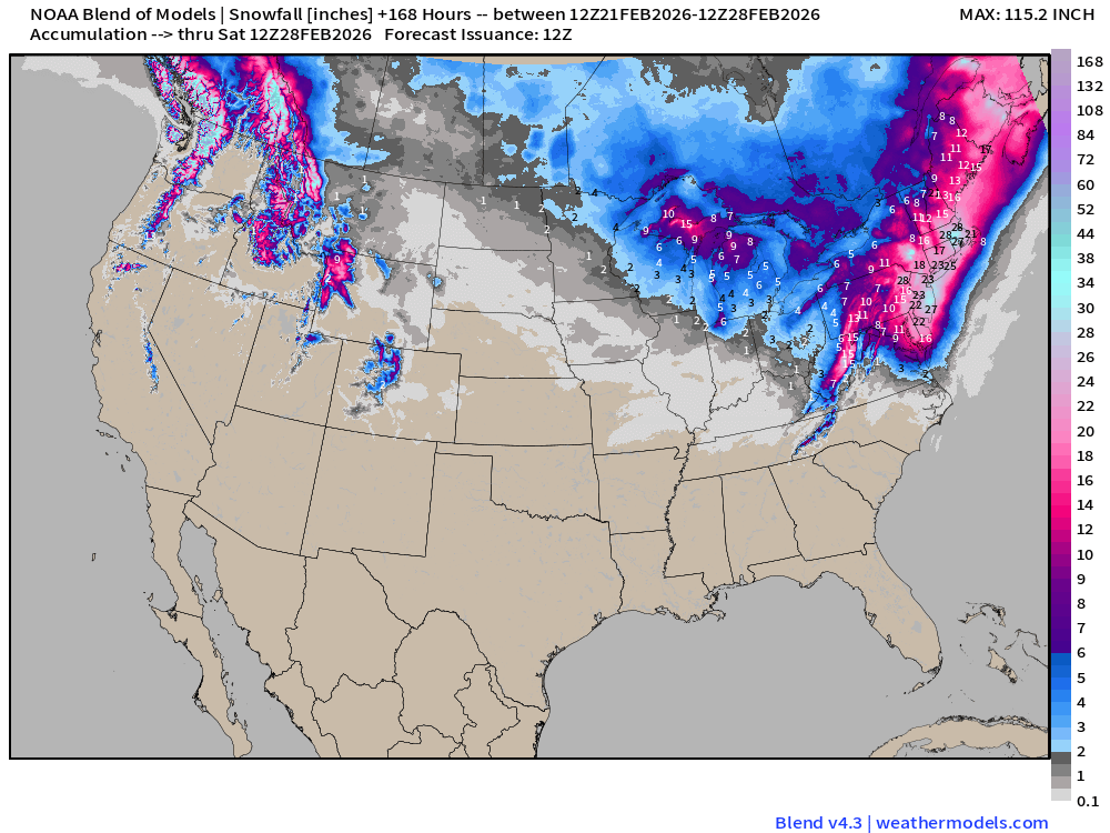
Blend of Models Snowfall
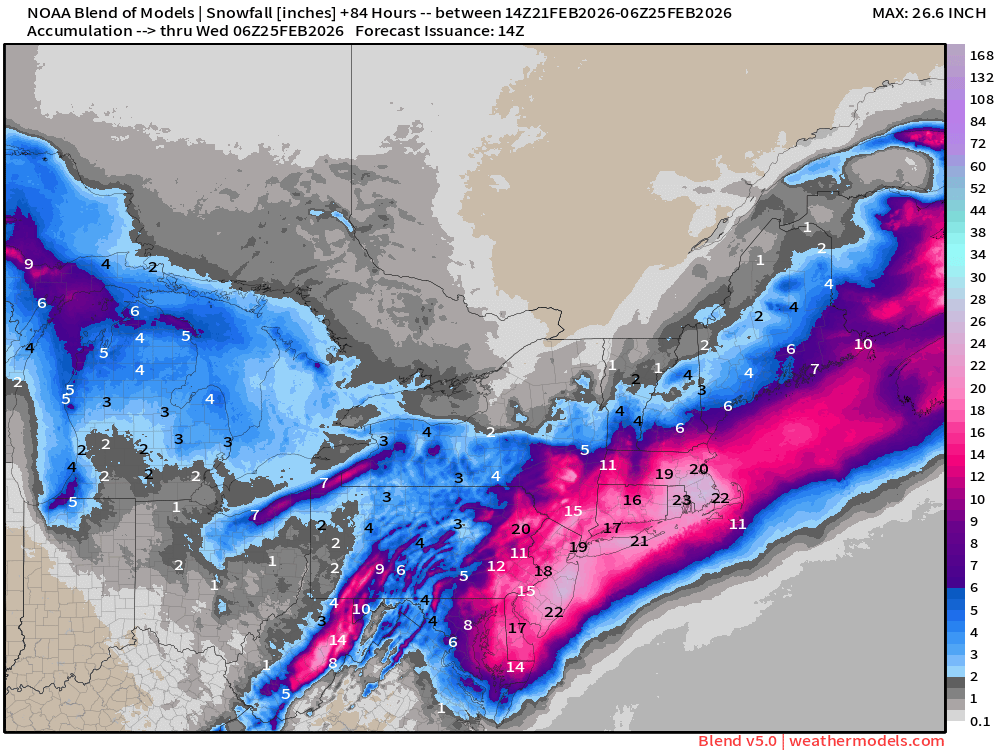
This is a good summary of what the “weather models’ are saying for this event when averaged and adjusted for snow/liquid content. Blockbuster is apt description!
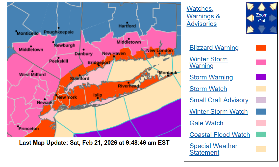
Blizzard Warnings for New York City and Long Island and along the Connecticut coast with the strongest winds. Winter storm warnings another county or two inlands.
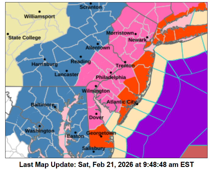
Blizzard warnings for the New Jersey coastline including Atlantic City. Winter storm warning for Philadelphia, Trenton, and Dover.
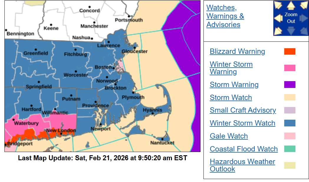
Winter storm watch — not quite within the warning window for Boston, but expect Winter Storm warnings for much of Massachusetts and extension of the Blizzard Warning for Newport to the Cape.
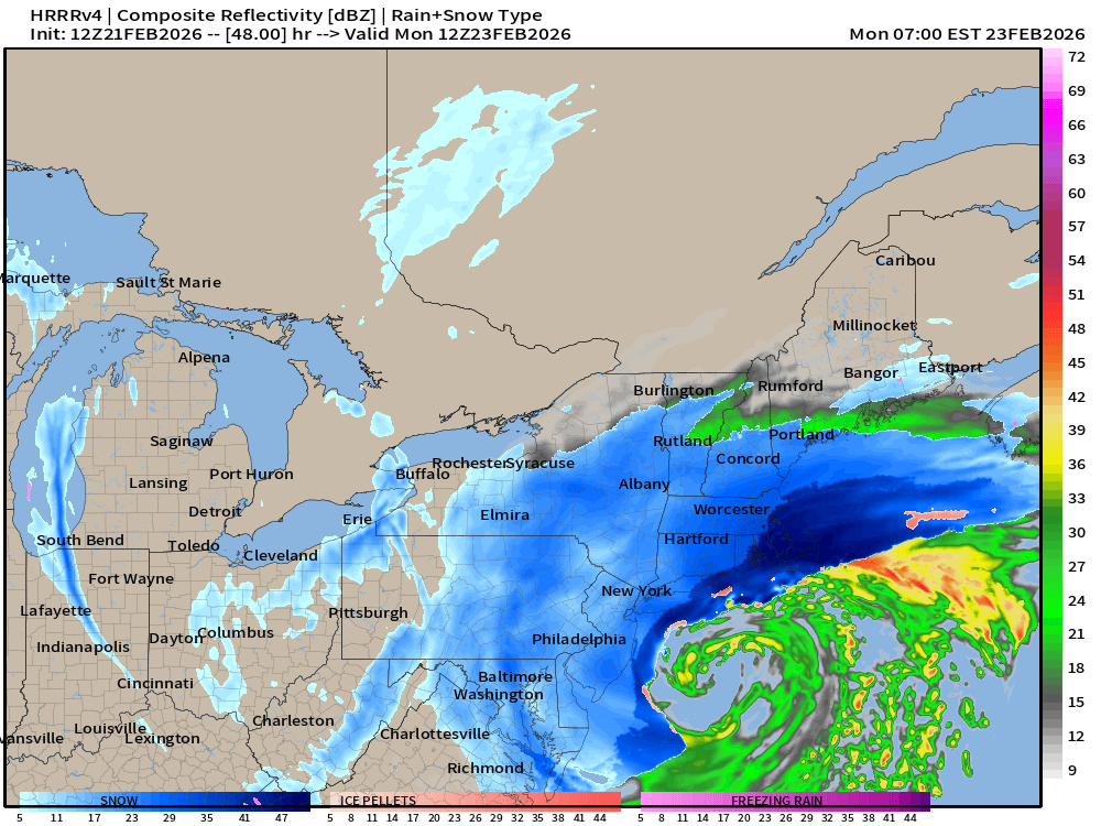
All Time HRRR 12z Model Run for “Blockbuster Blizzard”
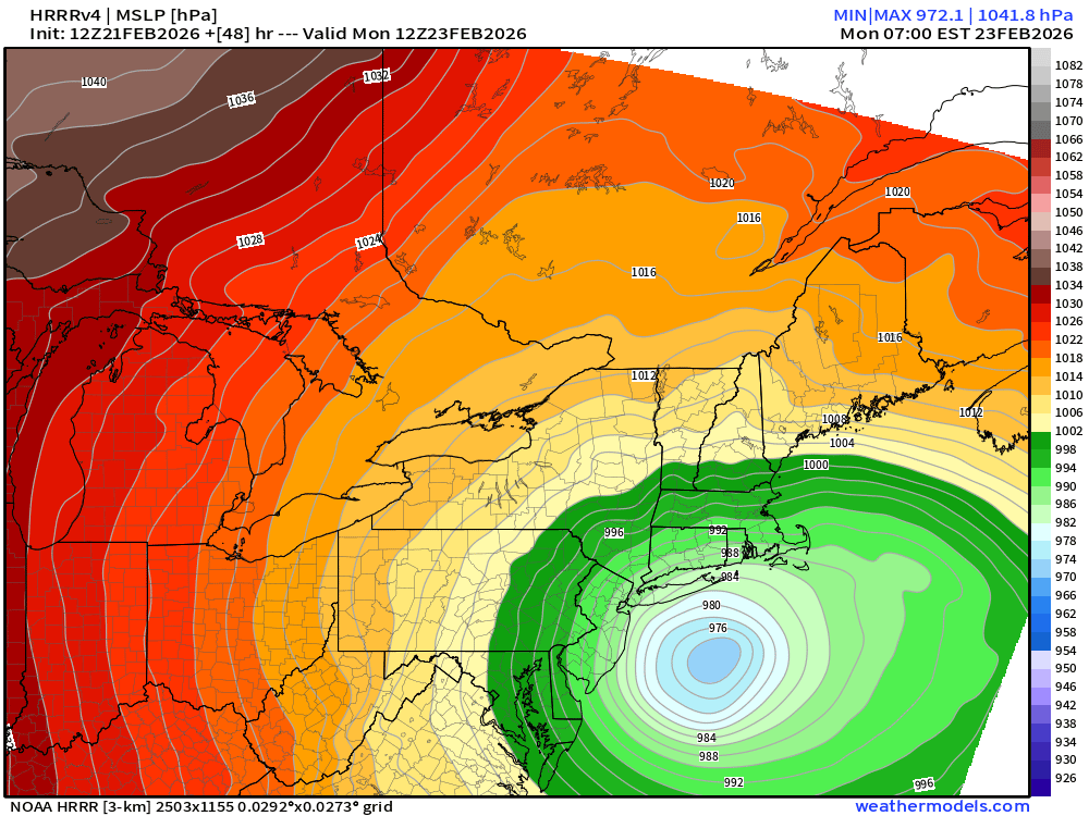
The model depiction is a “Winter Hurricane” with a tightly wound center of circulation — which will look like a serpentine coil on satellite imagery Monday morning.
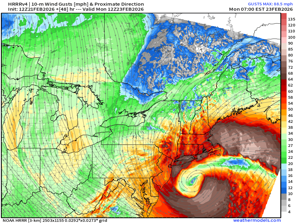
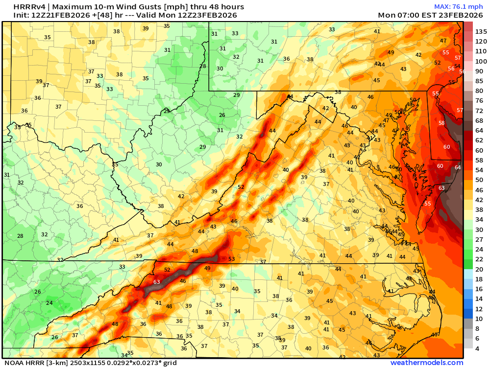
Wind gusts from HRRR are extreme — higher than NWS forecasts right now.
Coastal wind gusts near hurricane force are possible as well as New York City and Boston.
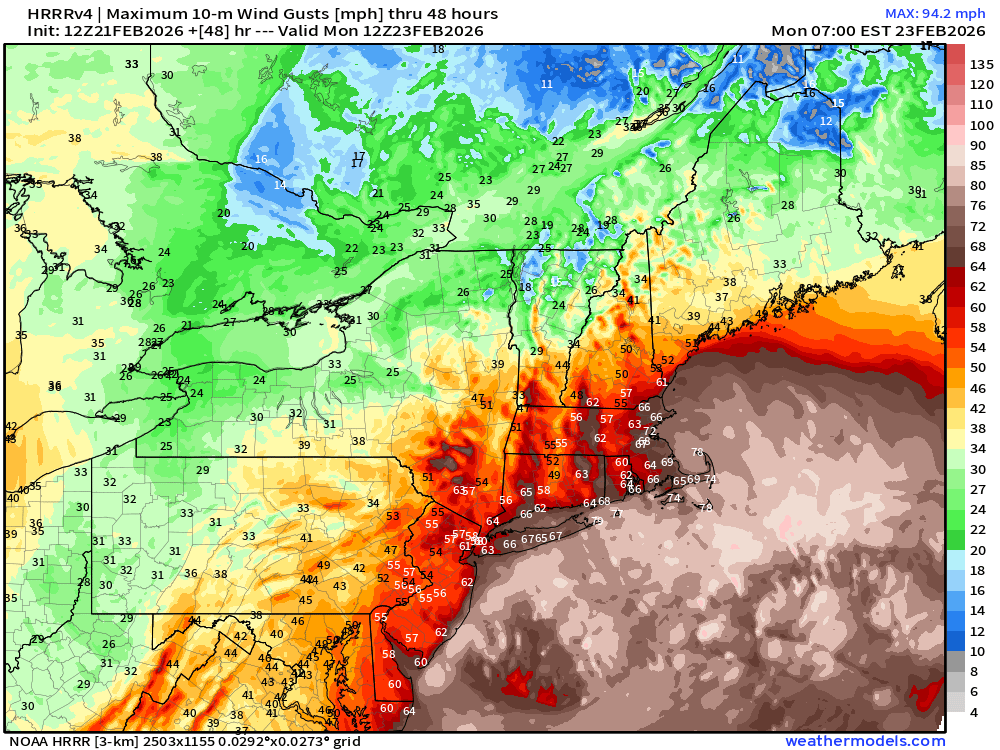
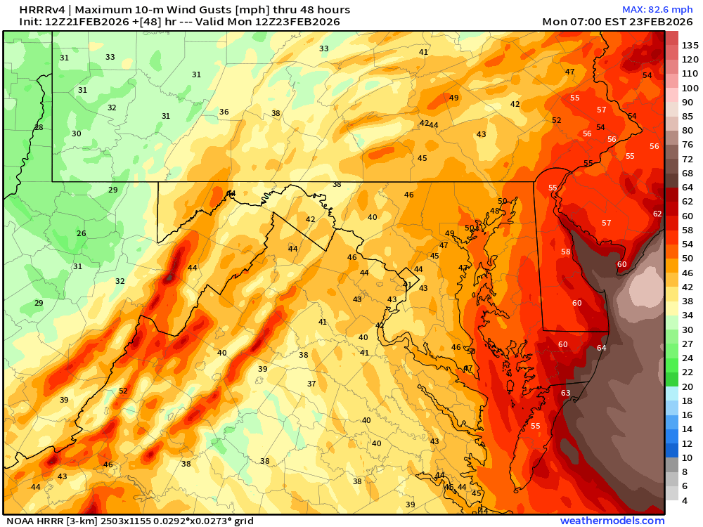
HRRR Maximum Wind Gusts through Monday morning (7 AM ET)
A lot of 60+ mph gusts along the entire coast!
Central Pressure will still be dropping Monday morning — 972 mb at end of HRRR model.
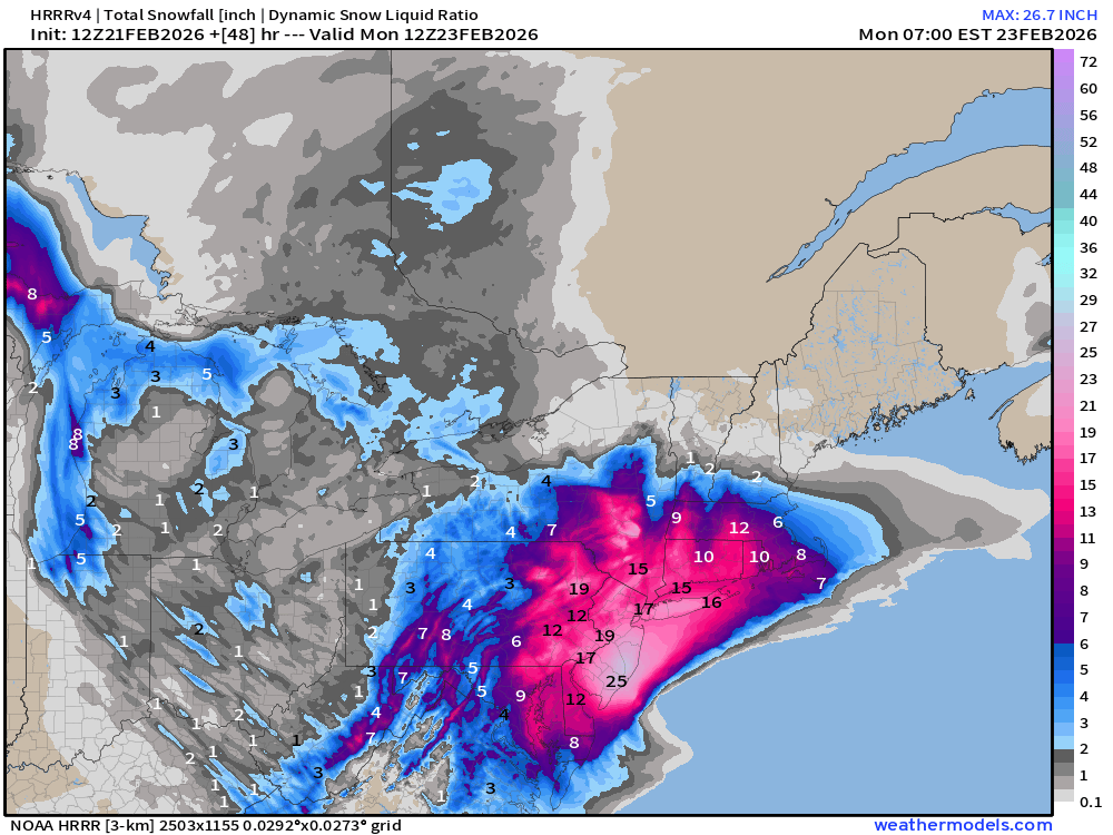
Total snowfall from HRRR — not complete for entire event — through 48-hours, but the jackpot zone of 25” to 27” in southern New Jersey looks legitimate!
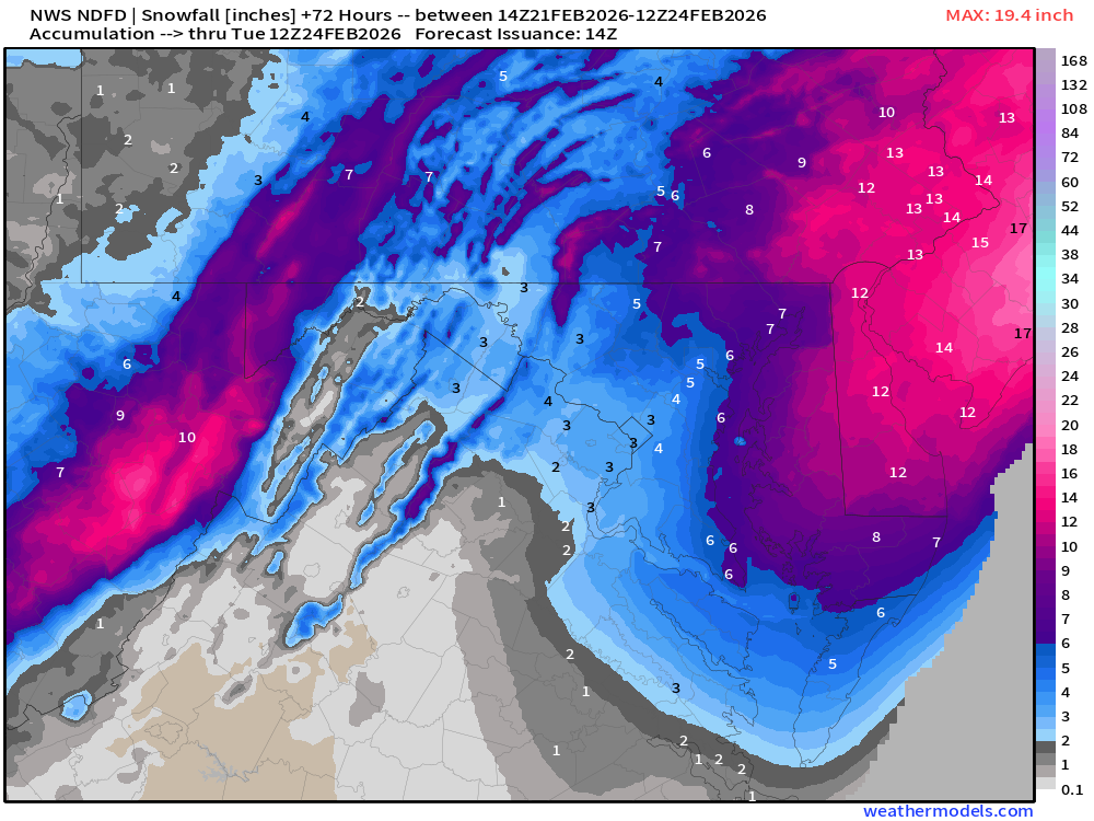
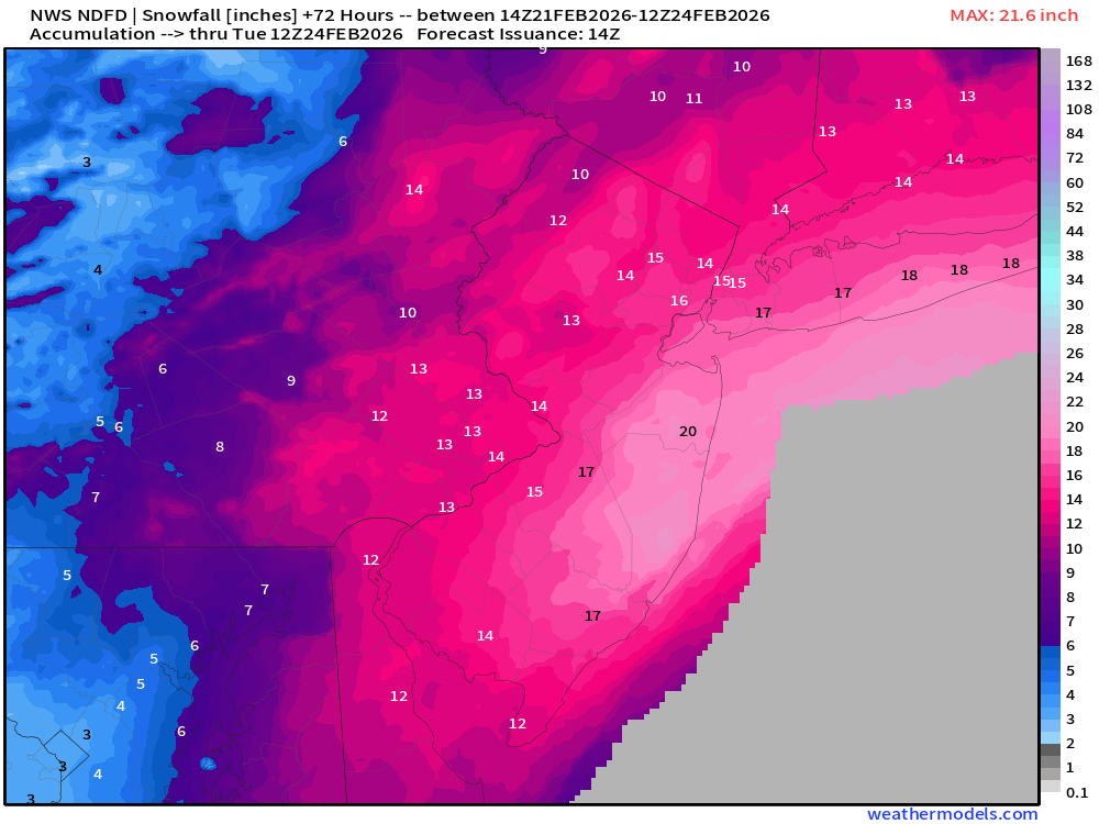
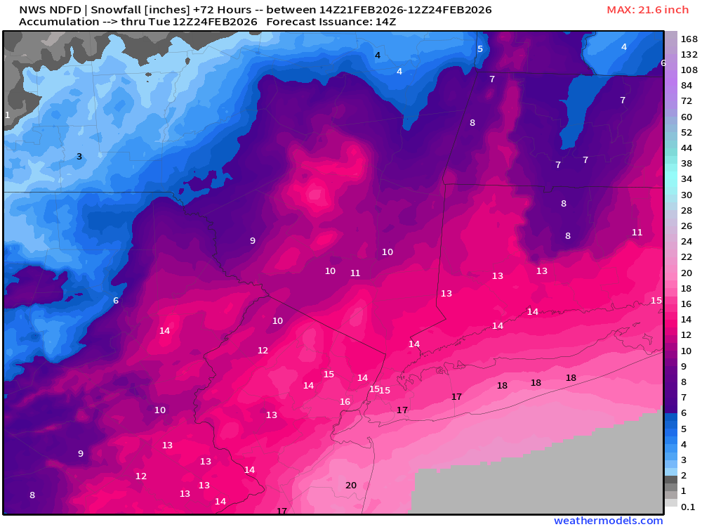
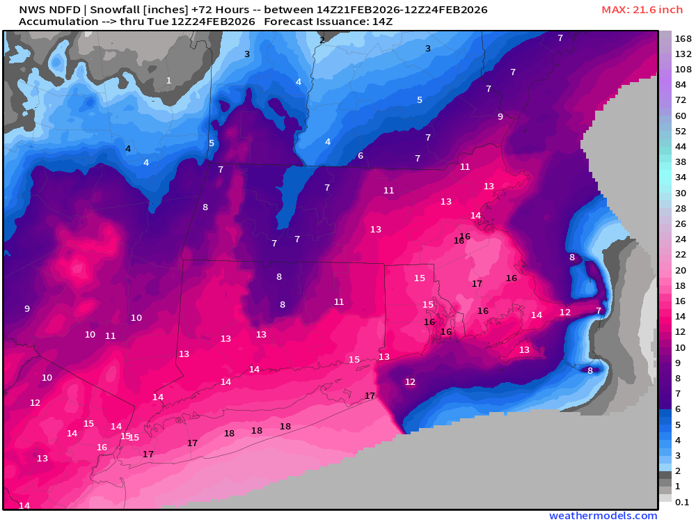
Official National Weather Service Forecast | Snowfall next 72-hours (entire blizzard)
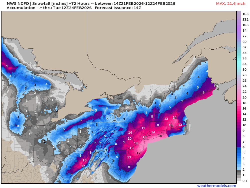
New York City: 15” Philadelphia: 13” to 15”
Boston: 14” Long Island: 18” to 21”
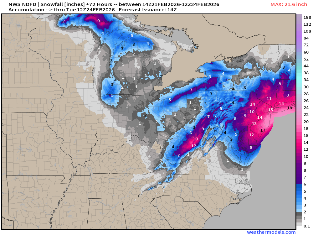
Washington D.C. only 3” to 5” due to warmer air.
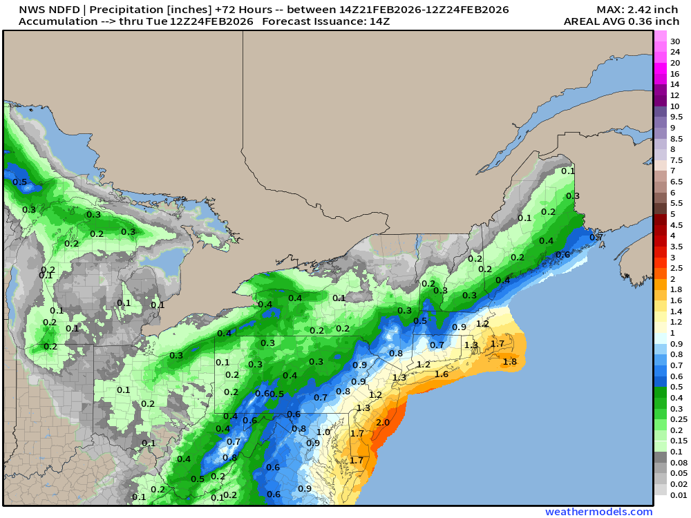
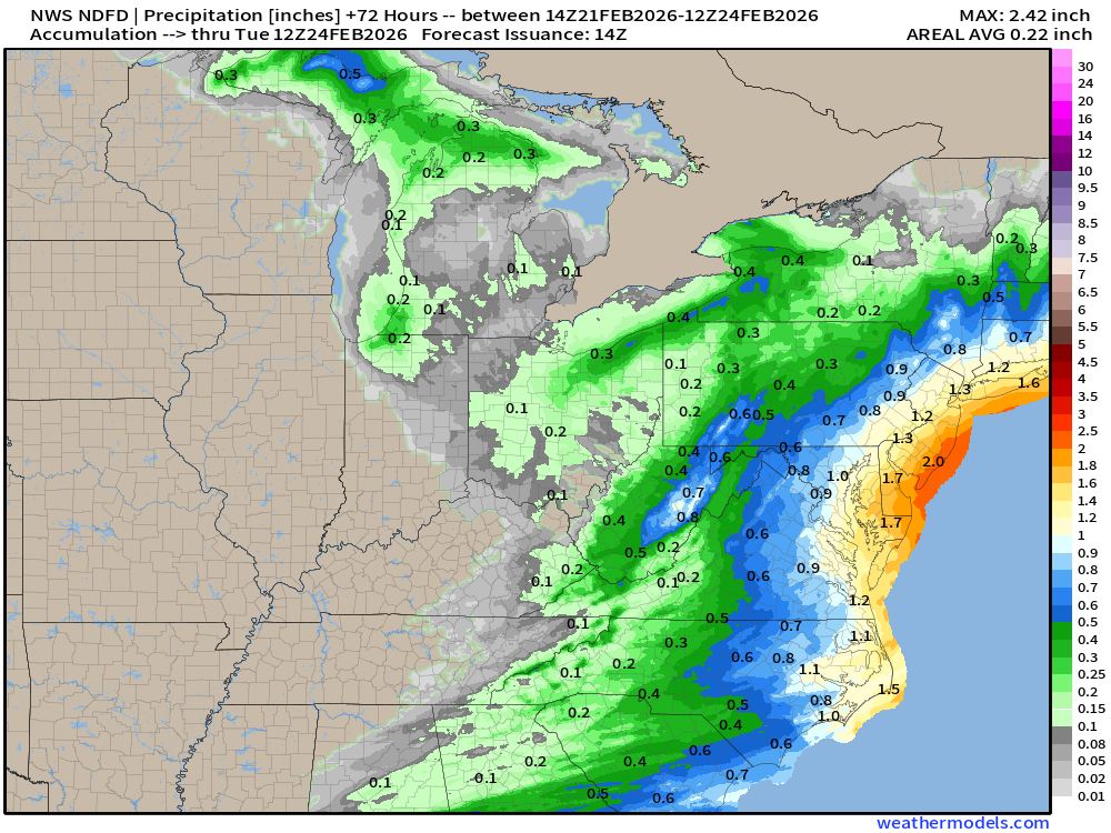
NDFD NWS Total Precipitation Next 72-hours
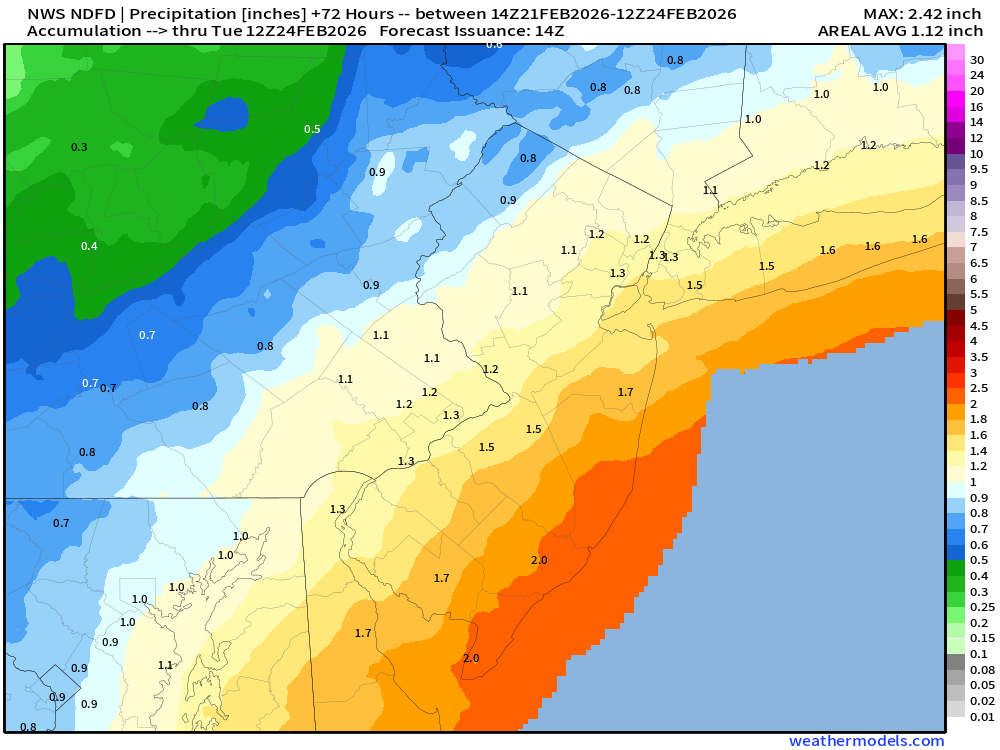
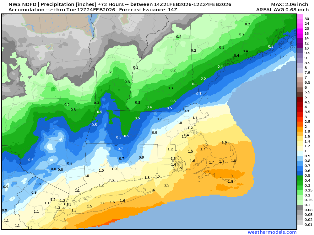
The total QPF or liquid moisture content that will fall out as snowfall is in the 1.7” to 2” range — and 10:1 ratios would be 17” to 20” of snowfall across a large area.
1.3” to 1.5” QPF in New York City
Boston: 1.2” to 1.5” QPF
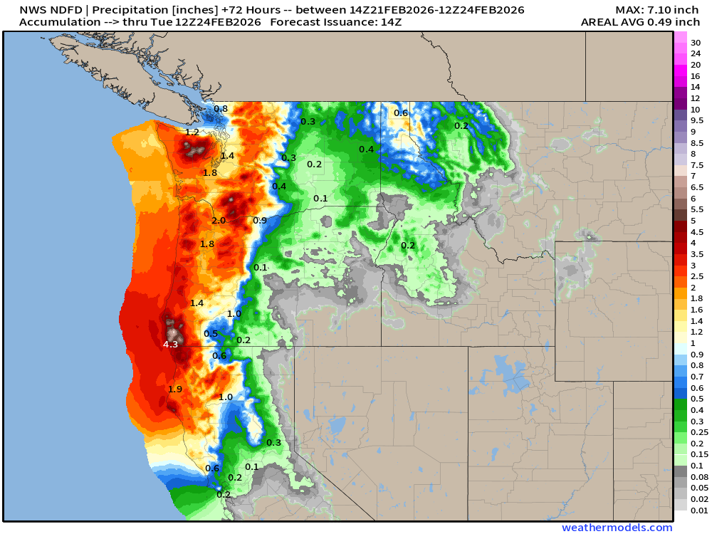
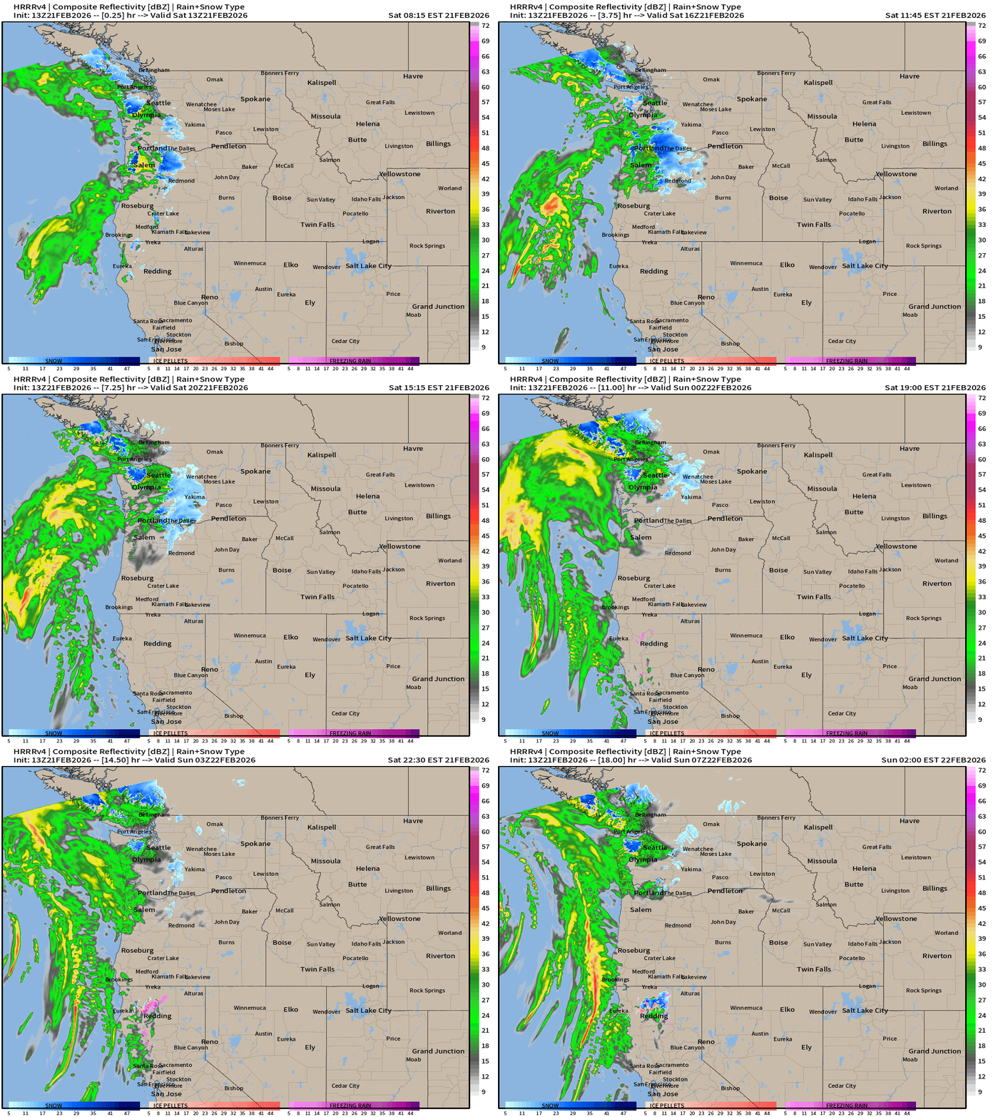
Also, heavy rain (and snow) in the Pacific Northwest
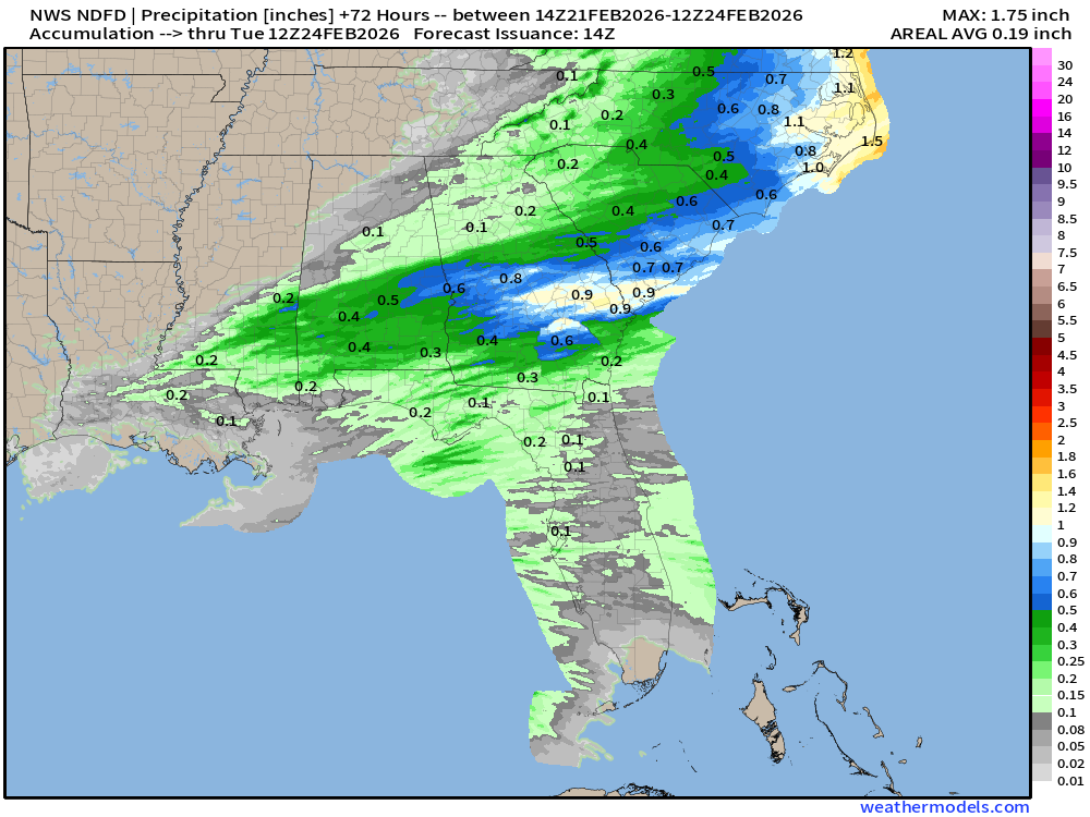
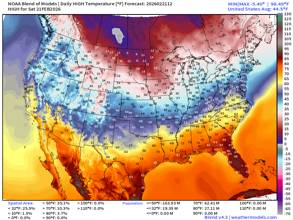
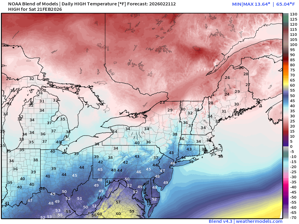
High Temperatures on Saturday
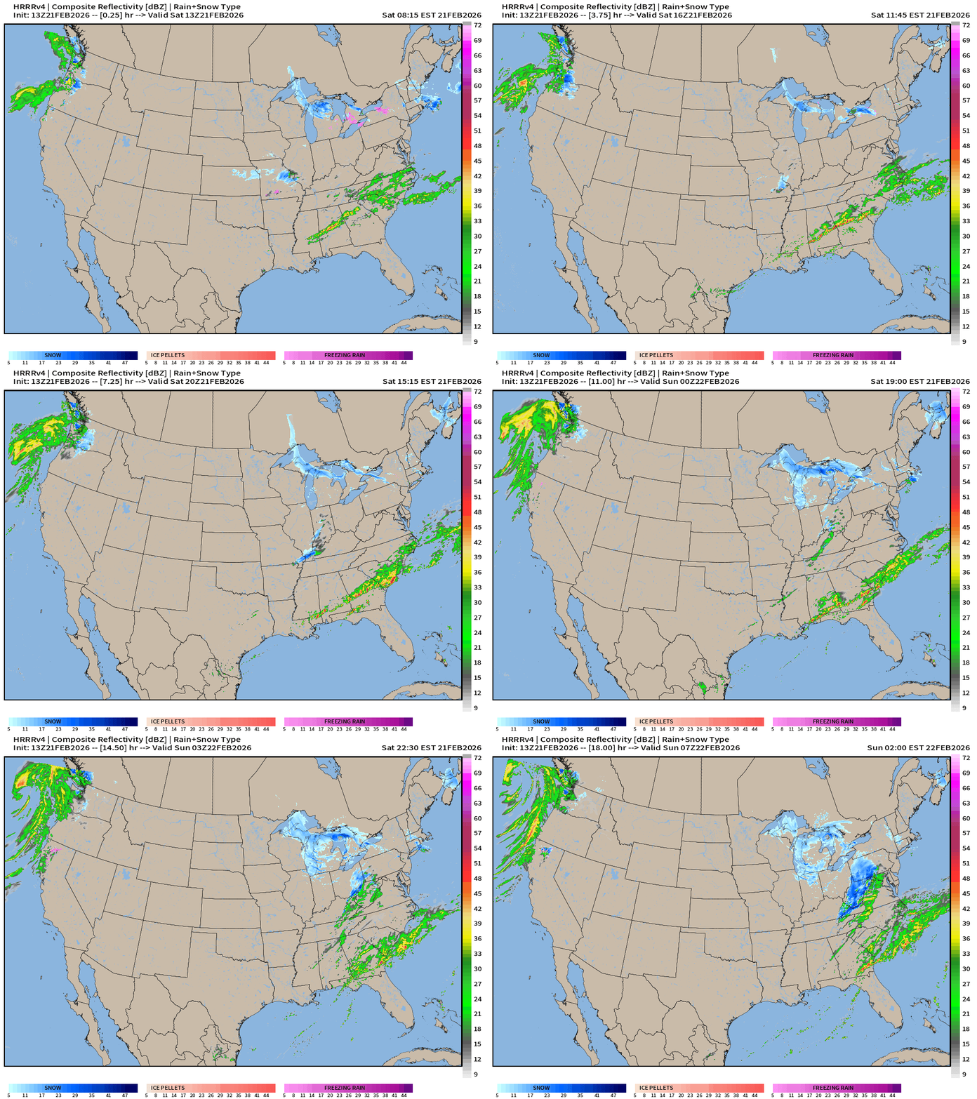
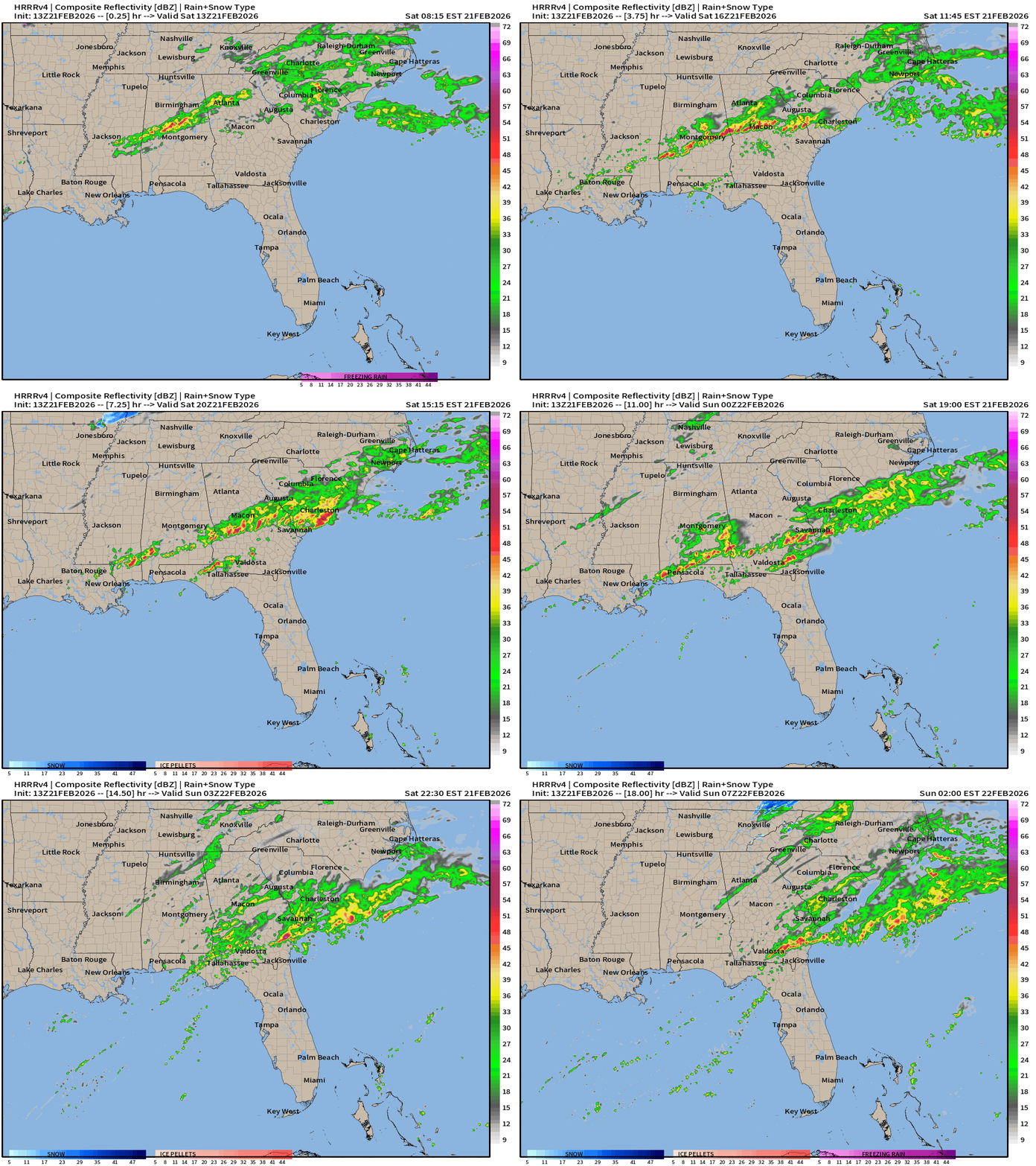
Today’s Weather — Radar Simulation Next 18-hours
ECMWF 06z Precipitation Type + Intensity | Next 6-days
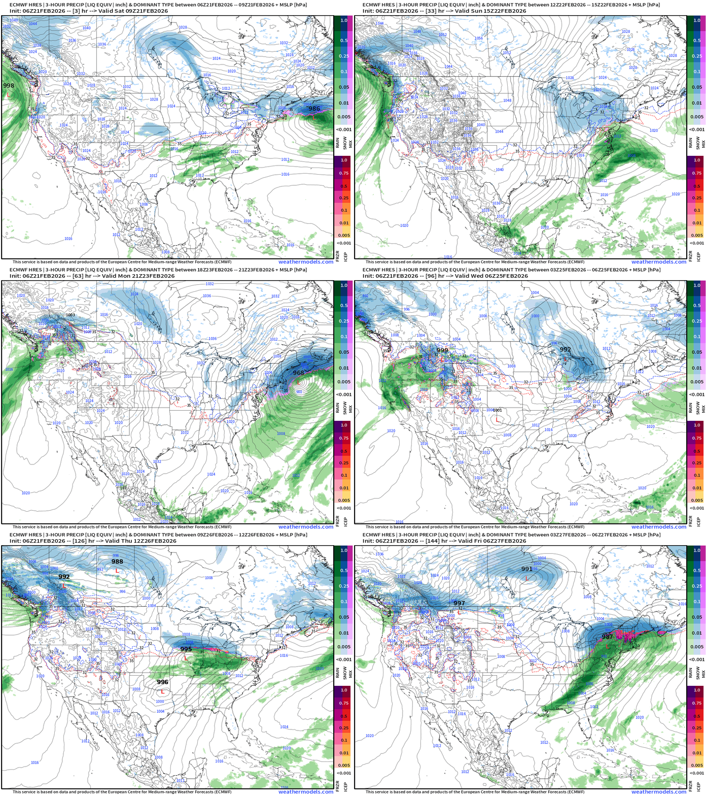
More storms on the way across the Great Lakes and into the Northeast into late next week, but looks warmer for the big cities … and heaviest snow will be in Canada and northern New England.
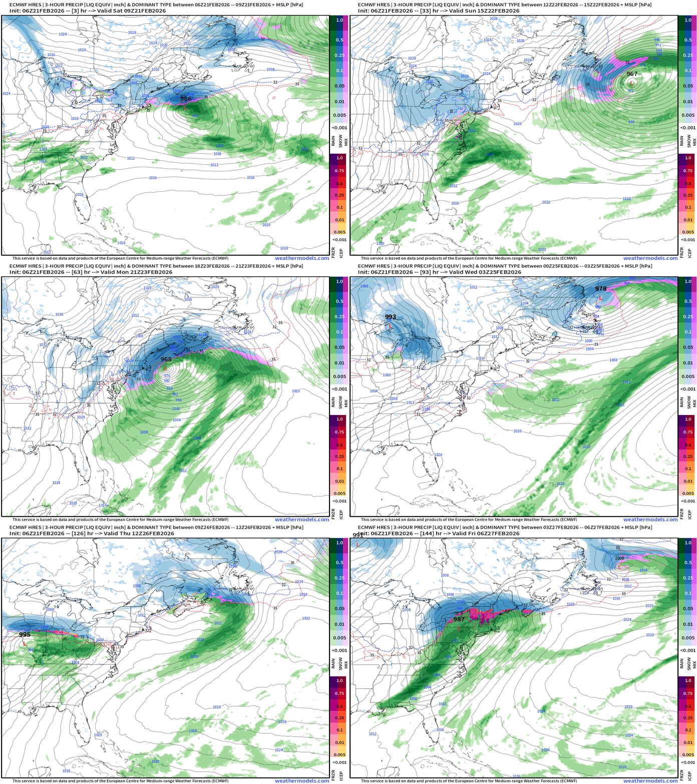
Eastern U.S. Next 6-days storm systems | ECMWF 18z
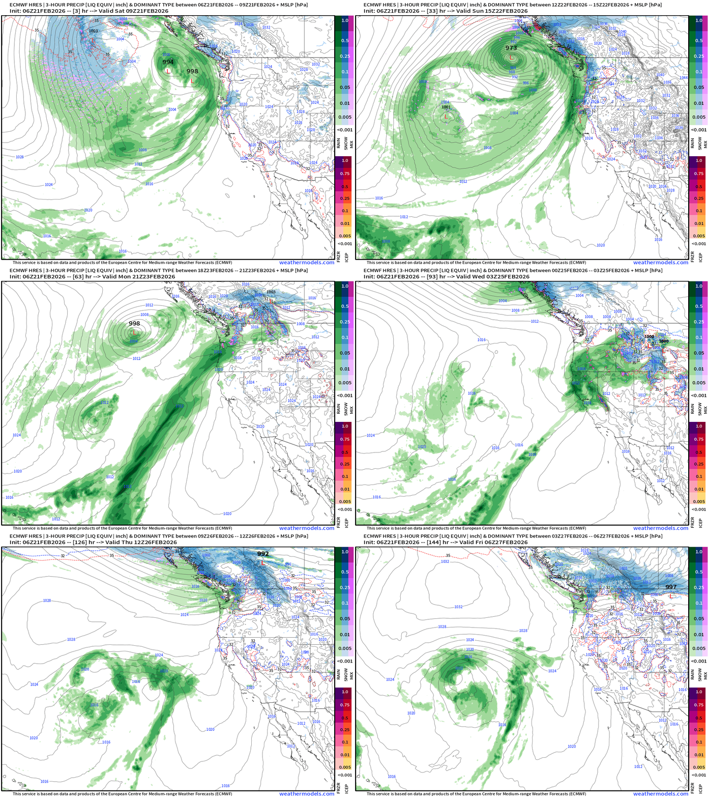
Western U.S. Storm Systems — next 6-days
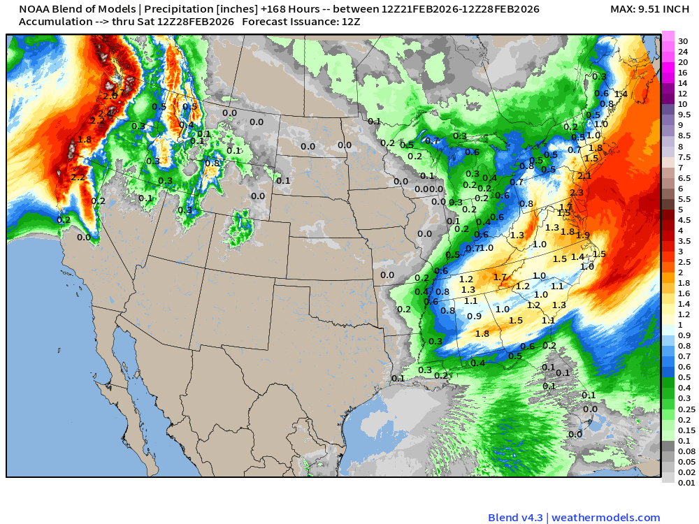
Blend of Models | 7 Days Precipitation Total
Blend of Models | Total Snowfall Next 7-Days
Temperature Anomaly Next 15-days | ECMWF EPS 00z Ensemble Mean
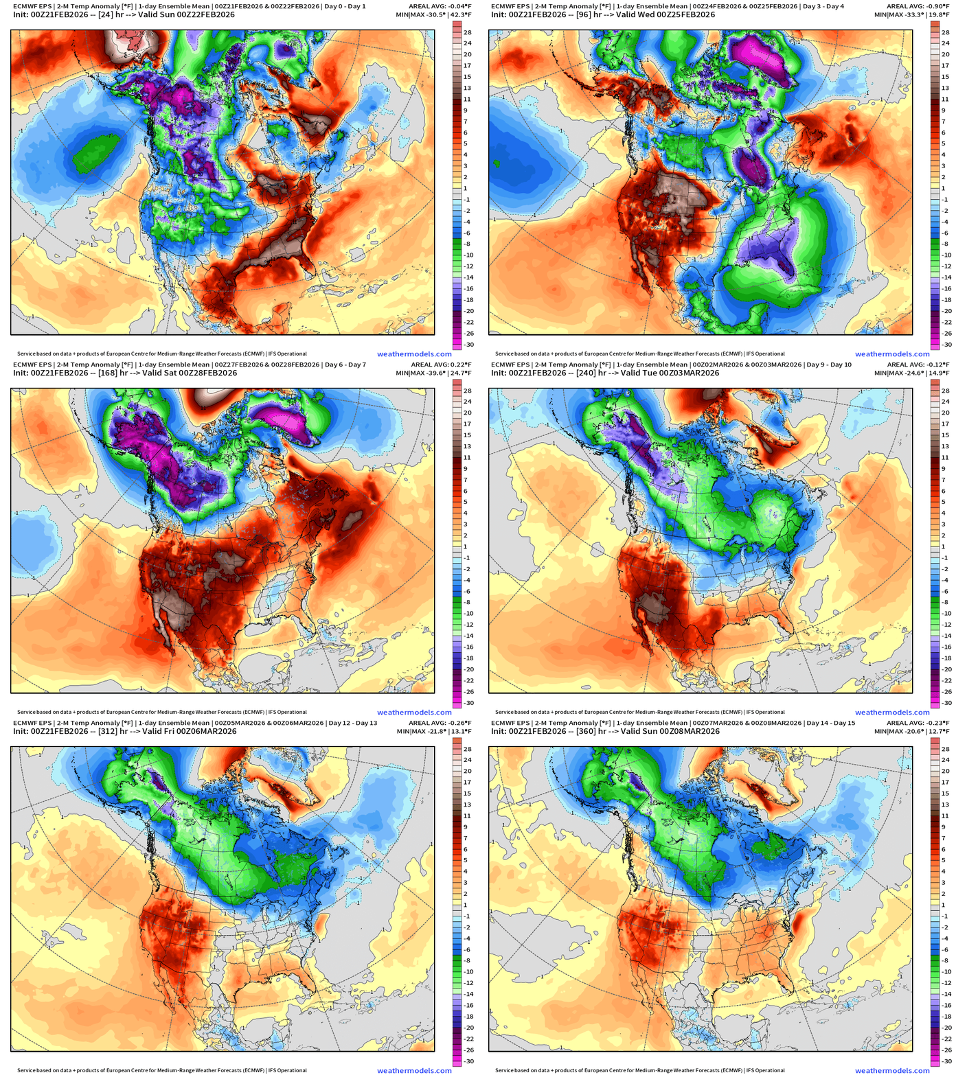
Temperature Anomaly | Next 15-days | ECMWF EPS 00z
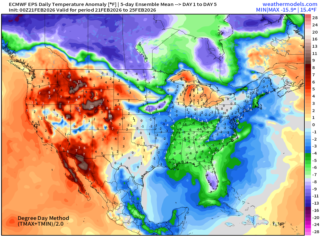
5-Day Chunk #1 | Temperature Anomaly | Feb 21 - Feb 25
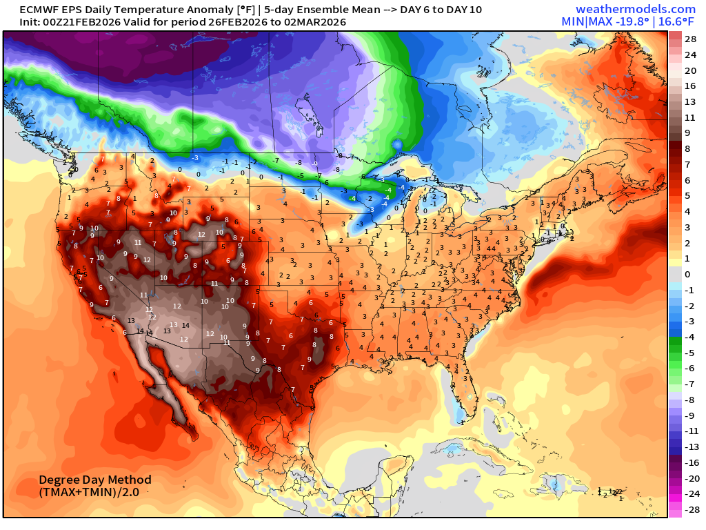
5-Day Chunk #2 | Temperature Anomaly | Feb 26 - March 2
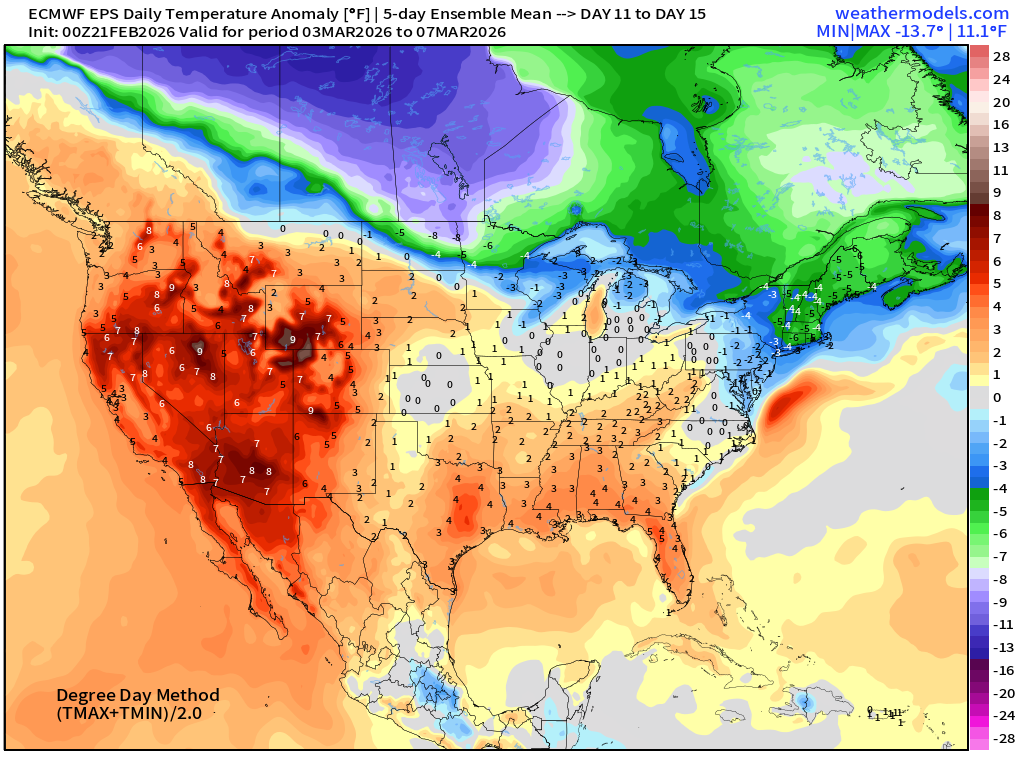
5-Day Chunk #3 | Temperature Anomaly | March 3 - March 7
Maps sourced from weathermodels.com designed and innovated by yours truly! Please subscribe there for real-time access to the newest maps, charts from all of the weather models including ECMWF and AIFS, and NOAA GFS/GEFS.
- Milepost
- 878 · laid 2026-02-21T15:32:39.551000Z
- Source
- https://weather.substack.com/p/february-21-2026-blockbuster-blizzard
- Digest
- 7fbf7c9c498aa63c1d8f974269994fa720750a3e380dffe39d41831dcfcc7949
- Machine
- JSON