February 15, 2026 Sunday Winter Weather
Winter resumes for the Western U.S. with warmth East of the Rockies
February 2026 was the 4th-warmest February in the 132-year national record (1895–2026), at 40.3°F against a 1991–2020 normal of 35.6°F (+4.6°F).
February 2026 was the 5th-driest February in the 132-year national record (1895–2026), at 1.4in against a 1991–2020 normal of 2.1in (-0.7in).
NOAA/NCEI Climate at a Glance, contiguous United States. This is the observed record for the month, not a score of anything said in this piece — the forecast ledger begins 2026-08-17 and cannot reach earlier posts.

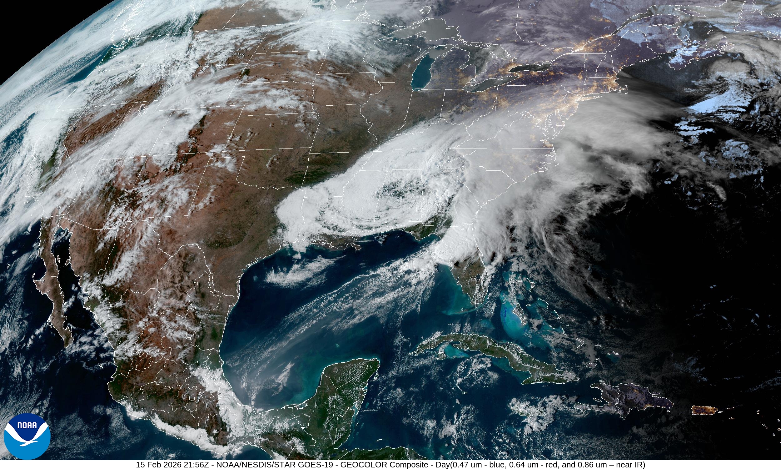
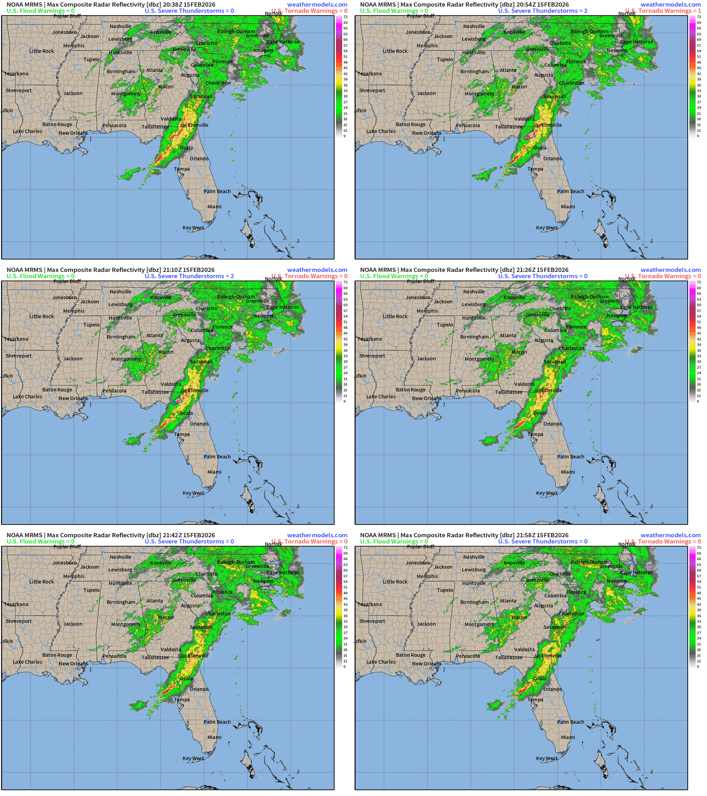
Spring like storm system tracked from Texas along the Gulf coast earlier Sunday, and now pushing rain and thunderstorms through north Florida with arrival at the Daytona 500 in the 6 PM hour. Note, this is all rain on the radar — thankfully — as the Arctic air is bottled up north of the Canadian border — for another several days as a mid-February thaw melts mountains of concrete snowfall.
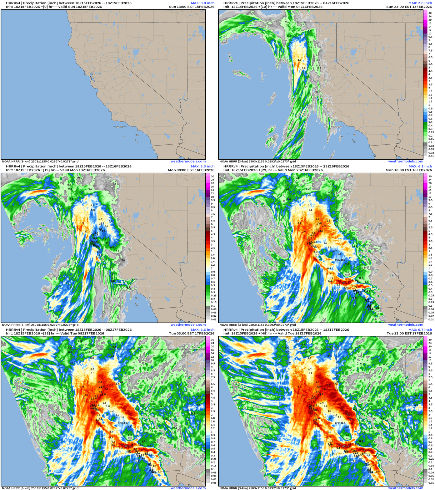
Storm System: Radar Simulation next 48-hours — through Tuesday 1 PM
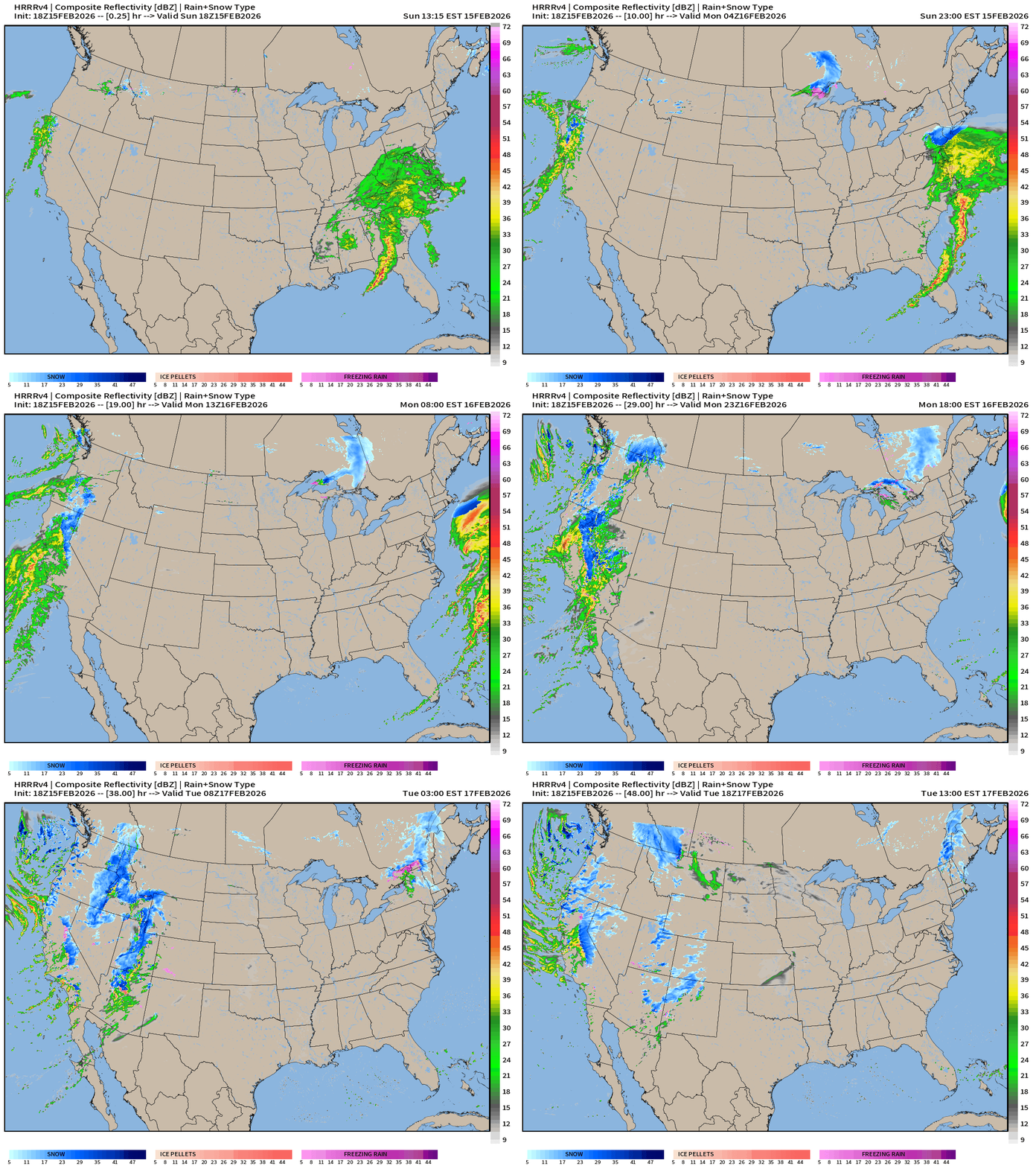
Massive influx of moisture across the Western U.S. as a trough digs along the coast —> atmospheric rivers of moisture head inland = heavy California rain and snow (mountains)
Early Monday, some snowfall on the northern edge of storm system in Philly and NYC as the low heads out to sea off the Mid-Atlantic. Maybe a dusting to 2” … but talk about a “wasted” Nor'easter (for some)
High Temperatures Next 8-days —> Mid-February thaw continues
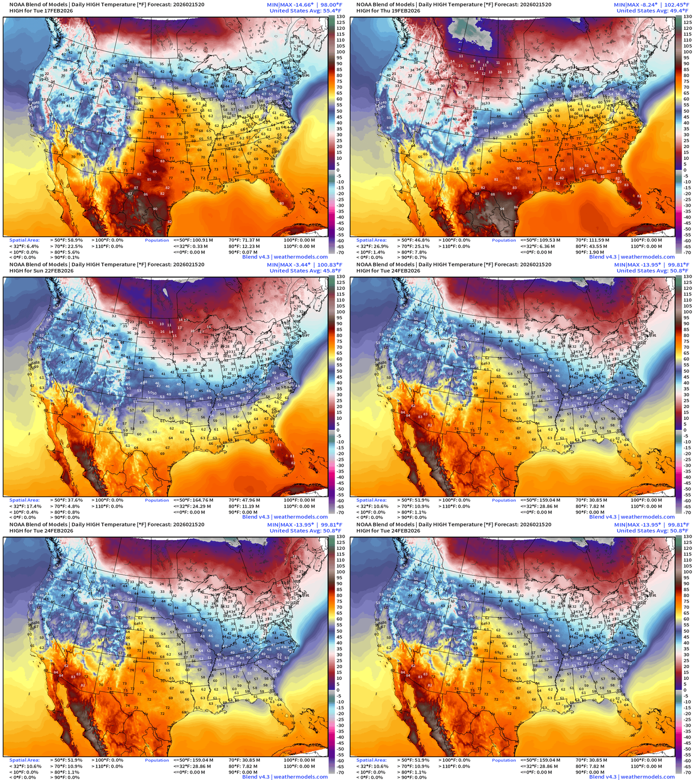
Arctic air is mostly at bay, but it’s still not spring in the Midwest, Great Lakes, and Northeast as high temperatures revert back to the 20s and 30s by next weekend.
Eastern U.S. Next 6-days storm systems | ECMWF 12z
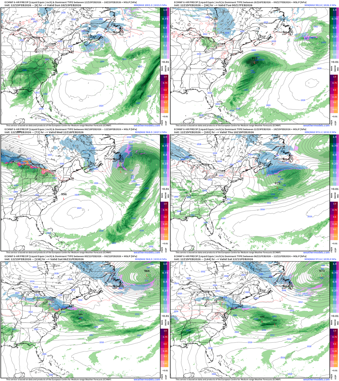
Next significant precipitation for Northeast: Clipper system Thursday
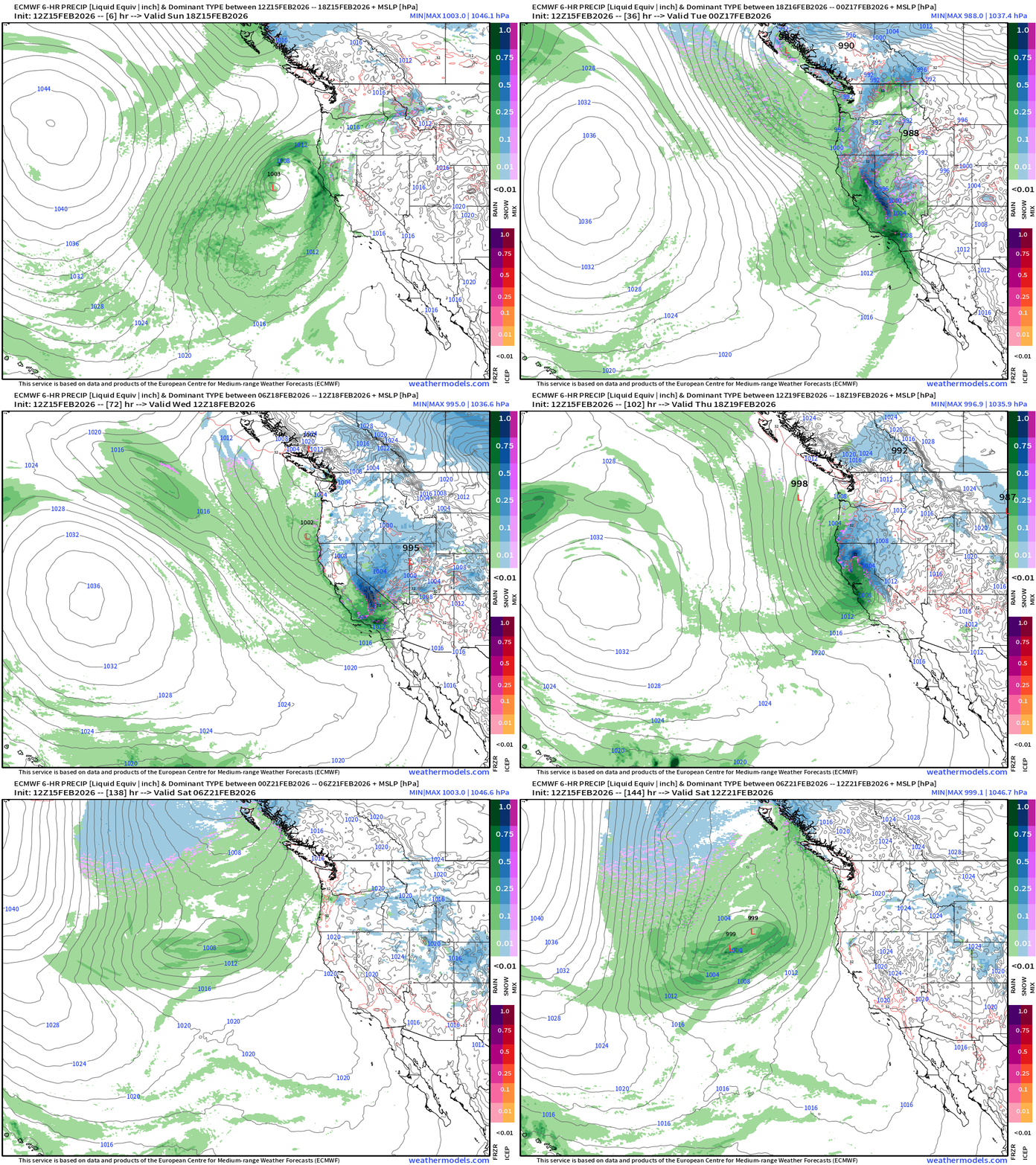
Western U.S. Pattern Change —> Winter Resumes in a Major Way
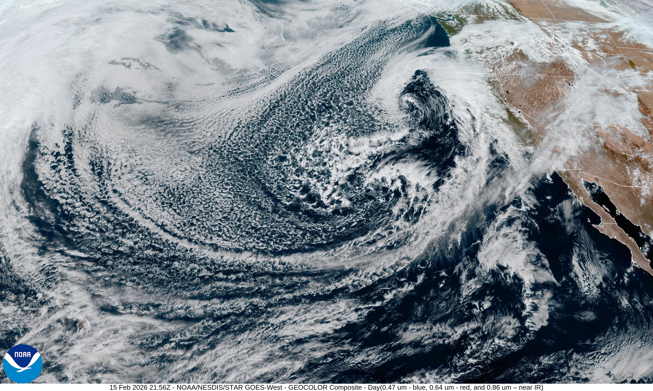
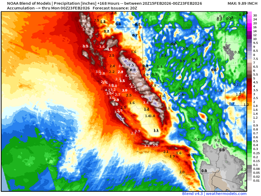
Major Storm System for California — moisture blasts onshore for huge mountain snows: Colder air and moisture surges southward out of the Gulf of Alaska. Major rainfall + snowfall for California, but also into the Great Basin and Rockies —> continued unsettle at least through Friday. West Coast Next 6-days
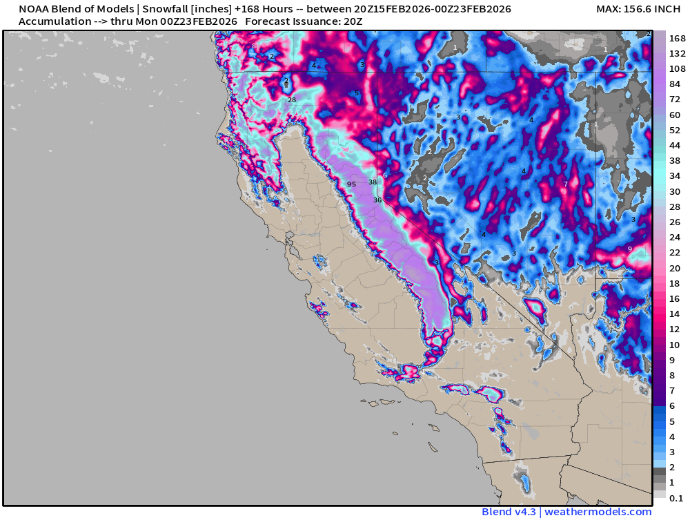
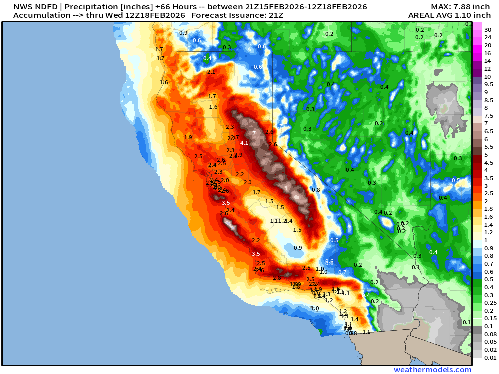
Precipitation from the first storm system —> upwards of 3” of rainfall along the coast and similar QPF in the mountains = 3 or 4 feet of snowfall in Sierra. HRRR 48-hour precipitation:
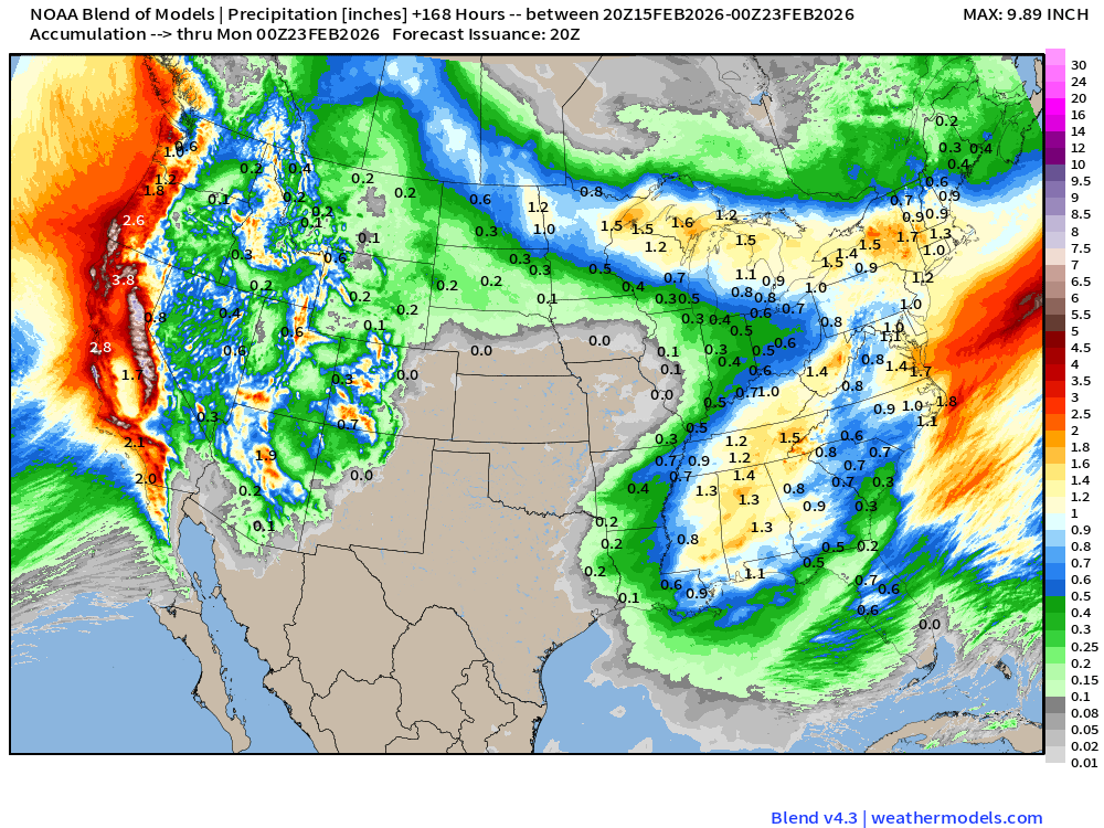
Blend of Models | 7 Days Precipitation Total
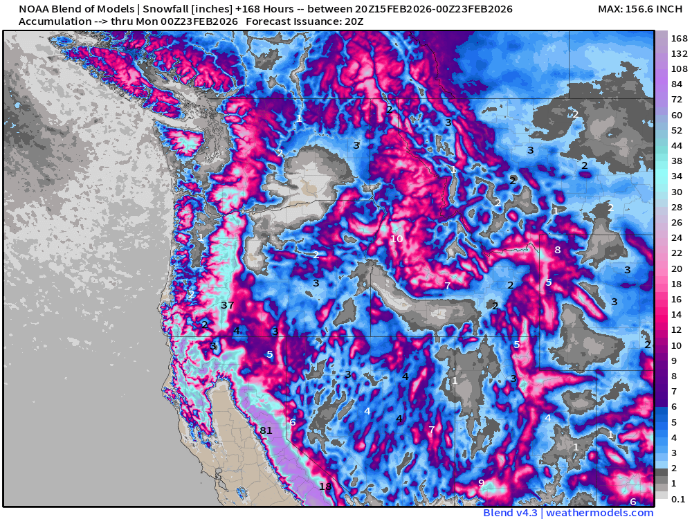
Blend of Models | Total Snowfall Next 7-Days
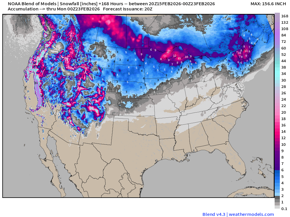
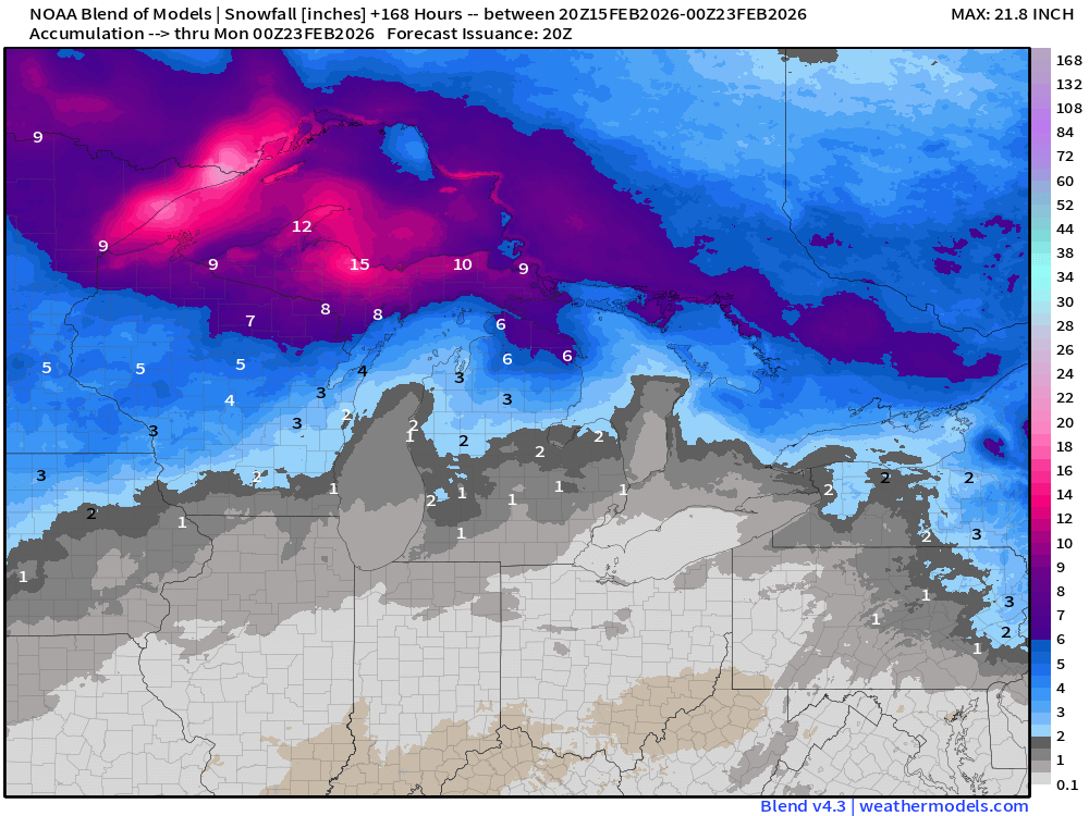
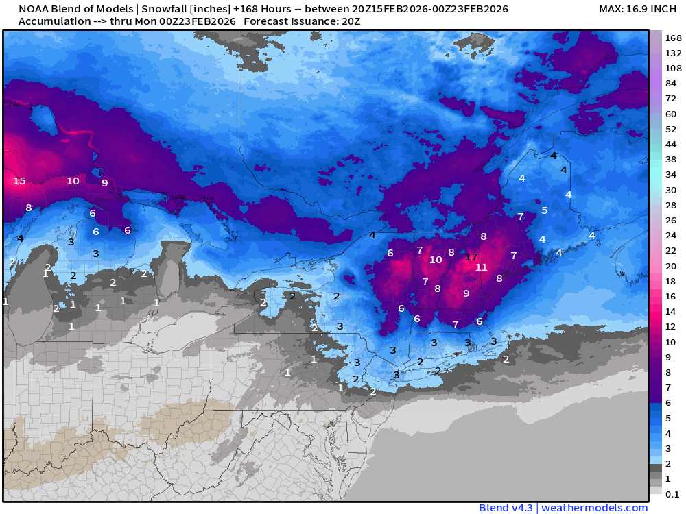
Snowfall in the Sierra, Cascades, and Rockies will be measured in feet / yards.
Flagship ECMWF 12z EPS | Temperature Anomaly | Next 15-days
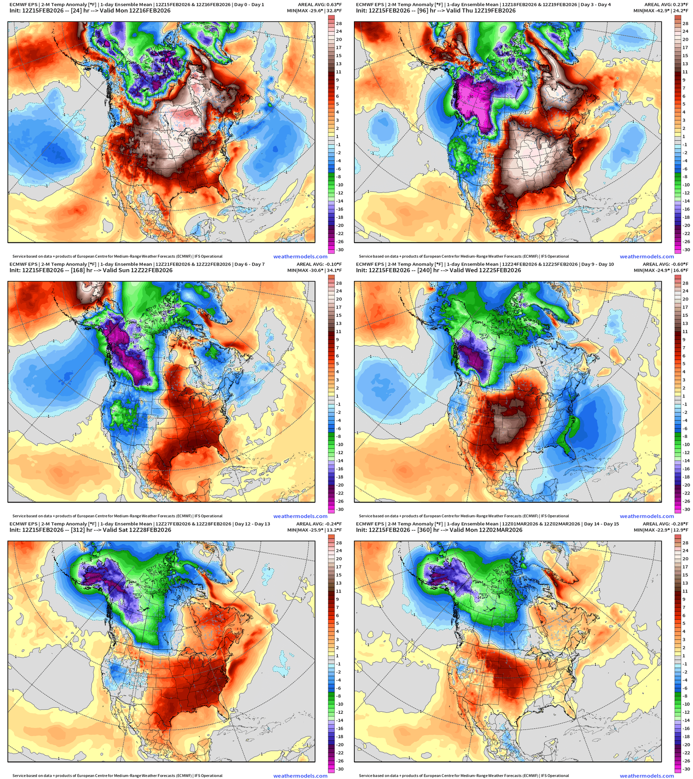
Arctic air returns for the Eastern U.S in the 8-day range — so by next weekend we should be talking about an Arctic blast on the way. Then, another warm up into early March. —> transitory cold
ECMWF IFS 12z | Precipitable Water Next 6-days
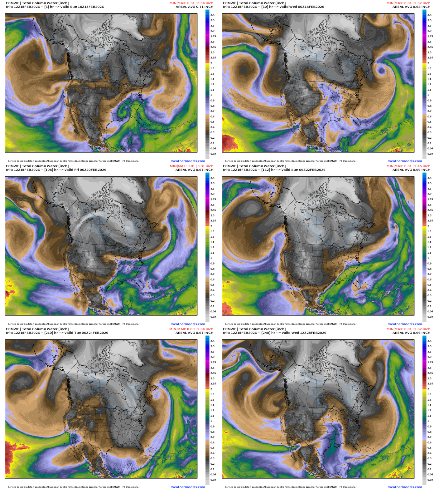
Multiple centers of low pressure swirl off the California coast and direct a sequence of atmospheric rivers inland. Seeing the Gulf of Mexico more involved in weather systems as we transition into March but the cold/dry air continues to infiltrate the Lower 48 first from the U.S. Northwest — and then from east of the Rockies into next weekend.
ECMWF 12z Precipitation Type + Intensity | Next 10-days
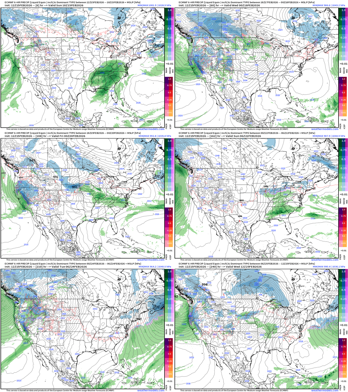
Moisture from the Pacific storm system surges northward with the jet stream into Southern Canada — and fuels a “northern tier” boundary with Clipper Systems —> accumulating snow from the Dakotas into Great Lakes and Northeast from Tues-Thursday. In the extended range, next Sun/Mon, ECMWF 12z has a Nor’easter.
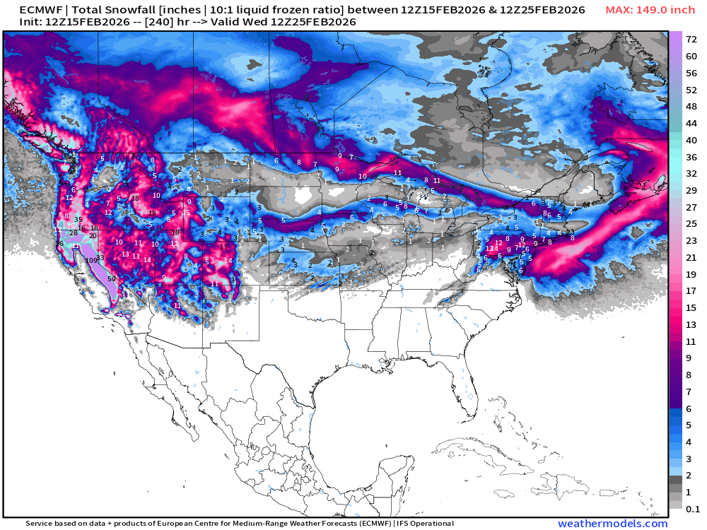
ECMWF 12z Snowfall | Next 10-days
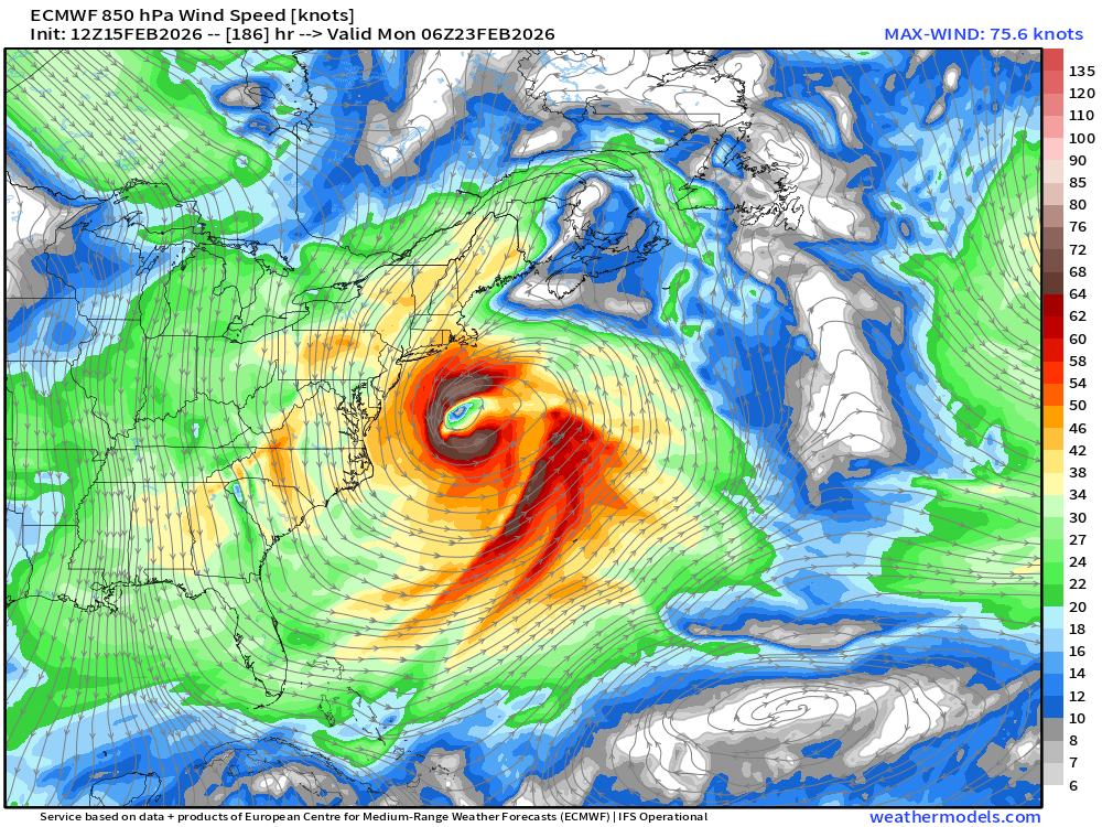
Nor’easter at 976 mb popped up in the ECMWF 12z grids for Day 8 — next Sun/Mon
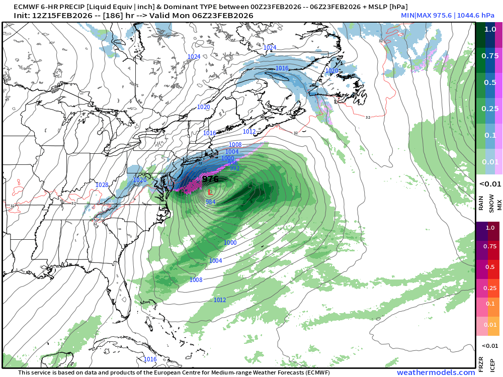
We’ll monitor this “potential” storm, but we’ve narrowly escaped “big ticket” snowfalls (just barely) when medium-to-long range modeling showed major impacts.
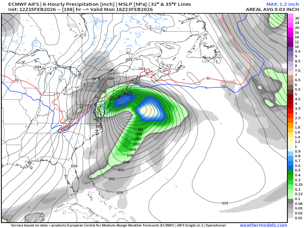
10-day Snowfall (Long Range) ECMWF AIFS 12z Cycle

ECMWF AIFS 12z also has the storm system — so either both HRES and AIFS are right/wrong, or onto something.
Winter is not over by any stretch of the imagination.
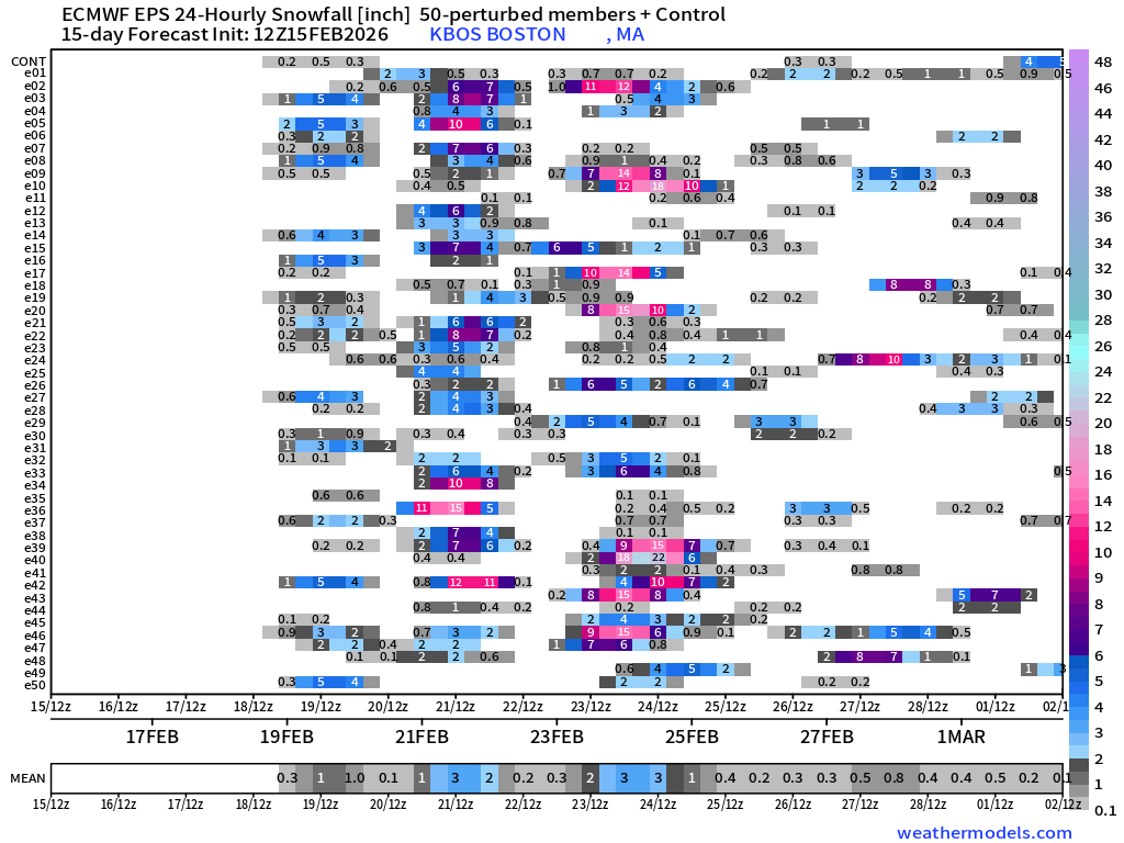
Checking on “big ticket” snowfall in NYC from ensemble members (12z ECMWF EPS)
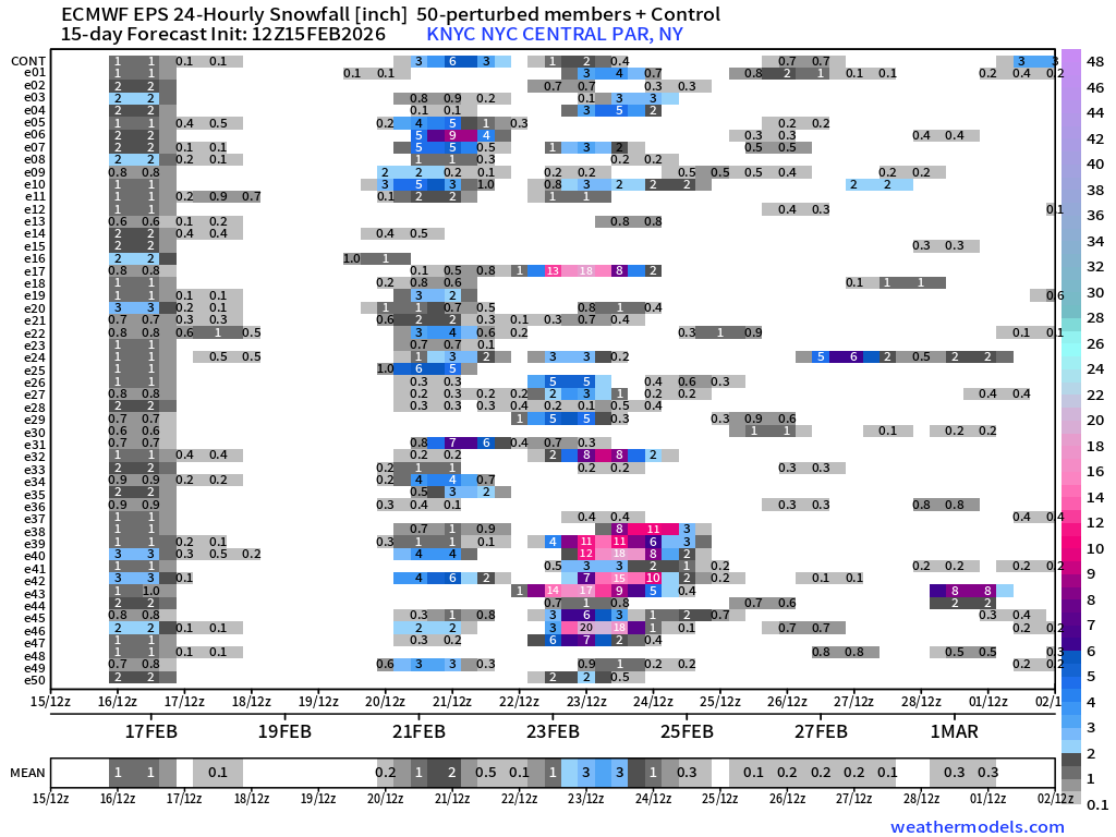
3 main opportunities: into Monday morning from fringe of storm system, Clipper system next Thurs/Fri, and then major Nor’easter following Sun/Mon. Boston:
NWS NDFD Snowfall next 3-days
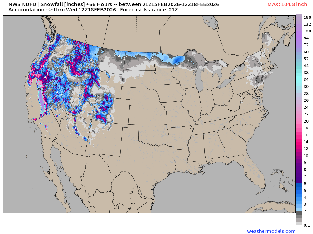
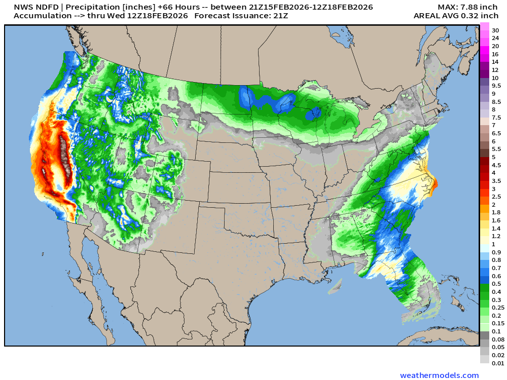
NWS going with 1” to 2” of snowfall for this brief encounter with the northern fringe of the storm system that will intensify offshore the Mid-Atlantic. Several feet in the Sierra.
NWS NDFD Precipitation (QPF) next 3-days through Tuesday evening
RTMA | Temperature Analysis | 4:30 PM ET
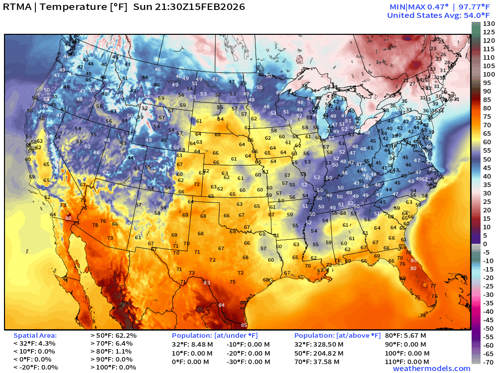
Avg Lower 48 temperature was 54.0°F — with 38 million at least 70°F
Temperature Anomaly | 4:30 PM ET
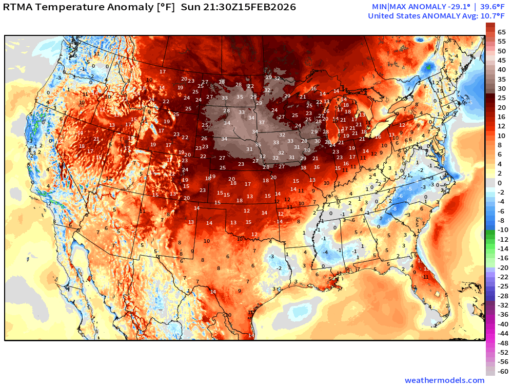
Lower 48 Temperature Anomaly above normal by 10.7°F
Monday Morning Low Temperatures
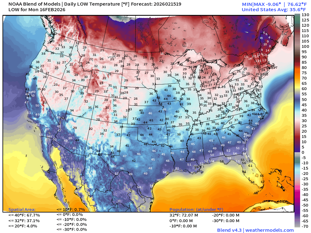
About 72 million below freezing with coldest air still in northern New England
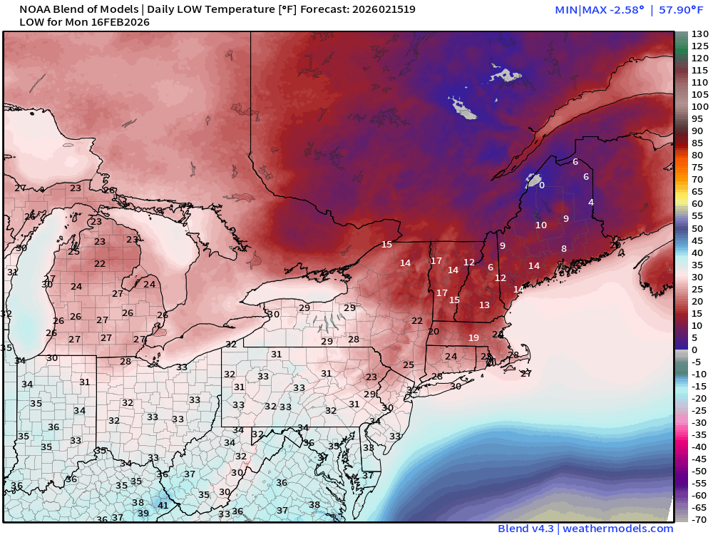
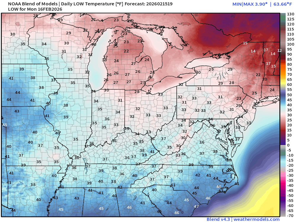
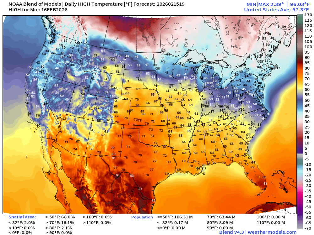
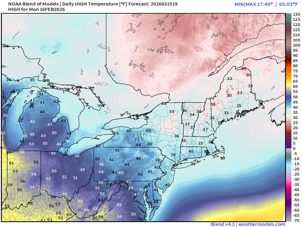
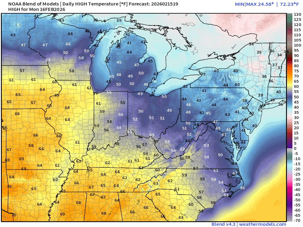
High Temperatures on Monday
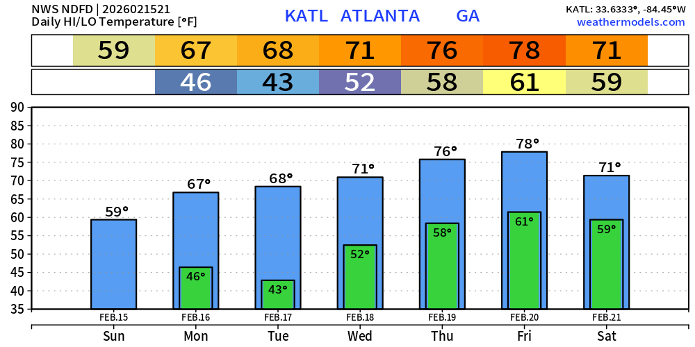
Next 7-days in Atlanta: Almost 80°F by Friday (thank goodness)
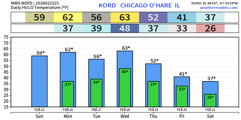
Next 7-days in Chicago: 60s Mon and Wed
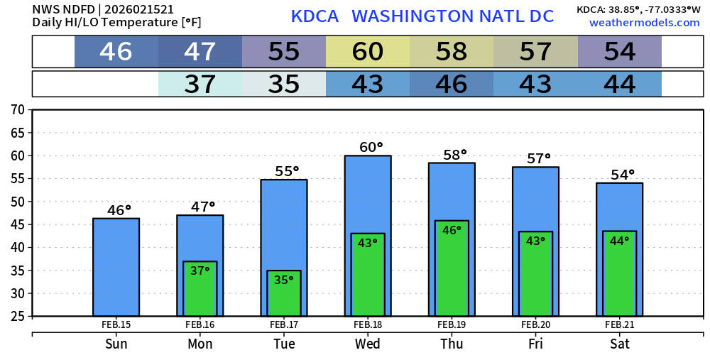
Next 7-days in Washington D.C. —> much warmer in the 50s to 60°F
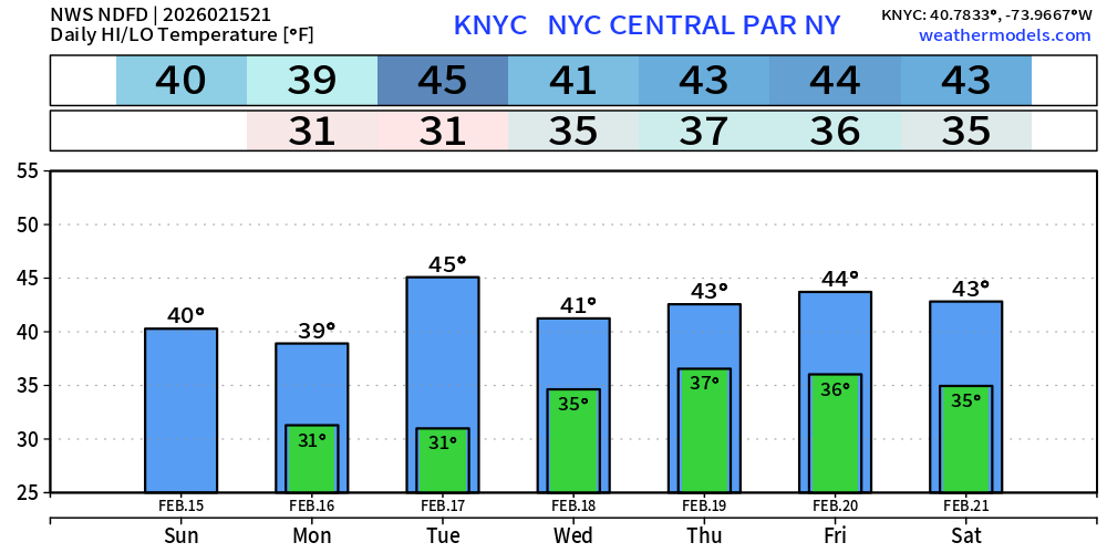
Next 7-days in New York City: 40s will feel quite warm!
ECMWF AIFS-Single 12z | Temperature (500 hPa) Next 10-days
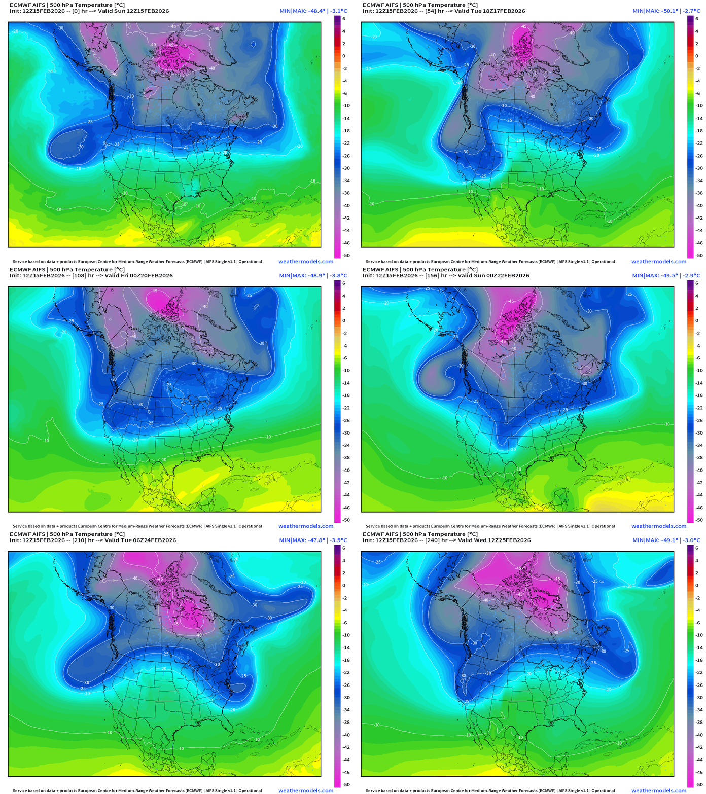
The temperature at 500 mb is the easiest way to highlight the “polar vortex” across North America with the coldest pool at -50°C (pink) with the -25°C contour usually associated with below freezing temperatures at 2-meters (surface).
Heading into the final week of February —> the main Polar Vortex cold pool reservoir remains largely locked up over Canada north of the Arctic Circle, but seeing multiple lobes descending in the Northwest and Northeast with surface low pressure systems.
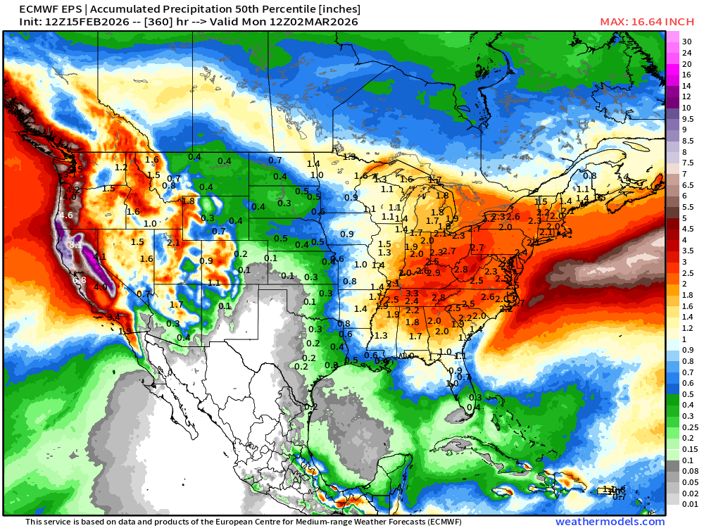
Total Precipitation Median from Ensembles Next 15-days
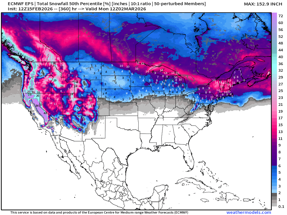
Ensemble Median next 15-days Total Snowfall (ECMWF EPS 12z)
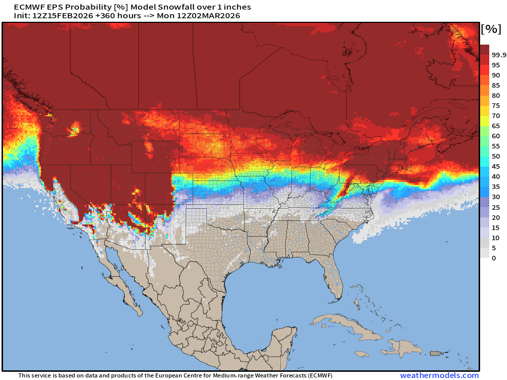
Probability of 1-inch of snowfall from the Ensembles (12z)
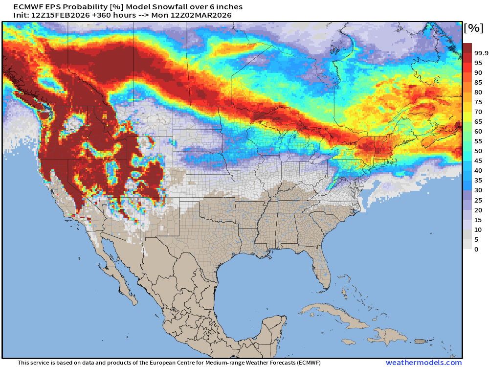
Probability of 6-inches of snowfall from the Ensembles (12z)
Temperature Anomaly | Next 15-days | ECMWF EPS 12z
5-Day Chunk #1 | Temperature Anomaly | Feb 15 - Feb 19
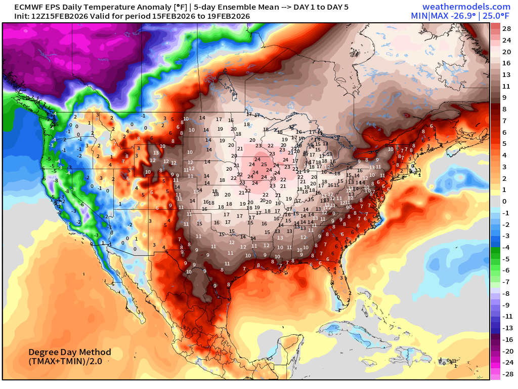
Still over 25°F above normal for upper Midwest for a 5-day chunk centered upon Iowa
5-Day Chunk #2 | Temperature Anomaly | Feb 20 - Feb 24
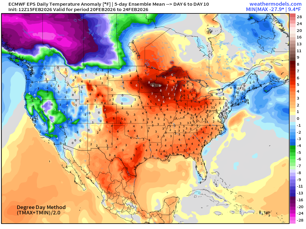
5-Day Chunk #3 | Temperature Anomaly | Feb 25 - March 1
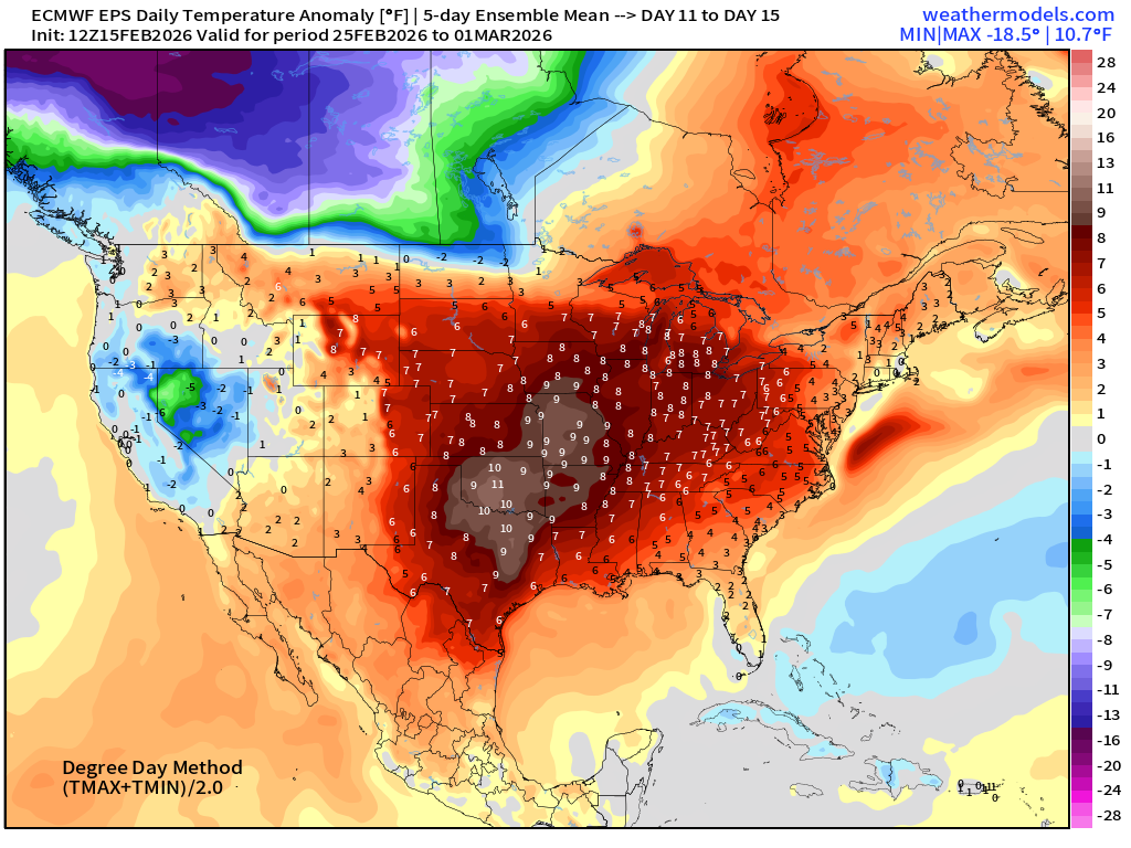
Above normal warmth intensity has bumped up to +11°F into Oklahoma — and finally we see the huge cold pool over Western Canada and Alaska begin to fade.
Maps sourced from weathermodels.com designed and innovated by yours truly! Please subscribe there for real-time access to the newest maps, charts from all of the weather models including ECMWF and AIFS, and NOAA GFS/GEFS.
- Milepost
- 870 · laid 2026-02-15T22:45:30.379000Z
- Source
- https://weather.substack.com/p/february-15-2026-sunday-winter-weather
- Digest
- 131cdc0a518bdf93684764ac322c463e8021b9b2638cba3e4f3e7b0329cf115f
- Machine
- JSON