January 30, 2026 Friday Winter Storm
Snowfall will pile up in the Carolinas with gusty winds from bomb cyclone
January 2026 was the 25th-warmest January in the 132-year national record (1895–2026), at 33.1°F against a 1991–2020 normal of 32.3°F (+0.8°F).
January 2026 was the 12th-driest January in the 132-year national record (1895–2026), at 1.6in against a 1991–2020 normal of 2.3in (-0.8in).
NOAA/NCEI Climate at a Glance, contiguous United States. This is the observed record for the month, not a score of anything said in this piece — the forecast ledger begins 2026-08-17 and cannot reach earlier posts.

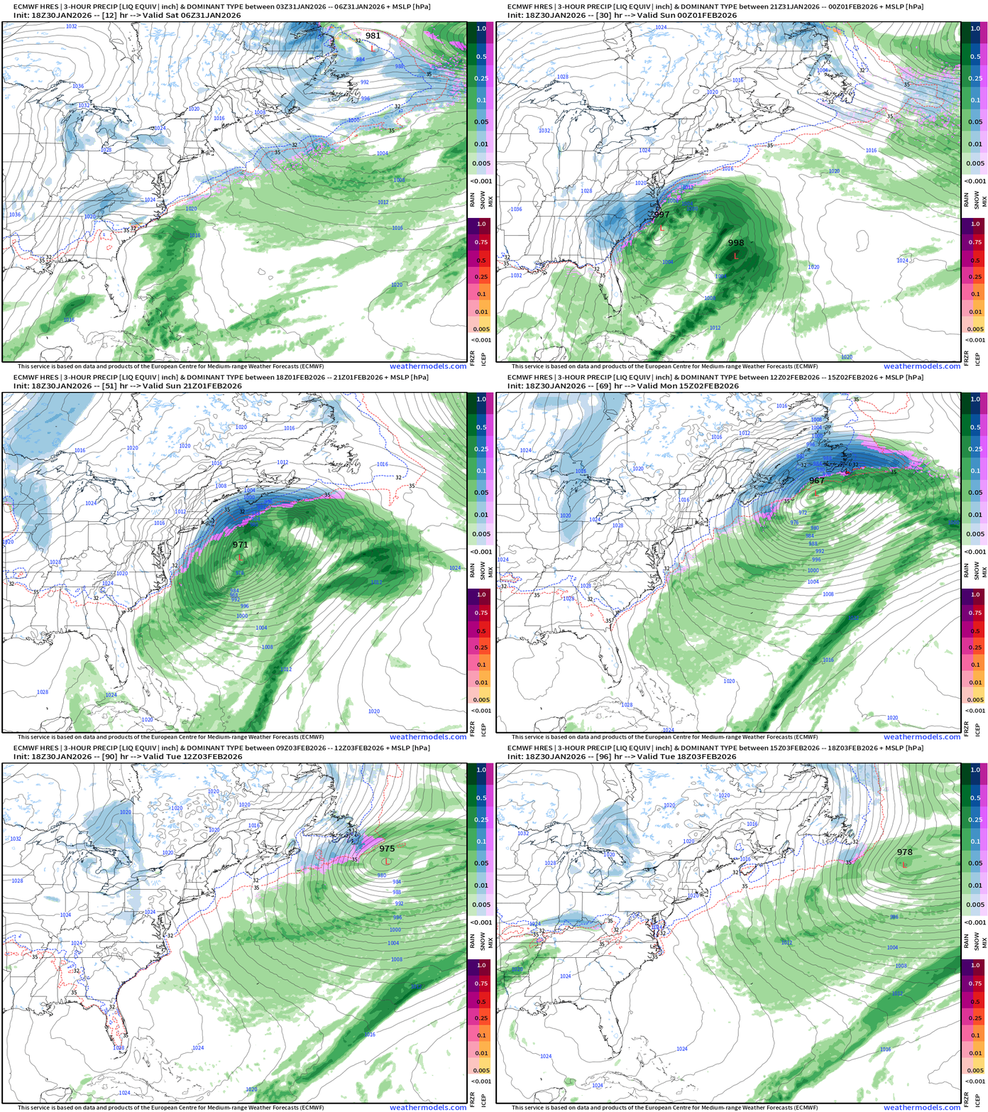
Bomb Cyclone underway — with rapid pressure falls later Saturday over the warm Gulf Stream. On the back side of the circulation, enough moisture is available for heavy snowfall — briefly — and it should be powdery with the cold temperatures. No threat of freezing rain or sleet with this system — way too cold.
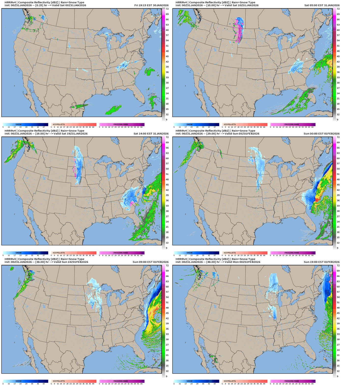
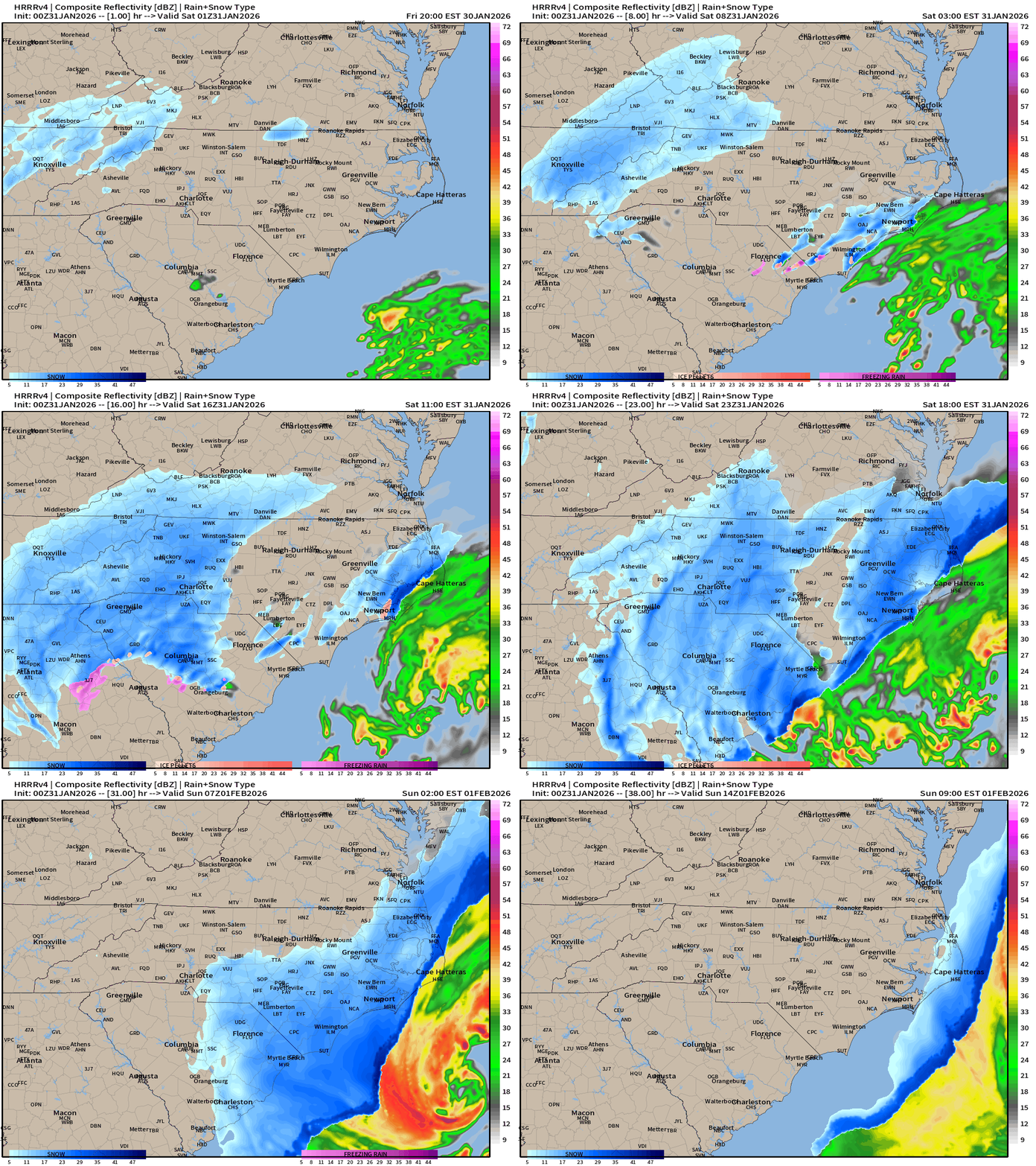
HRRR 00z simulation for the next 36-hours — dry slot misses Raleigh, so that would be a party pooper for some people I know that really want the heavy snowfall.
If you are a first time visitor but not signed up to receive my daily update emails — please do! There is no A.I. content generation here unless it is a global weather model like AIFS!
East Coast | 18z ECMWF Precipitation Type
Maximum Wind Gusts (mph) Next 72-hours from National Weather Service: red is 50 mph+
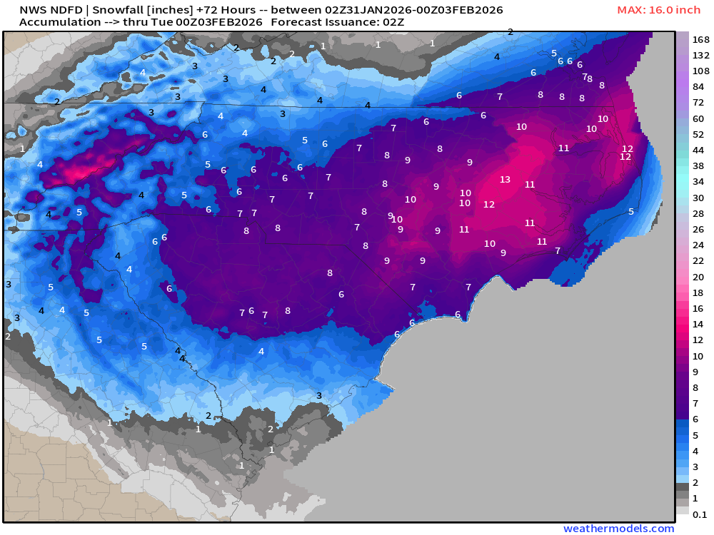
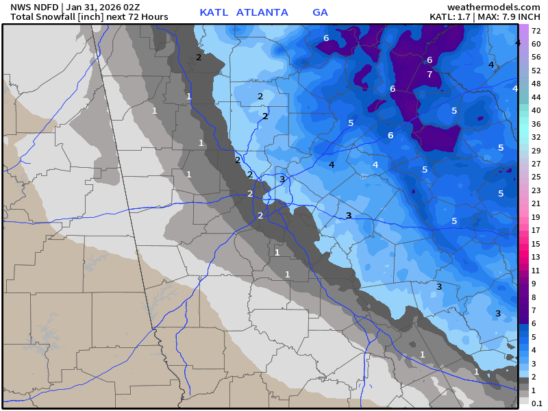
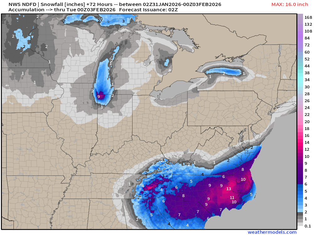
NWS NDFD Snowfall next 3-days
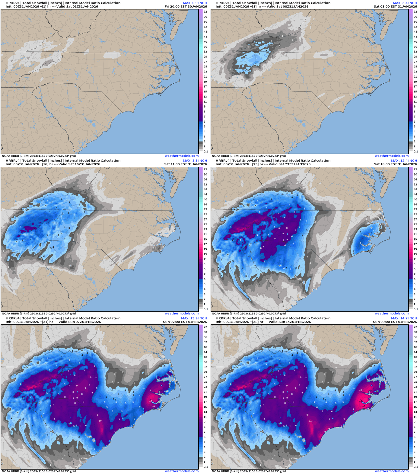
North Carolina — 6” - 9” including Charlotte and Raleigh, and 12” to 15” on the Outer Banks with Blizzard Conditions likely — insane!
Atlanta: 1” at the airport to 3” in Northeast Metro counties and 5” in Greenville on I-85 heading into South Carolina.
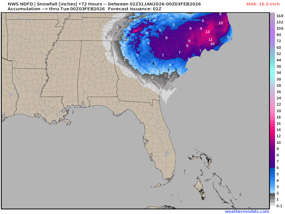
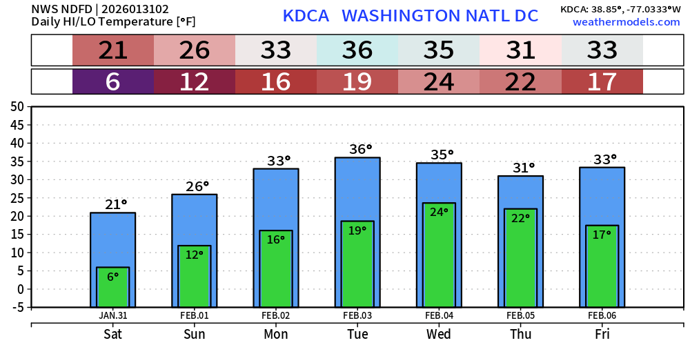
Mid-Atlantic will only be clipped — no new snowfall likely in Washington D.C.
New England Snowfall: much less likely to see major accumulations in Boston or along the Cape as in yesterday’s model update — 2” to 4” is a far cry from 24” to 36”, but we’ll try again the following weekend.
Lake Effect Snow Continues (for now) until they freeze over. South end of Lake Michigan still cranking out the snow squalls with perhaps another 6”+ around Gary, Indiana.
RTMA | Morning Temperature Analysis | 8:45 PM ET
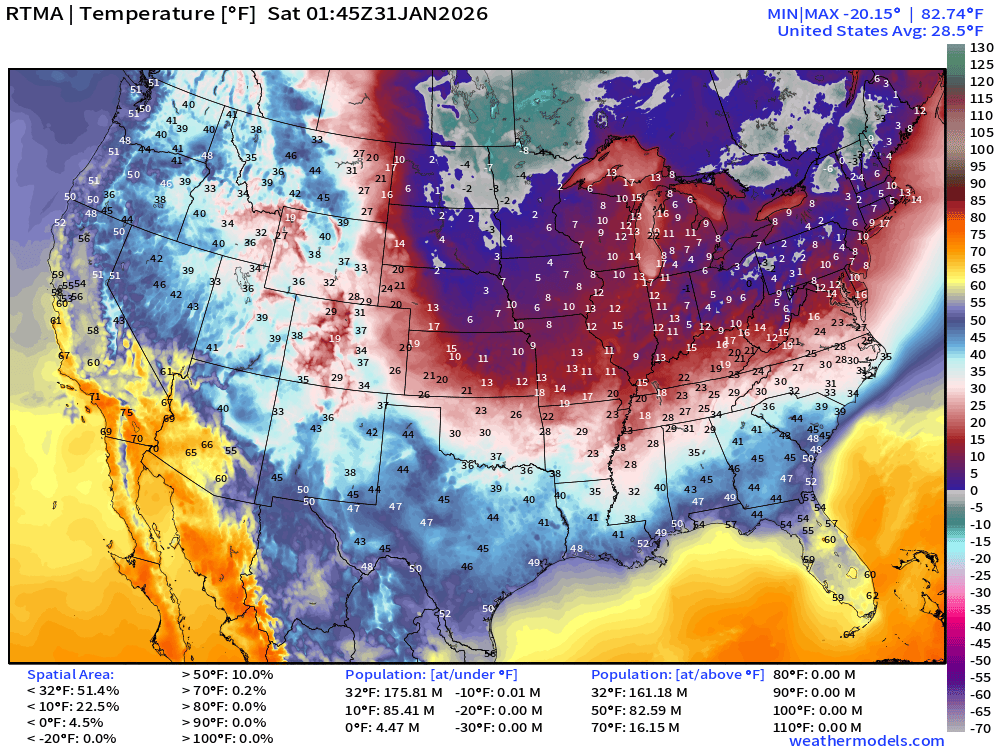
Avg Lower 48 temperature was 28.5°F — 176 million below freezing.
Temperature Anomaly | 8:45 PM ET
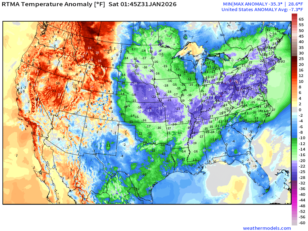
Lower 48 Temperature Anomaly below normal by -7.3°F — and going down fast.
Continuing Arctic Cold | Lows next 8-days
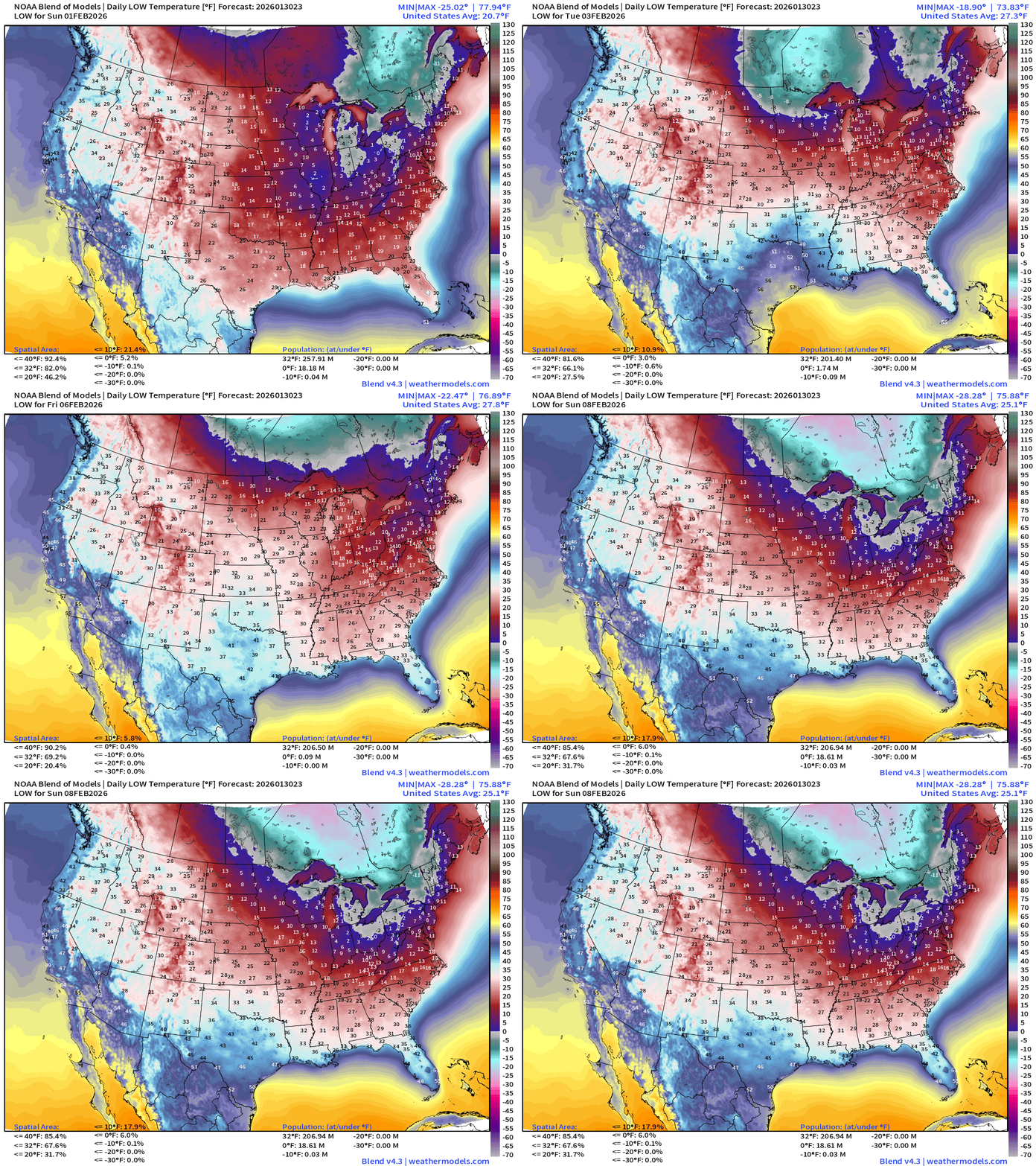
Hard to see much improvement across the Eastern U.S. heading into next weekend especially with another MAJOR Arctic blast poised to enter the Lower 48 again.
Low Temperatures Saturday
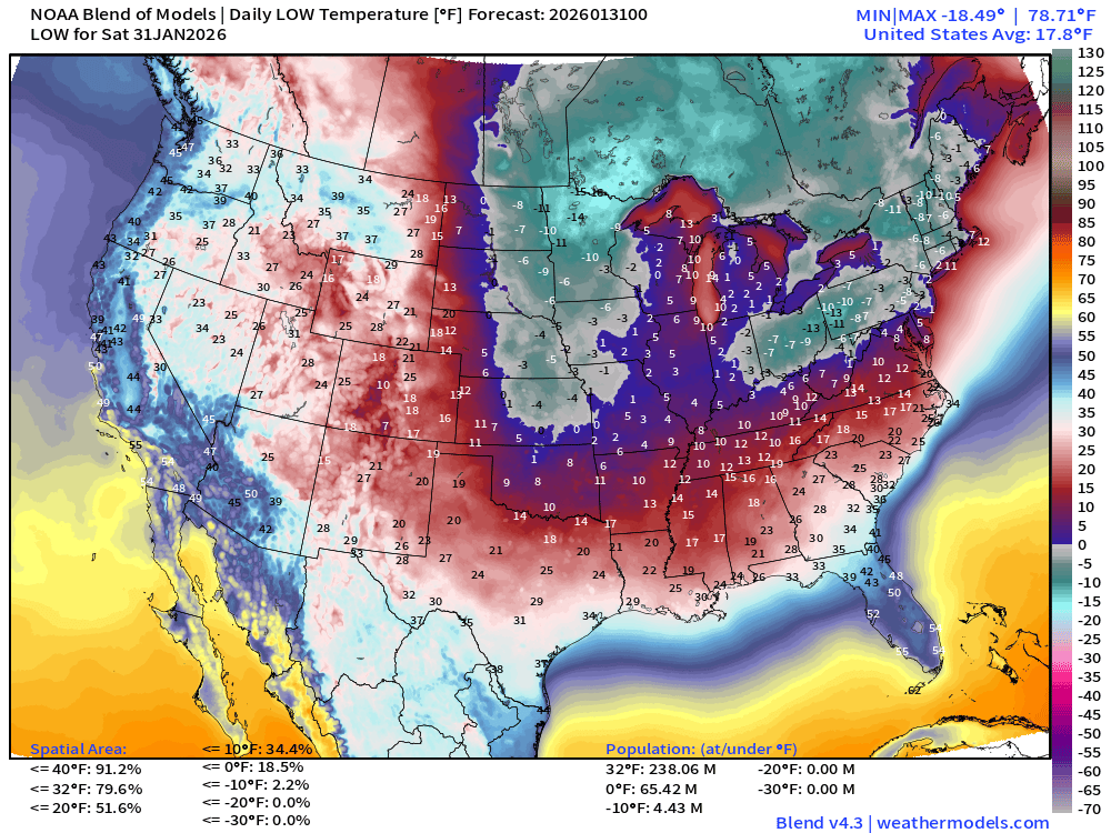
238 million below freezing — only average of 17.8°F
18.5% of the Lower 48 is below zero — area wise — and 65 million population
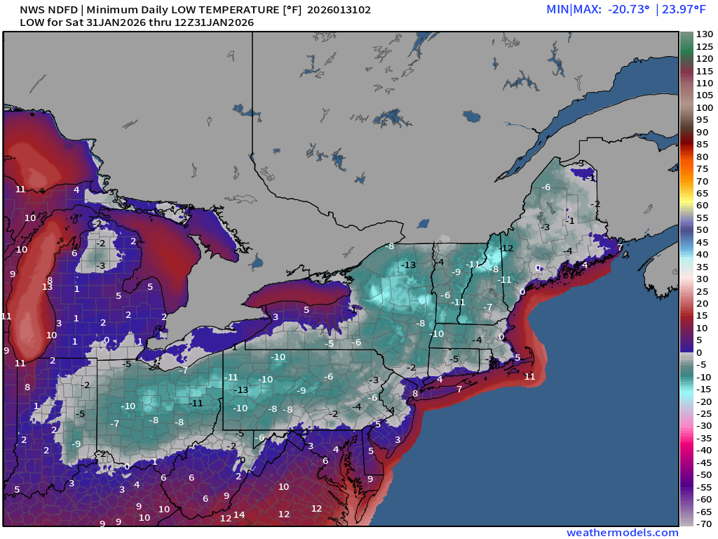
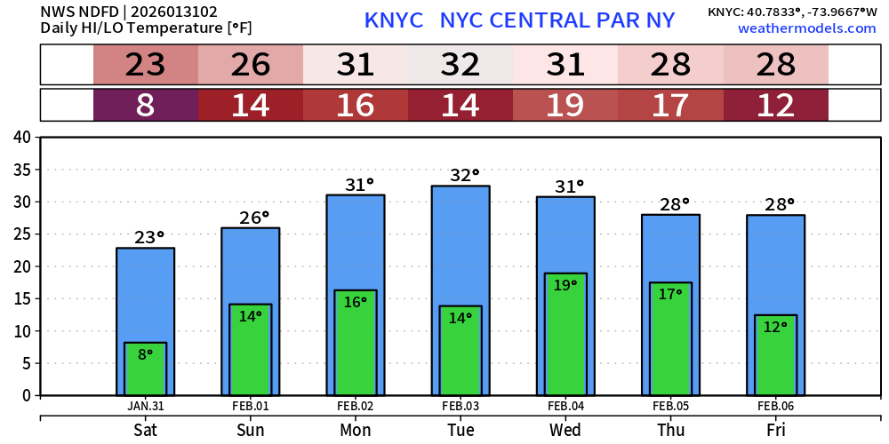
Low of 8°F at Central Park
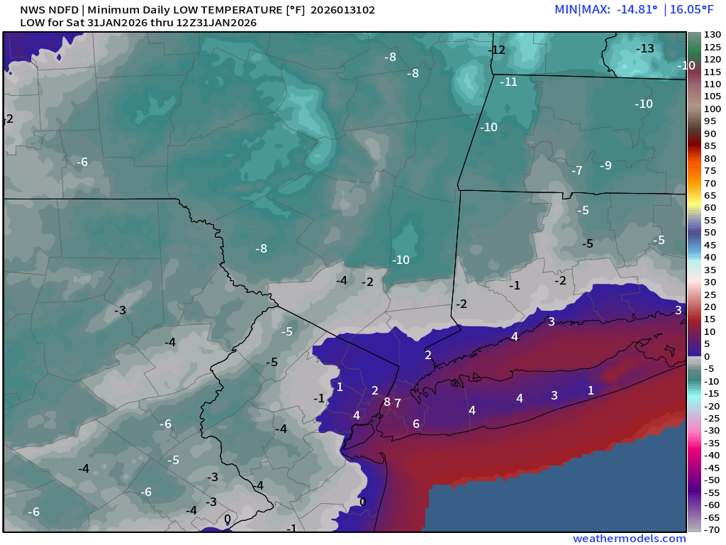
1°F low at Boston Logan but we’ll see if subzero happens

High Temperatures Saturday
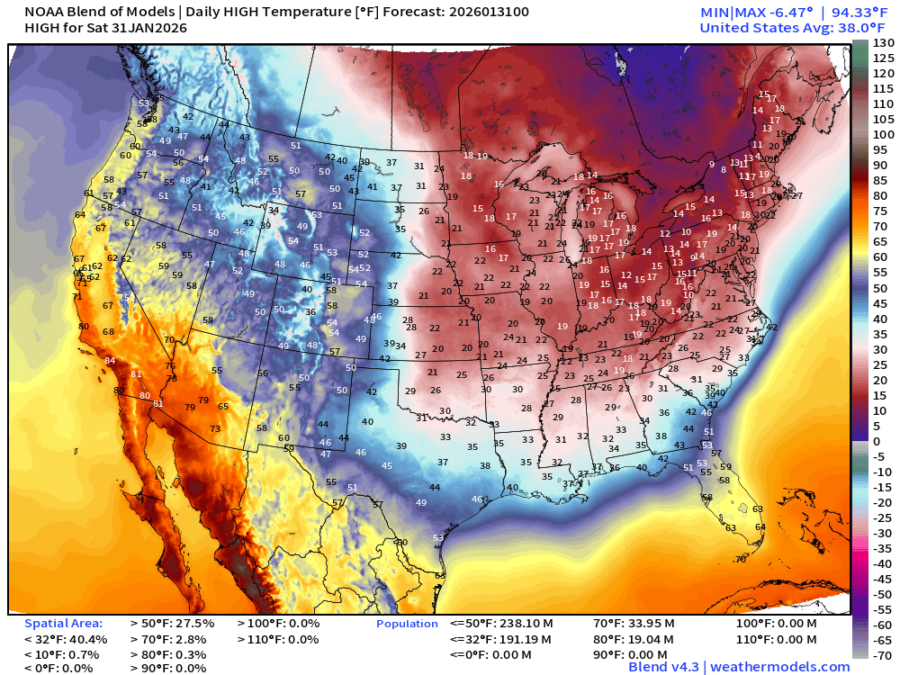
Still 191 million freezing during day … with subfreezing highs almost to the Gulf Coast and into North Texas. Only a daytime high of 28°F to 30°F in Atlanta.
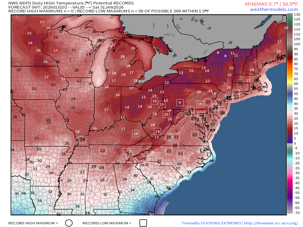
Record low maximums spread all across the Mid-Atlantic and into the Southeast
Low Temperatures Sunday
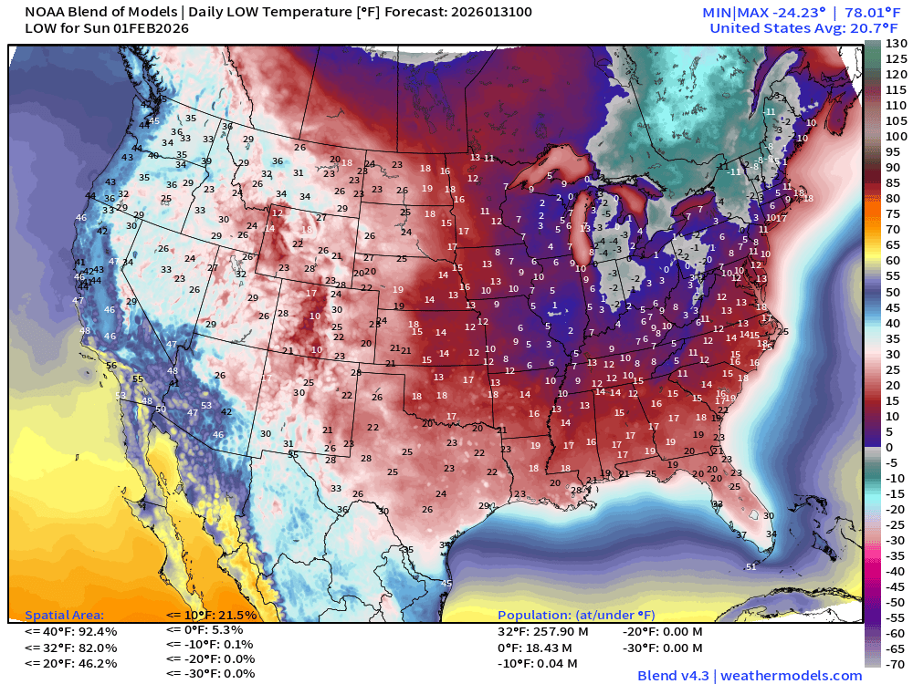
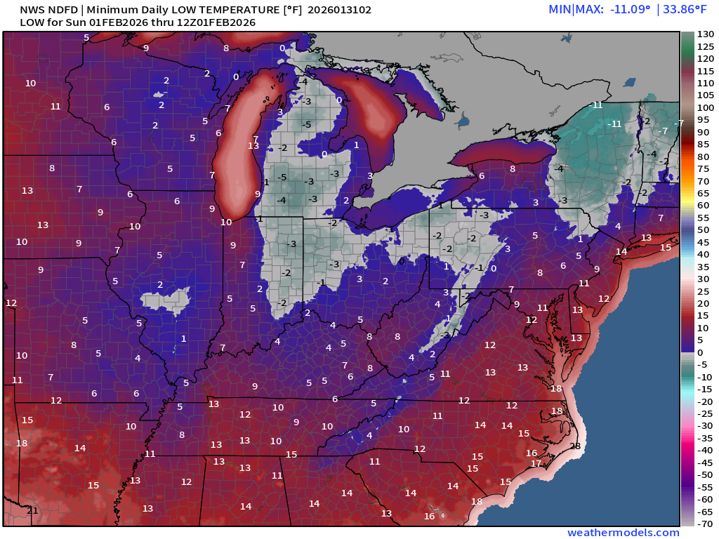
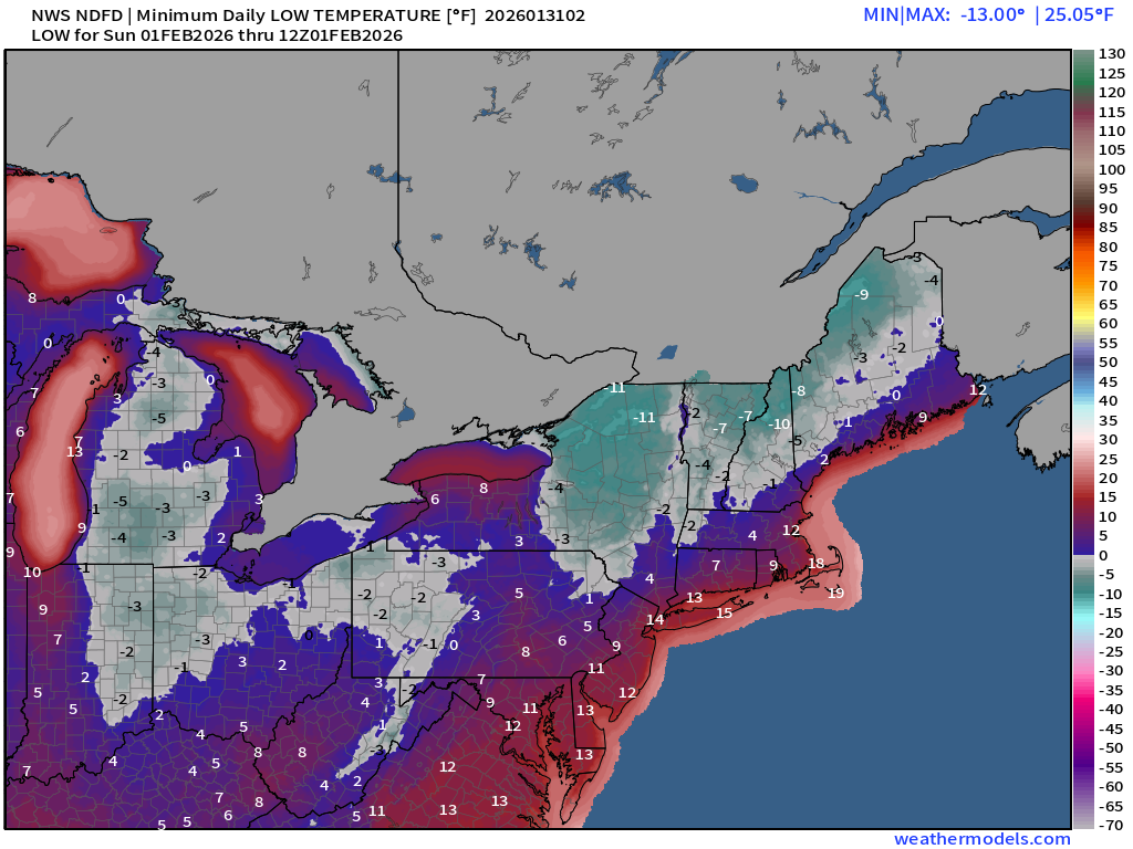
Florida Record Lows — the entire state —> call your relator!
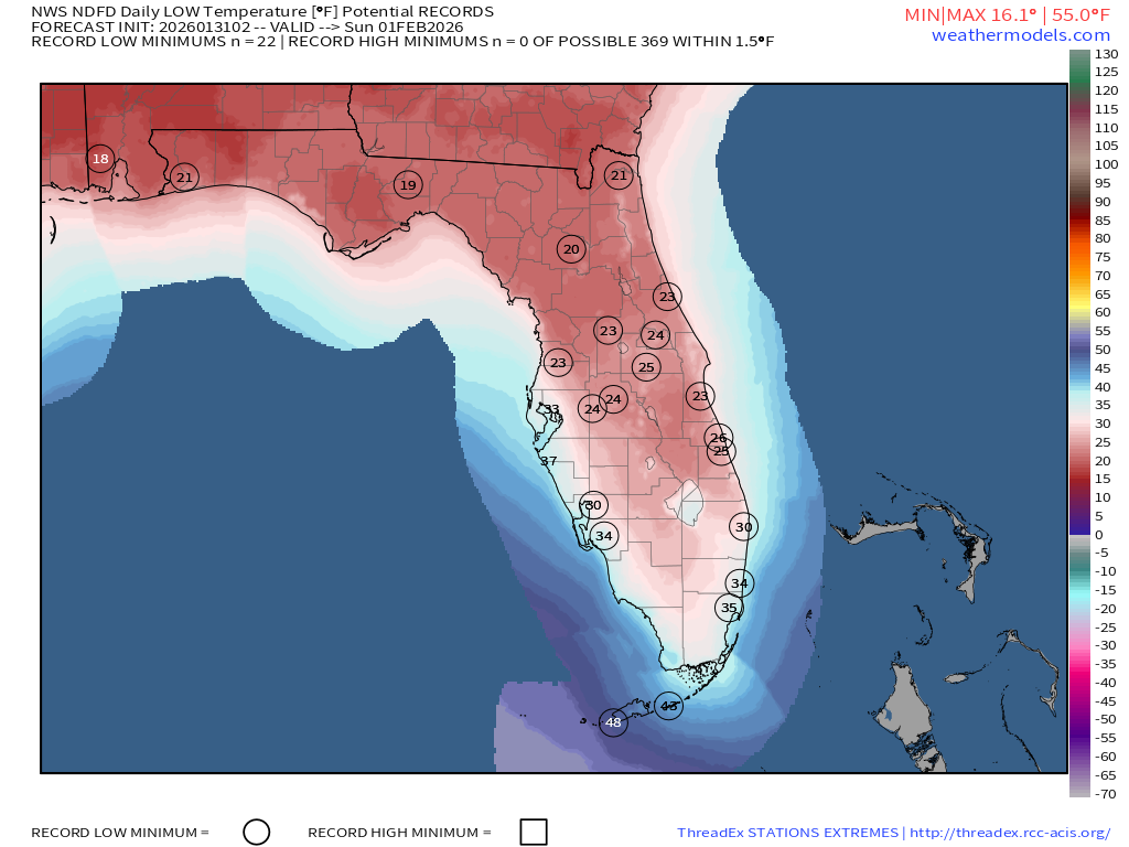
Only 16°F in Atlanta … 12°F Nashville. Teens to Tallahassee and down I-75 to near Ocala. Hard freeze!
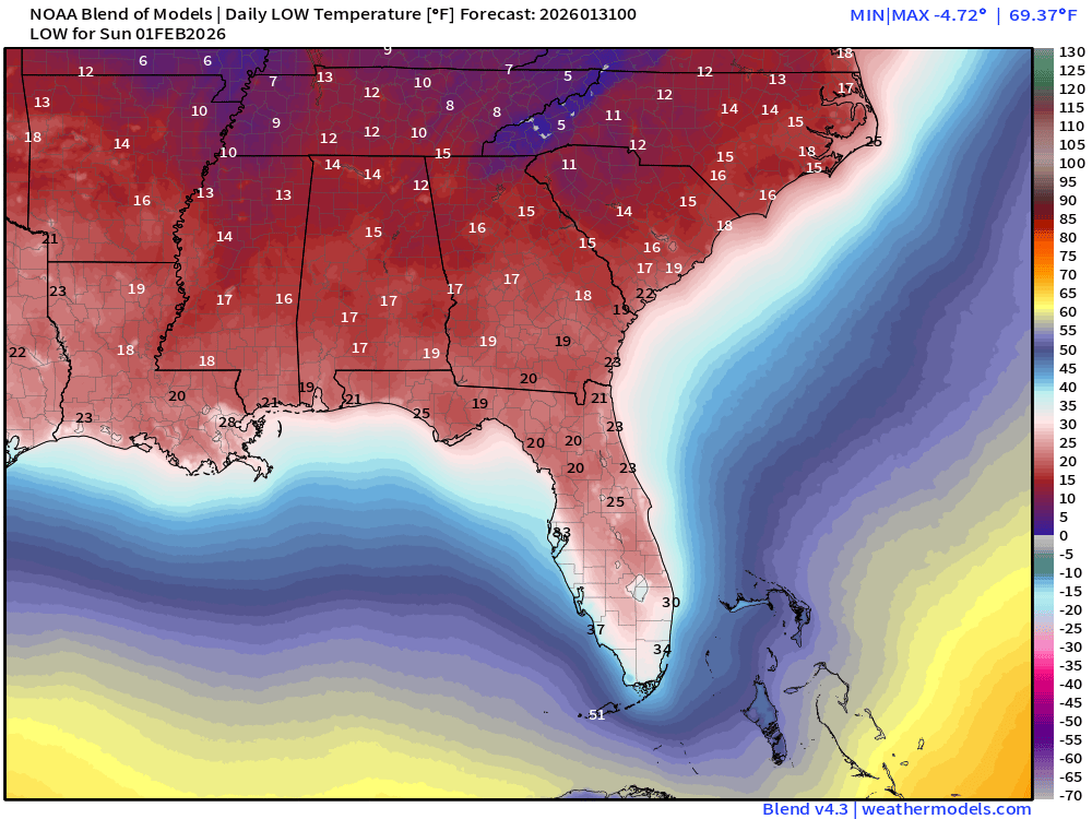
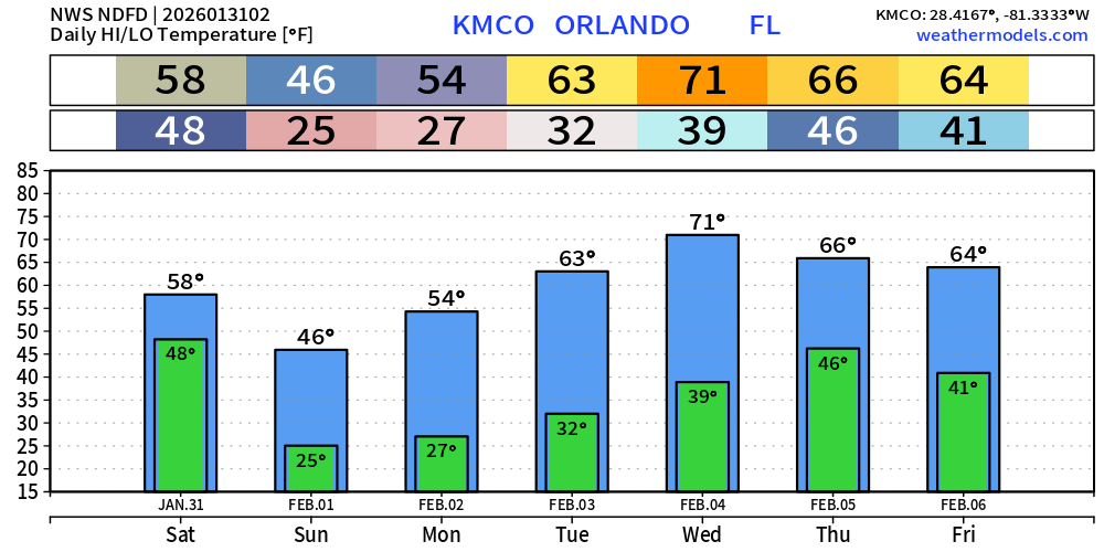
mid-20s to Orlando / Interstate 4.
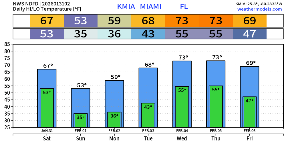
Lower 30s in Miami metro and probably below freezing inland a ways.
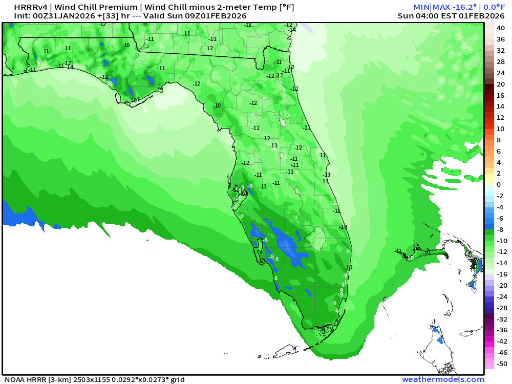
Wind Chill Premium | Sunday Morning at 4 AM ET
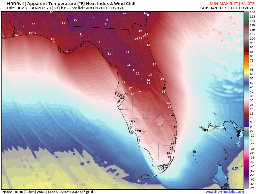
How much colder due to wind chill? 10°F to 12°F colder
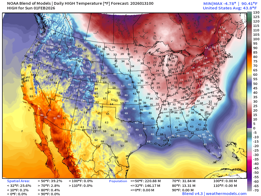
High Temperatures Sunday
Orlando 7-day Forecast
Miami 7-day Forecast
Washington D.C. 7-day Forecast
New York City 7-day Forecast
Lower 48 Precipitation Type Next 6-days
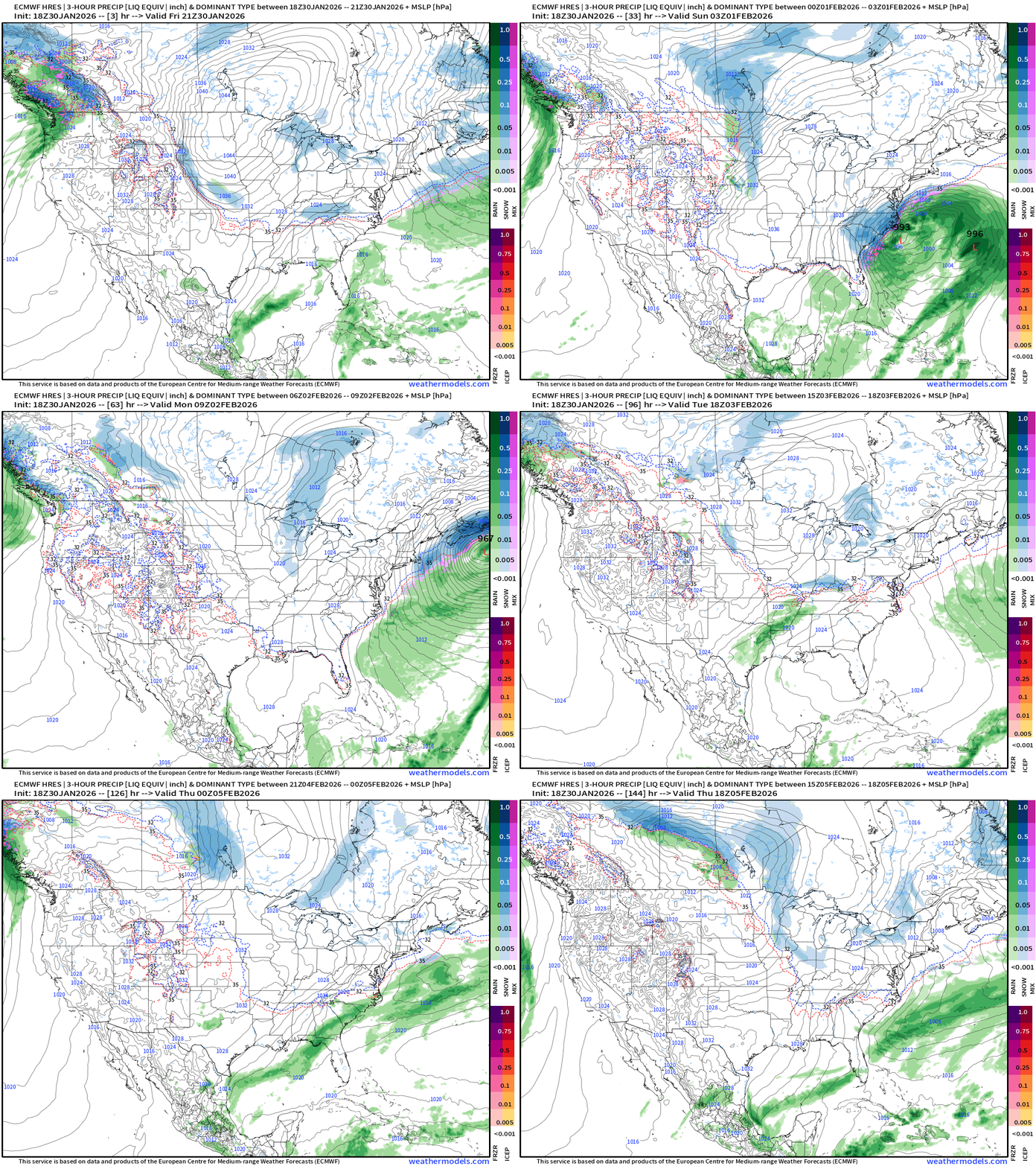
Other than the “bomb cyclone” the only active weather is in the Pacific Northwest with a series of atmospheric rivers heading into B.C. Canada.
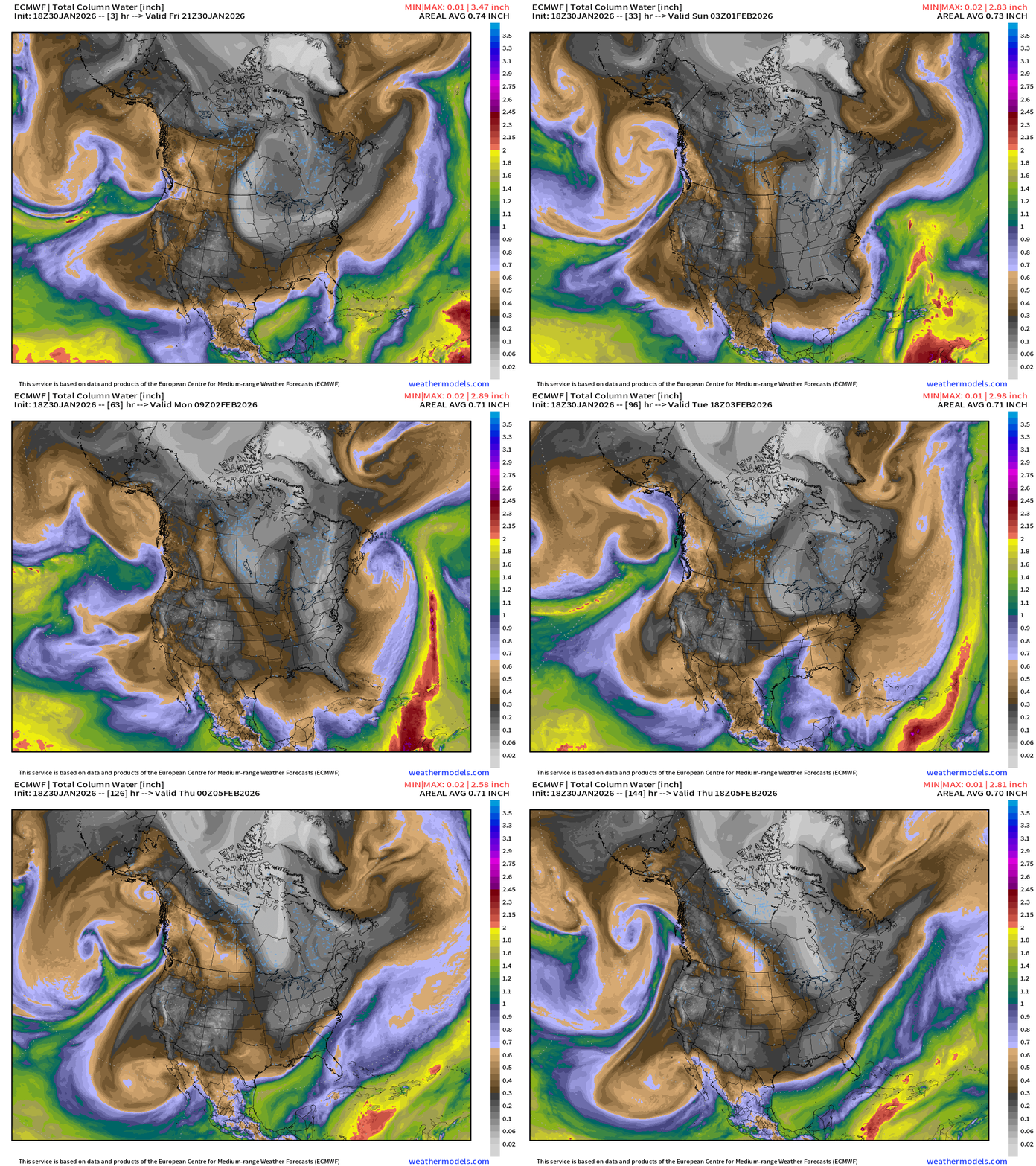
ECMWF IFS 18z | Precipitable Water Next 6-days
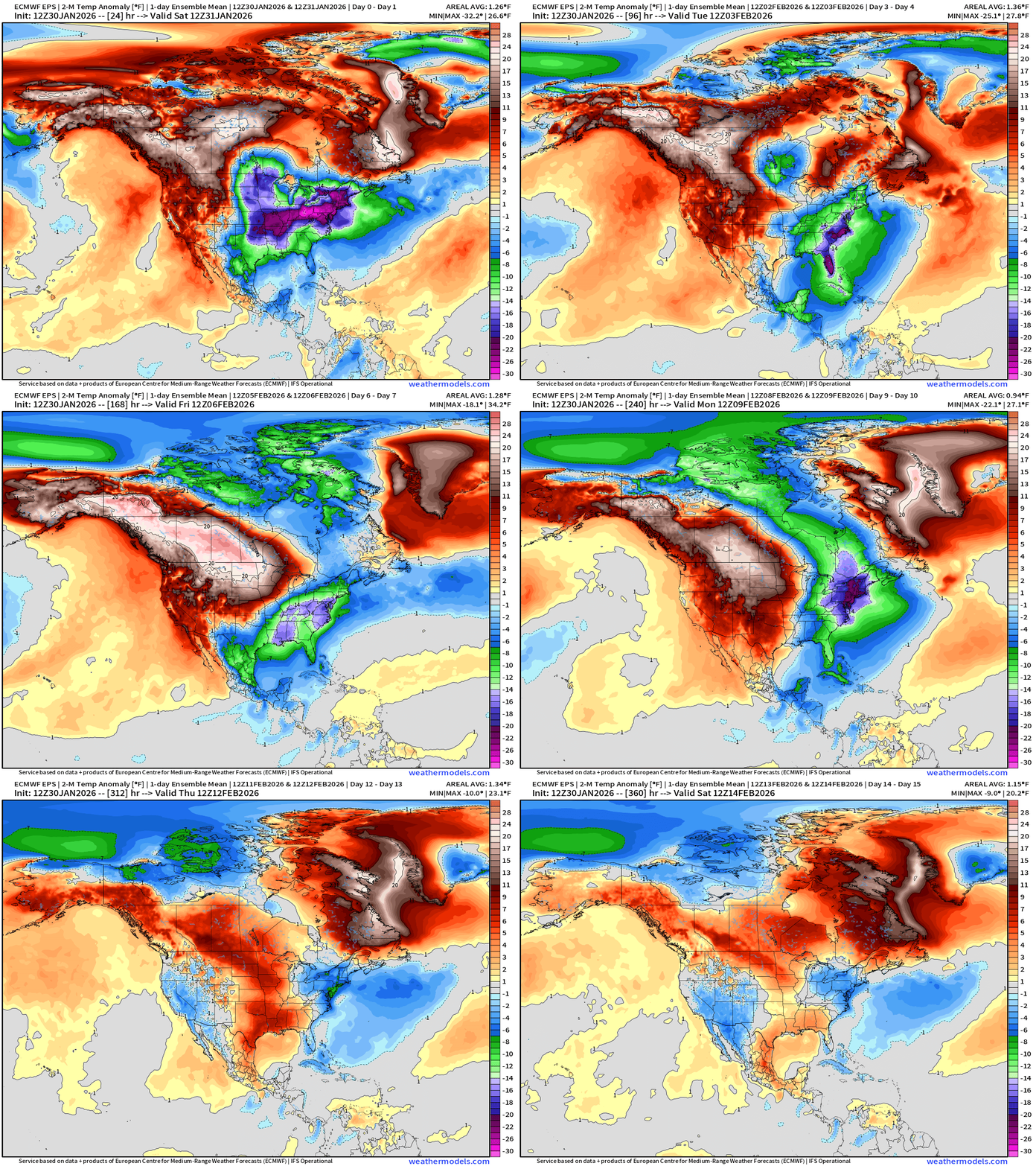
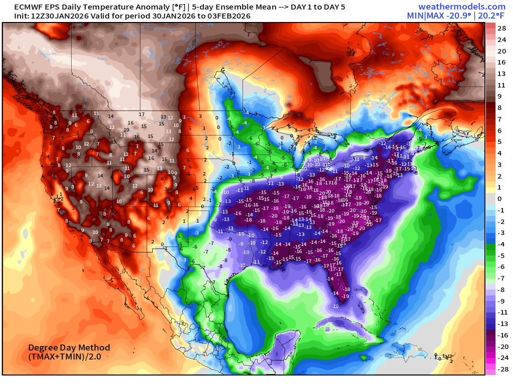
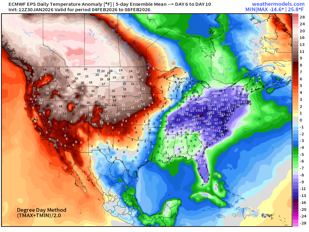
Flagship ECMWF 12z EPS | Temperature Anomaly | Next 15-days
ECMWF AIFS-Single 18z | Temperature (500 hPa) Next 12-days
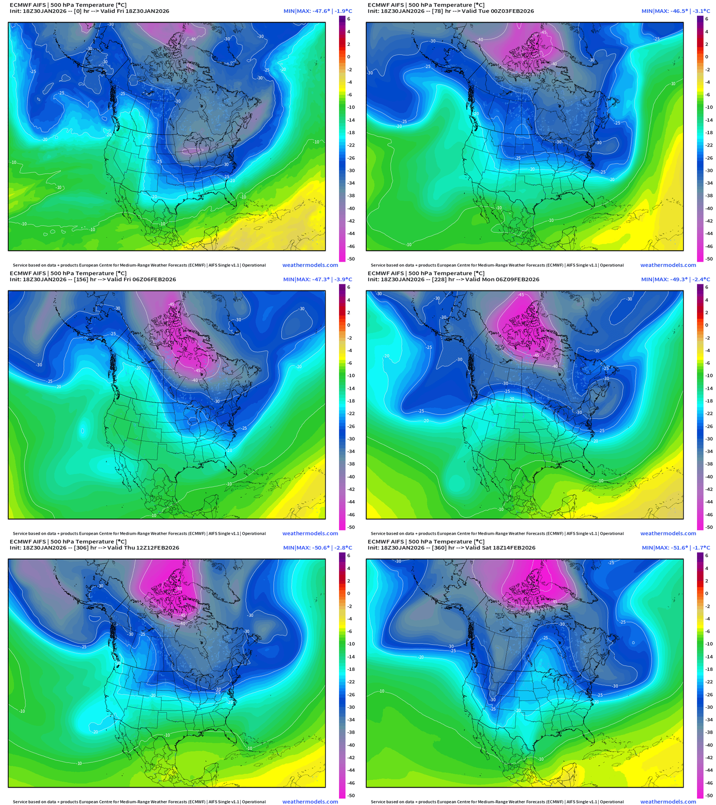
The temperature at 500 mb is the easiest way to highlight the “polar vortex” across North America with the coldest pool at -40°C (pink) with the -25°C contour usually associated with below freezing temperatures at 2-meters (surface).
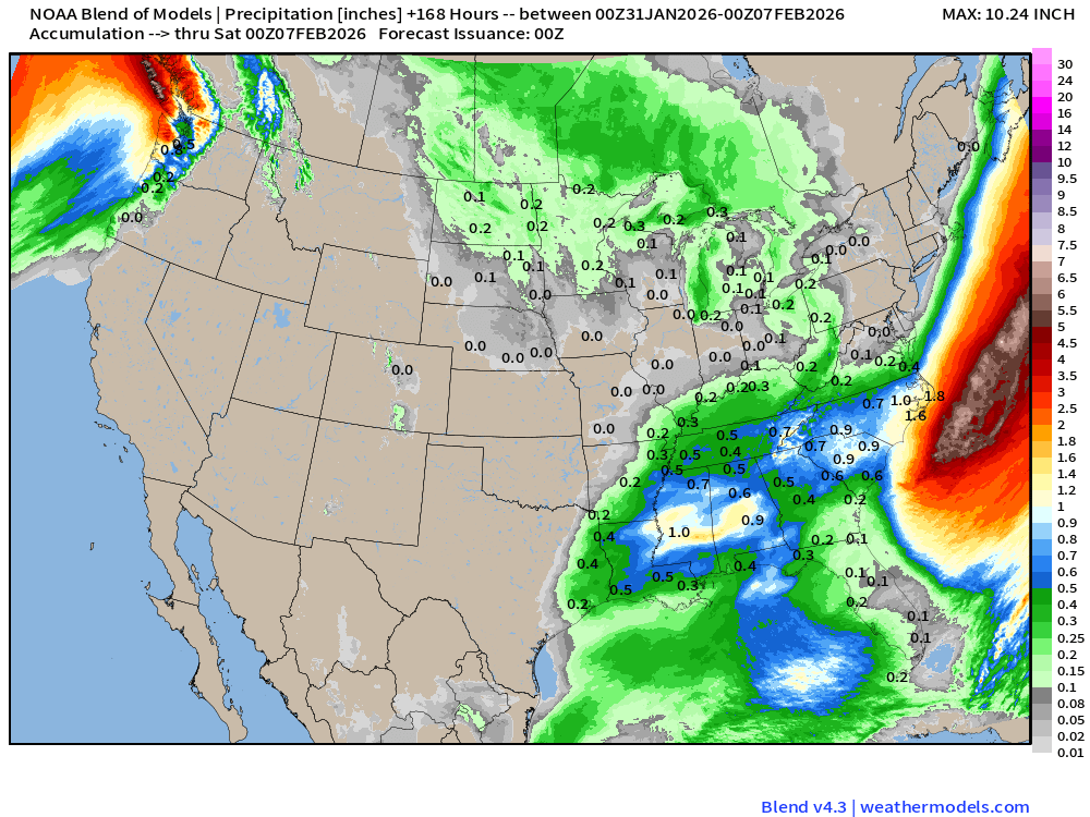
Blend of Models | 7 Days Precipitation Total
Blend of Models | Total Snowfall Next 7-Days
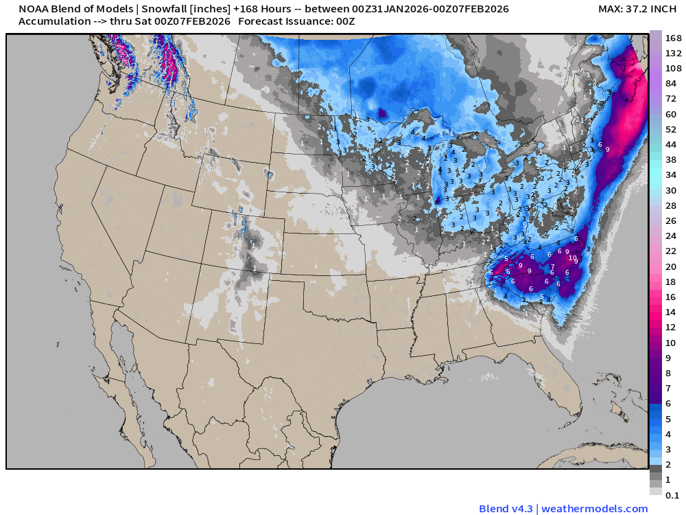
More snowfall coming out of Canada with a Clipper System that could “bomb out” off the Northeast coast next weekend.
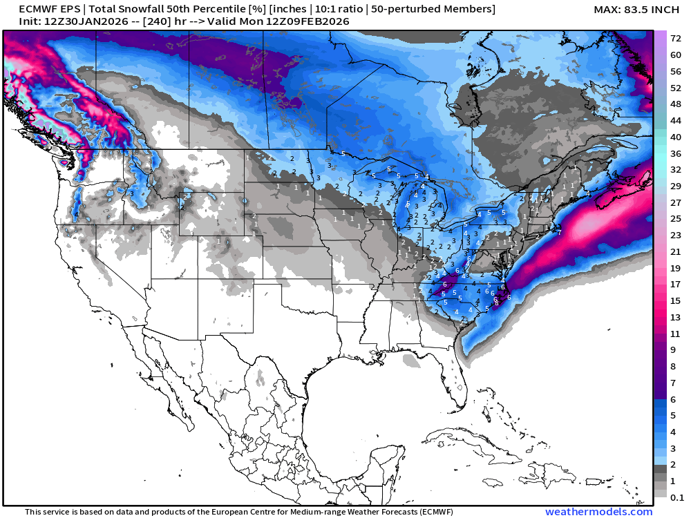
Long Range Snowfall from EPS 12z — Next 10-days Ensemble Median
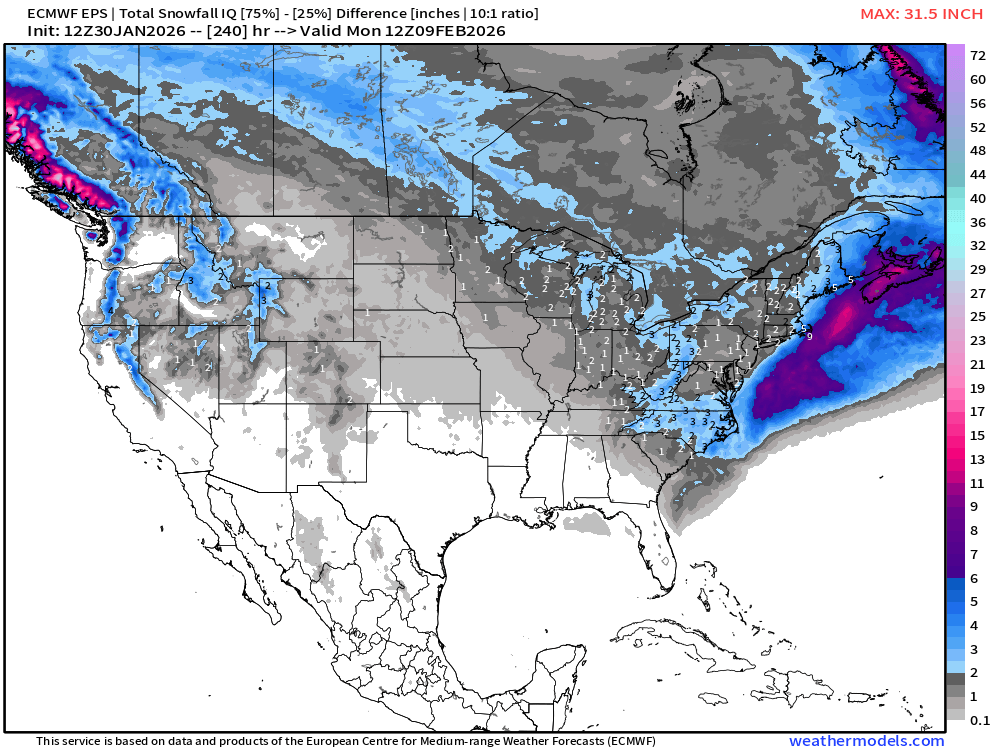
Variability about median: Magnitude of the Interquartile range (75% minus 25%)
Probability of at least 0.1” snowfall (trace) next 5-days
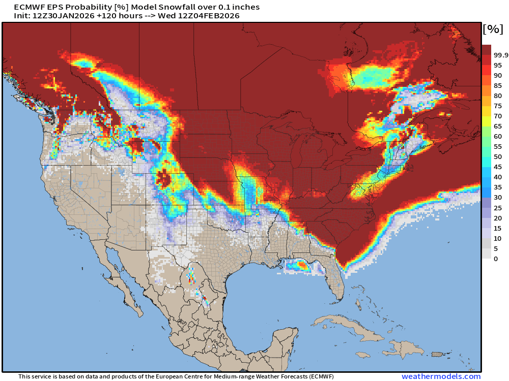
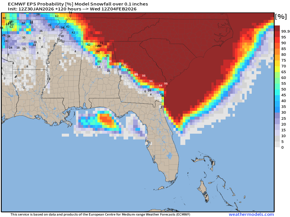
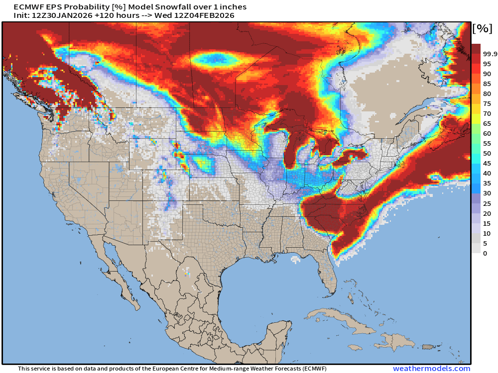
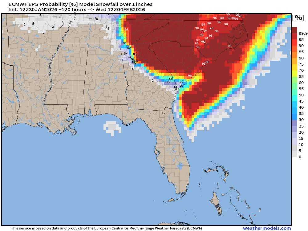
Probability of at least 1” snowfall next 5-days
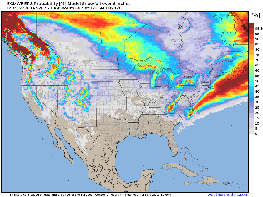
Probability of at least 6” snowfall next 15-days
Temperature Anomaly | Next 15-days | ECMWF EPS 12z
5-Day Chunk #1 | Temperature Anomaly | Jan 30 - Feb 3
5-Day Chunk #2 | Temperature Anomaly | Feb 4 - Feb 8
5-Day Chunk #3 | Temperature Anomaly | Feb 9 - Feb 13
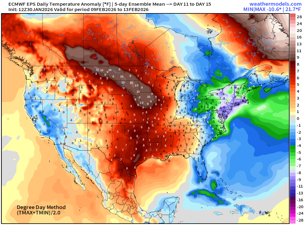
Maps sourced from weathermodels.com designed and innovated by yours truly! Please subscribe there for real-time access to the newest maps, charts from all of the weather models including ECMWF and AIFS, NOAA AI-GFS/AI-GEFS
- Milepost
- 855 · laid 2026-01-31T03:23:18.287000Z
- Source
- https://weather.substack.com/p/january-30-2026-friday-winter-storm
- Digest
- 47b17b0ebbc639b047a2ccb7095a3ada387f8f863651eb214f4e230de1caeedf
- Machine
- JSON