January 12, 2026 Monday Winter Weather
Ensembles went much colder into Week 2 as Canadian cold pool reloads
January 2026 was the 25th-warmest January in the 132-year national record (1895–2026), at 33.1°F against a 1991–2020 normal of 32.3°F (+0.8°F).
January 2026 was the 12th-driest January in the 132-year national record (1895–2026), at 1.6in against a 1991–2020 normal of 2.3in (-0.8in).
NOAA/NCEI Climate at a Glance, contiguous United States. This is the observed record for the month, not a score of anything said in this piece — the forecast ledger begins 2026-08-17 and cannot reach earlier posts.

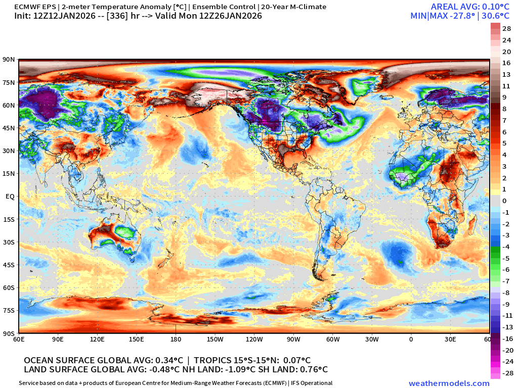
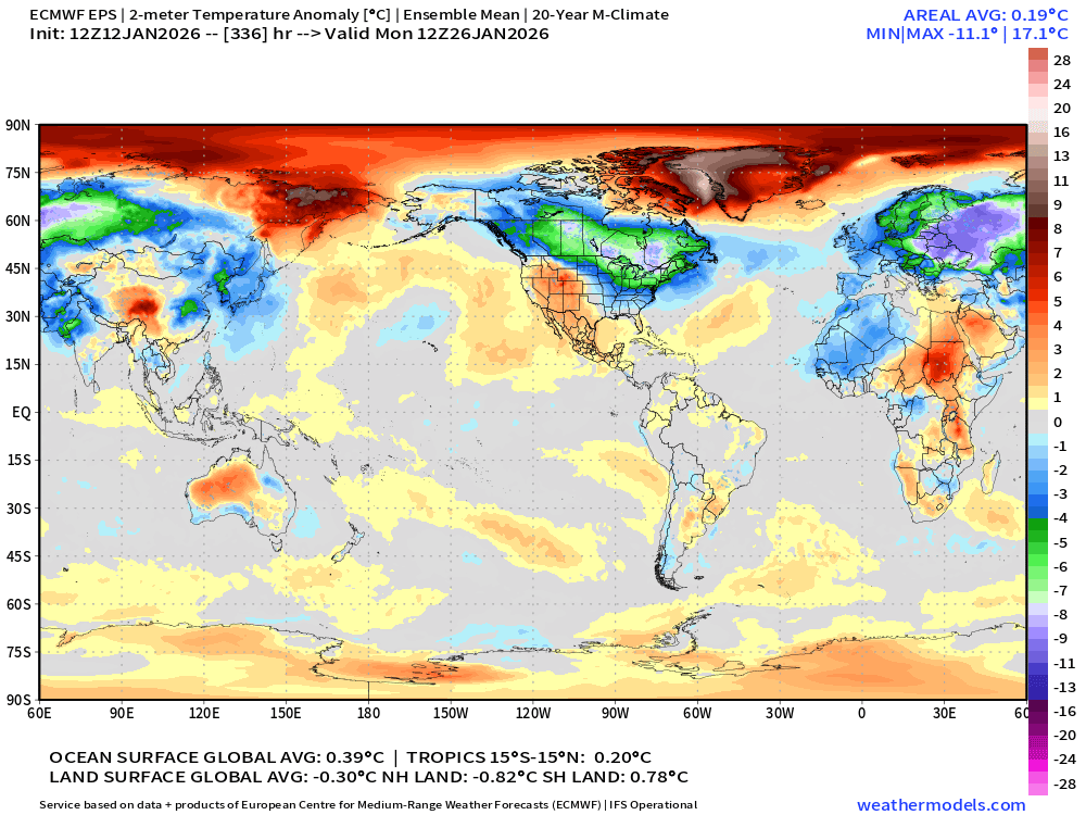
Returning again this evening to the extended range Day 14 global temperatures from the European flagship full-physics ensemble — the control (HRES) and the ensemble mean. Both show remarkable Northern Hemisphere land cooling to about 1°C below normal, and the global number to near the 30-year normal (1991-2020). This is widespread, extreme cold for billions of global population into the end of January primarily due to a weakened / perturbed stratospheric polar vortex. This is 2 weeks in the future, so the details and intensity will change, but we are poised to see a potentially historic Arctic “polar vortex” blast across North America and Eurasia into the end of January.
Control Day 14
Ensemble Mean Day 14
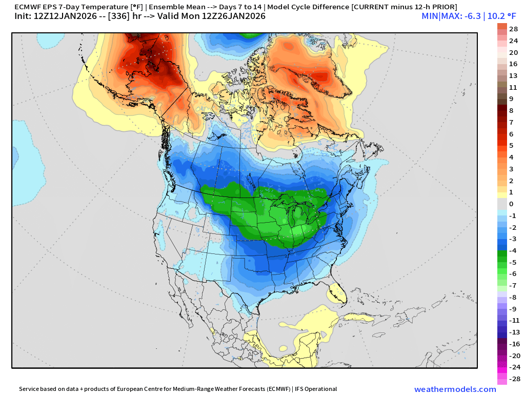
Other major story was the Week 2 ensemble mean sharply moved colder by upwards of 5°F to 6°F centered on the Midwest and Great Lakes. We’ll see if the basket of ensembles grows — and this cold pool intensifies in the ensemble mean — or we see windshield wiper effect and again a decrease in the 00z suite.
Headlines Monday Evening
Colder pattern across Eastern U.S. peaking Friday across the Southeast with a hard freeze into Central Florida
Suspected Nor’easter not coming together — need to settle for Clipper systems and scraps
Trans-Canadian Cold Pool reforms once NE Pacific block breaks down = risk increasing for much more intense cold into end of the month
ECMWF AIFS-Single 18z | Height Anomaly (500 hPa) Next 10-days
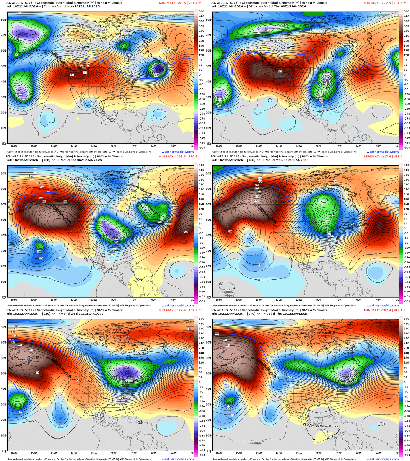
A strong blocking ridge forms over the Pacific Northwest and retrogrades to Alaska finally dislodging the extreme cold pool that has been tormenting the 49th State for weeks. The jet stream will need to go up and over this ridge meaning a dip or weakness in the Great Lakes and Northeast. This allows the “polar vortex” anchored over Hudson Bay to drop multiple lobes or extrusions of “cold pool” air even into the Southeast U.S.
Multiple Hudson Bay origin “polar vortex” events dip across the eastern U.S.
And, looking at Day 10, the western extent of the Canadian cold pool increases by eroding the Alaska block from the East. Quick look at Day 12 upper-level 500 mb temperature and the corresponding 2-meter temperature anomaly.
ECMWF AIFS-Single 18z | Temperature (500 hPa) Next 10-days
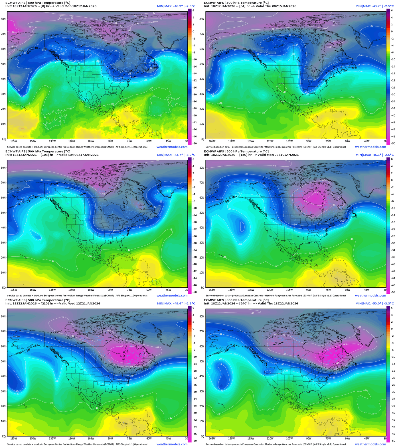
The temperature at 500 mb is the easiest way to highlight the “polar vortex” across North America with the coldest pool at -40°C (pink) with the -25°C contour usually associated with below freezing temperatures at 2-meters (surface).
The Western U.S. and Pacific Northwest ridge is very apparent and firmly entrenched vs. the Hudson Bay / Arctic Canada undulations are dipping southward into the eastern U.S. = cold.
HRRR Next 48-hours Radar | Through Wednesday Afternoon 1 PM ET
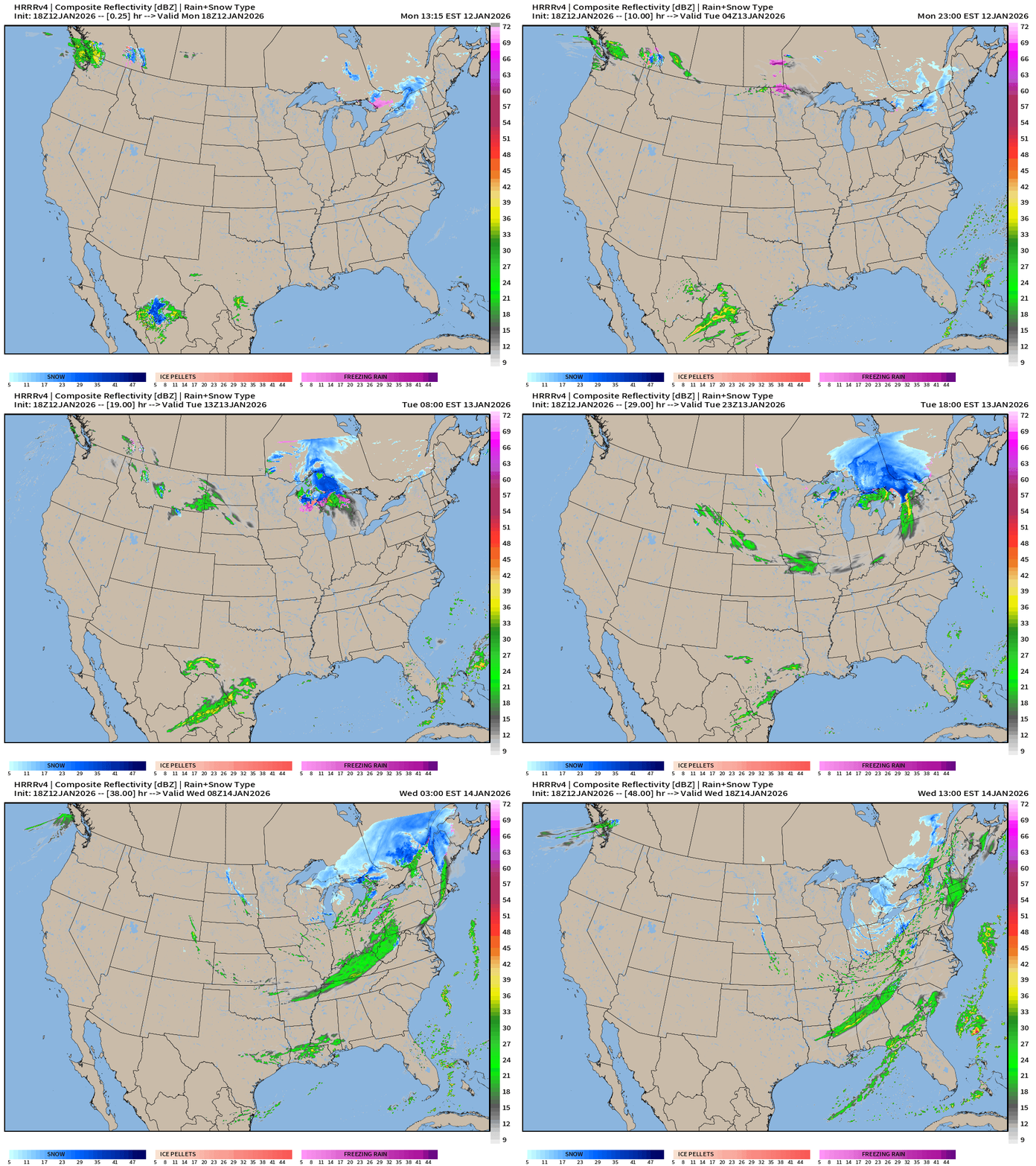
The Great Lakes Clipper remains the only show in town
ECMWF 18z | Precipitable Water Next 6-days | My Favorite Parameter
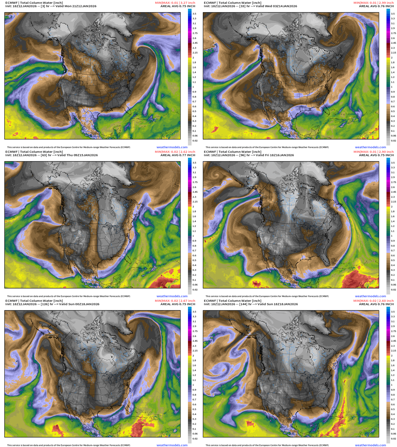
Colder Arctic air dips into the Eastern U.S. by way of the Midwest and Great Lakes in two major waves: Wed-Thurs and then again Sat-Sun
ECMWF 12z | Integrated Vapor Transport Next 10-days
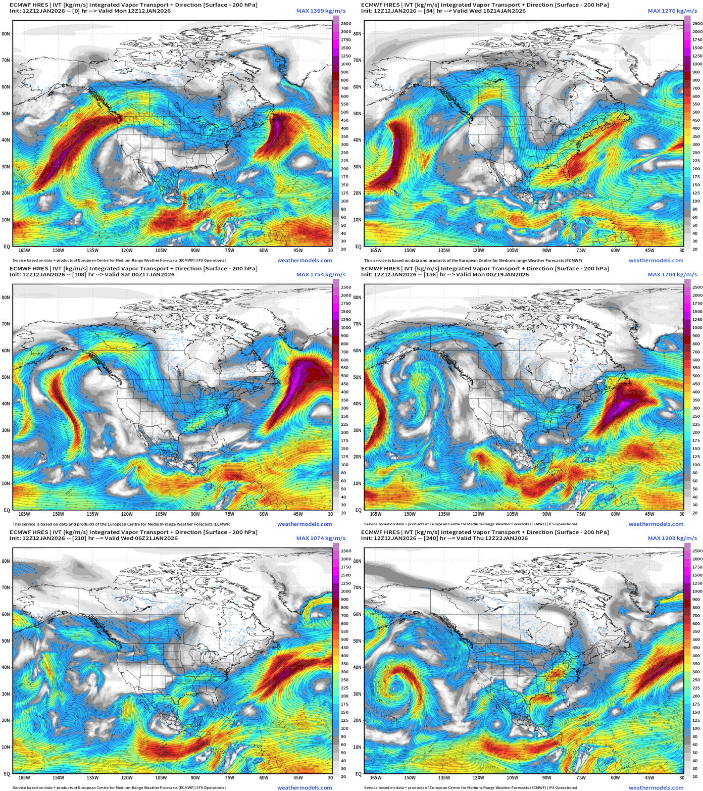
Western blocked upper level pattern shuts off the West Coast from atmospheric rivers — and keeps the Gulf of Mexico closed for business.
Not seeing any Nor’easters with East Coast impacts in the next 10-days
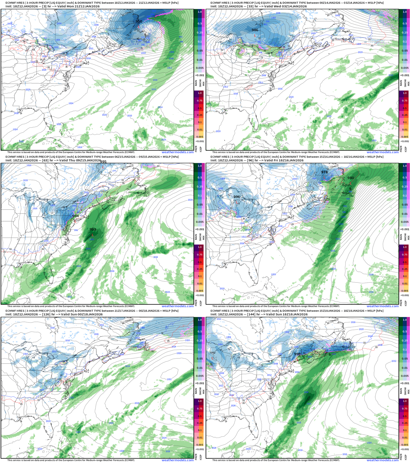
ECMWF 18z Precipitation Type and Intensity | Next 6-days
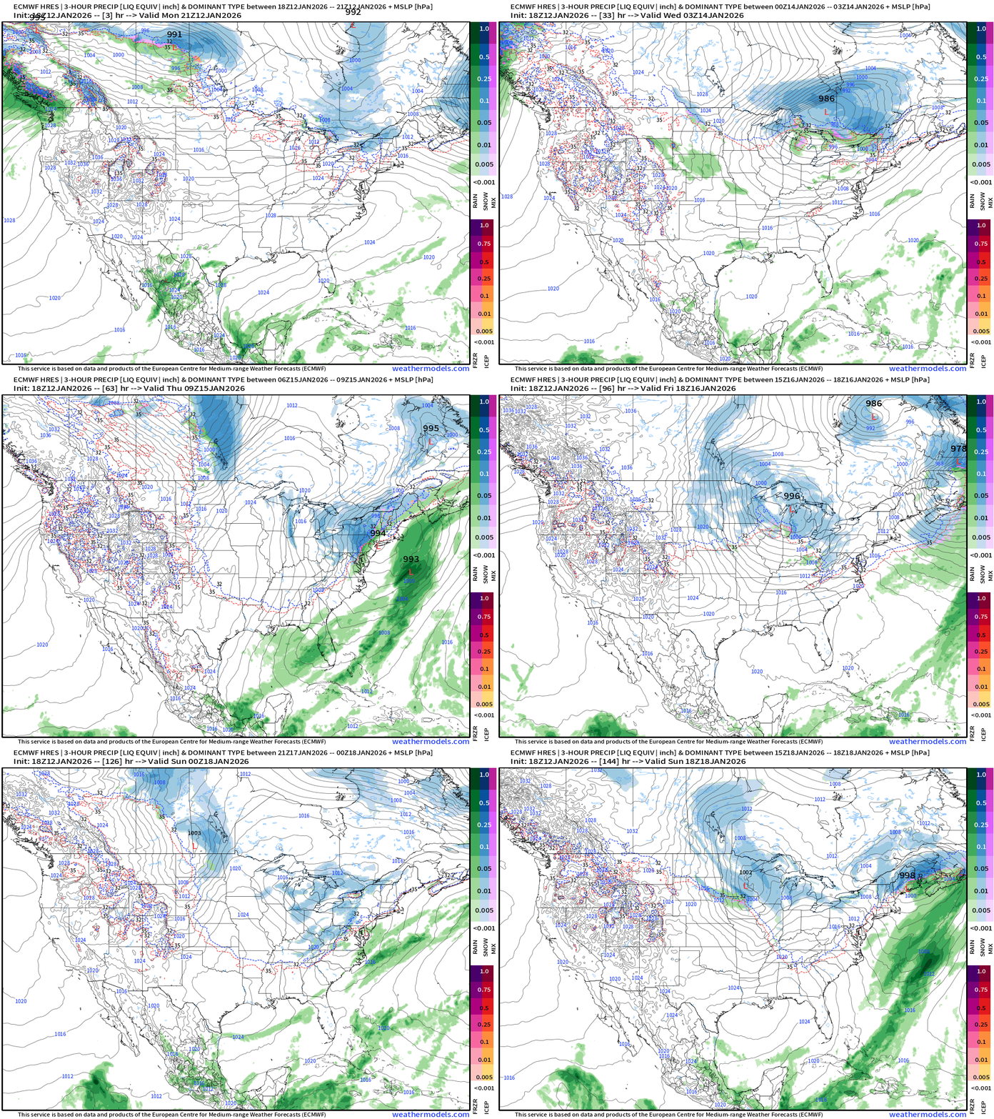
Northwesterly flow out of Alberta —> clipper systems into the Great Lakes and Northeast but do not phase too well with the upper-level polar vortex for “bombogenesis”.
We need to watch the Southeast for any moisture from the Gulf of Mexico combing with the very cold Arctic air —> light wintry precipitation in Atlanta (10% chance)
Eastern U.S. | Two areas of low pressure wobble through the Northeast with light accumulating snowfall events but not a major storm
Extreme cold across Southeast and Florida —> Friday Morning Lows
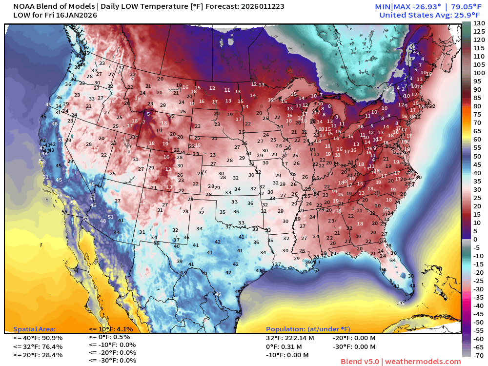
222 million below freezing
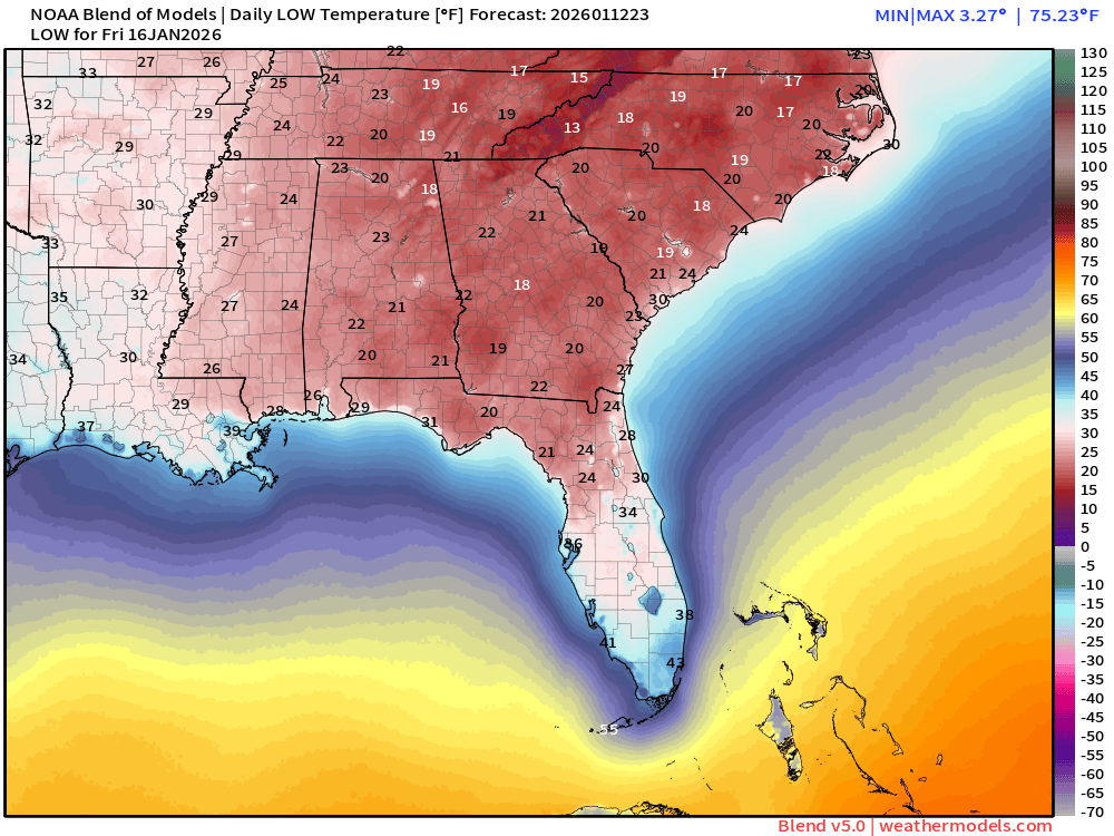
22°F in Atlanta, 18°F in Macon, 20°F in Tallahassee
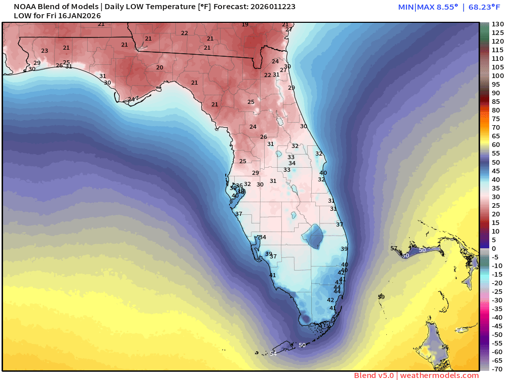
Freezing to Interstate 4
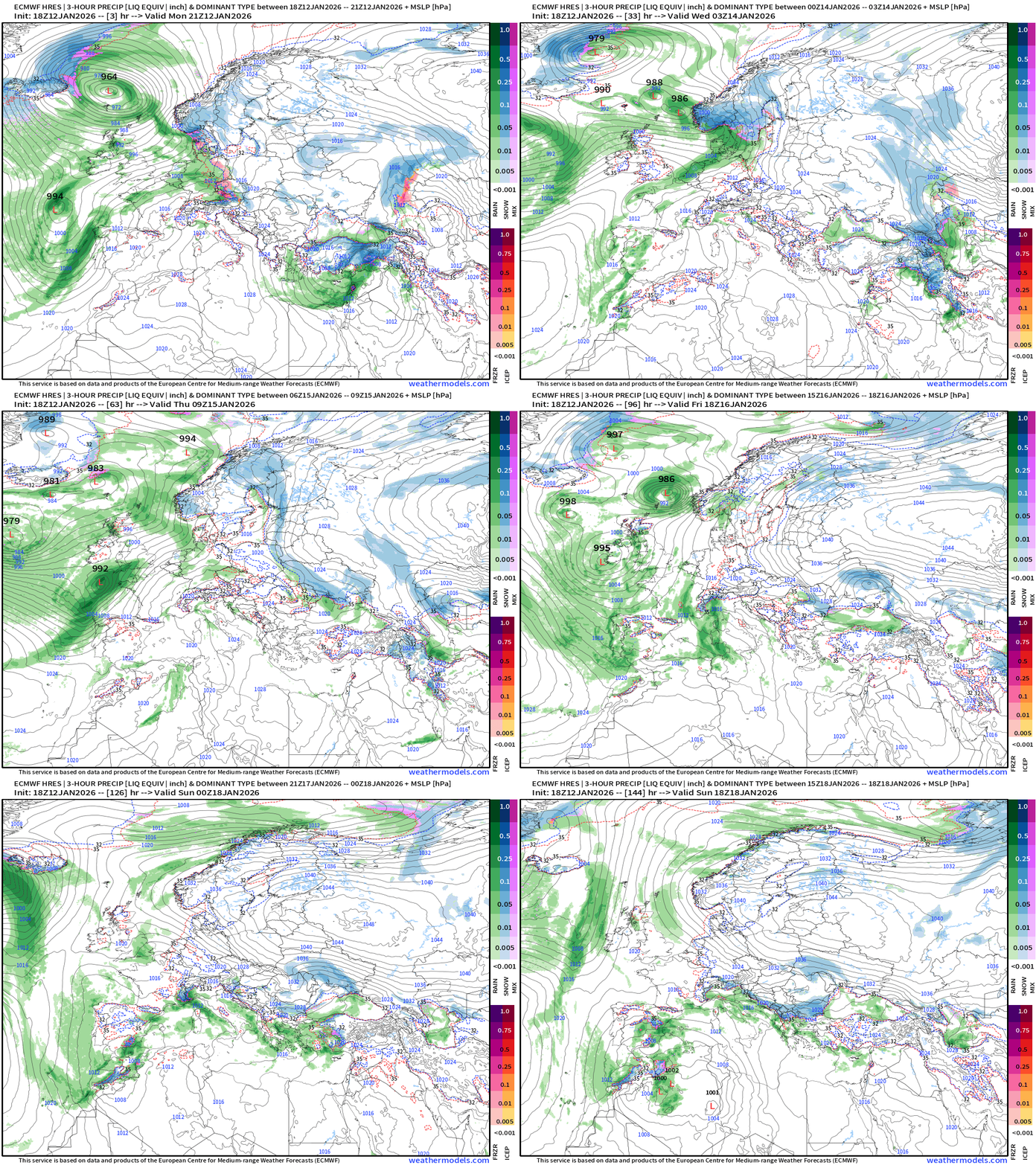
Europe Storm Systems next 6-days
ECMWF 12z EPS | Temperature Anomaly | Next 15-days
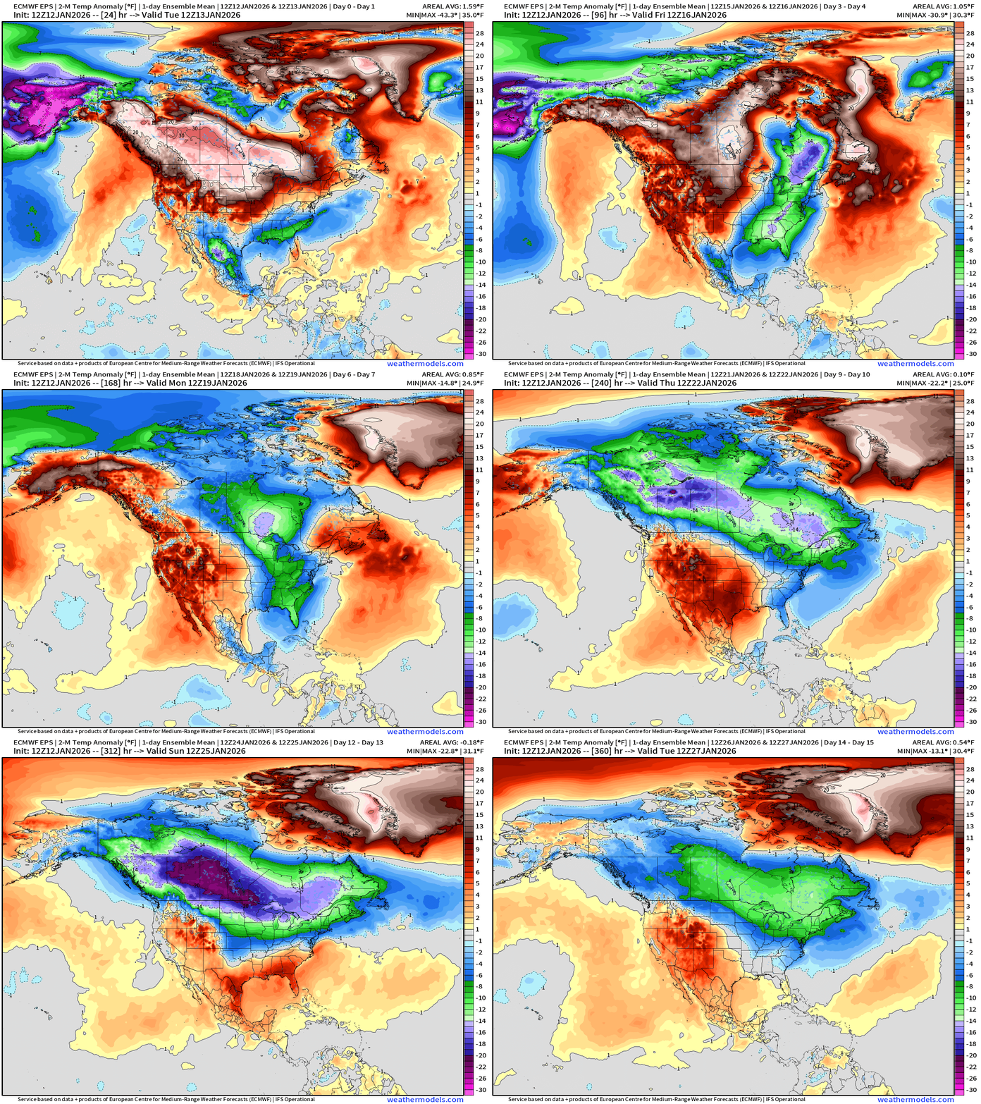
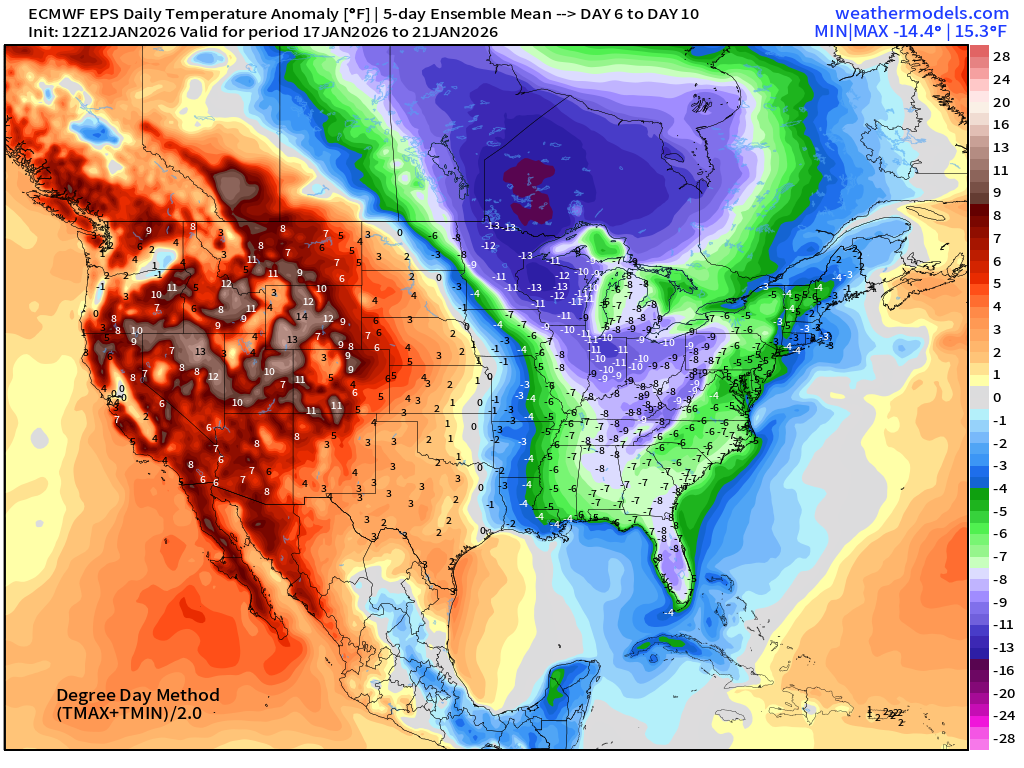
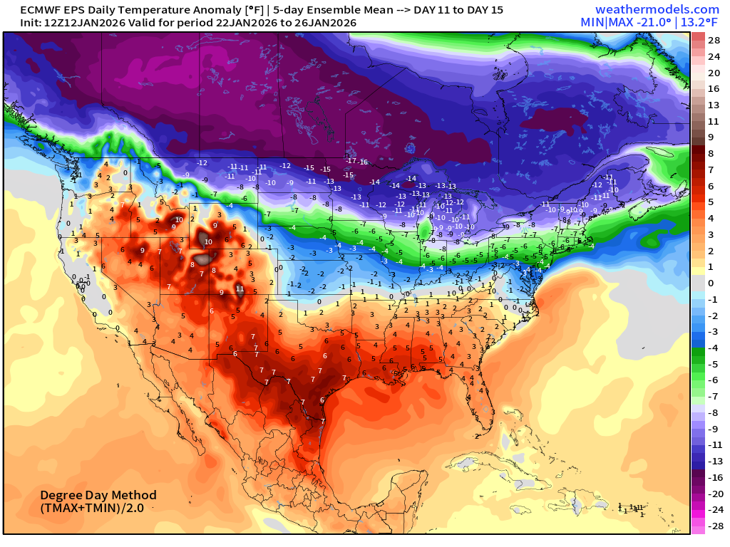
Major Arctic blast of cold air again next week — Wed-Thursday — with the Canadian cold pool reloading into Days 10-14
NWS Precipitation Next 72-hours
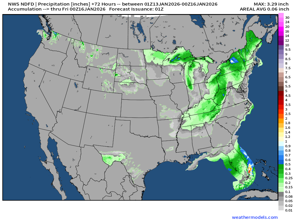
NWS Snowfall Next 72-hours
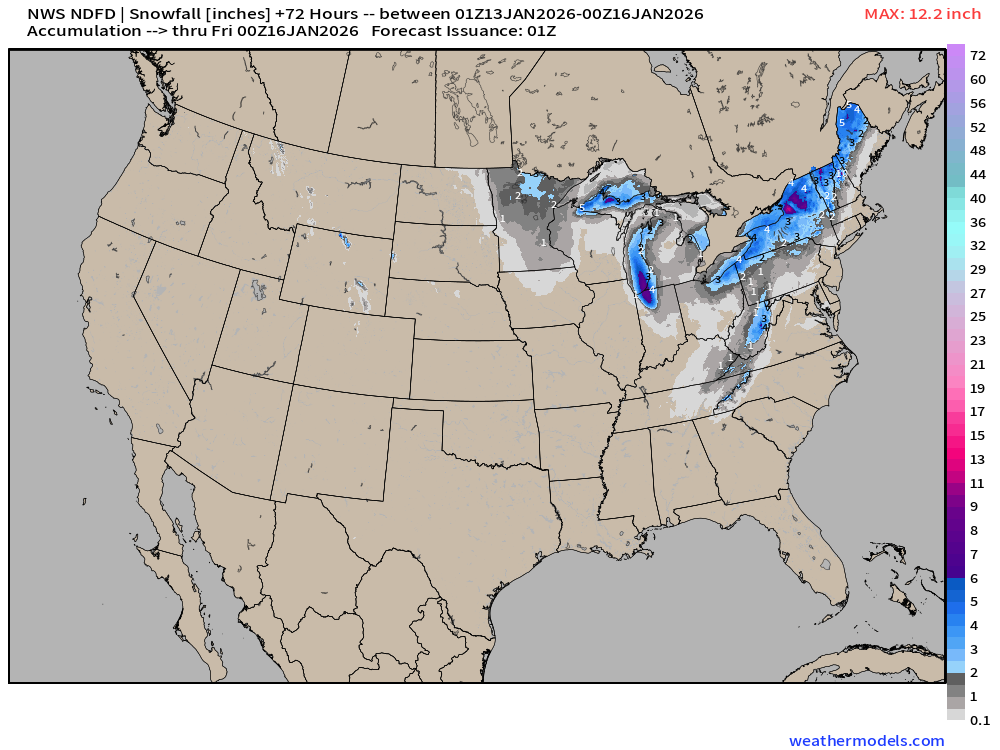
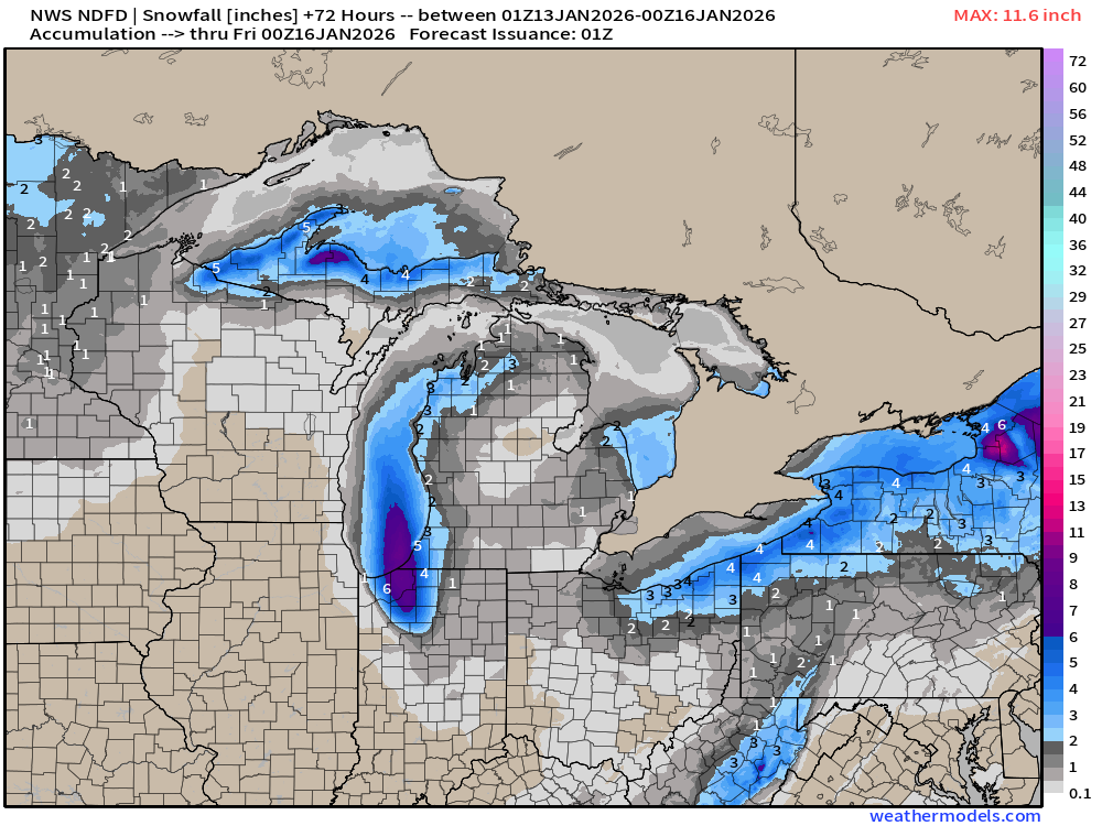
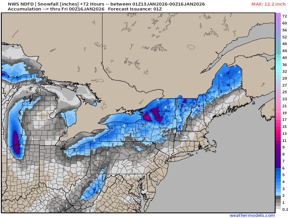
RTMA | Temperature Analysis | 7:00 PM ET
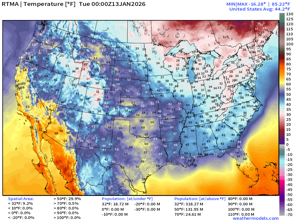
Average Lower 48 temperature was 44.2°F with 19 million below freezing.
Temperature Anomaly | 7:00 PM ET
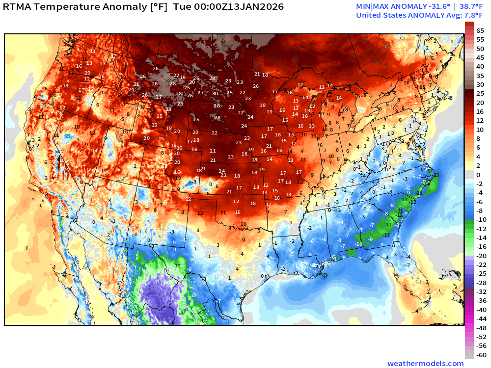
Lower 48 Temperature Anomaly above normal by 7.8°F
Tuesday Morning Low Temperatures
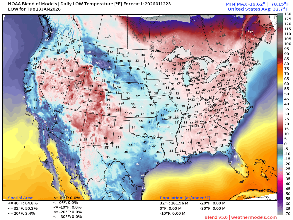
162 million below freezing — nationwide average of 32.7°F
Tuesday High Temperatures
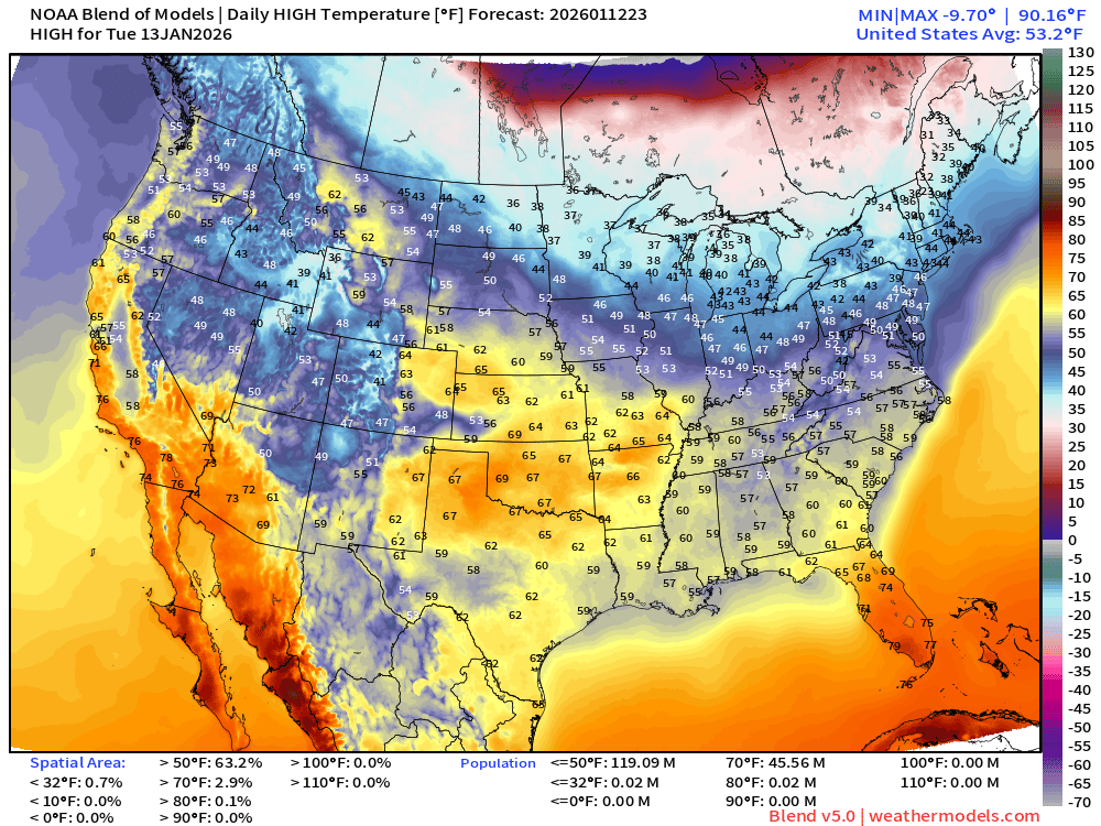
46 million at least 70°F —> nationwide average of 53.2°F
Wednesday Morning Low Temperatures
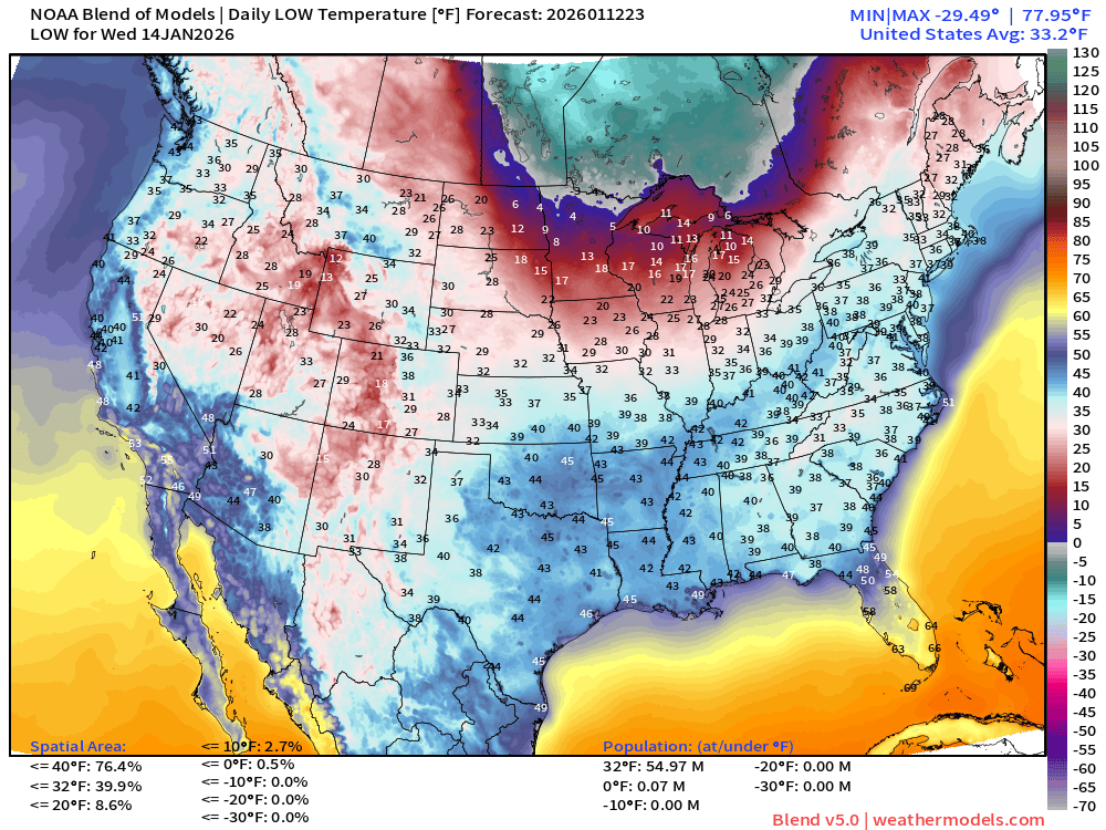
Only 55 million below freezing — nationwide average of 33.2°F
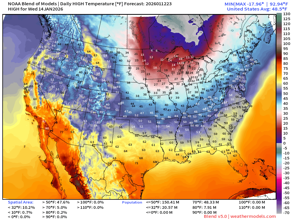
Wednesday High Temperatures
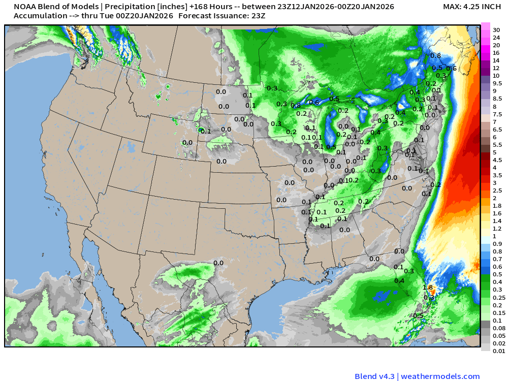
Blend of Models | 7 Days Precipitation Total
Blend of Models v5.0 | Total Snowfall Next 7-Days
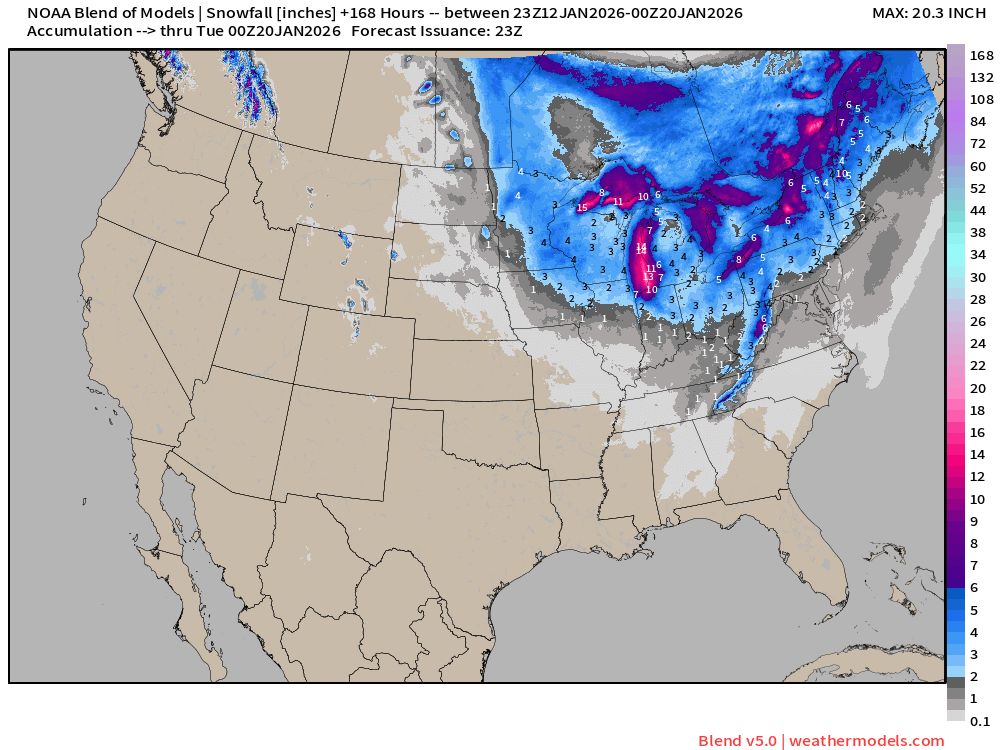
Western U.S. nary a snowflake —> winter is busted
Lake Effect Snow Machine —> cranks up again!
ECMWF 18z | Snowfall Next 6-days
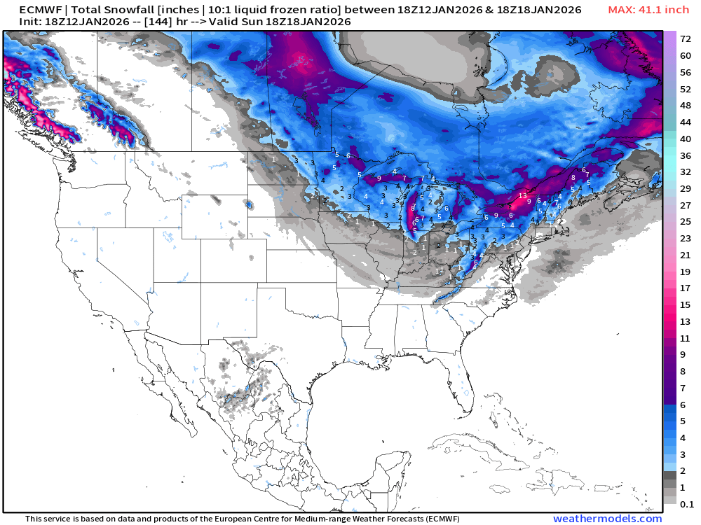
European Winter | Snowfall Next 6-days
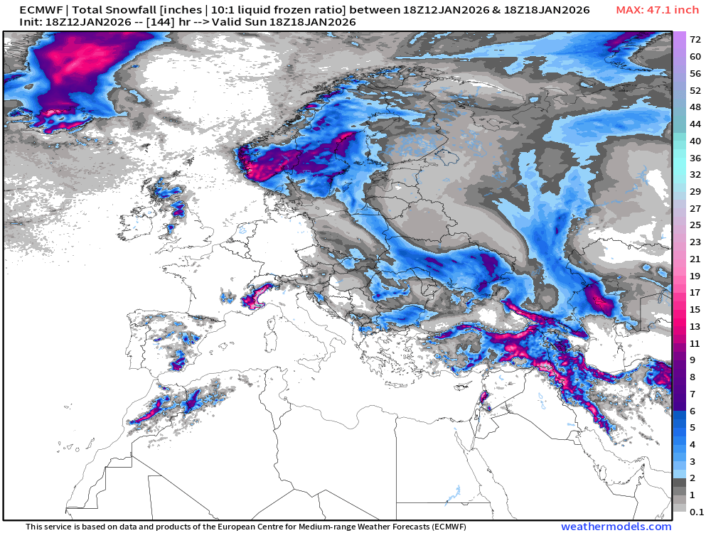
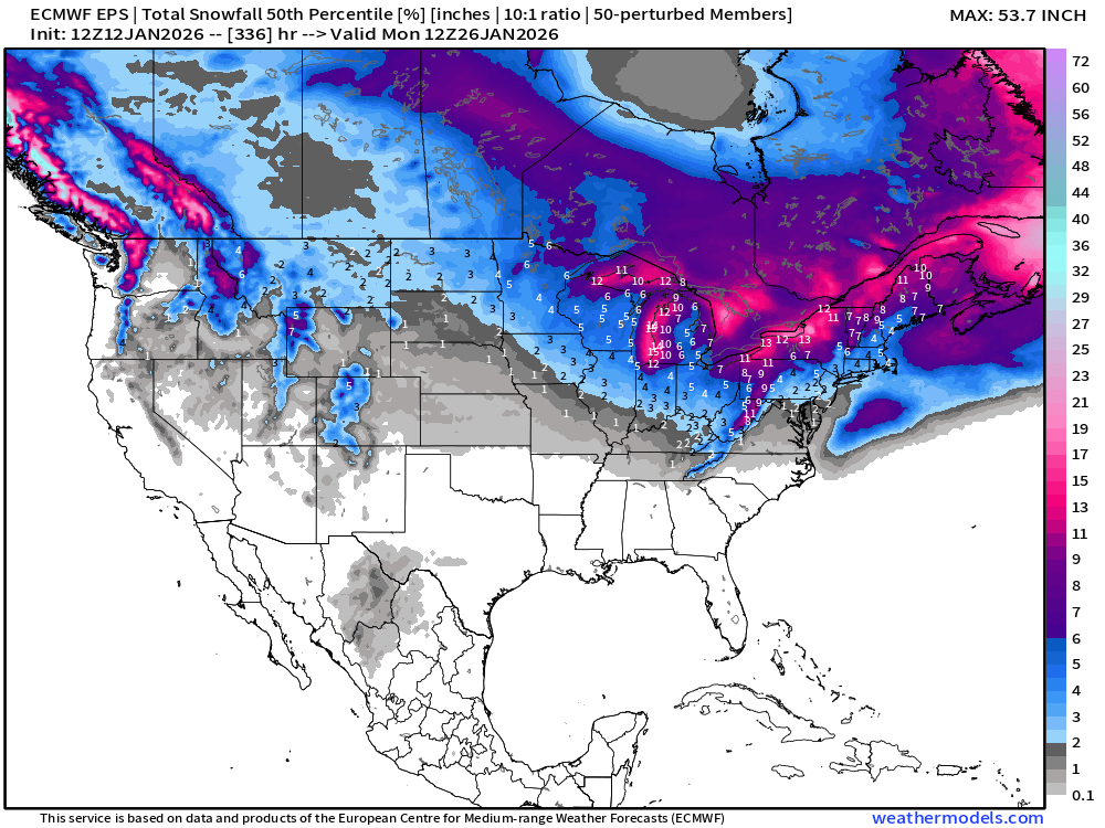
ECMWF EPS 12z | Ensemble Median Snowfall Next 14-days
Probability of 1-inch or more Snowfall in the next 14-days
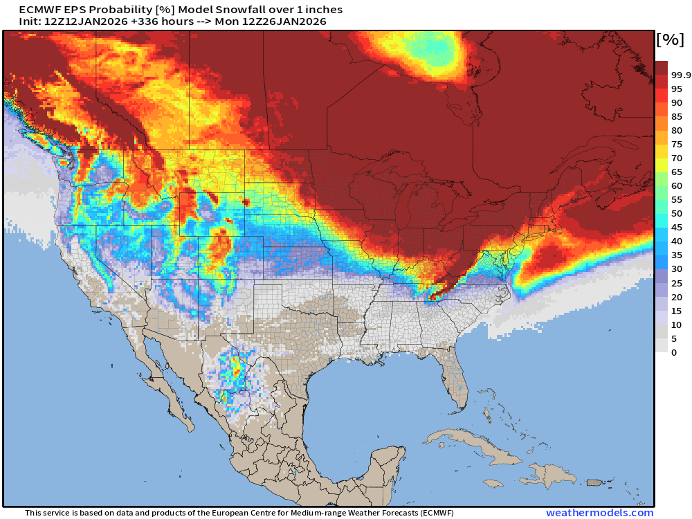
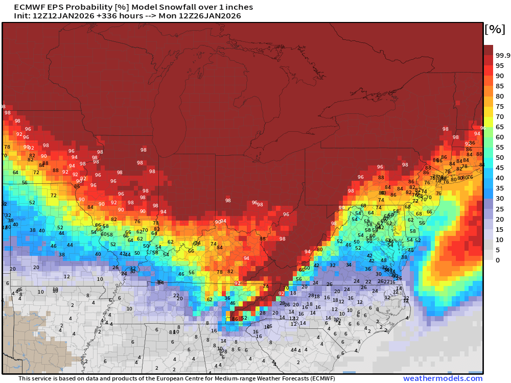
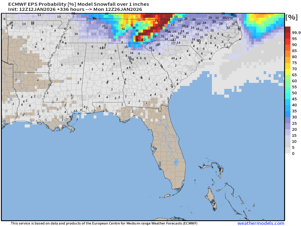
10% chance of 1-inch or more in Atlanta within next 2-weeks
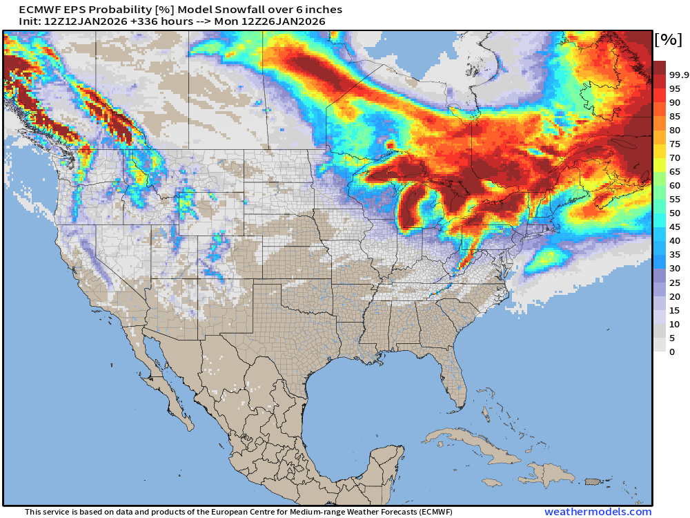
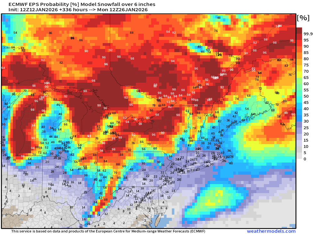
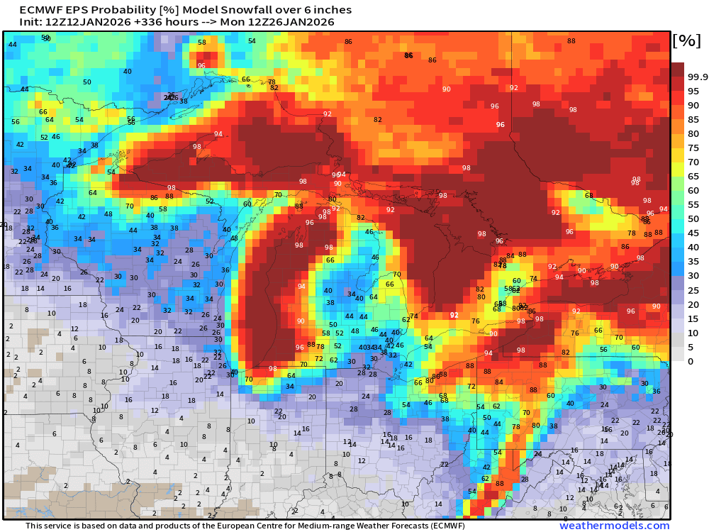
Probability of 6-inch or more Snowfall in the next 10-days
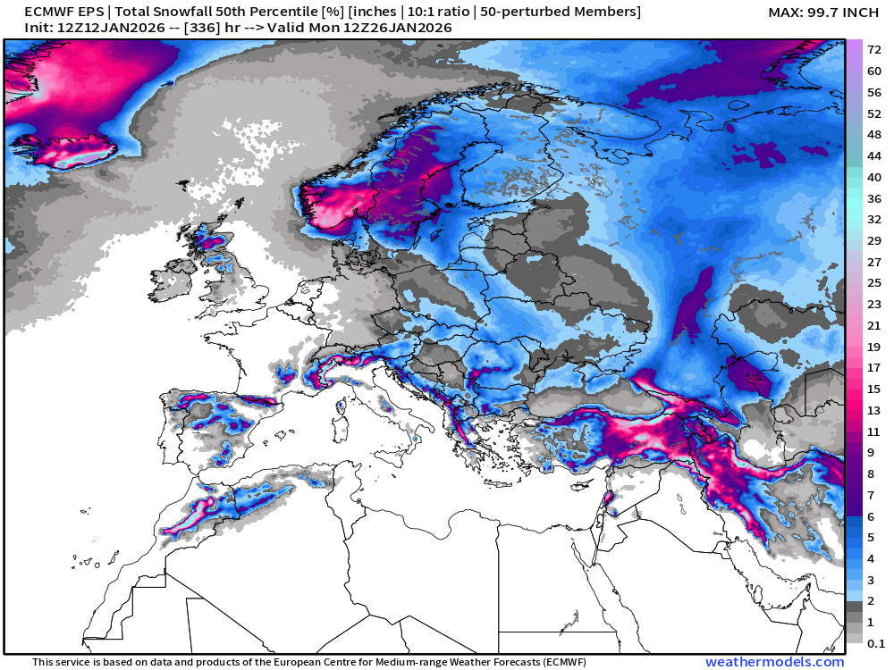
Ensemble Median Snowfall for Europe Next 14-days
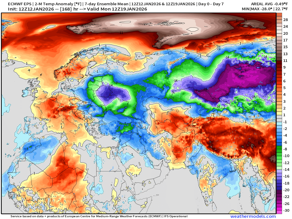
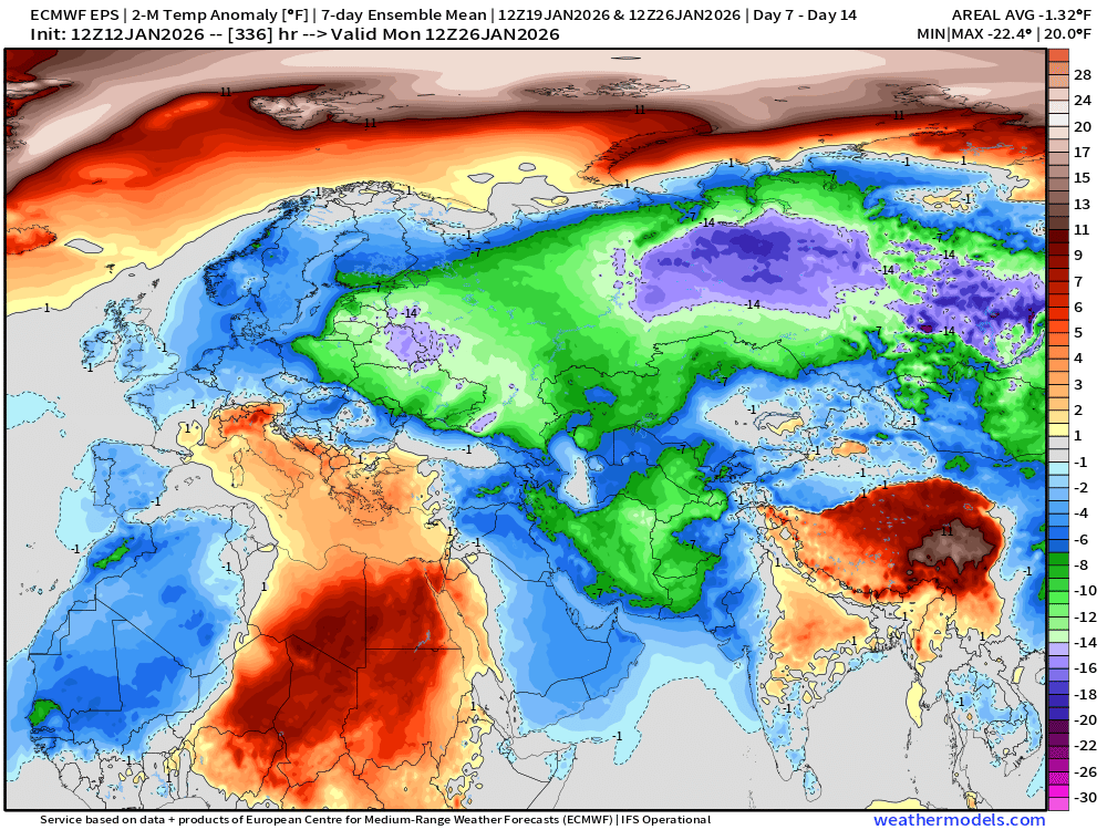
Eurasia Temperature Anomaly | Week 1 and Week 2
Lower 48 Temperature Anomaly | Next 15-days | ECMWF EPS 12z
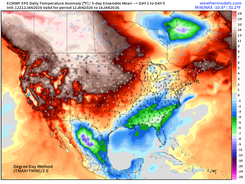
5-Day Chunk #1 | Temperature Anomaly | Jan 12 - Jan 16
5-Day Chunk #2 | Temperature Anomaly | Jan 17 - Jan 21
5-Day Chunk #3 | Temperature Anomaly | Jan 22 - Jan 26
Compared to Previous 00z Temperature Anomaly for 5-day Chunk | Jan 22-26
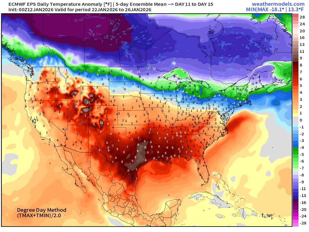
And the Week 2 difference from the previous model cycle —> much colder!
Maps sourced from weathermodels.com designed and innovated by yours truly! Please subscribe there for real-time access to the newest maps, charts from all of the weather models including ECMWF and AIFS, NOAA AI-GFS/AI-GEFS
- Milepost
- 839 · laid 2026-01-13T01:38:10.503000Z
- Source
- https://weather.substack.com/p/january-12-2026-monday-winter-weather
- Digest
- d46112e9e1b5e472a6e0ebc53e33f41060b9536656e4d9e40573263c10e3e37f
- Machine
- JSON