January 5, 2026 Monday Winter Weather
Wild winter weather in Europe this week
January 2026 was the 25th-warmest January in the 132-year national record (1895–2026), at 33.1°F against a 1991–2020 normal of 32.3°F (+0.8°F).
January 2026 was the 12th-driest January in the 132-year national record (1895–2026), at 1.6in against a 1991–2020 normal of 2.3in (-0.8in).
NOAA/NCEI Climate at a Glance, contiguous United States. This is the observed record for the month, not a score of anything said in this piece — the forecast ledger begins 2026-08-17 and cannot reach earlier posts.

Running late this evening — so going to publish without a lot of commentary, which is mainly an update from yesterday.
Wild Winter Weather in Europe —> powerful storm system Friday
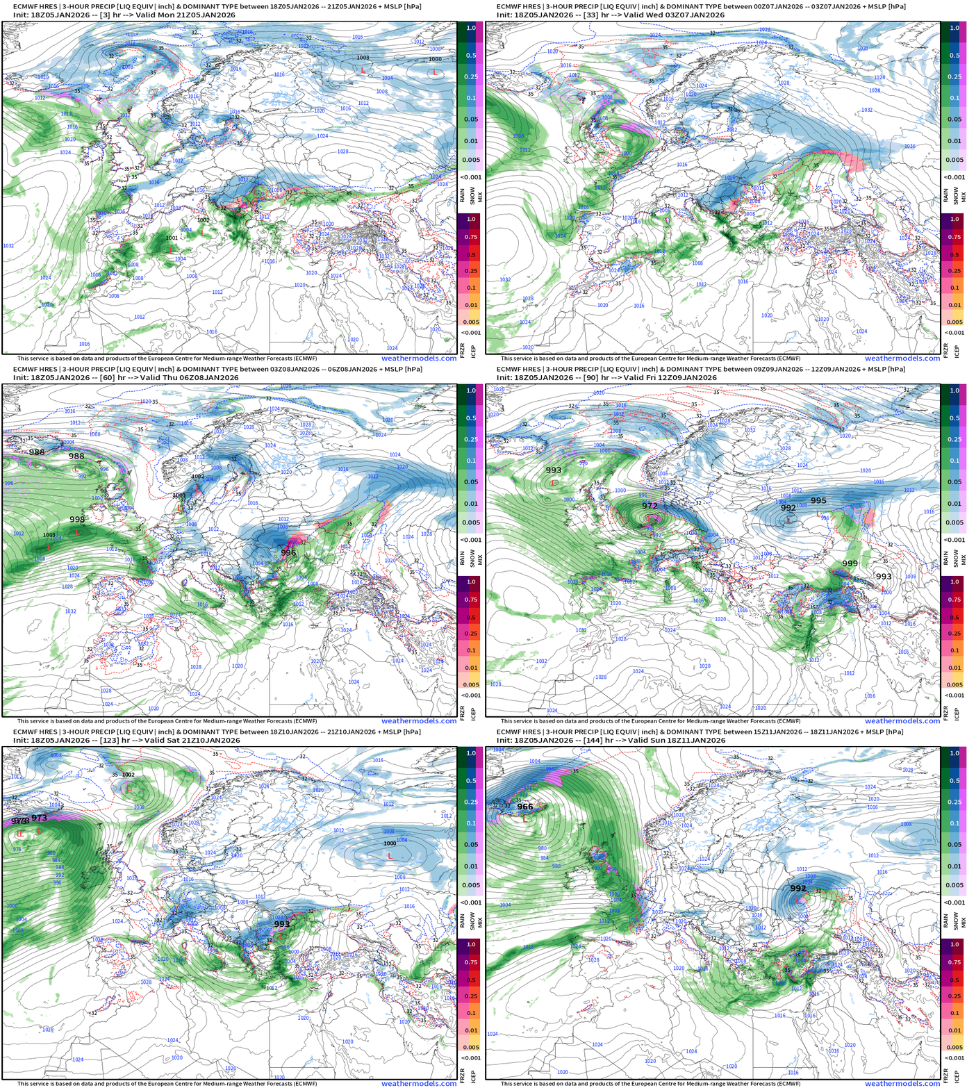
Several more areas of low pressure across the European continent each with winter weather. I don’t follow Europe’s day-to-day weather but it looks quite complicated this week with very cold air on their doorstep to the north in Scandinavia and Russia.
High Temperatures through Next Wednesday (January 14)
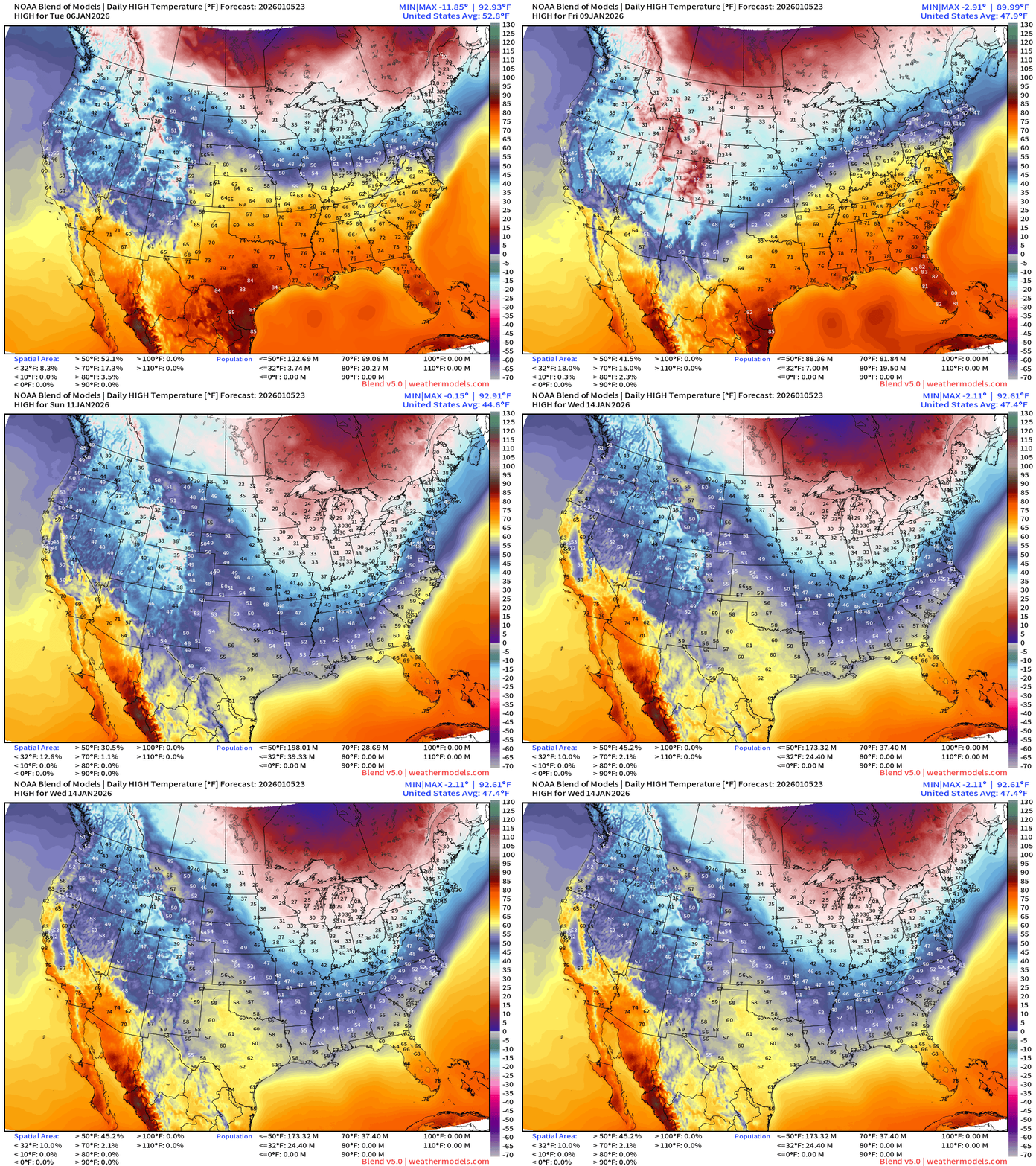
Warm week until a storm system and cold front dip out of the Midwest and Great Lakes into next week. But the Canadian Arctic air mass won’t be too frigid as Pacific origin air from strong jet stream finally dislodges the Alaskan cold pool and floods Canada with much warmer air —> January thaw.
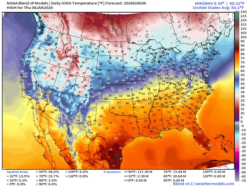
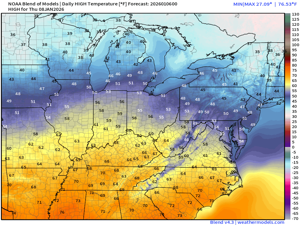
Thursday High Temperatures
Chicago to 50°F and 60s into Ohio River Valley
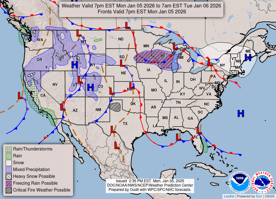
Weather Overnight | Great Lakes Clipper System into Tuesday
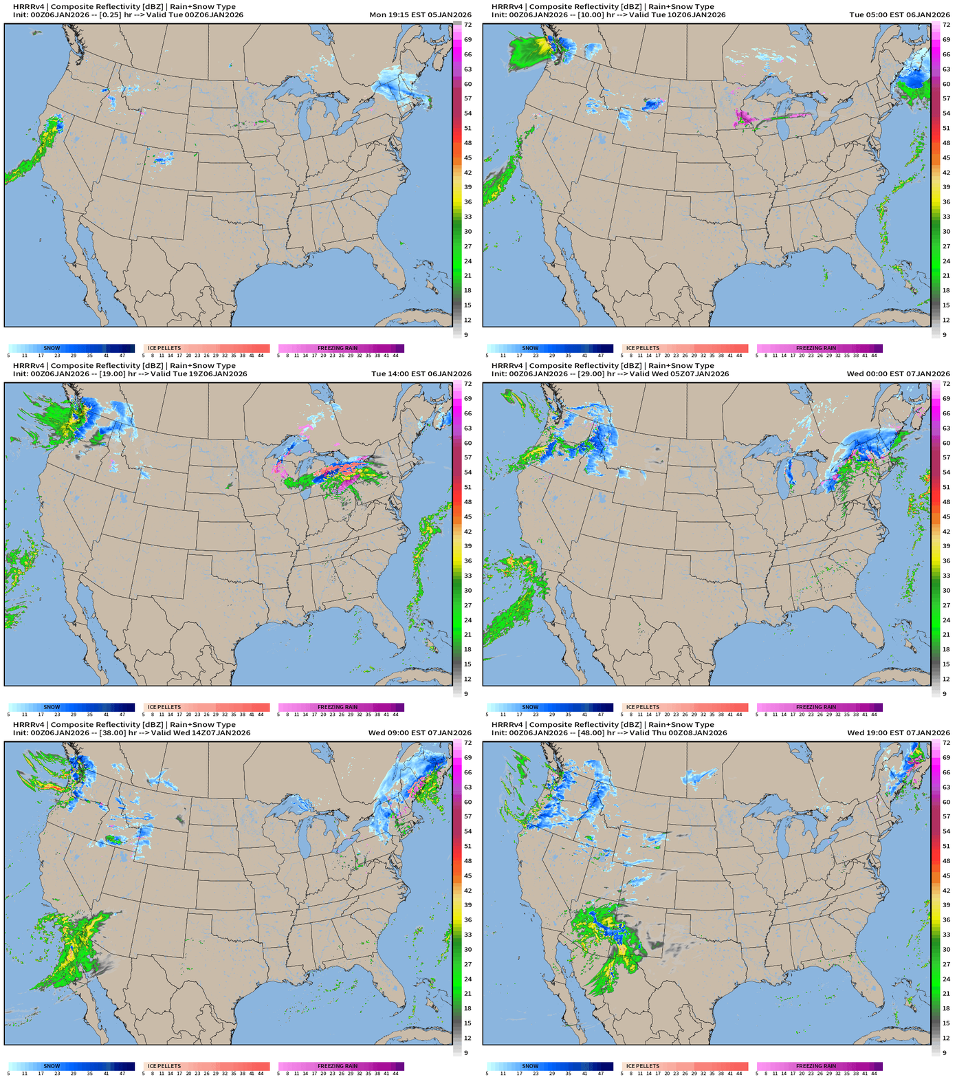
HRRR Simulated Radar next 48-hours —> through 7 PM ET Wednesday
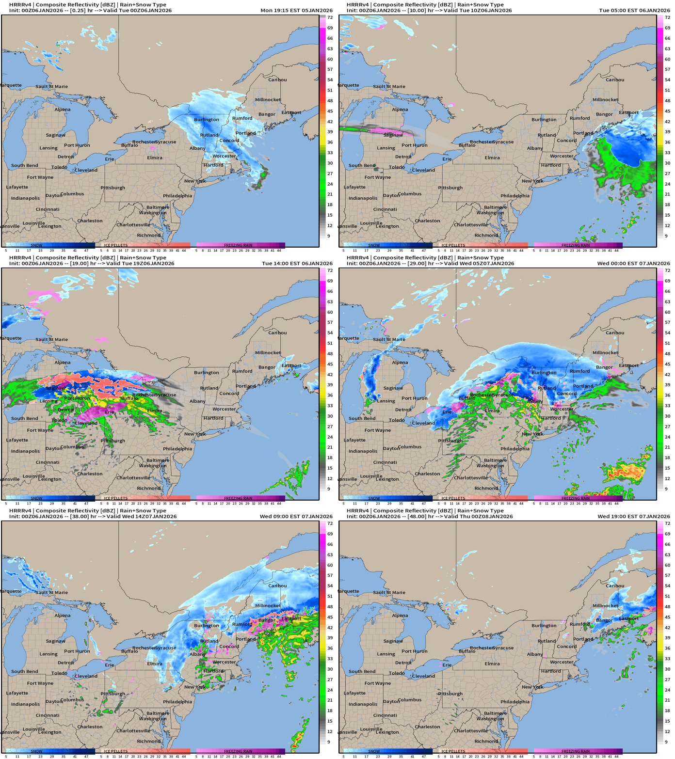
Great Lakes —> Northeast Clipper on Tuesday —> Wednesday
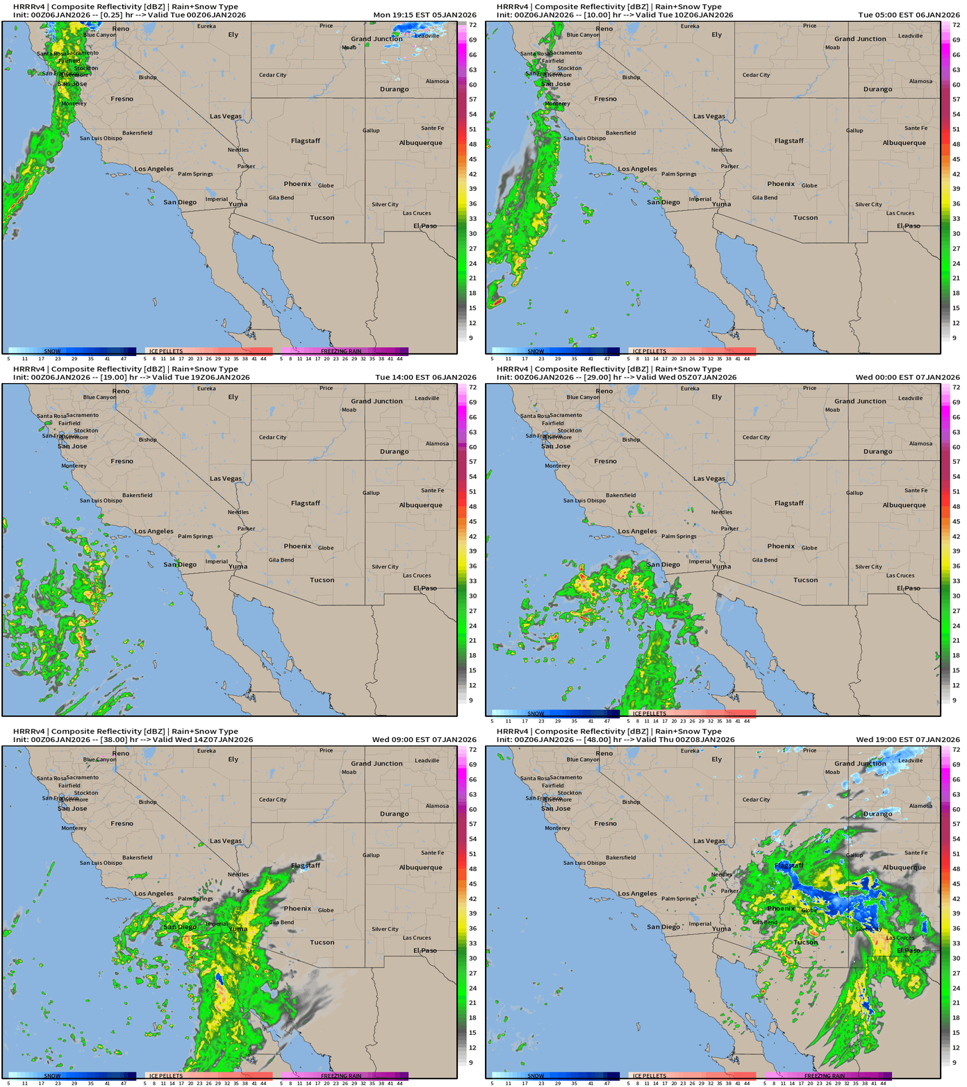
Southwest cut-off low pressure —> Rare rainmaker for the deserts including Phoenix
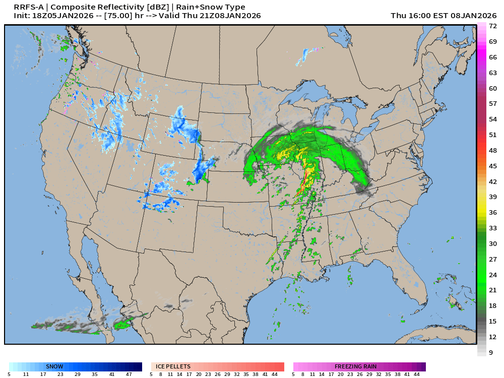
That cut-off low heads into the central Plains and intensifies into a powerful storm system for the Midwest and Great Lakes on Thursday into Friday:
Thursday 4 PM ET RRFS-A High Resolution Radar Simulation
Much Colder Europe next 7-8 days before warmth builds across Iberian Peninsula: ECMWF 12z EPS | Temperature Anomaly | Next 15-days
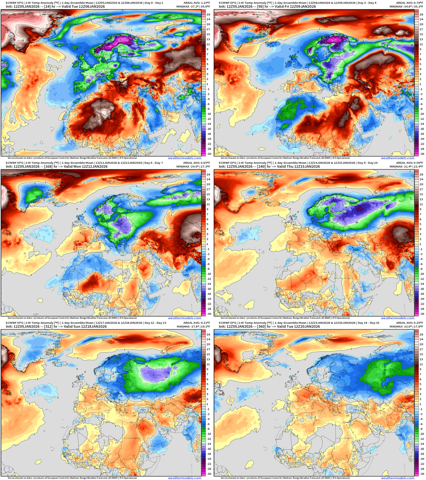
Well below normal temperature risk continues into middle January finally recedes to the east as warmer Atlantic air replaces the cold pool
North America Temperature Anomaly Next 6-days
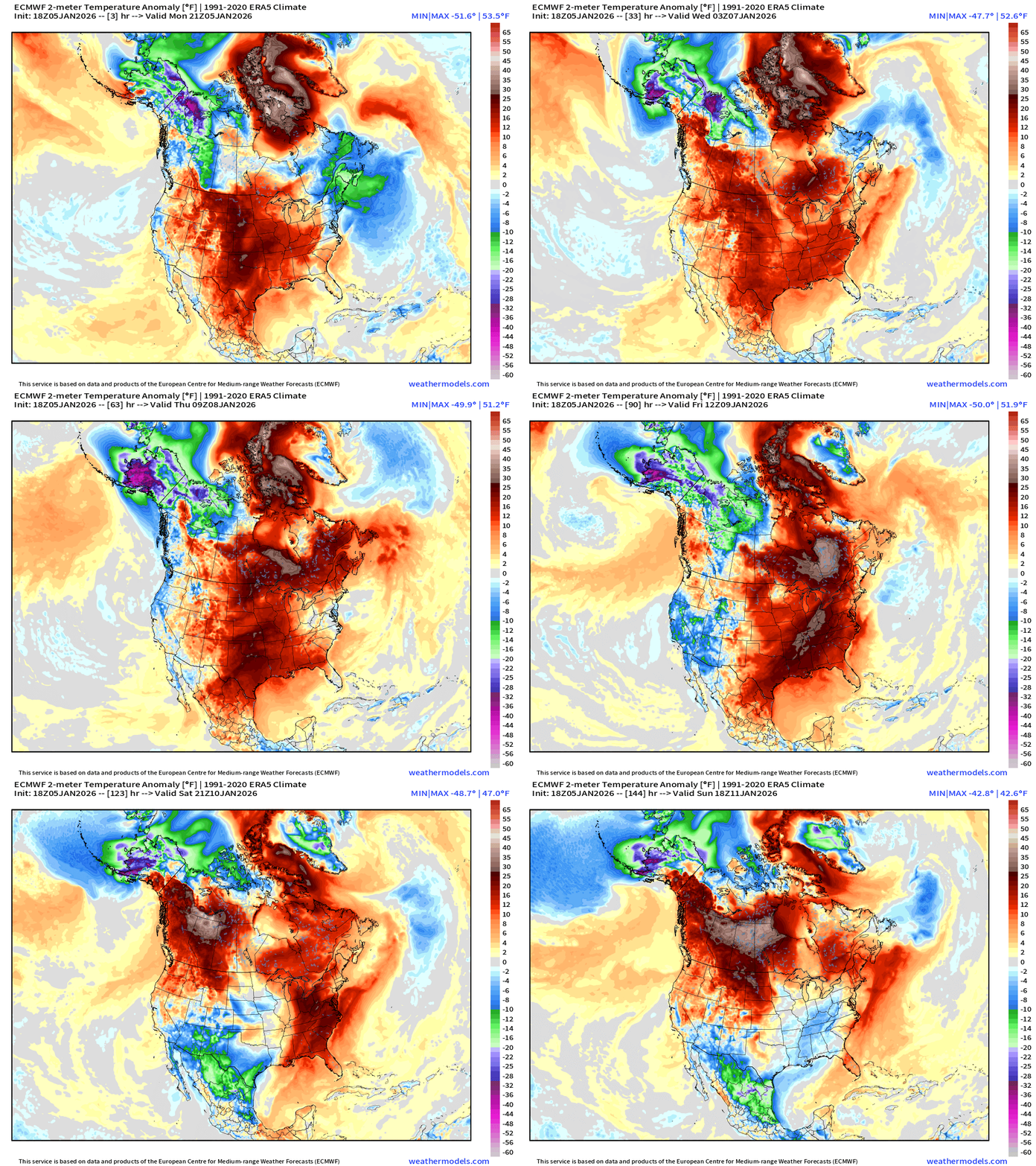
Widespread warming into this weekend — with only exception is the West Coast with a cut-off trough and Alaskan cold pool dipping southward into the American Southwest.
ECMWF 12z EPS | Temperature Anomaly | Next 15-days
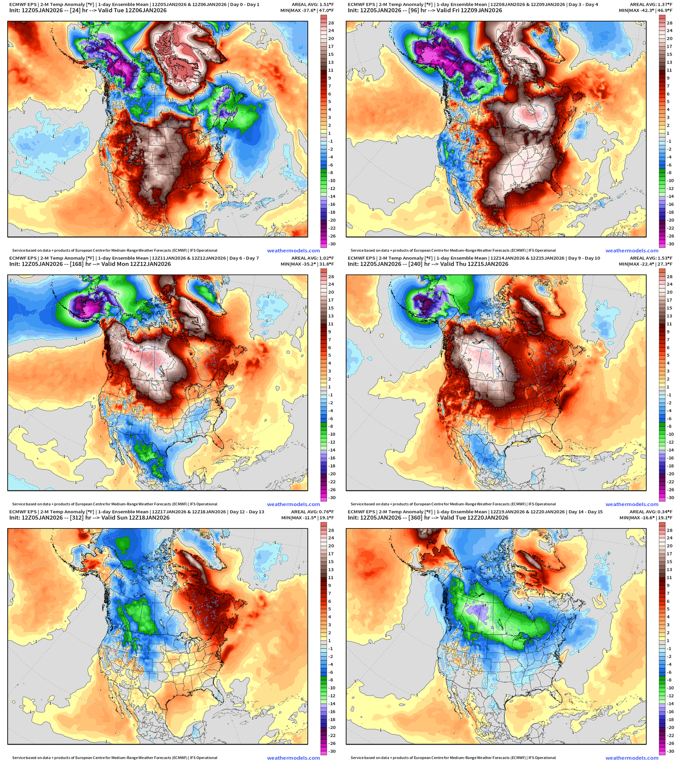
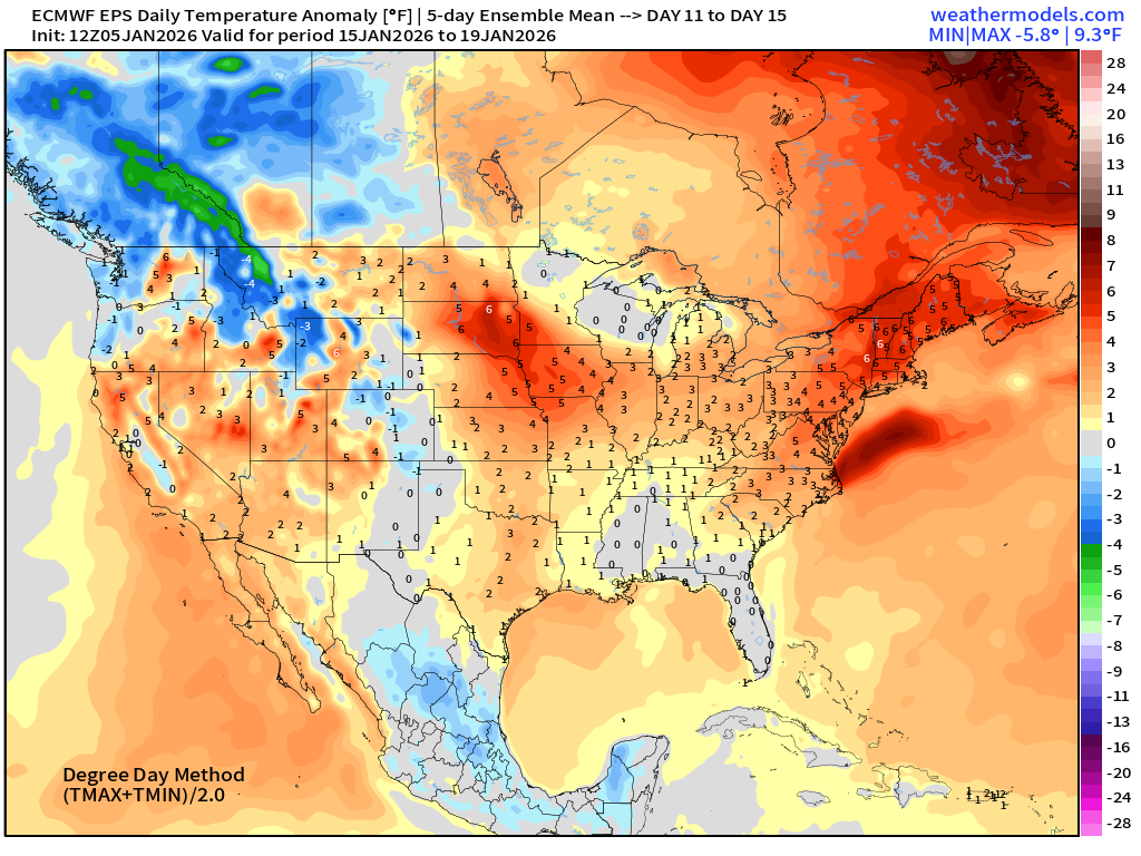
Cold pool over Alaska continues full bore for next 10 days, but it is soon blocked from entering the Midwest and Great Lakes and Northeast. Instead, much more of a Pacific origin air mass —> strong Pacific zone jet stream —> January thaw
However, that ends into Days 12-15 with colder air returning to Western Canada across the U.S. border into January 20th.
ECMWF 18z Precipitable Water Next 6-days | My Favorite Parameter
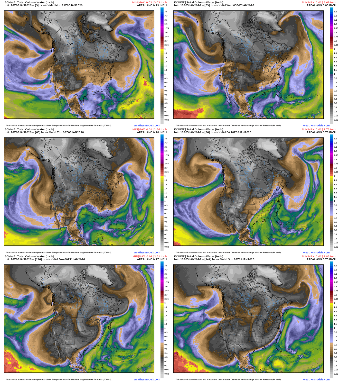
Cut-off low dipping south along the West Coast is impressive — it clears the atmospheric rivers and redirects the storm track away from California later in the week. The cut-off develops an area of low pressure into Arizona —> Plains and Great Lakes —> followed by a bigger storm this weekend
ECMWF 18z Precipitation Type and Intensity | Next 6-days
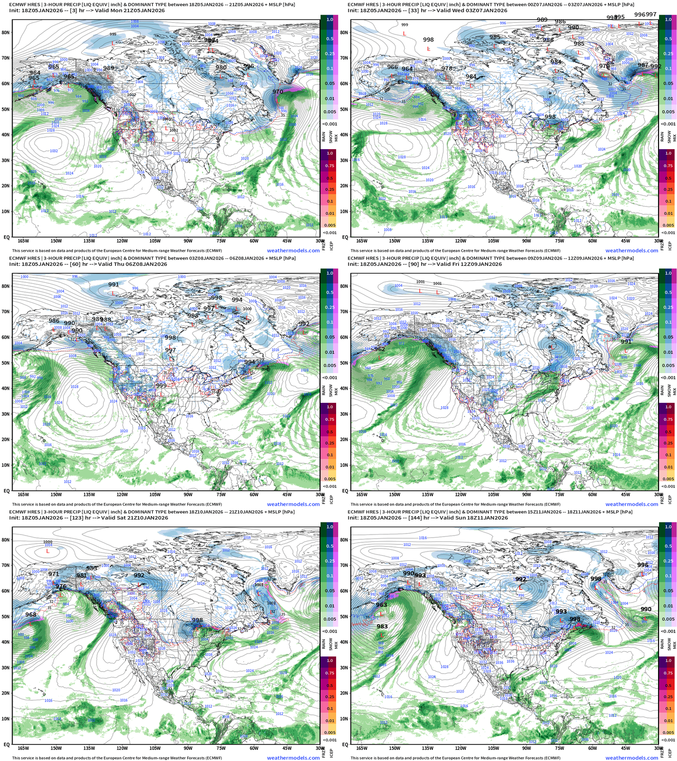
Western U.S. Storm Track next 6-days
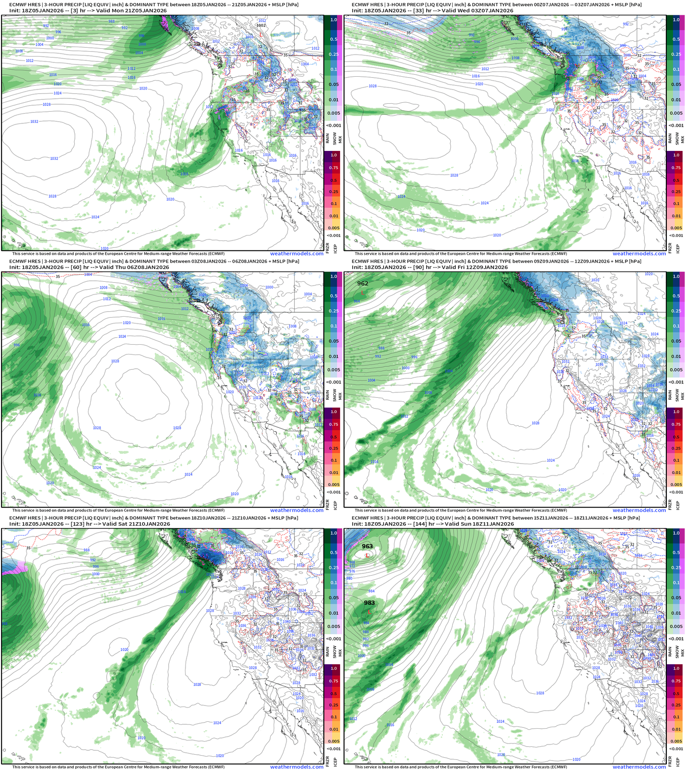
California finally quiets down with high pressure and offshore flow for remainder of the week after we ditch the cut-off
Eastern U.S. Storm Track Next 6-days
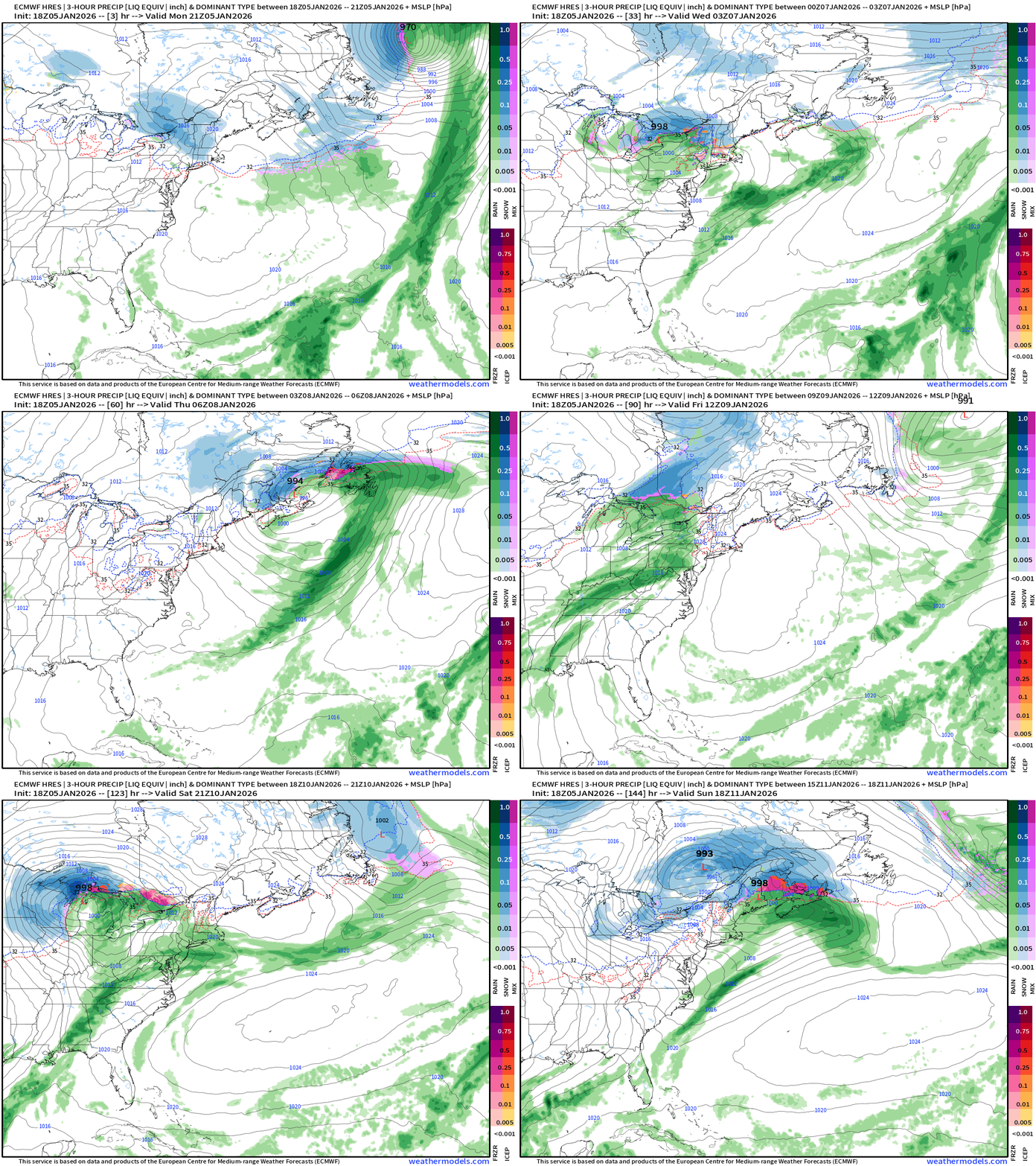
Clipper system weakens across Northeast into Tuesday
Another follows quickly on its heels through the Great Lakes on Wednesday and this one looks to be more impactful for New England. Not seeing heavy snow or winter precipitation for the big cities (DC, NYC, Boston) at all into the next 7-days
Next major storm Saturday in Great Lakes
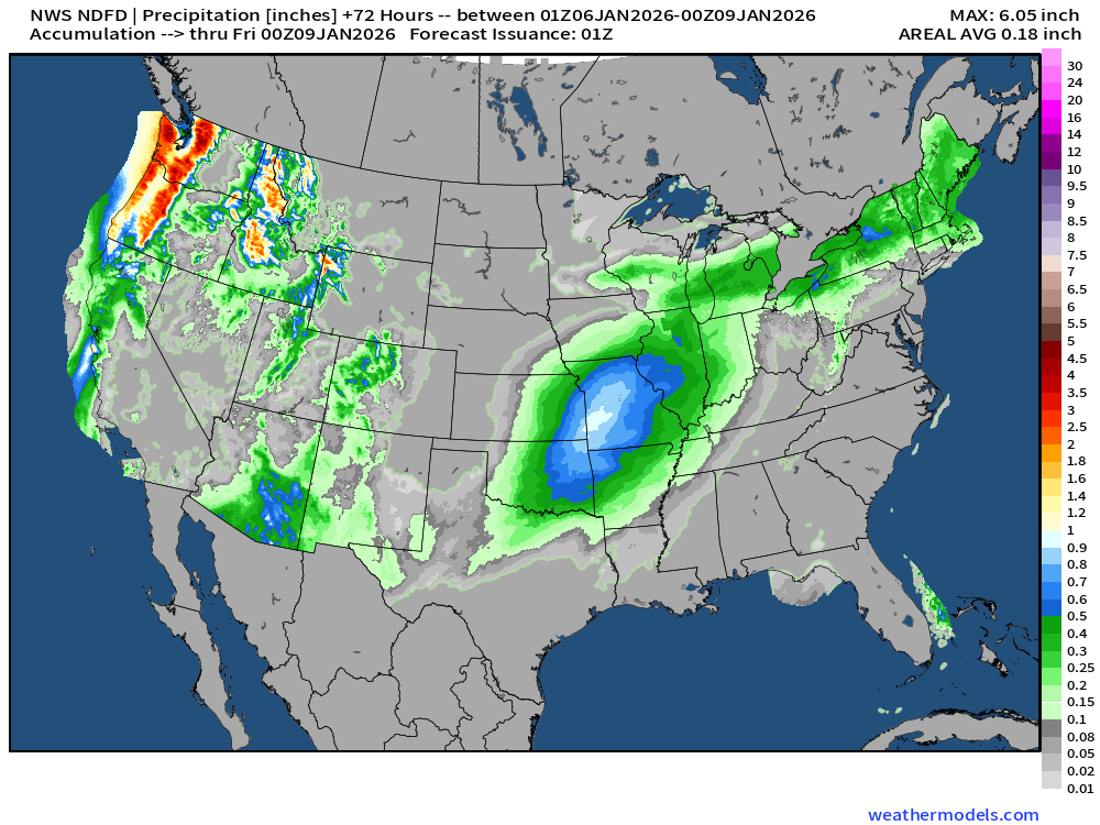
NWS Precipitation Next 72-hours
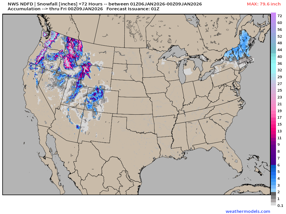
NWS Snowfall Next 72-hours
RTMA | Current Temperature Analysis | 8:00 PM ET
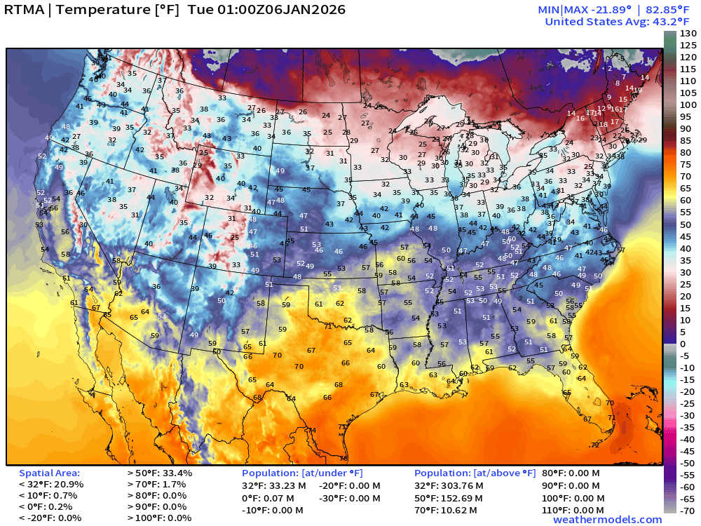
Average Lower 48 temperature was 43.2°F with 32 million below freezing.
Alaska Temperature Analysis | Fort Yukon still -49°F
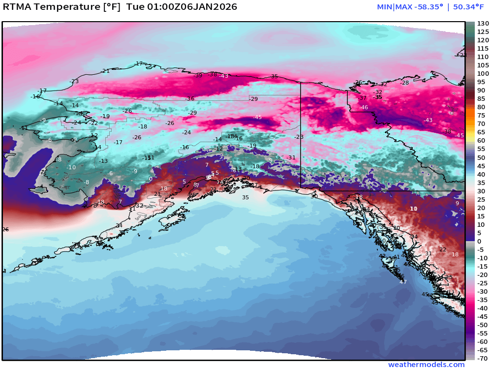
Fort Yukon has been stuck around -54°F for the past few days.
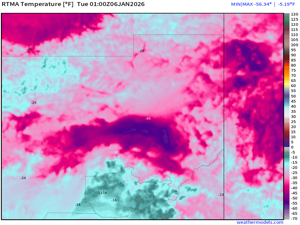
Temperature Anomaly | 8:00 PM ET
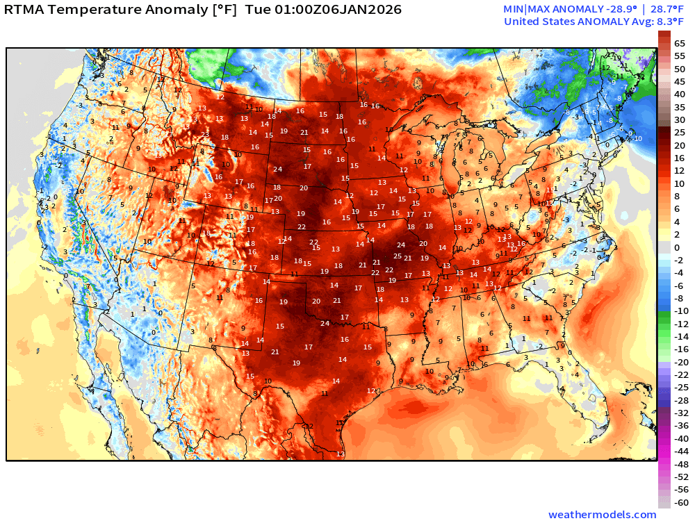
Lower 48 Temperature Anomaly way above normal by 8.3°F
Tuesday Morning Low Temperatures
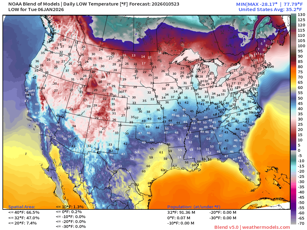
91 million below freezing — nationwide average of 35.2°F
Tuesday High Temperatures
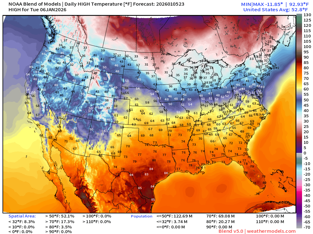
69 million at least 70°F —> nationwide average of 52.8°F —> Less than 4 million remain below freezing during the day.
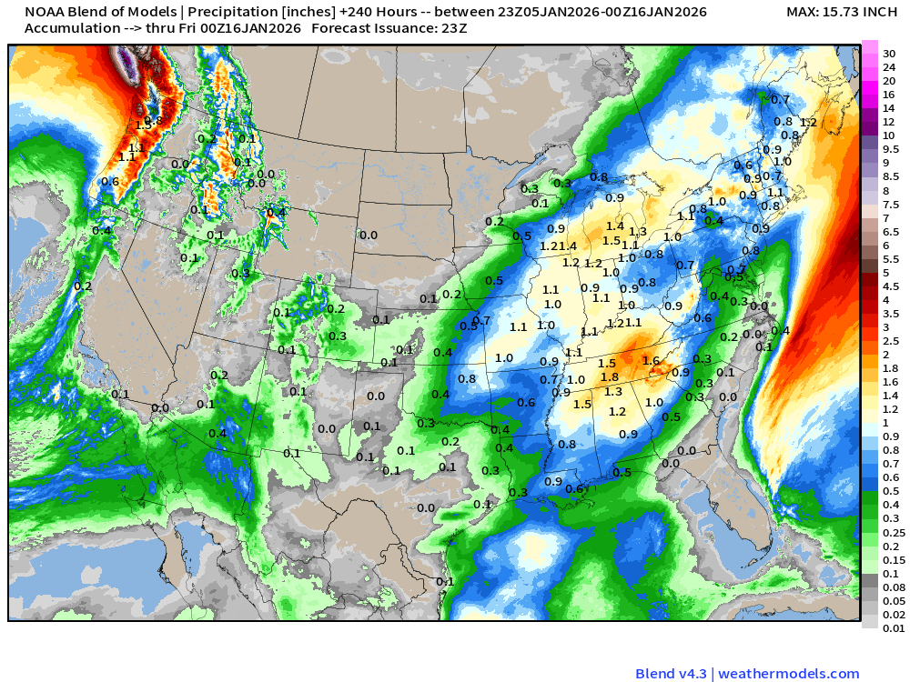
Blend of Models | 10 Days Precipitation Total
Blend of Models v5.0 | Total Snowfall Next 10-Days
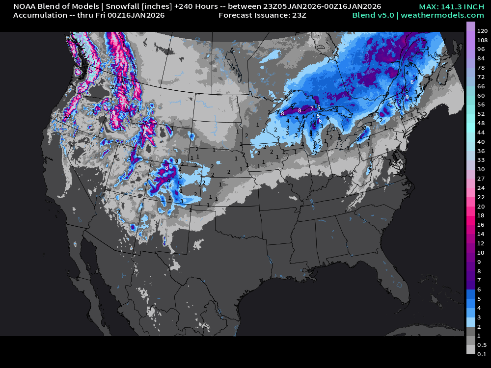
Significant mountain snowfall returns for early to mid January! The Great Lakes has to deal with system snow from 2 clippers
ECMWF AIFS-Single 18z | Height Anomaly (500 hPa) Next 10-days
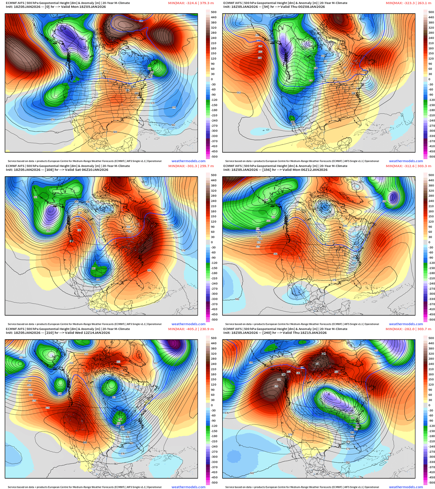
A cut-off trough exits the American Southwest later in the week and heads into the middle of the U.S. and Great Lakes. That trough does link up with the main Polar Vortex anchored over Hudson Bay — and a couple lobes descend southward to provide colder air into next weekend and early next week for the Eastern U.S.
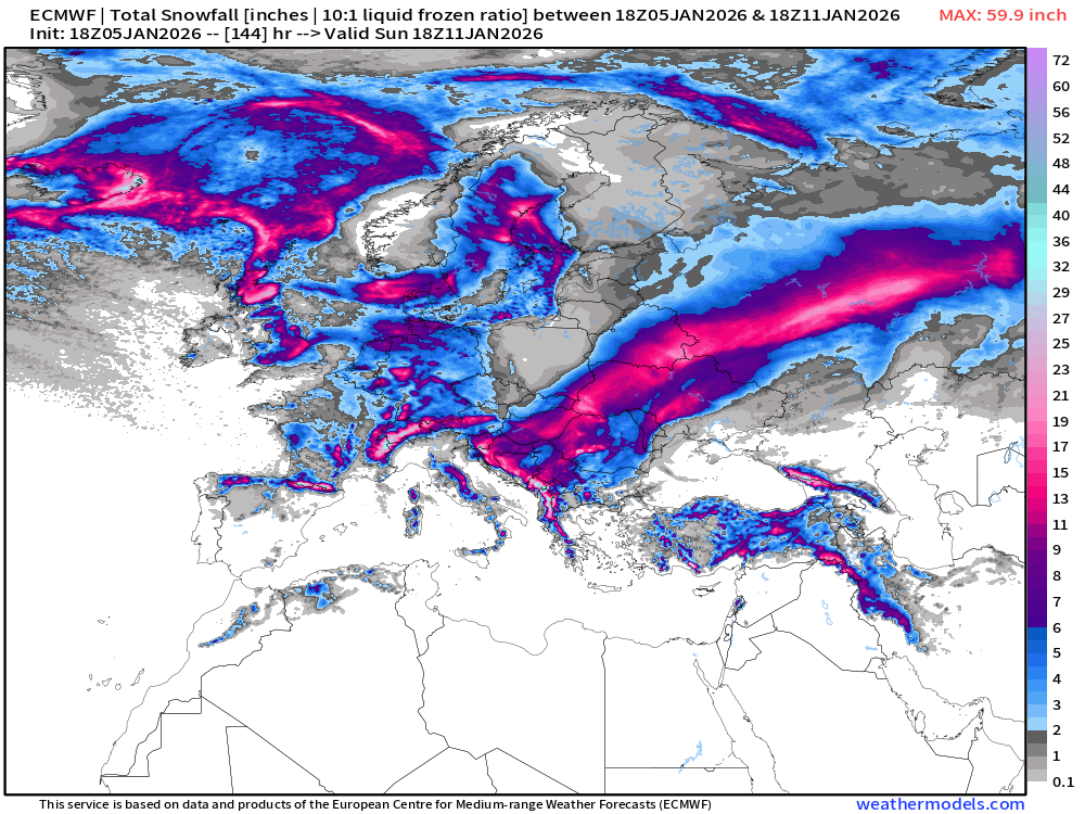
ECMWF 18z | Snowfall | Next 6-days | Lower 48 and Europe
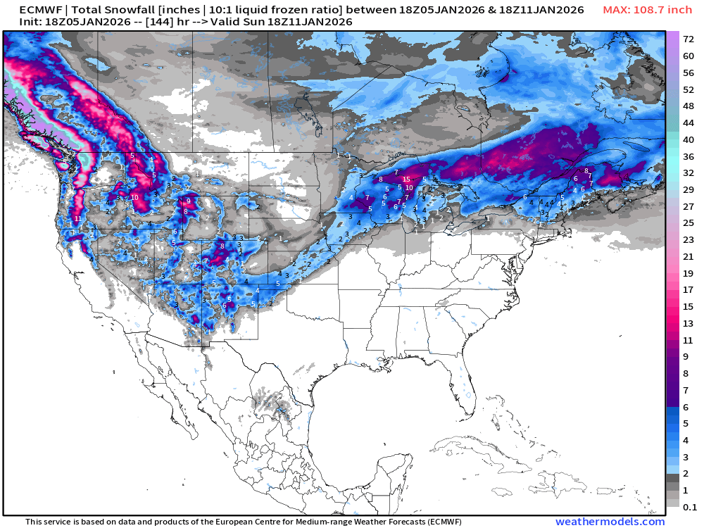
European Winter | Heavy Snowfall
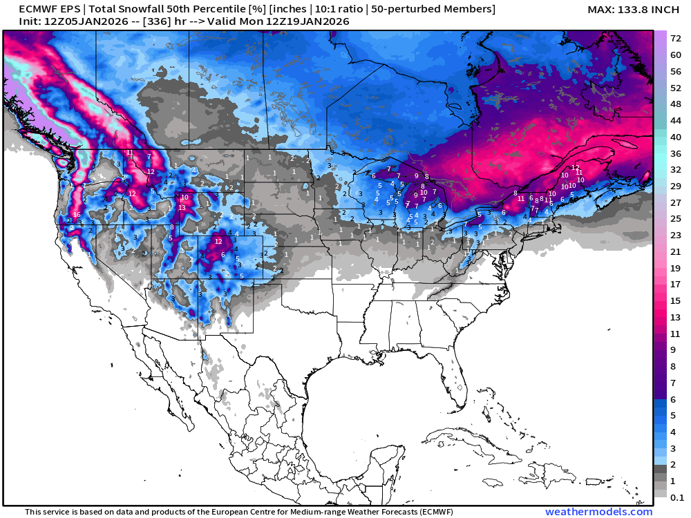
ECMWF EPS 12z | Ensemble Median Snowfall Next 15-days
Probability of 6-inch or more Snowfall in the next 15-days
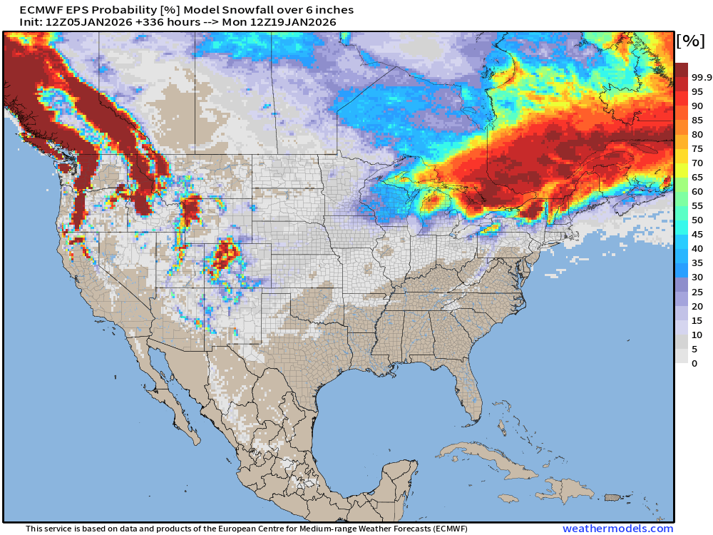
Big storm hunting — NOPE — just the Great Lakes systems + any Lake Effect. Not seeing the storm track line up along the U.S. East Coast for any Nor’easters
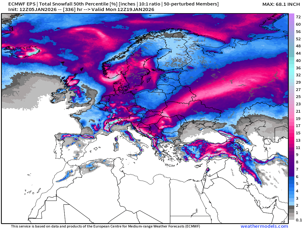
Ensemble Median Snowfall for Europe Next 15-days
European Temperature Anomaly | Week 1 and Week 2
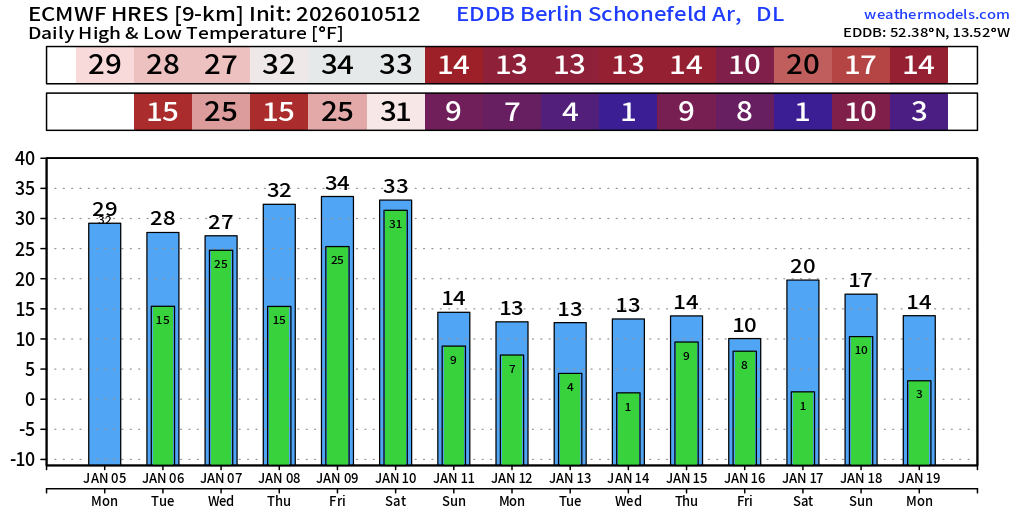
Berlin 15-day Forecast | Bottom Drops out Sunday
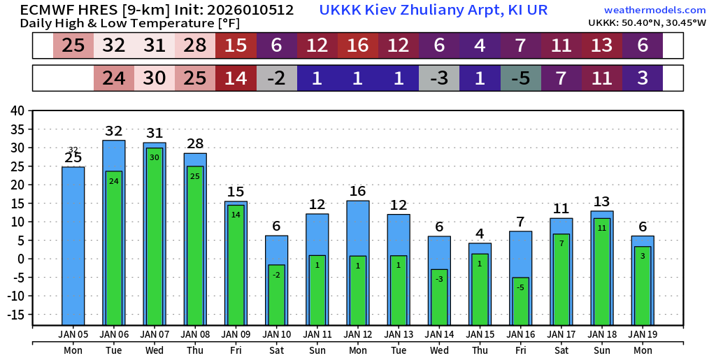
Kiev, Ukraine | Below 0°F very cold starting Saturday
Lower 48 Temperature Anomaly | Next 15-days | ECMWF EPS 12z
5-Day Chunk #1 | Temperature Anomaly | Jan 5 - Jan 9
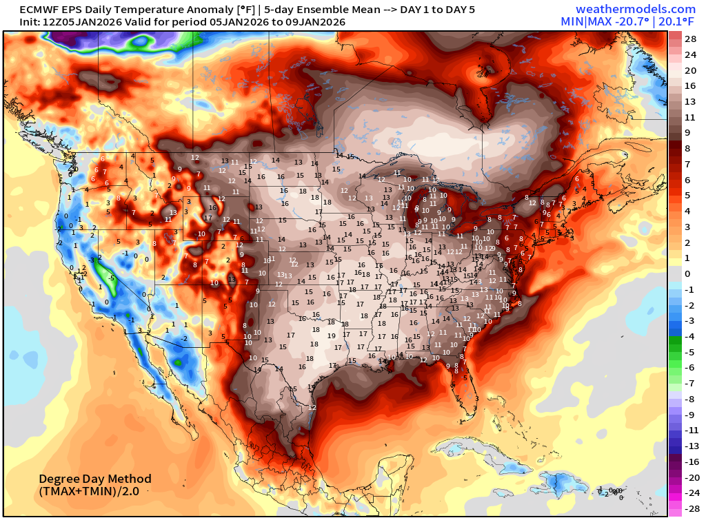
5-Day Chunk #2 | Temperature Anomaly | Jan 10 - Jan 13
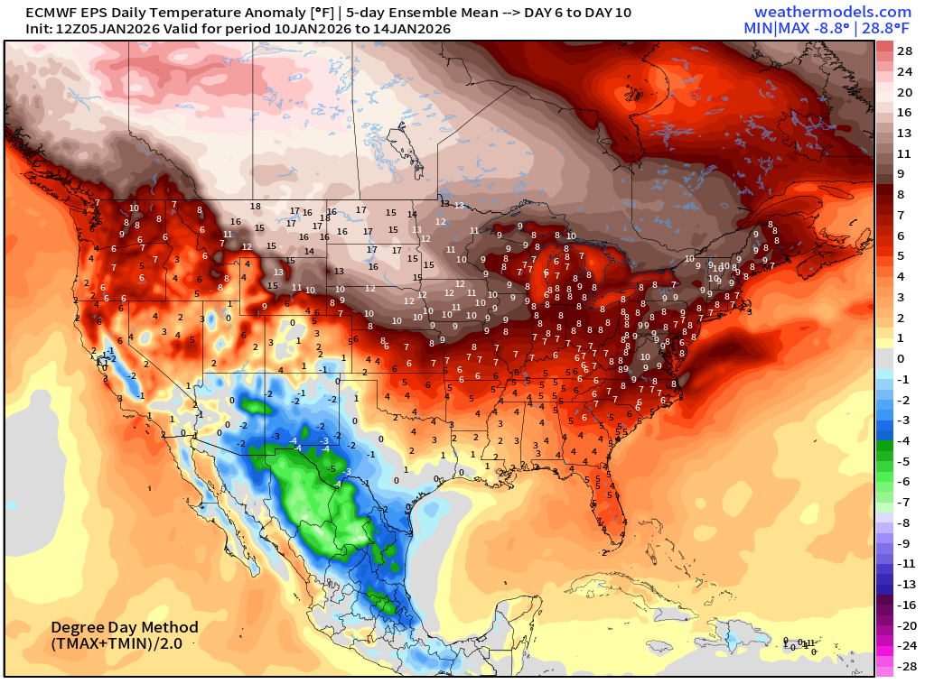
5-Day Chunk #3 | Temperature Anomaly | Jan 14- Jan 18
Maps sourced from weathermodels.com designed and innovated by yours truly! Please subscribe there for real-time access to the newest maps, charts from all of the weather models including ECMWF and AIFS, NOAA AI-GFS/AI-GEFS
- Milepost
- 834 · laid 2026-01-06T02:41:35.621000Z
- Source
- https://weather.substack.com/p/january-5-2026-monday-winter-weather
- Digest
- d8415992f398275200cd7eba9977ca9a54292796bec88bdd33c93fb9343d32b4
- Machine
- JSON