January 2, 2026 Friday Winter Weather
Much warmer weather into next week across Lower 48 as Europe builds a glacier
January 2026 was the 25th-warmest January in the 132-year national record (1895–2026), at 33.1°F against a 1991–2020 normal of 32.3°F (+0.8°F).
January 2026 was the 12th-driest January in the 132-year national record (1895–2026), at 1.6in against a 1991–2020 normal of 2.3in (-0.8in).
NOAA/NCEI Climate at a Glance, contiguous United States. This is the observed record for the month, not a score of anything said in this piece — the forecast ledger begins 2026-08-17 and cannot reach earlier posts.

Welcome to 2026
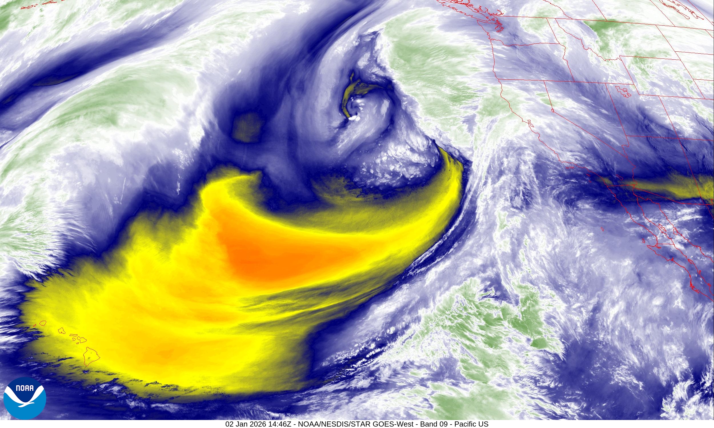
Western U.S. storm track is lit up and ready to go … multiple systems will parade into the West Coast including California over the next week. Initially, the air masses will be warmer with subtropical origin, but that will shift to the Northwest meaning colder upper-level air and significantly more snowfall at lower elevations.
HRRR Simulated Radar | Next 48-hours until Sunday 7 AM ET
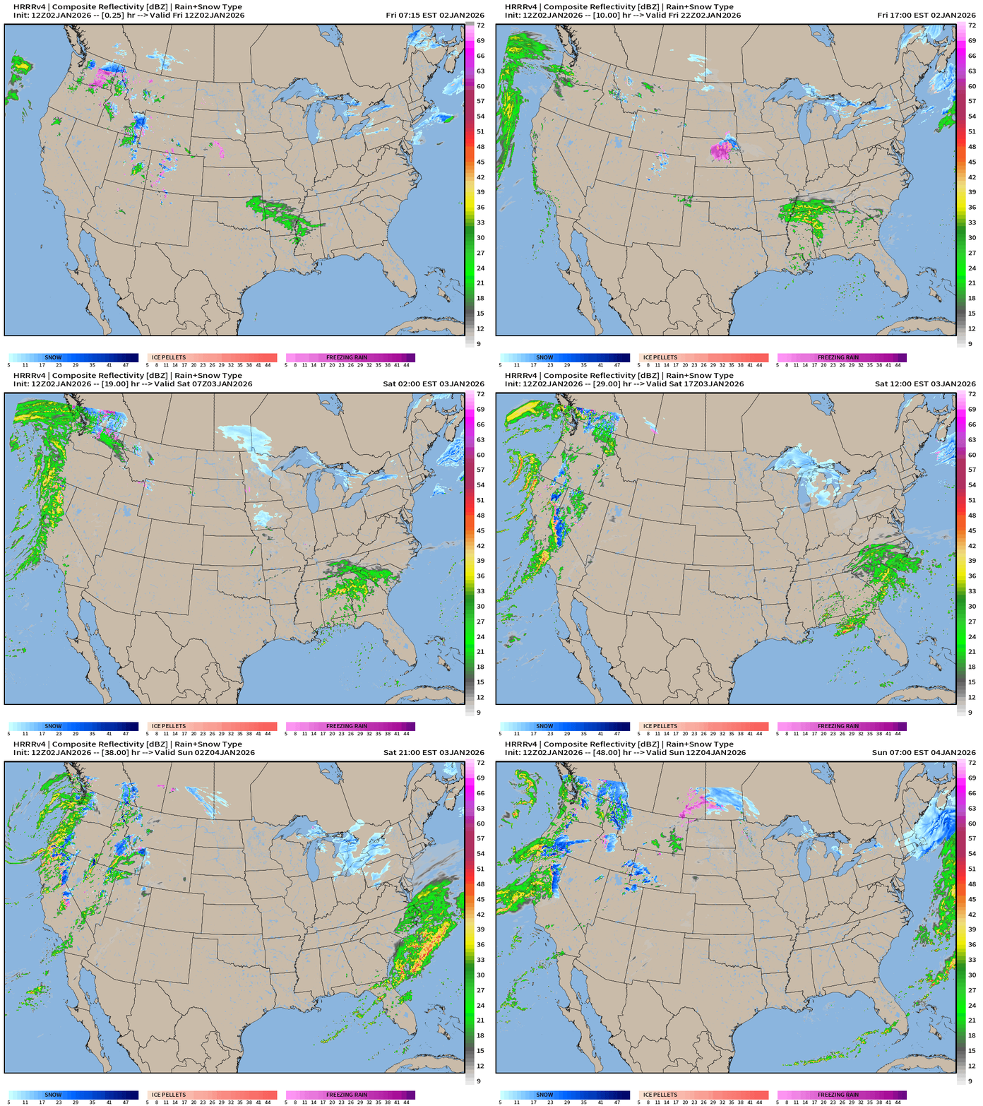
Great Lakes —> Northeast clipper system with Great Lakes enhanced snowfall
Southeast U.S. storm system with 0.5” to 1” of rainfall for a large area — welcome precipitation especially since it’s not frozen
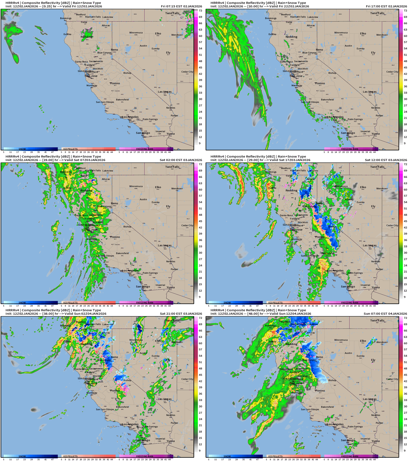
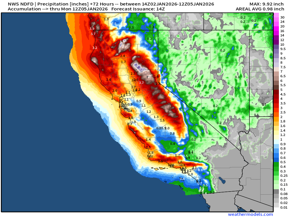
West Coast waves of rainfall from atmospheric rivers continue into next week. Major storm system for this weekend will dump heavy rainfall and high elevation snowfall due to the warm Southwesterly flow component
HRRR Simulated Radar | Next 48-hours until Sunday 7 AM ET
HRRR Total Precipitation| Next 48-hours until Sunday 7 AM ET
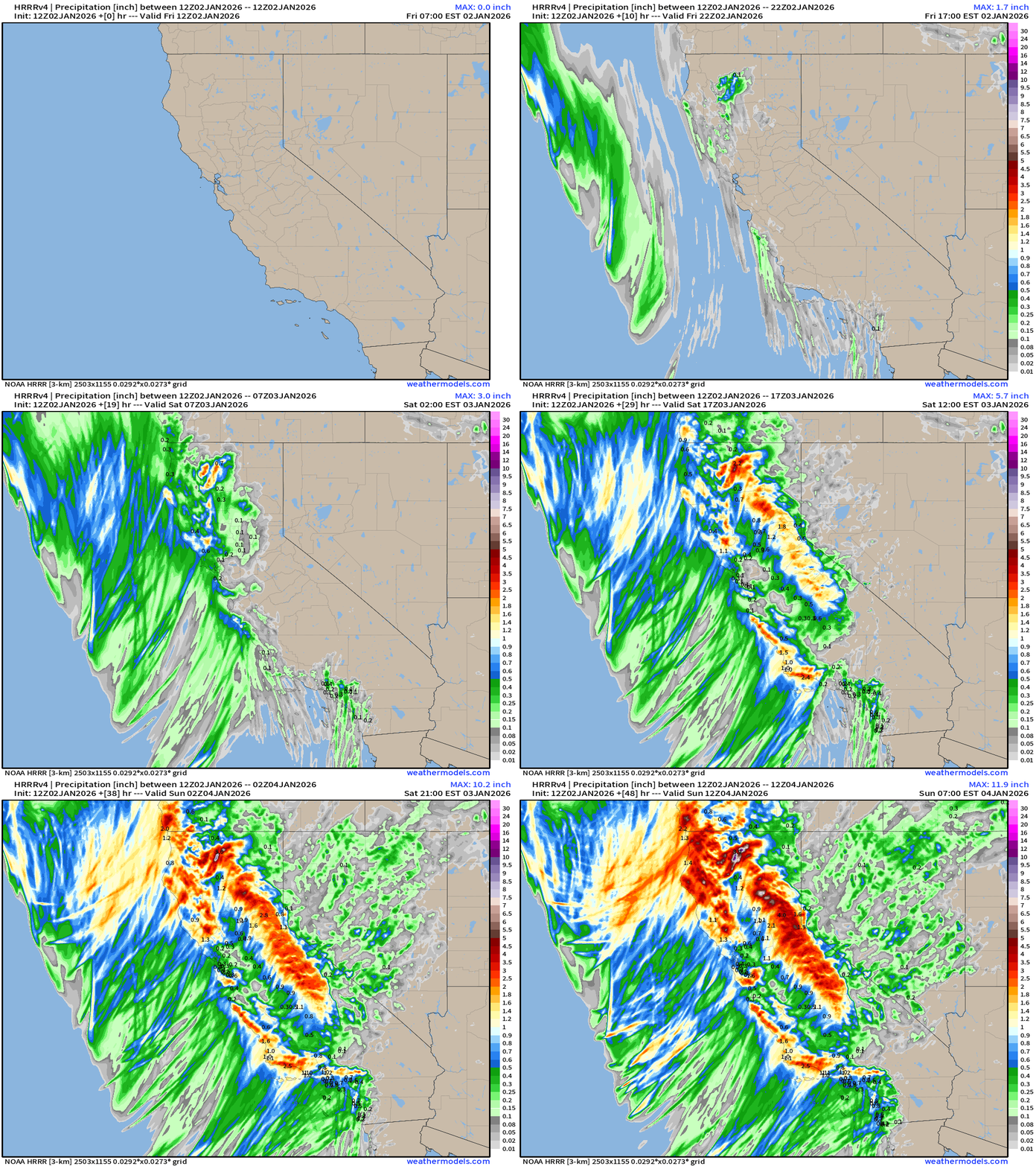
Rainfall fills up the observation buckets yet again this weekend!
RRFS-A High Resolution Rain Snow | Through 84-hours into Monday afternoon
HRRR Snowfall | Next 48-hours until Sunday 7 AM ET
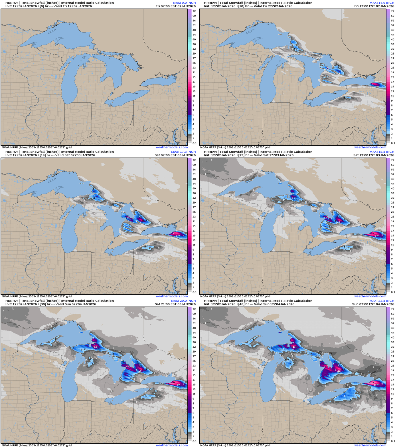
More snowfall with Great Lakes Effect Enhancement. The fetch from Superior to Huron and across Ontario will be impressive
European Polar Vortex arriving via Scandinavia next 6-days
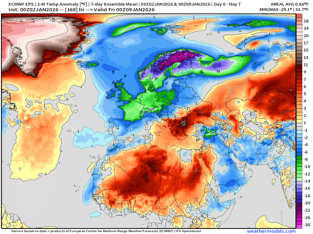
Trip to the other side of the pond to show the onset of very cold conditions across much of Europe with an intrusion of the Arctic tropospheric polar vortex. -40°C air at 500 mb cuts through London and Paris, with a sharp trough reaching Spain and the Mediterranean by early next week.
ECMWF 06z | Temperature Anomaly Next 6-days
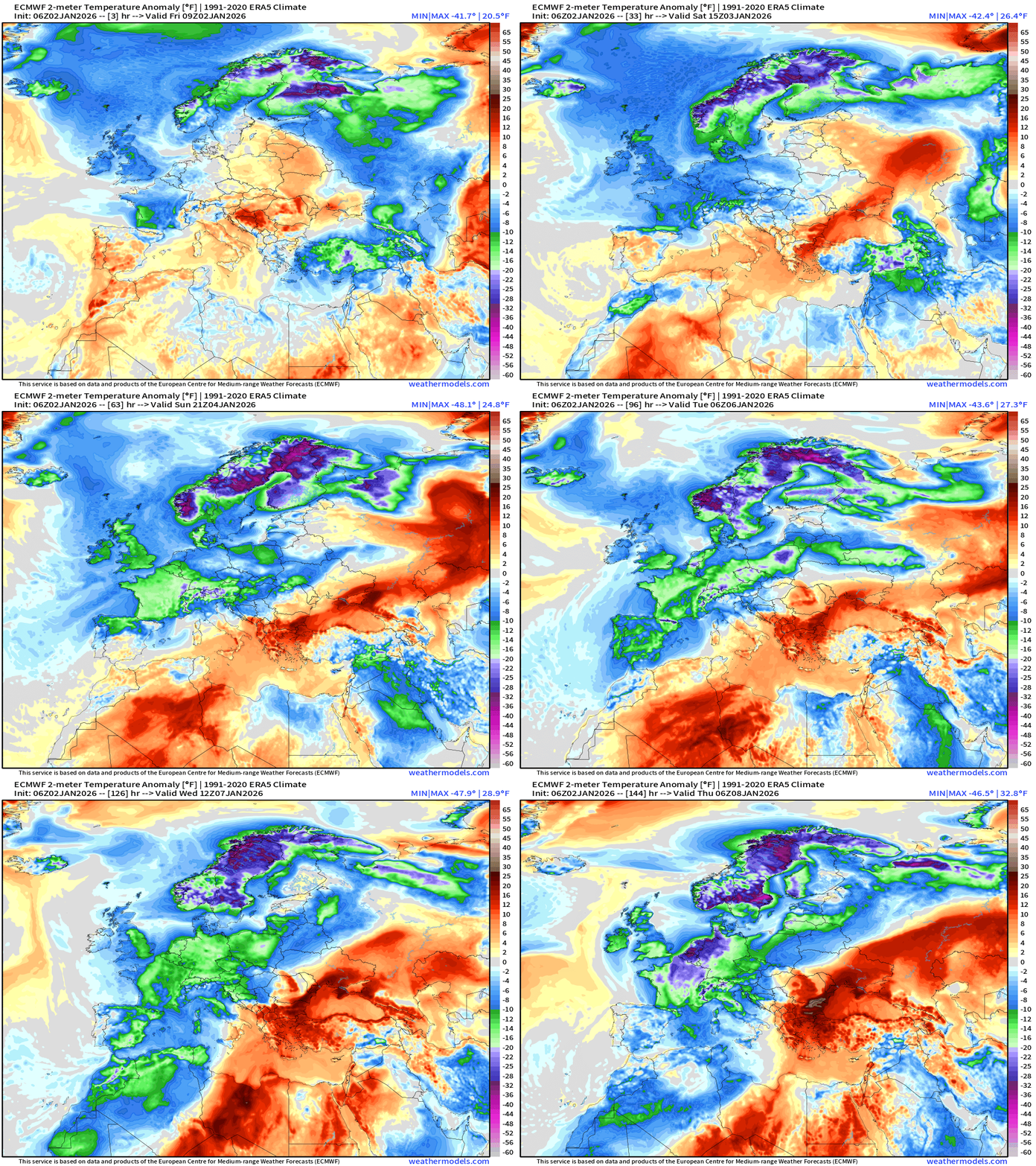
20°F below normal = green and even 30°F below normal = purple —> large cyclonic upper-level trough settles slowly across the continent through first week of January 2026
ECMWF 00z EPS | Temperature Anomaly | Next 15-days
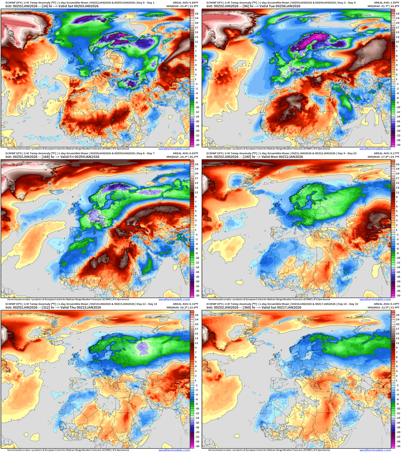
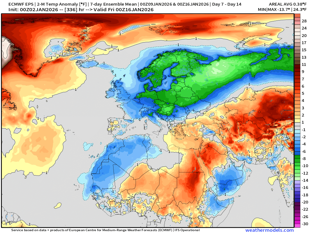
Well below normal temperature risk continues into middle January
North America Temperature Anomaly Next 6-days
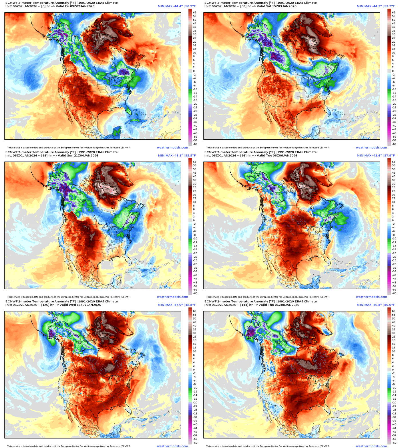
Will take until early next week, but the end of the Arctic air influence across the Lower 48 as the Pacific warmer origin air floods into North America dislodging the Alaska and Canadian cold pool.
Well above normal temperatures into next week, January 8th for the continent — with increasing risk, of colder air down the west coast from Alaska cold pool dragged southward by a storm system (trough)
ECMWF 00z EPS | Temperature Anomaly | Next 15-days
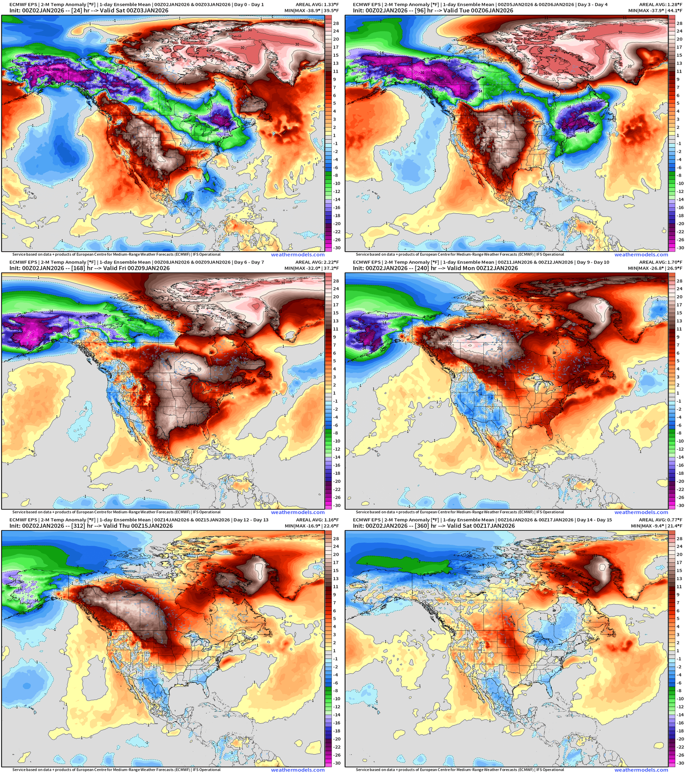
Cold pool over Alaska continues full bore for next 10-12 days, but it is soon blocked from entering the Midwest and Great Lakes and Northeast … with warming into middle-next week.
Pattern Shift to Much Colder Arctic Air? We’ll see!
Way down the road, but ECMWF 00z hinted at a major polar vortex, extreme cold blast building across Western and Central Canada that would dump out across the Rockies by Day 15
This is only one solution out of hundreds/thousands that we will see in the coming days, but it bears watching to see if (1) more ensembles pick up on the extreme cold risks (2) this model ECMWF persists with this pattern (3) other models show similar solutions. Mid-January is a long ways off — but the MJO flip to Phase 6/7 would favor the downstream Rossby wave response to perturb or destabilize the polar vortex and dump out the Siberian/Arctic/Canadian polar express train on the Lower 48.
ECMWF 06z Precipitable Water Next 6-days | My Favorite Parameter
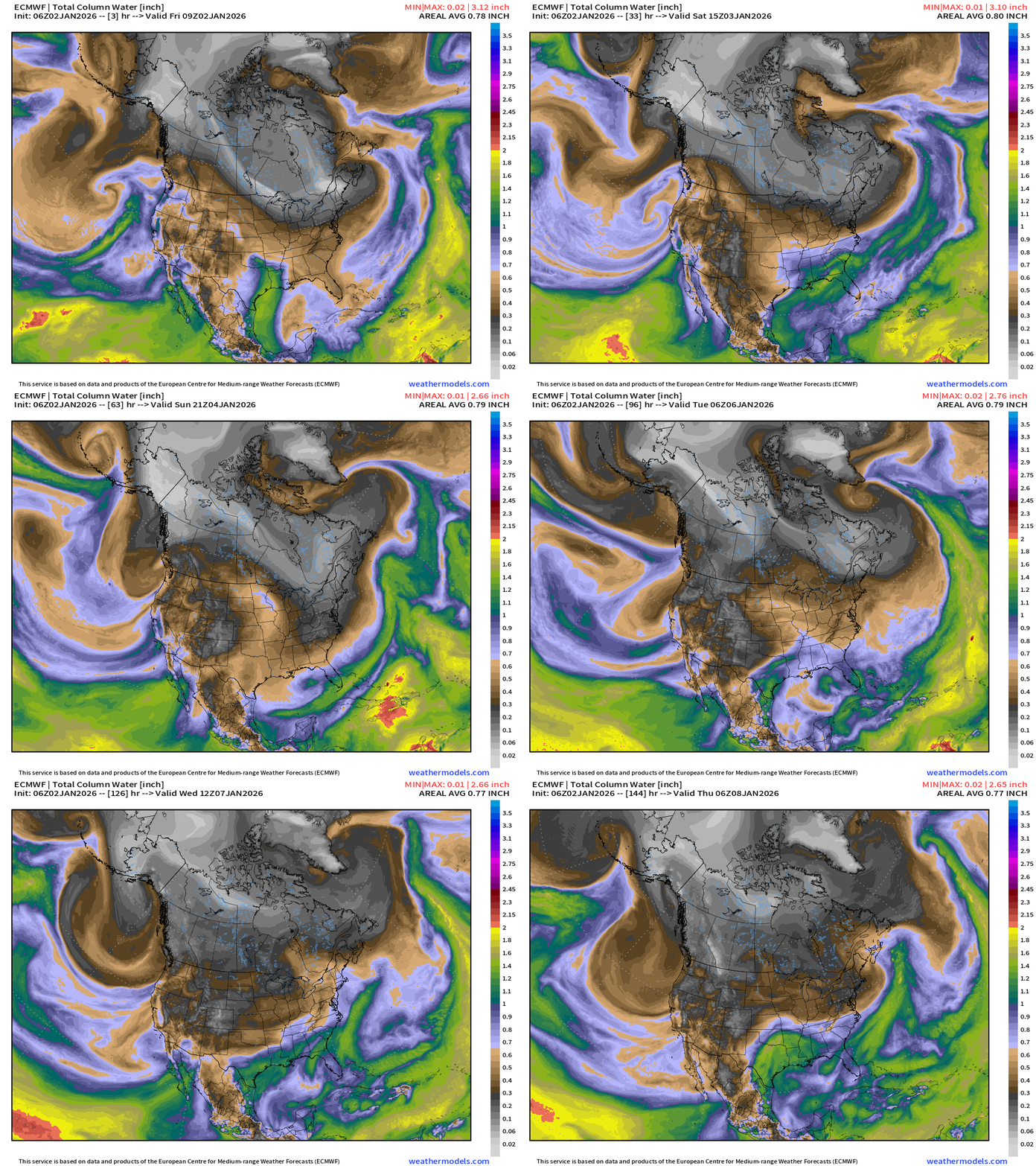
Finally ditch the cold, northwesterly flow out of Canada for the Great Lakes and Northeast.
The West Coast goes back into the washing machine with more precipitation — initially a warmer system out of the subtropics (rain) and then more typical Gulf of Alaska origin systems —> lower snow levels = heavy mountain snowfall returns for the Sierra and Rockies.
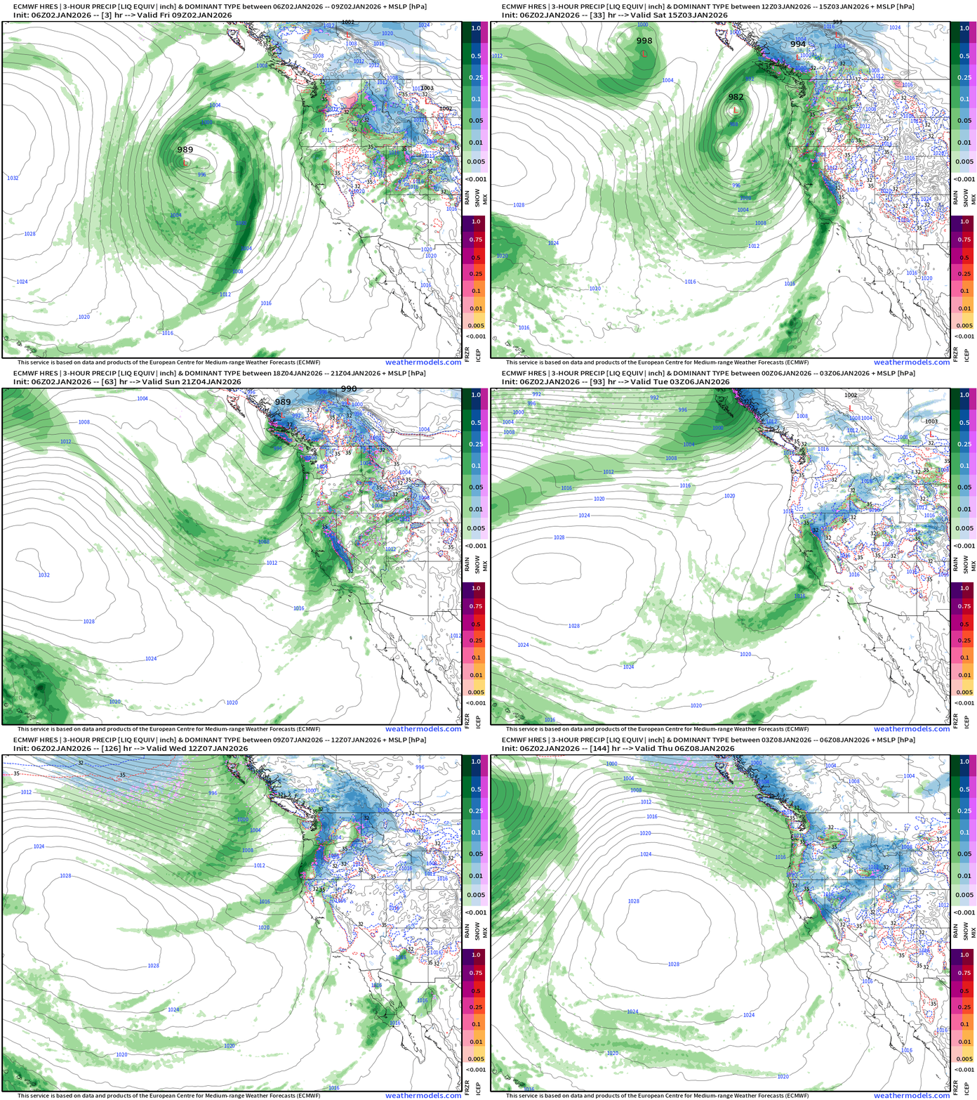
ECMWF 06z Precipitation Type and Intensity | Next 6-days
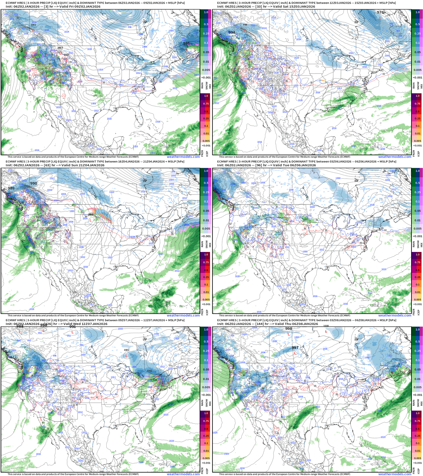
No major storms east of the Rockies — but west coast remains very busy
Western U.S. continued precipitation onslaught from all directions
Eastern U.S. Storm Track Next 6-days
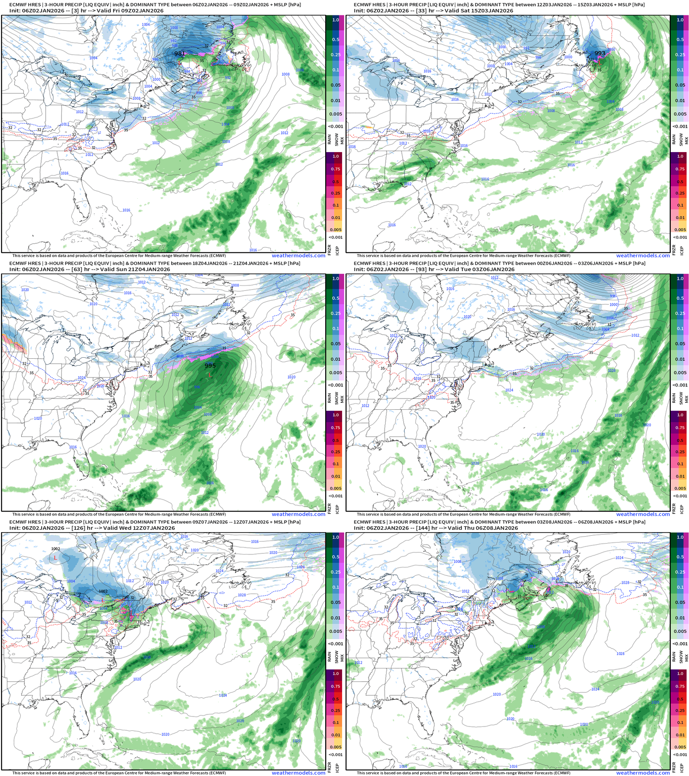
Clipper intensifies on Friday into 970s mb and decays/spins over Quebec
Another strong system “bombs out” on Monday (960s mb)
Both systems are glancing blows at most for Northeast, but certainty reinforce the cold air flow into early next week. As they intensify well off the coast, the phasing with the upper-level trough is delayed = blown opportunities for mega-blizzards.
NWS Precipitation Next 72-hours
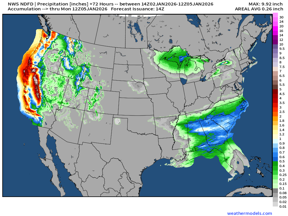
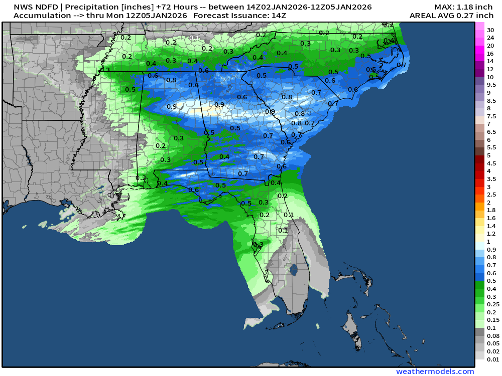
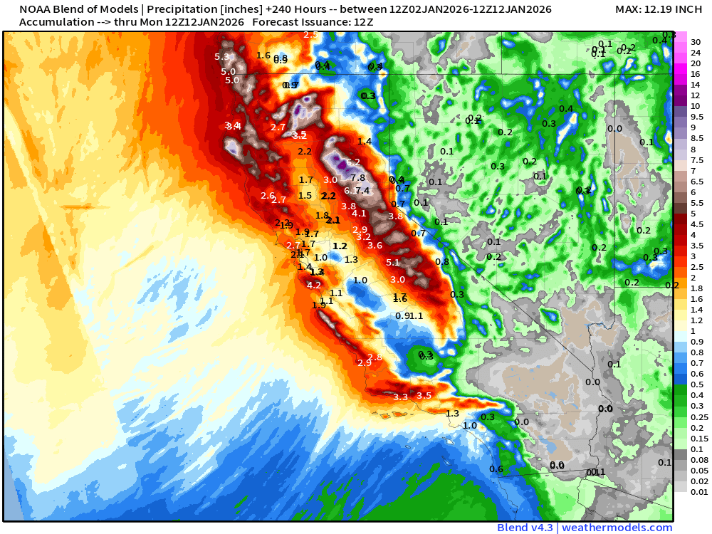
Huge precipitation — coastal rainfall and mountain snowfall — in next 3-days, and it continues
NWS Snowfall Next 72-hours
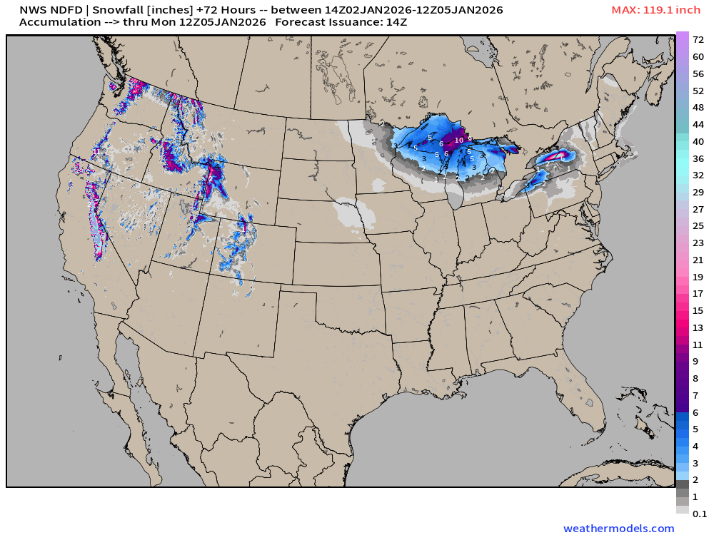
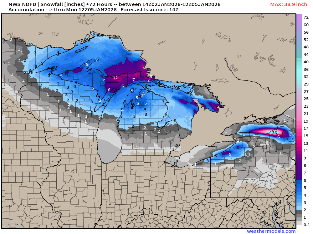
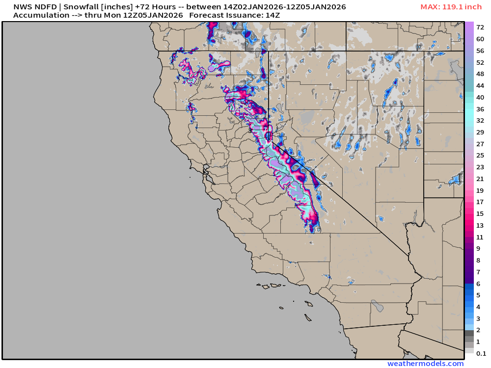
RTMA | Current Temperature Analysis | 9:15 AM ET
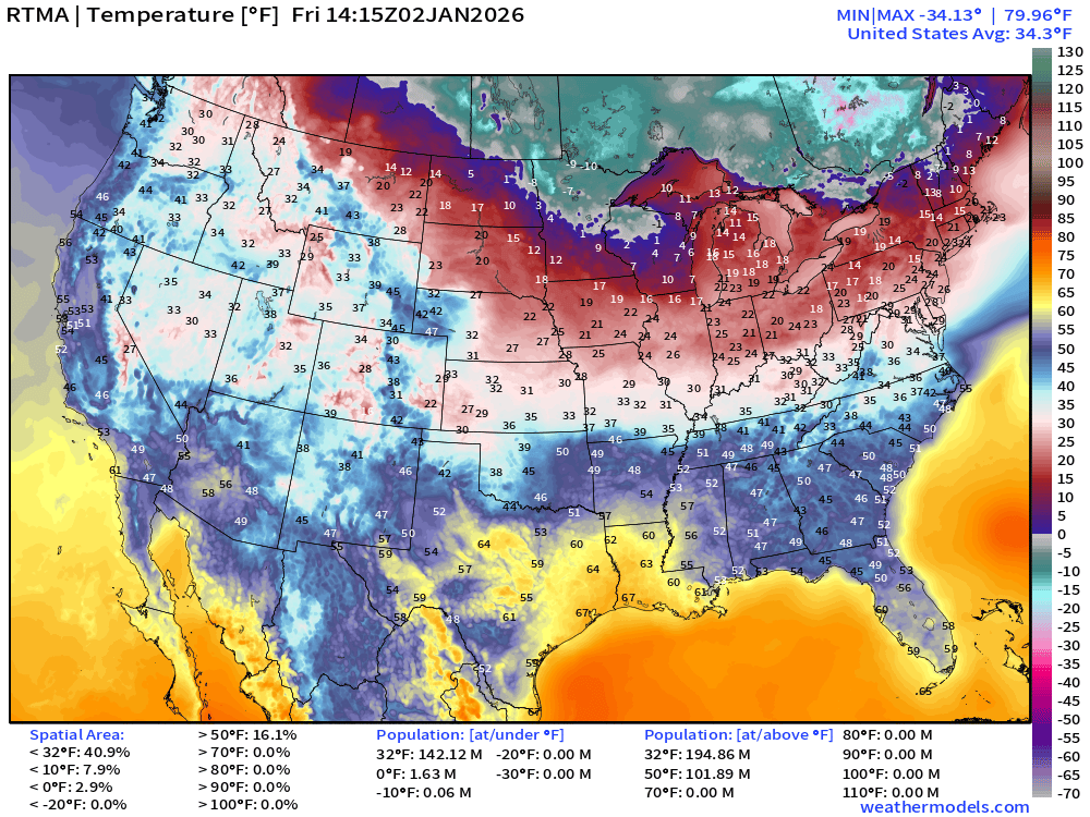
Average Lower 48 temperature was 34.3°F with 142 million below freezing.
Temperature Anomaly | 9:15 AM ET
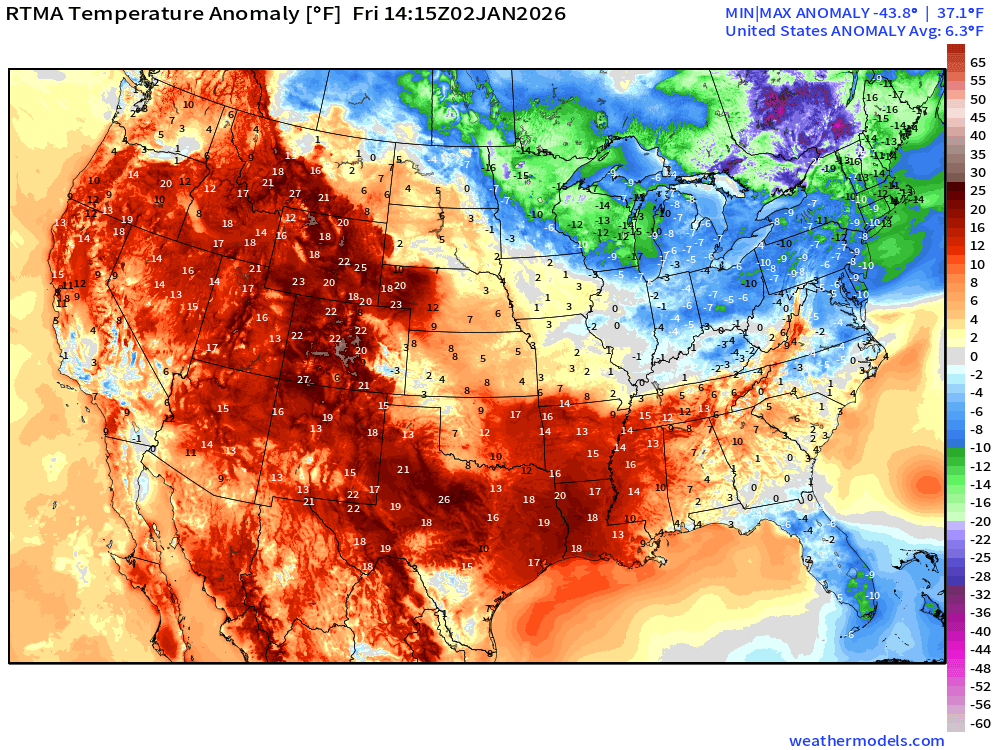
Lower 48 Temperature Anomaly way above normal by 6.3°F dominated by western warmth (relative to normal) outweighing Great Lakes, Northeast, and Florida “cold”
Friday High Temperatures
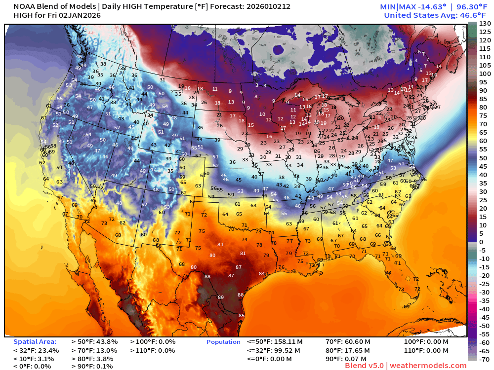
60 million at least 70°F —> nationwide average of 46.6°F —> 100 million remain below freezing during the day.
Saturday Morning Low Temperatures
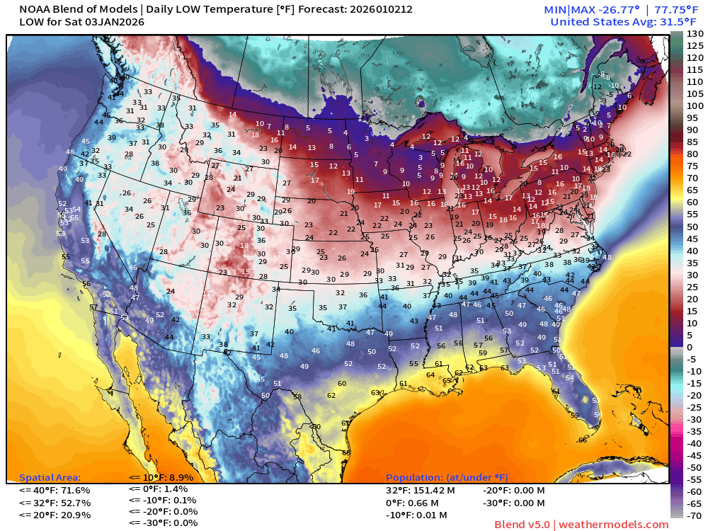
151 million below freezing — nationwide average of 31.5°F
Blend of Models | 10 Days Precipitation Total
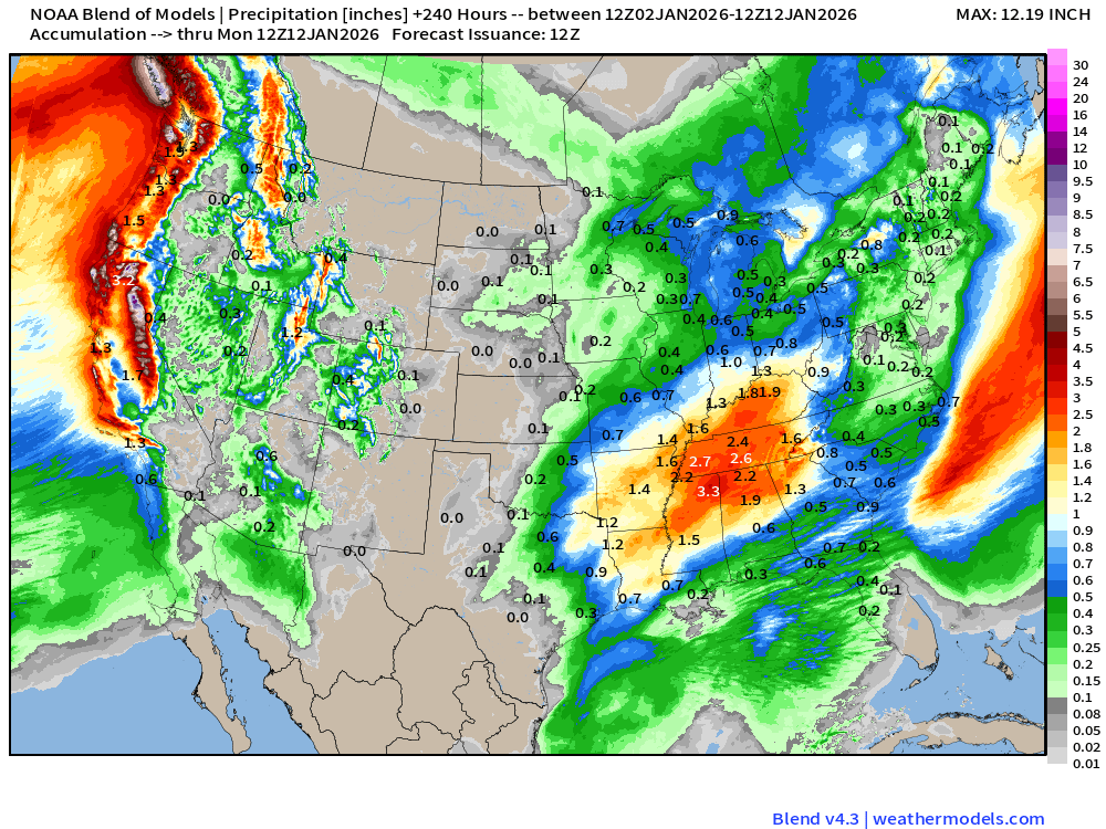
Blend of Models v5.0 | Total Snowfall Next 10-Days
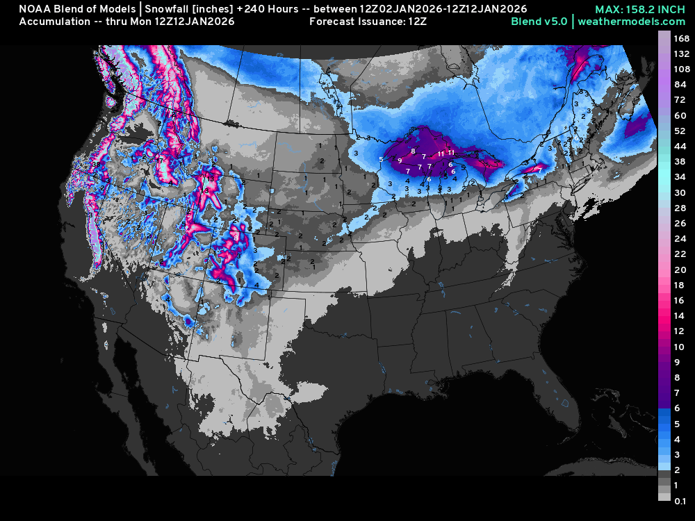
Lake Effect snowfall totals especially downwind of Erie, Ontario, and Huron in the next few days, and then the pattern warms up and the machine is shut off
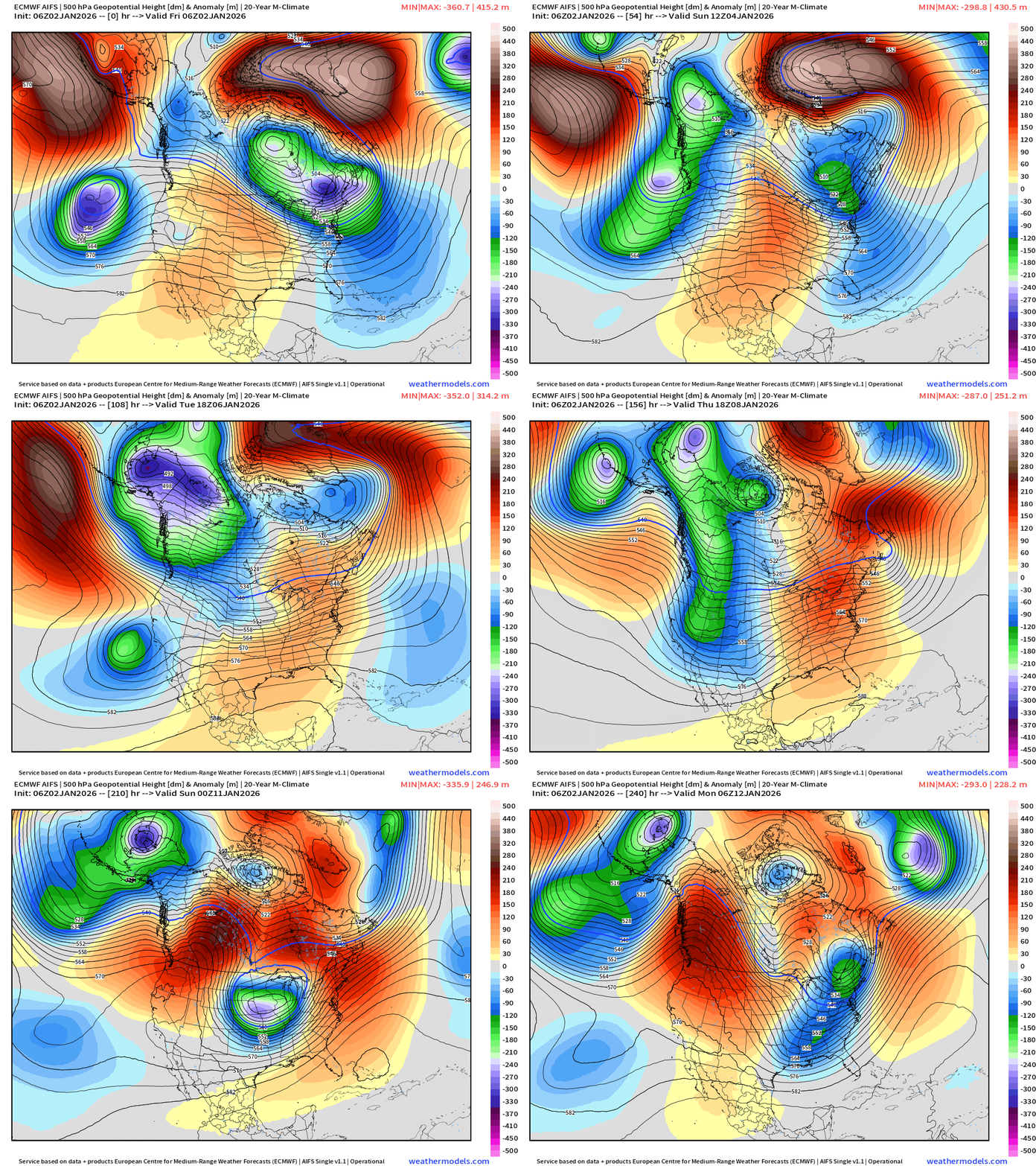
Significant mountain snowfall returns for early to mid January!
ECMWF AIFS-Single 06z | Height Anomaly (500 hPa) Next 10-days
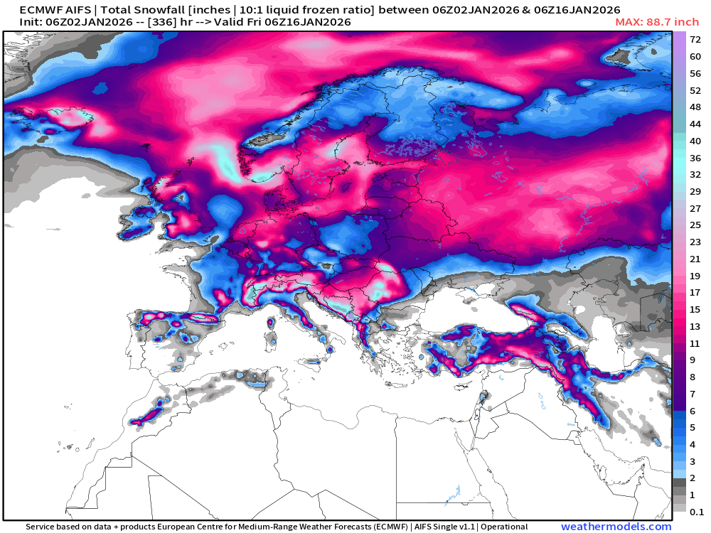
Long Range Snowfall from AIFS-Single Next 14-days
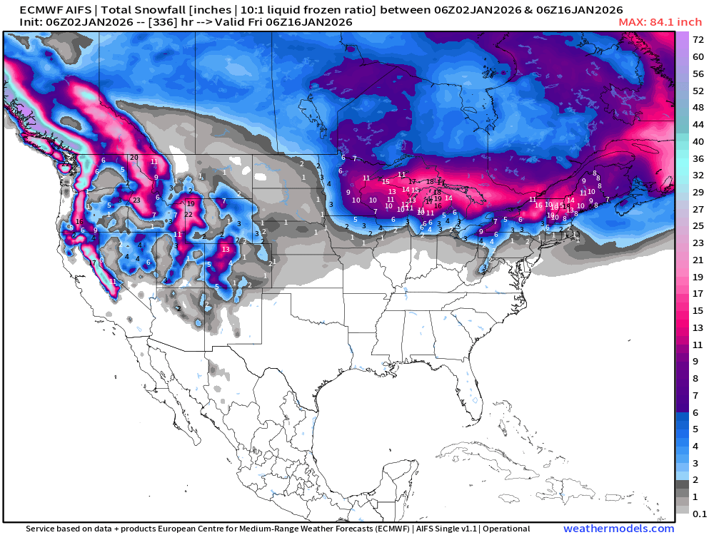
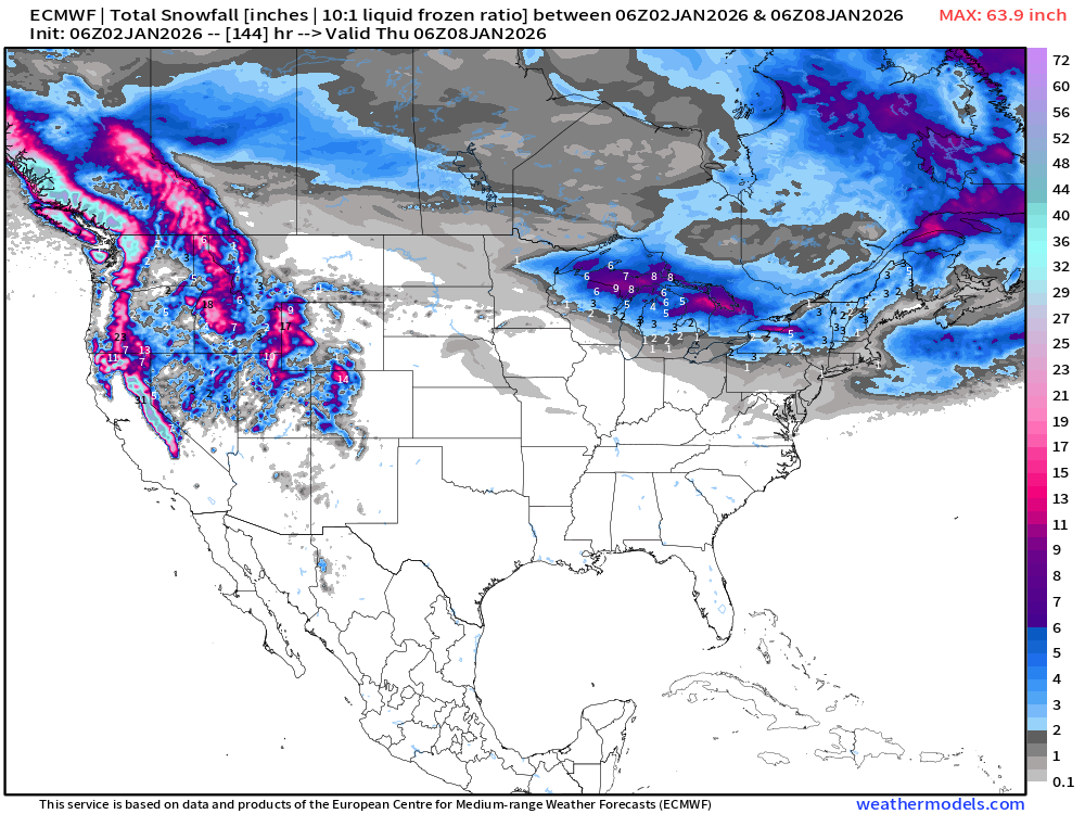
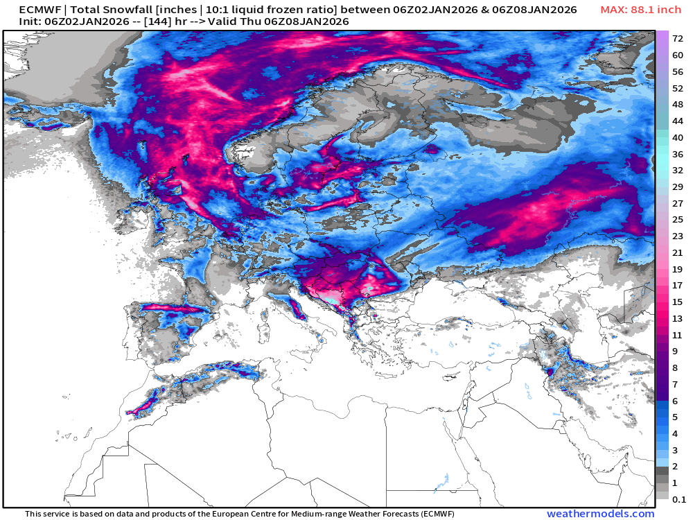
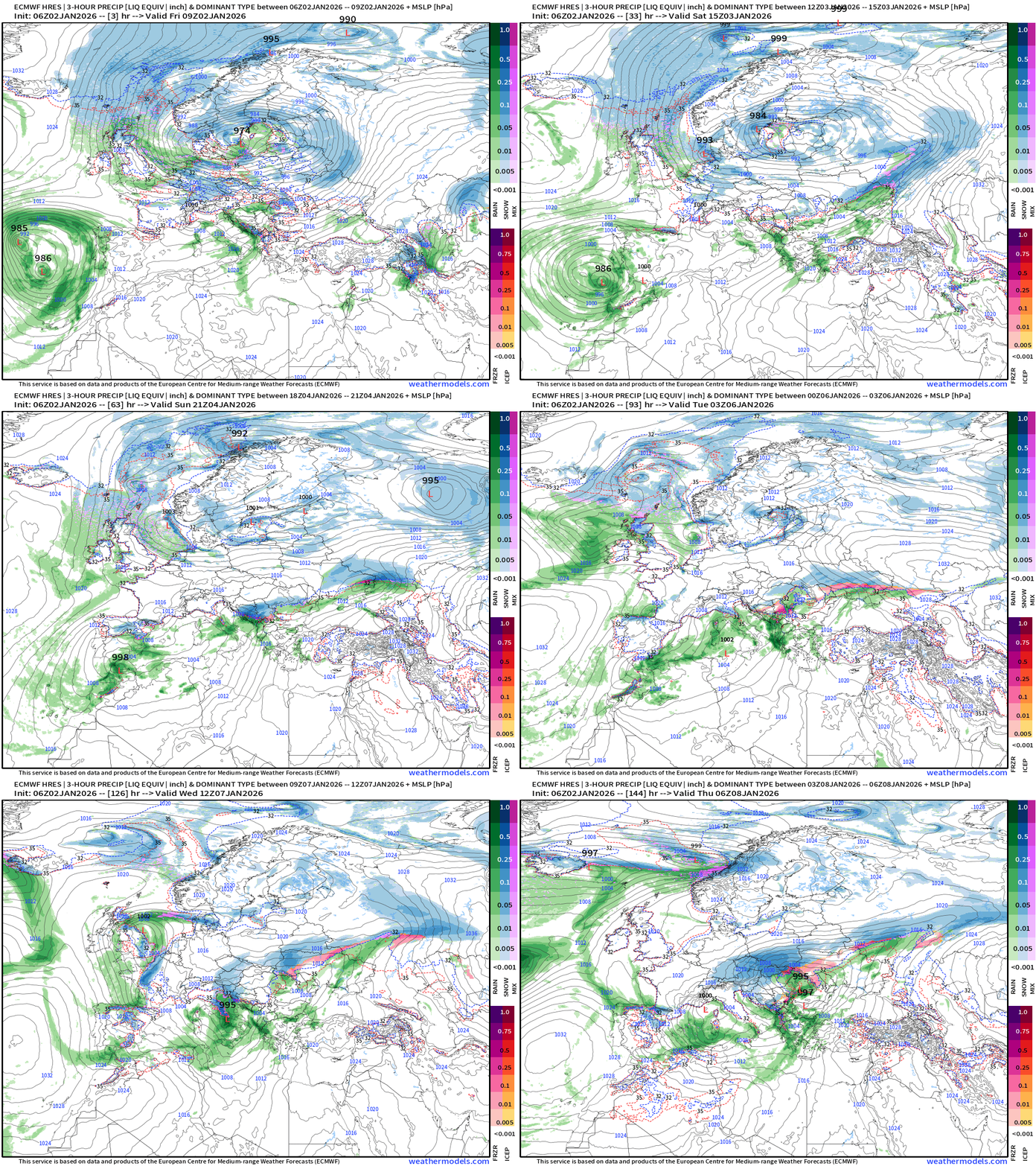
Hunting for storm systems — when is the next major winter storm? Could be a while across the Lower 48 — not seeing much on horizon for next 1-2 weeks. Europe, on the other hand — holy moly!
ECMWF 06z | Snowfall | Next 6-days | Lower 48 and Europe
European Winter | Heavy Snowfall Begins
Europe Precipitation Type Next 6-days
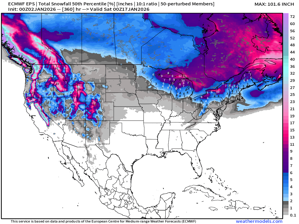
ECMWF EPS 00z | Ensemble Median Snowfall Next 15-days
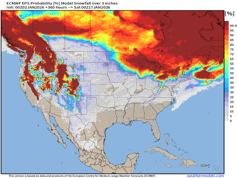
Probability of 3-inch or more Snowfall in the next 15-days
European Temperature Anomaly | Week 1 and Week 2
Lower 48 Temperature Anomaly | Next 15-days | ECMWF EPS 00z
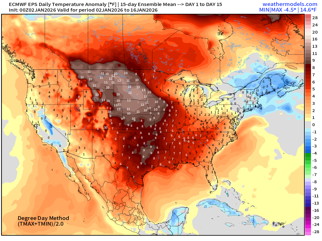
5-Day Chunk #1 | Temperature Anomaly | Jan 2 - Jan 6
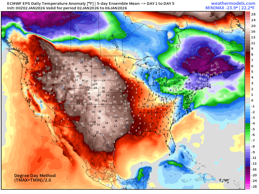
Very cold for a while across the Northeast!
5-Day Chunk #2 | Temperature Anomaly | Jan 7 - Jan 11
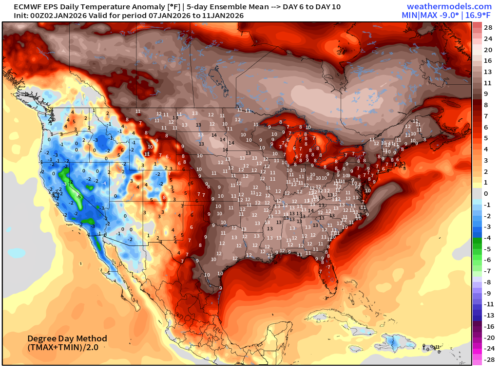
Huge warm-up across the central U.S. into the second week of January, as California seems to transition colder
5-Day Chunk #3 | Temperature Anomaly | Jan 12- Jan 16
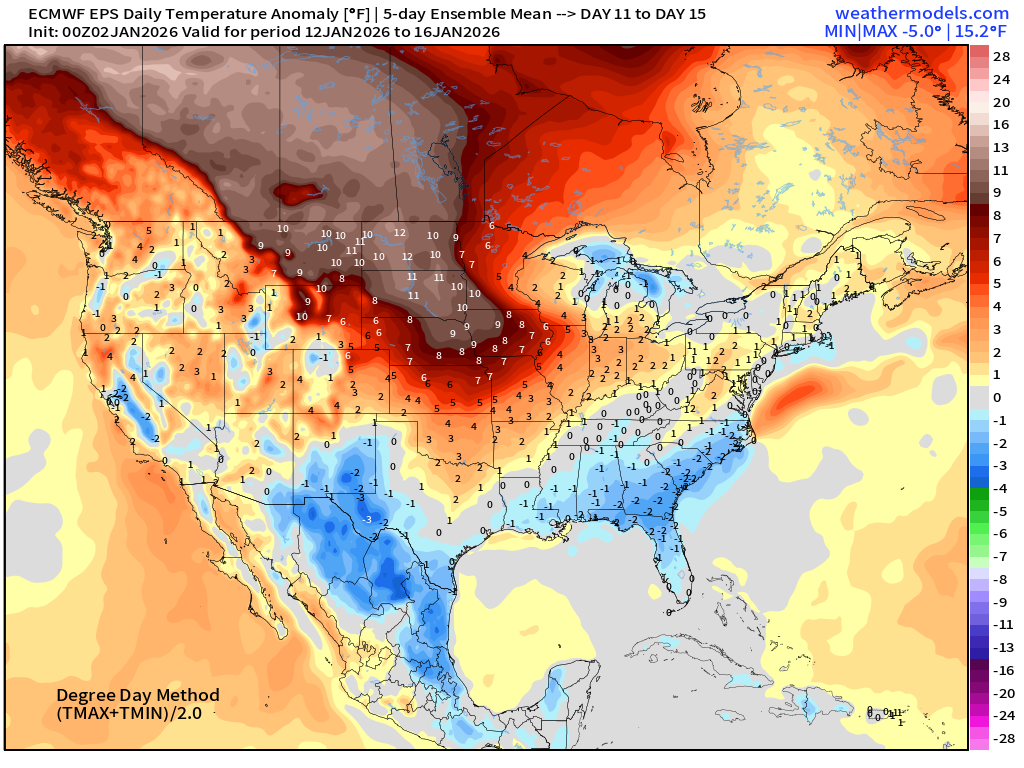
Mixed / high uncertainty
Maps sourced from weathermodels.com designed and innovated by yours truly! Please subscribe there for real-time access to the newest maps, charts from all of the weather models including ECMWF and AIFS, NOAA AI-GFS/AI-GEFS
- Milepost
- 832 · laid 2026-01-02T15:34:13.873000Z
- Source
- https://weather.substack.com/p/january-2-2026-friday-winter-weather
- Digest
- 28f74a6b235e9adda435ae00473e881fce66c4733fc6213b38ca2a85206a9331
- Machine
- JSON