December 27, 2025 Saturday Evening Winter Weather
Great Lakes Blizzard of 2025 scheduled to end the year with heavy snow and damaging winds
December 2025 was the 5th-warmest December in the 131-year national record (1895–2025), at 37.8°F against a 1991–2020 normal of 34.3°F (+3.5°F).
December 2025 was the 37th-driest December in the 131-year national record (1895–2025), at 2.0in against a 1991–2020 normal of 2.5in (-0.5in).
NOAA/NCEI Climate at a Glance, contiguous United States. This is the observed record for the month, not a score of anything said in this piece — the forecast ledger begins 2026-08-17 and cannot reach earlier posts.

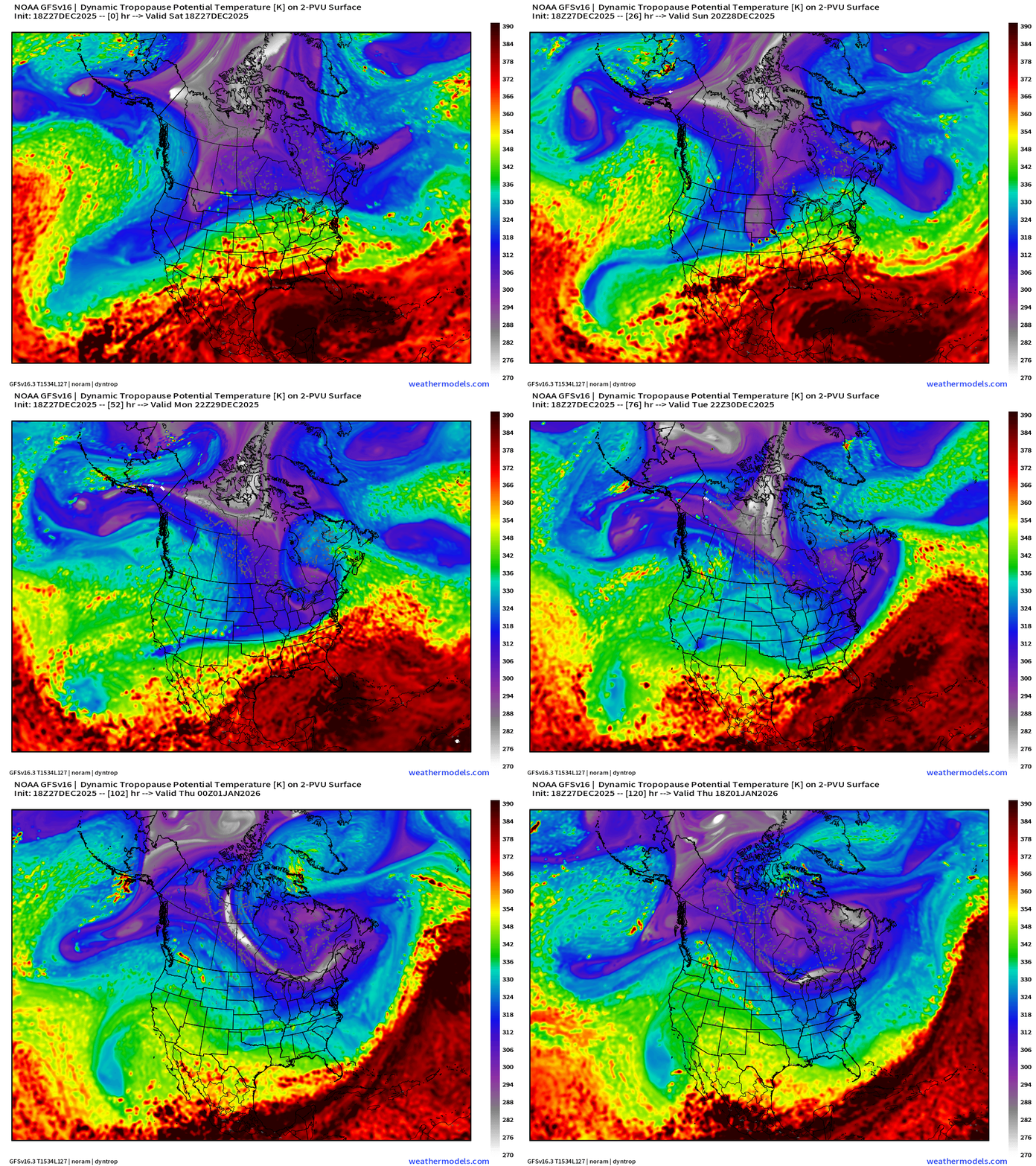
Major Blizzard —> Bomb Cyclone forecast for Midwest and Great Lakes Sunday into Monday. The system maintains pressure in the 970s mb then intensifies again once it phases with the upper-level (Polar Vortex) lobe that arrives out of Arctic Canada. This whole “treble clef” looking deal is representative of the “baroclinic” or extratropical cyclone lifecycle. This is an impressive example with very low pressure over land almost entirely on its journey. Dynamic tropopause maps show the air masses and the movement of the cyclones + anticylones (ridges) as they migrate through North America. The atmosphere is a fluid and sometimes when we don’t use high temporal frequency maps of every 1-2 hours, it looks like the storm systems jump, but that’s not so.
Purple haze + white fuzzballs = cold polar vortex related air vs. red = subtropical (warmer) origin. Next 5-days from GFS 18z:
Simulated Radar Next 48-hours into Monday 7 PM ET
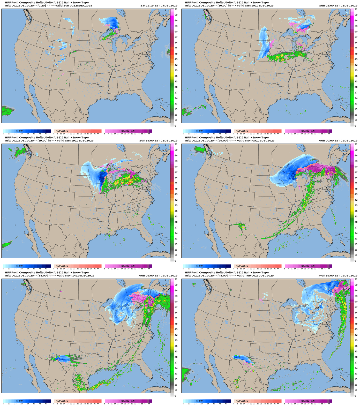
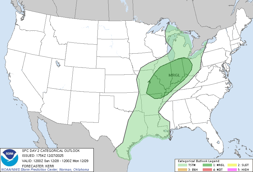
HRRR captures most of the storm development through 48-hours from the 00z cycle. IN addition to the heavy snowfall and wintery precipitation, MARGINAL chance of severe thunderstorms with a risk of tornadoes along the warm front in IL/IN and perhaps southern Michigan on Sunday. The main threat even outside of thunderstorms will be very gusty winds.
Severe Thunderstorm Outlook | Sunday morning to Monday morning
Headlines Saturday Evening
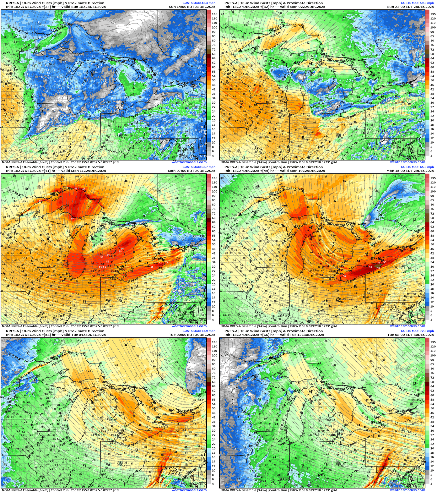
Powerful “bomb cyclone” blizzard now scheduled for Sunday/Monday across the Great Lakes with central pressure around 970 mb —> gusty winds over 60 mph likely in Michigan. Not good.
Much colder air behind a cold front attached to this cyclone — which then tracks into Hudson Bay into mid-week becoming vertically stacked with a lobe of the Polar Vortex (951 mb) —> winter cold returns to the Eastern U.S. into next week
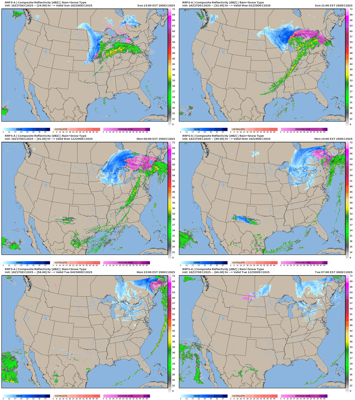
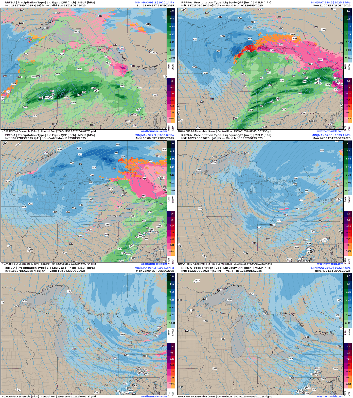
RRFS-A Extension from Sunday to Tuesday morning
RRFS-A Zoom on Great Lakes | Precipitation Type
RRFS-A Zoom on Great Lakes | Wind Gusts —> Yikes (50-60 mph)
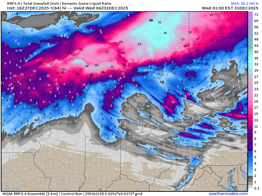
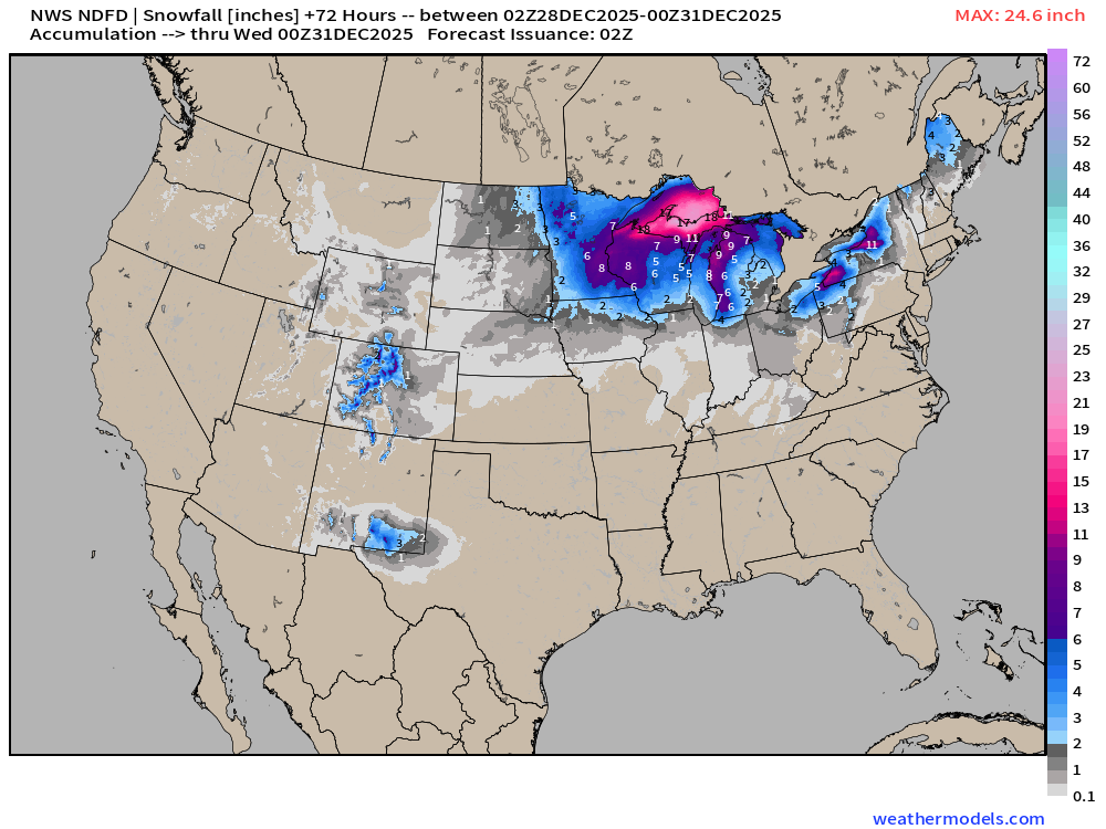
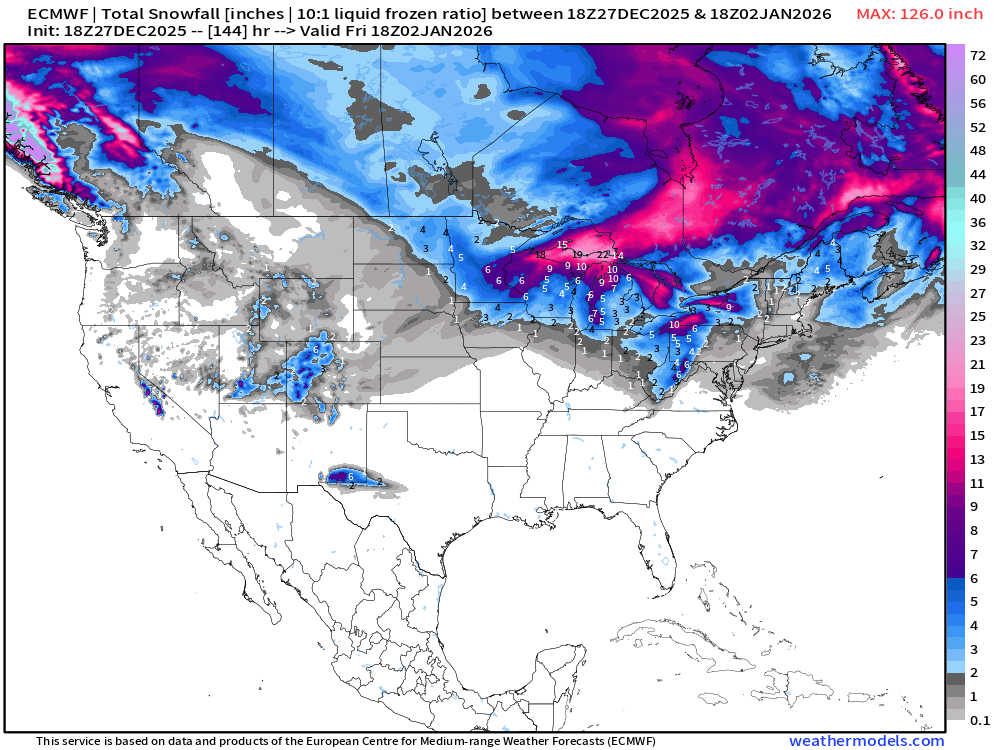
Total Snowfall —> System + Lake Effect
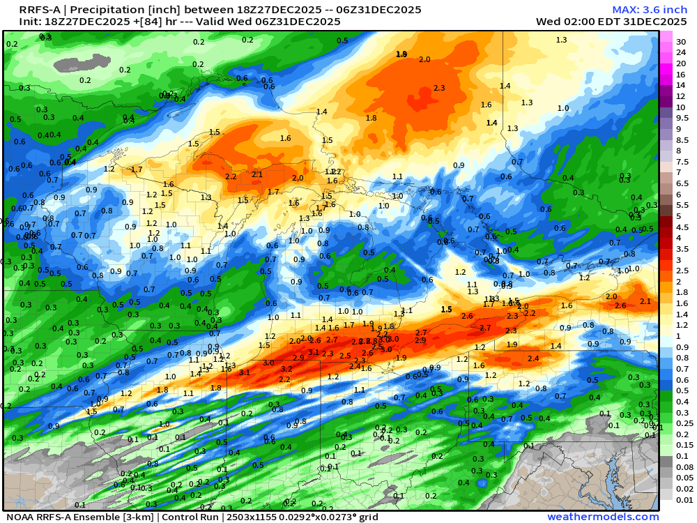
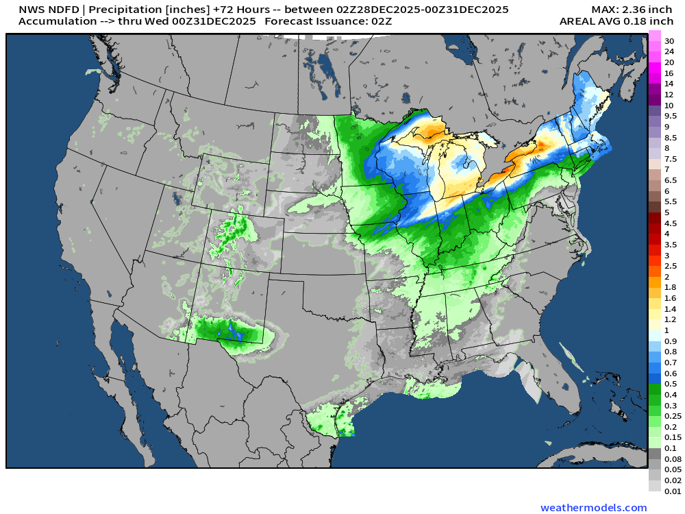
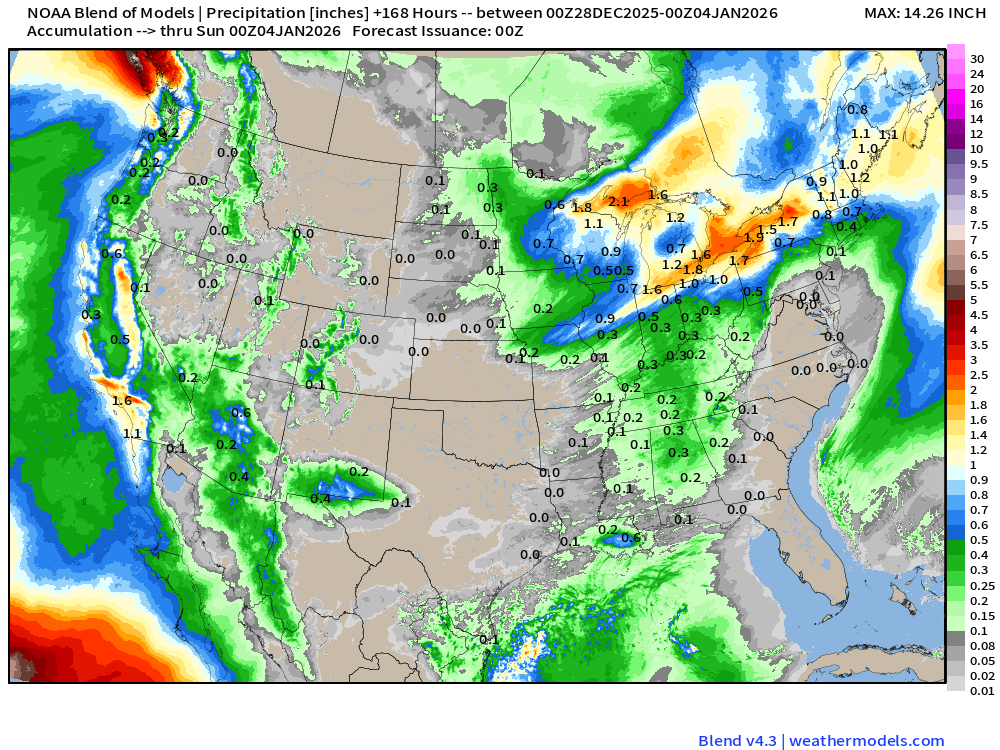
Total Precipitation —> intense bands of rainfall from Northern Illinois across I-80 into Detroit.
ECMWF 18z Precipitable Water Next 6-days
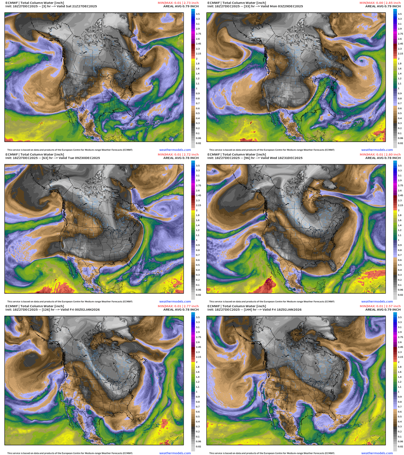
White/gray = Arctic air from Canada wraps around the “bomb cyclone” into middle of next week. The polar cold front sweeps through Florida.
A Subtropical Something System comes out of the Eastern Pacific northward into Southern California by Wednesday.
ECMWF 18Z MSLP Next 6-days
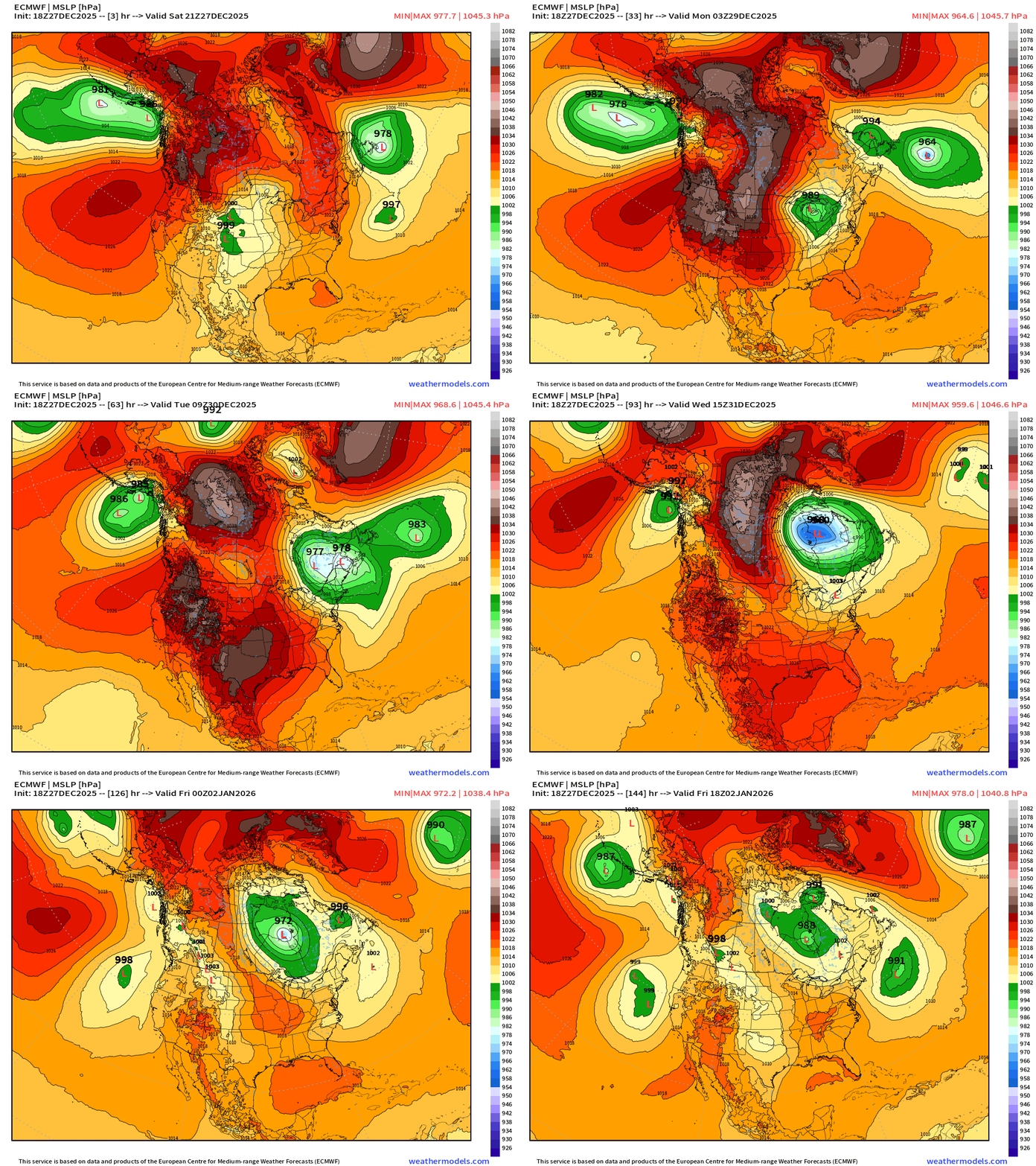
Long track of “bomb cyclone” to 957 mb in Quebec retrograde into Hudson Bay — maintains the cyclonic / cold circulation out of Canada into the Great Lakes.
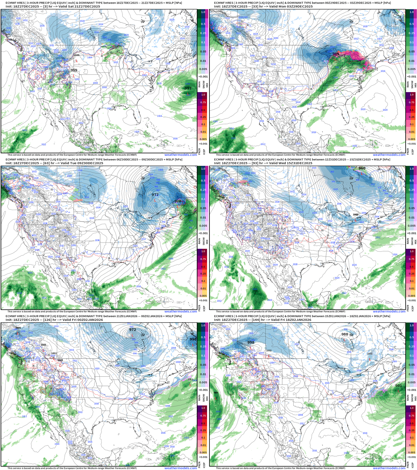
ECMWF 18z Precipitation Type and Intensity | Next 6-days
NWS Precipitation Next 72-hours
NWS Snowfall Next 72-hours
RTMA | Current Temperature Analysis | 8:45 PM ET
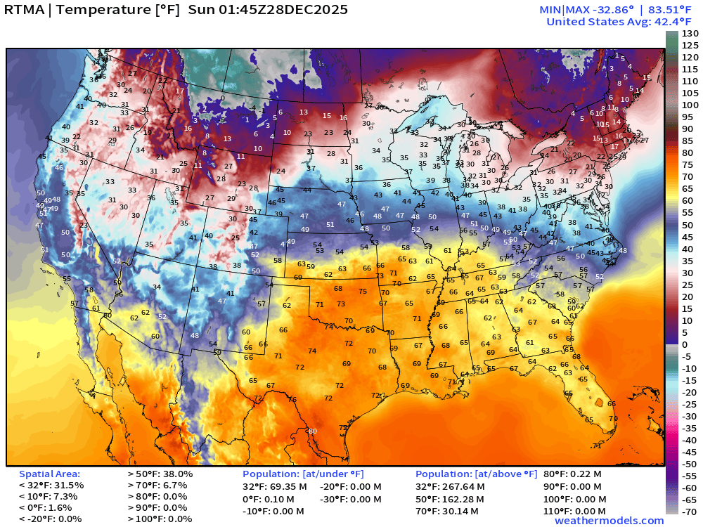
Average Lower 48 temperature was 42.4°F with 69 million below freezing.
Temperature Anomaly | 8:45 PM ET
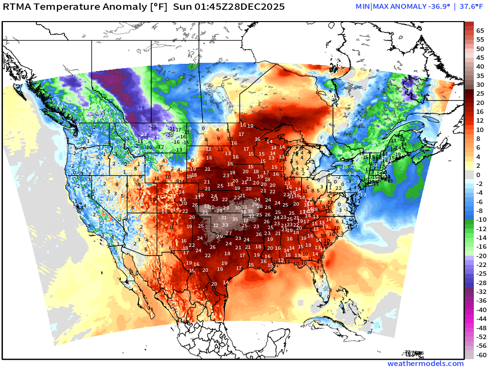
Lower 48 Temperature Anomaly whopping 8.2°F ABOVE normal
Sunday Morning Low Temperatures
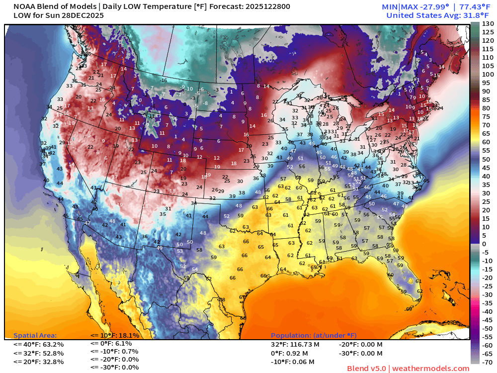
117 million below freezing and a small area of subzero in Maine
Sunday High Temperatures
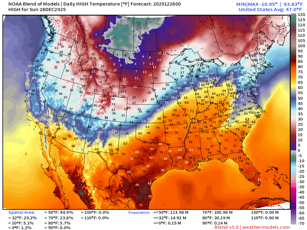
101 million at least 70°F —> nationwide average of 47.0°F.
Monday High Temperatures
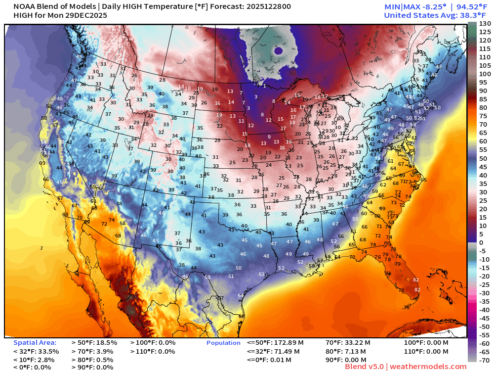
Only 33 million at least 70°F —> nationwide average of 38.3°F
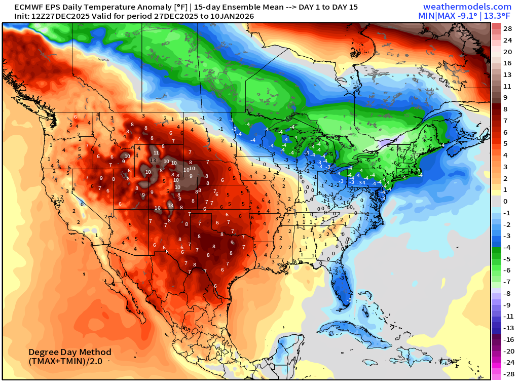
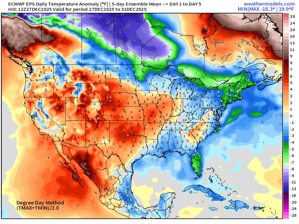
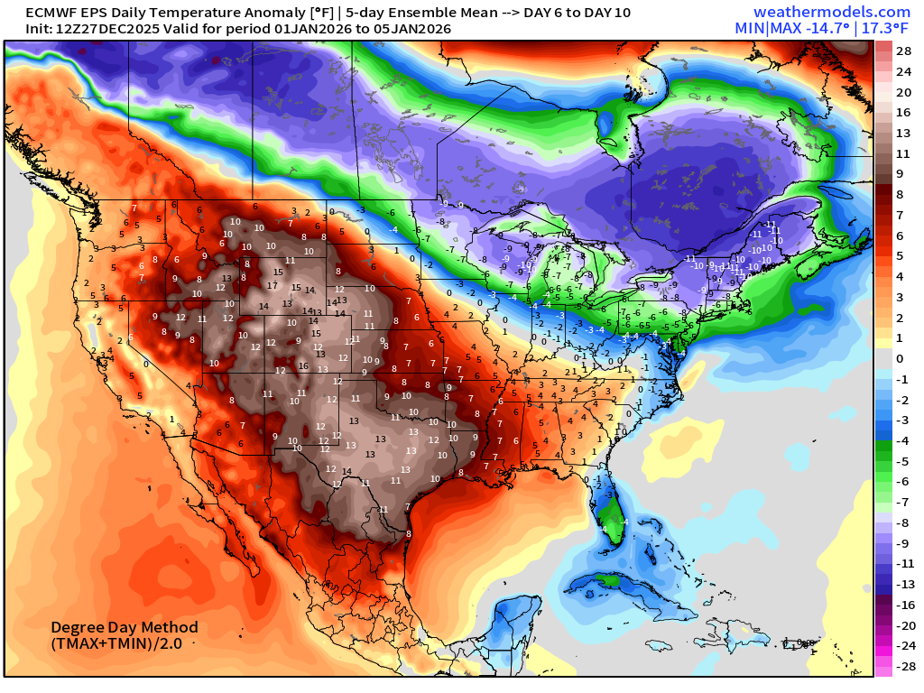
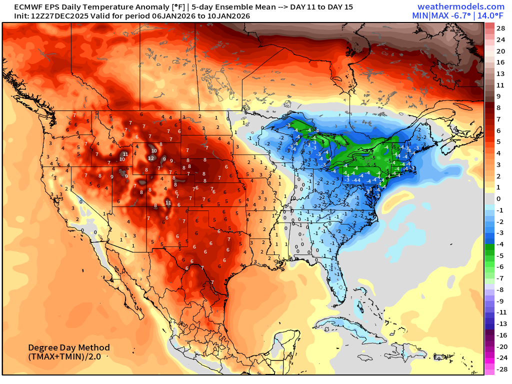
ECMWF 12z EPS | Temperature Anomaly | Next 15-days
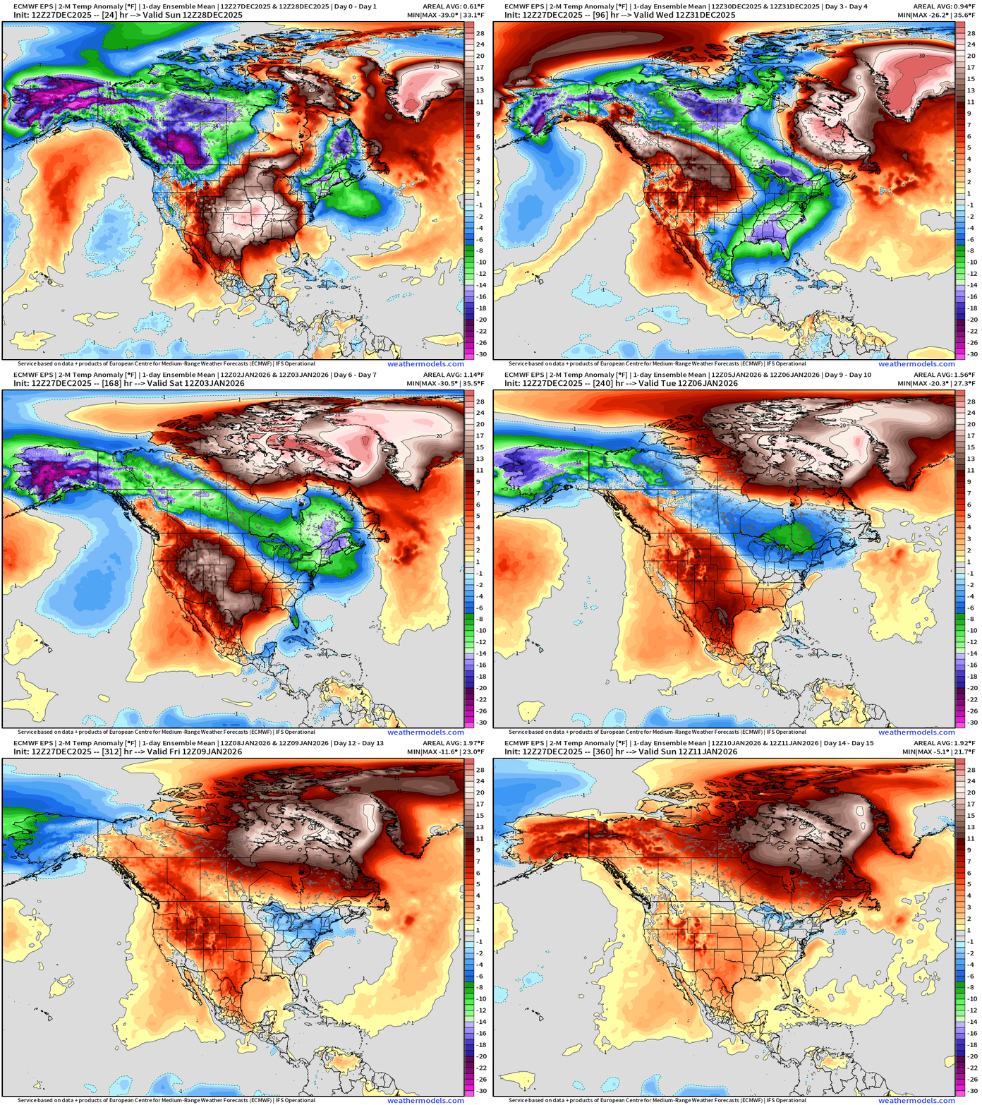
Alaska + Canadian Cold Pool drains ESE into the Midwest and Great Lakes next week and it seems the Lower 48 ridge will weaken — allowing a southward push of the “polar front” — Canada finally warms up into 2nd week of January —> pattern shifts to much warmer for North America
Blend of Models | 7 Days Precipitation Total
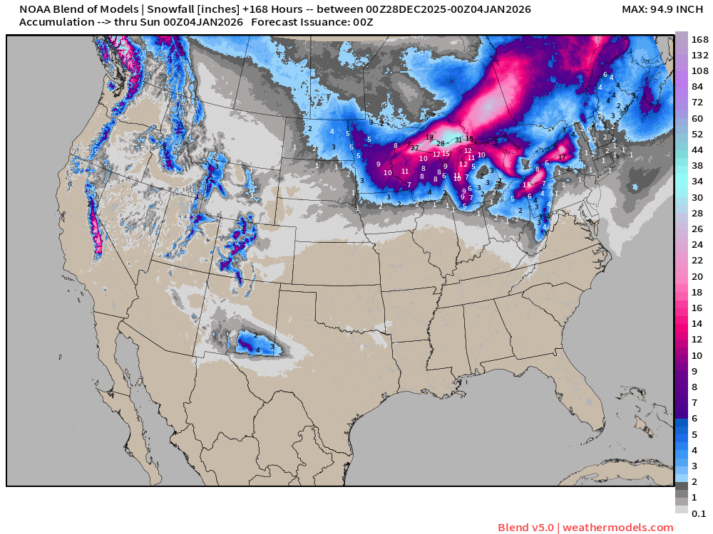
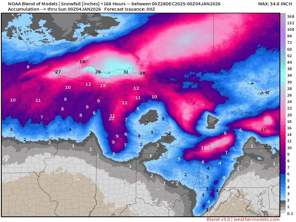
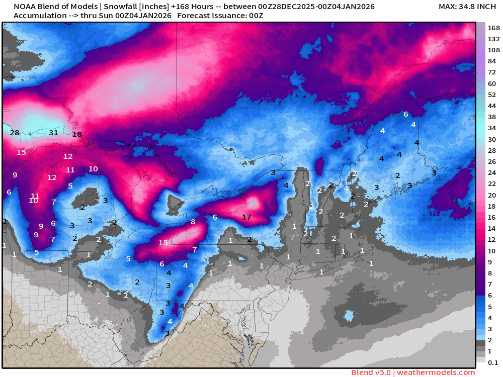
Blend of Models v5.0 | Total Snowfall Next 7-Days
ECMWF AIFS-Single 18z | Height Anomaly (500 hPa) Next 10-days
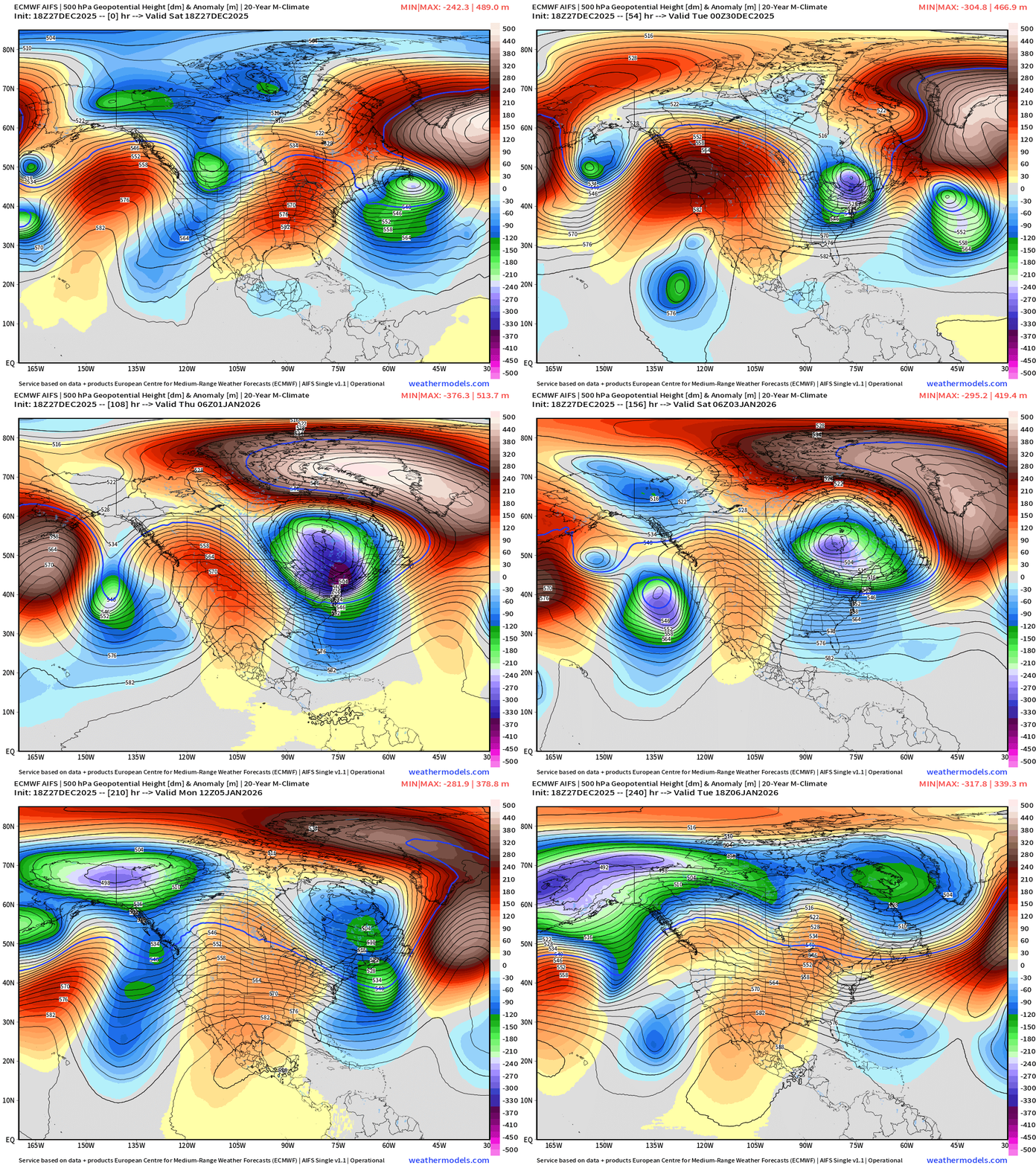
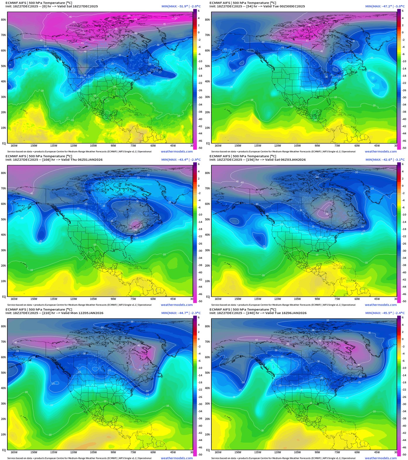
The bomb cyclone interacts with the “Polar Vortex” lobe over the Northeast and then violently retrogrades into Hudson Bay — also due to the Greenland blocking ridge
ECMWF AIFS-Single 18z | Temperature at 500 hPa Next 10-days
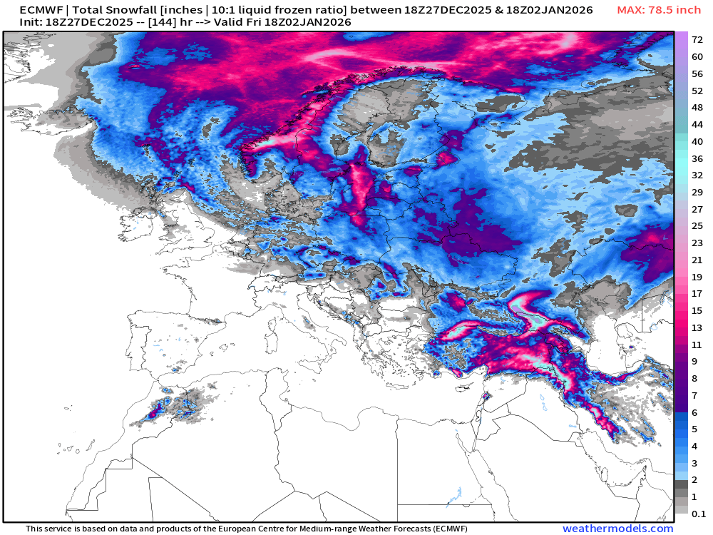
ECMWF 18z | Snowfall | Next 6-days | Lower 48 and Europe
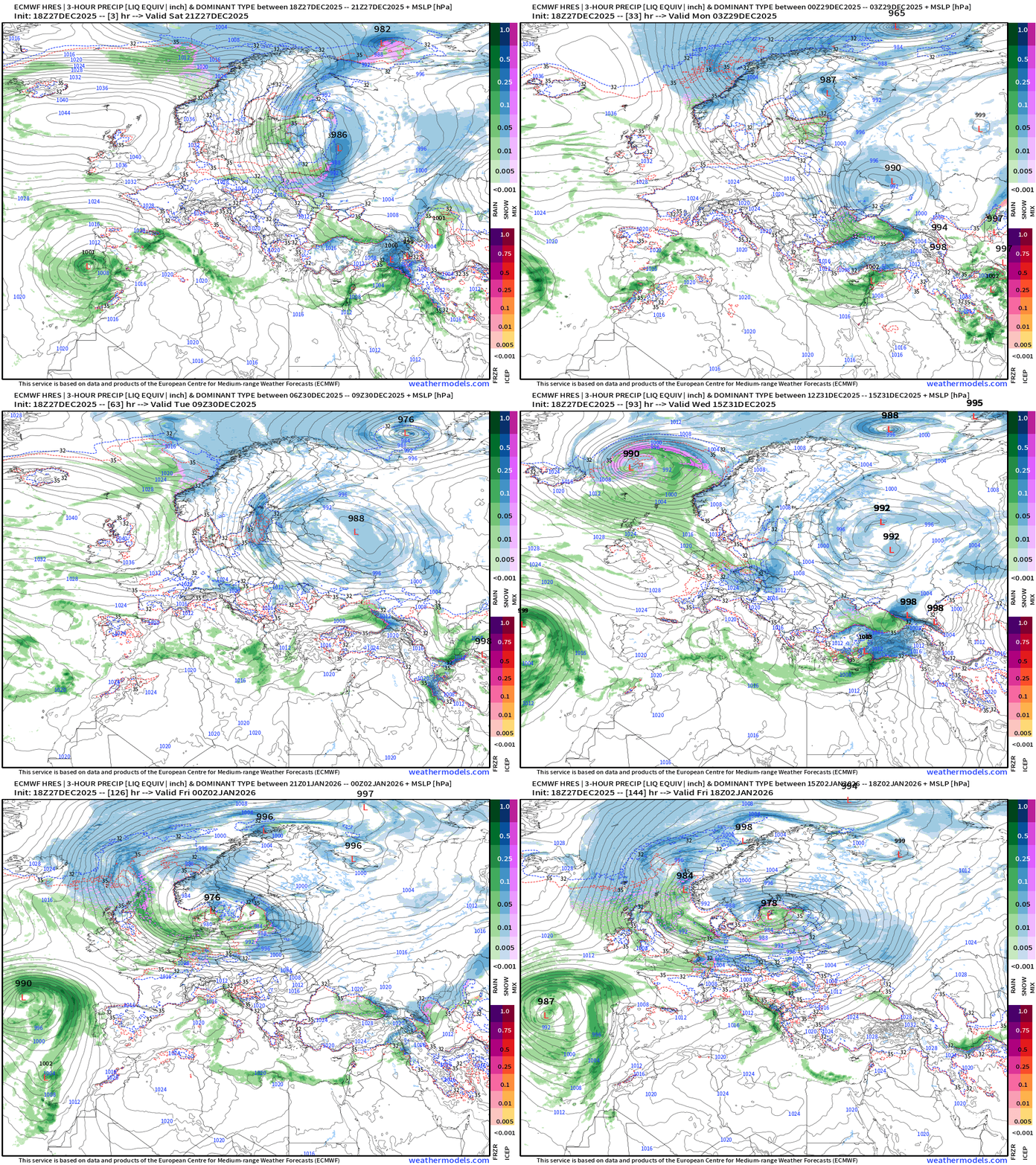
Europe Precipitation Type Next 6-days
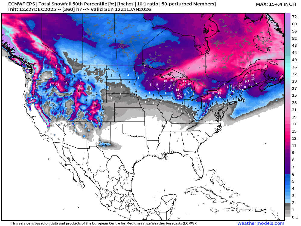
ECMWF EPS 12z | Ensemble Median Snowfall Next 15-days
Ensemble Maximum | Max Snowfall out of 51-members thru 15-days
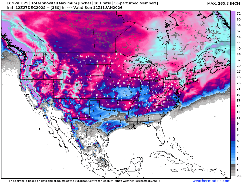
The actual chance of seeing accumulating snow somewhere in the Lower 48 is actually pretty small BUT not zero.
Probability of 1-inch or more Snowfall in the next 15-days
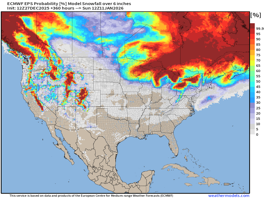
Probability of 6-inches or more Snowfall in the next 15-days
Temperature Anomaly | Next 15-days | ECMWF EPS 12z
5-Day Chunk #1 | Temperature Anomaly | Dec 27 - Dec 31
5-Day Chunk #2 | Temperature Anomaly | Jan 1 - Jan 5
5-Day Chunk #3 | Temperature Anomaly | Jan 6 - Jan 10
Maps sourced from weathermodels.com designed and innovated by yours truly! Please subscribe there for real-time access to the newest maps, charts from all of the weather models including ECMWF and AIFS, NOAA AI-GFS/AI-GEFS
Active coupon codes:
None. Please send a message or reply to this email for inquiries.
- Milepost
- 828 · laid 2025-12-28T02:46:29.674000Z
- Source
- https://weather.substack.com/p/december-27-2025-saturday-evening
- Digest
- 34d888c1c1a24e0ca1dfd45f9ebb4a6a1757c58bdcd7e6fe1e8a2076d09664d0
- Machine
- JSON