December 26, 2025 Friday Evening Winter Weather
Powerful Great Lakes Blizzard next major storm system with much colder air next week
December 2025 was the 5th-warmest December in the 131-year national record (1895–2025), at 37.8°F against a 1991–2020 normal of 34.3°F (+3.5°F).
December 2025 was the 37th-driest December in the 131-year national record (1895–2025), at 2.0in against a 1991–2020 normal of 2.5in (-0.5in).
NOAA/NCEI Climate at a Glance, contiguous United States. This is the observed record for the month, not a score of anything said in this piece — the forecast ledger begins 2026-08-17 and cannot reach earlier posts.

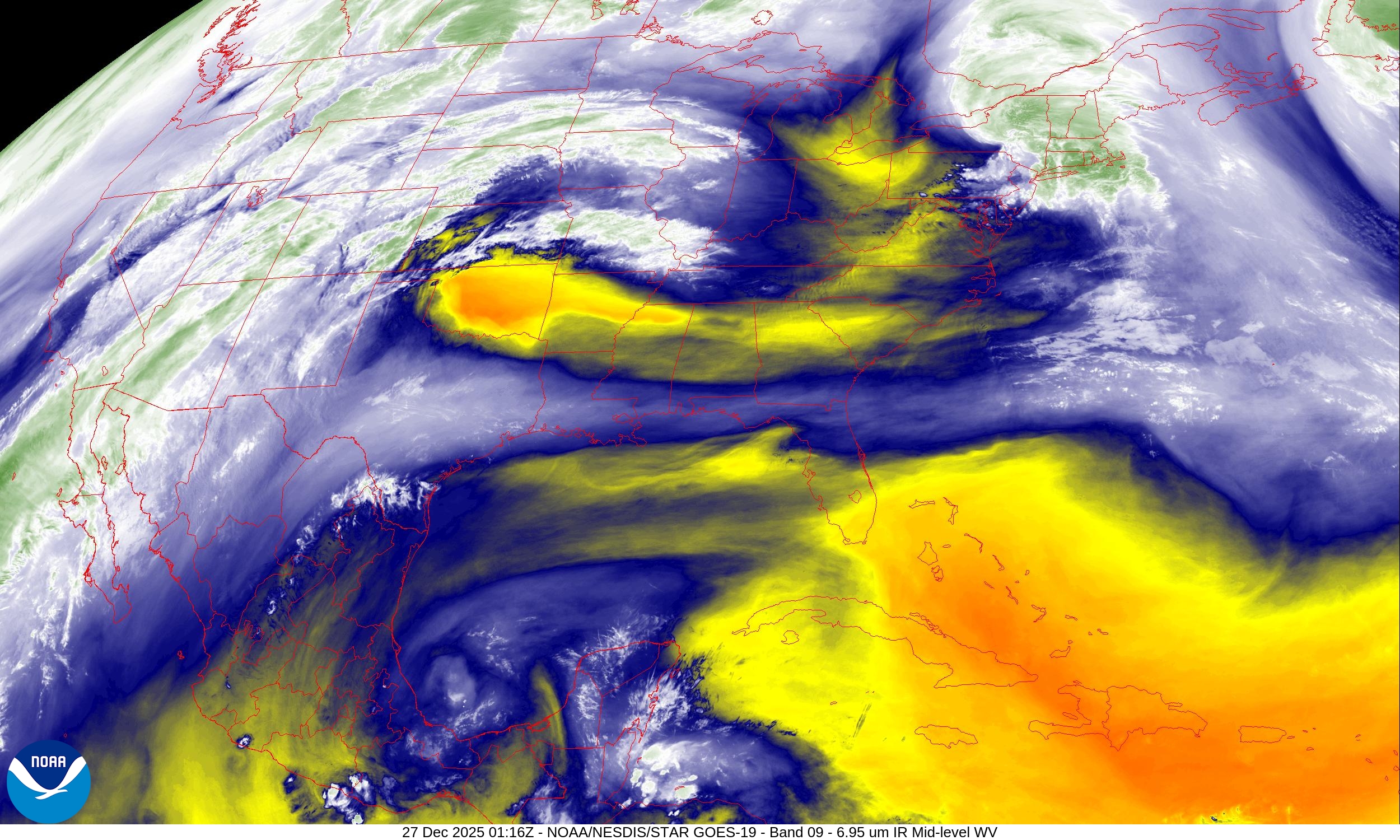
Simulated Radar Next 18-hours into Saturday Noon ET
Northeast storm system quickly moves off the coast taking its snow and sleet with it — but could still see some flurries or light snow showers in the morning
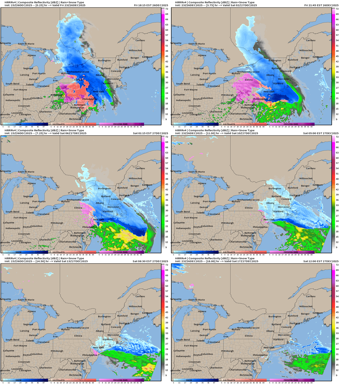
West Coast finally calms down with high pressure shutting off the Pacific moisture flow No complaints about the heavy snowfall in the Rockies even with “above normal” temperatures — it’s still snowing heavily at ski resorts that desperately need it.
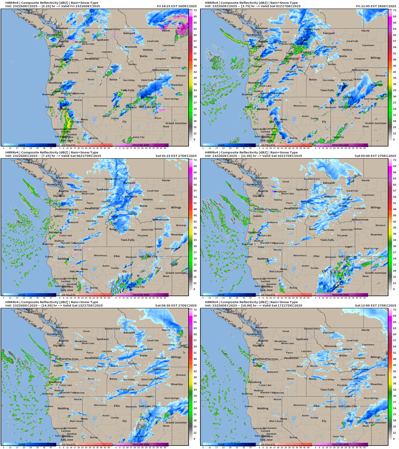
Headlines Friday Evening
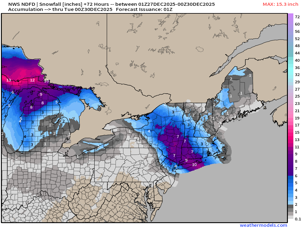
Winter storm warnings across the Northeast with a “snow emergency” up in New York City — with heavy snowfall and sleet blanketing roadways.
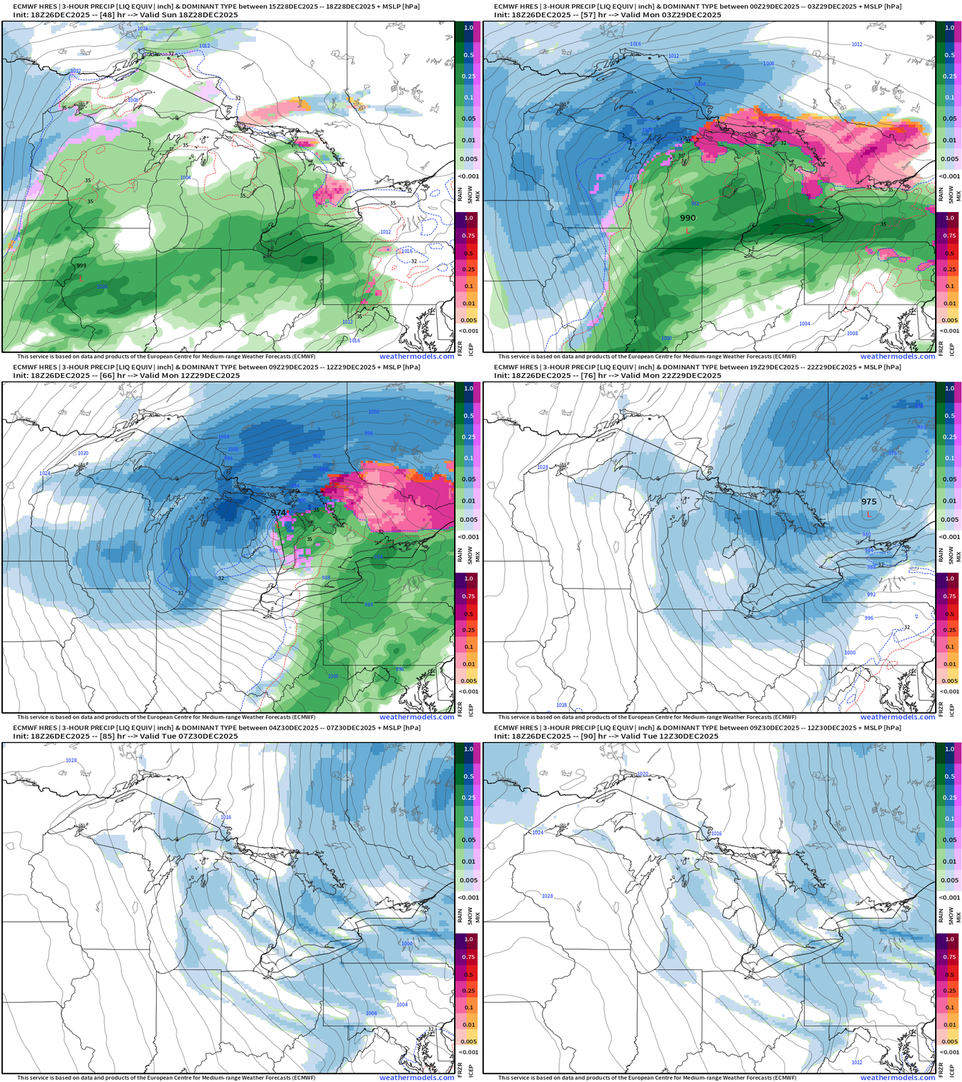
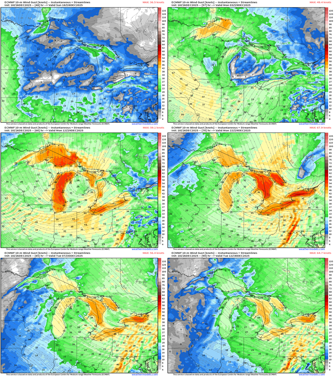
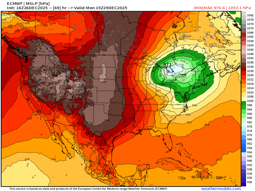
Powerful “bomb cyclone” blizzard now scheduled for Sunday/Monday across the Great Lakes with central pressure around 971 mb —> gusty winds > 60 mph possible in Michigan. Yikes!
Much colder air behind a cold front attached to this cyclone — which then tracks into Hudson Bay into mid-week becoming vertically stacked with a lobe of the Polar Vortex —> winter cold returns to the Eastern U.S. into next week
HRRR Simulated Radar Next 48-hours to Sunday 1 PM ET
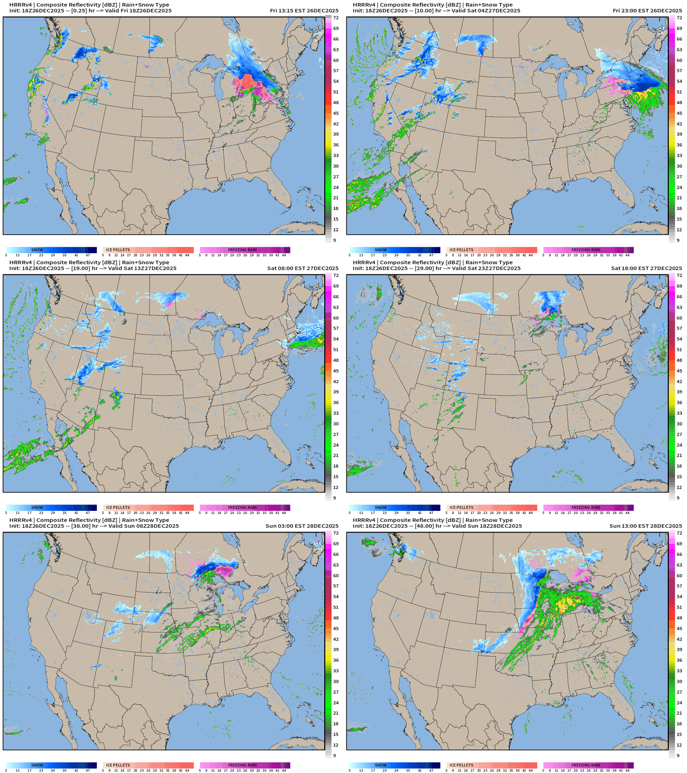
We see the formation of the storm system in the Great Lakes — impressive banding underway into Sunday afternoon.
RRFS-A at Monday 2 AM ET
ECMWF 18z Precipitable Water Next 6-days
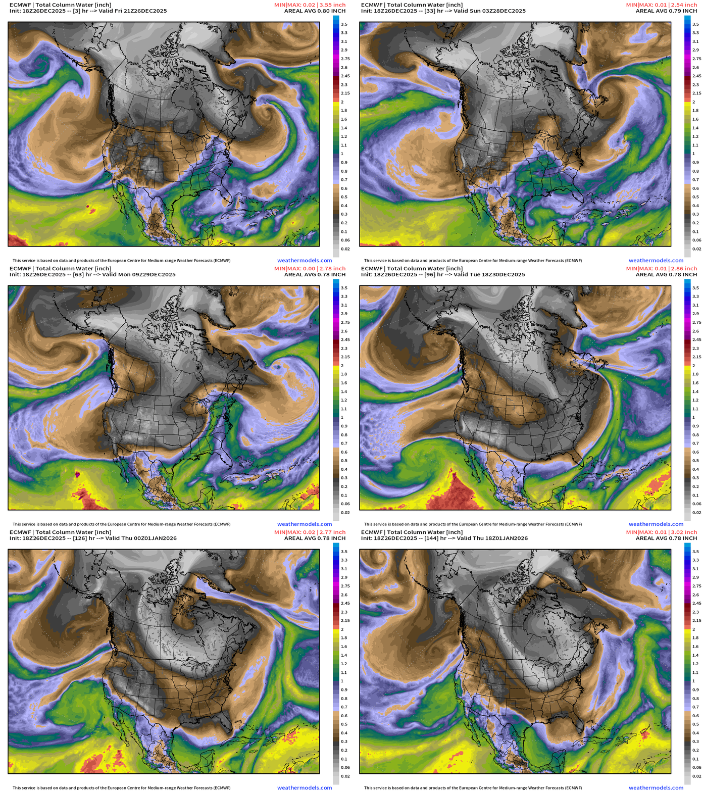
White/gray = Arctic air from Canada wraps around the “bomb cyclone” into middle of next week. The polar cold front sweeps through Florida.
A weird Subtropical System comes out of the Eastern Pacific northward into Southern California by Wednesday.
ECMWF 18Z MSLP Next 6-days
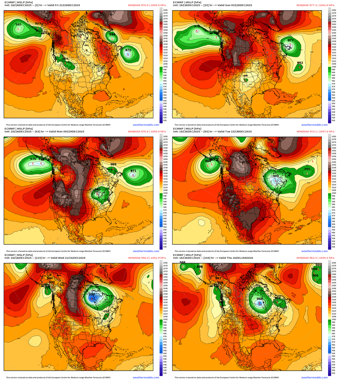
Long track of “bomb cyclone” to 955 mb in Quebec retrograde into Hudson Bay — maintains the cyclonic / cold circulation out of Canada into the Great Lakes.
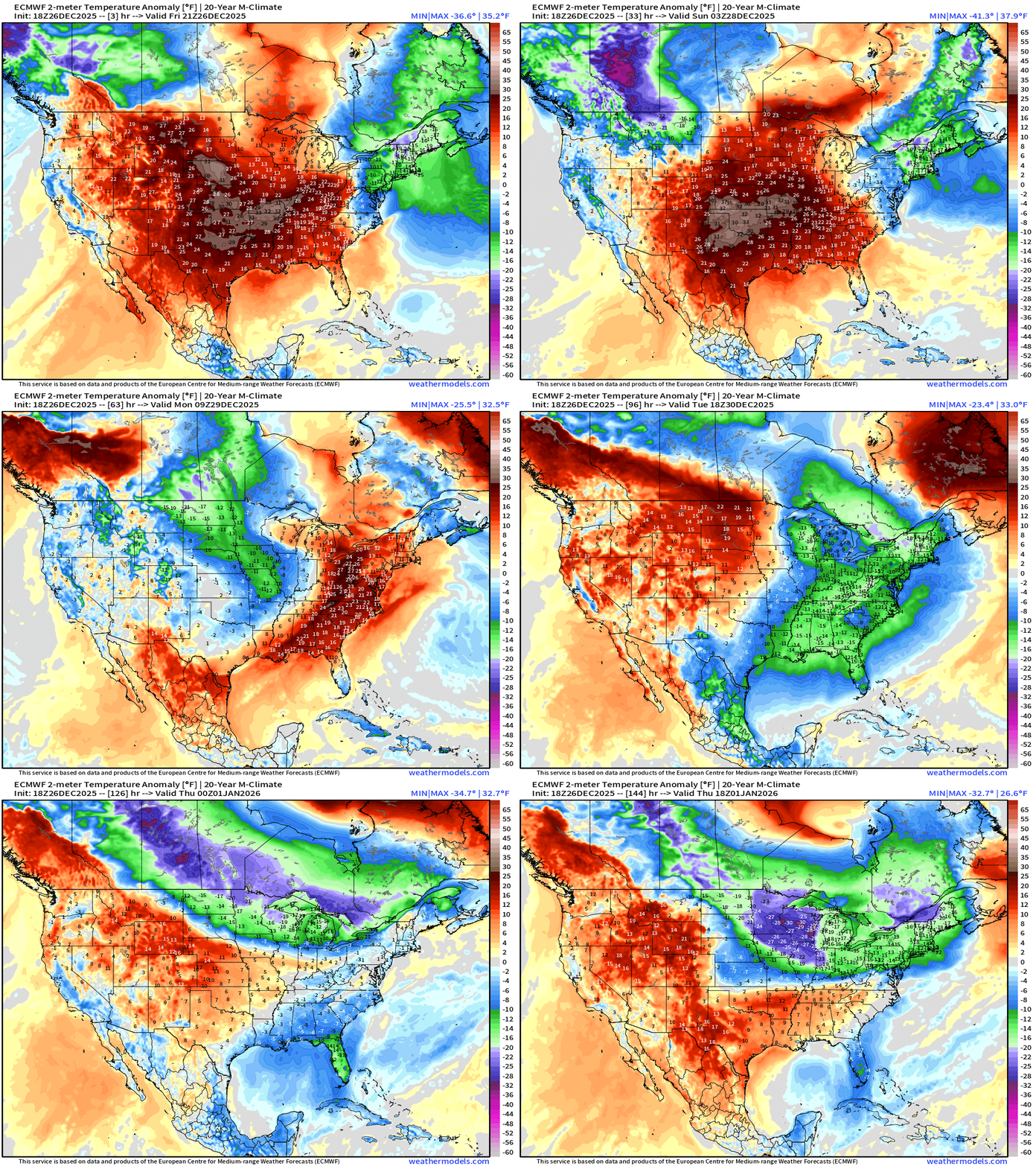
Temperature Anomaly Next 6-days
ECMWF 18z Precipitation Type and Intensity | Next 6-days
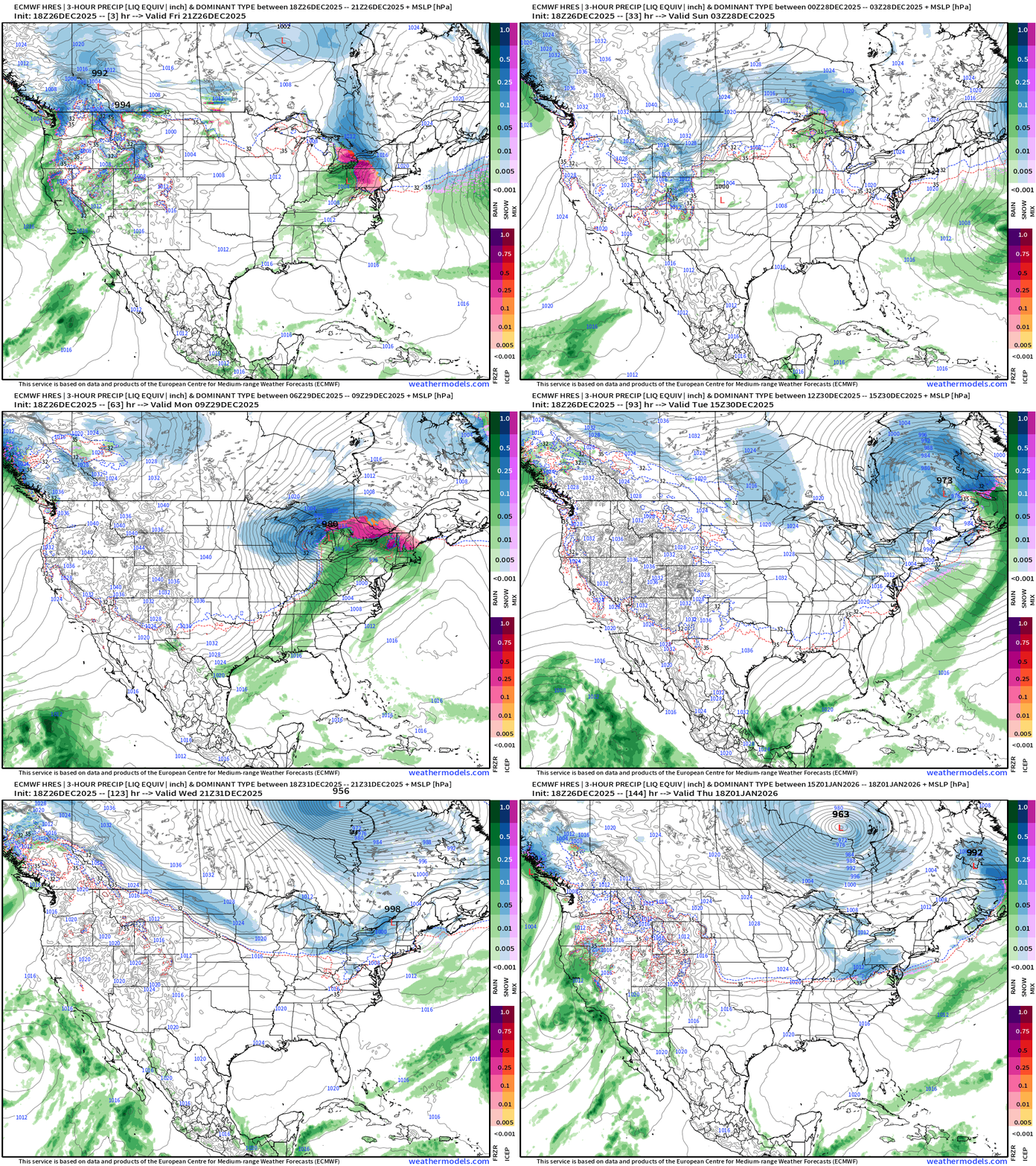
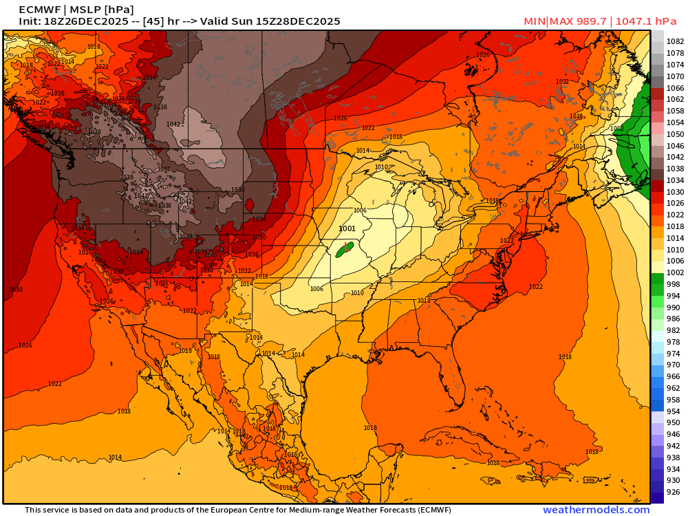
Powerful Great Lakes Bomb Cyclone
Wind Gusts | Sunday —> Monday
Sunday 10 AM —> 1001 mb
Monday 10 AM —> 971 mb = 30 mb pressure drop in 24-hours = bomb!
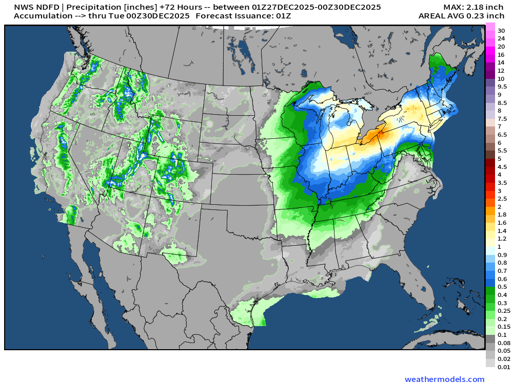
NWS Precipitation Next 72-hours
NWS Snowfall Next 72-hours
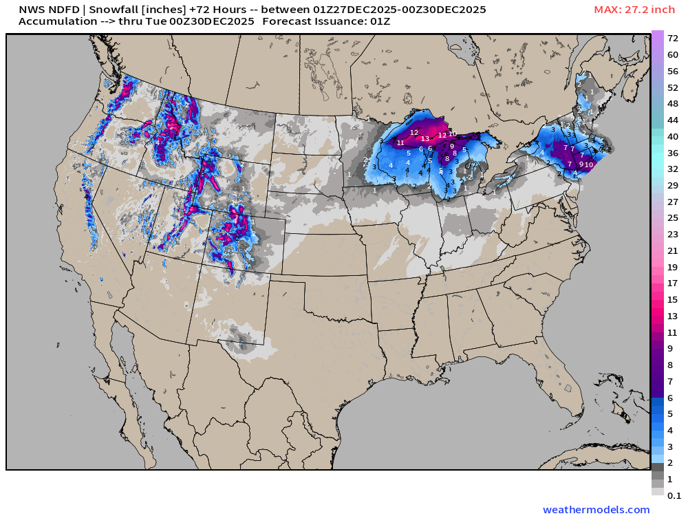
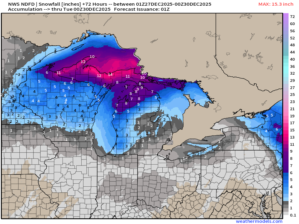
Northeast snowfall is the ongoing event.
RTMA | Current Temperature Analysis | 7:00 PM ET
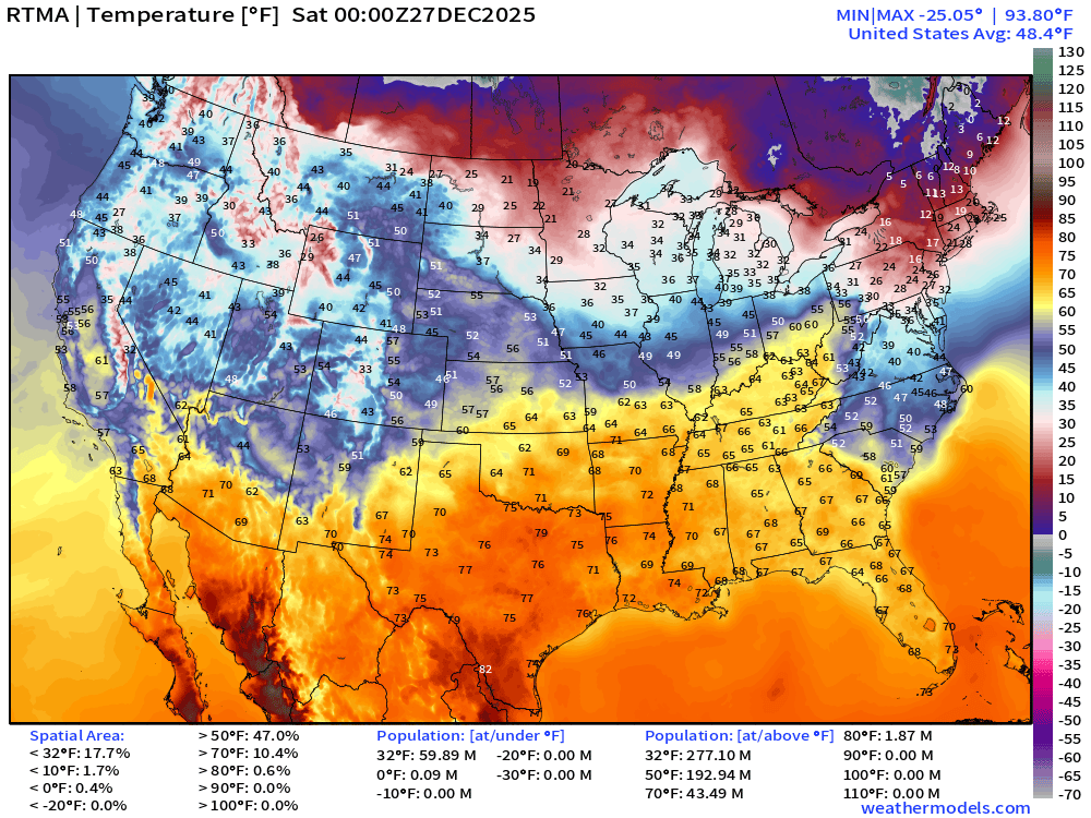
Average Lower 48 temperature was 48.4°F with 60 million below freezing.
Temperature Anomaly | 7:00 PM ET
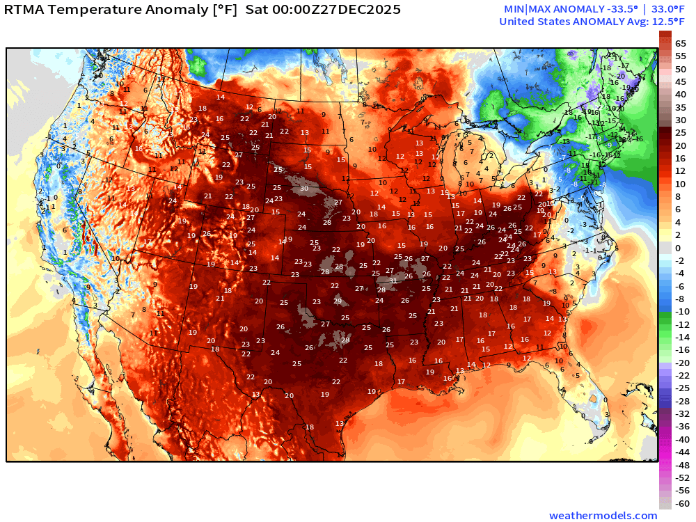
Lower 48 Temperature Anomaly whopping 12.5°F ABOVE normal
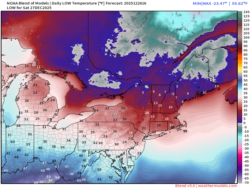
Saturday Morning Low Temperatures
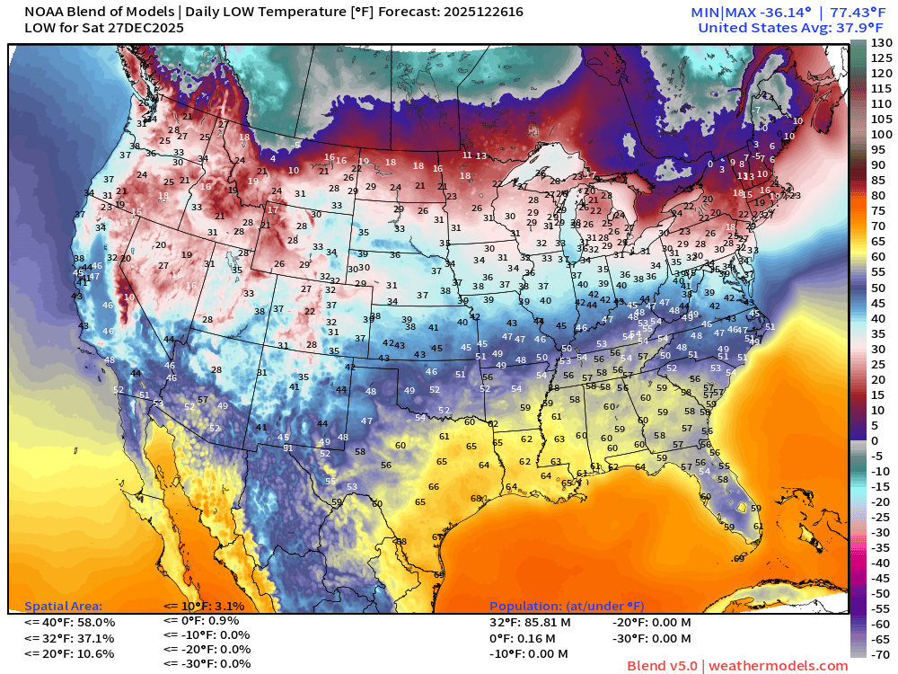
86 million below freezing and a small area of subzero in Maine
Saturday High Temperatures
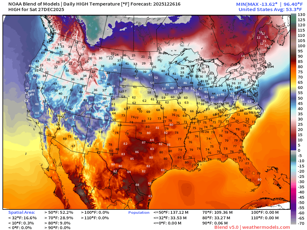
109 million at least 70°F —> nationwide average of 53°F.
Sunday High Temperatures
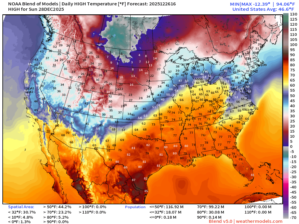
99 million at least 70°F —> nationwide average of 46.6°F.
Monday High Temperatures
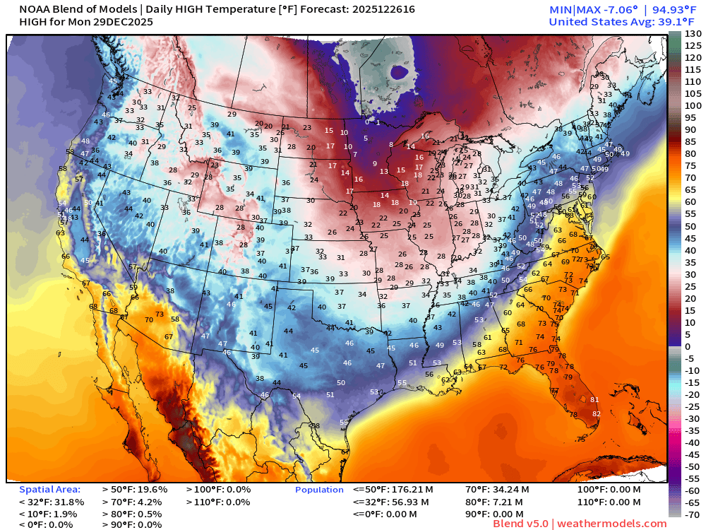
Only 34 million at least 70°F —> nationwide average of 39.1°F
ECMWF 12z EPS | Temperature Anomaly | Next 15-days
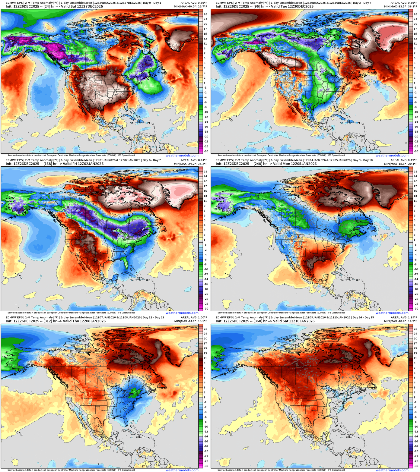
Alaska + Canadian Cold Pool drains ESE into the Midwest and Great Lakes next week and it seems the Lower 48 ridge will weaken — allowing a southward push of the “polar front” — Canada finally warms up into 2nd week of January
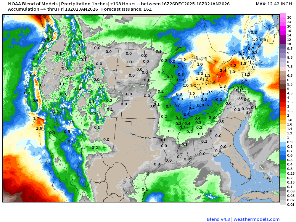
Blend of Models | 7 Days Precipitation Total
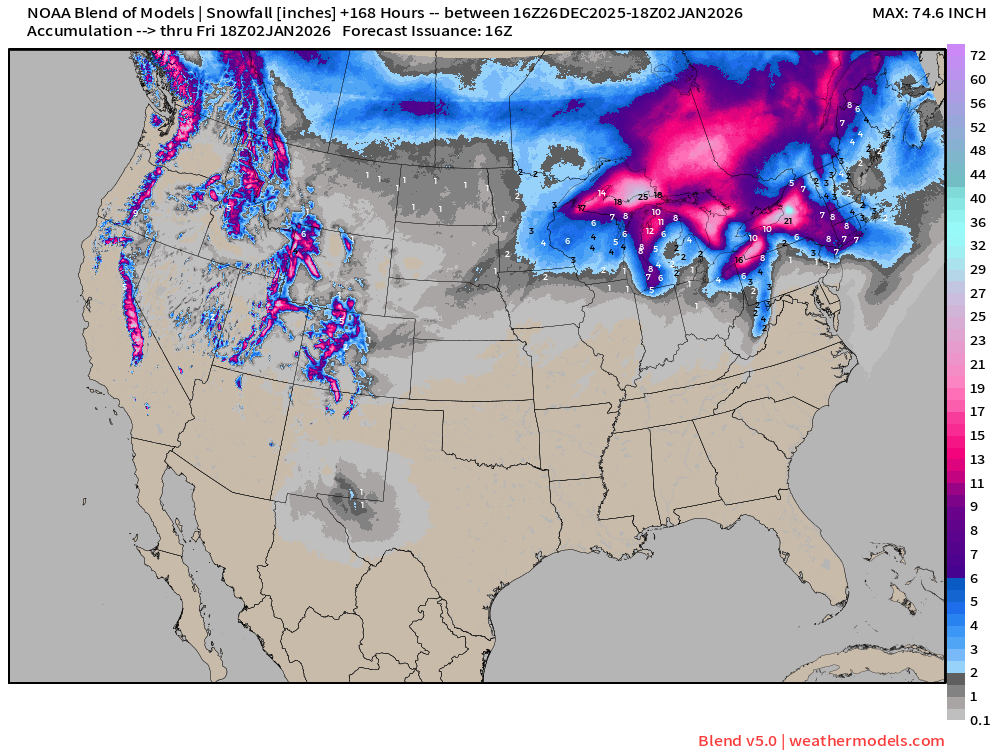
Blend of Models | Total Snowfall Next 7-Days
ECMWF AIFS-Single 18z | Height Anomaly (500 hPa) Next 10-days
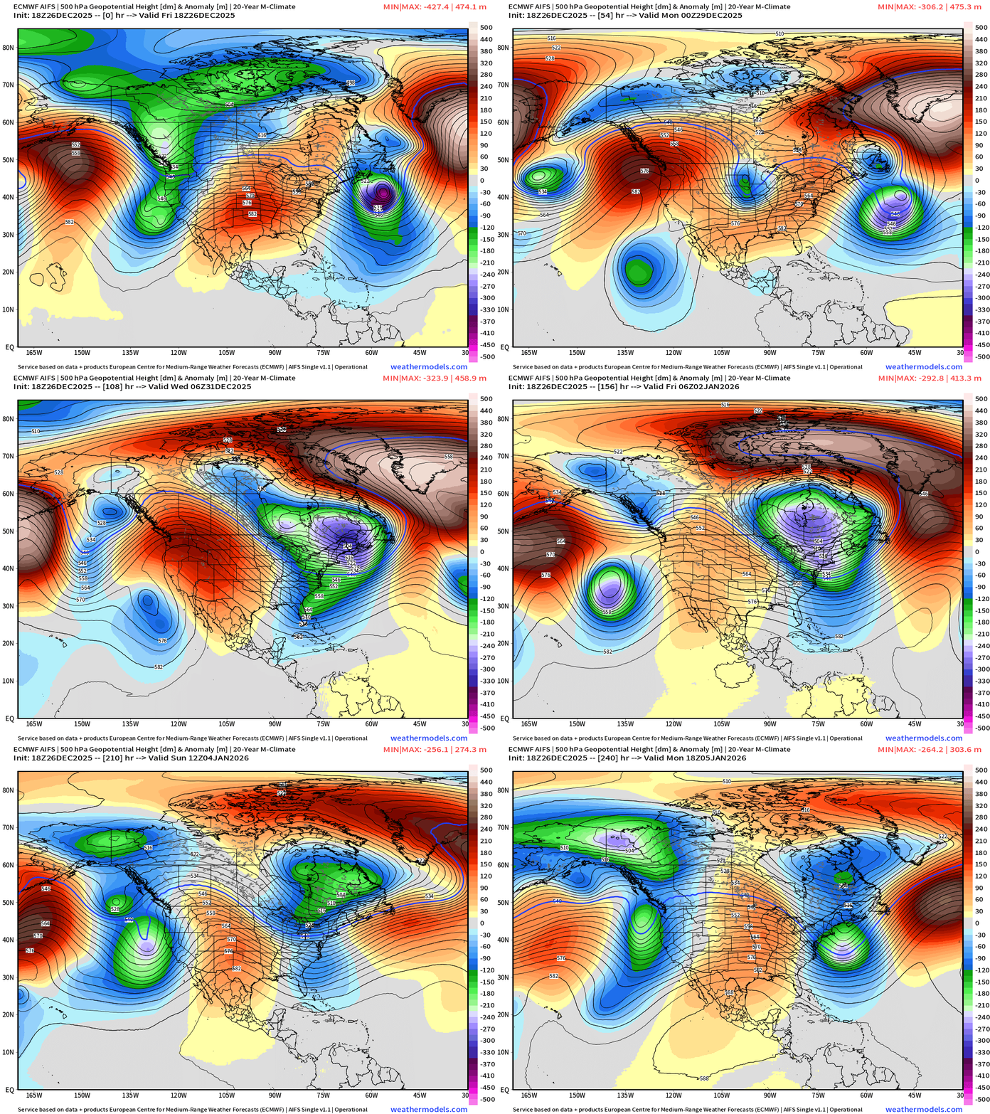
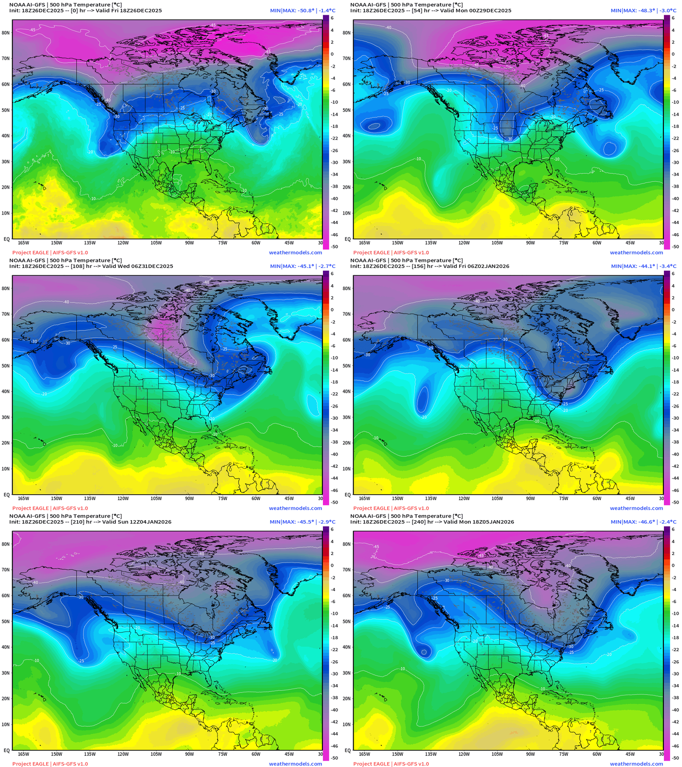
Major trough across Northeast for multiple days Wed-Friday of next week —> much colder air with cyclone wrapping up —> textbook baroclinic lifecycle
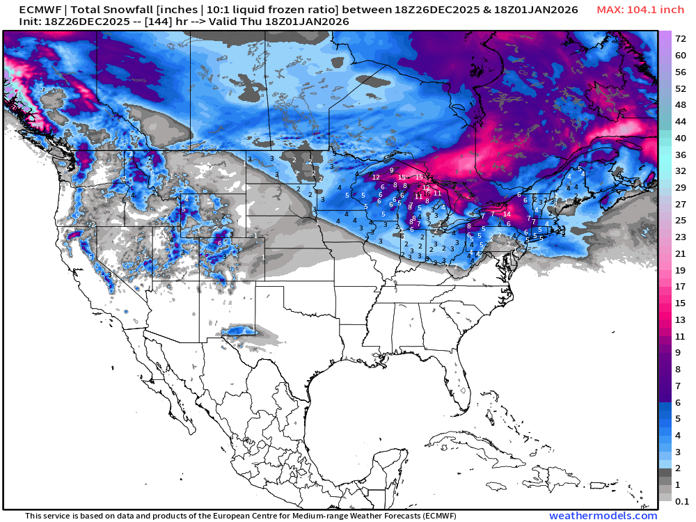
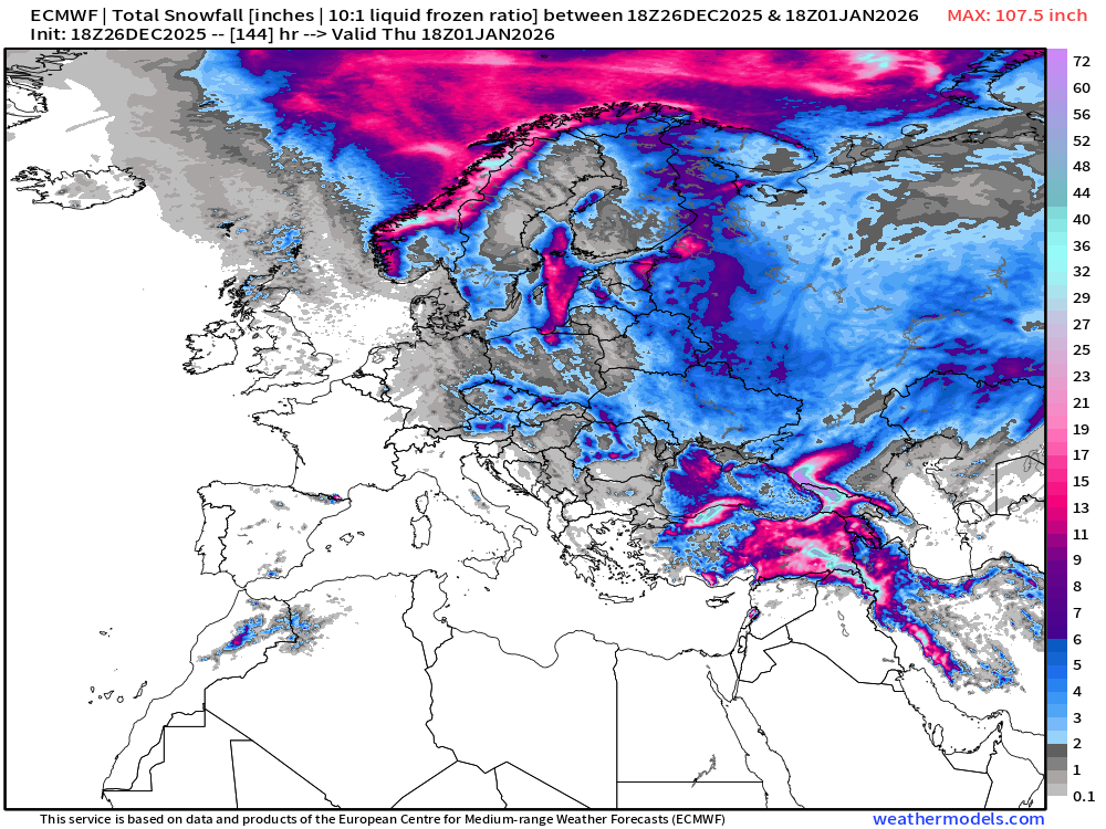
ECMWF 18z | Snowfall | Next 6-days | Lower 48 and Europe
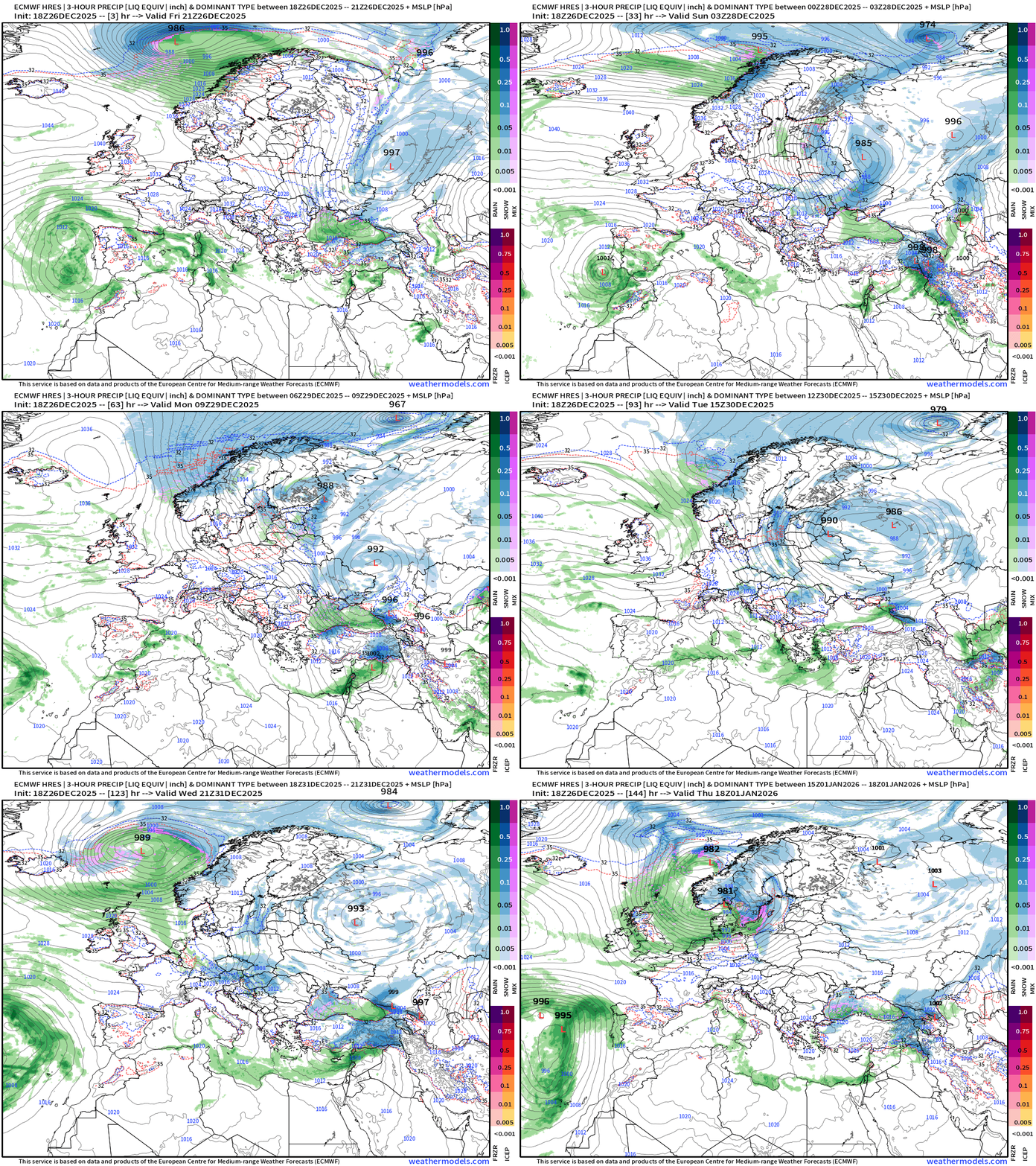
Europe Precipitation Type Next 6-days
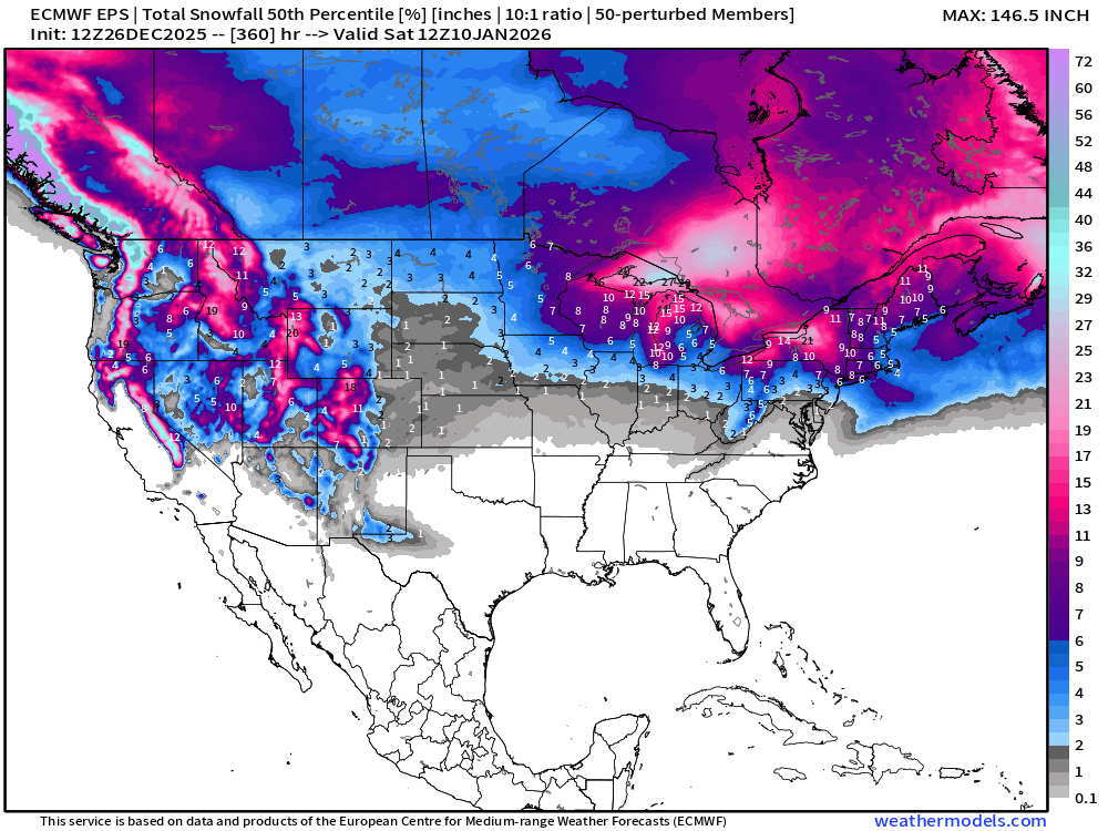
ECMWF EPS 12z | Ensemble Median Snowfall Next 15-days
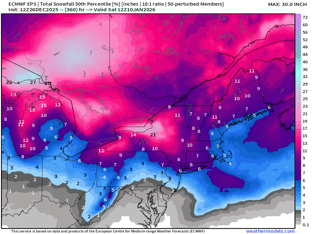
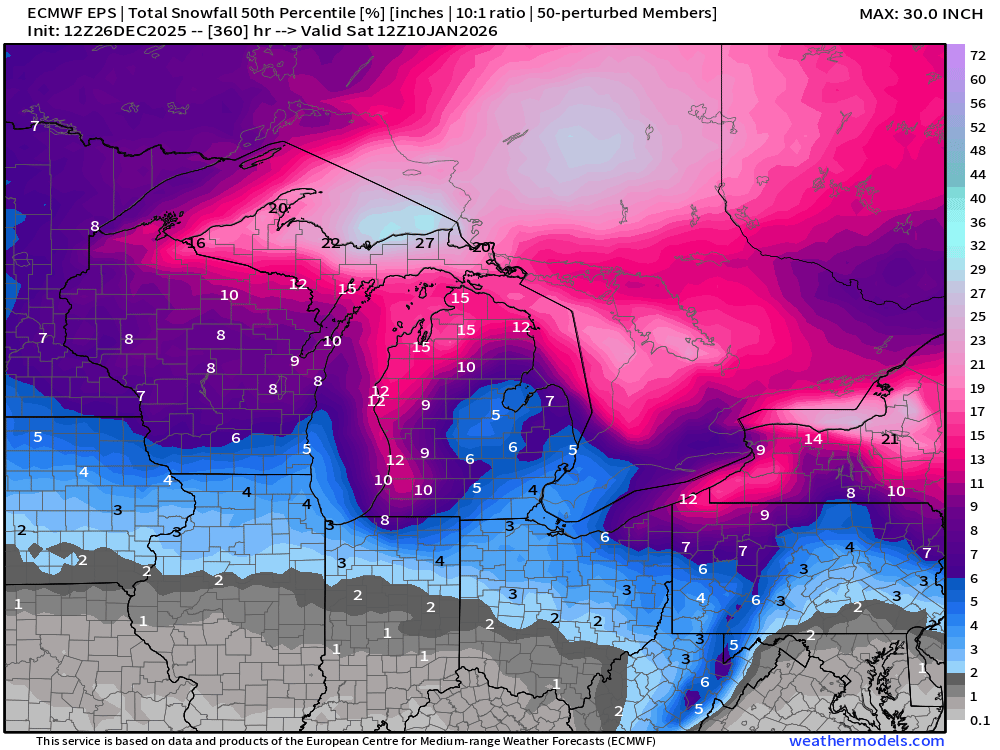
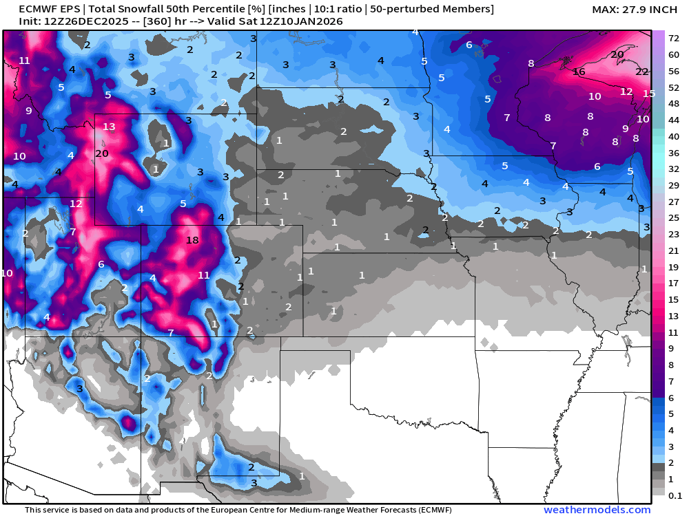
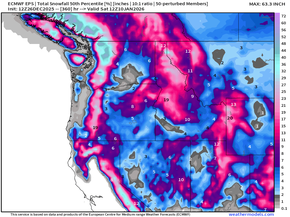
Probability of 6-inches or more Snowfall in the next 15-days
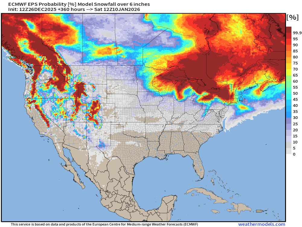
Probability of 12-inches or more Snowfall in the next 15-days
Temperature Anomaly | Next 15-days | ECMWF EPS 12z
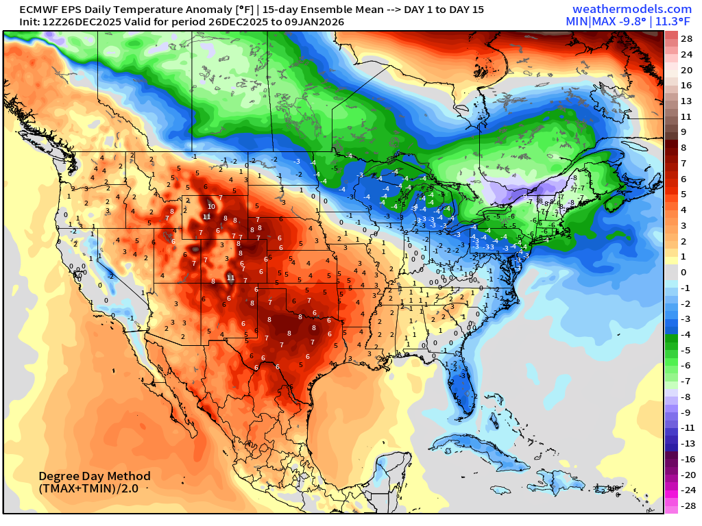
5-Day Chunk #1 | Temperature Anomaly | Dec 26 - Dec 30
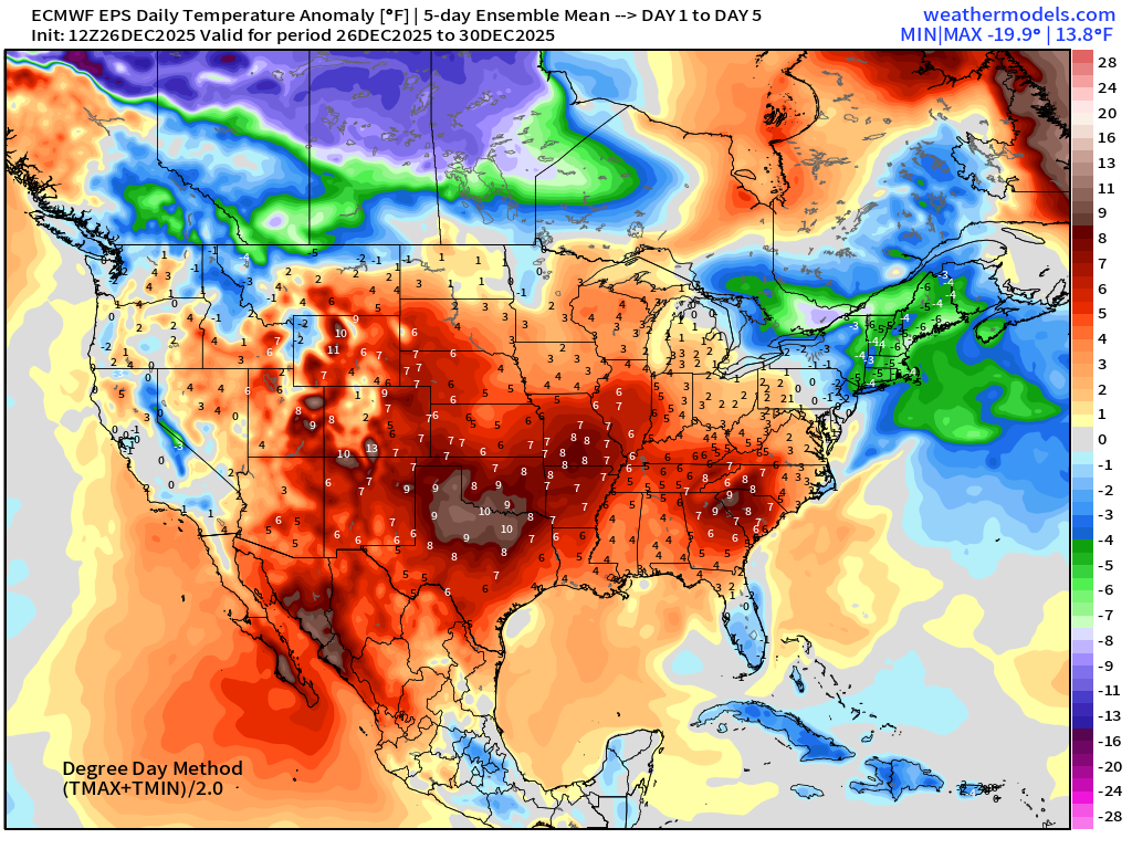
5-Day Chunk #2 | Temperature Anomaly | Dec 31 - Jan 4
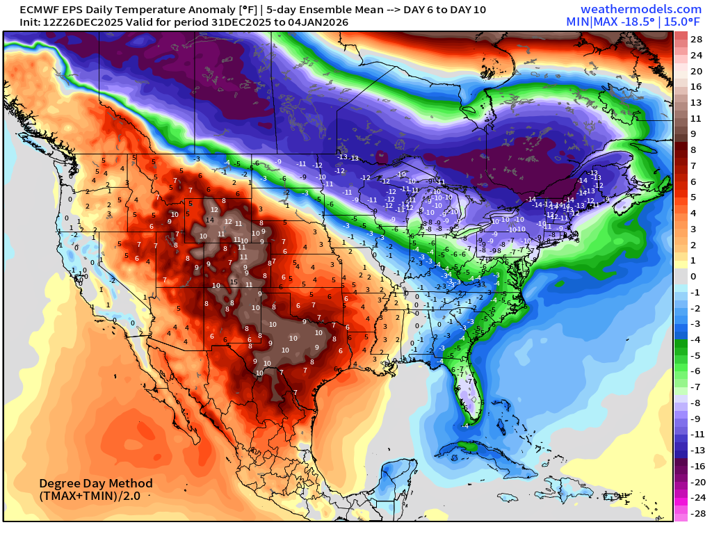
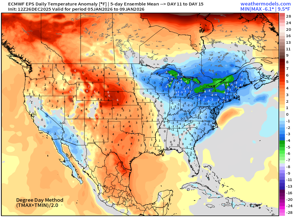
5-Day Chunk #3 | Temperature Anomaly | Jan 5 - Jan 9
Maps sourced from weathermodels.com designed and innovated by yours truly! Please subscribe there for real-time access to the newest maps, charts from all of the weather models including ECMWF and AIFS, NOAA AI-GFS/AI-GEFS
Active coupon codes:
None. Please send a message or reply to this email for inquiries.
- Milepost
- 827 · laid 2025-12-27T01:45:40.310000Z
- Source
- https://weather.substack.com/p/december-26-2025-friday-evening-winter
- Digest
- 450d87ef92f2d5a882b24a65b444a4ea0e3fd1ced3287c4e1e21f9cdfedfd9aa
- Machine
- JSON