December 25, 2025 Merry Christmas
Significant snowfall into early Saturday across Northeast
December 2025 was the 5th-warmest December in the 131-year national record (1895–2025), at 37.8°F against a 1991–2020 normal of 34.3°F (+3.5°F).
December 2025 was the 37th-driest December in the 131-year national record (1895–2025), at 2.0in against a 1991–2020 normal of 2.5in (-0.5in).
NOAA/NCEI Climate at a Glance, contiguous United States. This is the observed record for the month, not a score of anything said in this piece — the forecast ledger begins 2026-08-17 and cannot reach earlier posts.

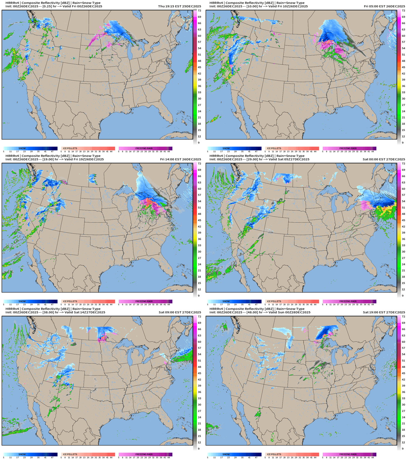
Simulated Radar Next 48-hours into Saturday Evening 7 pm ET
Headlines Thursday Evening
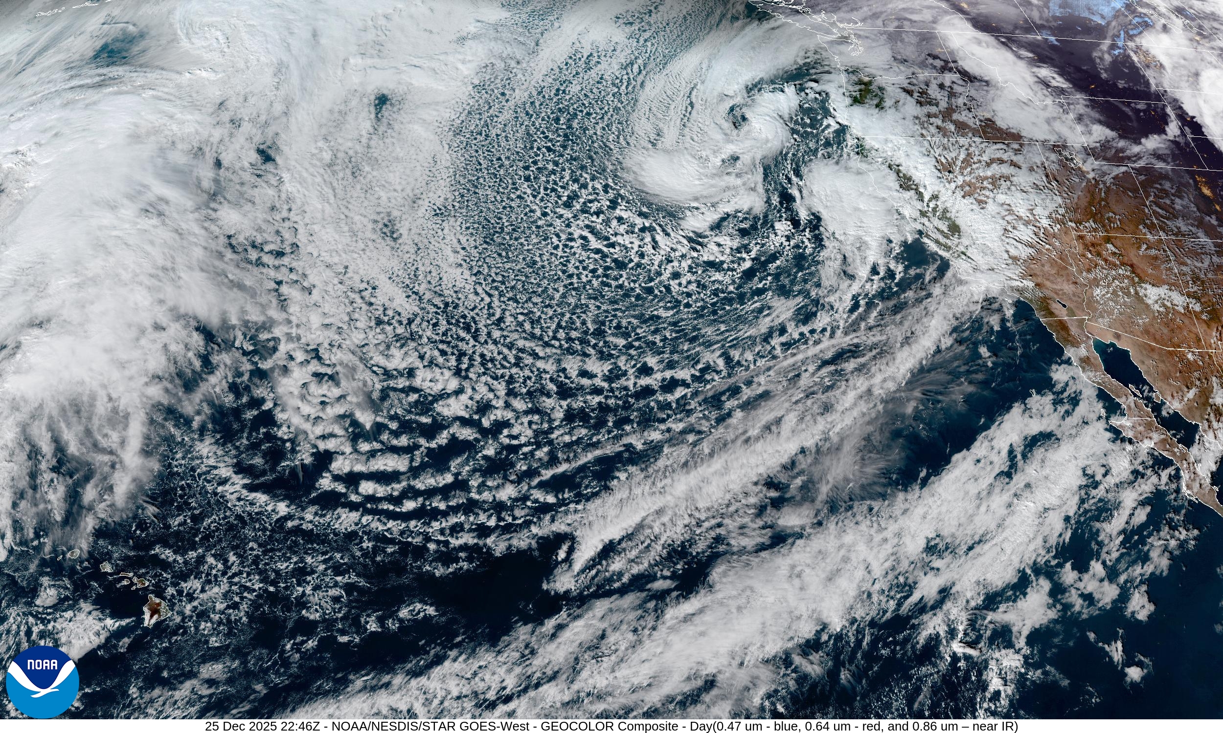
Powerful West Coast storm system battering California with rain/snow finally winding down Saturday
Winter storm quickly tracks from Great Lakes on Friday —> arriving in Northeast including NYC by evening. Heavy snowfall to the north / freezing rain (ice) to the south of frontal boundary.
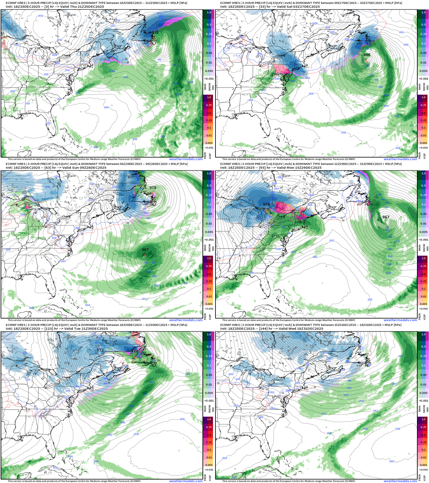
Quite the parade of storm systems across the Northeast U.S.
ECMWF 18z Precipitable Water Next 6-days
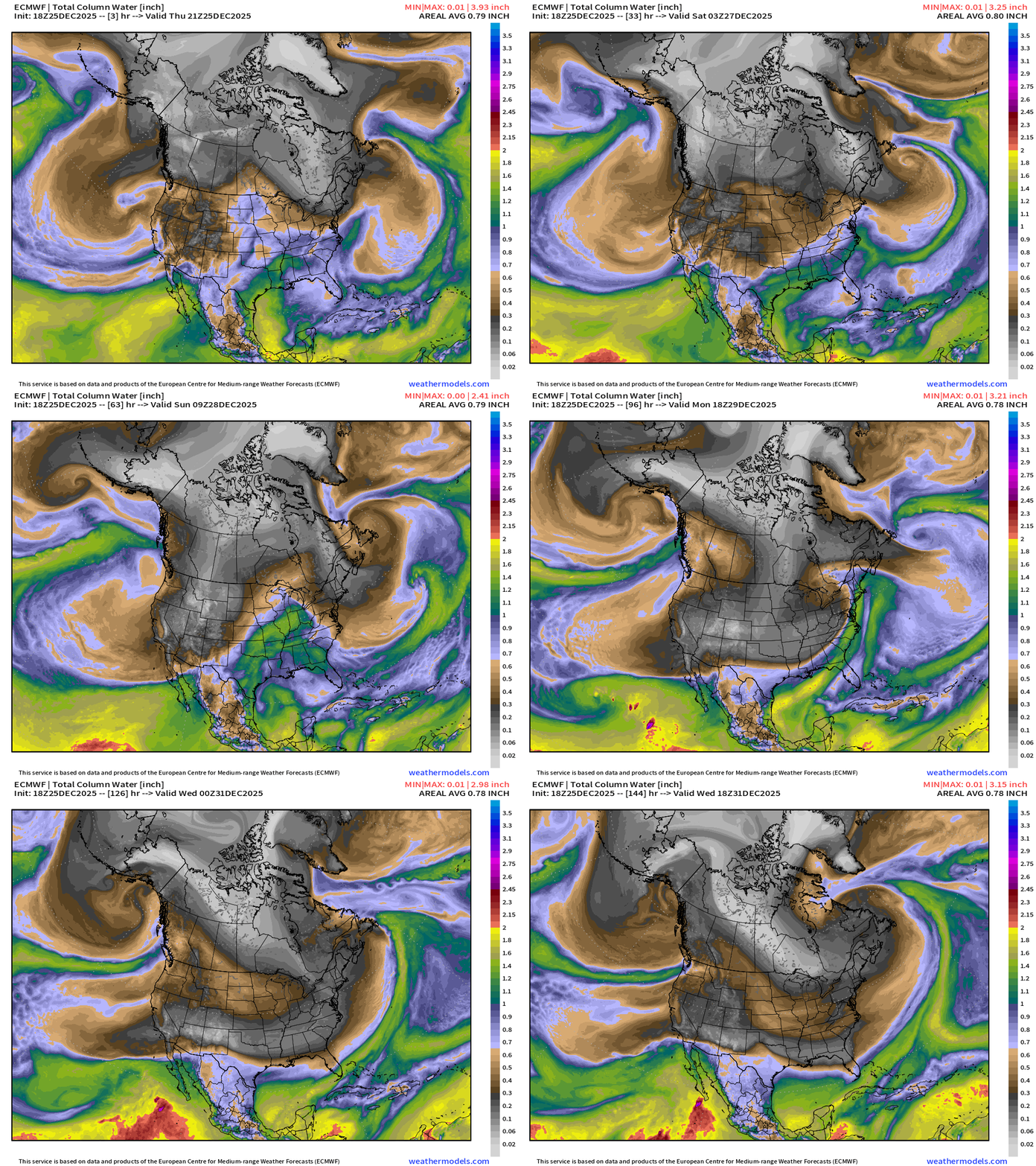
Powerful Gulf of Alaska low pressure will direct plume of moisture into Alaskan panhandle as high pressure takes over California into the weekend
Friday storm system — part of a parade of low-pressure centers that rotate cyclonically around Quebec
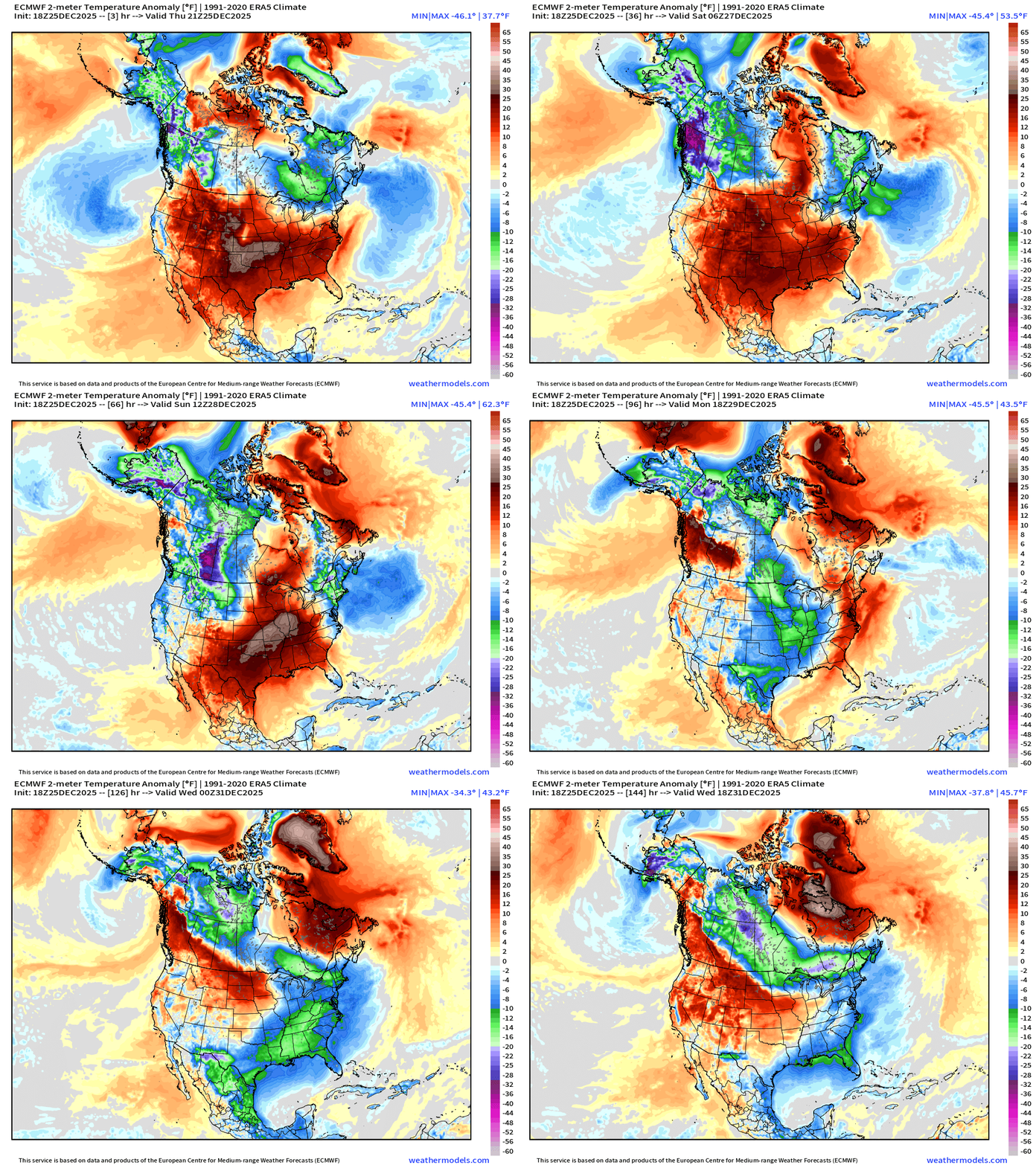
Temperature Anomaly Next 6-days
ECMWF 18z Precipitation Type and Intensity | Next 6-days
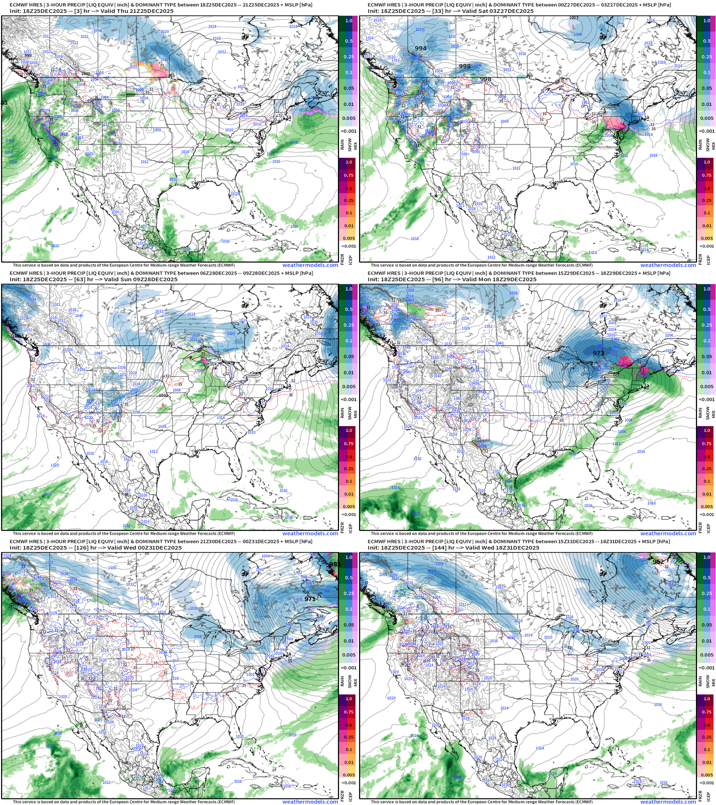
Larger continental view —> main storm track remains across Southern Canada — more so like Clipper systems but they have moisture from the Pacific atmospheric rivers for some precipitation (snow) across the Great Lakes (+Lake Effect) and the Northeast this weekend … but that might not be as substantial as previous thought.
West Coast cyclone — Next 48-hours
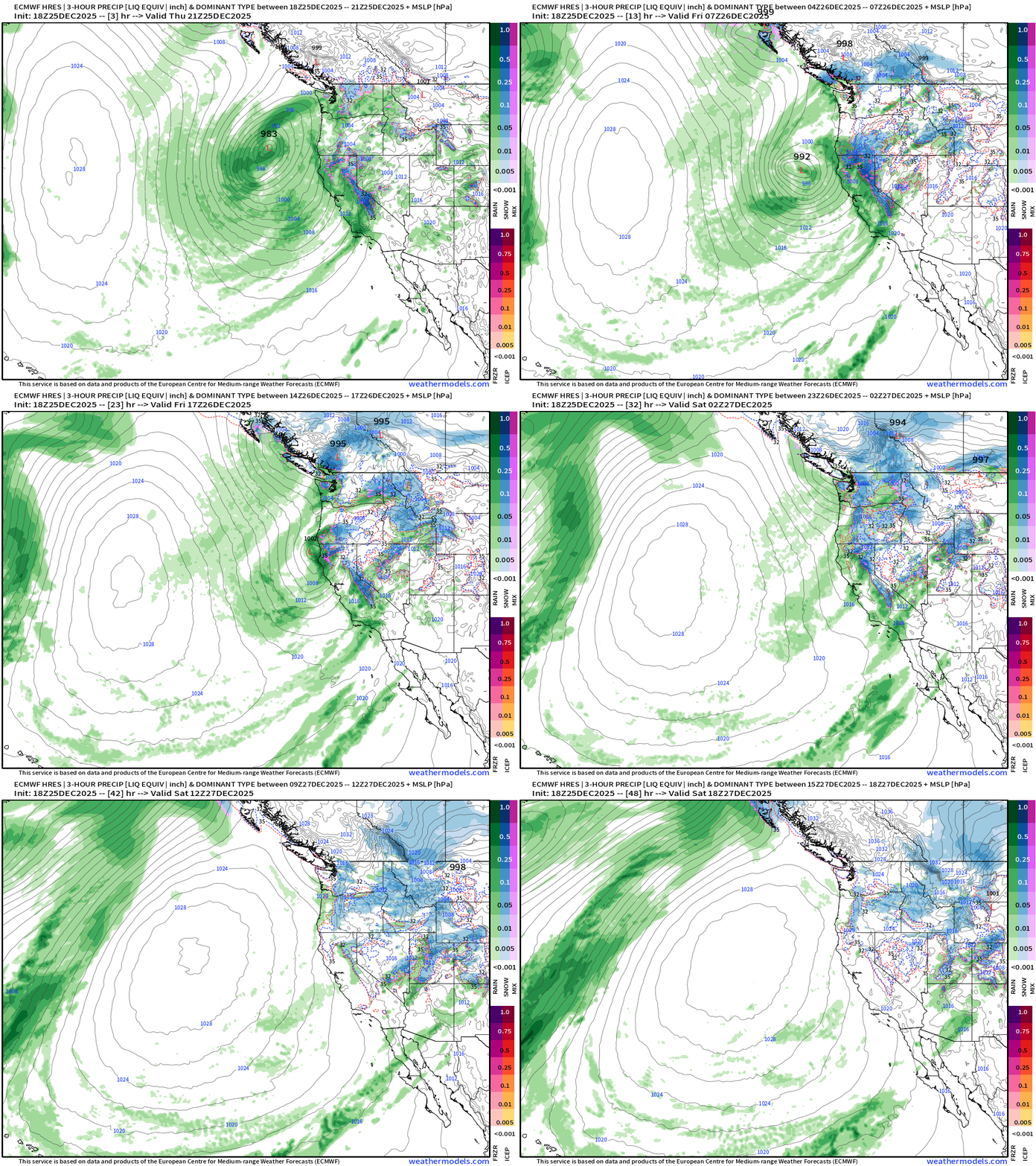
Storm system makes landfall in North California while continuing to weaken
18z Analysis: West Coast cyclone — 982 mb within the upper-level low
Eastern U.S. Storm Systems | Friday into Saturday
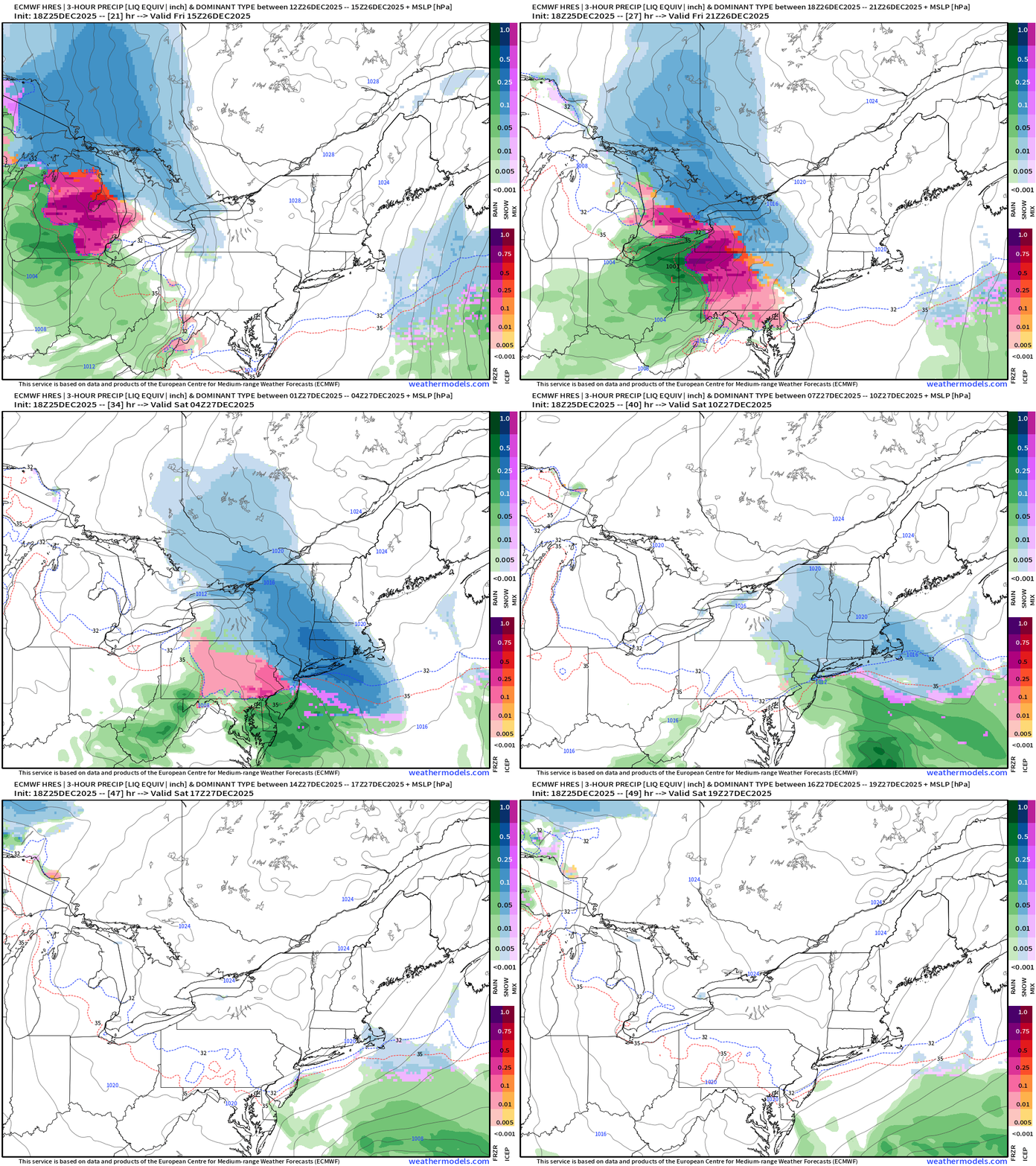
Cold air behind this storm means any snow that fall should stick around all weekend, and melt later on Monday
Accumulated Snowfall by P-Type + Estimated Snowfall from SLR
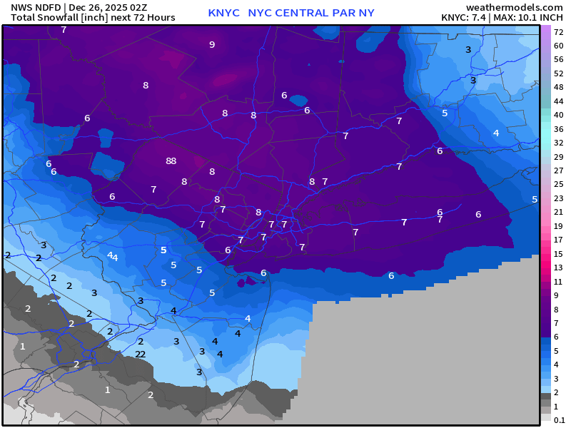
All systems go for 6” to 8” of snowfall across New York City
Multiple Storm Systems next 6-days — but avoiding a major blizzard
Weather Trader is an entirely subscriber-supported publication [sweat equity] from Dr. Ryan Maue. To receive all new posts, consider becoming a free [1-2 updates per week] or paid subscriber [golden ticket] and please LIKE and SHARE posts.
NWS Precipitation Next 72-hours
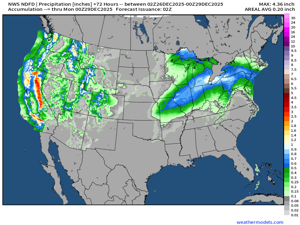
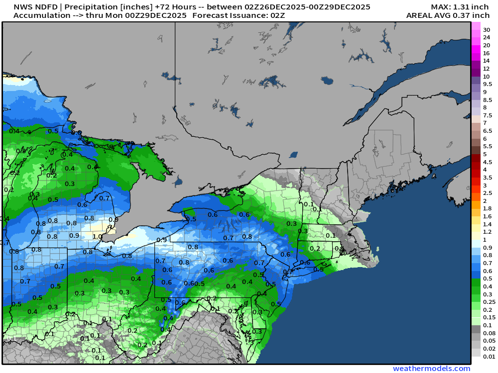
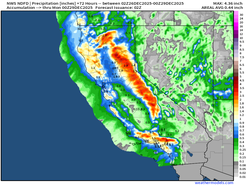
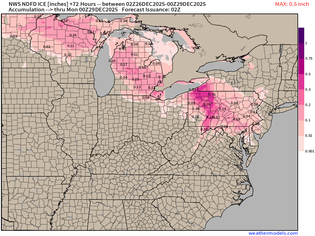
Accumulated Ice Next 3-days
NWS Snowfall Next 72-hours
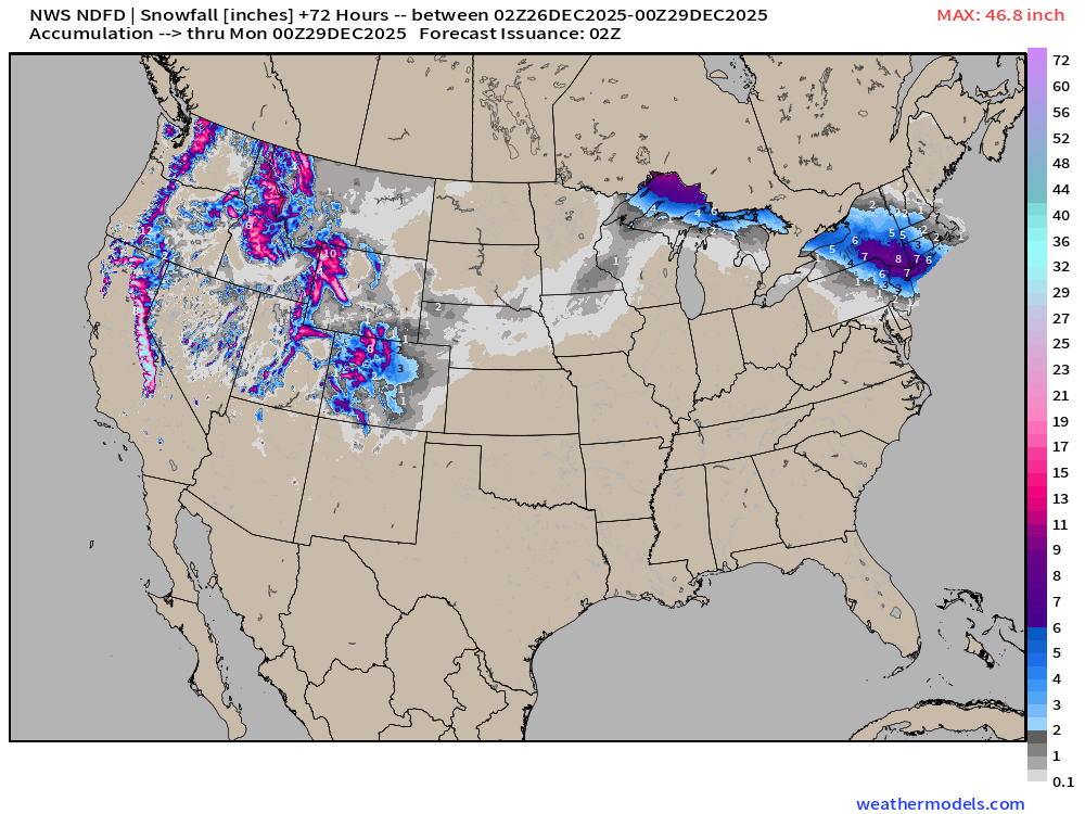
Snowfall returns to Colorado including Denver. Hooray, Roger!
7.4 inches in NYC | Forecast remarkably steady since yesterday
RTMA | Current Temperature Analysis | 9:00 PM ET
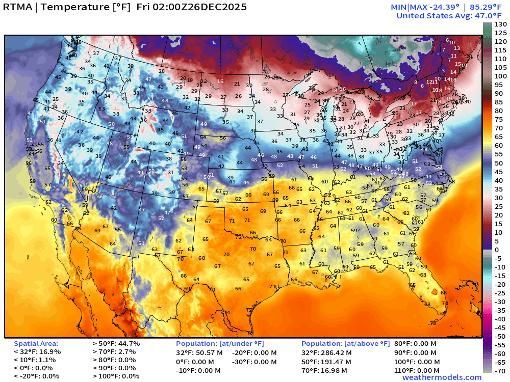
Average Lower 48 temperature was 47.0°F with 50 million below freezing.
Temperature Anomaly | 9:00 PM ET
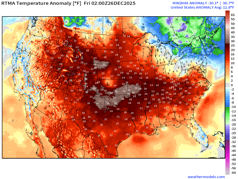
Lower 48 Temperature Anomaly was scorching 12.8°F ABOVE normal
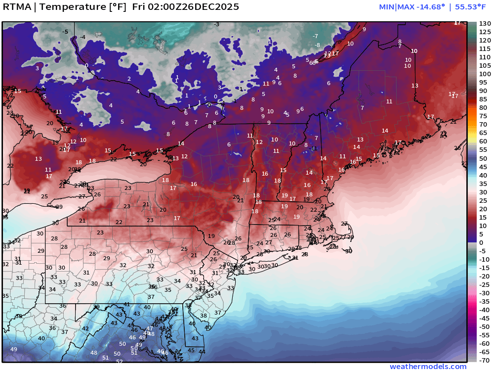
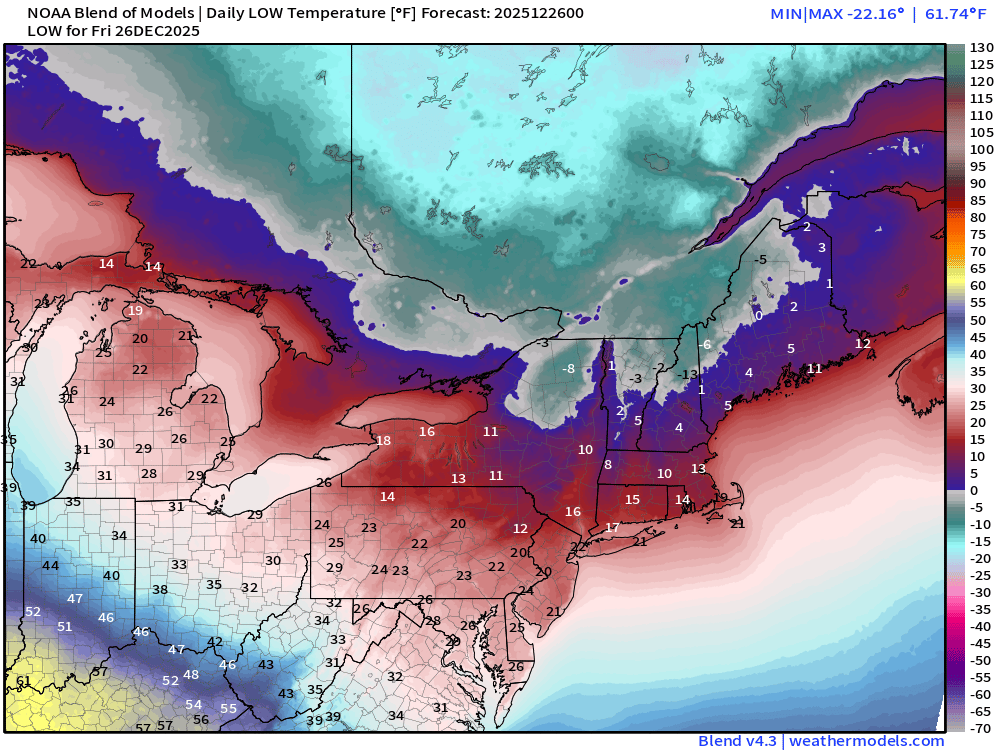
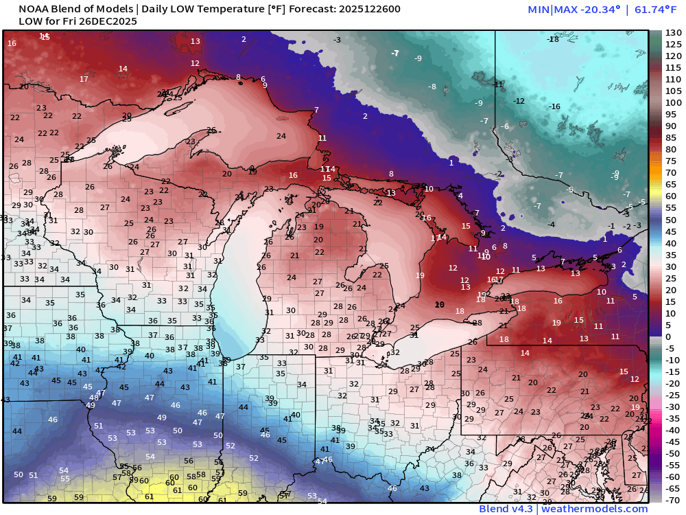
Friday Morning Low Temperatures
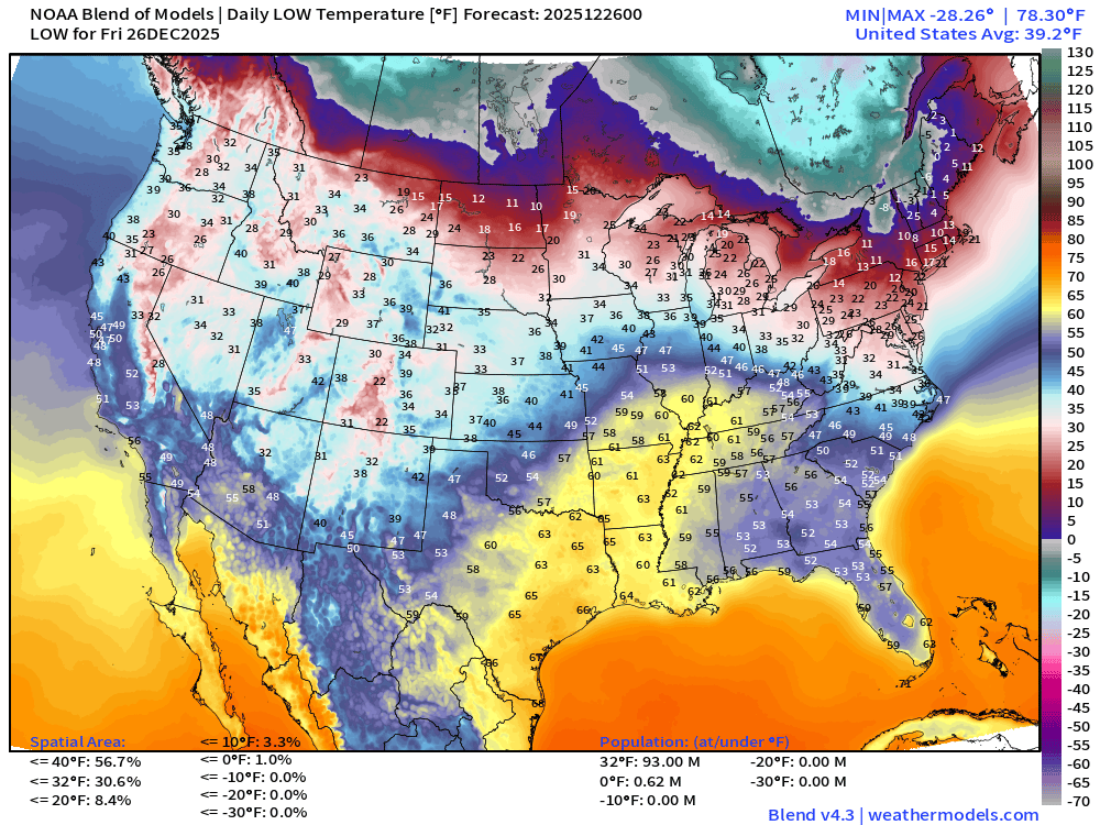
93 million below freezing and a small area of subzero in New England
Friday High Temperatures
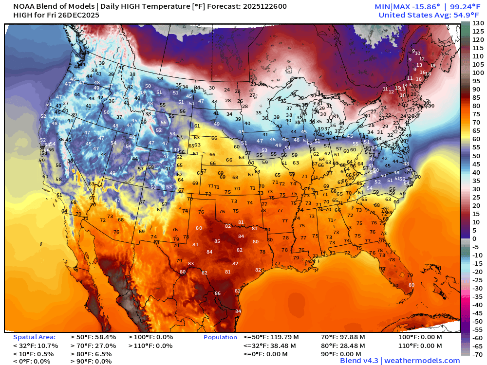
98 million at least 70°F —> nationwide average of 55°F.
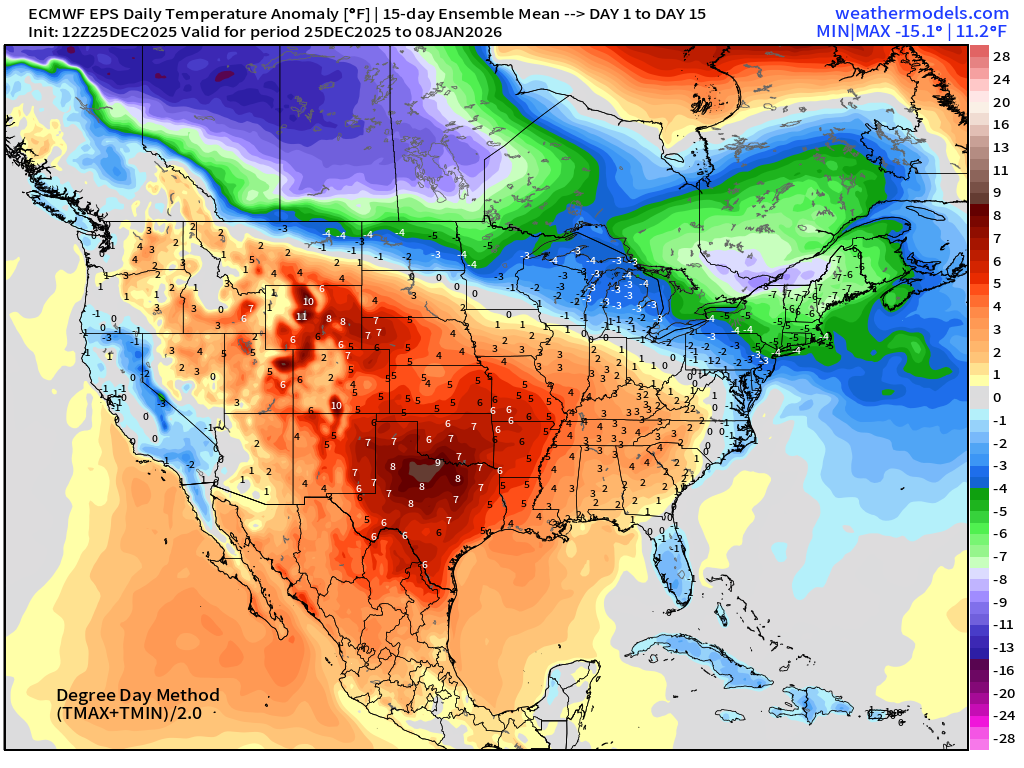
ECMWF 12z EPS | Temperature Anomaly | Next 15-days
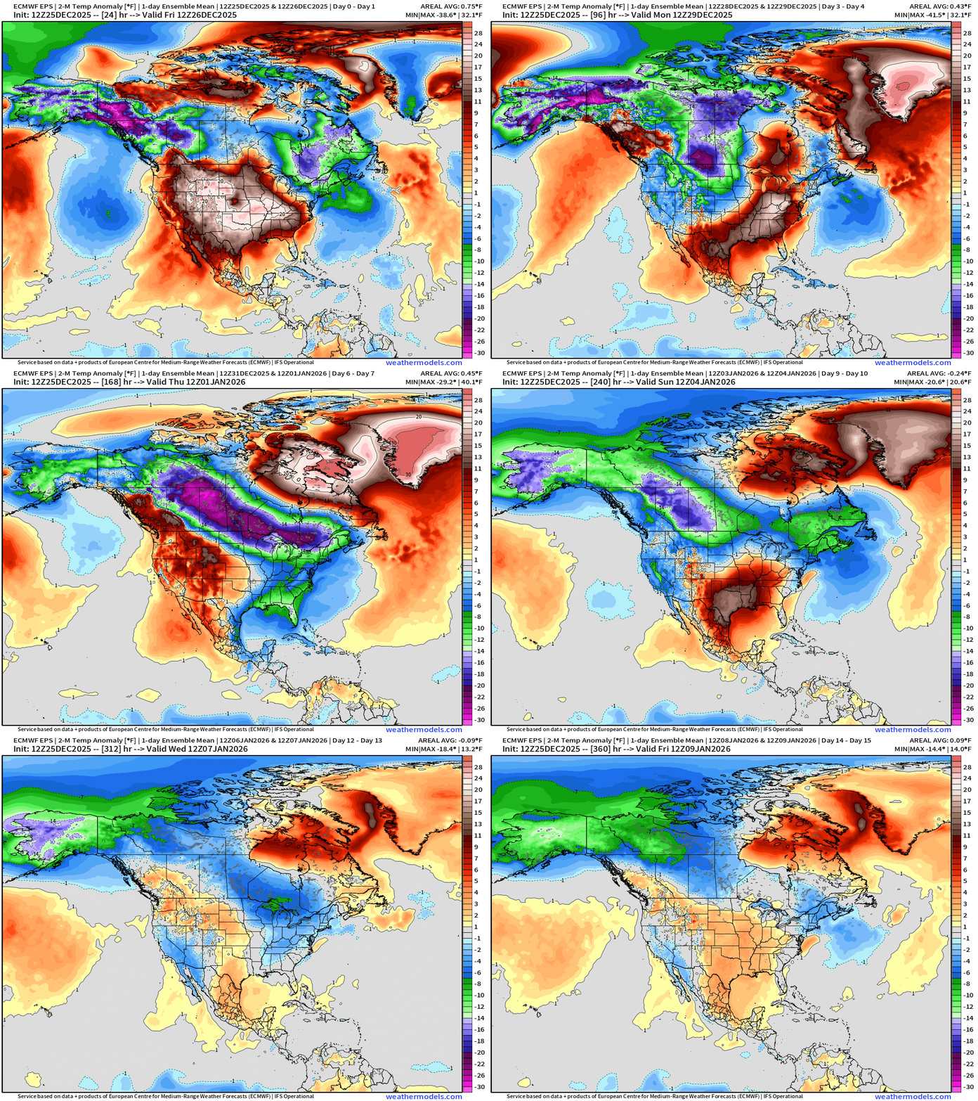
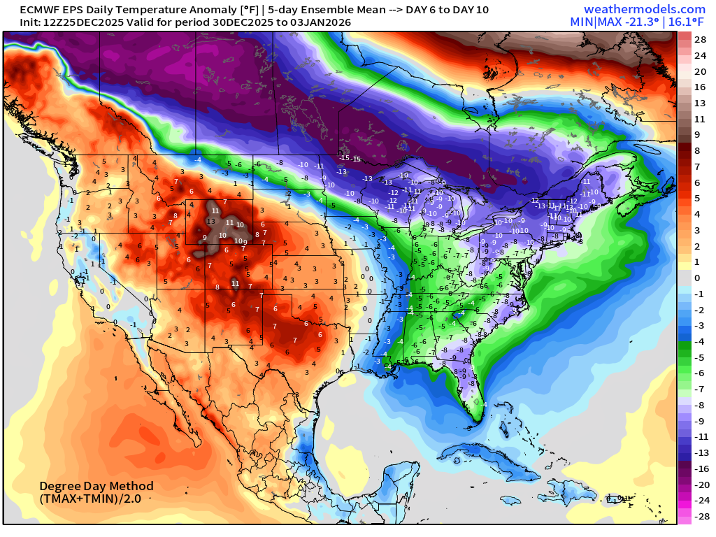
Alaska + Canadian Cold Pool drains ESE into the Midwest and Great Lakes next week and it seems the Lower 48 ridge will weaken — allowing a southward push of the “polar front”
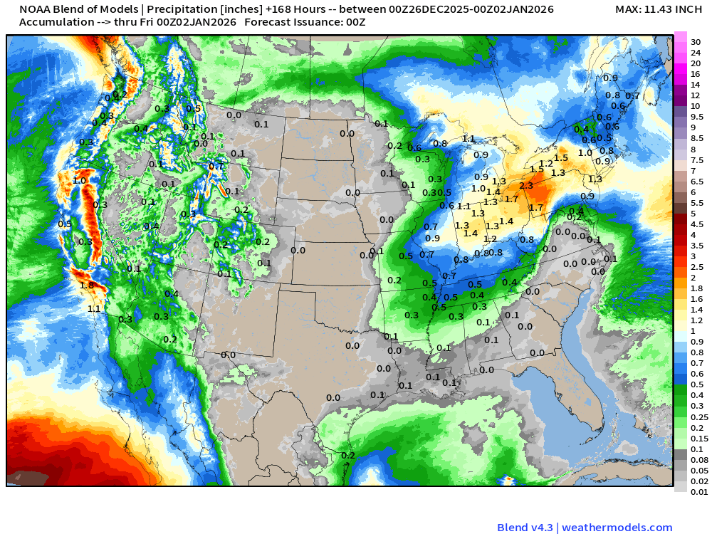
Blend of Models | 7 Days Precipitation Total
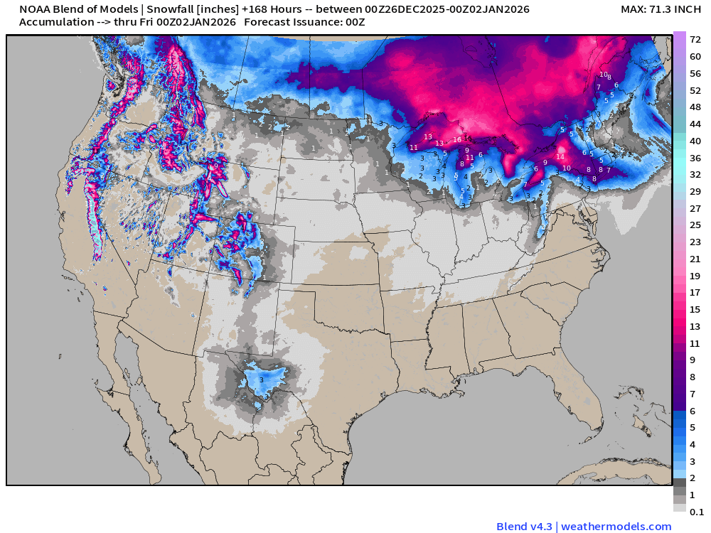
Blend of Models | Total Snowfall Next 7-Days
ECMWF AIFS-Single 18z | Height Anomaly (500 hPa) Next 10-days
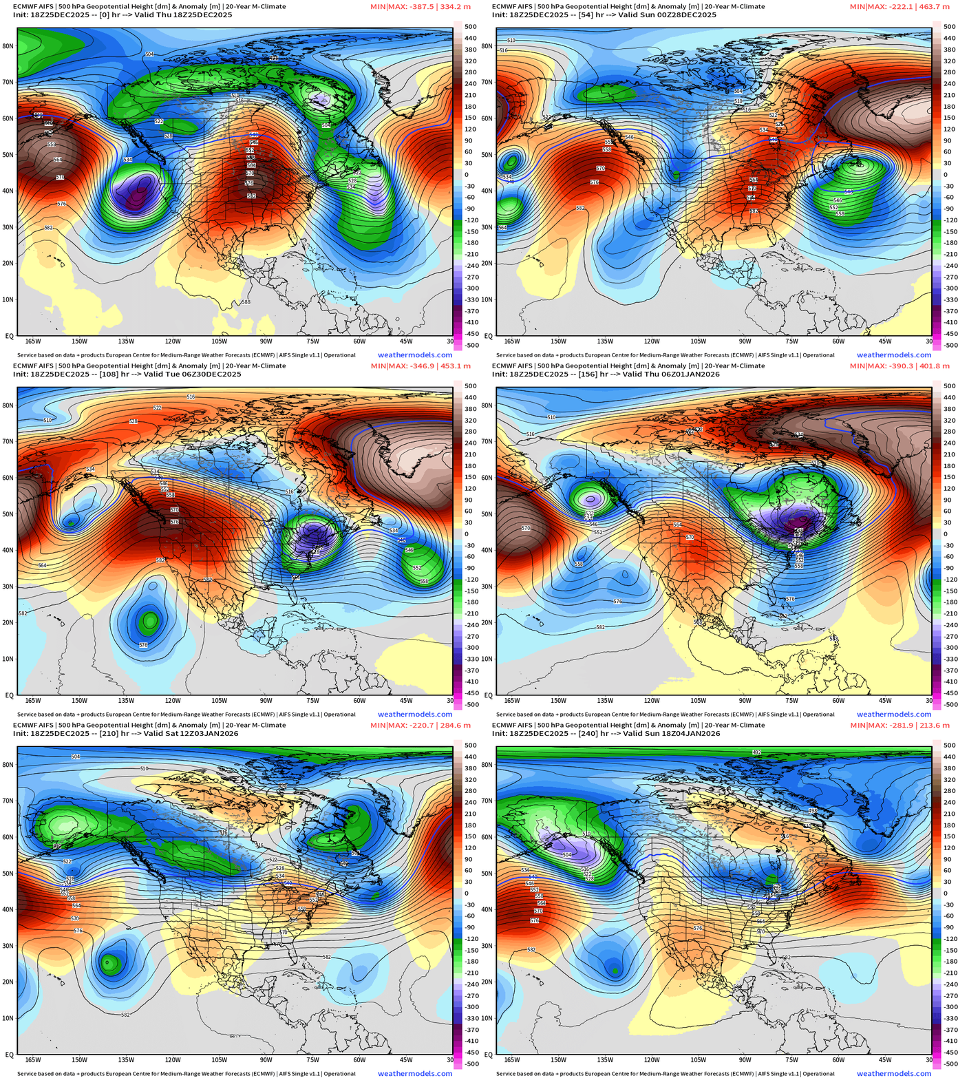
Major trough across Northeast for multiple days Wed-Friday of next week —> much colder air.
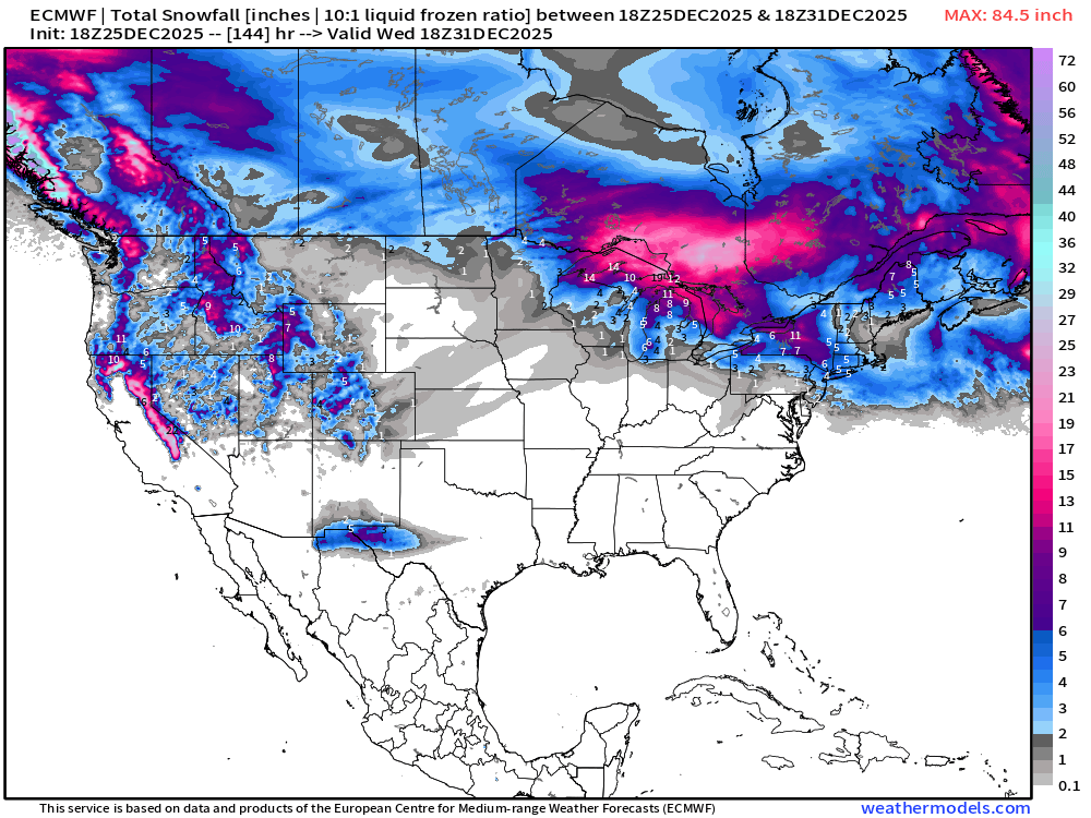
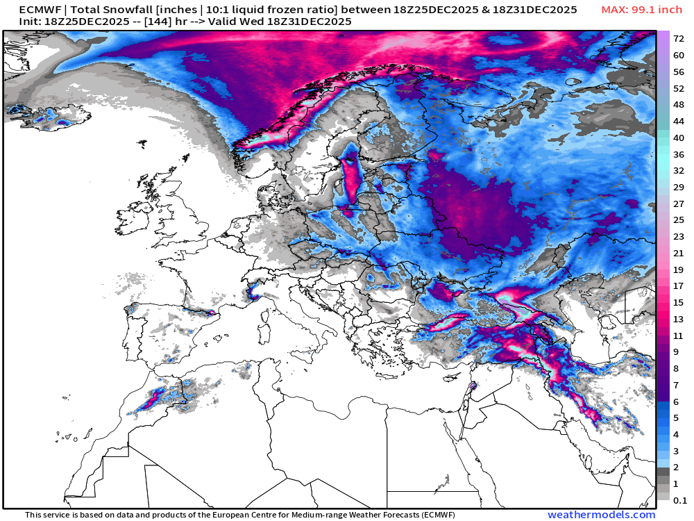
ECMWF 18z | Snowfall | Next 6-days | Lower 48 and Europe
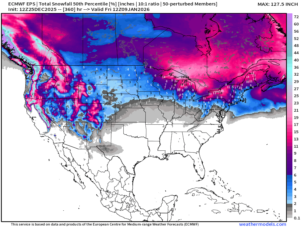
ECMWF EPS 12z | Ensemble Median Snowfall Next 15-days
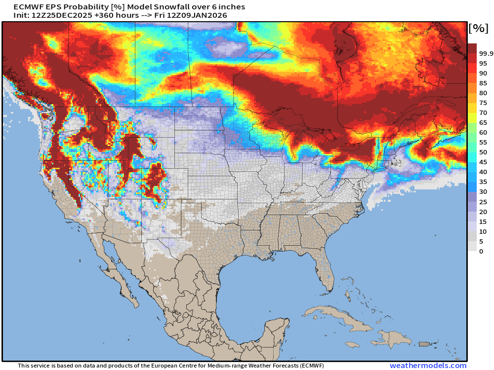
Probability of 6-inches or more Snowfall in the next 15-days
Temperature Anomaly | Next 15-days | ECMWF EPS 12z
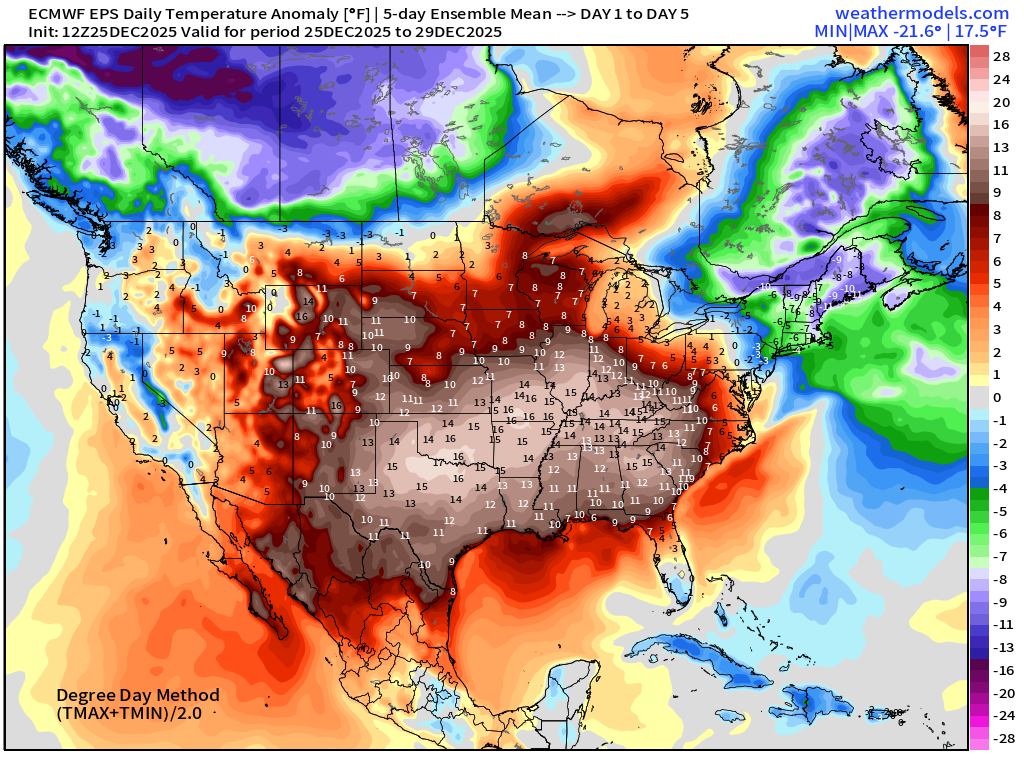
5-Day Chunk #1 | Temperature Anomaly | Dec 25 - Dec 29
5-Day Chunk #2 | Temperature Anomaly | Dec 30 - Jan 3
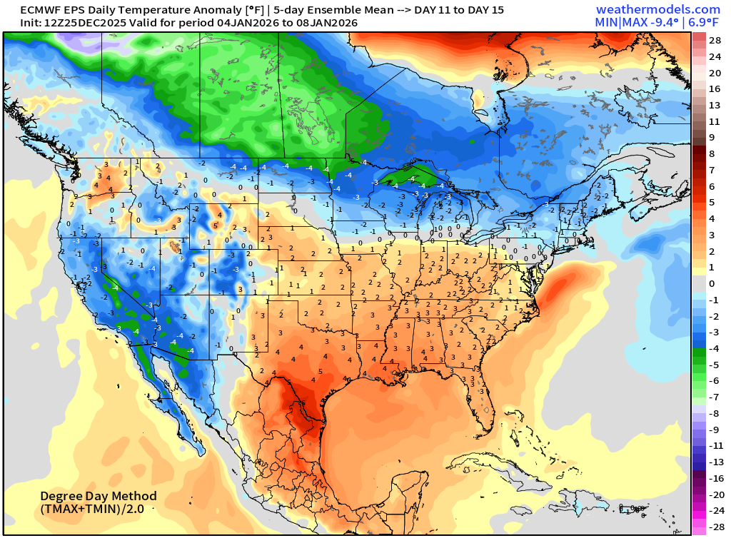
5-Day Chunk #3 | Temperature Anomaly | Jan 4 - Jan 8
Maps sourced from weathermodels.com designed and innovated by yours truly! Please subscribe there for real-time access to the newest maps, charts from all of the weather models including ECMWF and AIFS, NOAA AI-GFS/AI-GEFS
Active coupon codes:
None. Please send a message or reply to this email for inquiries.
- Milepost
- 826 · laid 2025-12-26T03:18:36.753000Z
- Source
- https://weather.substack.com/p/december-25-2025-merry-christmas
- Digest
- f16313aa4f8f8ad98adb7628a0584eba4ea076d5d8581986e060a140127ac220
- Machine
- JSON