December 20, 2025 Saturday Weather After Dark
Northeast will not participate in the exceptional warmth through end of year
December 2025 was the 5th-warmest December in the 131-year national record (1895–2025), at 37.8°F against a 1991–2020 normal of 34.3°F (+3.5°F).
December 2025 was the 37th-driest December in the 131-year national record (1895–2025), at 2.0in against a 1991–2020 normal of 2.5in (-0.5in).
NOAA/NCEI Climate at a Glance, contiguous United States. This is the observed record for the month, not a score of anything said in this piece — the forecast ledger begins 2026-08-17 and cannot reach earlier posts.

White Christmas
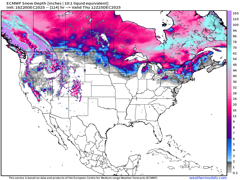
Snow on the ground Christmas morning mainly because there was so much that fell in recent weeks and lack of a major thaw.
ECMWF 18z | Next 6-days Temperature Anomaly
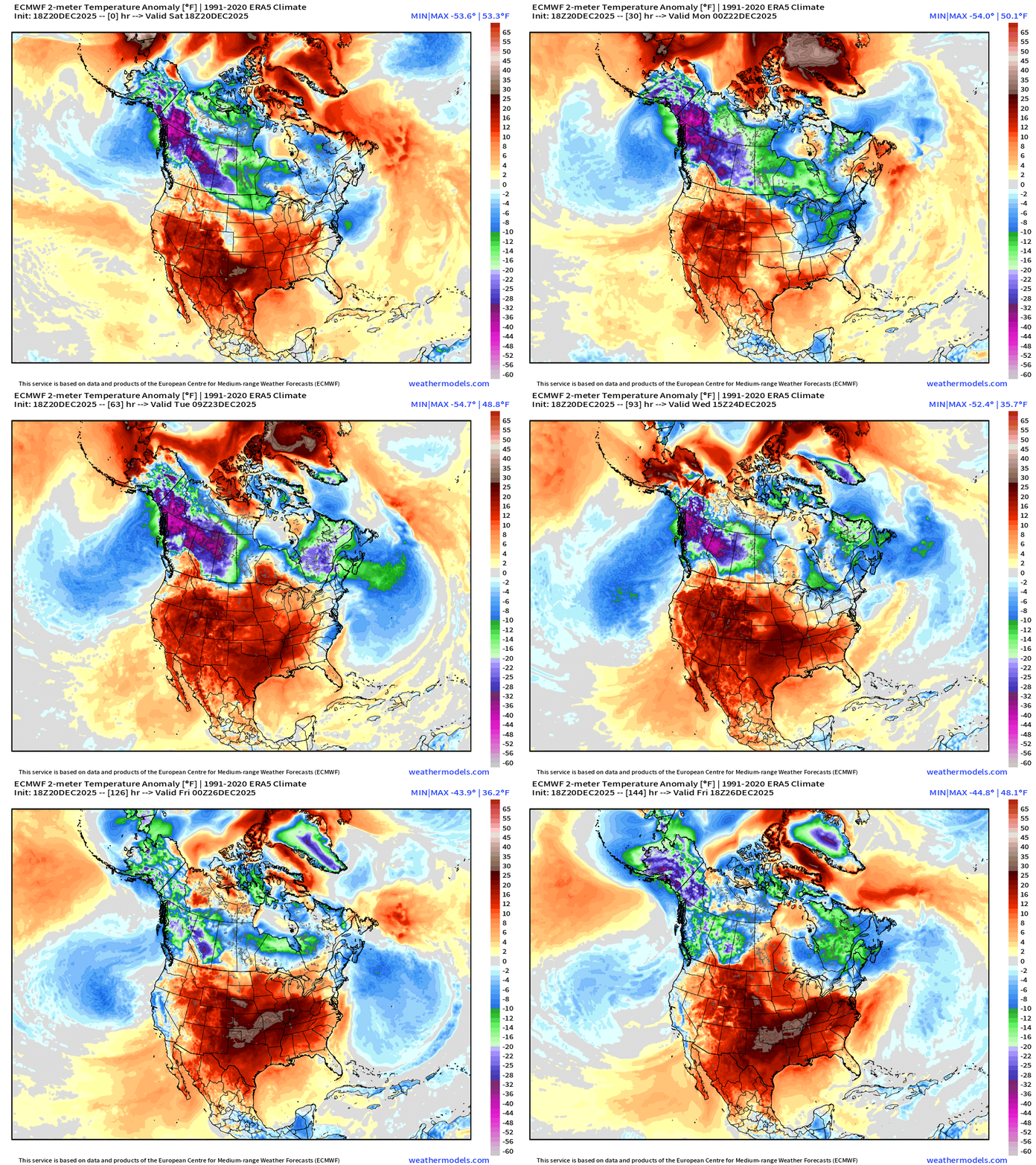
The western Canada cool pool is looking to escape in any direction and sends a blast of cold air out in the Pacific with a “Polar Vortex” lobe and upper-level trough — all linked with a complex of powerful surface storm systems (low pressure) off the California coast.
Cold air is finally eroded in the Great Lakes — but the Northeast might not see much warmth in the coming week, and instead be on watch for snow squalls.
ECMWF 18z Precipitable Water Next 6-days | My favorite parameter
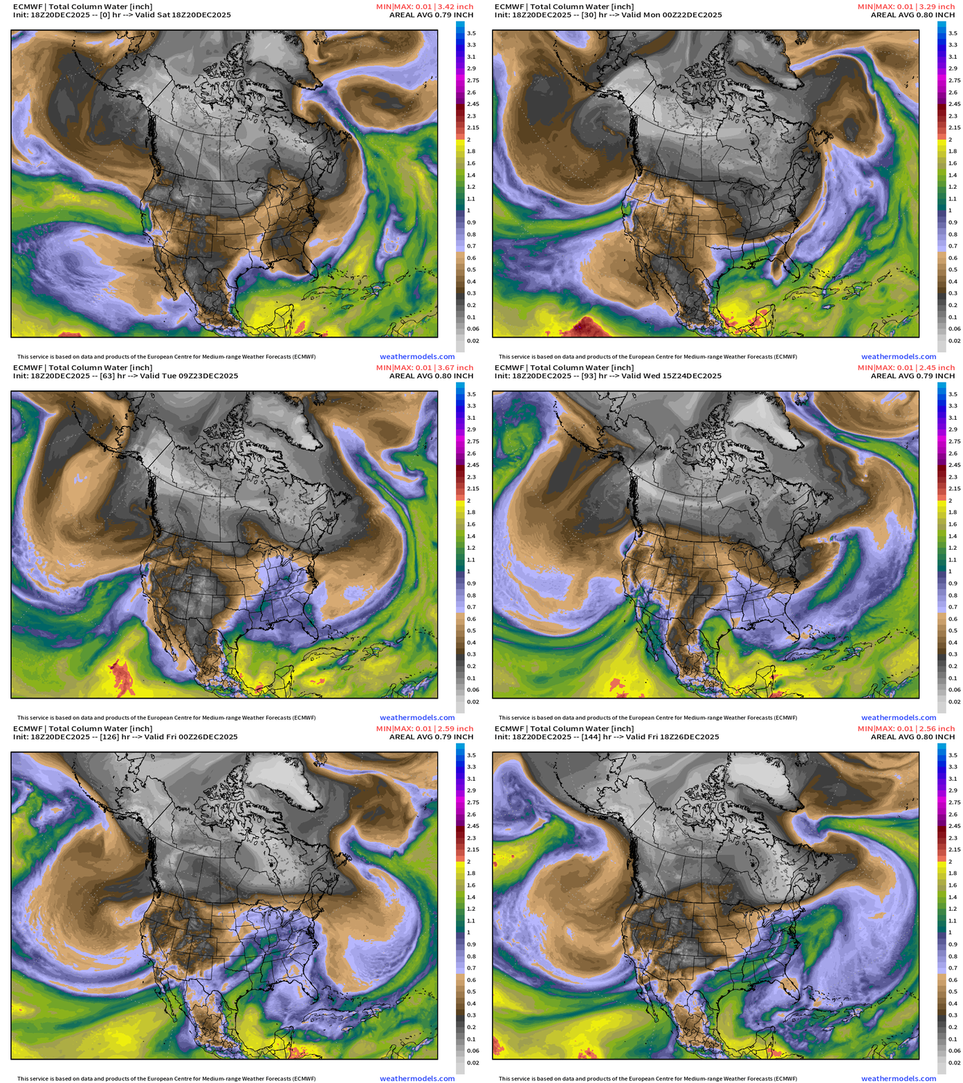
White/gray/black colored precipitable water = absence of moisture = cold/polar air masses rotate through the Midwest and Great Lakes into the Northeast
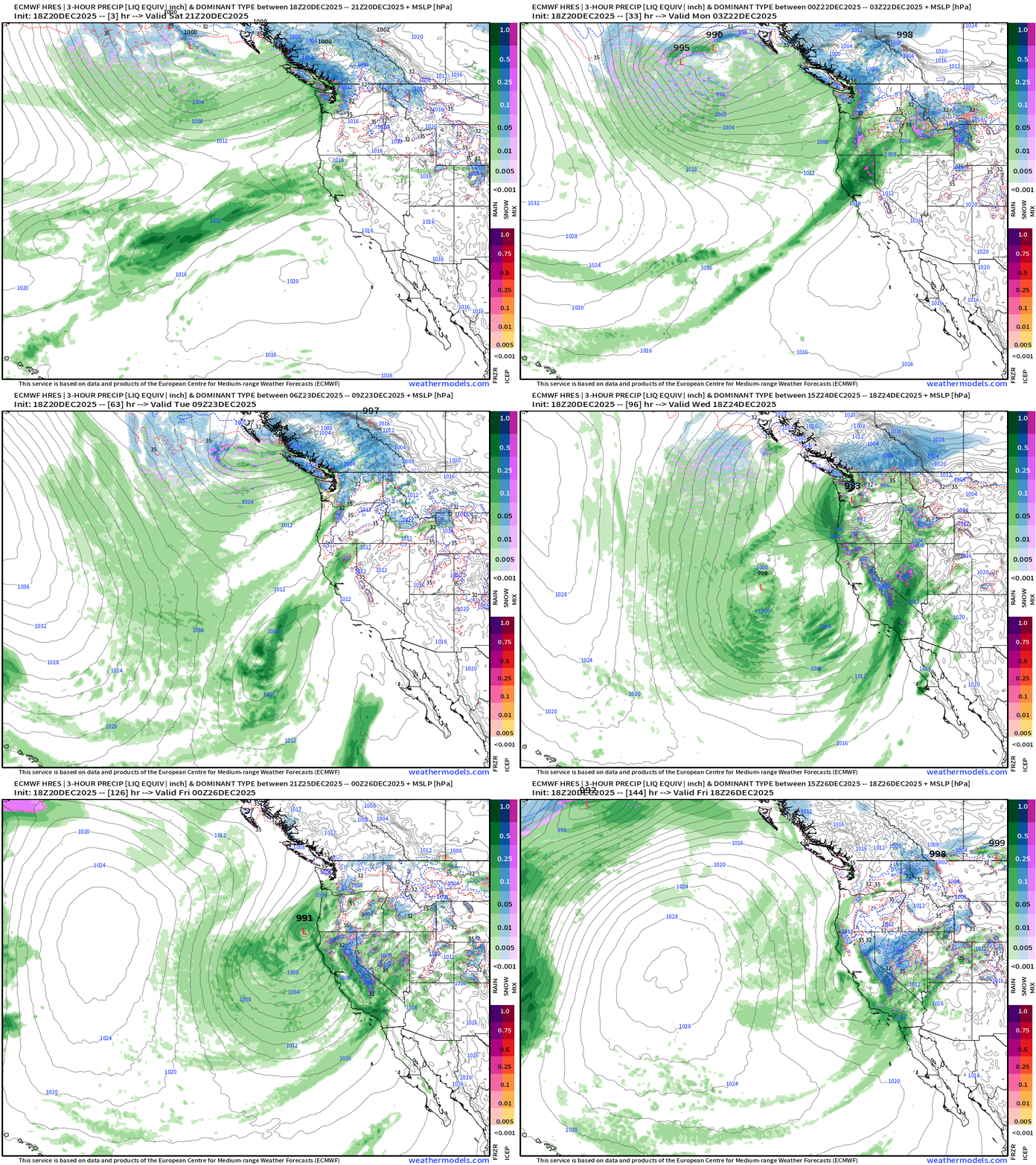
West Coast atmospheric rivers coming from multiple attack vectors — but all onshore with landfalling ARs, powerful storm systems, and enormous rainfall + snowfall on the way. Major impacts.
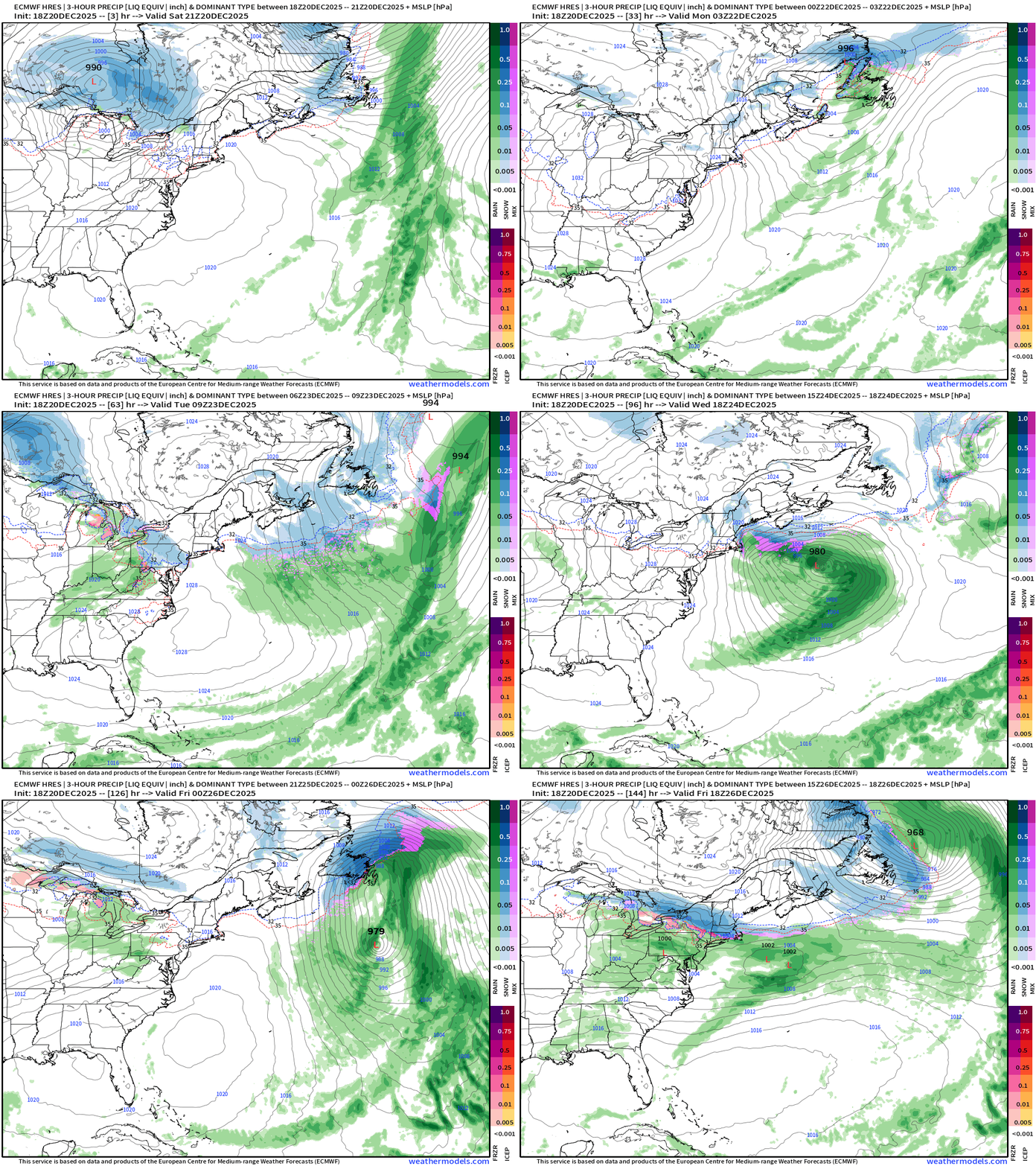
Precipitation Type and Intensity | Next 6-days
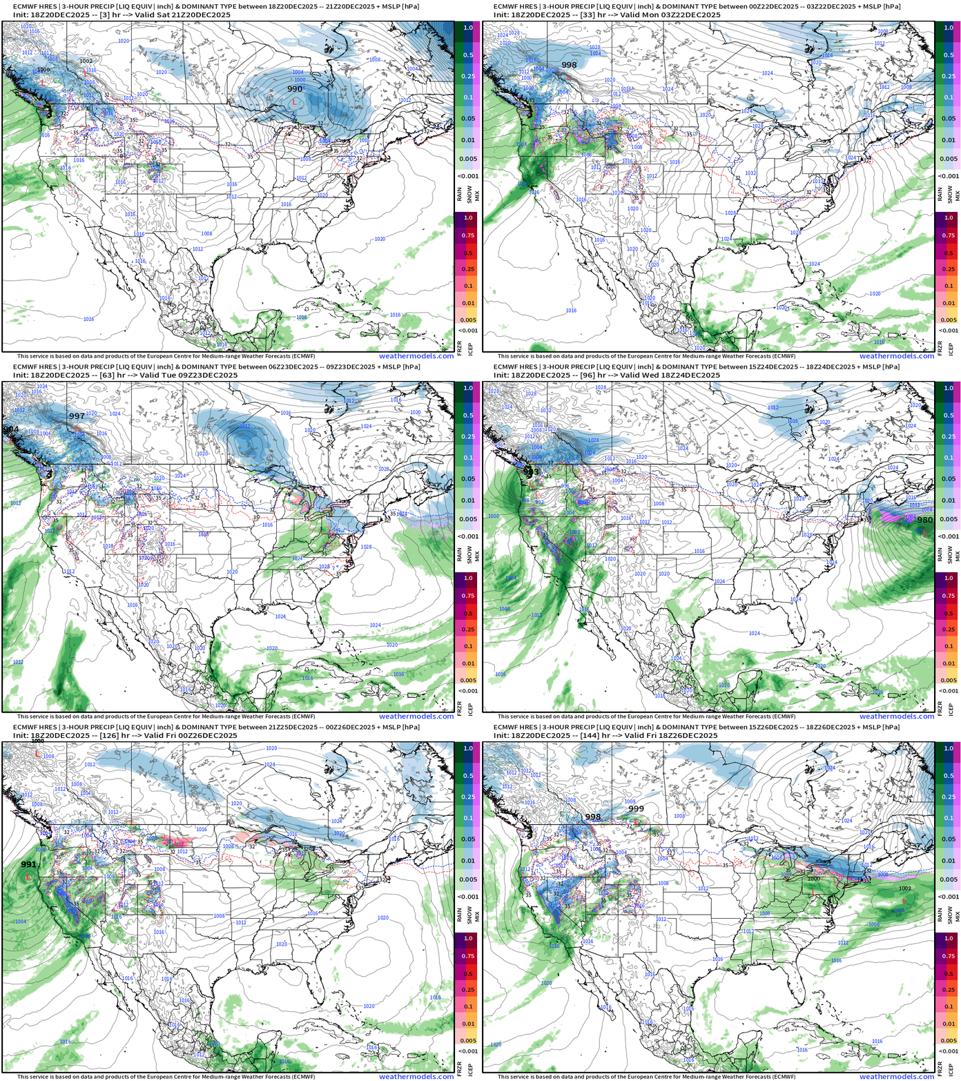
Powerful West Coast Storm Systems — Wednesday and Thursday
Chance of snowfall accumulations Tues, Wed, and Friday across the Northeast
Weather Trader is an entirely subscriber-supported publication [sweat equity] from Dr. Ryan Maue. To receive all new posts, consider becoming a free [1-2 updates per week] or paid subscriber [golden ticket] and please LIKE and SHARE posts.
HRRR 00z | Next 48-Hours Sim Radar through Monday 7 PM ET
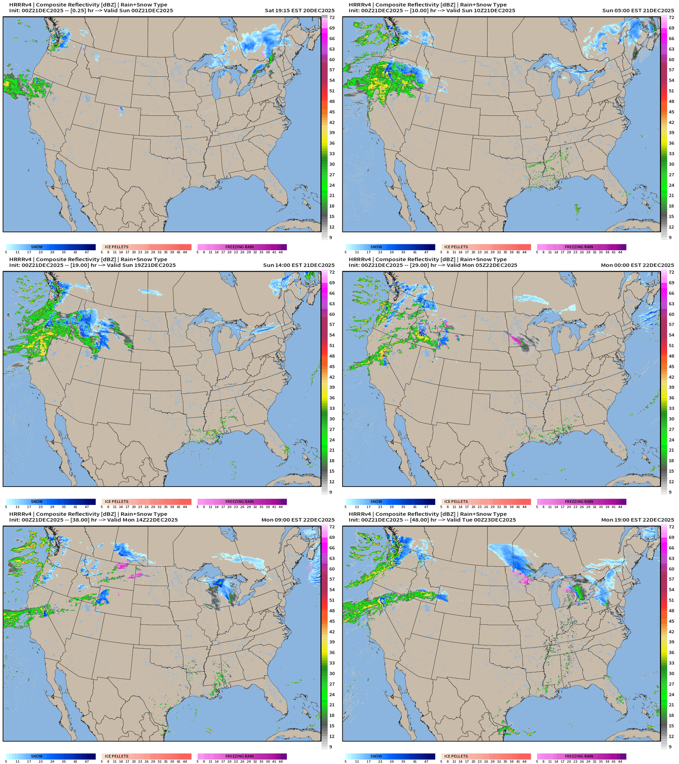
West coast moisture plume — centered on Northern California initially and then northward again into OR/WA by Monday.
RRFS-A Total Precipitation Through 84-hours —> Wednesday 2 AM
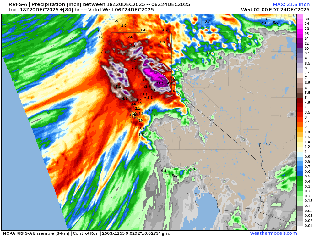
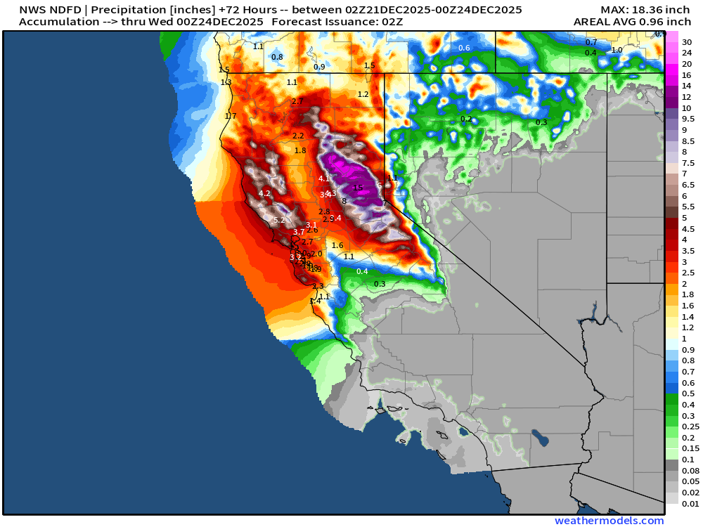
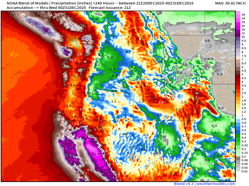
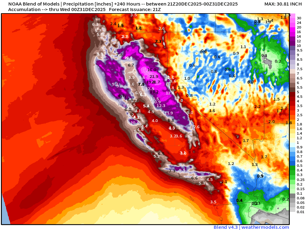
Northern and Central California precipitation through early Wednesday … northern Sierra capture upwards of 20” of precipitation (!) while the NorCal coast could see 6” to 10” just in the next 3-days. Whoa.
NWS Precipitation Next 72-hours
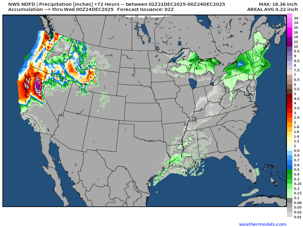
National Weather Service gridded forecasts similar to RRFS … also showing the huge max over northern Sierra.
NWS Snowfall Next 72-hours
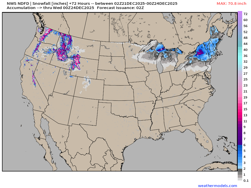
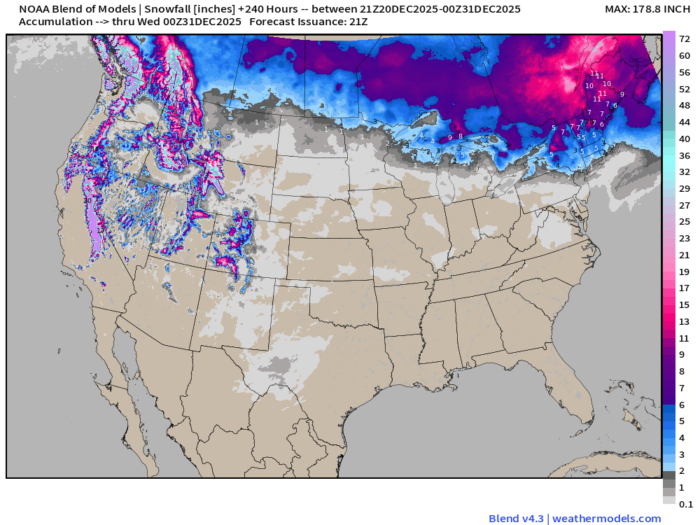
Nice area of 2” to 4” of snowfall across the Northeast mainly into Tuesday … more off the Lakes.
RTMA | Current Temperature Analysis | 9:00 PM ET
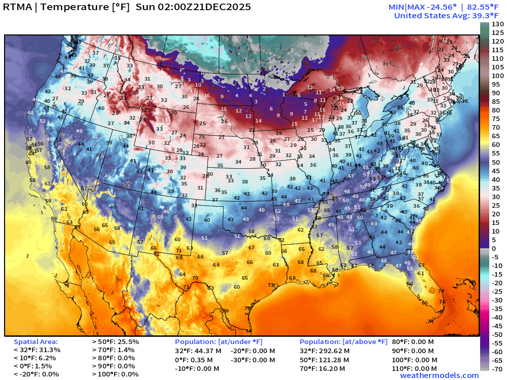
Average Lower 48 temperature was 39..3°F with 44 million below freezing.
Temperature Anomaly | 9:00 PM ET
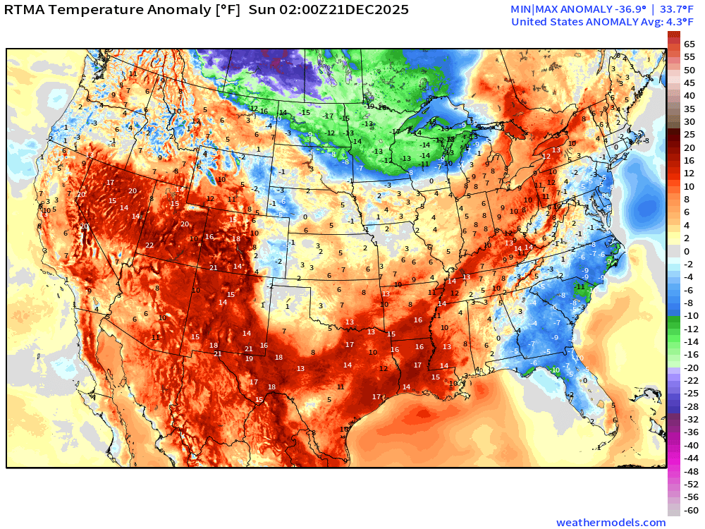
Lower 48 Temperature Anomaly was a 4.3°F ABOVE normal
Sunday Morning Low Temperatures
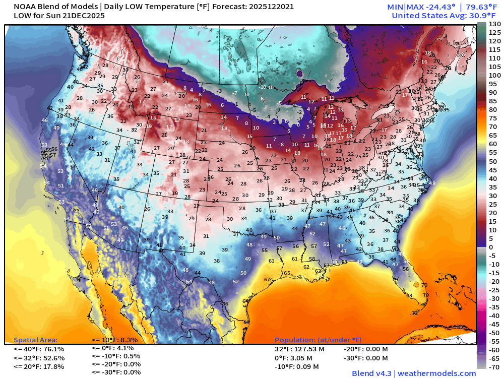
128 million below freezing with extreme cold in the Midwest > 3 million subzero.
Sunday High Temperatures
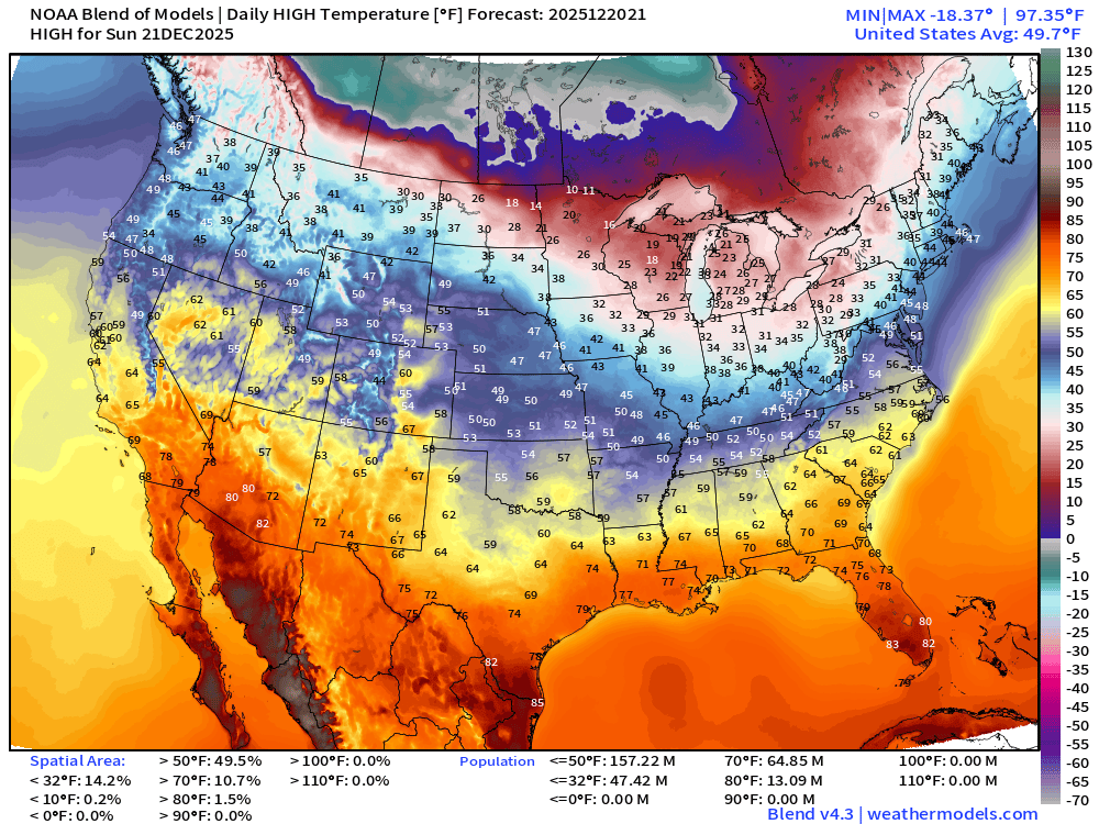
Warming trend underway from south to north … 65 million at least 70°F
Christmas Eve Temperatures | High Temperatures
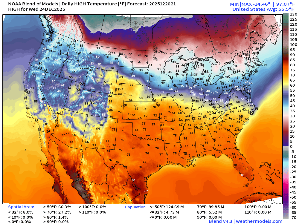
Almost 100 million at least 70°F
Christmas Day Temperatures | Morning Lows
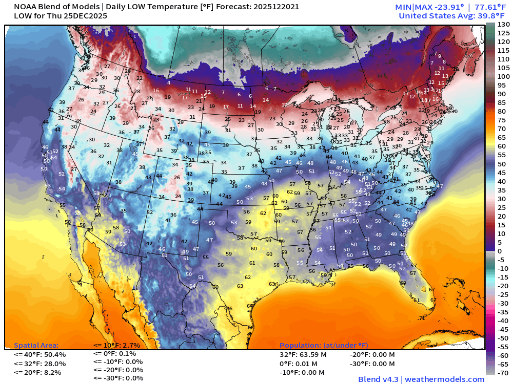
Only 64 million below freezing for low temperatures
Christmas Day Temperatures | Daily Highs
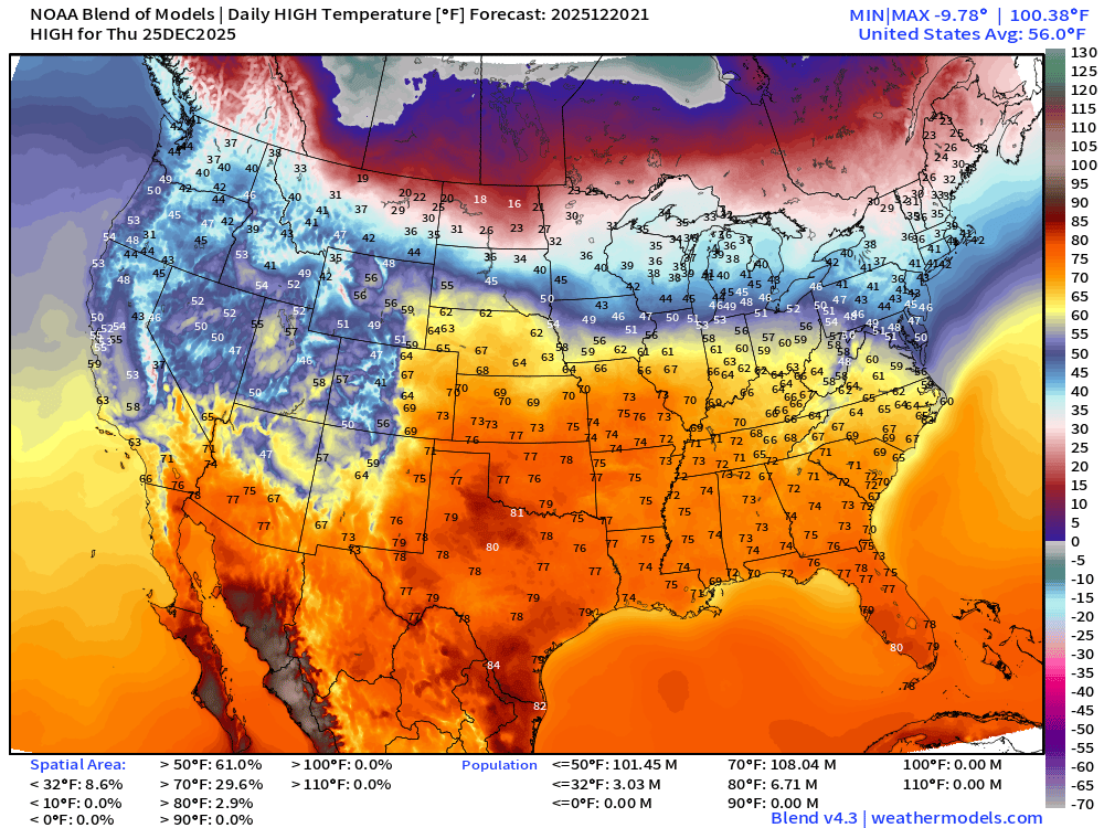
108 million now at/above 70°F on Christmas Day!
ECMWF 12z EPS | Temperature Anomaly | Next 15-days
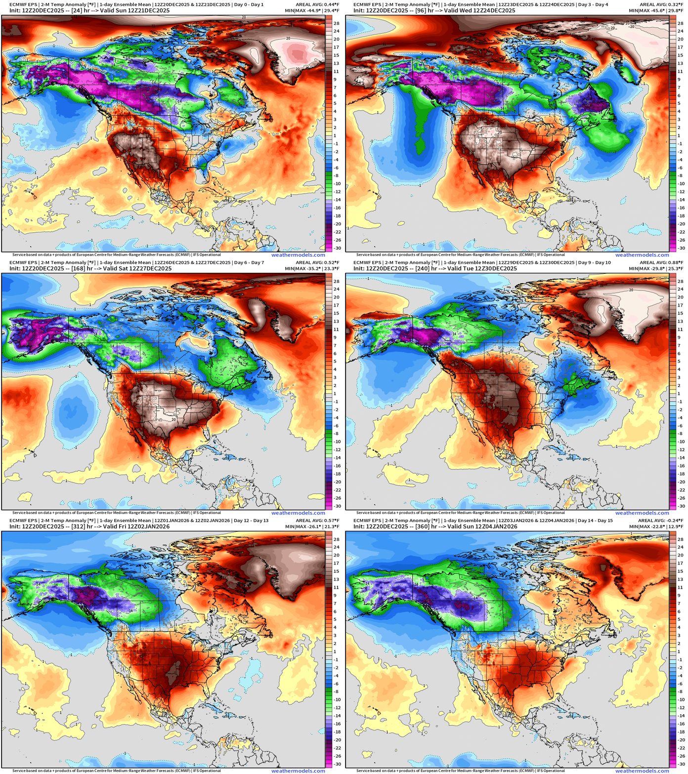
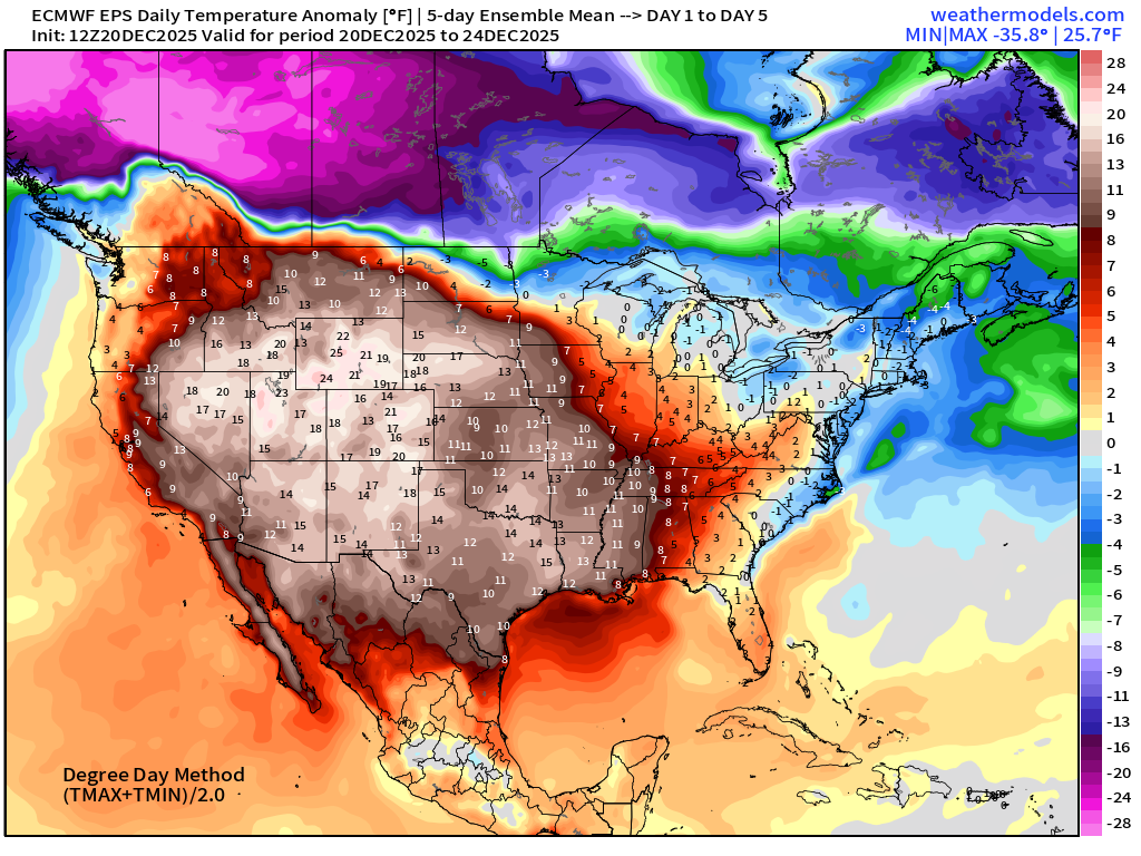
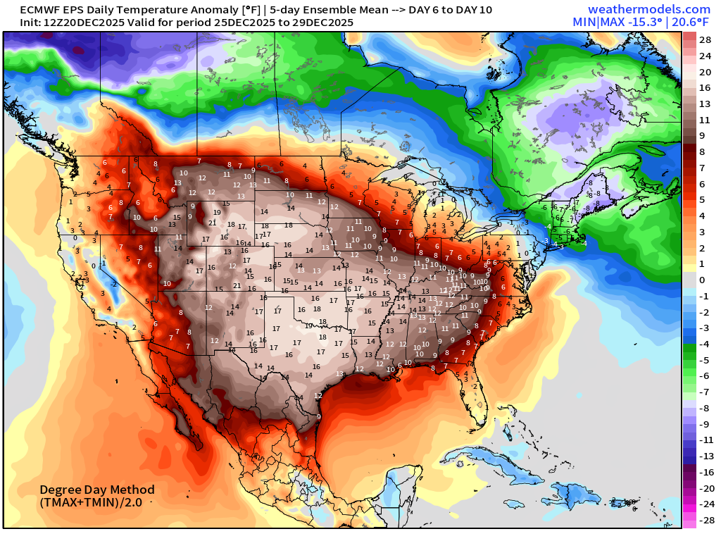
The Lower 48 settles into a MUCH ABOVE NORMAL temperature pattern except for the Northeast … the ridge reforms (build a block 2.0) across the central U.S. in the New Year. Alaska goes into the Deep Deep Freeze.
Blend of Models | 10 Days Precipitation Total
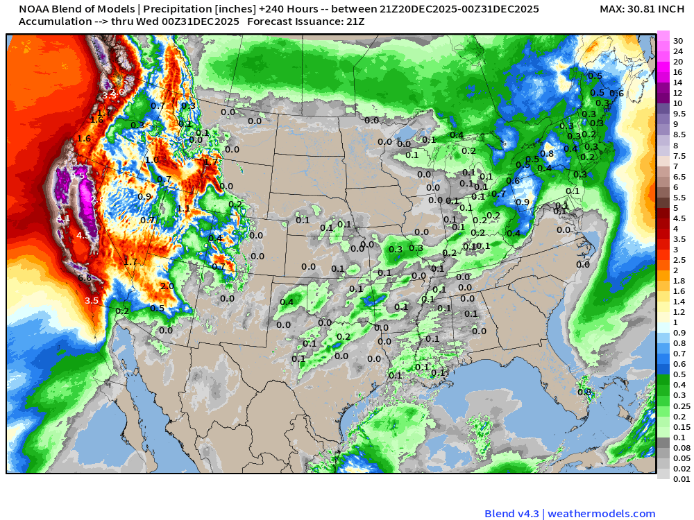
Enormous rainfall totals across California | Deluge
Blend of Models | Total Snowfall Next 10-Days
ECMWF AIFS-Single 18z | Height Anomaly (500 hPa) Next 10-days
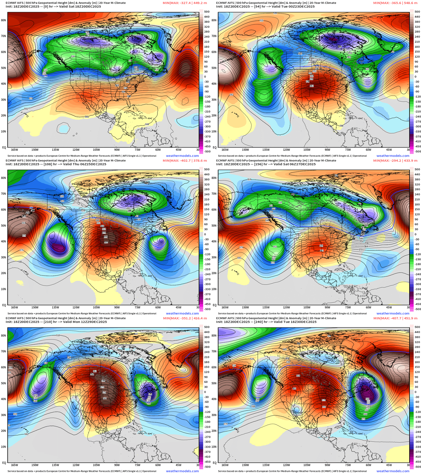
Upper-level pattern is blocked (Omega) across the central U.S. and seems to hit the repeat button into final days of 2025.
ECMWF AIFS-Single 186z | Temperature (500 hPa) Next 10-days
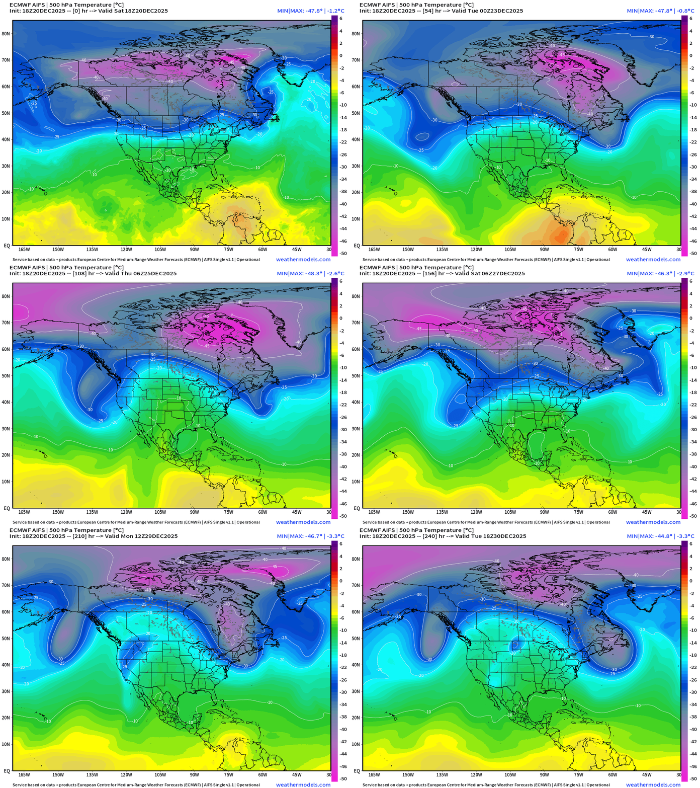
Polar Vortex (tropospheric) monitor —> the pink = coldest at 500 mb and we see the arrival of some cold air from Siberia over the pole into the New Year to reinforce the PV over Alaska and Canadian Arctic.
The ridge builds back into the New Year across the central Lower 48 (?)
ECMWF 12z | Integrated Vapor Transport Next 10-days
Look at the IVT source from the Tropical Pacific heading westward out of the Caribbean and then pulled northward into Southern California and the U.S. Southwest.
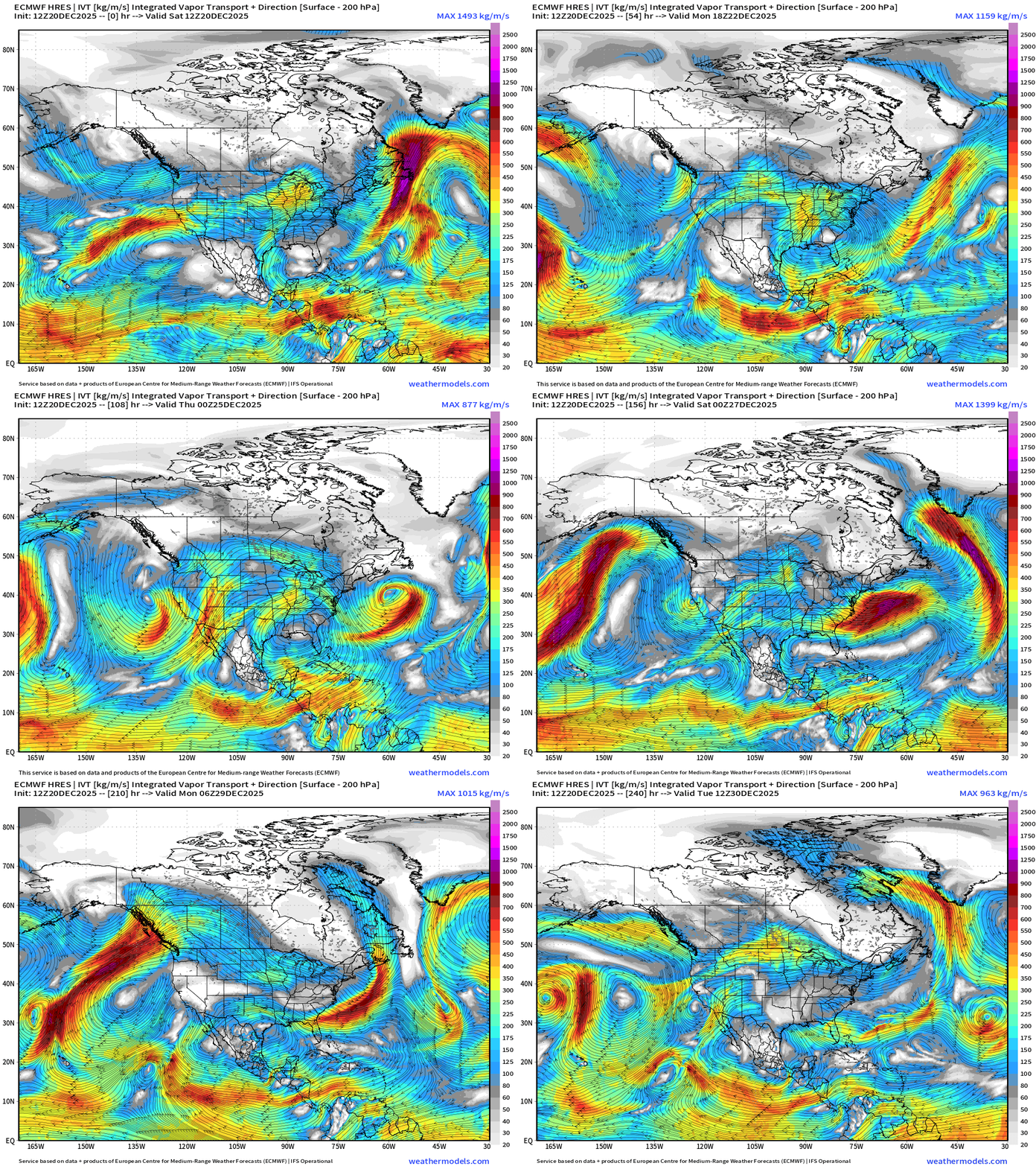
Parameter used for monitoring “atmospheric rivers” usually along the U.S. west coast, but the idea works well for many other areas — highlighting midlatitude storm systems with warm conveyor belts (moisture plumes)
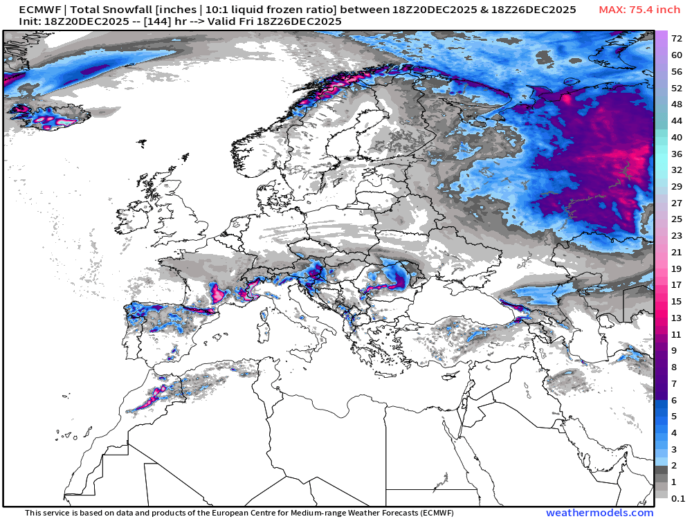
ECMWF 06z | Snowfall | Next 6-days
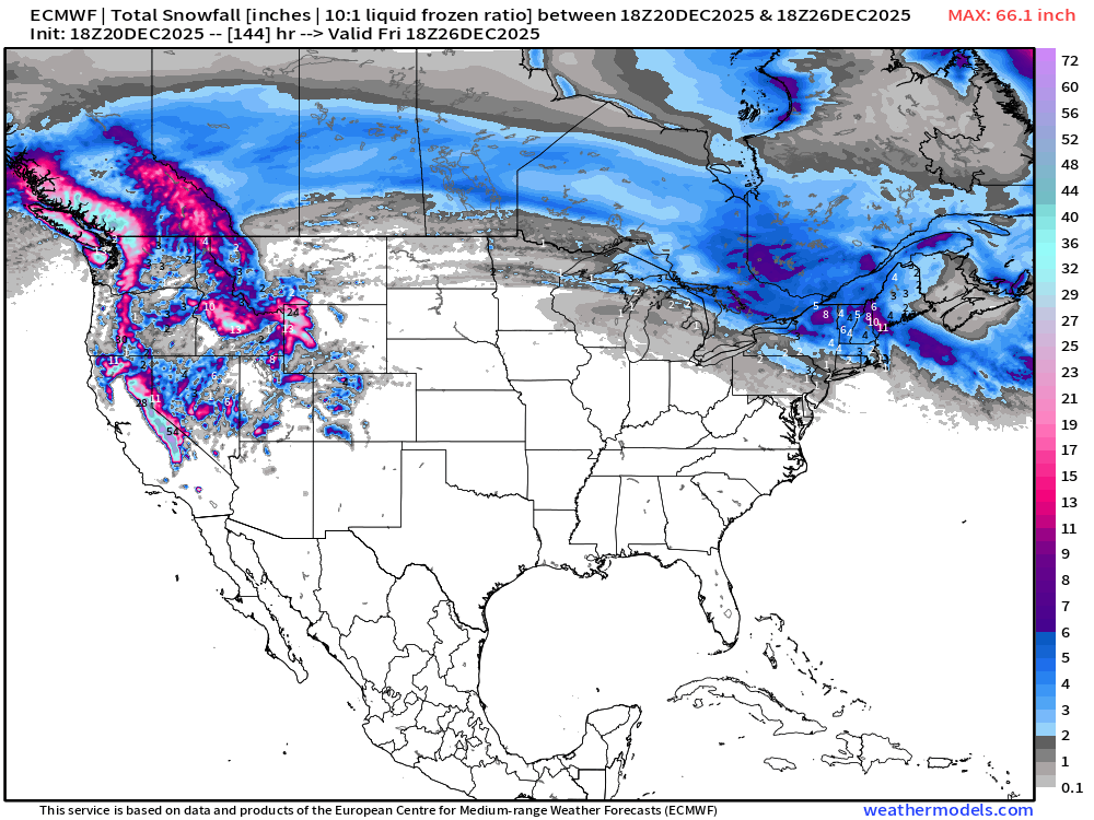
Snowfall for New England —> could be significant in a narrow band as winter is not taking a break.
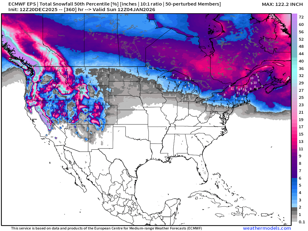
ECMWF EPS 12z | Ensemble Median Snowfall Next 15-days
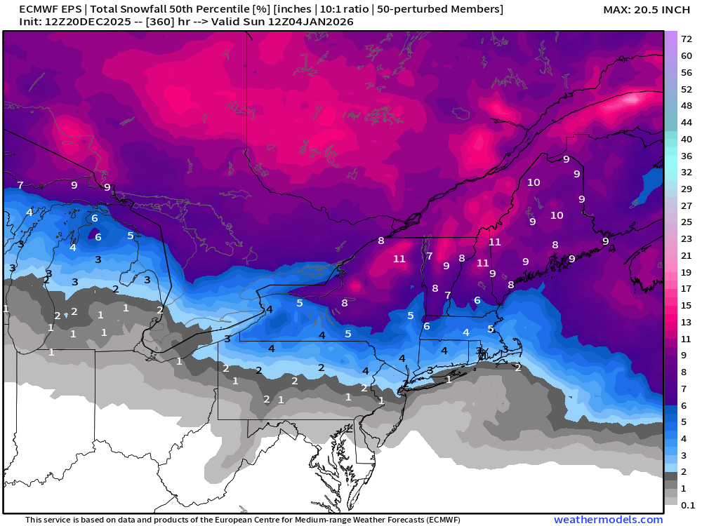
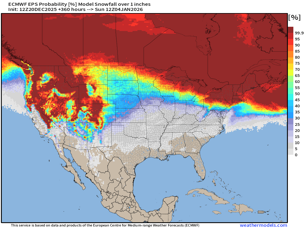
Probability of 1-inch or more Snowfall in the next 15-days
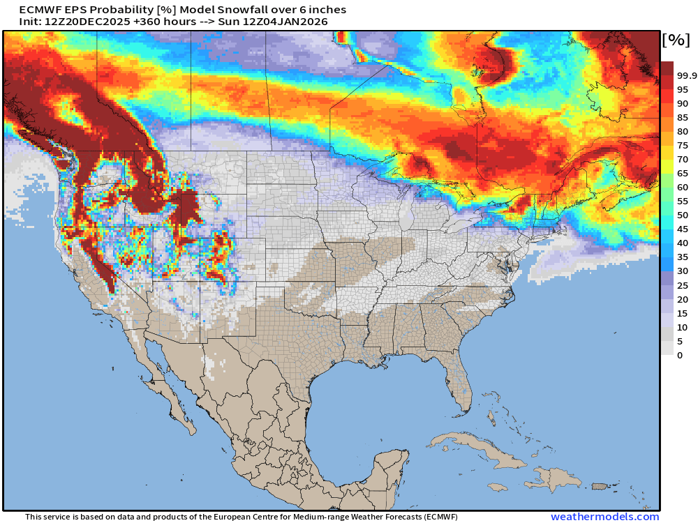
Probability of 6-inches or more Snowfall in the next 15-days
Temperature Anomaly | Next 15-days | ECMWF EPS 12z
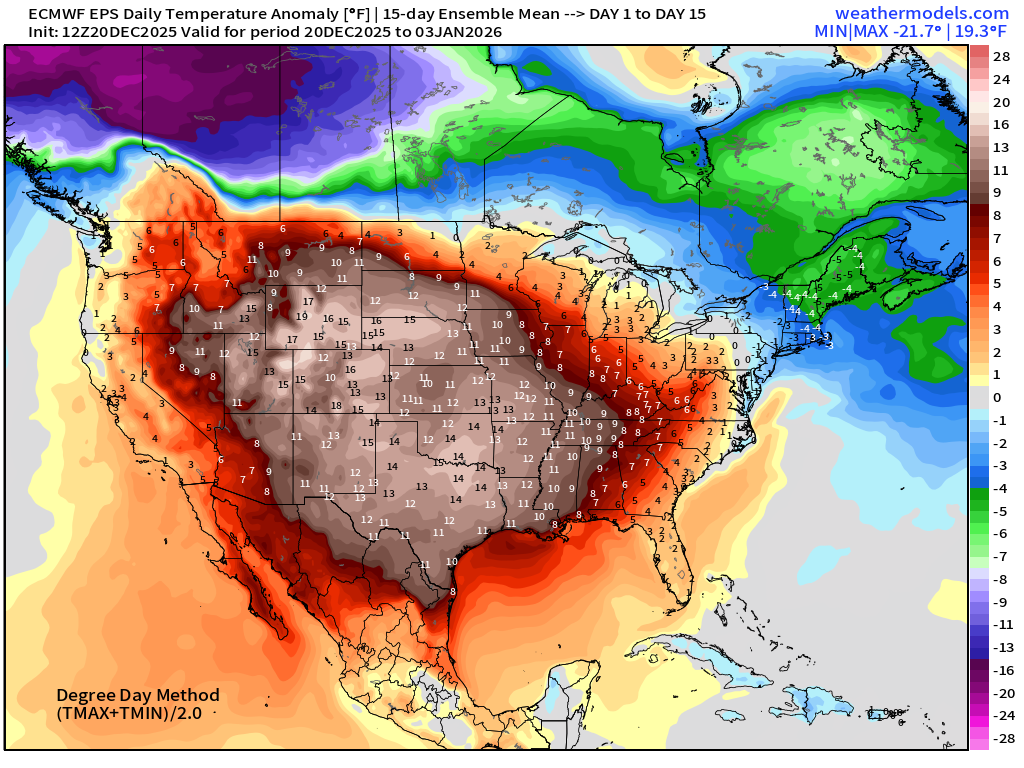
The Northeast will be below normal for the 15-day period … as the ridge is not strong enough to prevent the polar vortex related troughs from dipping through along with strong storm systems out in the Atlantic.
5-Day Chunk #1 | Temperature Anomaly | Dec 20 - Dec 24
5-Day Chunk #2 | Temperature Anomaly | Dec 25 - Dec 29
5-Day Chunk #3 | Temperature Anomaly | Dec 30 - Jan 3
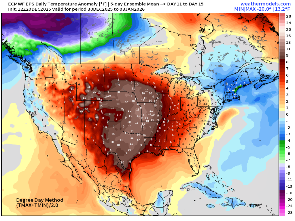
Canadian Cold Pool remains intense — and seems to be dumping out over the Pacific rather than escaping to the east across Manitoba into the Great Lakes.
Maps sourced from weathermodels.com designed and innovated by yours truly! Please subscribe there for real-time access to the newest maps, charts from all of the weather models including ECMWF and AIFS, NOAA AI-GFS/AI-GEFS
Active coupon codes:
None. Please send a message or reply to this email for inquiries.
- Milepost
- 822 · laid 2025-12-21T03:12:59.504000Z
- Source
- https://weather.substack.com/p/december-20-2025-saturday-weather
- Digest
- 607fe8bba86ec3051842c5d515e45bcc68fc6403cc60dc95c3f7e3998573d9bb
- Machine
- JSON