December 16, 2025 Tuesday Morning Winter Weather
Boatloads of precipitation from powerful west coast atmospheric rivers
December 2025 was the 5th-warmest December in the 131-year national record (1895–2025), at 37.8°F against a 1991–2020 normal of 34.3°F (+3.5°F).
December 2025 was the 37th-driest December in the 131-year national record (1895–2025), at 2.0in against a 1991–2020 normal of 2.5in (-0.5in).
NOAA/NCEI Climate at a Glance, contiguous United States. This is the observed record for the month, not a score of anything said in this piece — the forecast ledger begins 2026-08-17 and cannot reach earlier posts.

HRRR 06z | Next 48-Hours through Thursday 1 AM ET
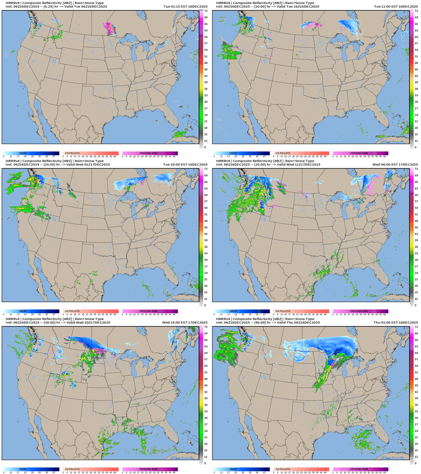
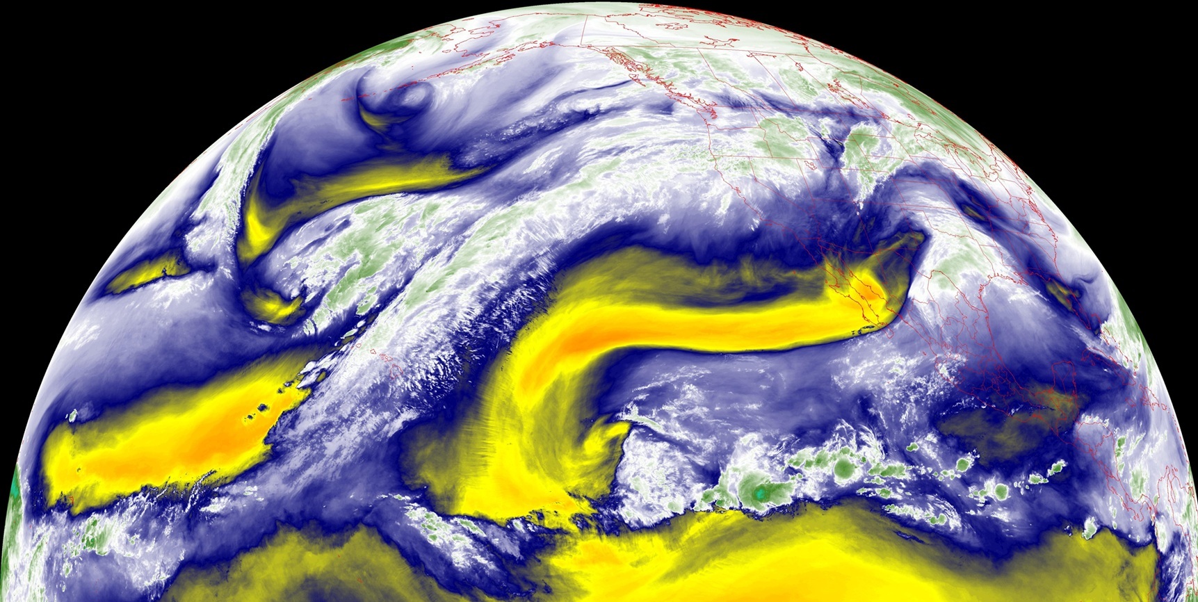
Atmospheric river crashes into Pacific Northwest … moisture crosses the Rockies within a parade of storm systems on the edge of the tropospheric polar vortex.
Storm System Parade Across Canada | Next 6-days | MSLP
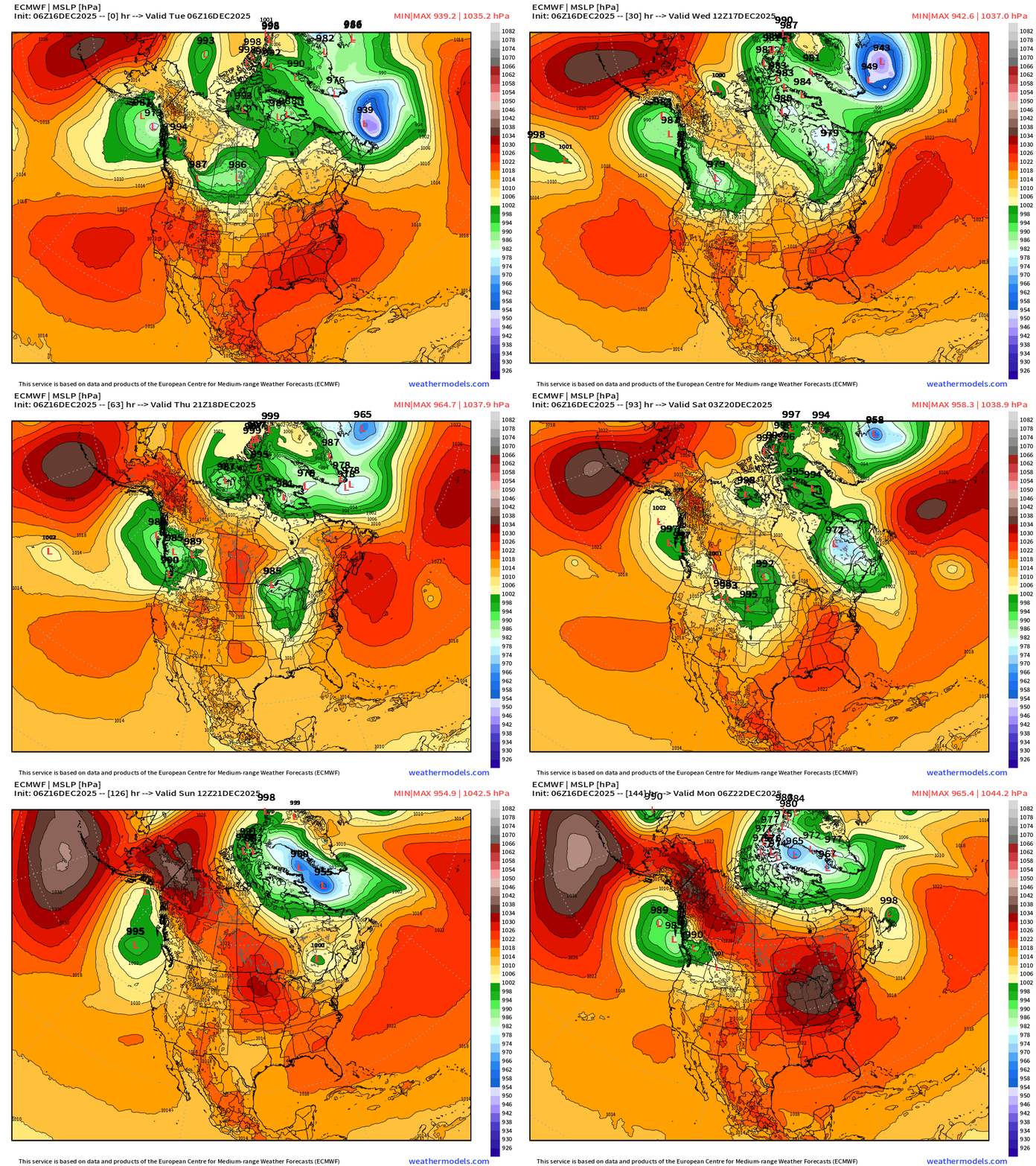
Sequence of 3 powerful storm systems measured by central pressure in the 970s in an unlikely location over land in southern Canada. These mobile cycles quickly track east over the next 6-days … each time providing a “clash of air masses” between warmer Pacific origin air to the south and the Alaska/Canadian cold pool to the north.
Next 6-days | 850 mb Winds
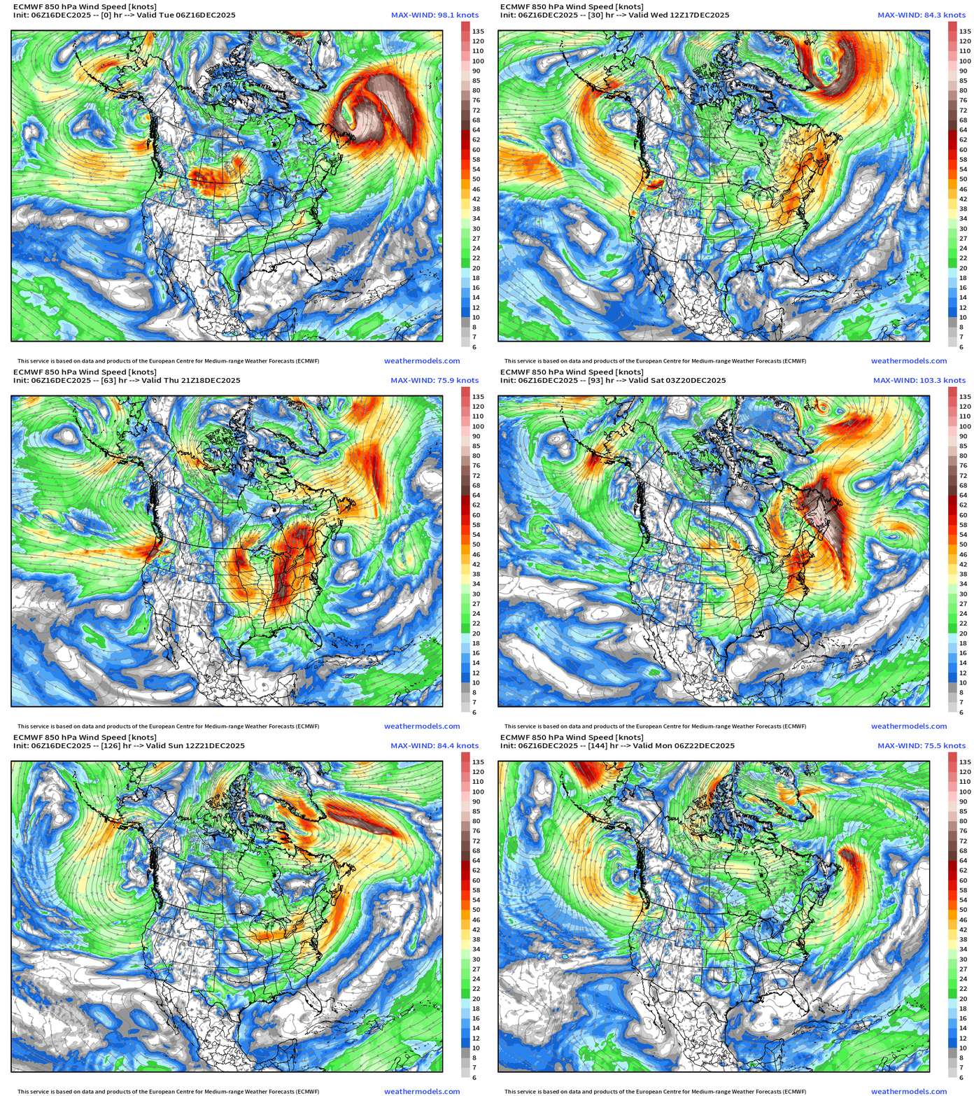
Lower atmosphere level winds show plenty of energy with these storm systems sweeping across the Midwest, Great Lakes, and Northeast into next weekend. Thankfully, much warmer across the Lower 48 so we’re NOT looking at a trio of crippling blizzards.
Precipitation Type | Weather Next 6-days | ECMWF 06z
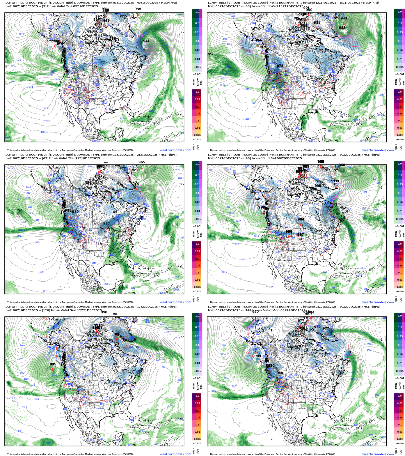
Headlines Tuesday Morning
Significant warming trend into upcoming week with some interludes of Arctic air associated with parade of storm systems in Southern Canada.
Powerful storm systems with pressure in the 970s mb track from the Pacific through British Columbia into the Prairie provinces. There isn’t much moisture available to the south until the Gulf of Mexico can be accessed Friday.
One of these storms intensifies in Quebec to perhaps the 950s mb and will usher in a polar vortex lobe and colder air behind it on Friday
And, another quick blast of cold air from that replenished Western Canada “cold pool” for the Midwest and Great Lakes this weekend.
Next 6-days Temperature Anomaly
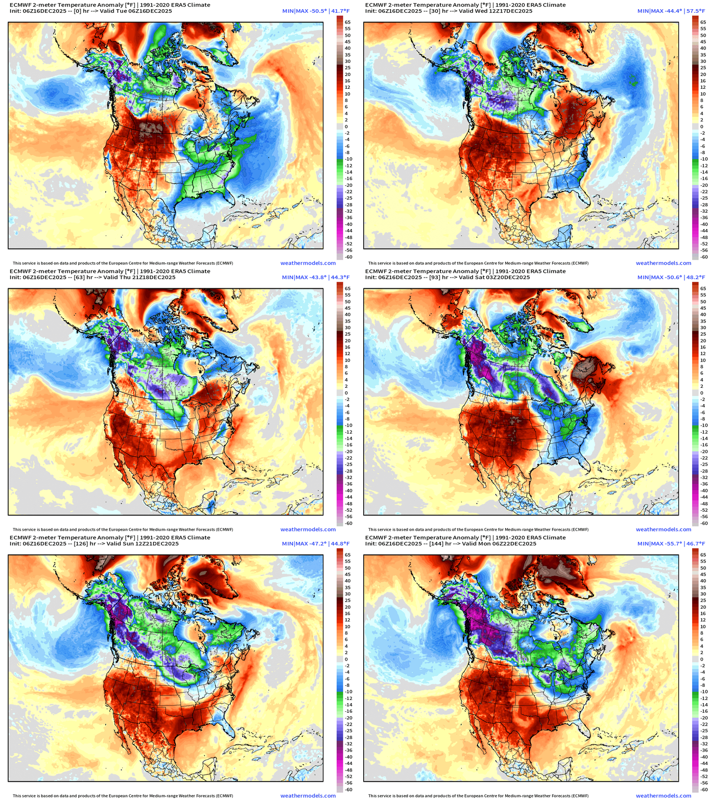
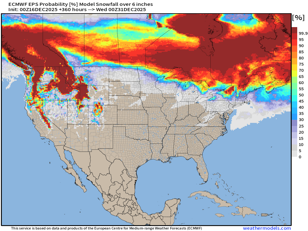
Pattern looks more like early March than mid-December with these strong storm systems … thankfully not looking at severe weather. Instead, we’ll see windy and wet conditions in the Great Lakes and Northeast, but unlikely to see much in the way of snow accumulations in the Lower 48. Canada will be further buried in snow.
High Temperatures Next 8-days | Until Wednesday Dec 24th
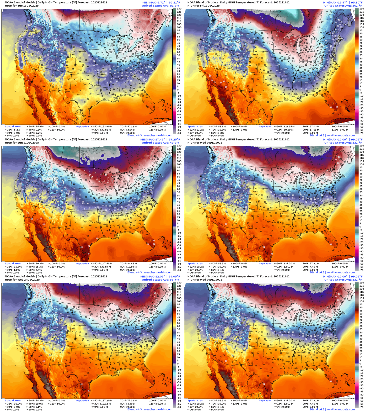
The temperature pattern sees some “amplification” with the brief cold snaps on Friday and Sunday … but the cold retracts northward as strong, warm zonal flow dominates the Lower 48 with a strong/honking ridge.
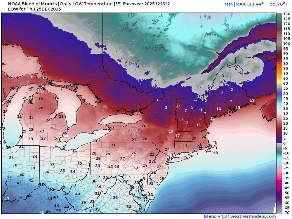
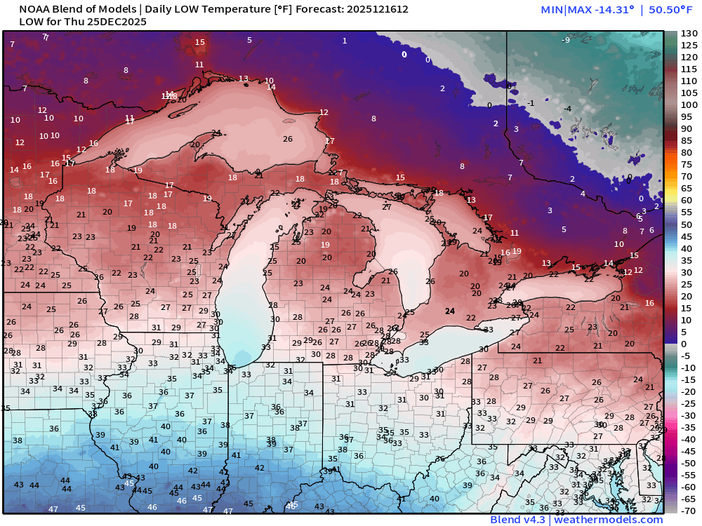
Christmas Day Temperatures | Morning Lows
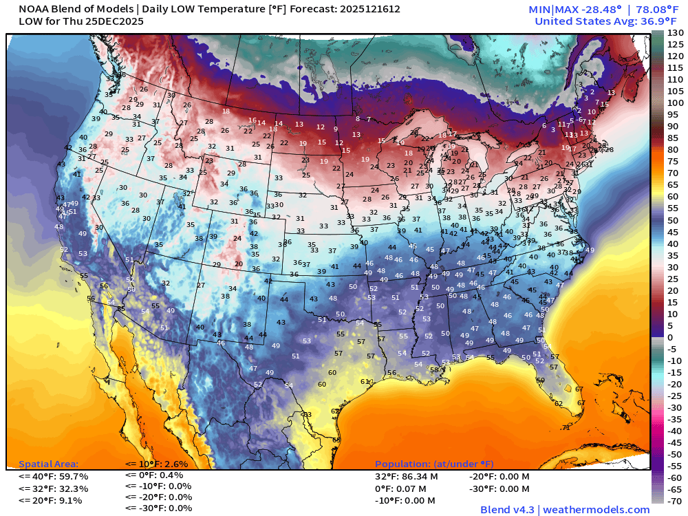
86 million below freezing for low temperatures — but that’s not too bad for December 25th.
Holiday Coupon code 50% off Annual Upgrade 🎅
Christmas Day Temperatures | Daily Highs
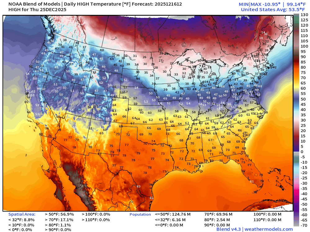
Almost 70 million at/above 70°F on Christmas Day! Only 9% of the Lower 48 by area will be freezing on Christmas Day — according to Blend of Models (v4.3)
ECMWF 06z Precipitable Water Next 6-days | My favorite parameter
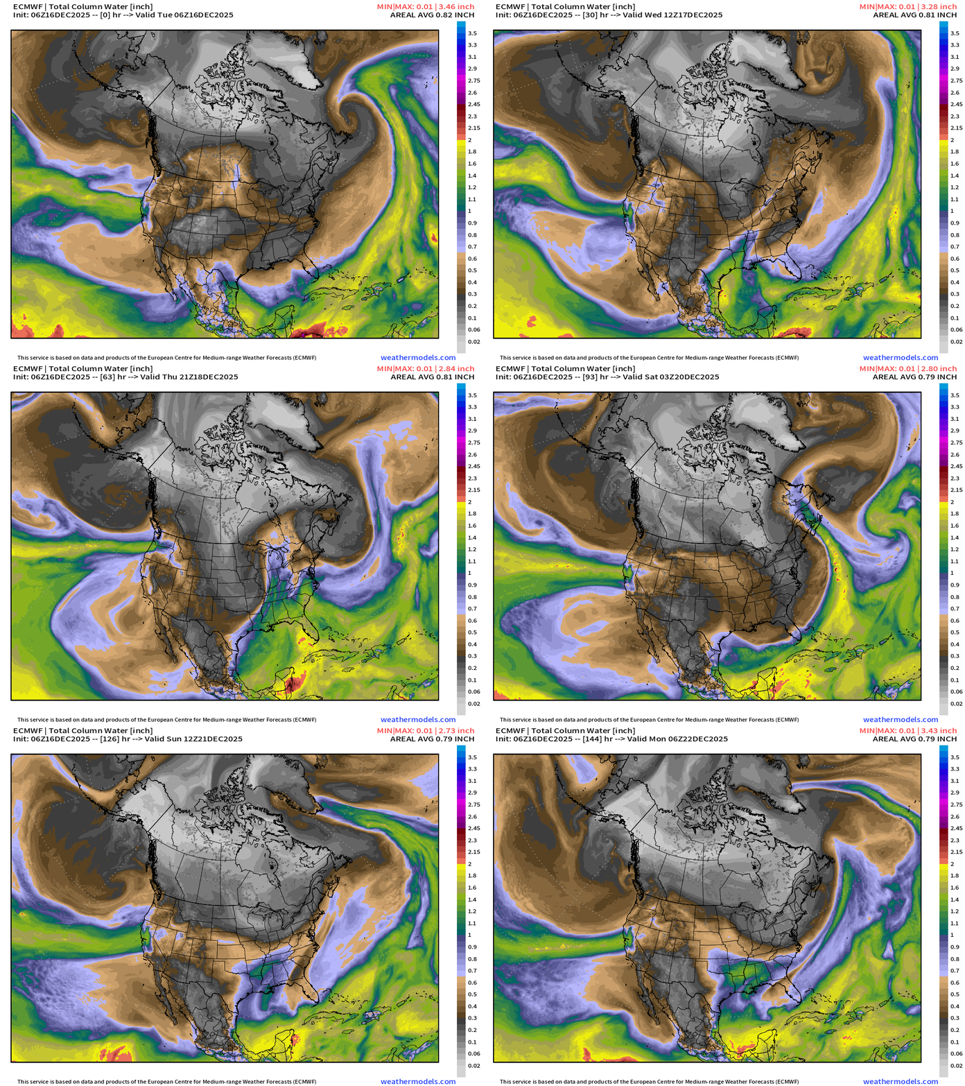
White/gray/black colored precipitable water = absence of moisture = cold/polar air masses rotate through the Midwest and Great Lakes around the “still potent” polar vortex anchored over Canada.
Parade of “atmospheric rivers” continue for the West Coast — and sink a bit further south across Oregon into even Central California by next weekend with major impacts likely. HUGE atmospheric river into California this weekend.
“Arctic blast” scheduled for Friday — not as a severe — and brief as the warmer westerly flow from the Pacific wins the battle with the parade of southern Canada storm systems.
ECMWF 00z EPS | Temperature Anomaly | Next 15-days
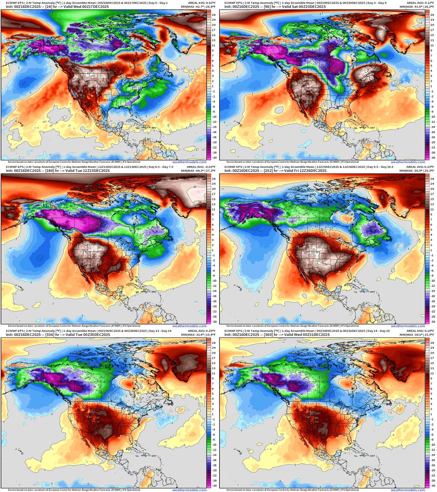
The Lower 48 settles into a MUCH ABOVE NORMAL temperature pattern — eventually — once we can finally block off the “polar vortex” by the weekend.
Temperatures surge to well above normal for much/all of the Lower by Christmas — BUT the Northeast could see normal or colder air, especially with proximity to the “Polar Vortex” and any lobes that may be dragged south by passing storm systems.
The Alaska / Western Canada cold pool replenishes strongly into the New Year, but the Lower 48 blocking ridge remains firmly in charge — at least for now!
NOAA GFS 06z | Dynamic Tropopause (Polar Vortex monitor)
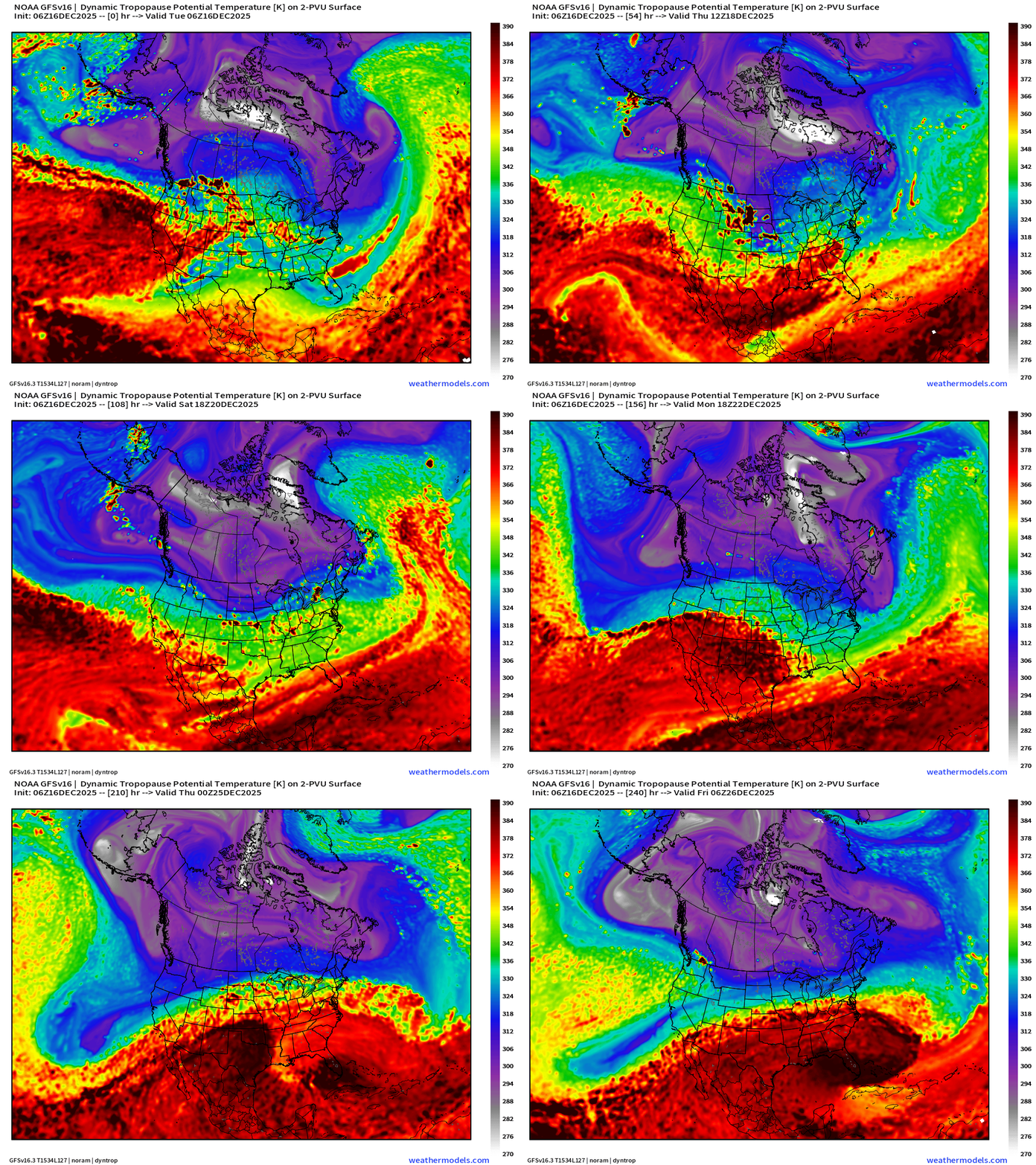
Don’t often show GFS — but I do like this parameter which shows the clash between the Arctic air mass (purple + white fuzzball) and subtropical warmth (red)
We can see the “lobes” of the tropospheric polar vortex still rotating through the Midwest and Northeast into next week until the blocking ridge firmly takes hold.
RTMA | 24 Hour Temperature Change | 8:15 AM ET
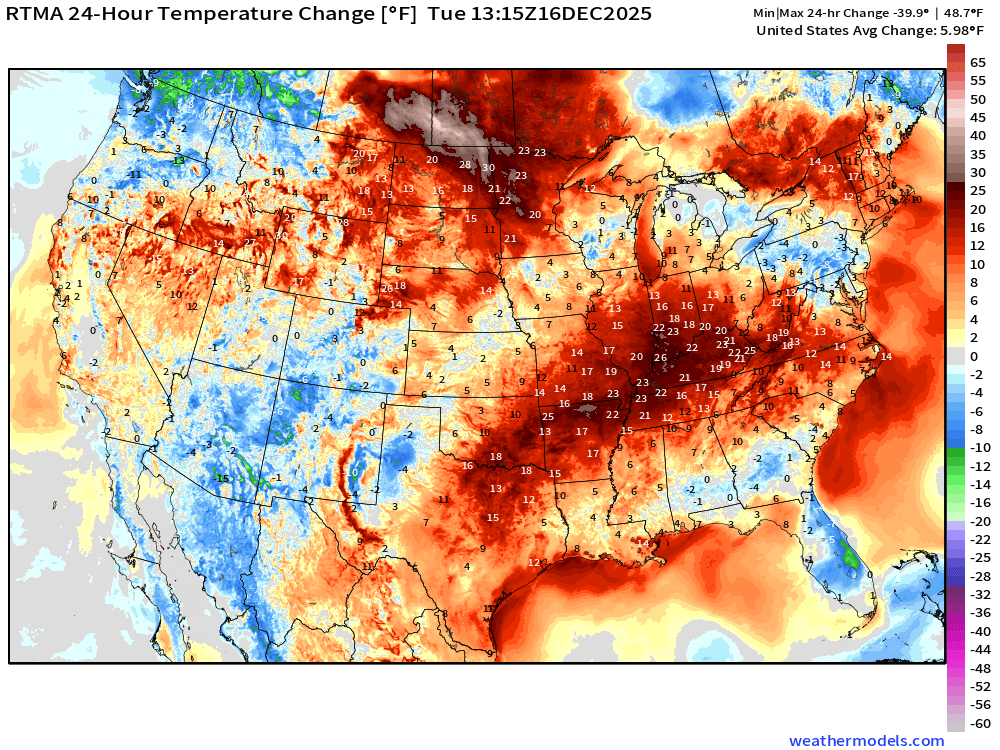
Lower 48 is 6.0°F warmer than 24-hours ago
RTMA | Current Temperature Analysis | 8:15 AM ET
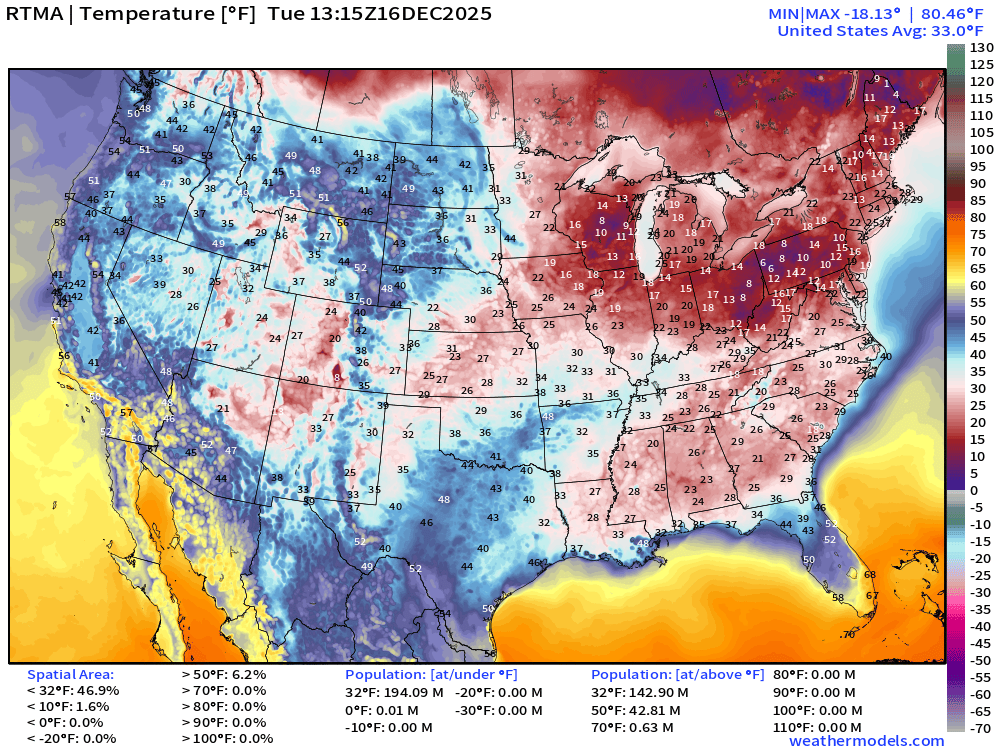
Average Lower 48 temperature was 33.0°F with about 143 million below freezing.
Temperature Anomaly | 8:15 AM ET
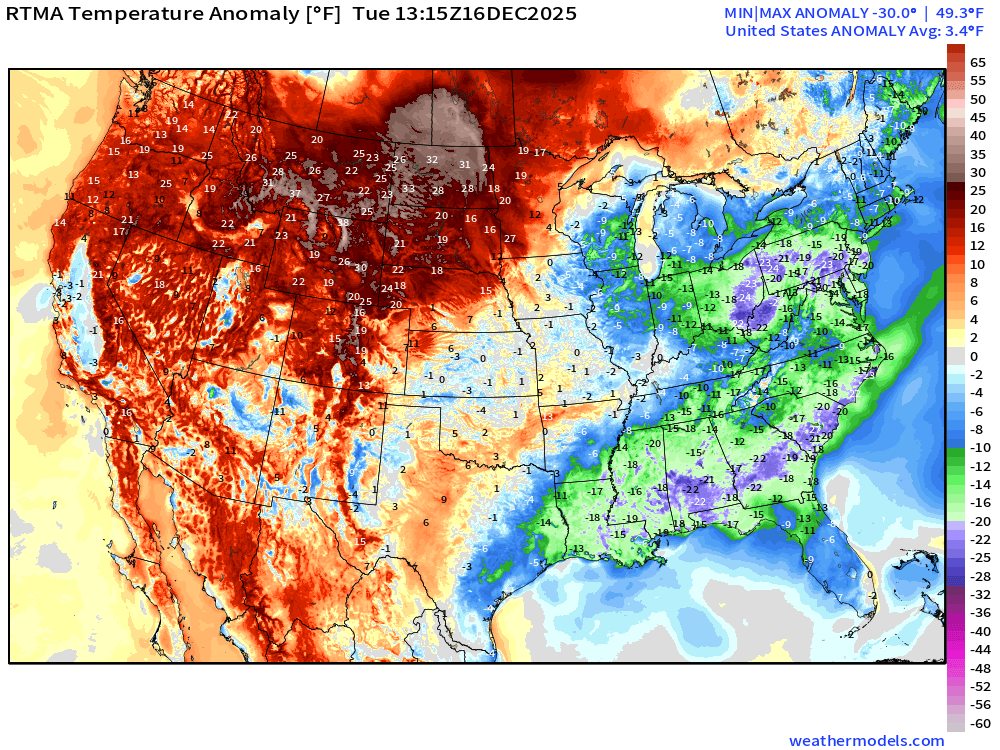
Lower 48 Temperature Anomaly was 3.4°F ABOVE normal
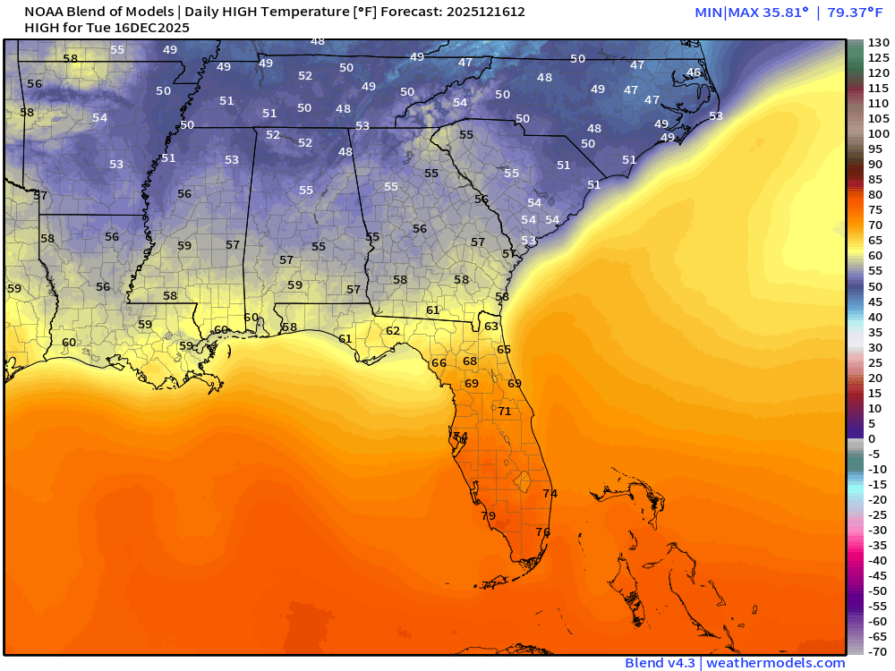
Tuesday High Temperatures
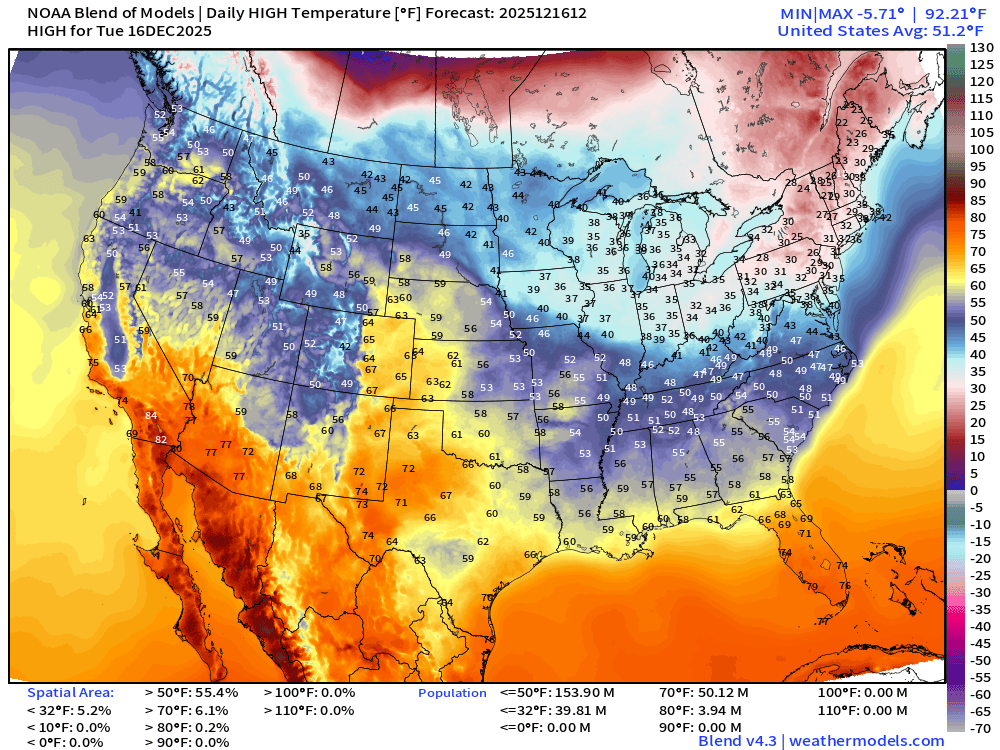
Lower 48 average high > 51°F — with 50 million at least 70°F and 40 million below freezing mainly in the great Lakes and Northeast
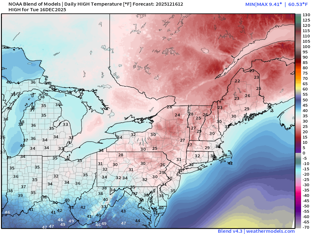
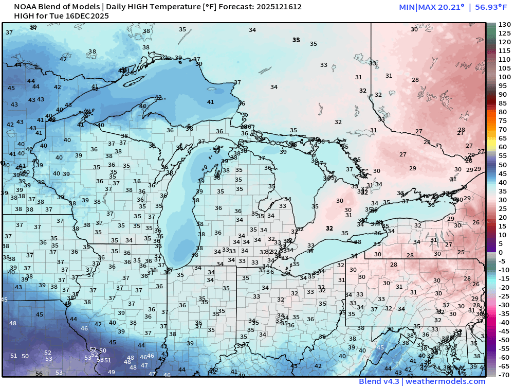
Wednesday Low Temperatures
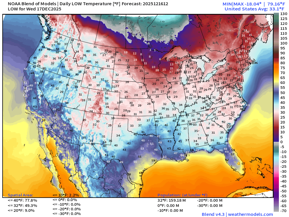
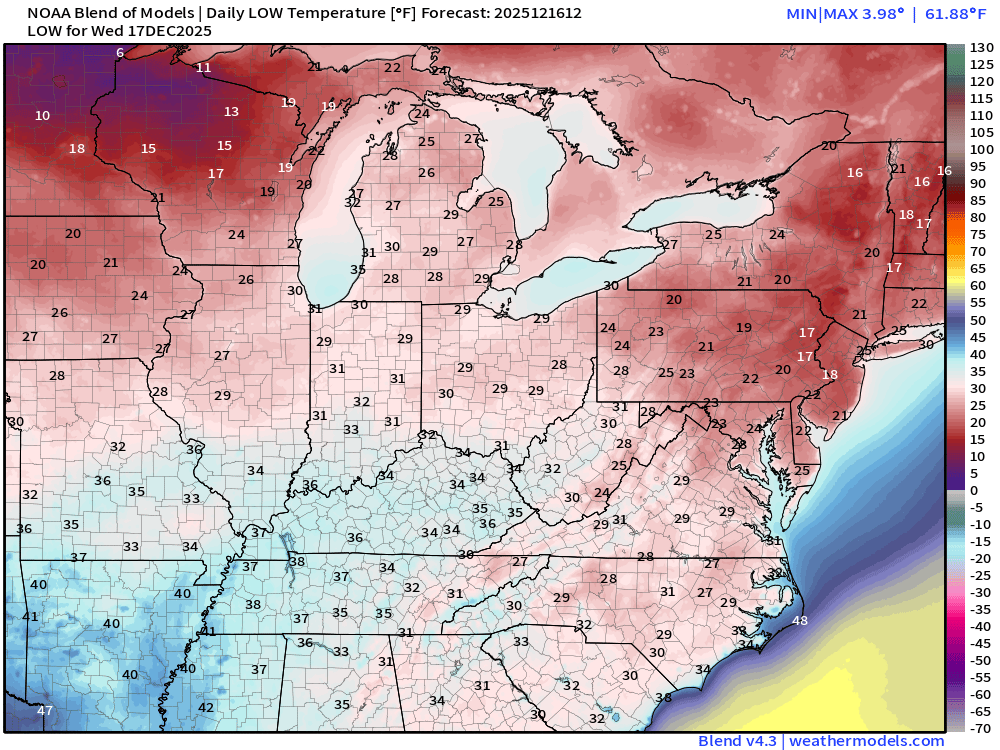
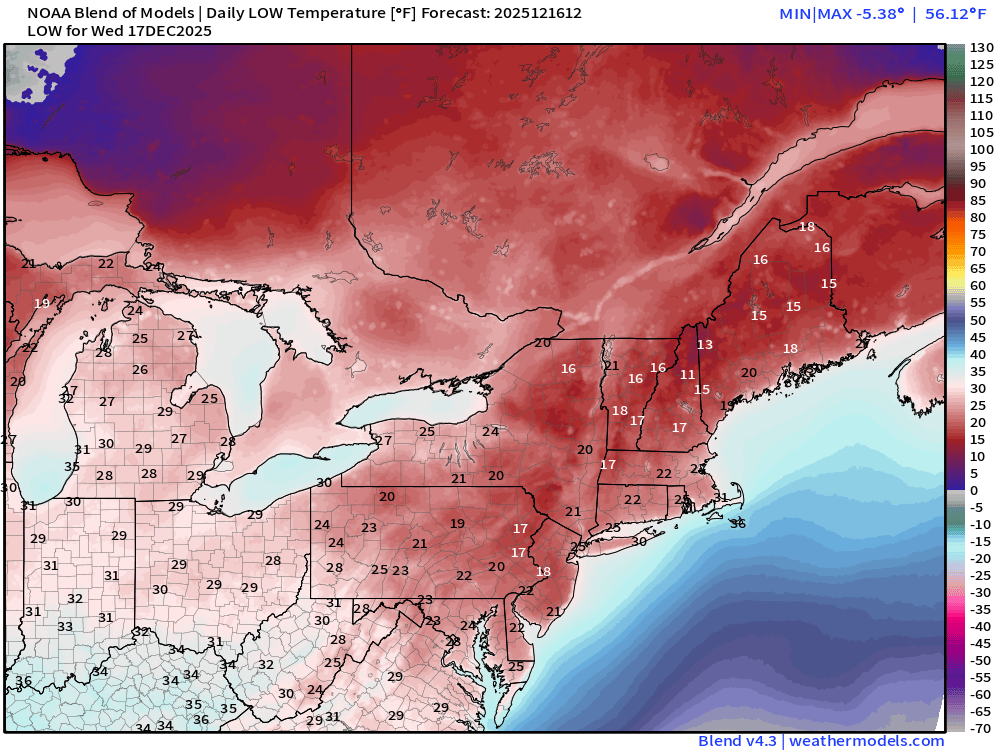
159 million below freezing but not seeing any subzero readings.
Wednesday High Temperatures
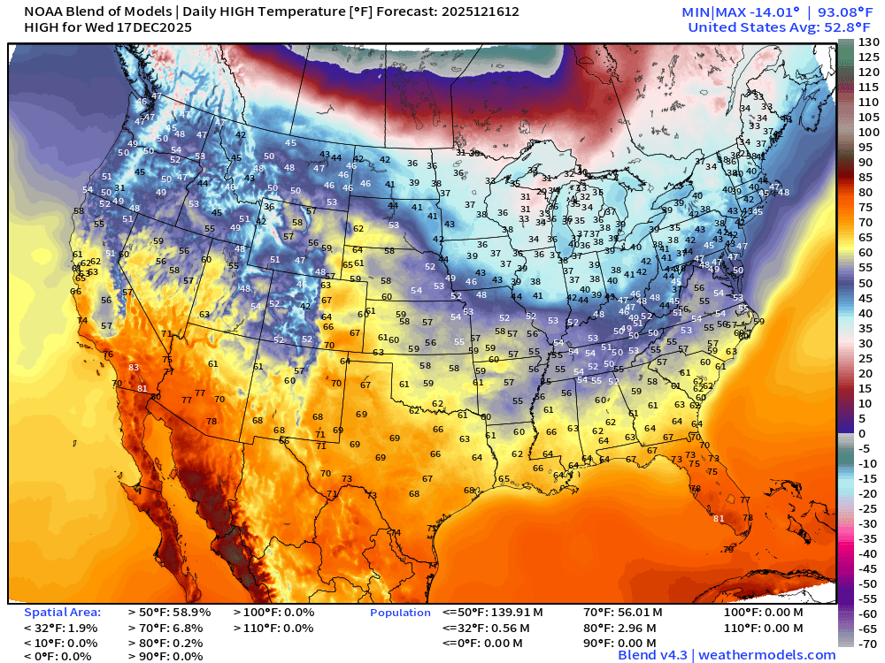
Even warmer — we lose almost the entire freezing population — up to 56 million at least 70°F
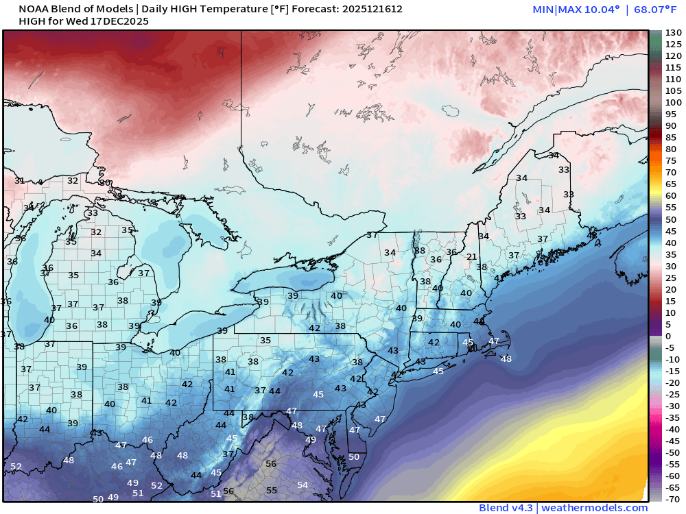
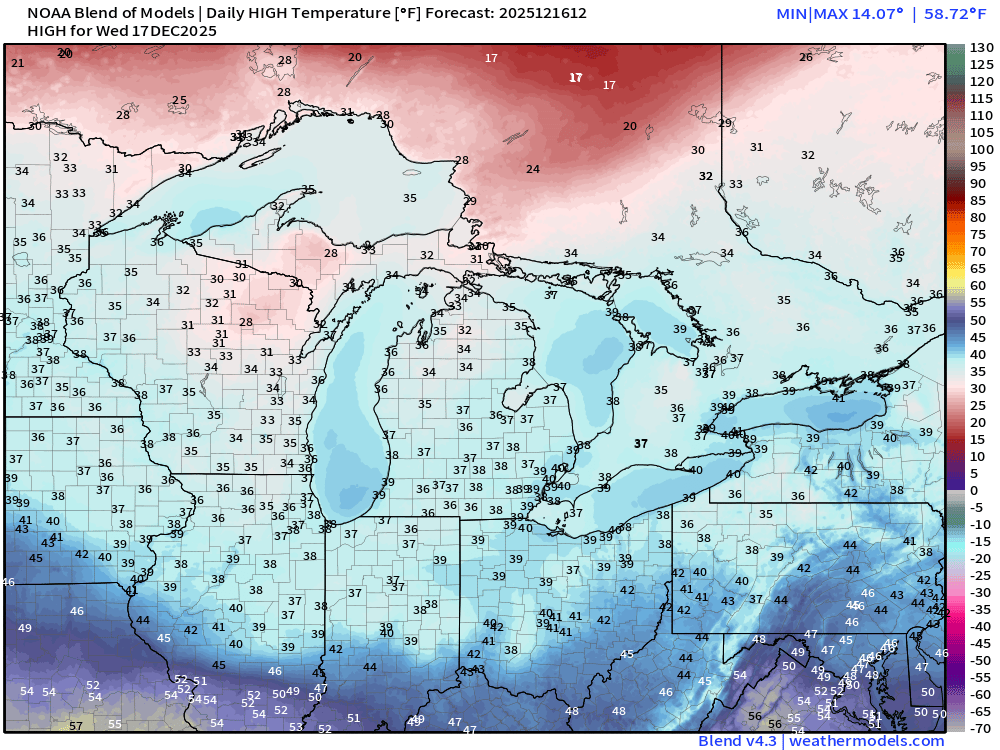
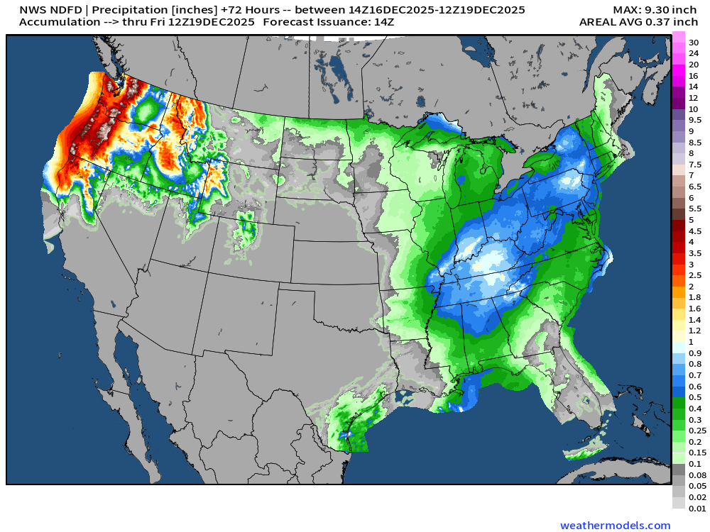
NWS Precipitation Next 72-hours
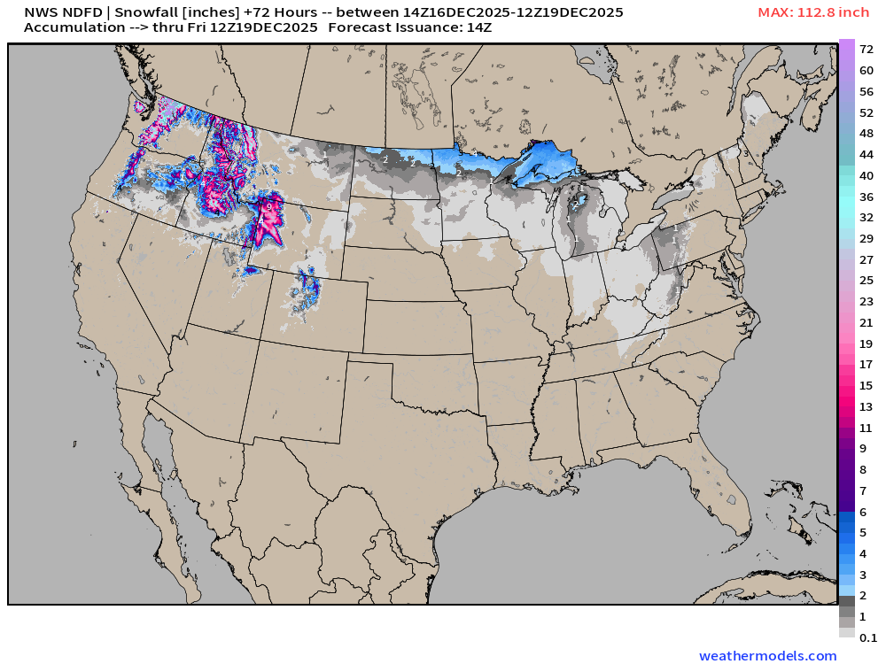
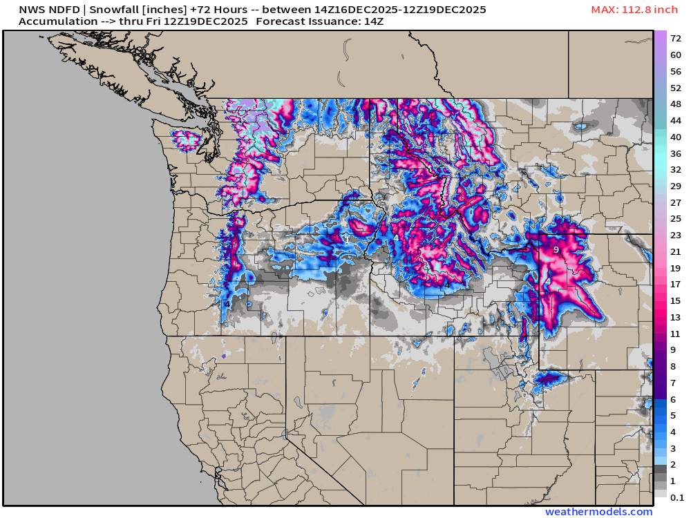
NWS Snowfall Next 72-hours
Blend of Models | 10 Days Precipitation Total
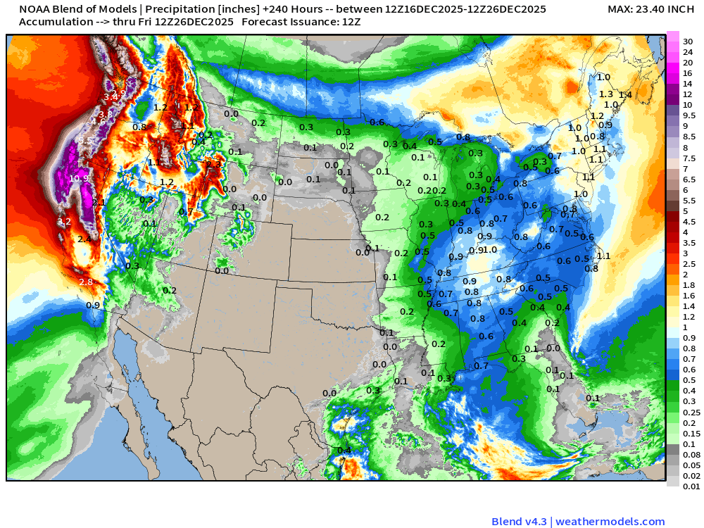
Massive amount of rain into California over the next 10-days —> 5 trillion gallons+
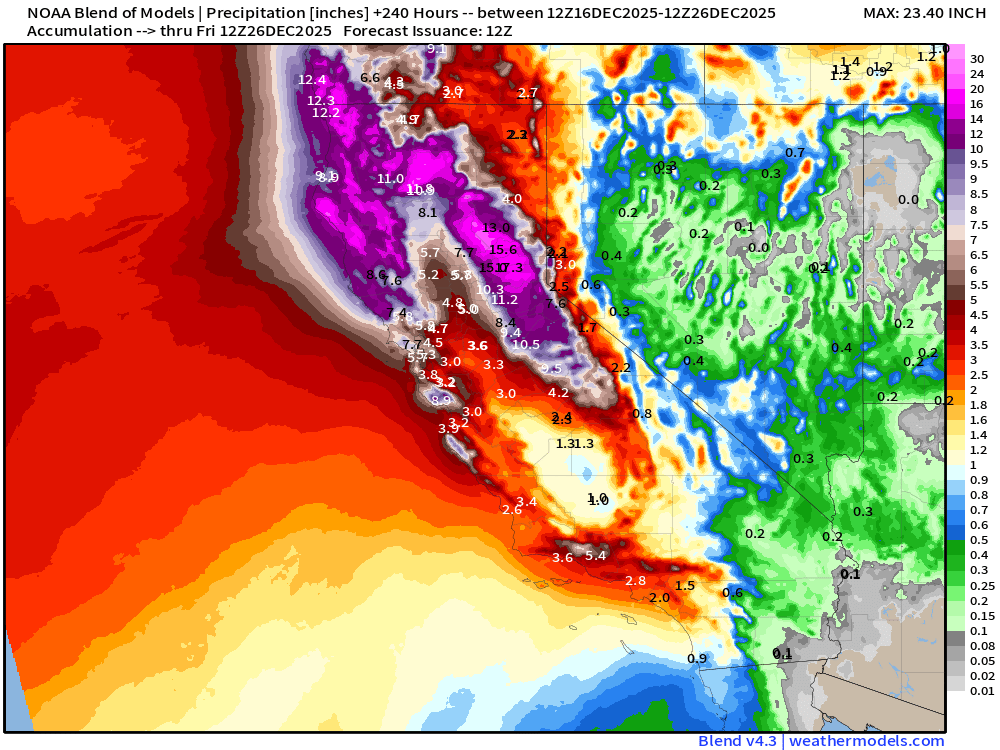
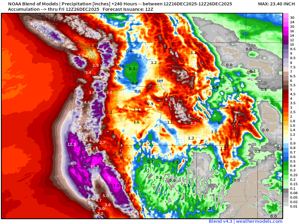
Enormous rainfall totals across the Pacific Northwest continue
Blend of Models | Total Snowfall Next 10-Days
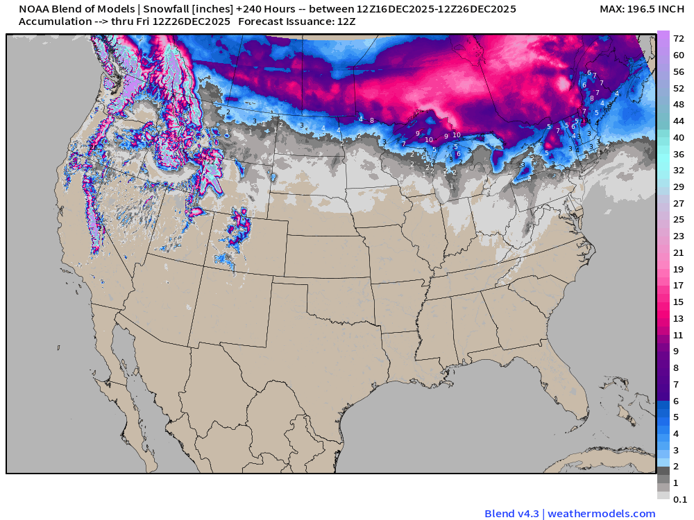
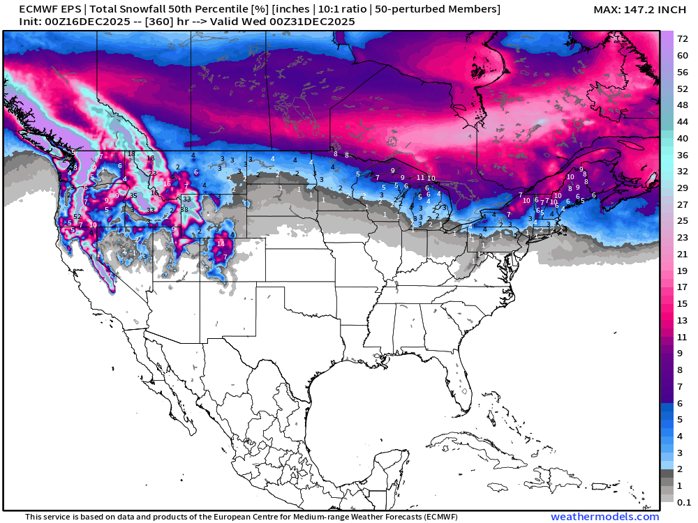
Not much snowfall east of the Rockies — but we see cold enough air at higher elevation to dump major accumulations on higher elevations.
ECMWF AIFS-Single 06z | Height Anomaly (500 hPa) Next 10-days
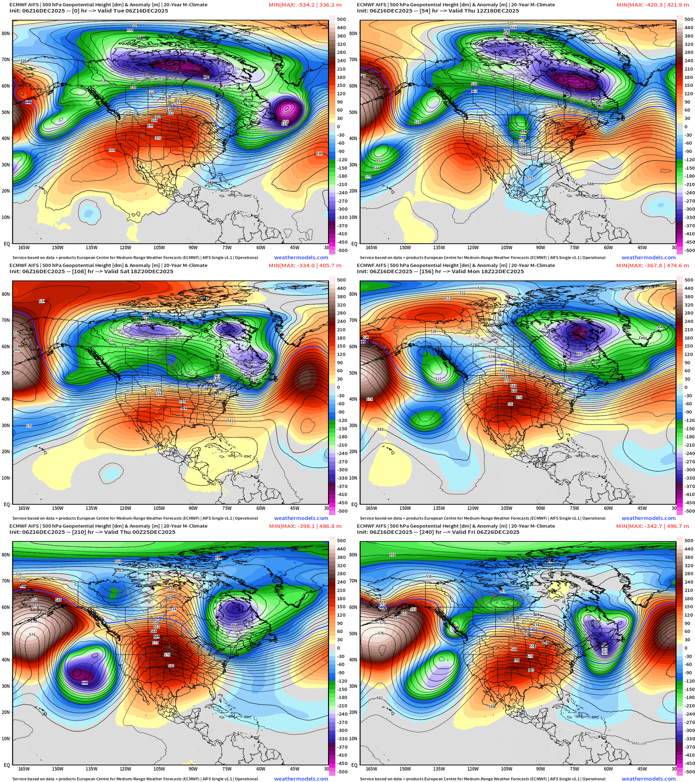
One more “polar vortex” trough into this weekend … and then the ridge builds across the Rocky Mountains and forms a long-lasting block.
No doubt about the intensity of this Lower 48 Blocking Ridge — so we next must determine when this pattern “breaks down” and we shake the bag, spin the wheel, or whatever to determine where the overall upper-level patterns goes into the weekend after Christmas
ECMWF 00z | Integrated Vapor Transport Next 10-days

Parameter used for monitoring “atmospheric rivers” usually along the U.S. west coast, but the idea works well for many other areas — highlighting midlatitude storm systems with warm conveyor belts (moisture plumes)
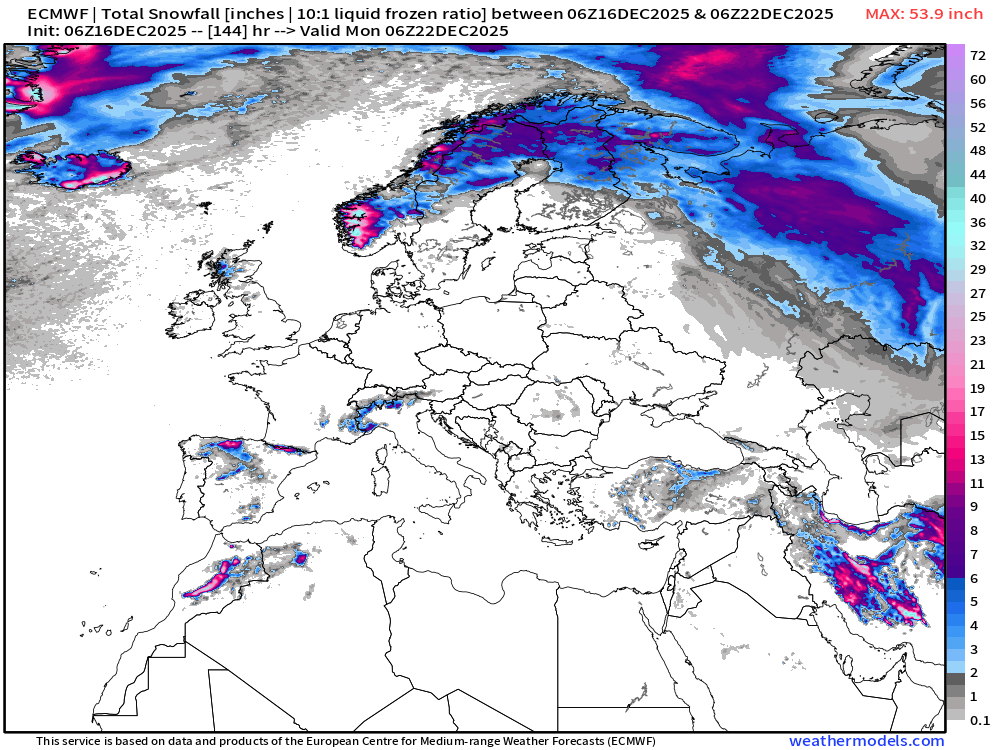
ECMWF 06z | Snowfall | Next 6-days
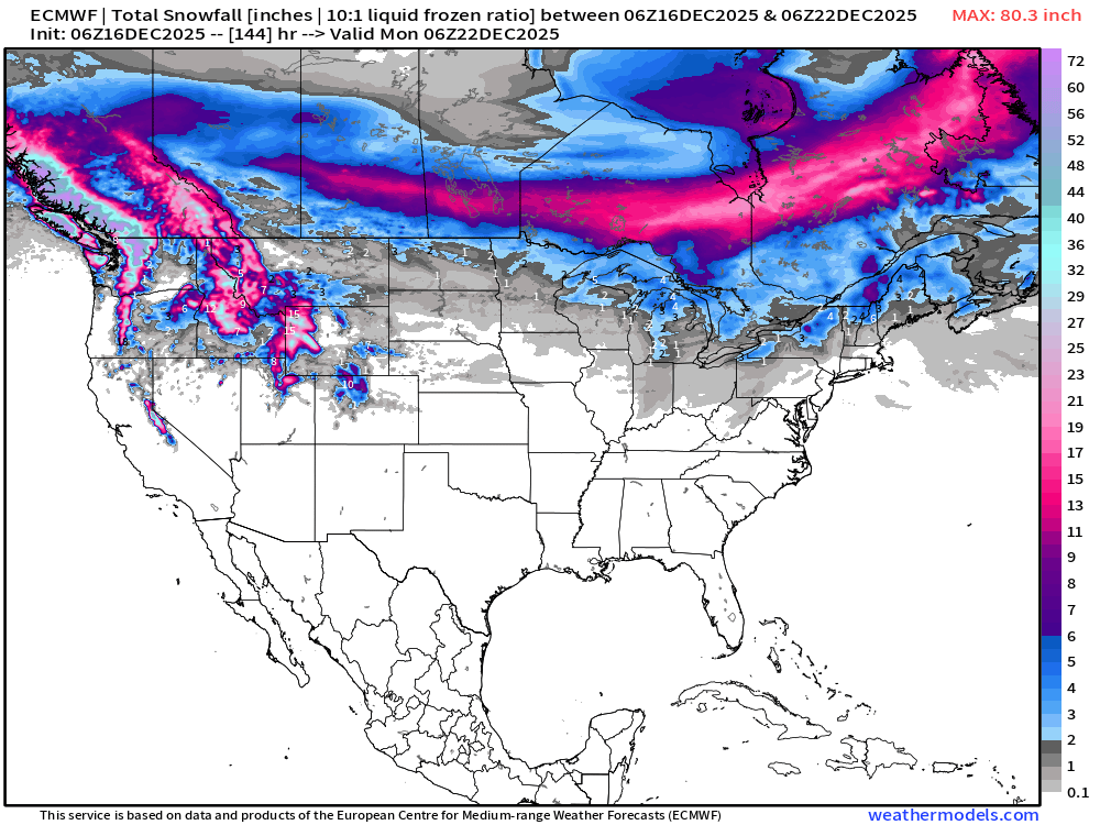
ECMWF EPS 00z | Ensemble Median Snowfall Next 15-days
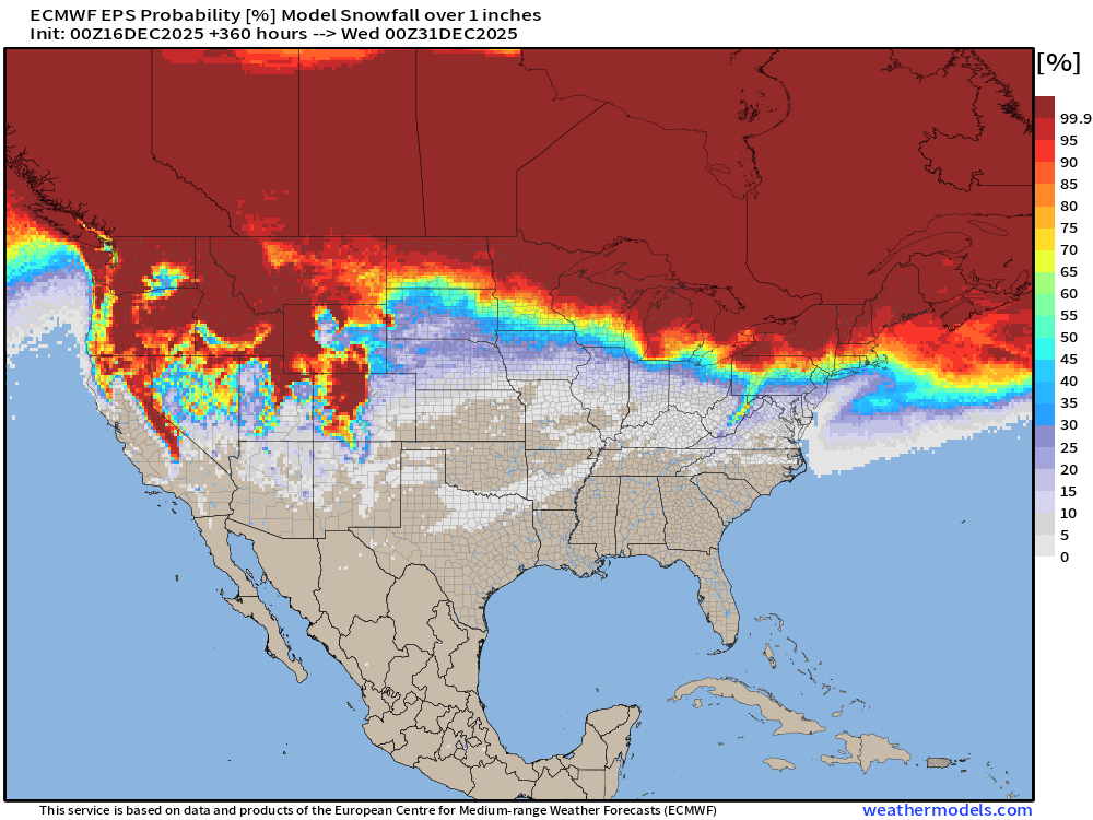
Probability of 1-inch or more Snowfall in the next 15-days
Probability of 6-inches or more Snowfall in the next 15-days
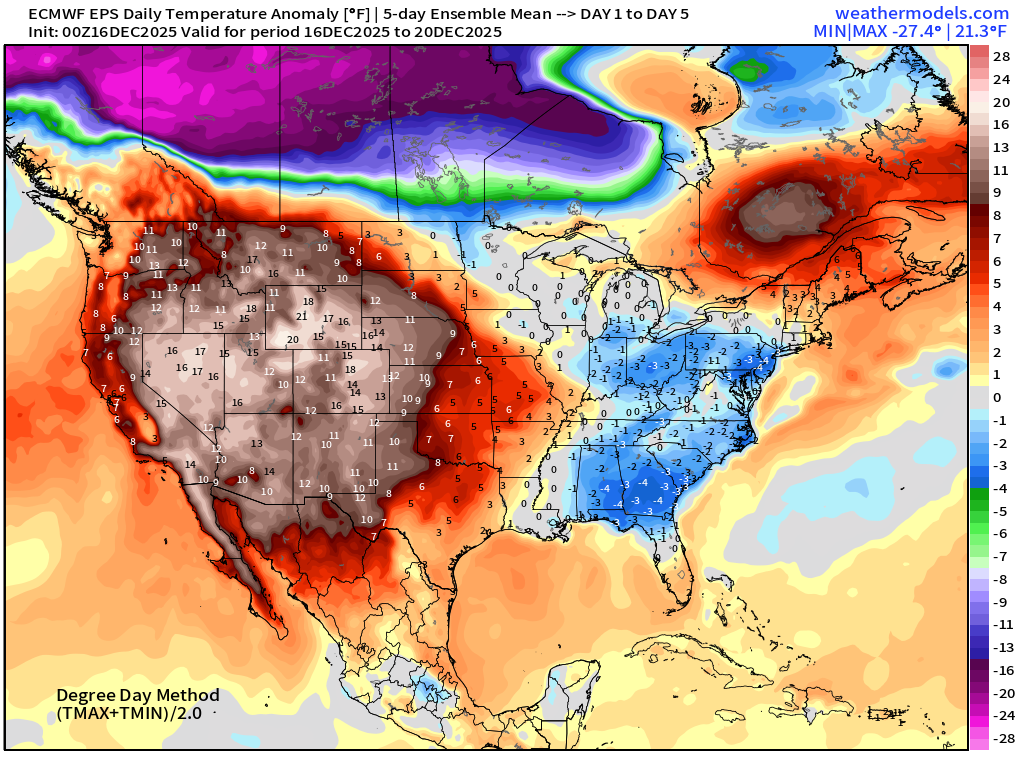
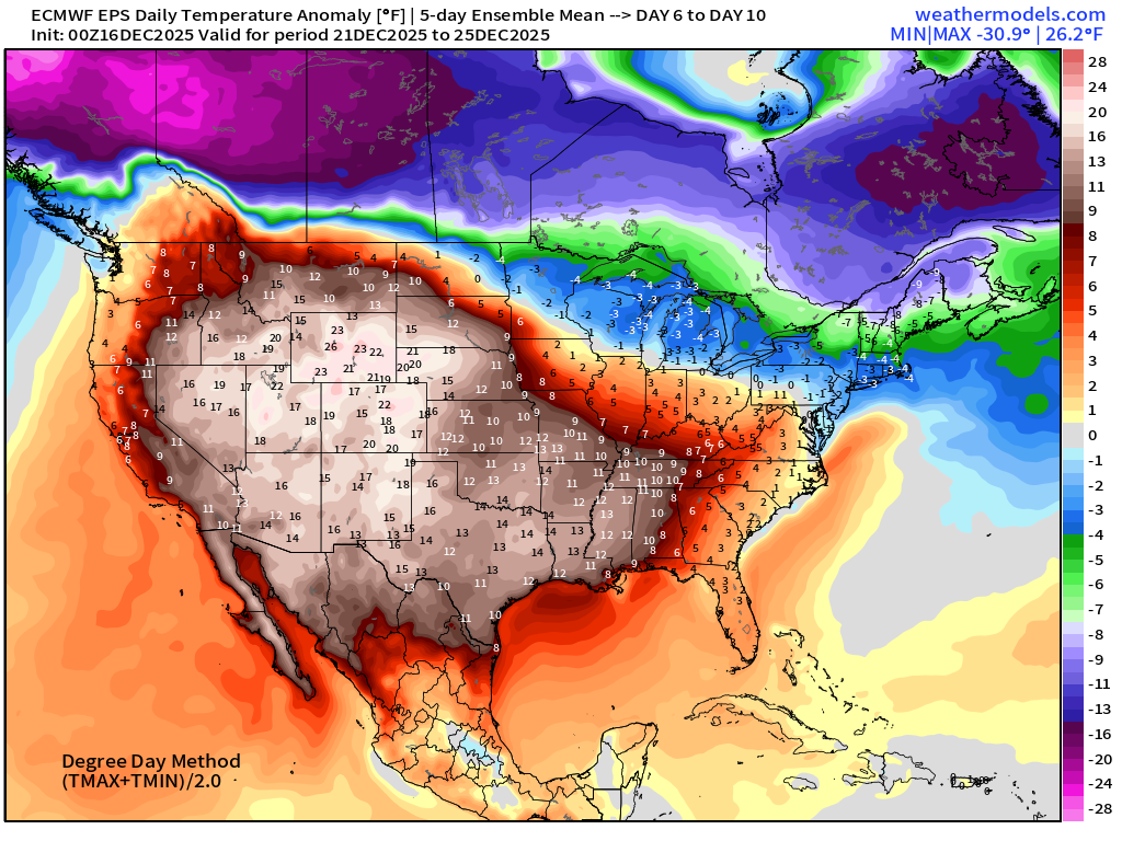
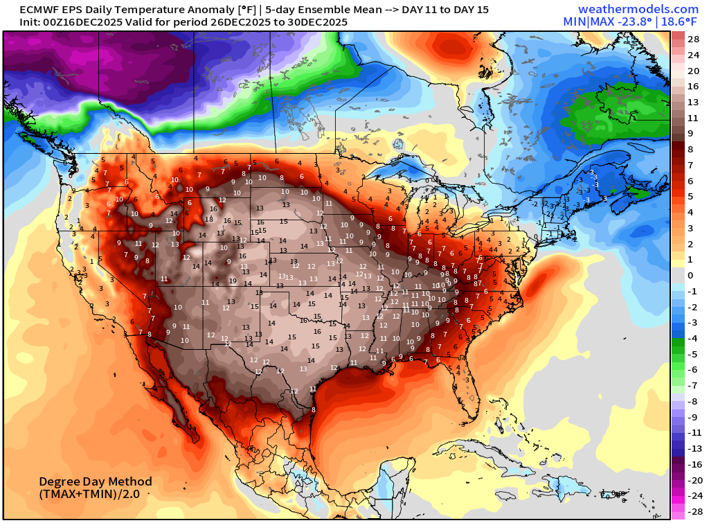
Temperature Anomaly | Next 15-days | ECMWF EPS 00z
5-Day Chunk #1 | Temperature Anomaly | Dec 16 - Dec 20
5-Day Chunk #2 | Temperature Anomaly | Dec 21 - Dec 25
5-Day Chunk #3 | Temperature Anomaly | Dec 26 - Dec 30
Maps sourced from weathermodels.com designed and innovated by yours truly! Please subscribe there for real-time access to the newest maps, charts from all of the weather models including ECMWF and AIFS, NOAA AI-GFS/AI-GEFS
Active coupon codes:
- Milepost
- 817 · laid 2025-12-16T14:39:25.262000Z
- Source
- https://weather.substack.com/p/december-16-2025-tuesday-morning
- Digest
- 626d045b9daf05e126fac0a90ab67396dcaabd047d2d49e7fe517beb3cf636b6
- Machine
- JSON