December 7, 2025 Sunday Evening Weather
Extreme cold (again) next weekend in Midwest and Great Lakes
December 2025 was the 5th-warmest December in the 131-year national record (1895–2025), at 37.8°F against a 1991–2020 normal of 34.3°F (+3.5°F).
December 2025 was the 37th-driest December in the 131-year national record (1895–2025), at 2.0in against a 1991–2020 normal of 2.5in (-0.5in).
NOAA/NCEI Climate at a Glance, contiguous United States. This is the observed record for the month, not a score of anything said in this piece — the forecast ledger begins 2026-08-17 and cannot reach earlier posts.

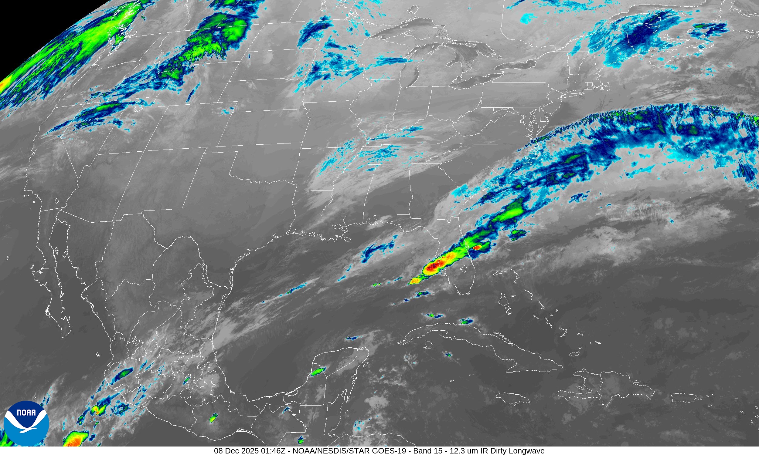
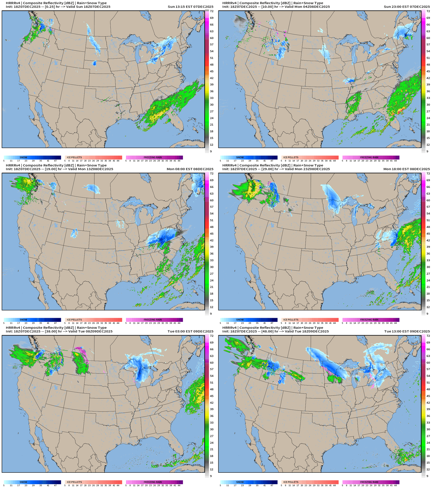
Some active thunderstorms across central Florida this evening — a reminder of what “warm convection” looks like as we move into mid-December
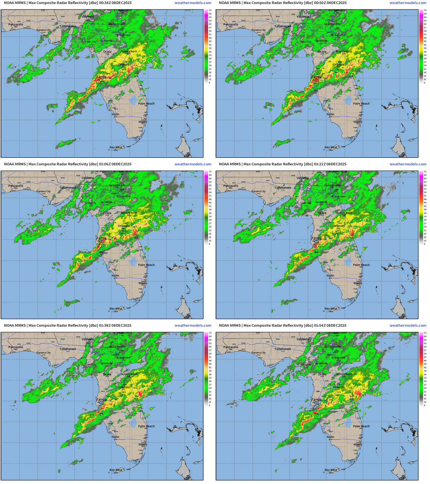
HRRR 18z | Next 48-Hours into Tuesday Early Afternoon
Another storm system for Virginia — not intense but decent snowfall accumulations
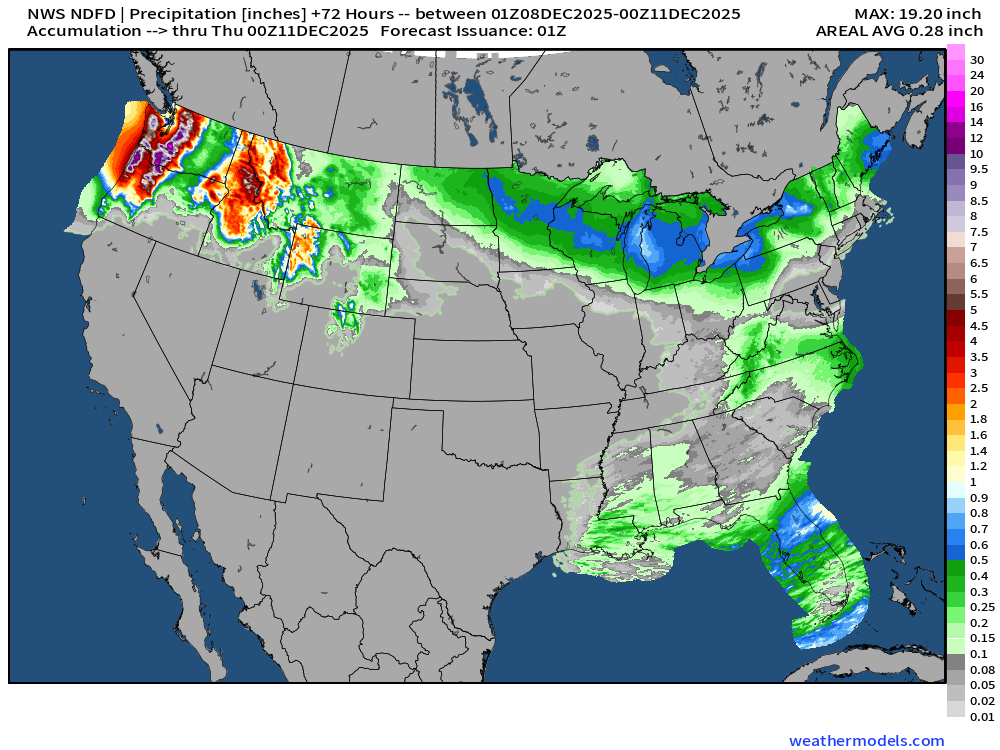
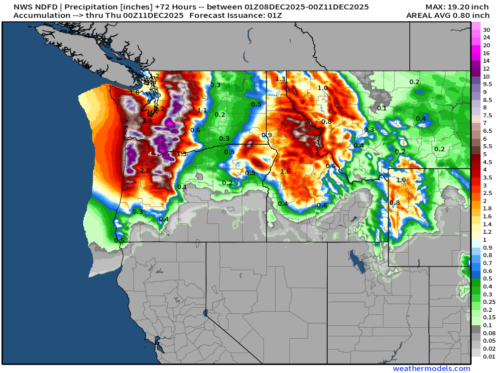
Atmospheric river crashes into Washington
Moisture then heads into the Midwest to be captured by “Clipper systems”
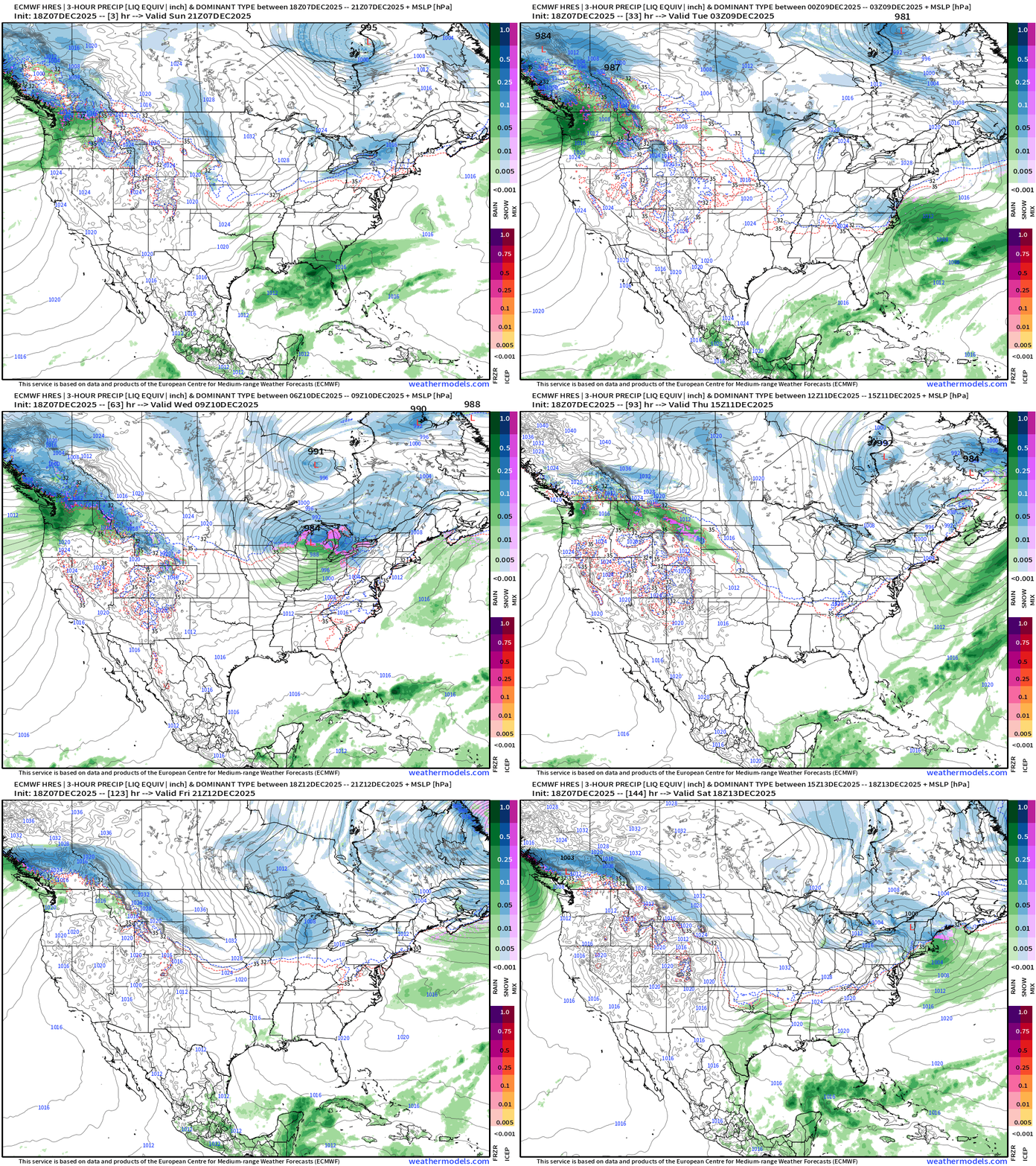
Precipitation Type | Weather Next 6-days | ECMWF 18z
Headlines Sunday Evening
Powerful Alberta Clipper system Tues-Wed across the Midwest and Great Lakes
72-hours of “atmospheric river” event “boatloads” of moisture into the Pacific Northwest
Strong Western U.S. ridge remains anchored — and firmly in charge for the next 10-14 days (at least)
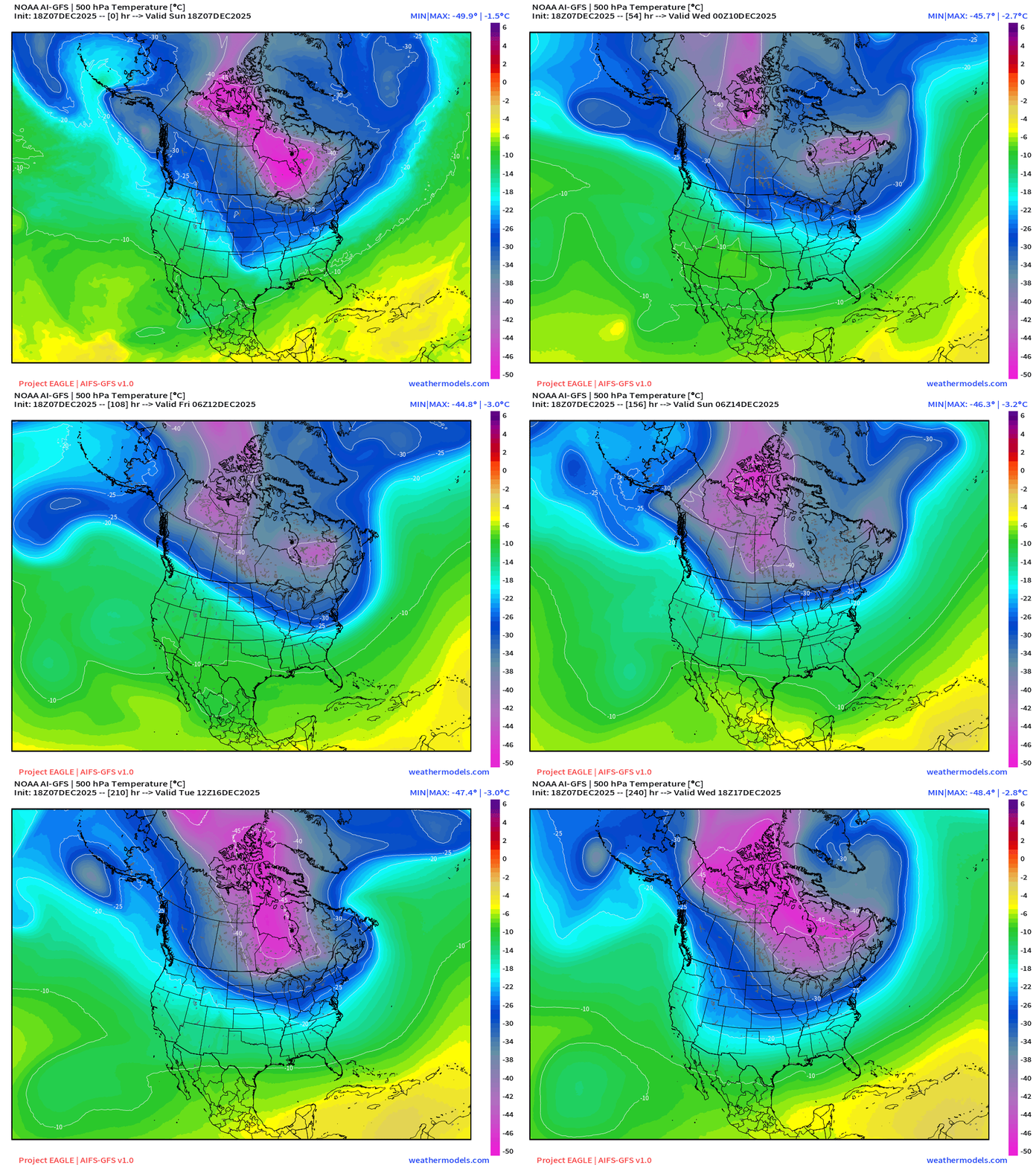
Blocking ridge out west —> Arctic air continues to spill out of Canada and Alaska as lobes of the polar vortex are extended southward by passing shortwaves — vorticity / energy packets from the North Pacific riding down the polar front boundary.
COLD — even for mid-December — peaking Sat/Sun across the Midwest/Great Lakes.
ECMWF 18z Precipitable Water Next 6-days | My favorite parameter
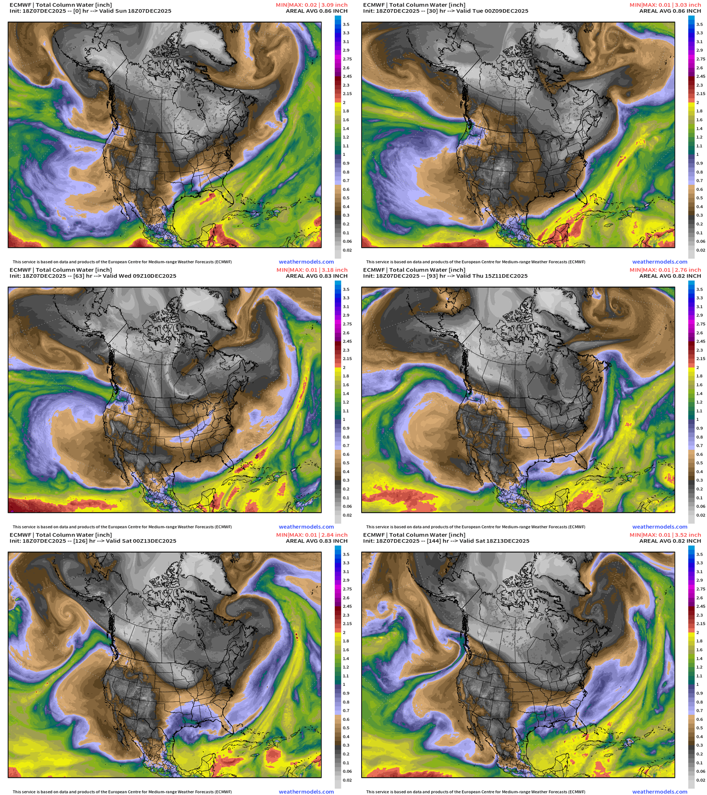
Atmospheric river systems into the Pacific Northwest — narrow at first, and then quite a wide swath by Tues/Wed — see how shortwave disturbances along the polar front (polar vortex edge) pick up the moisture = Alberta clipper systems
White colored precipitable water = absence of moisture = cold/polar air mass surges southeast out of Western Canada into the Midwest into next weekend.
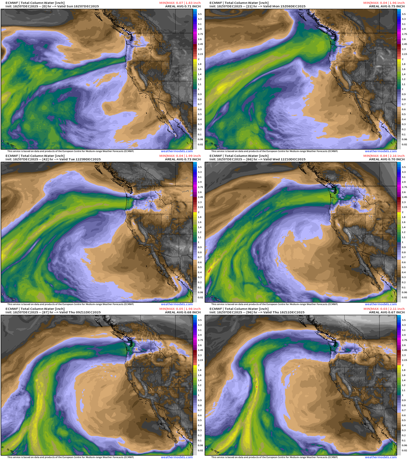
West coast atmospheric river (AR — Category 5) = pineapple express out of Hawaii
Temperature Anomaly | Next 15-days
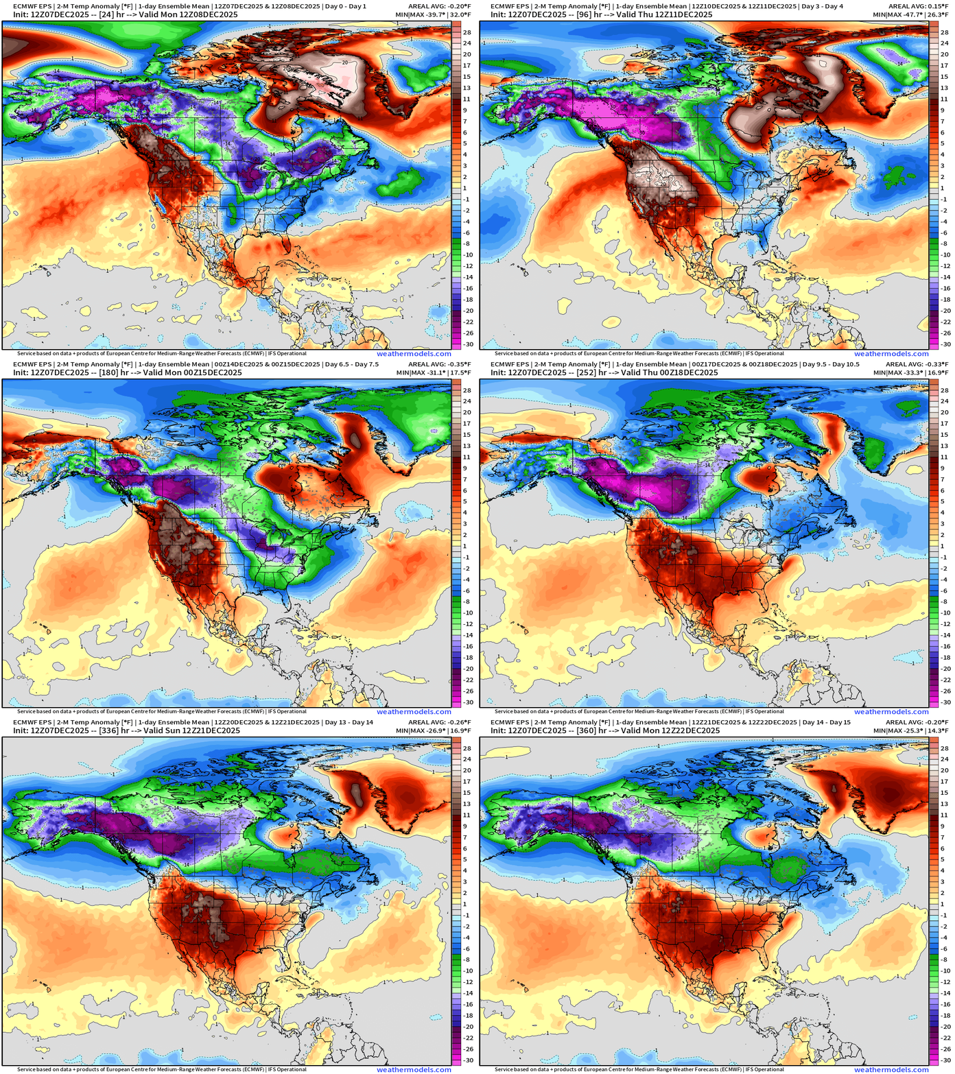
Flagship European model ensemble solution for temperature anomaly next 15-days shows intense cold pool formation over Alaska and Western Canada while a very warm/persistent blocking ridge remains stuck across the Western U.S.
Main uncertainty is ability of this ridge to extend east across the Rockies — and perhaps transition to a much warmer pattern into the 3rd week of December, but it’s not guaranteed (yet)
Note, there are fast moving disturbances or short-waves riding along the polar front from the Gulf of Alaska through the Pacific Northwest and then in the Midwest and Great Lakes. These features are spaced out in time — so the ensemble mean blends or smooths out 51 solutions that ALL have cold blasts but intermixed with warm periods. The end result is a rather smoothed continuous blob of cold connecting Alaska with the Northeast U.S.
Temperature Anomaly Days 3-6 | Into Saturday morning
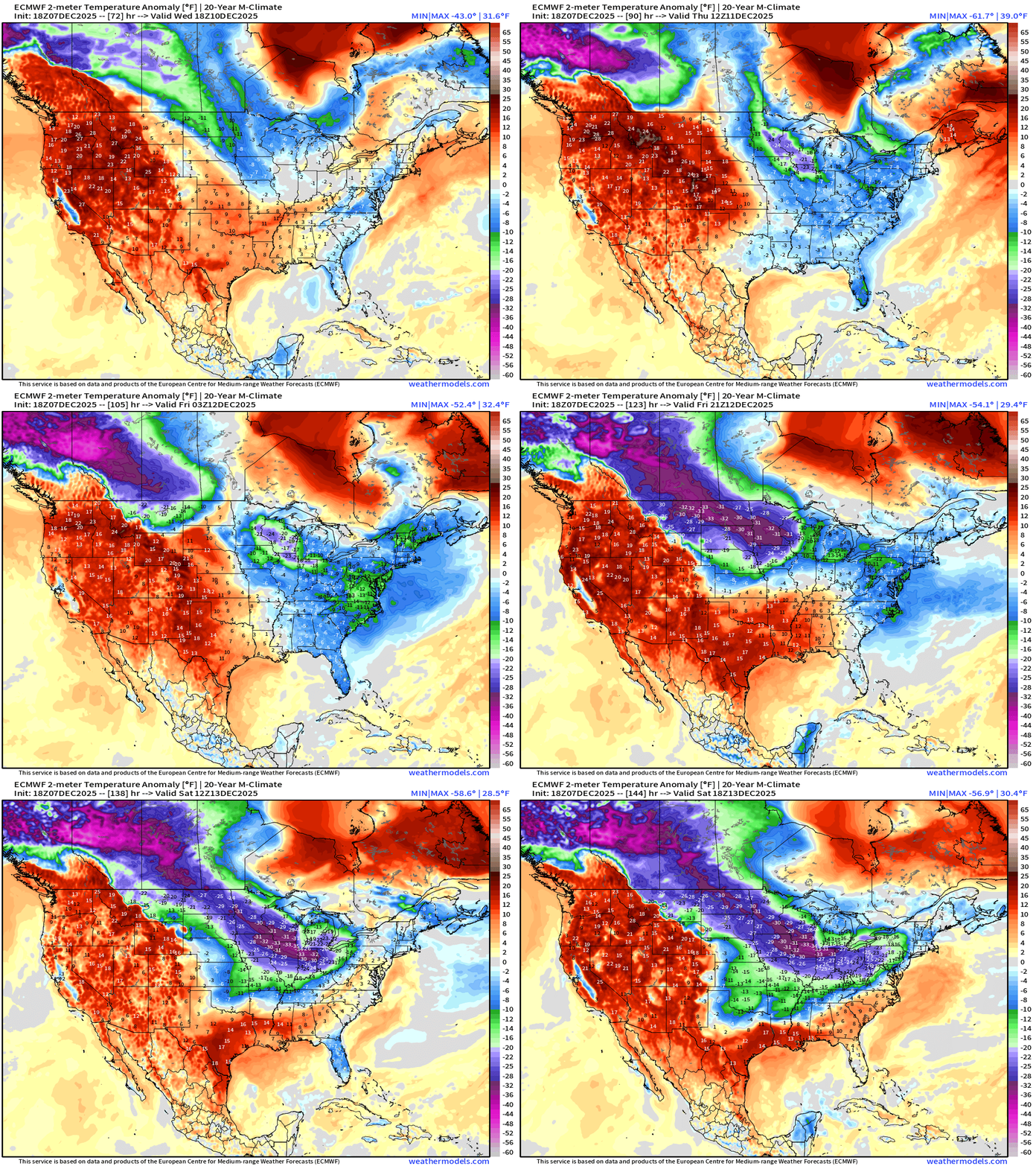
Exceptionally cold air spills into the Midwest and Great Lakes
RTMA | Current Temperature Analysis | 8:00 PM ET
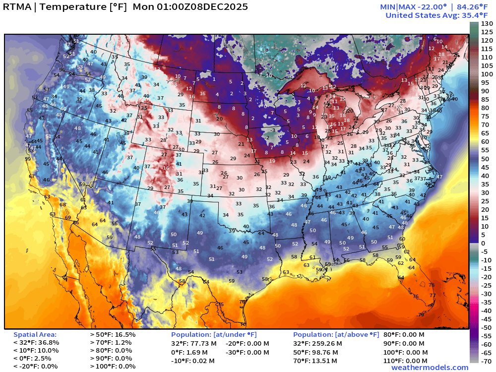
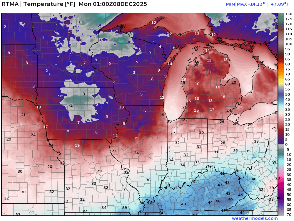
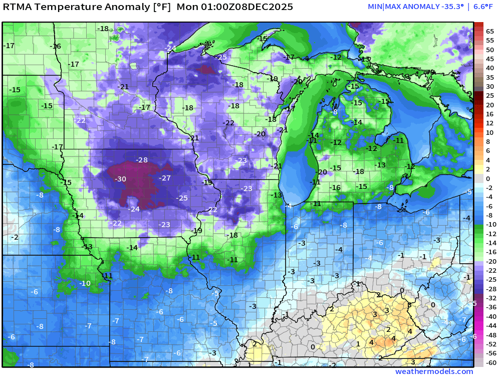
Temperature Anomaly | 8:00 PM ET
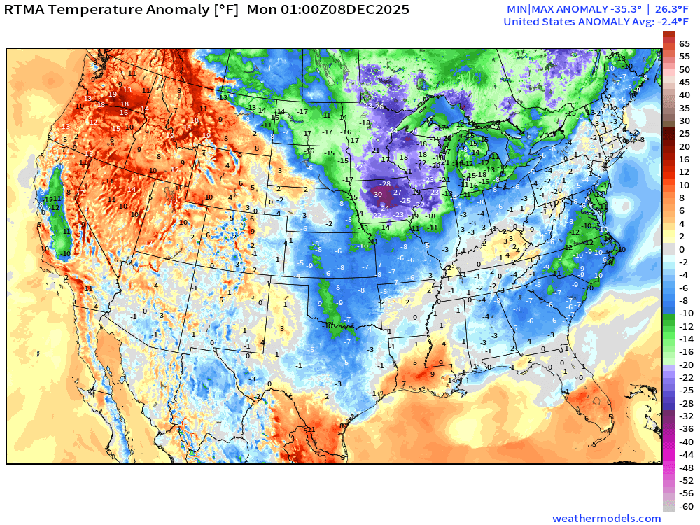
Lower 48 Temperature Anomaly was -2.4°F below normal
NWS Precipitation Next 72-hours
NWS Snowfall Next 72-hours
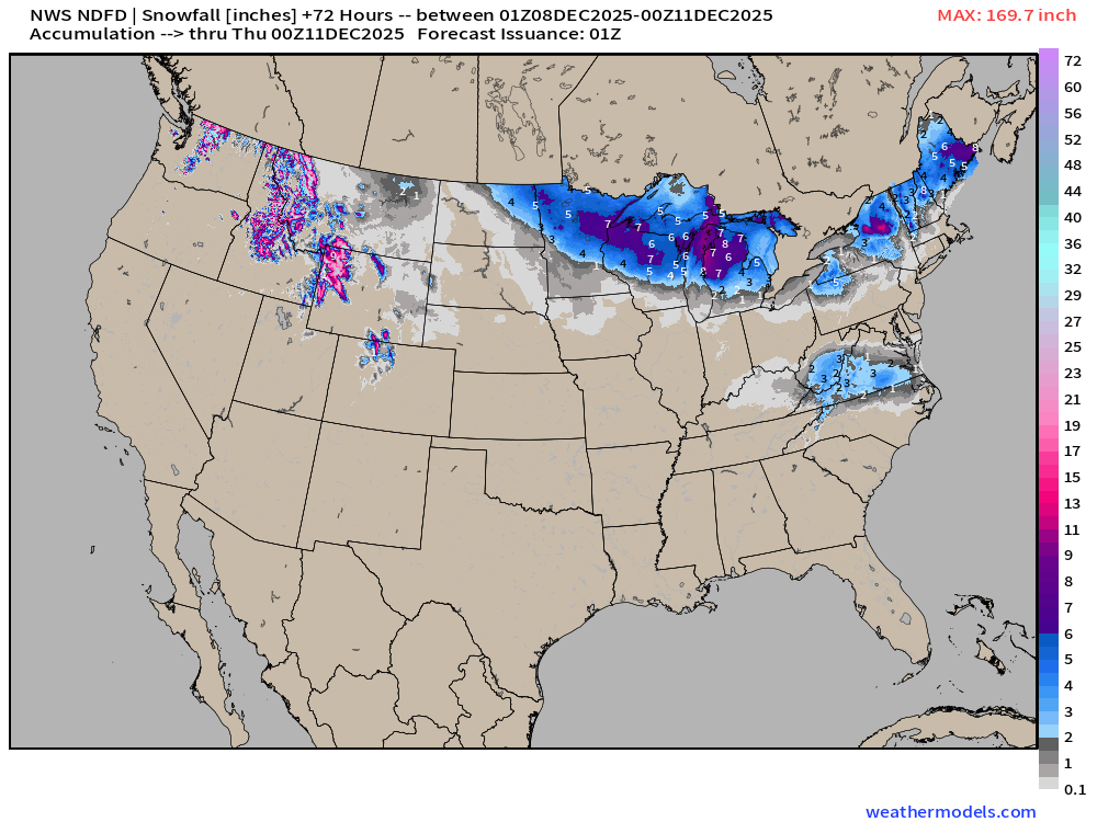
More snowfall for Midwest — Great Lakes but looks to mainly miss Minneapolis, Chicago, and Detroit — big bummer for large population if you like travel disruptions!
Blend of Models | 7 Days Precipitation Total
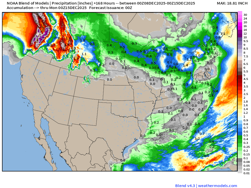
Upwards of 10-20 inches of precipitation — including liquid equivalent of snowfall in the Cascades from AR event
Blend of Models | Total Snowfall Next 10-Days
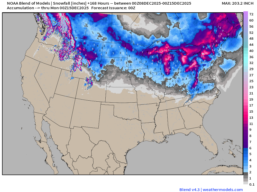
Completely snow free — zip/zero/zilch across California and the Great Basin
Plenty of opportunity for Lake Effect snow showers to crank up as Arctic air flows over the still much, much warmer Great Lakes.
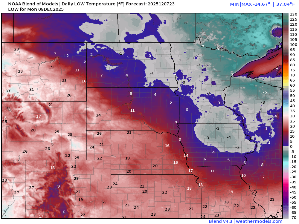
Monday Morning Low Temperatures
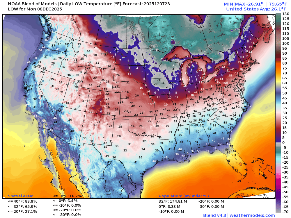
175 million below freezing (Lower 48 average low is 26.1°F) … 6 million below 0°F
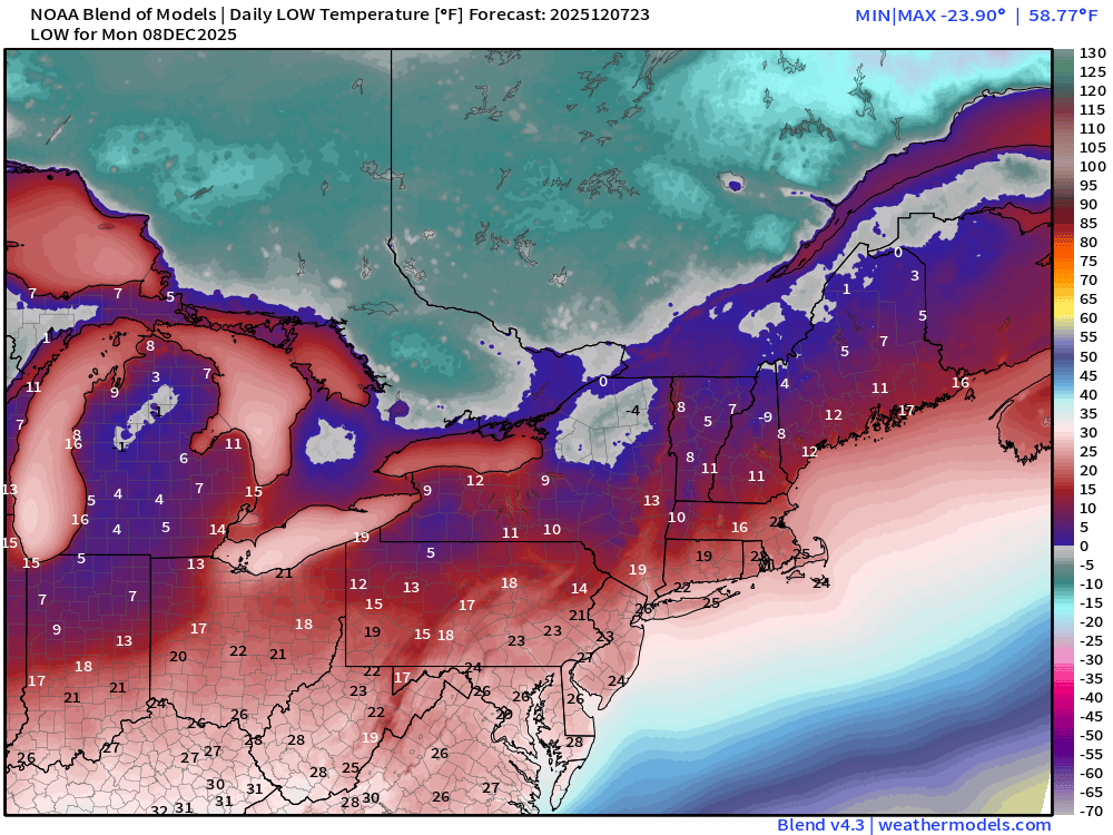
Single digits across Michigan —- across the lake into Toronto, and interior New England.
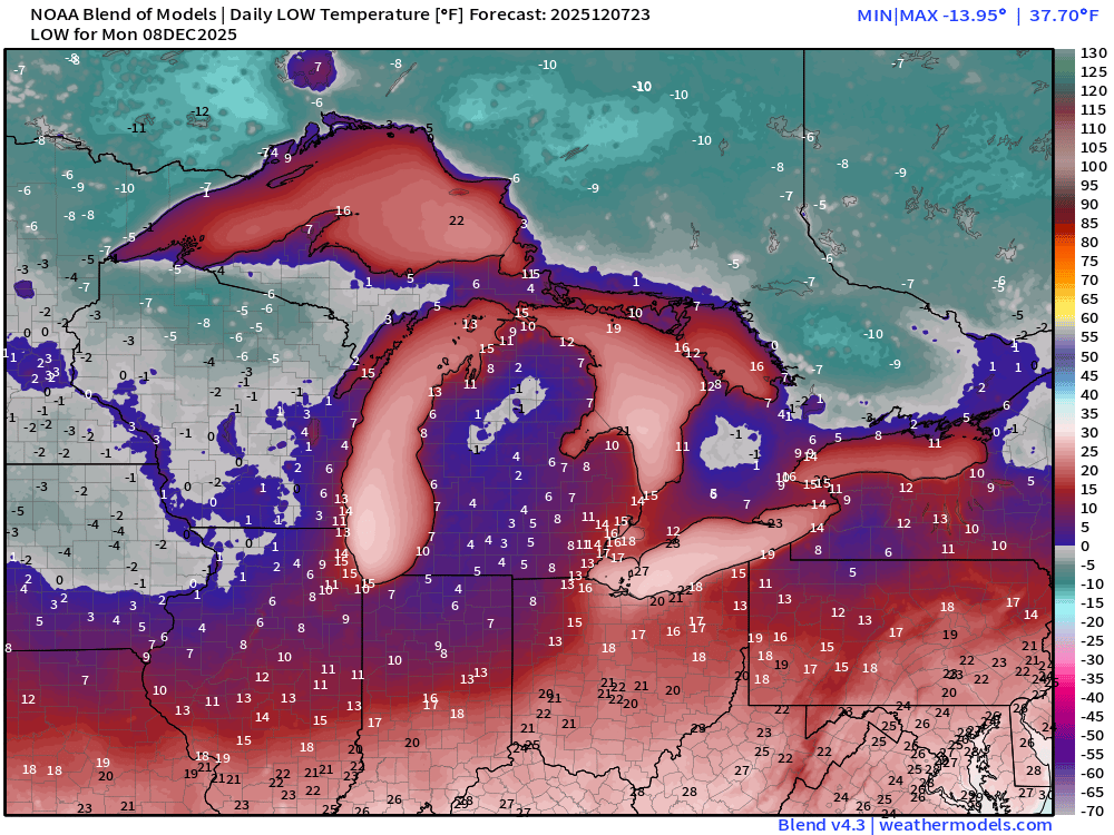
Subzero in the Midwest — but could worse — it will get colder into next weekend.
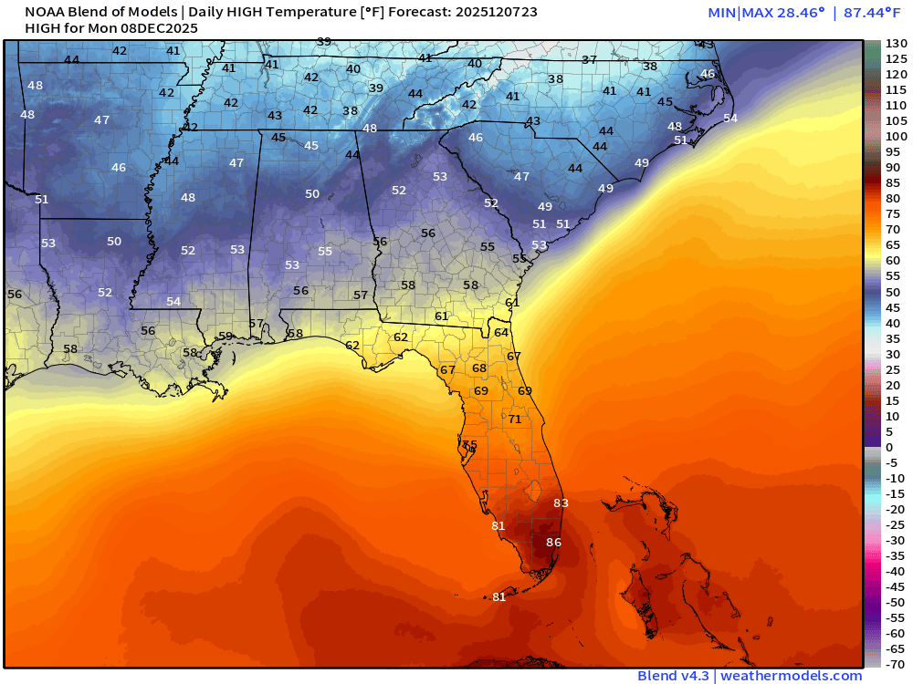
Monday High Temperatures
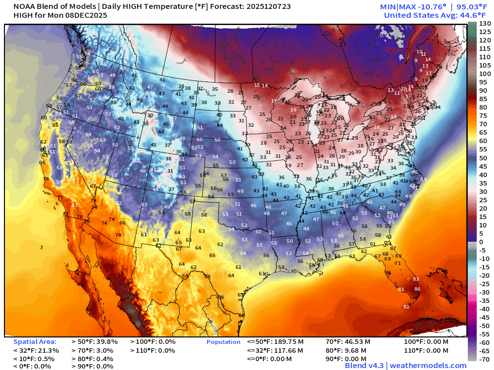
Around 10 million at/above 80°F in Florida! 118 million don’t get above freezing!
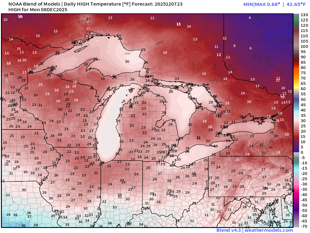
20s across the Great Lakes and Northeast — chilly!
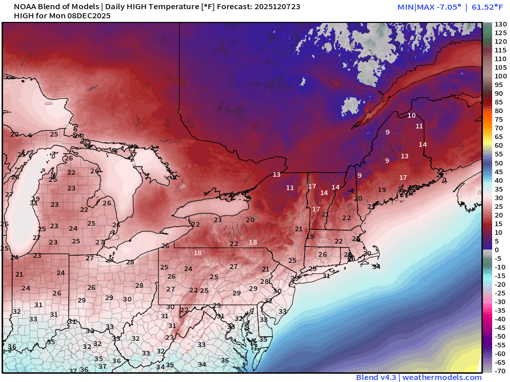
… still in the mid-80s in South Florida — escaping the Arctic air mass completely.
Tuesday Morning Low Temperatures
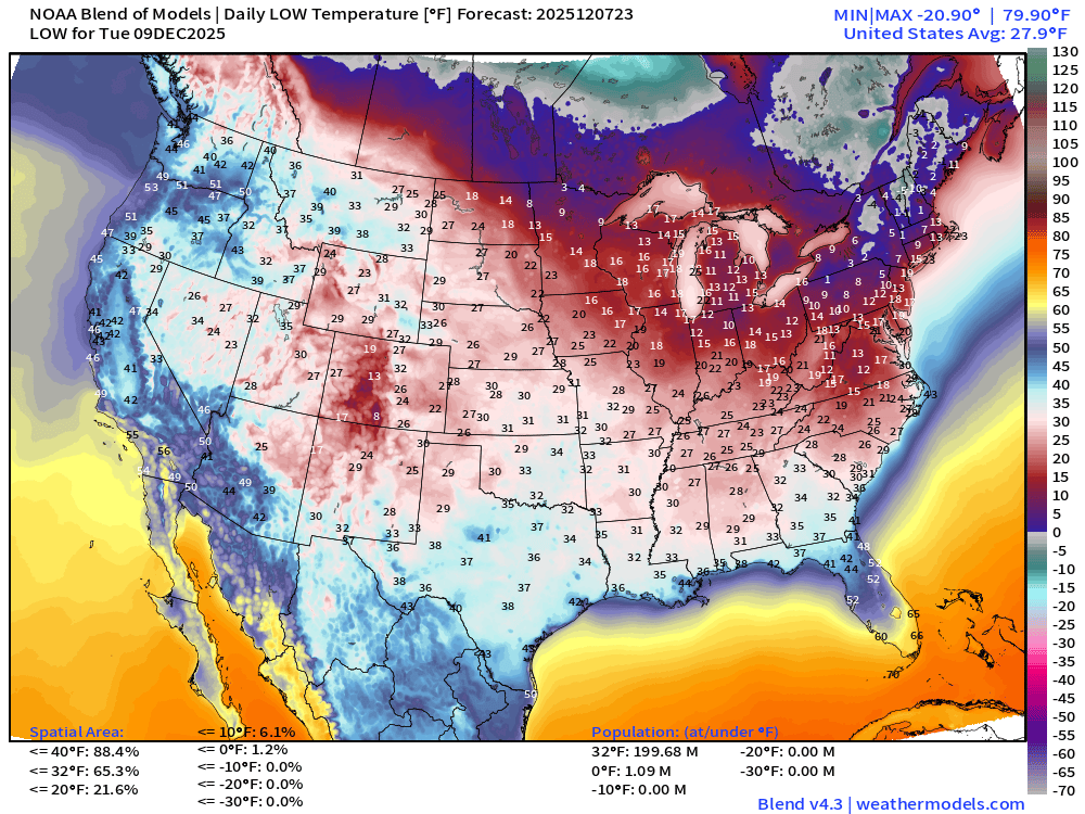
200 million below freezing (Lower 48 average low is 27.9°F)
Coldest compared to “normal” in the Northeast more than 15°F to 20°F below average lows — in the single digits to below 0°F
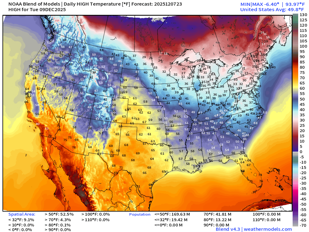
Tuesday High Temperatures
AI-GFS 18z | 500 mb Temperatures | Polar Vortex Watch Next 10-days
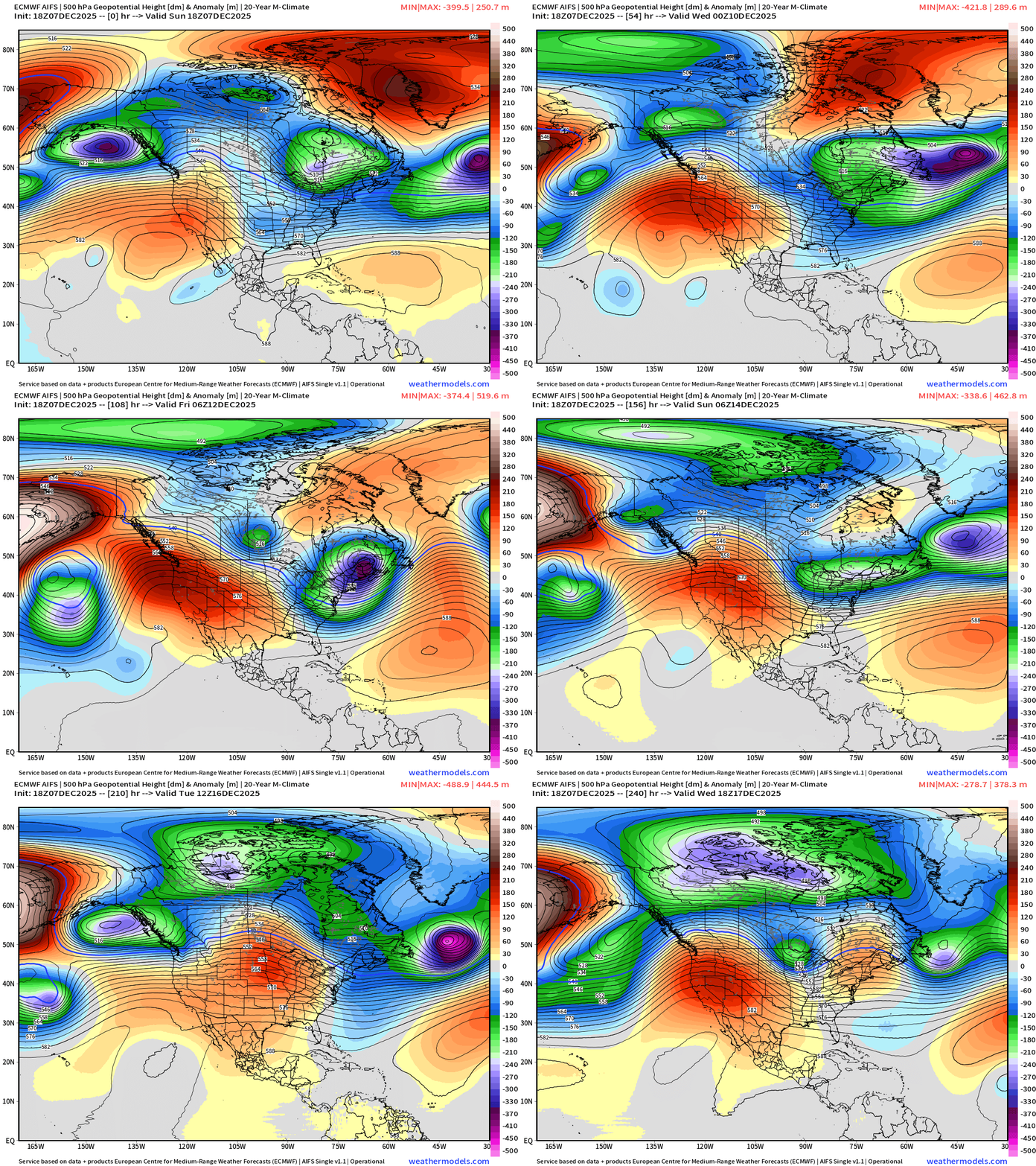
ECMWF AIFS-Single 18z | Height Anomaly (500 hPa) Next 10-days
Integrated Vapor Transport Next 10-days | North America
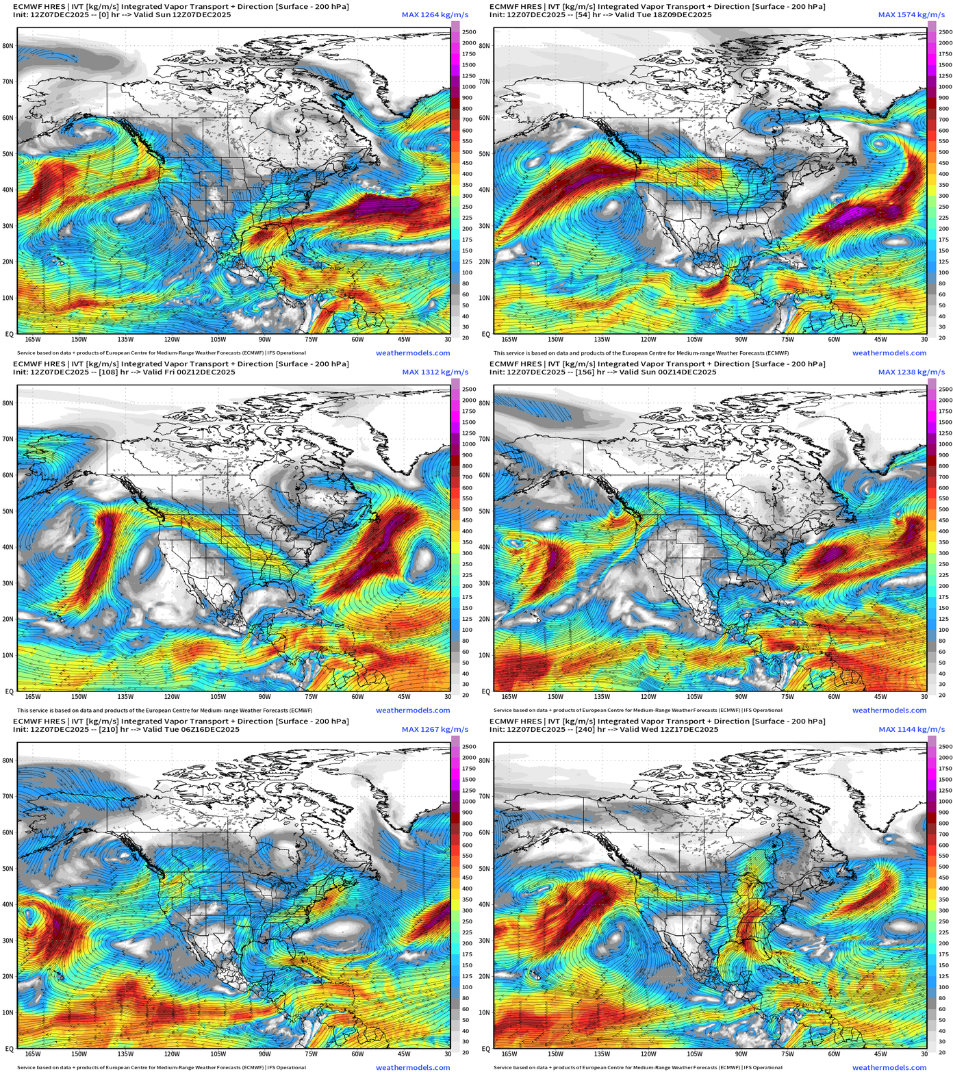
Parameter used for monitoring “atmospheric rivers” usually along the U.S. west coast, but the idea works well for many other areas — highlighting midlatitude storm systems with warm conveyor belts (moisture plumes)
Integrated Vapor Transport Next 4-days | South America
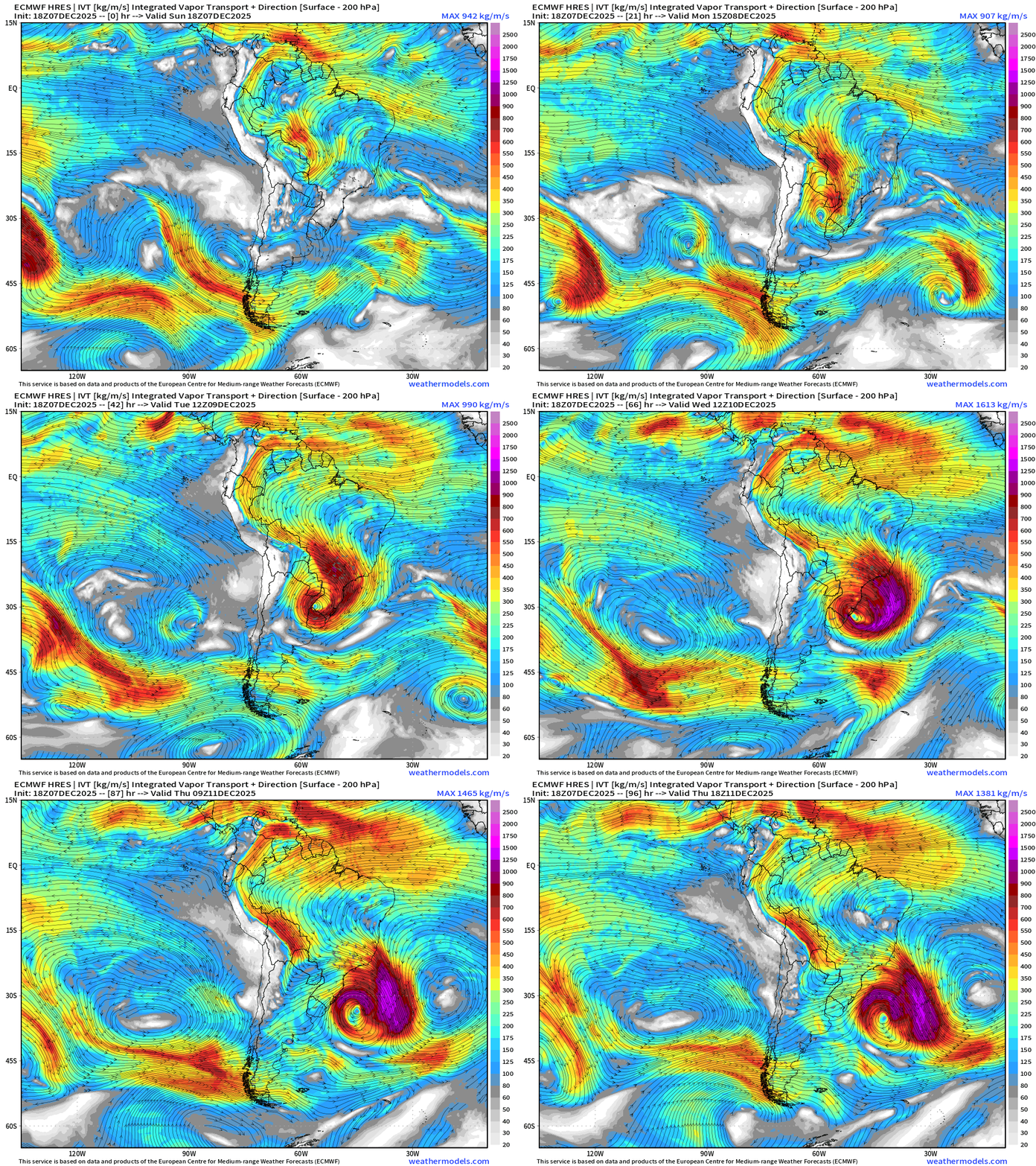
Powerful storm system forms over Southern Brazil — a cut-off low with huge moisture flow coming in off Atlantic = major rainfall/flooding risk
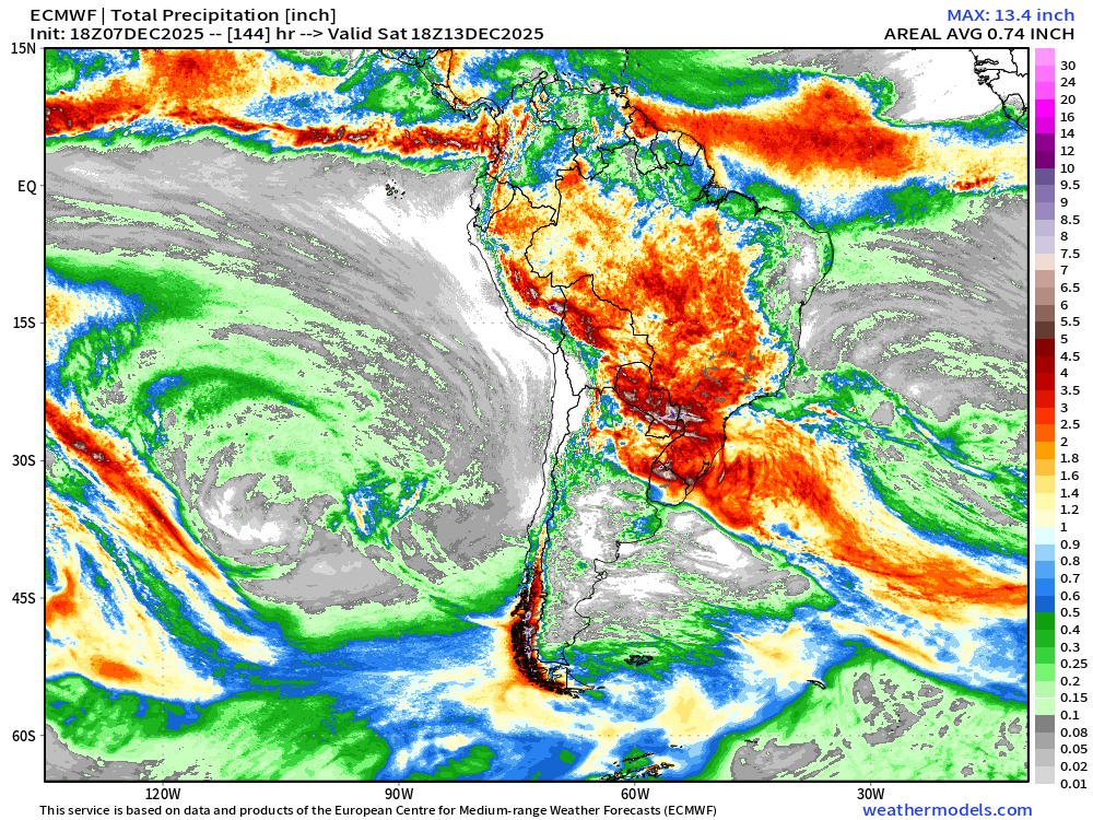
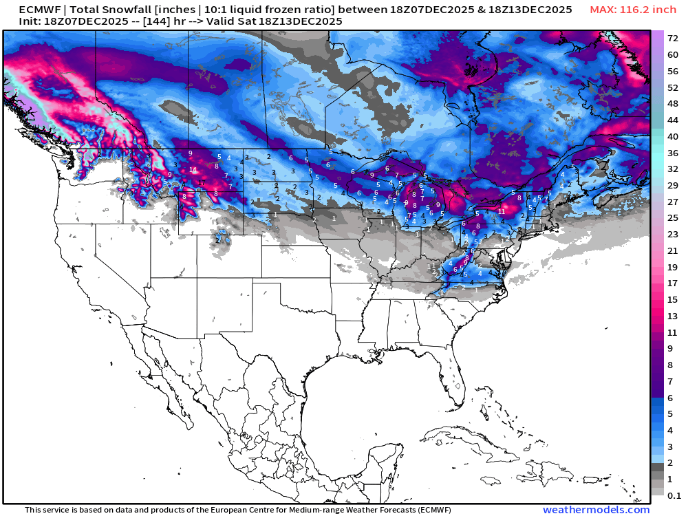
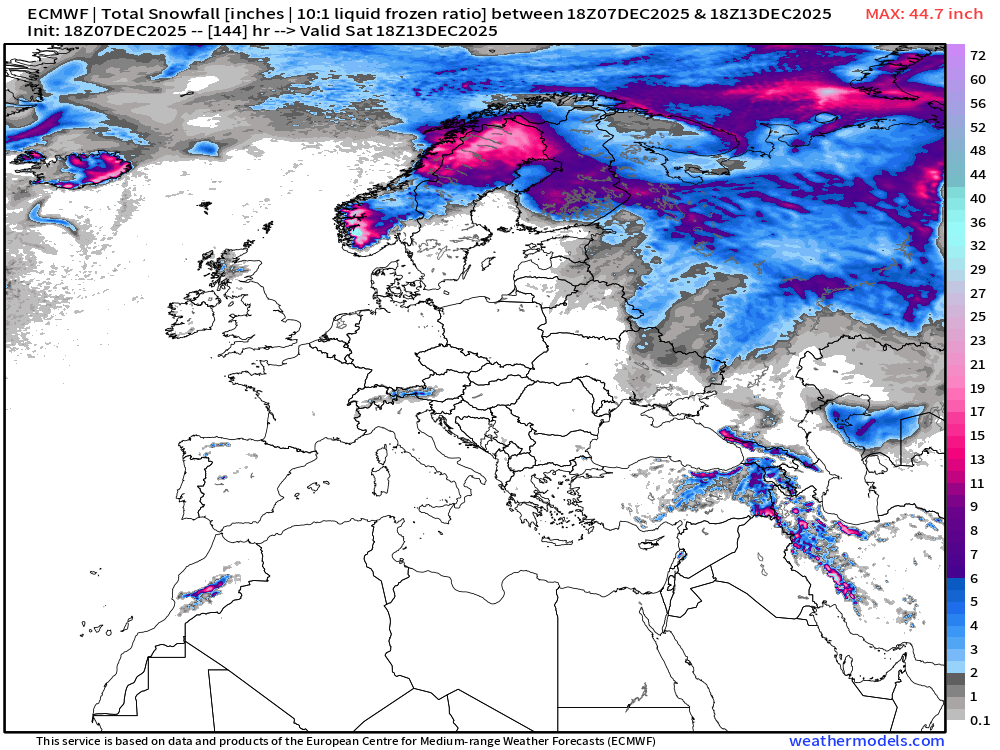
ECMWF 18z | Snowfall | Next 6-days
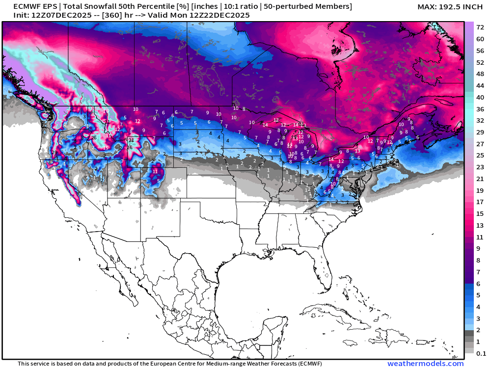
ECMWF EPS 12z | Ensemble Median Snowfall Next 15-days
ECMWF EPS 12z | Ensemble Snowfall Probability > 1” | Next 15-days
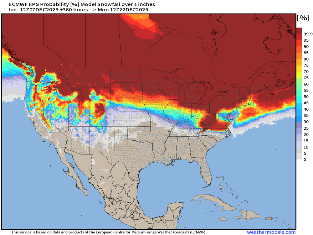
We’ll be monitoring the 1” chance of snowfall for a “White Christmas” in the coming weeks. This map is through late December 20th.
ECMWF EPS 12z | Ensemble Snowfall Probability > 6” | Next 15-days
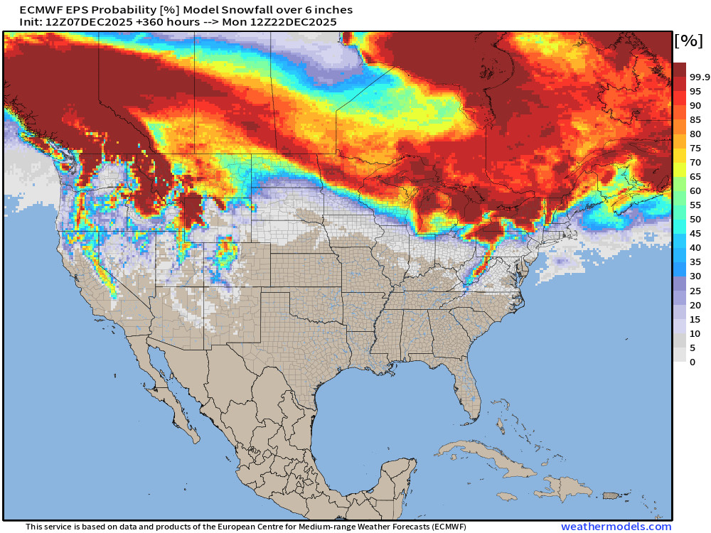
6-inches is sufficient for a “big storm” and Lake Effect machine diagnostic
Next 15-days Temperature Anomaly | Ensemble Mean to December 21
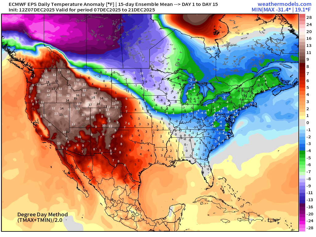
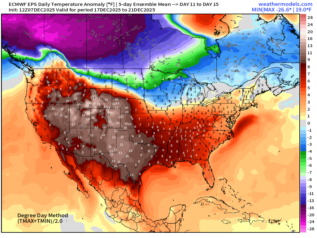
The western ridge is STRONG … and should provide enough Pacific moisture and moderating mild air to temper the longevity and intensity of any Arctic blasts that sink from the massive cold pool over Western Canada.
Temperature Anomaly | Next 15-days | ECMWF EPS 12z
5-Day Chunk #1 | Temperature Anomaly | Dec 7 - Dec 11
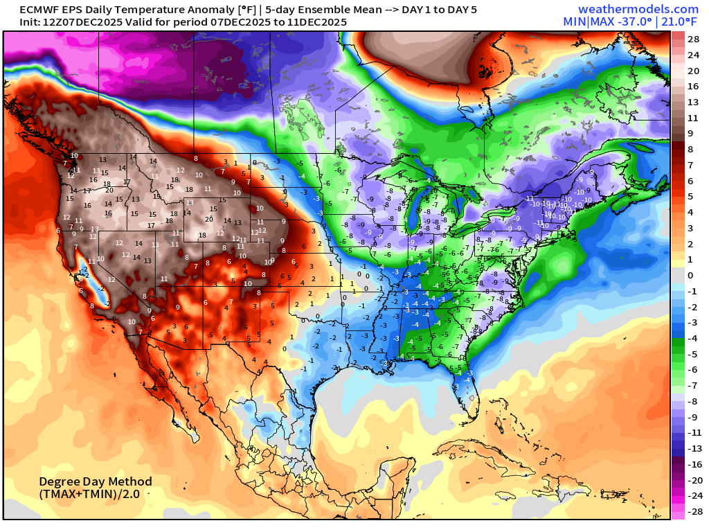
5-Day Chunk #2 | Temperature Anomaly | Dec 12 - Dec 16
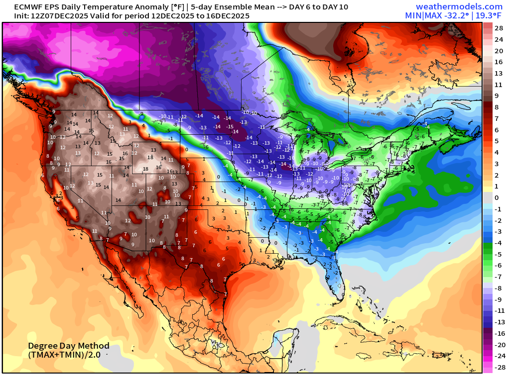
5-Day Chunk #3 | Temperature Anomaly | Dec 17 - Dec 21
Maps sourced from weathermodels.com designed and innovated by yours truly! Please subscribe there for real-time access to the newest maps, charts from all of the weather models including ECMWF and AIFS, NOAA AI-GFS/AI-GEFS
Active coupon codes:
- Milepost
- 809 · laid 2025-12-08T02:30:10.245000Z
- Source
- https://weather.substack.com/p/december-7-2025-sunday-evening-weather
- Digest
- 35a7c4783ab58d7a2523730f47002acee3cc921676ea241e39d3b837c276d371
- Machine
- JSON