November 6, 2025 Thursday Weather Update
Polar vortex hype as first major cold blast poised to affect Eastern U.S.
November 2025 was the 4th-warmest November in the 131-year national record (1895–2025), at 46.7°F against a 1991–2020 normal of 43.0°F (+3.7°F).
November 2025 was the 29th-driest November in the 131-year national record (1895–2025), at 1.7in against a 1991–2020 normal of 2.3in (-0.6in).
NOAA/NCEI Climate at a Glance, contiguous United States. This is the observed record for the month, not a score of anything said in this piece — the forecast ledger begins 2026-08-17 and cannot reach earlier posts.

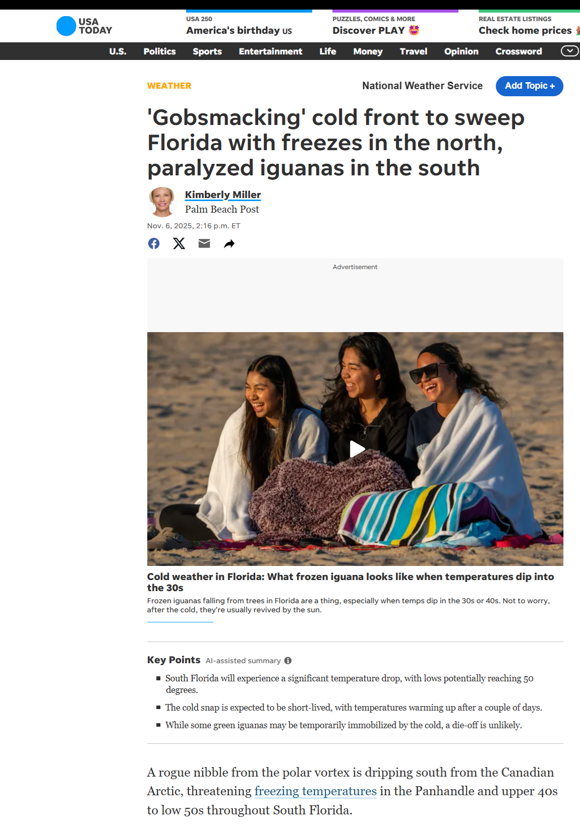
From my X feed posts — admittedly engagement farming to get folks interested, excited about the weather —> we get various local journalists grabbing posts to embed into the reporting without having to interview or do much other work. It’s an easy way to expand my reach on social media and branch out this platform.
Headlines Thursday Evening
Arctic blast this weekend into early next week (coldest air of season) with Lake Effect snow piling up, and frost/freeze deep into the Southeast.
Storm system for the Great Lakes, more like a Clipper
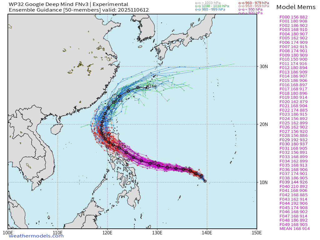
Tropical Storm 32W (Fung-wong) slowing organizing in the Western Pacific with a very large circulation
Quick mention of the dry conditions across the Eastern U.S. with the updated Drought Monitor heading into the mid-autumn season.
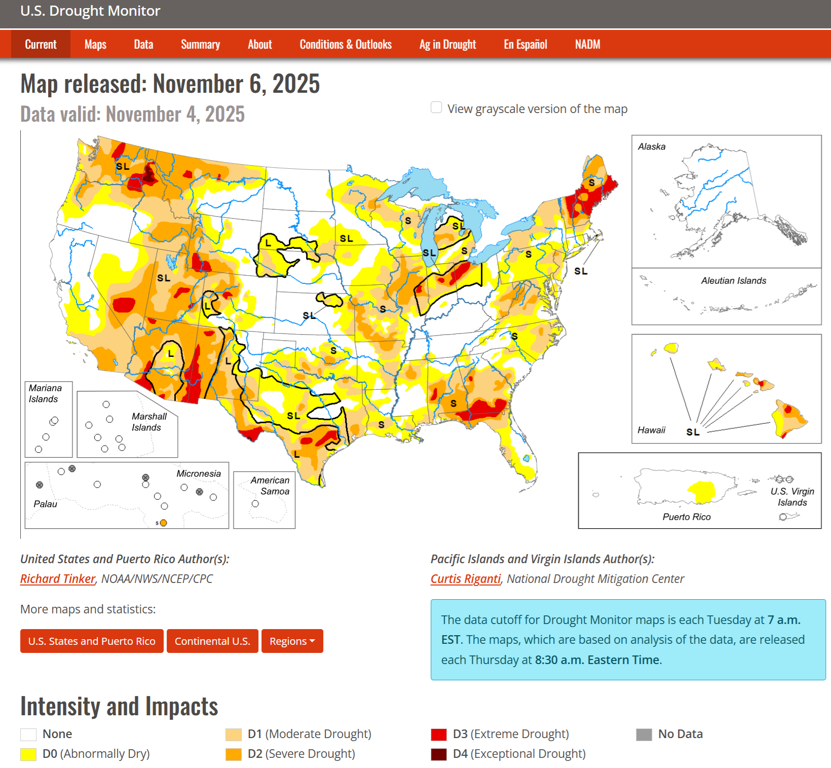
Good news: California is only seeing moderate drought (D1) across southern third of the state with the rest either none or just dry (D0) — and with more atmospheric rivers on the way, hopefully we can continue that trend into 2026.
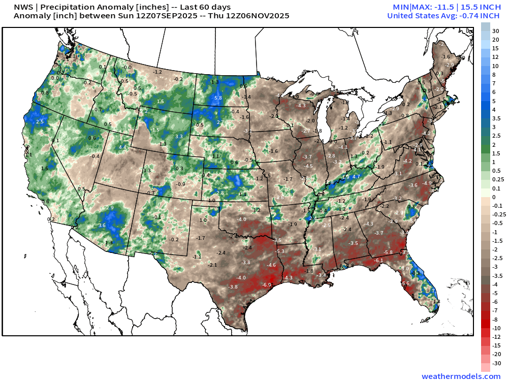
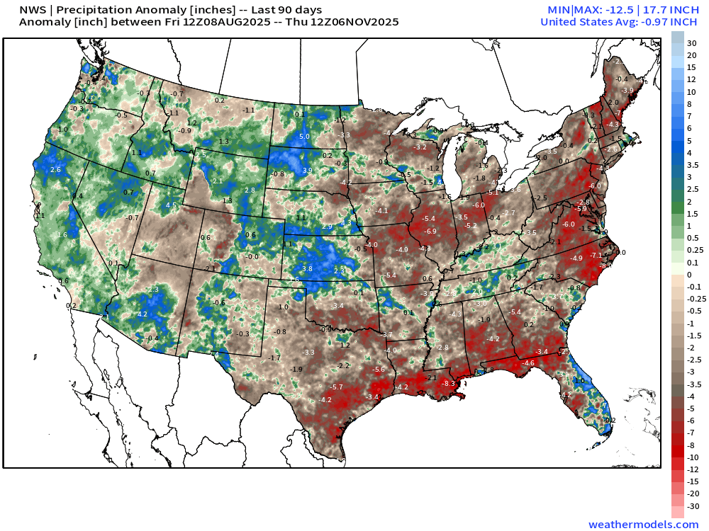
East of the Rockies, extreme drought in Southeast Texas, North Florida and South Georgia, northern Ohio, and northern New England. The missing rain is exceptional pushing 4” to 6” or more over the past 2-3 months from the anomaly maps:
Last 60-days rainfall deficit
Last 90-days rainfall deficit
Snowfall Next 6-days | ECMWF 18z
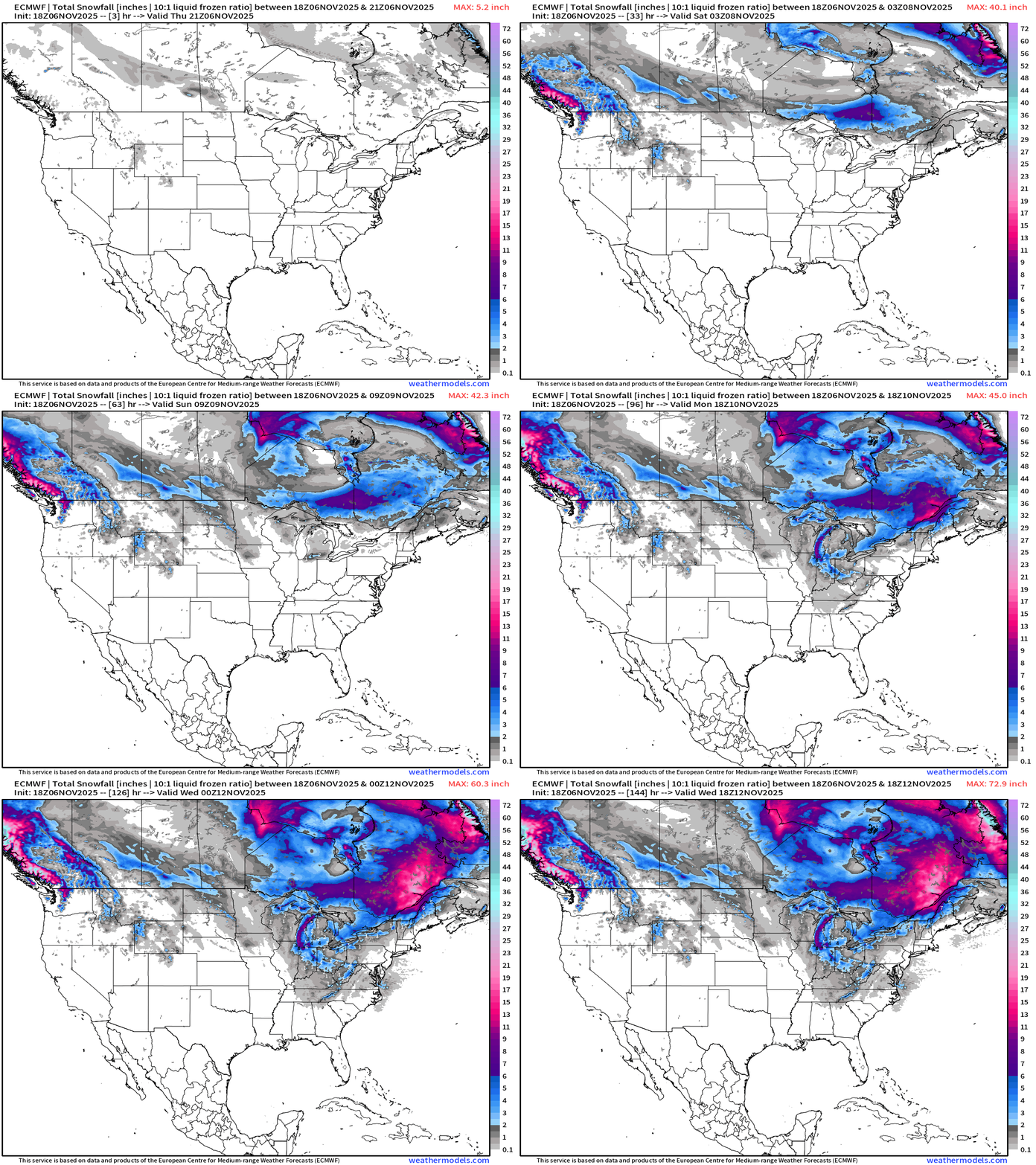
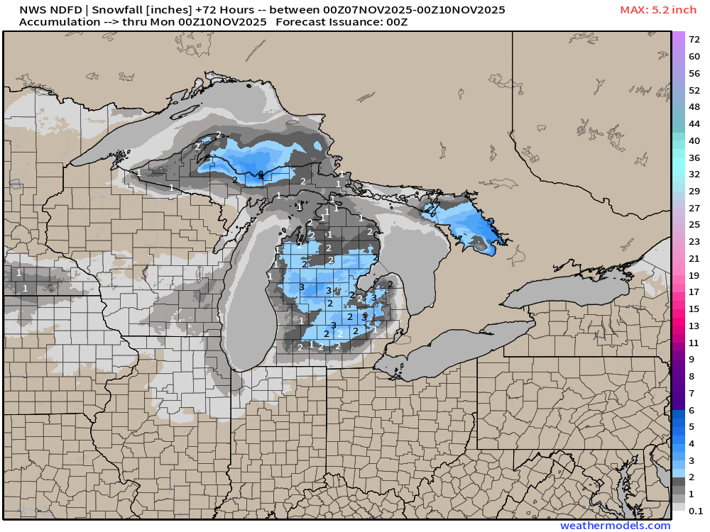
A storm system cruising across the Great Lakes and southern Ontario will drop a blanket of snowfall into this weekend that will help intensify and sustain the building Canadian cold pool with the upper-level “tropopause anomaly” and trough that has been advertised for the last few days.
Light snow could reach into the Southeast including Atlanta metro with flurries on Monday/Tuesday.
Heavy lake effect snow is underestimated on the ECMWF snowfall maps that are 10:1 ratio especially if the air is much colder than freezing, but that’s more important getting closer to the event, because the QPF error is on the same order as the snow ratio estimate.
Simulated Radar | HRRR Next 48-hours | Through Saturday afternoon
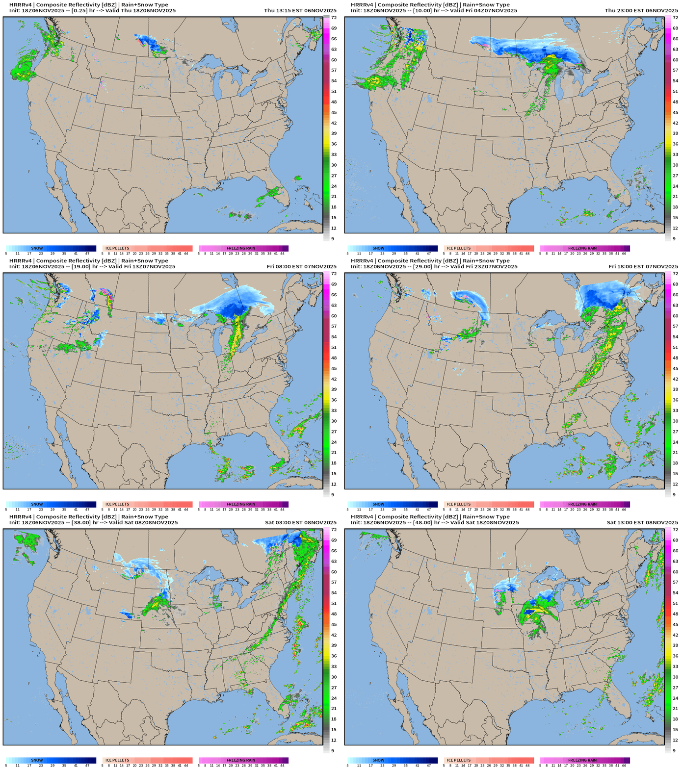
Alberta Clipper (literally) heads into the Midwest and dips toward Chicago by Saturday afternoon.
ECMWF Precipitable Water Next 6-days
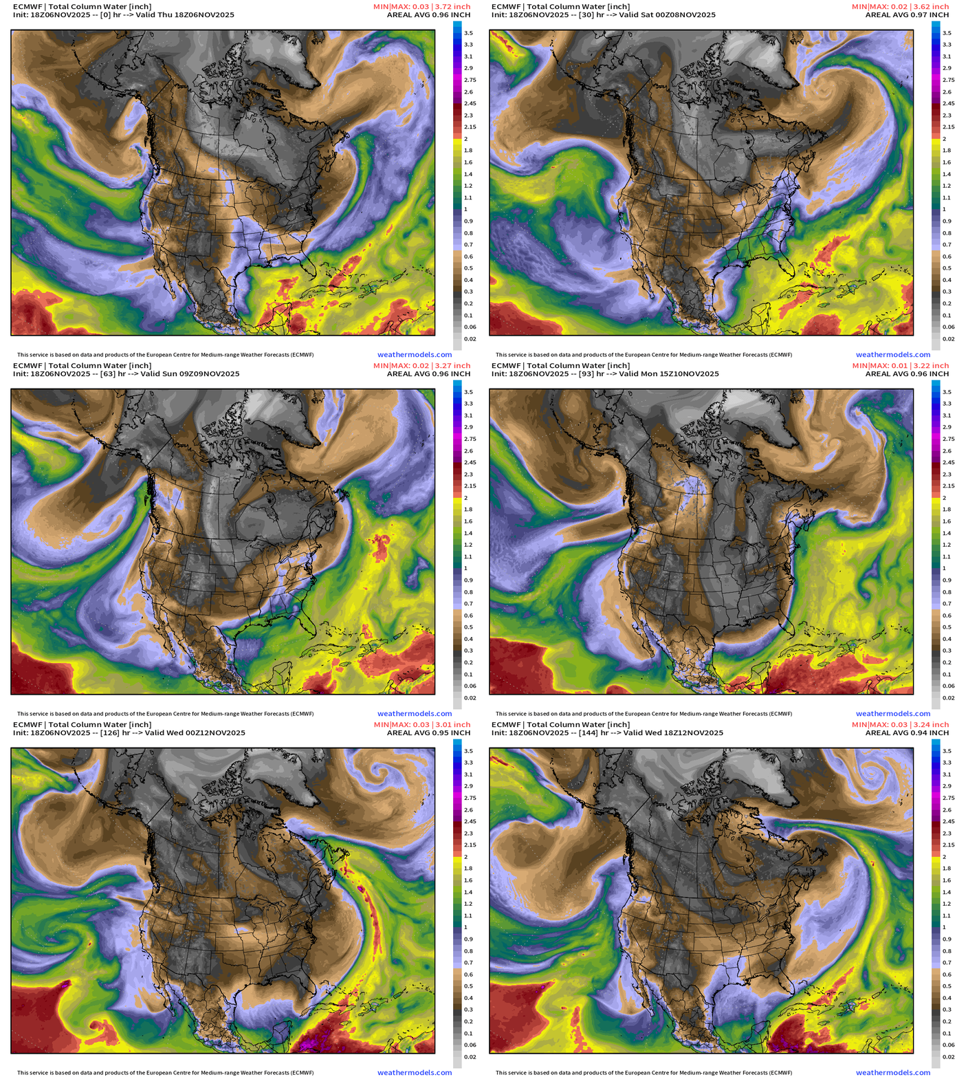
My favorite parameter! Note the black/gray/white coming out of the Canadian Arctic = cold and dry air — crashes through the Gulf of Mexico AND south Florida. Indeed, the shape of the precipitable water dry plume = Florida peninsula Tuesday morning with perfect NNW flow bringing the entirety of the cold/dry plume south.
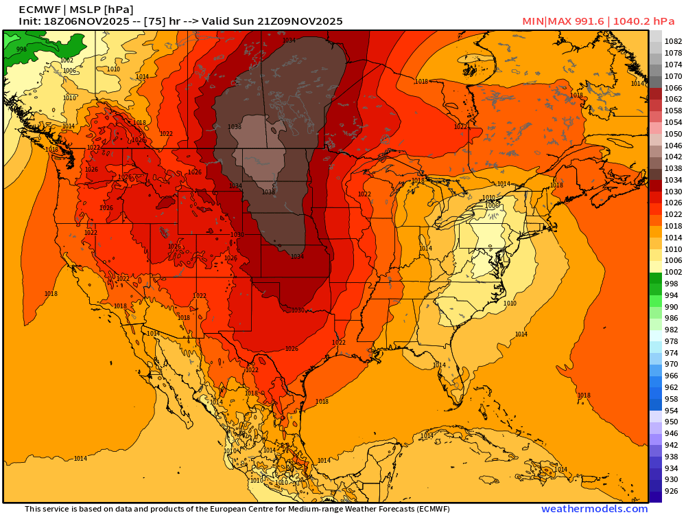
1040 mb Surface High Pressure | Sunday afternoon
Polar Vortex — Trough | 500 mb Temperature Anomaly from ECMWF
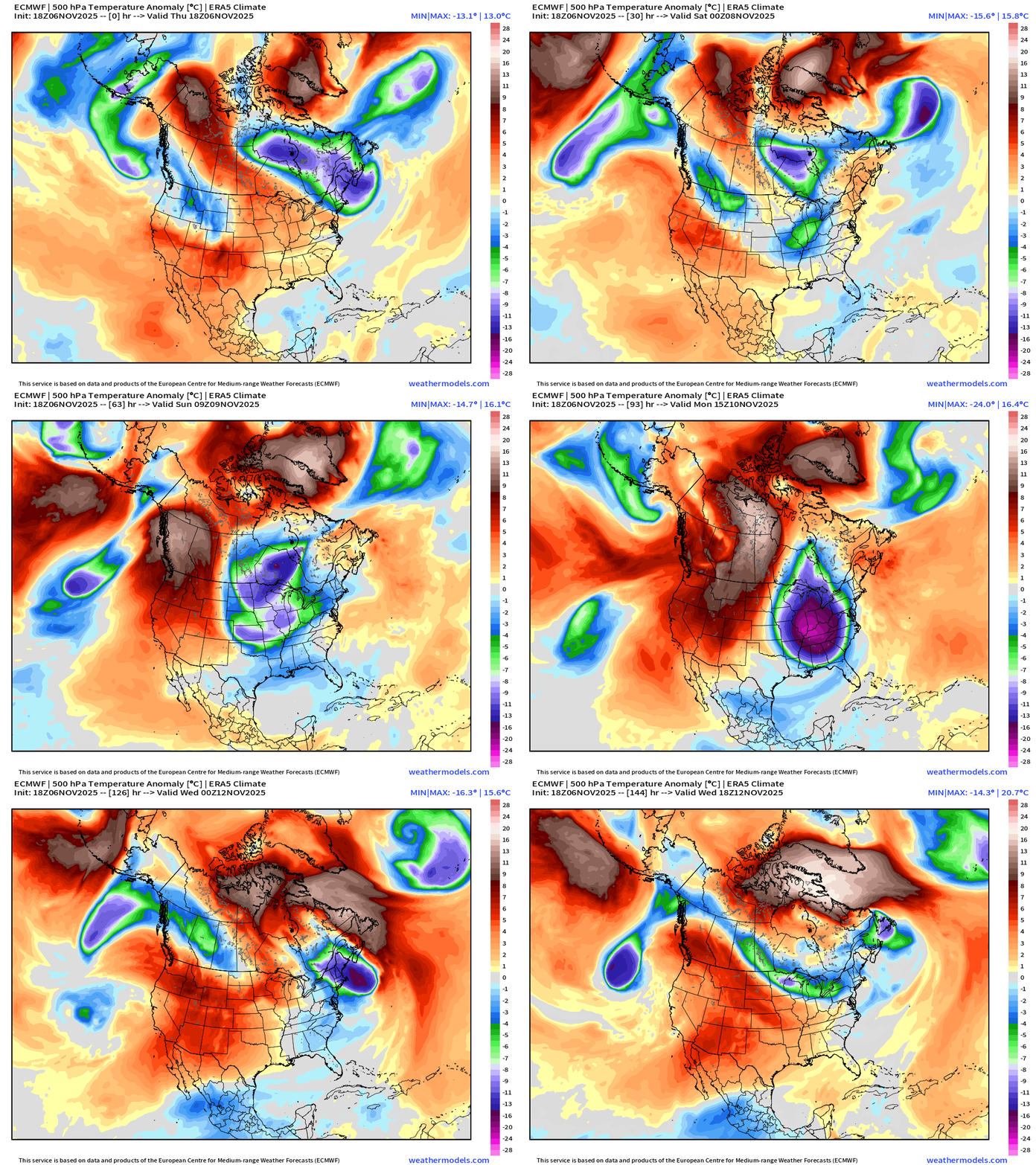
From the anomaly of T500, we can see 2 impulses along the middle latitudes wave guide coming out of the Pacific Northwest and combining with tropopause PV anomaly over Hudson Bay / Great Lakes —> the resulting dynamics = monster height falls and thickness anomaly —> also VERY cold at 500 mb!
My task on Friday is to create a data viz showing the rarity of this 500 mb trough with -40°C temperatures at 500 mb invading the Lower 48 — on November 10-11 (!)
Digging Trough — Lobe of the Polar Vortex | ECMWF vs. GFS
Cold front sweeps the East Coast and Southeast including Miami | ECMWF vs. GFS
Remarkable to see the neighborhood of -40°C cold at 500 mb over Indiana and Michigan. This is “old fashioned” type cold we’d normally only see in January with origin from the far reaches of the Arctic — usually Siberia or Greenland.
November 2025 winter sign up for new subscribers (through November 11th). My goal is to build this newsletter and platform into the winter to take over as my full time job — meaning even MORE posts, content [VIDEOS], and products on the stand along Weather Trader website. Current subscribers (now for 2-years+) are greatly appreciated, and keep me going at full power day after day. This is post number 782.
Integrated Vapor Transport | Next 10-days ECMWF 12Z
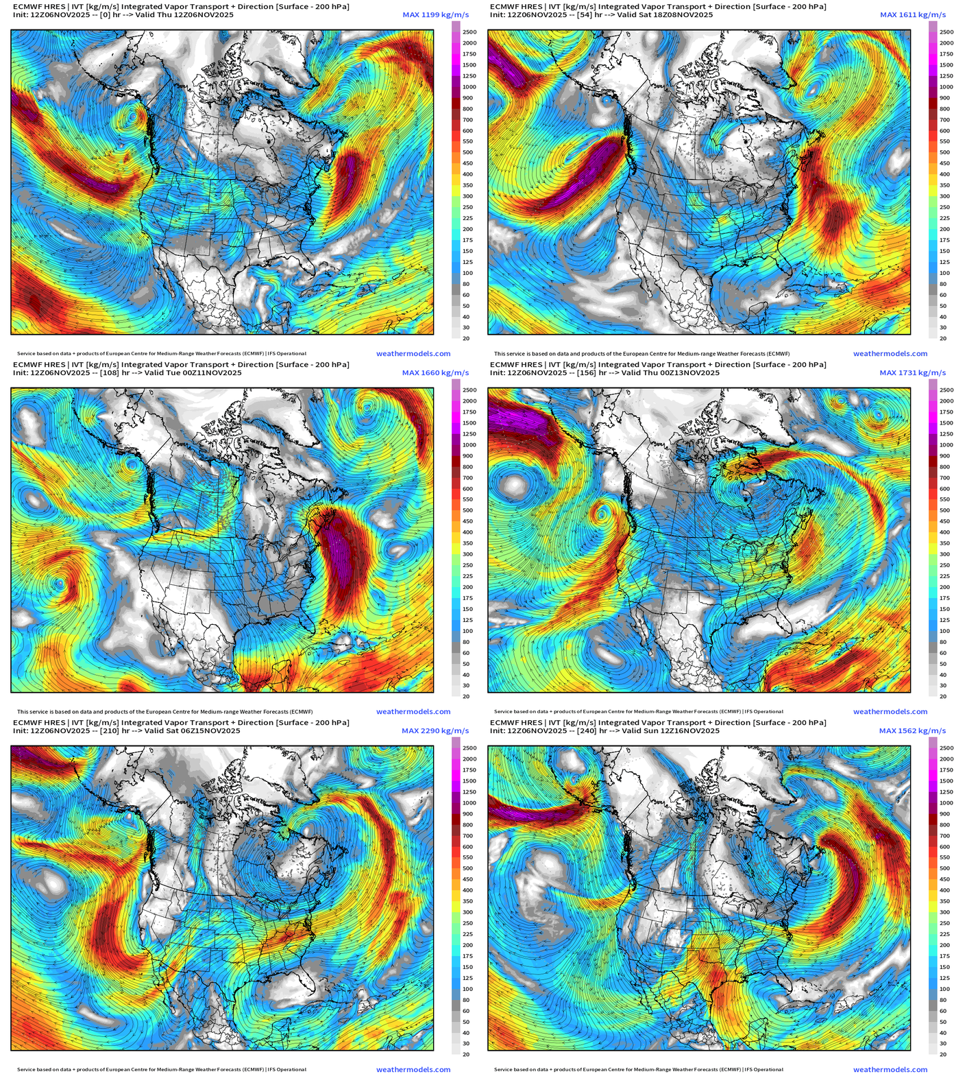
IVT highlights atmospheric rivers of moisture in the atmosphere — and we typically look at the U.S. West Coast … but also works elsewhere, including the East Coast. Not seeing any huge storms on the horizon for the next 10-days.
ECMWF AIFS 18z Height Anomaly (500 hPa) Next 10-days
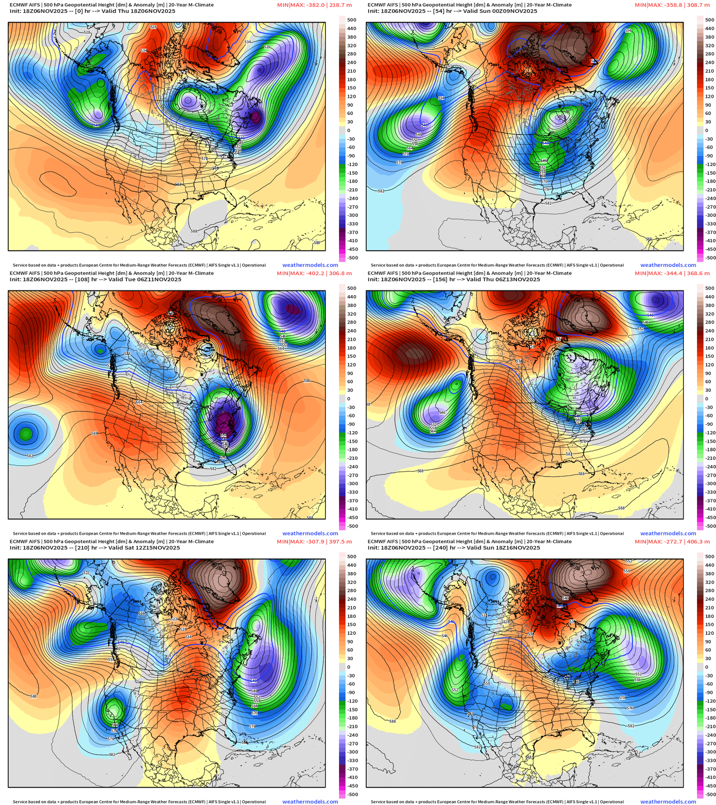
The massive trough is replaced by central U.S. ridging into Week 2 —> much warmer.
ECMWF Snowfall 18z | Next 6-days
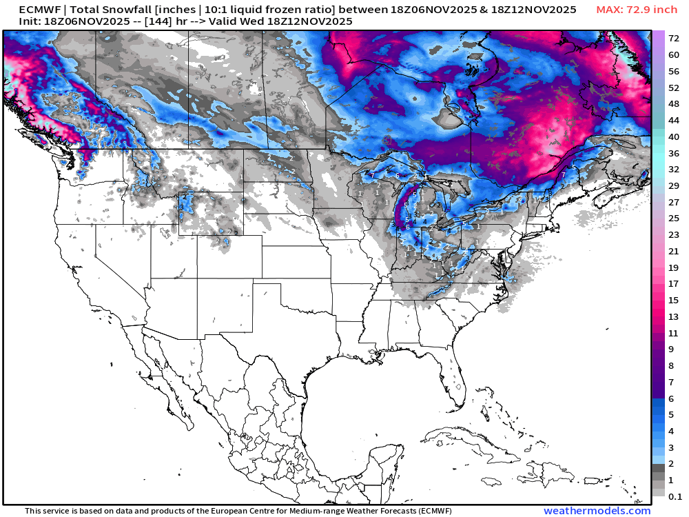
Global model — flagship from ECMWF —> we largely lost the exceptional snowfall totals across Southern Michigan from the winter storm system / Clipper system, which is now much weaker.
ECMWF 12z | Snowfall Next 15-days
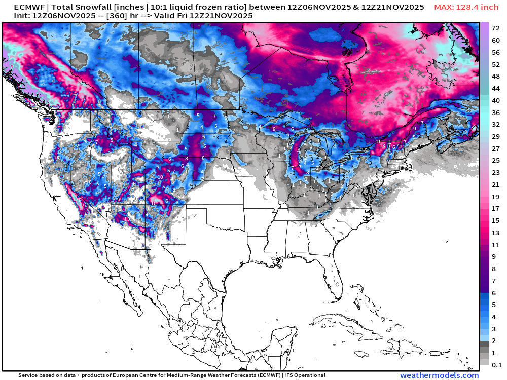
Total for the next 15-days from the flagship ECMWF model shows nationwide snowfall — pretty darn good for the first half of November, if I say so myself!
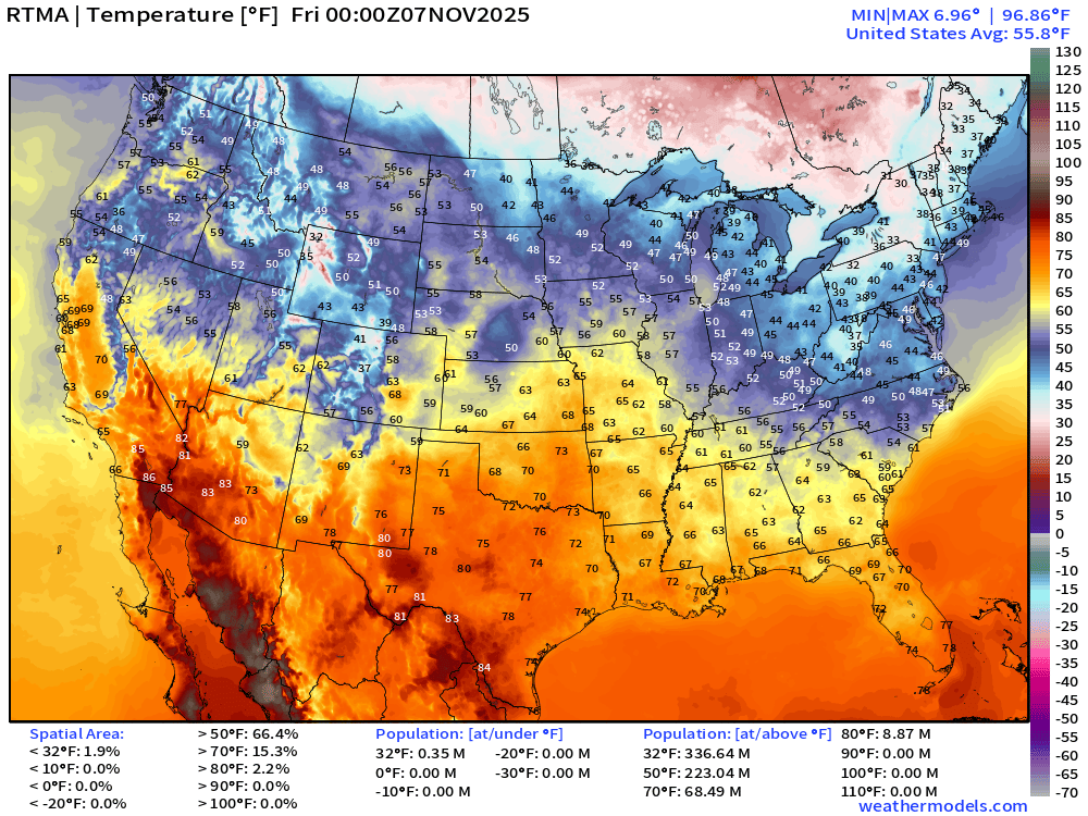
Temperature Analysis | 7:00 PM ET
Temperature Anomaly | 7:00 PM ET
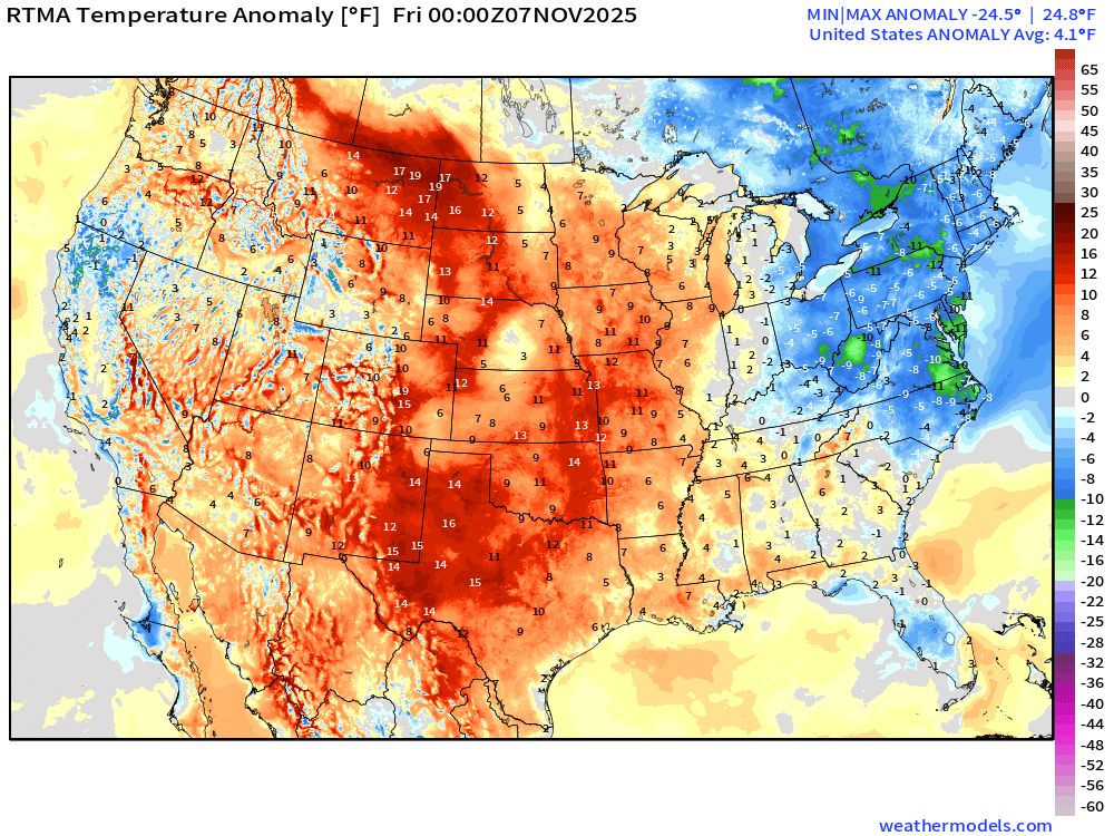
Lower 48 Temperature Anomaly was 4.1°F above normal
Low Temperatures Friday Morning
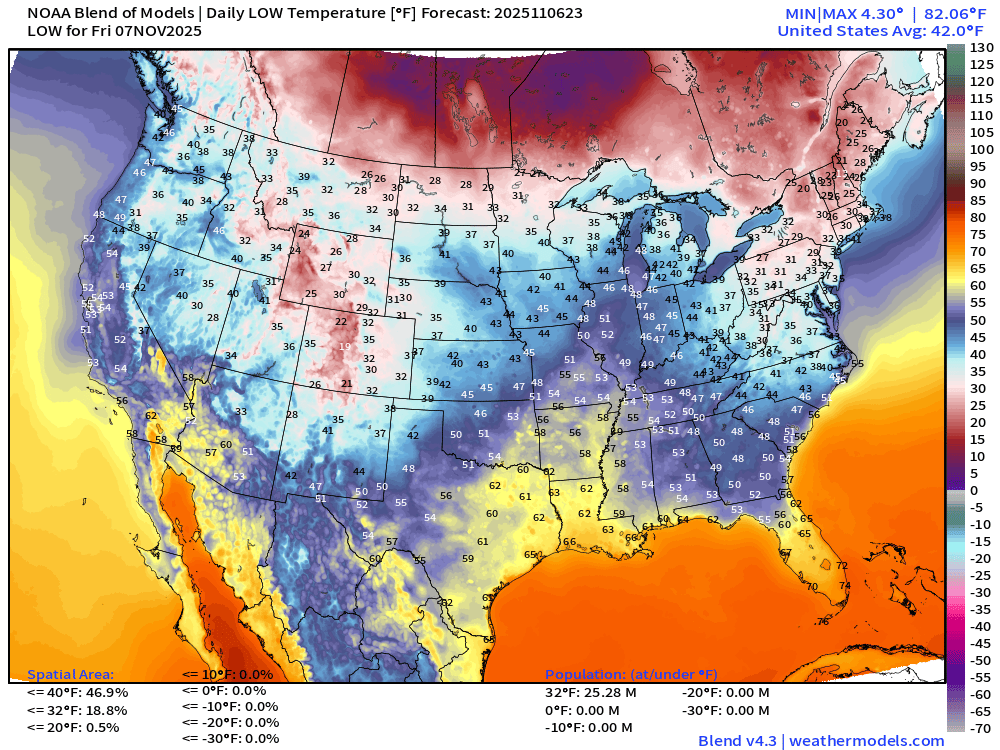
25 million below freezing!
High Temperatures on Friday
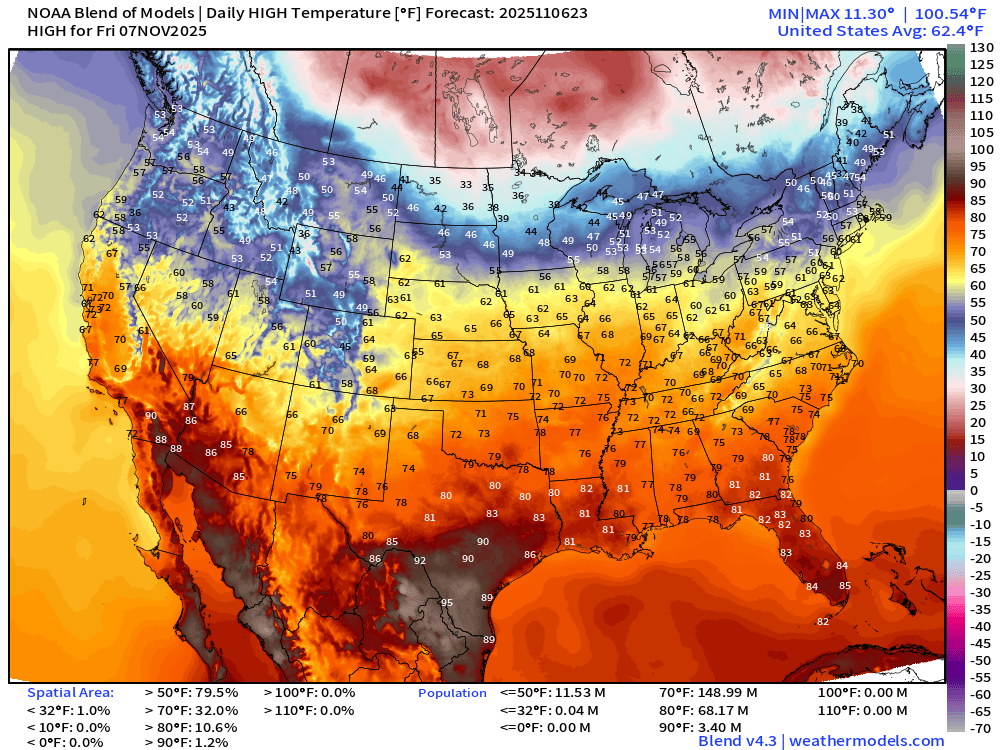
Quite warm — 62.4°F as the Lower 48 average high temperature with a LOT of 70s almost 150 million people and 68 million at/above 80°F
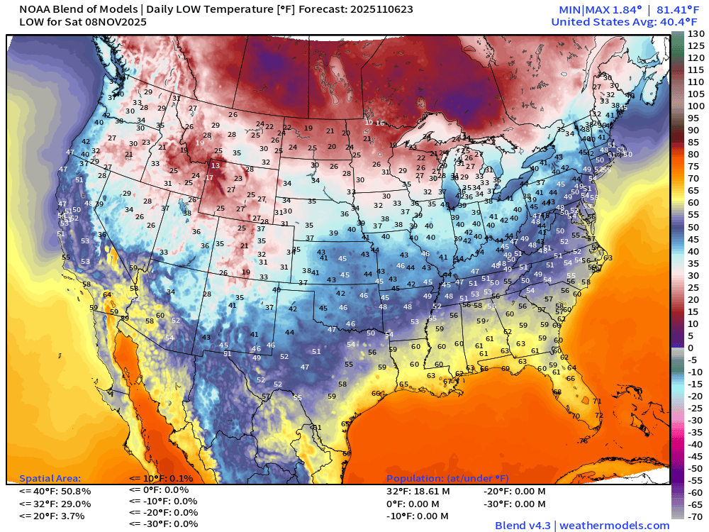
Low Temperatures Saturday Morning
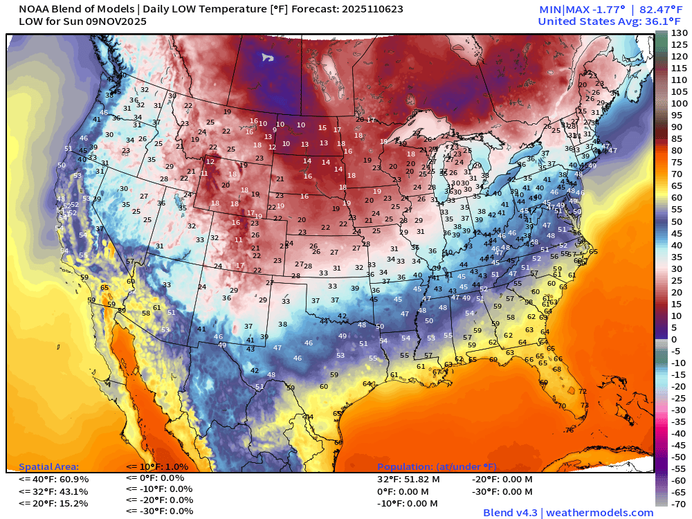
Low Temperatures Sunday Morning
Low Temperatures Monday Morning
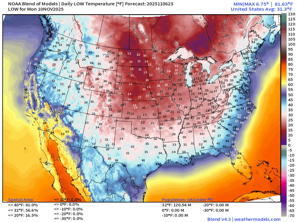
We are up to 120 million below freezing on Monday
Tuesday Morning Low Temperatures
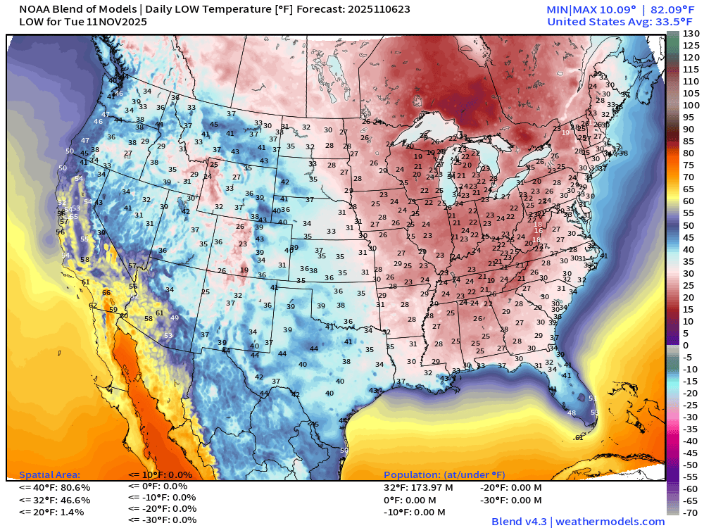
And coldest morning is Tuesday —> 174 million below freezing. No one at 0°F.
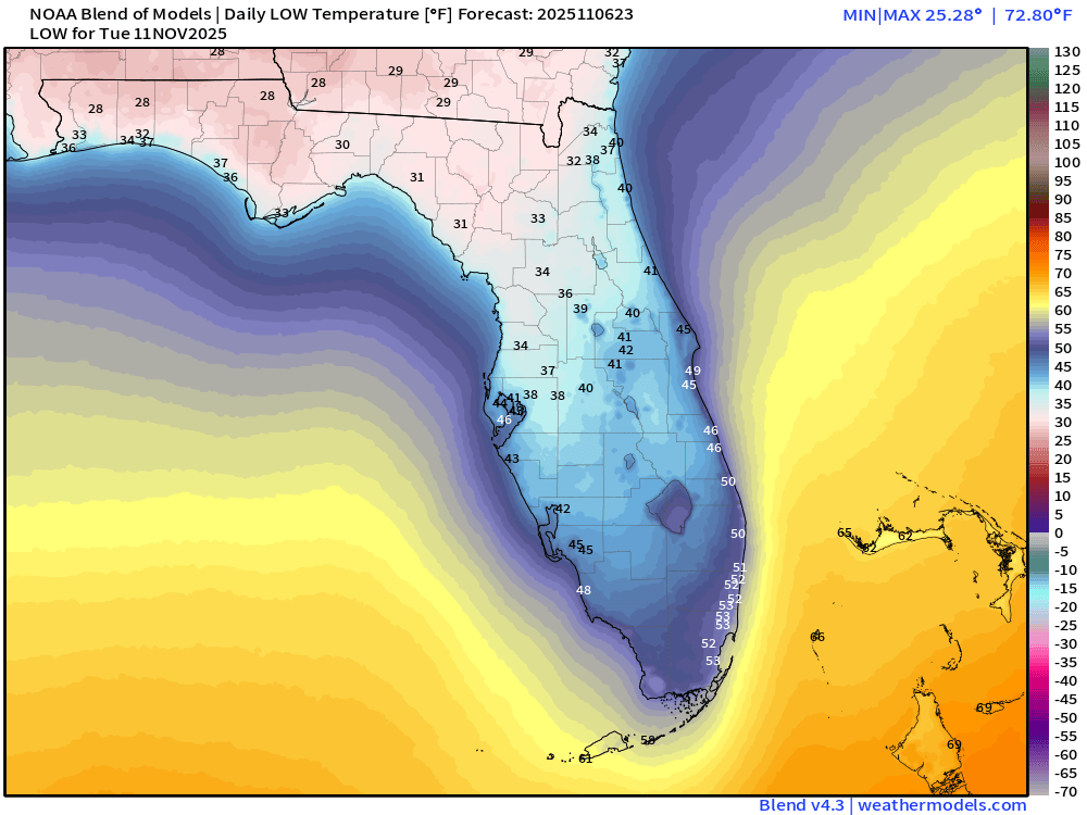
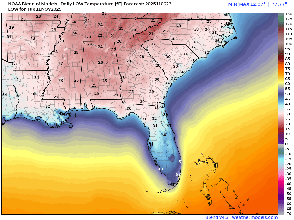
20s in Georgia including Atlanta, and 30s into north central Florida … probably lower-40s along Interstate 4 —> however, this is the multi-model blend, and ECMWF is colder on its own —> so trending downward? (Yes)
NWS Precipitation Next 72-hours
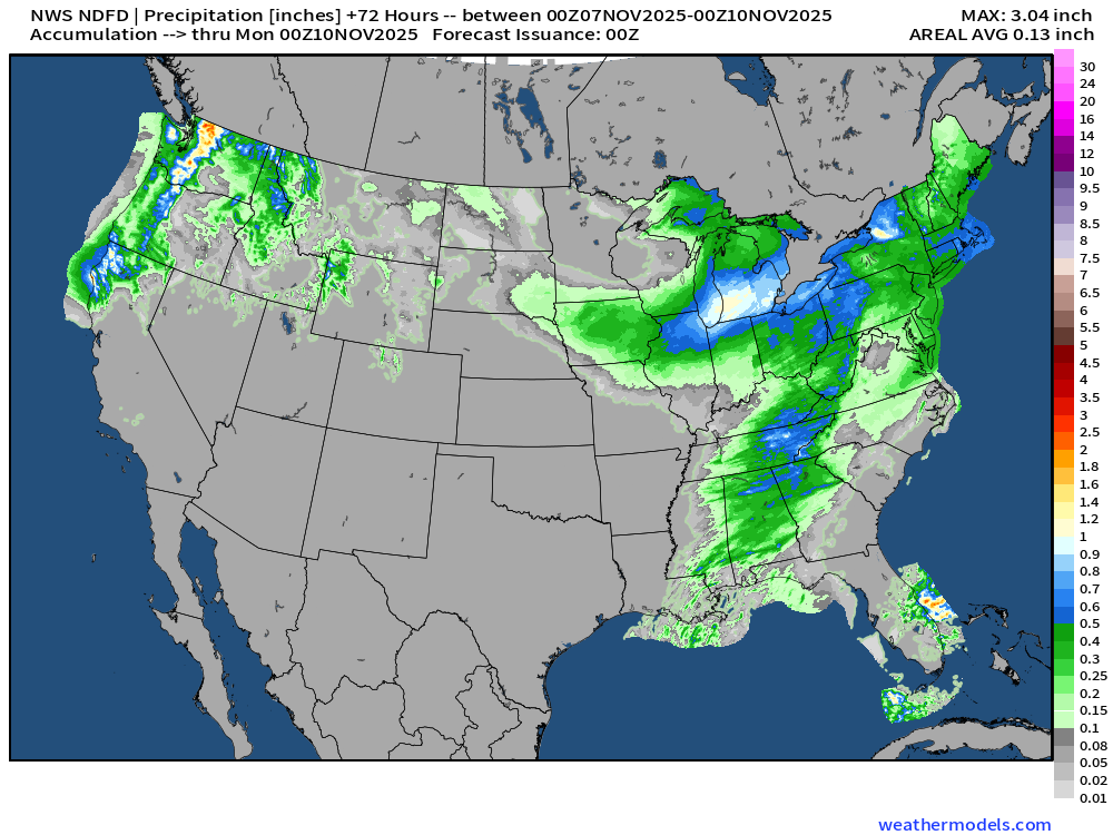
NWS Snowfall Next 72-hours
ECMWF 18z | Precipitation Type Next 6-days
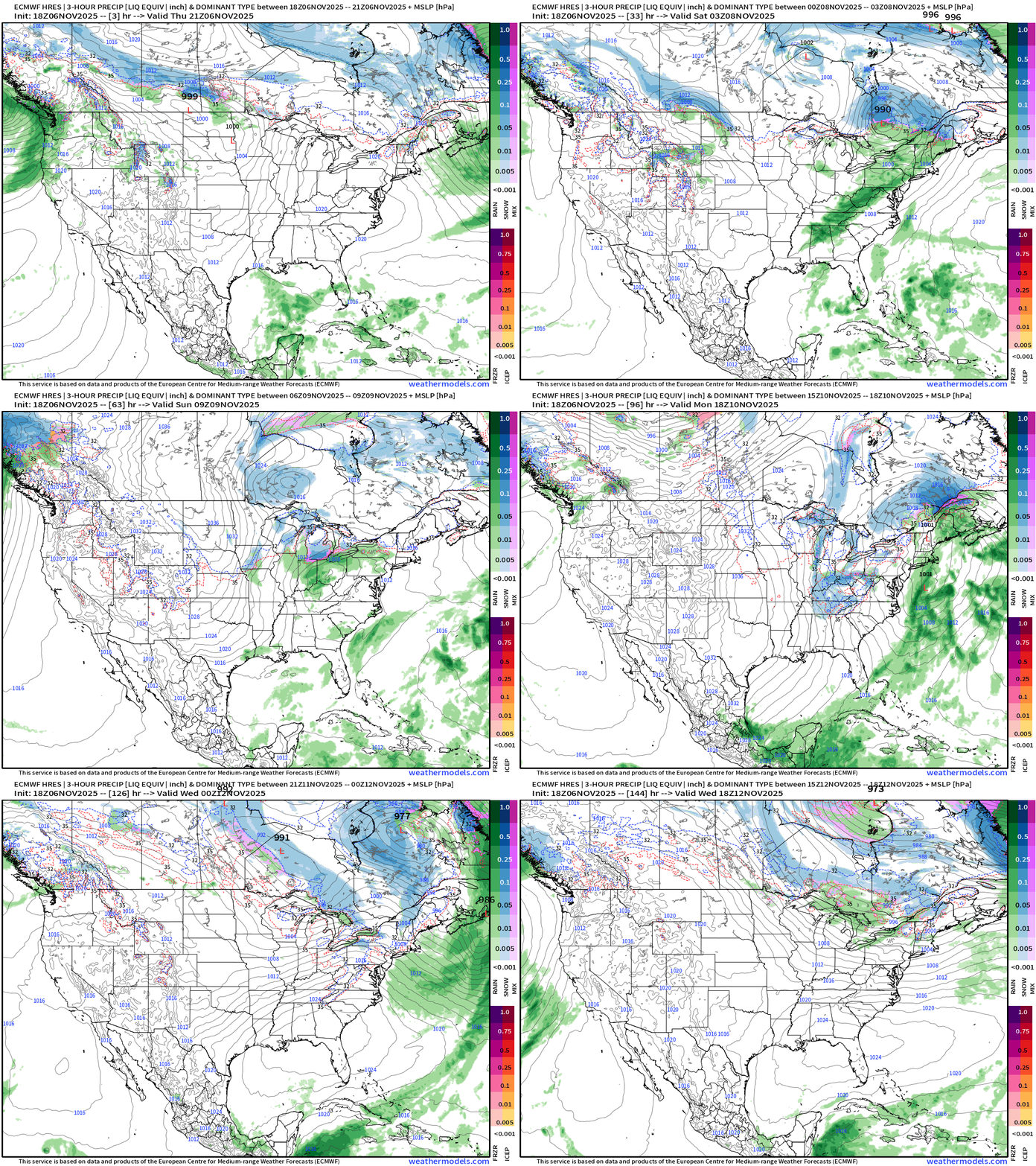
This is a very early “wintry” pattern — I do declare! Check out that little spinner out of the Great Lakes dipping south into Days 5-6 … Clipper systems are so much fun because they can dump a lot of snow in a quick burst.
Arctic high pressure takes control into middle of next week — while another storm system lashes the west coast.
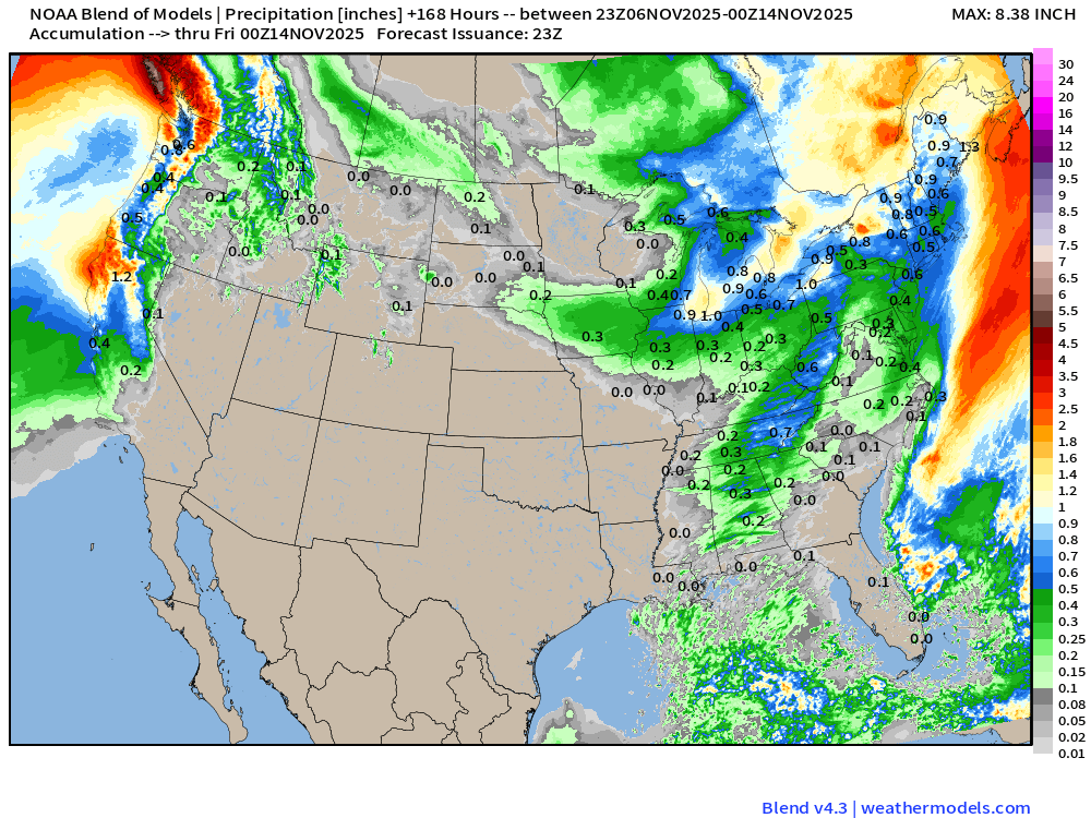
Blend of Models | 7 Day Precipitation Totals
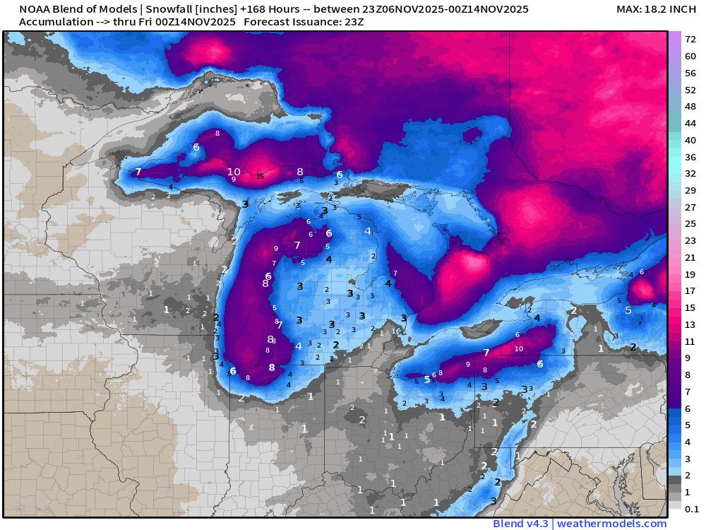
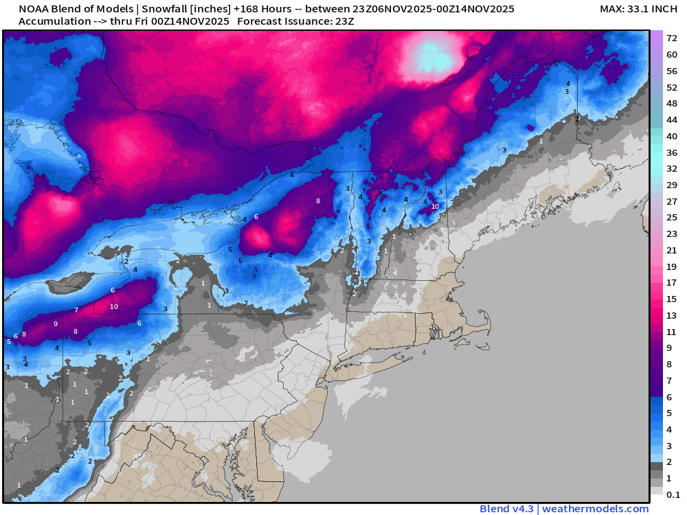
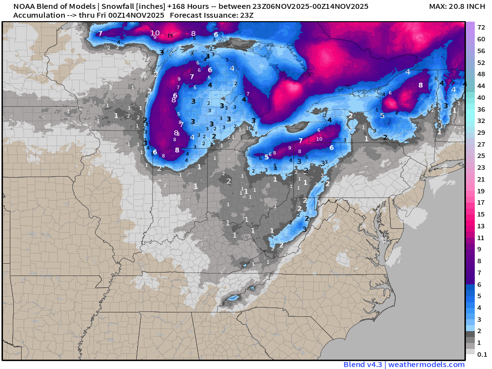
Blend of Models | 7 Day Snowfall Totals
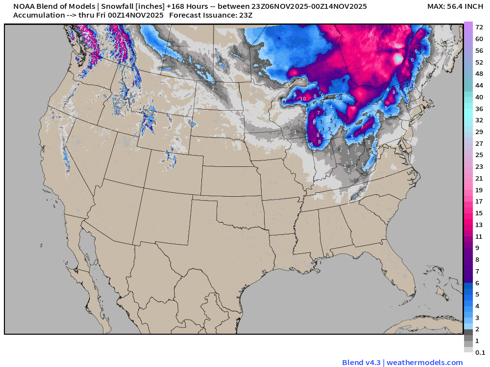
Lake Effect Snow Machine Cranked Up
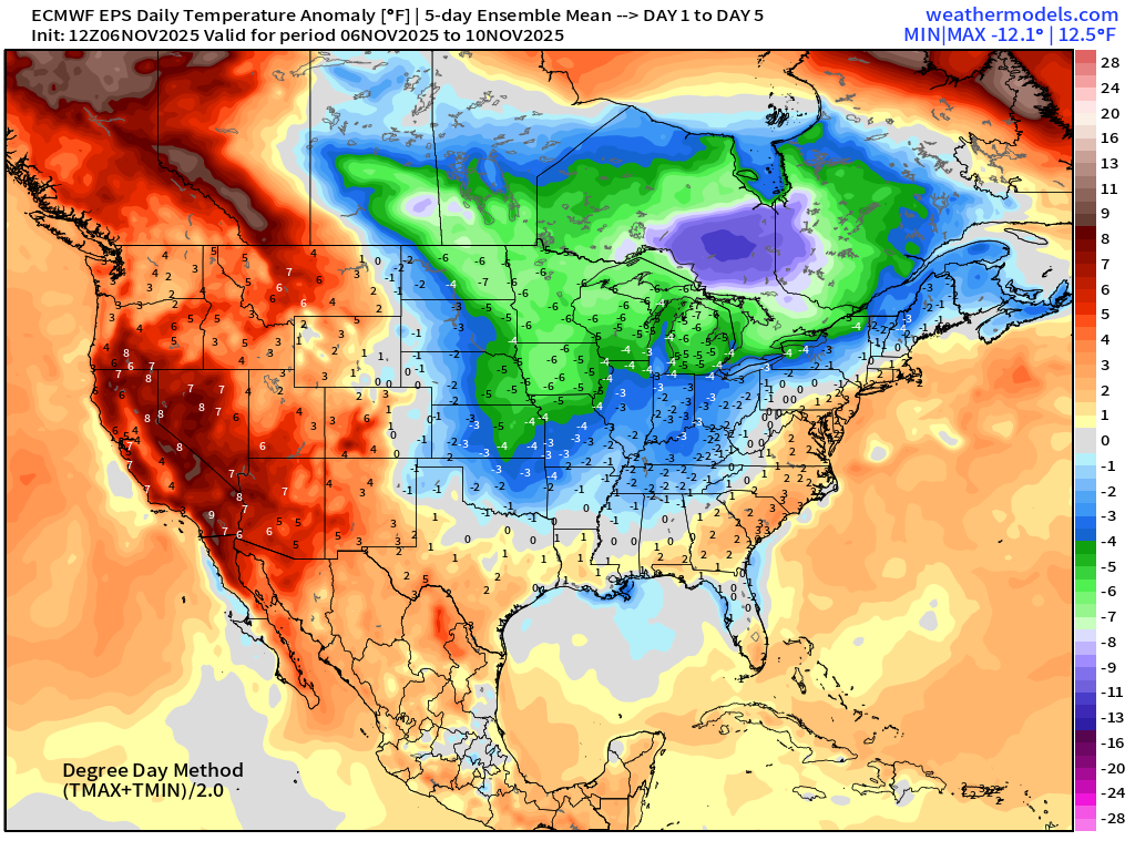
5-Day Chunk #1| Temperature Anomaly | Nov 6 - Nov 10
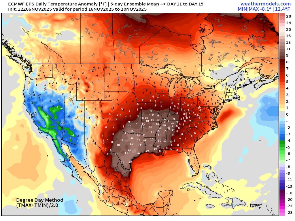
5-Day Chunk #2 | Temperature Anomaly | Nov 11 - Nov 15
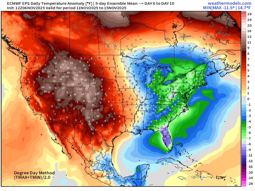
Needed to switch from weekly to 5-day chunks to show the cold air pool over the Southeast with Florida the “most anomalously” cold.
5-Day Chunk #3 | Temperature Anomaly | Nov 16 - Nov 20
Atlantic Hurricane Season Statistics | November 6, 2025
Nothing brewing in the next 7-days —> November 12th according to NHC.
2025 Hurricane Season [Day 159]. My FORECAST for this year was 14 named storms, 7 hurricanes, and 3 major hurricanes (near average)
2025 Season to Date: 13 Named Storms, 5 Hurricanes, and 4 Majors, and 3 Category 5’s | Accumulated Cyclone Energy (ACE) = 135.5
Atlantic Basin Water Vapor and IR Satellite
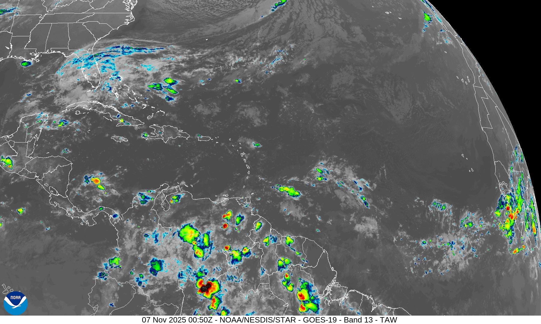
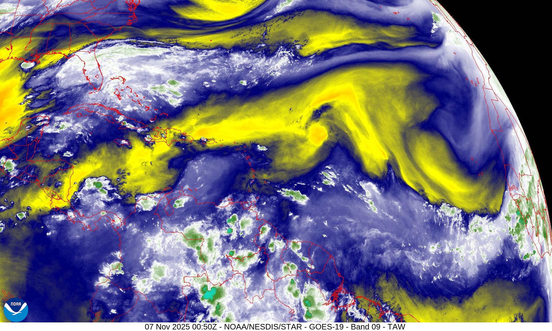
Atlantic tropics are being scoured by a massive trough extending westward into the Caribbean and across the northern MDR to nearly the coast of Africa. Quiet.
15-Day Tropical Outlook —> ECMWF EPS 12z | Active Tracks
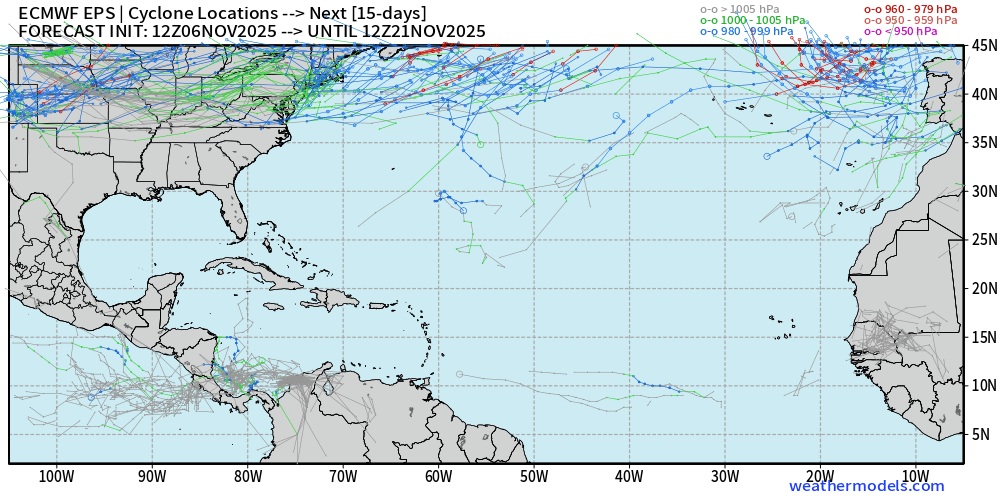
Nothing brewing in the 2-week ensemble tracking —> dead quiet.
West Pacific Typhoon Update
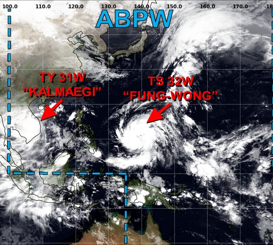
Typhon Kalmaegi made landfall after reaching Category 4 (115-knots) in Vientam
Tropical Storm Fung-wong is underway — a very LARGE system
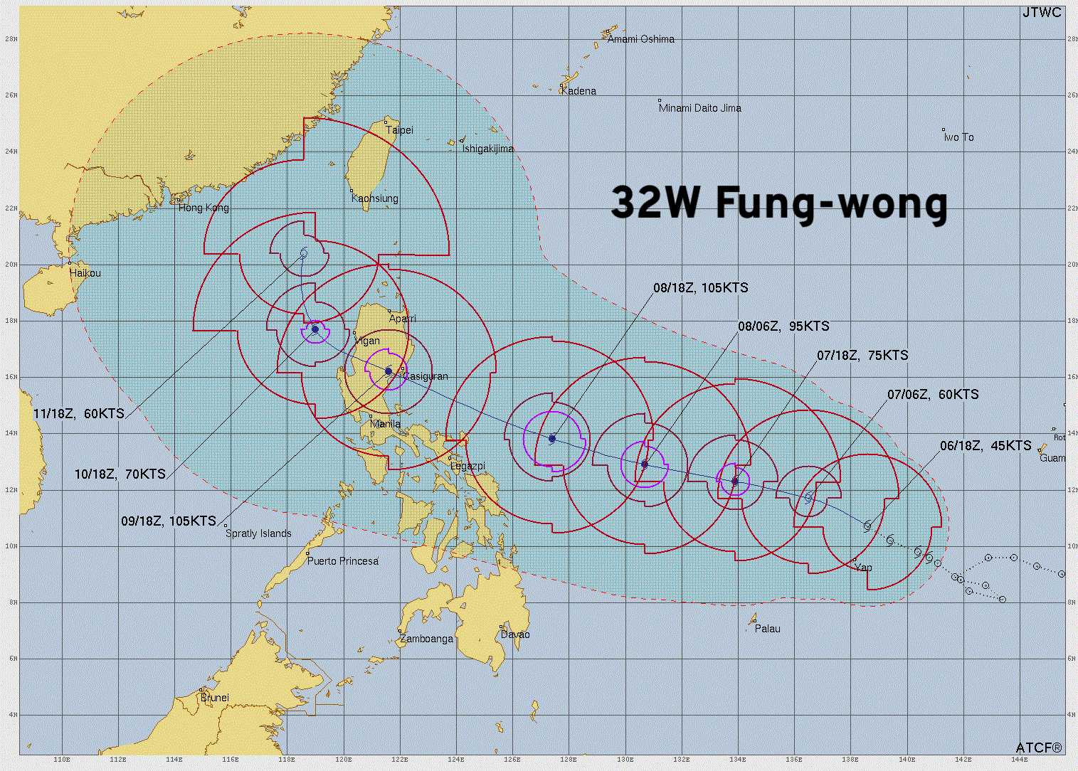
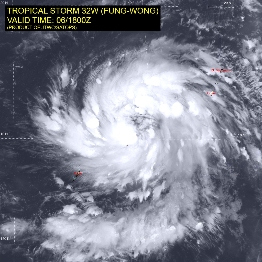
Google Deep Mind insists on Super Typhoon - Category 5+ but the large size and lack of inner-core means intensification will be SLOW.
Main threat to Luzon in 72-hours
Maps sourced from weathermodels.com designed and innovated by yours truly! Please subscribe there for real-time access to the newest maps, charts from all of the weather models including ECMWF.
- Milepost
- 783 · laid 2025-11-07T01:12:17.947000Z
- Source
- https://weather.substack.com/p/november-6-2025-thursday-weather
- Digest
- 606a87865160a695ac5e015b456c164cf94e7bd6e52731b5e280efb08ab97033
- Machine
- JSON