October 29, 2025 Wednesday Weather Update
Melissa heading out to sea ahead of a strong trough across the Eastern U.S.
October 2025 was the 7th-warmest October in the 131-year national record (1895–2025), at 57.0°F against a 1991–2020 normal of 54.5°F (+2.4°F).
October 2025 was the 56th-wettest October in the 131-year national record (1895–2025), at 2.3in against a 1991–2020 normal of 2.5in (-0.2in).
NOAA/NCEI Climate at a Glance, contiguous United States. This is the observed record for the month, not a score of anything said in this piece — the forecast ledger begins 2026-08-17 and cannot reach earlier posts.

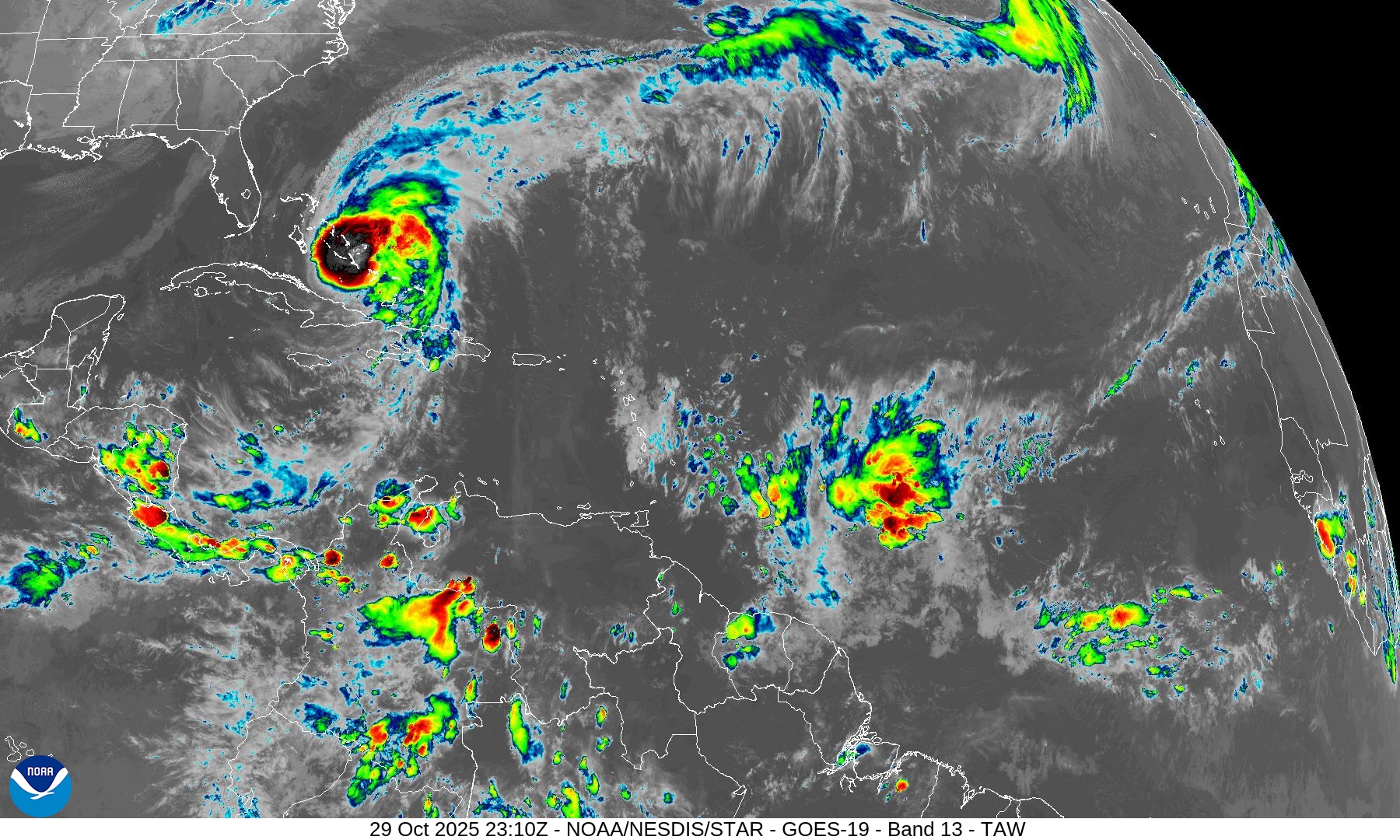
Not seeing additional hurricane activity in the weather model ensembles through the next 2-weeks. So while Atlantic hurricane season technically lasts through November 30, we don’t typically see much action in the tropics. But we would look into the Western Caribbean as a genesis region as quite a few historical late-season storms formed way down there.
Assuming we are done for 2025 — then we will end up with a “near-average” number of named storms (13) and 5 hurricanes of which 4 became majors and 3 became Category 5. ACE will finish in the low-130s once Melissa becomes post-tropical, so the Accumulated Cyclone Energy will also be near-normal (121 — 1991-2020 average).
My forecast for the season ended up being pretty good, of course, and I didn’t update or change it.
Atlantic Hurricane Season Statistics | End of October 2025
2025 Season to Date: 13 Named Storms, 5 Hurricanes, and 4 Majors | ACE = 130
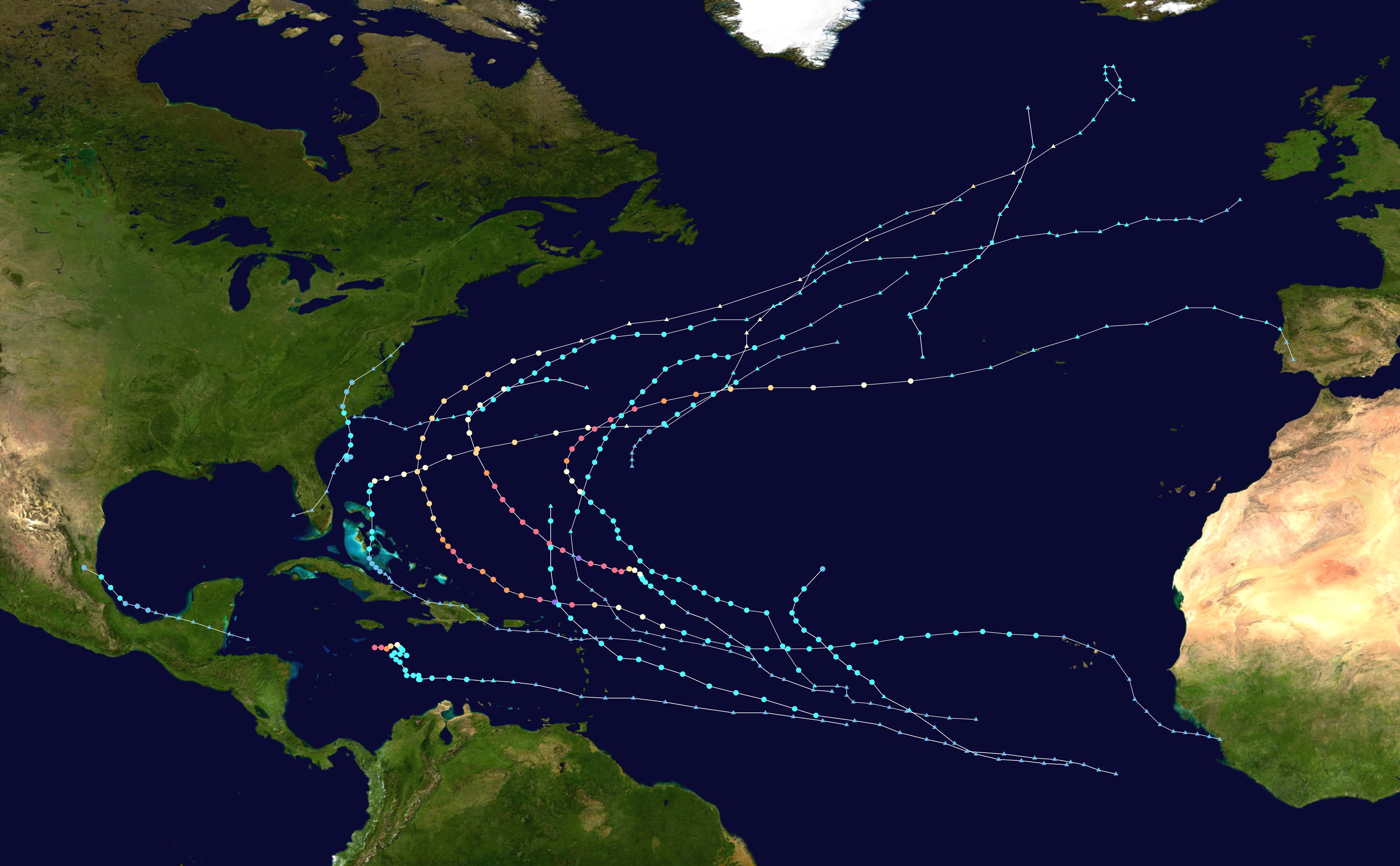
Melissa was heavily sheared for several days prior to rapidly intensifying -- it was quite a “marathon” for the storm after facing adversity. A large circulation was already established so when the shear relaxed, Melissa’s convective bursts could quickly form a small inner-core and pressure fell rapidly.
Erin and Humberto, the other Cat 5’s also had a similar lifecycles battling unfavorable conditions like shear, dry air, and marginal SSTs out in the open Atlantic before reaching the Western part of the basin.
Individually, each storm has its quirks, but only Melissa stands out as exceptional mainly for its location in 2025. The Gulf of Mexico was completely void of hurricanes.
Some are saying this is the “new normal” of “climate fueled” or “supercharged” hurricane seasons in the Atlantic. However, I don’t get that impression from the past 5-months.
8 PM Advisory | Hurricane Melissa | 90mph Winds | 970 mb
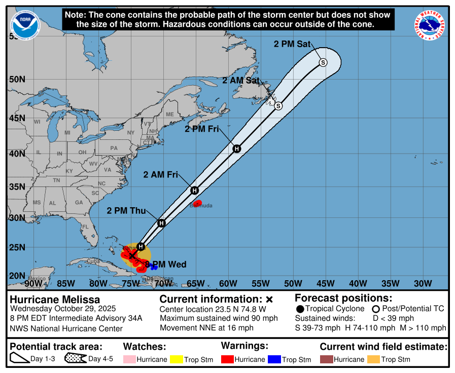
Melissa has a brief window of 24-36 hours to intensify again — with assistance of upper-level divergence ahead of the incoming trough.
850 hPa winds will remain very strong well in excess of major hurricane intensity — but won’t mix down to the surface entirely. This does put Bermuda on the wrong side of the eye — and we will likely see hurricane conditions on the island from Melissa.
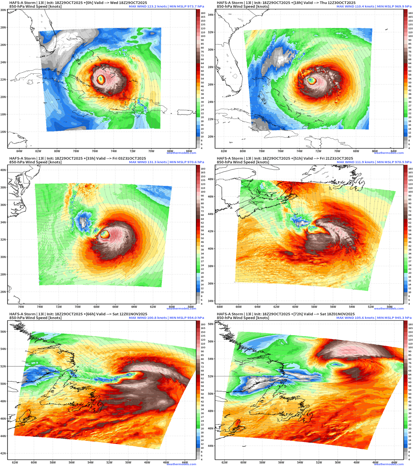
Melissa becomes post-tropical — but will still pack a punch as is brushes by Newfoundland. — perhaps its center / lowest pressure may cross land again by this weekend.
ECMWF AIFS 18z Height Anomaly (500 hPa) Next 10-days
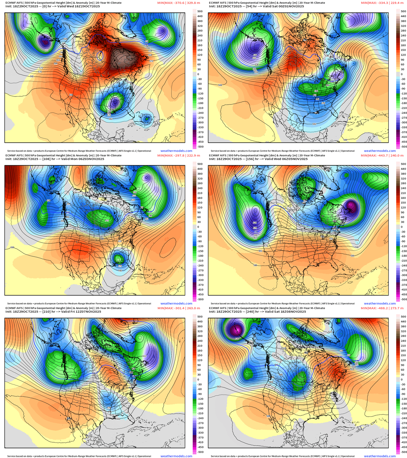
Two major troughs are impacting the Pacific Northwest and the Northeast — with a repeating pattern building a ridge over the middle Lower 48.
We get a brief respite from the Pacific storm track sourced troughs across the West this weekend forming a ridge —> moves eastward to warm up the Lower 48 into Week 2
Then, the middle latitude storm track amps up again with strong troughs into Day 10 and a more amplified pattern > wavenumber 5 around Northern Hemisphere.
This is a busy pattern into early November — but thankfully not cold enough for snowfall.
The next few days will see the development of a Nor’easter like system out of the trough that dug into the Southeast U.S. and kept Melissa away from the East Coast.
48 Hour Forecast from ECMWF 18z
Broad Nor’easter and Windy/Wet Conditions | Friday afternoon
979 mb broad area of low pressure centered over New England with huge circulation of gusty winds 30-40 mph across the Northeast and Mid-Atlantic.
Rain heads northward with the surface low into Friday afternoon
HRRR | Simulated Radar Next 48-hours | through Friday Afternoon
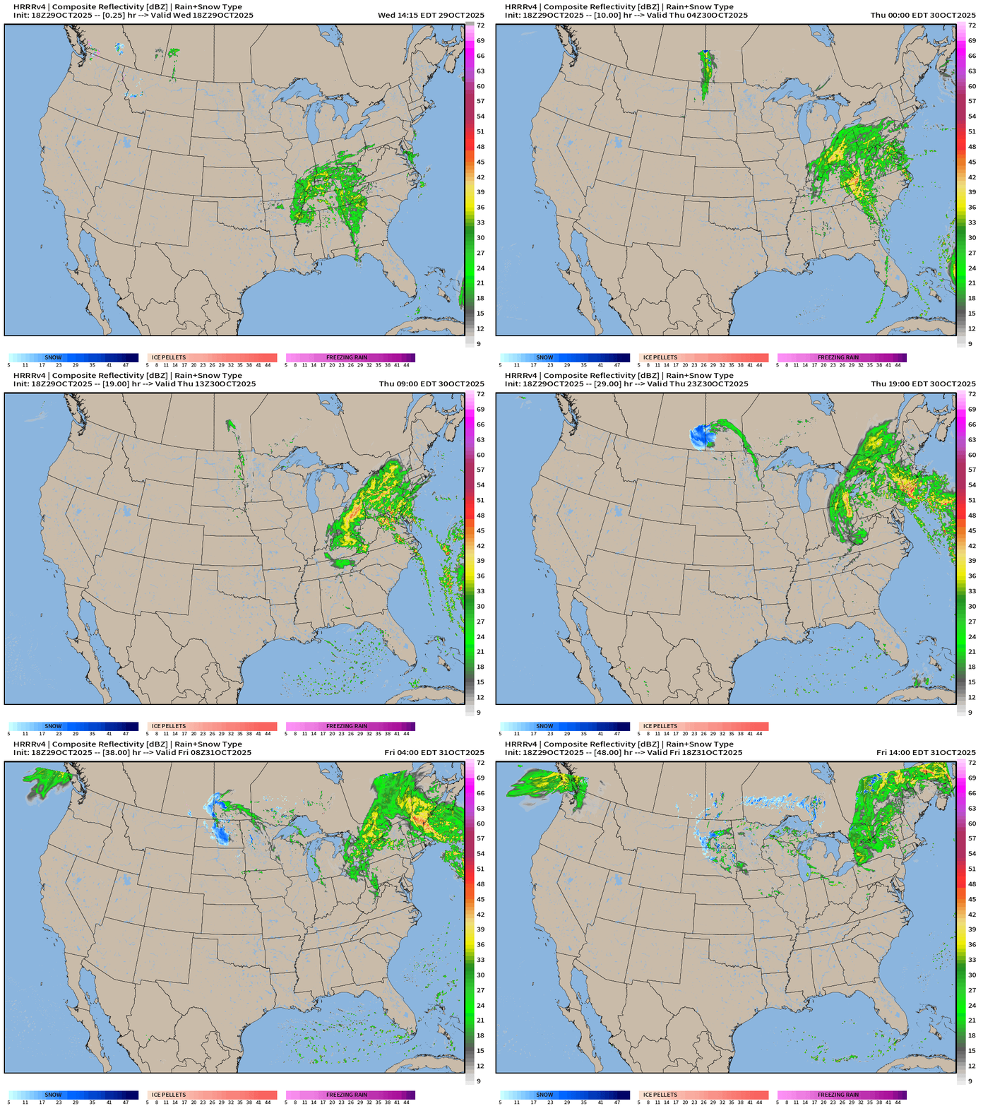
NWS Rainfall Next 48-hours could exceed 1-2 inches over most of the Northeast
Integrated Vapor Transport | Next 10-Days | 12z ECMWF
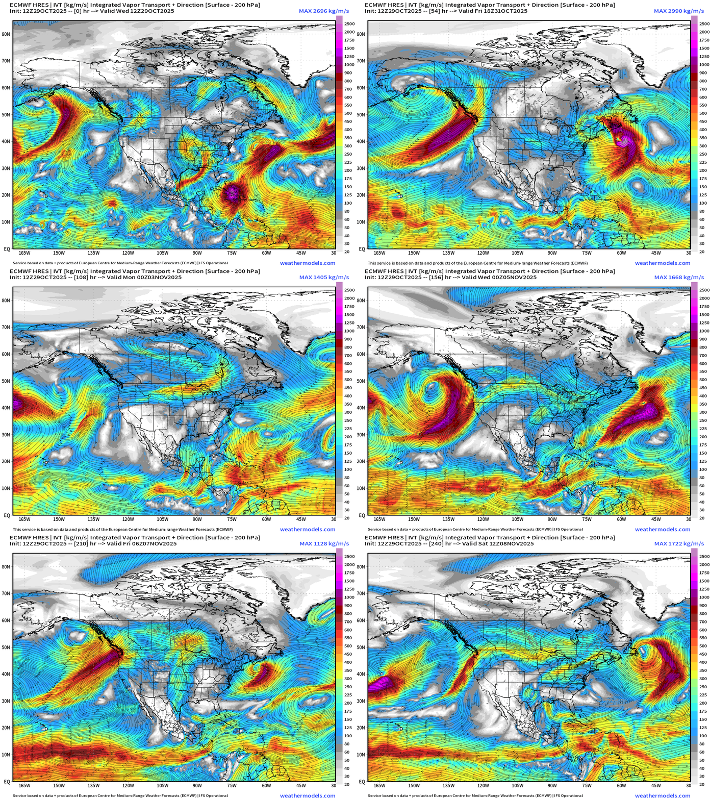
Larger plan view of the atmospheric rivers continuing into the Pacific Northwest over the next 10-days due to a vigorous North Pacific storm track … the conveyor belts of moisture will largely skirt from Northern California into OR/WA. Not expecting the Sierra to get much moisture — so little if any snowfall. Instead, ridging and warmth builds for first week of November.
Precipitable Water Forecast | Next 6-days
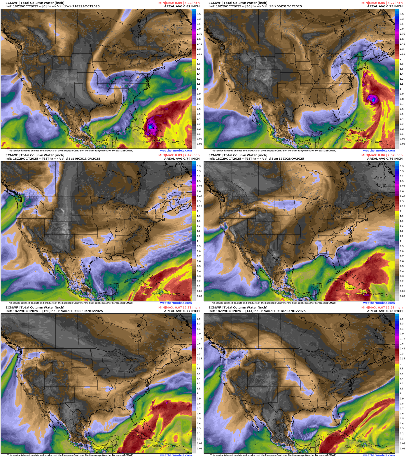
Nor’easter type system heads up the East Coast into Friday — and will dump 1-2”+ rainfall from the Carolinas into New England. Then, dry air out of Canada will cross the continent.
850 hPa Winds from ECMWF 18z | Next 6-days
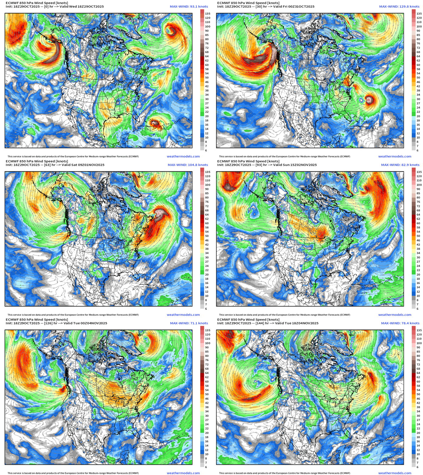
Quite a bit of wind energy with the Nor’easter type system — but thankfully nothing remotely close to the power of Melissa.
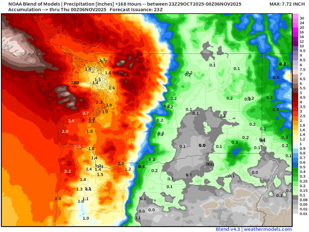
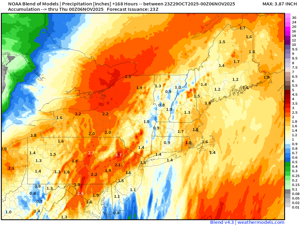
Blend of Models | 7 Day Precipitation Totals
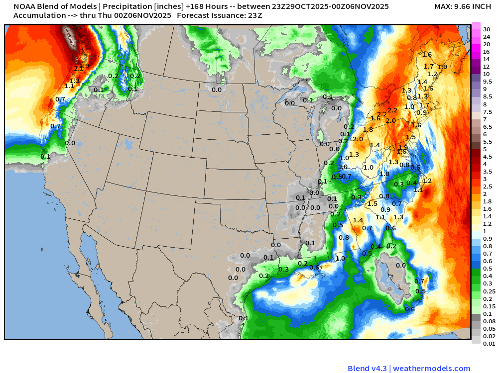
Rainfall > 1” extends into northern California — much more in the Pacific Northwest including Seattle.
Widespread 1” to 2” across the Northeast including Boston, NYC, and Washington D.C.
Blend of Models | 7 Day Snowfall Totals
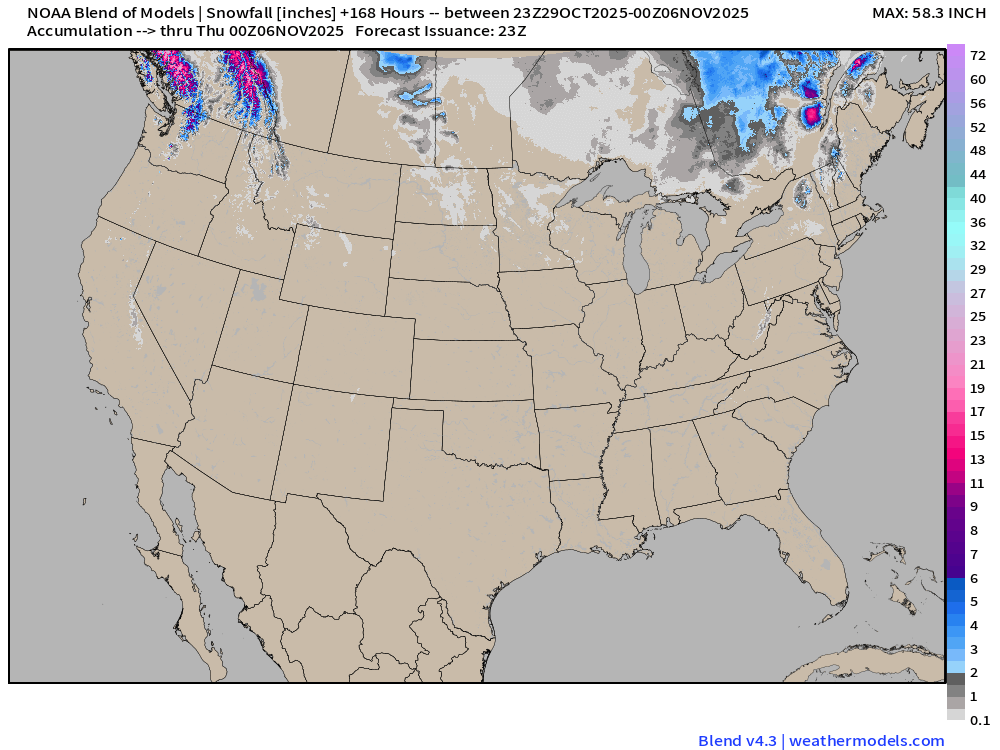
Snowfall in the Cascades and far northern Rockies in British Columbia. Nothing out across the Western U.S. as a significant warm-up is on the way.
Low Temperatures Thursday Morning
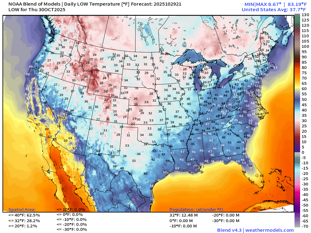
Lower 48 average low temperature is 38°F with 12.5 million population freezing.
High Temperatures on Thursday
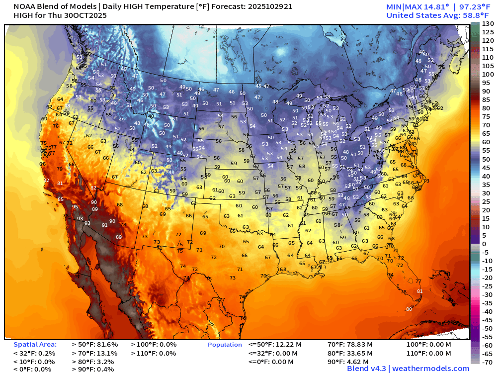
Lower 48 average high temperature is only 59°F with the only heat remaining in the Southwest. Only in the 50s and 60s in the Southeast for daytime highs.
Weekly Temperature Anomaly | Oct 29 - Nov 4
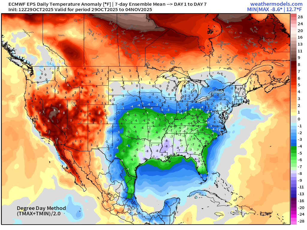
Chilly conditions continue across the Southeast behind the strong Canadian frontal boundary and trough
Weekly Temperature Anomaly | Nov 5 - Nov 11
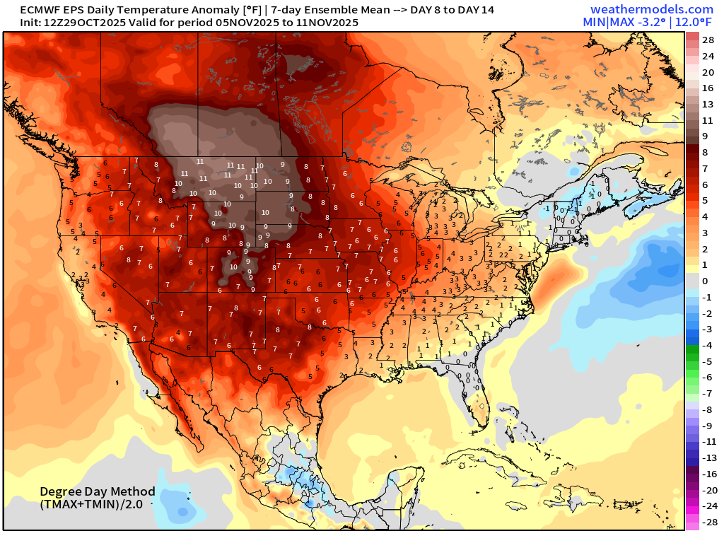
Significant warming trend across the Western U.S. with 10°F+ warm anomaly in the Week 2 ensemble mean
Maps sourced from weathermodels.com designed and innovated by yours truly! Please subscribe there for real-time access to the newest maps, charts from all of the weather models including ECMWF.
- Milepost
- 777 · laid 2025-10-30T00:44:28.039000Z
- Source
- https://weather.substack.com/p/october-29-2025-wednesday-weather
- Digest
- 95e721801fb0b127e42fbe8e9ce5cf2466276fe854624c2c1b06dfd5a209ed6d
- Machine
- JSON