October 21, 2025 Tropical Storm Melissa Watch
NHC 100% chance of Tropical Storm Melissa developing Tuesday
October 2025 was the 7th-warmest October in the 131-year national record (1895–2025), at 57.0°F against a 1991–2020 normal of 54.5°F (+2.4°F).
October 2025 was the 56th-wettest October in the 131-year national record (1895–2025), at 2.3in against a 1991–2020 normal of 2.5in (-0.2in).
NOAA/NCEI Climate at a Glance, contiguous United States. This is the observed record for the month, not a score of anything said in this piece — the forecast ledger begins 2026-08-17 and cannot reach earlier posts.

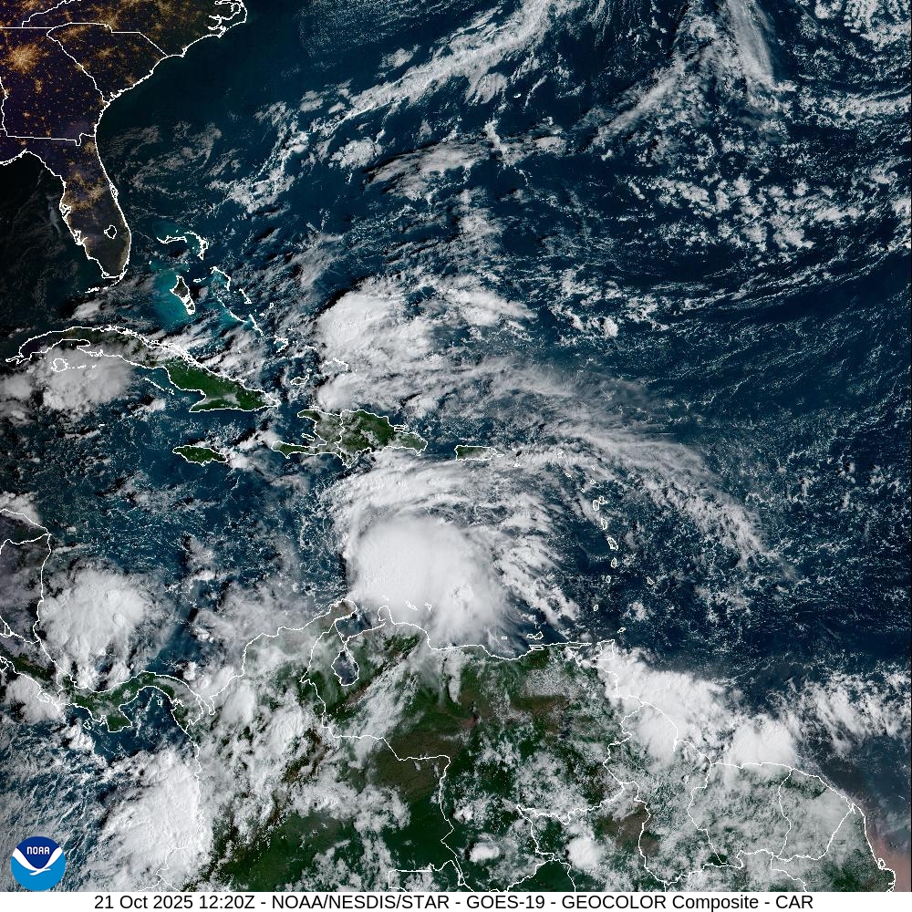
Waiting on formation of Tropical Storm Melissa later today (100% chance) with initial cone and forecast likely at 11 AM ET. Until then, we’ll quickly update the maps/models to figure out where Melissa is headed, and how slowly it will get there!
There is an increasing potential for a Category 5 hurricane in the Western Caribbean.
The vast majority of reliable model solutions keep Melissa over the deep warm ocean heat content through 7-days.
ECMWF 06z Precipitable Water | Next 6-days
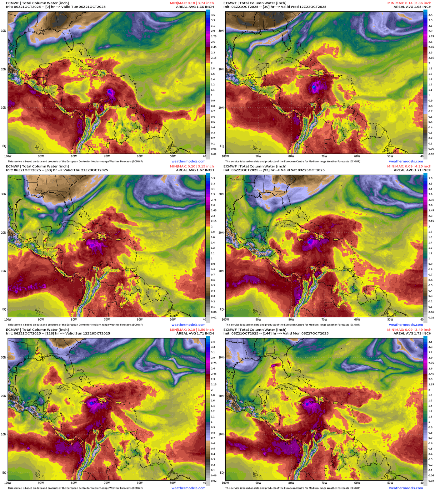
From the ECMWF 06z flagship model, Tropical Storm Melissa will track south of Hispaniola near Jamaica in the coming days, and steadily intensifies to low-970s mb pressure in 4-days settling between Jamaica and Haiti. The slow movement and extreme ocean heat content = rainfall amounts measurable in the feet (> 4 feet)
Into this weekend, we see that ECMWF does NOT take Melissa across Hispaniola (as GFS continues to insist), but instead does a slow loop — nearly stationary next to Jamaica into early next week.
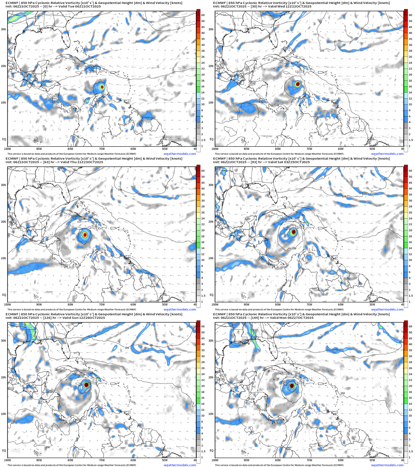
ECMWF Cyclonic Vorticity Next 6-days
ECMWF Wind Gusts Next 6-days
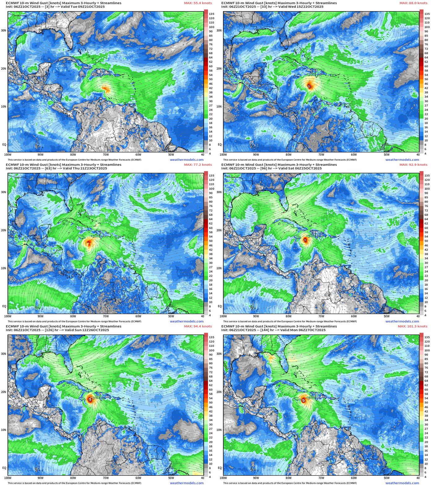
The small inner-core or vortex of Melissa = potential for extremely rapid intensification especially if the wind shear decreases enough.
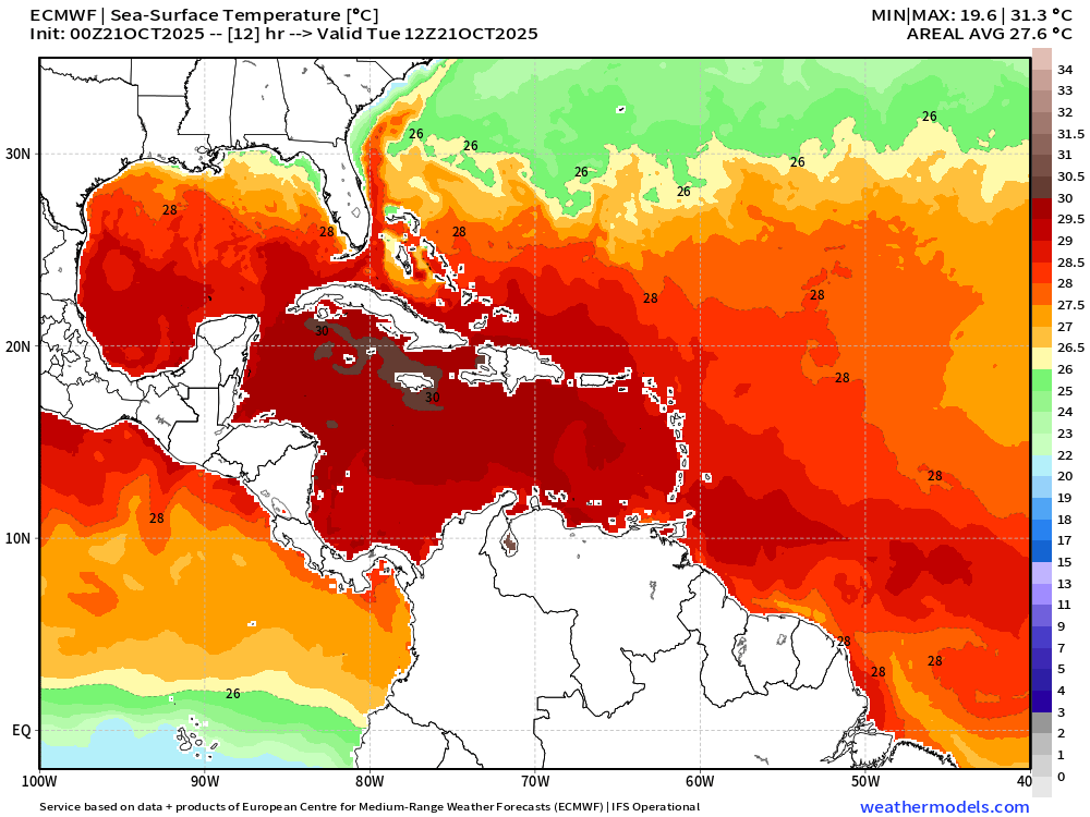
We don’t typically use the global models for intensity forecasts due to their lower spatial resolution (grid spacing) but ECMWF at 9 km resolves ~970 mb with a tiny vortex. To me, that favors potential for Category 5 with the ocean heat content and 29° to 30°C SSTs.
Atlantic Integrated Vapor Transport | Next 12-Days | 00z ECMWF
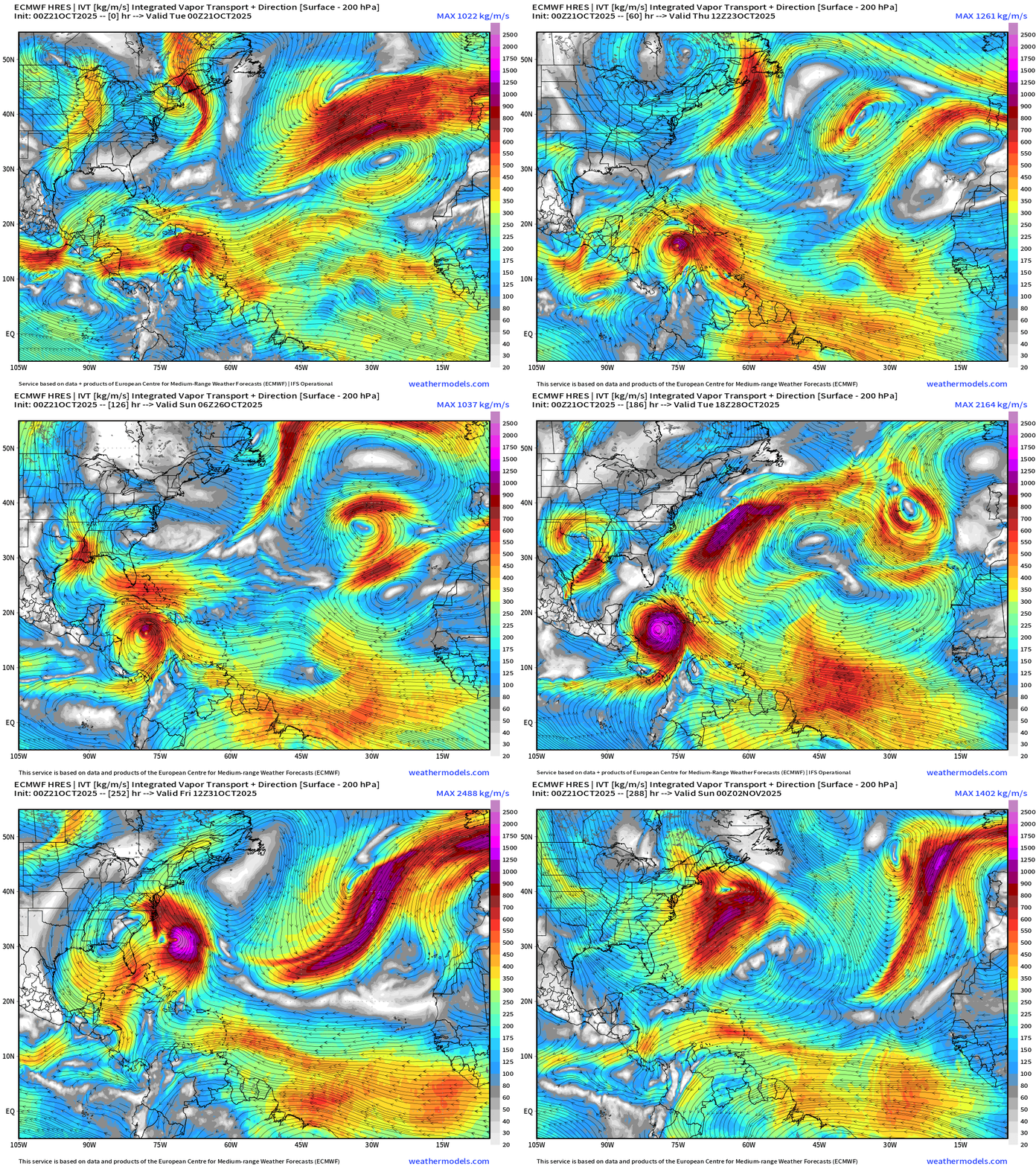
The flagship 00z solution extends here into Day 12 — and shows a monster Hurricane Melissa spinning over the very warm western Caribbean before sprinting across eastern Cuba into the Atlantic. Still not worrying about the East Coast — that would be 10 days down the road — and would require an extremely rare alignment or weather pattern to repeat a Sandy-like trough capture.
Atlantic Basin Outlook | 8 AM ET Update
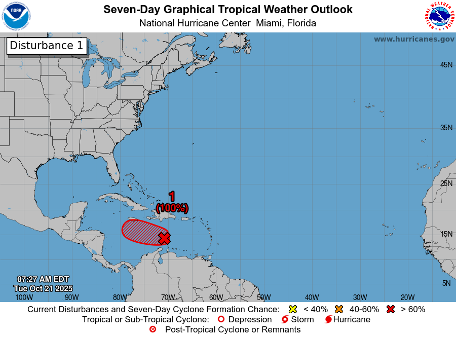
Invest 98L —> 100% —> Tropical Storm Melissa.
2025 Hurricane Season [Day 143]. My FORECAST for this year is 14 named storms, 7 hurricanes, and 3 major hurricanes (near average)
2025 Season to Date: 12 Named Storms, 4 Hurricanes, and 3 Majors | ACE = 100
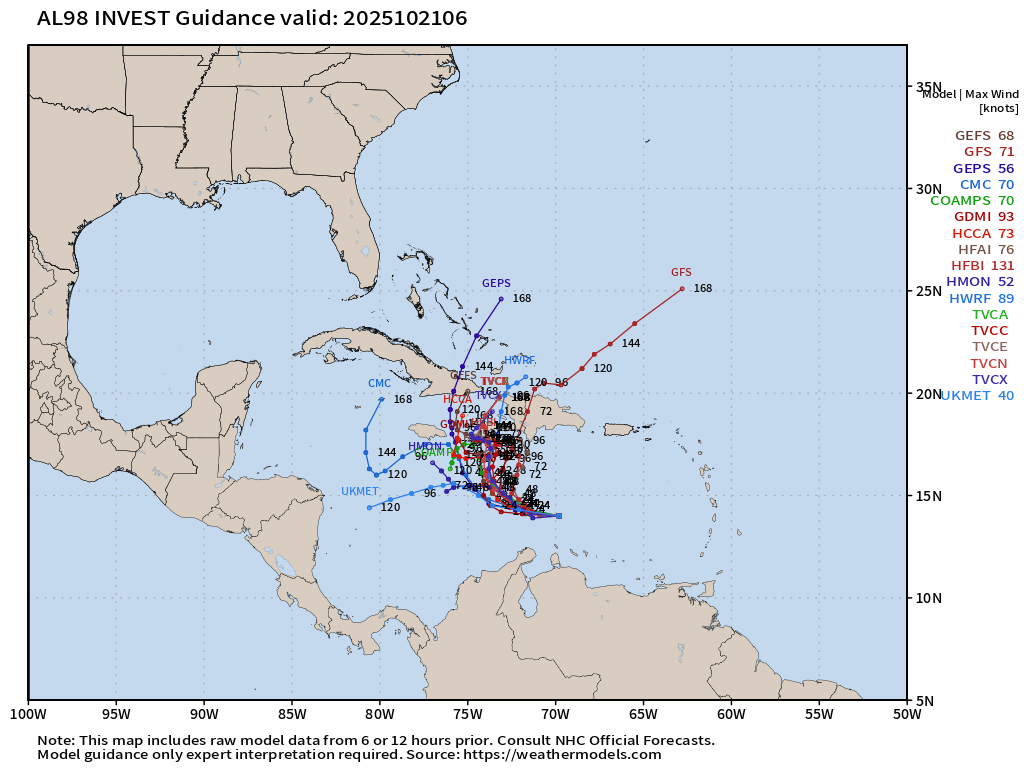
ATCF Spaghetti | Invest 98L
Caribbean IR Satellite Loop
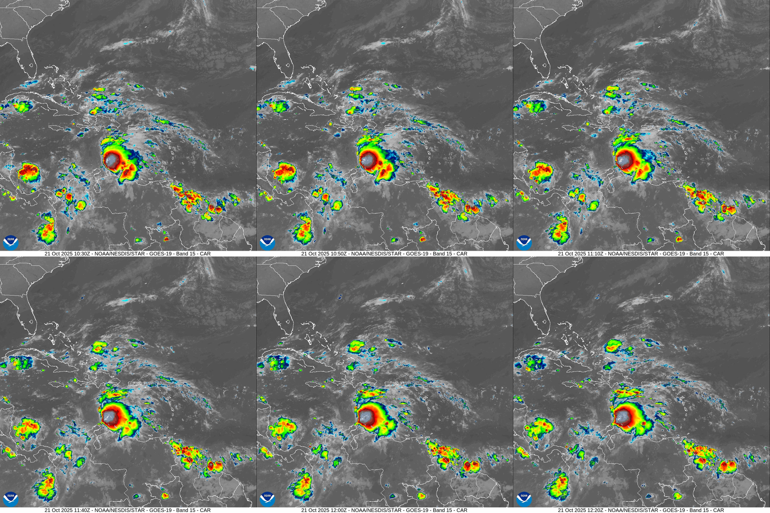
Very healthy blob of convection with Invest 98L —> Melissa.
NOAA Tropical Surface Analysis | 06z
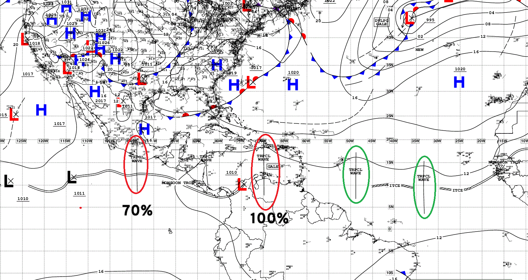
Atlantic Tropical Waves = 3 —> Invest 98L has 100% chance of development in the Caribbean
Google Deep Mind Forecast Tracks | Invest 98L
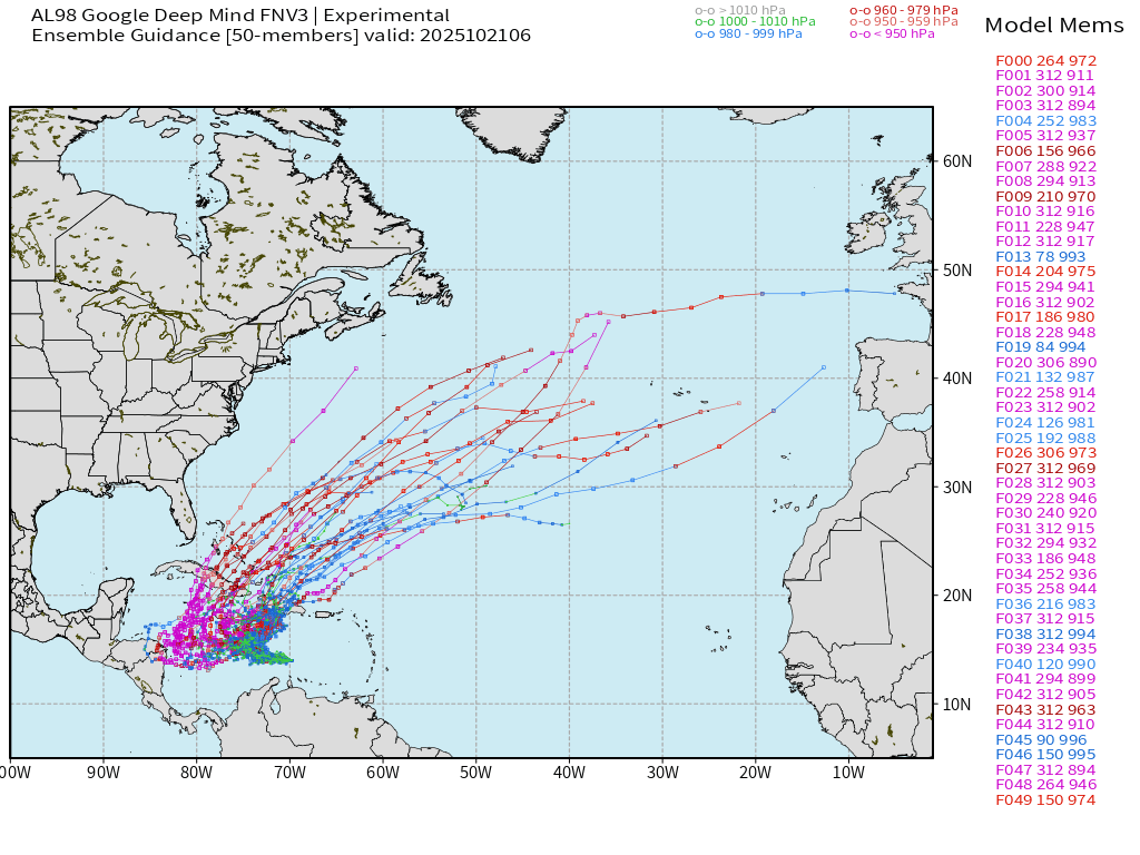
50-members from this A.I. trained system — which has performed very well after storm formation — shows 2 camps: westward/more intense vs. into Hispaniola.
There are members at 894 mb, and many others at Category 5 pressure — assuming Melissa heads westward w/o as much northward component of motion like the ECMWF 06z.
ECMWF 00z EPS Internal Tracker | Invest 98L
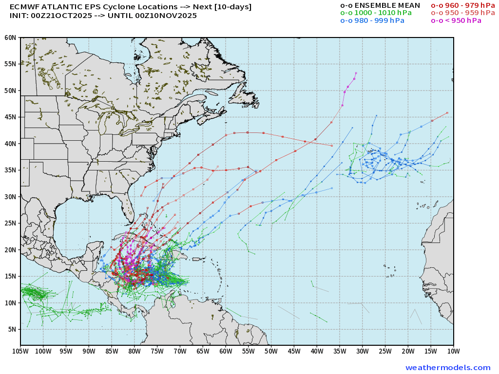
Similar story from the EPS 00z (internal tracking routine provided by ECMWF) — the red tracks = major or even Category 5 hurricanes that linger longer SW of Jamaica before accelerating out-to-sea. The animated “active tracks” show the 2 potential outcomes very nicely, but the majority of solutions now drift WSW away from Jamaica and Haiti.
Active Tracks Animation | ECMWF EPS 00z through 12-days
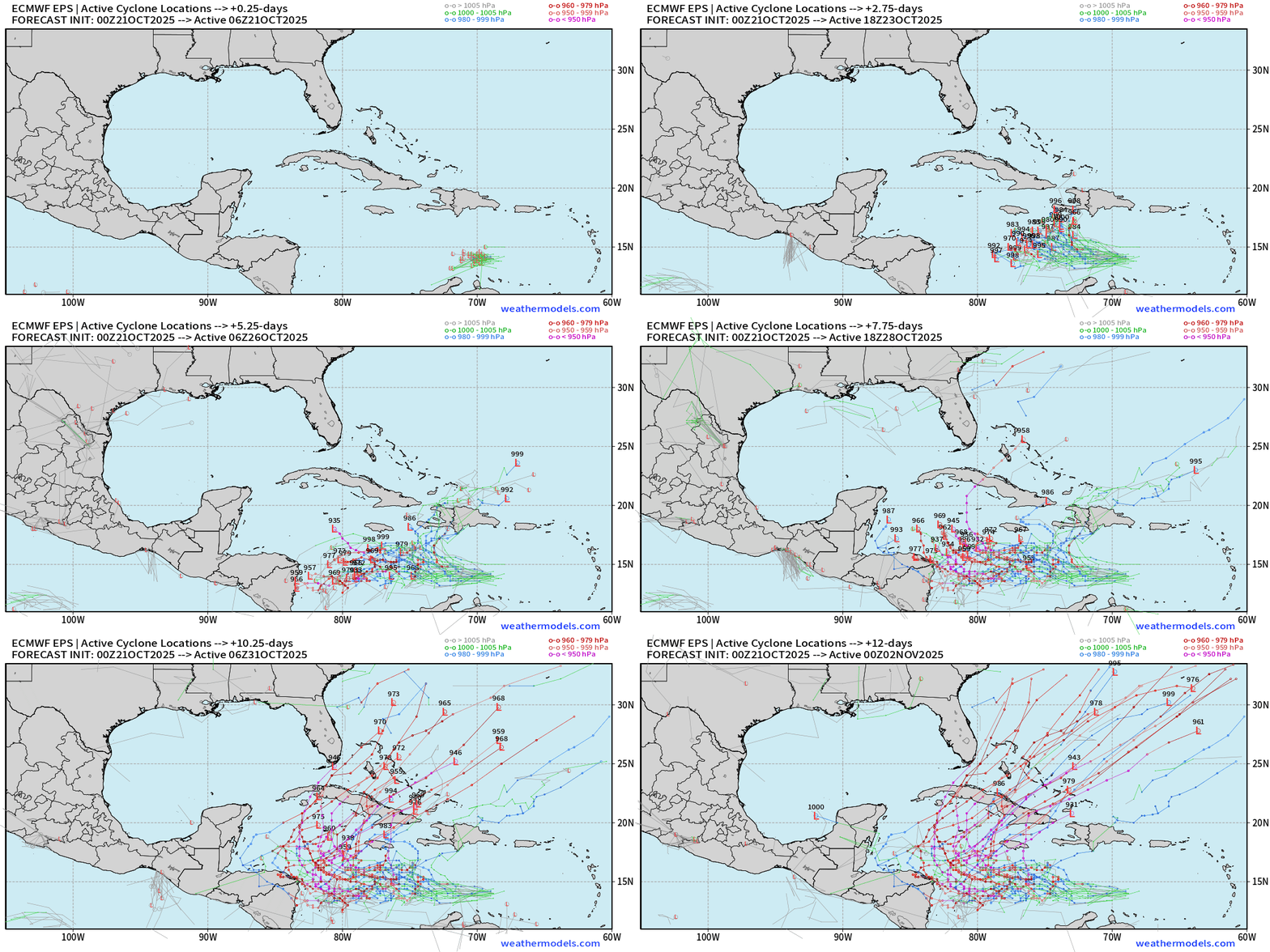
If we sort the members that do have hurricanes, then the expected track out of the western Caribbean is near/east of Florida and then into the Western Atlantic.
NOAA GEFS 00z & 06z (31-members) | Through 7-days
GEFS Ensemble Tracks favor a more northward solution but there are a minority that match ECMWF EPS + Google Deep Mind.
GFS 06z is due north to Hispaniola in 3-days as a major hurricane (not favored solution)
Eastern Pacific Tropical Weather Outlook | 8 AM ET
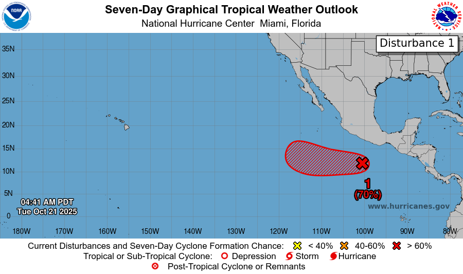
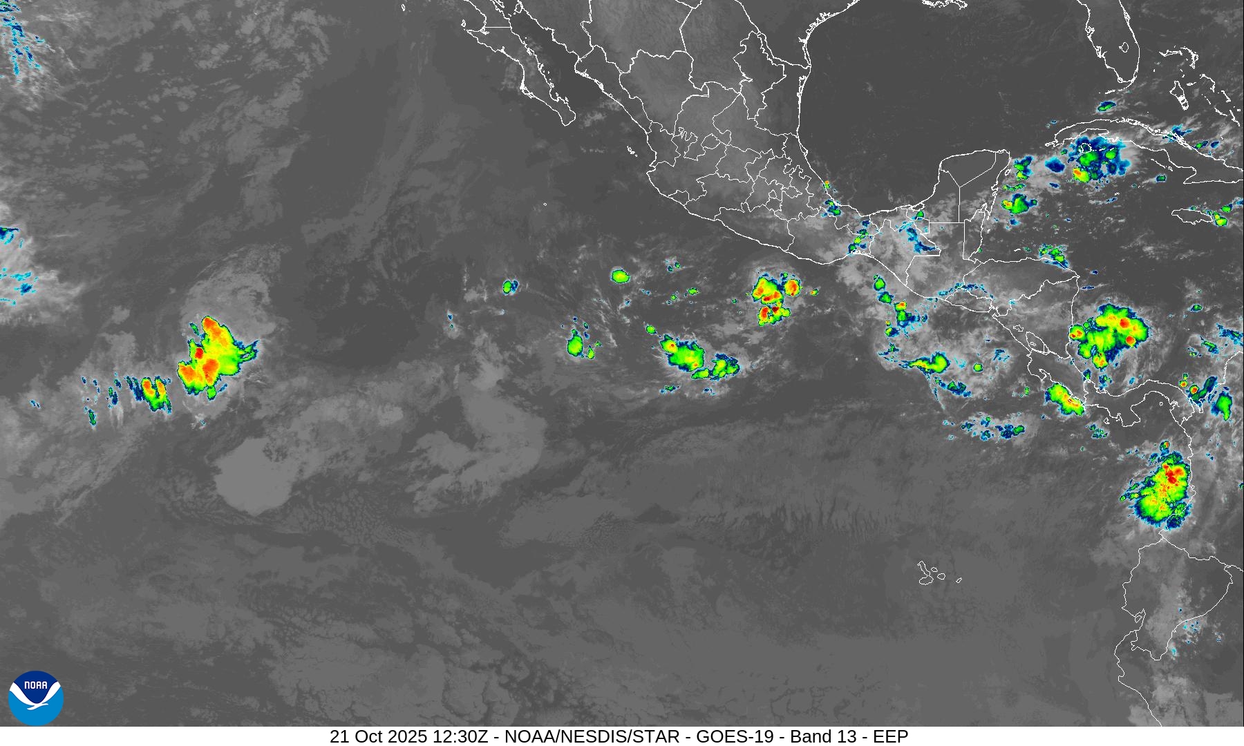
70% chance of formation of another tropical cyclone (next name is Sonia) in the next several days. However, the convection is not well organized and any development would be slow.
Maps sourced from weathermodels.com designed and innovated by yours truly! Please subscribe there for real-time access to the newest maps, charts from all of the weather models including ECMWF.
- Milepost
- 770 · laid 2025-10-21T13:09:42.055000Z
- Source
- https://weather.substack.com/p/october-21-2025-tropical-storm-melissa
- Digest
- 152f8bc8b905678bdce1fc748c178446df46367cbf8f1420a861126845699b1e
- Machine
- JSON