October 19, 2025 Sunday Hurricane Season
NHC 60% chance of Melissa developing in Caribbean this coming week
October 2025 was the 7th-warmest October in the 131-year national record (1895–2025), at 57.0°F against a 1991–2020 normal of 54.5°F (+2.4°F).
October 2025 was the 56th-wettest October in the 131-year national record (1895–2025), at 2.3in against a 1991–2020 normal of 2.5in (-0.2in).
NOAA/NCEI Climate at a Glance, contiguous United States. This is the observed record for the month, not a score of anything said in this piece — the forecast ledger begins 2026-08-17 and cannot reach earlier posts.

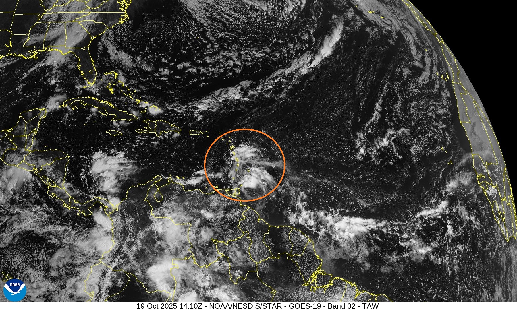
Models show a high likelihood of tropical storm formation in the next 5-7 days but the location and timing are uncertain. NHC is currently at 60% (Moderate) chance of development in the next 7-days.
ECMWF EPS (conventional full-physics systems) much slower formation thus reaching the western Caribbean, and then becoming a hurricane. This scenario — further west — could create a risk to Florida and potentially the U.S. East Coast way down the road as a post-tropical system. However, that’s so far over the forecast skill horizon, that we should only keep the risk in back of our mind.
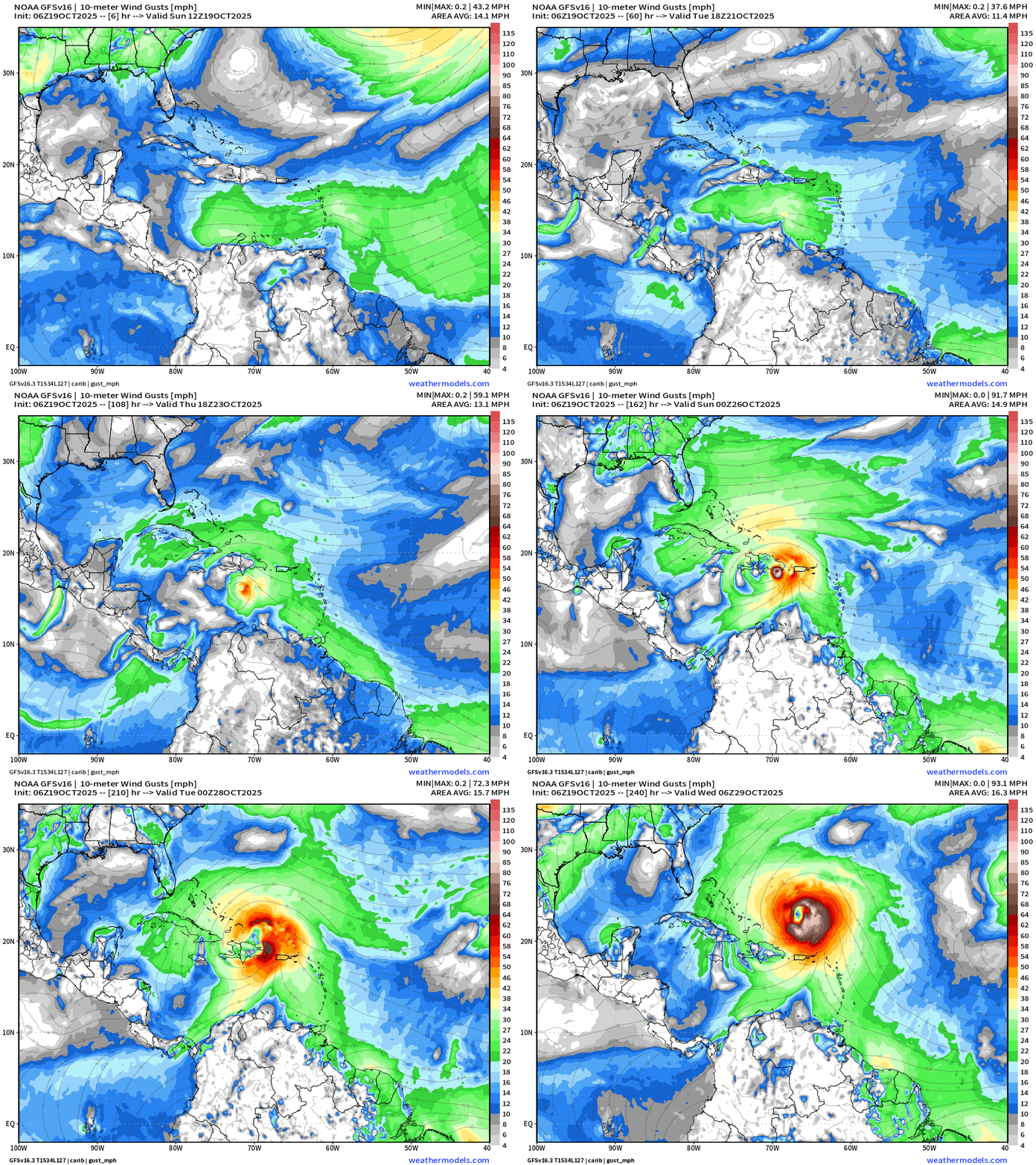
NOAA GEFS/GFS and half of the ECMWF AIFS (artificial intelligence ensembles) show faster development and then a sharp northward turn out of the Caribbean with primary threat to Hispaniola and Puerto Rico.
Interests in the Caribbean from Jamaica, Cuba, Hispaniola to Puerto Rico should monitor Invest 98L in the coming days.
Atlantic Integrated Vapor Transport | Next 15-Days | 00z ECMWF
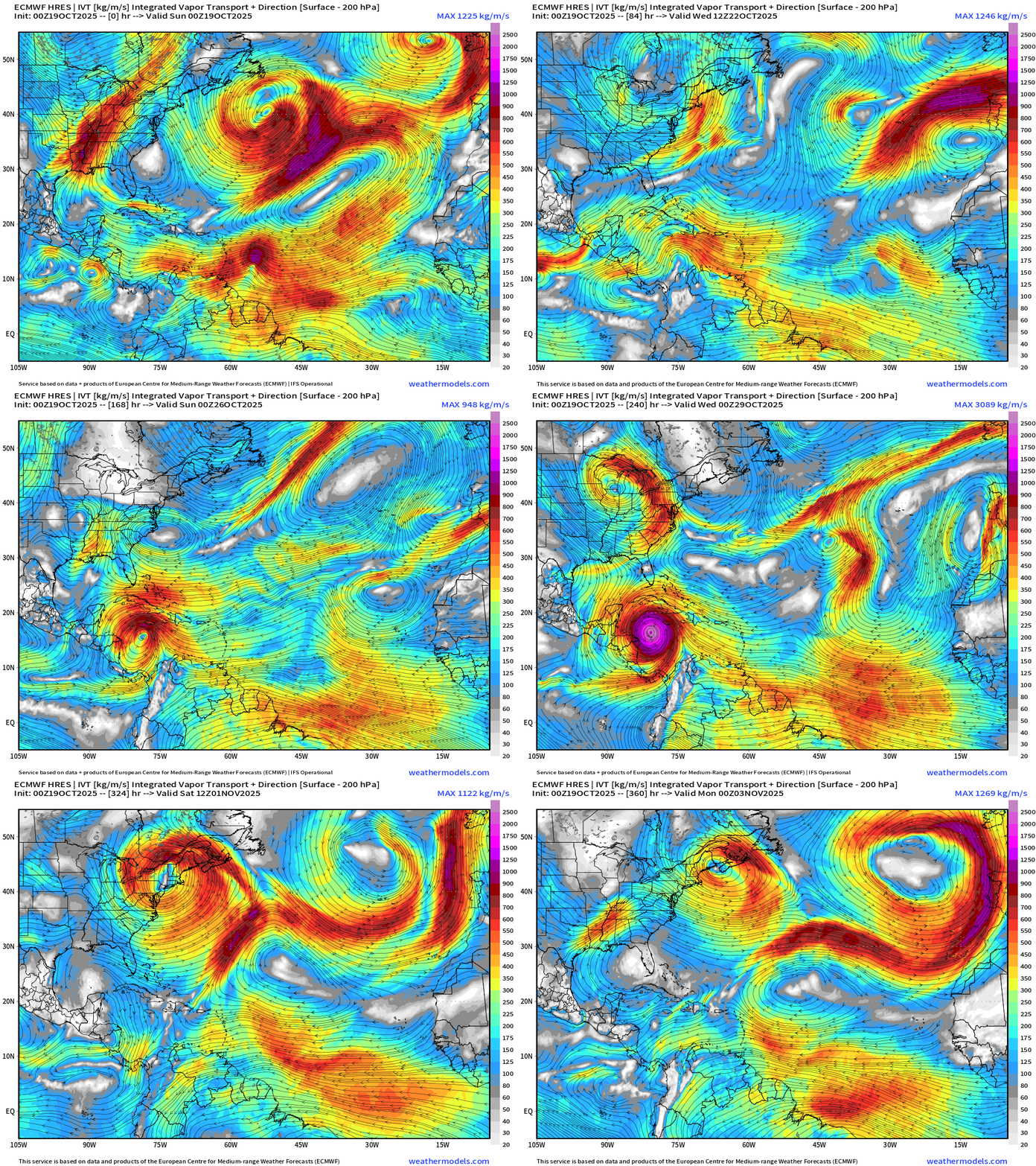
ECMWF HRES (flagship) model solution is slower with development waiting until the tropical wave nearly reaches Central America before rapidly intensifying into a major hurricane. The ocean waters are very warm/deep and untapped this hurricane season so any late-October tropical system has uncapped potential intensity.
In the days after hurricane formation, the system (Melissa) sprints NNE captured by an Eastern U.S. trough, and becomes a strong post-tropical storm / Nor’easter — typical upper-level weather pattern into late-October. While there is large-scale parallel to late October 2012, again, that is in the Week 2 time frame and well beyond our capability to skillfully forecast.
My Favorite Parameter | Precipitable Water | Next 6-days
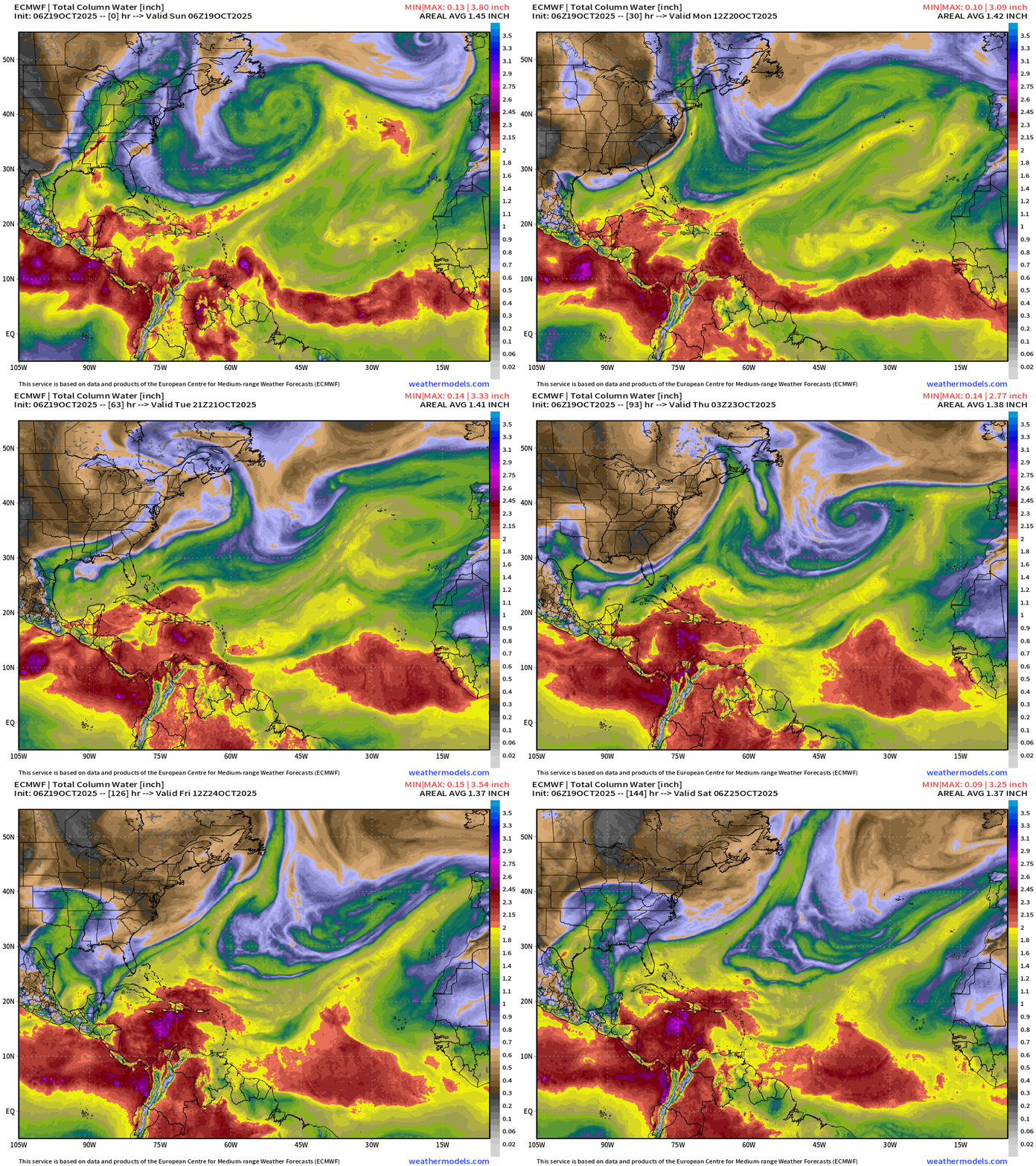
There is a distinctive spin in the central Caribbean just south of Jamaica by Day 6 — but not quite a named storm by next Friday. ECMWF has been notoriously slow on cyclogenesis (formation) but then seems to do quite well on intensification thereafter.
ECMWF Cyclonic Vorticity Next 6-days
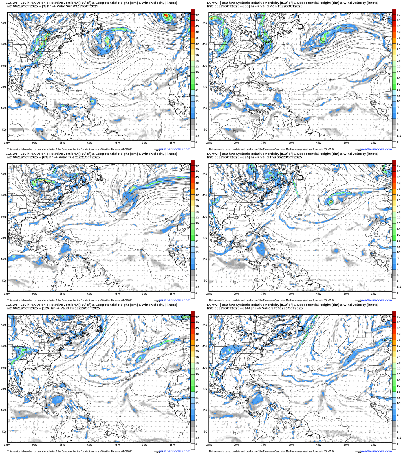
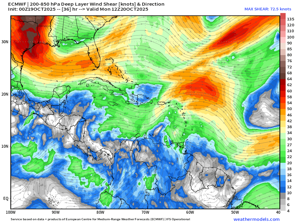
Invest 98L is tracked into the Caribbean but does not “catch fire” due to strong wind shear > 25 knots combined with the rapid translation of the system to the west. Normally the central Caribbean is a “graveyard” for tropical systems, but the western part of the basin is more conducive for powerful hurricanes assuming the tropical waves hold together. Otherwise, usually they continue into the Eastern Pacific, but that’s not expected as we head into late October with strong cold fronts already blasting through the Gulf of Mexico capable of slowing down and then redirecting the systems NE.
Wind Shear Monday Morning
Atlantic Basin Outlook | 8 AM ET Update
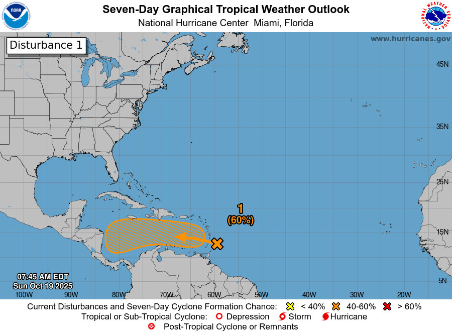
Invest 98L —> 60% through 7-days. The next name is Melissa.
2025 Hurricane Season [Day 141]. My FORECAST for this year is 14 named storms, 7 hurricanes, and 3 major hurricanes (near average)
2025 Season to Date: 12 Named Storms, 4 Hurricanes, and 3 Majors | ACE = 100
ATCF Spaghetti | Invest 98L
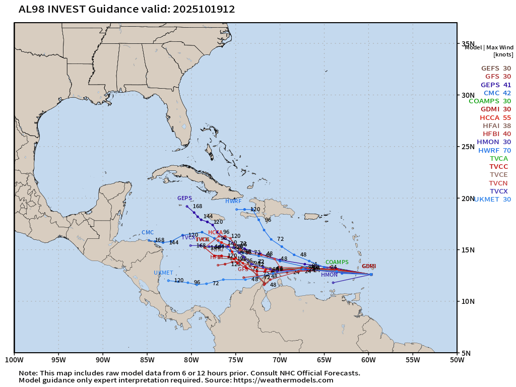
Through 5-7 days, not expecting significant development — but this was always going to be a slow process.
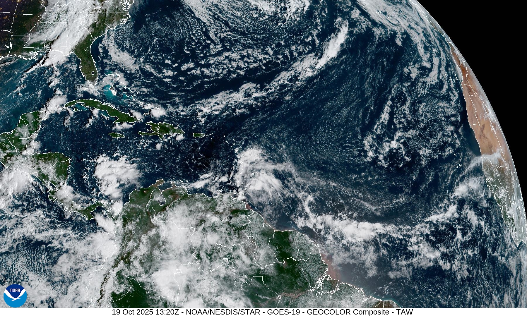
Central Atlantic | Water Vapor Satellite Loop
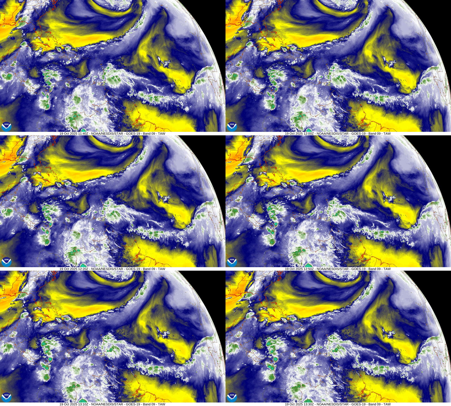
The tropical wave is well south of the strong mid-latitude troughs already carving out the Atlantic into the Bahamas and Gulf of Mexico.
SST and Anomaly | ECMWF
Ocean waters remain slightly above normal in the Caribbean in the 28°C to 30°C range — untapped this hurricane season.
NOAA Tropical Surface Analysis | 06z
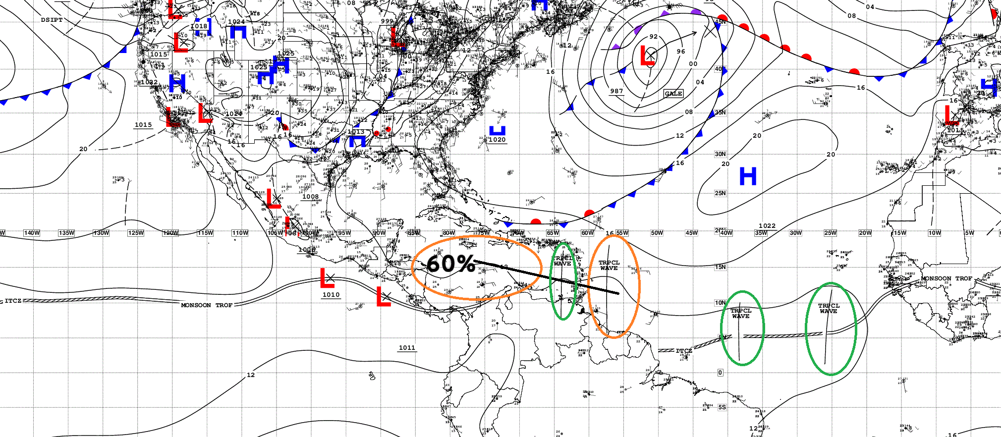
Atlantic Tropical Waves = 4 —> Invest 98L has 60% chance of development into the Caribbean from Invest 98L
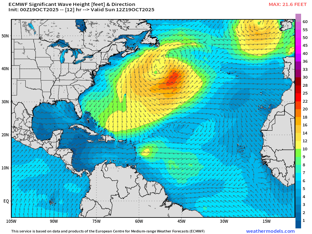
Large Swell from East Coast Gale
ECMWF EPS 00z | Active Storm Tracks Day 5
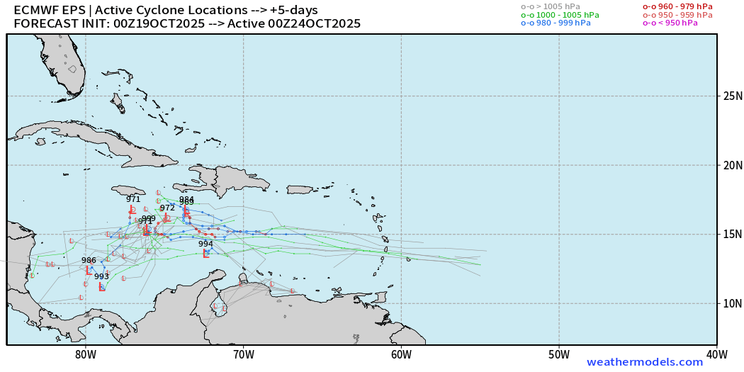
We do see a handful of members active with TS/Hurricane in 5-days, but that’s likely too fast.
ECMWF EPS 00z | Active Storm Tracks Day 9
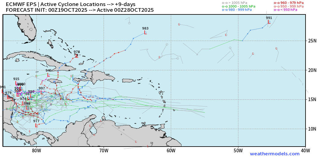
Cluster of members > 50% in the western Caribbean by Day 9.
ECMWF EPS 00z | Active Storm Tracks Day 12
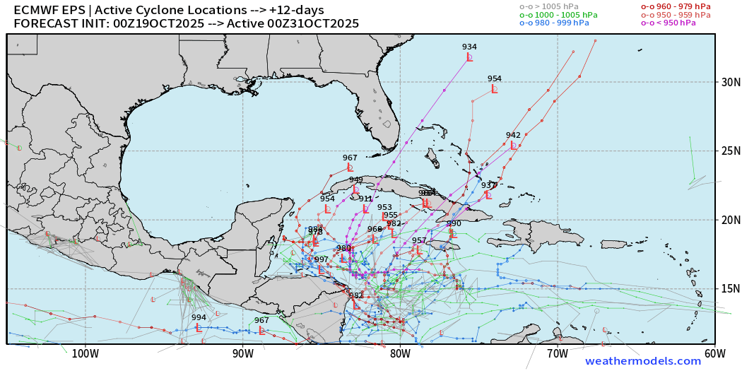
ECMWF EPS 00z | Active Storm Tracks Day 15
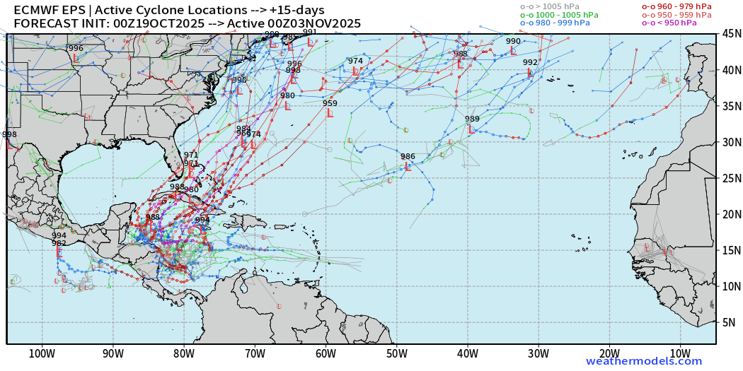
If we sort the members that do have hurricanes, then the expected track out of the western Caribbean is near/east of Florida and then into the Western Atlantic.
However, way too early to speculate on impacts for this system — but we’ll have more certainty likely by middle of the week.
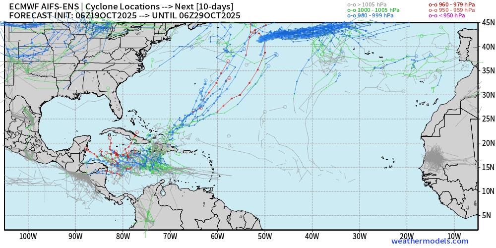
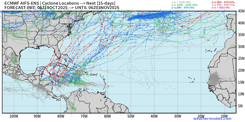
AIFS ENS at Day 10 and Day 15 Comparison | Active Storm Tracks
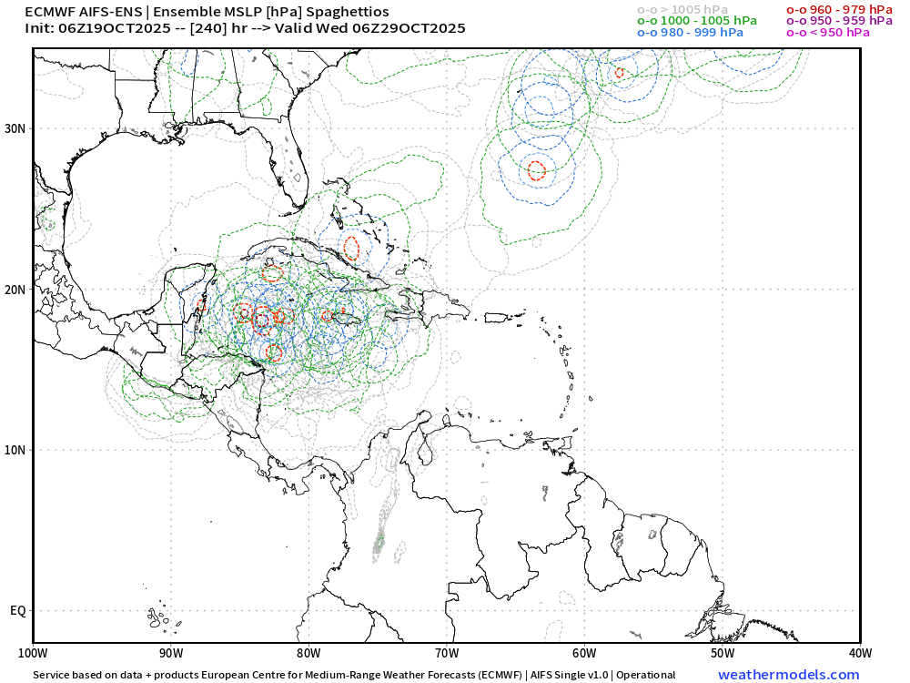
Two clusters of solutions from AIFS-ENS (06z) with development in the western or central Caribbean. It’s uncanny how well these A.I. trained systems mimic the full-physics ensembles.
And, similarly at Day 15, any formation in the Western Caribbean into a hurricane would sprint NE across Cuba, Florida, and then post-tropical quickly thereafter.
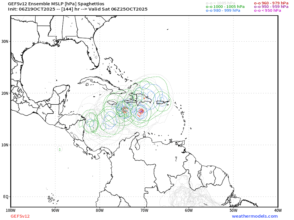
NOAA GEFS 00z & 06z (31-members) | Through 10-days
GEFS Ensemble Tracks continue to show sooner development over the central Caribbean.
NOAA GFS 06z | Earlier Central Caribbean Development
Summary:
We have low skill with location/intensity of tropical storm development even 7-days into the future — BUT there remains a strong signal (> 50%) for TS Melissa to develop based upon current guidance.
What do we do with this information? Monitor the situation daily to look for trends up/down in the risk of hurricane development — nothing new/different than what you’d do during the rest of the season.
Eastern Pacific Tropical Weather Outlook | 8 AM ET
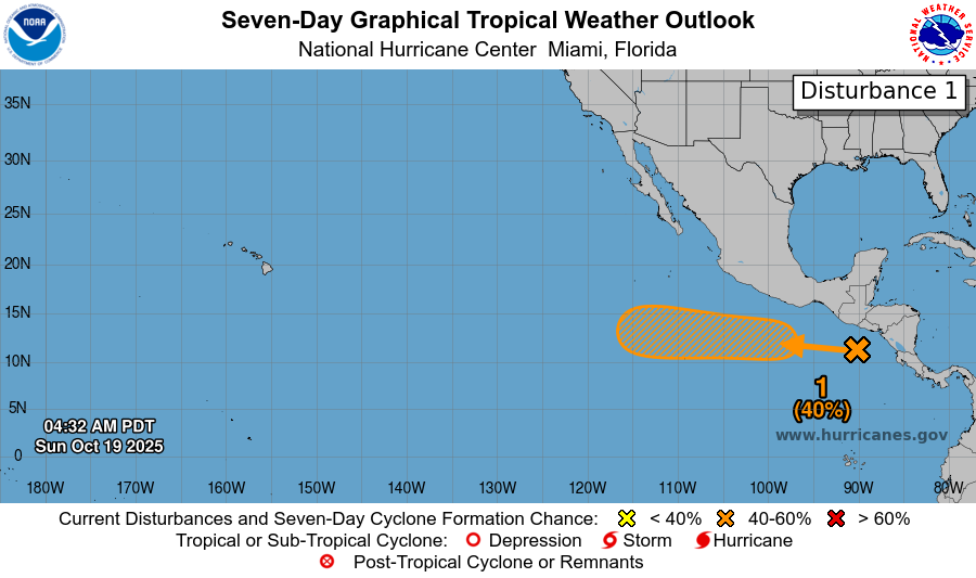
40% chance of formation of another tropical cyclone (next name is Sonia) in the next several days. The previous Invest last week did not catch fire.
Western Pacific Typhoon and Southern Hemisphere Cyclone Update
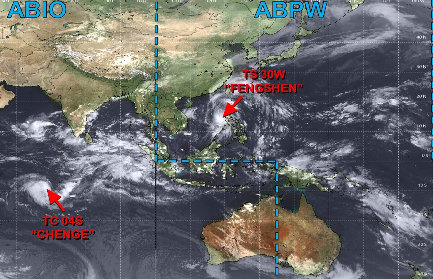
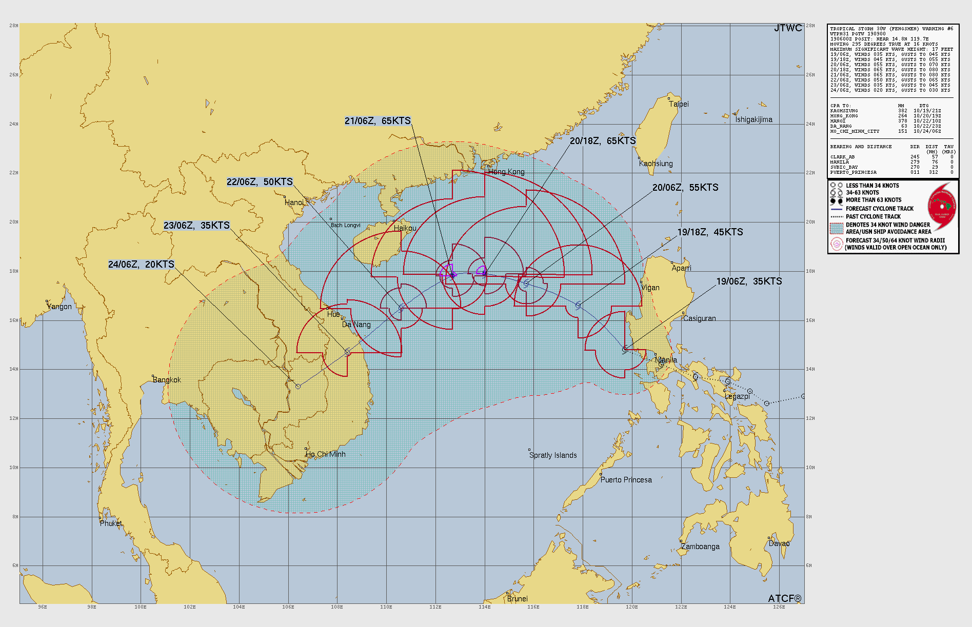
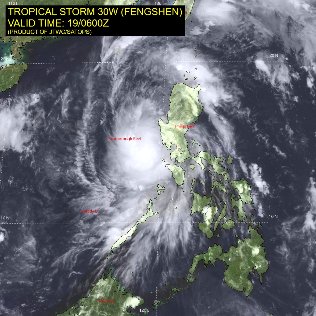
Tropical Storm Fengshen (30W) should track WSW across the South China Sea becoming a typhoon but weakening upon reaching Vietnam in 5-days
Tropical Cyclone 04S (Chenge) | Southern Indian Ocean
No threat to land from this weak tropical storm.
Maps sourced from weathermodels.com designed and innovated by yours truly! Please subscribe there for real-time access to the newest maps, charts from all of the weather models including ECMWF.
- Milepost
- 768 · laid 2025-10-19T14:42:19.880000Z
- Source
- https://weather.substack.com/p/october-19-2025-sunday-hurricane
- Digest
- 88a04fbe30e112f43ef0cf81d97b75c308fd681cc99ac4f5f2bb7be0e5ca2686
- Machine
- JSON