October 10, 2025 Friday Weather Update
Both coasts with impactful weather including a Nor'easter
October 2025 was the 7th-warmest October in the 131-year national record (1895–2025), at 57.0°F against a 1991–2020 normal of 54.5°F (+2.4°F).
October 2025 was the 56th-wettest October in the 131-year national record (1895–2025), at 2.3in against a 1991–2020 normal of 2.5in (-0.2in).
NOAA/NCEI Climate at a Glance, contiguous United States. This is the observed record for the month, not a score of anything said in this piece — the forecast ledger begins 2026-08-17 and cannot reach earlier posts.

2025 Season to Date: 11 Named Storms, 4 Hurricanes, and 3 Majors | ACE = 97
North America Precipitable Water next 7-Days
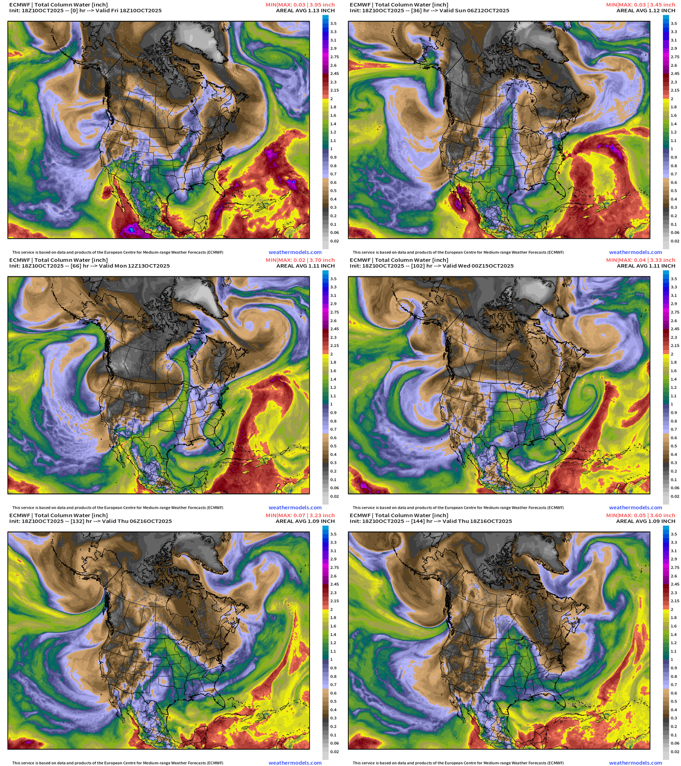
Overview of the continent: Next 7-days
Tropical moisture from former TS Priscilla and Tropical Storm Raymond will funnel into the U.S. Southwest and then continue ENE into the central Plains and Midwest fueling significant rainfall.
Atmospheric rivers descend the west coast from WA/OR into California for a great start to the 2025-26 Water Year.
Fall chill continues behind a Canadian cold front across the Great Lakes and Northeast, and a reinforcing shot of cold/dry air into next Thursday
A non-tropical “Nor’easter” like system forms off Southeast U.S. Coast, which lifts north into the Northeast — all the while battering the coast with gusty winds and rainfall — mainly this weekend. Hurricane force wind gusts could be just offshore New Jersey with 40-60 mph gusts affecting residents for quite a while.
Atlantic tropics: Tropical Storm Jerry is a mess — sheared and poorly organized. Not expecting any other development for at least 7-days.
Precipitation Type _ MSLP | Next 7-days
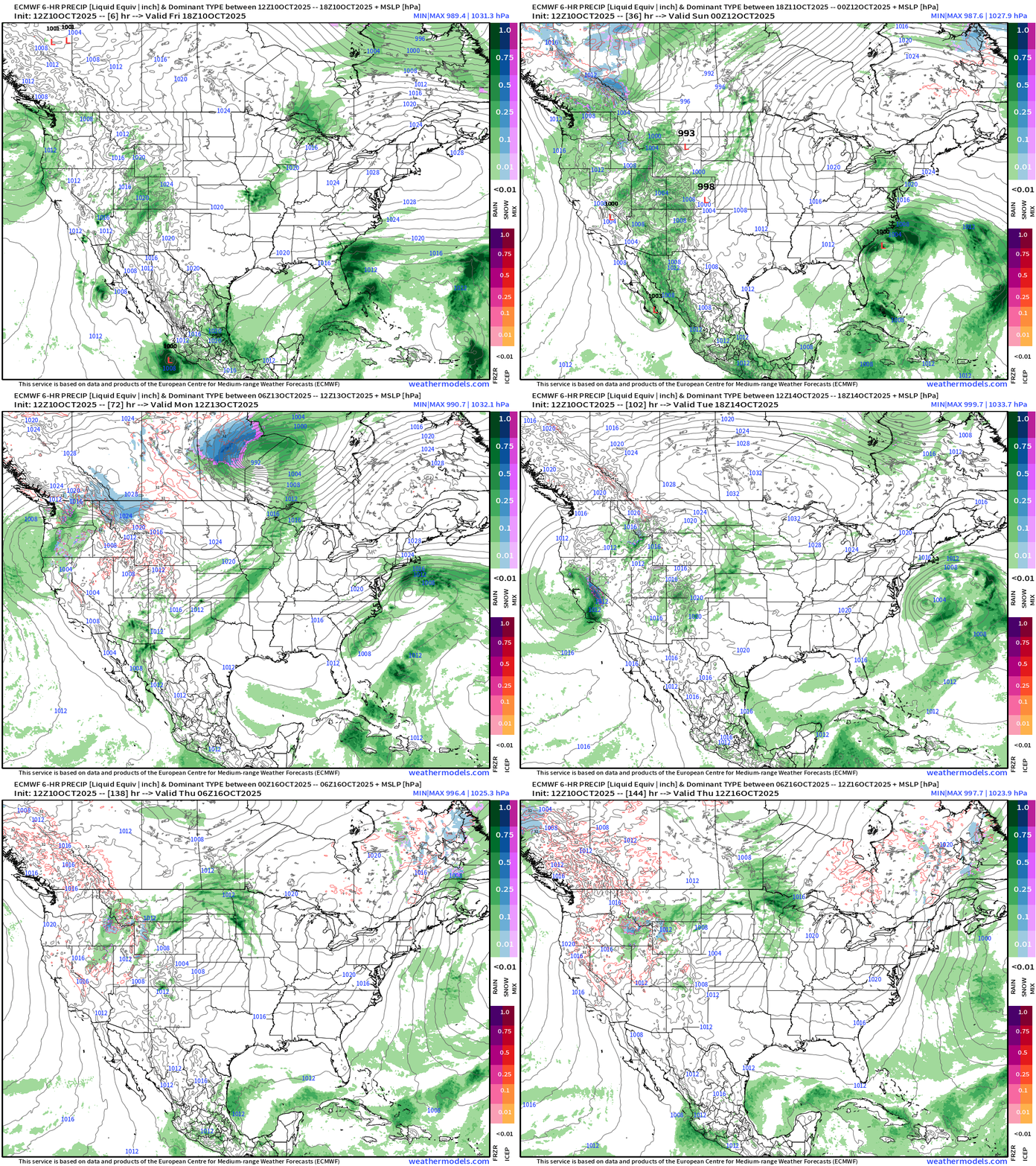
There is some snowfall (blue) showing up on the maps across the Rockies and into Canadian Prairies as mid-October is already cold enough for snowfall.
Plenty of moisture into the West Coast + tropical input from Priscilla and Raymond into the Southwest. Meanwhile, the east coast sees a blustery Nor’easter with heavy rain and near hurricane force wind gusts. Not a named system, but similar to a tropical storm — and thankfully no snow (yet).
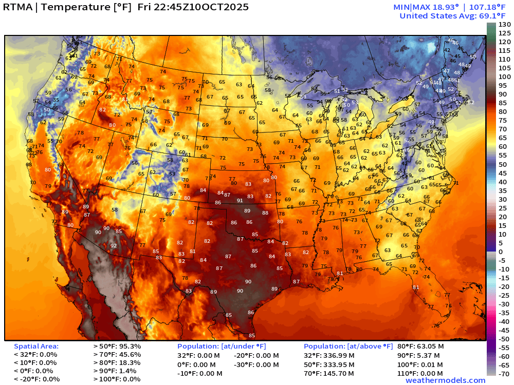
Current Temperature | RTMA 6:45 PM ET
Current Temperature Anomaly | RTMA 6:45 PM ET
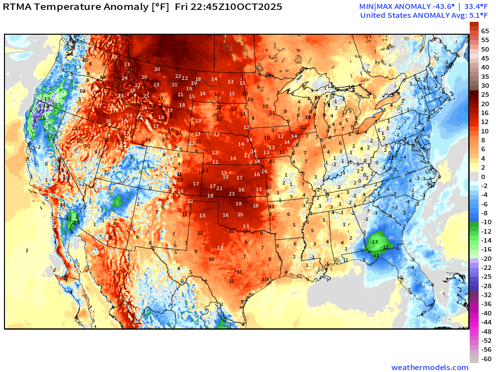
Lower 48 is a +5.1°F above normal
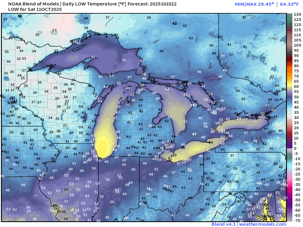
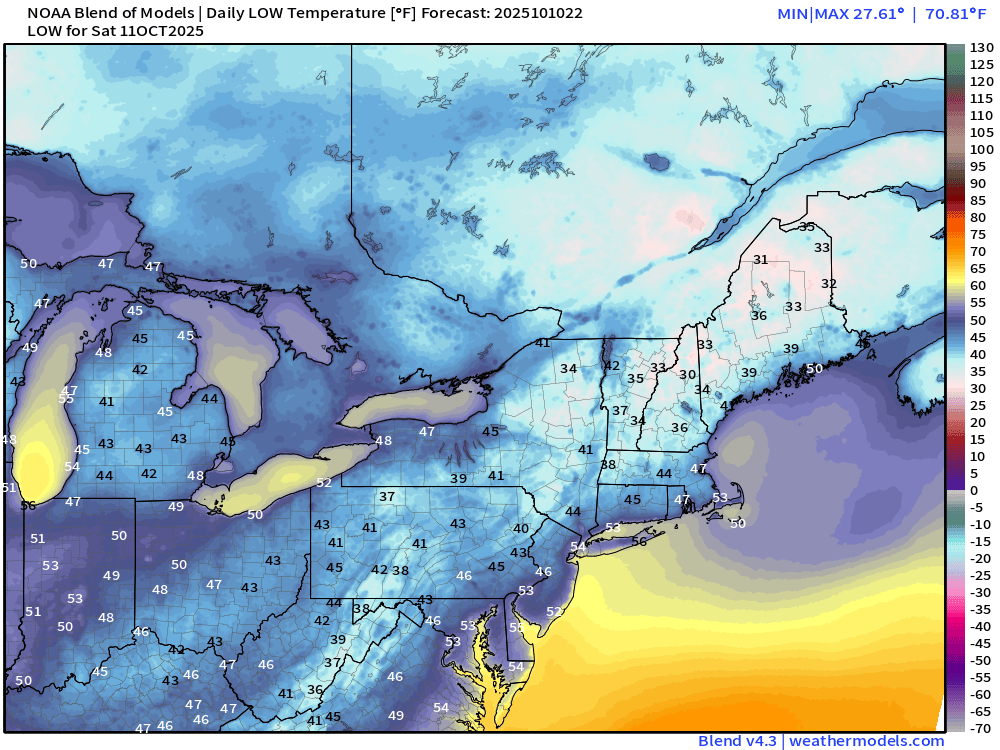
Low Temperatures Saturday Morning
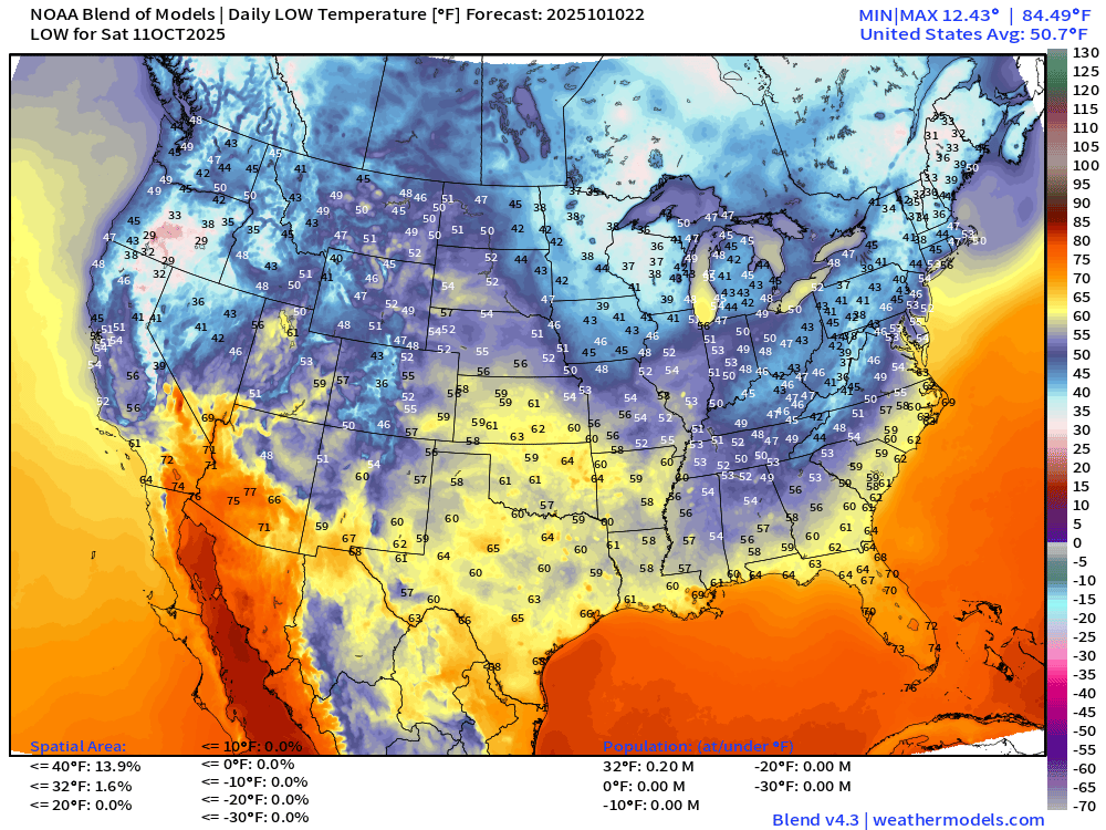
Only 200k population below freezing, so slightly warmer morning, but 30s and 40s now typical for mid-October in the Great Lakes and Northeast
High Temperatures on Saturday
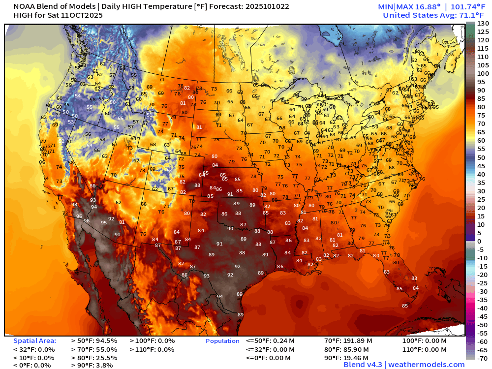
Comfortable with a Lower 48 average temperature of 71°F … with 90s in Texas and Arizona (almost 20 million population)
High Temperatures Next 9-days | Blend of Models
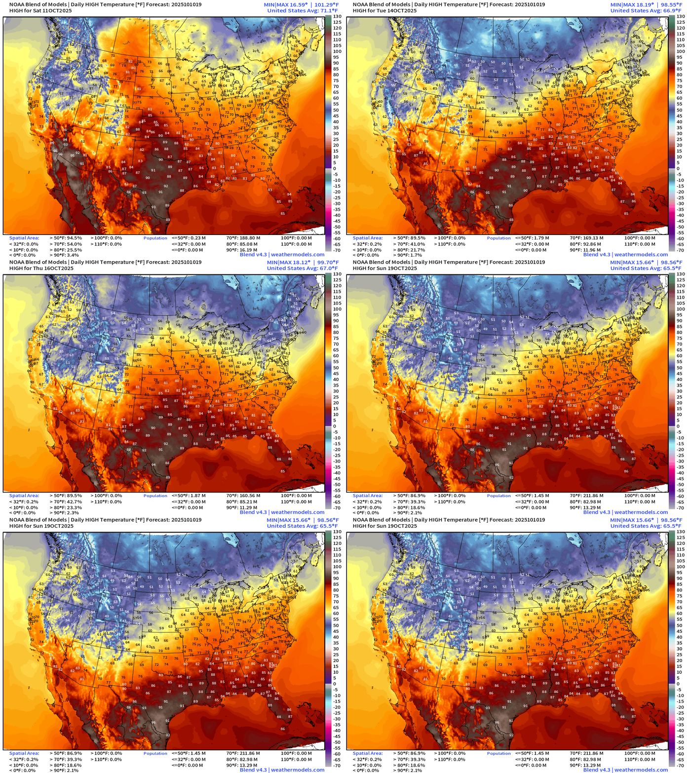
Cooler air moves through the Midwest, Great Lakes, and Northeast into next week but warmth returns thereafter —> busy/progressive pattern
ECMWF Next 8-Days Integrated Vapor Transport | 12z cycle
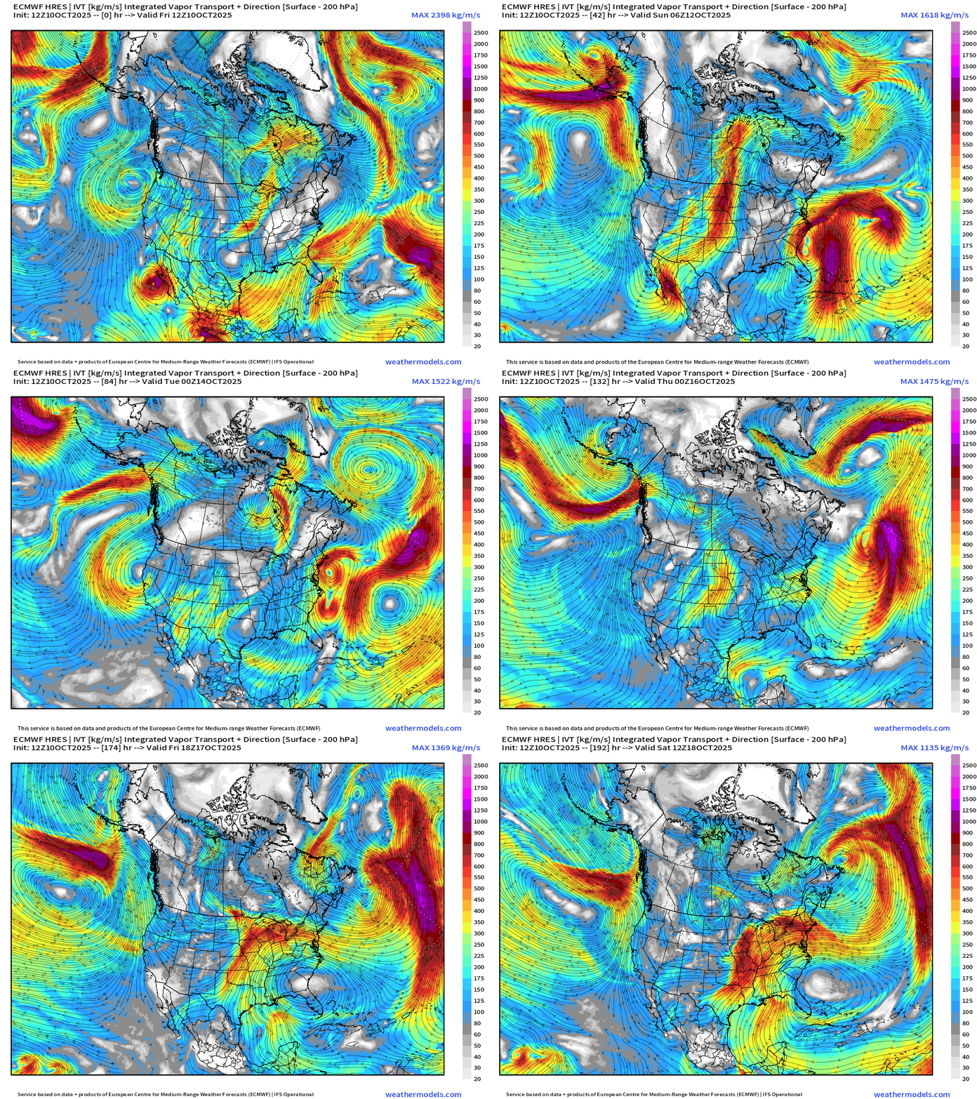
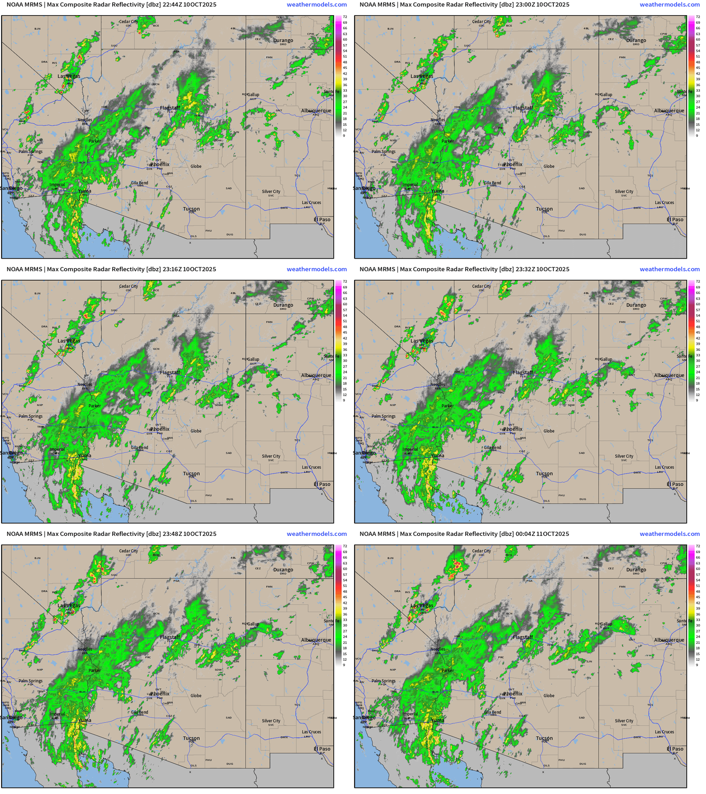
Remnants of Priscilla and its moisture plume head into Southwest with significant rainfall ongoing to Arizona + CA/NV including Las Vegas
Radar shows some heavy storms extending from Mojave into Vegas, and then from Yuma to Needles. Rare!
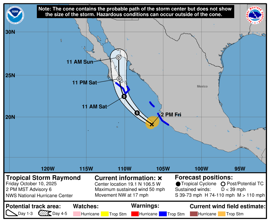
Tropical Storm Raymond formed and is hugging the coast of Mexico
In the Atlantic, Jerry stays just NE of the Caribbean and Leeward Islands, although could see some tropical storm conditions in Guadeloupe.
Nor’easter develops out of a non-tropical trough —> “hybrid system” off the East Coast that could be impactful even if not a named storm (unlikely based upon structure)
Blend of Models 7-Day Precipitation through next Friday evening
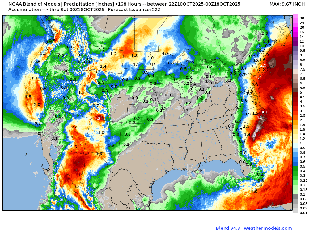
MAJOR rainfall threat for Arizona with widespread 2”-4” (and thus locally more) from the remnants of Priscilla and then Raymond Also note 1-3” accumulations across the West Coast from Washington to central California.
… and the coastal / hybrid system along the East Coast could dump a lot of locally heavy rain near the coast and just inland — 2-4” as well.
Medium Range | AIFS 12z | 10-days Height Anomaly
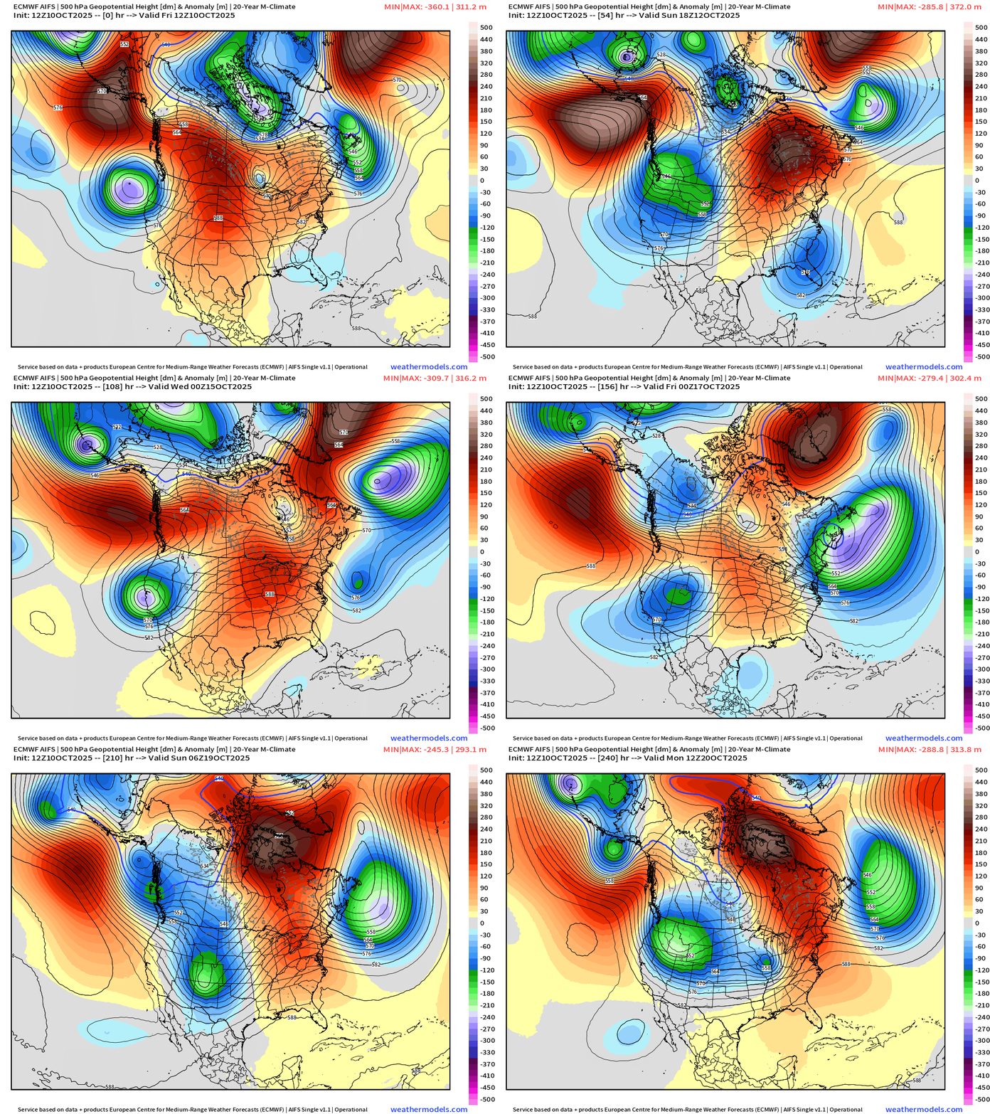
Central U.S. ridging (and warmth) in the story of the next 10-days while the western U.S. deals with cool/cold troughing from Canada. Another major trough develops off the Northeast U.S. as the overall weather pattern repeats itself — including troughing across the West. Parade of troughs with ridging in between = blocking party!
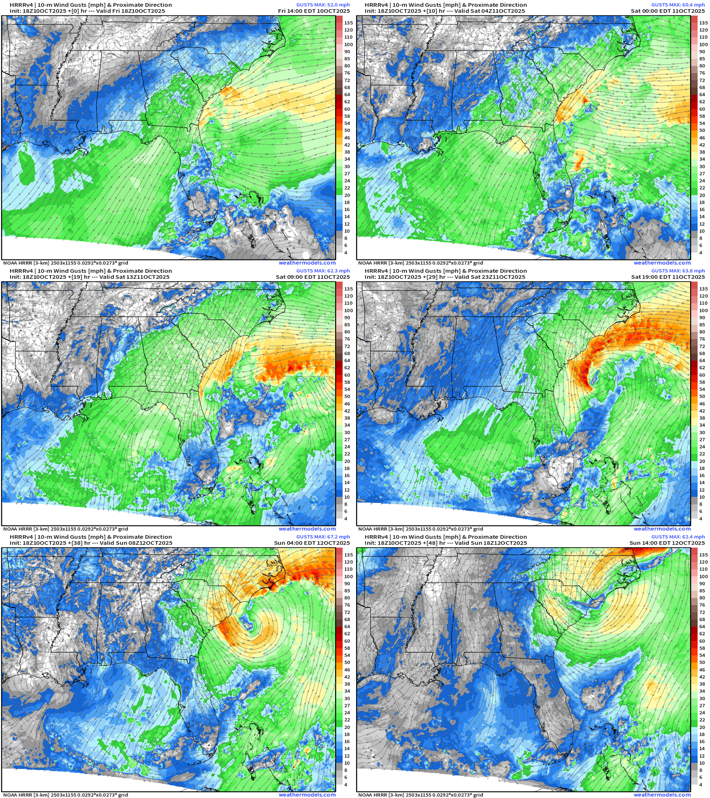
East Coast Nor’easter / Hybrid Storm
Wind Gusts Next 48-hours | HRRR | Southeast U.S. into Sunday
Secondary development northward — impactful coastal wind gusts Mon/Tues into Northeast | ECMWF 18z Gusts (knots) to Tuesday morning
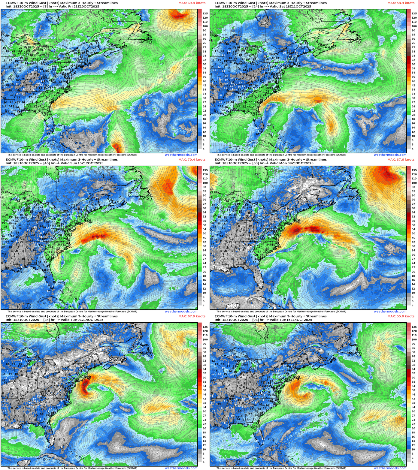
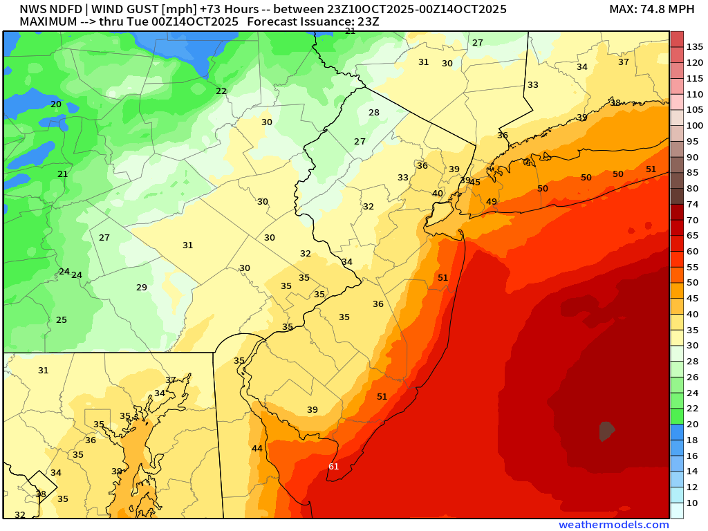
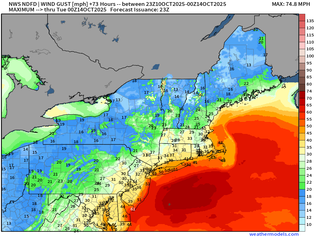
We could see 40-60 mph wind gusts … over a long stretch of coastline, but the track of the low could spare the worst impacts — as the backside of the low may remain offshore, hopefully.
NDFD Maximum Wind Gusts through Monday Evening
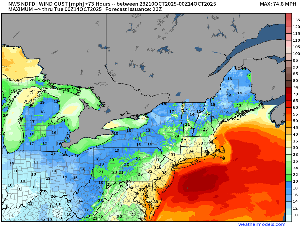
40-60 mph gusts similar to ECMWF
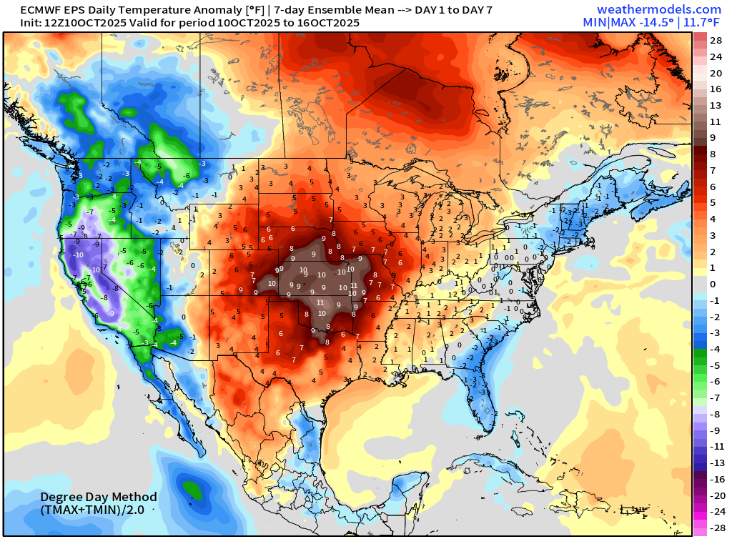
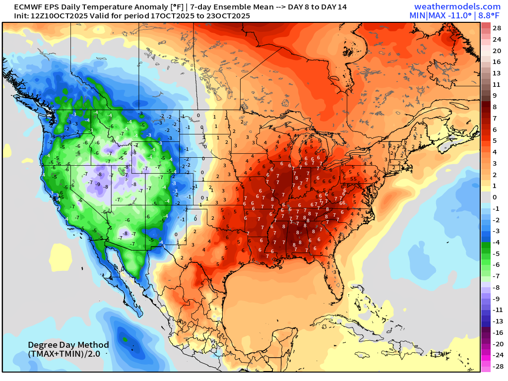
ECMWF EPS 12z Temperature Anomaly | Weekly Chunks
Week 1 —> cooler air in the eastern U.S. including the Mid-Atlantic + California
Week 2 —> significant warmth across Texas and the central U.S. while California remains very cool
Snowfall Next 15-days | ECMWF Control 12z (Flagship model solution)
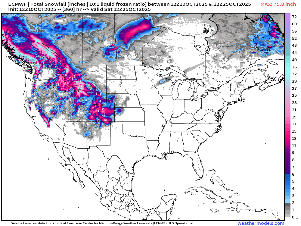
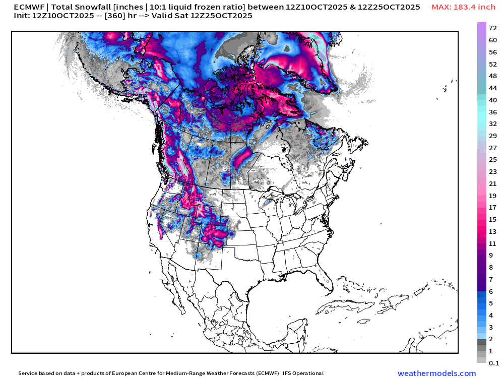
Nothing much east of the Rockies … but significant mountain snows likely into final 10-days of October — right on schedule. The input of atmospheric rivers from the Pacific = big time snowfall at higher elevations
Alaska and Arctic Canada already seeing heavy snowfall —> winter
Atlantic Basin Outlook | 8 PM ET Update
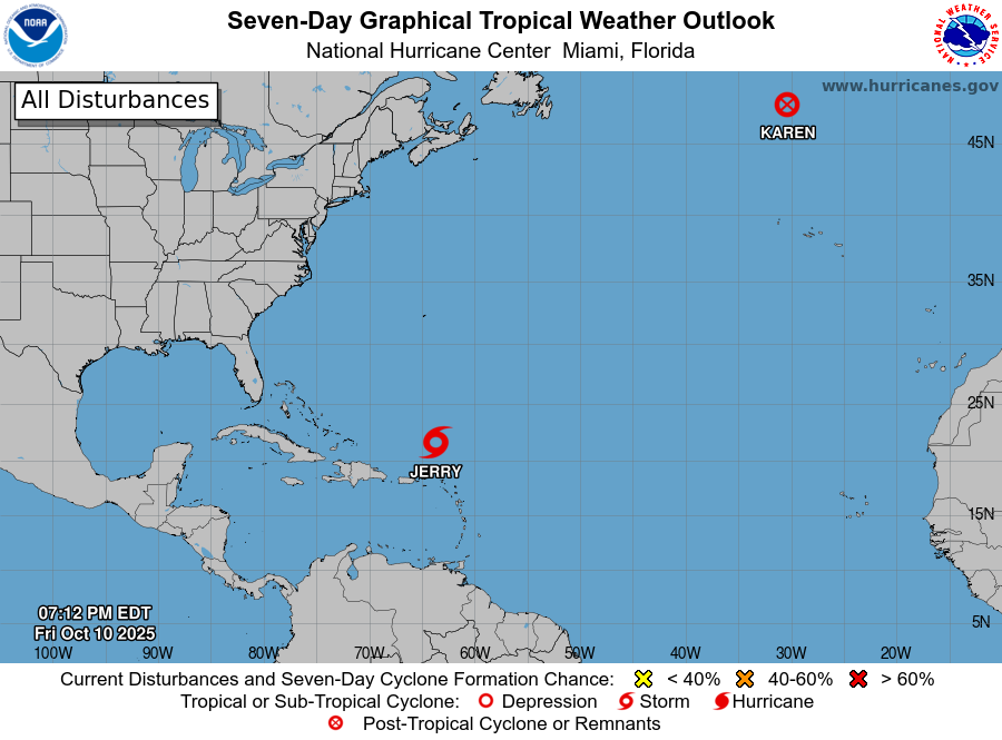
The little area of convection way up in the middle latitudes at > 45°N briefly became Subtropical Karen earlier this morning, and is already history.
However, in the record books, this will count as a named storm, and get a Wikipedia entry.
Tropical Storm Jerry (10L)
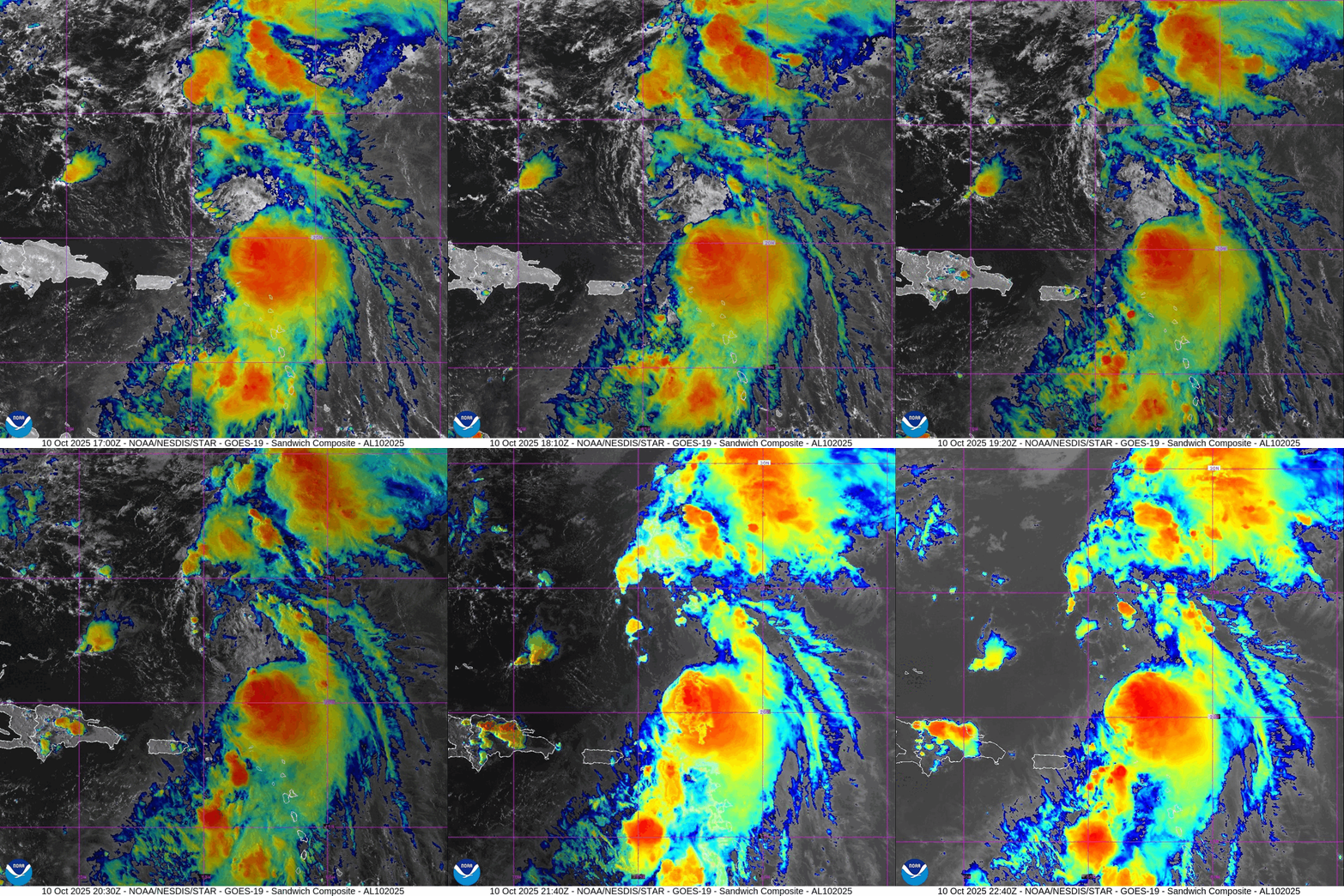
Poorly organized and heavily wind sheared tropical storm Jerry … however the rain bands to the south are causing problems in the islands of Northeast Caribbean.
As often the case, a poorly organized TD/TS can be highly impactful since it is so messy.
NHC Track of Tropical Storm Jerry | 1006 mb | 50 mph
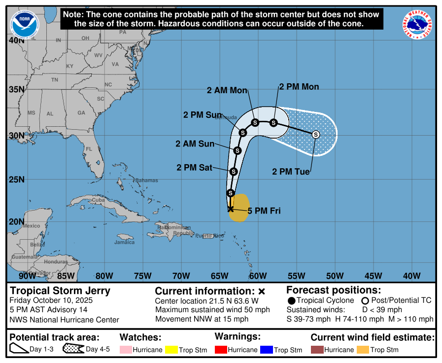
Jerry will likely become post-tropical early next week, and may not become a hurricane.
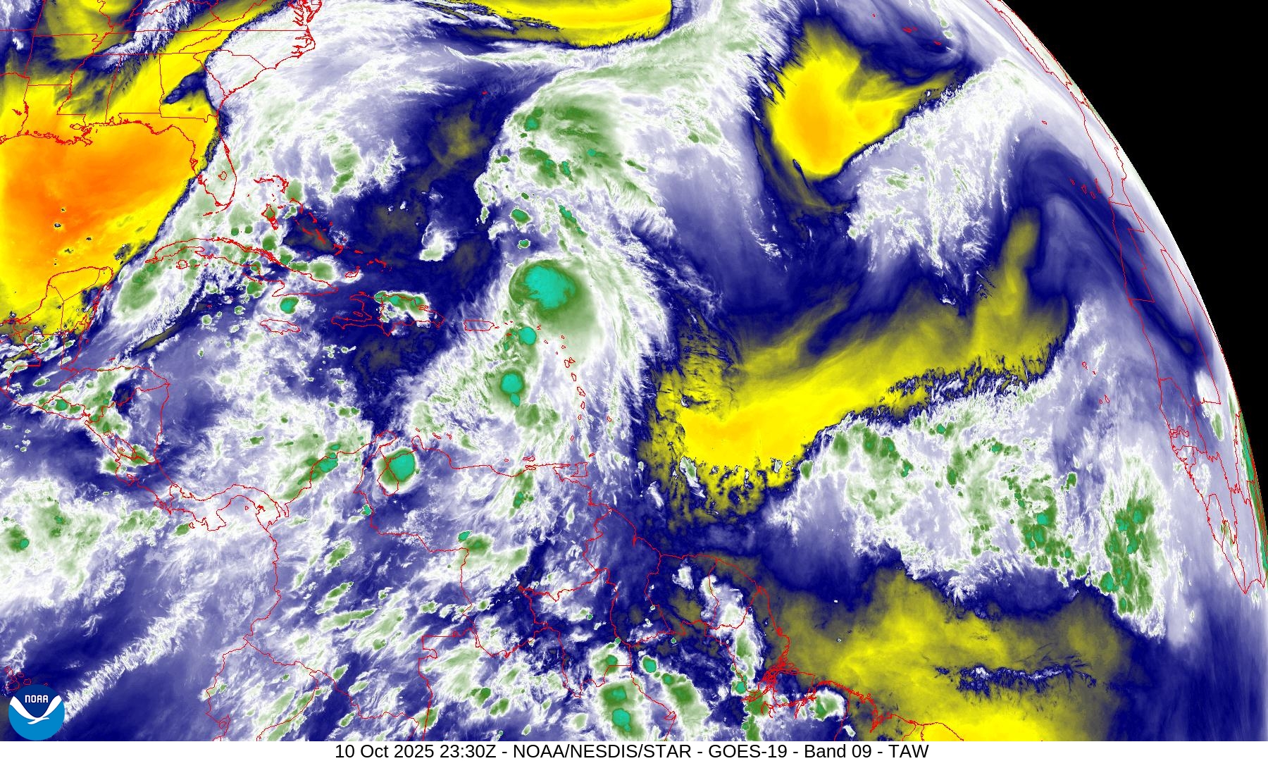
Central Atlantic IR + Water Vapor Satellite Images
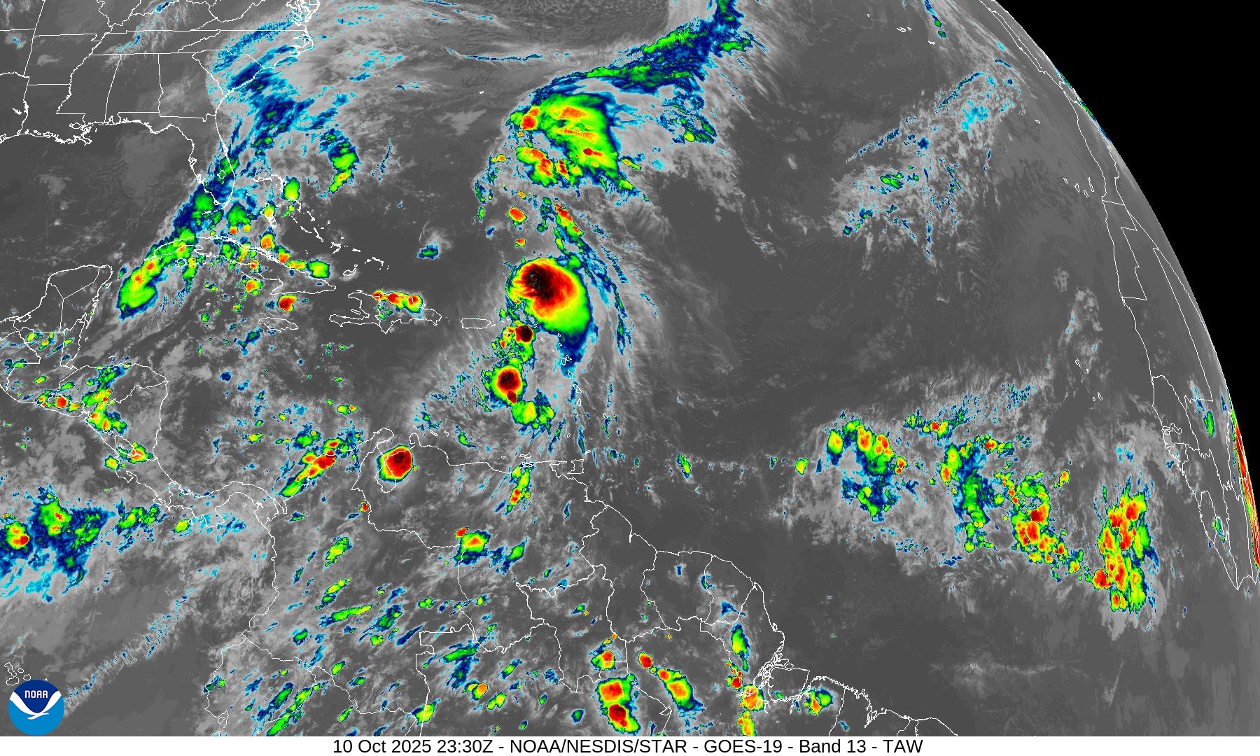
Only show in town is Jerry — and it is not particularly well organized. Overall, the Atlantic tropics remain hostile to development — as we head into the last 7-weeks of the Hurricane Season, our attention shifts to the Caribbean.
Major trough digging into the Gulf of Mexico w/Nor’easter developing
ECMWF 18z Precipitable Water | Next 6-days
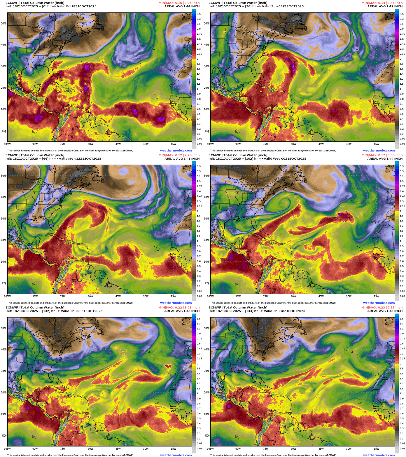
Impressive East Coast — Nor’easter with frontal structure — so likely not going to become a named system … but it could be long lasting into middle of next week as it spins up/down
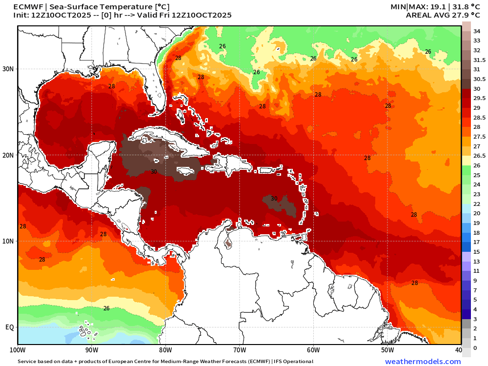
SST Analysis and Anomaly | 12z
SST in Caribbean and Gulf plenty warm
NOAA Tropical Surface Analysis | 18z
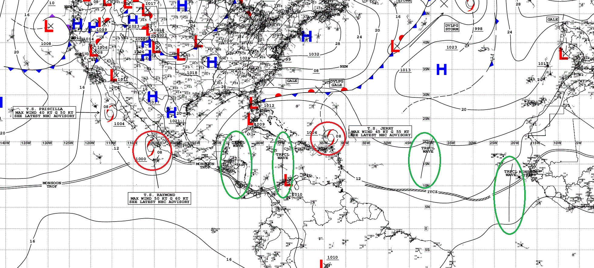
Atlantic Tropical Waves = 4 but none showing development potential
ECMWF EPS 12z | All Storm Tracks Day 6
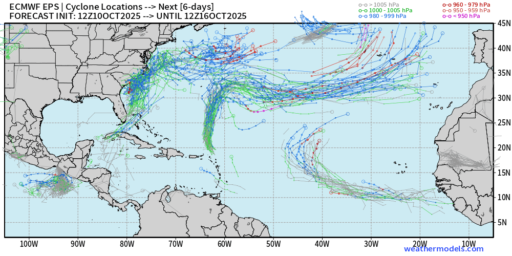
Nor’easter + Jerry + eastern MDR tropical wave (moderate signal)
ECMWF EPS 12z | Active Storm Tracks Day 15
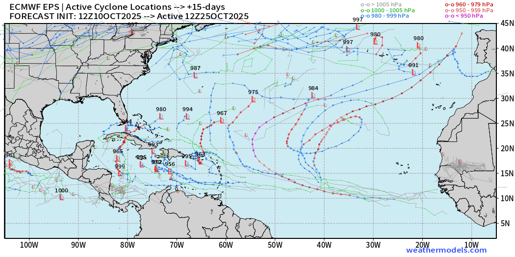
20/50 of ensemble members have an active system … which is 40%, so moderate signal for something in the basin on October 25. Hurricane season isn’t over (yet)
Eastern Pacific Tropical Weather Outlook | 2 PM ET
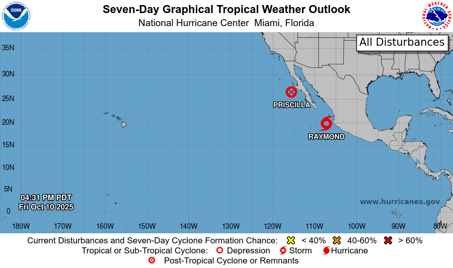
We lost Priscilla but Tropical Storm Raymond remains a threat to Baja California this weekend with more tropical moisture. Nothing else on the horizon through 7-days.
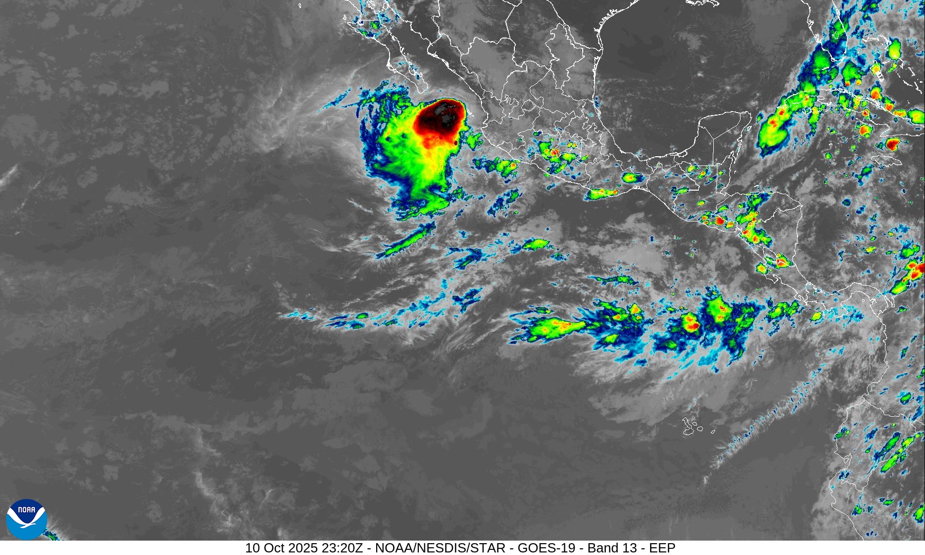
Tropical Storm Raymond (50 mph) will not intensify much in the coming few days … but could hold together as a TS at landfall tomorrow morning. It’s generating strong convection but also in a sheared environment so the inner-core couldn’t organize, similar to Jerry in the Atlantic. Tough sledding all around!
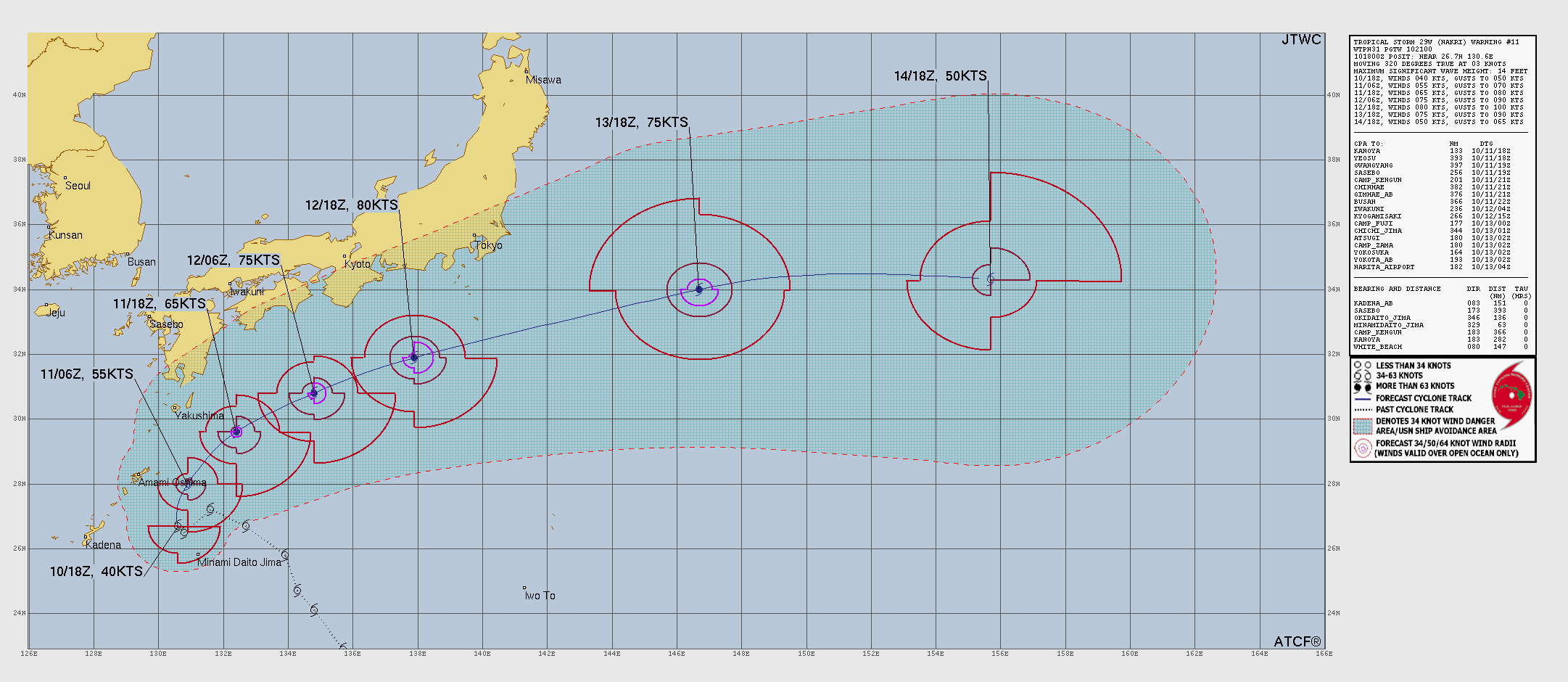
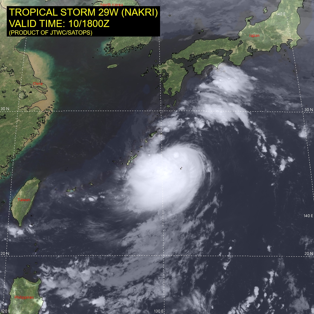
Western Pacific Typhoon Season | 29W (Nakri)
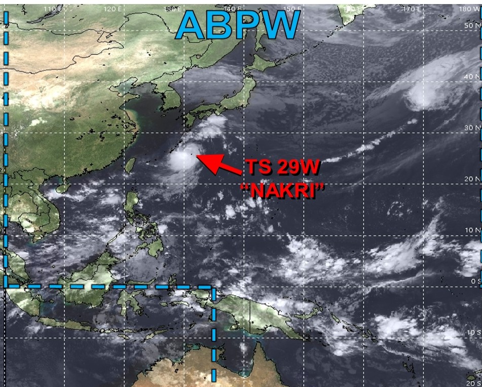
The only show in town is minimal tropical storm Nakri, which will follow ex-Halong on a similar track looping out-to-sea away from Japan. Maximum intensity should be Category 1 Typhoon … and it looks well on its way.
Maps sourced from weathermodels.com designed and innovated by yours truly! Please subscribe there for real-time access to the newest maps, charts from all of the weather models including ECMWF.
- Milepost
- 762 · laid 2025-10-11T00:15:17.259000Z
- Source
- https://weather.substack.com/p/october-10-2025-friday-weather-update
- Digest
- 7c4a9e38396ad875f4703cd9968d5da50797a215ae16a1c2bb76b12ea9fb2f0b
- Machine
- JSON