October 7, 2025 Tuesday Evening Tropical Update
Nor'easter system to form off Southeast coast into weekend
October 2025 was the 7th-warmest October in the 131-year national record (1895–2025), at 57.0°F against a 1991–2020 normal of 54.5°F (+2.4°F).
October 2025 was the 56th-wettest October in the 131-year national record (1895–2025), at 2.3in against a 1991–2020 normal of 2.5in (-0.2in).
NOAA/NCEI Climate at a Glance, contiguous United States. This is the observed record for the month, not a score of anything said in this piece — the forecast ledger begins 2026-08-17 and cannot reach earlier posts.

2025 Season to Date: 10 Named Storms, 4 Hurricanes, and 3 Majors
Tropical Storm Jerry underway in the central Atlantic (Main Development Region) with large area of convection billowing over the center of circulation
Jerry is moving quickly West at 23 mph but seems to be unaffected by any environmental concerns e.g. wind shear, dry air, or nearby troughs. Slow but steady intensification is likely: Jerry should become a hurricane on Wednesday
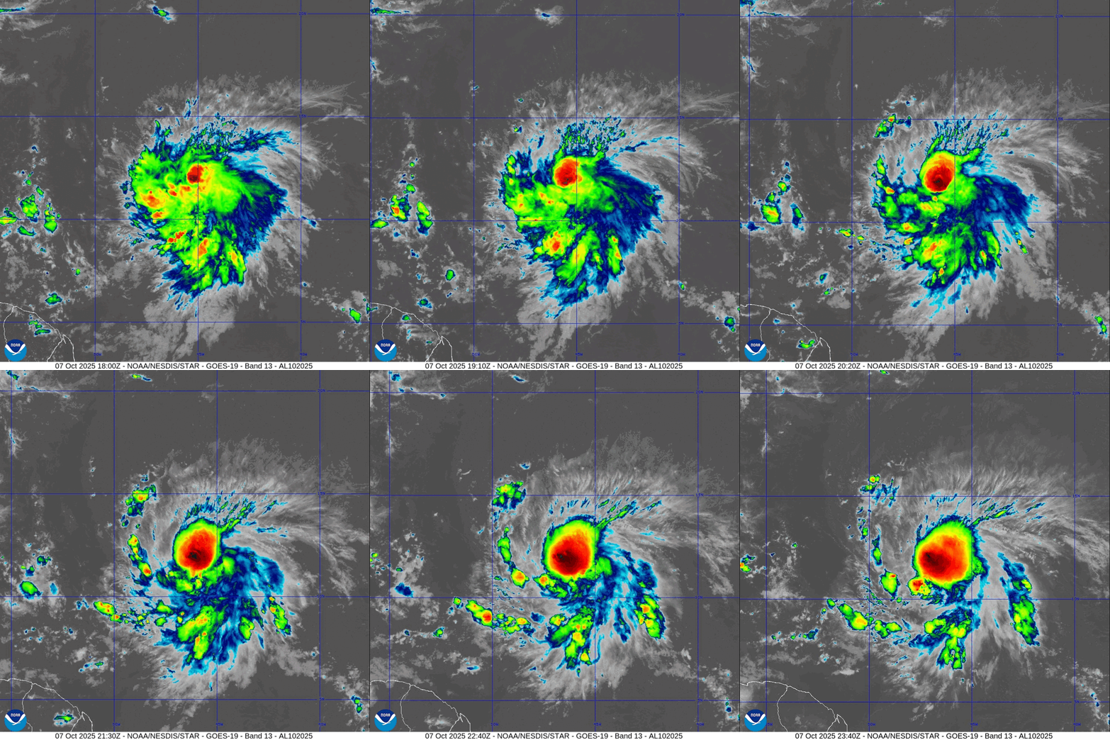
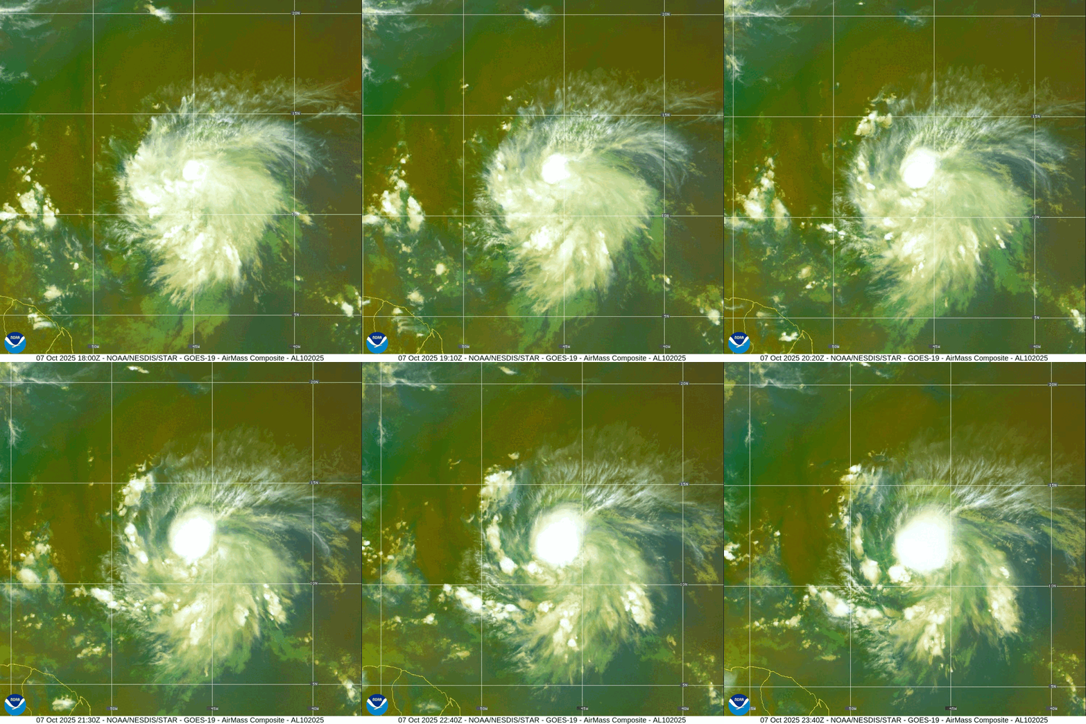
NHC Track of Tropical Storm Jerry —> Hurricane by Wednesday
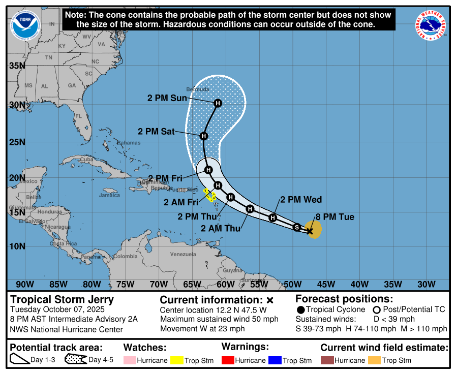
While the center will pass to the ENE of the northern Leeward Islands, we should expect tropical storm conditions heading into Friday.
Jerry will then head “out to sea” and stay east of Bermuda … not heading west of 65°W longitude
Central Atlantic Water Vapor + IR Satellite Images
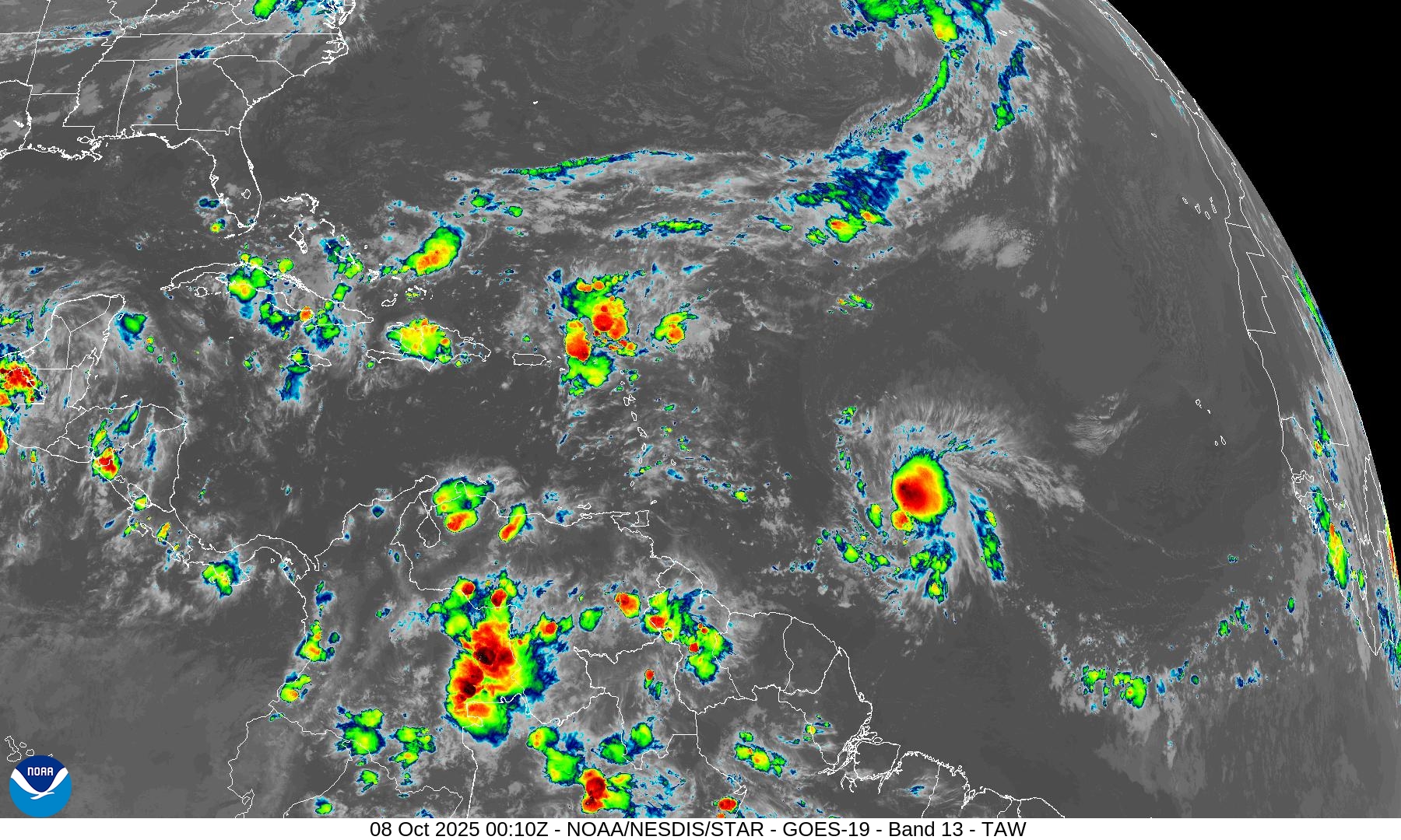
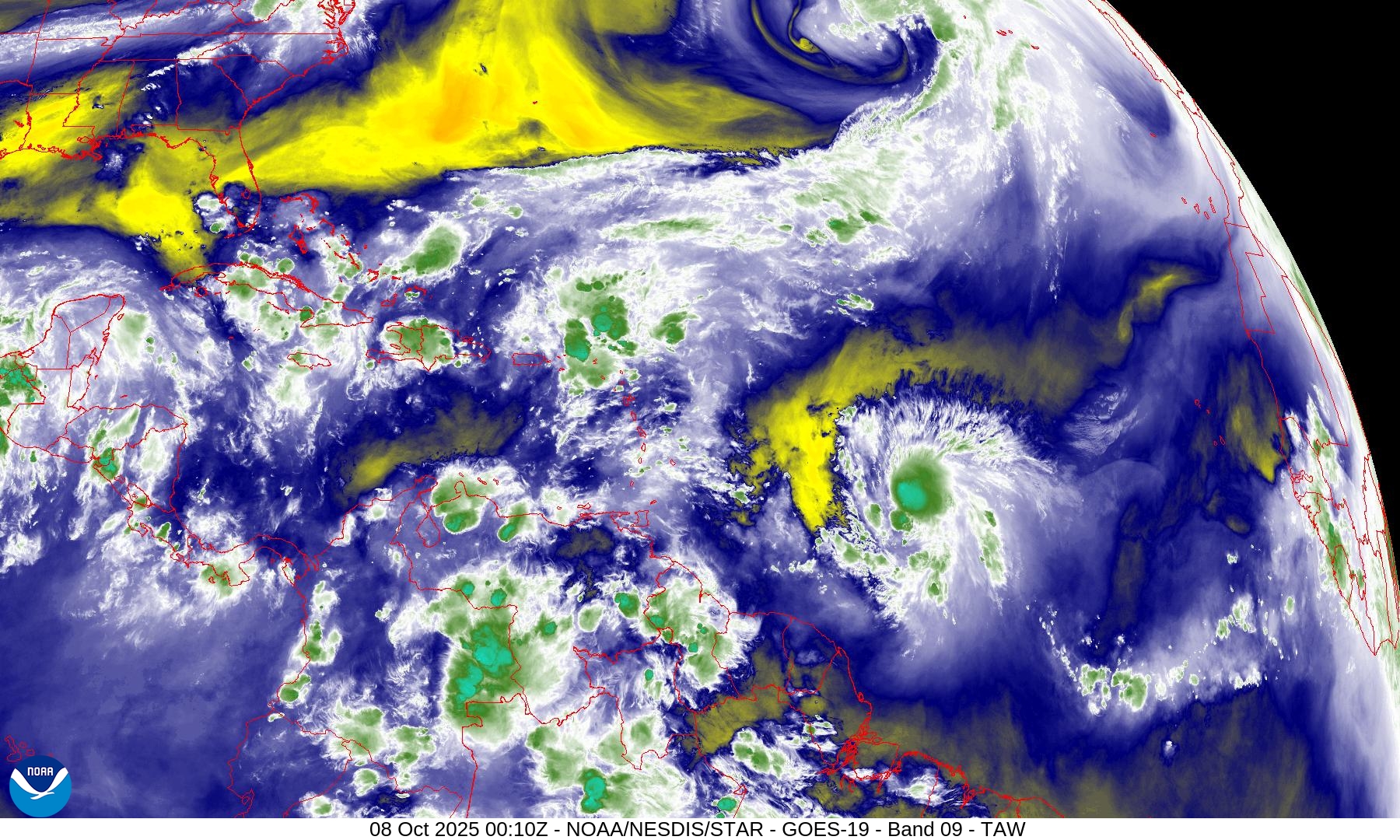
The mid-level dry air moat ahead of Jerry has mostly been moistened by the outflow — nice job Jerry!
ECMWF Next 8-Days Integrated Vapor Transport | 12z cycle
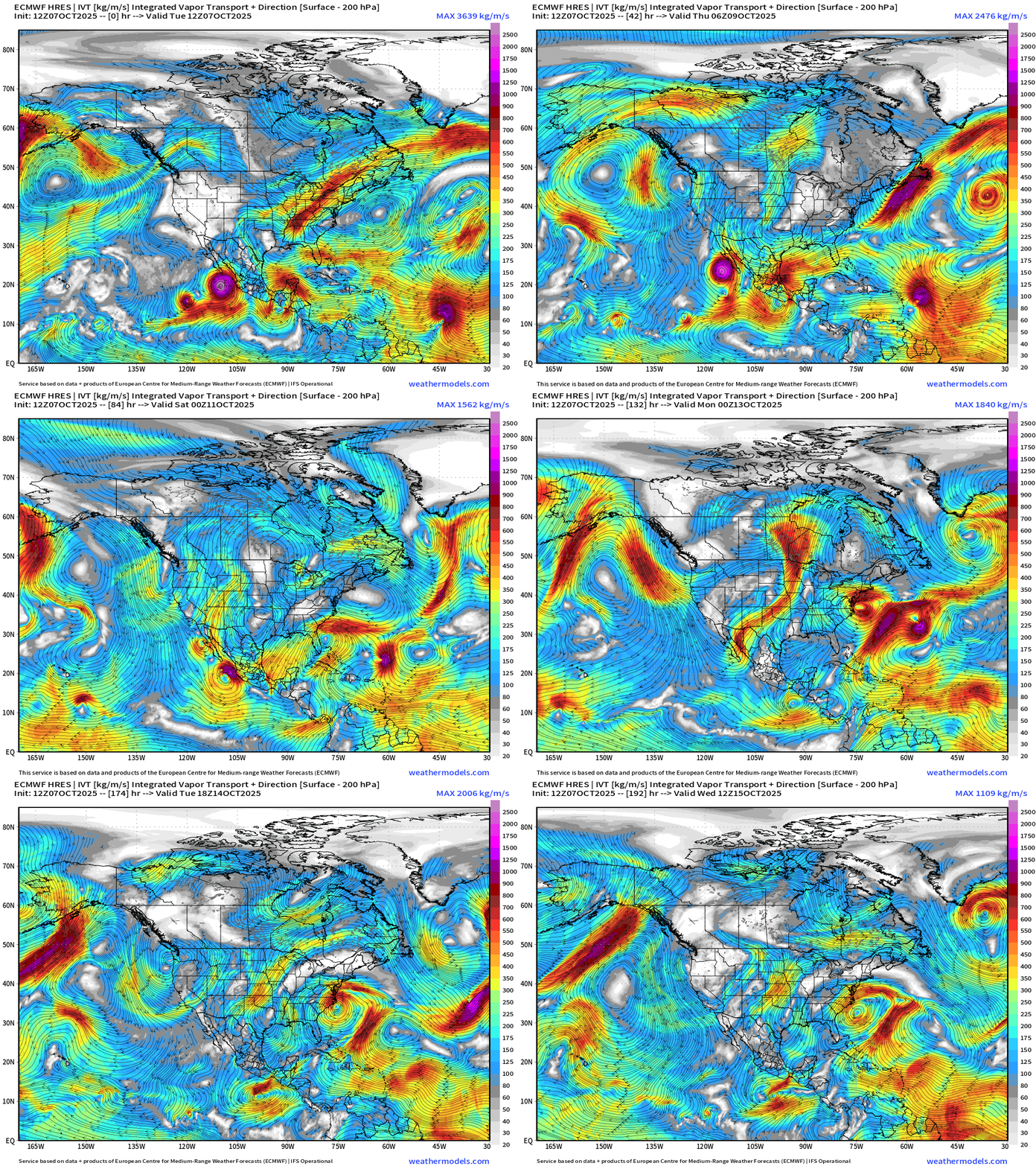
Large view centered on North America shows [Eastern Pacific] Hurricane Priscilla and its moisture plume heading into the American Southwest with significant rainfall and flooding threat to Arizona.
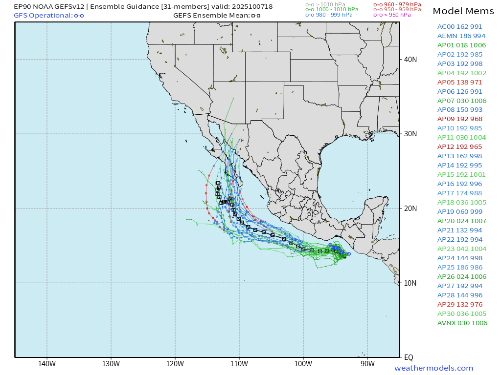
Another system (Invest 90E) behind Priscilla —> to become Raymond along the coast of Mexico
In the Atlantic, Hurricane Jerry reaches the northern Leeward Islands — and will likely merge with a frontal boundary and become extratropical next week
Nor’easter develops out of a non-tropical trough —> “hybrid system” off the East Coast that could be impactful even if not a named storm (but it would be named Karen)
Medium Range | AIFS 18z | 10-days Height Anomaly
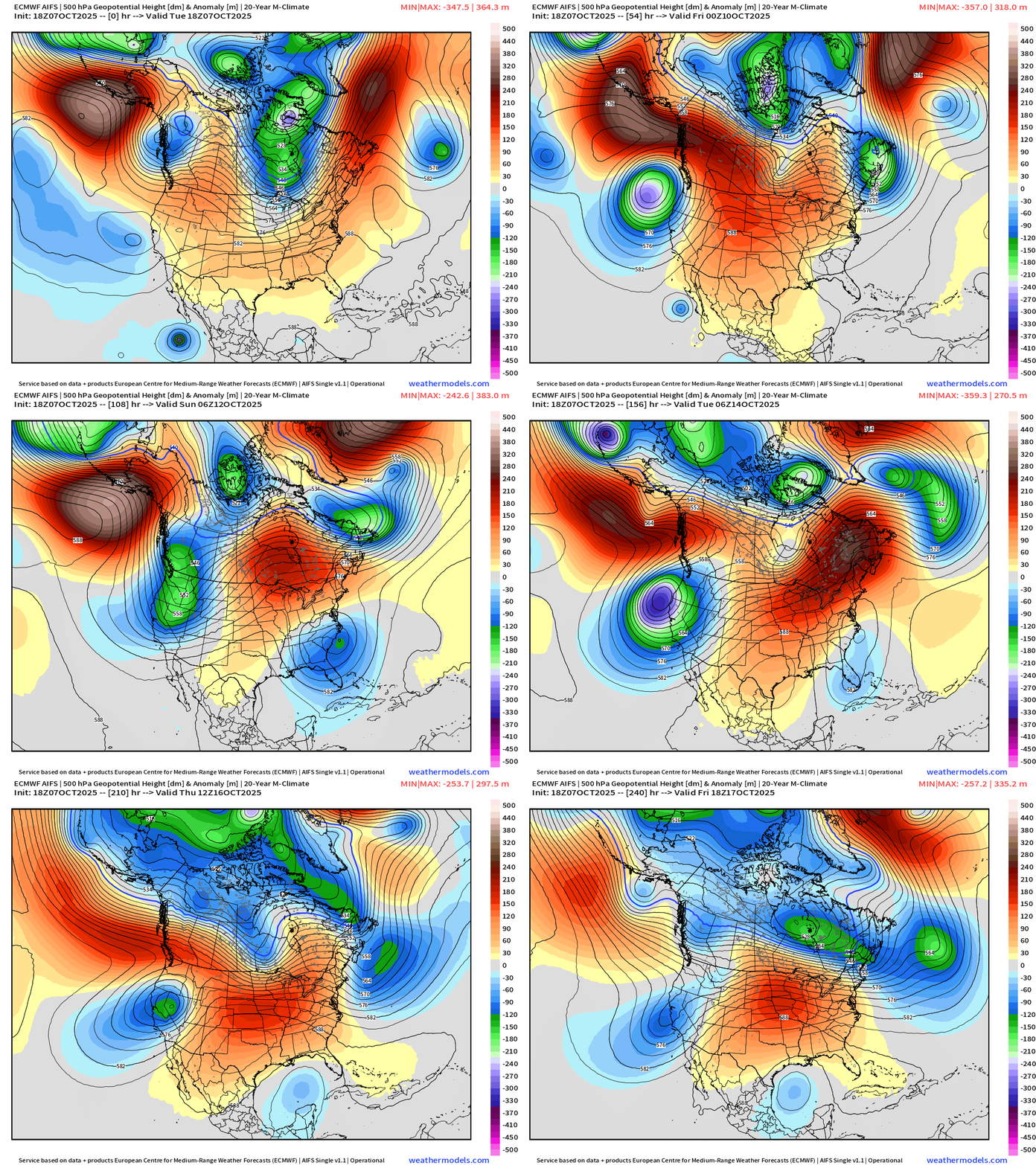
Central U.S. ridging (and warmth) in the story of the next 10-days while the western U.S. deals with cool/cold troughing from Canada
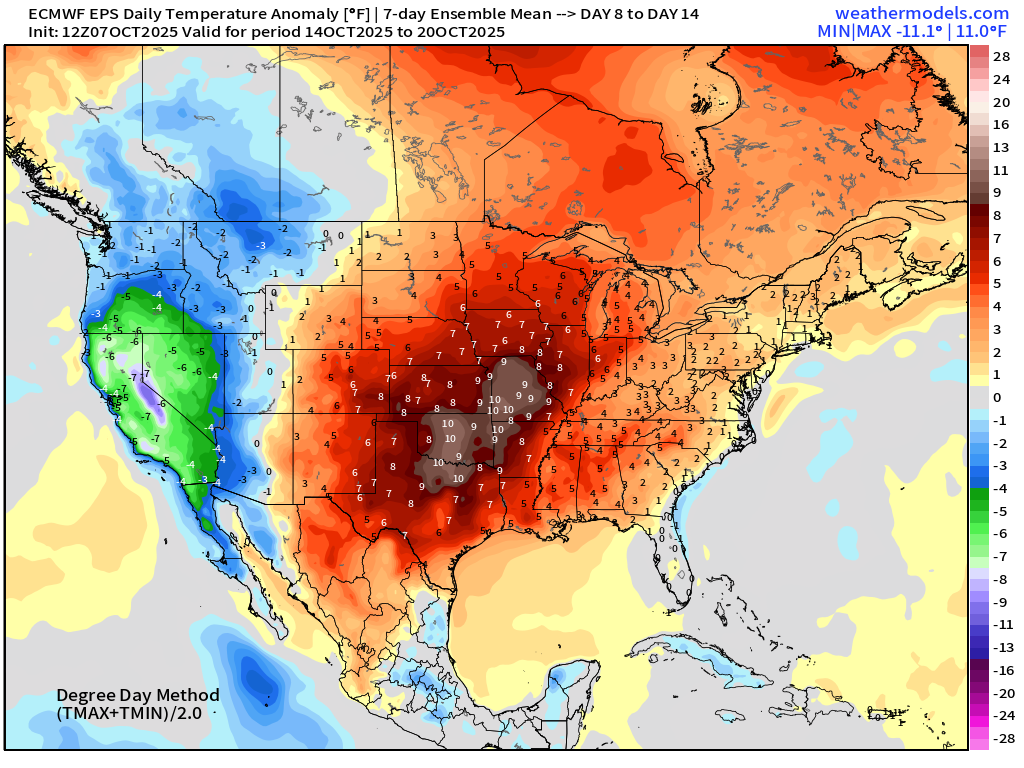
ECMWF EPS Temperature Anomaly | Weekly Chunks
Week 1 —> cooler air in the eastern U.S. including the Mid-Atlantic and especially in California
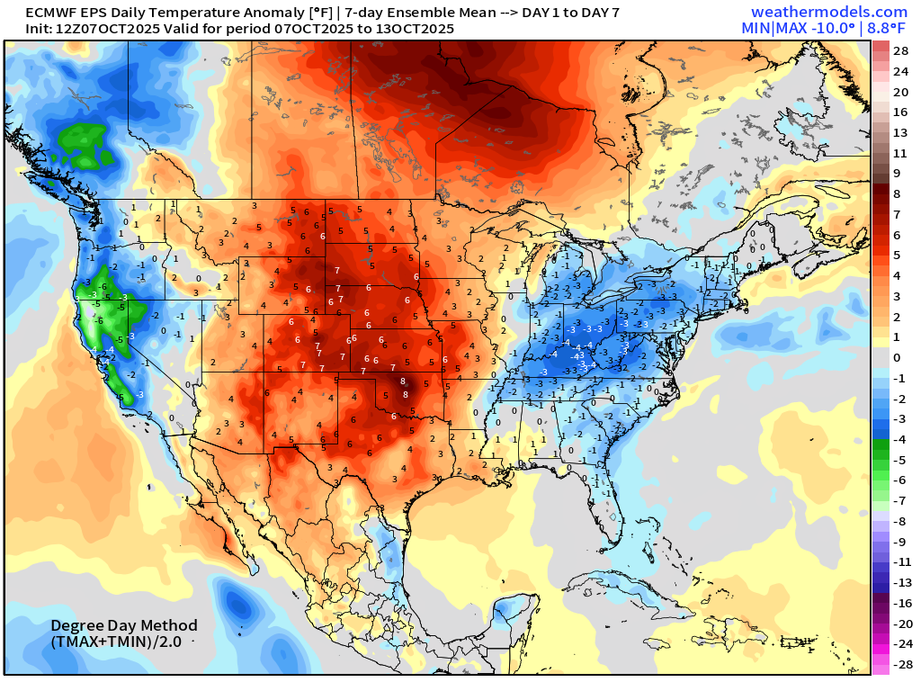
Week 2 —> significant warmth in the central U.S.
Snowfall Next 15-days
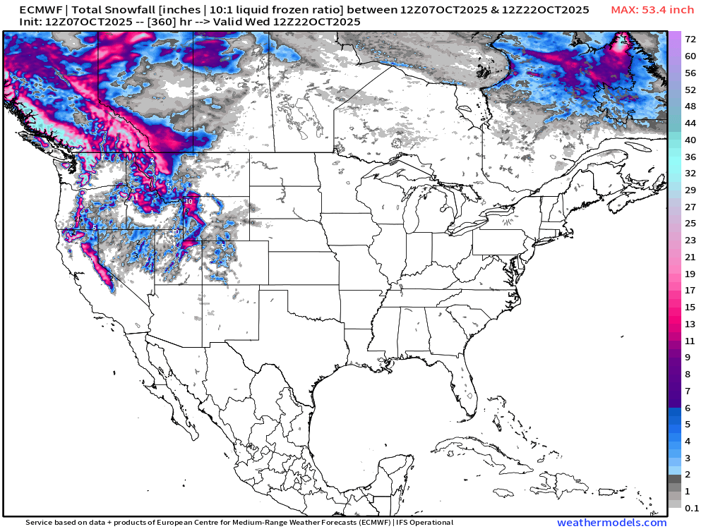
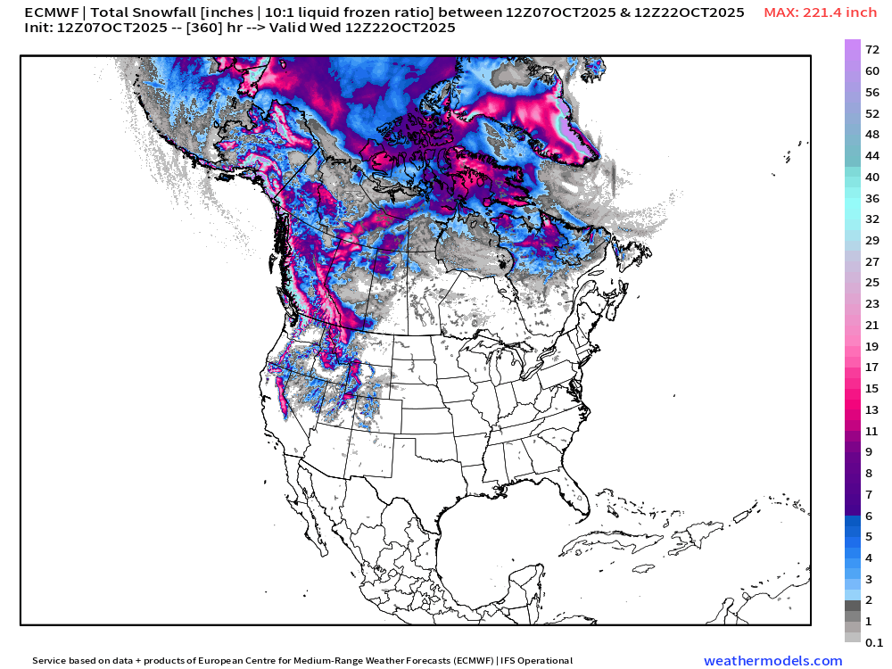
Thankfully nothing much east of the Rockies … but significant mountain snows likely into final 10-days of October — right on schedule.
Alaska and Arctic Canada already heading into winter
ECMWF 18z Wind Gusts | Into this weekend | Next 3 to 6-days
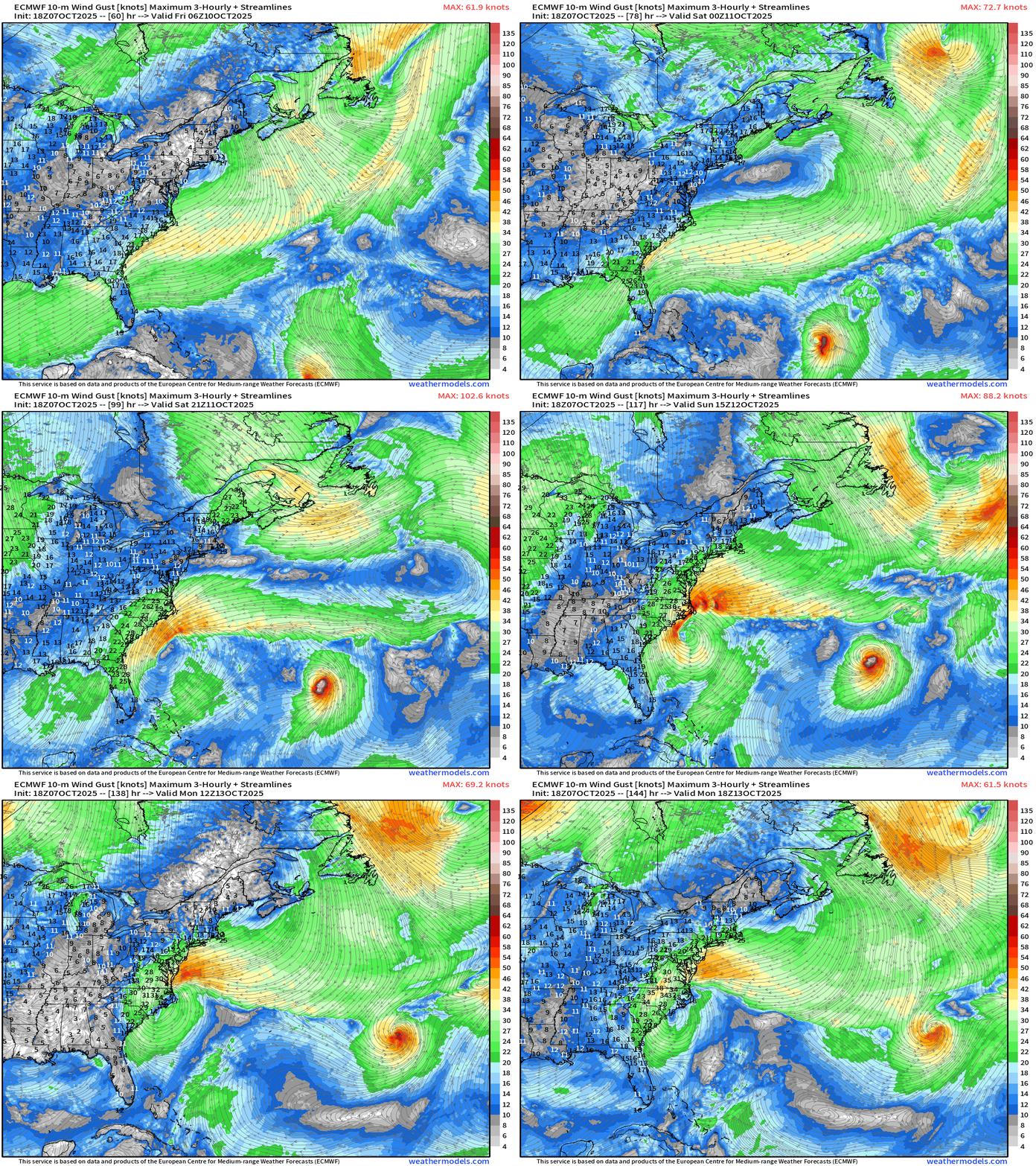
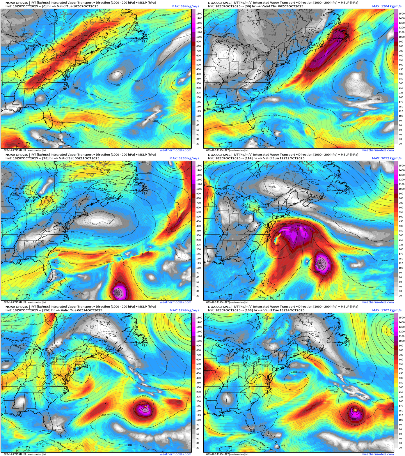
A Nor’easter like hybrid system developing this weekend off the Carolinas but the intensity and track is still uncertain
ECMWF stalls out off the Carolinas while GFS takes the low-pressure into New England. Either way, impacts of tropical storm force / or gales if you prefer for quite a long duration along the East Coast … making for rainy/blustery weather + beach erosion from onshore flow for days.
GFS 18z | Integrated Vapor Transport | Next 7-days
NOAA WPC 7-Day Precipitation
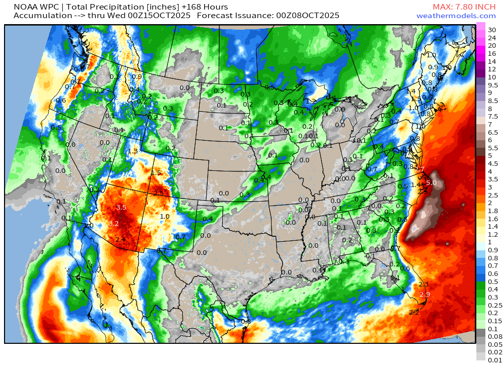
MAJOR rainfall threat for Arizona with widespread 2”-4” (and thus locally more) from the remnants of Hurricane Priscilla
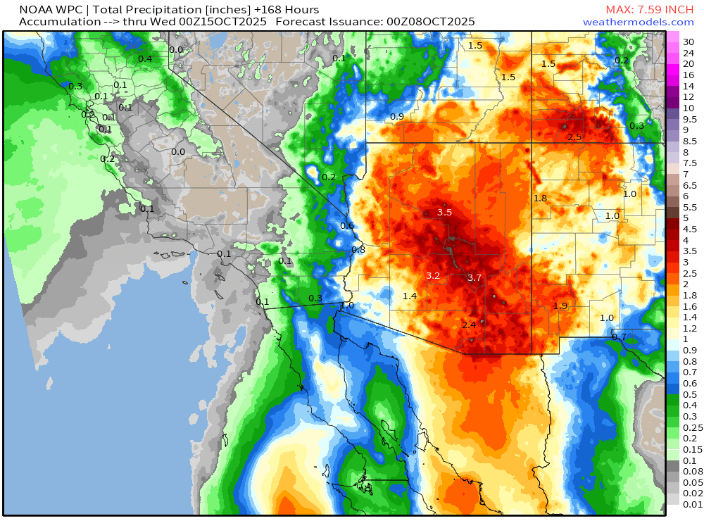
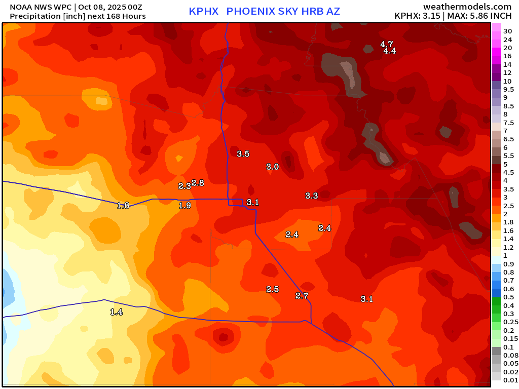
NOAA WPC has 3”+ for Phoenix through 7-days but could be 6”+
Atlantic Basin Outlook | 8 PM ET Update
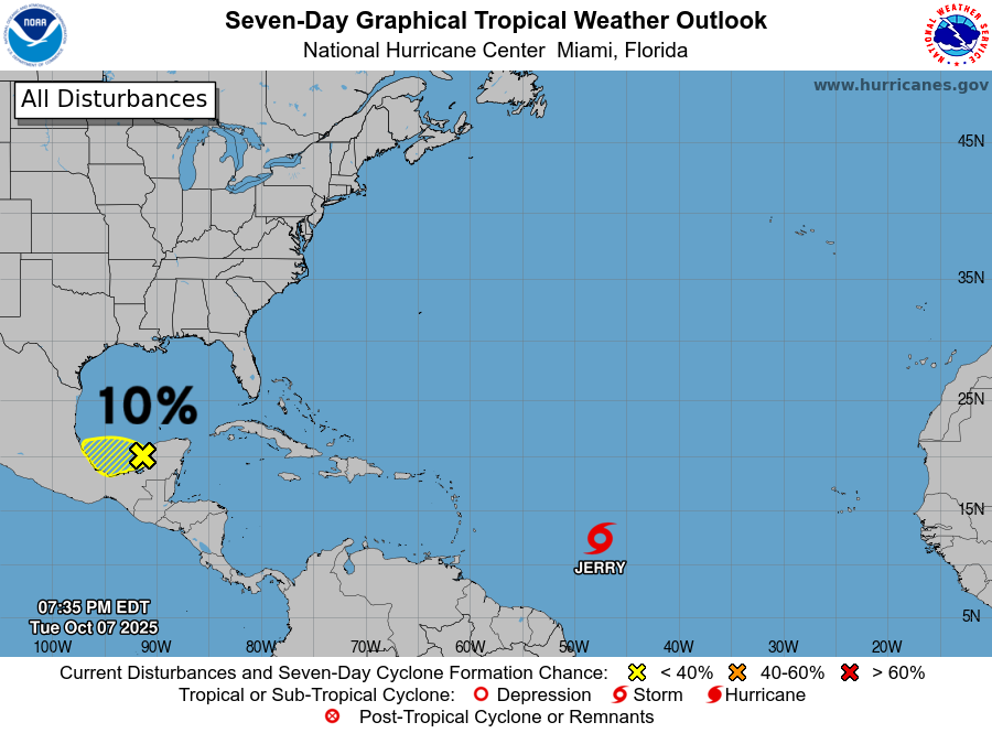
The vorticity associated with a tropical wave moving through central America has a very low chance (10%) of spinning up into a short-lived TD — while on the other side in the Eastern Pacific, Tropical Storm Raymond will form.
Tropical Storm Jerry (10L) | ATCF Spaghetti
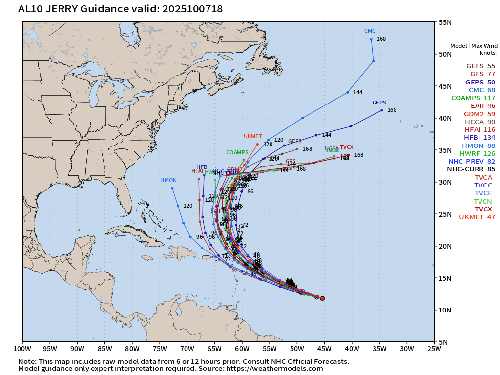
We are discounting the western members including the HMON, HAFS-A and HAFS-B, as the NHC (and consensus aids) do not show track of Jerry through the Northeast Caribbean.
ECMWF 18z Precipitable Water | Next 6-days
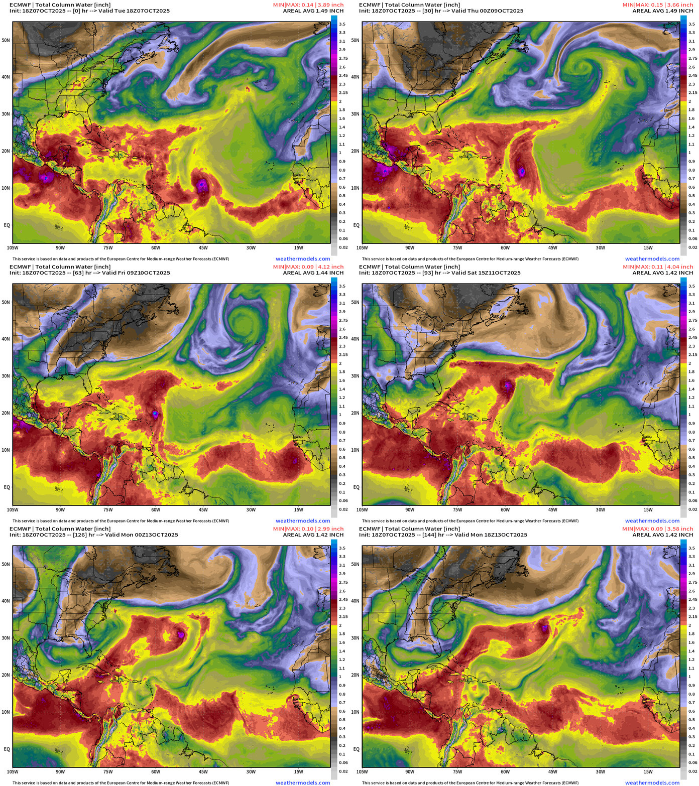
ECMWF 18z did a poor job with the formation of Jerry … but at least it intensifies it into a hurricane over the coming days.
Another tropical wave coming off Africa this weekend might bear watching.
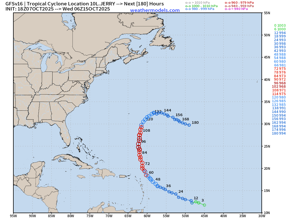
NOAA GFS 18z | Early Monday | Jerry + Nor’easter
Nor’easter from GFS 18z is snuggled up near New York City in the Northeast this weekend — and a different scenario than ECMWF 18z.
GFS does take Jerry to near Major Hurricane status — 968 mb
NASA GEOS-5 | 5-day Dust Forecast
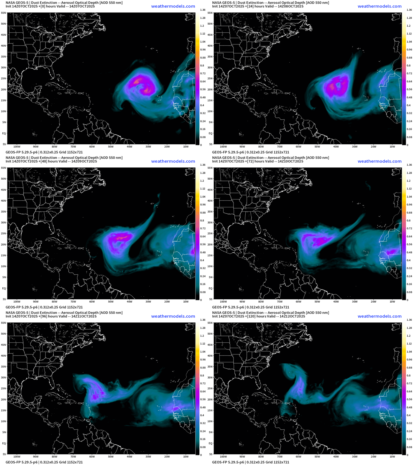
This is a very strong — and unusual Saharan Air Layer + Dust outbreak in the Eastern Atlantic that will rotate anti-cyclonically to the west — just north Jerry
SST Analysis and Anomaly | 12z
Passage of Imelda and Humberto took a huge bite out of the water temperature along the U.S East Coast to Bermuda with sub-26°C water and a remarkable “cold wake” that probably won’t recover heading through October.
Gulf of Mexico and Caribbean remain warm … with 28°C+ into the MDR = wide open for business.
NOAA Tropical Surface Analysis | 18z
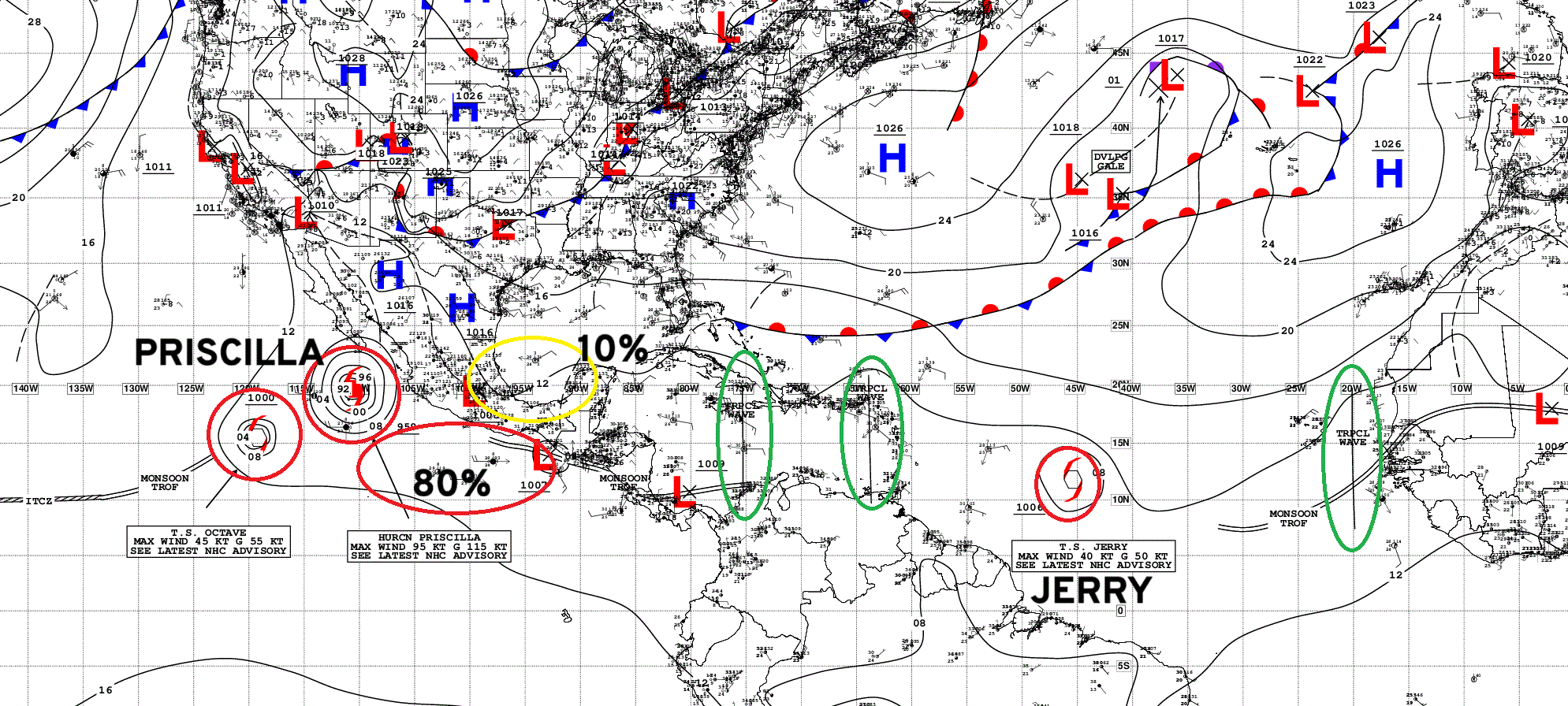
Atlantic Tropical Waves = 3 but none showing development potential
ECMWF EPS 12z | All Storm Tracks Day 5
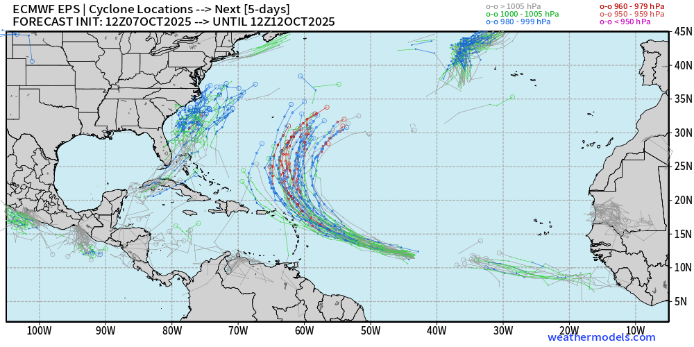
Nor’easter + Jerry + eastern MDR tropical wave
ECMWF EPS 12z | All Storm Tracks Day 12
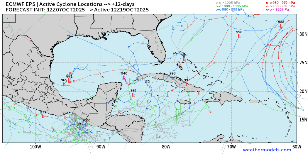
Watching the Gulf of Mexico and Caribbean into mid-October for anything that may spin up locally but nothing imminent or threatening after Jerry.
Eastern Pacific Tropical Weather Outlook | 8 PM ET
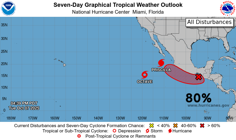
Almost gone — Tropical Storm Octave and large almost Major Hurricane Priscilla + Next System is Invest 90E (80% —> Raymond)
Another system — Raymond will likely follow along the coast of Mexico (60%)
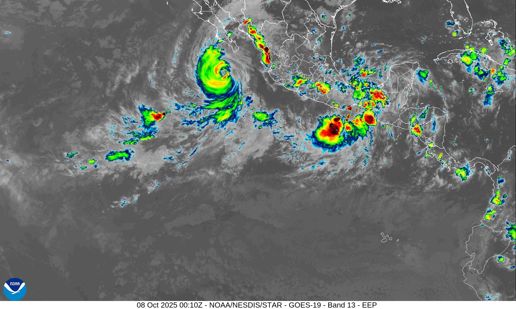
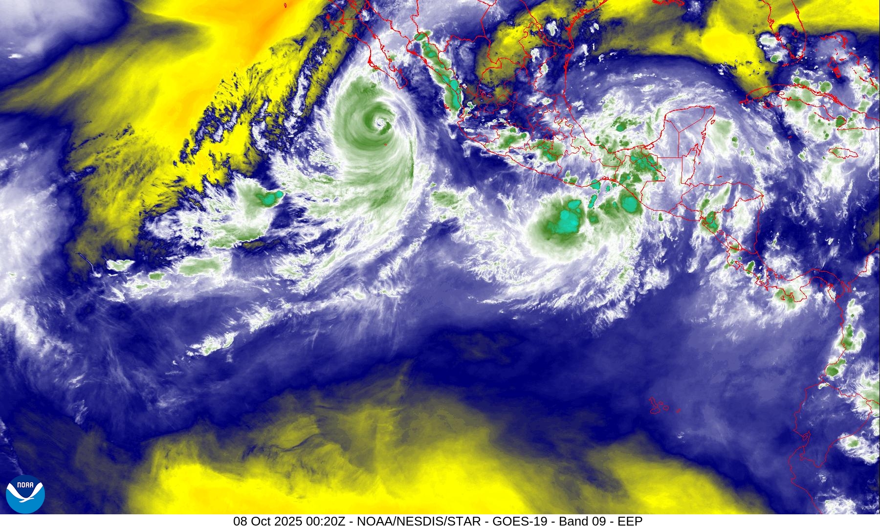
Hurricane Priscilla is losing convection on the eastern half of the circulation with dry air impinging upon the core … likely peaked at 95 knots = Category 2.
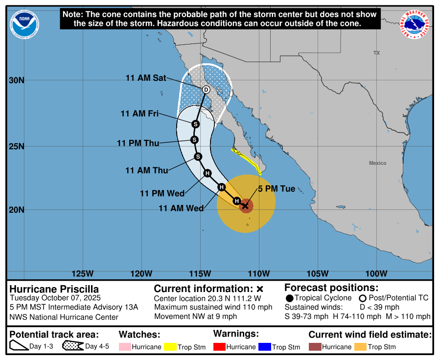
Hurricane Priscilla | NHC Cone | 110 mph Category 2 | 958 mb
PWAT Next 6-days for Priscilla and Raymond
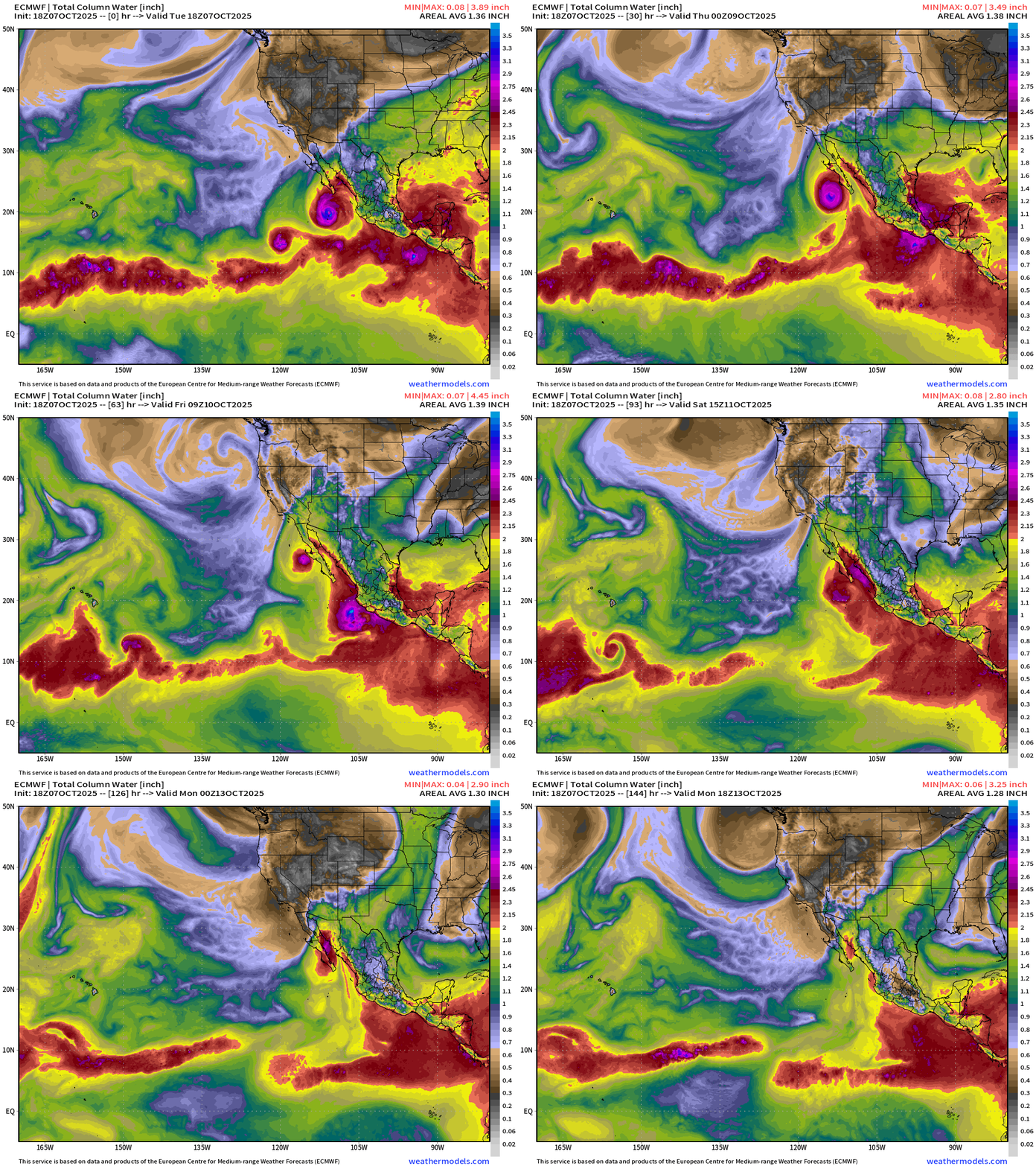
Surge of moisture through Gulf of California into Southern California and Arizona — and Raymond on its heels
Invest 90E —> Raymond
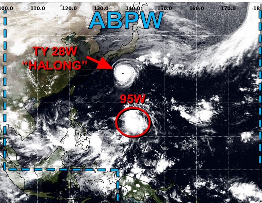
Western Pacific Typhoon Season | 28W (Halong) and 95W (Invest)
JTWC Outlook shows High chance of Invest 95W becoming a named storm
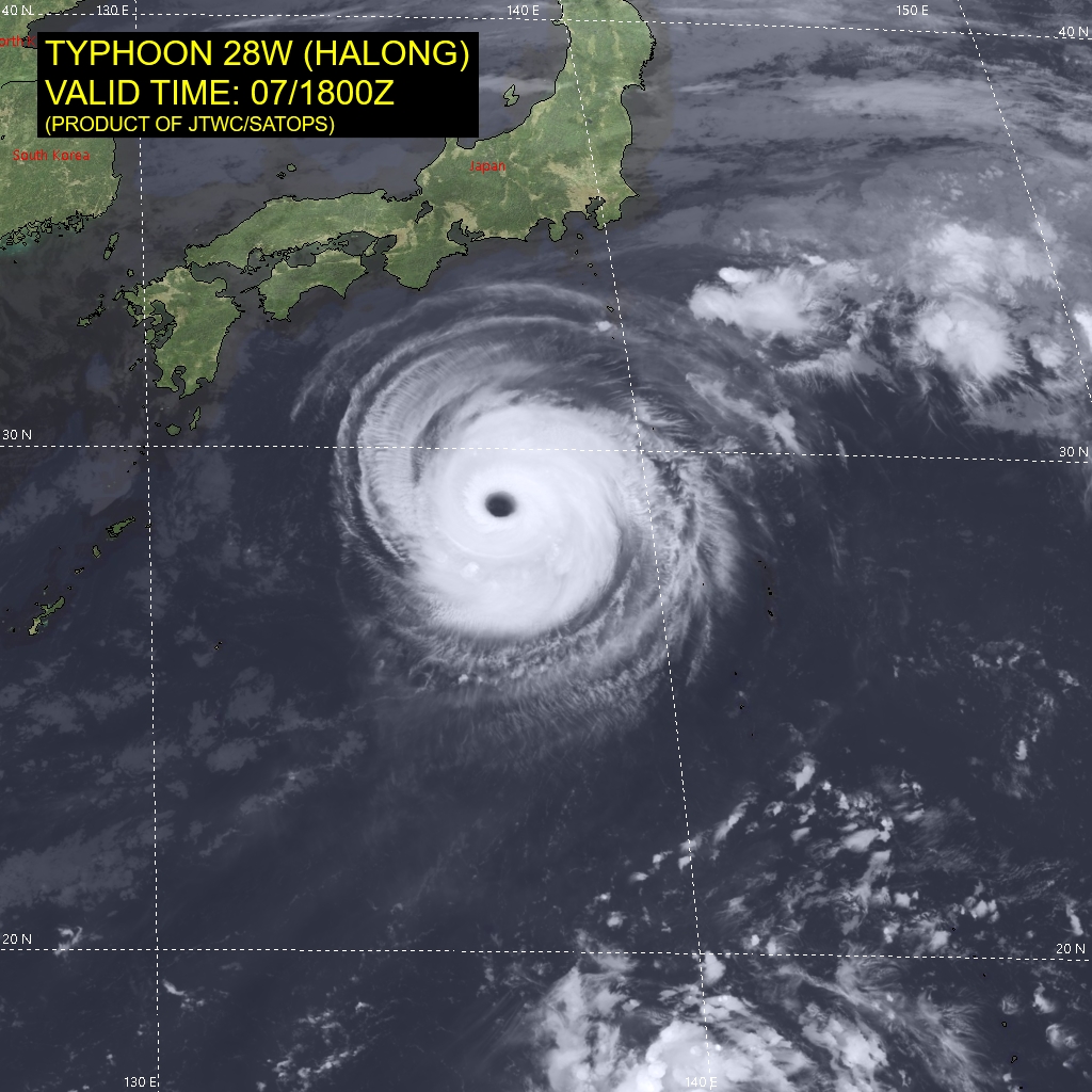
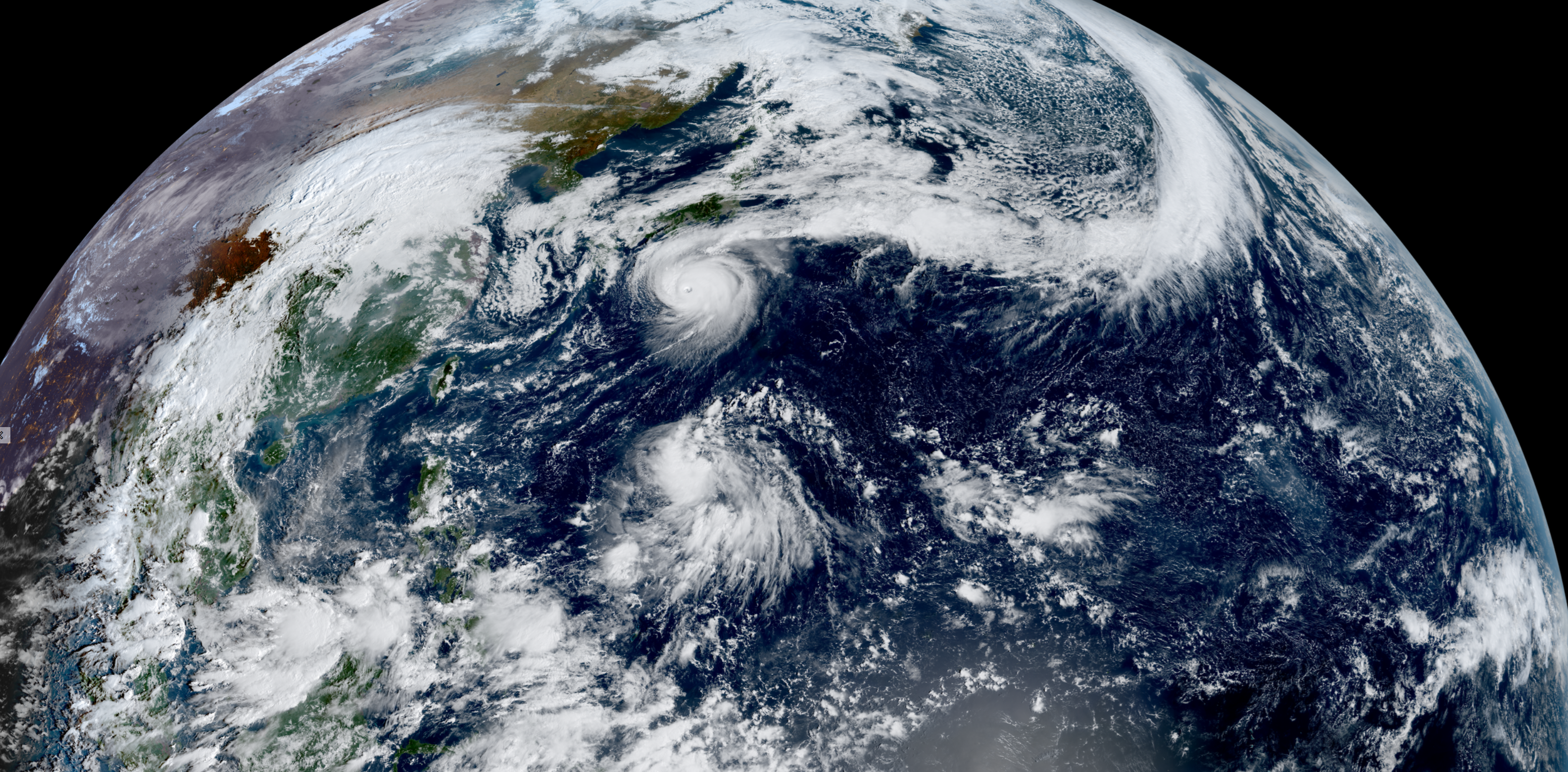
Typhoon Halong (28W) impressive symmetry | 120 knots = Category 3
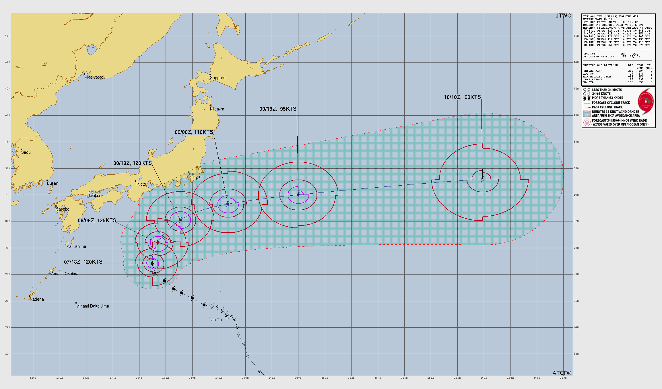
Typhoon Halong will loop/curve out to sea and surely miss Japan.
Satellite shows a compact and powerful Typhoon with a clearing/warm eye = T 6.0 and about 115-knots (Category 4)
ECMWF 18z | Next 6-days Precipitable Water
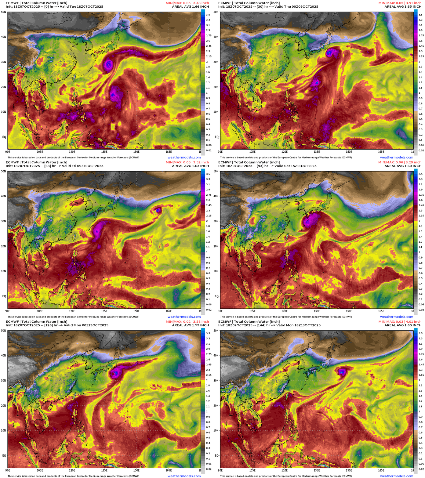
Invest 95W —> next storm will be named Nakri
ECMWF EPS 12z | Ensemble Tracks for Halong
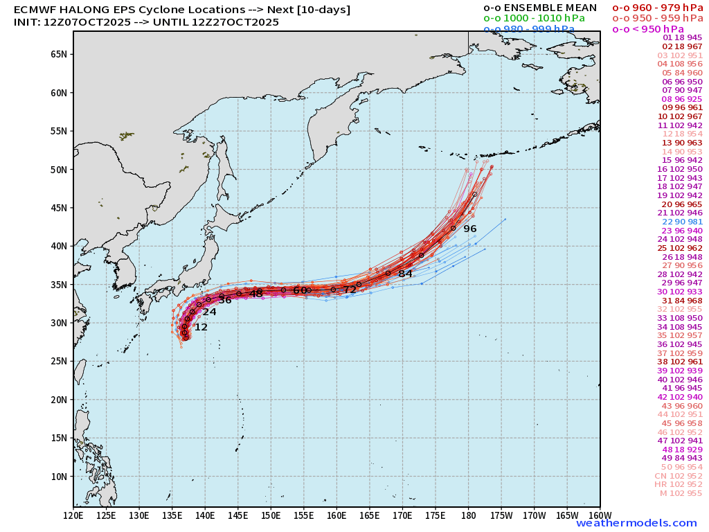
Maps sourced from weathermodels.com designed and innovated by yours truly! Please subscribe there for real-time access to the newest maps, charts from all of the weather models including ECMWF.
- Milepost
- 759 · laid 2025-10-08T01:13:09.714000Z
- Source
- https://weather.substack.com/p/october-7-2025-tuesday-evening-tropical
- Digest
- 2b1d62410c9d4d2f6a216b01553b13300b3a145516ccebc9fea36b9620280bf1
- Machine
- JSON