October 6, 2025 Monday Evening Tropical Update
Impactful coastal storm this weekend off Carolinas + Jerry
October 2025 was the 7th-warmest October in the 131-year national record (1895–2025), at 57.0°F against a 1991–2020 normal of 54.5°F (+2.4°F).
October 2025 was the 56th-wettest October in the 131-year national record (1895–2025), at 2.3in against a 1991–2020 normal of 2.5in (-0.2in).
NOAA/NCEI Climate at a Glance, contiguous United States. This is the observed record for the month, not a score of anything said in this piece — the forecast ledger begins 2026-08-17 and cannot reach earlier posts.

2025 Season to Date: 9 Named Storms, 4 Hurricanes, and 3 Majors
Fantasy Land GFS model at 12z … can’t resist showing this scenario well over the forecast predictability horizon — heavy lake effect snow (feet) in the Great Lakes snowbelts on October 22 (!)
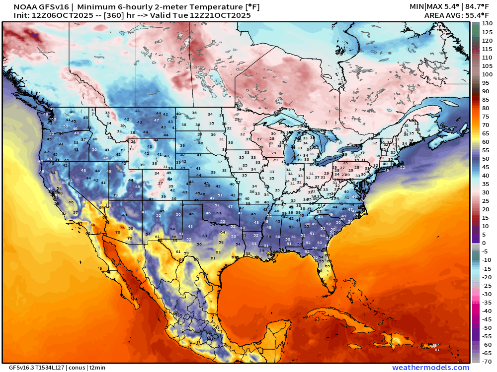
How can this happen? Cold air behind a strong Canadian Arctic cold front in the 20s and 30s °F blowing over the much warmer Great Lakes (60s) …
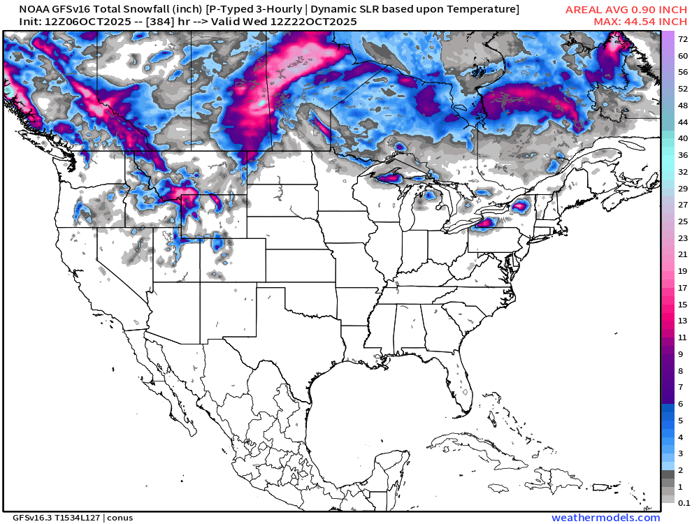
Yes, it can get pretty cold into the latter half of October — but not expecting this level of extreme cold — however, we should be ready for a pattern switch to cooler conditions once the record warmth departs.
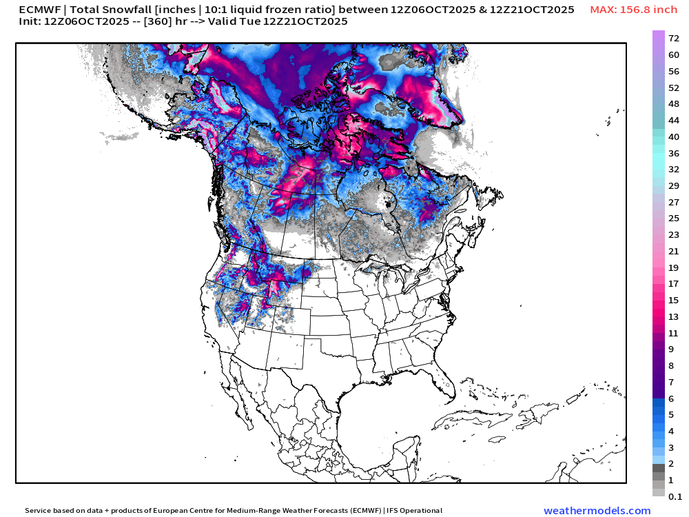
Canada already seeing substantial snowfall … and if we zoom out to the rest of North America (from ECMWF), we see the Arctic including Alaska well into winter weather season … 15-day forecast also sees the Rocky Mountains with substantial snowfall.
Central Atlantic Water Vapor + IR Satellite Images
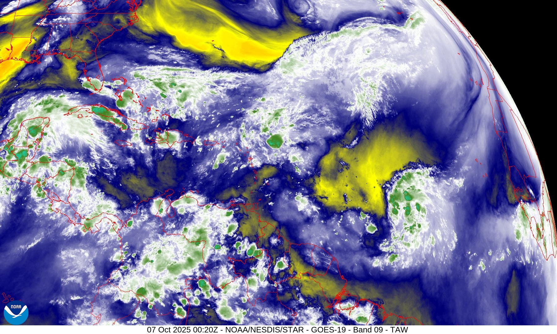
NHC has a 90% chance of development for Invest 95L — tropical wave in the central Main Development Region
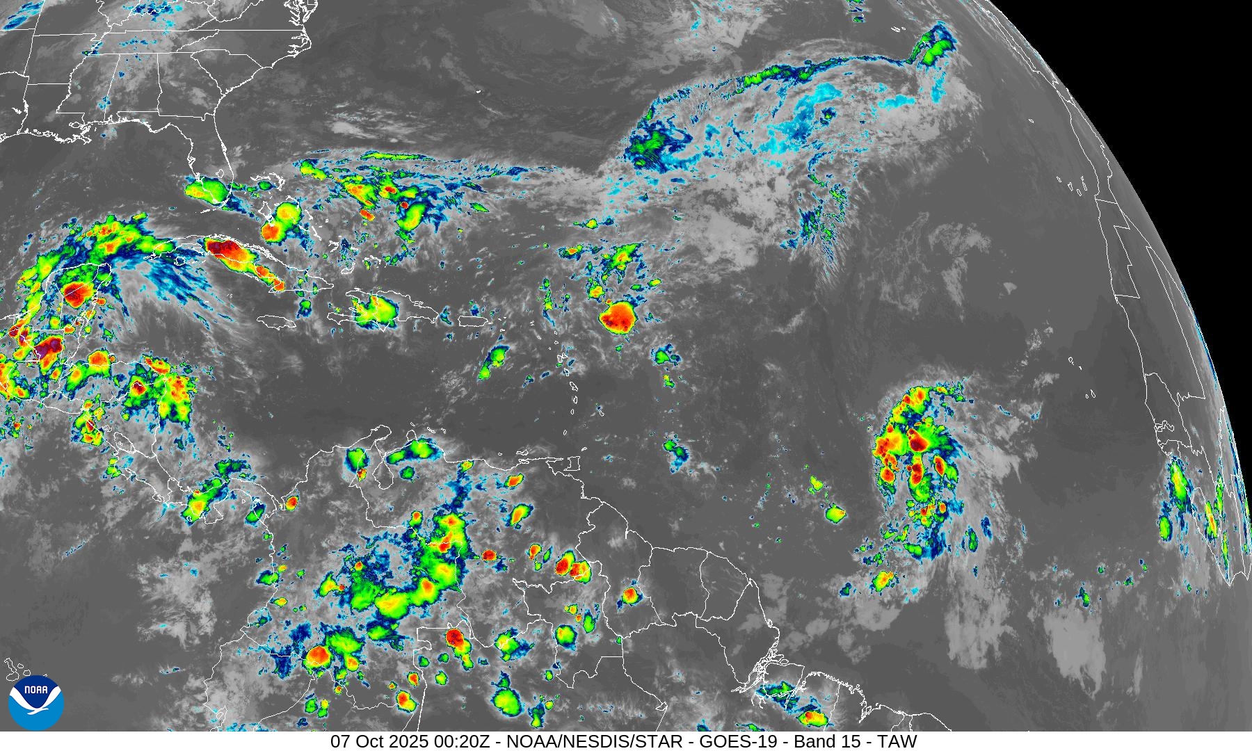
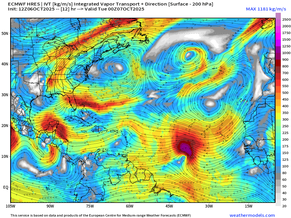
The environment in front of the storm (to the west) is rather dry in the mid-levels. Plus, from the NASA Dust loop, there is a fairly impressive Saharan Air Dust layer behind the tropical wave. Convection continues to fire, so the dry air doesn’t seem to be counteracting instability or ascent + moisture availability.
Snapshot of Integrated Vapor Transport valid at 00z (Tuesday) shows plenty of moisture on the top half of the wave — and we just need a surface circulation to close off the low.
NASA GEOS-5 | 5-day Dust Forecast
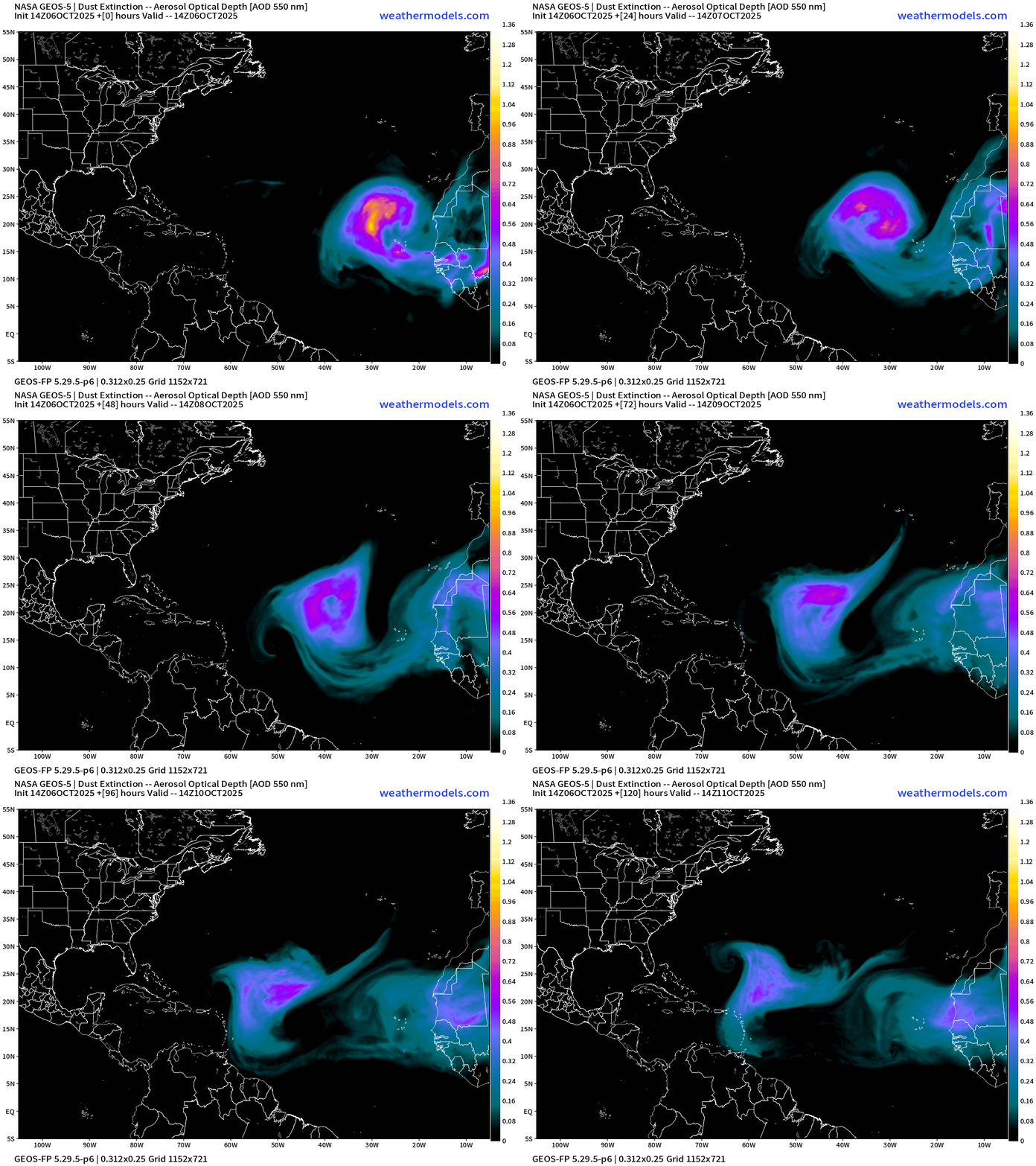
This is a very strong — and unusual Saharan Air Layer + Dust outbreak in the Eastern Atlantic that will rotate anti-cyclonically to the west — just north of Invest 95L.
ECMWF Next 12-Days Integrated Vapor Transport | 12z cycle
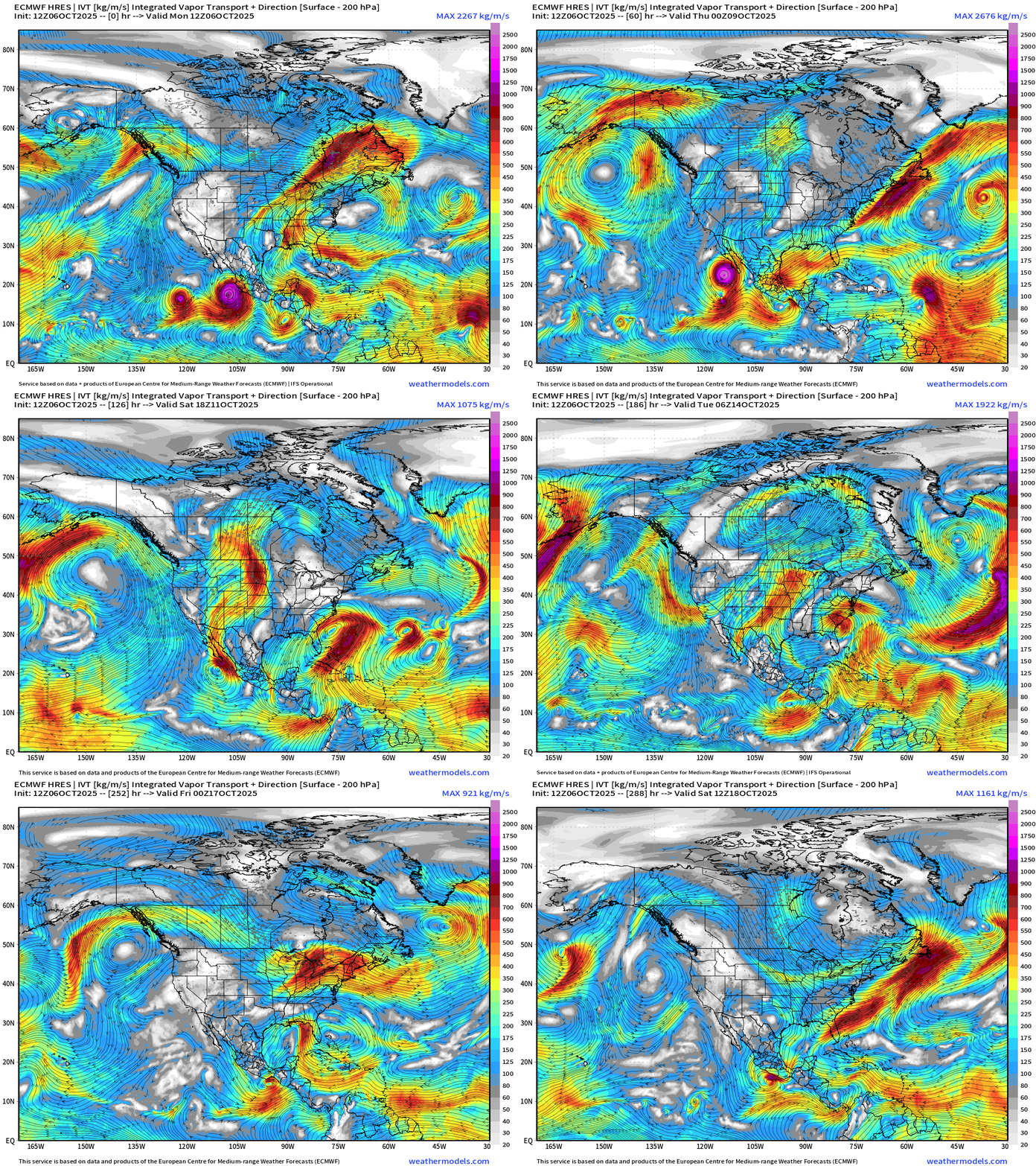
Large view centered on North America shows [Eastern Pacific] Hurricane Priscilla and its moisture plume heading into the American Southwest.
Another system behind Priscilla —> to become Raymond along the coast of Mexico
In the Atlantic, Invest 95L reaches the northern Leeward Islands and comes apart in a very hostile environment —> NHC at 90% chance of development
Non-tropical trough —> development of “hybrid system” off the East Coast that could be impactful even if not a named storm (but it could be Karen)
Medium Range | AIFS 18z | 10-days Height Anomaly
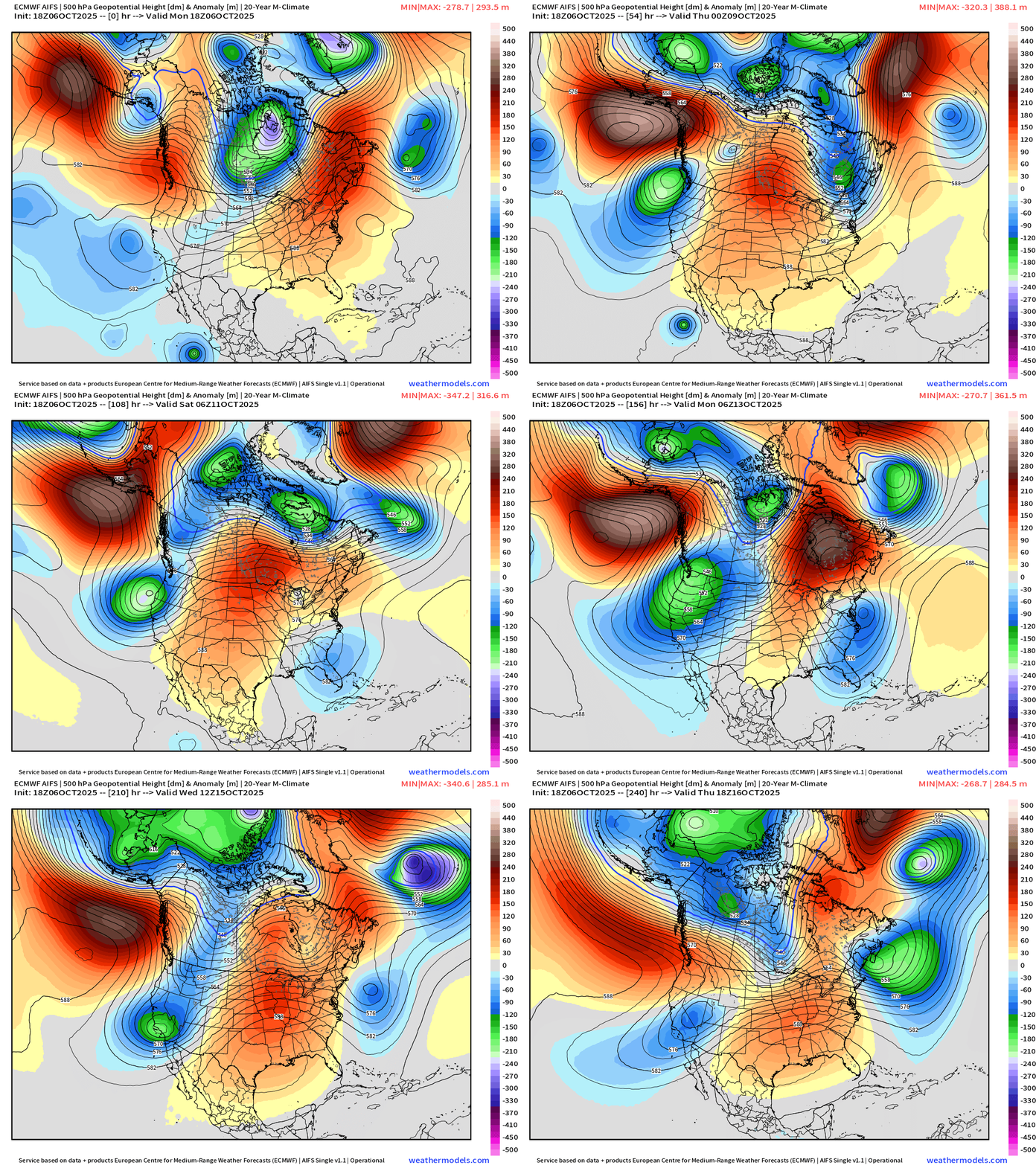
Central U.S. ridging (and warmth) in the story of the next 10-days with troughs on either side that persists through 10-days
ECMWF EPS Temperature Anomaly | Next 15-days
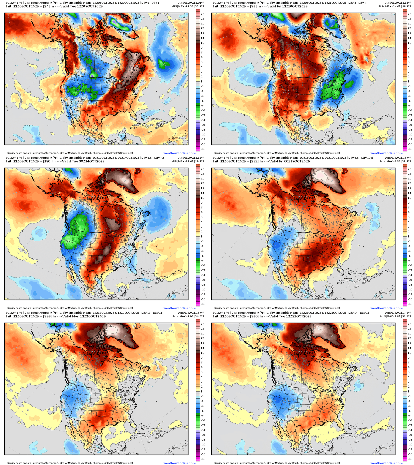
Ensemble mean shows cooler air through this weekend across the Midwest, Great Lakes, and Northeast behind a cold front / trough. But warmth builds again in the Central U.S. — but cooler out west into Week 2
ECMWF 18z Wind Gusts | Into this weekend | Next 3 to 6-days
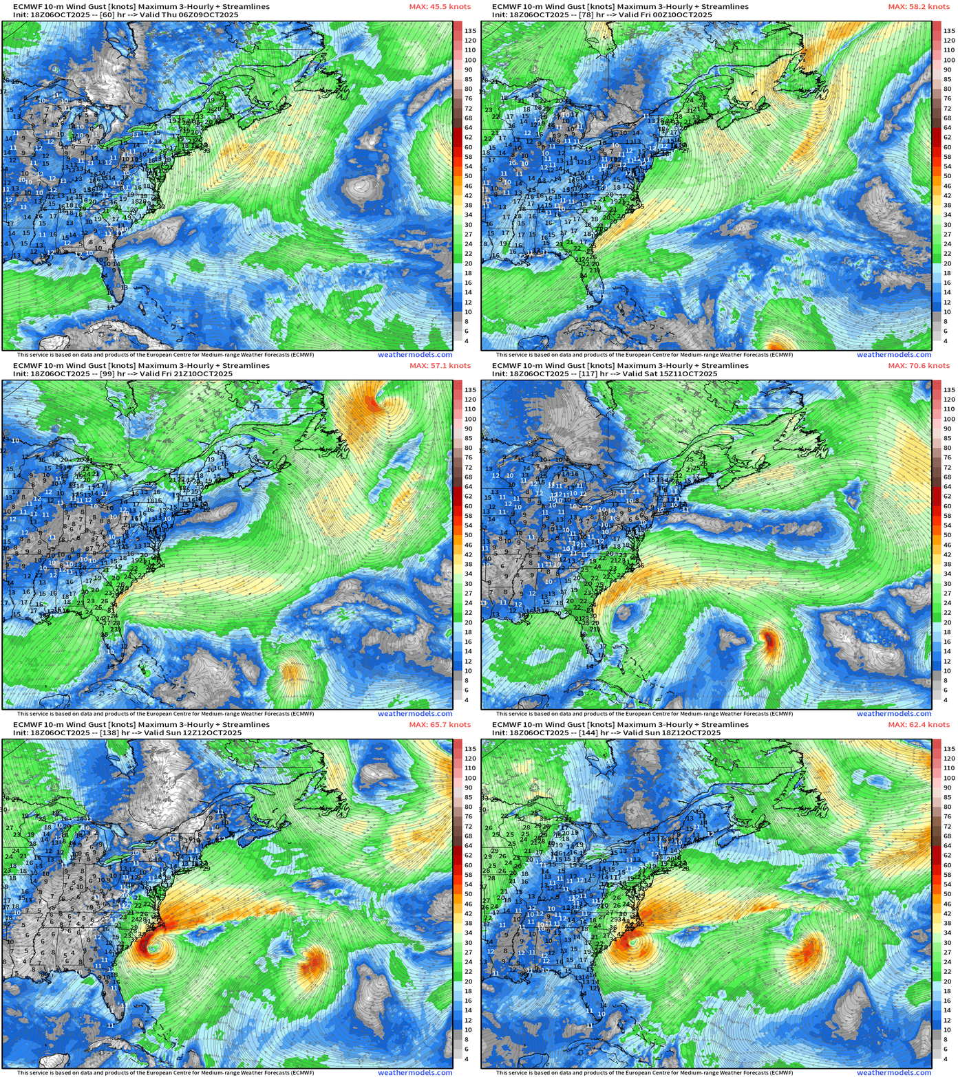
A Nor’easter like hybrid system developing this weekend off the Carolinas
ECMWF 18z Precipitable Water | Next 6-days
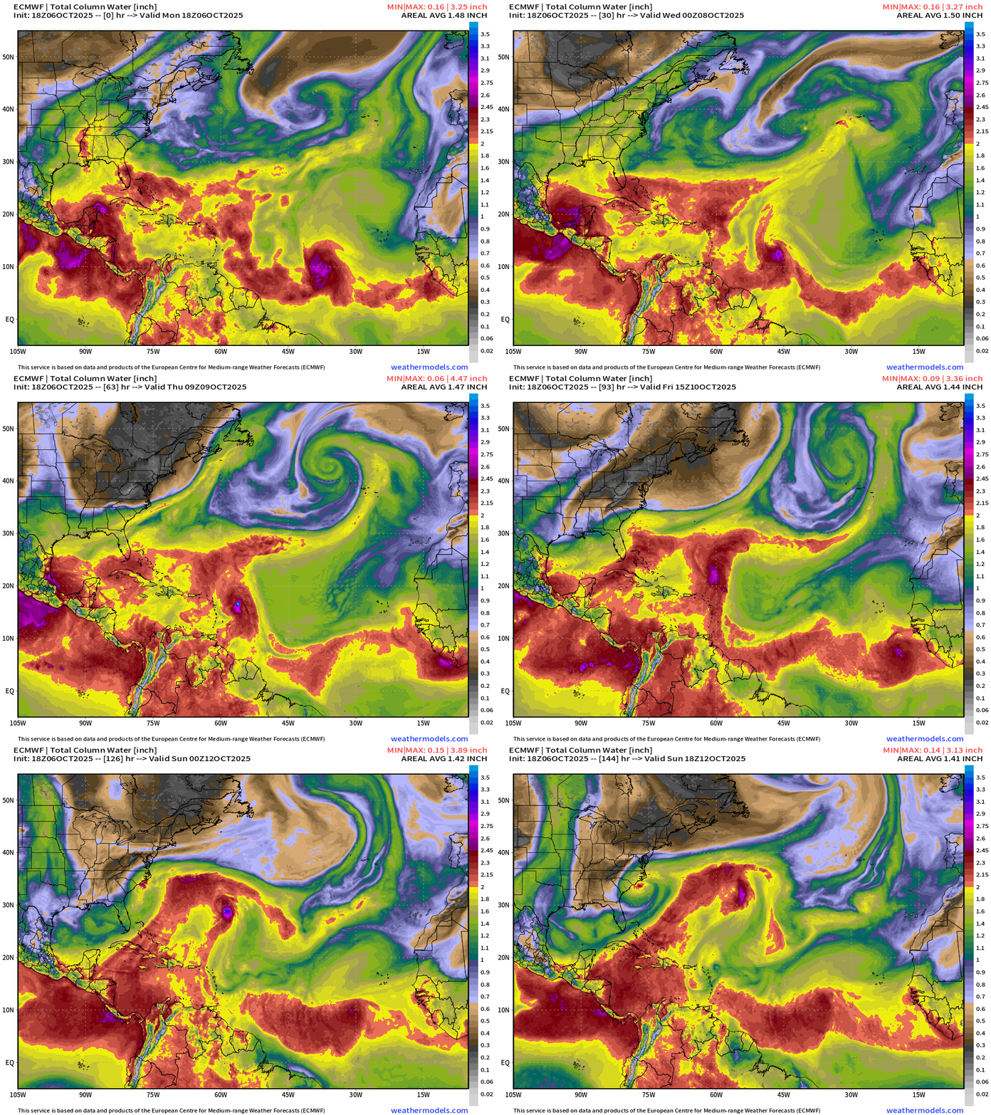
Major Canadian Trough bringing cooler and dryer air into the Eastern U.S. helps force the development of Southeast coastal low —> which will push northward. Jerry is well to the east and by this weekend, poorly organized.
Note ECMWF is much faster with the movement of Invest 95L —> Jerry
NOAA GFS 18z —> East Coast “Nor’easter” Hybrid System
Slower movement of Jerry —> more intense
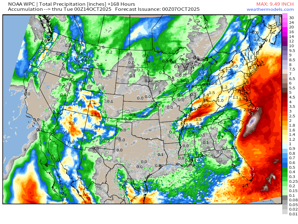
Major coastal low —> looks like a powerful (but rainy) Nor’easter in a similar location as ECMWF 18z
NOAA WPC 7-Day Precipitation
Atlantic Basin Outlook | 8 PM ET Update
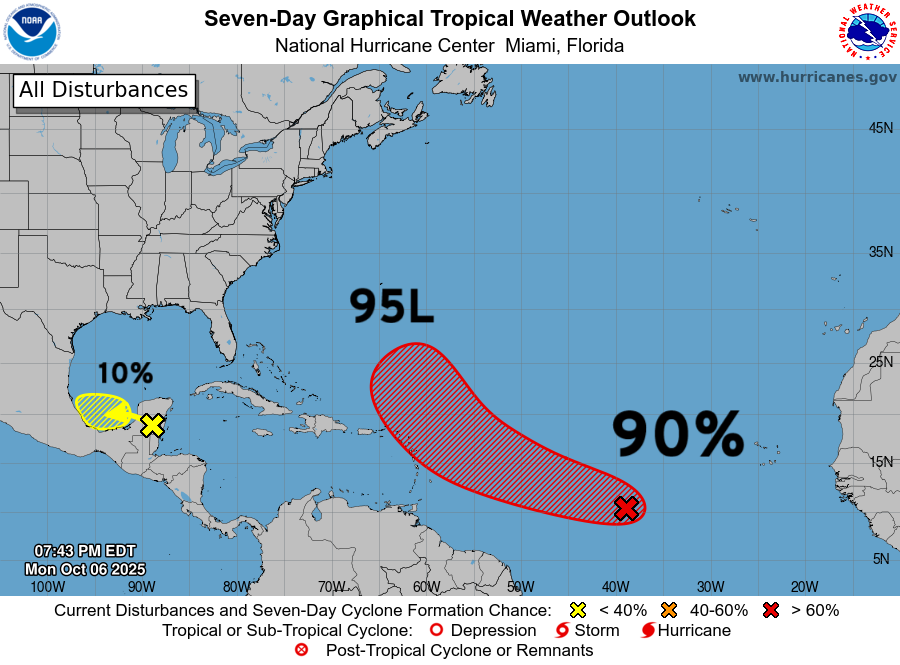
90% NHC — Invest 95L with risk to northern Leeward Islands and Northeast Caribbean in 3-4 days
Invest 95L ATCF Spaghetti
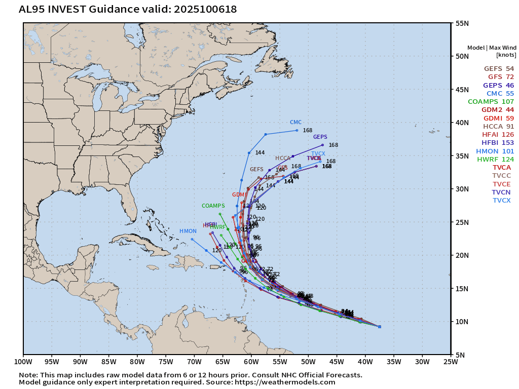
I’m discounting the western members mainly the HMON, HAFS-A and HAFS-B
ECMWF 18z Precipitable Water | Next 6-days
Updated ECMWF 18z is only somewhat interested in the small vortex from Invest 95L and only minimally develops it into a TD/TS before merging with a frontal boundary in the subtropics. A strong African dust / Saharan Air Layer clears out the MDR like an eraser. Another tropical wave comes off Africa for this weekend.
NOAA GFS 186z | Integrated Vapor Transport
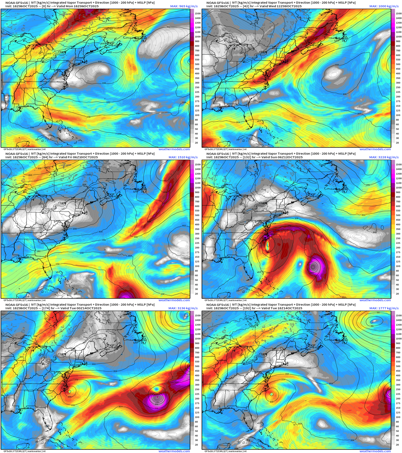
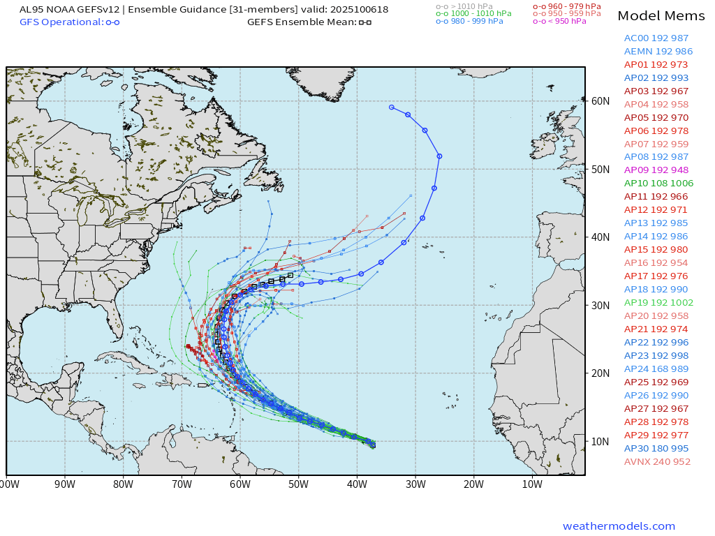
GFS/GEFS = much more aggressive with development of Hurricane Jerry
NOAA GEFS 18z | Invest 95L | 31 Ensemble Members
HAFS Hurricane Models | 12z Intensity Update | Major —> Cat 4
HAFS Hurricane Models | 18z Intensity Update | Cat 1 Hurricane
—> Uncertainty about intensity and therefore the ultimate track from the HAFS mesoscale model (A and B)
Range of outcomes from TS/Cat 1 to perhaps Category 5
SST Analysis and Anomaly | 12z
Passage of Imelda and Humberto took a huge bite out of the water temperature along the U.S East Coast to Bermuda with sub-26°C water and a remarkable “cold wake” that probably won’t recover heading through October.
Gulf of Mexico and Caribbean remain warm … with 28°C+ into the MDR = wide open for business.
NOAA Tropical Surface Analysis | 18z
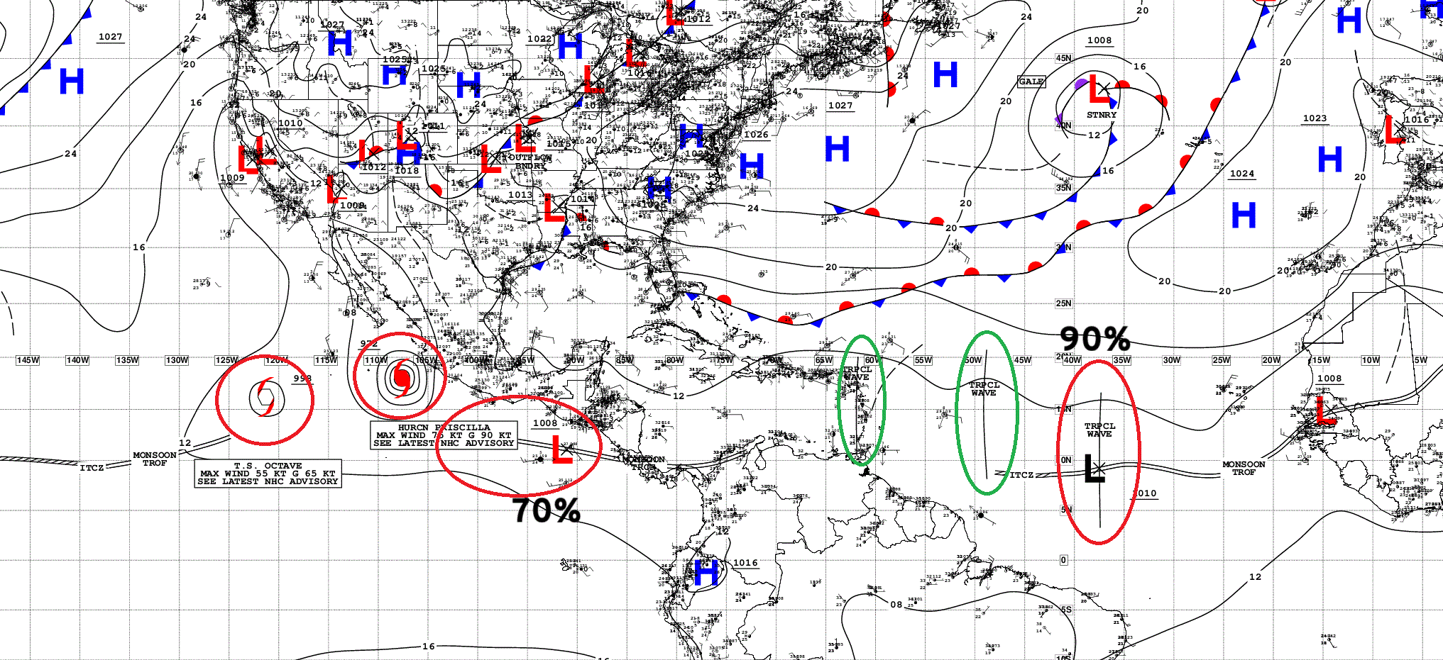
Atlantic Tropical Waves = 3 with Invest 95L — red 90% {HIGH chance)
ECMWF EPS 12z | All Storm Tracks Day 6
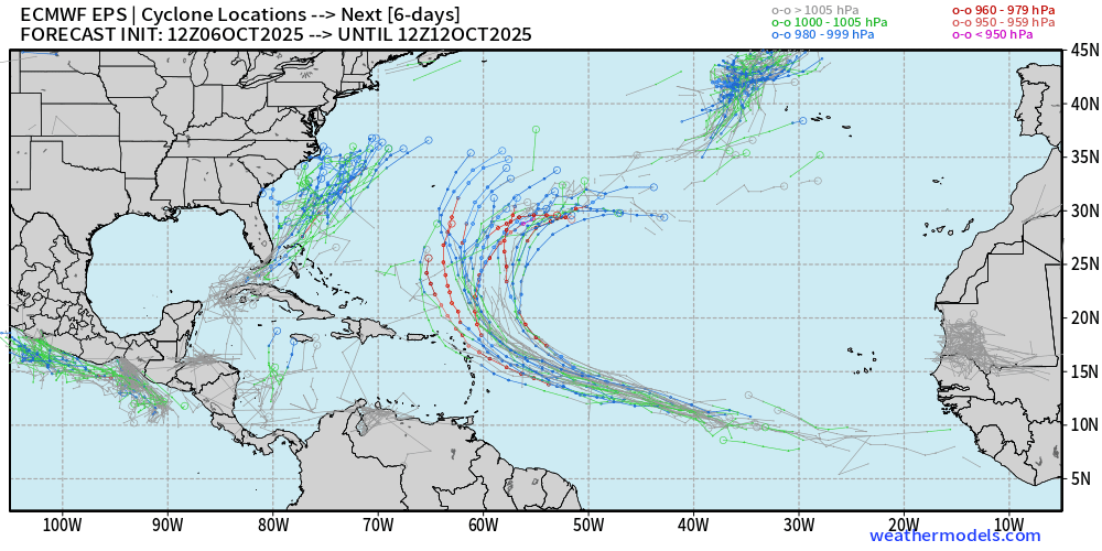
Most members develop Invest 95L … with a range of intensity outcomes
Non-tropical area of low-pressure off the East Coast could be impactful.
ECMWF EPS 12z | All Storm Tracks Day 15
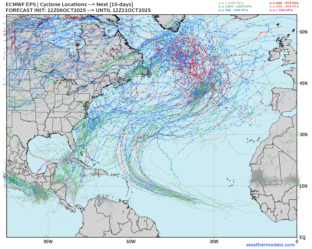
Some weak TS tracks in the Caribbean + 2 more intense out of 51 members in the Gulf of Mexico —> we shift focus to the western half of the Atlantic basin through October as the Cape Verde season winds down.
Nothing imminent or threatening after Jerry — and whatever develops off the Carolinas.
Eastern Pacific Tropical Weather Outlook | 8 PM ET
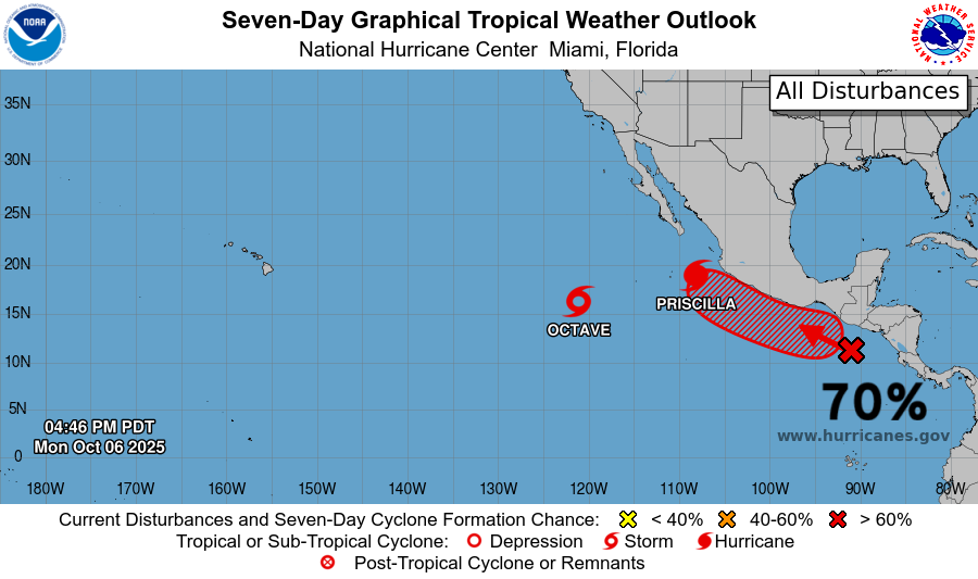
Tropical Storm Octave and large Hurricane Priscilla + Next System (70% —> Raymond)
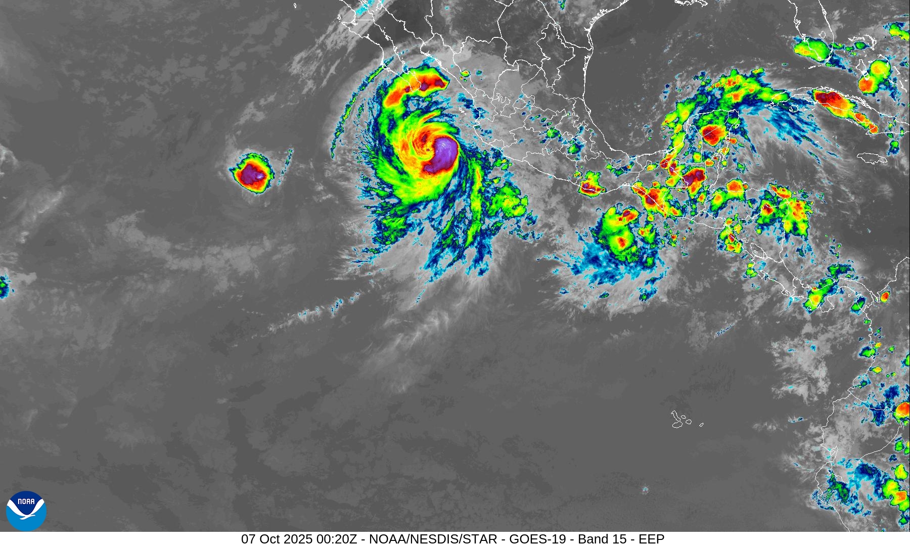
Another system — Raymond will likely follow along the coast of Mexico (60%)
Hurricane Priscilla | NHC Cone | 85 mph Category 1
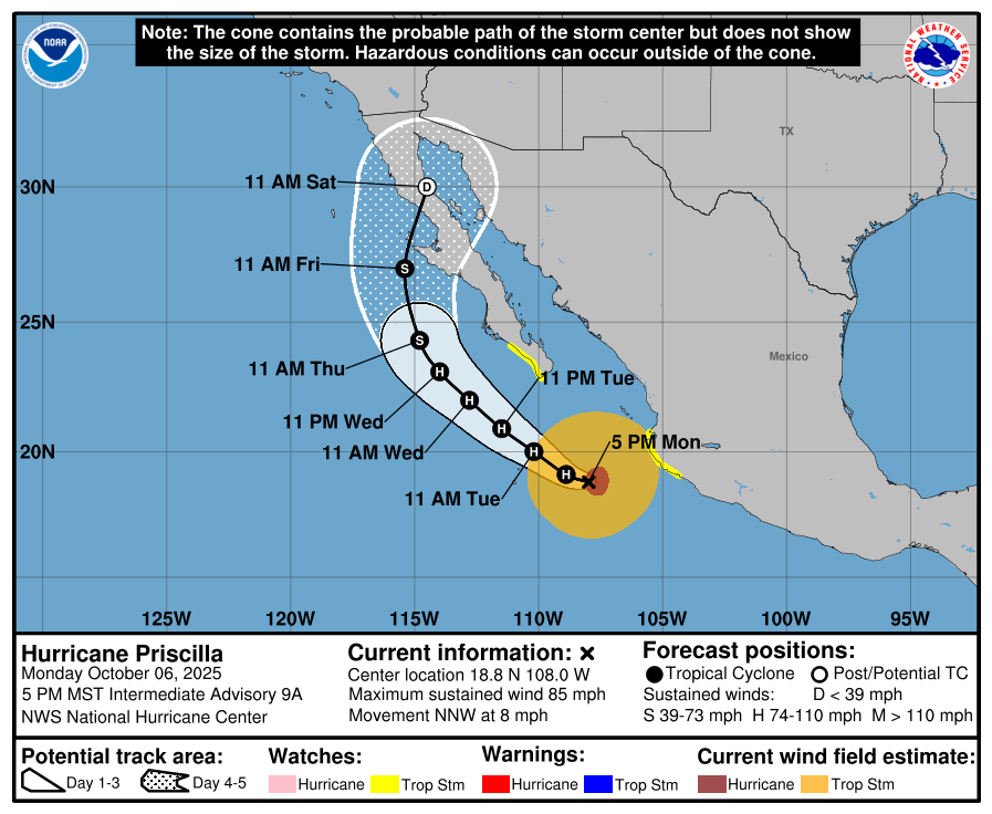
Priscilla still could become a major hurricane heading slowly NW to west of Baja California in next several days. Moisture from the remnants will likely head into the U.S. Southwest in a week.
PWAT Next 6-days for Octave and Priscilla — then Raymond!
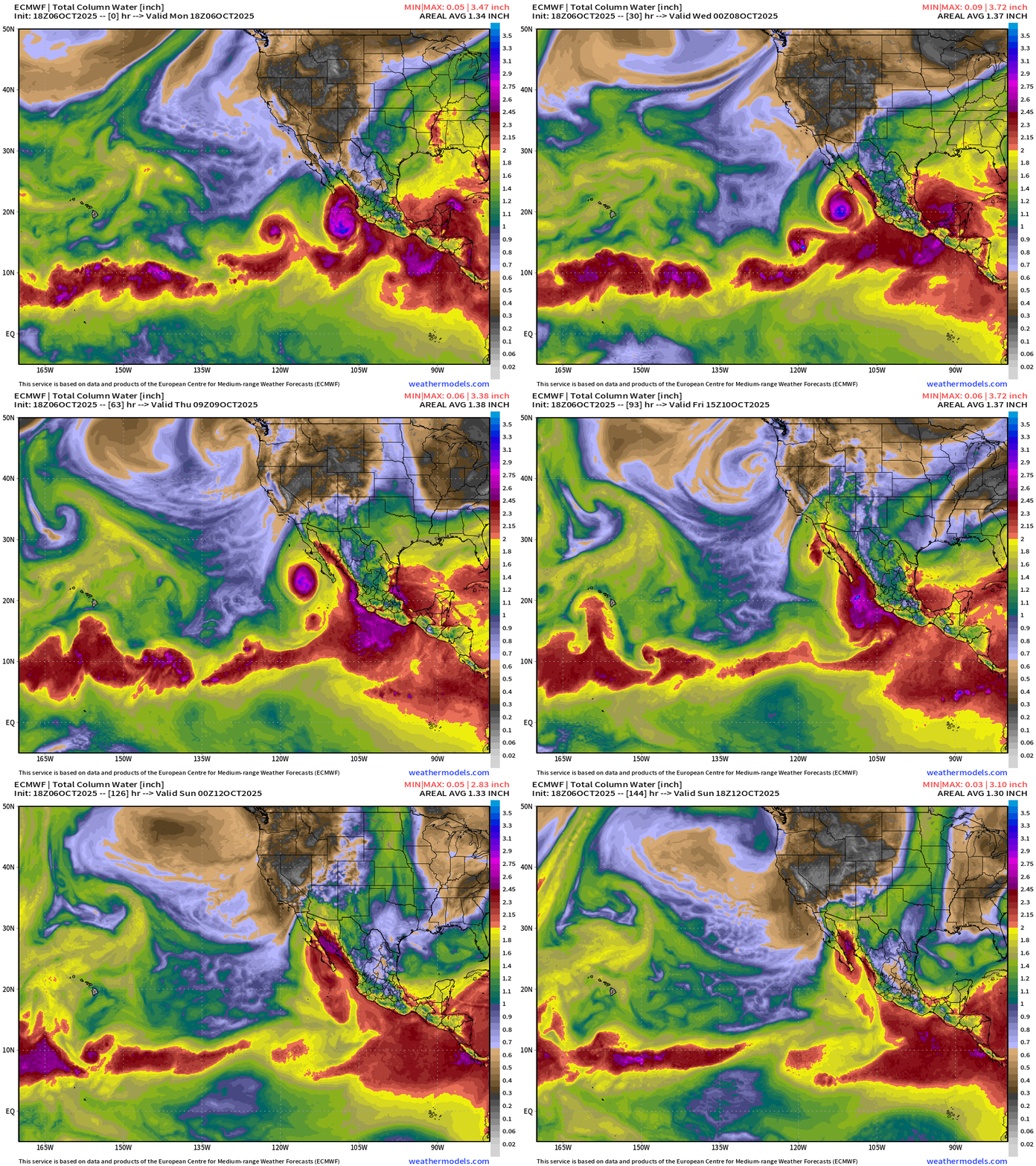
Surge of moisture through Gulf of California into Southern California and Arizona — and Raymond on its heels
Western Pacific Typhoon Season | 28W (Halong) and 95W (Invest)
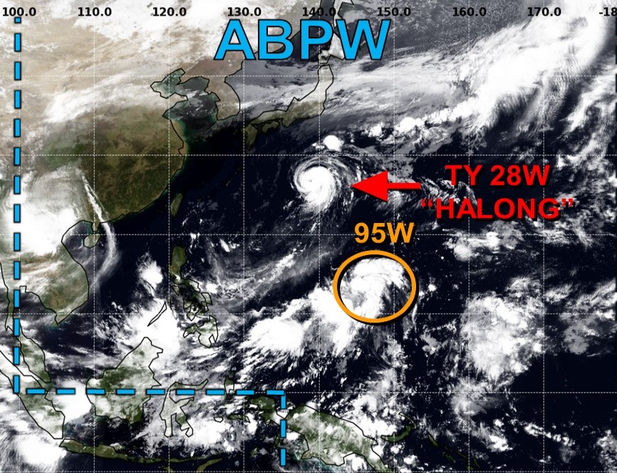
Potential Super Typhoon Halong (28W)
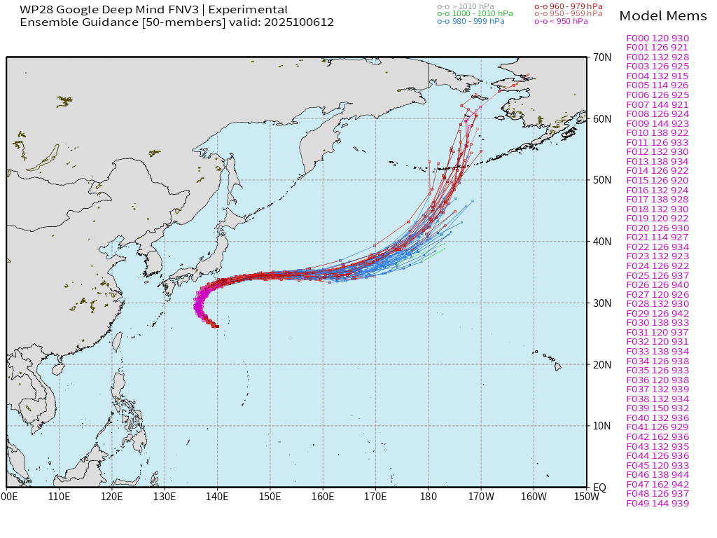
Massive typhoon — should reach 130-knots over warm waters well south of Japan. The storm will loop/curve out to sea and surely miss Japan.
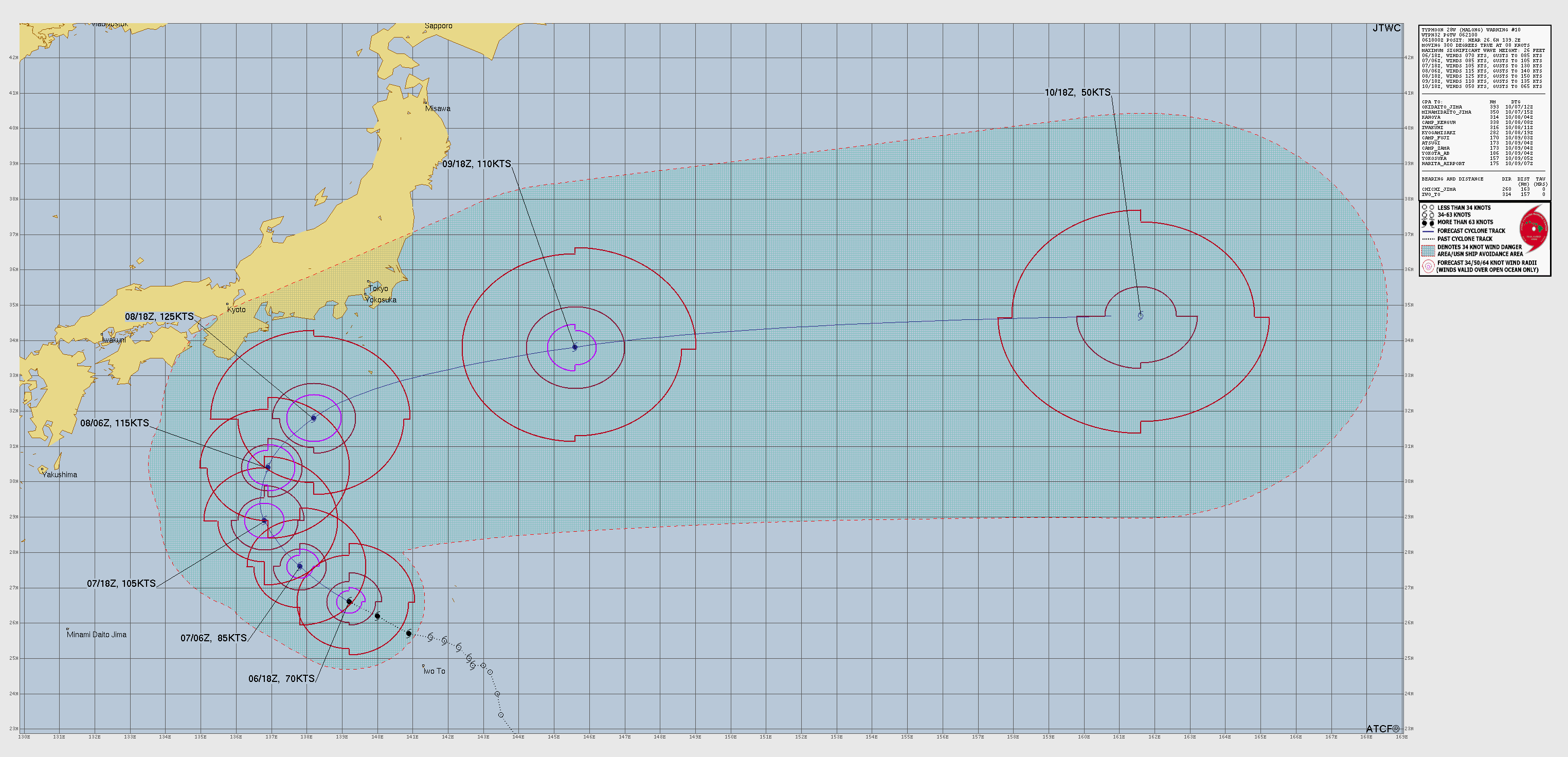
Satellite shows a compact and powerful Typhoon with a clearing/warm eye = T 6.0 and about 115-knots (Category 4)
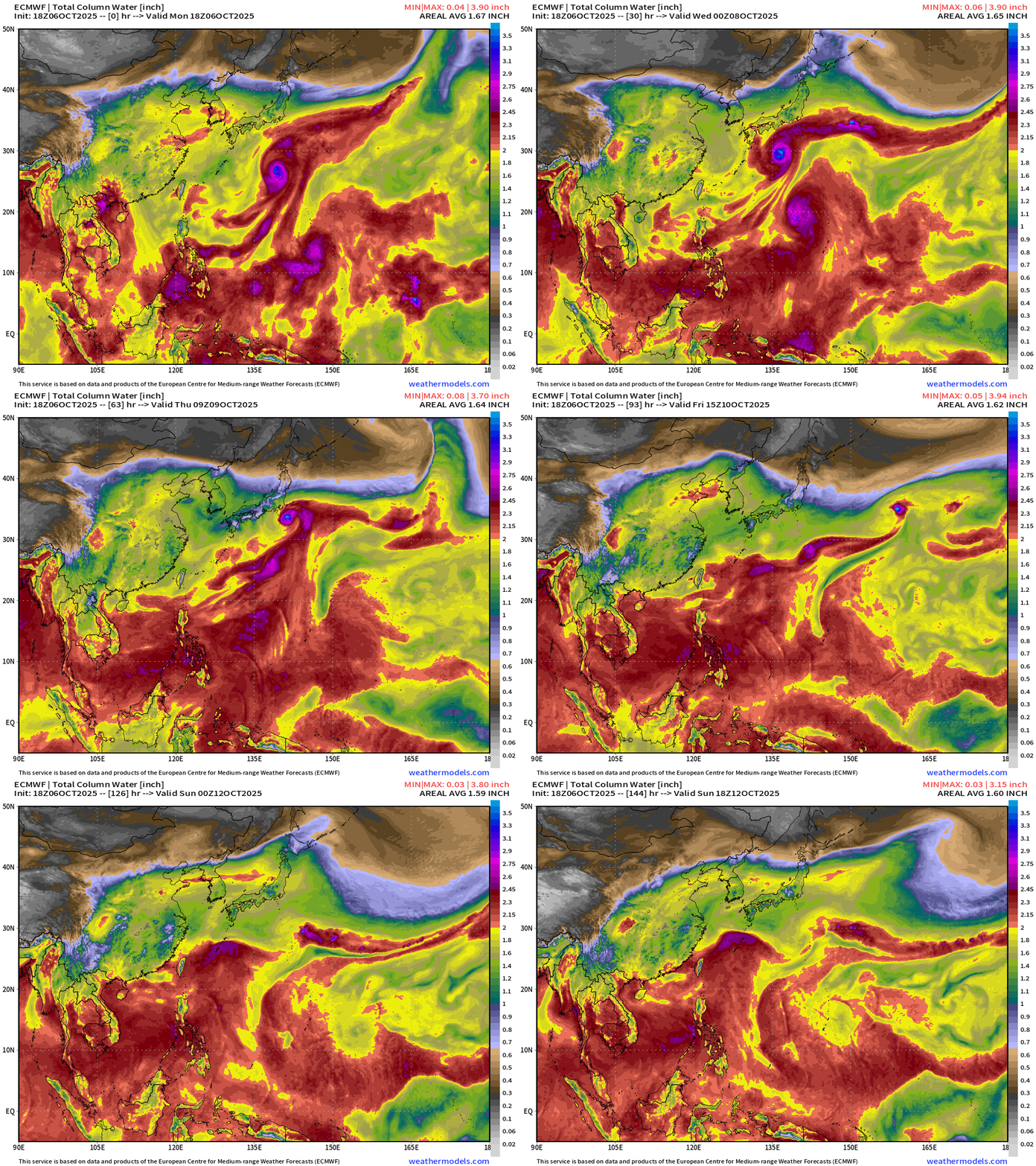
ECMWF 18z | Next 6-days Precipitable Water
Google Deep Mind 12z | Ensemble Tracks for Halong
Maps sourced from weathermodels.com designed and innovated by yours truly! Please subscribe there for real-time access to the newest maps, charts from all of the weather models including ECMWF.
- Milepost
- 758 · laid 2025-10-07T01:16:45.952000Z
- Source
- https://weather.substack.com/p/october-6-2025-monday-evening-tropical
- Digest
- e3670a08d961290dafd3361ec9d89f7e419af67235f1e28b09da4312fa57a9b4
- Machine
- JSON