October 5, 2025 Sunday Tropical Update
NHC up to 70% chance of Tropical Storm Jerry formation in central Atlantic
October 2025 was the 7th-warmest October in the 131-year national record (1895–2025), at 57.0°F against a 1991–2020 normal of 54.5°F (+2.4°F).
October 2025 was the 56th-wettest October in the 131-year national record (1895–2025), at 2.3in against a 1991–2020 normal of 2.5in (-0.2in).
NOAA/NCEI Climate at a Glance, contiguous United States. This is the observed record for the month, not a score of anything said in this piece — the forecast ledger begins 2026-08-17 and cannot reach earlier posts.

2025 Season to Date: 9 Named Storms, 4 Hurricanes, and 3 Majors
Mid-Level Water Vapor Loop | Atlantic Basin
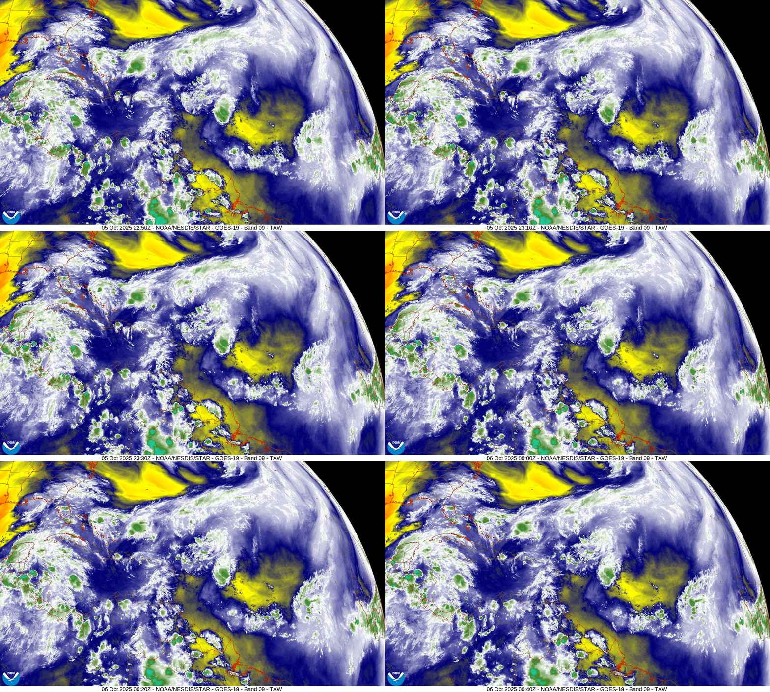
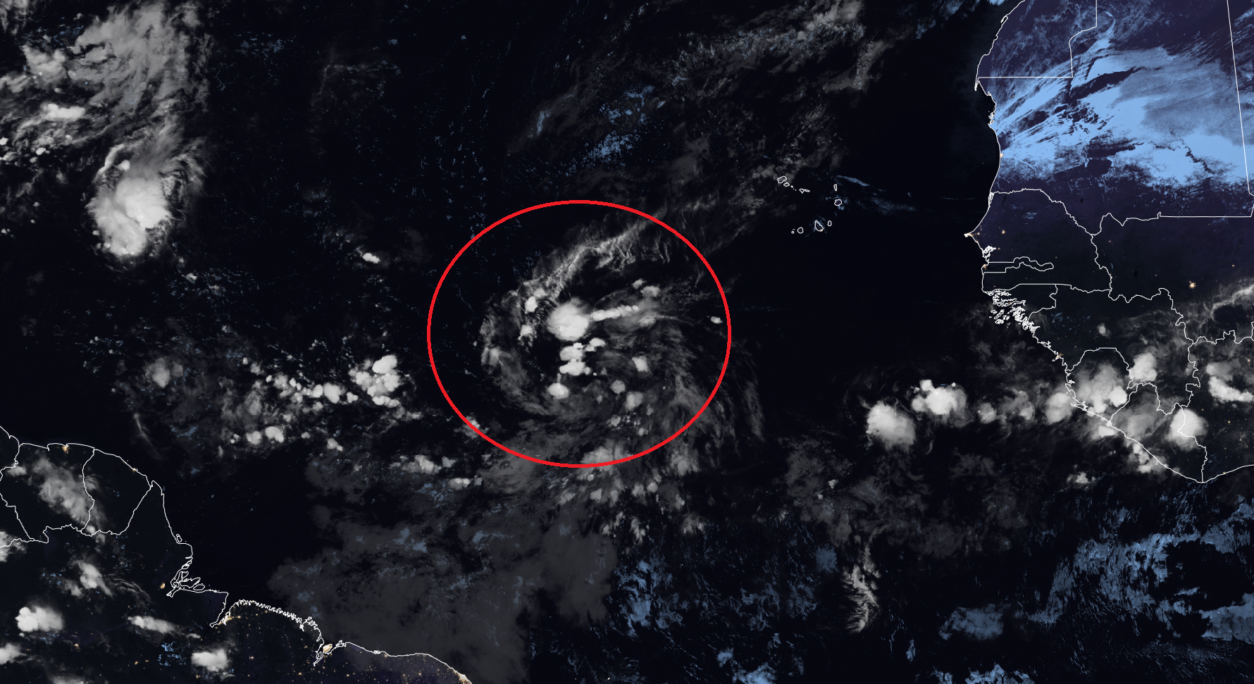
While the Atlantic is currently quiet, NHC is continuing to watch an active tropical wave with some convection bubbling up late tonight. NHC has a 70% chance of development in 7-days.
The environment in front of the storm is rather dry in the mid-levels. However, as we’ll see from the NASA Dust loop, there is a fairly impressive Saharan Air Dust layer behind the tropical wave that may be signaling to ECMWF model to tamp down expectations of a powerful Hurricane Jerry.
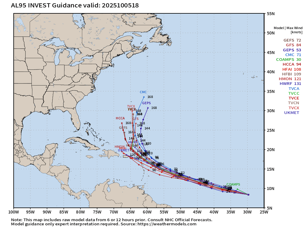
The GFS/GEFS systems + Mesoscale models are ALL in agreement on Major Hurricane Jerry — while the ECMWF/EPS system is a coin flip for no development vs. major hurricane.
ECMWF Next 12-Days Integrated Vapor Transport | 12z cycle
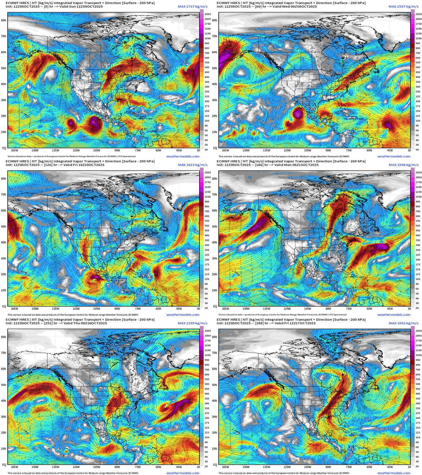
Large view centered on North America shows the eventual dissipation of Hurricane Octave in the wake of Eastern Pacific]Hurricane Priscilla with moisture heading into the U.S. Southwest — also absorbing what’s left of Octave, and then being followed by Raymond *60% chance NHC).
The flagship 12z model run from ECMWF shows a weaker reflection of Tropical Storm Jerry developing east of the Lesser Antilles and heading near/through the Northeast Caribbean through 5-6 days.
Tropical storm development chance is increasing — now up to 70% chance but uncertainty about the intensity — large range from minimal TS to Category 5.
Medium Range | AIFS 18z | 10-days Height Anomaly
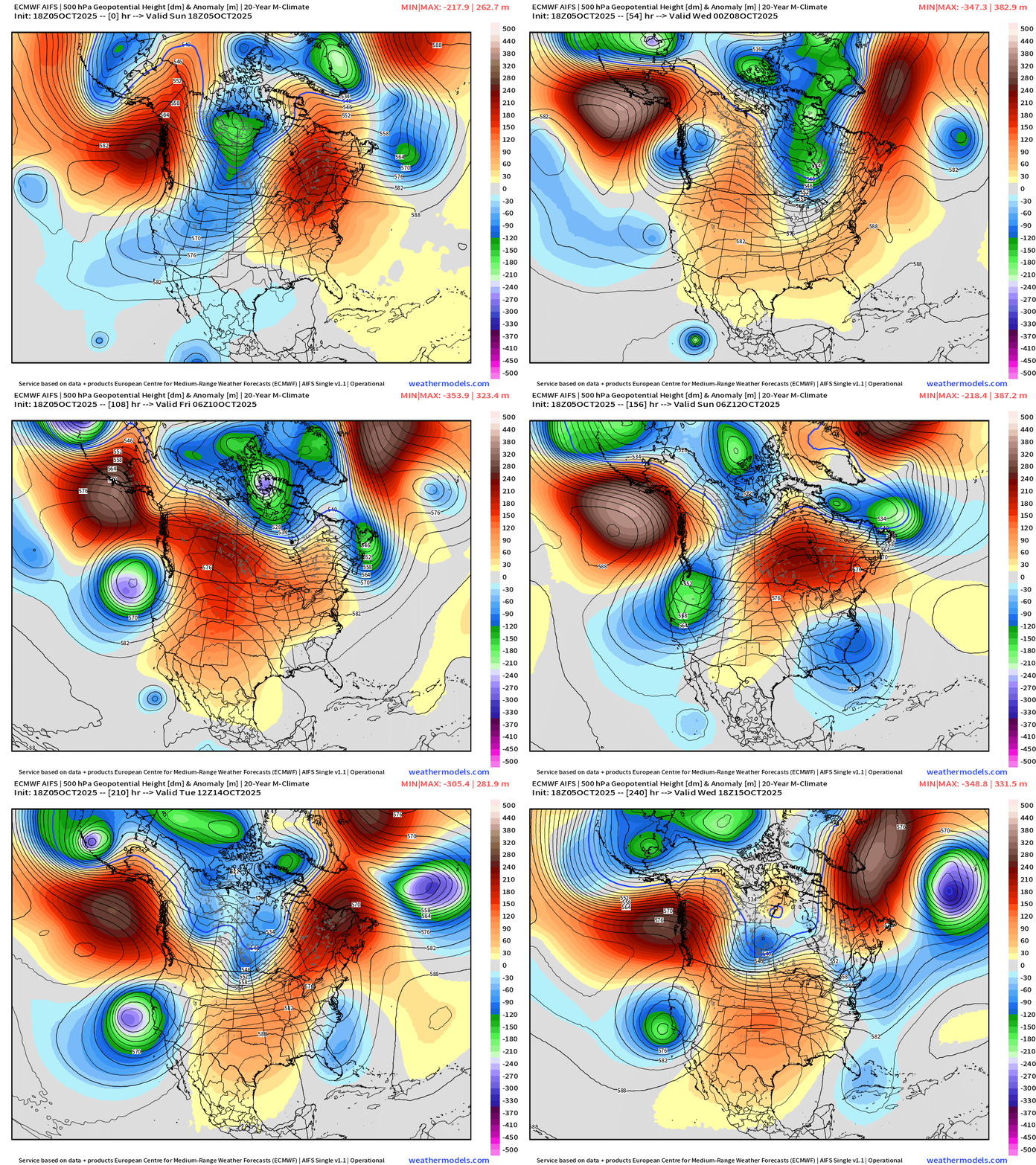
Central U.S. ridging (and warmth) in the story of the next 10-days with troughs on either side. This is a persistent pattern — may need a recurving Typhoon to help rejigger the North Pacific jet stream and downstream Rossby waves.
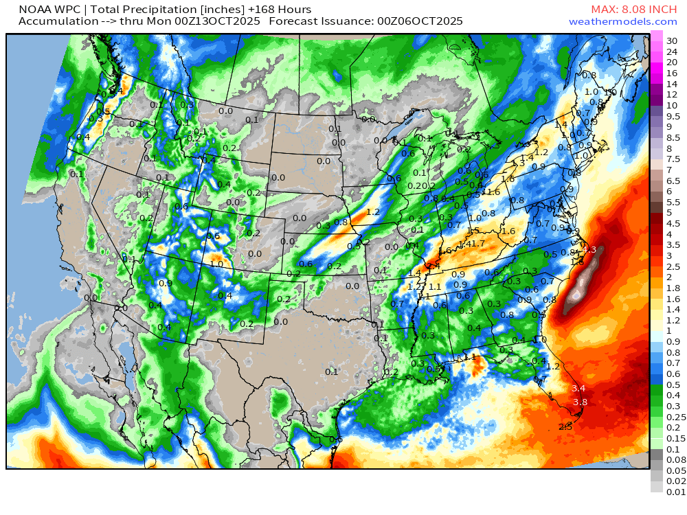
NOAA WPC 7-Day Precipitation
Atlantic Basin Outlook | 8 PM ET Update
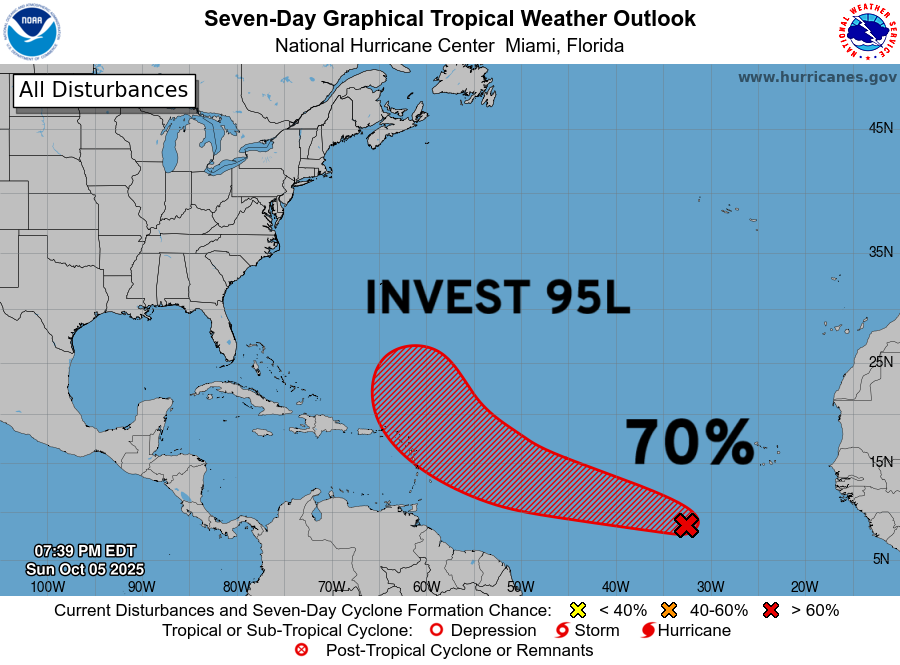
70% NHC — Invest 95L with risk to Lesser Antilles and Northeast Caribbean in 4-5 days | Invest 95L ATCF —>
ECMWF 18z Precipitable Water | Next 6-days
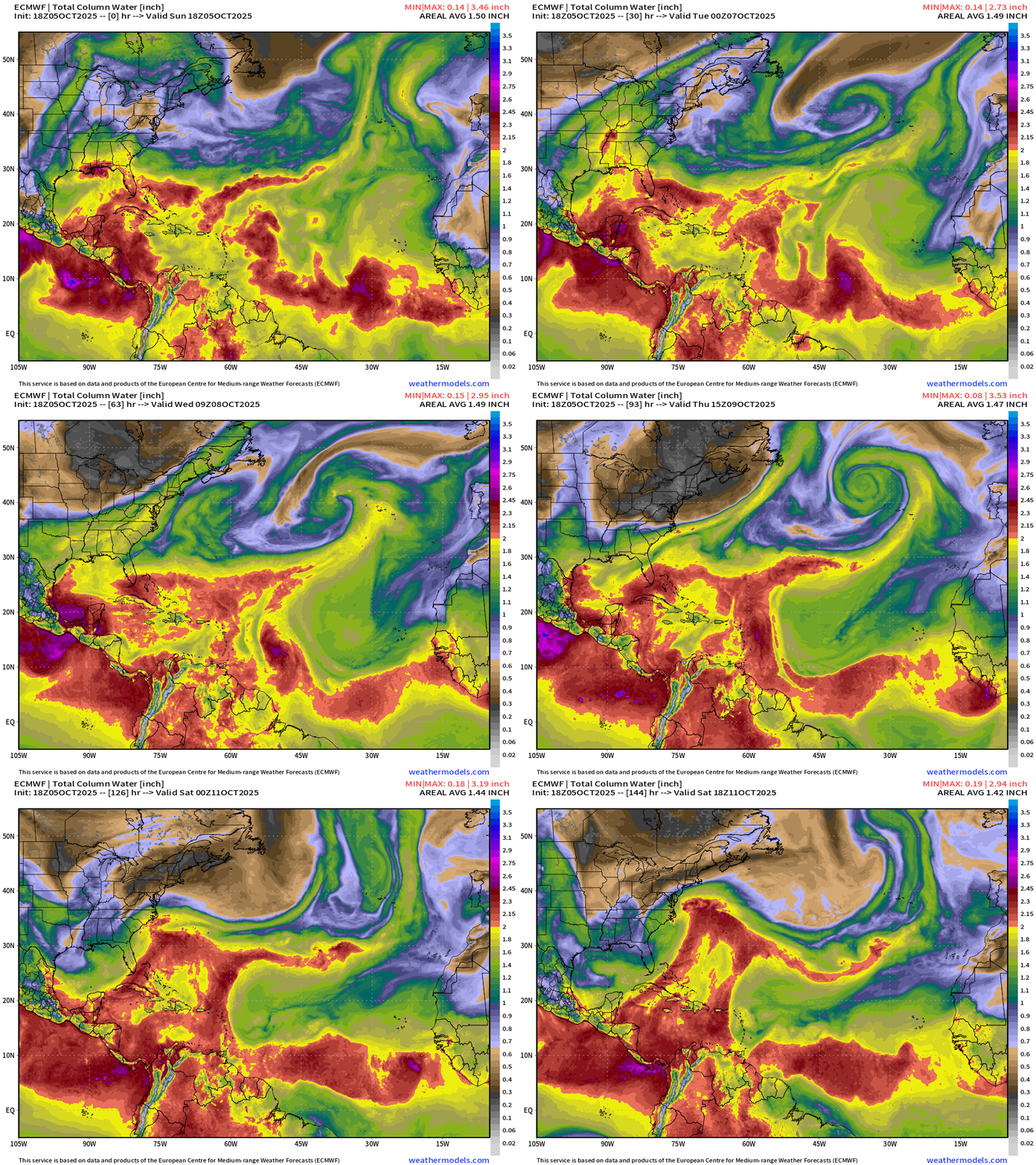
Updated ECMWF 18z is barely interested in the small vortex from Invest 95L and only minimally develops it into a TD/TS before merging with a frontal boundary in the subtropics. A strong African dust / Saharan Air Layer clears out the MDR like an eraser.
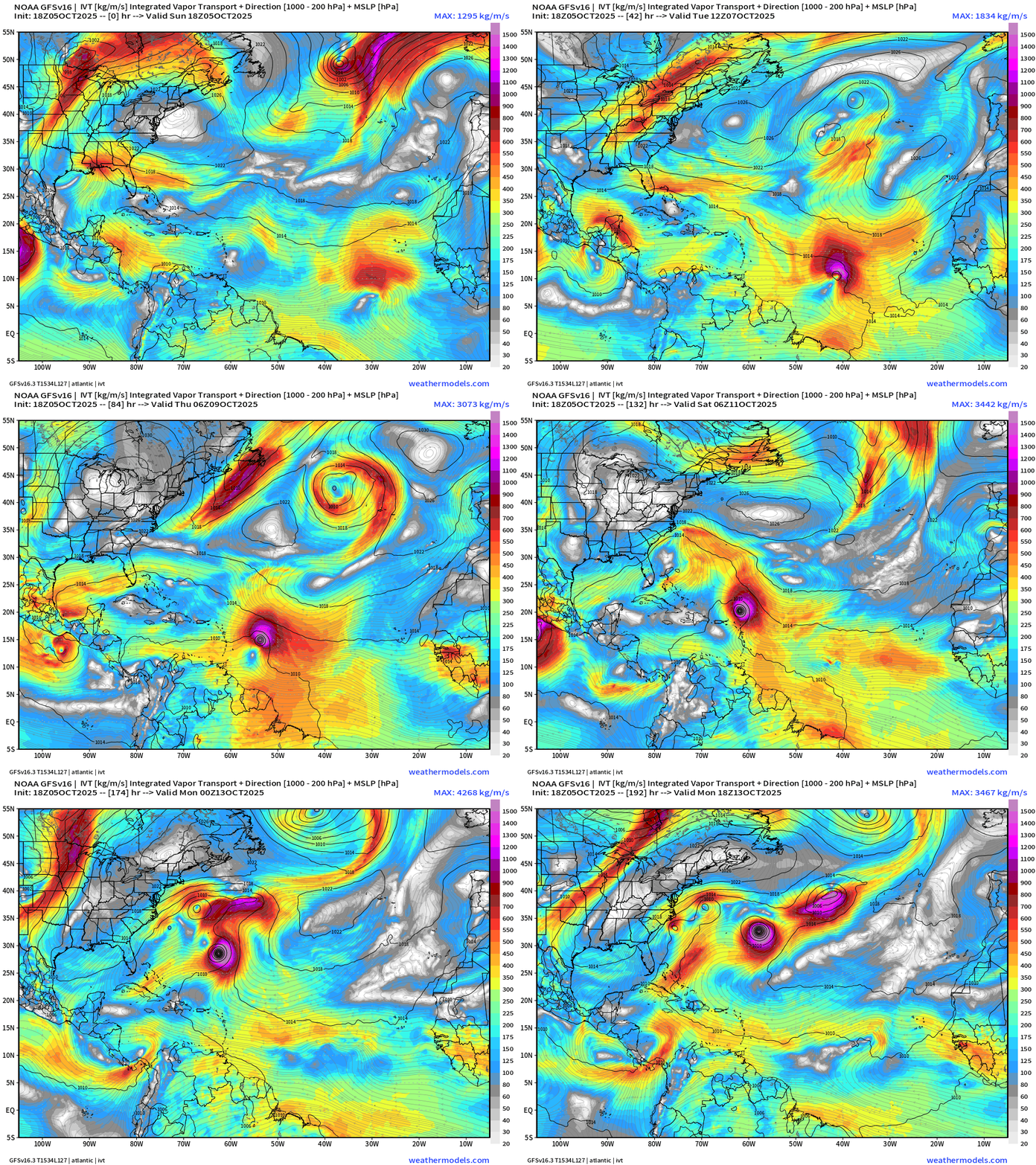
NOAA GFS 18z | Integrated Vapor Transport
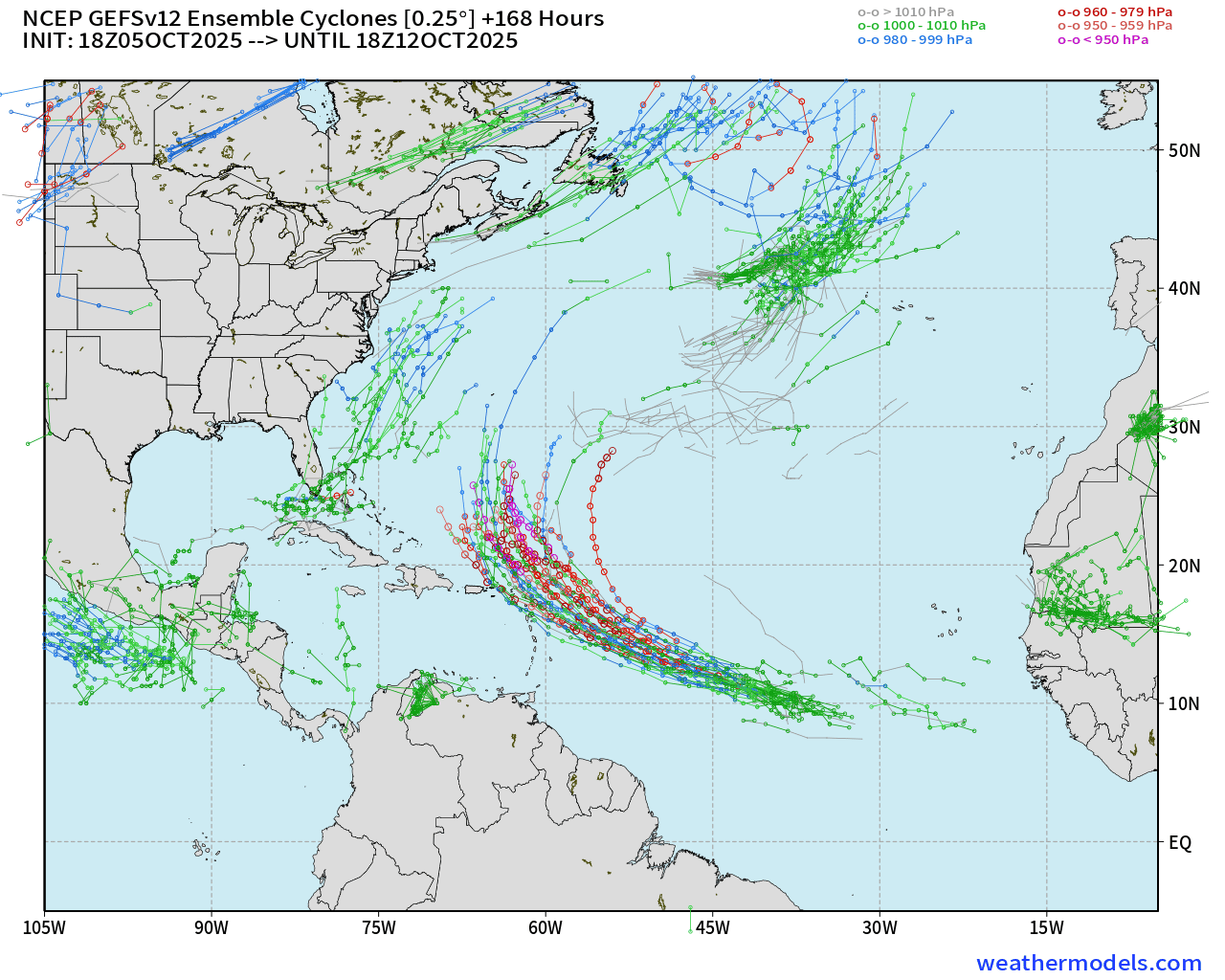
GFS/GEFS = very aggressive with development of Major Hurricane Jerry
NOAA GEFS 18z | All Cyclone Tracks | 31 Ensemble Members
HAFS Hurricane Models | 18z Intensity Update
Major hurricane — but a small inner-core
NASA Dust Forecast | Next 5-days
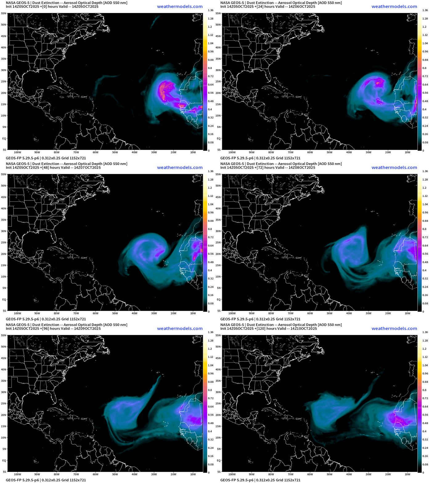
Impressive Saharan dust layer!
SST Analysis and Anomaly | 12z
Passage of Imelda and Humberto took a huge bite out of the water temperature along the U.S East Coast to Bermuda with sub-26°C water and a remarkable “cold wake” that probably won’t recover heading through October.
Gulf of Mexico and Caribbean remain warm … with 28°C+ into the MDR = wide open for business.
Atlantic Satellite Image | IR
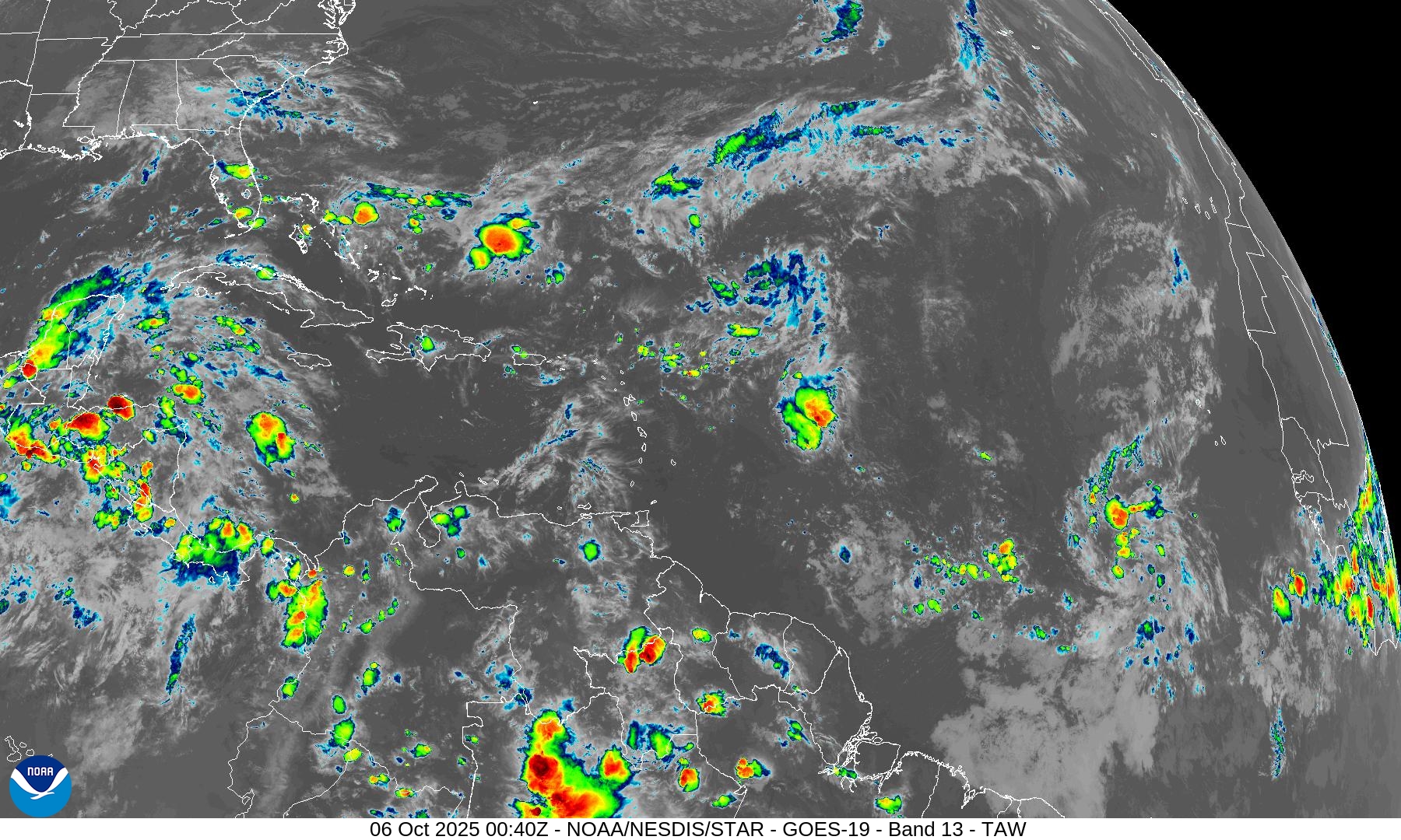
Areas of convection including 3 tropical waves — with Invest 95L showing some showers and thunderstorms.
NOAA Tropical Surface Analysis | 18z
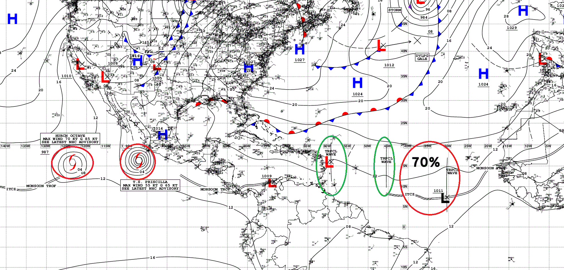
Atlantic Tropical Waves = 3 with Invest 95L — red 70%
Eastern Atlantic Night Pseudo-Visible Satellite Image | Invest 95L
ECMWF EPS 12z | Active Storm Tracks Day 7
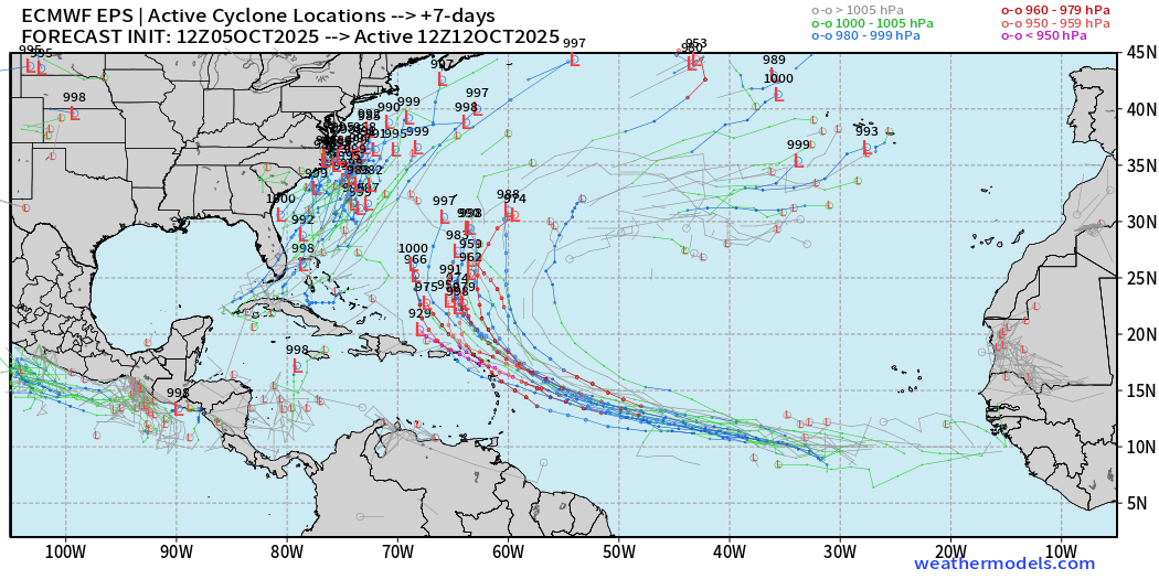
Still around 50% chance of developing Invest 95L from EPS 12z — full physics.
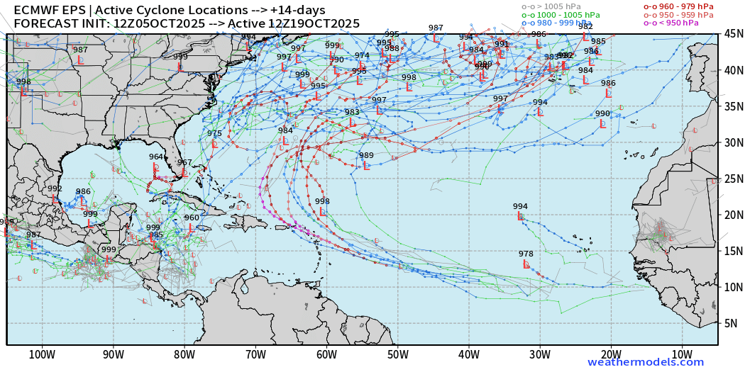
Non-tropical area of low-pressure off the East Coast could be impactful..
ECMWF EPS 12z | Active Storm Tracks Day 10
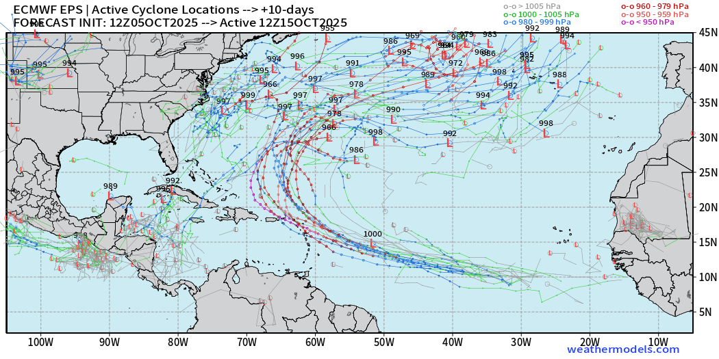
Need to keep an eye on the western Caribbean and whatever might spin out randomly of the Central American Gyre.
ECMWF EPS 12z | Active Storm Tracks Day 14
Comparison with AIFS-ENS | 18z | Day 6 All Storm Tracks
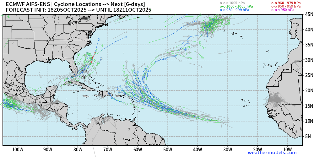
Not all of the members trigger a track with Invest 95L but more than conventional model … also see the East Coast system tracks
Eastern Pacific Tropical Weather Outlook | 8 PM ET
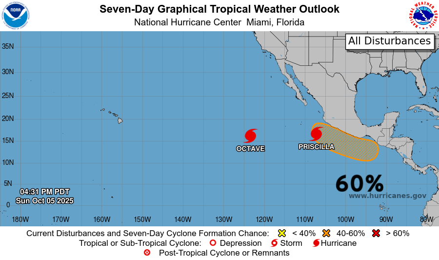
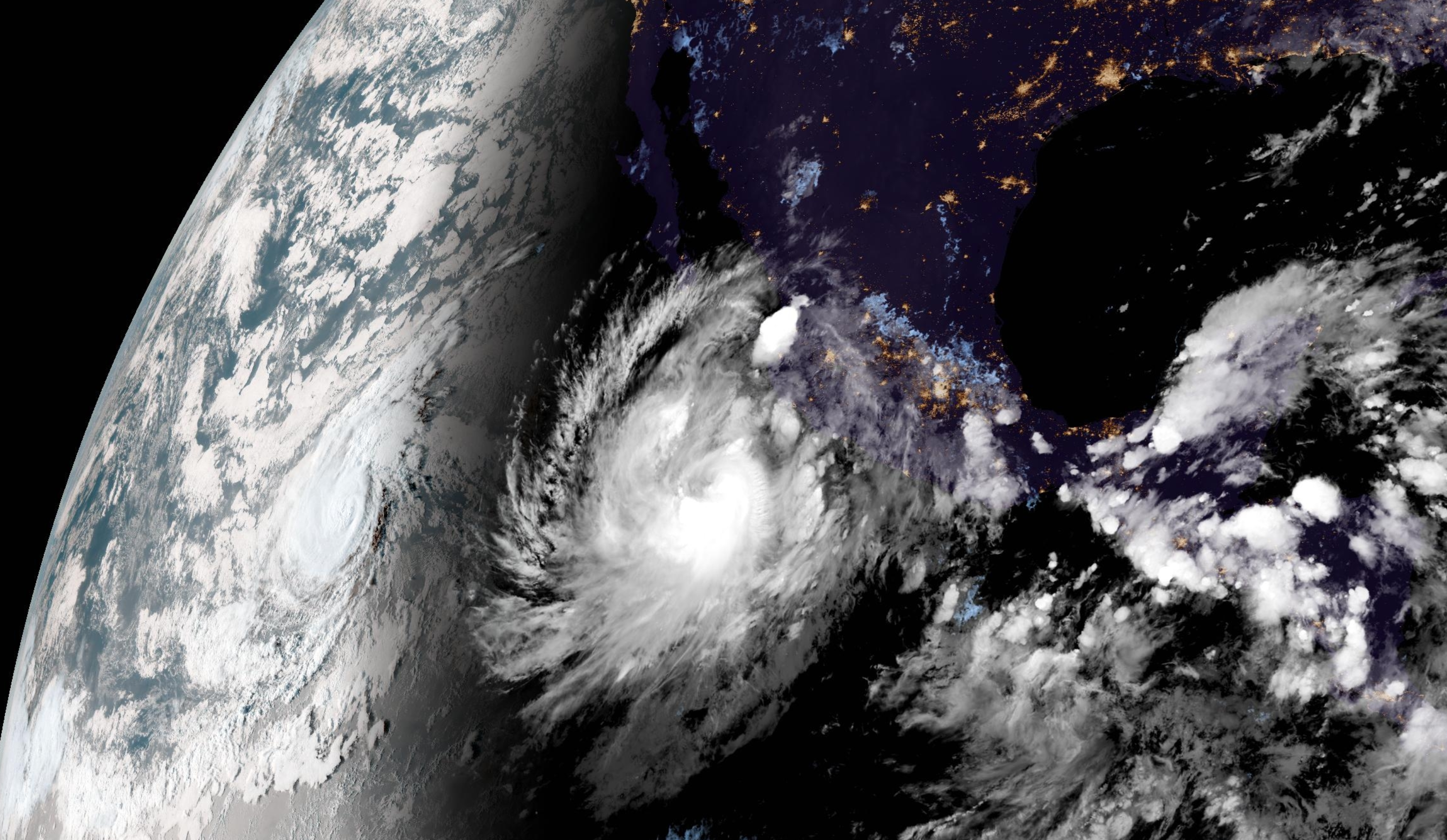
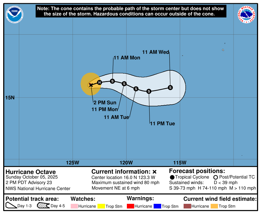
Busy — 2 hurricanes: small Octave and large Priscilla
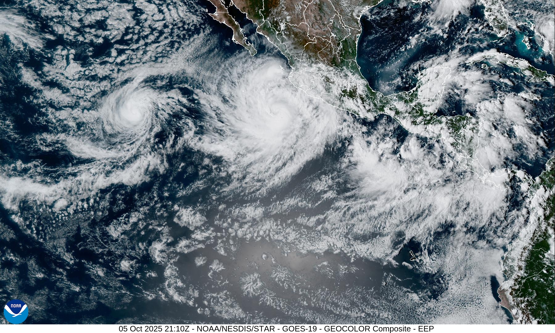
Another system — Raymond will likely follow along the coast of Mexico
Hurricane Octave | NHC Cone | 80 mph Category 1
Hurricane Priscilla | NHC Cone | 75 mph Category 1
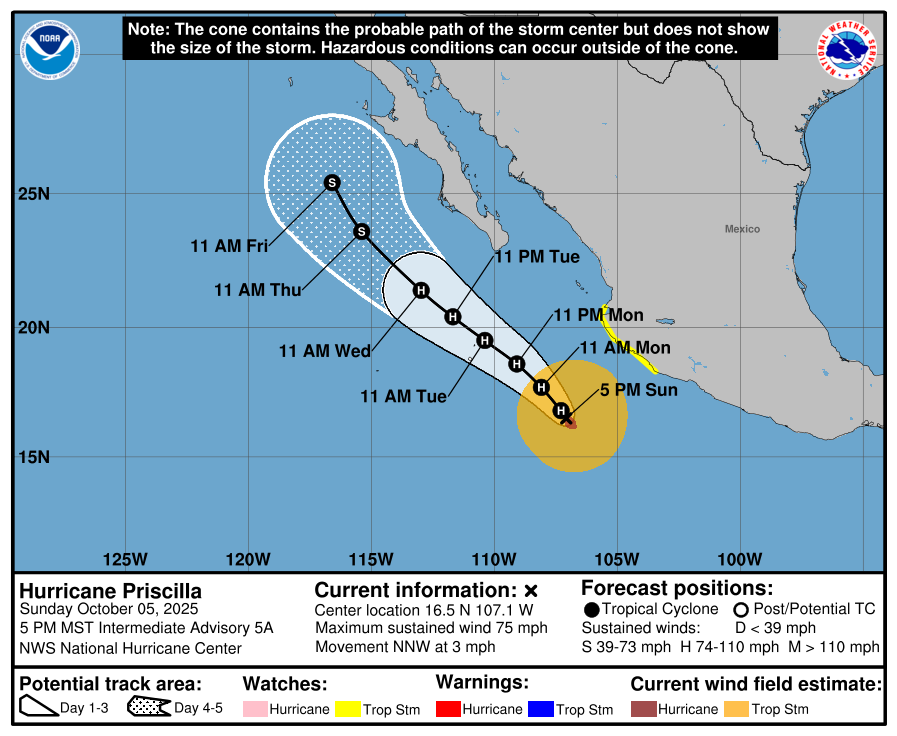
Could become a major hurricane heading slowly NW to west of Baja California in next several days. Moisture from the remnants will likely head into the U.S. Southwest in a week.
Eastern Pacific Current Satellite
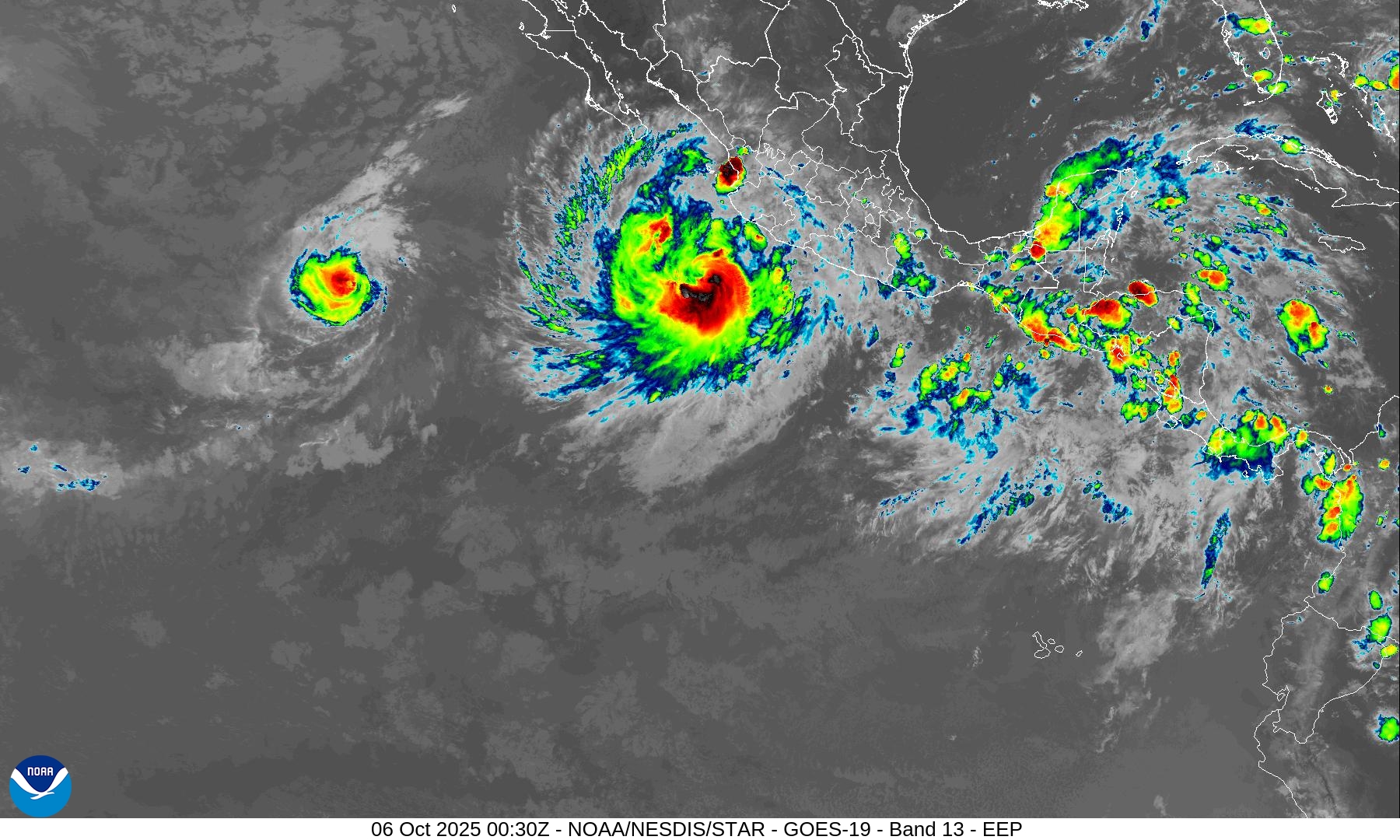
Priscilla significantly larger than Octave.
PWAT Next 6-days for Octave and Priscilla — then Raymond!
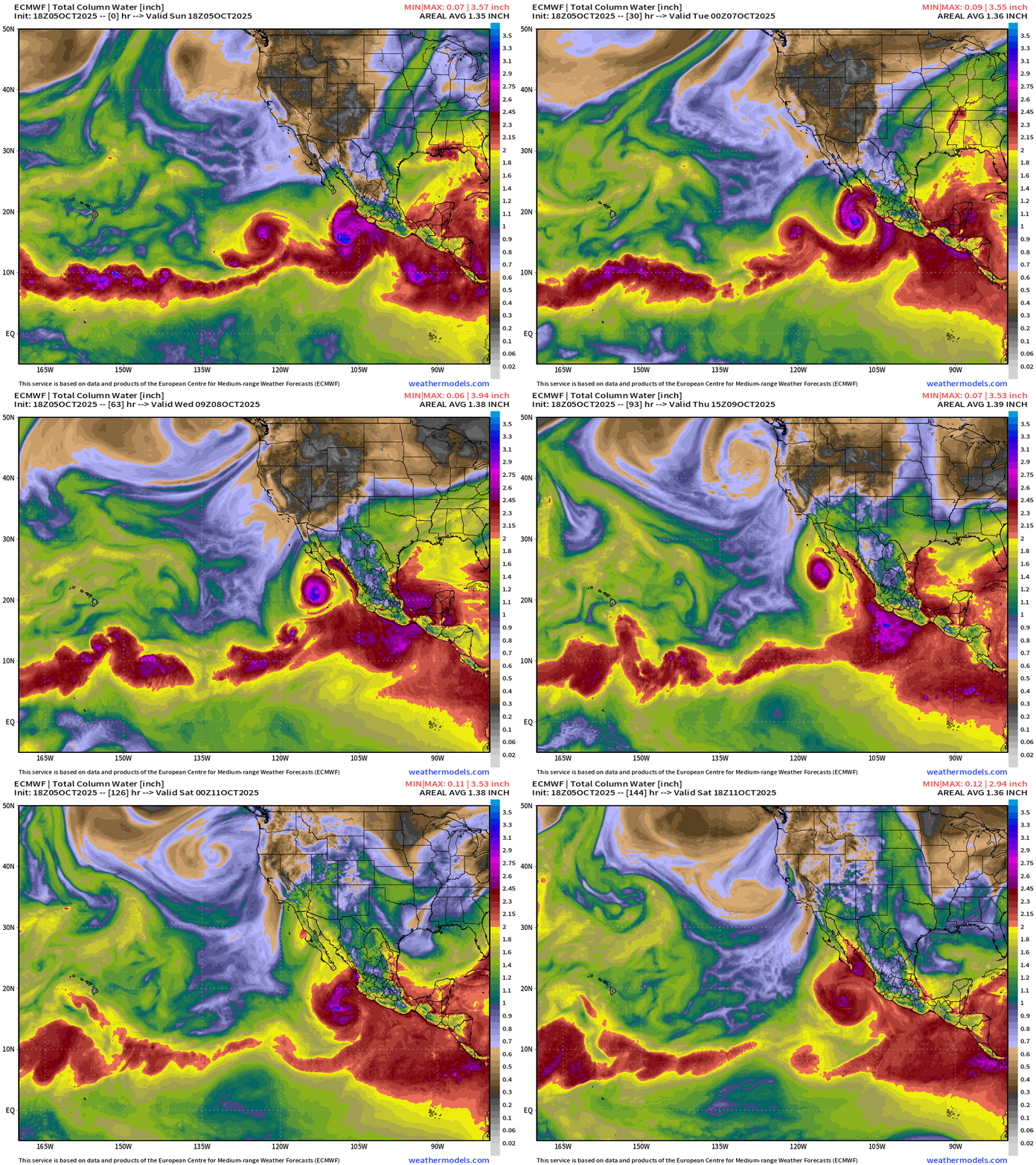
Surge of PWAT through Gulf of California into Southern California and Arizona — and Raymond on its heels
Western Pacific Typhoon Season + Northern Indian Ocean Cyclones
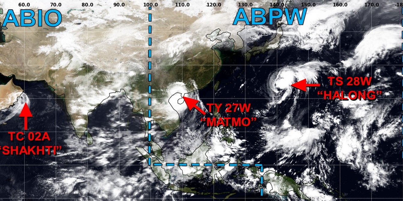
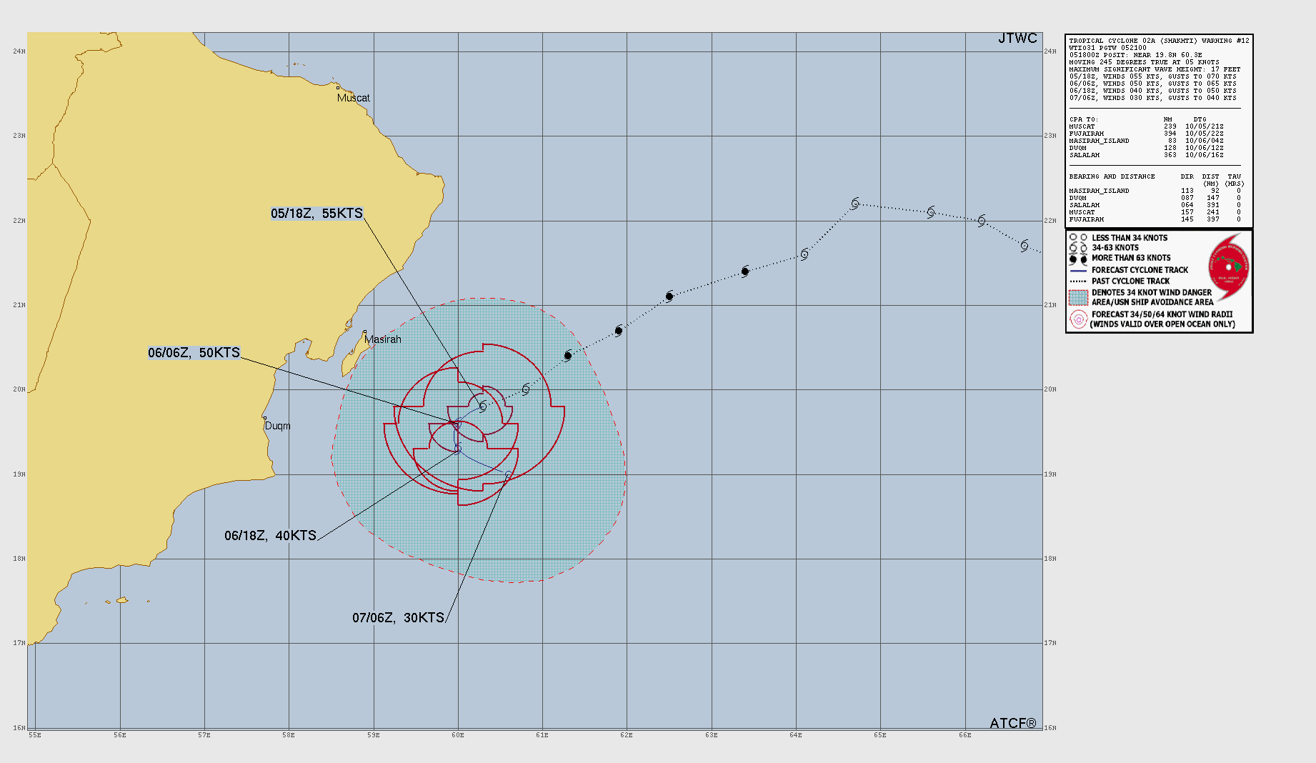
A Hurricane developed in the Arabian Sea but has since nearly sputtered out over cooler water and very stable/dry atmospheric conditions east of Oman. It will dissipate in the coming couple days.
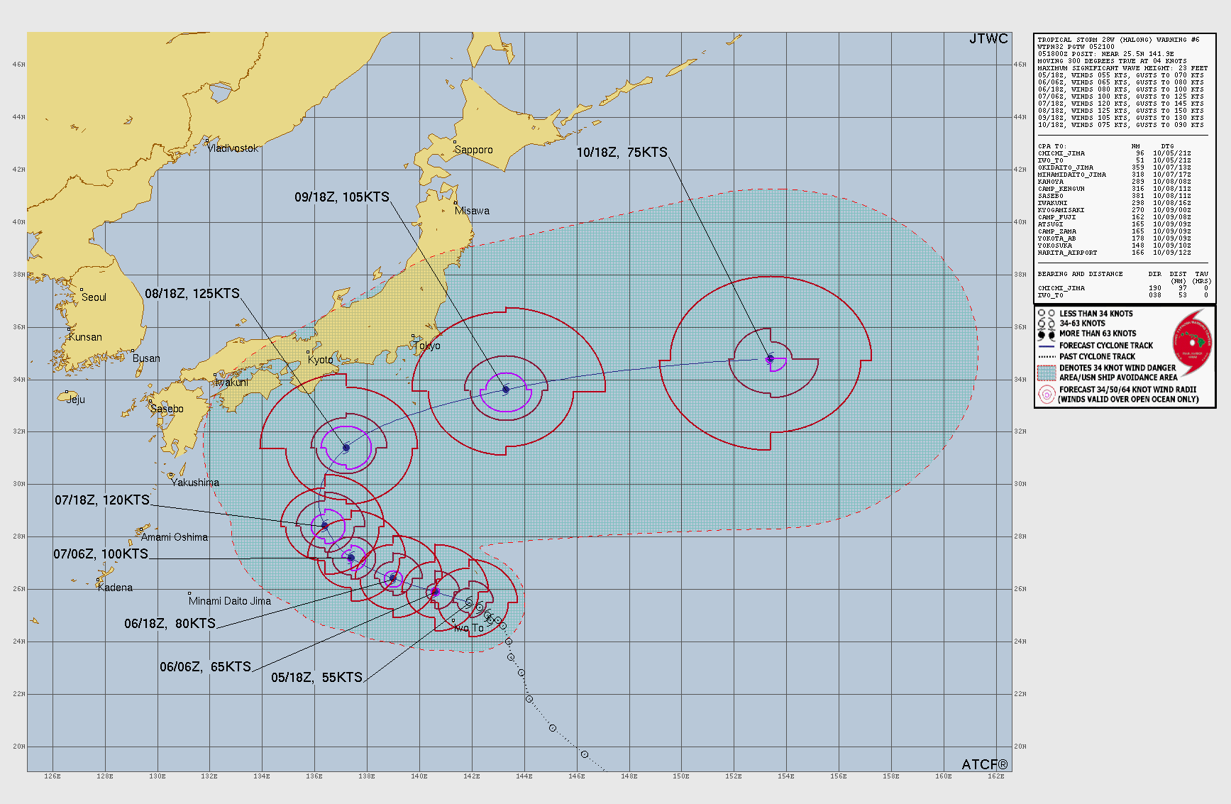
Potential Super Typhoon Halong (28W)
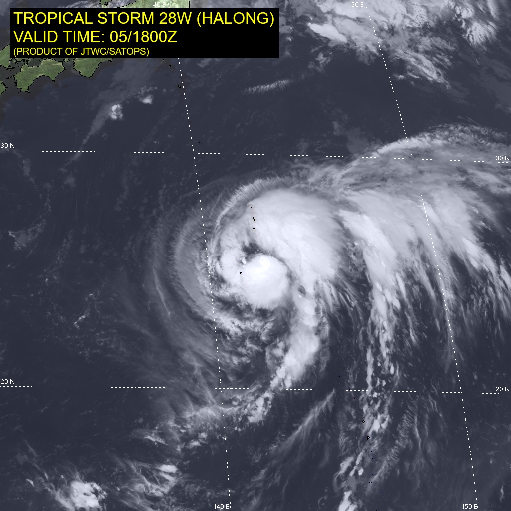
Massive typhoon — could reach 130-knots (I think) over warm waters well south of Japan. The storm will loop/curve out to sea and likely miss Japan.
ECMWF 12z | Ensemble Tracks for Halong
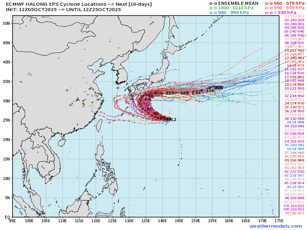
Interesting track for Halong — comes very close the Japan with the ECMWF 12z flagship model — but at this juncture — misses landfall — barely.
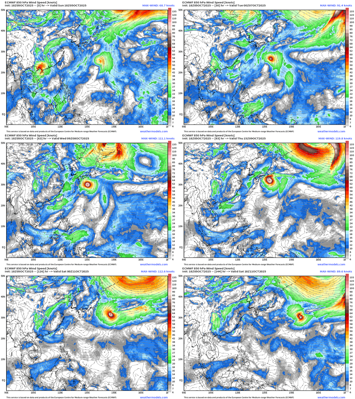
Maps sourced from weathermodels.com designed and innovated by yours truly! Please subscribe there for real-time access to the newest maps, charts from all of the weather models including ECMWF.
- Milepost
- 756 · laid 2025-10-06T01:32:25.847000Z
- Source
- https://weather.substack.com/p/october-5-2025-sunday-tropical-update
- Digest
- 119531e43b10a2e7cb00039cceb721a8cac8372b7bb4b3738dee8c6d8efbd476
- Machine
- JSON