September 30, 2025 Tuesday Weather Update
Early October warmth for much of the Lower 48
October 2025 was the 7th-warmest October in the 131-year national record (1895–2025), at 57.0°F against a 1991–2020 normal of 54.5°F (+2.4°F).
October 2025 was the 56th-wettest October in the 131-year national record (1895–2025), at 2.3in against a 1991–2020 normal of 2.5in (-0.2in).
NOAA/NCEI Climate at a Glance, contiguous United States. This is the observed record for the month, not a score of anything said in this piece — the forecast ledger begins 2026-08-17 and cannot reach earlier posts.

2025 Season to Date: 9 Named Storms, 4 Hurricanes, and 3 Majors | ACE = 80
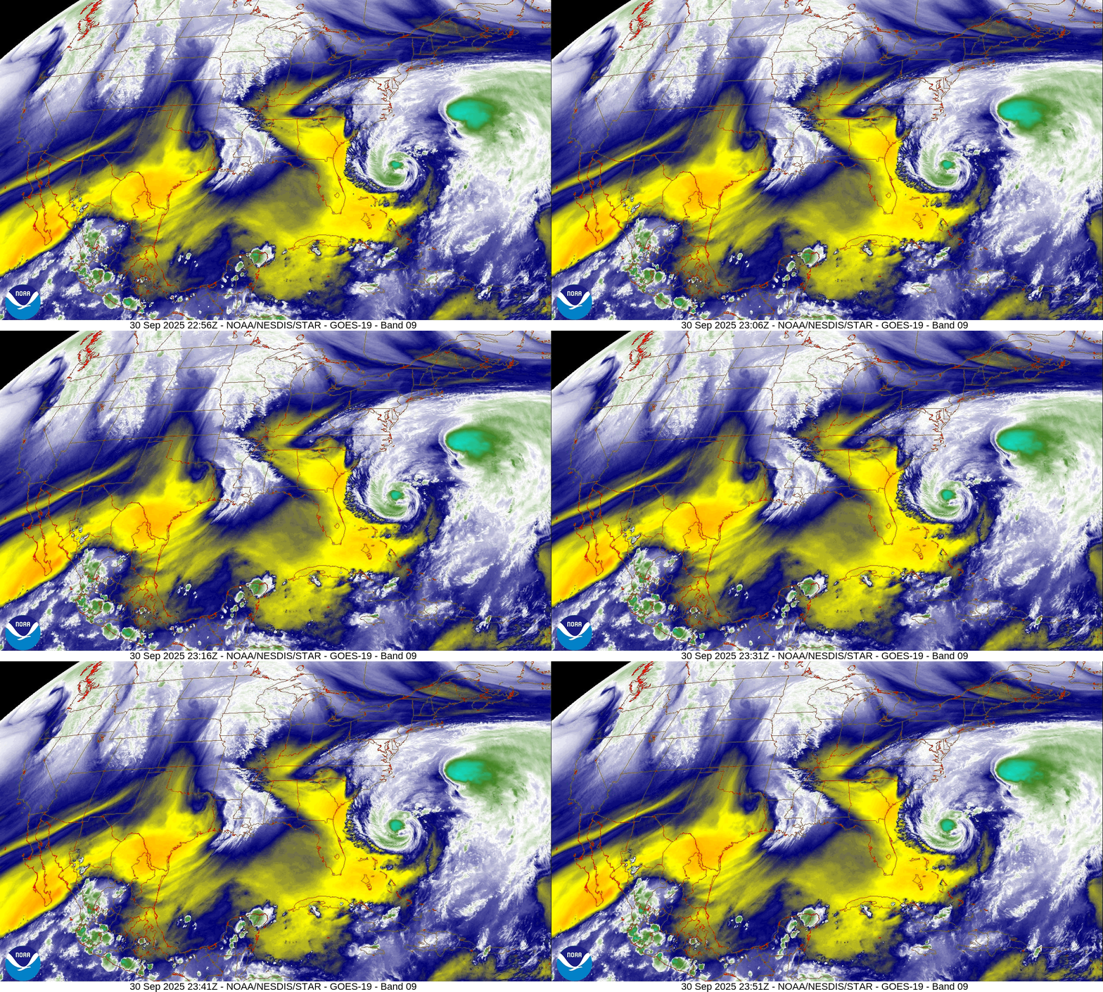
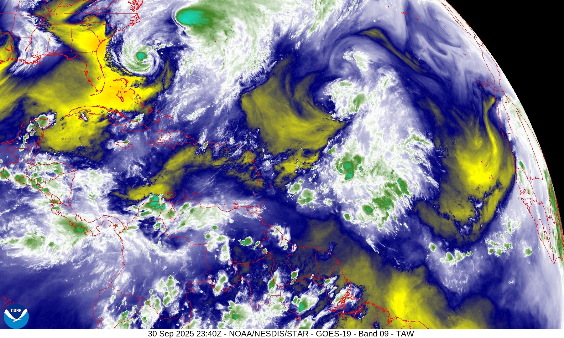
Mid-Level Water Vapor Loop
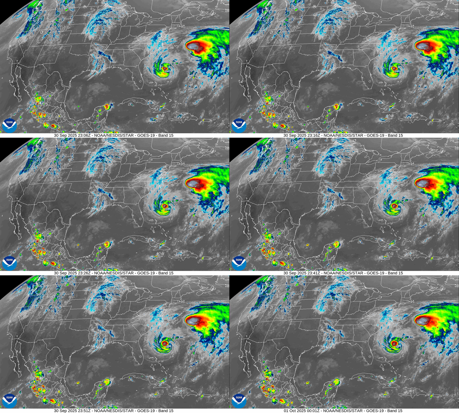
IR Loop
Medium and Range | AIFS 18z | 10-days Height Anomaly
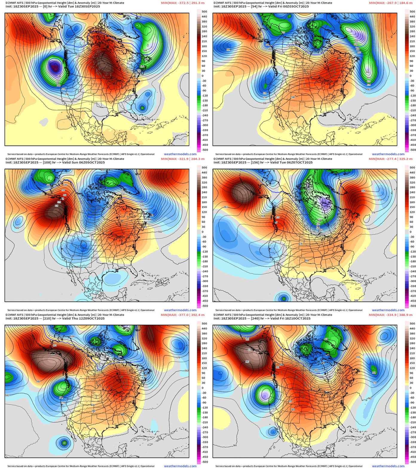
A powerful Canadian Arctic trough will connect with Humberto & Imelda and take them out to sea.
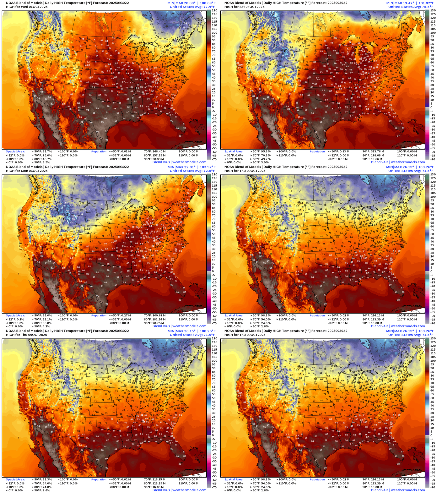
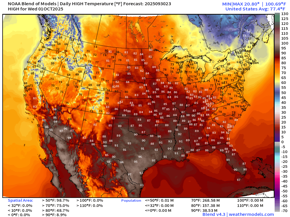
Strong ridging persists over the central U.S. into week 2 — with the Canadian Arctic “polar vortex” showing signs of dipping into the Midwest and Great Lakes, but not quite yet! Instead, we’ll have balmy early-October weather — otherwise quiet.
High Temperatures Next 9-days
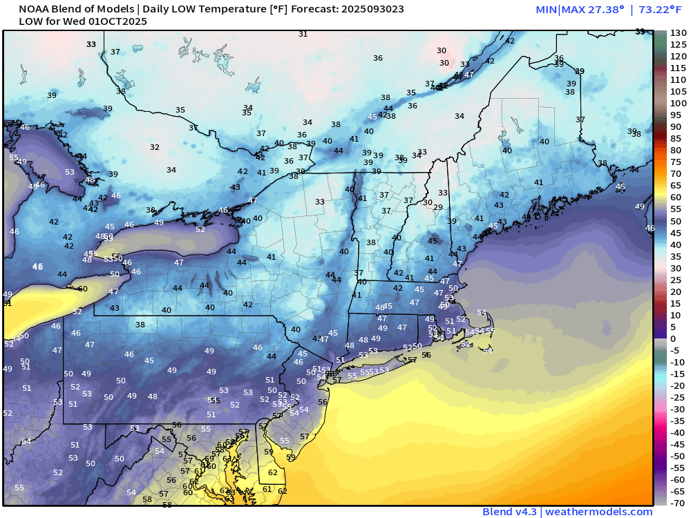
Wednesday Low Temperatures
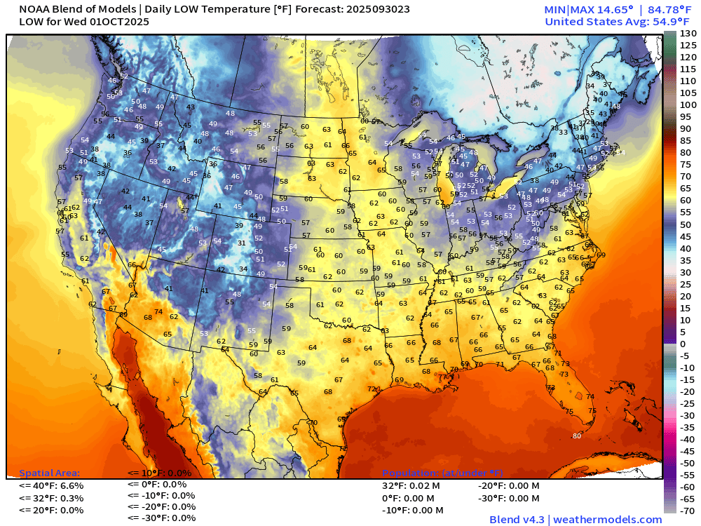
A tiny % of New England below freezing — more chilly air back over Quebec and Ontario with strong Canadian Arctic trough
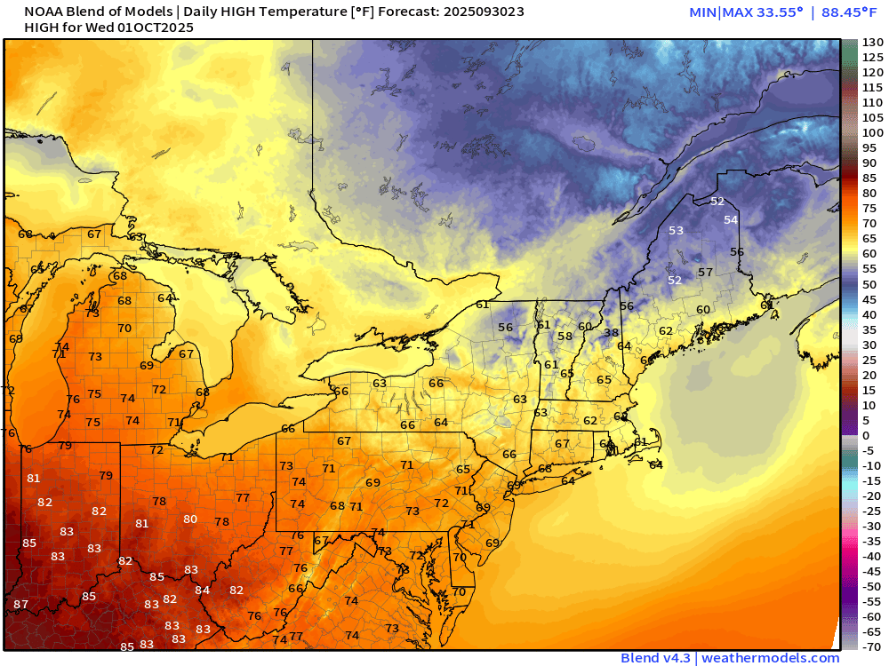
Wednesday High Temperatures
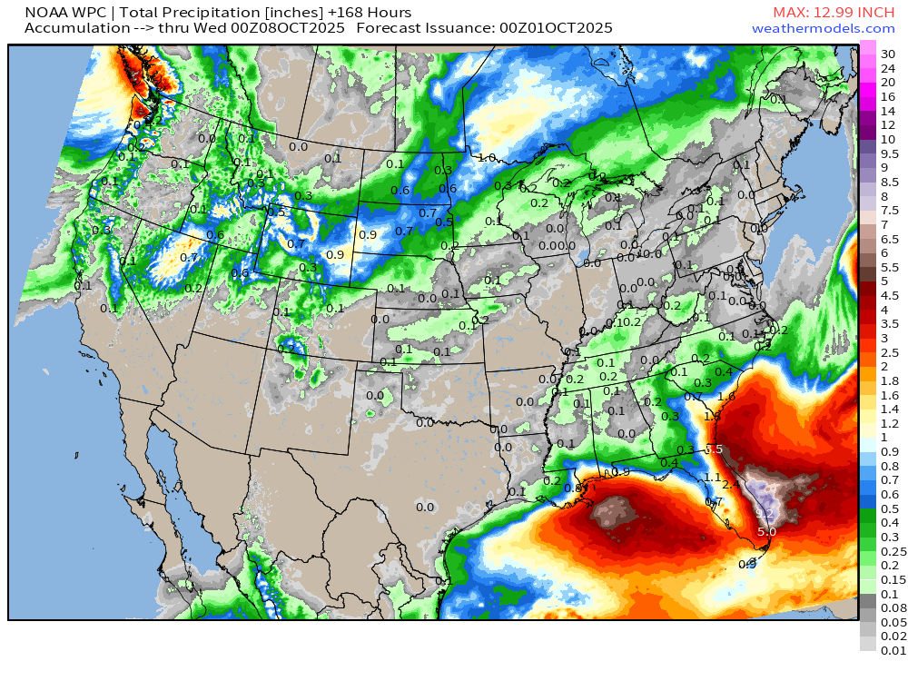
NOAA WPC 7-Day Precipitation
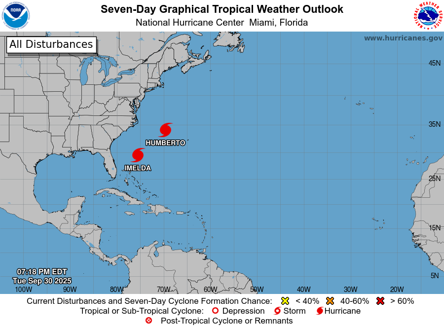
Atlantic Basin Outlook | 8 PM ET Update
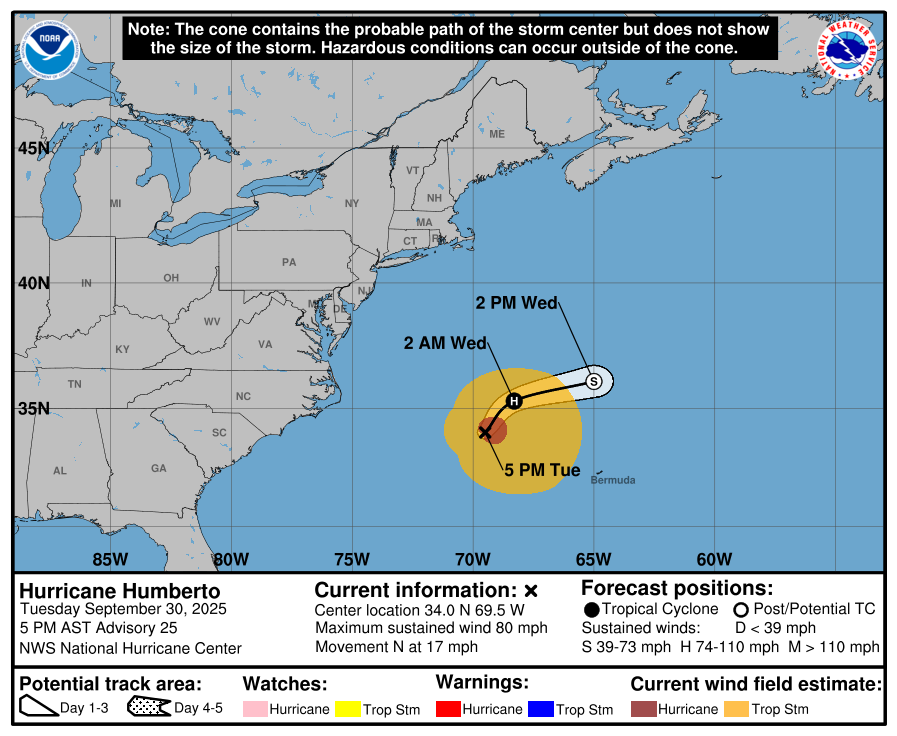
NHC Track for Hurricane Humberto
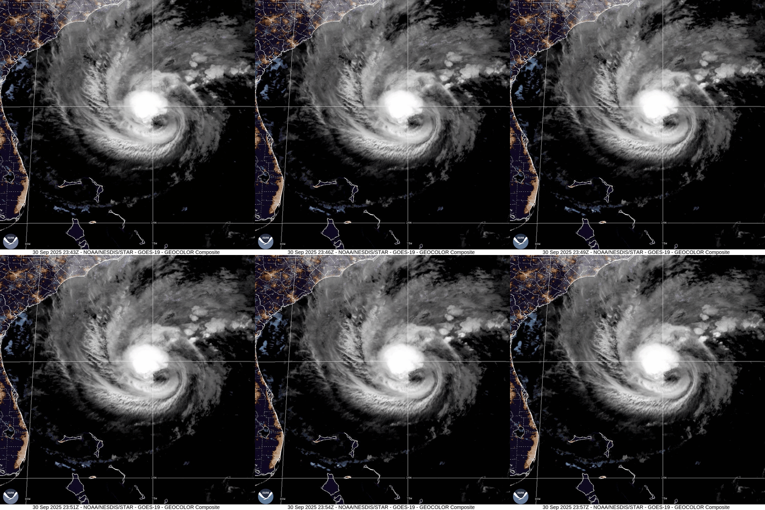
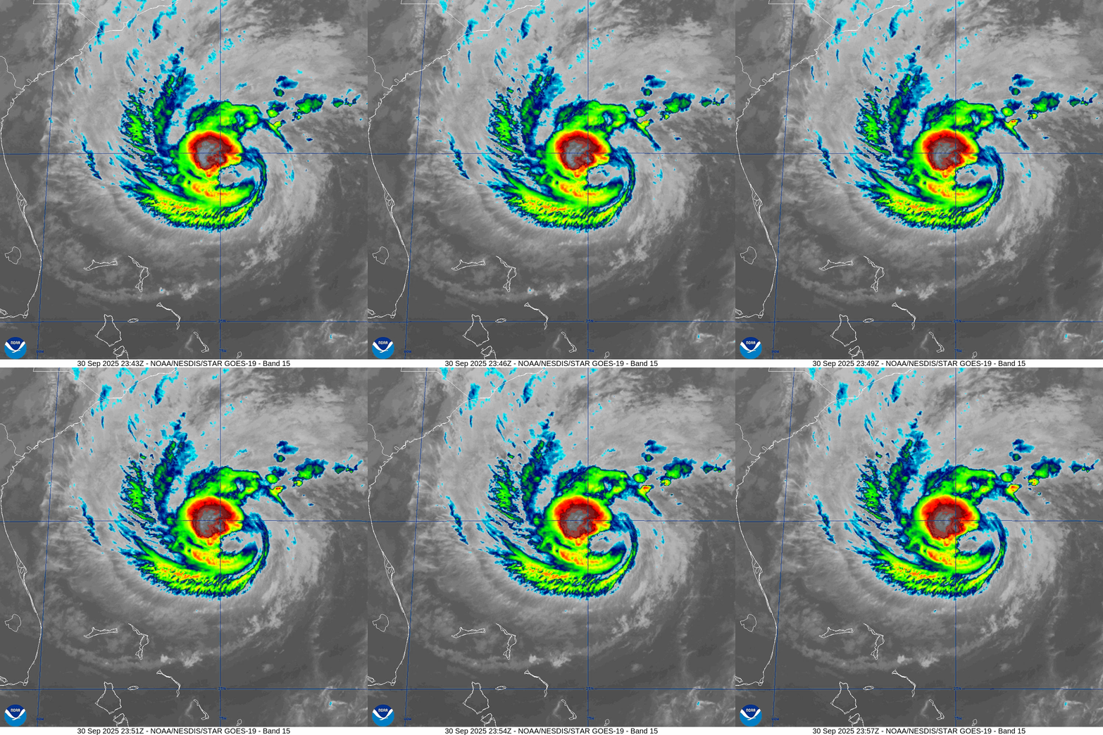
Hurricane Humberto IR and GeoColor Satellite
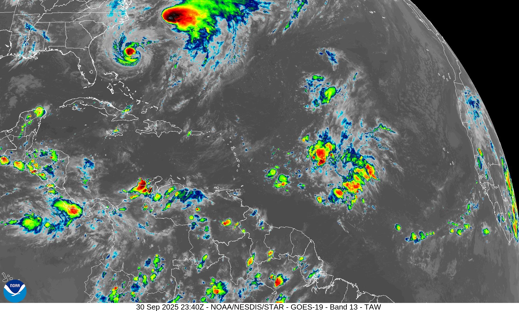
Humberto is firing very deep convection within a sheared environment — and looks more impressive than Imelda this evening
Hurricane Imelda | NHC Forecast Cone
978 mb — 75 knot maximum sustained winds
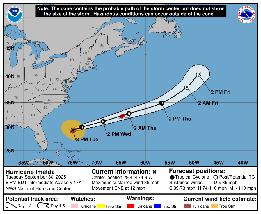
Imelda displaying a large, ragged eye like feature ESE of the main burst of convection
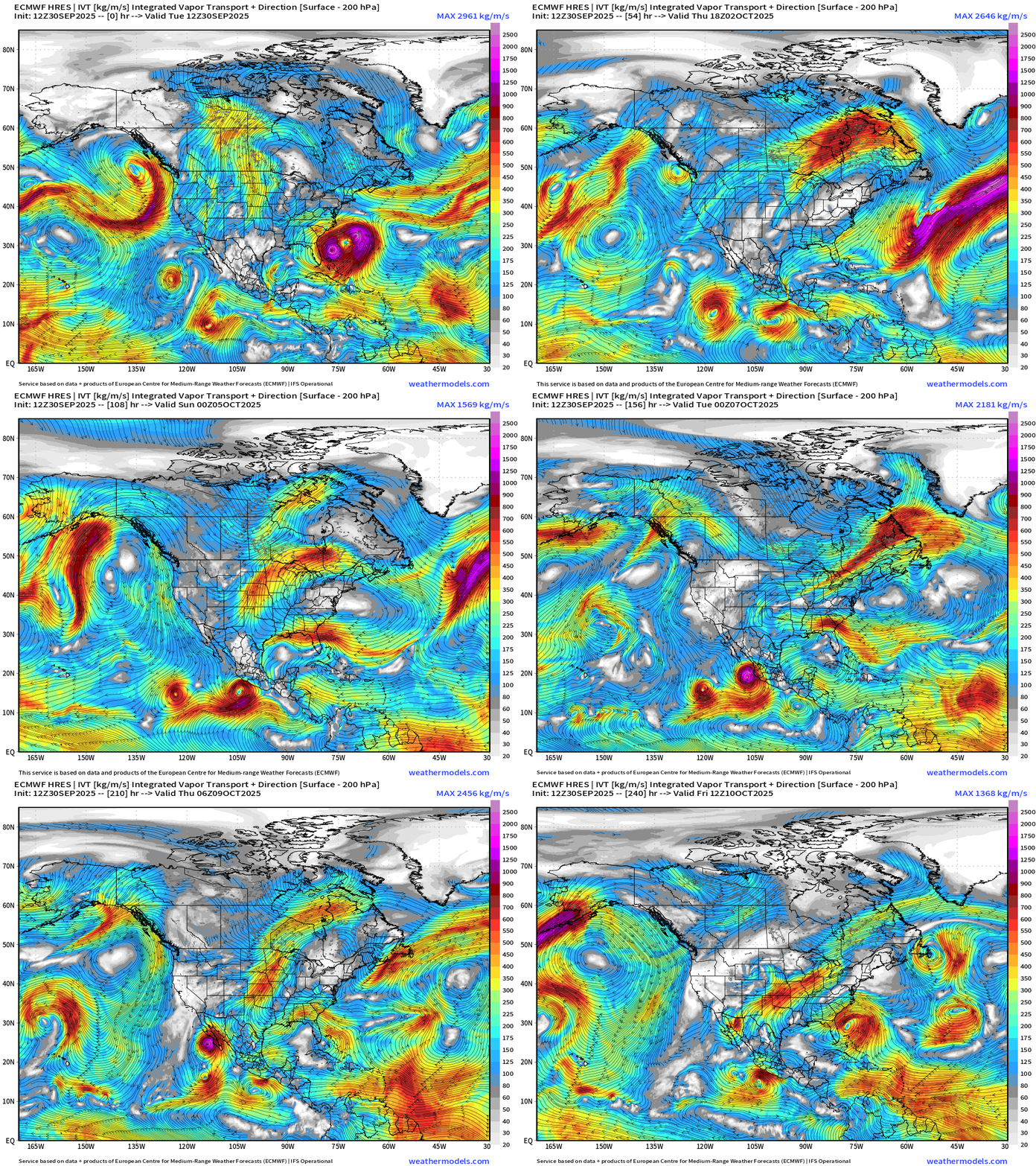
ECMWF Next 10-Days Integrated Vapor Transport | 12z cycle
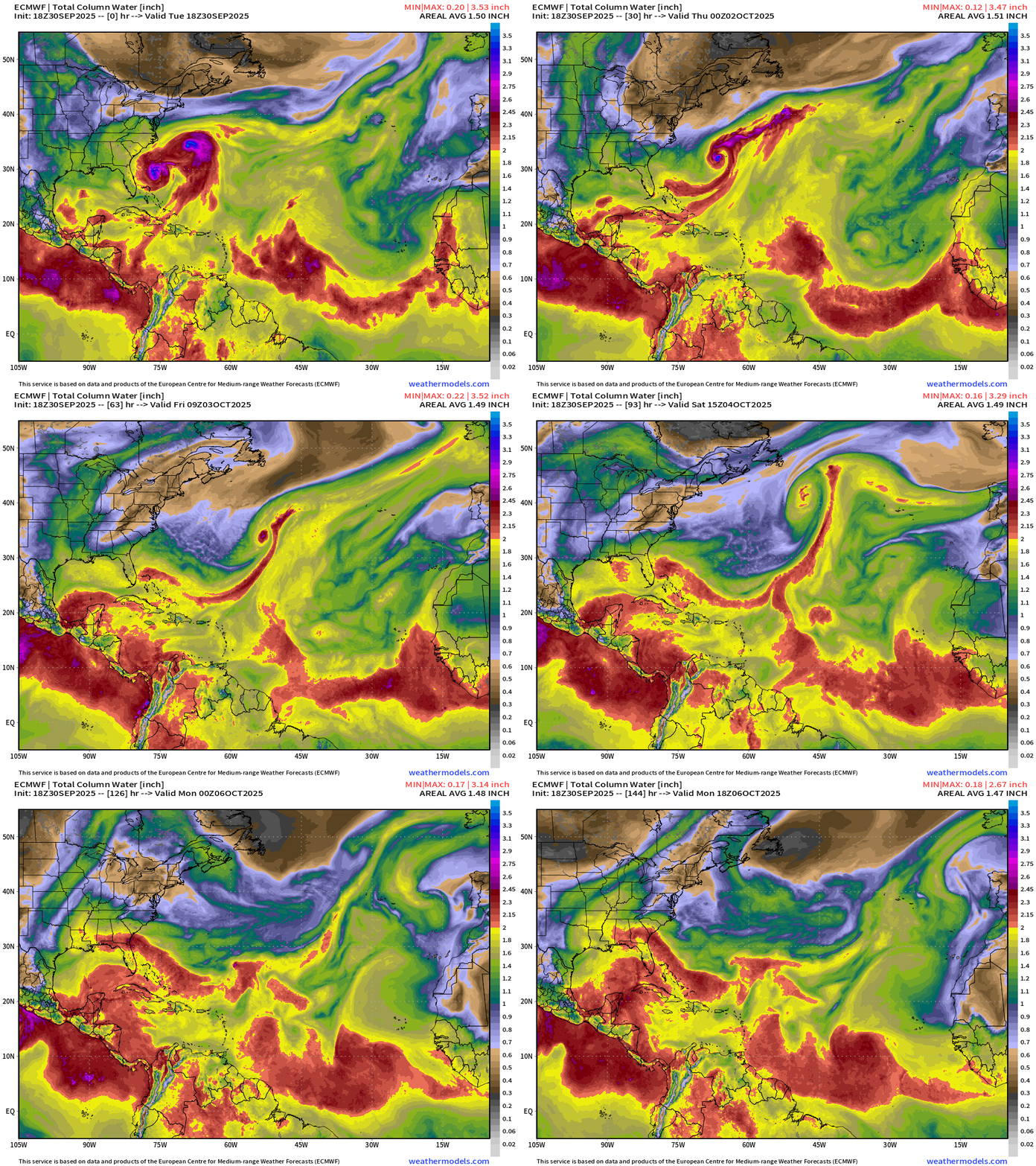
ECMWF 18z Precipitable Water | Next 6-days | Humberto and Imelda
ECMWF 18z Relative Vorticity | Next 6-days | Humberto and Imelda.
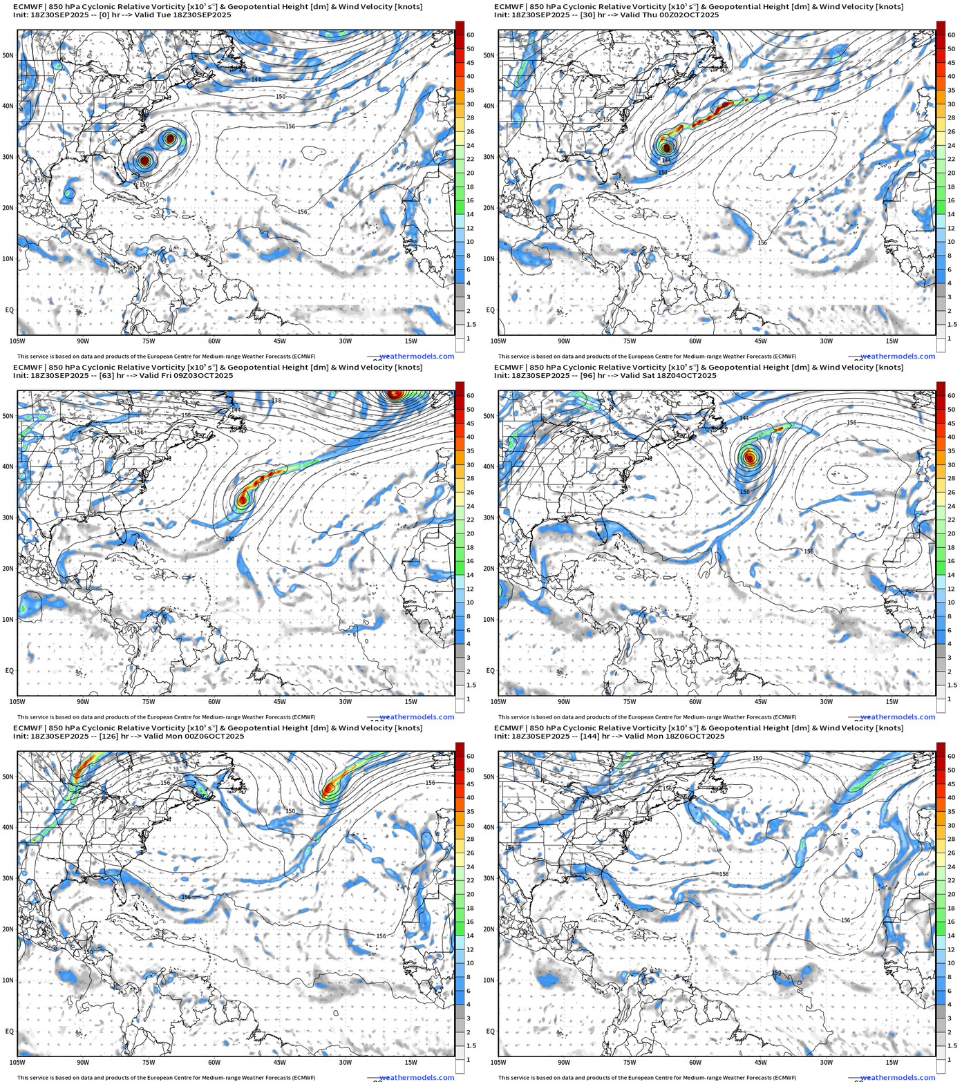
Post-Tropical Humberto —> Powerful Hurricane Force “bomb cyclone”
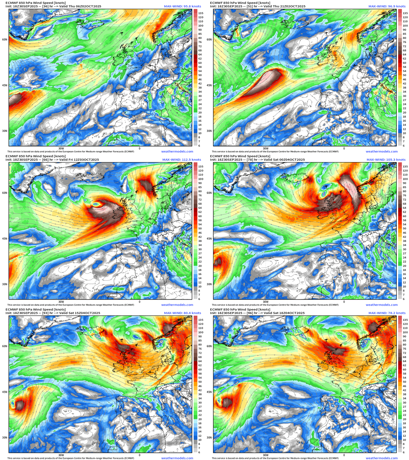
Textbook 942 mb — “warm seclusion” extratropical cyclone —> 80-100 knot winds + gusts over the ocean —> and perhaps hurricane force over British Isles into Friday and Saturday.
SST Analysis and Anomaly
Atlantic Satellite Images
NOAA Tropical Surface Analysis | 18z
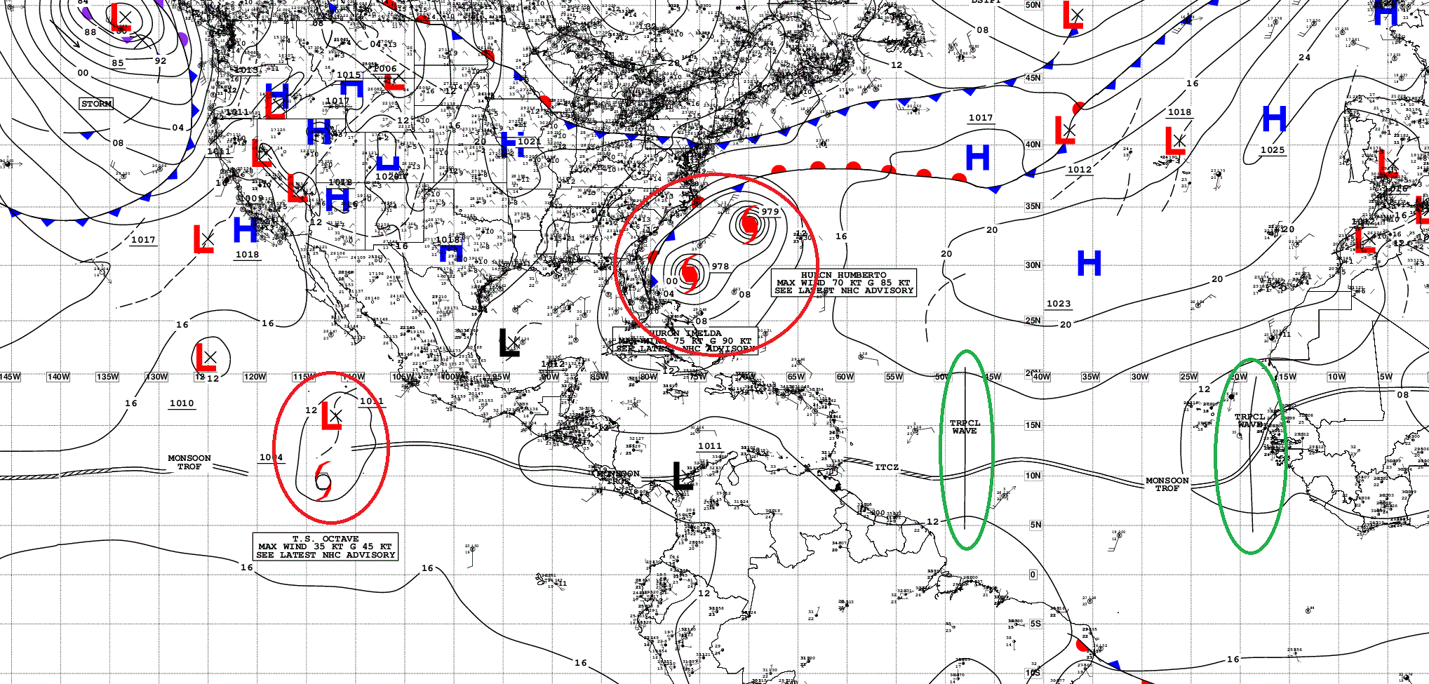
Atlantic Tropical Waves = 2 but neither flagged as development potential by NHC
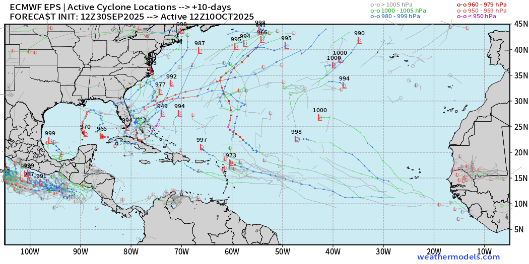
ECMWF EPS 12z | Active Storm Tracks Day 10
ECMWF EPS 12z | Active Storm Tracks Day 15
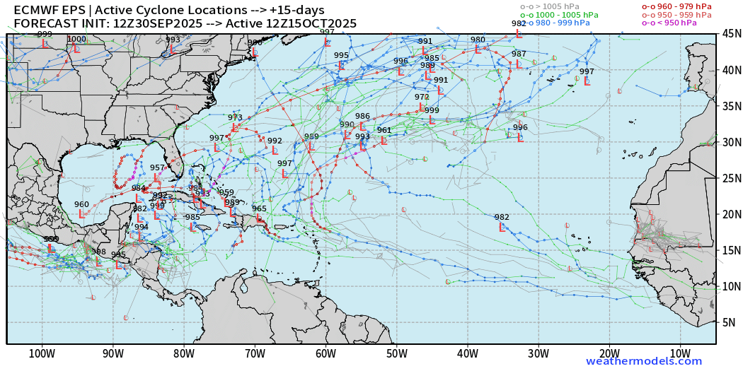
Still a LOT of random activity across the western half of the Atlantic basin through mid-October — including some Caribbean tracks likely emanating out of the Central American gyre — typical for early to mid October.
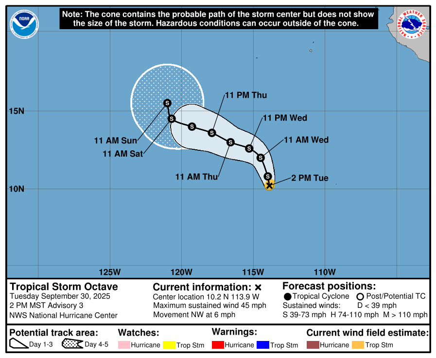
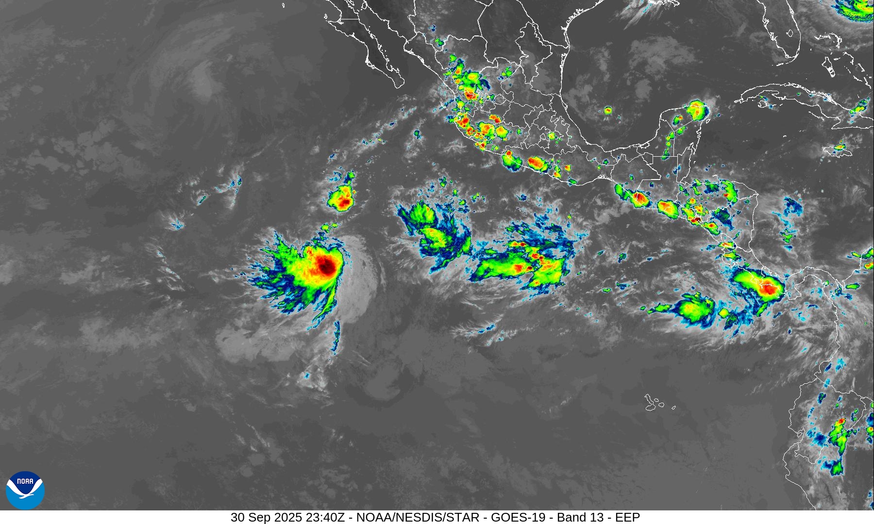
Eastern Pacific | Tropical Storm Octave (15E) + Disturbance (80%)
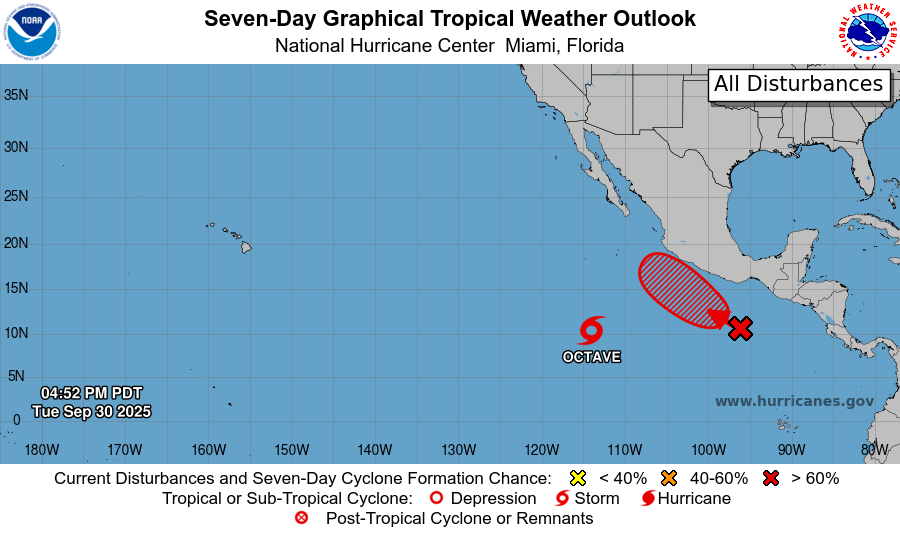
Octave might be around for a week meandering over warm-enough water to keep convection alive.
Burst of convection with Octave — the next disturbance likely a TD/TS by this weekend off coast of Mexico
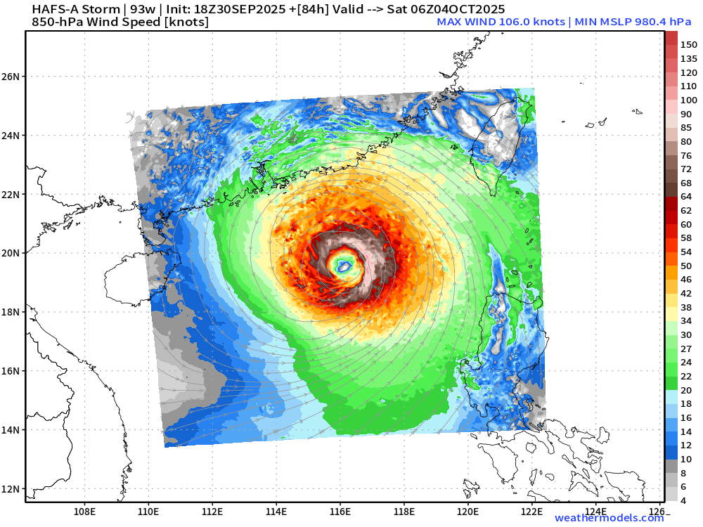
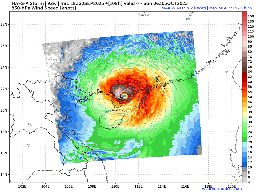
Western Pacific | Invest 93W —> Philippines into South China Sea
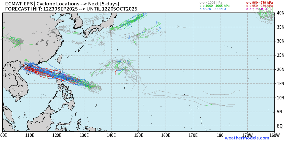
Another Typhoon landfall in China this weekend
Maps sourced from weathermodels.com designed and innovated by yours truly! Please subscribe there for real-time access to the newest maps, charts from all of the weather models including ECMWF.
- Milepost
- 752 · laid 2025-10-01T00:27:34.053000Z
- Source
- https://weather.substack.com/p/september-30-2025-tuesday-weather
- Digest
- a2bce3e97db43e9e6e6a5c767d2aceea51495ec9800e5c01d7f800cf27ebb56d
- Machine
- JSON