September 29, 2025 Monday Weather Update
Humberto and Imelda will encounter a powerful early fall upper-level trough
September 2025 was the 7th-warmest September in the 131-year national record (1895–2025), at 67.9°F against a 1991–2020 normal of 66.0°F (+2.0°F).
September 2025 was the 15th-driest September in the 131-year national record (1895–2025), at 1.9in against a 1991–2020 normal of 2.6in (-0.6in).
NOAA/NCEI Climate at a Glance, contiguous United States. This is the observed record for the month, not a score of anything said in this piece — the forecast ledger begins 2026-08-17 and cannot reach earlier posts.

2025 Season to Date: 9 Named Storms, 3 Hurricanes, and 3 Majors | ACE = 80
Mid-Level Water Vapor Loop
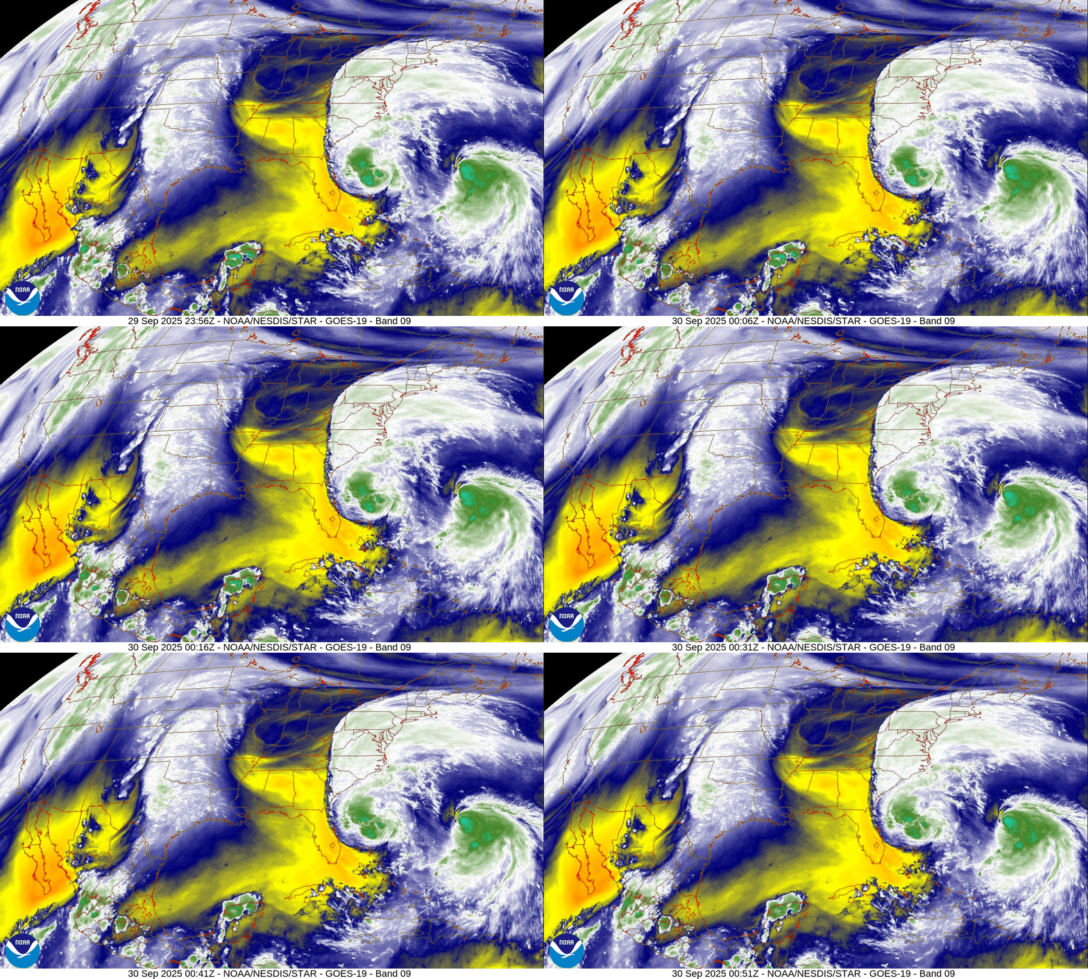
Impressive upper-level outflow from Imelda as a trough digs through the Southeast — dry as a bone underneath the yellow + orange colors.
Medium and Range | AIFS 18z | 10-days Height Anomaly
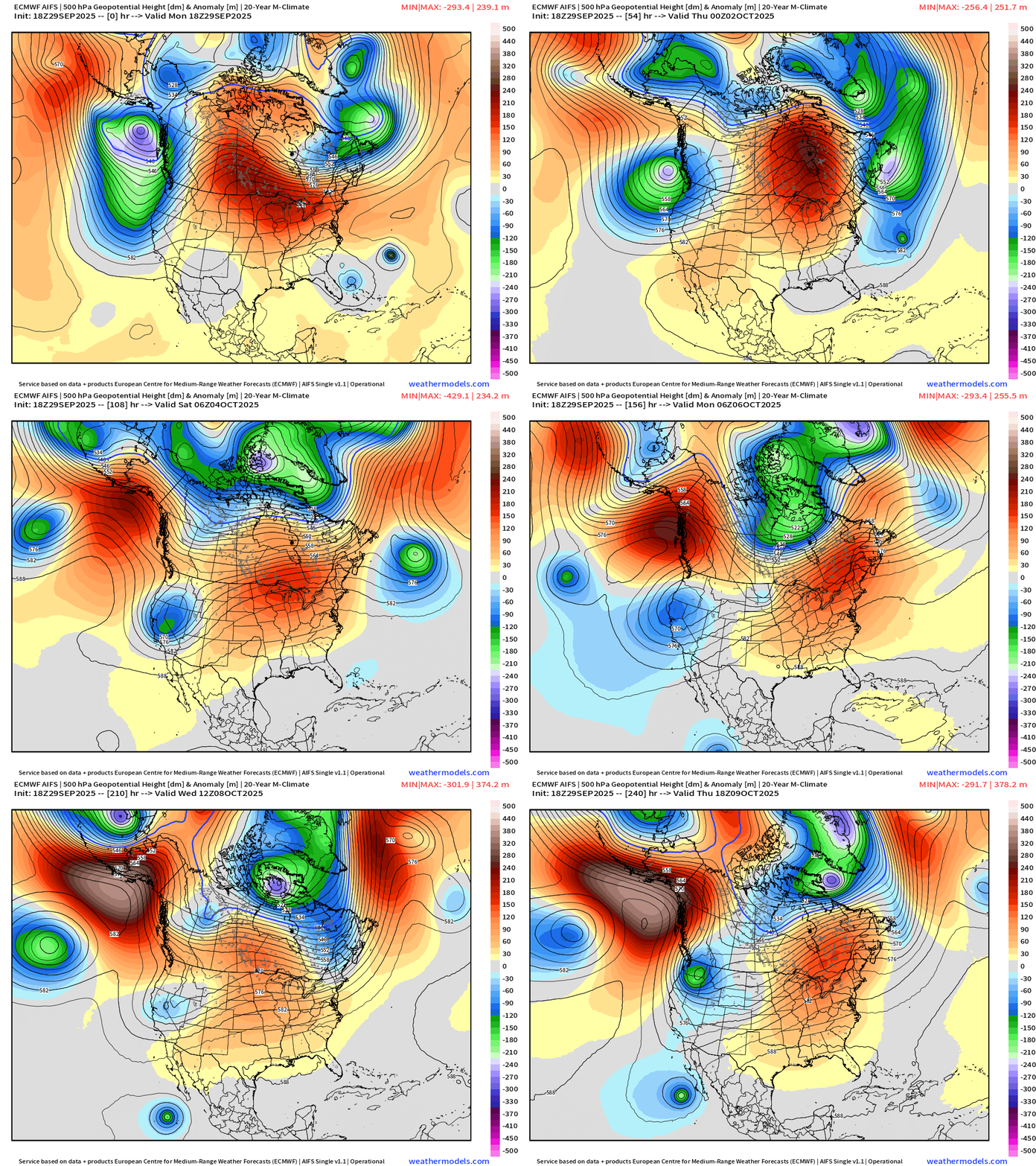
We can thank this powerful Canadian trough for obliterating Humberto — and just enough of a connection with Imelda to keep it from affecting the U.S. East Coast. A ridge then sweeps eastward across the U.S. = warm conditions into mid-October.
We really lucked out on this “twin hurricane” system — saved by a strong dip in the Canadian Arctic jet stream.
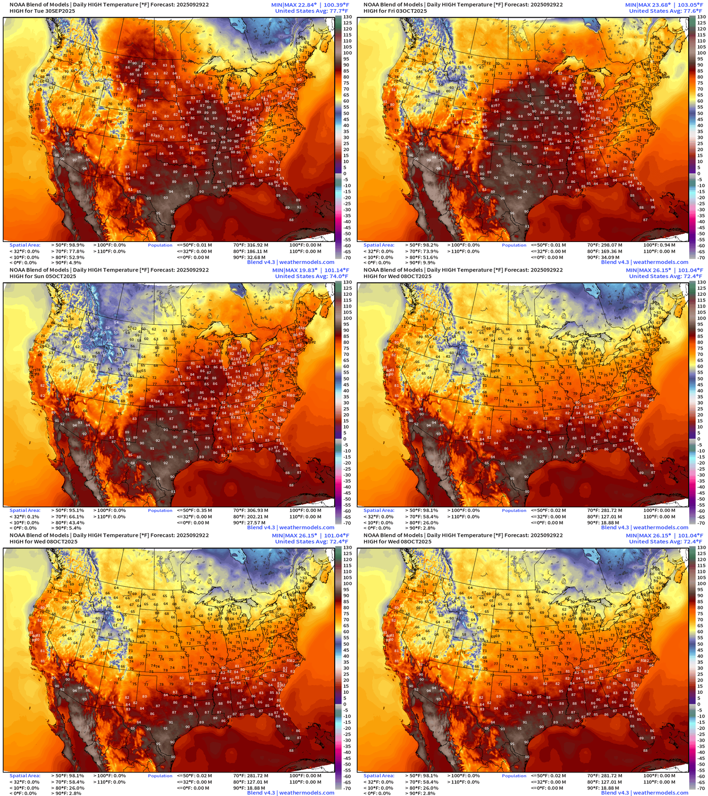
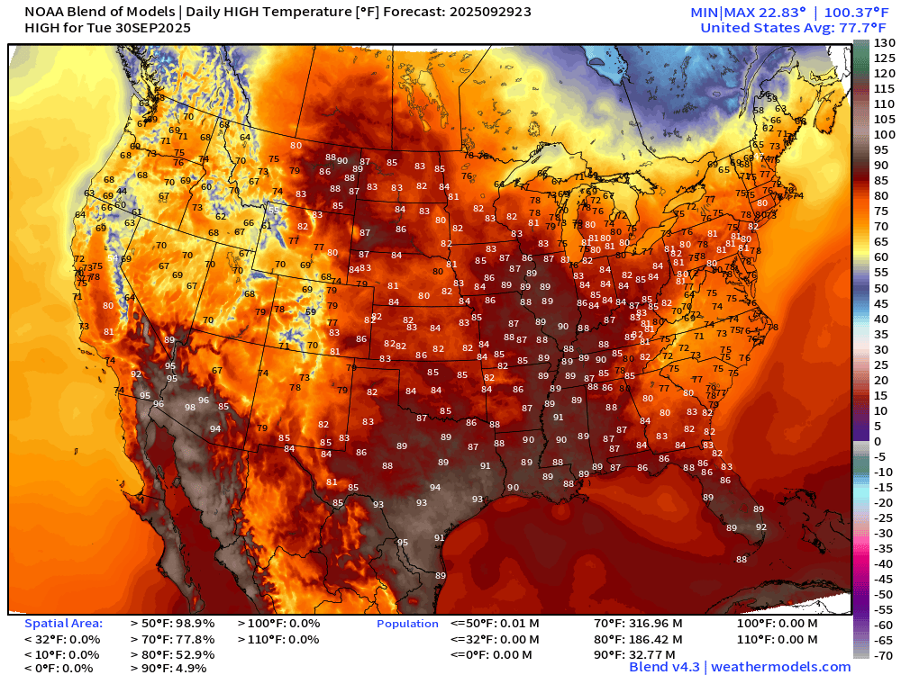
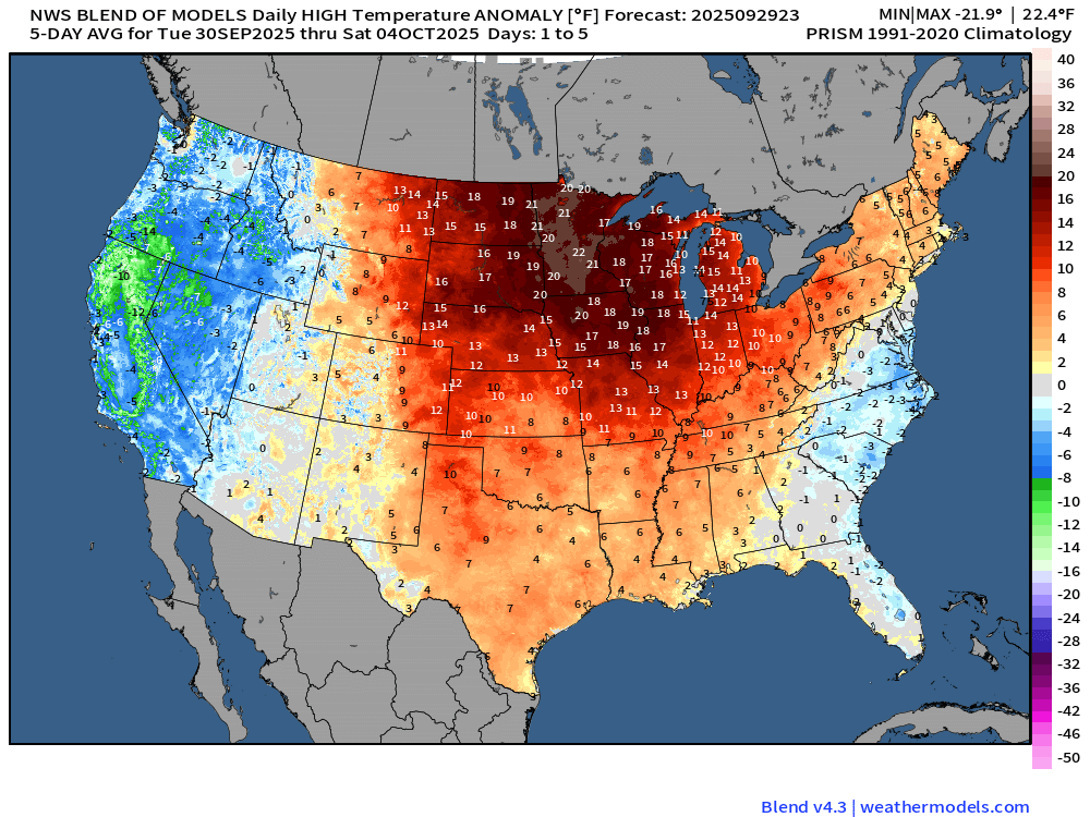
Not much going on weather-wise this week across the Lower 48 except late summer like warmth into October!
High Temperatures Next 9-days
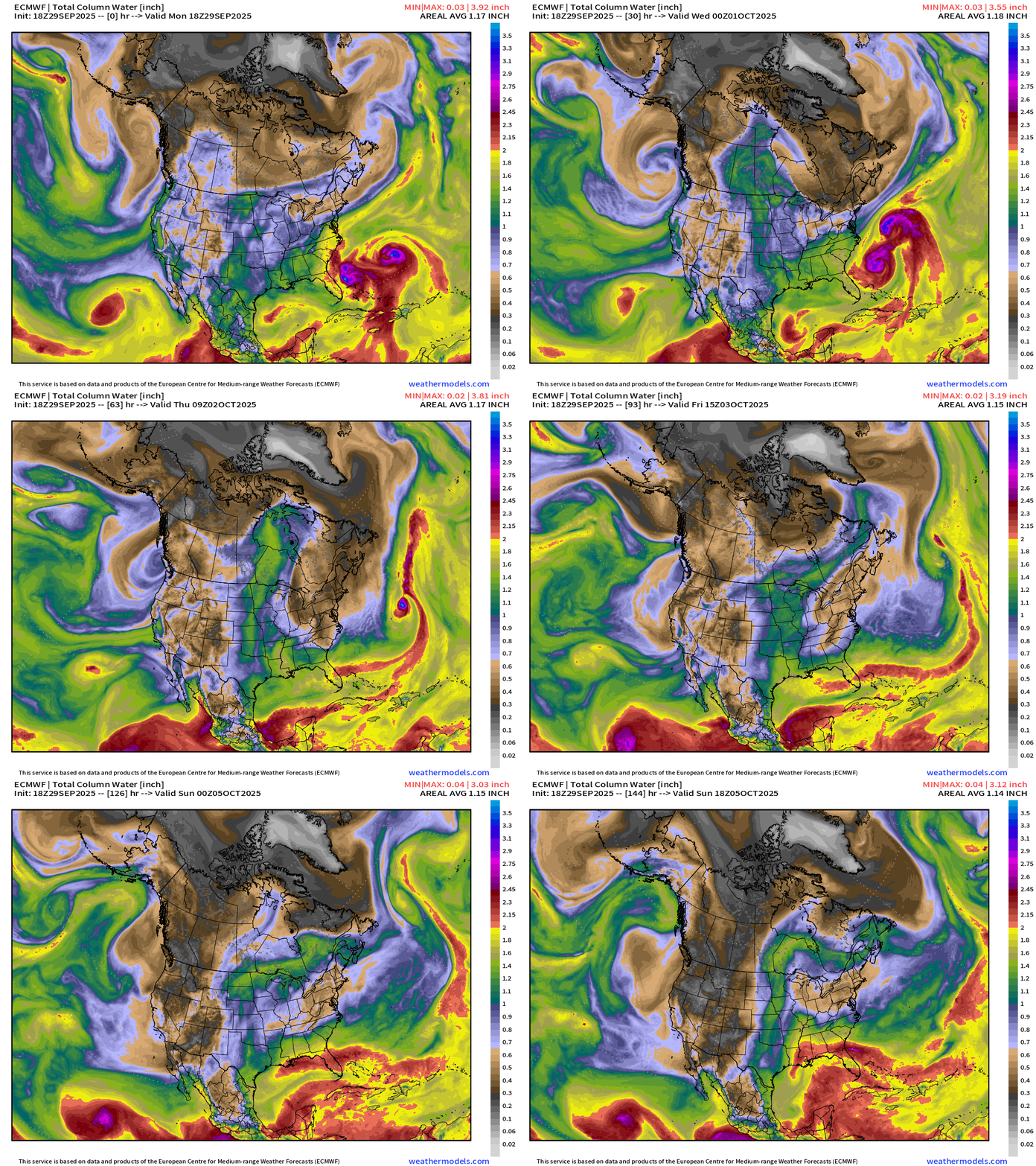
Precipitable Water Next 6-days
Precipitation Type Next 6-days
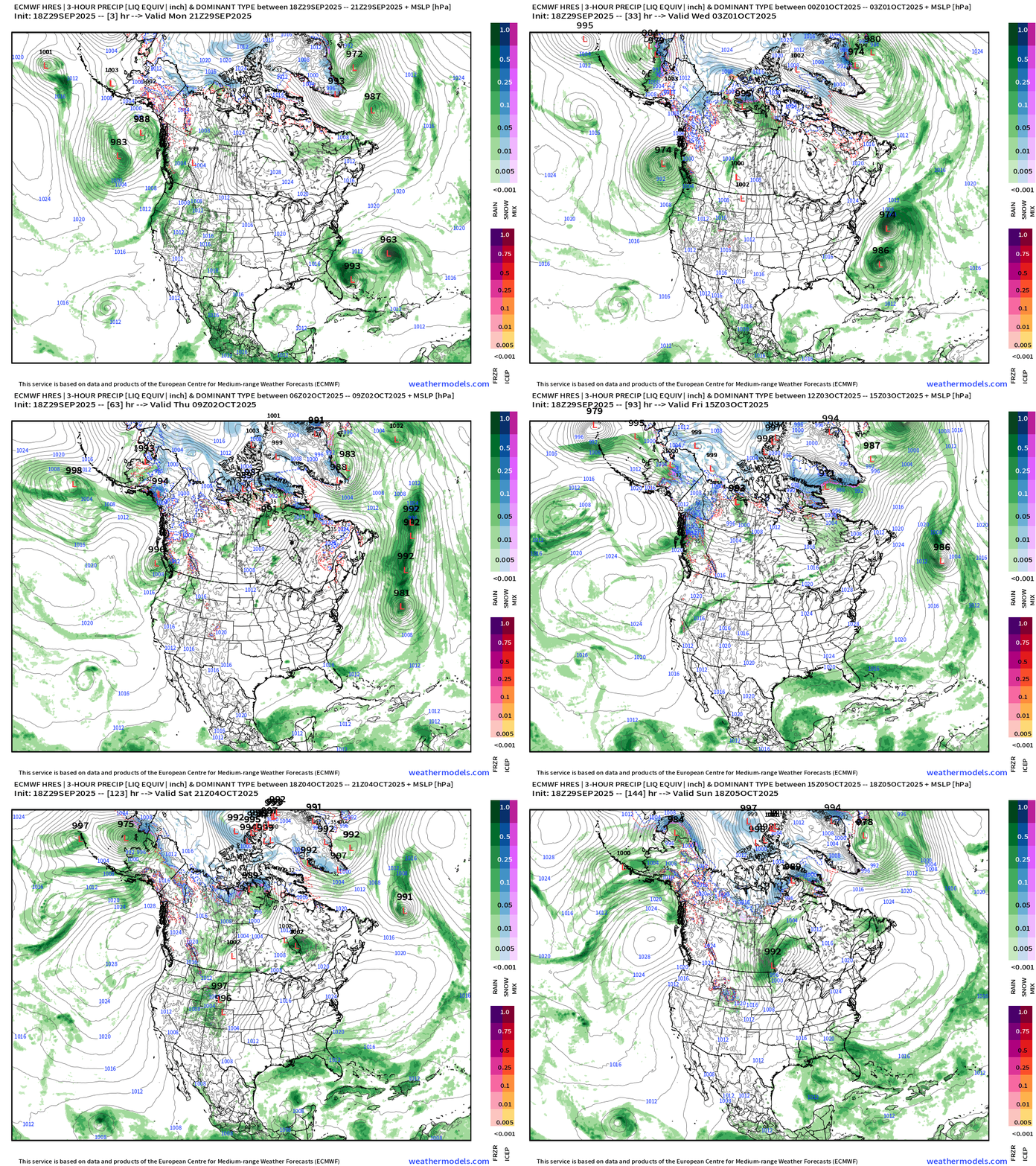
Snowfall Next 10-days
Plenty of snowfall already in the Arctic including Alaska — and some in the Rockies across Wyoming and Colorado.
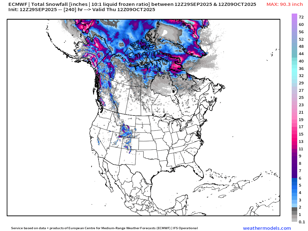
Global 10-day Snowfall
Siberia snowfall quite healthy with widespread winter weather already.
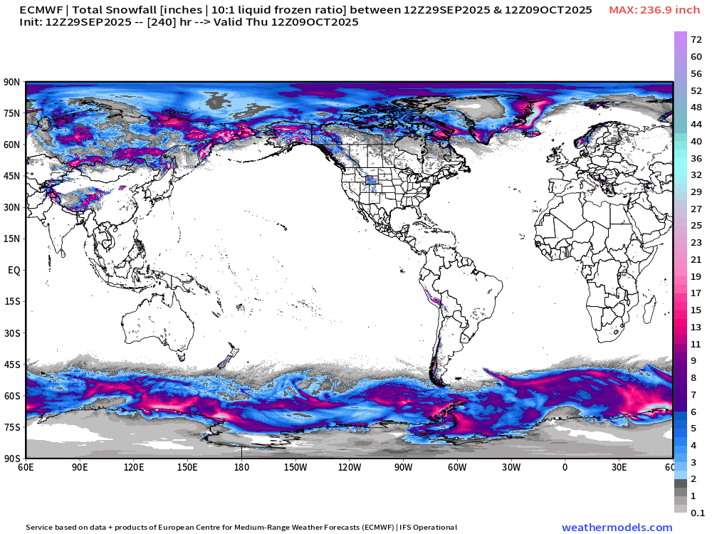
Tuesday Low Temperatures
Tuesday High Temperatures
Warmth | High Temperature Anomaly Next 5-days
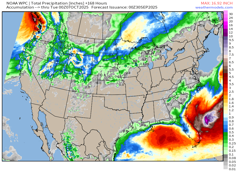
NOAA WPC 7-Day Precipitation
Atlantic Basin Outlook | 8 PM ET Update
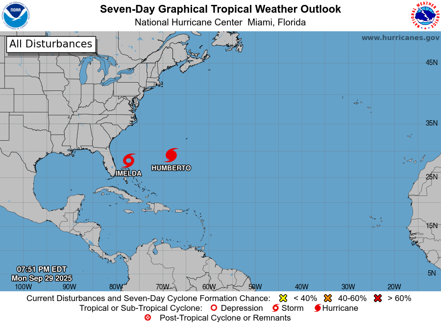
Thankfully Imelda will not be a threat to the U.S. East Coast but could bring hurricane conditions to Bermuda.
Evening Water Vapor Satellite Loop | mid-level
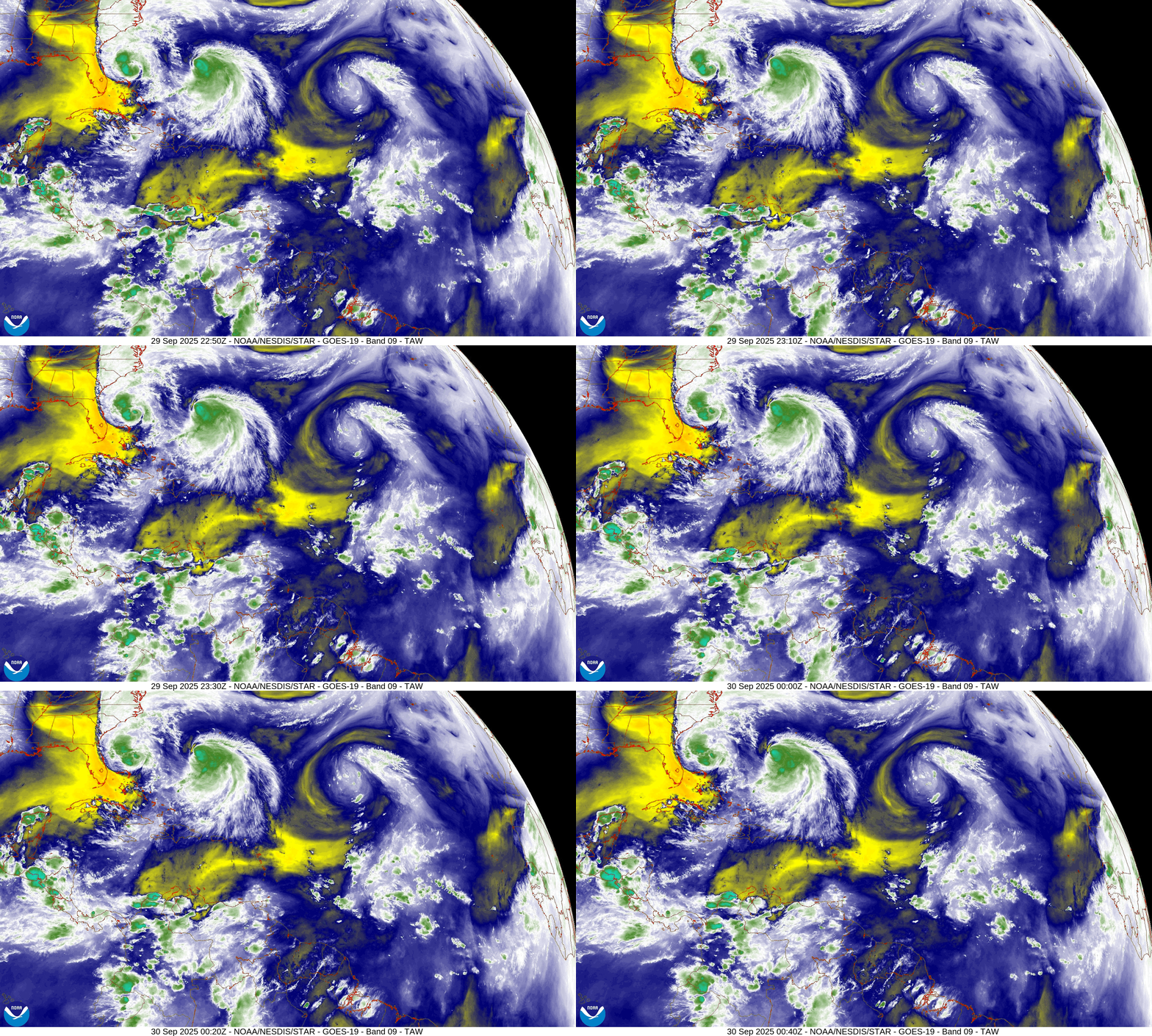
Wind shear is starting to impinge upon the circulation of Humberto — and it should steadily weaken until becoming post-tropical on Wednesday.
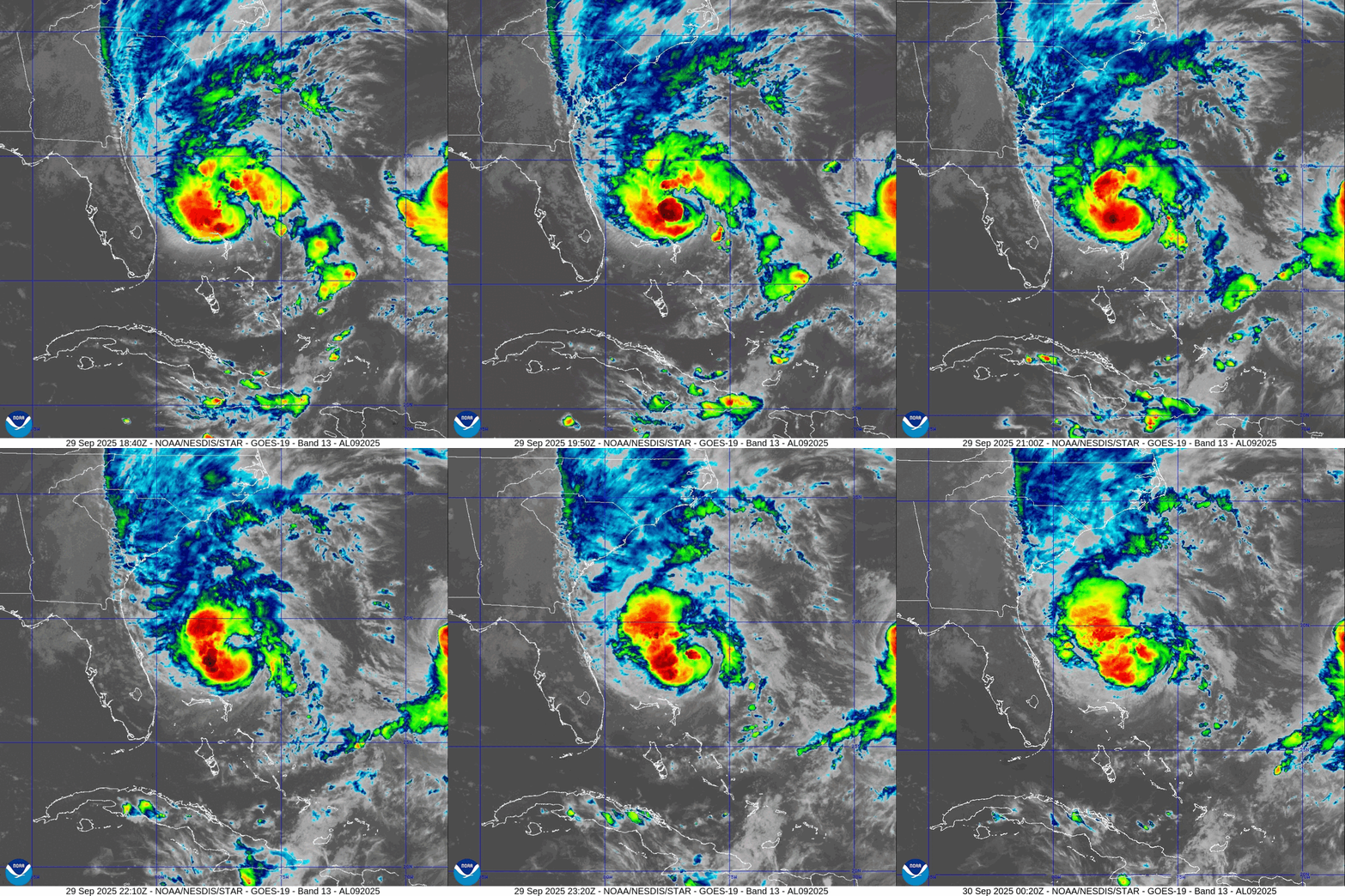
To the west of Imelda, another trough is digging through Florida and wrapping around the storm. Imelda is more asymmetric but the inner-core seems to be shielded from the worst of the mid-level dry air and upper-level wind shear —> so we should see Imelda become a hurricane on Tuesday and come close to “major status” before turning rapidly ENE out-to-sea.
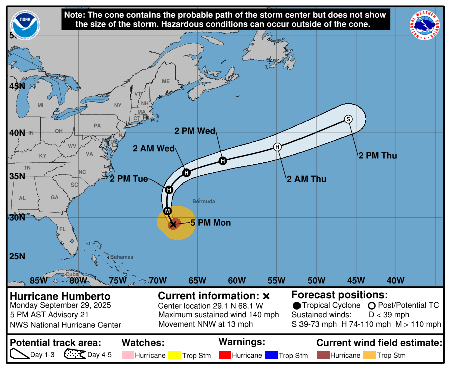
NHC Track for Tropical Storm Humberto | 942 mb | 140 mph Winds
Hurricane Humberto IR Satellite
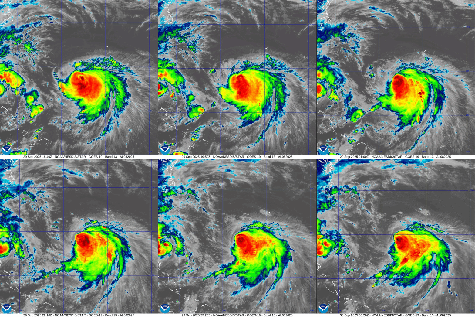
Wind shear is eroding the western semi-circle of the storm and the eyewall is opening … signaling a potential rapid weakening. Good news is that Humberto will go north and around Bermuda.
Tropical Storm Imelda | NHC Forecast Cone
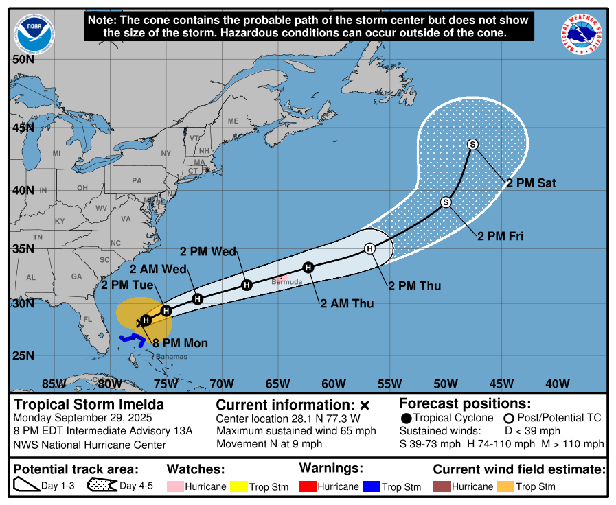
Winds are nearing hurricane intensity with Imelda — and NHC has a maximum forecast of 85-knots by Wednesday (Category 2).
However, the satellite loop looks messy — with the curved band of convection becoming less organized. Hostile environment for a developing tropical storm — for now.
ECMWF Next 10-Days Integrated Vapor Transport | 12z cycle
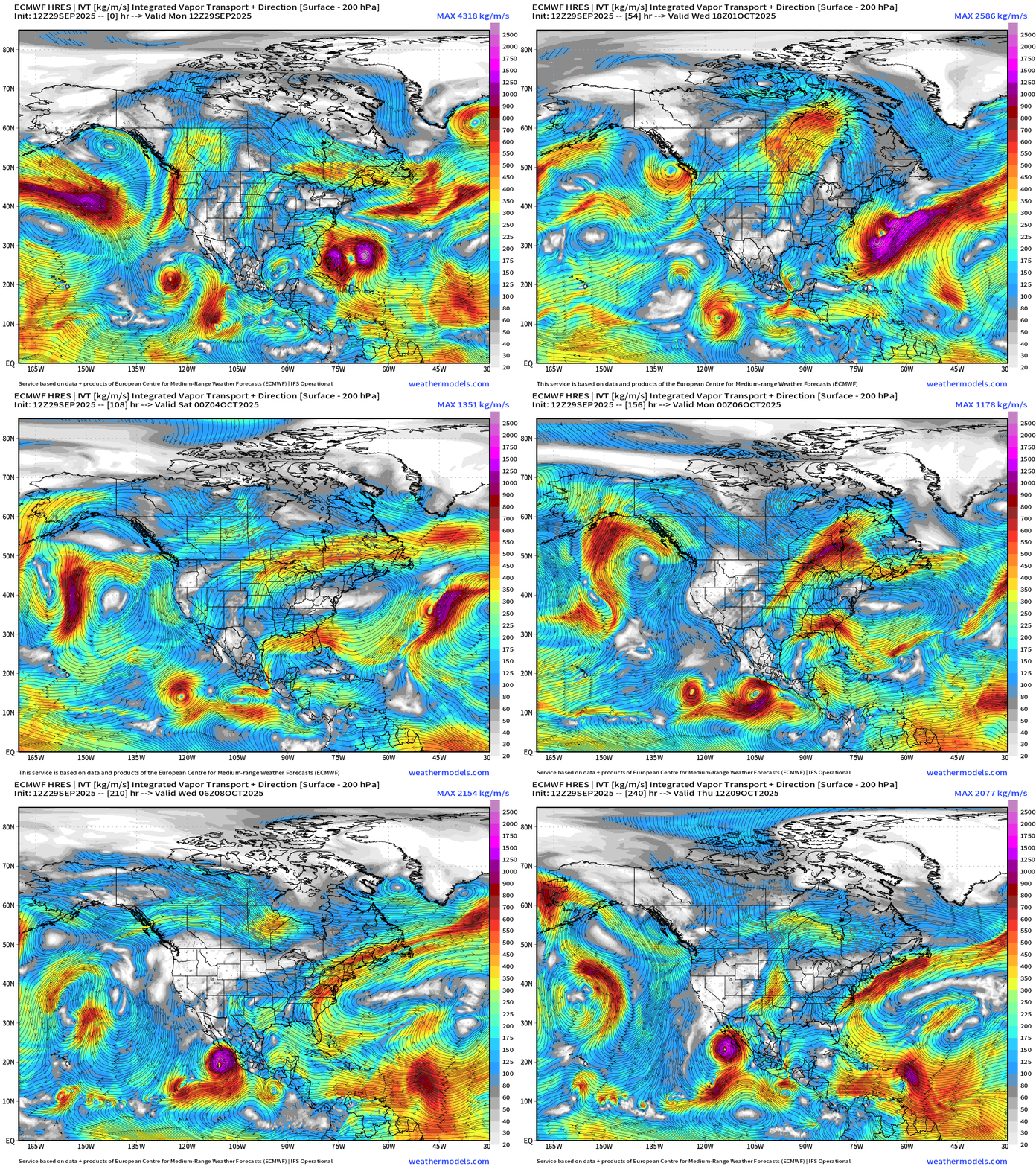
Humberto and Imelda both out-to-sea and gone by the end of the week.
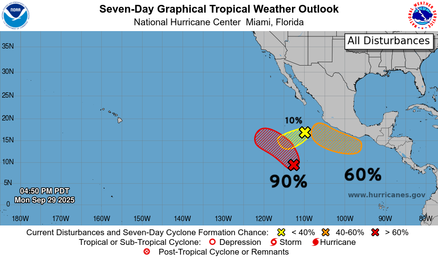
Two more named storms in the next 10-days likely in the Eastern Pacific: Octave and Priscilla — with the latter developing close to the Mexico coast — and could be quite intense.
Need to watch a tropical wave coming across the MDR over the next 5 to 10-days and arriving near the Lesser Antilles.
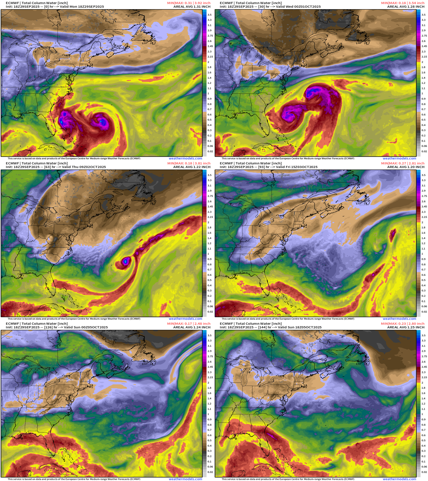
ECMWF 18z Precipitable Water | Next 6-days | Humberto and Imelda
ECMWF 18z Relative Vorticity | Next 6-days | Humberto and Imelda.
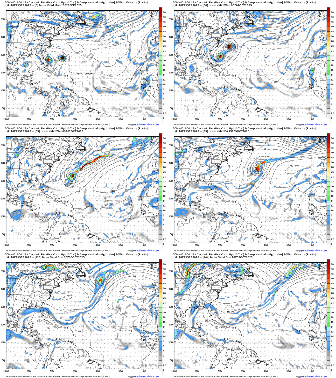
Cool loops of precipitable water as the two hurricanes interact — and form a twin cyclone systems that eventually breaks apart as Humberto becomes weaker during extratropical transition. Imelda will probably linger for a while longer — but will eventually head away as a post-tropical storm.
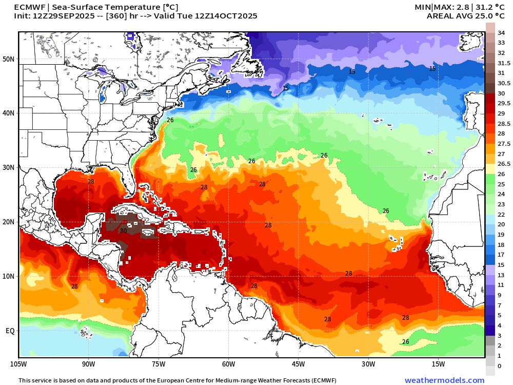
SST Analysis and Anomaly
Forecast in 15-days | ECMWF 12z
Just in two weeks, the 26°C isotherm begins rapidly eroding southward near 30°N latitude as Northern Hemisphere Fall continues.
NOAA Tropical Surface Analysis | 18z
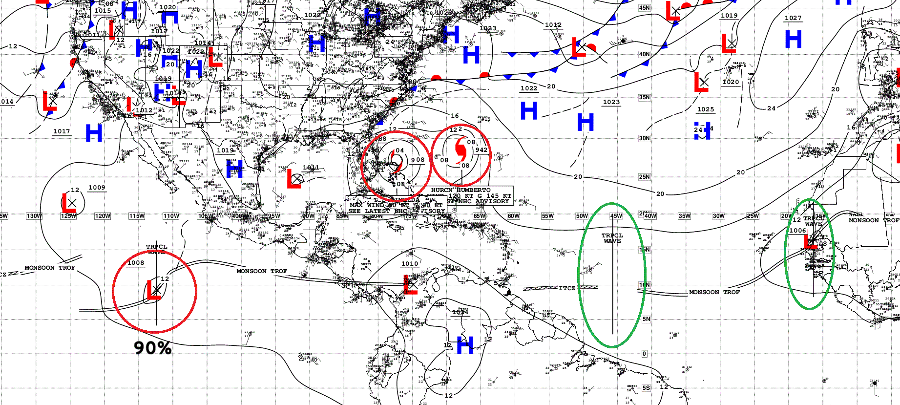
Atlantic Tropical Waves = 2 but neither flagged as development potential by NHC
Eastern Pacific | Invest 98E — 90% chance of development
Maps sourced from weathermodels.com designed and innovated by yours truly! Please subscribe there for real-time access to the newest maps, charts from all of the weather models including ECMWF.
- Milepost
- 751 · laid 2025-09-30T01:20:53.947000Z
- Source
- https://weather.substack.com/p/september-29-2025-monday-weather
- Digest
- 3c678341a02410a2e16a5a91e9a49a66defe6d4df3e89b5c528136f1bd02adf8
- Machine
- JSON