September 27, 2025 Saturday Tropical Update
Humberto becomes Category 5 while other system (Imelda) slowly organizes
September 2025 was the 7th-warmest September in the 131-year national record (1895–2025), at 67.9°F against a 1991–2020 normal of 66.0°F (+2.0°F).
September 2025 was the 15th-driest September in the 131-year national record (1895–2025), at 1.9in against a 1991–2020 normal of 2.6in (-0.6in).
NOAA/NCEI Climate at a Glance, contiguous United States. This is the observed record for the month, not a score of anything said in this piece — the forecast ledger begins 2026-08-17 and cannot reach earlier posts.

2025 Season to Date: 8 Named Storms, 3 Hurricanes, and 3 Majors | ACE = 70
I really enjoy collecting the maps and typing up these posts — keeps me updated and engaged every day on the ongoing weather in the tropics and around the world. — Dr. Ryan N. Maue (*me)
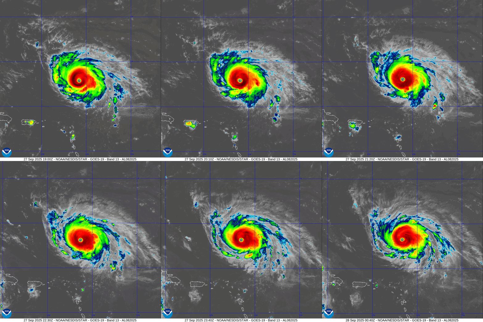
Category 5 Hurricane Humberto putting on a show
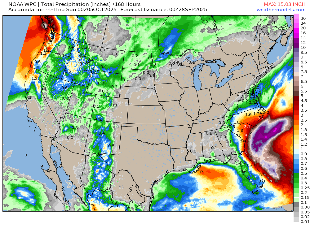
Potential for heavy rain accumulations along the Georgia - South Carolina - North Carolina coasts with Imelda nearby. Uncertainty in the track — but 10” - 20” likely with broad circulation of storm. We are hoping Imelda loops/stalls far enough away from the coast to limit direct impacts (winds, waves/rip currents, and rain).
7-Day Rainfall Totals
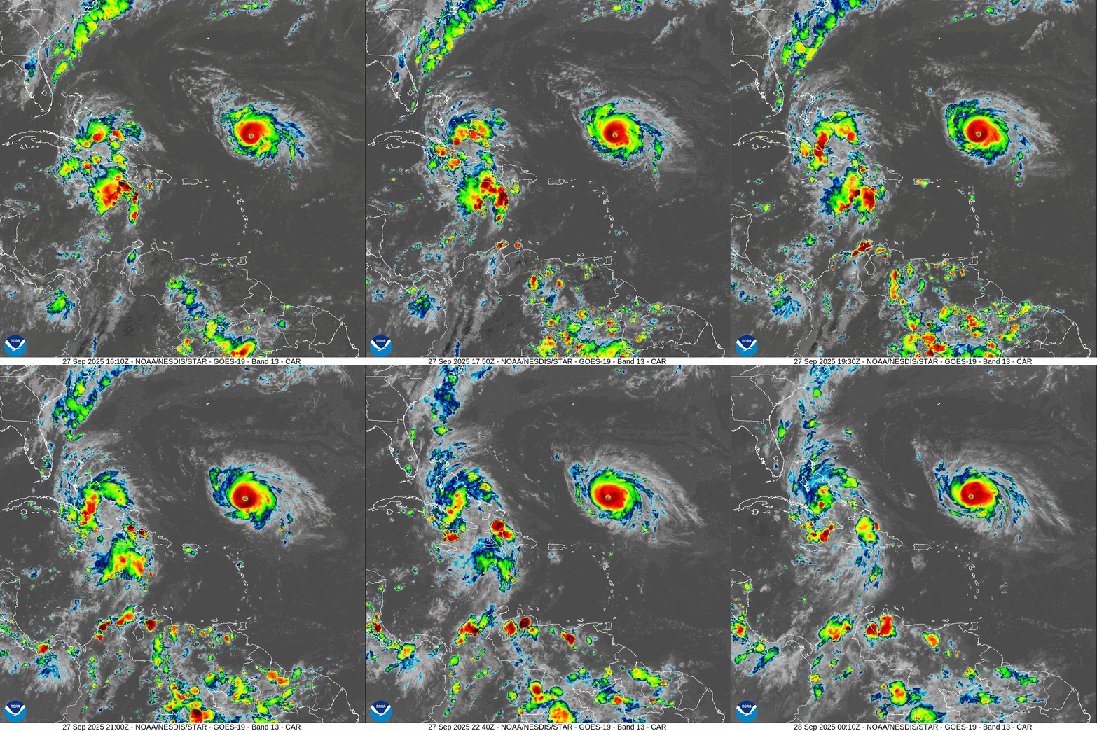
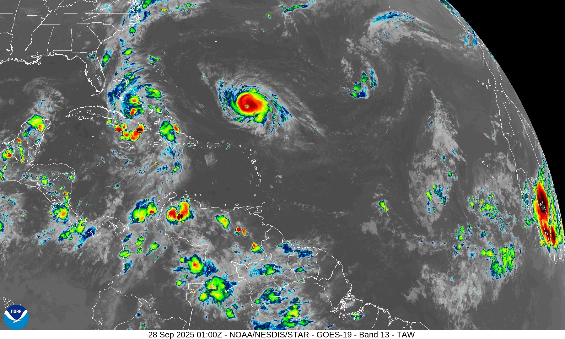
Evening IR Satellite Loop | Caribbean
Humberto reached T 7.1 on automated Dvorak technique (ADT) satellite intensity algorithm with a > 20°C eye and convection colder than -73°C … potential for Humberto to intensify a little bit more as it heads WNW over 29°C warm pool of the western Atlantic.
SST Analysis and Anomaly
SSTs are very warm along the path of both systems > 28.5° to 29.5°C
NHC Track for Tropical Storm Humberto | 925 mb | 160 mph Winds
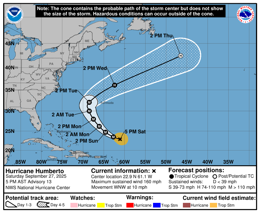
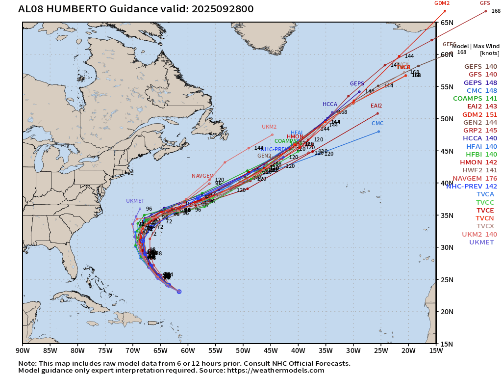
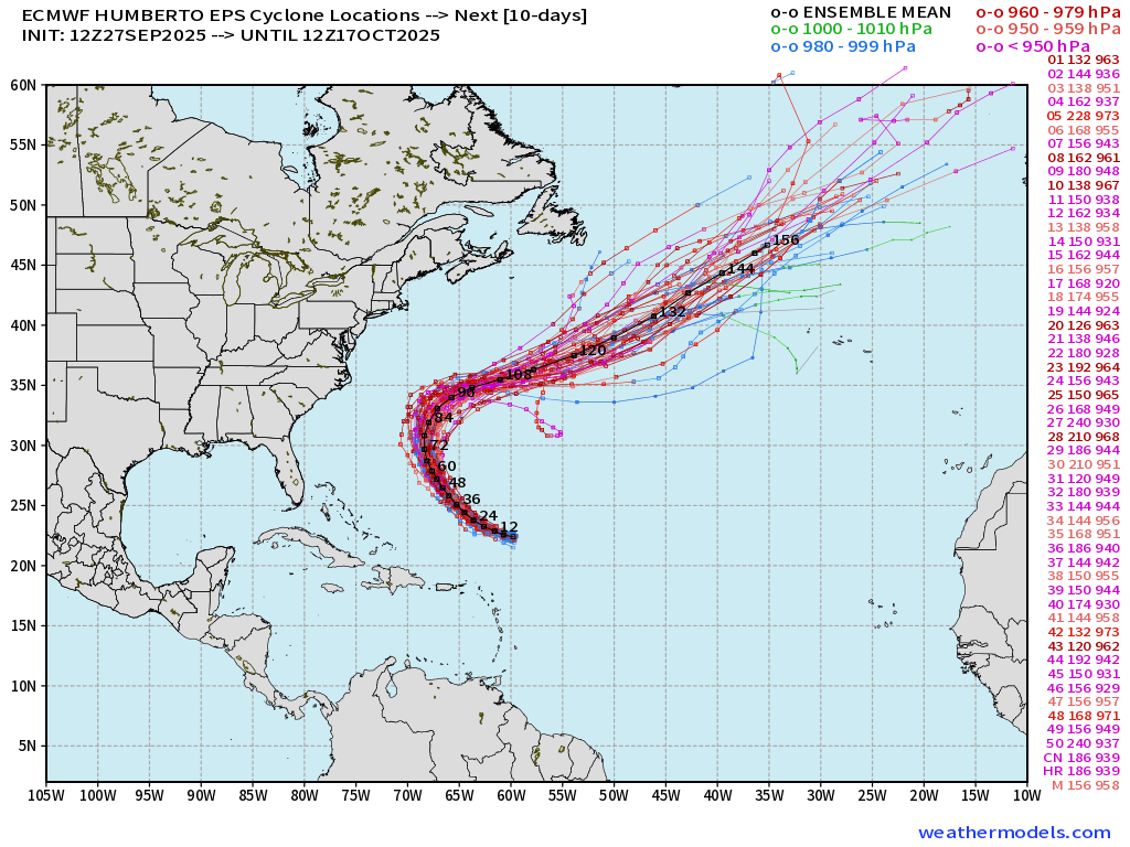
Watching the 70°W longitude marker — as the farthest west that Humberto will get — as that would determine how much Imelda is pushed into the coast
Humberto ATCF Spaghetti
ECMWF Ensemble 12z | Humberto Spaghetti
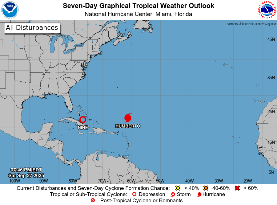
Tropical Depression 09L —> Imelda (09L) remains disorganized but should become a Hurricane by late Monday or early Tuesday as the forward motion slows to a crawl
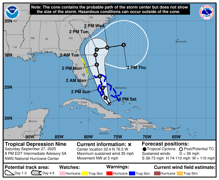
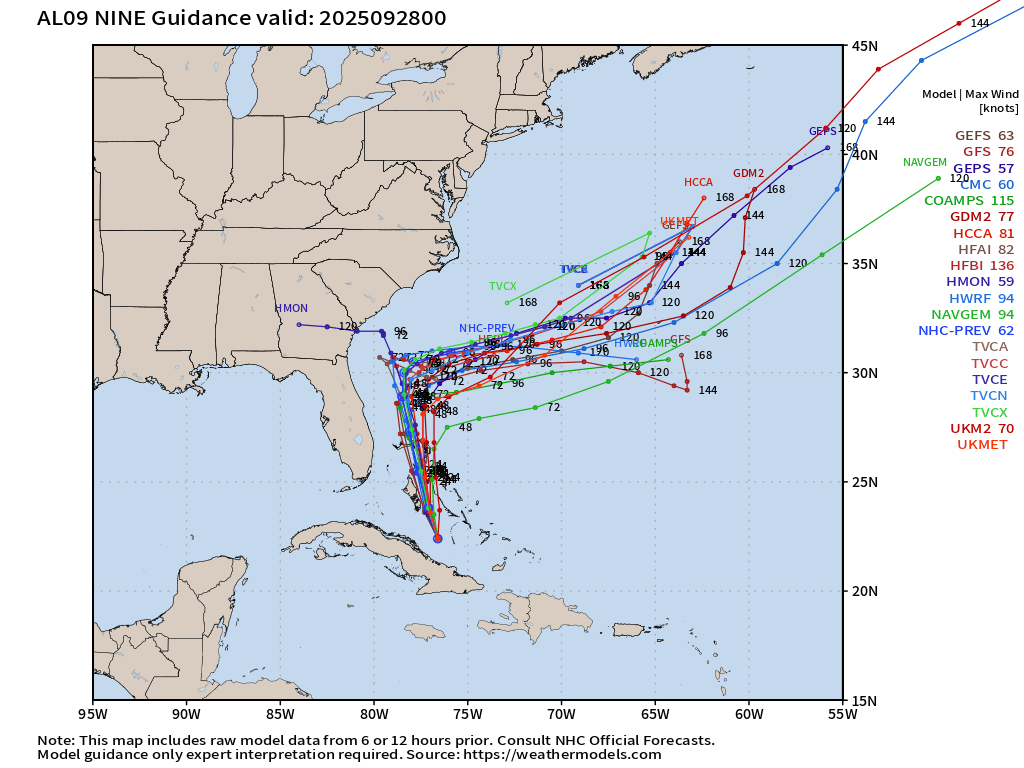
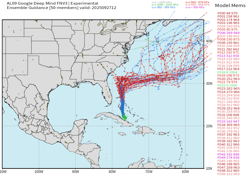
NHC still does NOT explicitly show a landfall of Hurricane Imelda through 5-days but there are ensemble members that show much closer approach
Tropical Depression 09L —> Imelda | ATCF Track Spaghetti
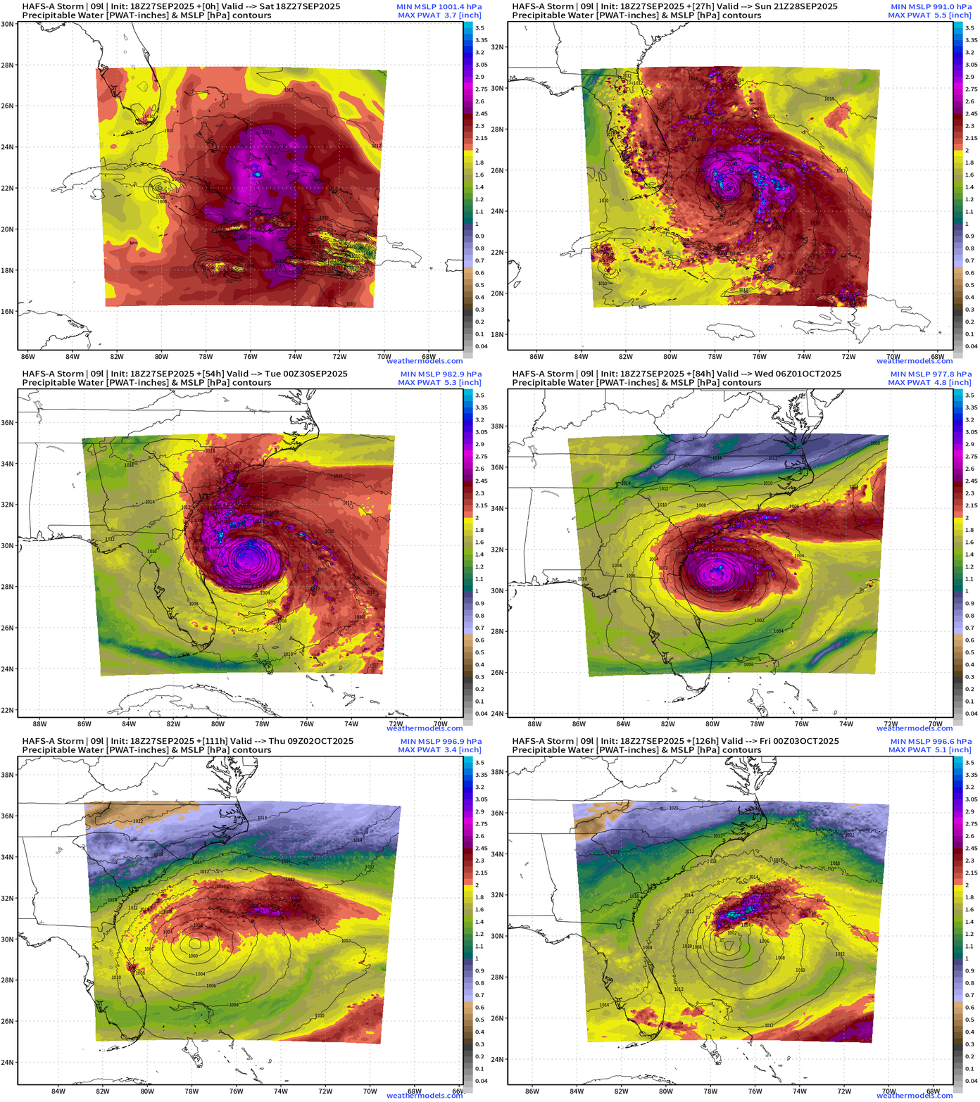
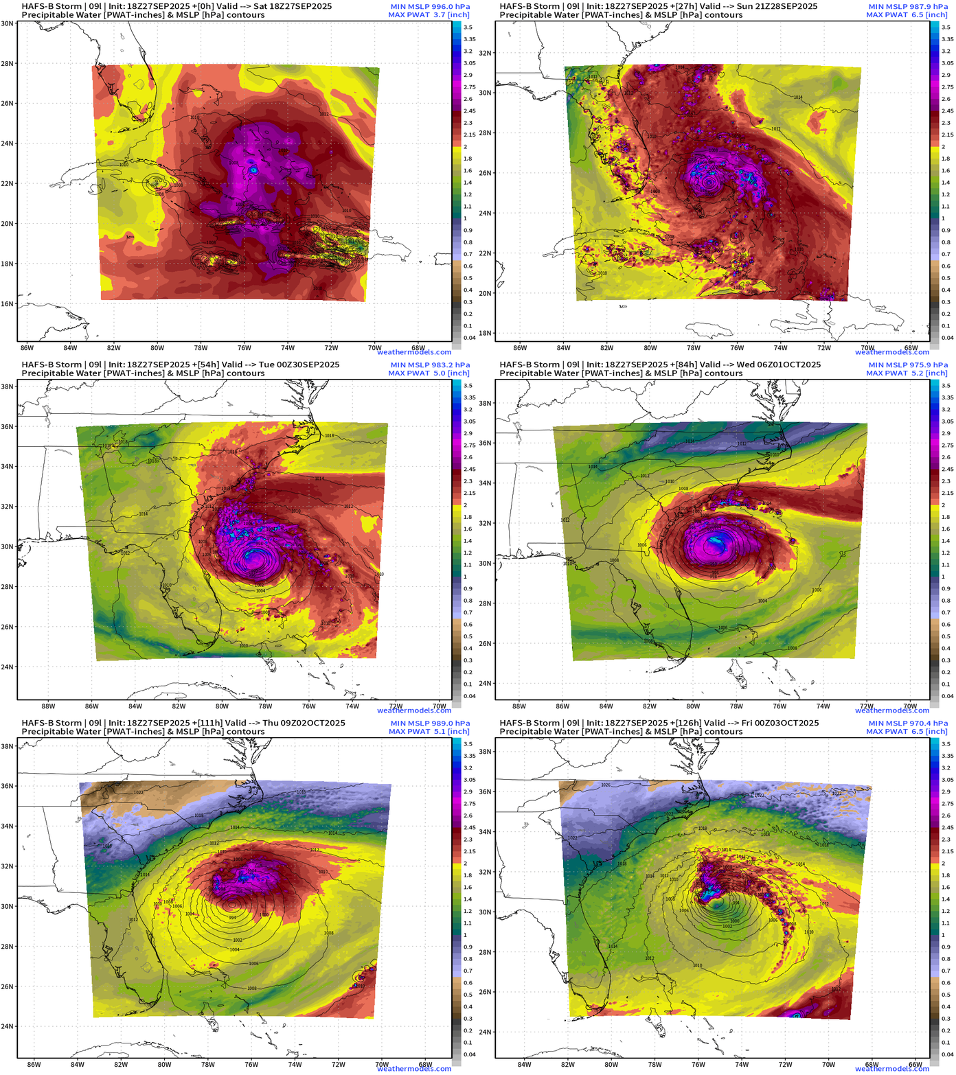
HAFS Maximum Intensity? Category 2 = pressure in the mid-970s
HAFS A Precipitable Water Next 126-hours
A trough from the north wipes out Imelda by Wednesday as Humberto exits into the North Atlantic
HAFS B Precipitable Water Next 126-hours
Imelda Spaghetti from the Google Deep Mind
Imelda Spaghetti from ECMWF EPS 12z
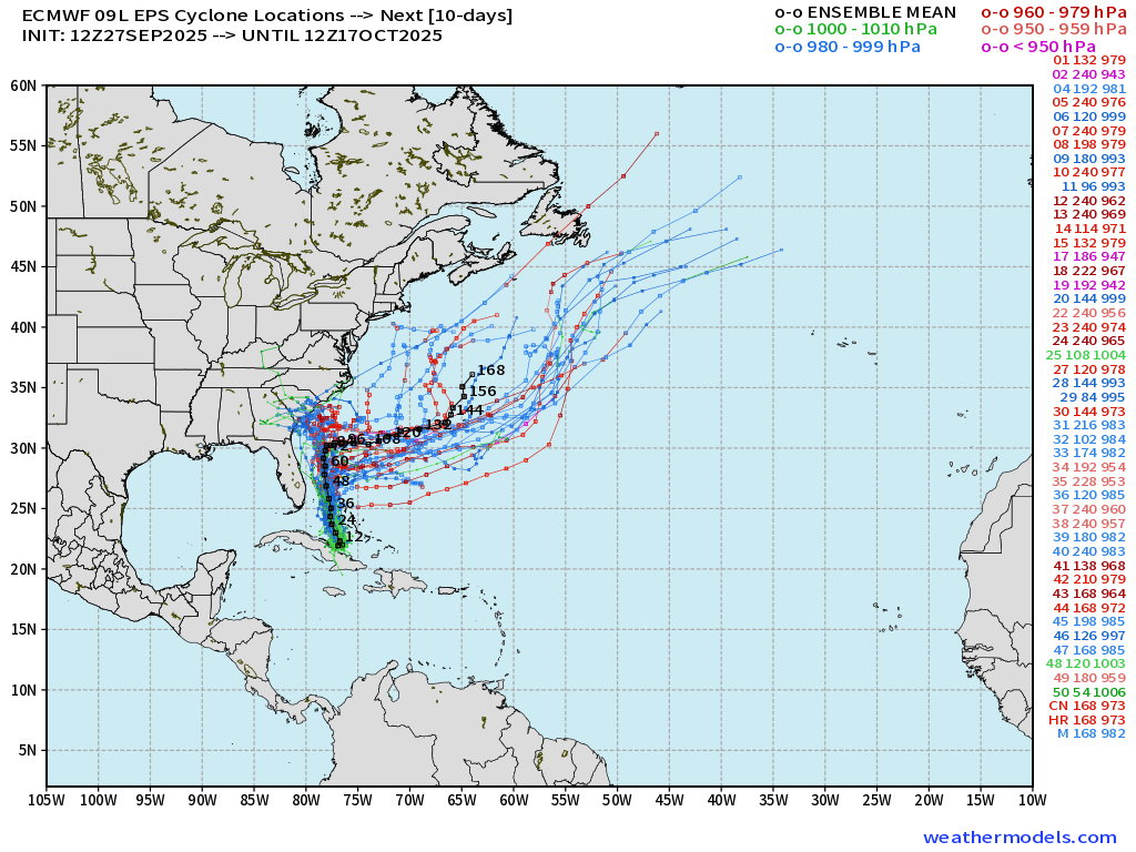
Note the members that DO directly landfall the coast — however, that is a minority solution < 30%
Atlantic Basin Outlook | 8 PM ET Update
Medium and Range | AIFS 18z | 10-days Height Anomaly
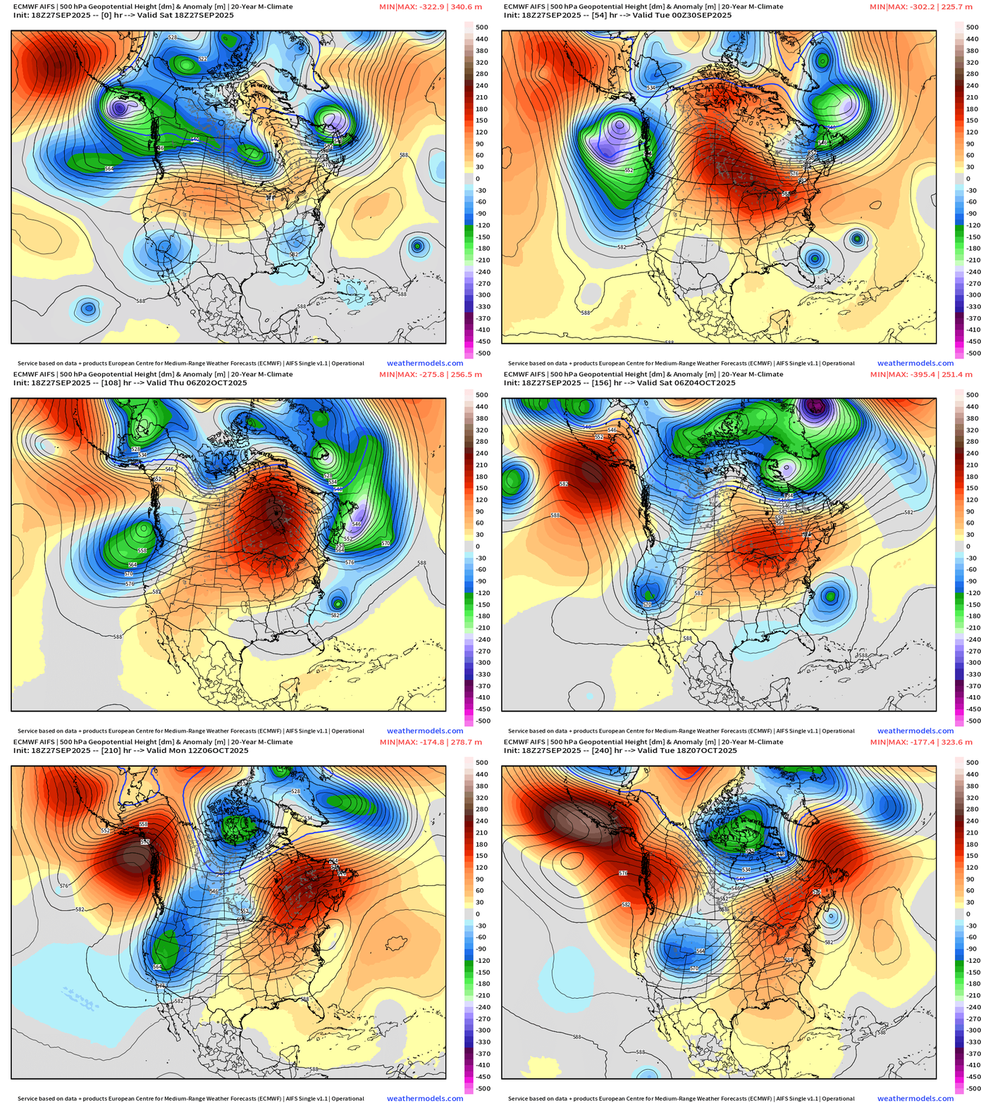
Steering Currents from the AIFS 10-day Heigh Anomaly loop: typical track NNW for Imelda — and then out-to-sea for Humberto until Day 7-8 when the blocking ridge strengthens to the north of Imelda.
Imelda is left behind and would likely be significantly weakened but not obliterated by combination of trough behind Humberto and then blocking ridge sequence.
ECMWF Next 10-Days Integrated Vapor Transport | 12z cycle
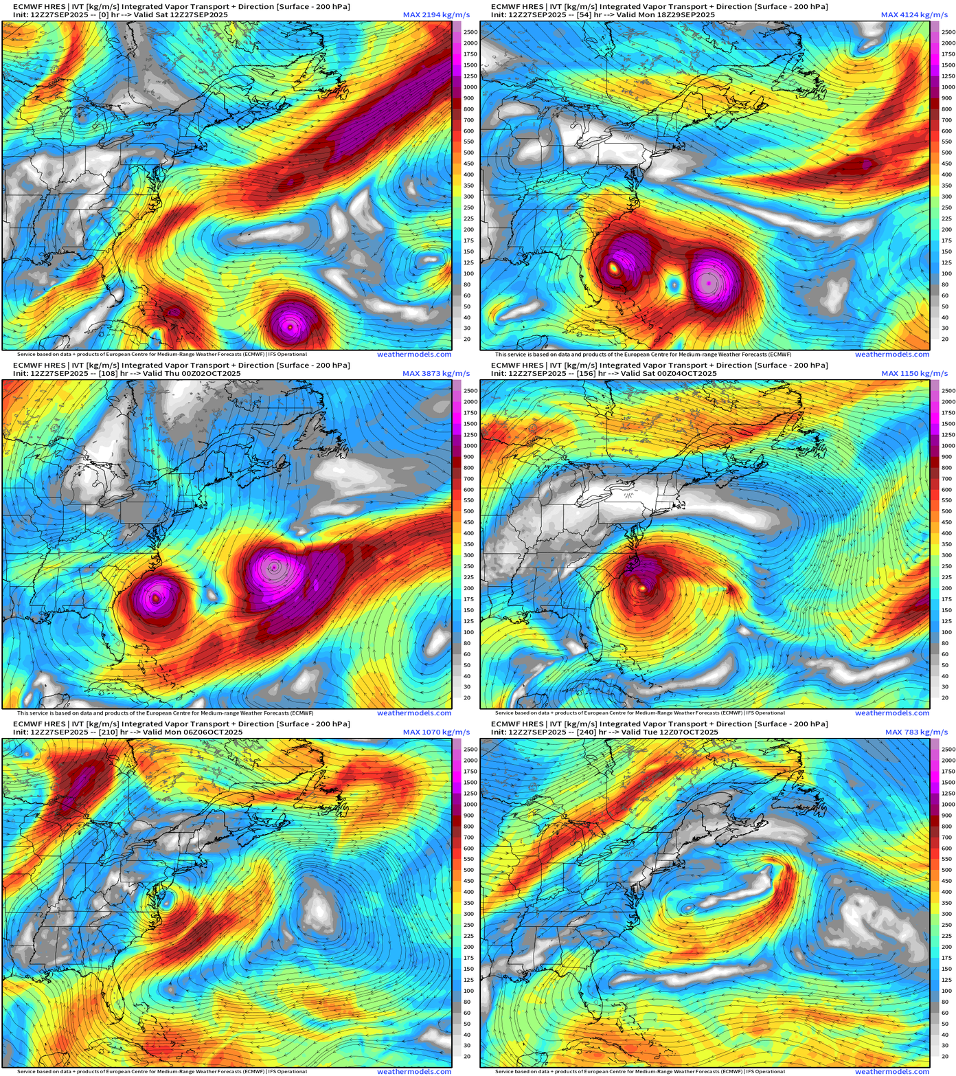
Flagship model 12z solution out to 10-days shows Imelda lingering and potentially making a loop over/near the coast of North Carolina — uncertainty remains. Similar solution from the 18z Update:
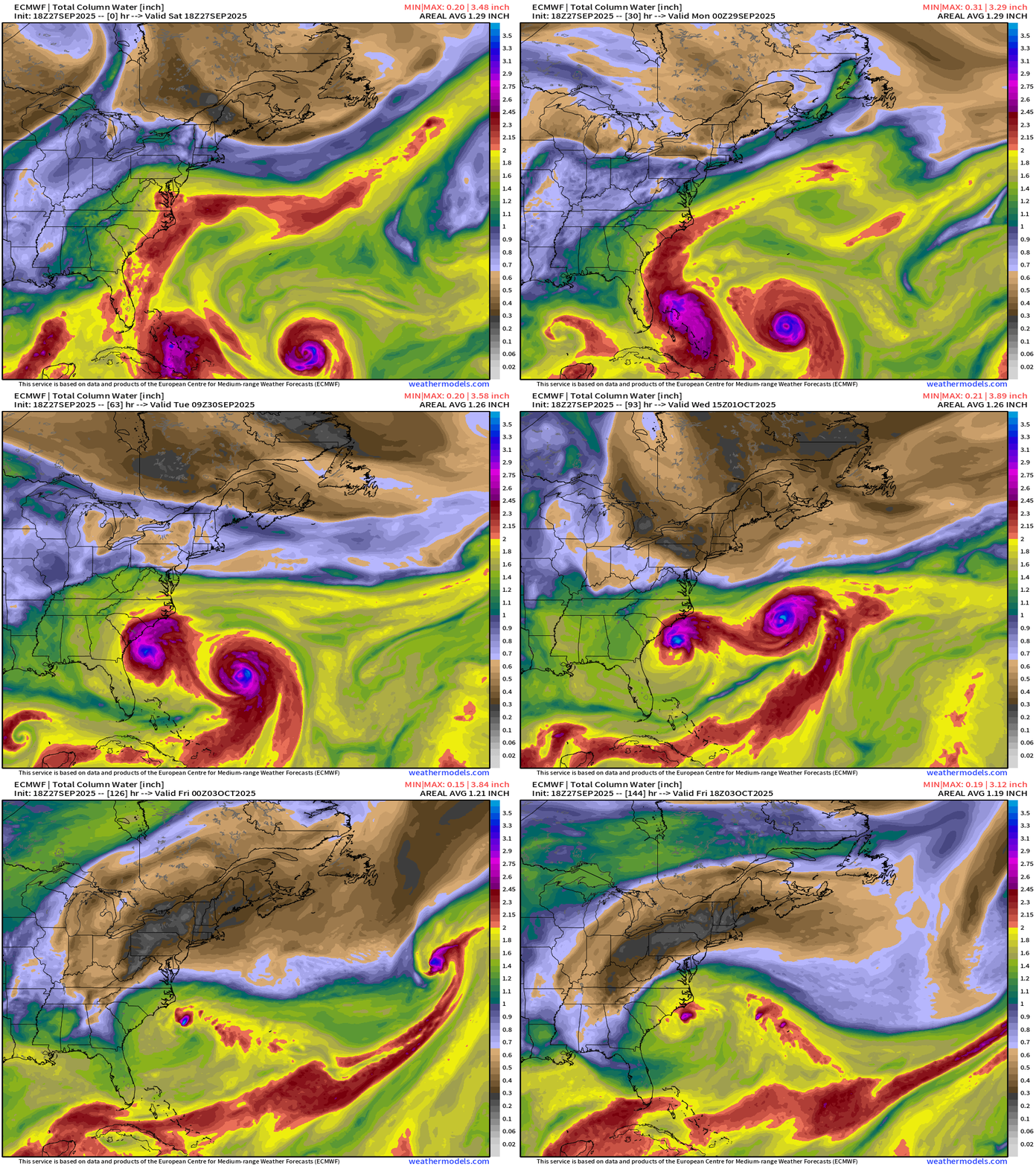
ECMWF 18z Precipitable Water | Next 6-days
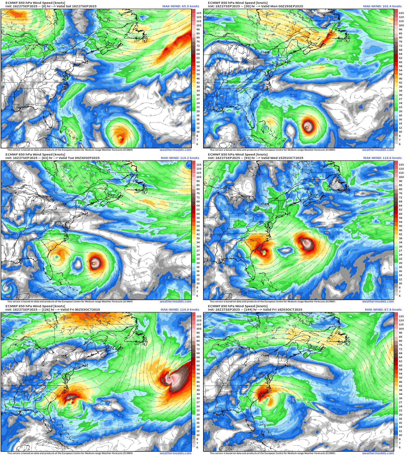
ECMWF 18z | 850 hPa Wind Speed | Next 6-days
NOAA Tropical Surface Analysis | 18z
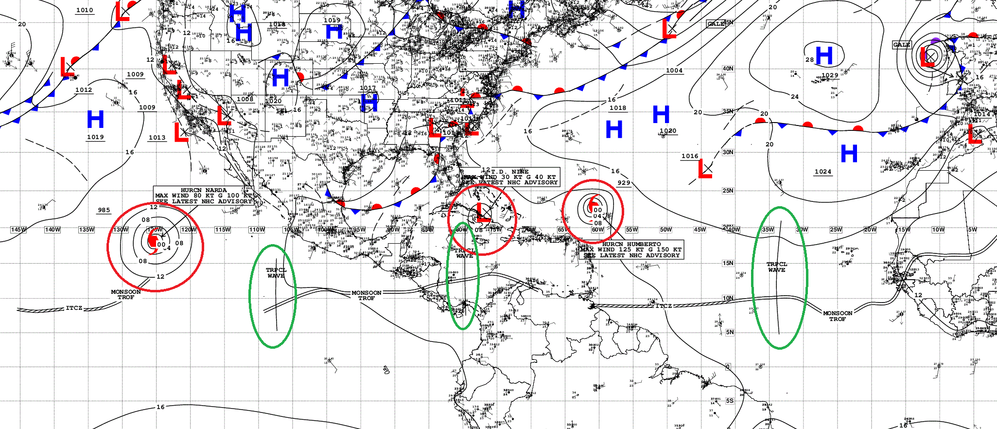
Atlantic Tropical Waves = 2 but neither flagged as development potential by NHC
One more tropical wave to watch coming off Africa tomorrow
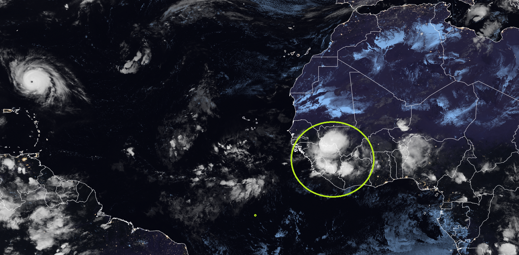
Easterly wave season ending soon into October.
Atlantic Satellite Imagery | IR and GeoColor (night time)
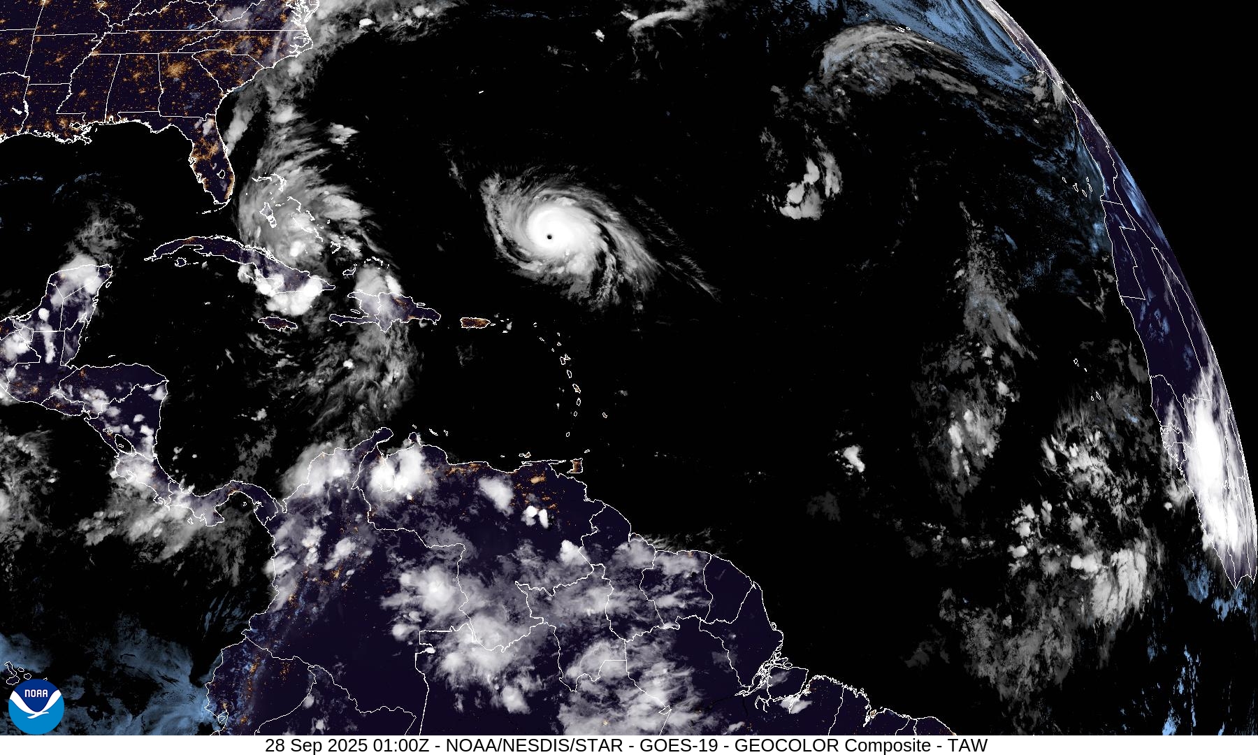
Eastern Pacific Tropical Update | Hurricane Narda
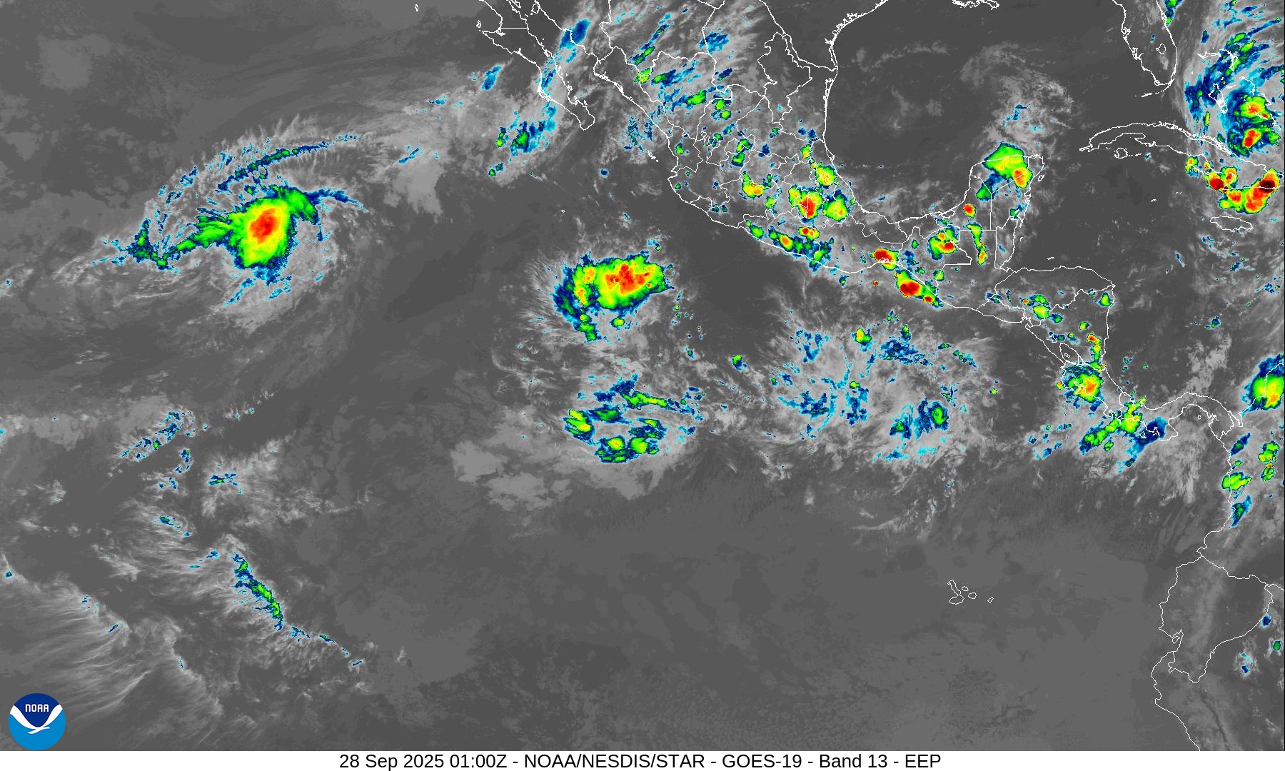
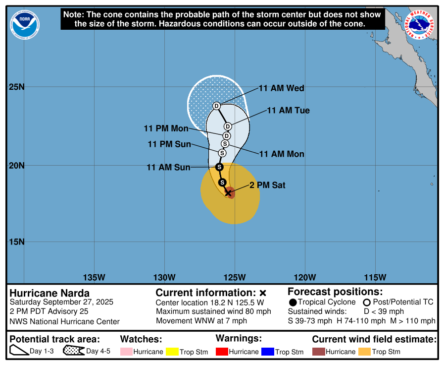
Hurricane Narda | Category 1 | 80 mph Winds —> weakening quickly.
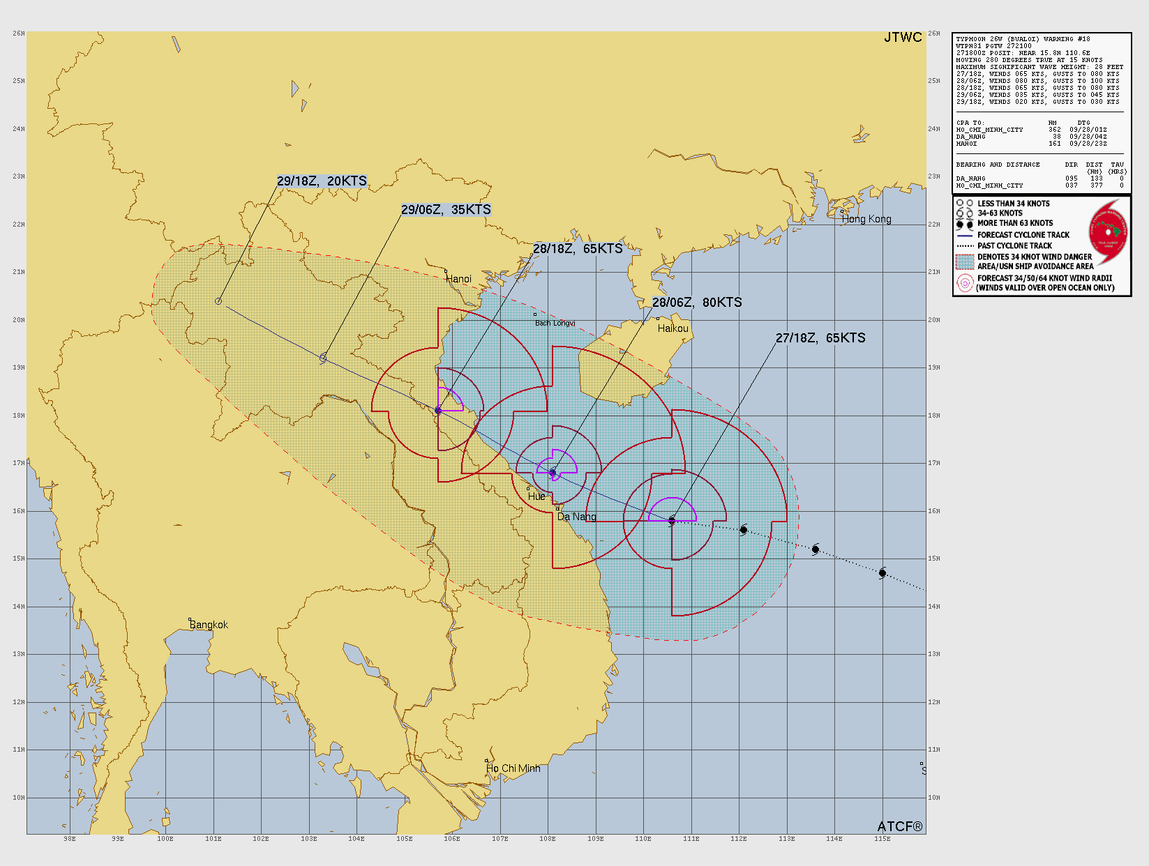
Western Pacific Tropical Update | Typhoon Bualoi
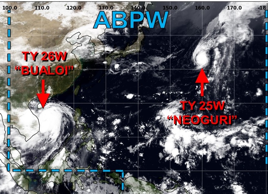
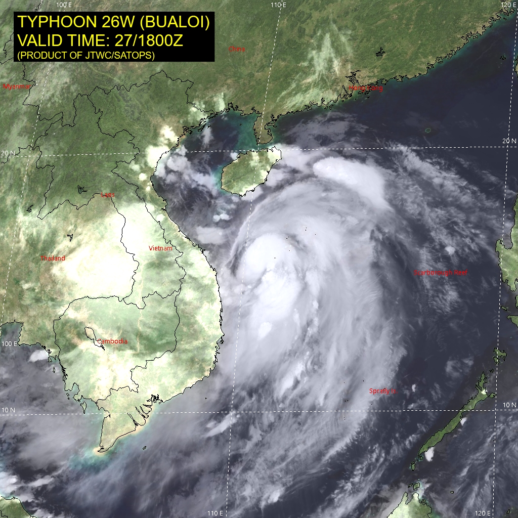
JTWC landfall forecast of 80-knots for Bualoi into Vietnam
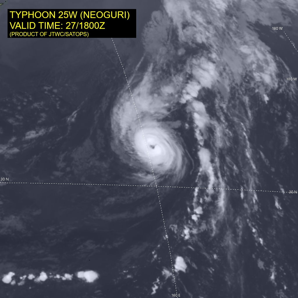
Typhoon Neoguri still going — 75 knot winds well into the central North Pacific with a nice eye
Maps sourced from weathermodels.com designed and innovated by yours truly! Please subscribe there for real-time access to the newest maps, charts from all of the weather models including ECMWF.
- Milepost
- 749 · laid 2025-09-28T01:51:05.118000Z
- Source
- https://weather.substack.com/p/september-27-2025-saturday-tropical
- Digest
- a689250437fd34d685888089e056601892acf49a1e8adc733e7a94ceb202cf28
- Machine
- JSON