September 25, 2025 Thursday Morning Hurricane Season
Imelda expected to form in next 48-hours increasing potential to threaten Southeast U.S.
September 2025 was the 7th-warmest September in the 131-year national record (1895–2025), at 67.9°F against a 1991–2020 normal of 66.0°F (+2.0°F).
September 2025 was the 15th-driest September in the 131-year national record (1895–2025), at 1.9in against a 1991–2020 normal of 2.6in (-0.6in).
NOAA/NCEI Climate at a Glance, contiguous United States. This is the observed record for the month, not a score of anything said in this piece — the forecast ledger begins 2026-08-17 and cannot reach earlier posts.

2025 Season to Date: 8 Named Storms, 2 Hurricanes, and 2 Majors | ACE = 59
I really enjoy collecting the maps and typing up these posts — keeps me updated and engaged every day on the ongoing weather in the tropics and around the world.
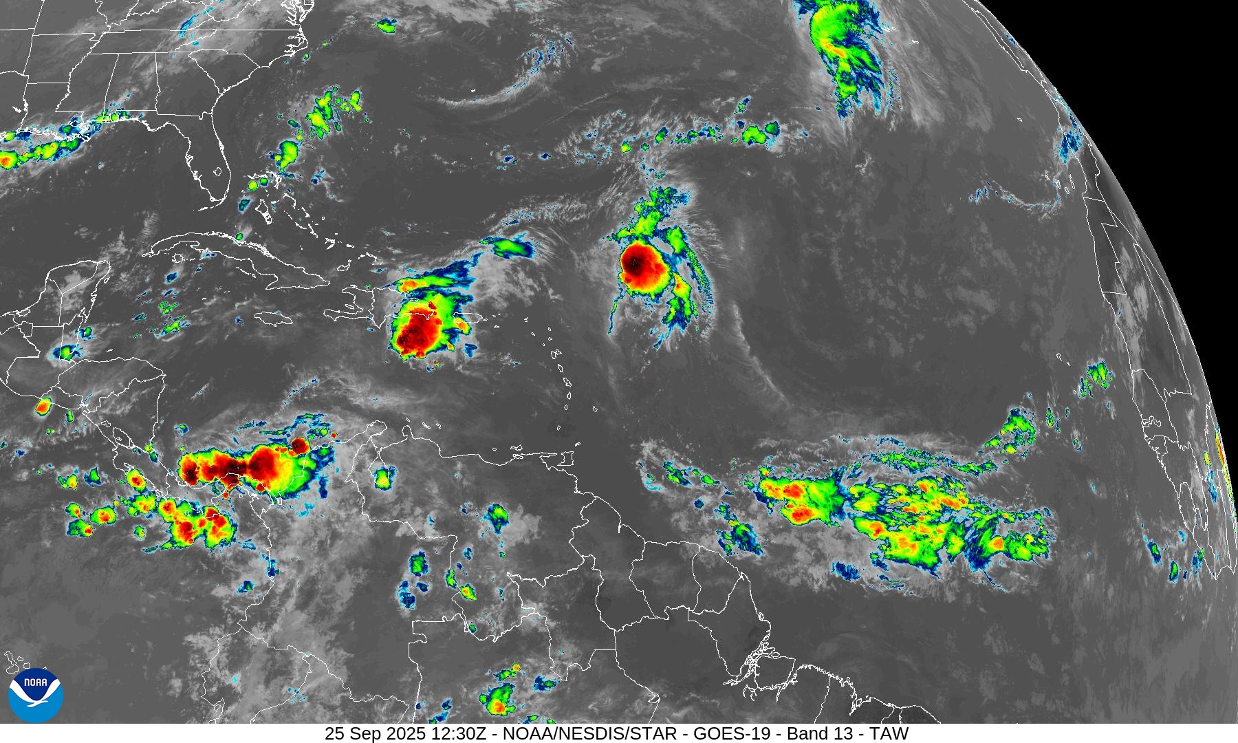
Morning IR Satellite Loop
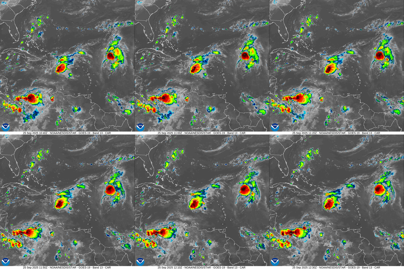
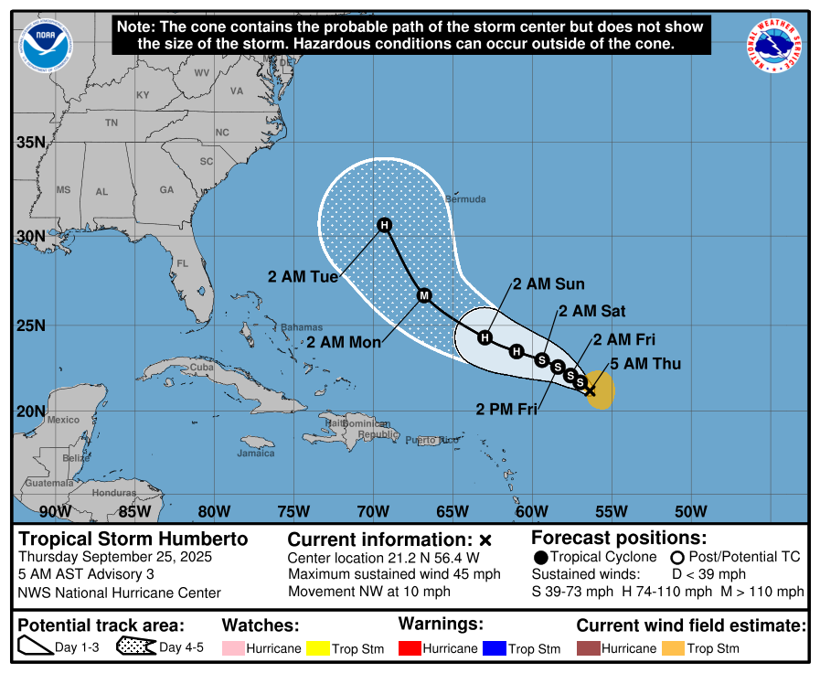
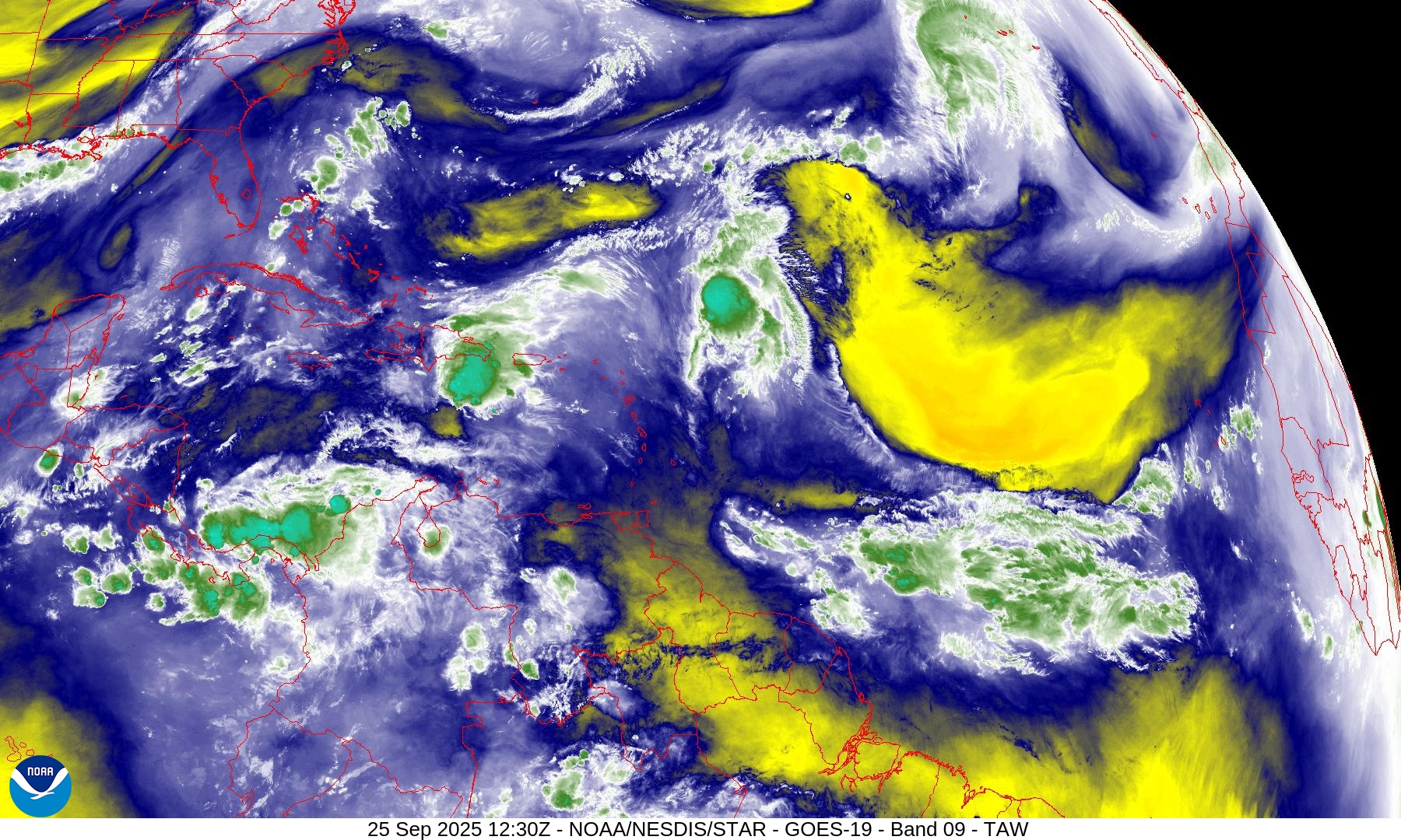
Both Invest 94L [90%] and Tropical Storm Humberto are firing off vigorous convection … especially Humberto in an optimal environment for rapid intensification.
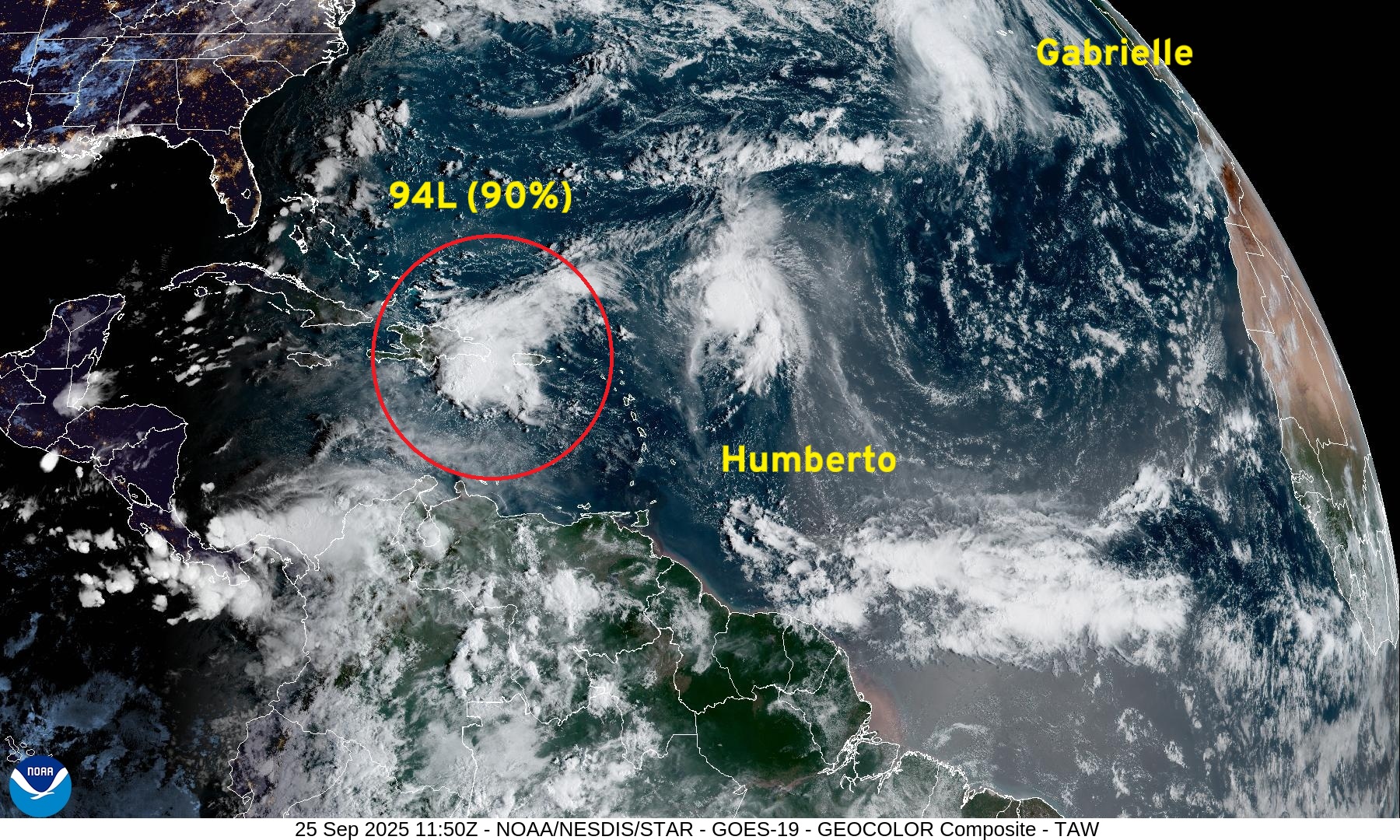
SSTs are very warm along the path of both systems > 28.5°C
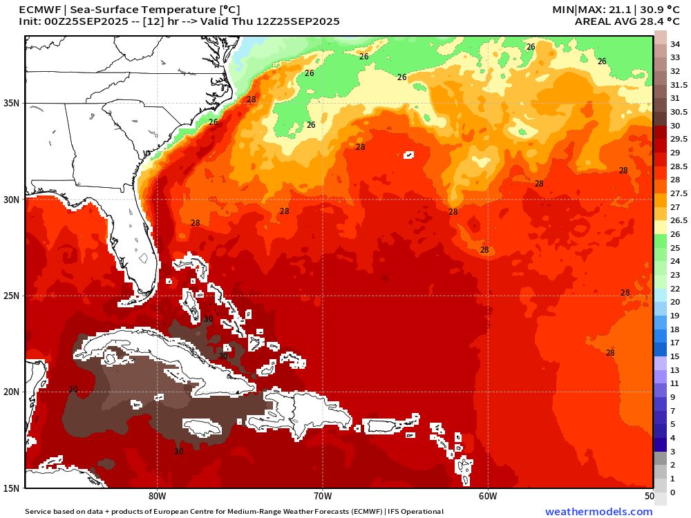
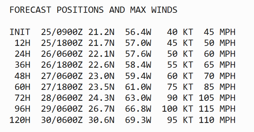
NHC Track for Tropical Storm Humberto
Track of Humberto is more typical — like Gabrielle before — but west of Bermuda. The hurricane will be LARGE and likely a major within 3-4 days, but probably sooner as NHC intensity forecasts are typically quite conservative.
Humberto ATCF Spaghetti
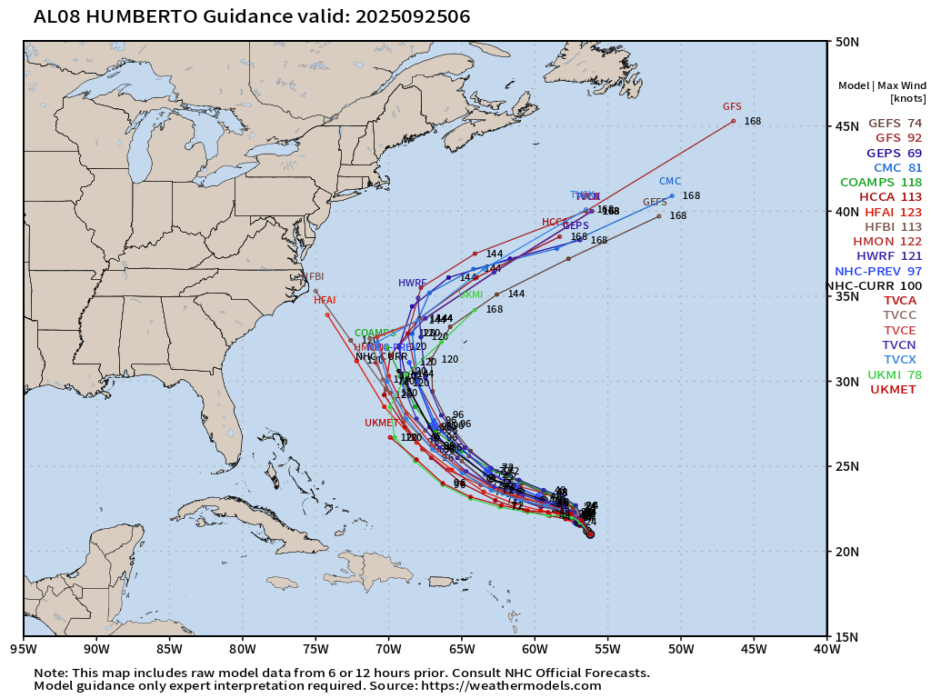
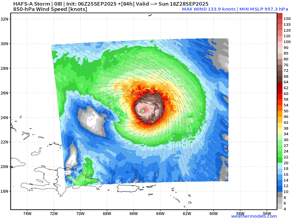
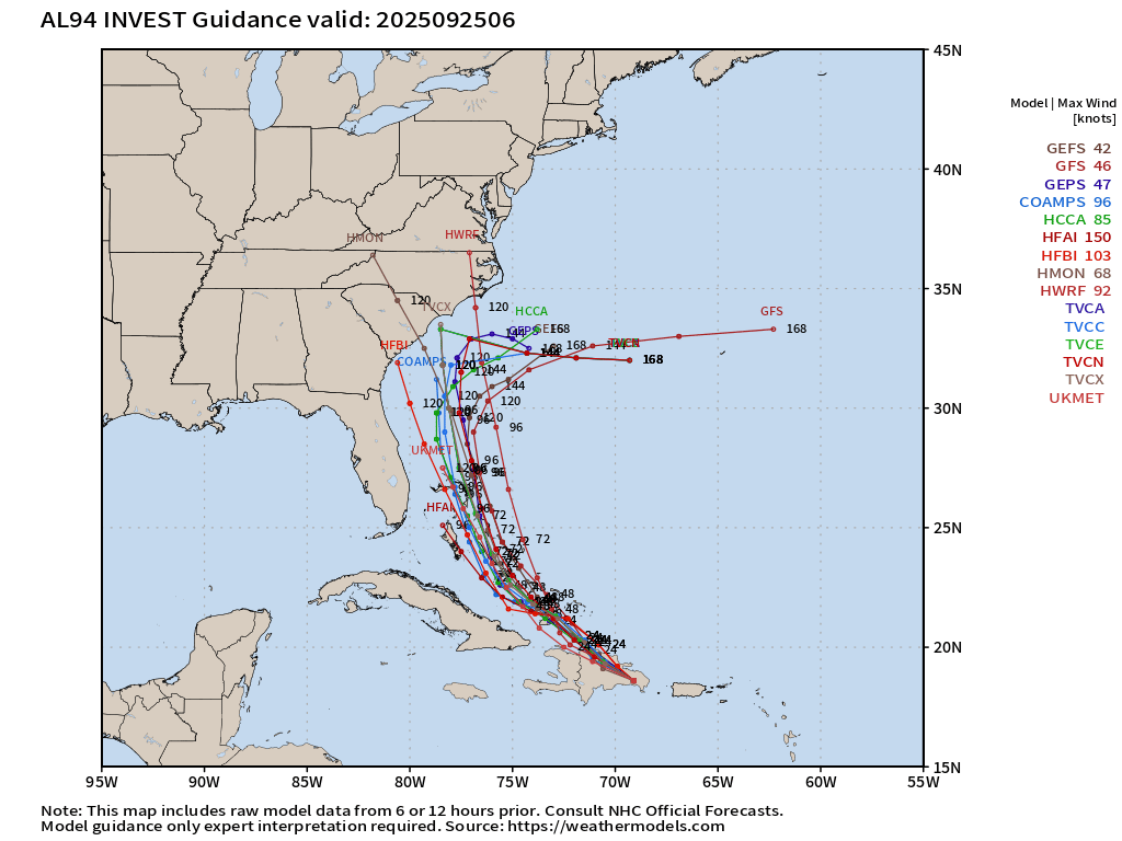
Current thinking: Humberto will intensity into a large, major hurricane by 4 days (Monday) and will control the twin cyclone system — with a PUSH of Imelda away toward the Southeast coast — and then perhaps a DRAG out to sea.
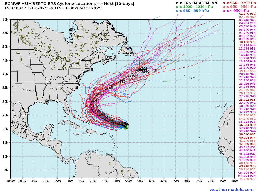
Most ECMWF Ensembles at 00z were Category 3-4 central pressure — very soon, too suggesting imminent rapid intensification
HAFS-A [Nest] +3 days | Central Pressure 957 mb — Category 4
Invest 94L —> Imelda | ATCF Track Spaghetti
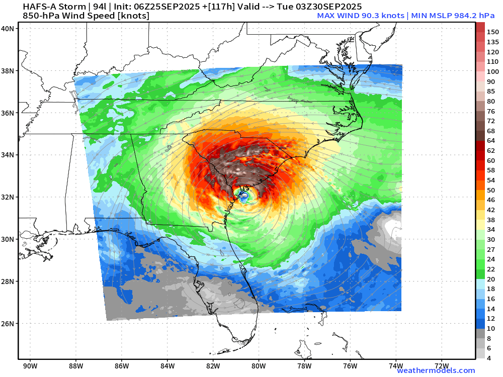
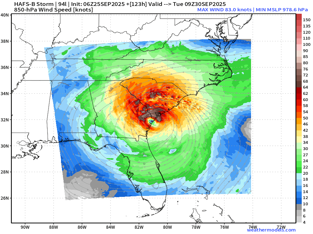
Both HAFS-A and HAFS-B Mesoscale Hurricane Models
Similar track & intensity (Category 1-2) into South Carolina / Georgia border by late Monday
HAFS-B Parent
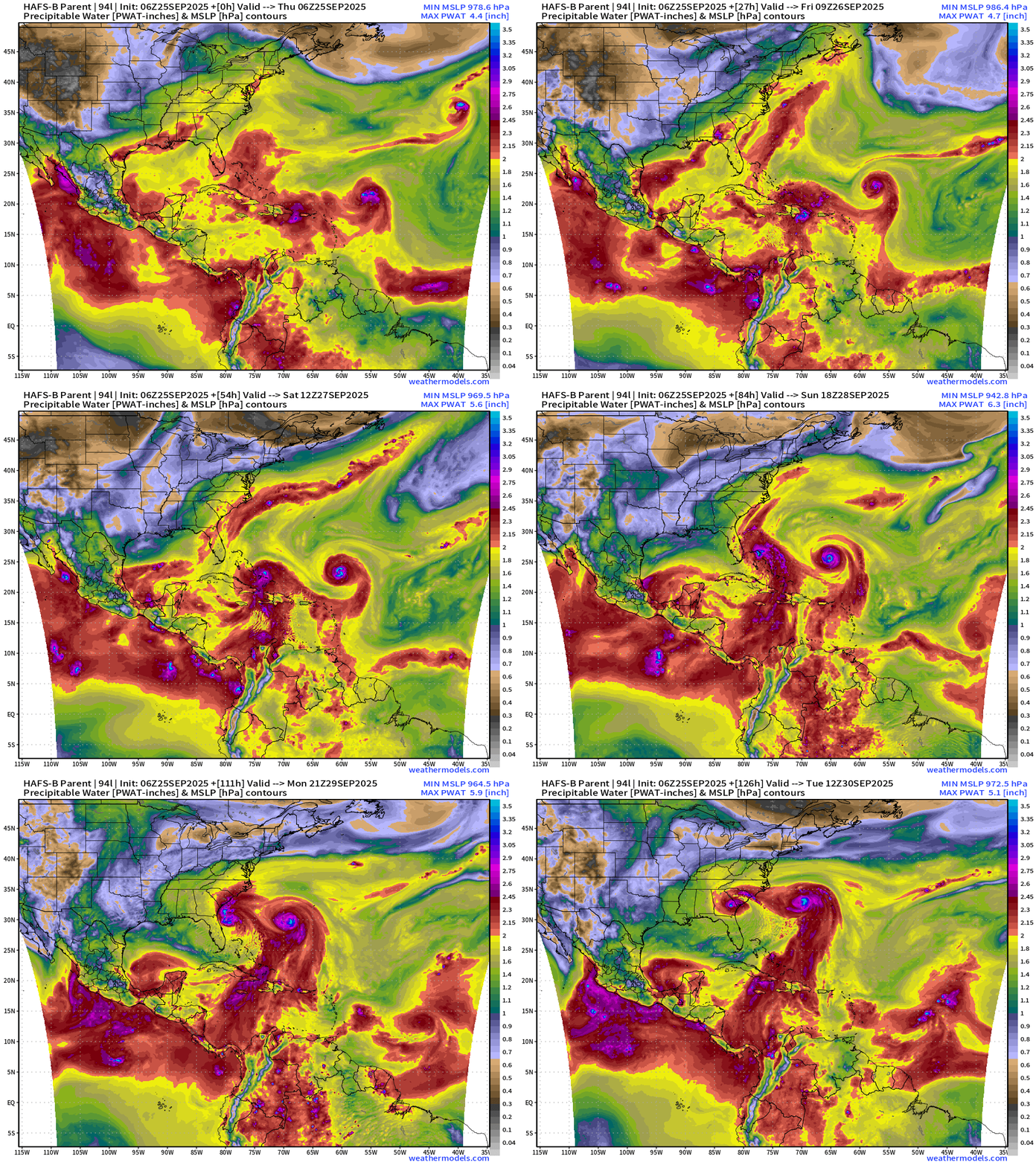
Key to the track of Imelda — intensity and size of Humberto and its ability to PUSH Imelda into the coast
Note, the systems gain latitude TOGETHER and are side by side here with HAFS-B (and HAFS-A, not shown). However, that’s uncertain with global modeling e.g. ECMWF 06z
Atlantic Basin Outlook | 8 AM ET Update
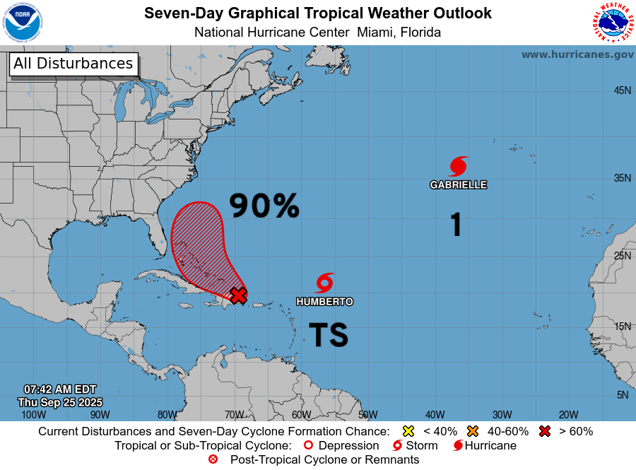
NHC has Invest 94L at 90% development — likely in next 48-hours
Medium and Extended Range
Steering Currents: bit of a blocking ridge to north of Imelda and Humberto force each to head westward until a sprawling trough digs into the Northeast and allows Humberto first to race out to sea …
However, Imelda may get left behind while sitting off the U.S. East Coast into early October.
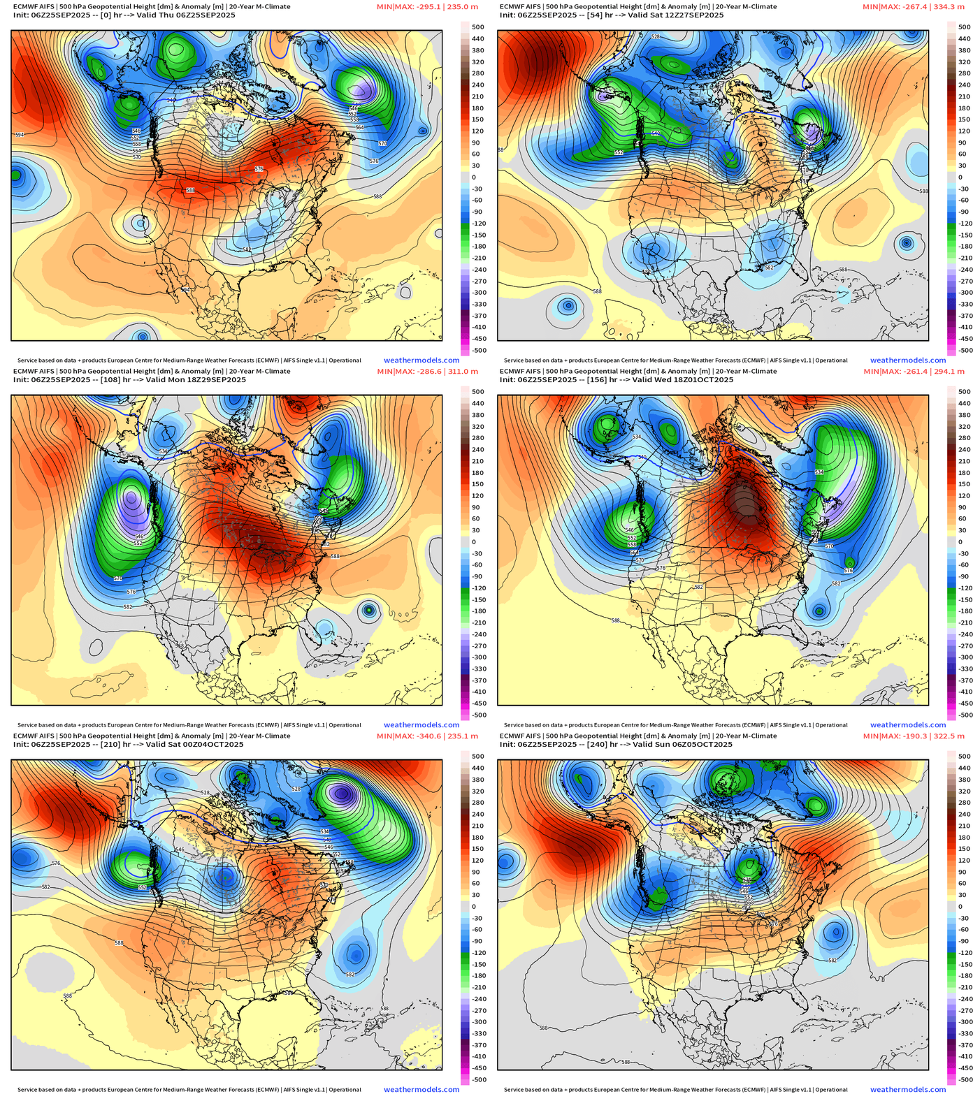
ECMWF Next 12-Days Integrated Vapor Transport | 00z cycle
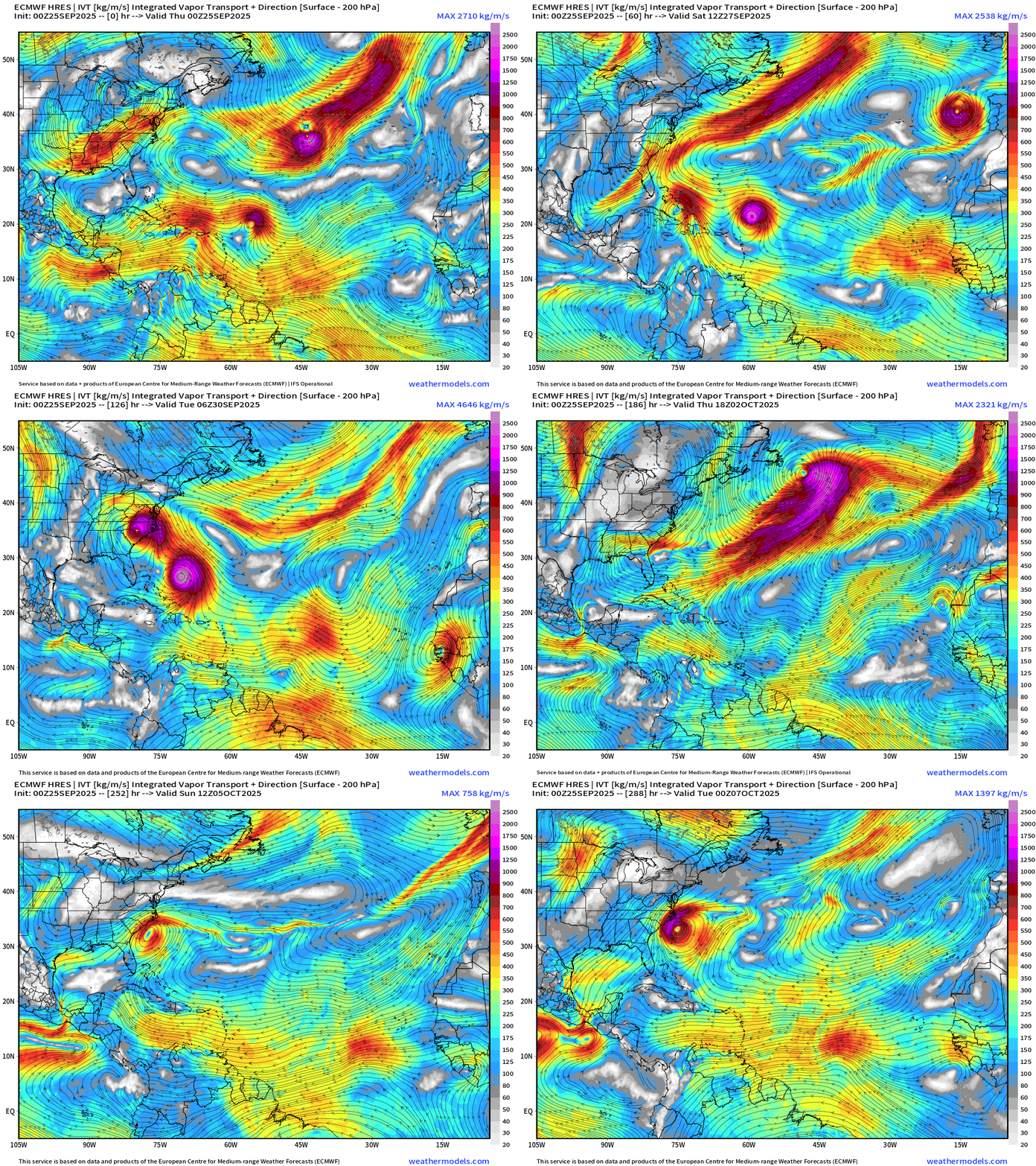
Wild flagship model solution at 00z through 12-days showed both Humberto and Imelda (94L) becoming hurricanes … with the two hurricane system eventually turning/looping in tandem
Humberto leaves to the ENE out to sea but Imelda is left behind to spin off the East Coast and expand in size over the Gulf Stream
ECMWF 06z Relative Cyclonic Vorticity | Next 6-days
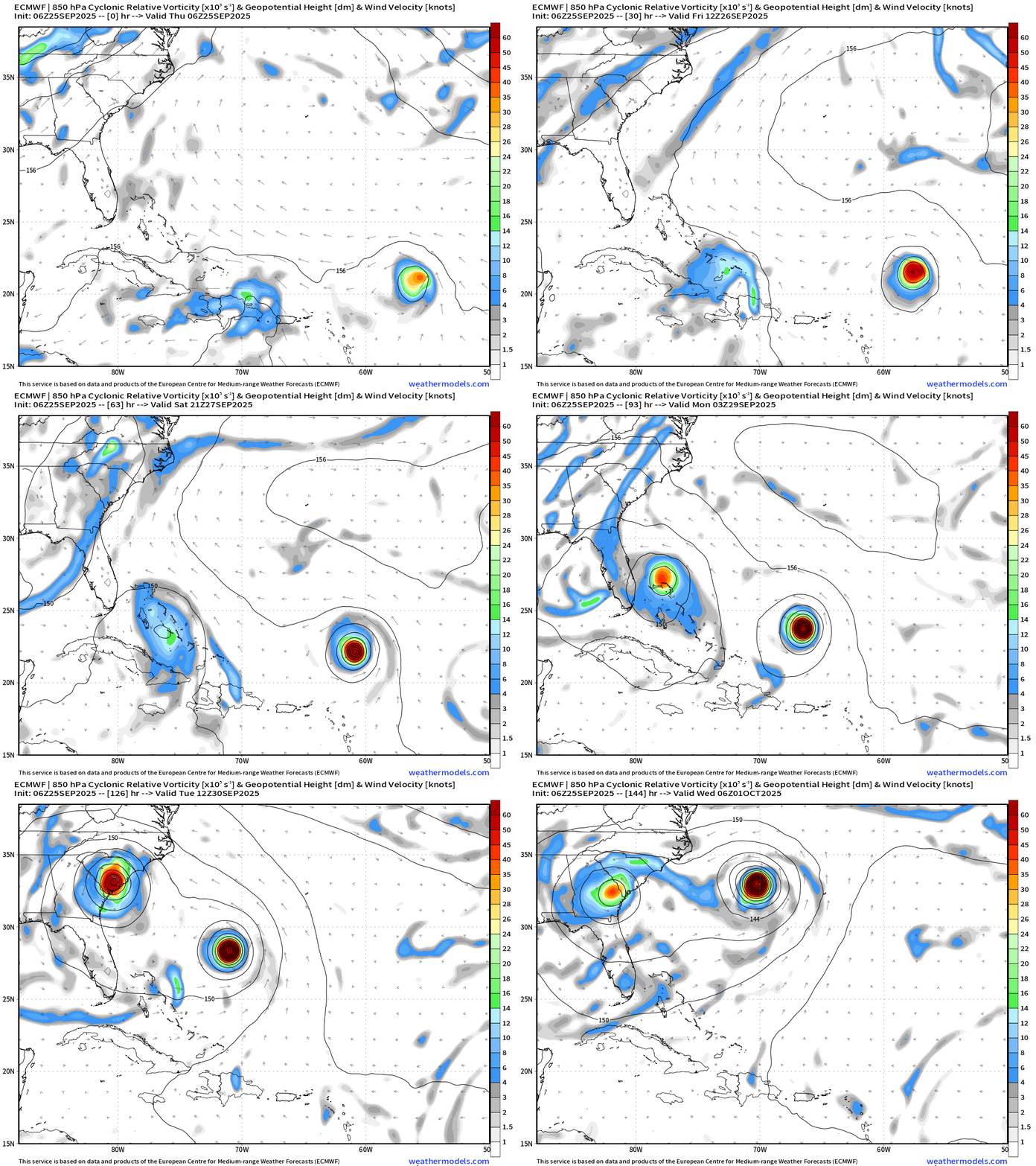
Imelda is FASTER than Humberto with a track into South Carolina in 5 days (Mon-Tues)
ECMWF 06z Precipitable Water | Next 6-days
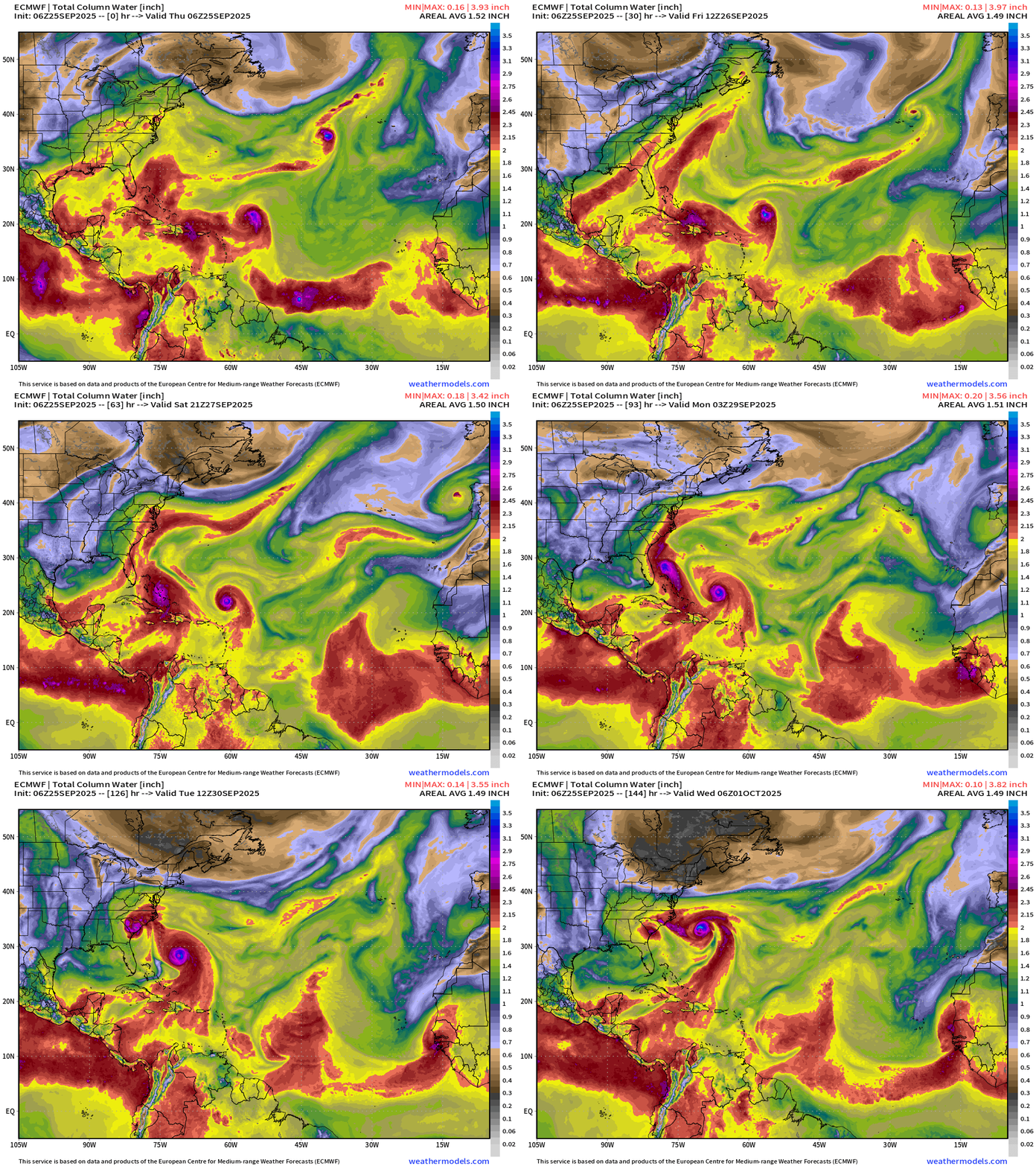
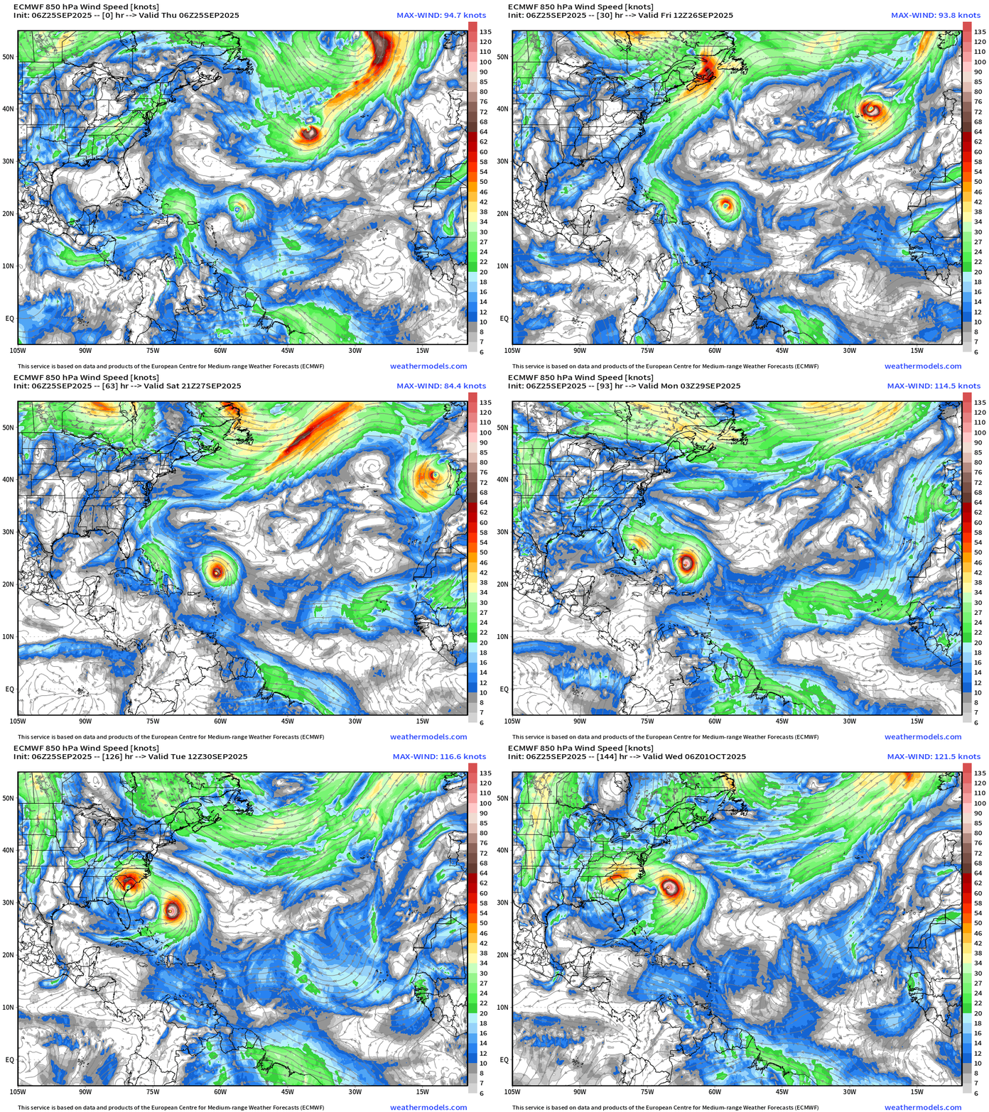
Most recent 06z cycle of the ECMWF (flagship) model has Imelda gaining latitude faster than Humberto, which is very intense (Cat 4+)
HIGH uncertainty — but interests along the U.S. East Coast should monitor BOTH systems which will interact
ECMWF 06z | 850 hPa Wind Speed | Next 6-days
Atlantic Satellite Imagery | IR and Mid-Level Water Vapor
NOAA Tropical Surface Analysis | 18z
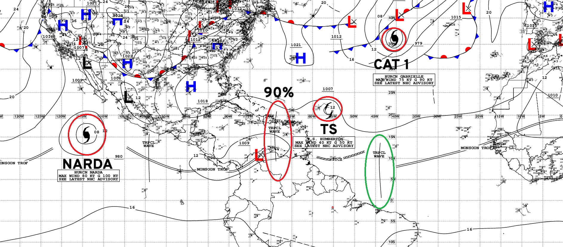
Atlantic Tropical Waves = 2 including Invest 94L being watched with HIGH chance of development (90%)
ECMWF EPS 06z Ensemble | All Cyclone Tracks Through 6-days
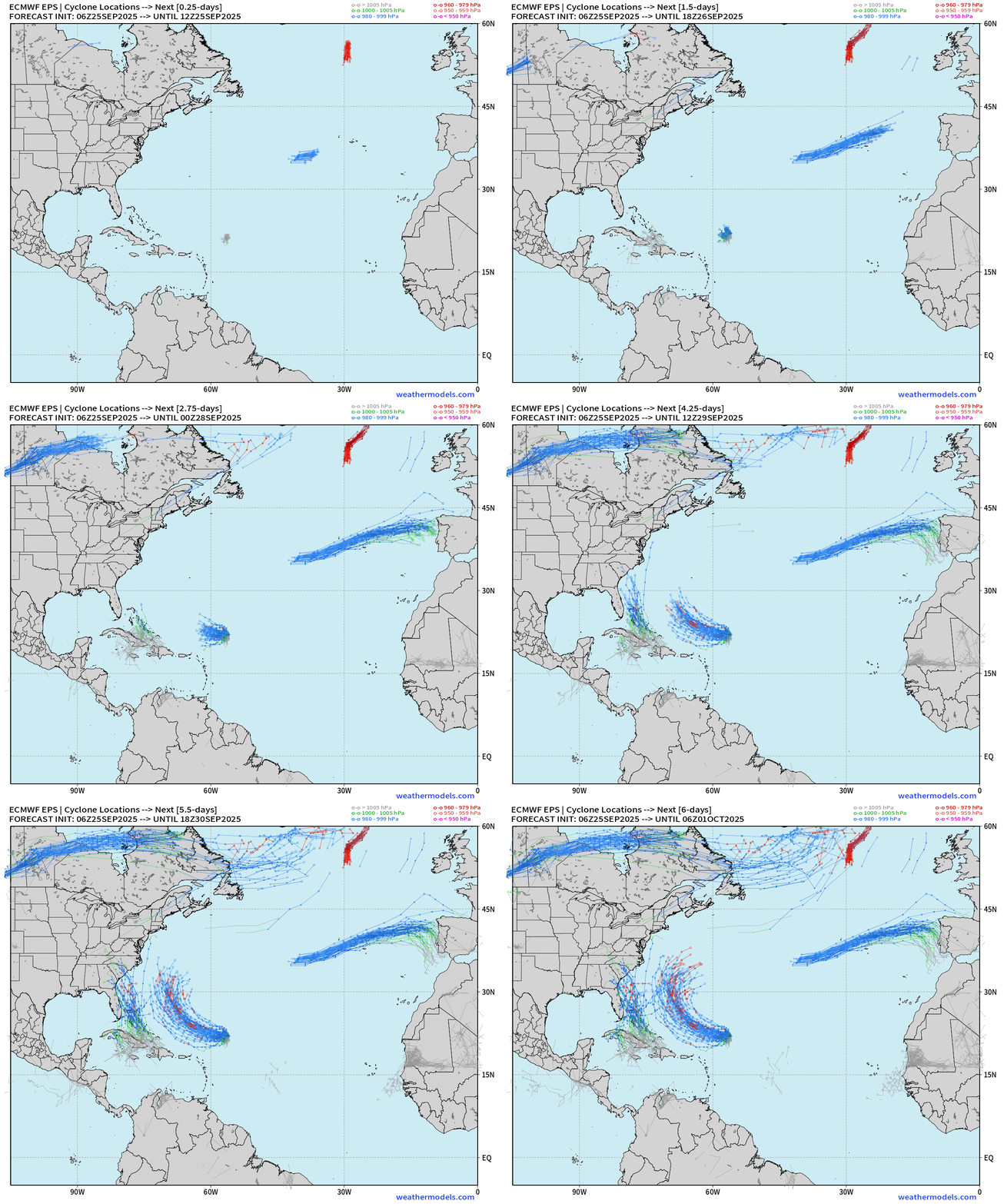
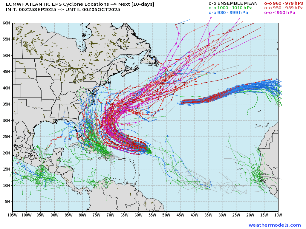
Continuing to trend toward Hurricane Imelda being a threat to land — with the forward motion being the main differentiator in terms of intensity at landfall in the Southeast.
00z Ensembles through 10-days
Hurricane Gabrielle another 24-36 hours before transitioning to post-tropical
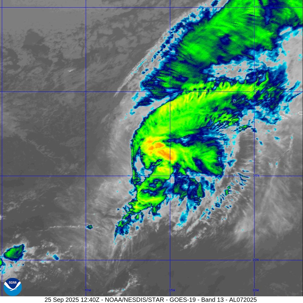
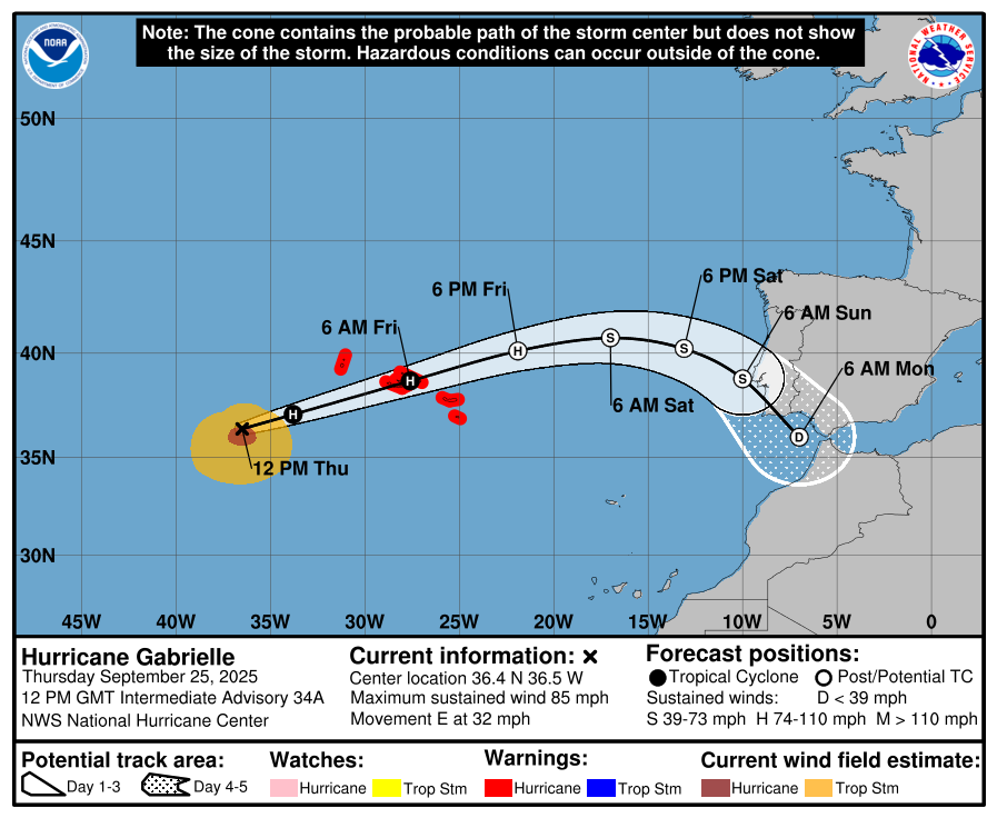
Category 1 Hurricane Gabrielle (85-mph | 970 mb) racing ENE at 32 mph to the Azores as a Hurricane into Friday
Post-tropical hurricane-force later on Friday — may landfall Portugal this weekend but much weaker as equivalent of minimal TS or TD (35 knot winds)
Eastern Pacific Tropical Update | Hurricane Narda
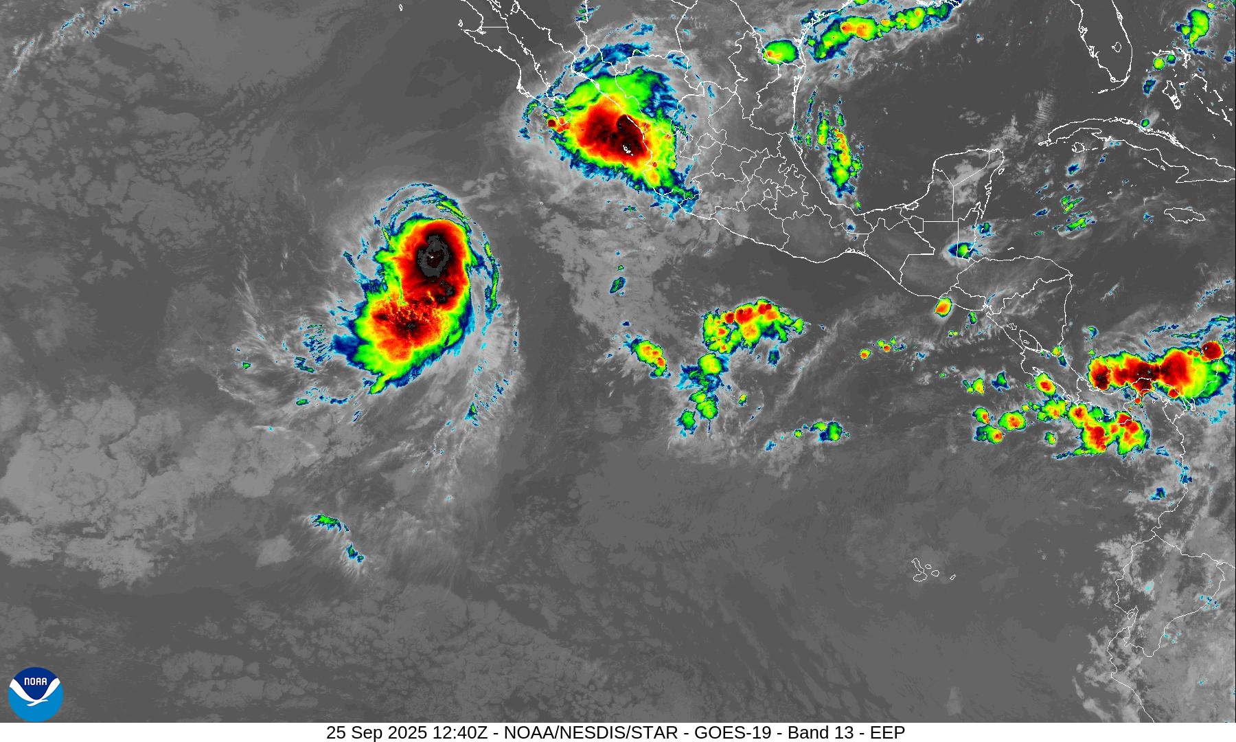
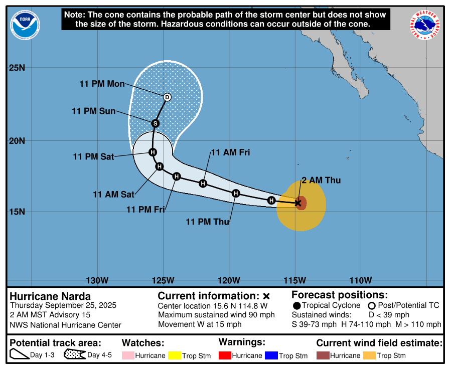
Hurricane Narda | Category 1 | 90 mph Winds
Narda will remain well away from land … and perhaps intensify to near major hurricane strength in the coming days
Maps sourced from weathermodels.com designed and innovated by yours truly! Please subscribe there for real-time access to the newest maps, charts from all of the weather models including ECMWF.
- Milepost
- 746 · laid 2025-09-25T13:20:24.825000Z
- Source
- https://weather.substack.com/p/september-25-2025-thursday-morning
- Digest
- 14aef3ec0b38c047fabf92c23a762bbd4debbf83d4de3d3dfa857493bebc14ff
- Machine
- JSON