September 23, 2025 Tuesday Evening Update
Twin hurricanes could develop with a risk to US East Coast
September 2025 was the 7th-warmest September in the 131-year national record (1895–2025), at 67.9°F against a 1991–2020 normal of 66.0°F (+2.0°F).
September 2025 was the 15th-driest September in the 131-year national record (1895–2025), at 1.9in against a 1991–2020 normal of 2.6in (-0.6in).
NOAA/NCEI Climate at a Glance, contiguous United States. This is the observed record for the month, not a score of anything said in this piece — the forecast ledger begins 2026-08-17 and cannot reach earlier posts.

2025 Season to Date: 7 Named Storms, 2 Hurricanes, and 2 Majors | ACE = 54
Good Evening! Atlantic hurricane season becoming quite busy over the next week or so with at least 2 more named storms — and both may become strong hurricanes. There is a risk for U.S. East Coast impacts from at least one of the systems — currently designated Invest 93L and Invest 94L — but we won’t know which one gets Humberto or Imelda naming rights. Holding patten until storm(s) formation occurs.
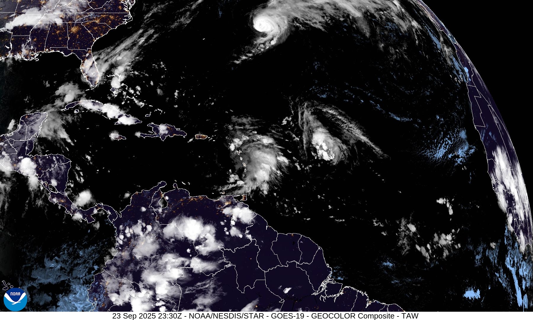
Hurricane Gabrielle is still a major hurricane as of 8 PM ET moving eastward across the central North Atlantic. The eye has become cloud filled an more ragged as the hurricane weakens over cooler ocean waters within a more stable and dry environment.
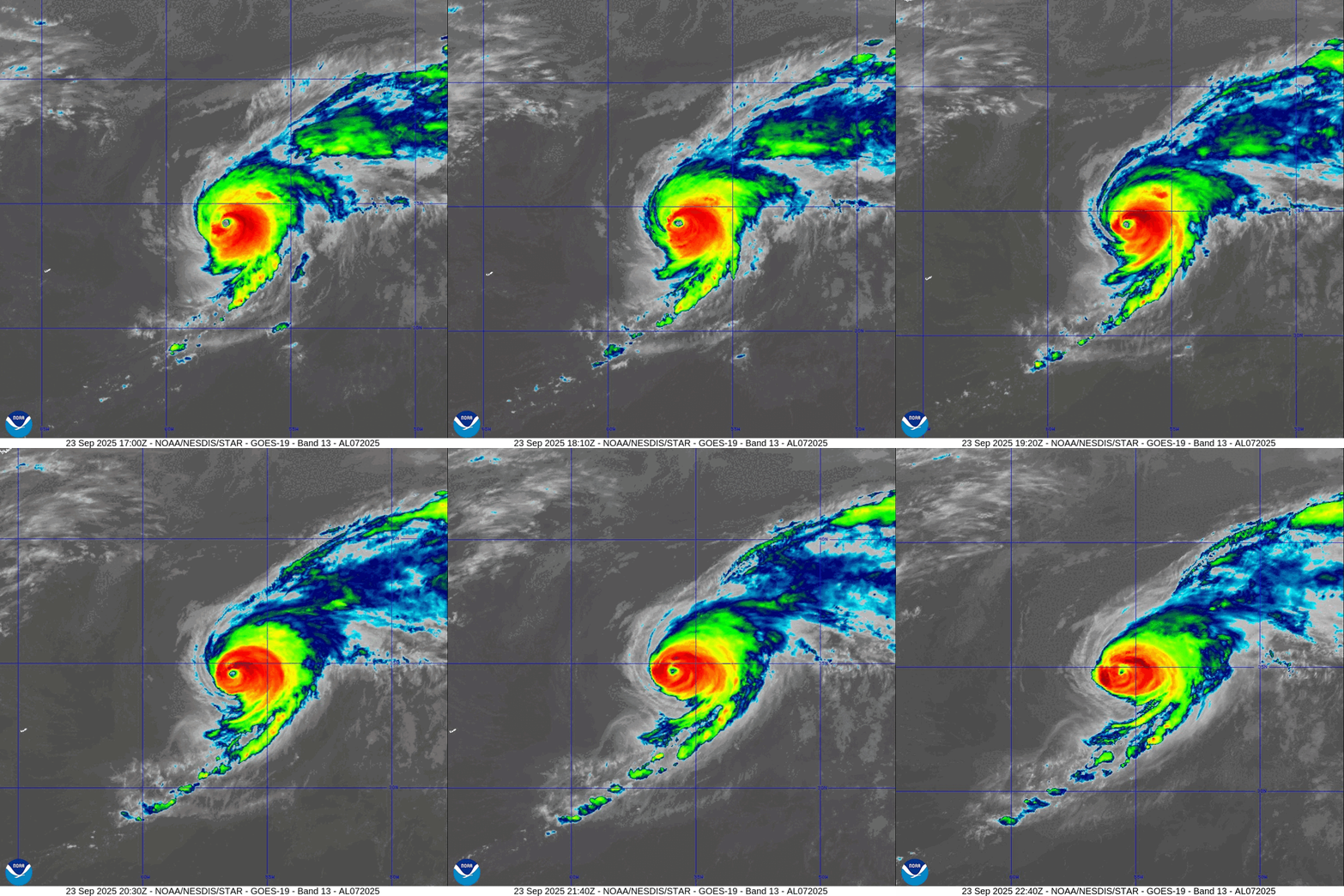
Atlantic Basin Outlook | 8 PM ET Update
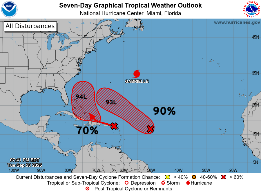
NHC has Invest 94L up to 70% development within next 7-days + Invest 93L to the right/east at 90%
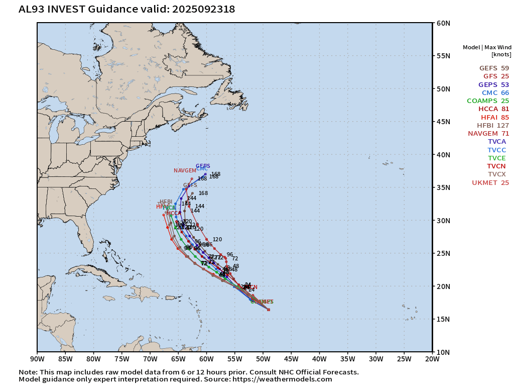
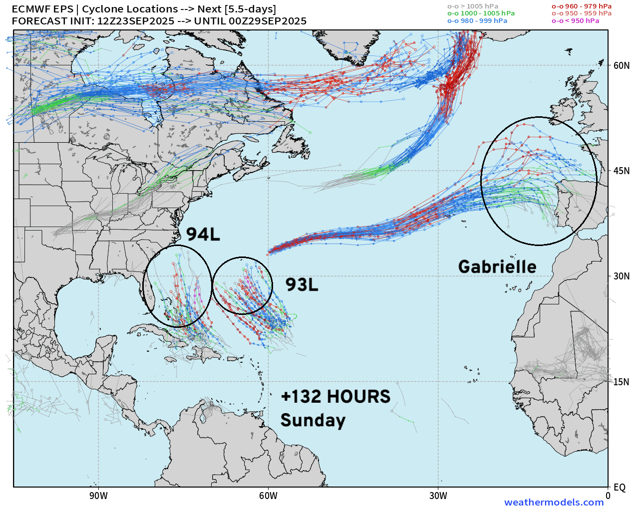
Invest 93L with similar NW track as Gabrielle
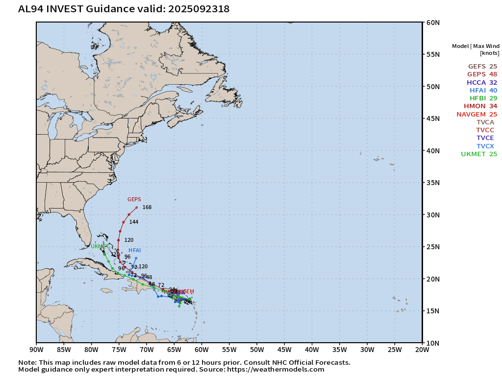
Invest 94L more uncertain WNW track through northern Caribbean into the Bahamas in next 5-days
Not much model guidance yet for 93L — more will be available tomorrow from the suite of hurricane models.
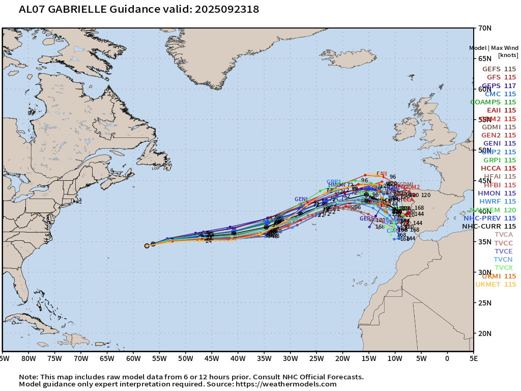
Category 3 Hurricane Gabrielle (110-knots | 953 mb)
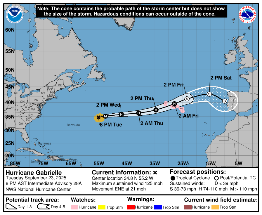
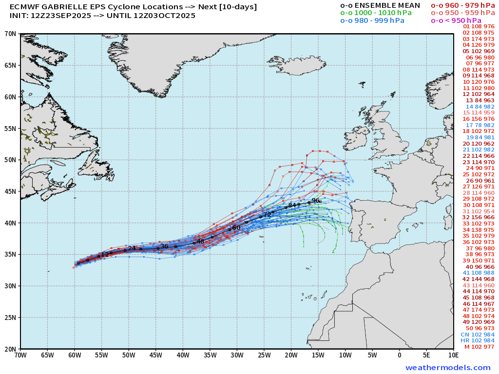
Post-tropical storm by Friday — may landfall Portugal this weekend but much weaker
Category 3 Hurricane Gabrielle (07L) ATCF Spaghetti
ECMWF Ensembles 12z | Gabrielle
Medium and Extended Range
ECMWF 12-Days Integrated Vapor Transport | 12z cycle
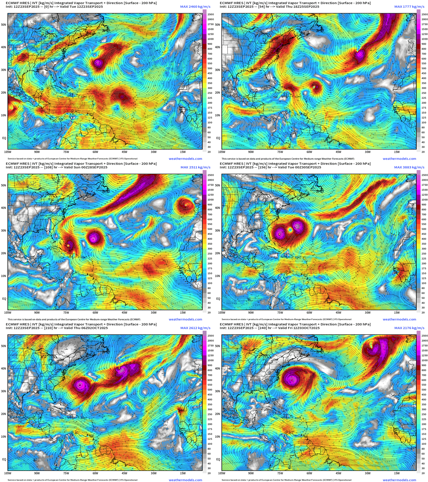
Flagship model at 12z through 12-days shows both Humberto (93L) and Imelda (94L) becoming hurricanes … but remaining separated and not interacting.
Humberto leaves to the ENE out to sea but Imelda is left behind to spin off the East Coast. Further in the future, it eventually heads out to sea with another trough.
UNCERTAINTY = HIGH — this is just one of hundreds of potential forecast ensemble scenarios we’ll see in the next several days.
ECMWF 18z Precipitable Water | Next 6-days
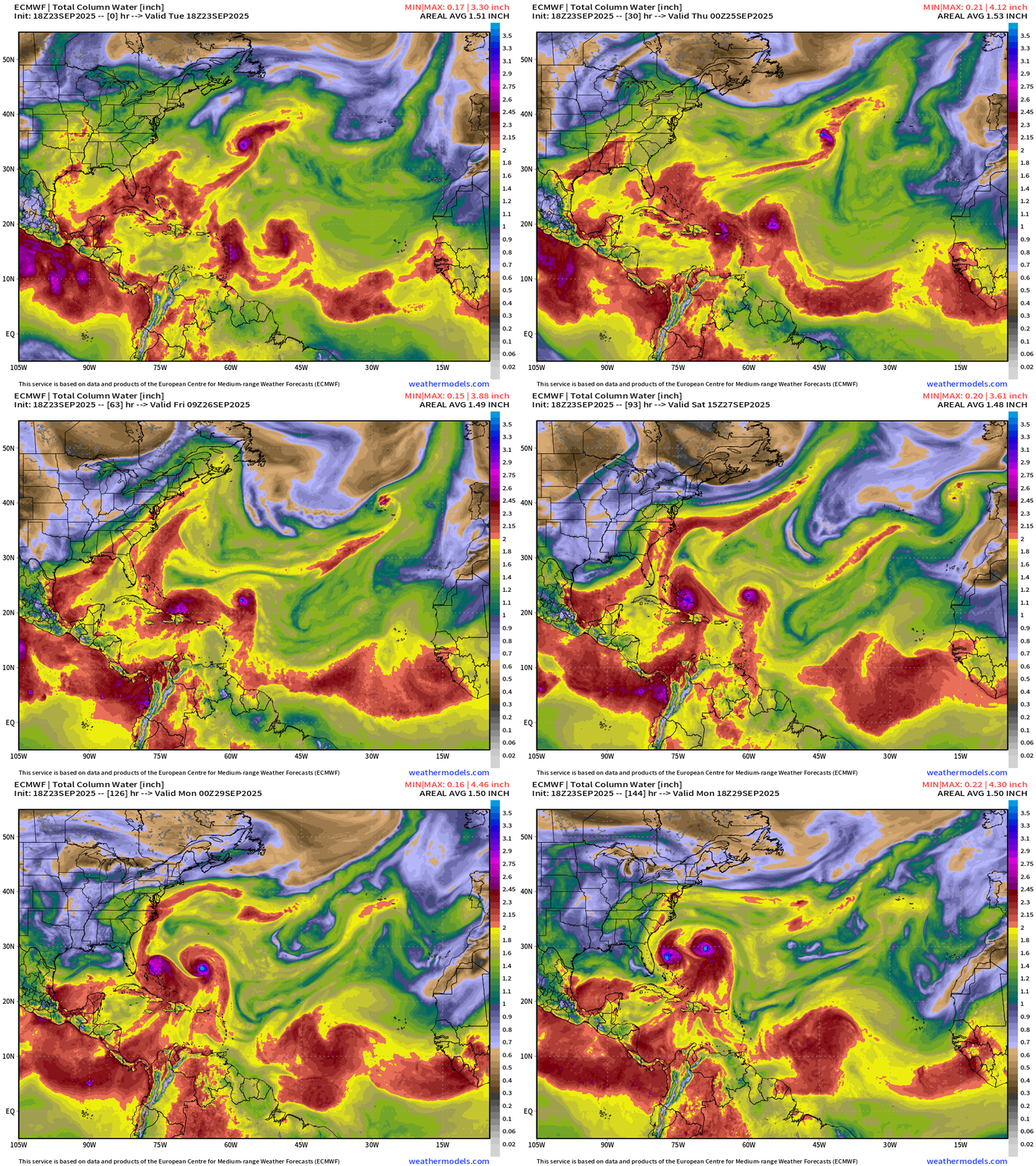
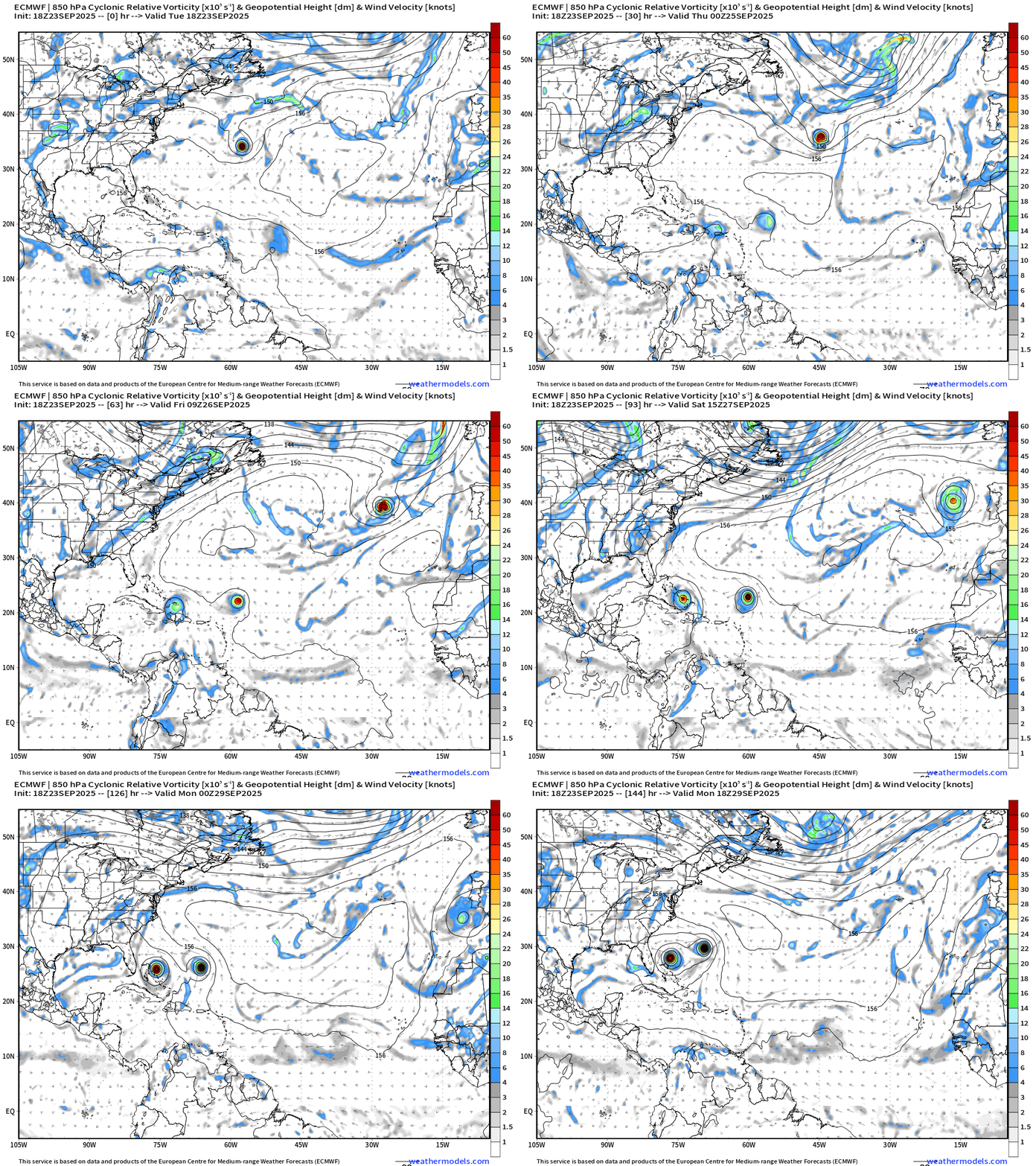
Most recent 18z cycle of the ECMWF (flagship) model has both Humberto and Imelda (hard to predict naming here) gaining latitude together side by side through Monday
HIGH uncertainty — but interests along the U.S. East Coast should monitor BOTH systems which may interact
ECMWF 18z Cyclonic Relative Vorticity | Next 6-days
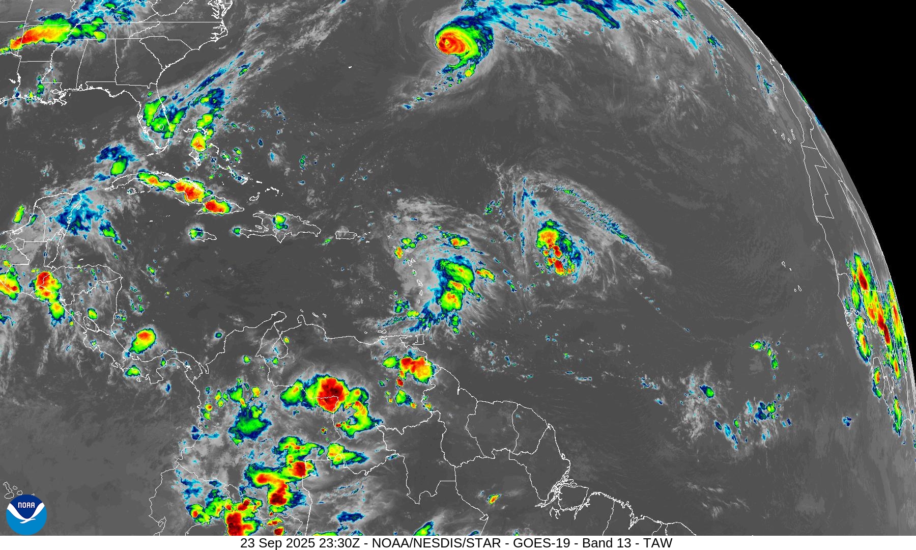
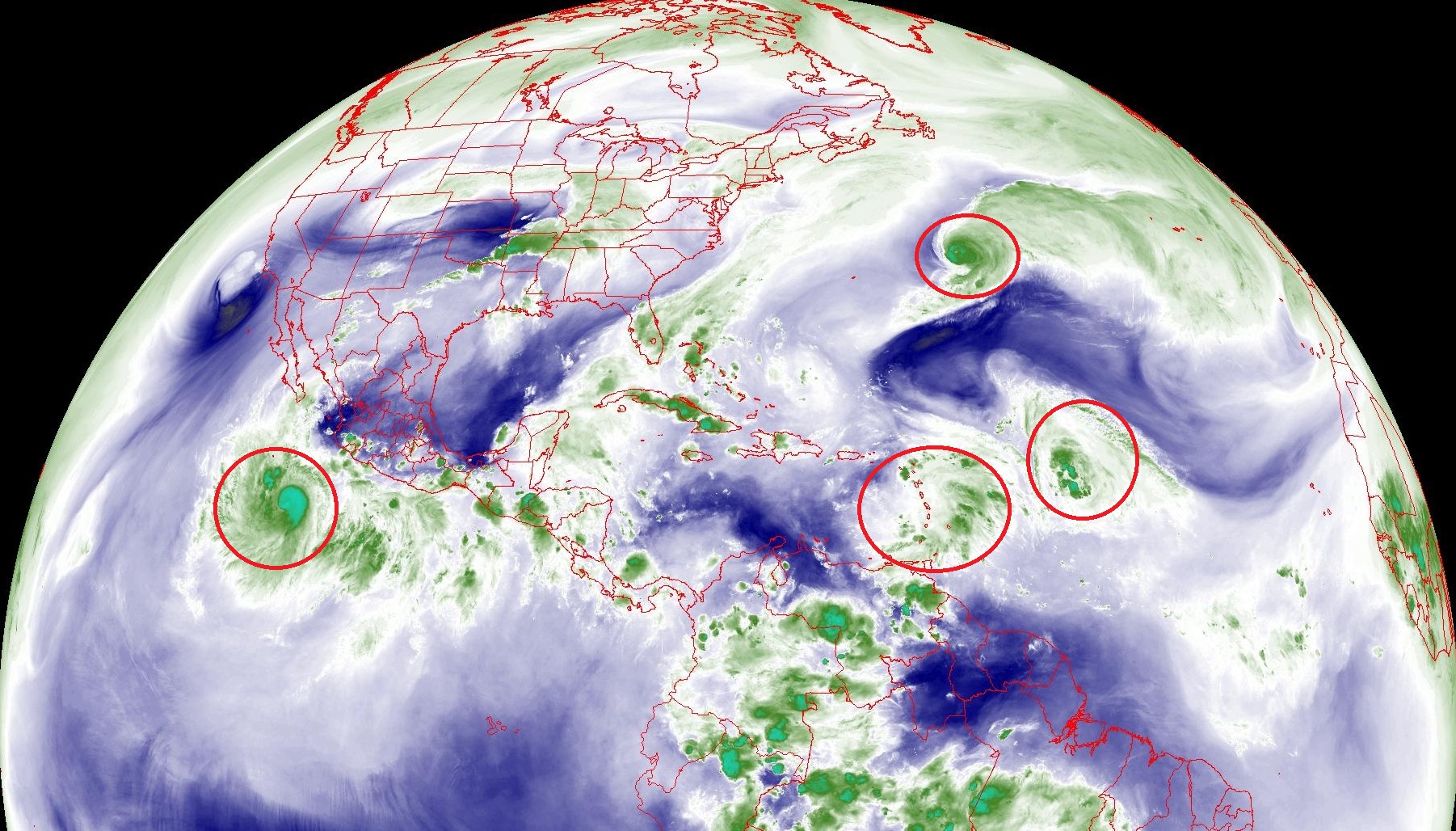
Atlantic Satellite Imagery | Infrared + Water Vapor + Night GeoColor
NOAA Tropical Surface Analysis | 12z
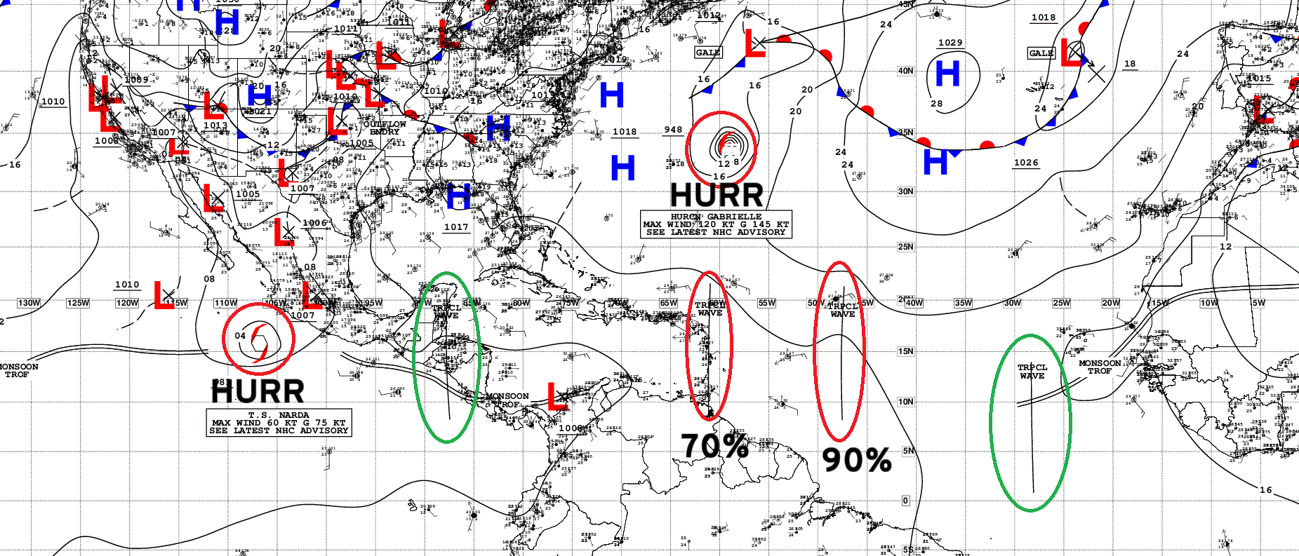
Atlantic Tropical Waves = 4 including two being watched with HIGH chance of development: Invest 93L and Invest 94L
Sea Surface Temperature + Anomaly | ECMWF 12z
Anomalously warm water centered upon Bermuda above 30°N — coincidentally along the path of Gabrielle and following system (Humberto or Imelda)
ECMWF EPS 12z Ensemble | All Cyclone Tracks Through 5.5-days
ECMWF EPS 12z Ensemble | All Cyclone Tracks Through 7-days
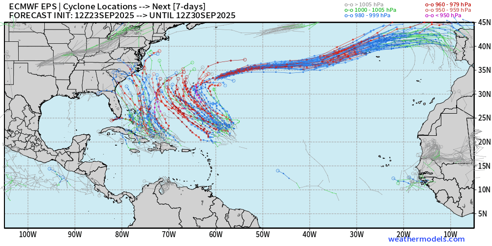
Threat to the U.S. Southeast —> Carolinas + Virginia coastline by 7-days from 94L
ECMWF EPS 12z Ensemble | All Cyclone Tracks Through 10-days
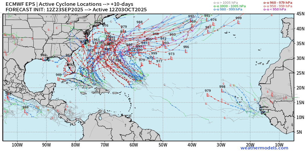
Highly chance of both systems developing into Hurricanes — with major intensity on the table. However, we’ll need to wait until formation occurs before making any impacts forecasts — very complicated because there are 2 storms!
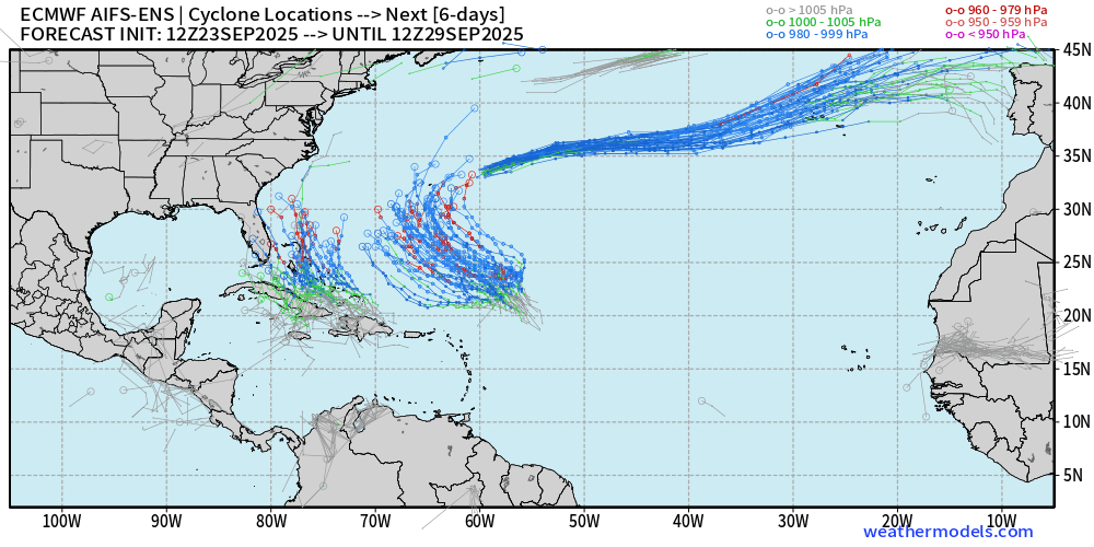
AIFS-ENS Comparison at 12z | All tracks at Day 6
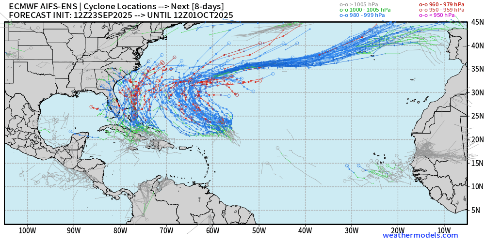
AIFS-ENS Comparison at 12z | All tracks at Day 8
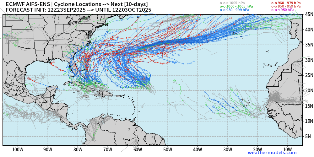
AIFS-ENS Comparison at 06z | All tracks at Day 10
Eastern Pacific Tropical Update | Hurricane Narda
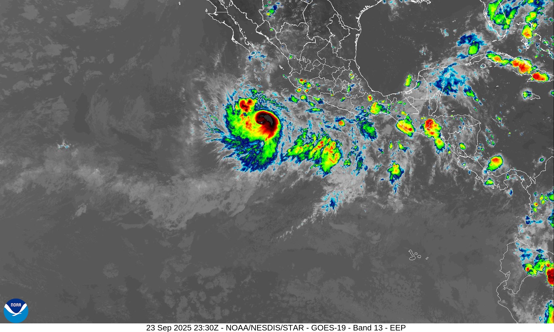
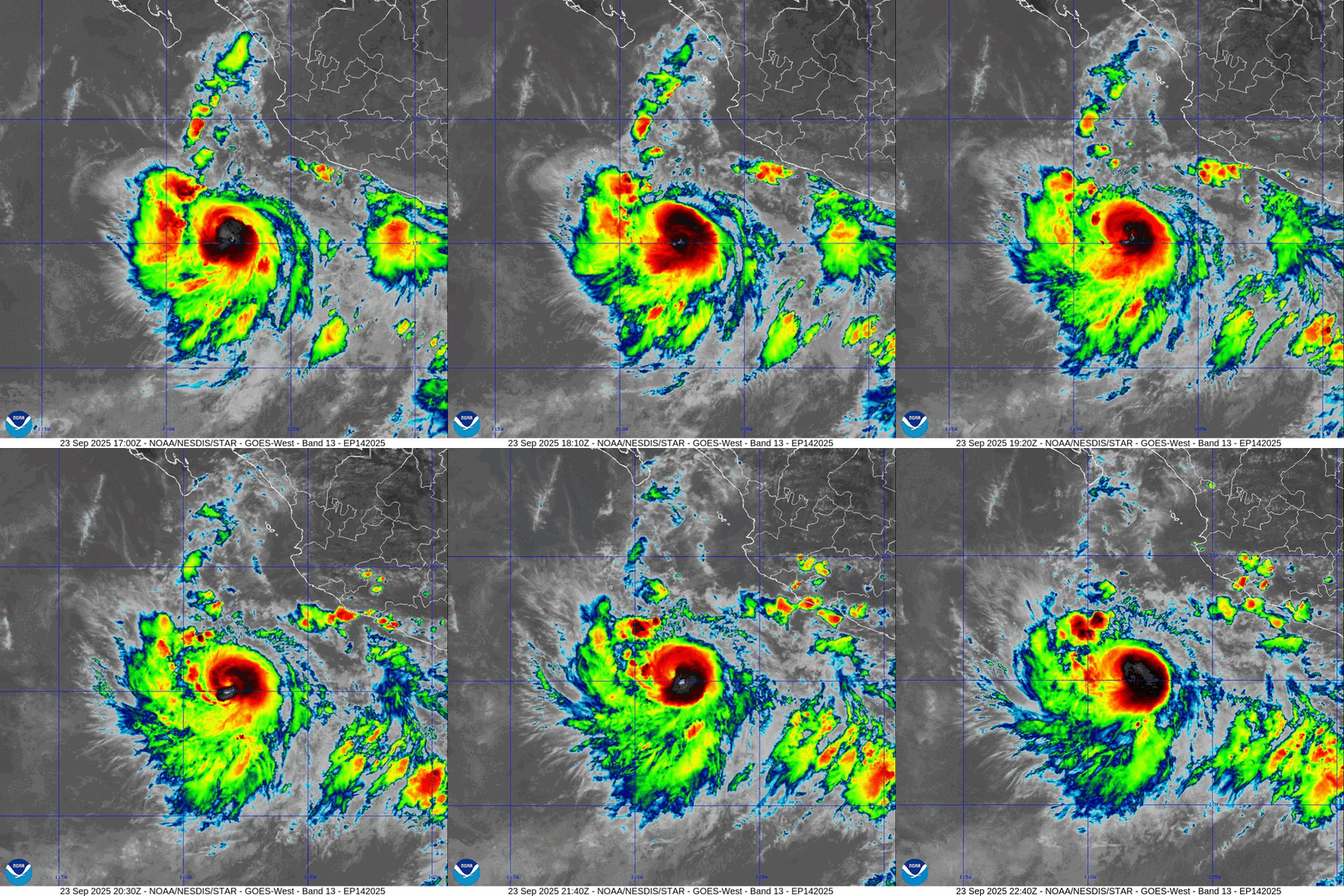
Hurricane Narda | Category 1
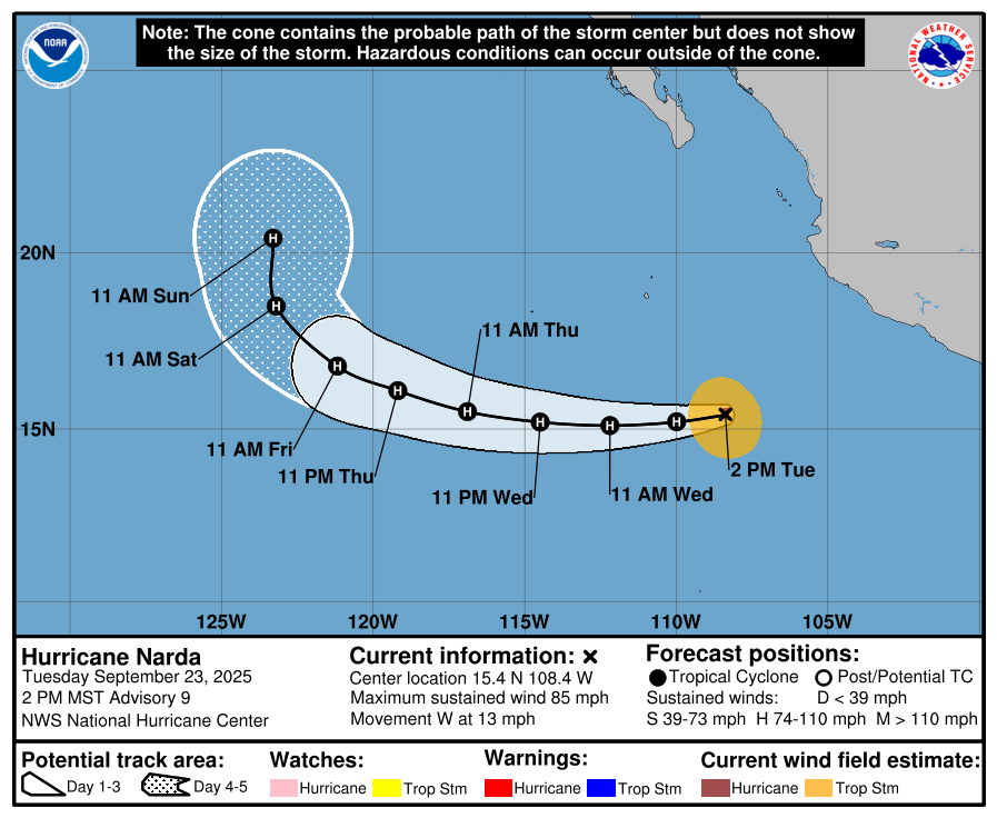
Forecast to reach near major hurricane strength over warm water of Eastern Pacific well away from Mexico.
Western Pacific Typhoon Season Update
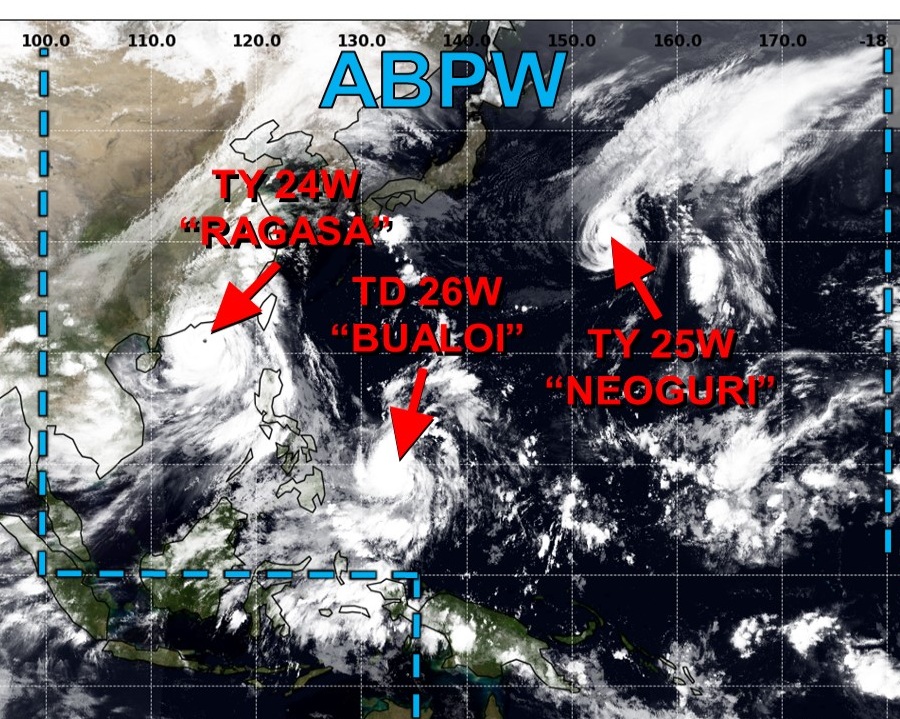
Category 4 Typhoon RAGASA (24W)
115-knots — Category 4 with a ragged eye
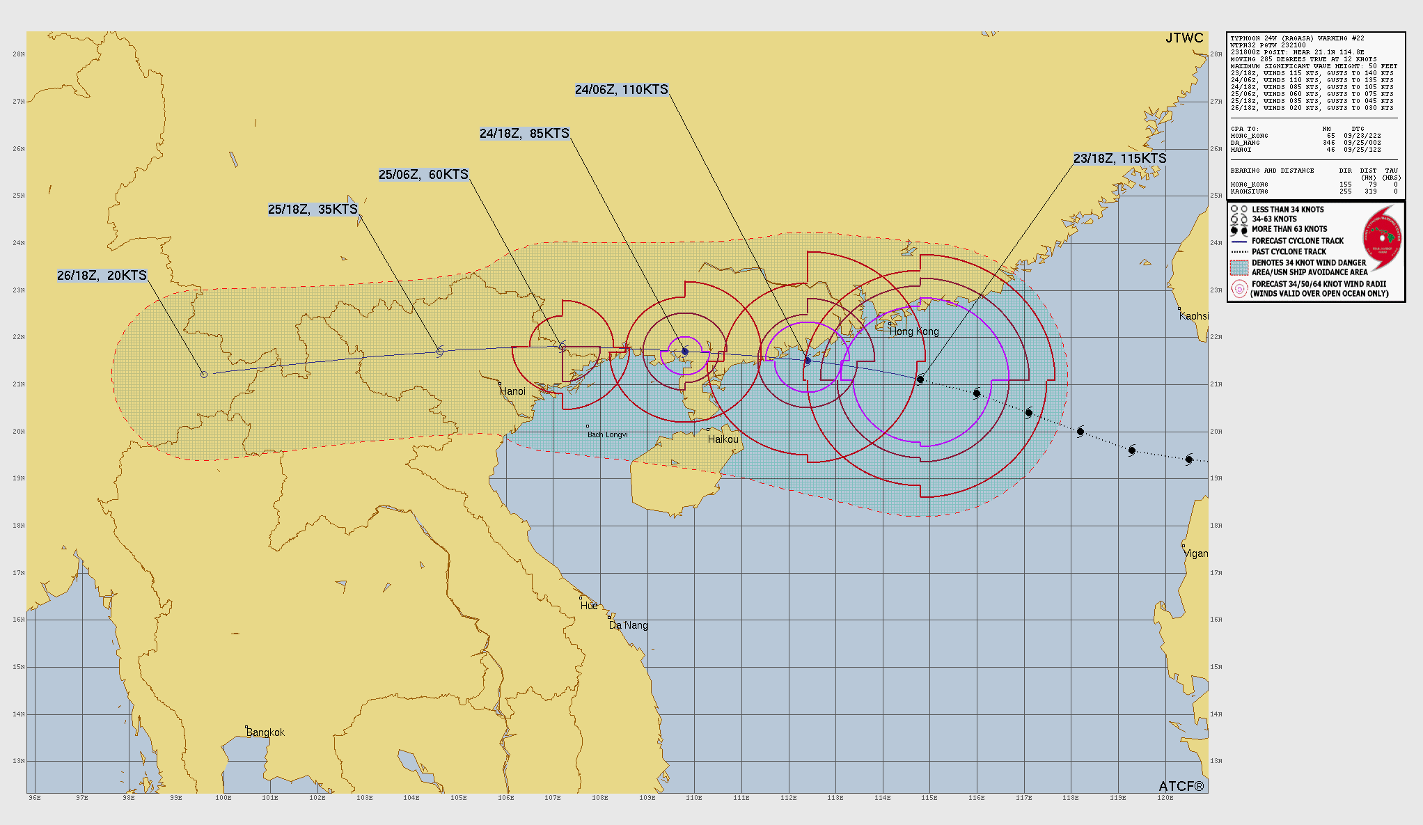
Ragasa is tracking south of Hong Kong and will maintain Major Typhoon intensity as it makes landfall down the China coastline on Wednesday.
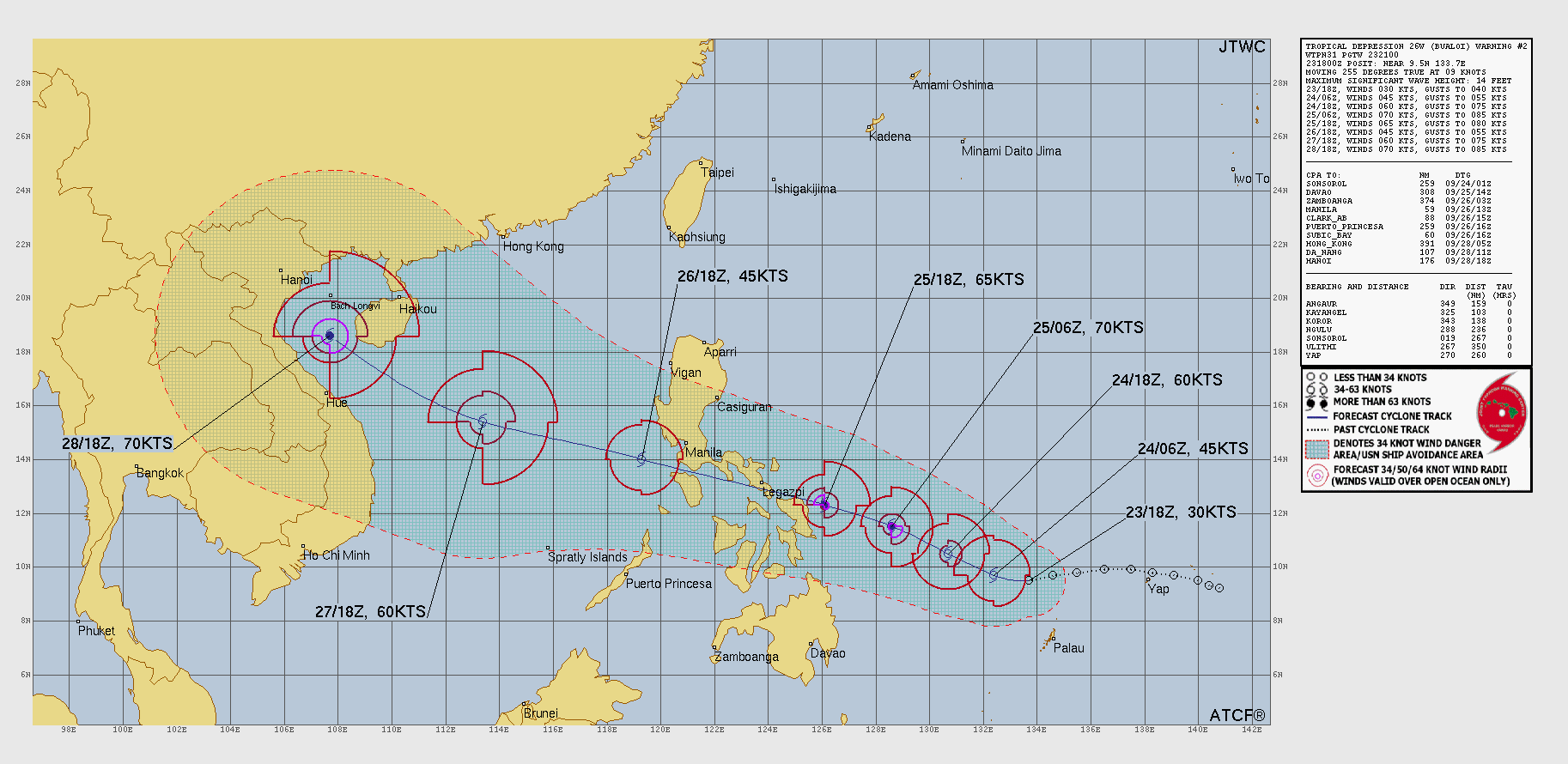
BUALOI (26W) has been designated — expected to become a Typhoon prior to impacting the Philippines in a couple of days.
ECMWF 18z Precipitable Water | Next 6-days
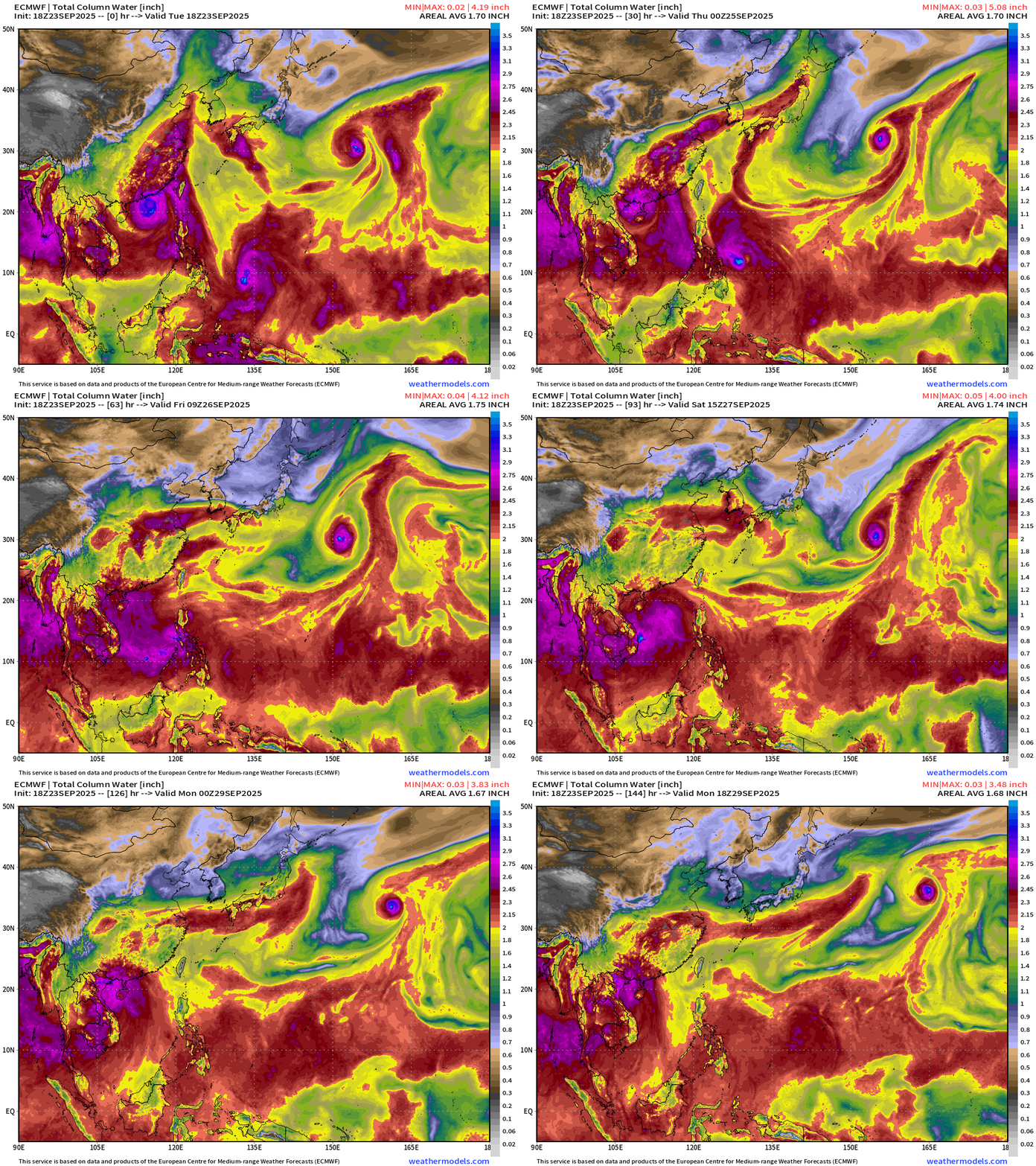
East of Japan, Typhoon Neoguri will eventually move into the North Pacific once another trough comes by to whisk it away.
Maps sourced from weathermodels.com designed and innovated by yours truly! Please subscribe there for real-time access to the newest maps, charts from all of the weather models including ECMWF.
- Milepost
- 743 · laid 2025-09-24T00:45:11.956000Z
- Source
- https://weather.substack.com/p/september-23-2025-tuesday-evening
- Digest
- f35c929a1e2df1f9dbd656cb71b5dfe75b6dc183ef7ebaae7628b18a1f5989cd
- Machine
- JSON