September 21, 2025 Sunday Hurricane Season
Hurricane Gabrielle may rapidly intensify with Humberto on the way
September 2025 was the 7th-warmest September in the 131-year national record (1895–2025), at 67.9°F against a 1991–2020 normal of 66.0°F (+2.0°F).
September 2025 was the 15th-driest September in the 131-year national record (1895–2025), at 1.9in against a 1991–2020 normal of 2.6in (-0.6in).
NOAA/NCEI Climate at a Glance, contiguous United States. This is the observed record for the month, not a score of anything said in this piece — the forecast ledger begins 2026-08-17 and cannot reach earlier posts.

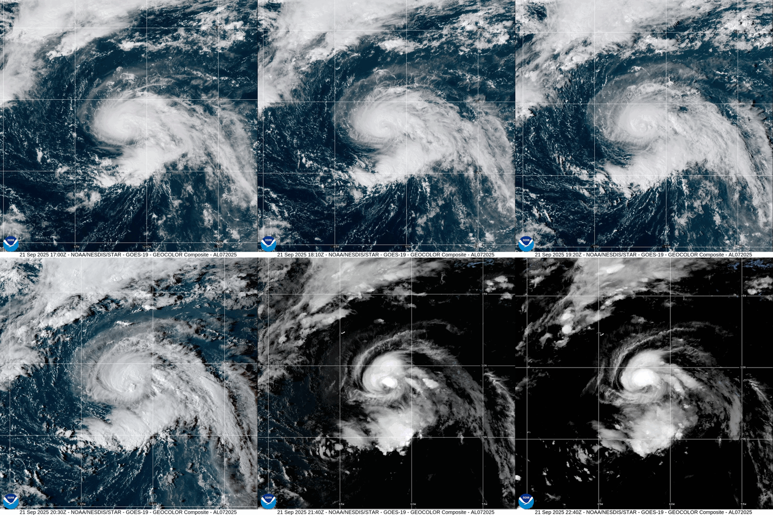
Hurricane Gabrielle was upgraded at 5 pm — and may be rapidly intensifying tonight as the eyewall wraps deep convection more tightly around a nascent eye. The hurricane has improved anticyclonic outflow. All systems go for at least a major hurricane and I would not be surprised to see Category 4 (115-knots).
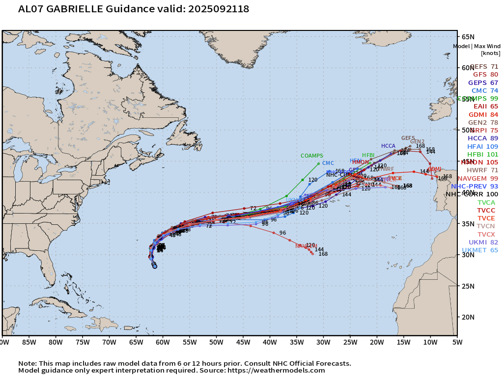
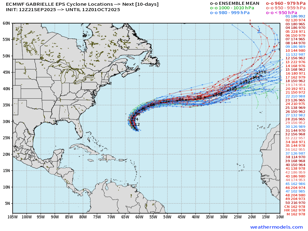
There is no direct threat to land as Gabrielle will slide safely east of Bermuda on ENE course. However, the remnants could impact Europe in a week.
Monster Super Typhoon Ragasa + Typhoon Neoguri | Sunrise
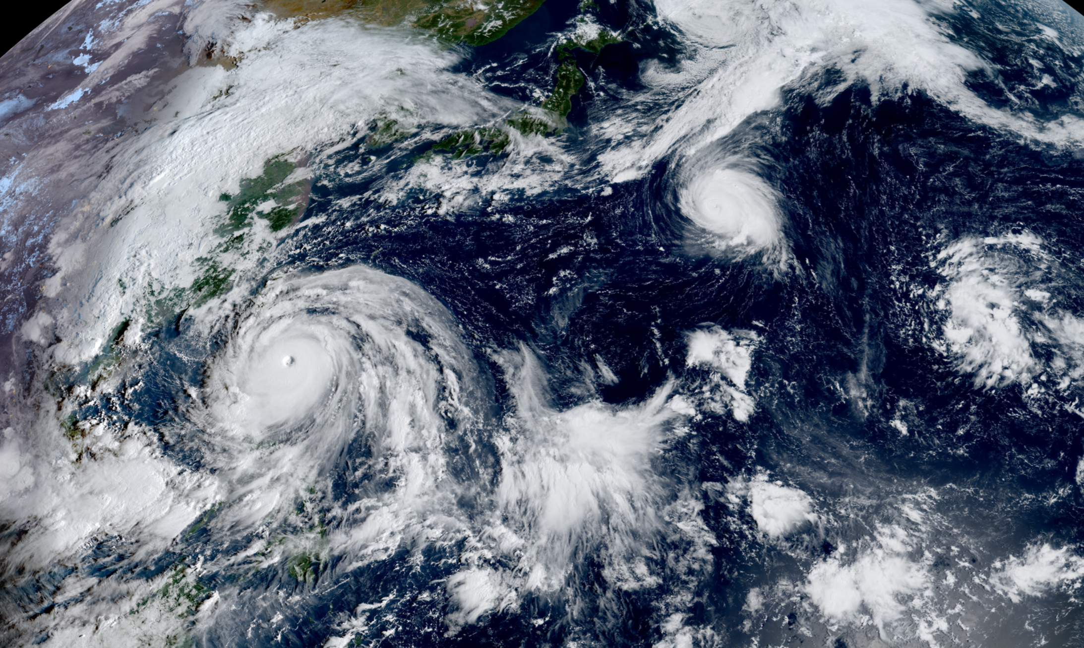
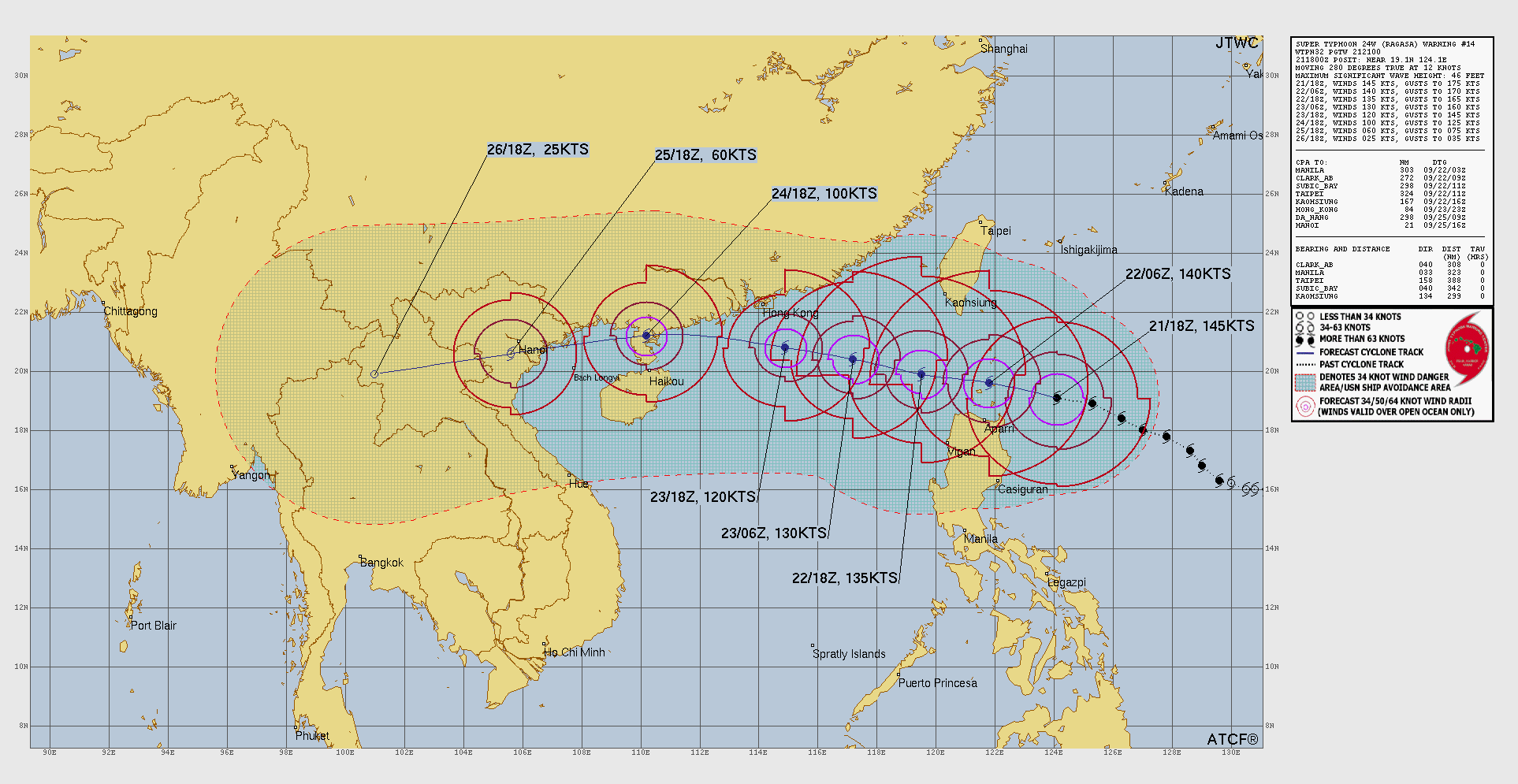
Ragasa is a massive typhoon w/145-knot winds and still has room to run up to 155-160 knots as the eye should contract heading through Taiwan Strait.
Atlantic Basin Outlook | 8 PM ET Update
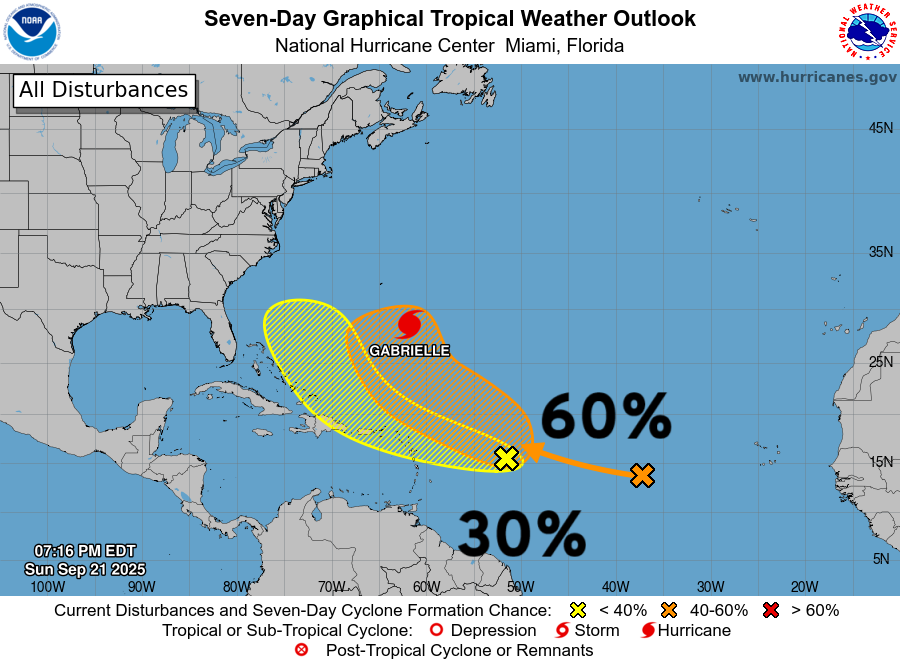
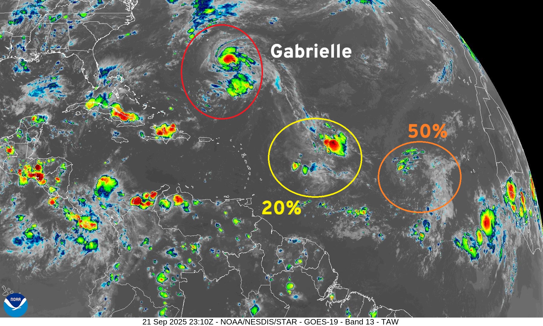
Two more areas being watched by NHC including a new 30% yellow hatchling based upon ensemble guidance from the A.I. models.
The 60% orange will be our next Invest and likely to develop into Humberto in next 5-7 days. Models also show it becoming a major hurricane on a similar course as Gabrielle.
Hurricane Gabrielle
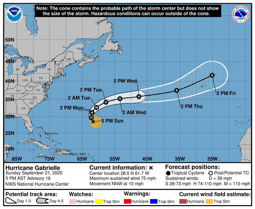
NHC keeps Gabrielle east of Bermuda — with maximum intensity of 100 knots (Category 3 —Major ) within 36 to 48 hours. I think the storm will reach at least 115-knots based upon the recent HAFS mesoscale guidance (18z)
2025 Season to Date: 7 Named Storms, 2 Hurricanes, and 1 Major | ACE = 44
Hurricane Gabrielle (07L) ATCF Spaghetti
ECMWF Ensembles 12z | Gabrielle
HAFS Mesoscale Models in 30 hours for Gabrielle
Central pressure in the 950s with 130-knots winds at 850 hPa more than sufficient for a Category 4 intensity
ECMWF 12-Days Integrated Vapor Transport | 12z cycle
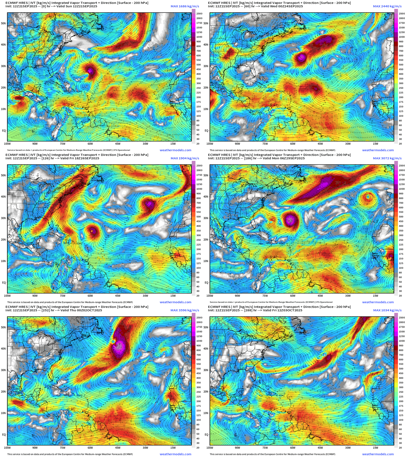
Flagship model ECMWF 12z now develops Humberto north of the Caribbean in 5-6 days … but not seeing the yellow hatchling catching fire (NHC 20%)
Atlantic Satellite Imagery | Infrared
NOAA Tropical Surface Analysis | 12z
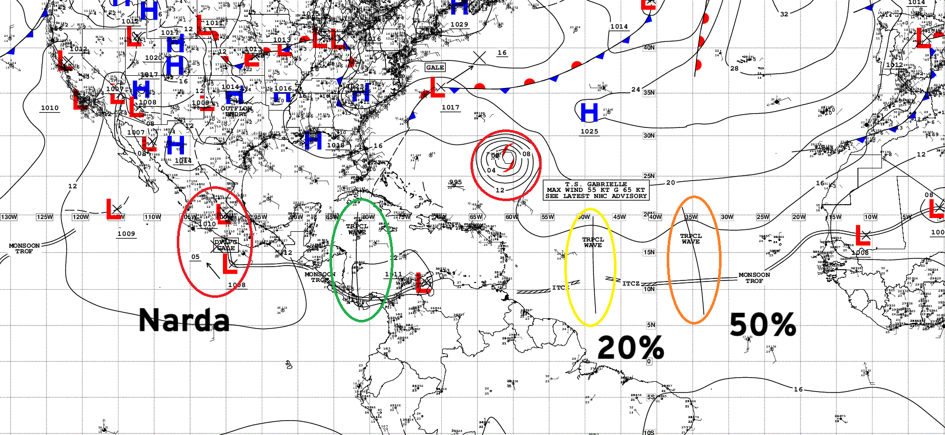
Atlantic Tropical Waves = 2
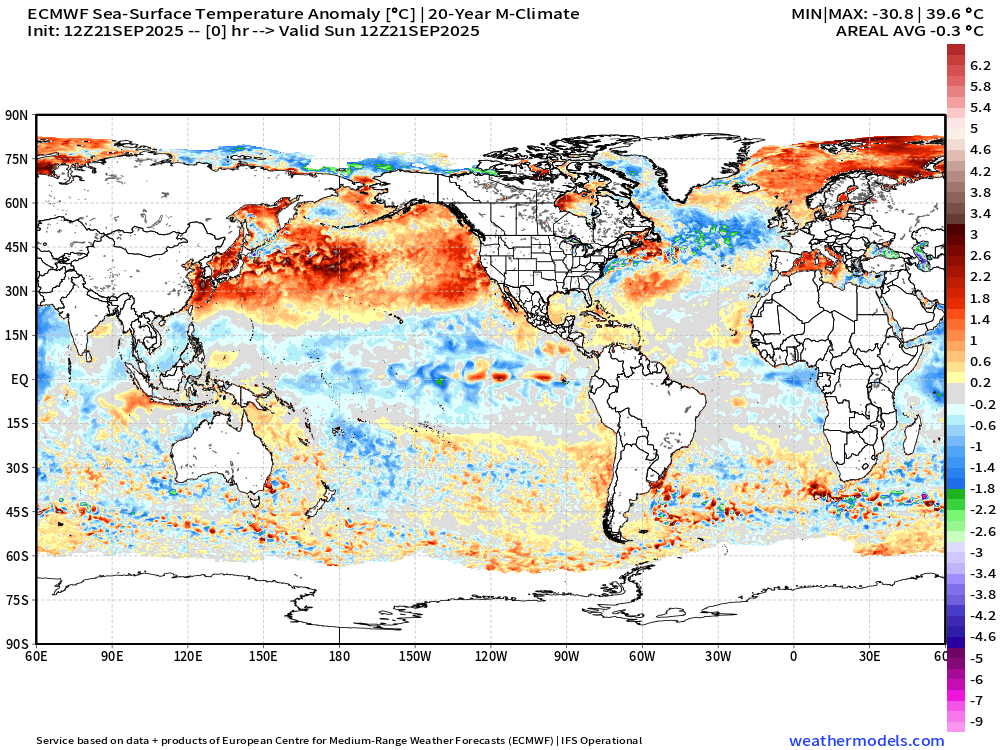
Sea Surface Temperature + Anomaly | ECMWF 12z Analysis
Anomalously warm water centered upon Bermuda
Global SST Anomaly: tropics generally cooler than normal while the North Pacific surface marine heat wave continues
Eastern Atlantic and Africa Infrared Satellite
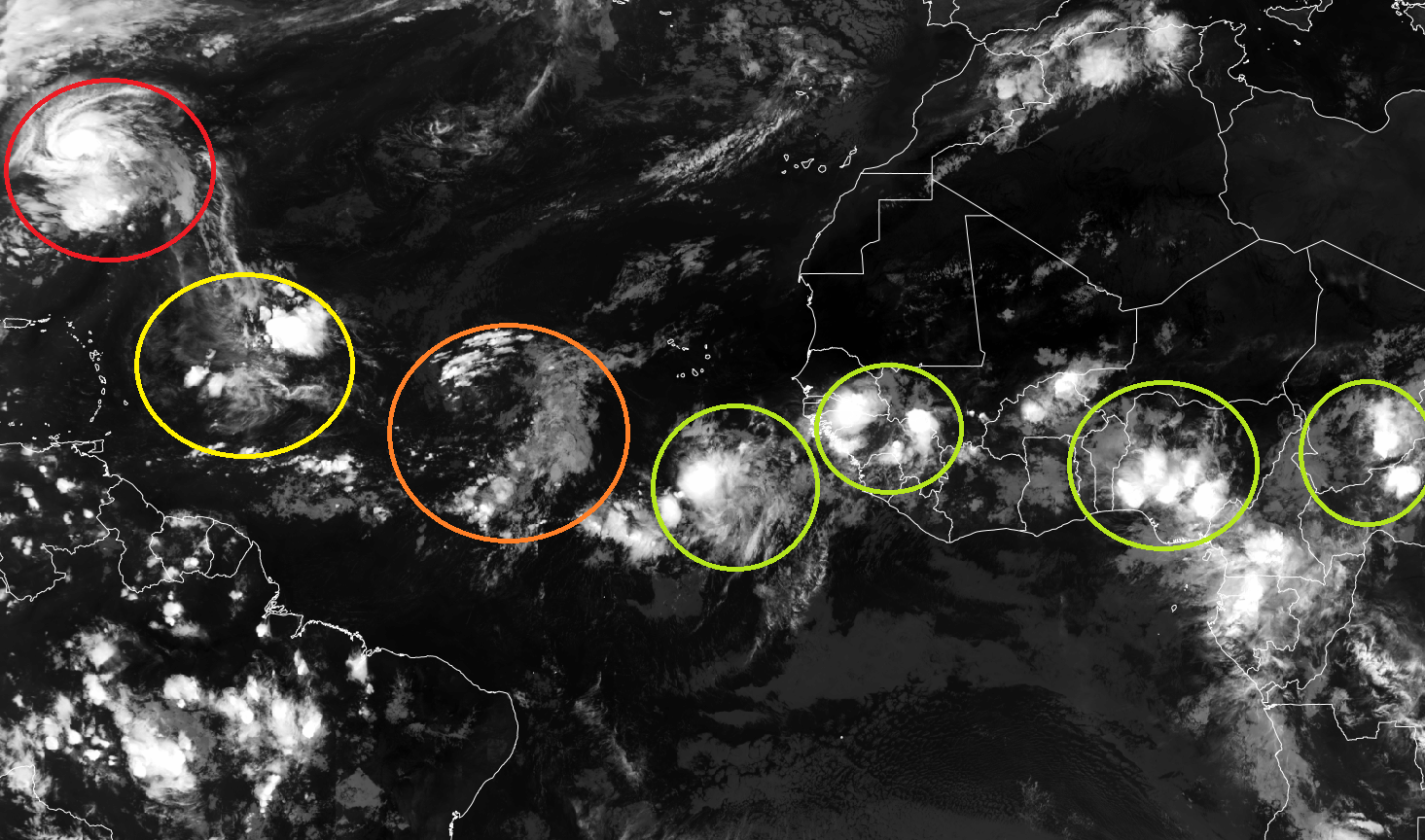
African wave train lined up on the tracks — we’ll see if background environmental conditions are more favorable in the next 1-2 weeks for tropical storm formation.
ECMWF EPS 12z Ensemble | All Cyclone Tracks Through 7-days
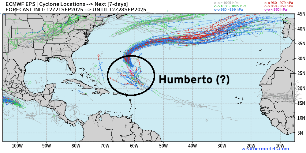
ECMWF EPS 12z Ensemble | All Cyclone Tracks Through 12-days
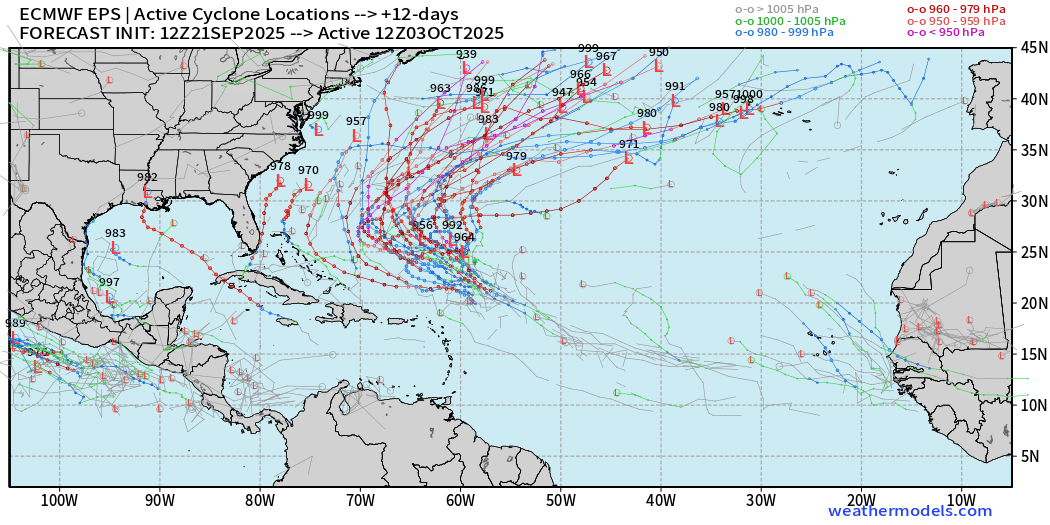
I see Humberto — and there are a few more tracks that randomly extend westward presumably from a leftover tropical wave — but low chances < 10%
ECMWF EPS 12z Ensemble | All Cyclone Tracks Through 15-days
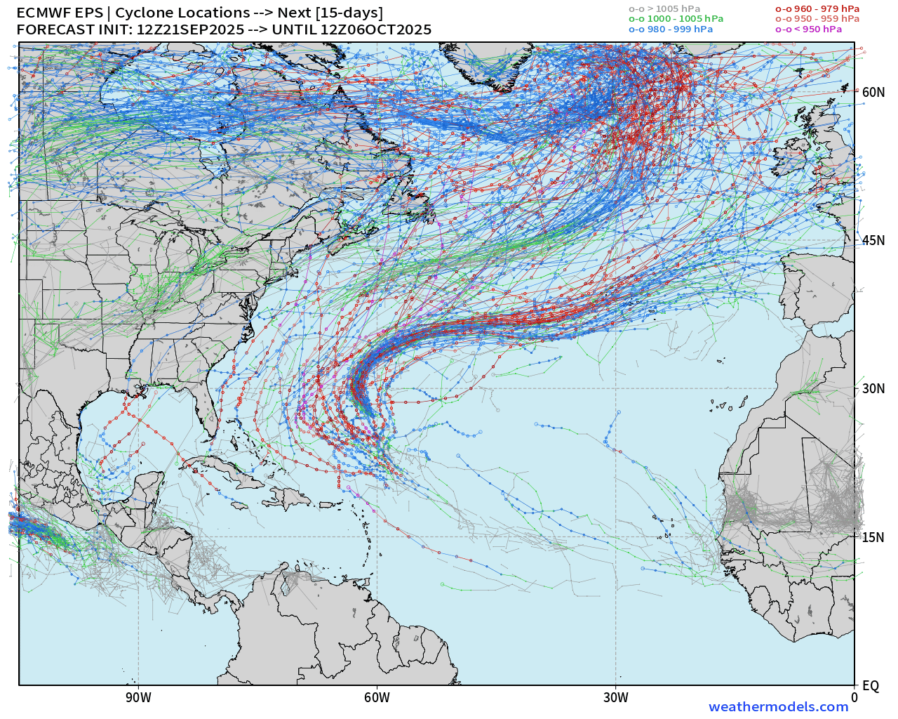
Gabrielle and Humberto but small chance of something else (< 10%) through 15-days (October 6)
AIFS-ENS Comparison at 12z | All tracks at Day 7
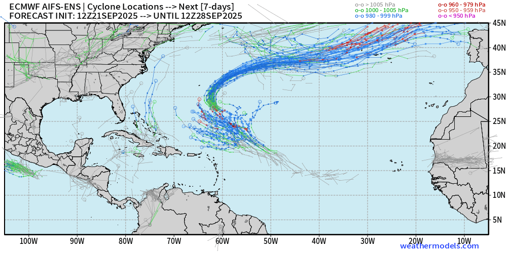
The A.I. trained ensembles also show Humberto … and if we look at the MSLP contours at Day 10 — a bunch of members show a TS or Hurricane from the Gulf to Bahamas.
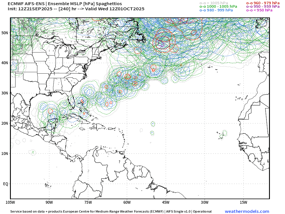
AIFS-ENS Comparison at 12z | All tracks at Day 12
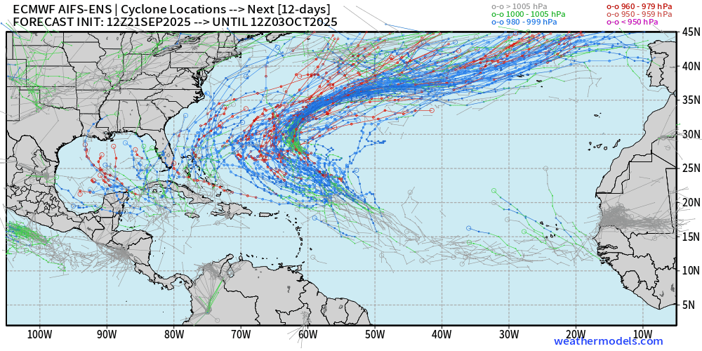
Meanwhile — AIFS blows up more member tracks w/ TS/Hurricane west of Humberto in the Gulf and out of the Caribbean
AIFS-ENS Comparison at 12z | Active Tracks at Day 15
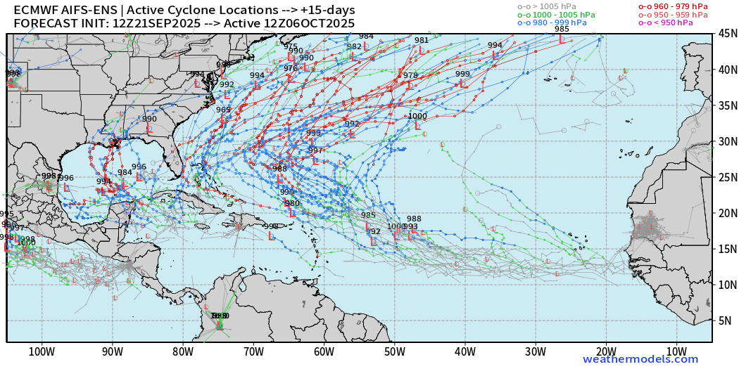
I’ve decided to keep showing the extended range (15 day) AIFS-ENS tracks since they may indicate potential tropical storm formation areas and favorable tracks — which apparently means the Gulf and off the U.S. Southeast coast.
However, I still suspect these are FALSE ALARMS as the AIFS-ENS has been way too eager to develop every tropical wave — likely a bias/problem with the lower resolution (0.25°) model — but I really don’t know. This model was just launched into the wild for everyone to use w/o much feeling for the quality of tropical storm formation forecasts in the medium and extended range.
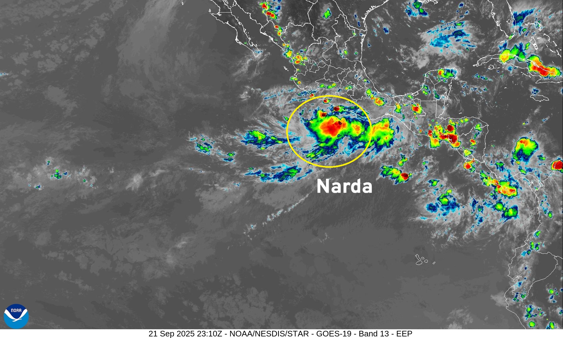
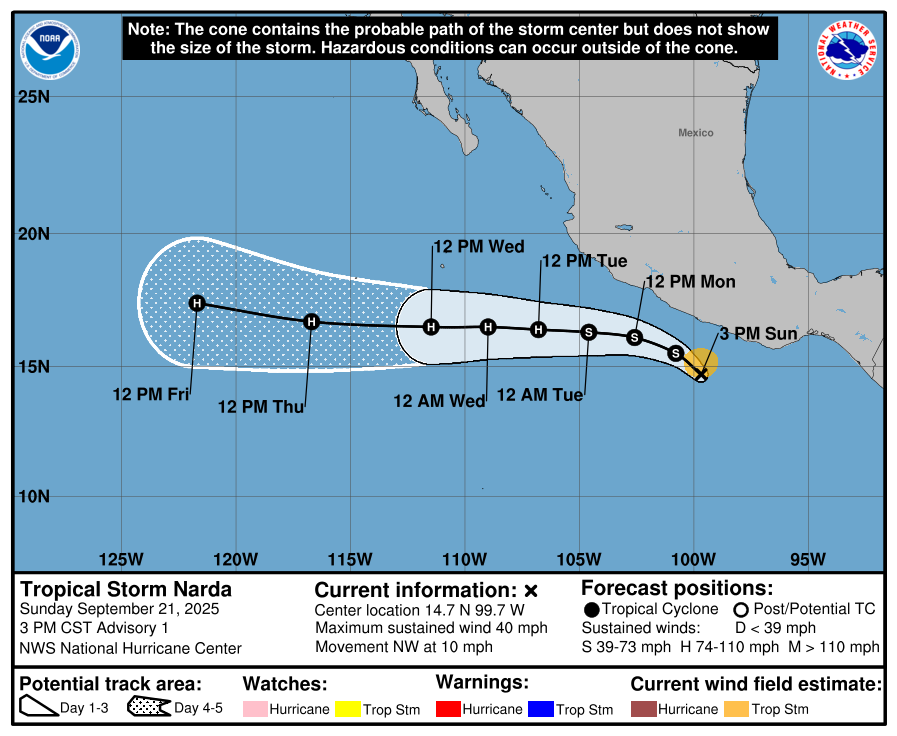
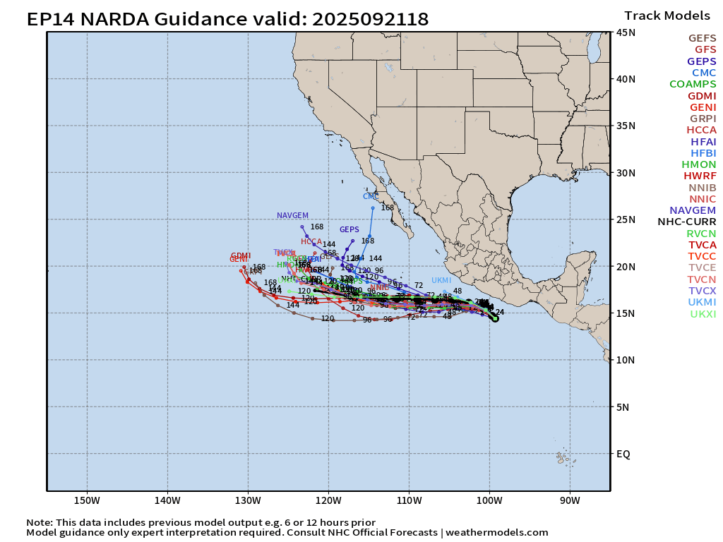
Eastern Pacific Tropical Update | Tropical Storm Narda
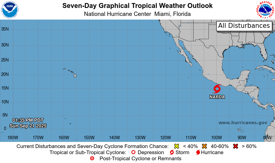
Tropical Storm Narda (14E) underway — should become a hurricane in 36-48 hours and head westward over warm enough waters for steady intensification to near a major hurricane.
Western Pacific Typhoon Season Update
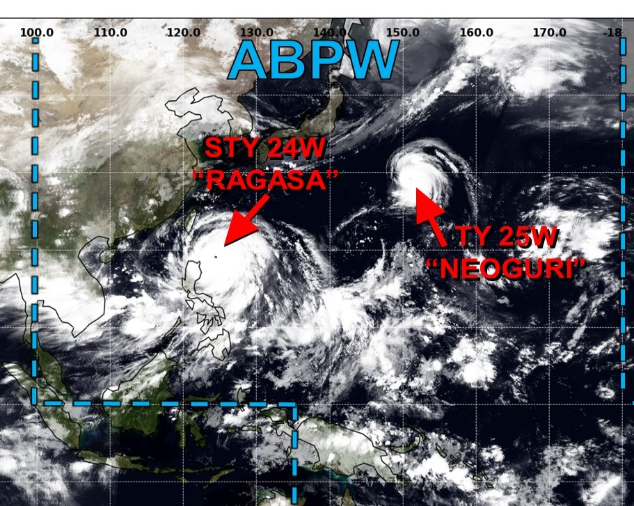
Morning GeoColor Imagery of Super Typhoon Ragasa
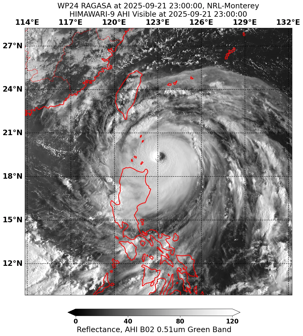
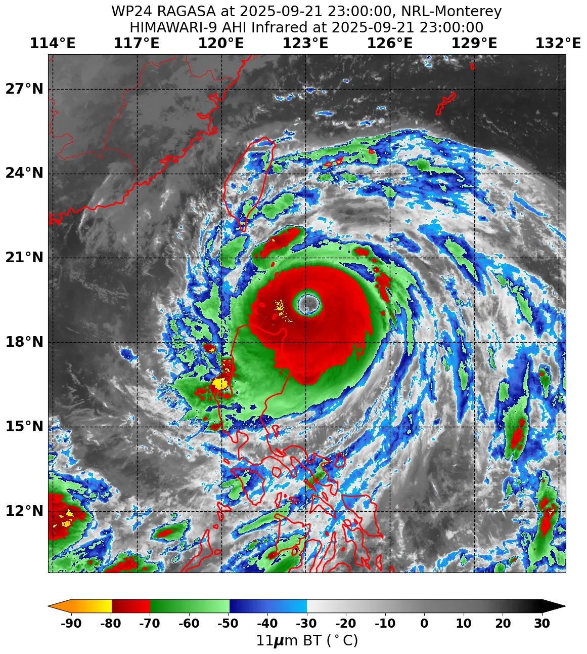
Super Typhoon Ragasa (24W) | 145 knots | Category 5
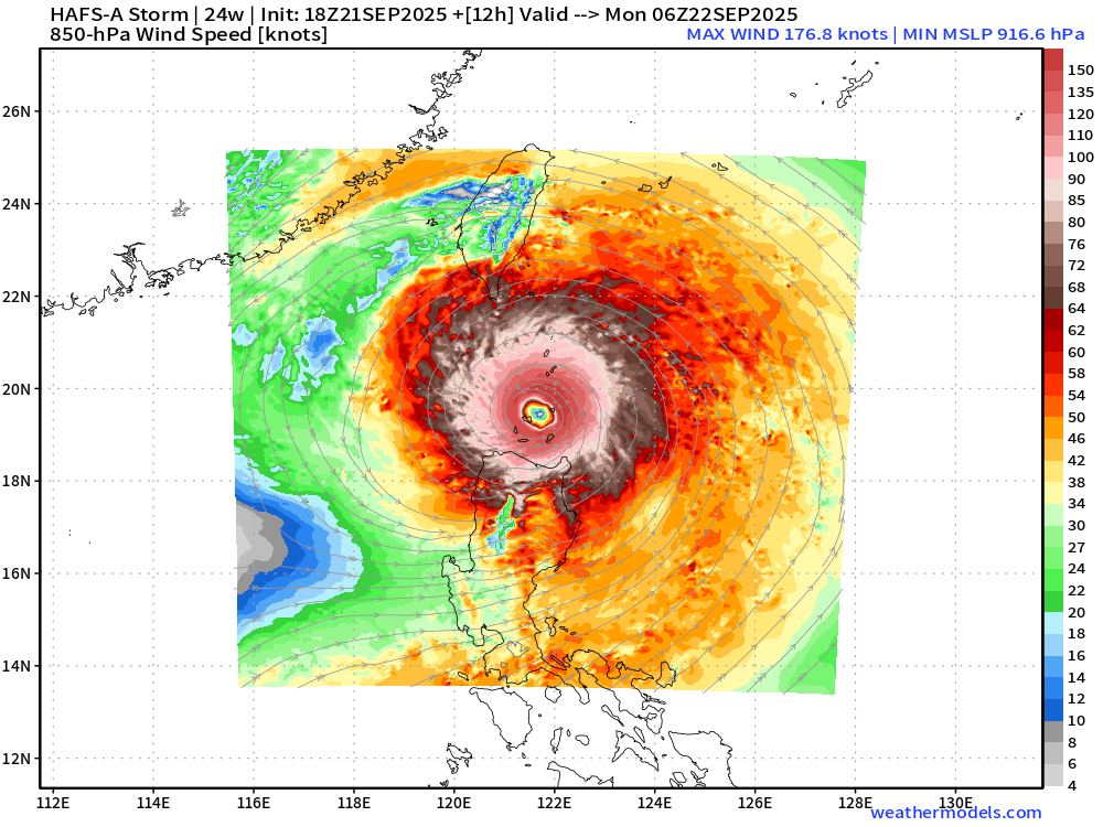
HAFS-A 18z at 06z on Monday
917 mb with 177 knot winds at 850 hPa = solid Category 5 Super Typhoon
HAFS-A 18z forecast +51 Hours Valid on Tuesday 21z
Ragasa retains its inner-core and does not appear to weaken much at all … without and land interference through the Taiwan Strait. While JTWC has Ragasa sliding south of Hong Kong, the typhoon is massive and significant impacts are possible on Tuesday regardless of a direct hit or landfall over the city.
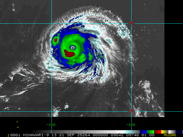
Tropical Storm Neoguri (25W) has slightly weakened to 110-knots (Category 3)
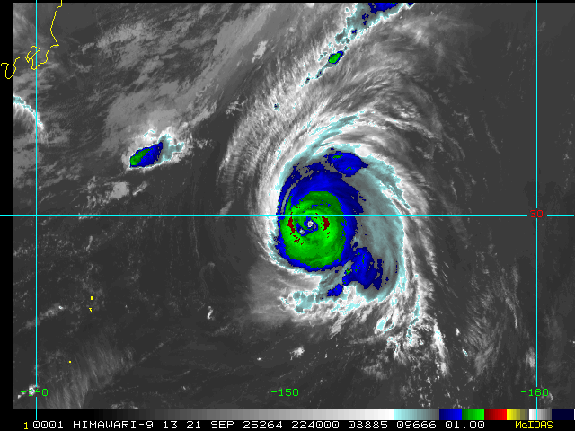
Neoguri did reach 125-knots — so NOT quite Super Typhoon status (130 knots) well east of Japan
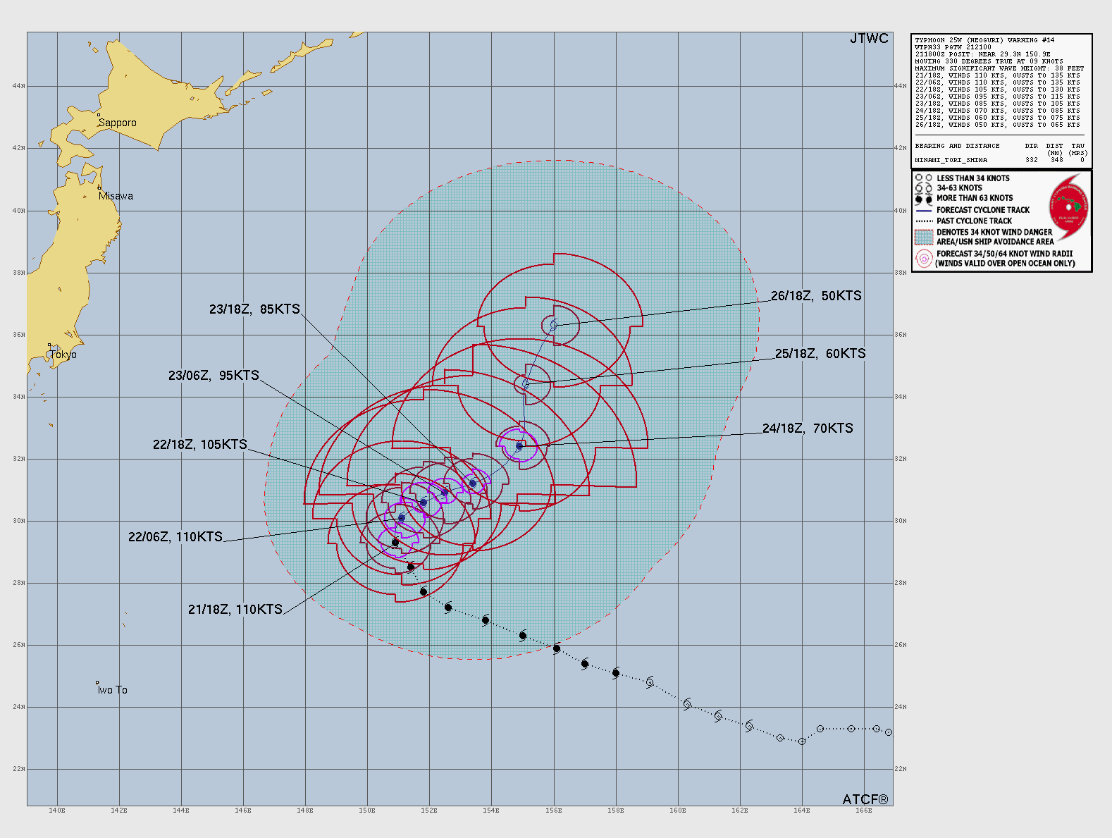
Maximum 125-knots at 00z earlier on Sunday
Maps sourced from weathermodels.com designed and innovated by yours truly! Please subscribe there for real-time access to the newest maps, charts from all of the weather models including ECMWF.
- Milepost
- 740 · laid 2025-09-22T00:07:38.152000Z
- Source
- https://weather.substack.com/p/september-21-2025-sunday-hurricane
- Digest
- 040f54a4bf08285b41e40c9b02a7e6a55f2651b4c18bfc7b62d0b90e309305e0
- Machine
- JSON