September 18, 2025 Thursday Hurricane Season
Tropical Storm Gabrielle nearly gave up but is back in business
September 2025 was the 7th-warmest September in the 131-year national record (1895–2025), at 67.9°F against a 1991–2020 normal of 66.0°F (+2.0°F).
September 2025 was the 15th-driest September in the 131-year national record (1895–2025), at 1.9in against a 1991–2020 normal of 2.6in (-0.6in).
NOAA/NCEI Climate at a Glance, contiguous United States. This is the observed record for the month, not a score of anything said in this piece — the forecast ledger begins 2026-08-17 and cannot reach earlier posts.

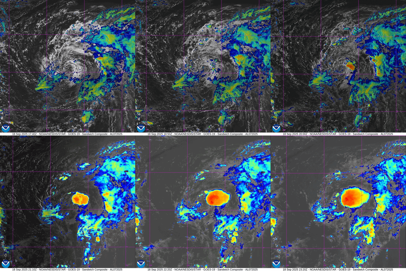
Tropical Storm Gabrielle was a naked swirl of low-level clouds all day but has since erupted with convection down shear — on the eastward side of the center of circulation. Once the shear relaxes and the effects of the mid-level trough (TUTT) subside, then Gabrielle can resume intensifying as an upright, fully functional tropical system.
Temperature Analysis | 6:45 PM ET
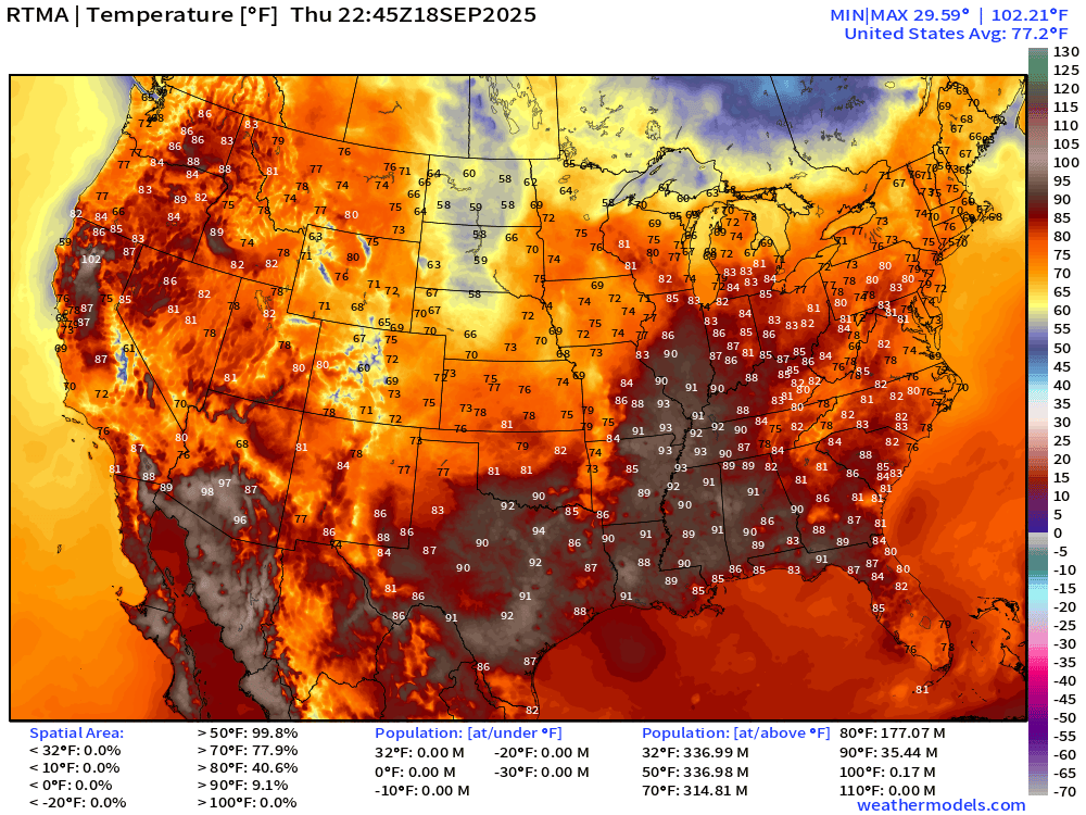
HOT in the Mississippi River valley with mid to upper 90s today
Temperature Anomaly | 6:45 PM ET
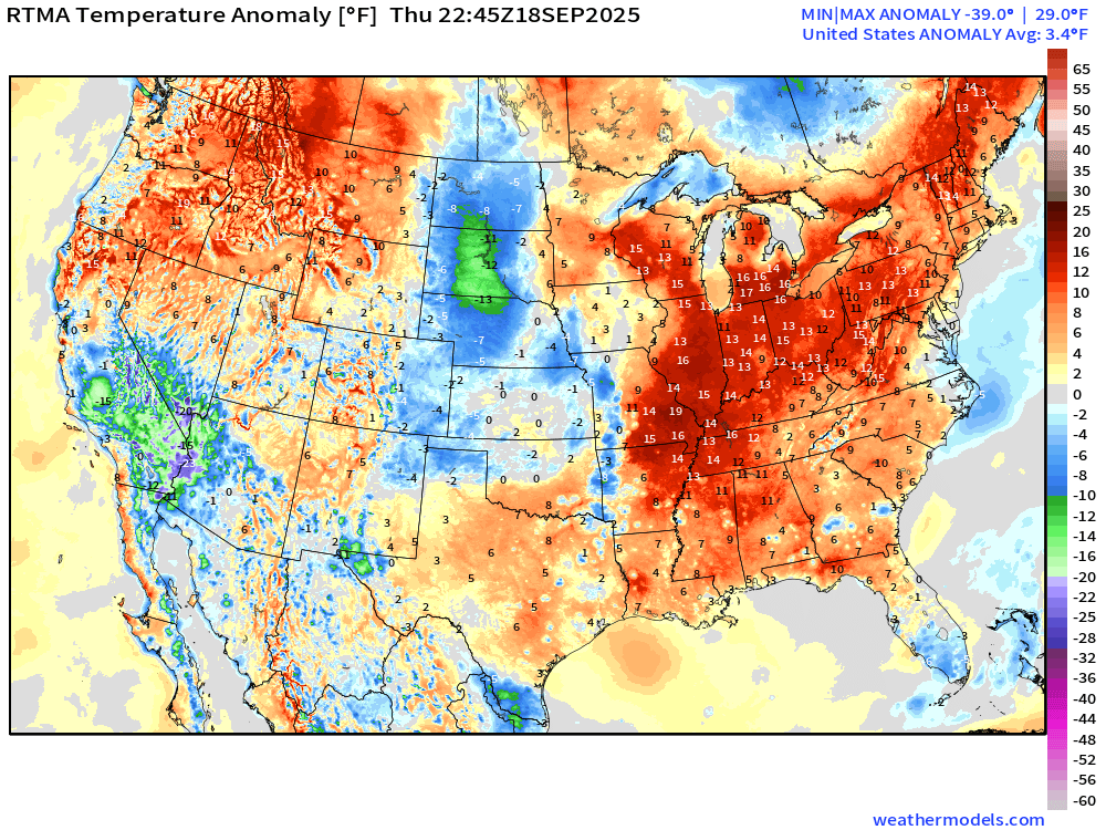
The heat wave is 15°F to 20°F above normal … and warmth extends from Memphis into the Northeast. Lower 48 is 3.4°F above normal
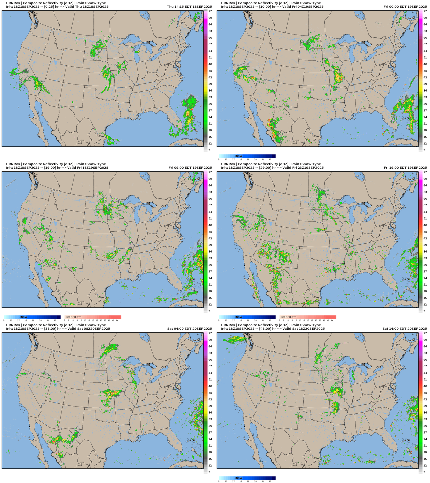
HRRR Simulated Radar Next 48-hours
North America Precipitable Water | Next 6-days
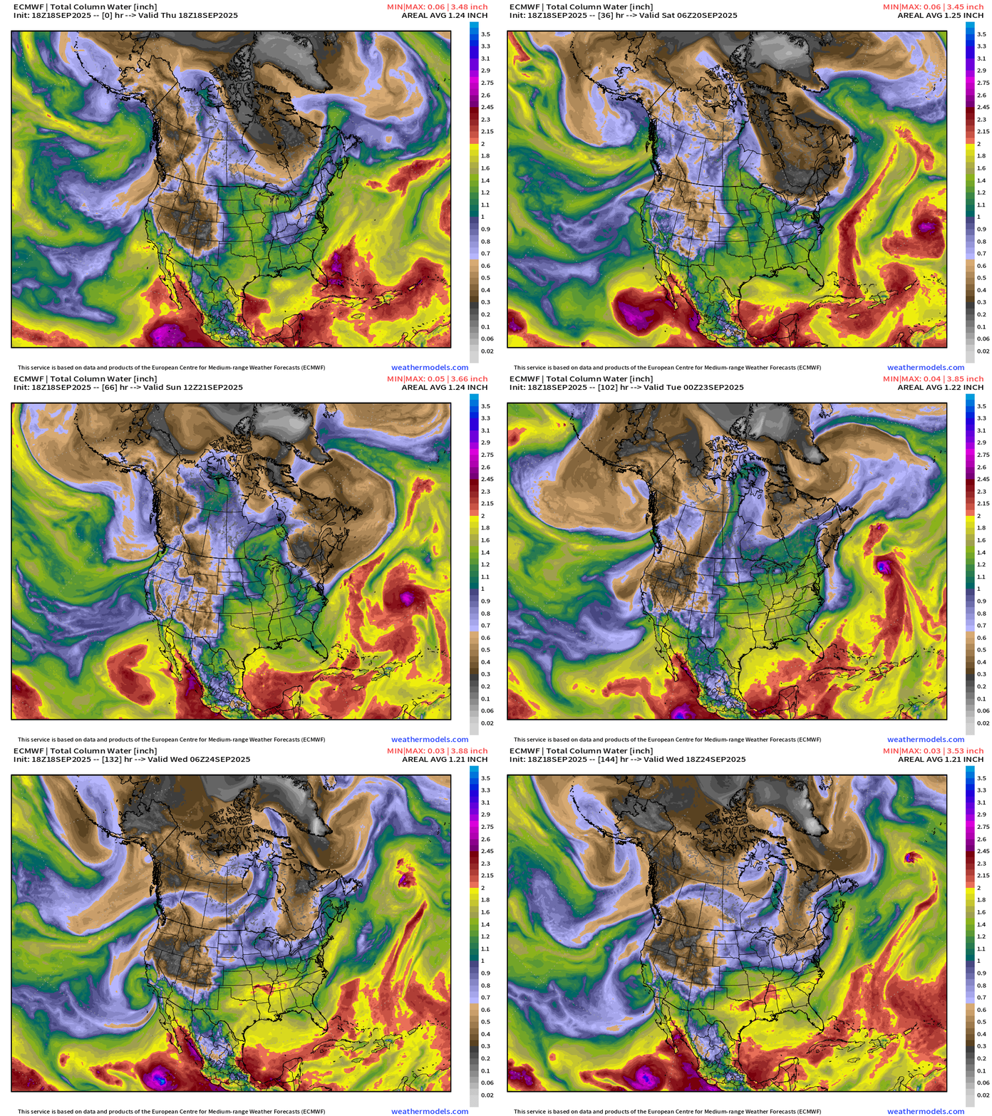
Next tropical storm in the Eastern Pacific —> (maybe) Narda — will push moisture into Southern California again by this weekend, with another tropical system following as the EPAC blows through the alphabet with weak, short-lived storms.
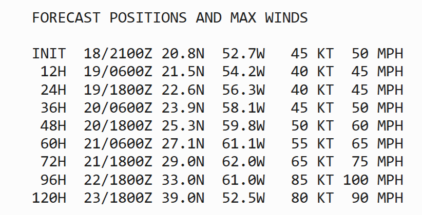
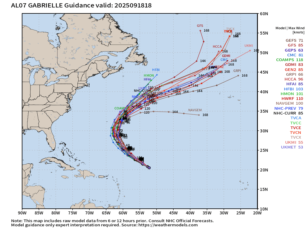
Tropical Storm Gabrielle passes east of Bermuda but uncertainty about intensity: TS to major hurricane … remains. NHC is at 85-knots (Category 2) maximum
Atmospheric rivers plow into Western Canada and then Pacific Northwest U.S. into next week — autumn like pattern
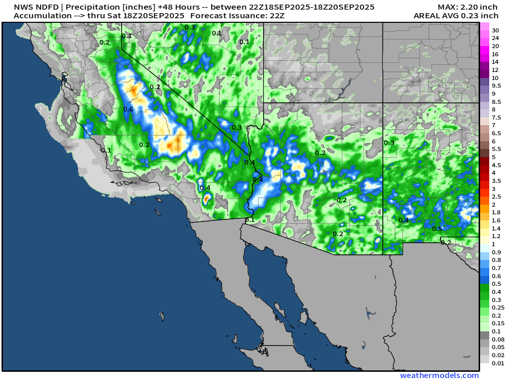
NWS NDFD Precipitation Next 48-hours
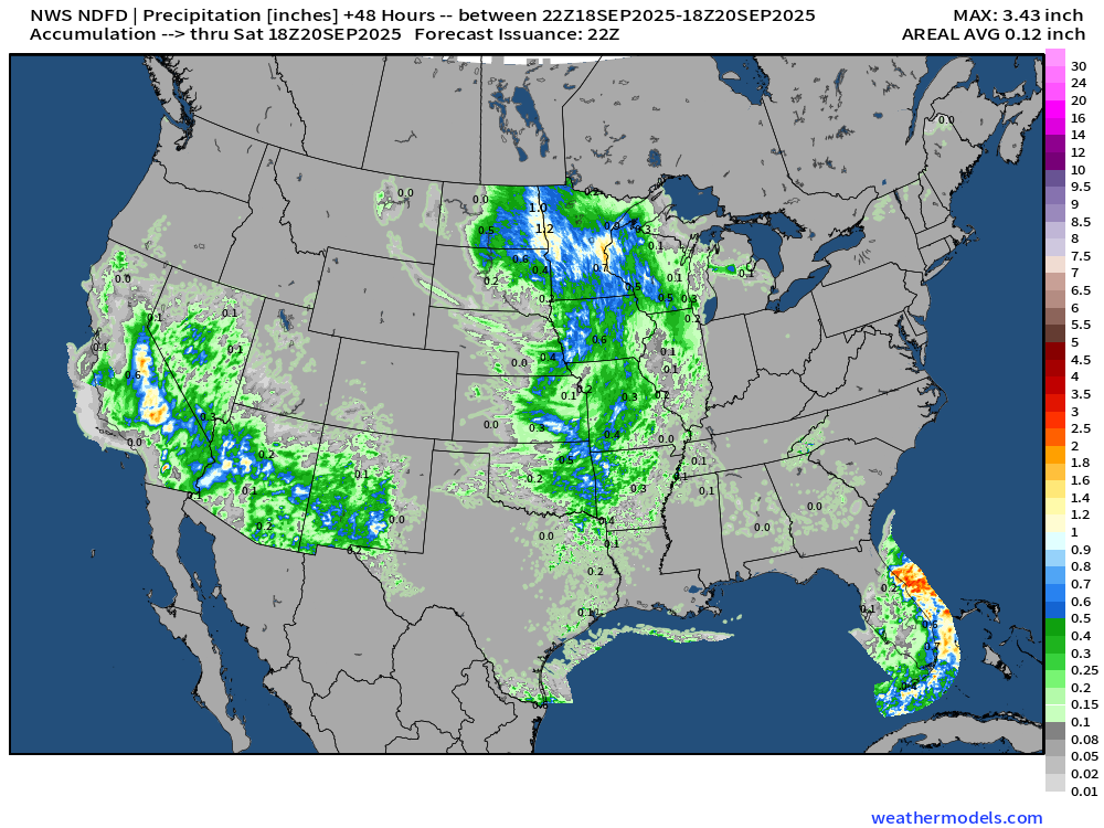
Quite the rainfall for the Sierra and deserts — including Death Valley, Las Vegas, and Phoenix.
NOAA WPC Precipitation + Anomaly | Next 7-days
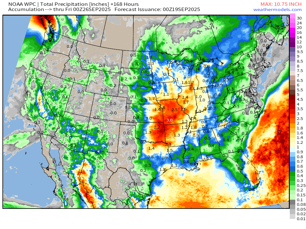
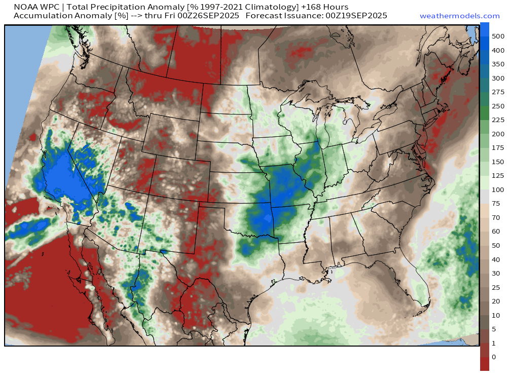
Little if any rain from the Northeast through Mid-Atlantic into North Florida = brown & red = much below normal through next 7-days.
Tropical moisture into California = huge bonus for the tail end of monsoon season.
Please Subscribe — or recommend to a friend to share our love of weather.
Atlantic Basin Outlook | 5 PM ET Update
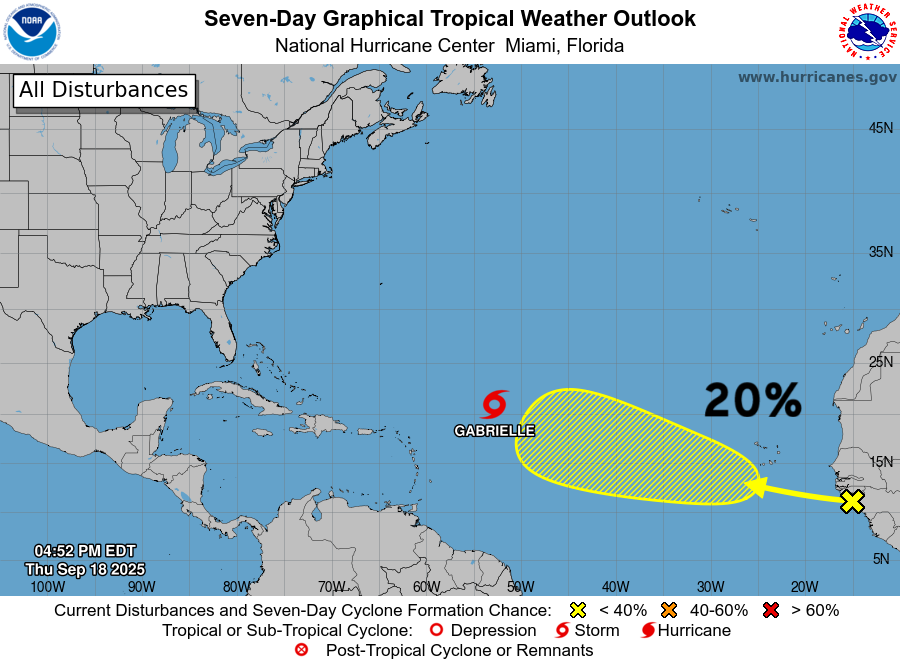
1 more area on the Atlantic Outlook but low chance from a tropical wave that just emerged off African coast.
2025 Hurricane Season [Day 110]. My FORECAST for this year is (still) 14 named storms, 7 hurricanes, and 3 major hurricanes (near average)
2025 Season to Date: 7 named storms, 1 hurricanes, and 1 majors | ACE = 41 ACE of Erin: 32.2 (140-knots maximum wind)
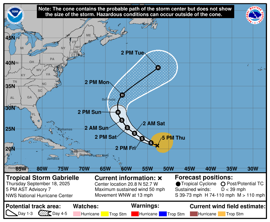
Gabrielle should become a hurricane in 4-days by Sunday, but there is uncertainty as the center reformed/jumped northward to almost 20°N … I think previous forecasts of Category 4+ were contingent on a much further south center (15°N) but we may be seeing a reversion to the mean … and NHC going with Category 2.
Tropical Storm Gabrielle (07L) ATCF Spaghetti
ECMWF Ensembles 12z | Gabrielle
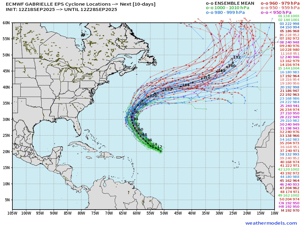
Some variety in the maximum intensity but near majority show Category 3 pressure < 960s mb but probably not until it reaches higher latitude — and possibly as a post-tropical cyclone
ECMWF 12-Days Integrated Vapor Transport | 12z cycle
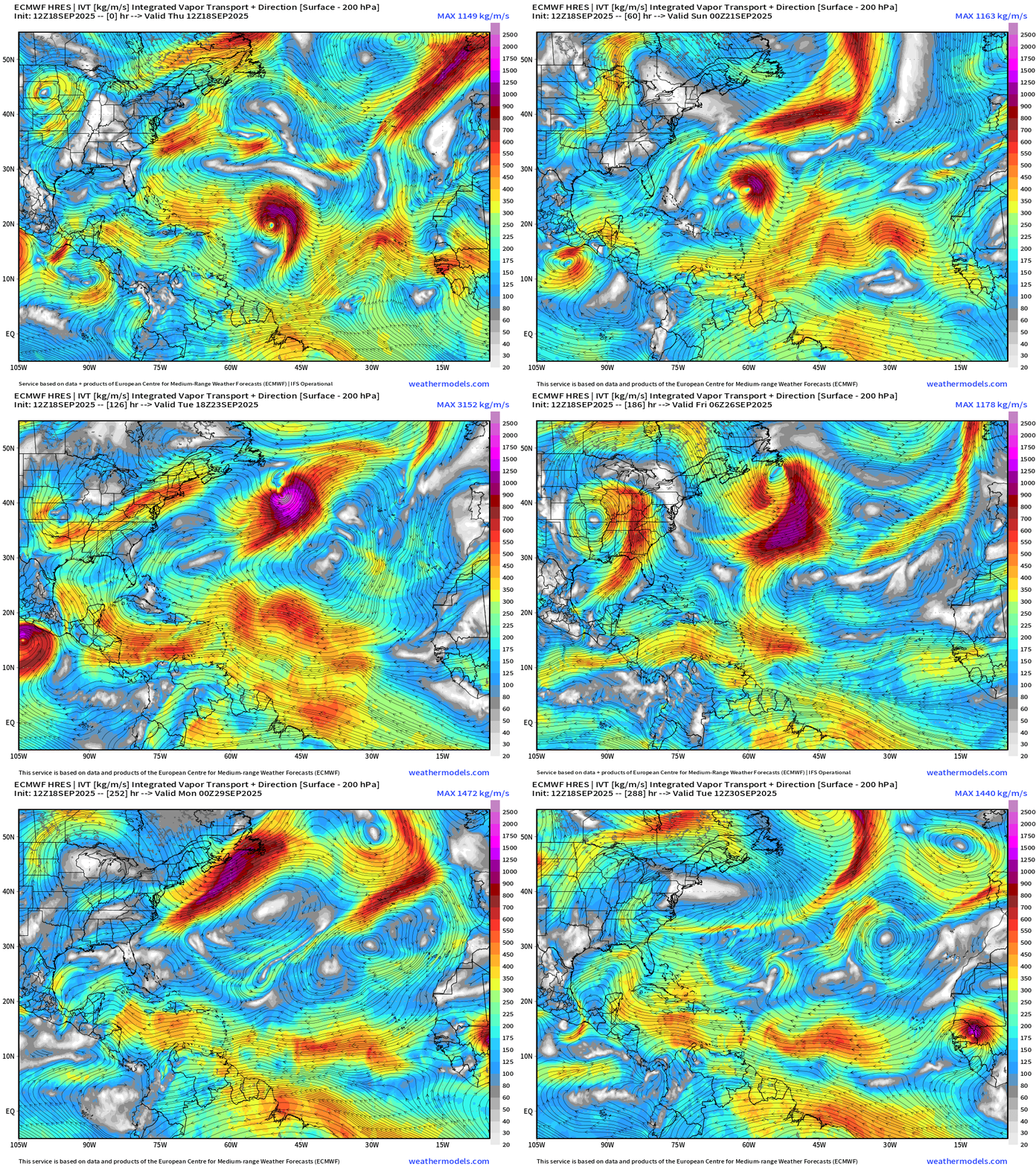
Flagship model ECMWF 12z did not have another wave developing behind Gabrielle
ECMWF 18z | +4 Days MSLP | UV850 | PWAT
Can’t say ECMWF Control (18z) is too terribly interested in Gabrielle with maybe minimal hurricane intensity
HAFS A and HAFS B mesoscale models (18z) with disorganized, minimum TS intensity at Day 5.
The uncertainty with intensity is not unusual with a system in its formative stages … and we have plenty of time to watch Gabrielle as it battles back against dry air and wind shear
Atlantic Satellite Imagery | Infrared
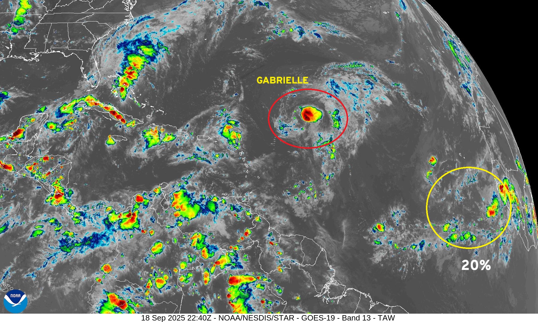
Mid-Level Water Vapor
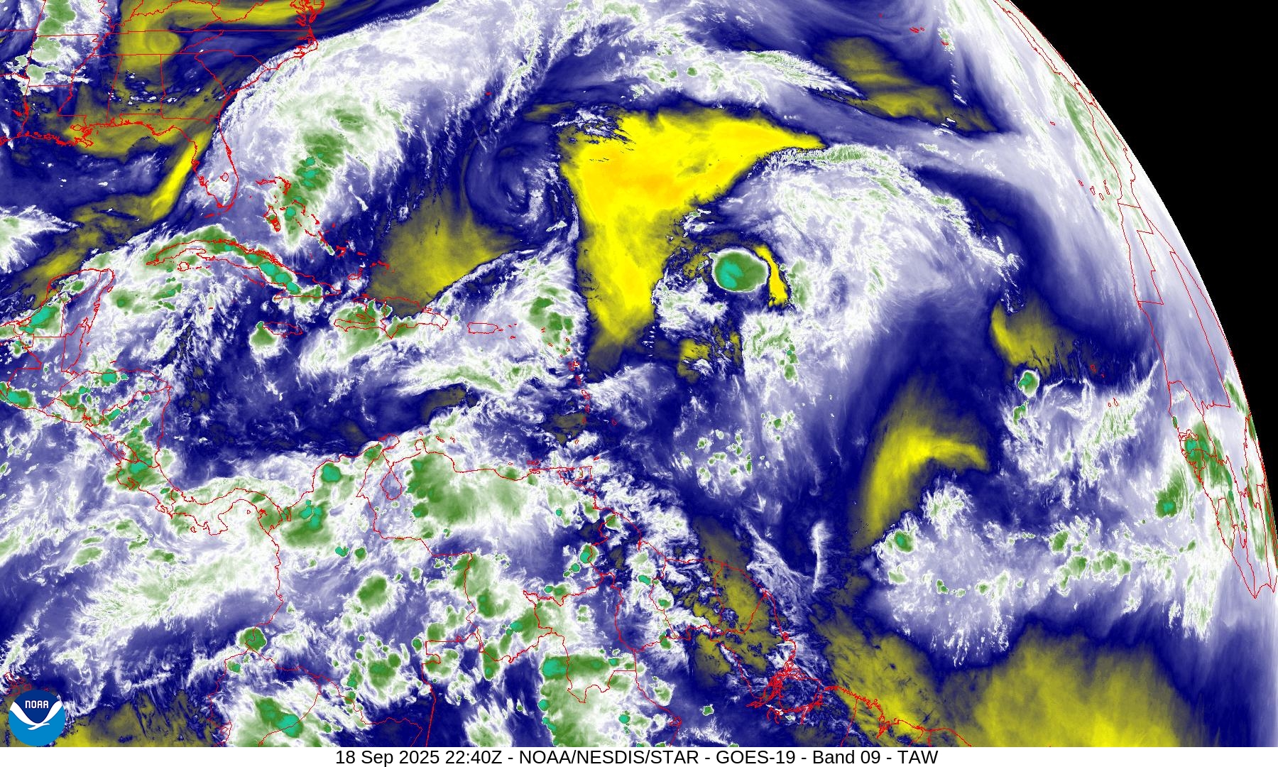
Tropical Upper Tropospheric Trough (TUTT) undercutting Gabrielle with westerly wind shear and mid-level dry air, but that should subside
SST and SST Anomaly | ECMWF 12:00 UTC Forecast
Warm pool 28° to 29°C plenty sufficient for any category of hurricane along the entire track of Gabrielle (07L)
NOAA Tropical Surface Analysis | 18z
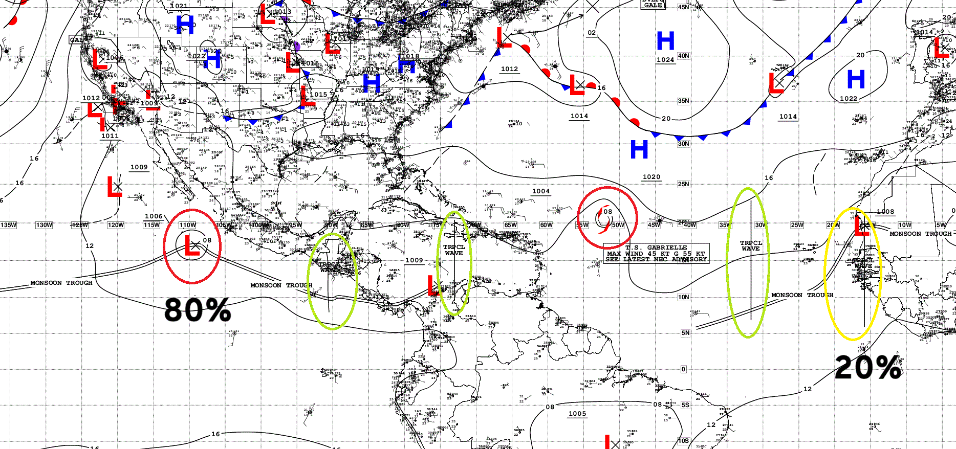
Atlantic Tropical Waves = 3 with the most recent coming off Africa (20%)
Eastern Atlantic and Africa Visible Satellite
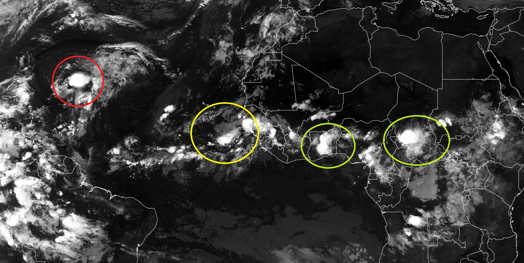
The healthy tropical wave that came off Africa today has mostly poofed
Long Loop of IVT from Day 2 to 15
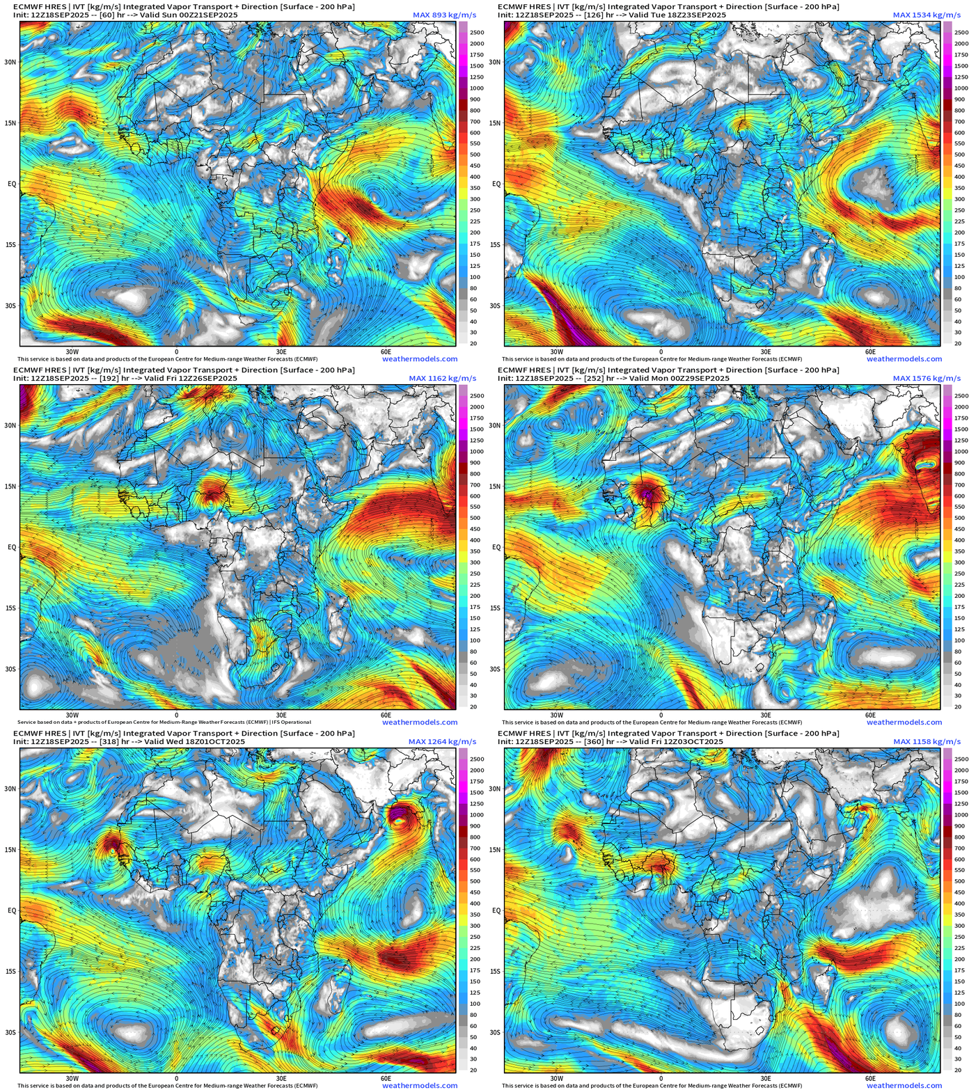
Cool to watch this African easterly wave born in Ethiopia and then take 8-9 days to cross Africa … emerge into the Atlantic at about 15°N — and weaken immediately.
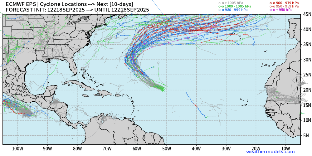
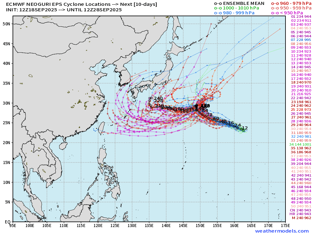
ECMWF EPS 12z Ensemble | All Cyclone Tracks Through 10-days
ECMWF EPS 12z Ensemble | All Cyclone Tracks Through 15-days
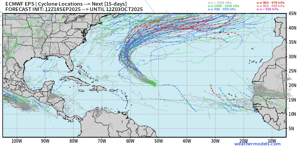
Gabrielle might be the ONLY show in town for the next 2-weeks from the full-physics EPS 15-day model
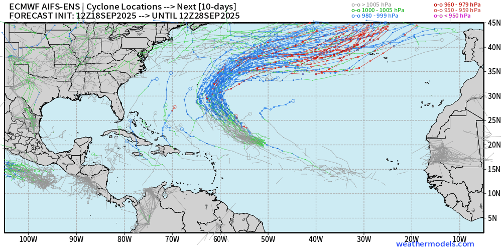
AIFS-ENS Comparison at 12z | Active Tracks at Day 10
AIFS-ENS Comparison at 12z | Active Tracks at Day 15
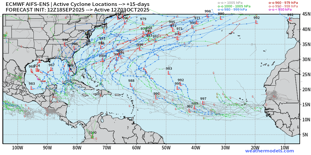
A.I. trained ensembles are MUCH busier with plenty of tropical cyclones all over the place — but I suspect these are FALSE ALARMS as the AIFS-ENS has been way too eager to develop every tropical wave — likely a bias/problem with the lower resolution (0.25°) model
Eastern Pacific Tropical Update | Invest 96E
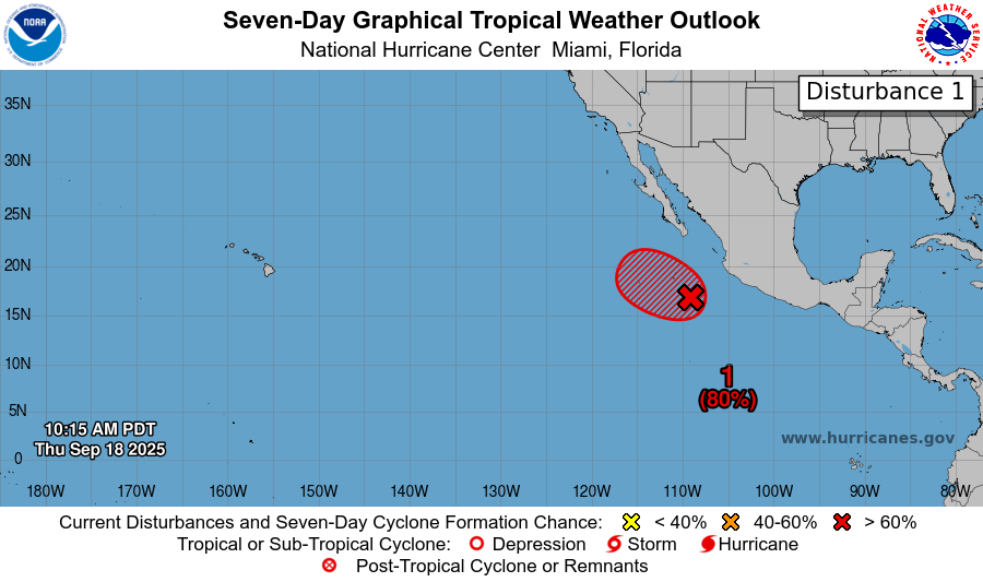
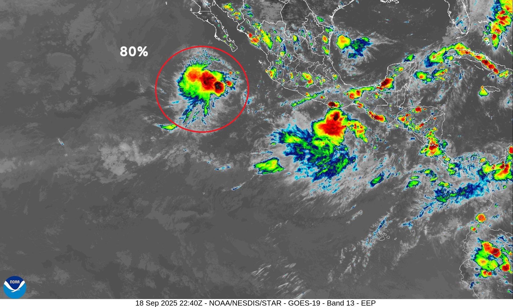
Next system would be named Narda but it is running out of time to organize before reaching cooler waters.
Western Pacific Typhoon Season Update | 24W and 25W
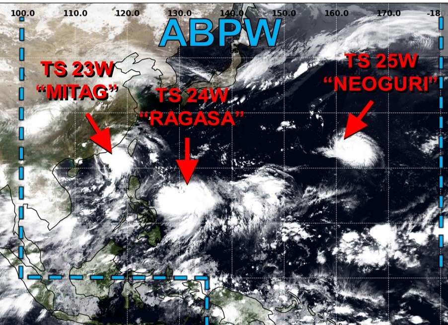
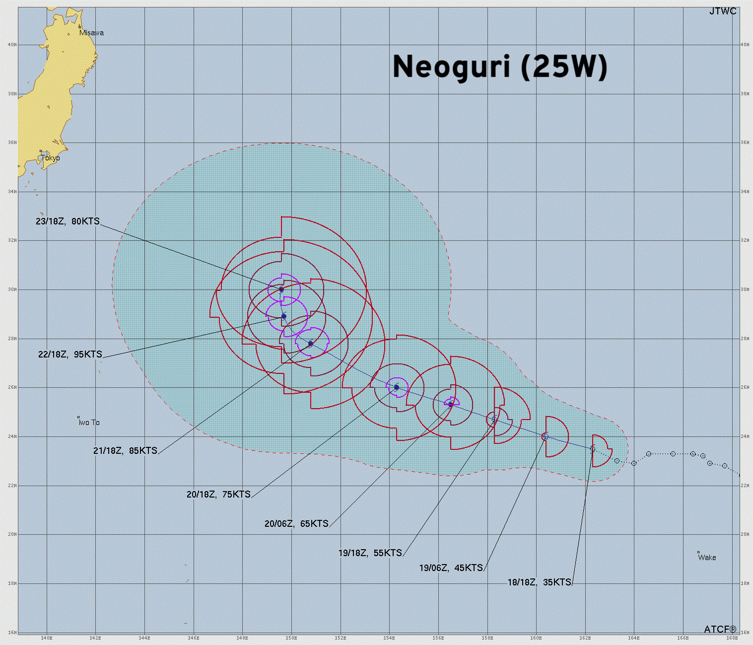
3 concurrent tropical storms — and Ragasa and Neoguri should both become powerful Typhoons.
Tropical Storm Ragasa (24W)
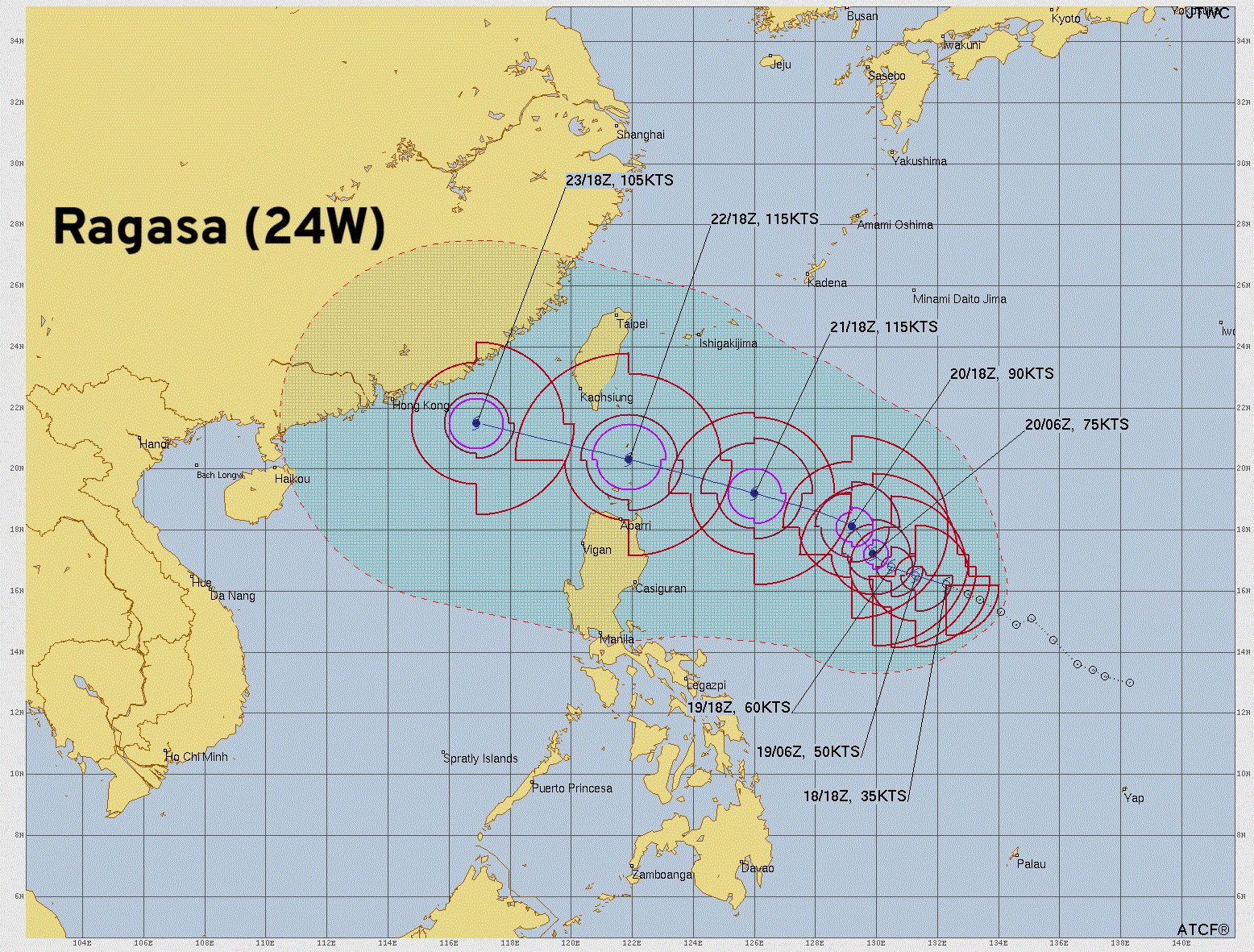
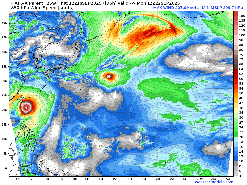
The potential intensity of Ragasa is easily Category 5 and could approach T 7.5 (155-knots) in short order heading just north of Luzon, Philippines over some of the deepest and warmest “pool” of tropical SSTs for some of history’s most intense Typhoons.
HAFS-A 12z dips to about 906 hPa
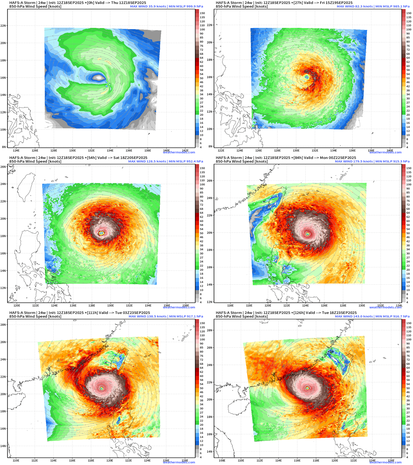
The size of Ragasa will be LARGE but it apparently will fit just between Luzon and Taiwan meaning it will largely head westward into China without disruption. This is not good!
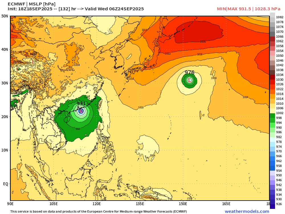
Threat to Hong Kong | ECMWF 18z location on Wednesday
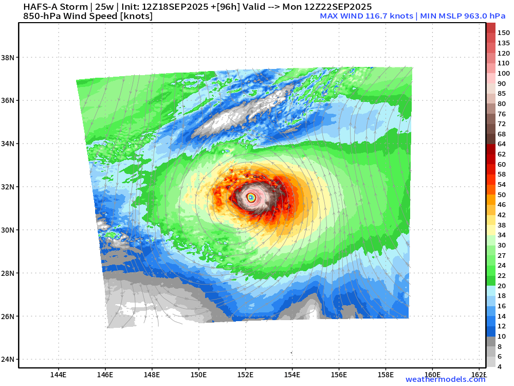
Tropical Storm Neoguri (25W)
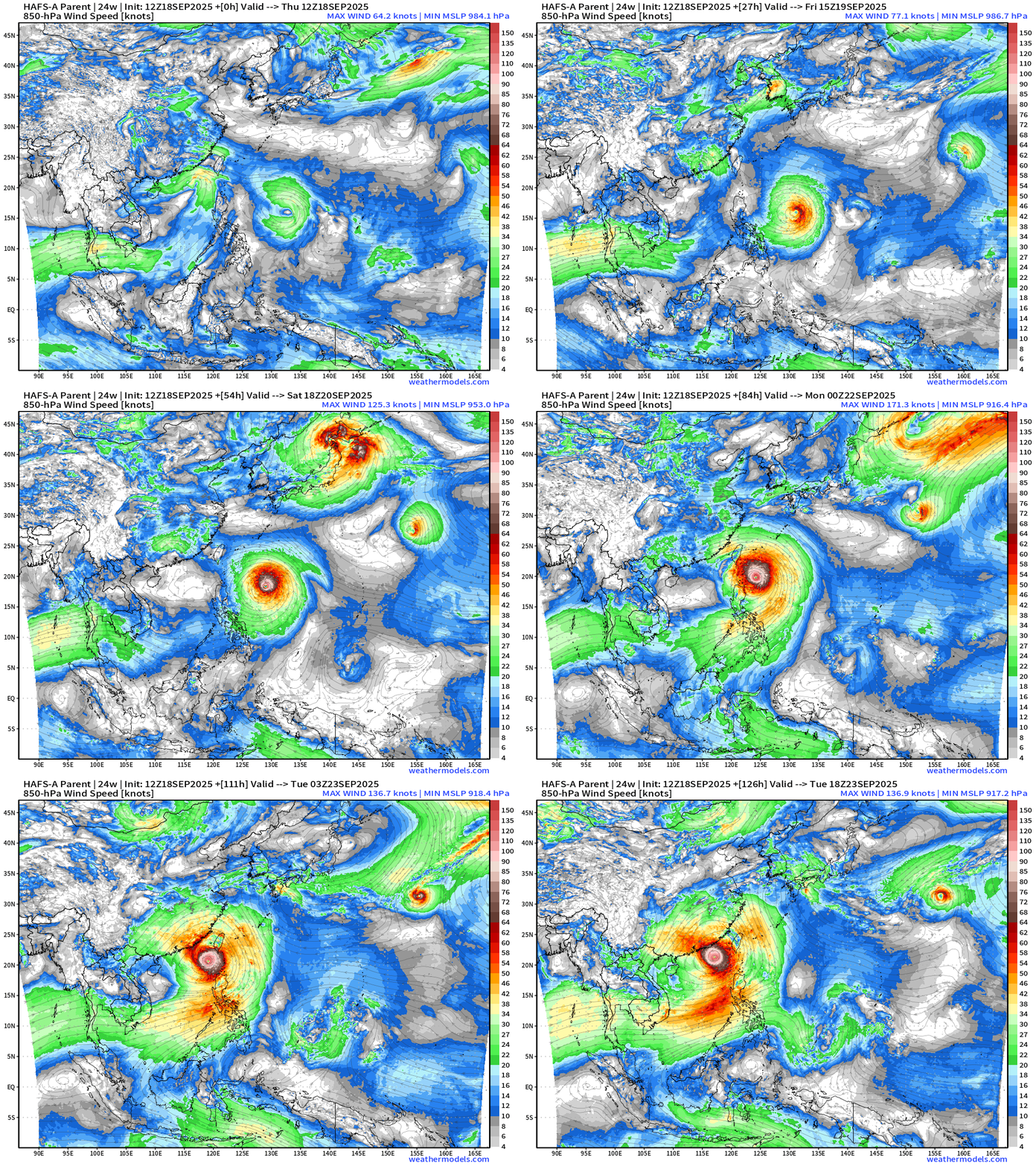
HAFS-A with 963 mb central pressure with Neoguri
The parent domain of Neoguri shows a hyper intense Ragasa with 208 knot winds at 850 hPa and a surface pressure of 899 mb … okay then!
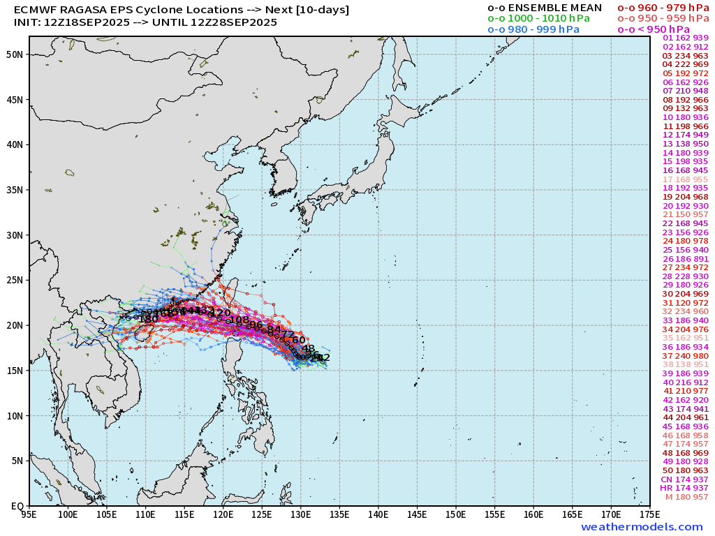
EPS 12z Ensemble Spaghetti — Stall and loop in 5-days
ECMWF 18z | 4-days Snapshot | UV850 | PWAT | MSLP
A big Super Typhoon + a little Super Typhoon = 2 maybe!
Maps sourced from weathermodels.com designed and innovated by yours truly! Please subscribe there for real-time access to the newest maps, charts from all of the weather models including ECMWF.
- Milepost
- 738 · laid 2025-09-19T00:22:30.052000Z
- Source
- https://weather.substack.com/p/september-18-2025-thursday-hurricane
- Digest
- 6f300fce937b4b666406066a1065ebd92c01ca42163db833a45810759757be4b
- Machine
- JSON