September 17, 2025 Wednesday Hurricane Season
Tropical Storm Gabrielle will struggle for several days
September 2025 was the 7th-warmest September in the 131-year national record (1895–2025), at 67.9°F against a 1991–2020 normal of 66.0°F (+2.0°F).
September 2025 was the 15th-driest September in the 131-year national record (1895–2025), at 1.9in against a 1991–2020 normal of 2.6in (-0.6in).
NOAA/NCEI Climate at a Glance, contiguous United States. This is the observed record for the month, not a score of anything said in this piece — the forecast ledger begins 2026-08-17 and cannot reach earlier posts.

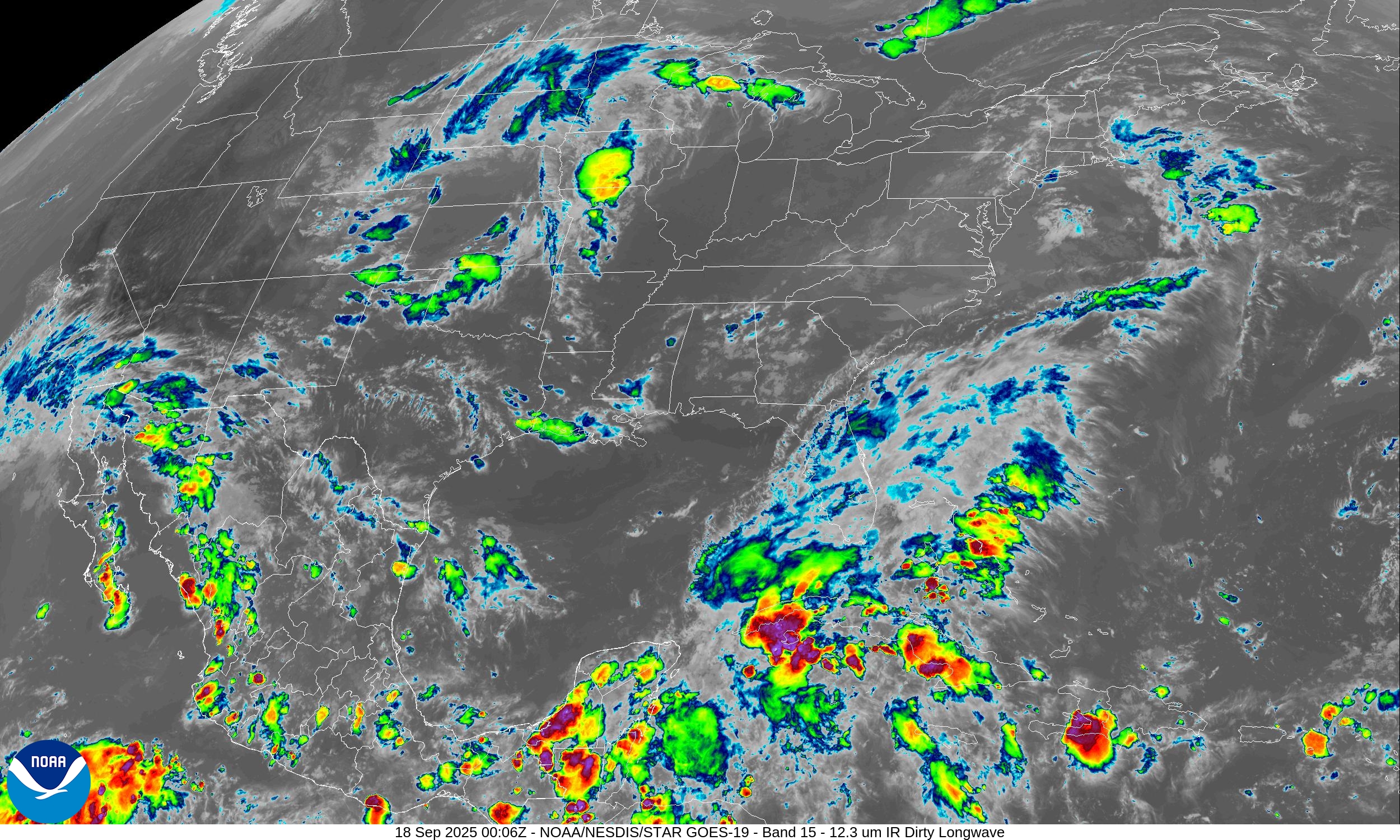
Rain showers spreading through Southern California this evening from the remnants of Tropical Storm Mario.
Temperature Analysis
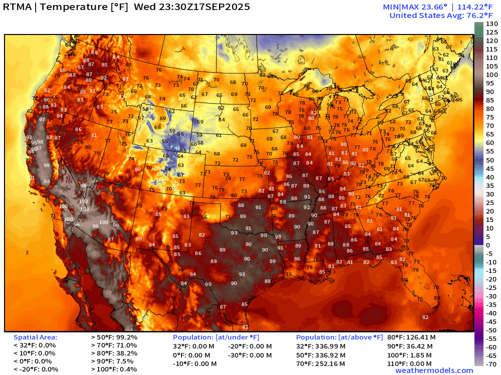
Still rather hot across the Mississippi River Valley this evening with some places still in the 90s past 7:30 PM ET.
HRRR Simulated Radar Next 18-hours
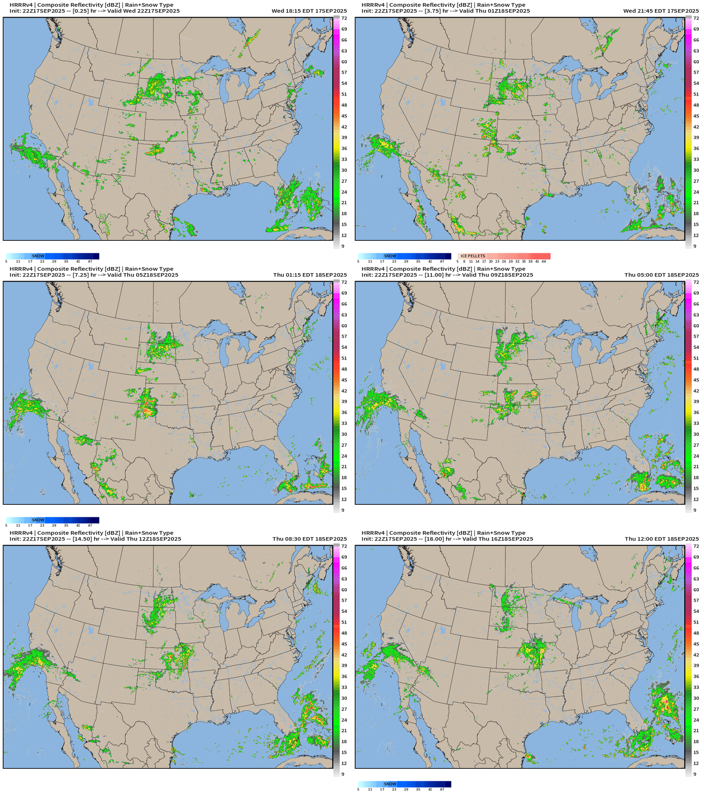
Showers continue across SoCal and in the Central Plains around a weak mid-level trough. Scattered showers also through Florida from a stationary frontal boundary connected to the lingering coastal storm finally departing the Mid-Atlantic.
North America Precipitable Water | Next 6-days
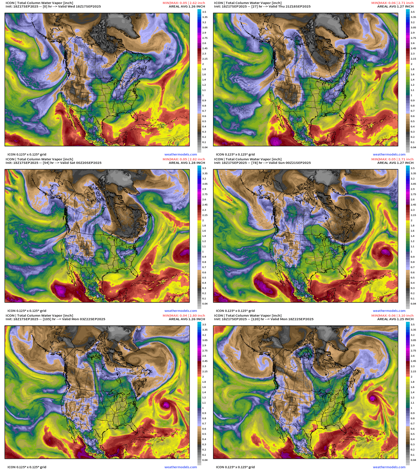
Next tropical storm in the Eastern Pacific —> Narda — will push moisture into Southern California again by this weekend
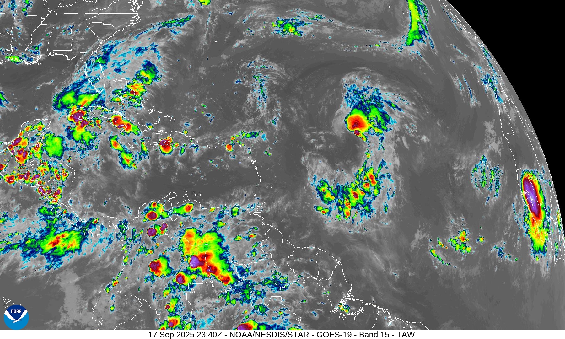
Tropical Storm Gabrielle passes east of Bermuda but uncertainty about intensity: TS to major hurricane
Atmospheric rivers plow into Western Canada and then Pacific Northwest U.S. into next week — autumn like pattern
NOAA WPC Precipitation + Anomaly
Little if any rain from the Northeast through Mid-Atlantic into North Florida = brown & red = much below normal through next 7-days.
Please Subscribe — or recommend to a friend to share our love of weather.
Atlantic Basin Outlook | 8 PM ET Update
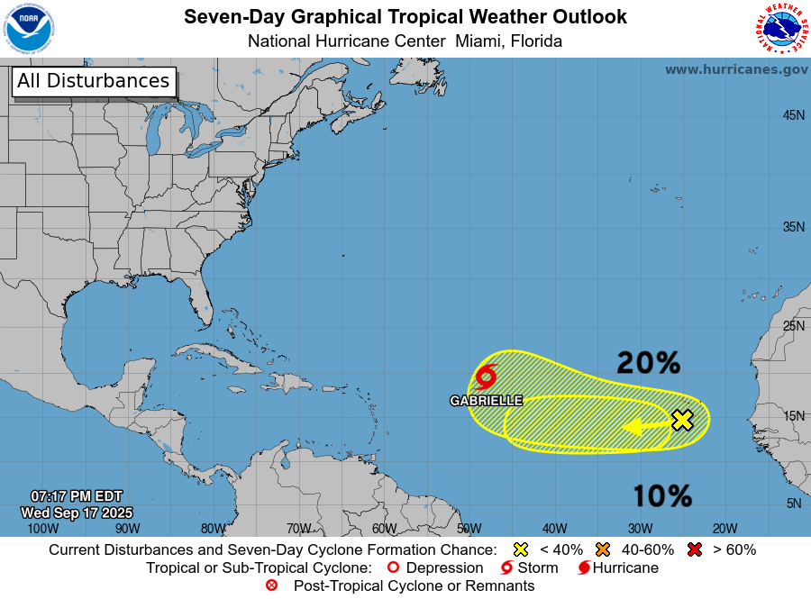
2 more areas on the Atlantic Outlook but low chances … from tropical waves
2025 Hurricane Season [Day 109]. My FORECAST for this year is (still) 14 named storms, 7 hurricanes, and 3 major hurricanes (near average)
2025 Season to Date: 6 named storms, 1 hurricanes, and 1 majors | ACE = 40 ACE of Erin: 32.2 (140-knots maximum wind)
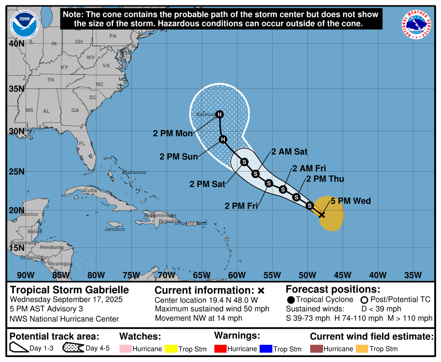
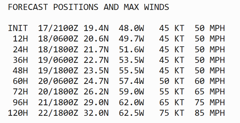
Gabrielle should become a hurricane in 4-days by Sunday, but there is uncertainty as the center reformed/jumped northward to almost 20°N … I think previous forecasts of Category 4+ were contingent on a much further south center (15°N)
Tropical Storm Gabrielle (07L) ATCF Spaghetti
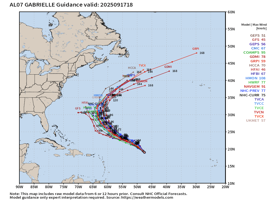
HCCA is faster and to the right — out to sea along with Google’s Deep Mind (GDMI) and GraphCast models (GDMI). GFS is drifting off to the west along with HAFS with weaker intensity.
ECMWF Ensembles 12z | Gabrielle
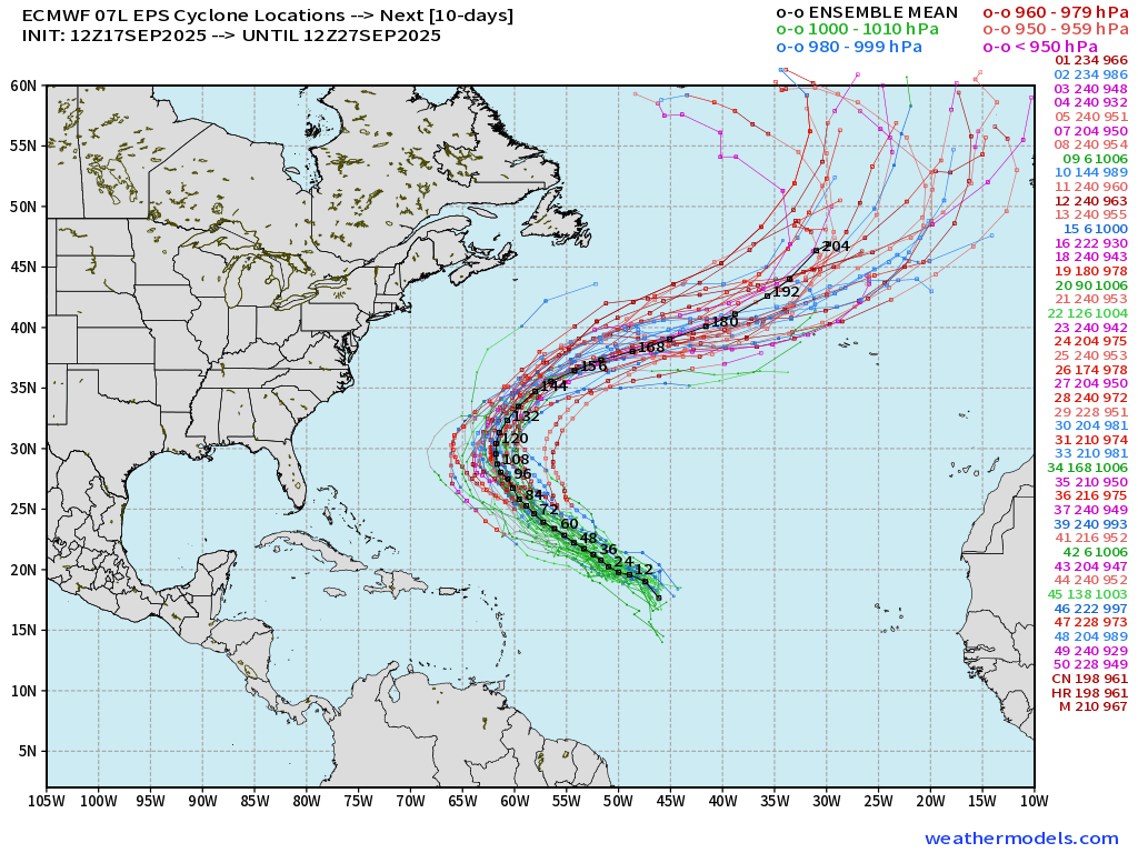
Some variety in the maximum intensity but near majority show Category 3 pressure < 960s mb
ECMWF 12-Days Integrated Vapor Transport | 12z cycle
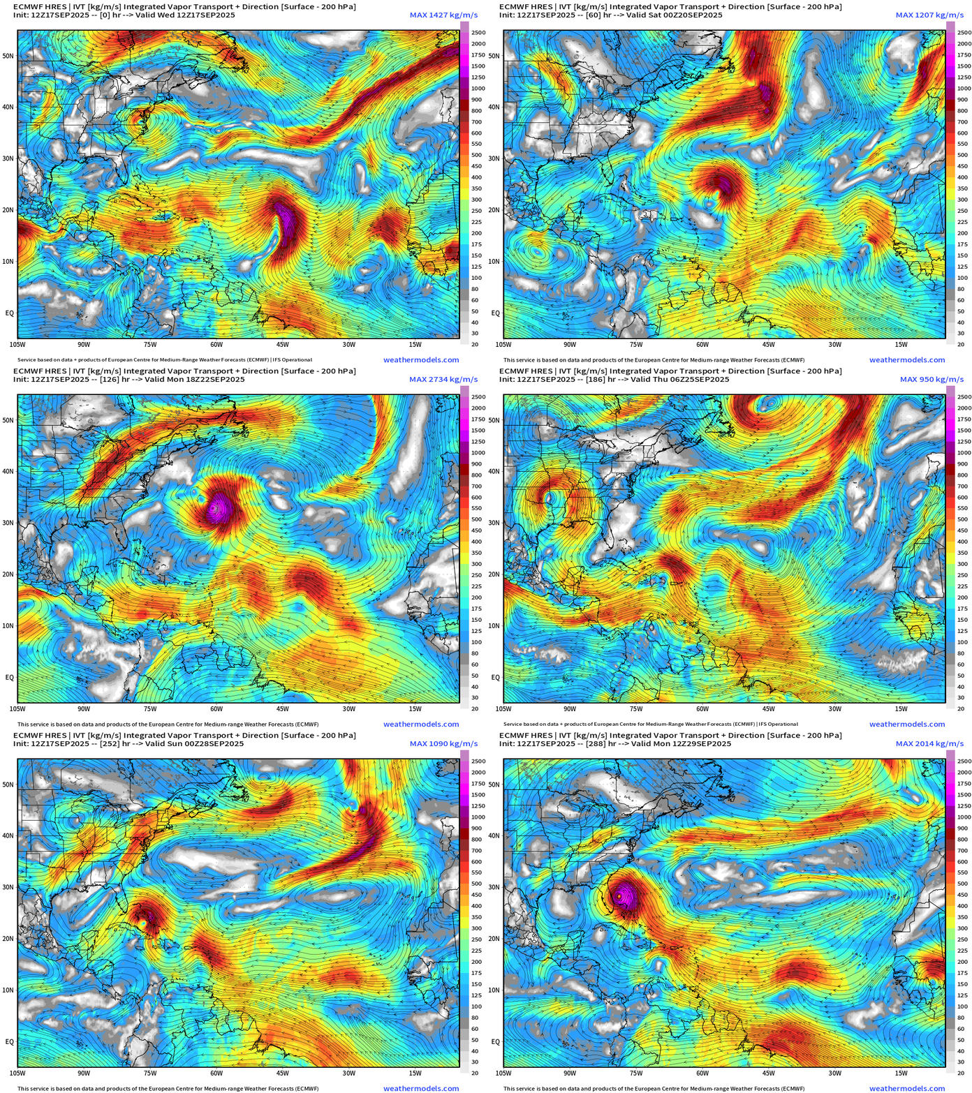
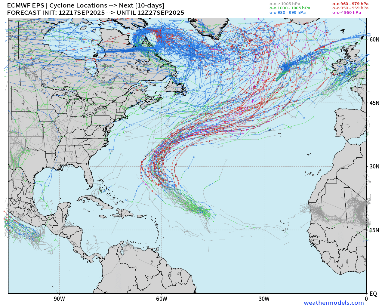
We need to watch the tropical waves that do NOT gain latitude so quickly … as ECMWF Control shows a scenario of a major hurricane developing east of Florida. This is over the “forecast skill horizon” — and it doesn’t affect land. There’s some folks on social media that don’t want to show these “extended range” solutions, but I think they’re useful to keep an eye upon for monitoring trends and extreme events.
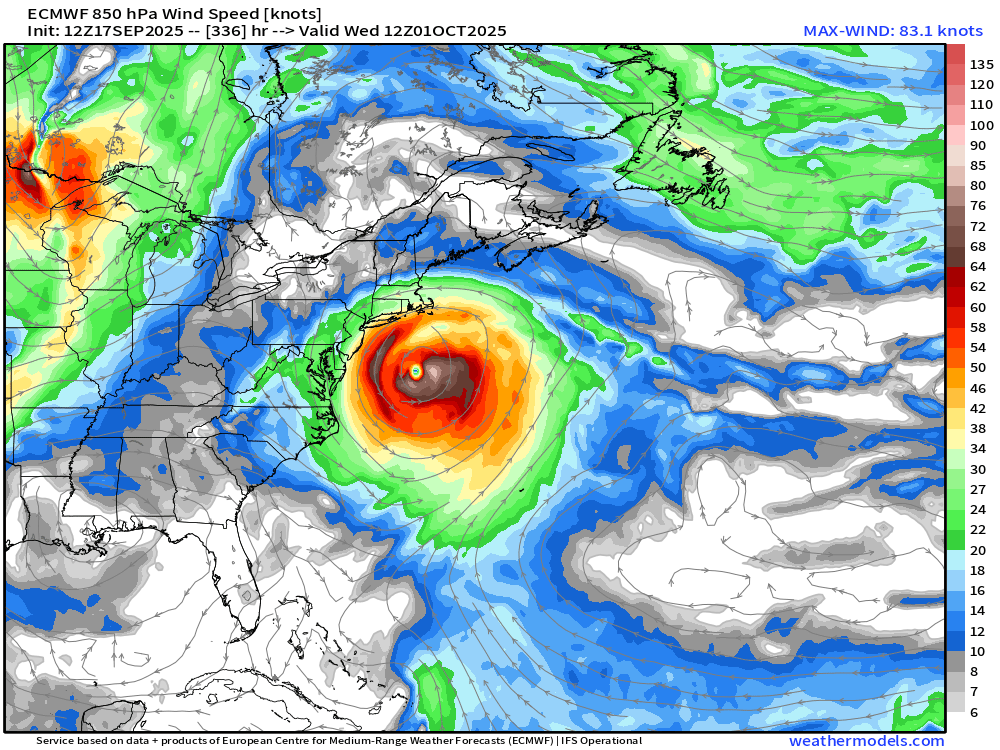
Way out there at Day 14 — this major hurricane misses East Coast … but nothing imminent — just showing the pattern favors development into late Sept / early October.
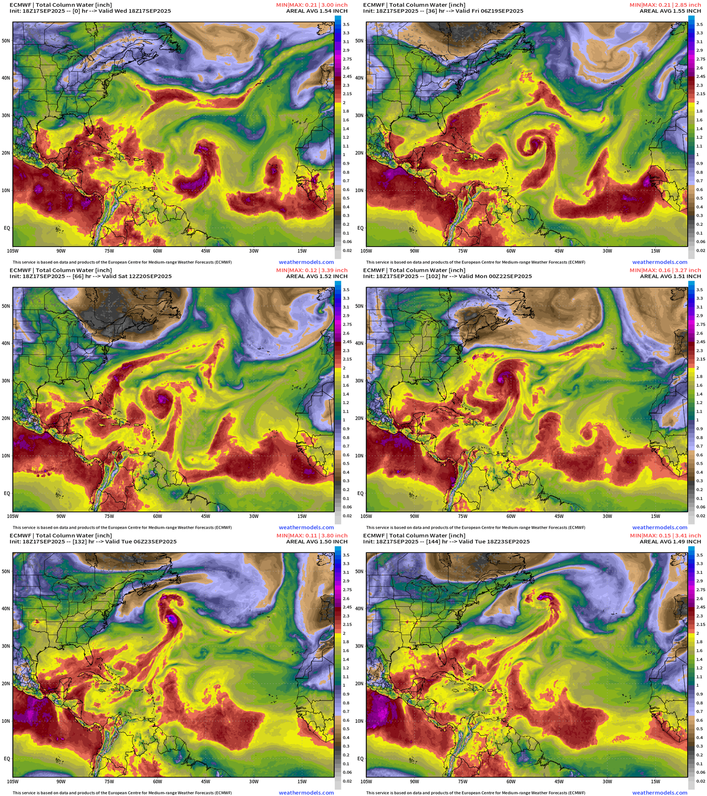
Atlantic Basin | ECMWF 18z | Precipitable Water Next 6-days
ECMWF 18z model not excited about Gabrielle with only tropical storm intensity through 5-days … weaker end of the spectrum.
ECMWF 18z | +5 Days MSLP | UV850 | PWAT
HAFS A and HAFS B mesoscale models (18z) with disorganized, minimum TS intensity at Day 5.
The uncertainty with intensity is not unusual with a system in its formative stages … and we have plenty of time to watch Gabrielle
Atlantic Satellite Imagery | Infrared
Mid-Level Water Vapor

Tropical Upper Tropospheric Trough (TUTT) undercutting Gabrielle
Water Vapor | Mid-level
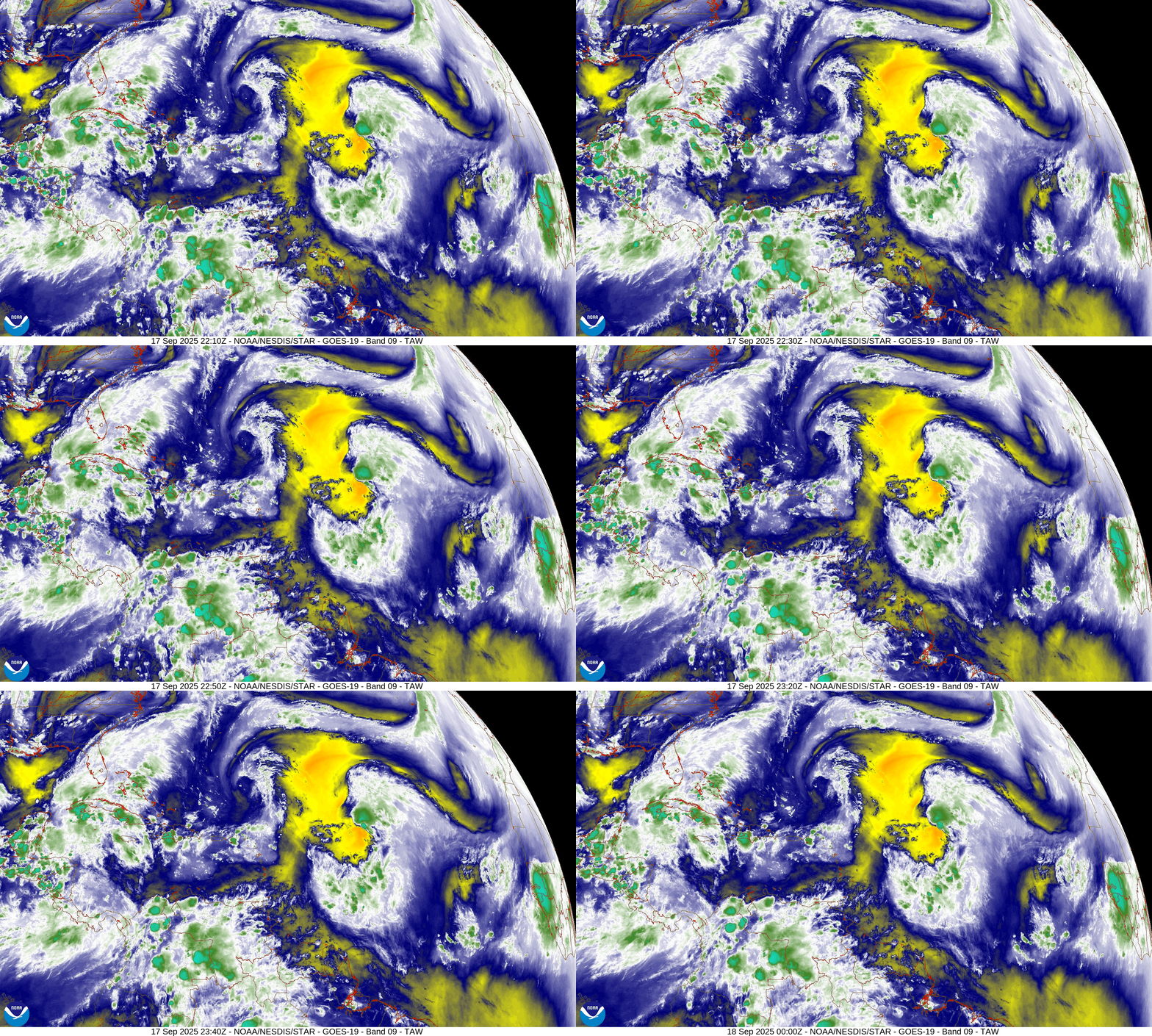
This is not a hospitable environment for a tropical system — what a mess.
SST and SST Anomaly | ECMWF 12:00 UTC Forecast
Warm pool 28° to 29°C plenty sufficient for any category of hurricane along the entire track of Gabrielle (07L)
NOAA Tropical Surface Analysis | 18z
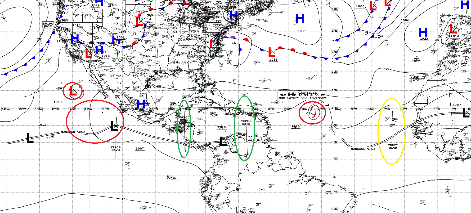
Atlantic Tropical Waves = 3
Eastern Atlantic and Africa Visible Satellite
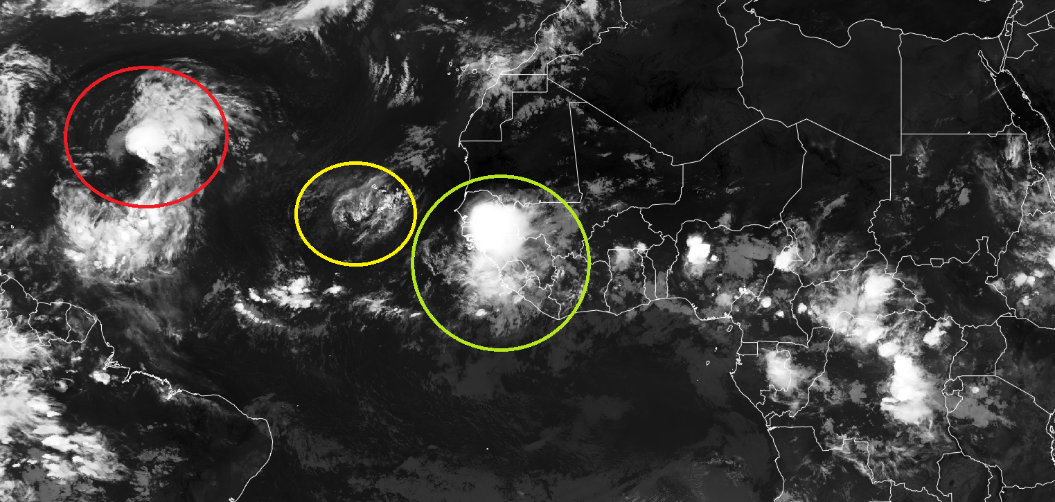
Massive blowup of convection for a tropical wave just coming off Africa tonight. Another one marked as 10% by NHC already faded — with minimal convection.
ECMWF EPS 12z Ensemble | All Cyclone Tracks Through 10-days
ECMWF EPS 12z Ensemble | All Cyclone Tracks Through 13.5-days
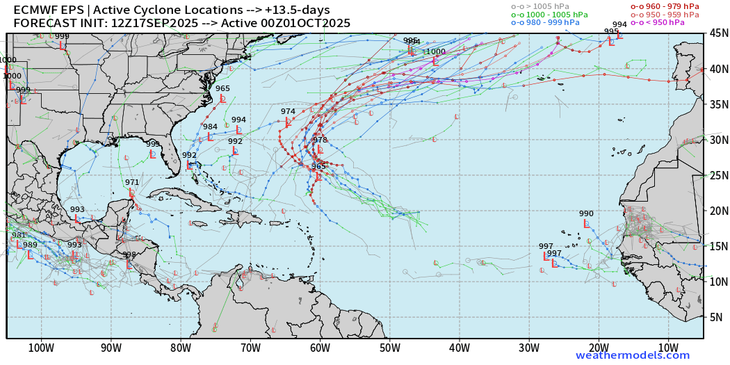
Low chance of random TS/H in the western portions of the Atlantic basin
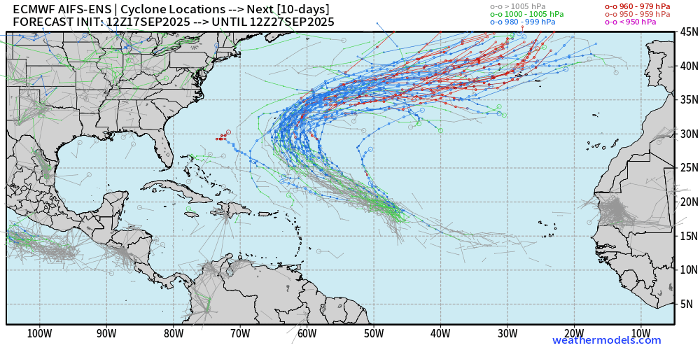
AIFS-ENS Comparison at 12z | Active Tracks at Day 10
AIFS-ENS Comparison at 12z | Active Tracks at Day 15
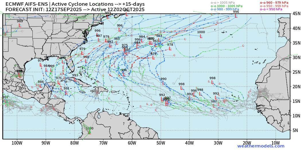
A.I. trained ensembles showing strong signal of TS/H closer to the mainland U.S. into early October. Fits the overall pattern … but nothing imminent.
AIFS-ENS 12z | 15-day Loop of Active Cyclones
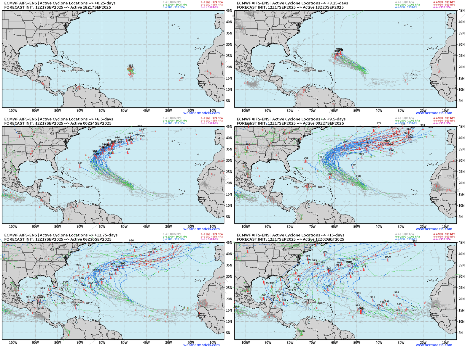
Busy Atlantic during the next 2-weeks with potential for 1-3 named tropical systems
Eastern Pacific Tropical Update | Invest 96E
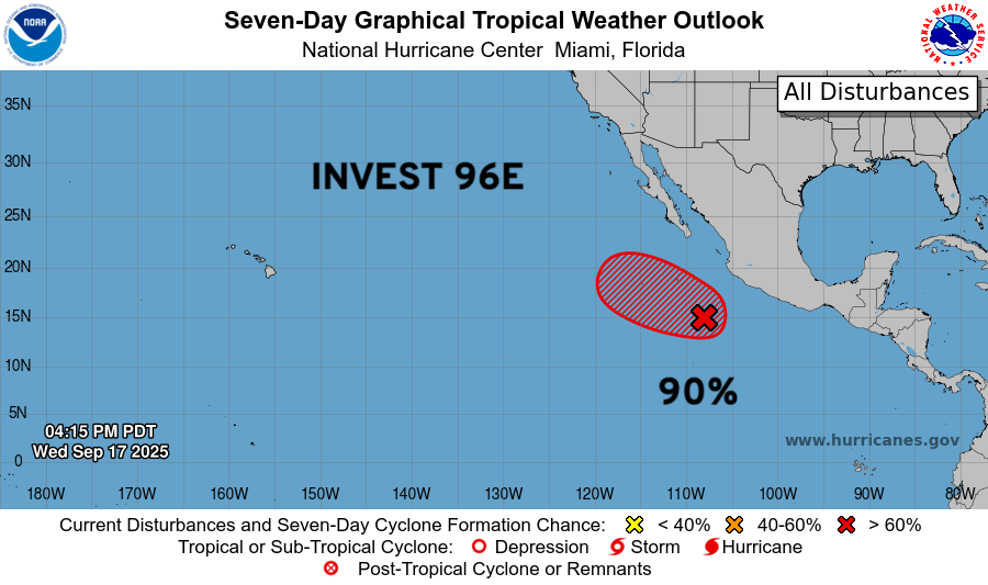
Next system will be named Narda.
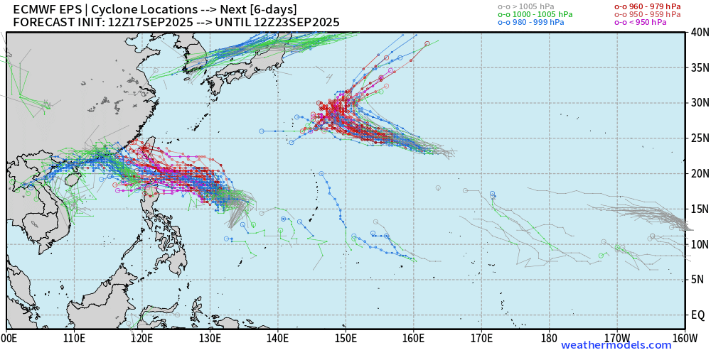
Western Pacific Typhoon Season Update | 90W and 91W
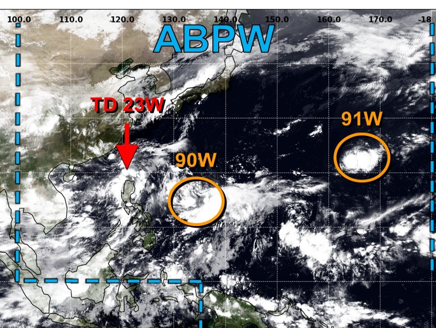
Both Invest 90W and 91W could become Super Typhoons
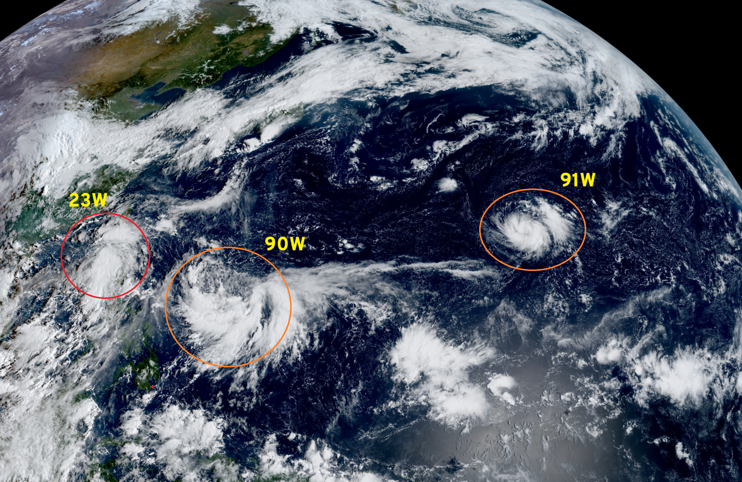
Very warm SSTs > 28°C across entire Western Pacific basin
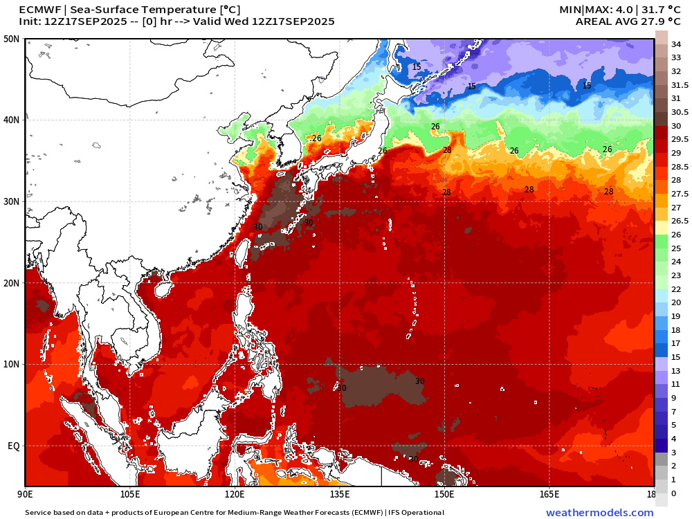
ECMWF 18z | 5-days Snapshot | UV850 | PWAT | MSLP
A big Super Typhoon + a little Super Typhoon = 2
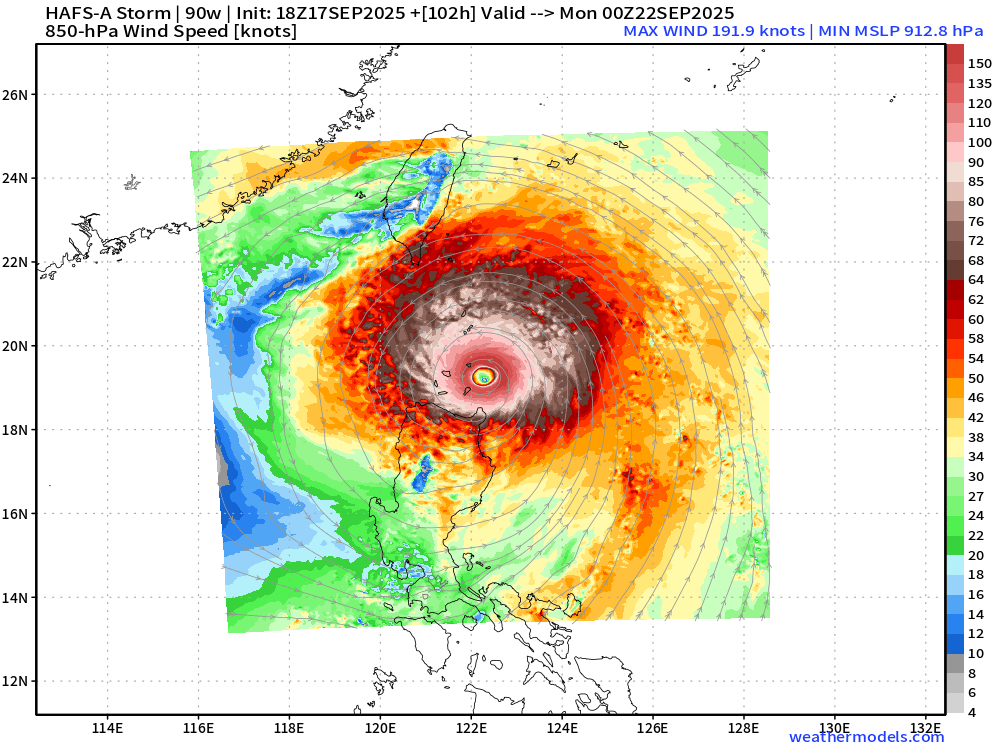
Monster from HAFS-A with Invest 90W in only 102-hours to 192 knot winds at 850-hPa and pressure 912 mb … yikes!
Integrated Vapor Transport | Next 8-days
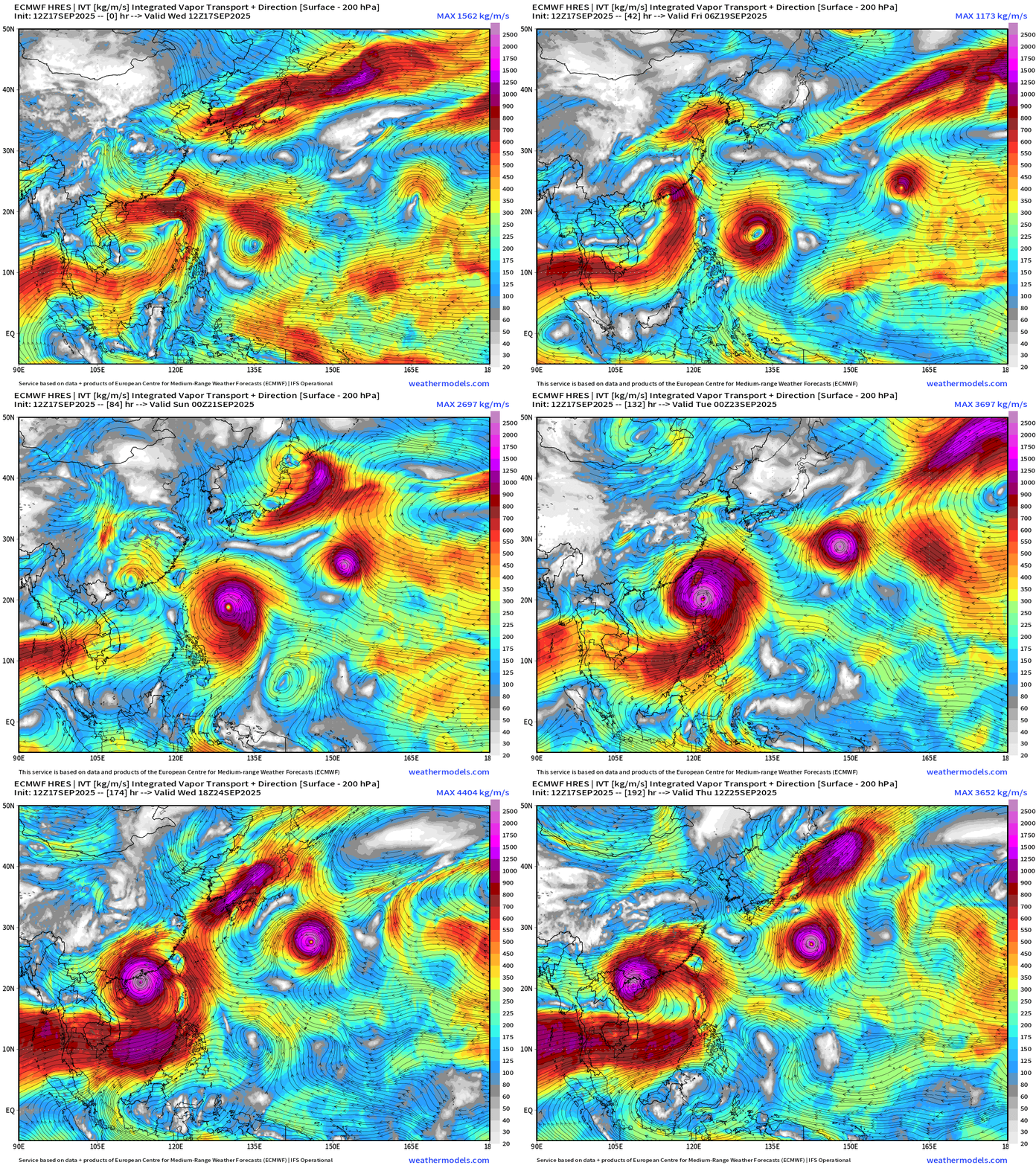
Due westward track for 90W between Philippines and Taiwan into China in 7-days — Hong Kong will need to keep close watch
850 hPa Wind Speed next 12-days | Interesting looping track possible for 91W in the subtropics at high intensity
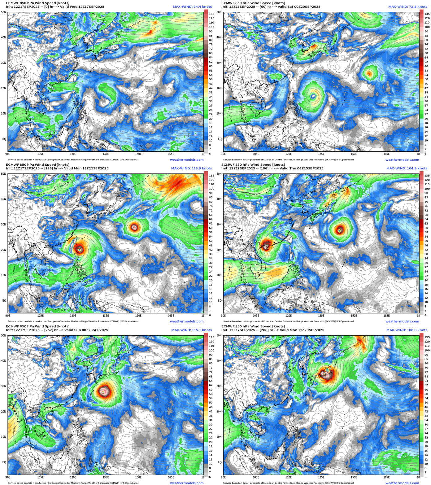
No doubt about potential for extreme intensity …
Maps sourced from weathermodels.com designed and innovated by yours truly! Please subscribe there for real-time access to the newest maps, charts from all of the weather models including ECMWF.
- Milepost
- 737 · laid 2025-09-18T00:48:05.744000Z
- Source
- https://weather.substack.com/p/september-17-2025-wednesday-hurricane
- Digest
- 421fd98b47ee136faa6caede35d7063490fdac39745c6254bc29b8d09619dae1
- Machine
- JSON