September 16, 2025 Tuesday Morning Hurricane Season
Invest 92L likely to become a tropical depression within next day or two
September 2025 was the 7th-warmest September in the 131-year national record (1895–2025), at 67.9°F against a 1991–2020 normal of 66.0°F (+2.0°F).
September 2025 was the 15th-driest September in the 131-year national record (1895–2025), at 1.9in against a 1991–2020 normal of 2.6in (-0.6in).
NOAA/NCEI Climate at a Glance, contiguous United States. This is the observed record for the month, not a score of anything said in this piece — the forecast ledger begins 2026-08-17 and cannot reach earlier posts.

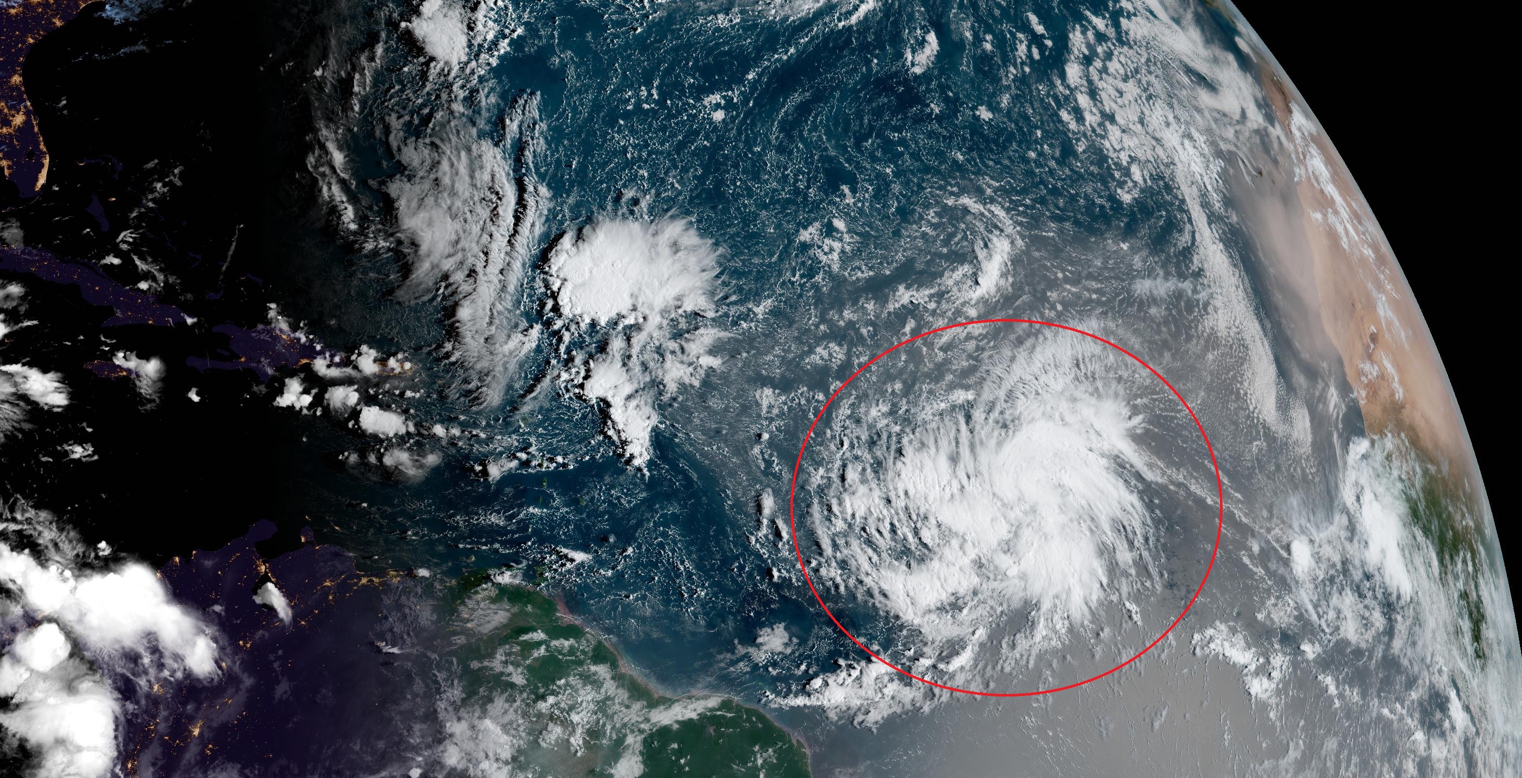
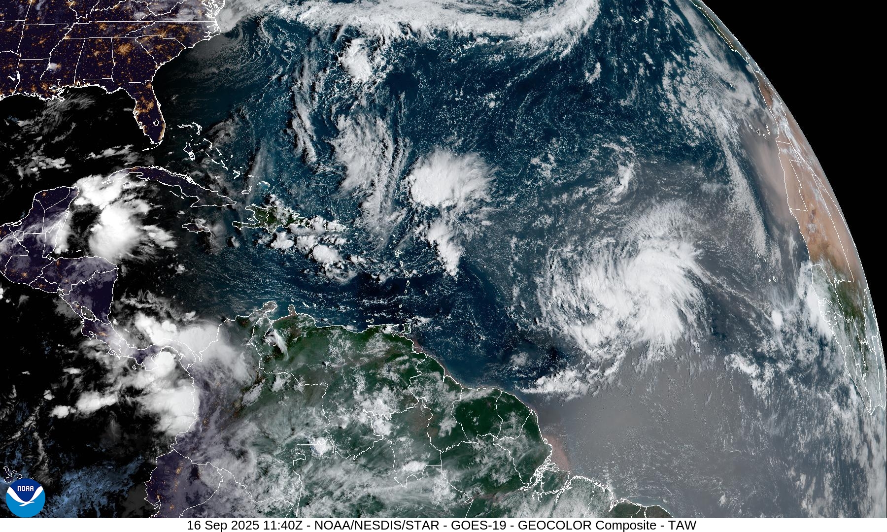
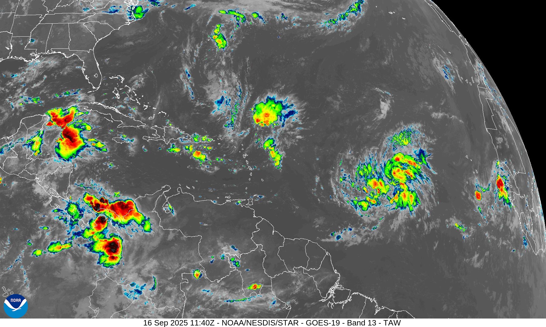
The system is showing convective banding and bursts of thunderstorms in clusters. While not terribly well organized, there is large cyclonic circulation. This sprawling initial size will probably mean slow but steady intensification into a hurricane over the next 4-5 days.
Invest 92L will become Tropical Storm Gabrielle and has the potential to become another Major Hurricane — perhaps Category 4+ over the very warm waters of the west Atlantic warm pool. However, highly unlikely to be a direct impact to land including the Eastern U.S.
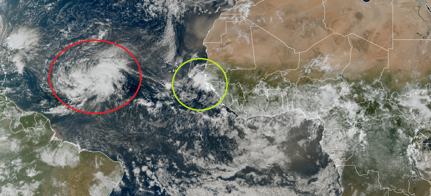
Another tropical wave will emerge off African coast (2nd in a parade) and currently has a 20% chance of developing according to the fresh NHC 8 AM outlook.
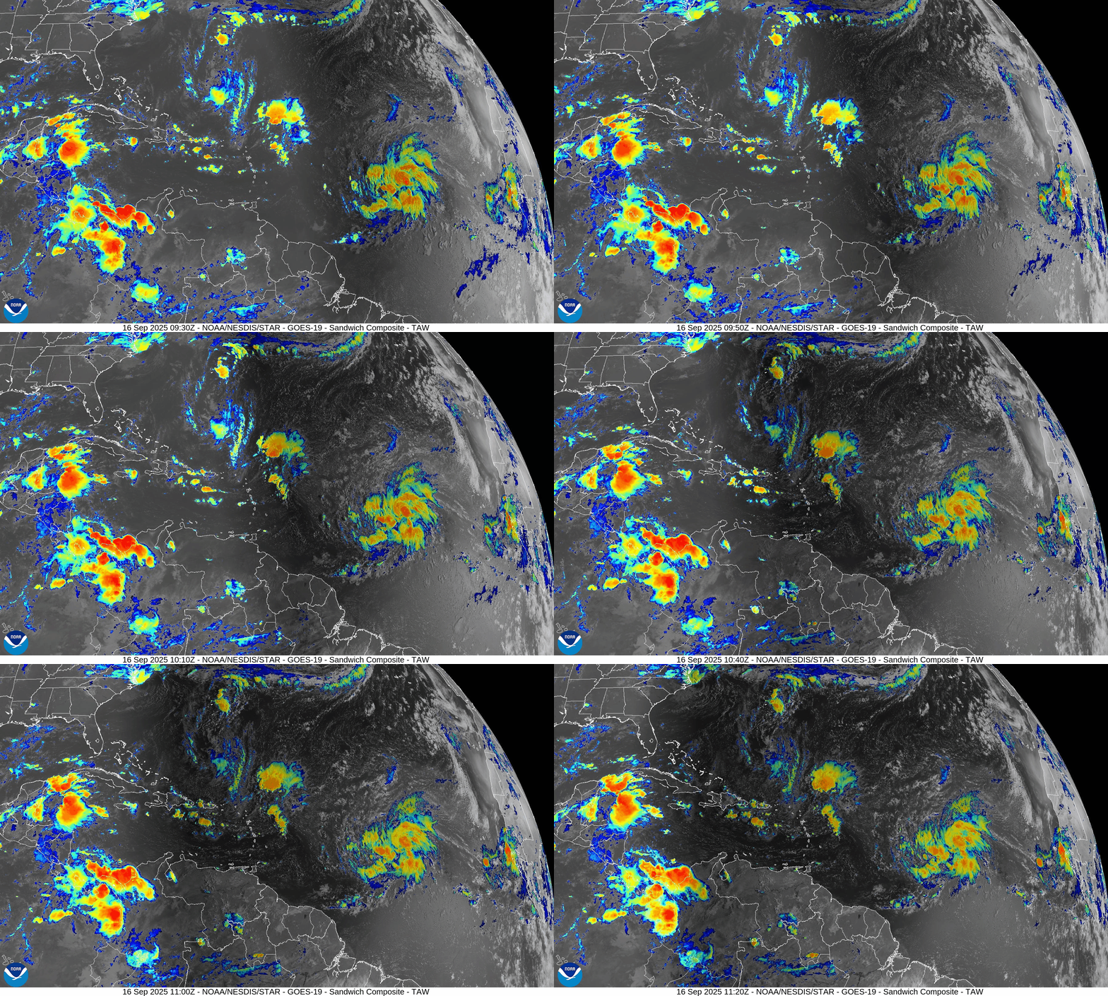
Atlantic Infrared Satellite Loop
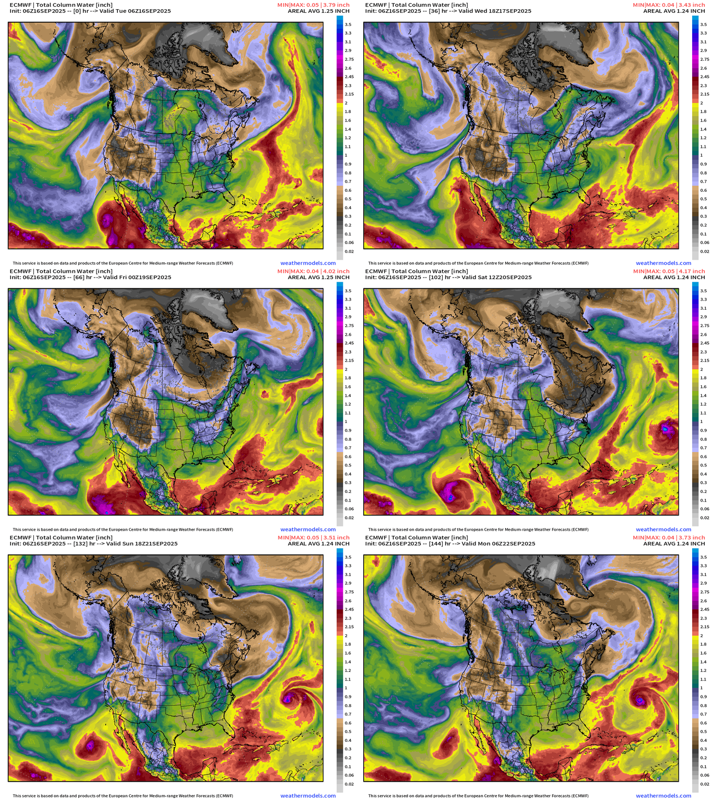
North America Precipitable Water | Next 6-days
The Eastern Pacific off the coast of Mexico and Baja California remains active with Tropical Storm Mario holding on (barely) over cooler ocean waters. The next system already is designated Invest 96E and will be named Narda following in a similar track as Mario.
By Day 6, Hurricane Gabrielle will cross 60°W longitude but slow down considerably before being quickly swept out to sea ahead of a trough. By this time, the system could be a major hurricane.
Atlantic Basin Outlook | 8 AM ET Update
2025 Hurricane Season [Day 108]. My FORECAST for this year is (still) 14 named storms, 7 hurricanes, and 3 major hurricanes (near average)
2025 Season to Date: 6 named storms, 1 hurricanes, and 1 majors | ACE = 40 ACE of Erin: 32.2 (140-knots maximum wind)
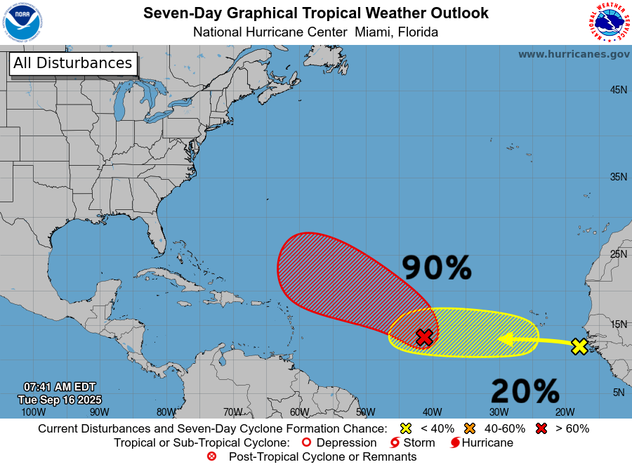
Invest 92L —> 90% chance of development + a new “area of interest” at 20% through 7-days.
Invest 92L ATCF Spaghetti
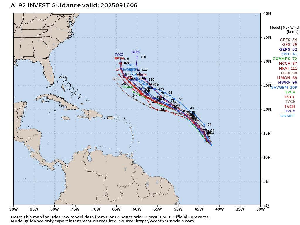
Through Day 7, we can see the northward turn —> out-to-sea “fish mixer'“
ECMWF 12-Days Integrated Vapor Transport | 00z cycle
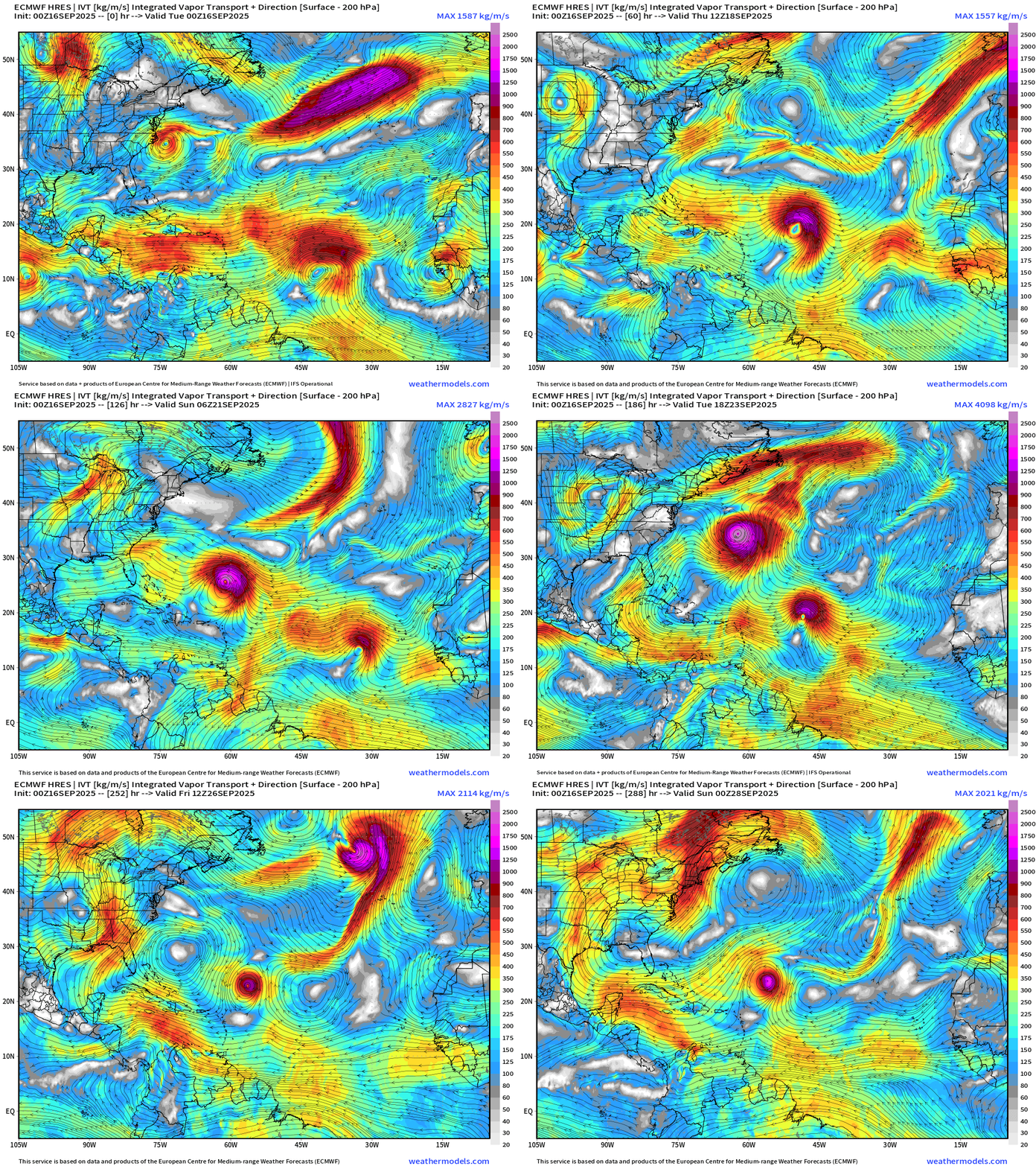
Another hurricane could form behind Gabrielle out of one several waves emerging off the African coast in sequence over the next few days. Then, looks like a break in the action in the Main Development Region (MDR) into end of September.
Atlantic Basin | ECMWF 06z | Precipitable Water Next 6-days
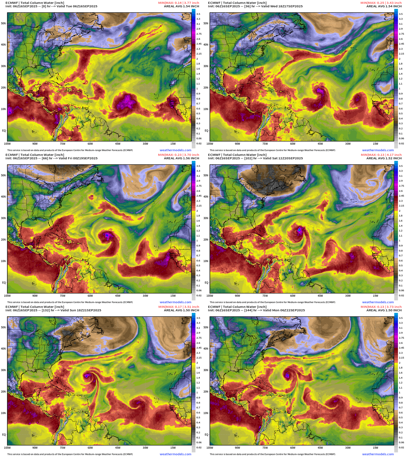
Wave train is nicely set up into this weekend. Gabrielle should be underway by then while we watch 2 other waves with potential.
ECMWF 06z | +6 Days MSLP | UV850 | PWAT
Gabrielle likely to be a major hurricane within 6-days
HAFS A and HAFS B mesoscale models (06z) are mixed with Category 1 to 2 intensity at Day 5.
Atlantic Satellite Imagery | GeoColor and Infrared
Water Vapor | Mid-level
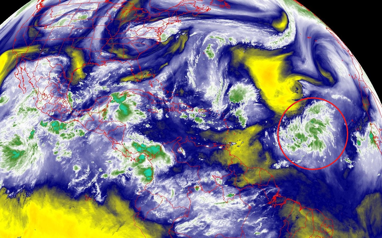
The upper-level low (trough) has moved SW just to the northwest of Invest 92L but so far seems to be helping with upper-level diffluence.
SST and SST Anomaly | ECMWF 12:00 UTC Forecast
Warm pool 28° to 29°C plenty sufficient for any category of hurricane along the entire track of Invest 92L —> Gabrielle
NOAA Tropical Surface Analysis | 06z
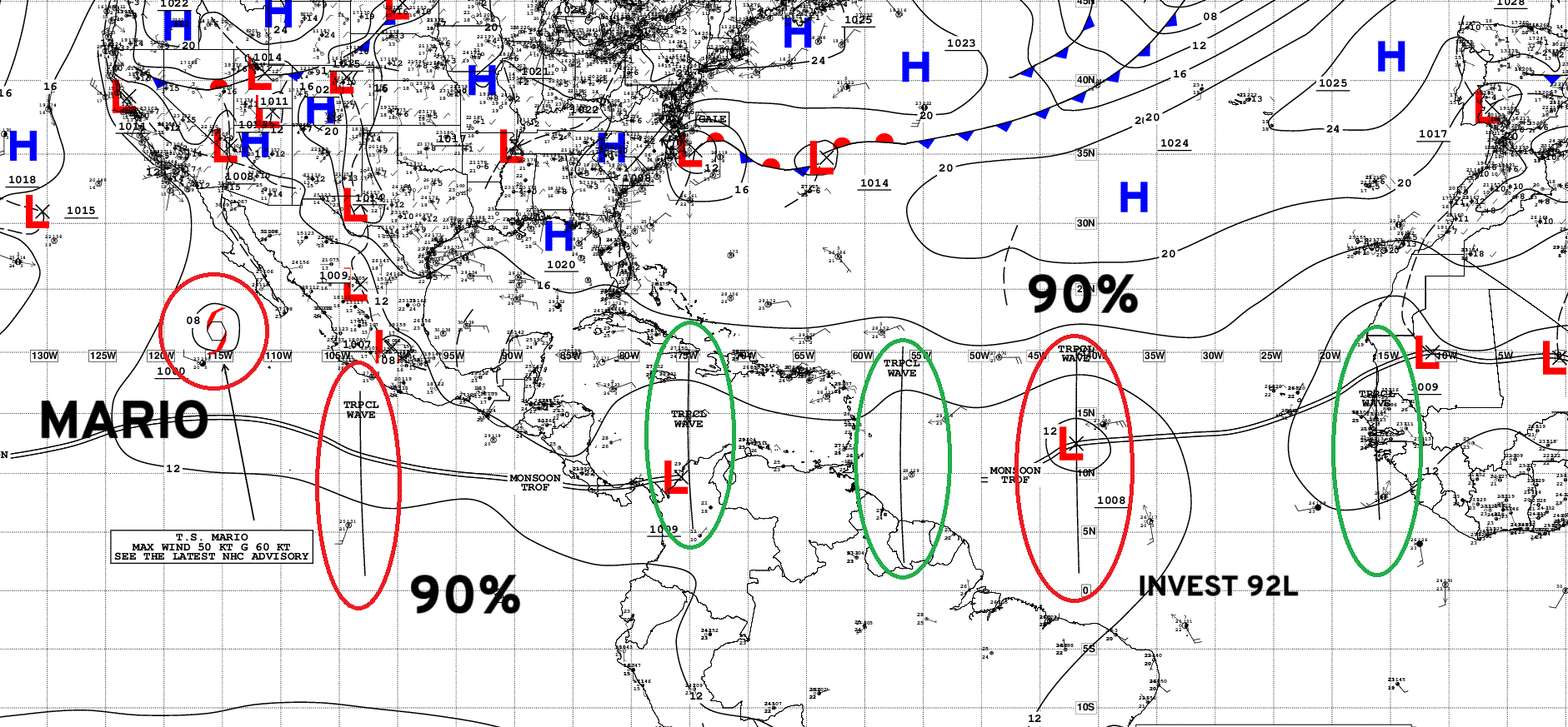
Atlantic Tropical Waves = 4 … including Invest 92L (90% NHC area of interest)
Eastern Atlantic and Africa Visible Satellite
ECMWF EPS 00z Ensemble | All Cyclone Tracks Through 5-days
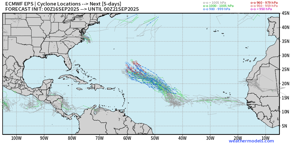
Some ensemble members showing major intensity surface pressure by Day 5 … not much along track spread, tightly clustered
ECMWF EPS 00z Ensemble | All Cyclone Tracks Through 10-days
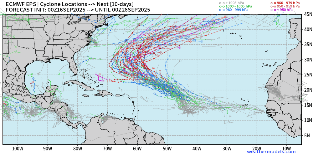
Only 2 members decide to leave the pack and head westward … but those eventually recurve out to sea as well.
ECMWF EPS 00z Ensemble | All Cyclone Tracks Through 15-days
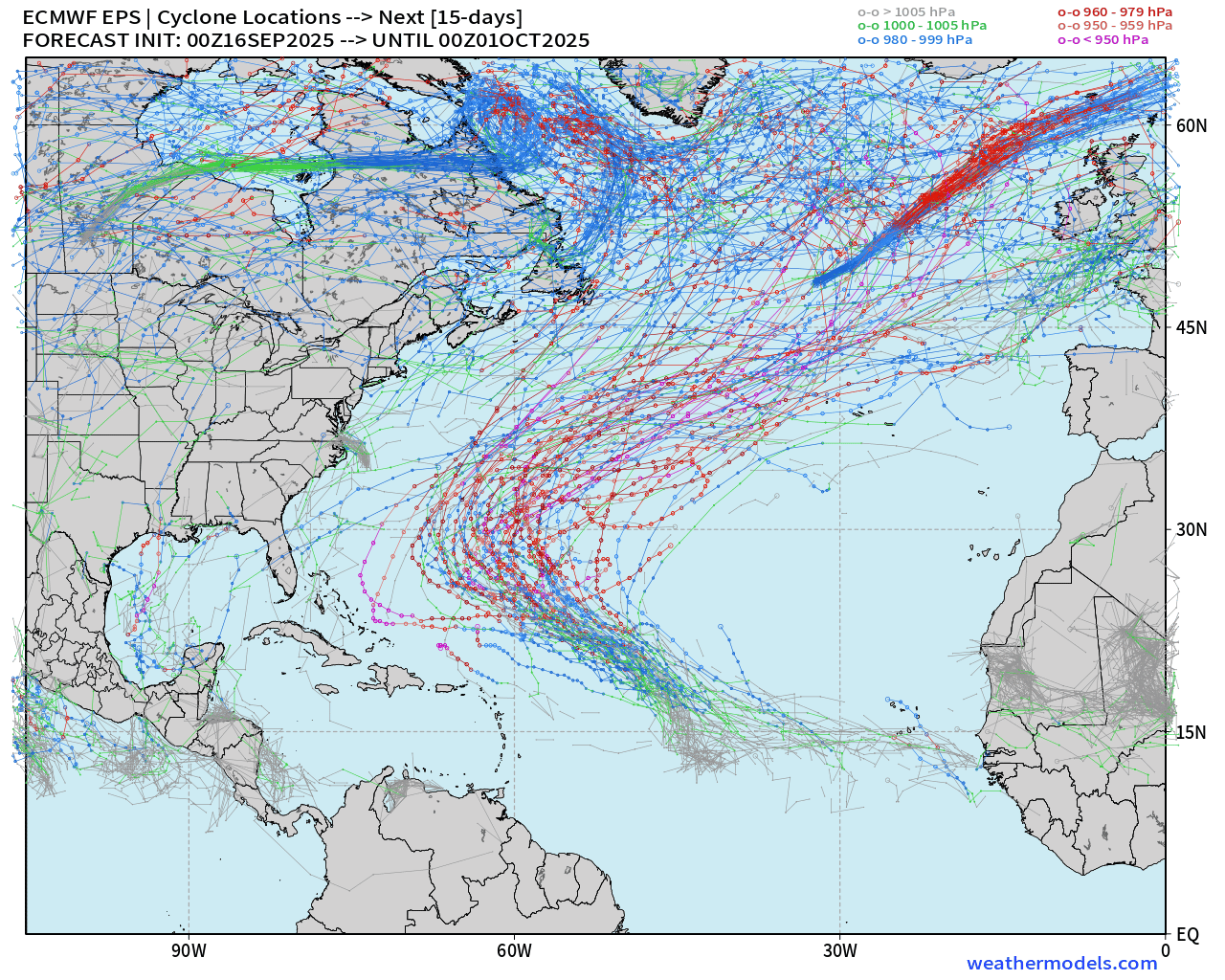
We need to keep an eye on the Caribbean and Gulf of Mexico for “Central American Gyre” spawned systems.
AIFS-ENS Comparison at 00z | Active Tracks at Day 8
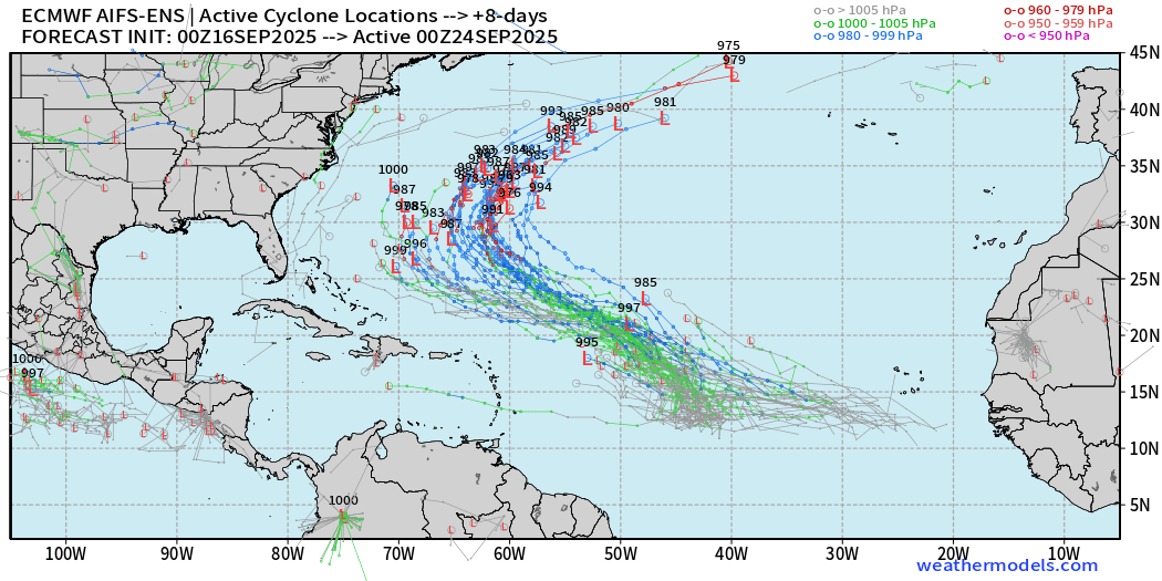
AIFS-ENS Comparison at 00z | Active Tracks at Day 15
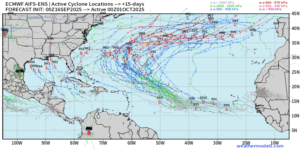
A few members show something in the Gulf of Mexico — way over the “forecast horizon” but still a signal we need to watch closely heading into October.
AIFS-ENS 06z | 15-day Loop of Active Cyclones
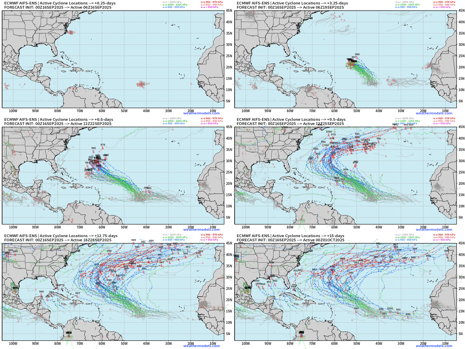
Busy Atlantic during the next 2-weeks with potential for 1-3 named tropical systems
Eastern Pacific Tropical Update | Tropical Storm Mario
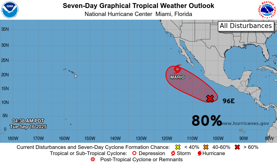
Mario is puffing a tiny burst of convection this morning so it remains a tropical storm. The next system is Invest 96E —> Narda.
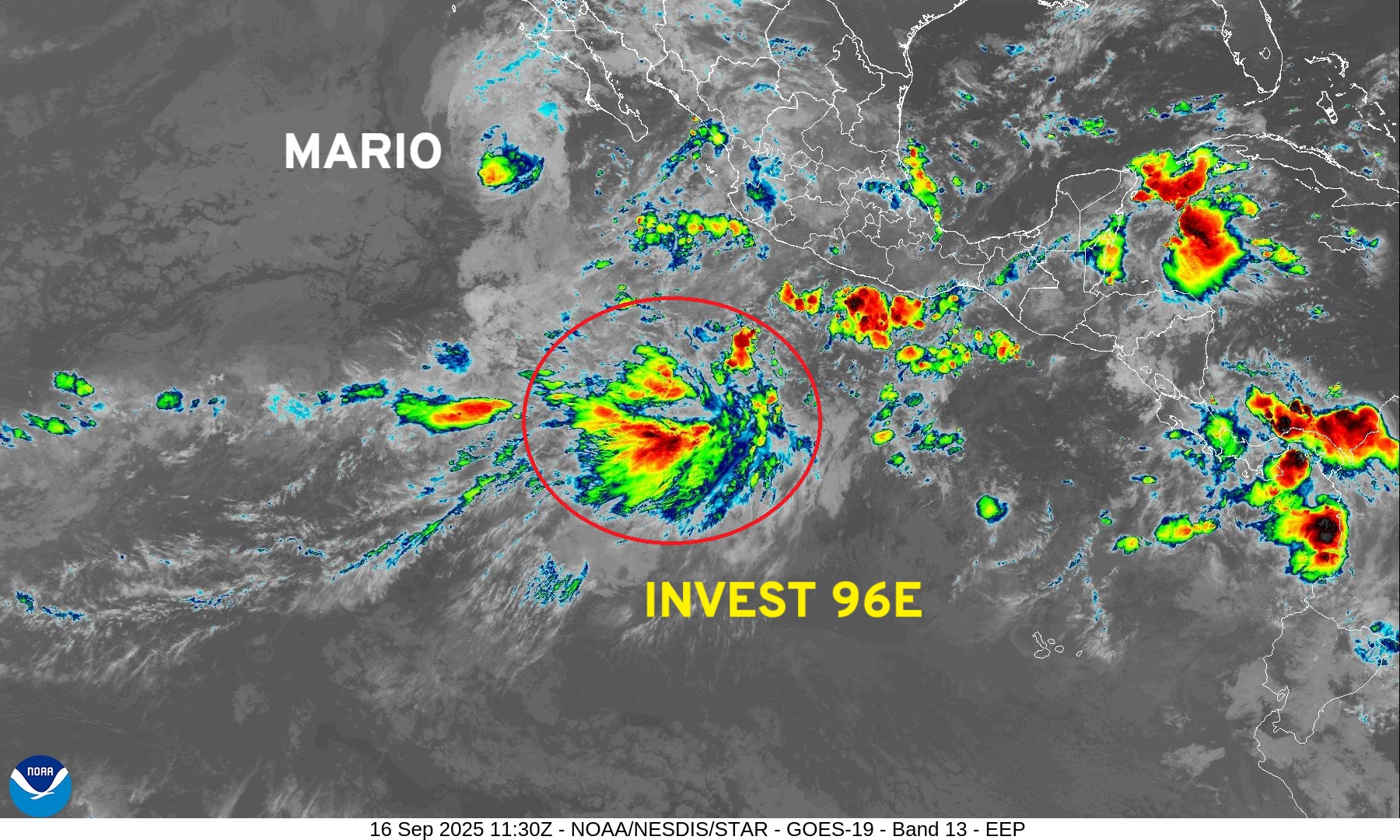
HAFS mesoscale models with TS and Hurricane intensity solutions in next few days.
Western Pacific Typhoon Season Update
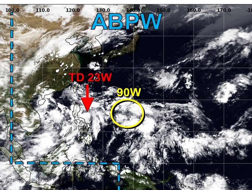
TD 23W is underway + Invest 90W — potential for a Super Typhoon in a week.
ECMWF 06z | 6-days Snapshot | UV850 | PWAT | MSLP
Integrated Vapor Transport | Next 9-days
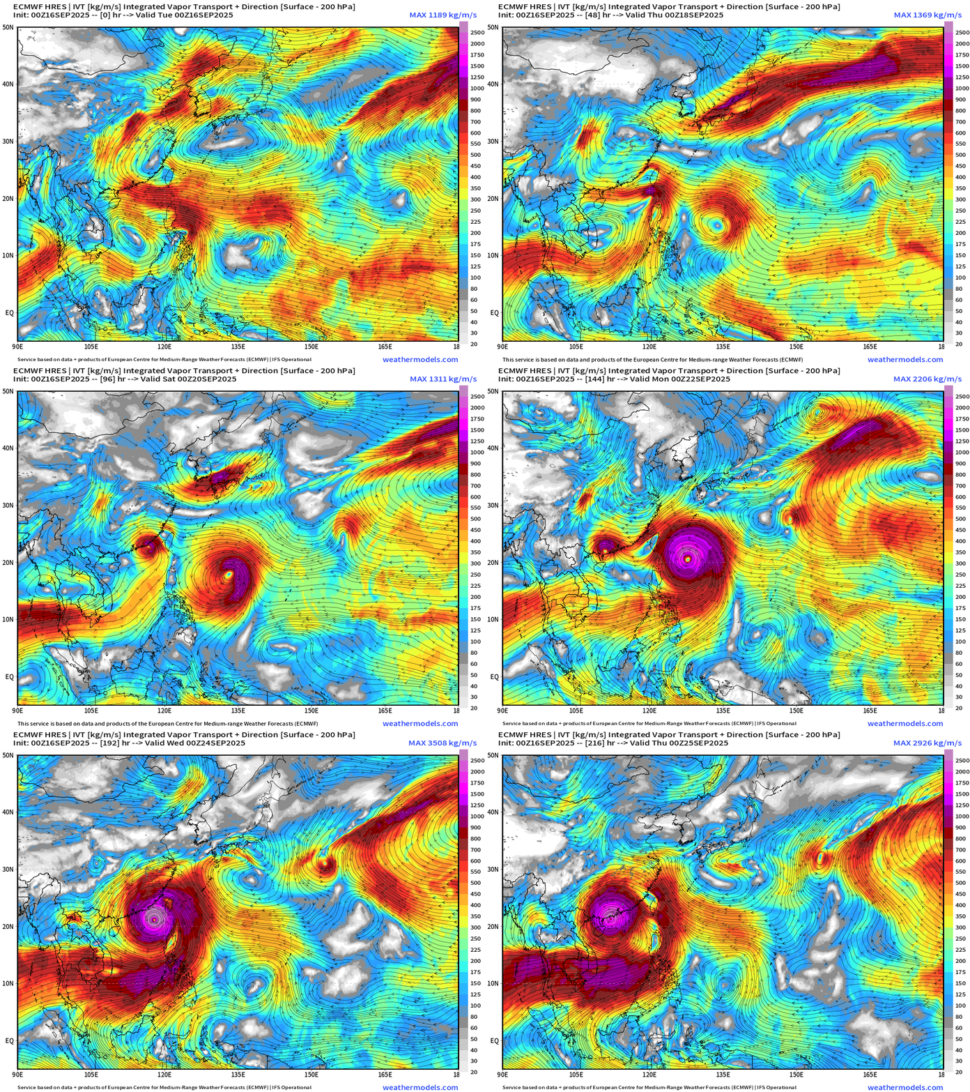
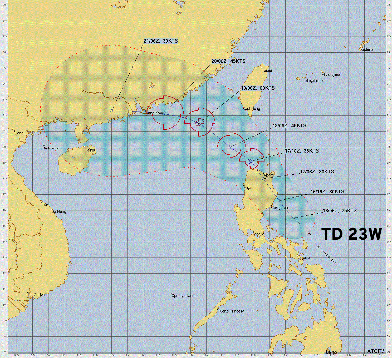
TD 23W remains a tropical storm according to JTWC, but if it avoids land, then I’d lean to a Typhoon
Maps sourced from weathermodels.com designed and innovated by yours truly! Please subscribe there for real-time access to the newest maps, charts from all of the weather models including ECMWF.
- Milepost
- 736 · laid 2025-09-16T12:36:10.376000Z
- Source
- https://weather.substack.com/p/september-16-2025-tuesday-morning
- Digest
- 0b0c2d3850fd288dfae40dbf867d6526a6ef99c35375ea2cb2694c0e10db6041
- Machine
- JSON