September 15, 2025 Monday Evening Hurricane Season Update
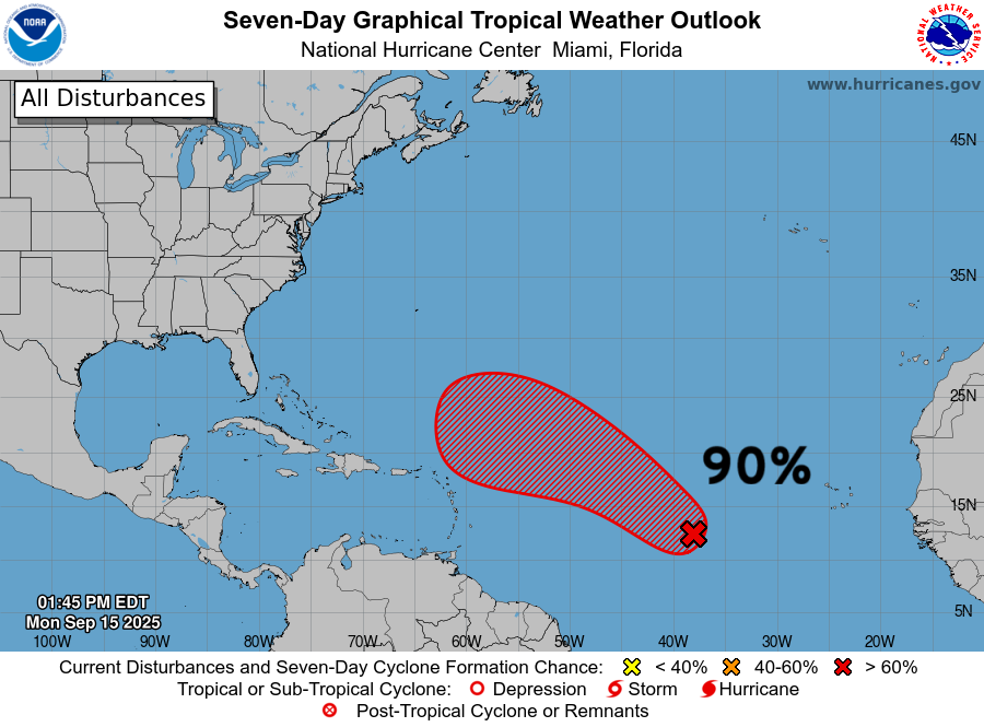
NHC 90% high chance of developing tropical wave
September 2025 was the 7th-warmest September in the 131-year national record (1895–2025), at 67.9°F against a 1991–2020 normal of 66.0°F (+2.0°F).
September 2025 was the 15th-driest September in the 131-year national record (1895–2025), at 1.9in against a 1991–2020 normal of 2.6in (-0.6in).
NOAA/NCEI Climate at a Glance, contiguous United States. This is the observed record for the month, not a score of anything said in this piece — the forecast ledger begins 2026-08-17 and cannot reach earlier posts.

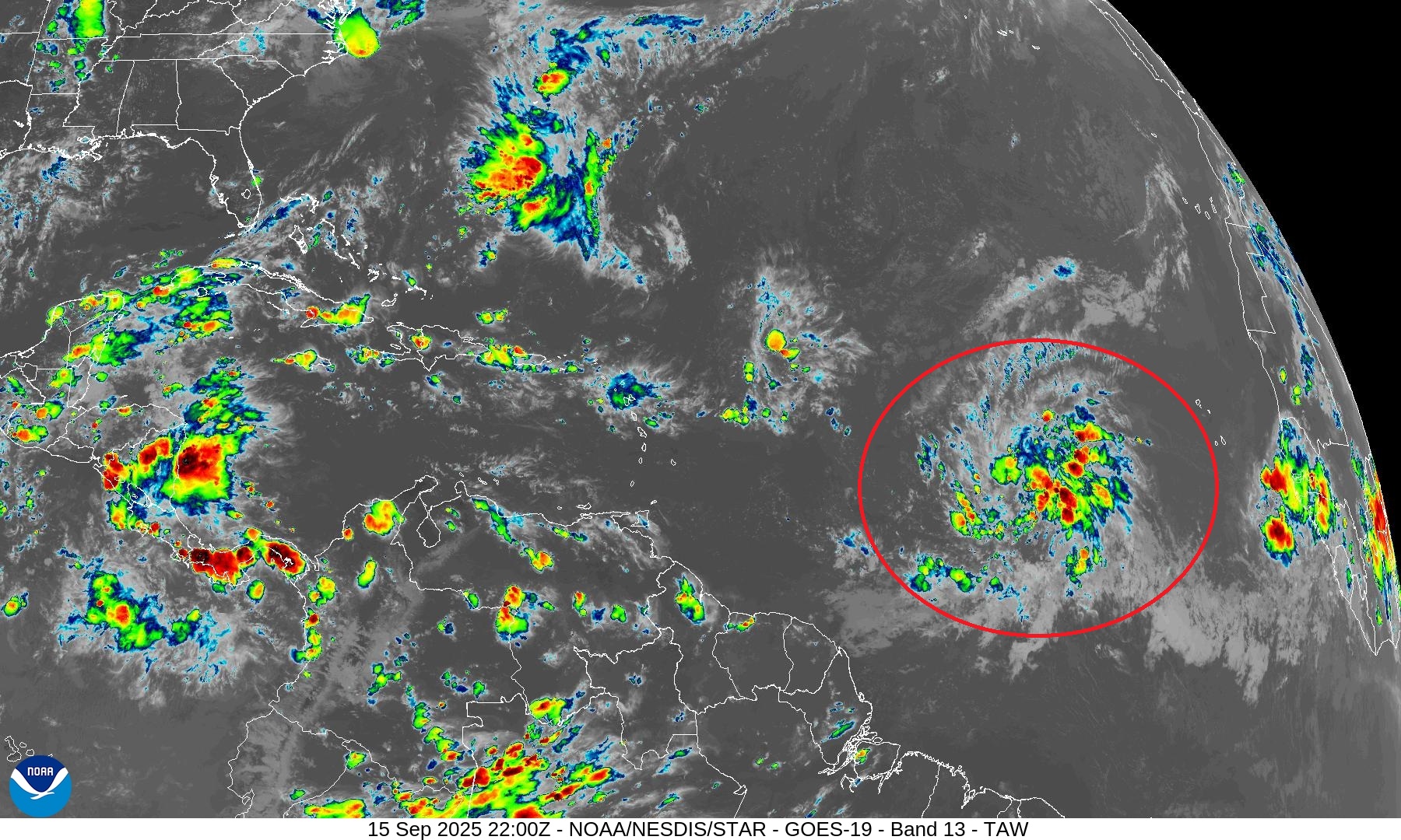
Invest 92L is underway in the central Main Development Region (MDR) and it is firing off sustained convection over a broad area. NHC has increased the likelihood of TS development to 90% — and this time, we mean it!
The Atlantic basin looks “healthier” this evening with more thunderstorm activity helping to moisten the atmosphere and increase instability.
Atlantic Infrared Satellite Snapshot
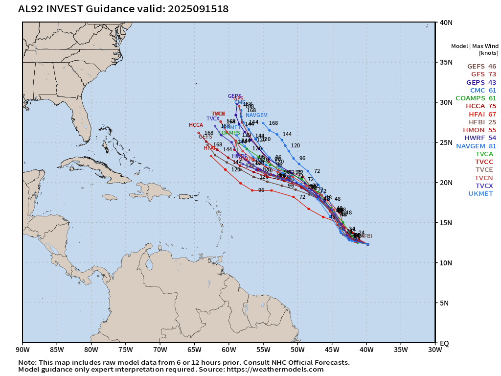
Where will Invest 92L —> T.S. Gabrielle go? On a NW course from the lower latitude of the MDR (12°N) to almost 30°N in 7-days. Note the HCCA consensus (answer key) is on the west/left side of the guidance envelope. Once the system reaches 25°N it will slow down to a crawl and then probably turn abruptly to the right/ENE out-to-sea.
ATCF Spaghetti | Invest 92L
Atlantic Basin Outlook | 2 PM ET Update | 90% HIGH
2025 Season to Date: 6 named storms, 1 hurricanes, and 1 majors | ACE = 40 ACE of Erin: 32.2 (140-knots maximum wind)
ECMWF 12-Days Integrated Vapor Transport | 12z cycle
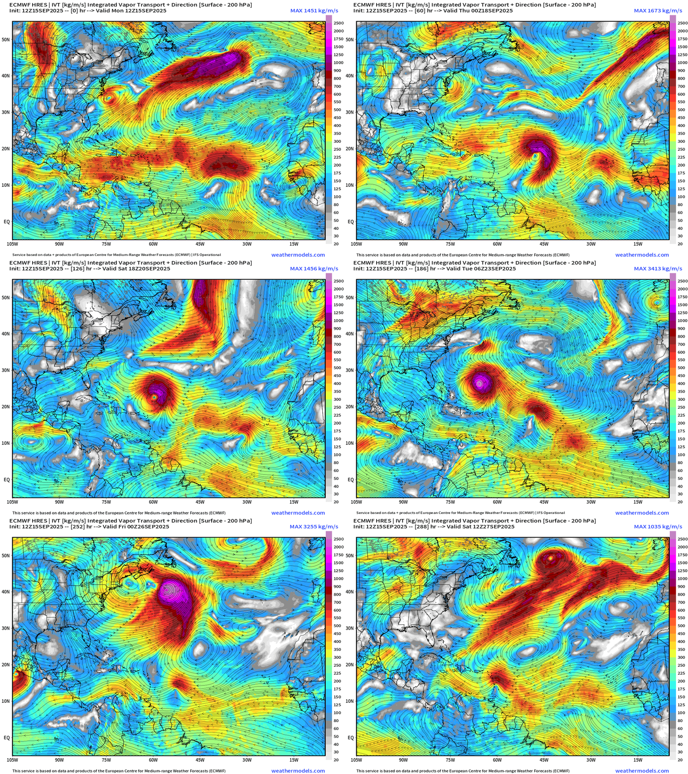
The wave train continues WNW until the parade comes to a halt — the tropical waves jumble up, and then quickly exit stage right out to sea —> “fish mixer” … note how Gabrielle absorbs or drags a tropical wave to the NE … but another is allowed to continue westward into the Lesser Antilles in the longer-range.
Maximum intensity looks to be high end Category 4 or even Category 5 in 9-days (931 mb) — Day 9:
Gabrielle | Major Hurricane closest approach to the Lower 48
ECMWF 12z | Precipitable Water Next 8-days
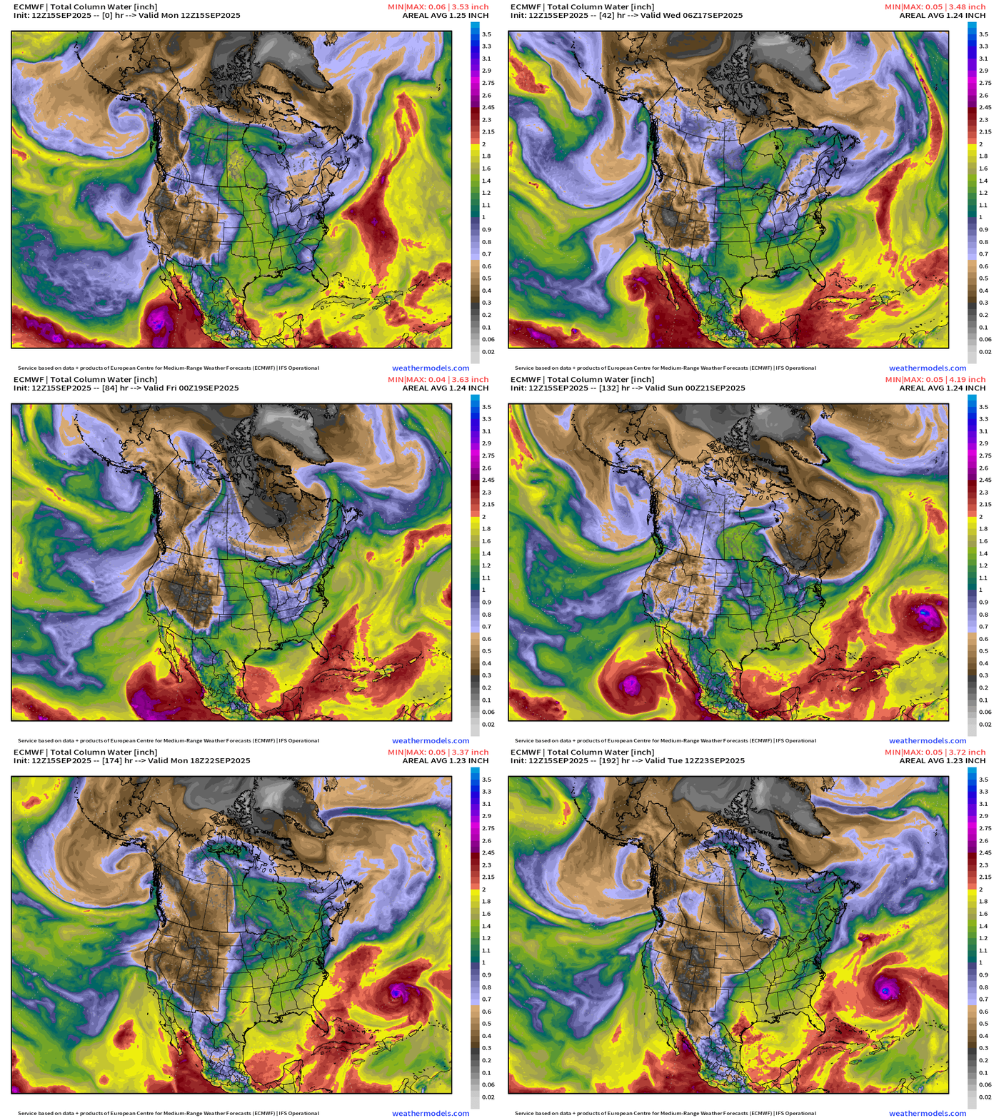
Mario and Narda decay over the cooler waters of the Pacific off Baja California to the west. Gabrielle enters the picture as a potential Major Hurricane by this time next week.
We will need to monitor the troughs/ridges over North America for steering currents to keep any approaching hurricanes from reaching the United States.
ECMWF 12z | Cyclonic Vorticity Next 12-days
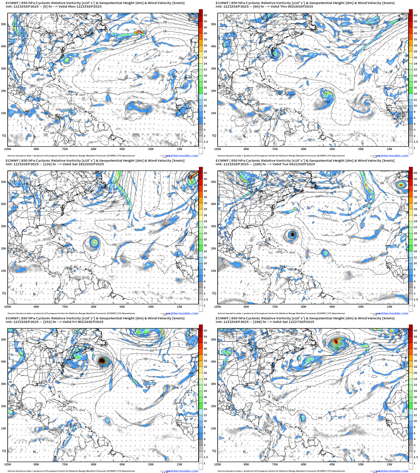
3 distinct systems including Gabrielle, a tropical wave a few days behind it that gets gobbled up, and then another trailing at lower-latitude in the MDR to near the Lesser Antilles in 12-days.
HAFS Intensity of Invest 92L through 5-days — near hurricane intensity but large circulation
Atlantic Satellite Imagery | Water Vapor | Mid-level Loop
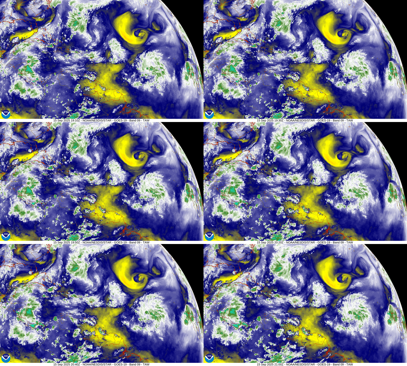
The upper-level low (yellow spinner) to the NNW of the tropical wave doesn’t seem to be affecting it much … and it may be oriented such that it orbits/rotates harmlessly to the SW and decays. The current circulation at mid-levels may be helping to ventilate Invest 92L — upper-level diffluence.
SST and SST Anomaly | ECMWF 12:00 UTC Forecast
Very warm water on the path of our next hurricane — Atlantic “warm pool”
NOAA Tropical Surface Analysis | 12z
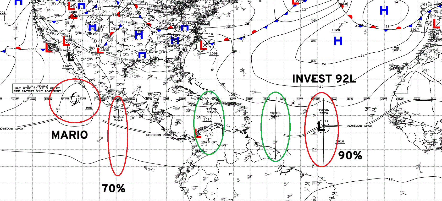
Atlantic Tropical Waves = 3 including the 90% NHC (Invest 92L)
Eastern Atlantic and Africa Infrared Satellite
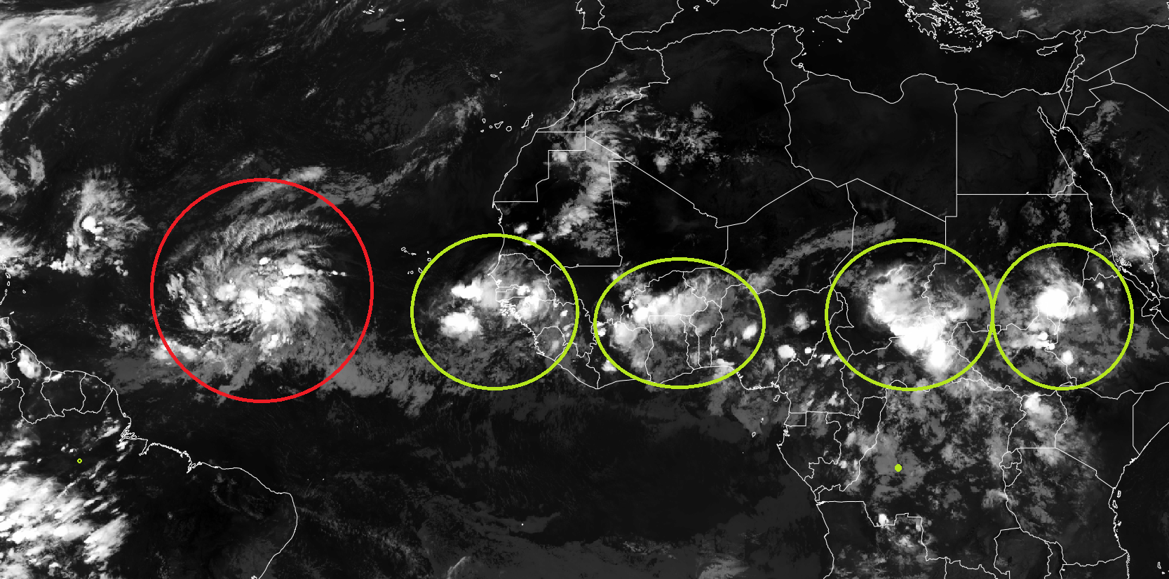
At least 4 more tropical waves lined up in a parade — African Easterly Wave train
Ensemble Spaghetti
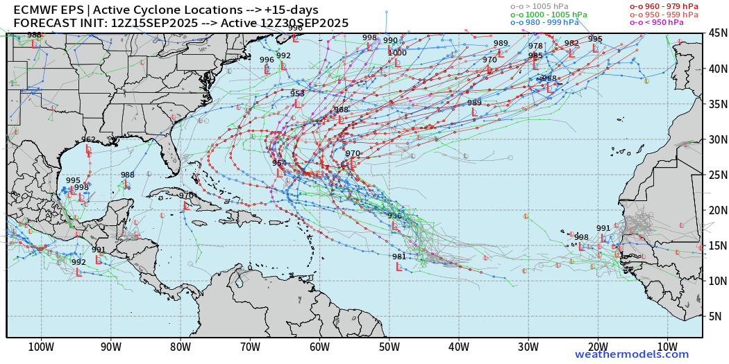
Ensemble spaghetti — from 51-members of the ECMWF full-physics and A.I. trained systems. Note, there is only one reality — and while there are potentially hundreds of forecasted scenarios in the coming days, we will only have 1 or 2 actual hurricanes. The tracks are meant to show uncertainty in location and intensity to trained forecasters.
ECMWF EPS 12z Ensemble | Active Cyclone Tracks Through 5-days
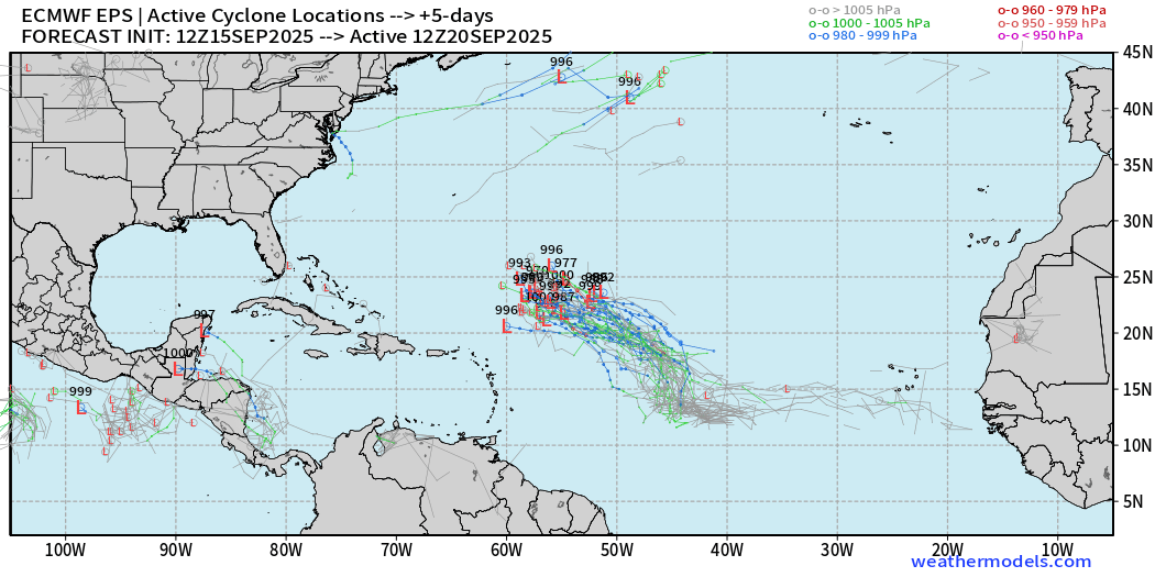
ECMWF EPS 12z Ensemble | Active Cyclone Tracks Through 7-days
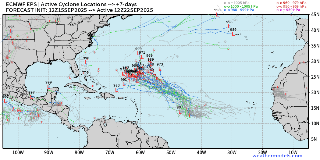
ECMWF EPS 12z Ensemble | Active Cyclone Tracks Through 10-days
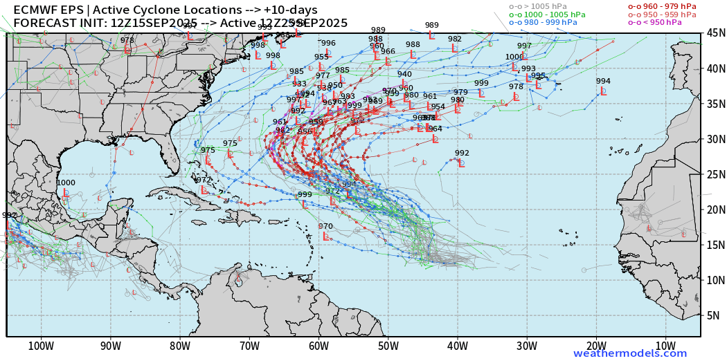
ECMWF EPS 12z Ensemble | Active Cyclone Tracks Through 15-days
AIFS-ENS Comparison at 12z | Active Tracks at Day 5
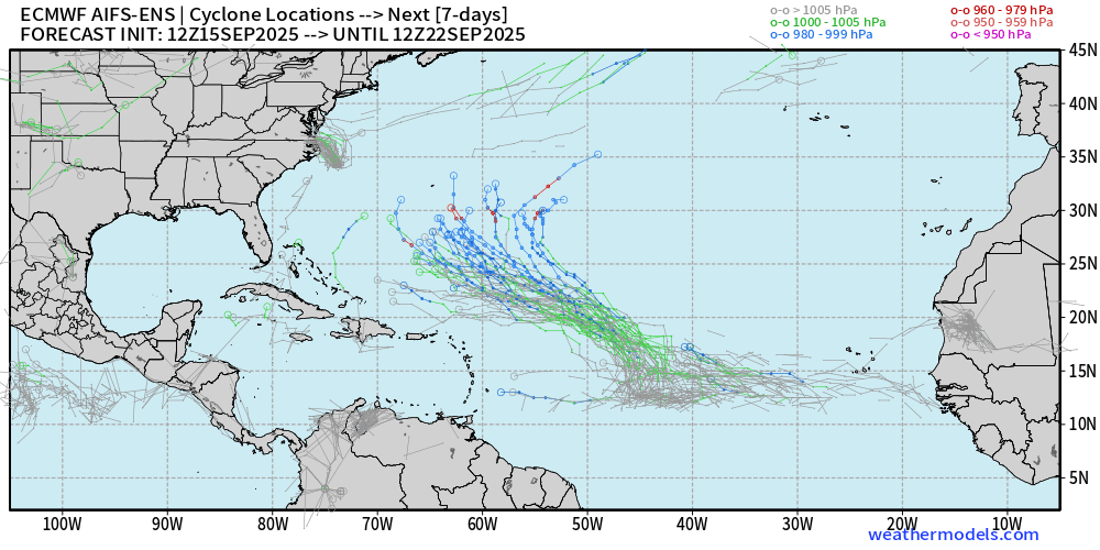
The A.I. trained system is weaker in the Atlantic with tracks than the full-physics
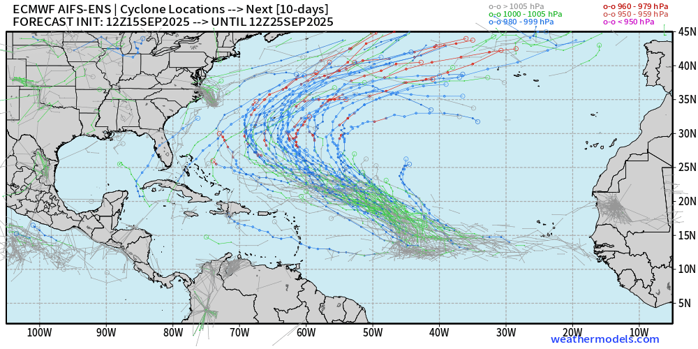
AIFS-ENS Comparison at 12z | Active Tracks at Day 10
AIFS-ENS Comparison at 12z | Active Tracks at Day 15
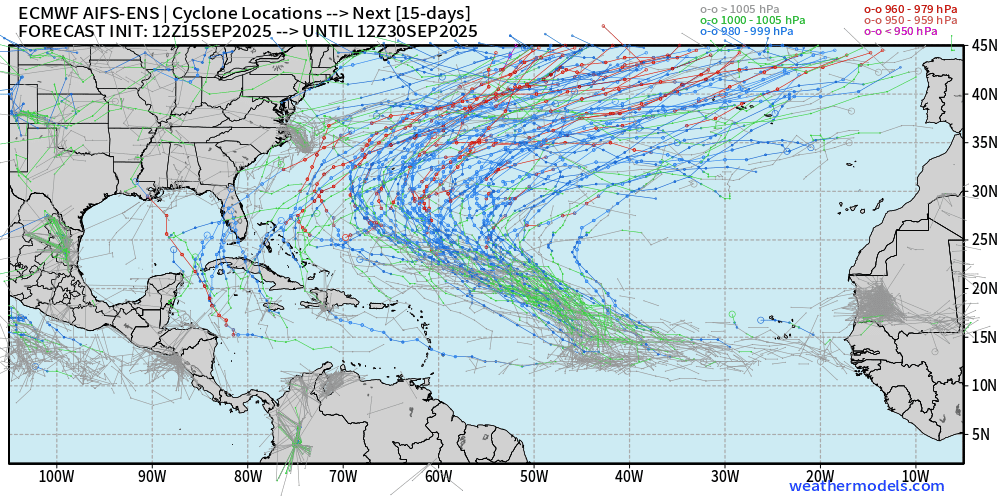
AIFS-ENS 12z | 15-day Loop of Active Cyclones
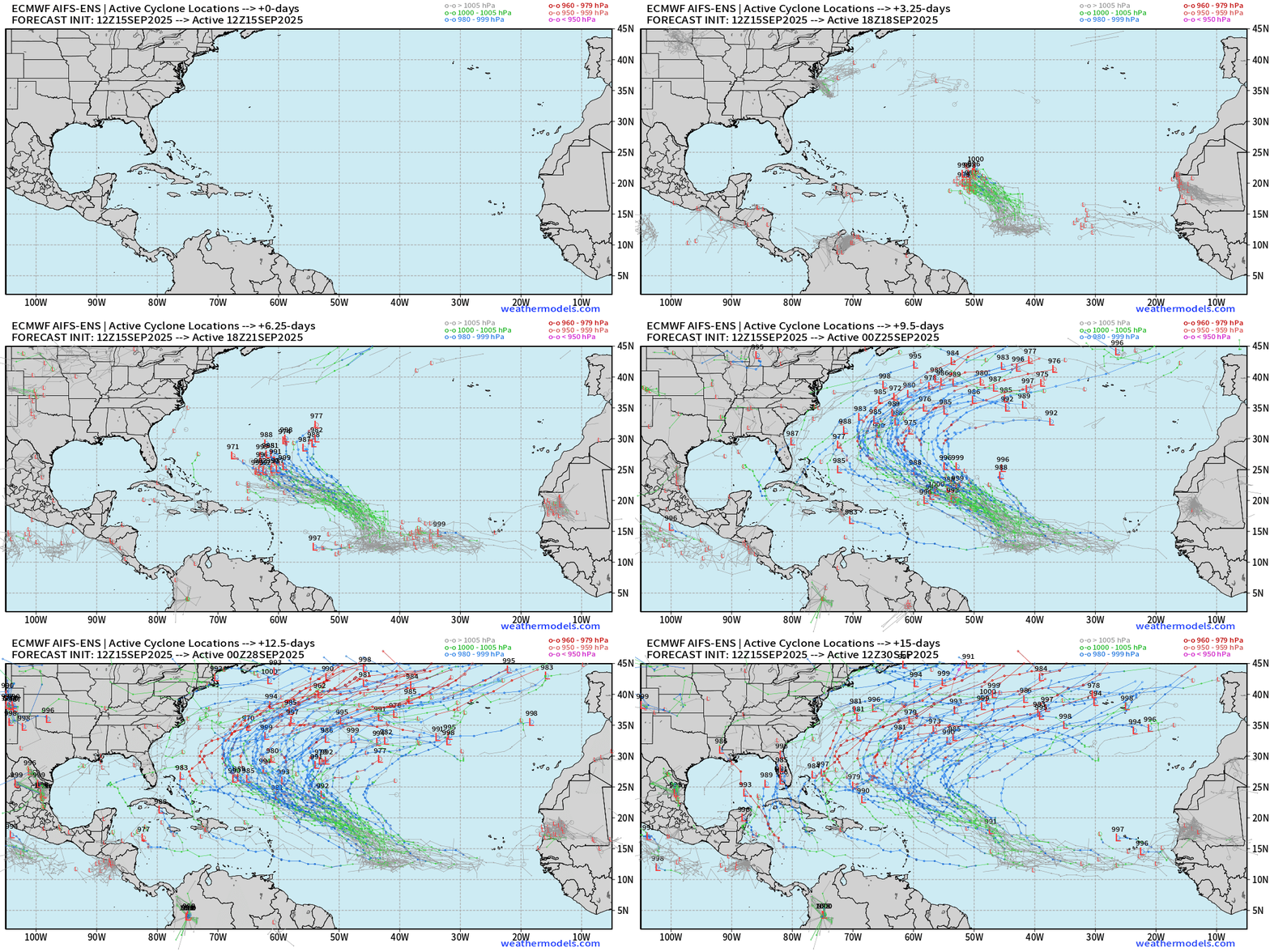
Busy Atlantic during the next 2-weeks with potential for 1-3 named tropical systems
Eastern Pacific Tropical Update | Tropical Storm Mario
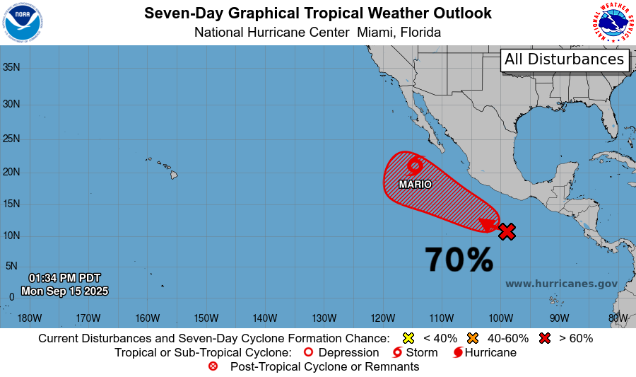
Mario almost became a hurricane, but will now decay quickly over cooler waters.
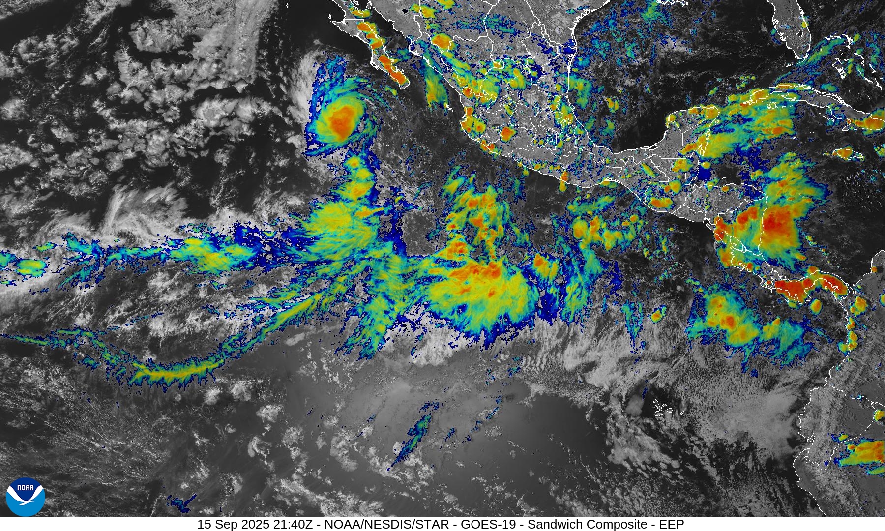
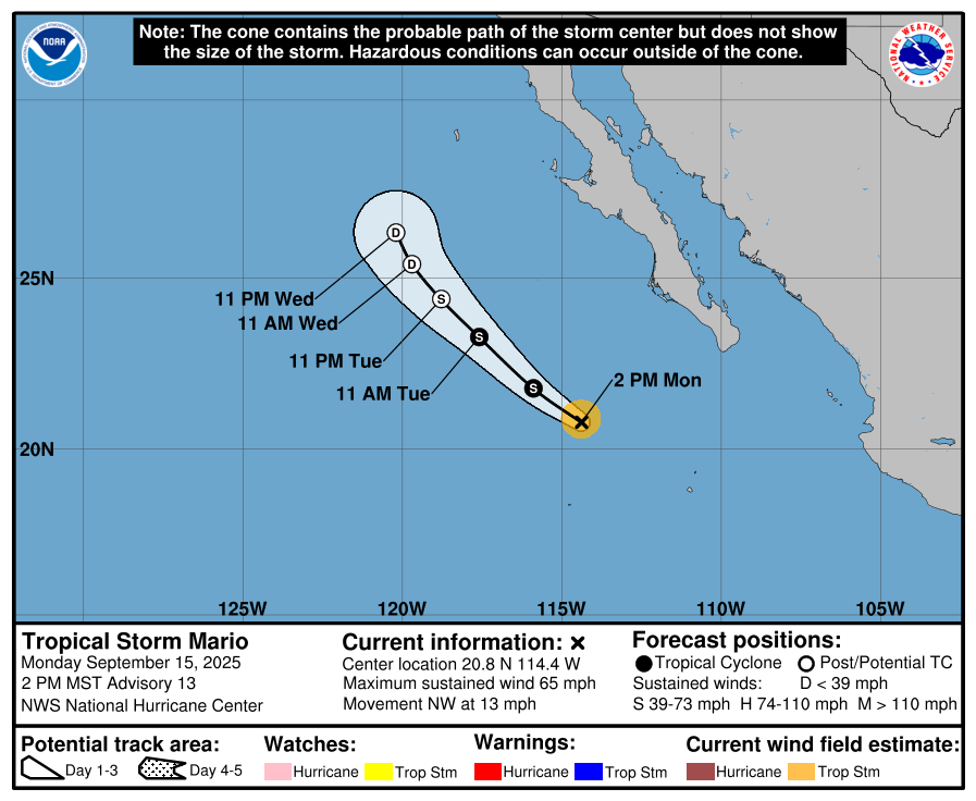
Mario is up to 55-knots this evening — but has 12-18 hours before losing all convection and steam over < 26°C ocean temperatures
55-knot tropical storm Mario
Next storm is Narda in a few days but may not intensity much beyond a minimal TS.
Western Pacific Typhoon Season Update
It’s been busy with numbered systems — 22 of them, but almost all of them have been quite weak and short-lived. That should change soon with potential for a Super Typhoon to develop east of the Philippines.
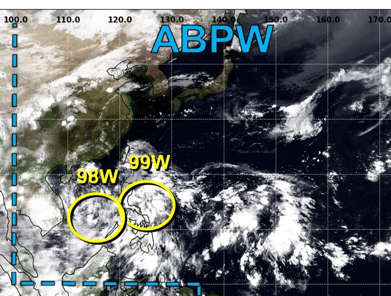
Two Invests 98W and 99W may likely become Typhoons with the eastern storm very intense — and potentially a Super Typhoon in 7-8 days near Philippines heading westward
Integrated Vapor Transport | Next 10-days
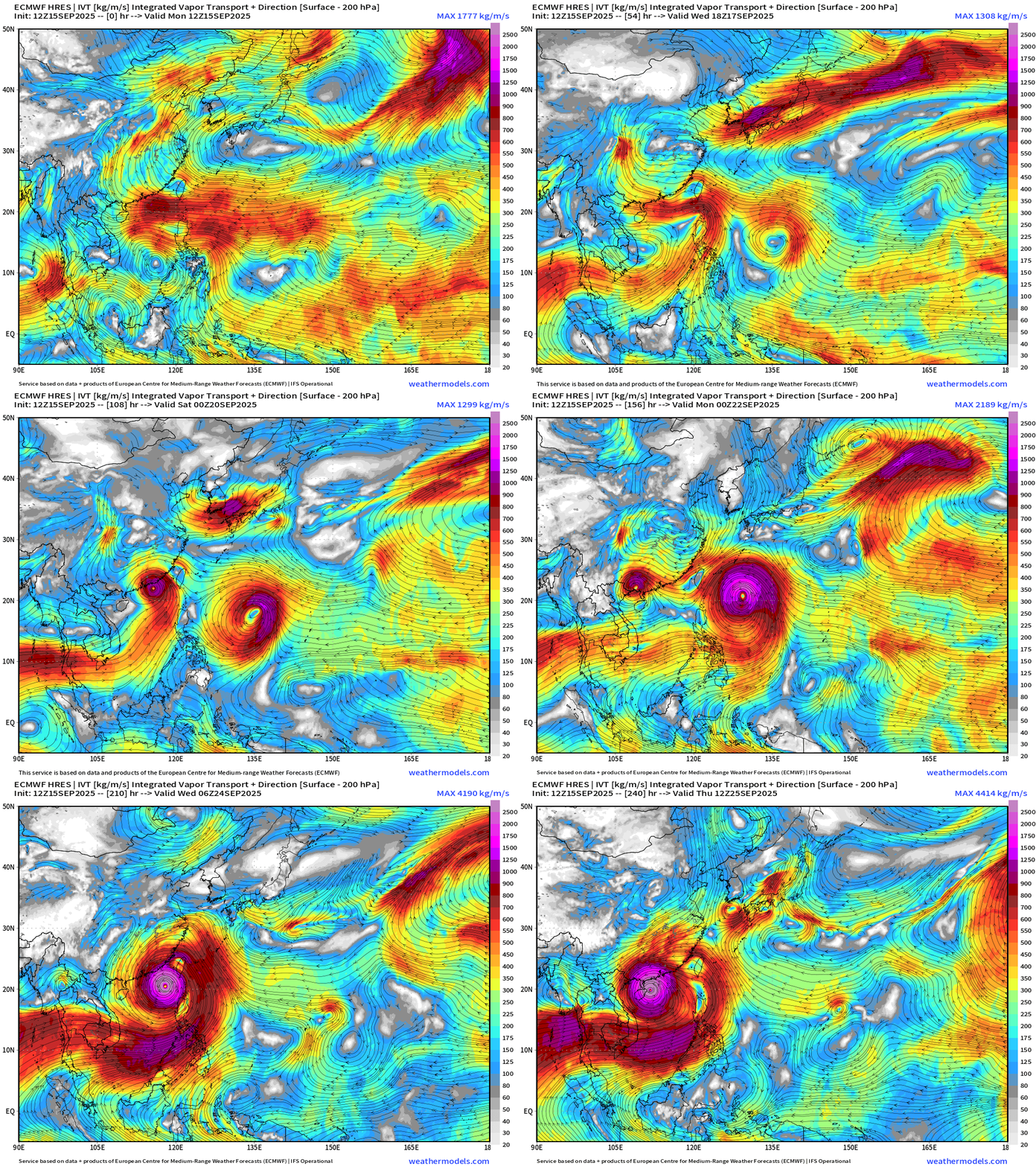
ECMWF 12z | 9-days Snapshot | UV850 | IVT
Maps sourced from weathermodels.com designed and innovated by yours truly! Please subscribe there for real-time access to the newest maps, charts from all of the weather models including ECMWF.
- Milepost
- 735 · laid 2025-09-15T23:00:57.888000Z
- Source
- https://weather.substack.com/p/september-15-2025-monday-evening
- Digest
- caca515299ee06b198c309e913d8ba8e8ac3b041c411ebe43ef3ff4a1483545b
- Machine
- JSON