September 14, 2025 Sunday Evening Update
NHC 70% high chance of developing tropical wave
September 2025 was the 7th-warmest September in the 131-year national record (1895–2025), at 67.9°F against a 1991–2020 normal of 66.0°F (+2.0°F).
September 2025 was the 15th-driest September in the 131-year national record (1895–2025), at 1.9in against a 1991–2020 normal of 2.6in (-0.6in).
NOAA/NCEI Climate at a Glance, contiguous United States. This is the observed record for the month, not a score of anything said in this piece — the forecast ledger begins 2026-08-17 and cannot reach earlier posts.

Also, NHC will start up Invest 92L in the Main Development Region of the central Atlantic probably tomorrow. There is a 70% chance of development of a tropical wave forming into Gabrielle in the next several days. The disturbance has been generating convection for the last 48-hours and overcoming (slowly) the otherwise neutral environmental conditions e.g. dry air.
Invest 92L has a high chance of becoming Gabrielle — and models (conventional + A.I.) show a major hurricane in the central Atlantic in 7-days but most likely it will remain “out to sea”
Lower 48 Precipitable Water Forecast | Next 5-days
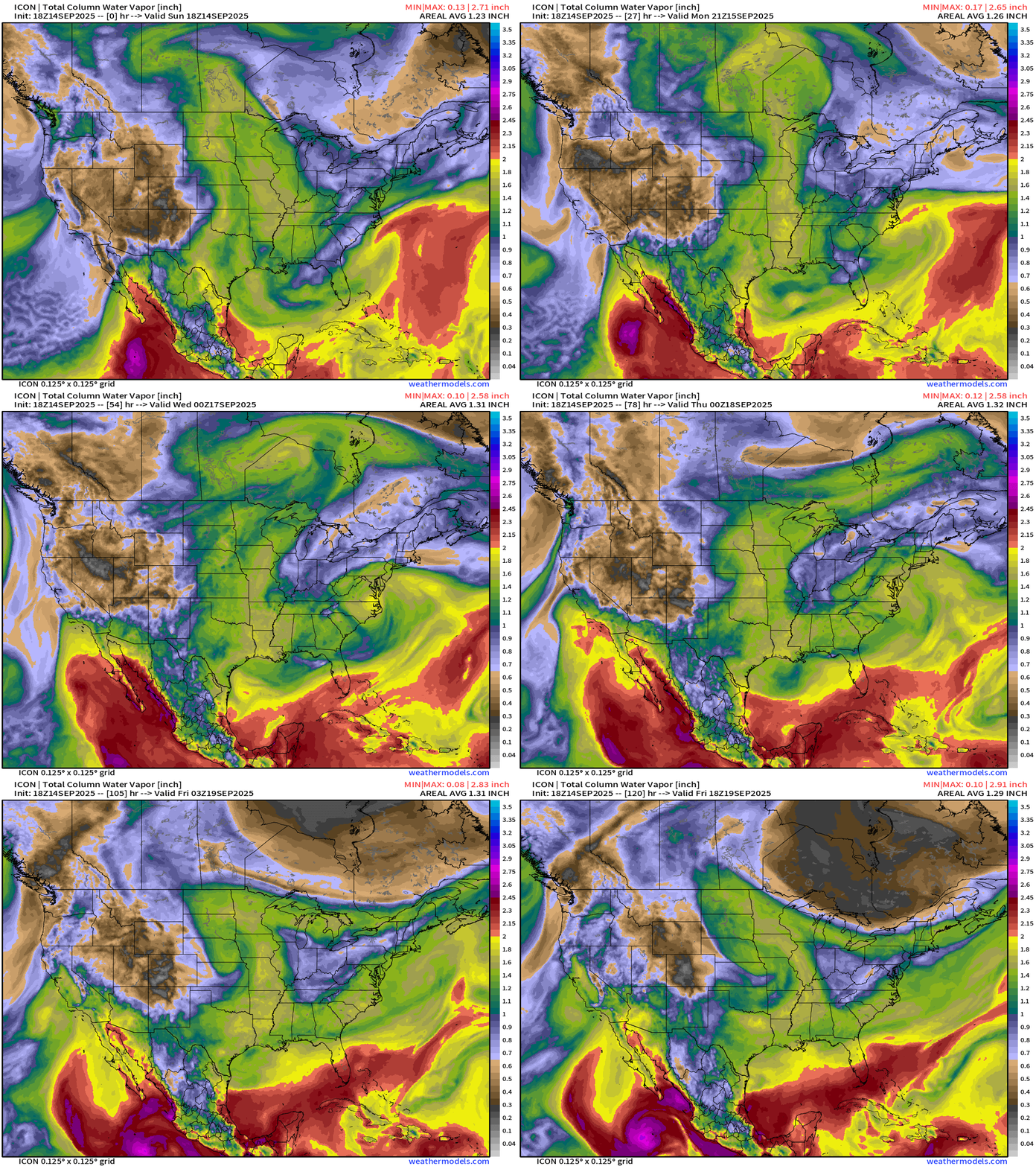
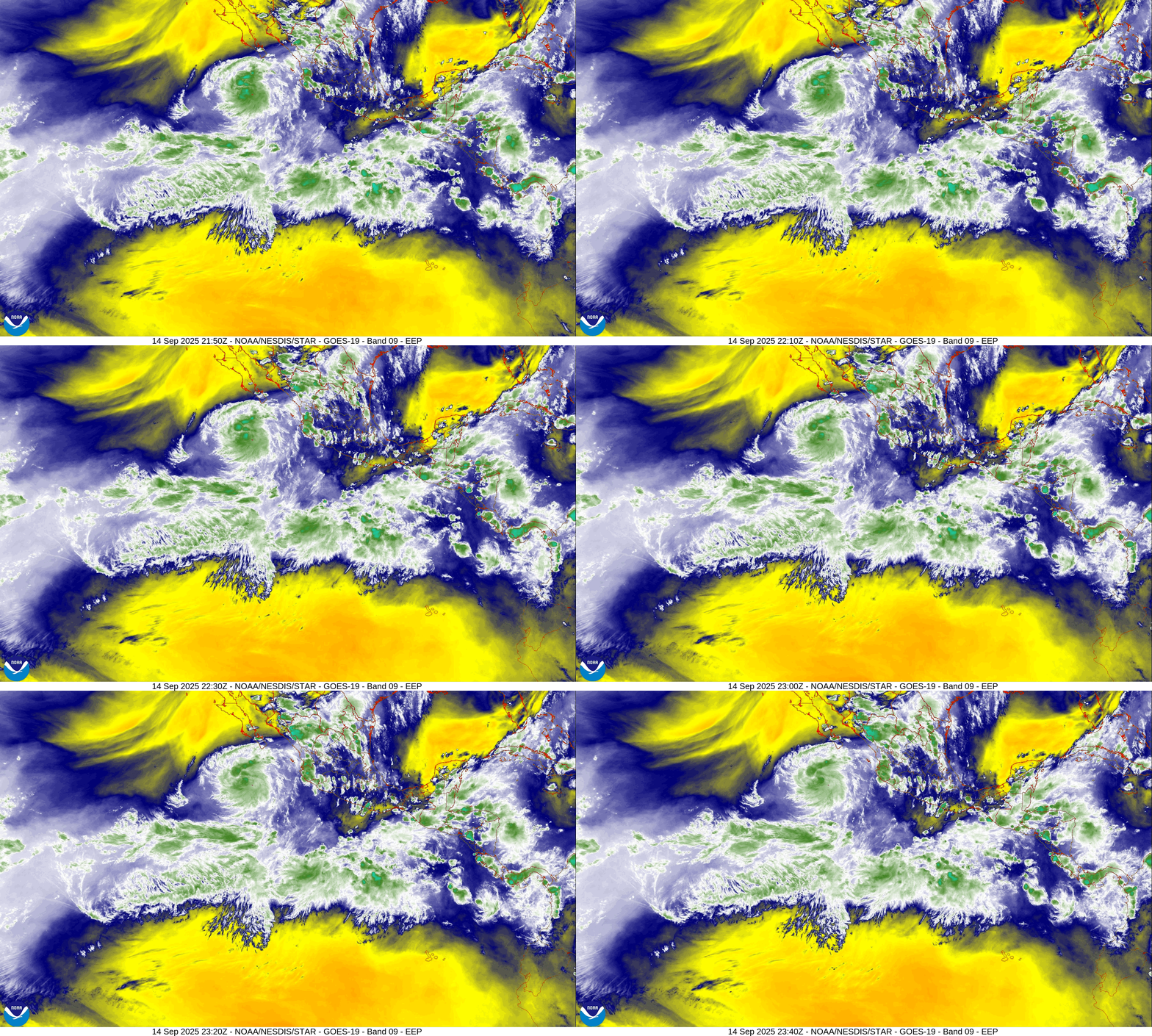
Tropical Storm Mario (not Marco!) actually fell apart yesterday due to proximity to the coast of Mexico but has come back — may intensity a little to a 50-knot TS. Another system is likely on its heels — named Narda.
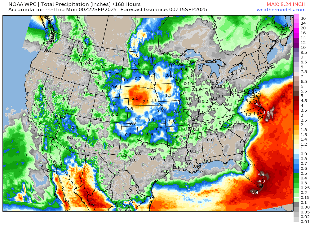
A cut-off low spins into the Carolinas this week and will actually dump quite a bit of rainfall (3”-5”) — this isn’t a tropical system but it has some Atlantic moisture to work with. This trough is on the right side / downstream of a big Omega block in Canada that is keeping the central U.S. very hot
Lower 48 Satellite Image | Sandwich Composite
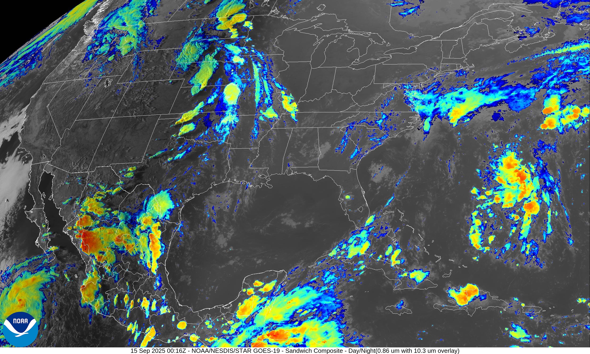
Thunderstorms in the central and norther Plains.
Lower 48 Satellite Image | Mid-Level Water Vapor
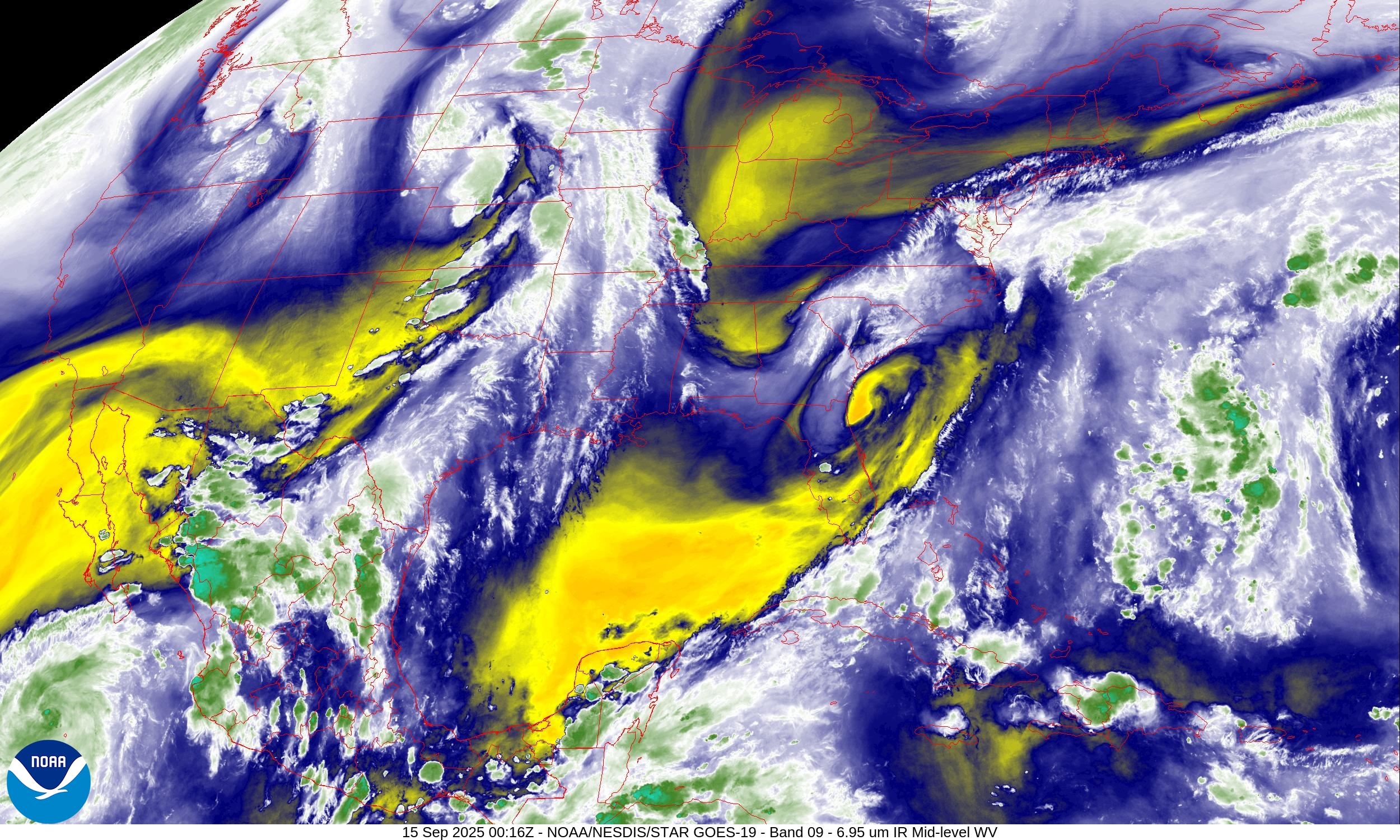
The trough over the Southeast is digging dry air into Florida and the Gulf of Mexico — actually comfortable tonight with dew points in the 60s in Orlando.
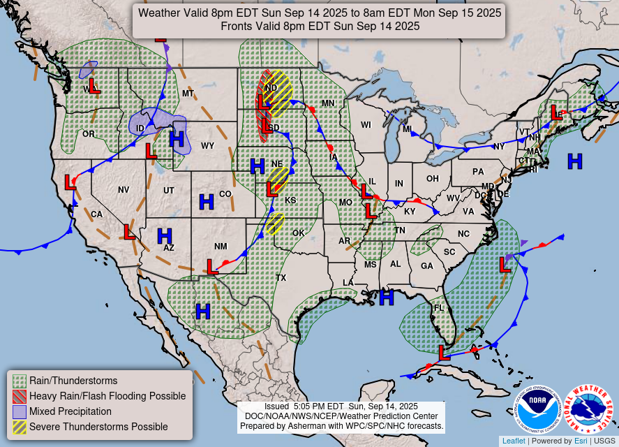
Weather | Fronts this Evening
RTMA Temperatures and Anomaly | 8:00 PM ET
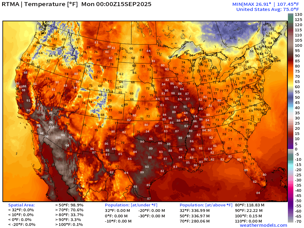
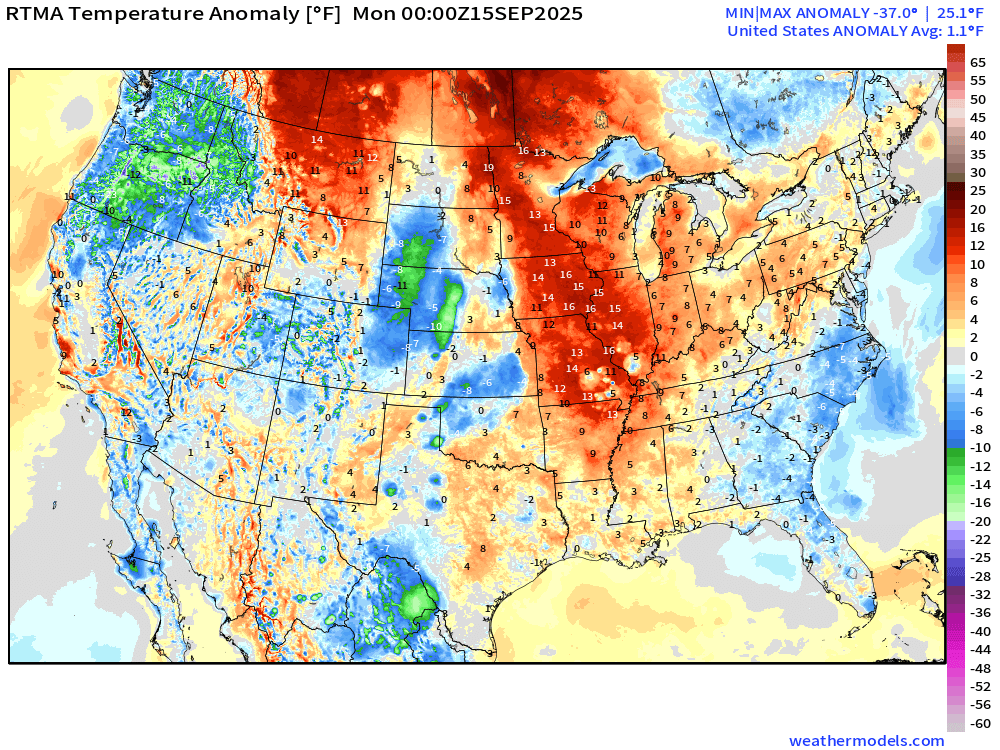
Lower 48 is above normal +1.1°F
Low Temperatures Monday Morning
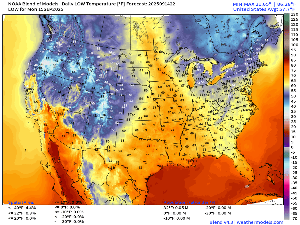
Chilly 20s and 30s showing up in the West including Oregon, Idaho, Wyoming and Colorado.
High Temperatures on Monday
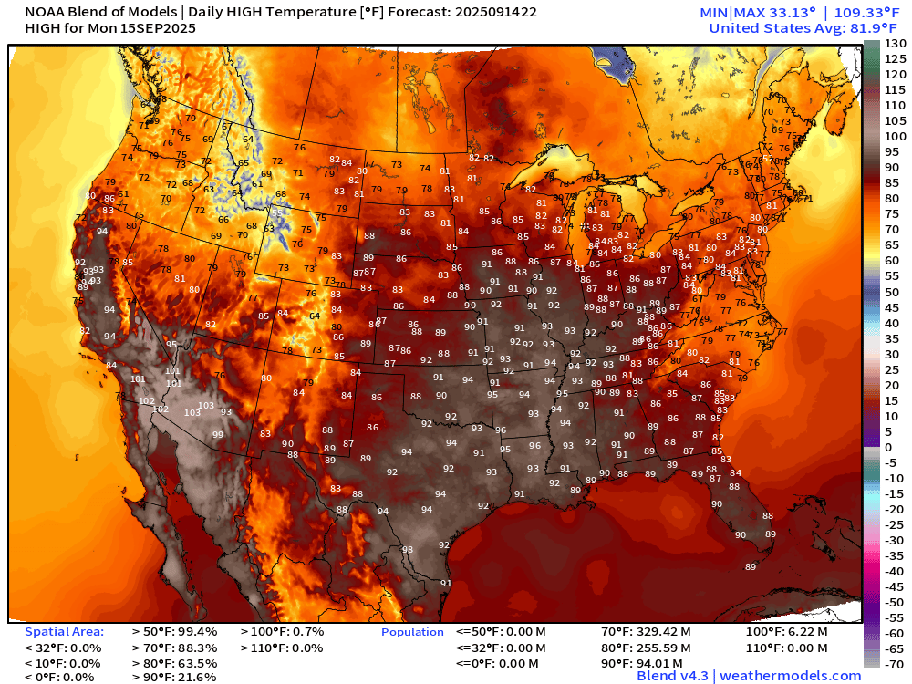
Still in the 90s along the Mississippi with 94 million at least 90°F
Rainfall Next 72-hours | NWS NDFD
3”-5” in North Carolina to Virginia from cut-off low pressure system
7-Day Precipitation from NOAA WPC
North America Upper Level Height Anomaly | AIFS 18z | Next 10-days
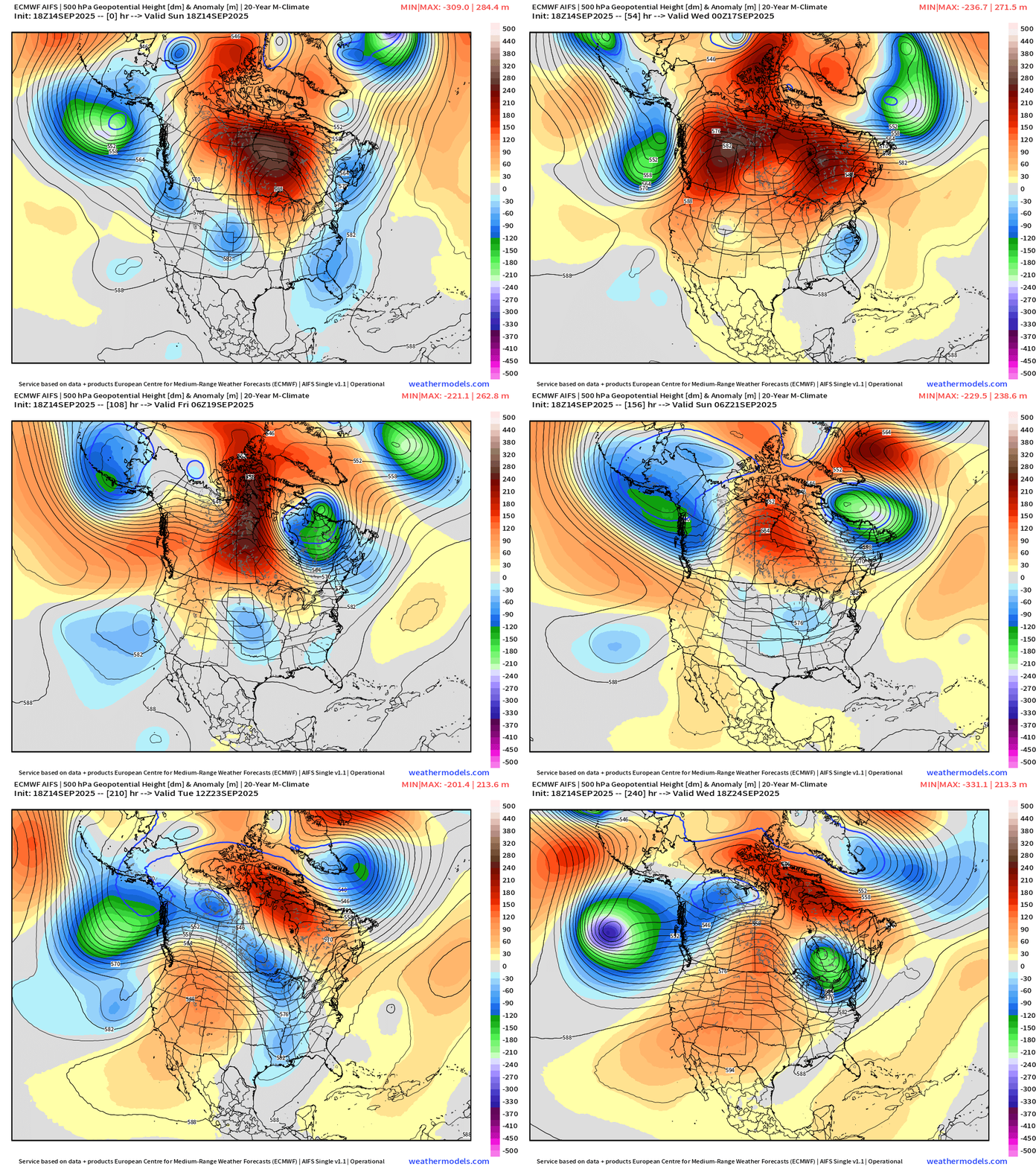
The ridge in Canada breaks down later in the week but then another block forms to the south over the Lower 48 = very warm weather into the following week!
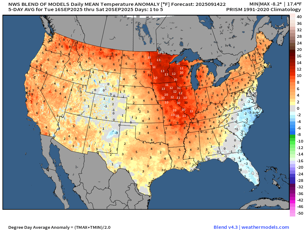
NWS Blend of Models — 5 day Average Temperature Anomaly (Days 1-5)
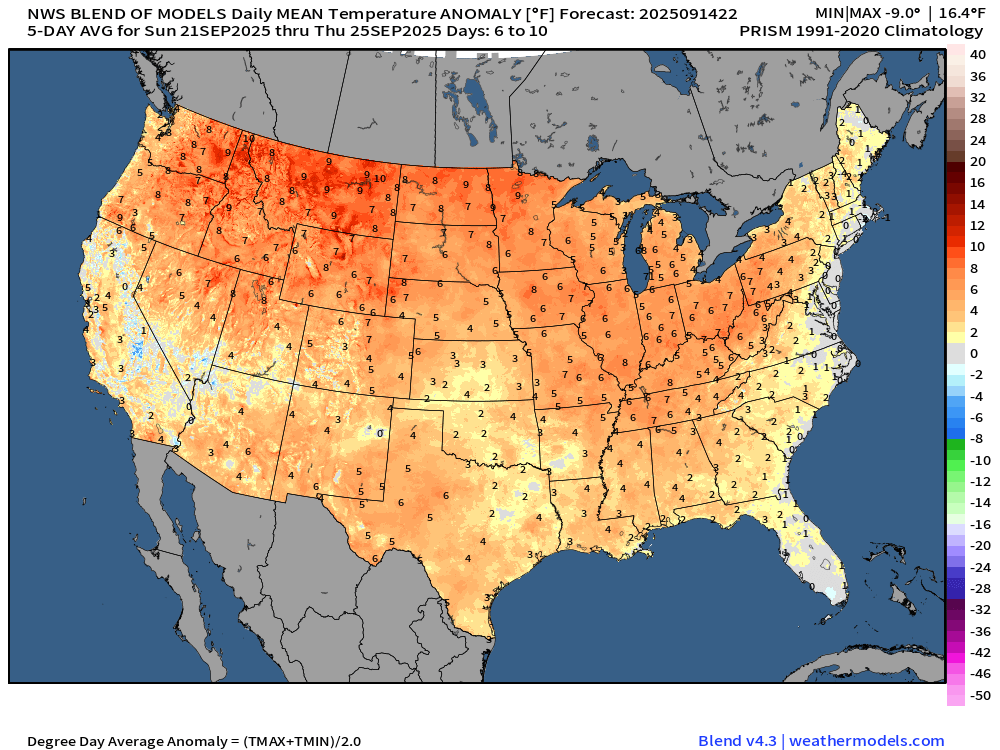
NWS Blend of Models — 5 day Average Temperature Anomaly (Days 6-10)
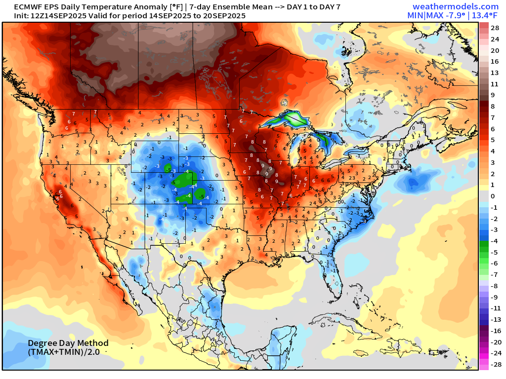
ECMWF EPS 12z | 7-day Temperature Anomaly | Week 1 (Sept 14-20)
ECMWF EPS 12z | 7-day Temperature Anomaly | Week 2 (Sept 21-27)
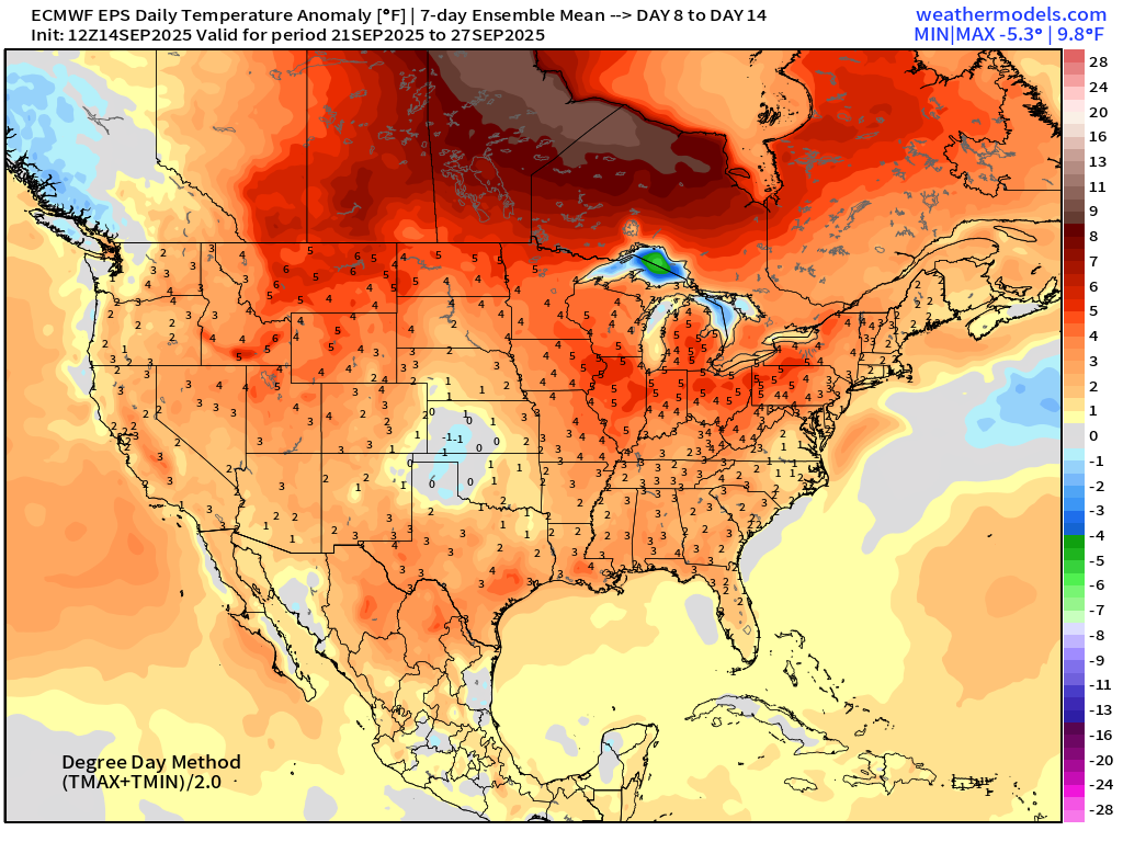
Coast to coast warmth … and this ensemble mean will underestimate the potential warmth
Atlantic Hurricane Season
2025 Hurricane Season [Day 106]. My FORECAST for this year is (still) 14 named storms, 7 hurricanes, and 3 major hurricanes (near average)
2025 Season to Date: 6 named storms, 1 hurricanes, and 1 majors | ACE = 40 ACE of Erin: 32.2 (140-knots maximum wind)
ECMWF 12-Days Integrated Vapor Transport | 12z cycle
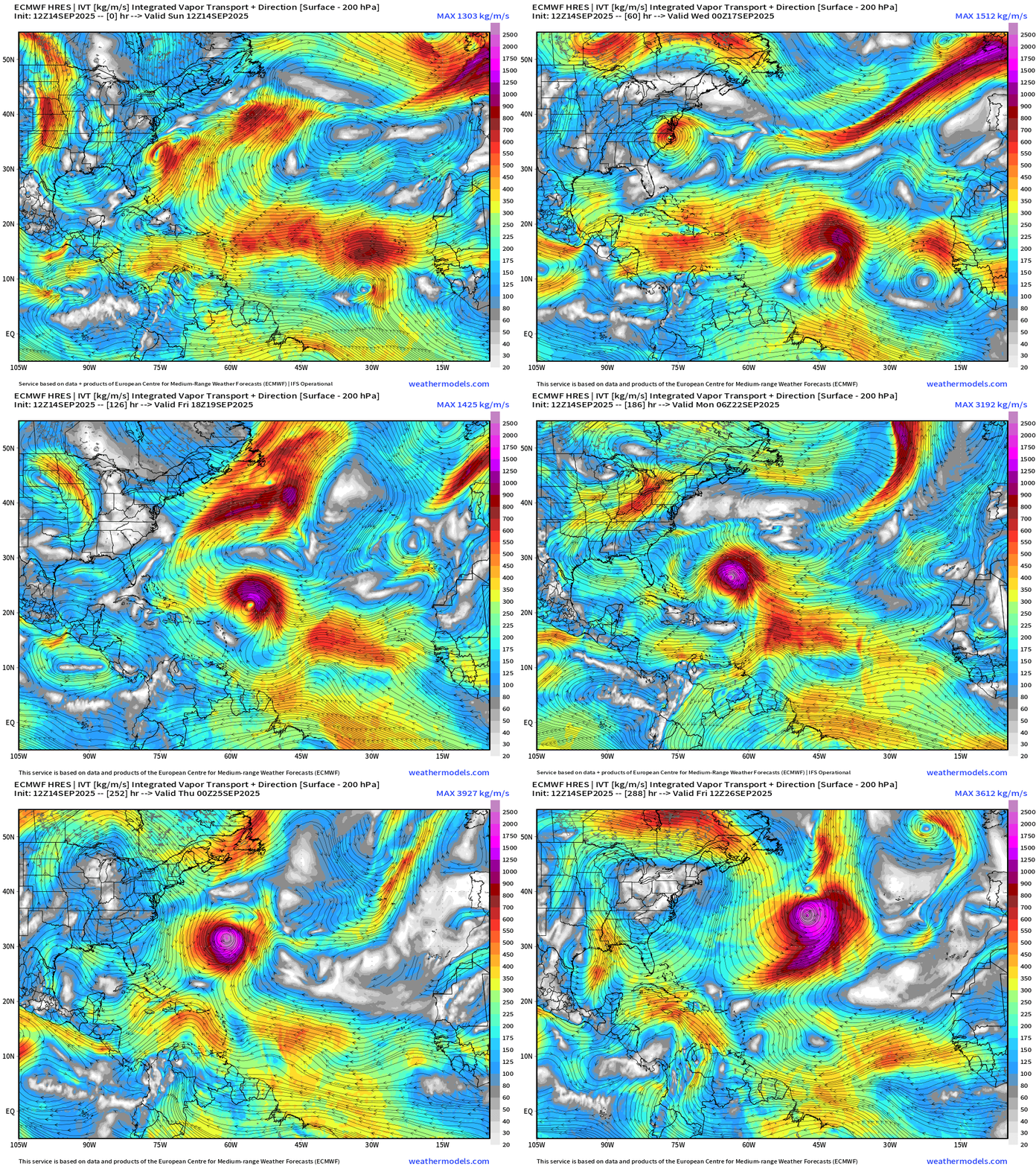
The tropical waves behind Gabrielle do NOT develop in this cycle of ECMWF flagship model (12z)
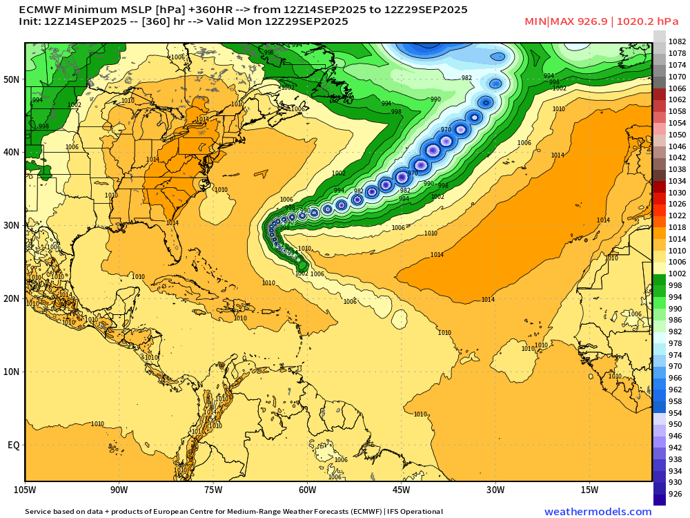
Maximum intensity looks to be high end Category 4 in 9-days
The hurricane slows down well east of Florida — at 30°N — and then takes a right turn out-to-sea —> “fish mixer”
ECMWF 18z | Precipitable Water Next 6-days
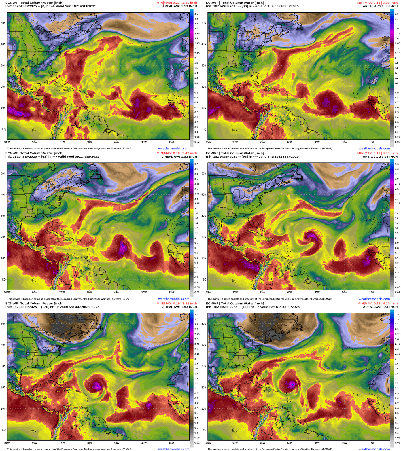
You can see the parade of tropical waves in the Precipitable Water field and then vorticity … we’ll have to watch 2 more behind Gabrielle.
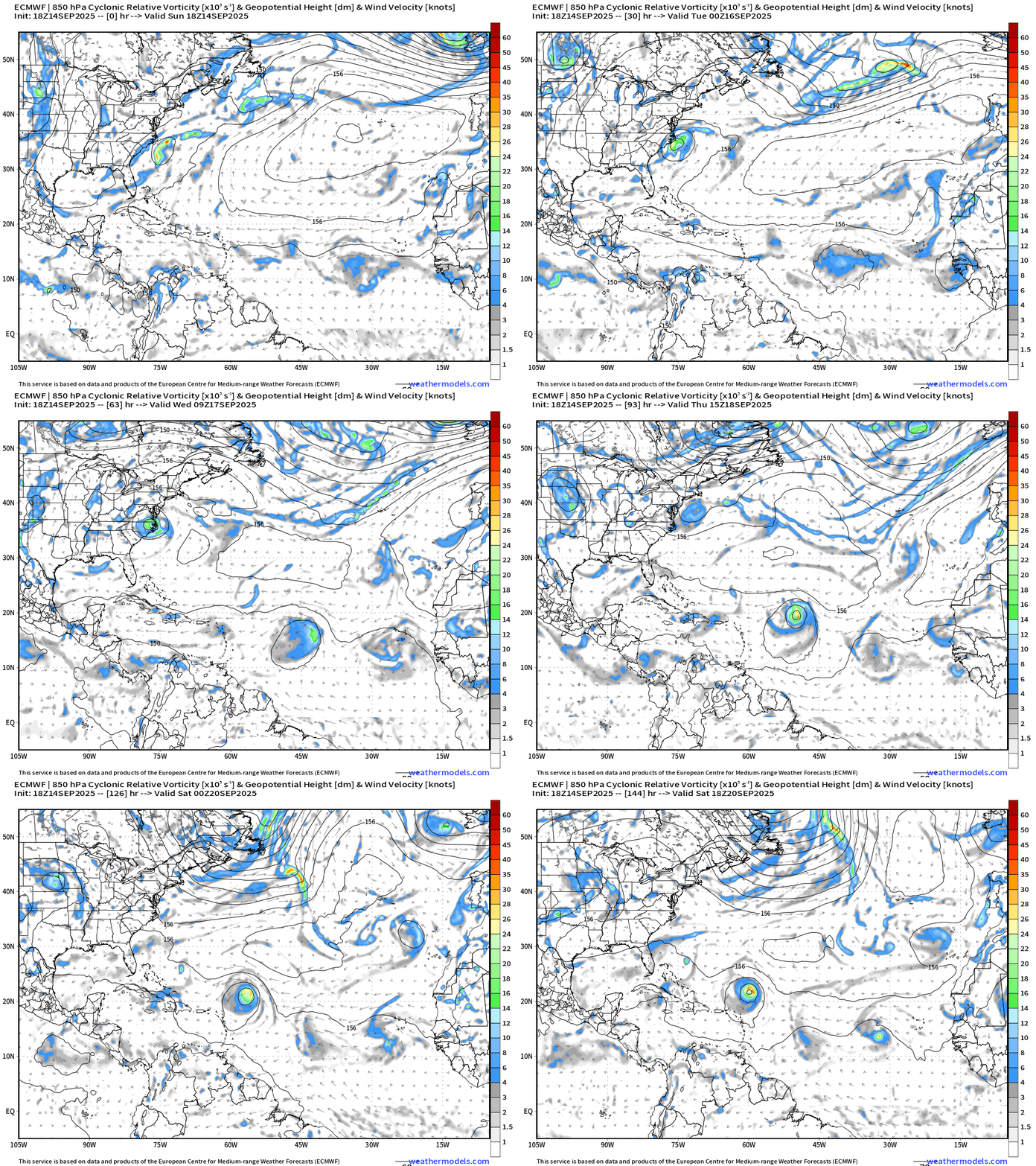
NOAA GFS 18z | Vorticity 10-day Forecast
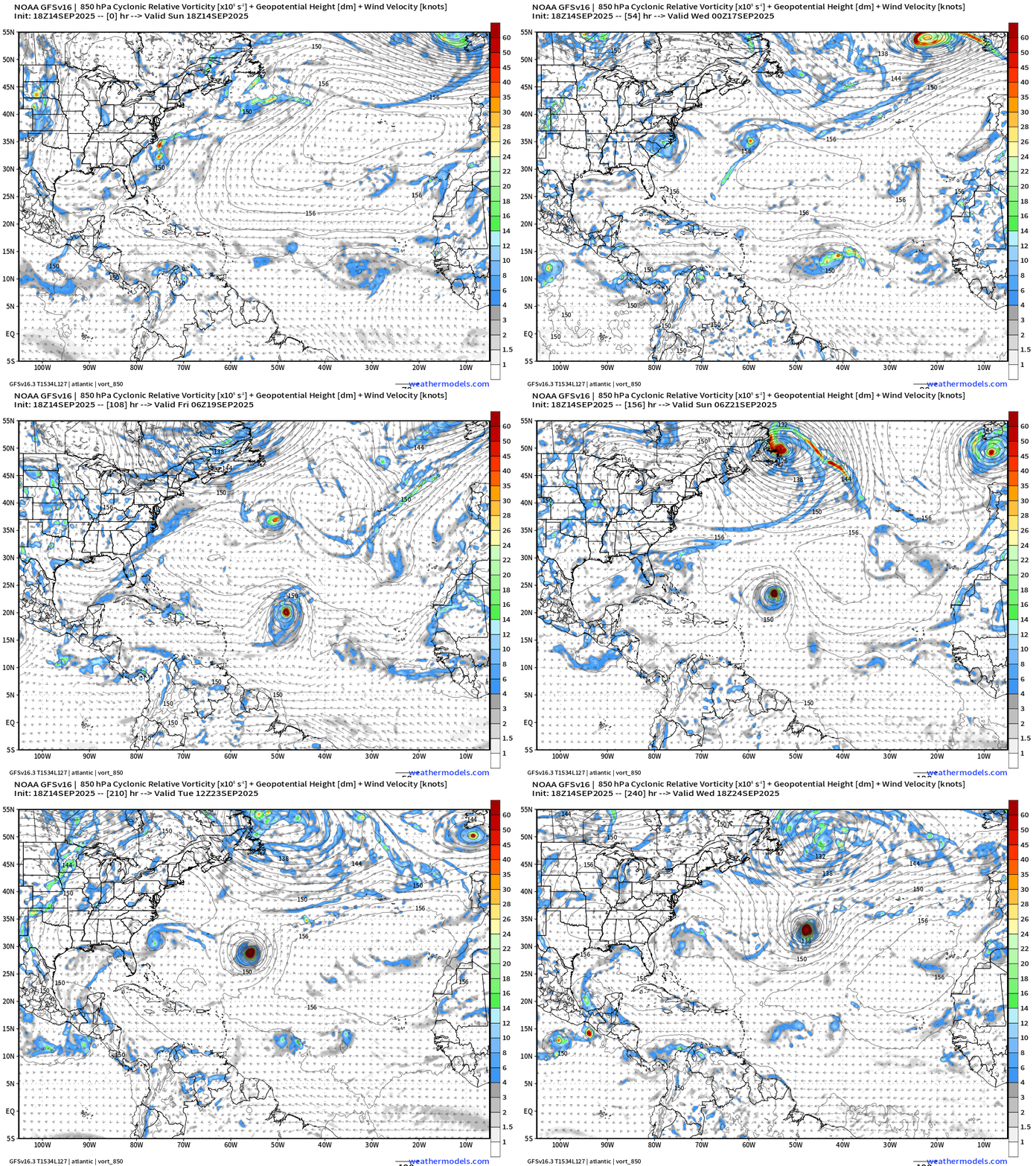
Everyone is in agreement on developing a major hurricane.
Atlantic Basin Outlook | 8 PM ET Update
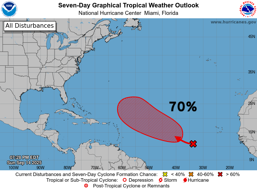
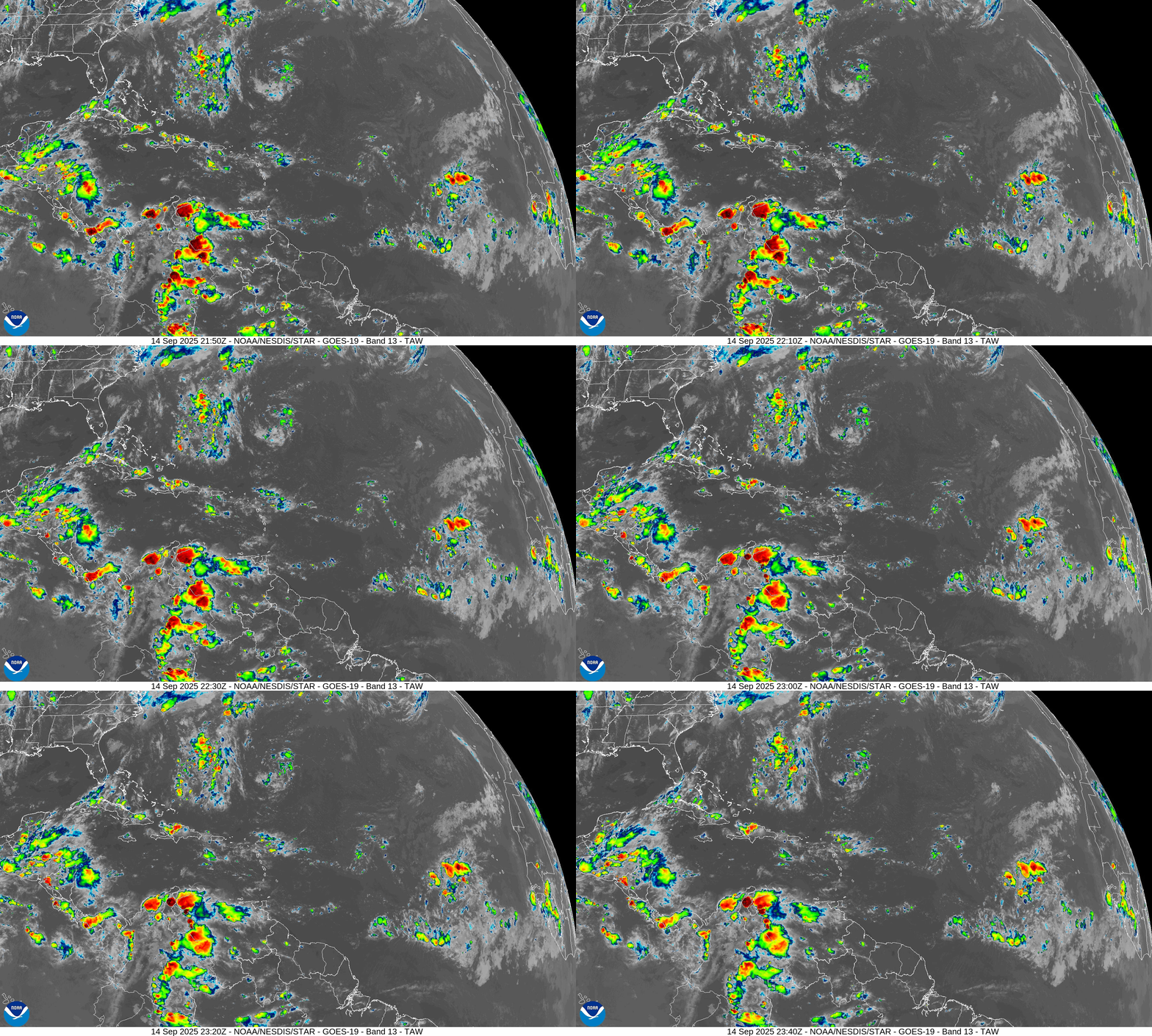
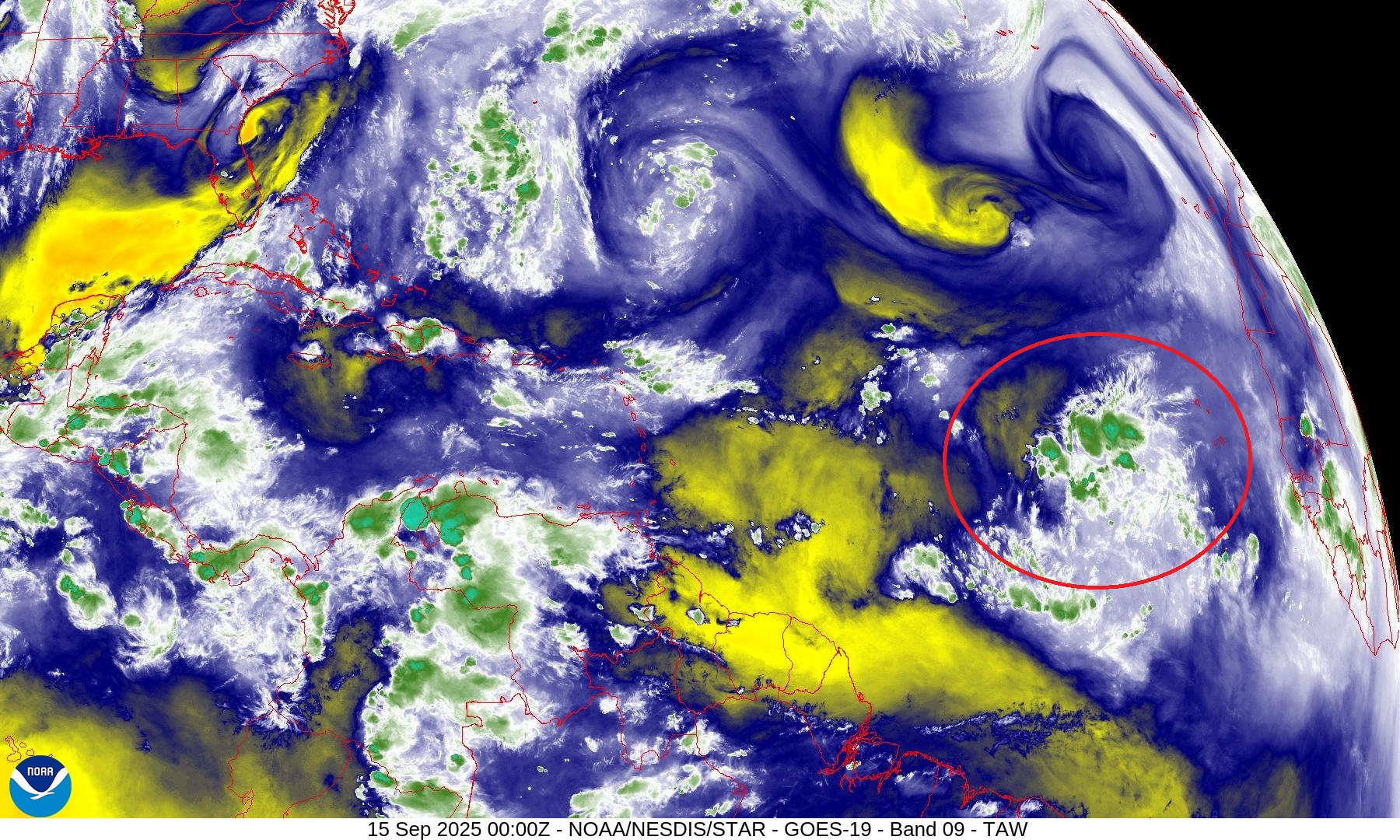
70% chance of development with convection bubbling up again tonight
Atlantic Satellite Imagery | Infrared
Water Vapor | Mid-level
SST and SST Anomaly | ECMWF 12z analysis
Very warm water on the path of our next hurricane.
NOAA Tropical Surface Analysis | 18z
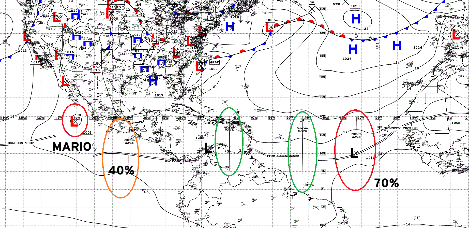
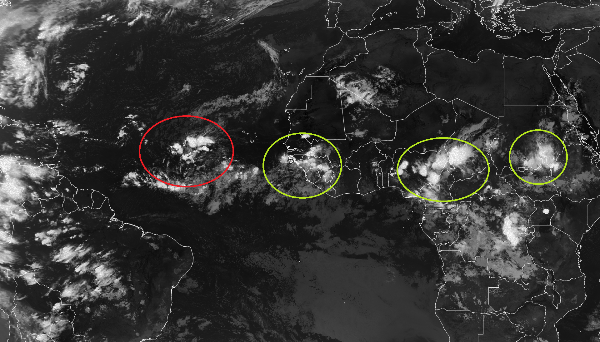
Atlantic Tropical Waves = 3 with our 70% NHC
Eastern Atlantic and Africa Infrared Satellite
ECMWF EPS 18z Ensemble | Active Cyclone Tracks Through 6-days
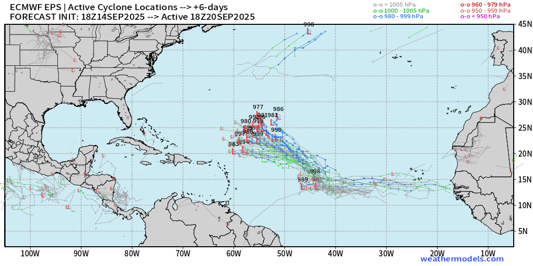
Strong signal for Invest 92L —> Gabrielle into likely a hurricane in 5-days.
ECMWF EPS 12z Ensemble | Active Cyclone Tracks Through 9-days
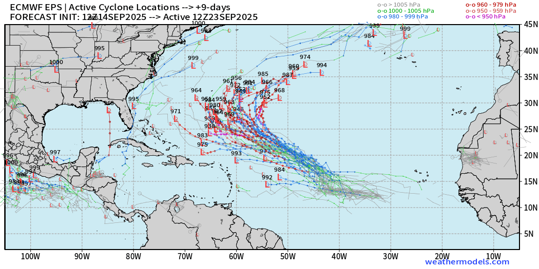
… and a major hurricane in a week or so.
ECMWF EPS 12z Ensemble | Active Cyclone Tracks Through 12-days
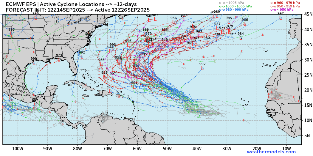
Some members have westward creepers — but they will all head out to sea …
ECMWF EPS 12z Ensemble | Active Cyclone Tracks Through 15-days
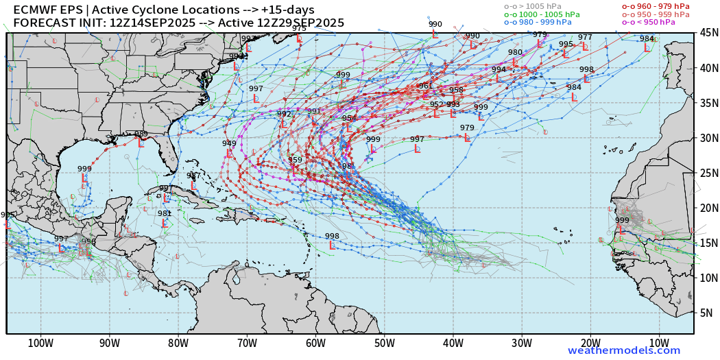
This is a STRONG signal for a major hurricane into the end of September. Bigger question is if another tropical wave can catch fire, or not.
AIFS-ENS Comparison at 12Z | Active Tracks at Day 8
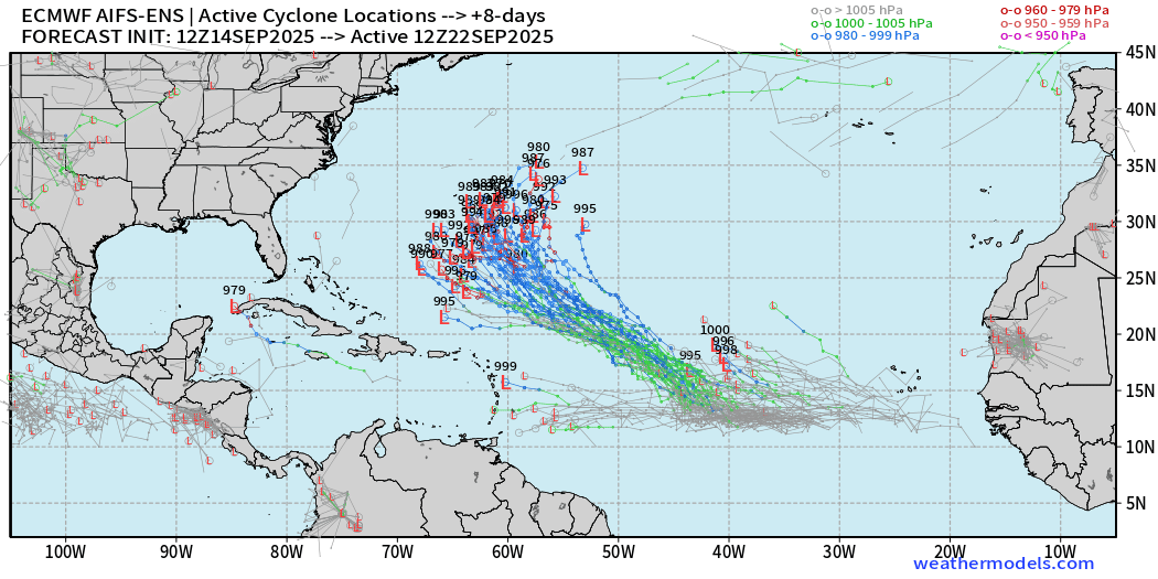
The A.I. trained ensembles have always been aggressive with tropical wave … no change to that thinking.
AIFS-ENS Comparison at 12Z | Active Tracks at Day 12
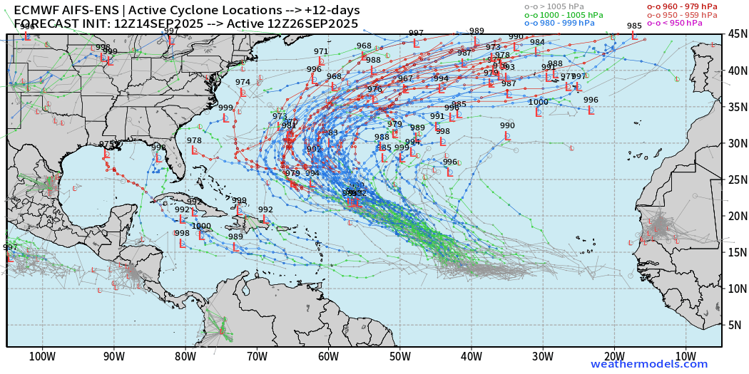
AIFS-ENS Comparison at 12Z | Active Tracks at Day 15
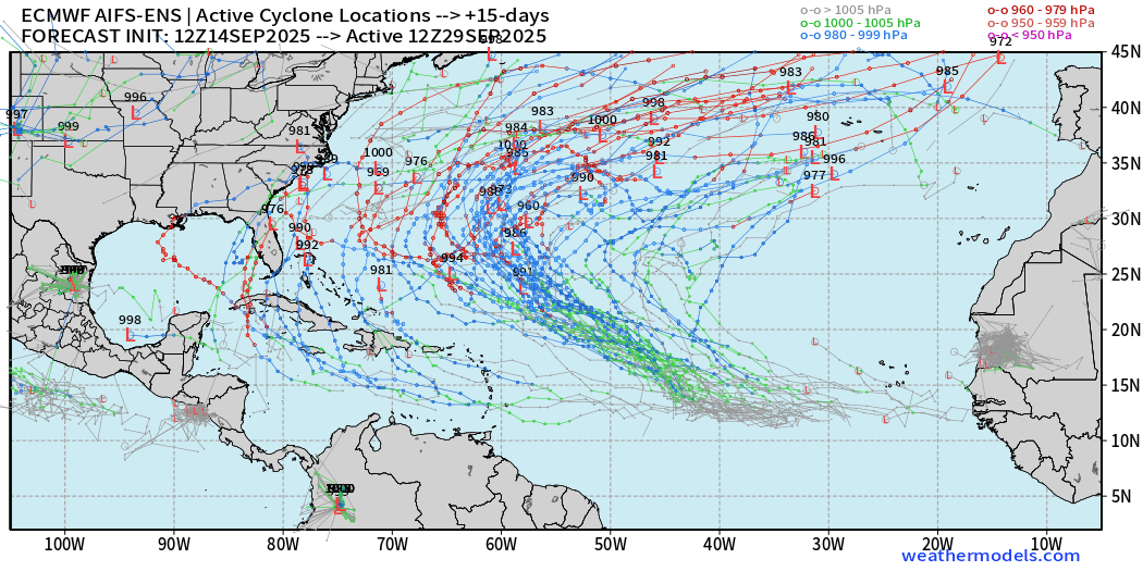
The outlier members near the U.S. are associated with other tropical waves that randomly pop up out of the Caribbean and Gulf. That’s not a coherent signal at this time.
Eastern Pacific Tropical Update | Tropical Storm Mario
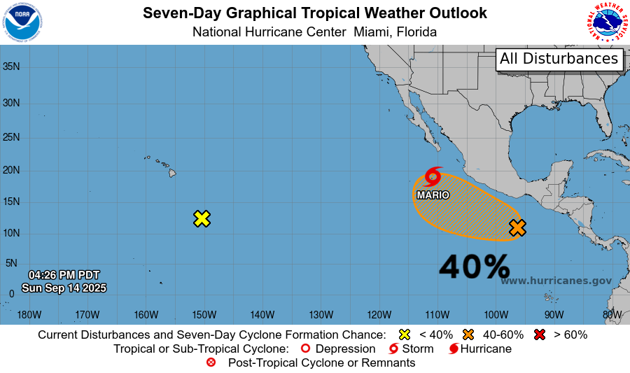
40-knot tropical storm Mario
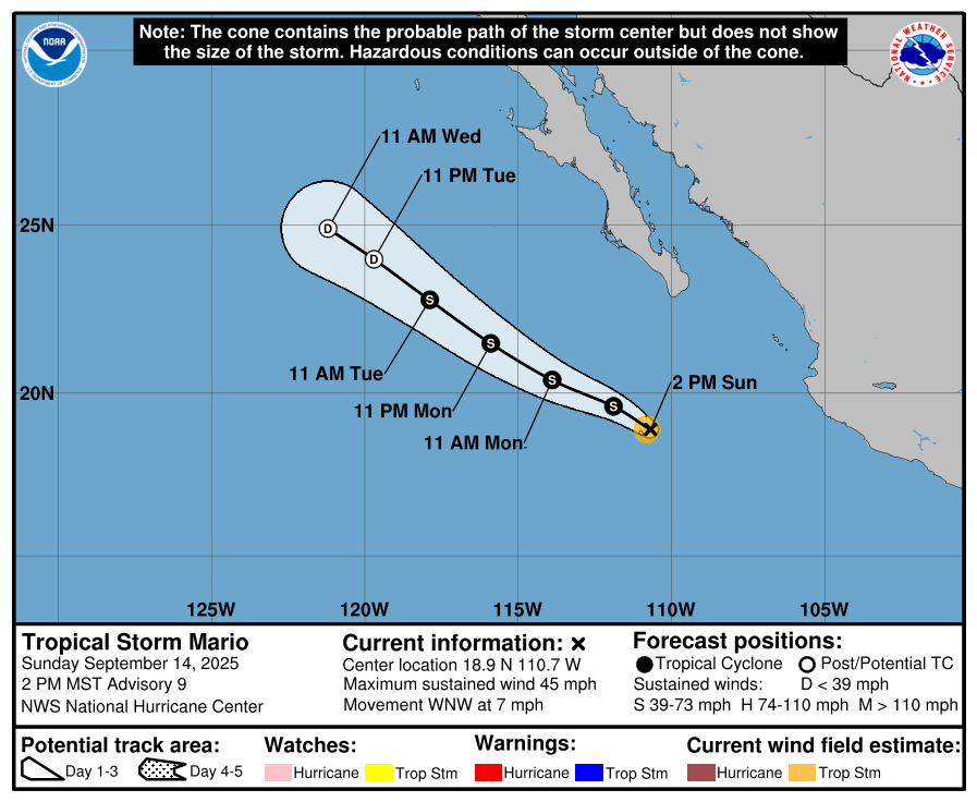
Mario will reach cooler water and dry mid-level atmosphere by Tuesday and weaken probably quickly into a remnant low.
Maps sourced from weathermodels.com designed and innovated by yours truly! Please subscribe there for real-time access to the newest maps, charts from all of the weather models including ECMWF.
- Milepost
- 733 · laid 2025-09-15T01:16:19.688000Z
- Source
- https://weather.substack.com/p/september-14-2025-sunday-evening
- Digest
- 6538dd4829a7622c6723b90b6cff9a3906361369a9db29beda64a583d9a5038c
- Machine
- JSON