September 12, 2025 Friday Evening Update
NHC up to orange 40% for Eastern MDR tropical wave
September 2025 was the 7th-warmest September in the 131-year national record (1895–2025), at 67.9°F against a 1991–2020 normal of 66.0°F (+2.0°F).
September 2025 was the 15th-driest September in the 131-year national record (1895–2025), at 1.9in against a 1991–2020 normal of 2.6in (-0.6in).
NOAA/NCEI Climate at a Glance, contiguous United States. This is the observed record for the month, not a score of anything said in this piece — the forecast ledger begins 2026-08-17 and cannot reach earlier posts.

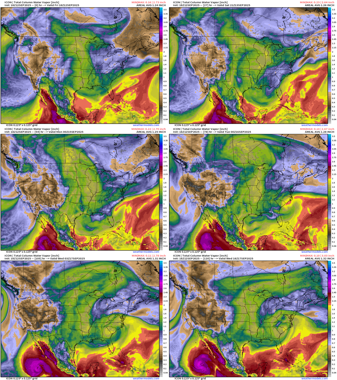
Lower 48 Precipitable Water Forecast | Next 5-days
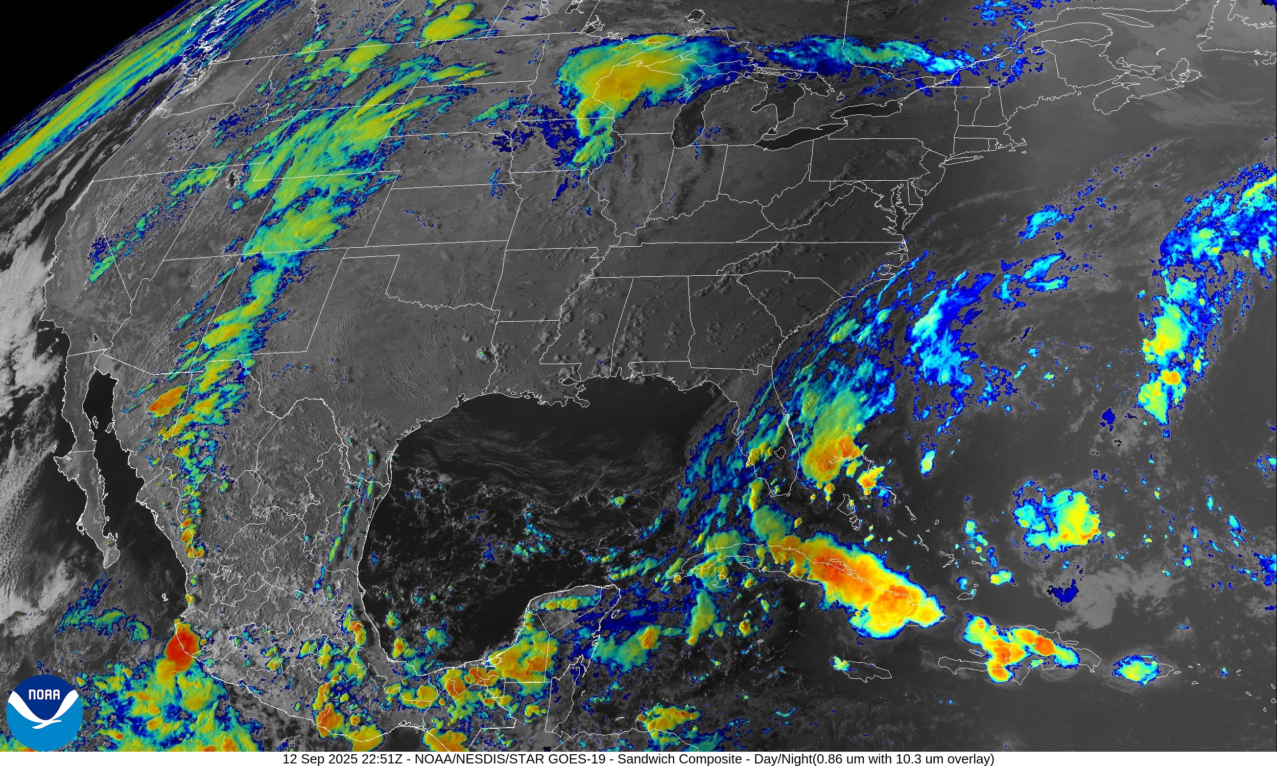
Tropical Storm Marco enters the frame in a few days and should become a hurricane prior to moving over cooler waters off Baja California Sur.
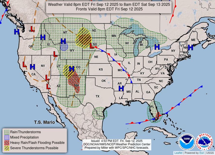
A cut-off low spins of the Southeast into next week on the “wave breaking” side of the strong blocking ridge centered in Canada pulling up as much moisture as it can through the U.S. Plains. The southerly flow is HOT — well above normal pushing 100°F.
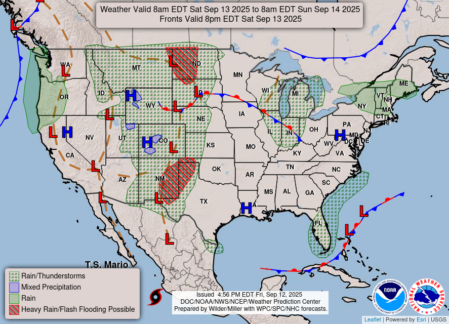
Weather | Fronts this Evening
RTMA Temperatures and Anomaly | 6:30 PM ET
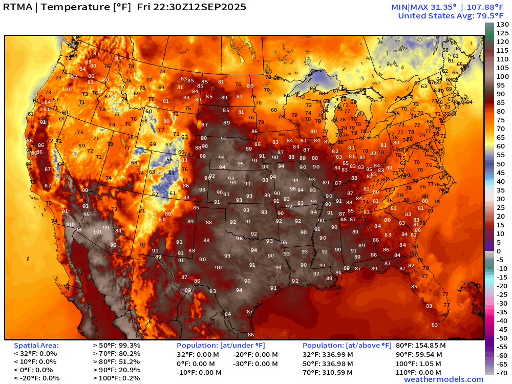
90s across the central U.S. including St. Louis
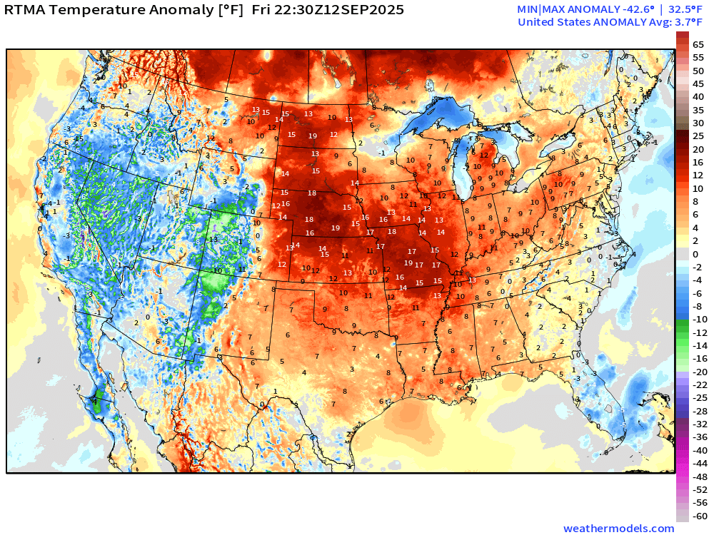
Lower 48 is above normal +3.7°F
Low Temperatures Saturday Morning
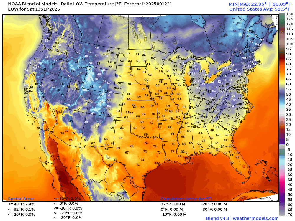
Even in the hottest daytime regions of the central Plains, still cools down nicely.
High Temperatures on Saturday
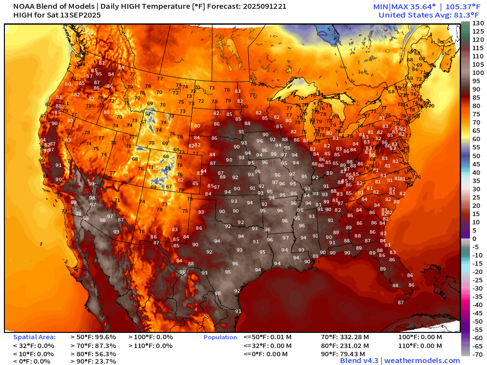
Well into the 90s and pushing 100°F maybe in Iowa. 79 million at least 90°F
High Temperatures on Sunday
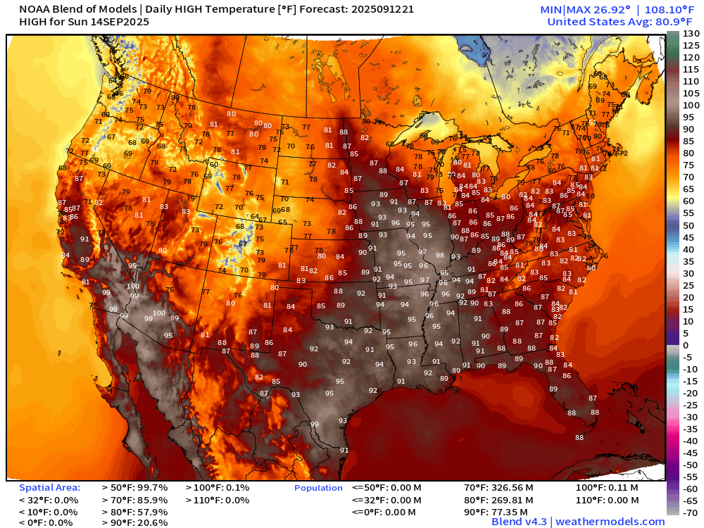
Heat moves eastward a smidge — very hot across the Plains into mid-Mississippi River Valley … 77 million at least 90°F
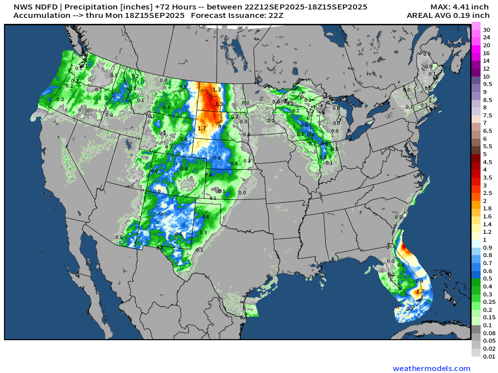
Rainfall Next 72-hours | NWS NDFD
Weather | Fronts on Saturday
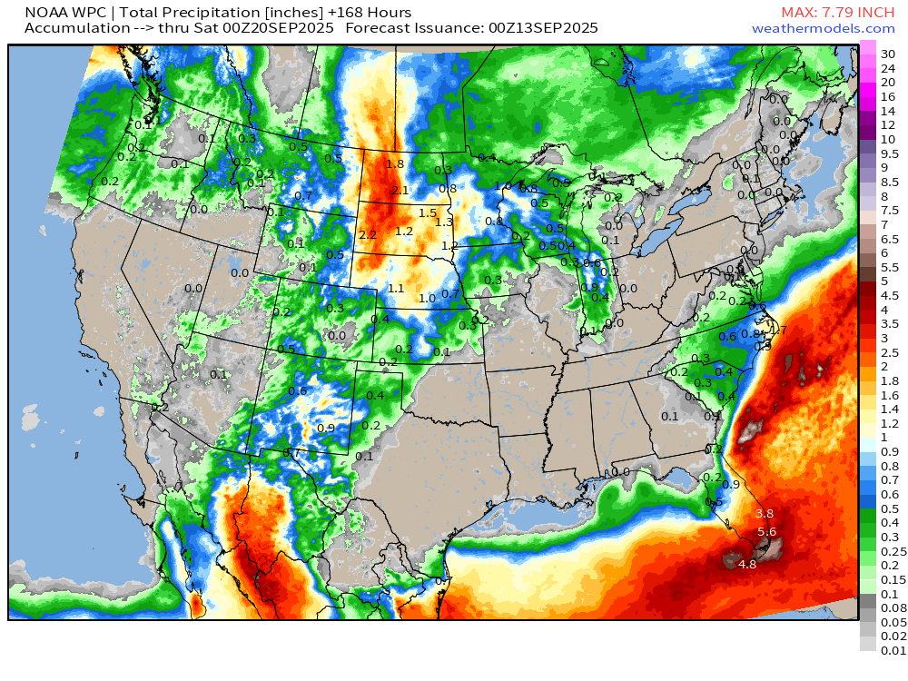
7-Day Precipitation from NOAA WPC
North America Upper Level Height Anomaly | AIFS 12z | Next 10-days
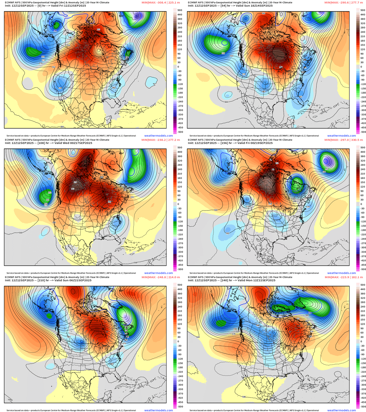
Canadian blocking ridge breaks down toward Days 8-10 with more “polar vortex” influence from the Arctic and some action from the Pacific.
Troughs and cut-offs dominate the Lower 48 under the ridge until then.
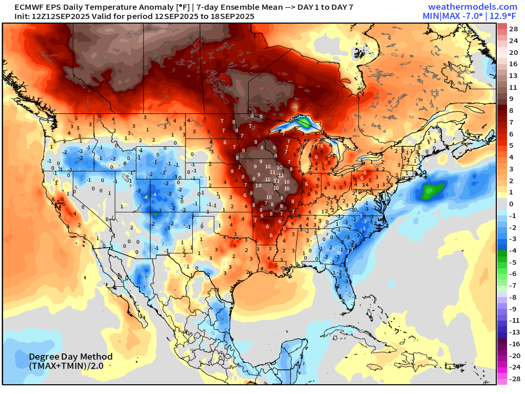
ECMWF EPS 12z | 7-day Temperature Anomaly | Week 1 (Sept 12-18)
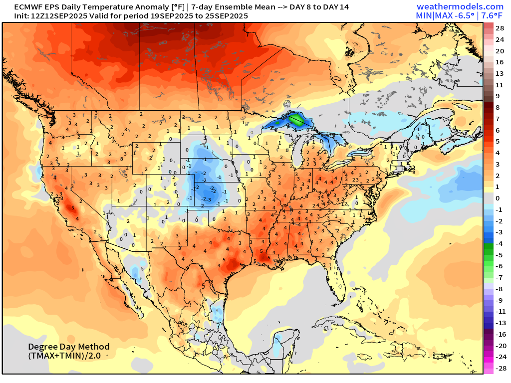
ECMWF EPS 12z | 7-day Temperature Anomaly | Week 2 (Sept 19-25)
Atlantic Hurricane Season
2025 Hurricane Season [Day 104]. My FORECAST for this year is (still) 14 named storms, 7 hurricanes, and 3 major hurricanes (near average)
2025 Season to Date: 6 named storms, 1 hurricanes, and 1 majors | ACE = 40 ACE of Erin: 32.2 (140-knots maximum wind)
ECMWF 12-Days Integrated Vapor Transport | 12z cycle
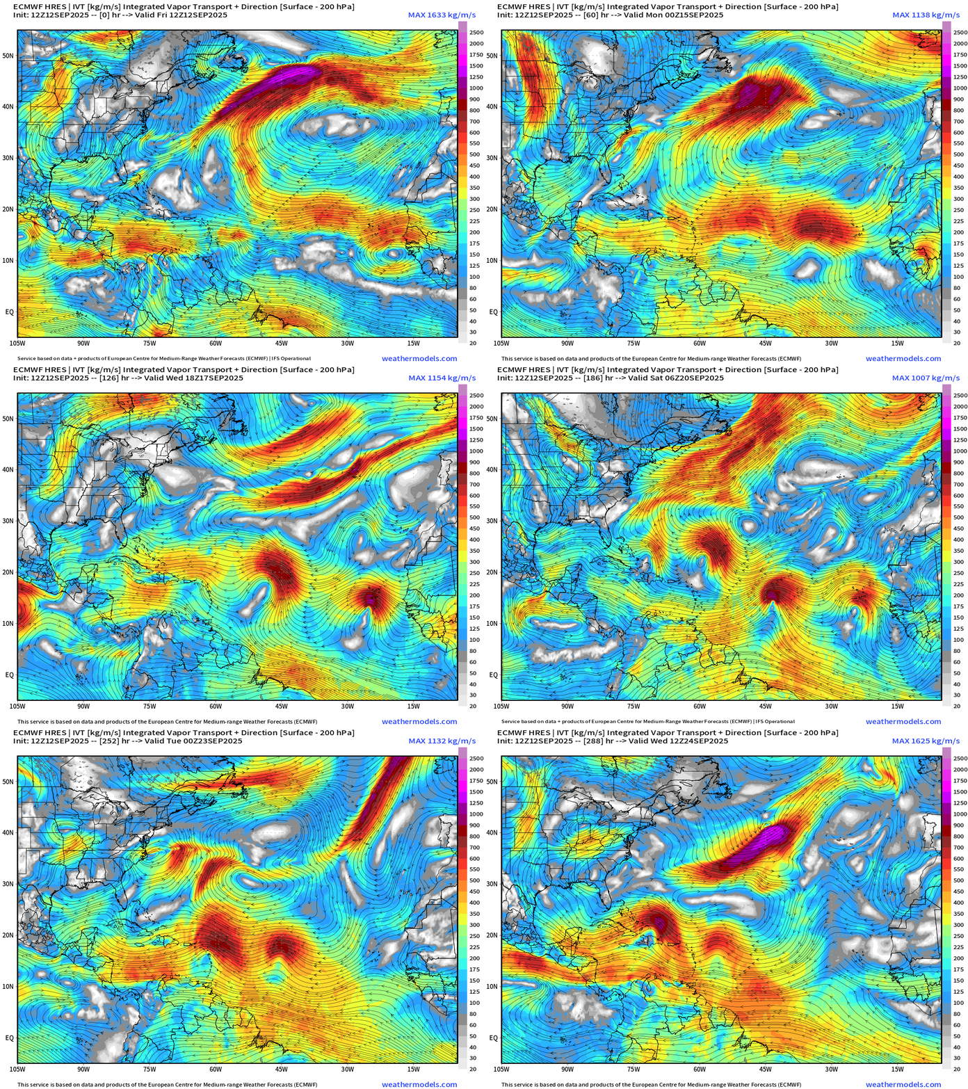
A parade of tropical waves — I can count 4 but at least here in the ECMWF 12z flagship model, none “catch fire” … but these are all candidates.
Germany ICON 18z | Precipitable Water Next 6-days
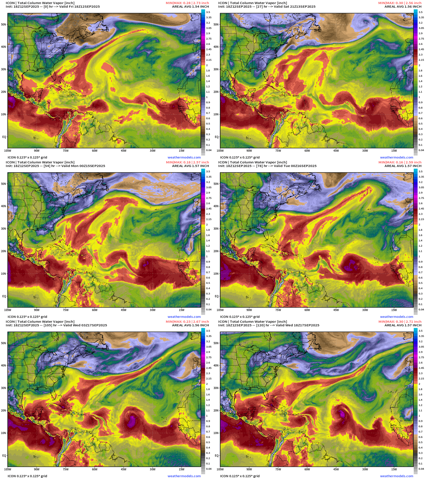
ICON model + GFS are more aggressive with 2 tropical waves … I just can’t believe we’ll get nothing out of this sequence — so if we split the baby, then 2 named storms in the next 8-12 days (Gabrielle and Humberto).
NOAA GFS 18z | Vorticity 12-day Forecast
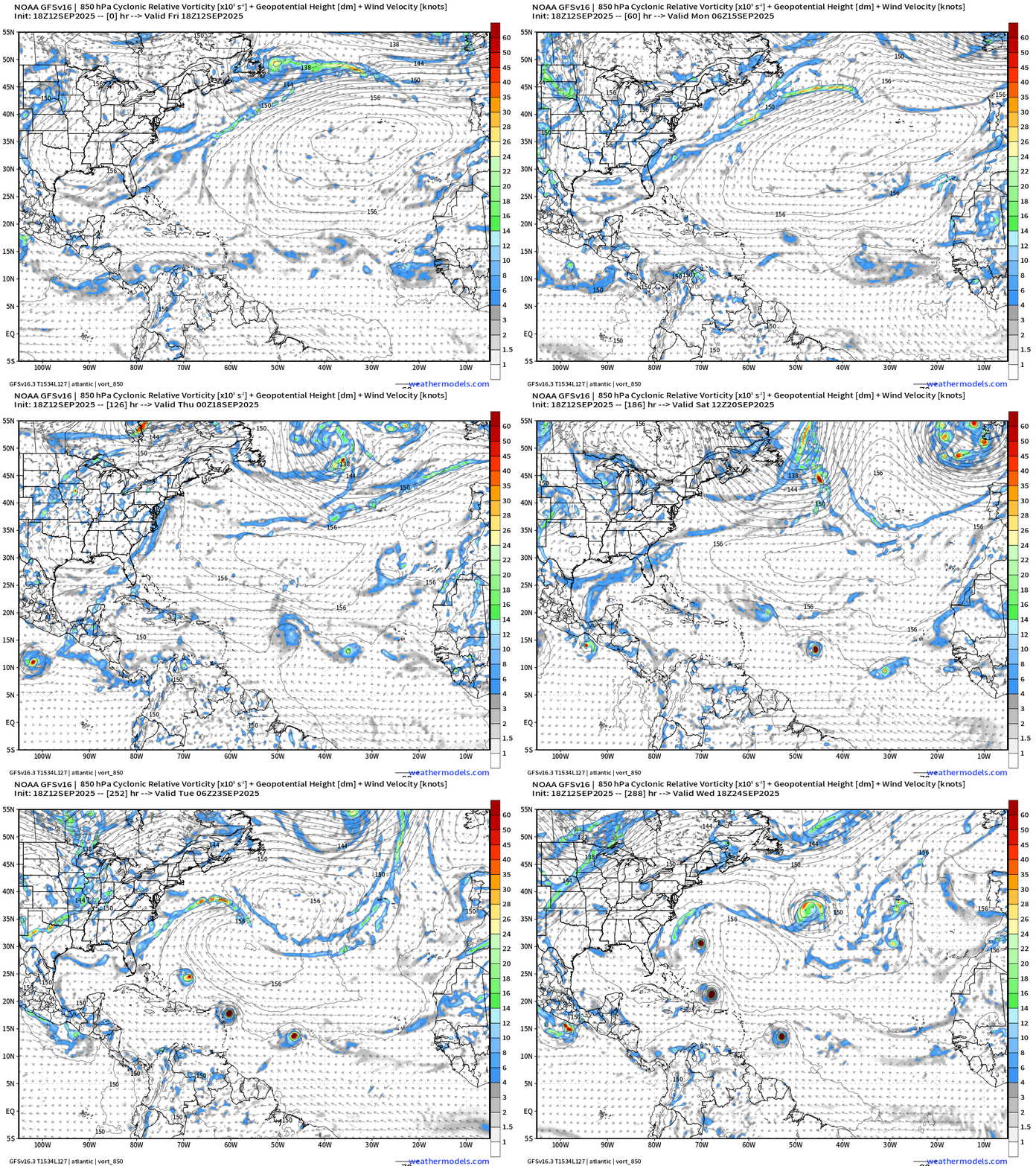
Happy Hour GFS 18z delivers a museum quality forecast model with 4 storms/hurricanes all in a row. Of course, we usually don’t put much stock in 18z models because there are no upper-air soundings (balloons) … but this is a shift/flip from what GFS was doing earlier today.
Atlantic Basin Outlook | 2 PM ET Update
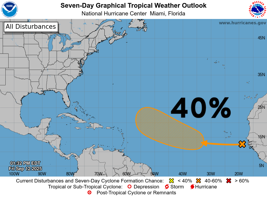
40% chance of development for a tropical wave in the far Eastern Atlantic … that is generating very little convection. Already poofed?
Atlantic Satellite Imagery | Infrared
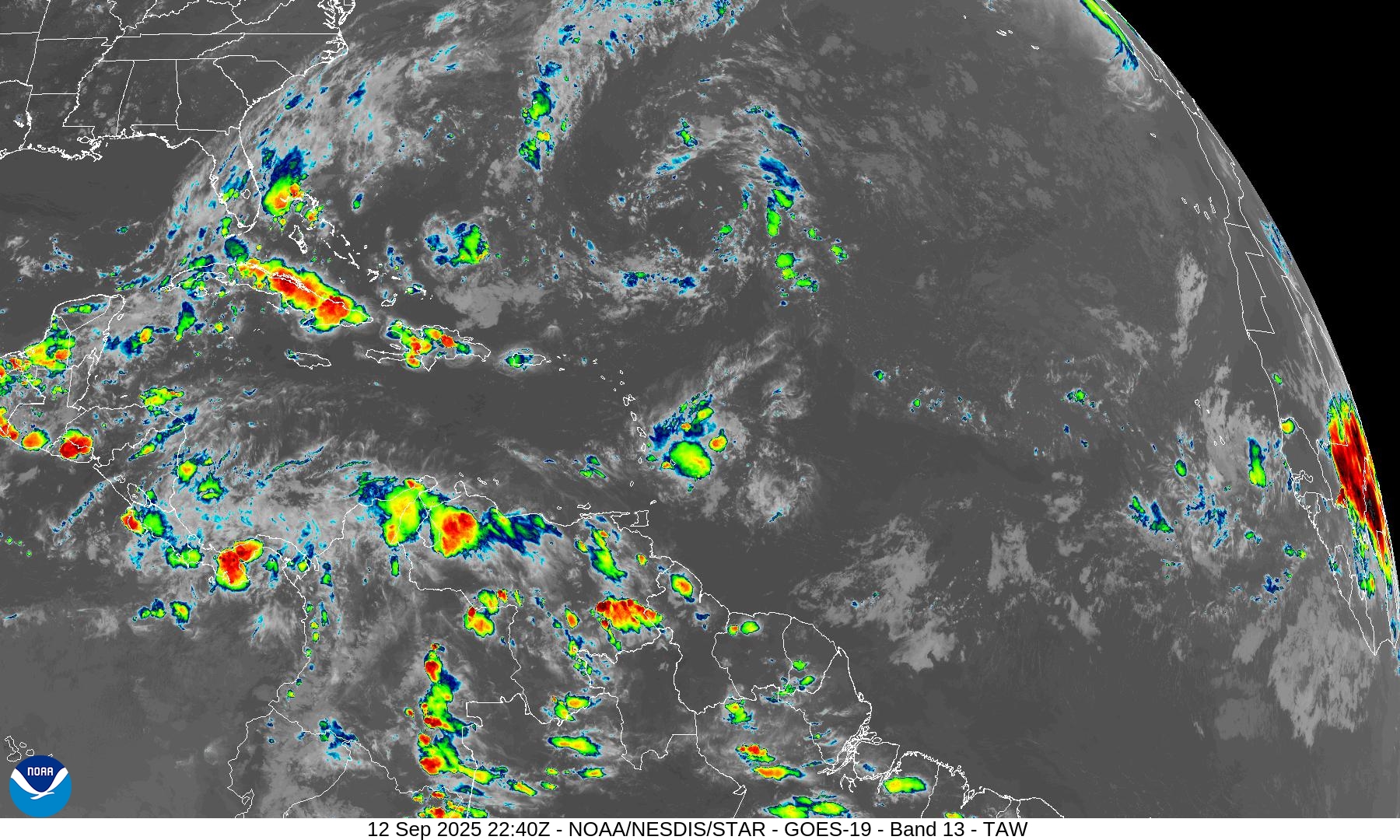
Very little convection across the MDR — stable and dry, but that will trend in the other direction.
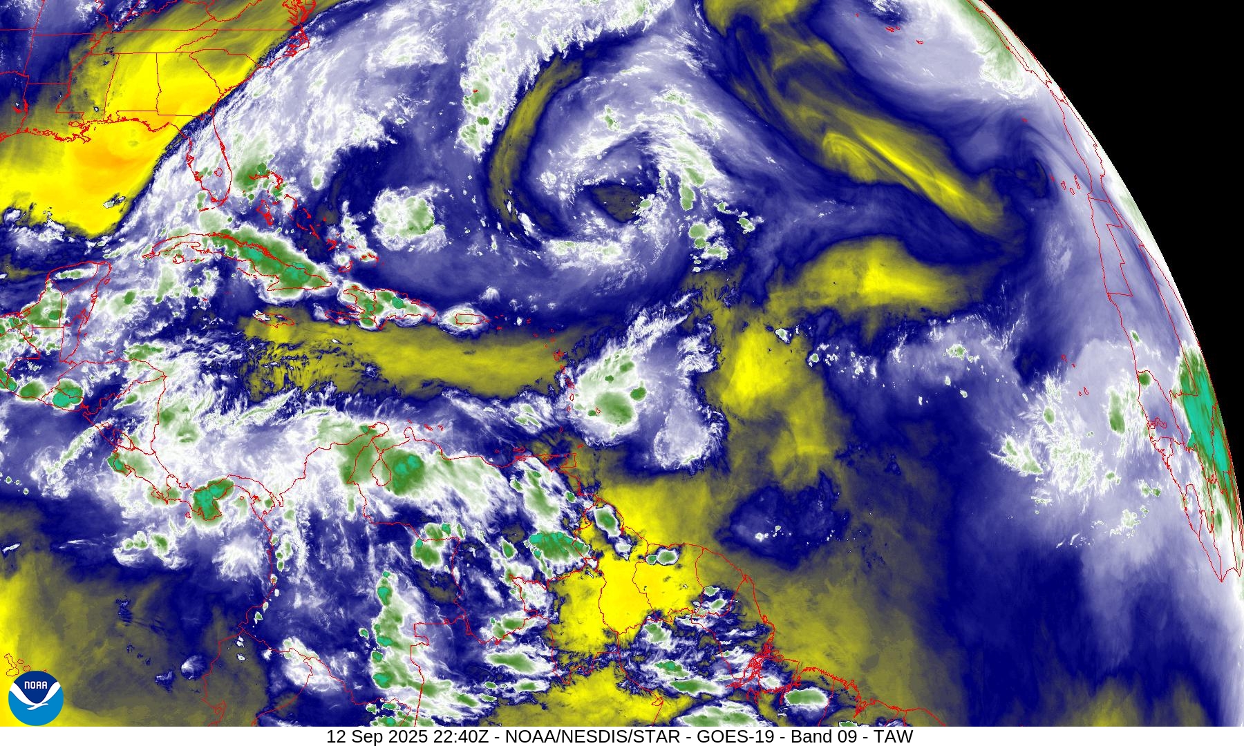
Water Vapor | Mid-level
SST and SST Anomaly | ECMWF 12z analysis
NOAA Tropical Surface Analysis | 12z
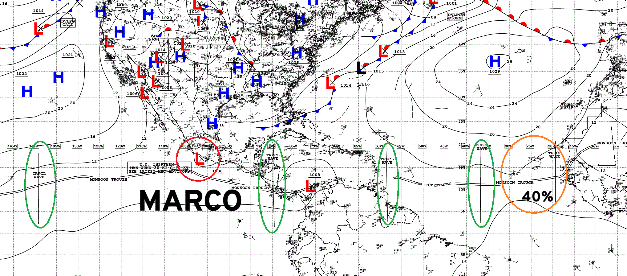
Atlantic Tropical Waves = 4 with our 40% NHC
Eastern Atlantic and Africa Infrared Satellite
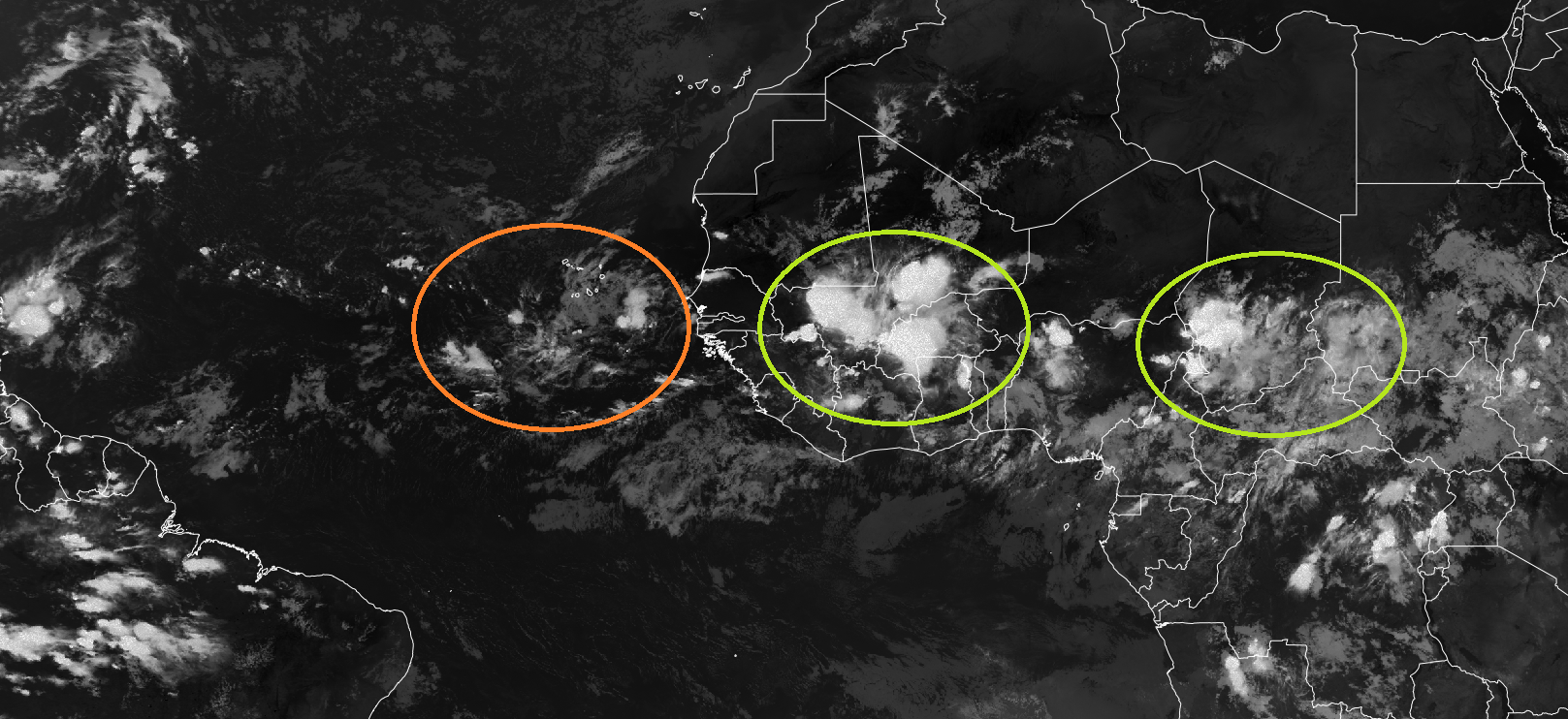
The next tropical wave over Africa — as we’ve seen all season — is convectively active and looks great — until it hits the Atlantic and goes poof. I think this next one will be different — further south.
ECMWF EPS 12z Ensemble | Active Cyclone Tracks Through 5-days
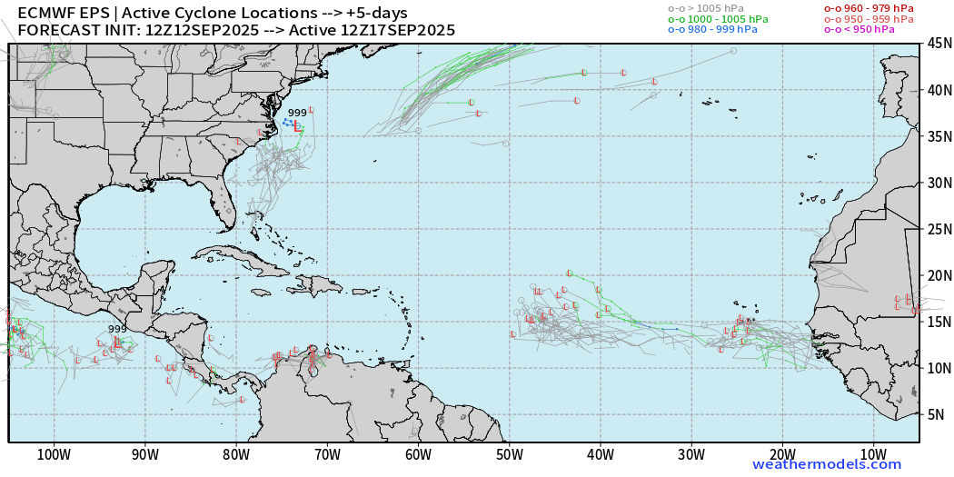
This is not a strong signal for the 2 waves to be TD/TS but perhaps a weak surface circulation will hold together on the long westward trek to more favorable environment near the Lesser Antilles and into Western Atlantic.
ECMWF EPS 12z Ensemble | Active Cyclone Tracks Through 10-days
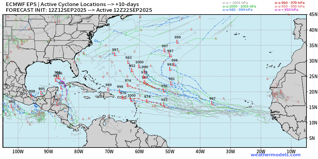
Again we see some members with hurricanes creeping out of the Caribbean into the Gulf — this sneaky ensembles are hopefully not indicative of something nefarious.
ECMWF EPS 12z Ensemble | Active Cyclone Tracks Through 15-days
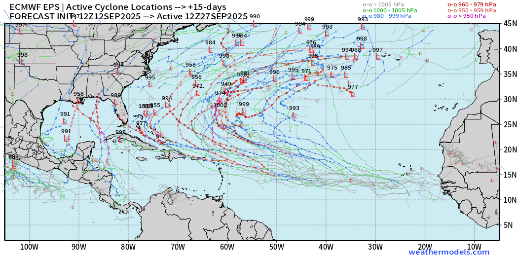
This is a STRONG signal for a hurricane or two “somewhere” and there are many very concerning situations — but past our forecast horizon (September 27th)
AIFS-ENS Comparison at 12Z | Active Tracks at Day 6
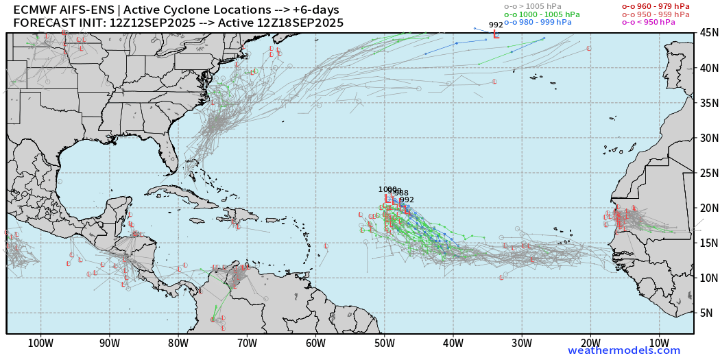
AIFS ENS remains very excited about this tropical wave — high chance > 90%
AIFS-ENS Comparison at 12Z | Active Tracks at Day 10
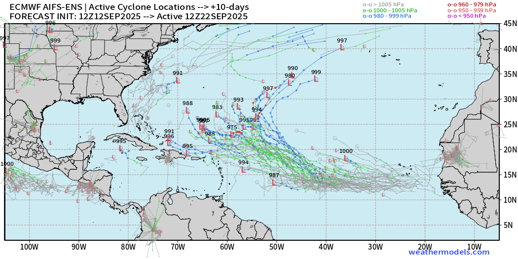
AIFS-ENS Comparison at 12Z | Active Tracks at Day 15
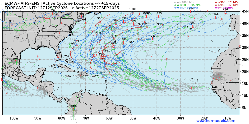
A more active Atlantic basin for sure, but thankfully everything looks to be recurving or staying away off the U.S. mainland.
Eastern Pacific Tropical Update | Tropical Storm Marco
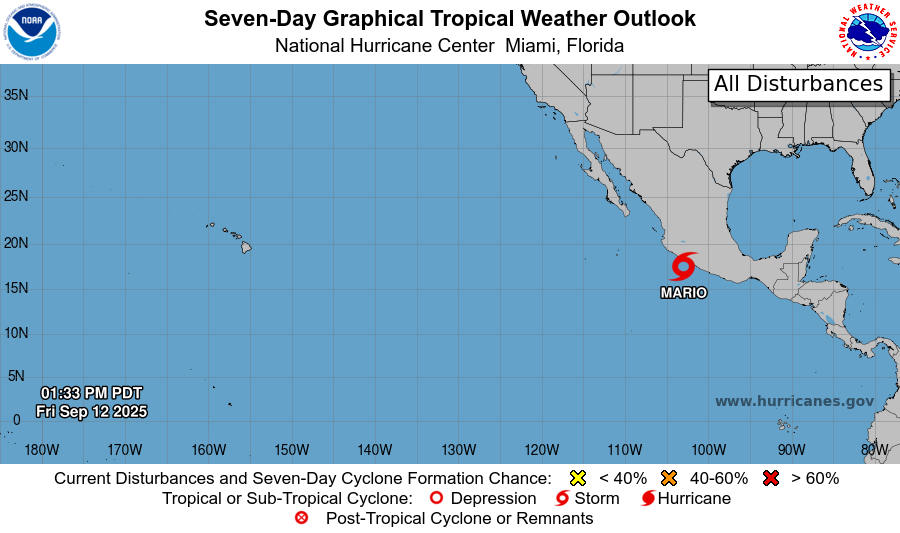
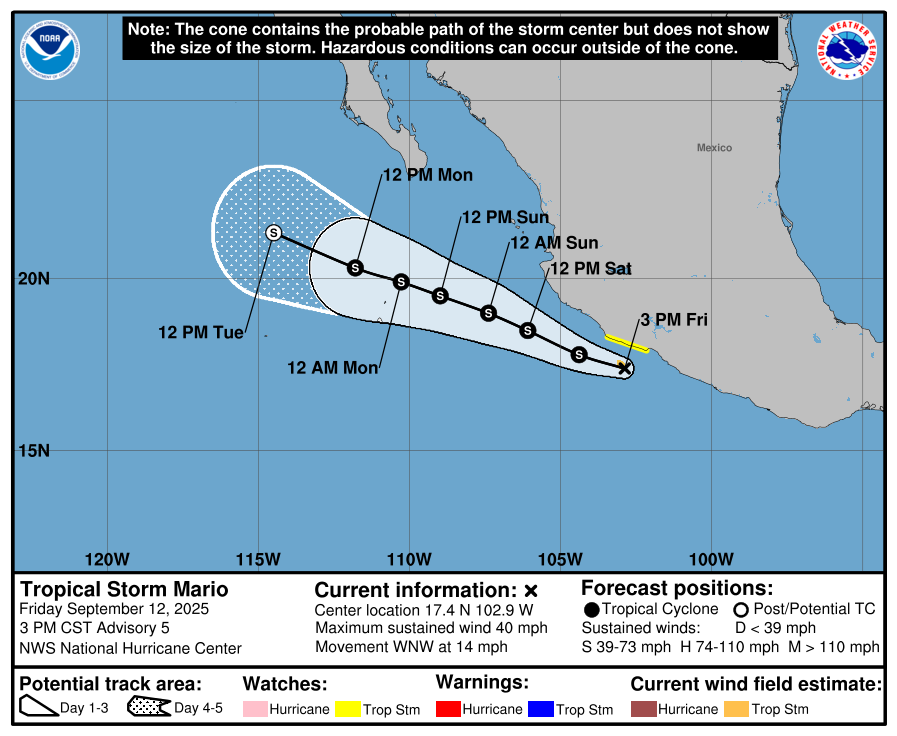
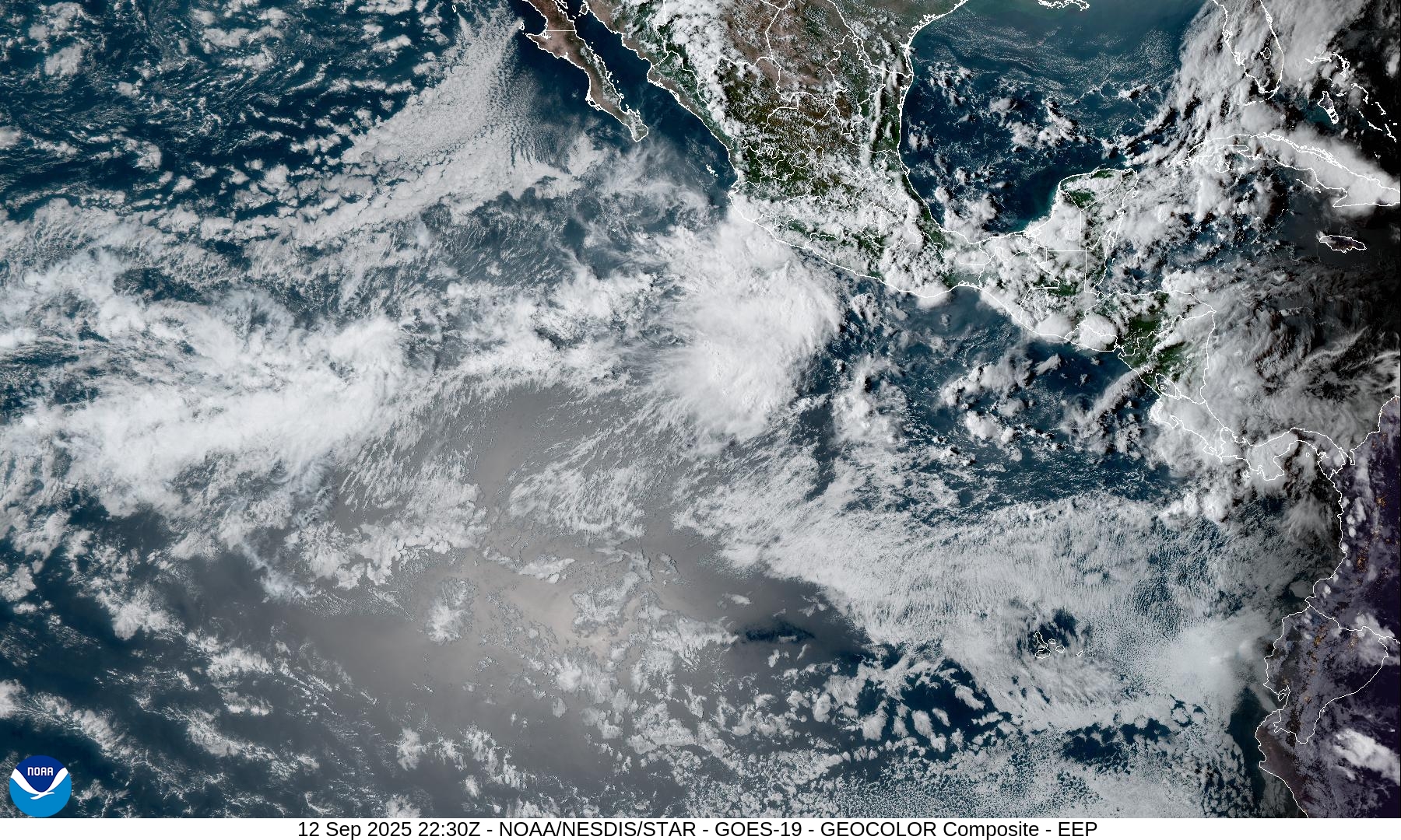
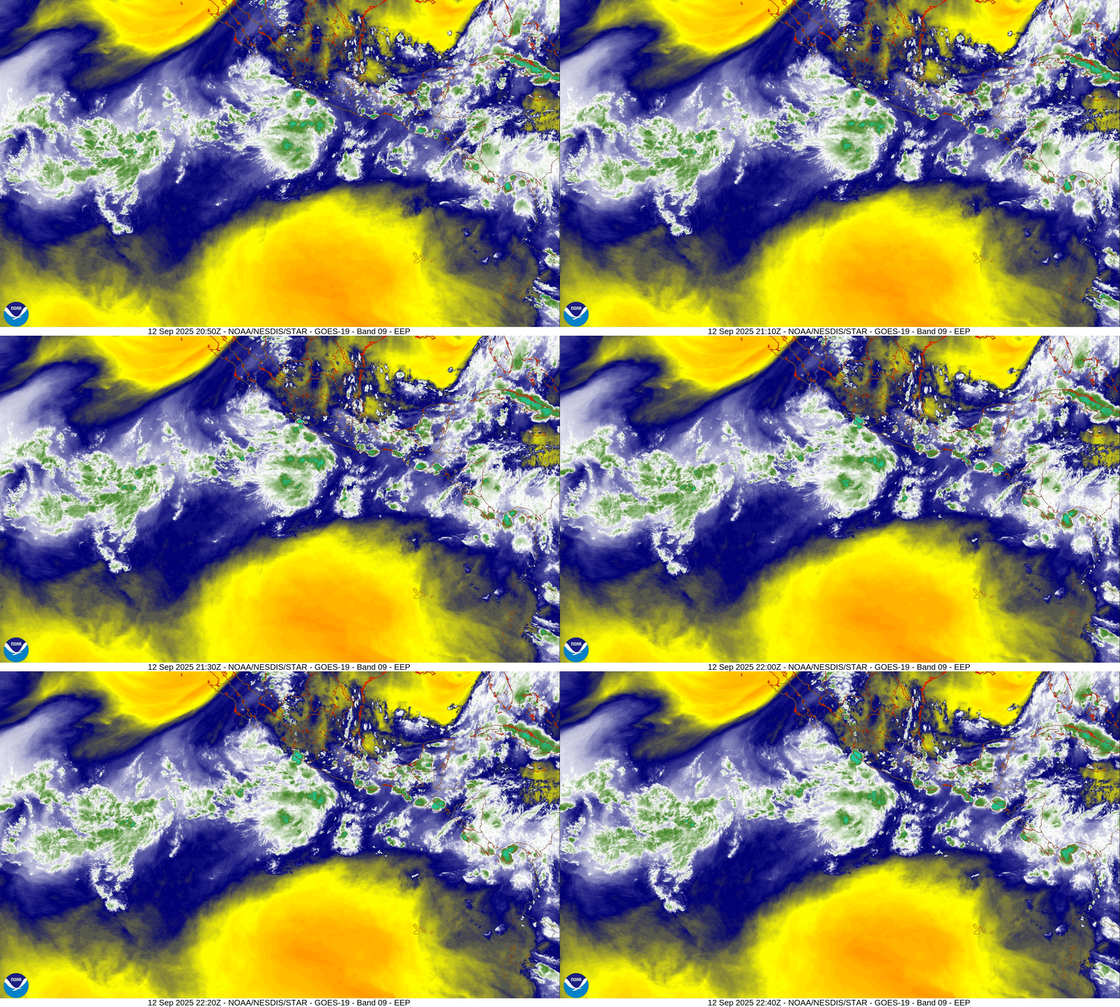
NHC is just under hurricane strength with Marco (13E) but I’m pulling for it to reach H status — and HAFS in 2-3 days brings it up to Category 1 moving away from Mexico eventually over cold water.
Maps sourced from weathermodels.com designed and innovated by yours truly! Please subscribe there for real-time access to the newest maps, charts from all of the weather models including ECMWF.
- Milepost
- 732 · laid 2025-09-12T23:49:00.431000Z
- Source
- https://weather.substack.com/p/september-12-2025-friday-evening
- Digest
- bd94b305c39c4702ee86c1bf60ceea35fd787702b4d05495ec2dfefb27d652b8
- Machine
- JSON