September 11, 2025 Thursday Evening Update
NHC yellow hatchling up to 30% for Eastern MDR tropical wave
September 2025 was the 7th-warmest September in the 131-year national record (1895–2025), at 67.9°F against a 1991–2020 normal of 66.0°F (+2.0°F).
September 2025 was the 15th-driest September in the 131-year national record (1895–2025), at 1.9in against a 1991–2020 normal of 2.6in (-0.6in).
NOAA/NCEI Climate at a Glance, contiguous United States. This is the observed record for the month, not a score of anything said in this piece — the forecast ledger begins 2026-08-17 and cannot reach earlier posts.

Good Evening! Update to move the maps and models forward.
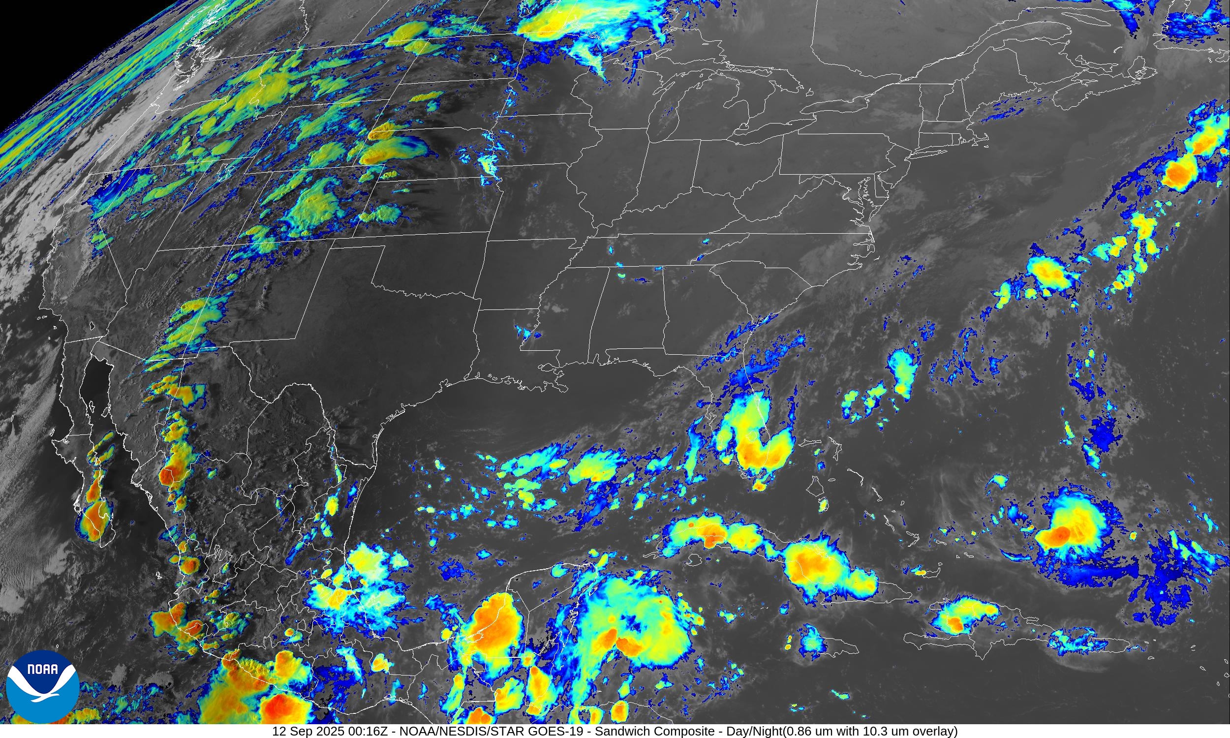
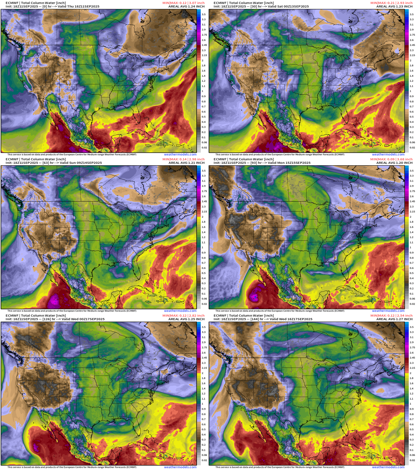
Lower 48 Precipitable Water Forecast | Next 6-days
Tropical Storm Marco enters the frame in a few days and may become a hurricane prior to moving over cooler waters off Baja California Sur.
Scattered showers in the mountain west + easterly flow across Florida peninsula for next several days. A plume of moisture that appears to originate from the Atlantic cruises through the Gulf and heads northward through the Plains — part of a highly amplified pattern: troughs on either side of a strong Canadian blocking ridge. The ridge is gobbling up the moisture and helping to sustain itself from the latent heat release.
Large Scale View of Integrated Vapor Transport Next 10-days
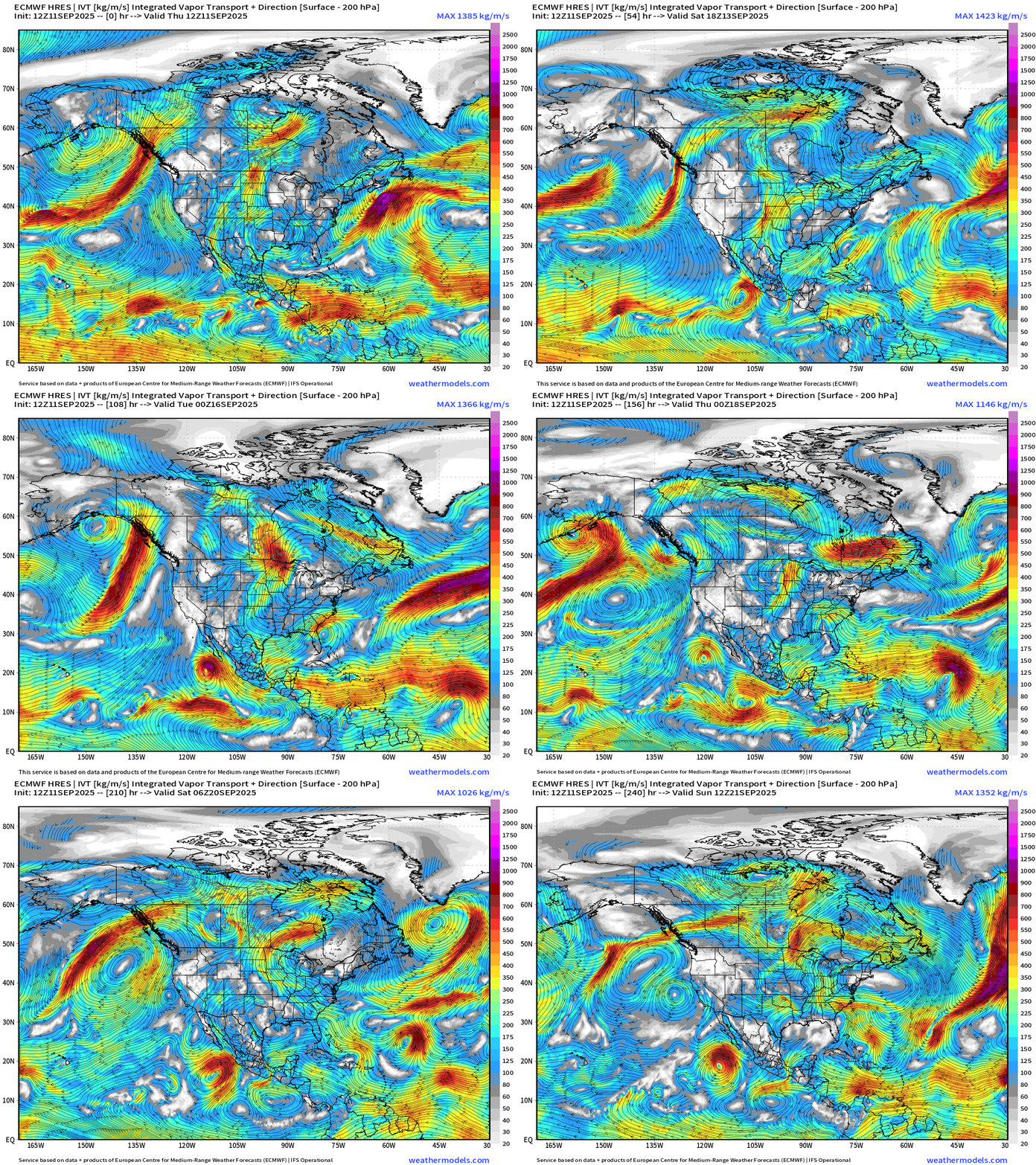
A lot going on — but not seeing much in the way of extreme weather in our neighborhood — typical for mid-September as long as the hurricanes stay away.
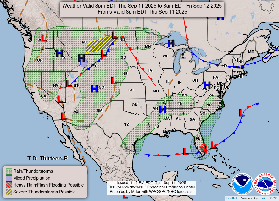
Weather | Fronts this Evening
RTMA Temperatures and Anomaly | 8:00 PM ET
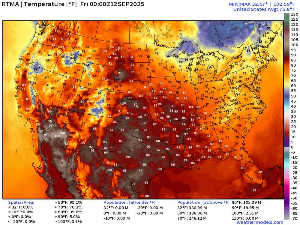
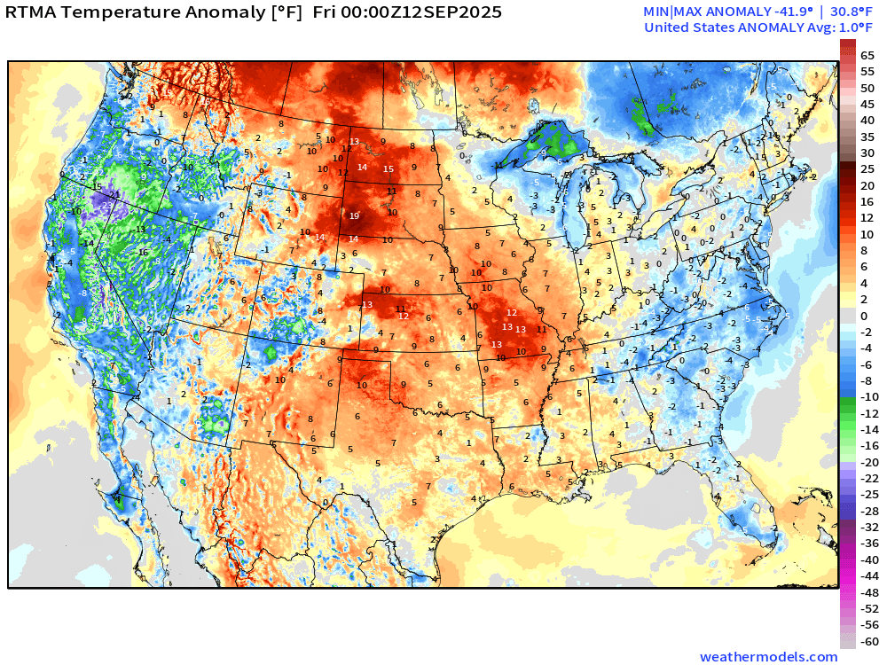
Lower 48 is above normal +1.0°F
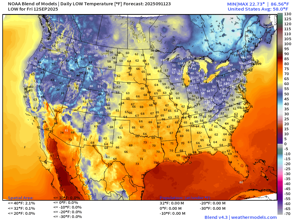
Low Temperatures Friday Morning
High Temperatures Friday

Hot across the Plains into mid-Mississippi River Valley … 76 million at least 90°F
Rainfall Next 72-hours | NWS NDFD
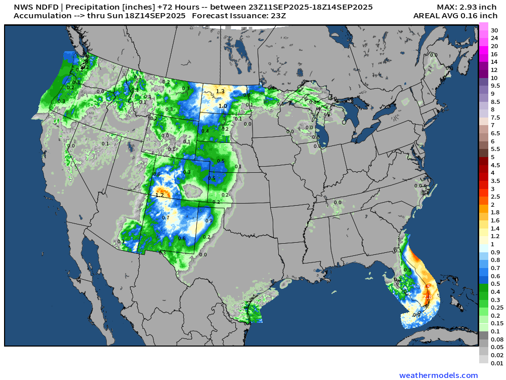
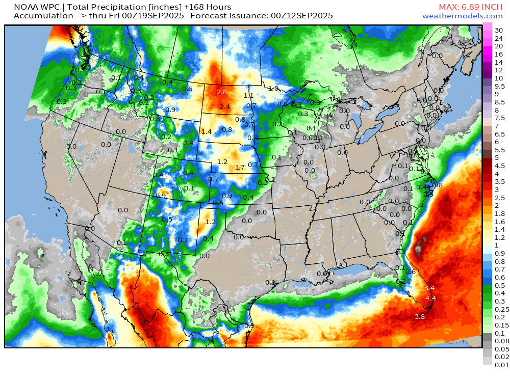
7-Day Precipitation from NOAA WPC
North America Upper Level Height Anomaly | AIFS 18z | Next 10-days
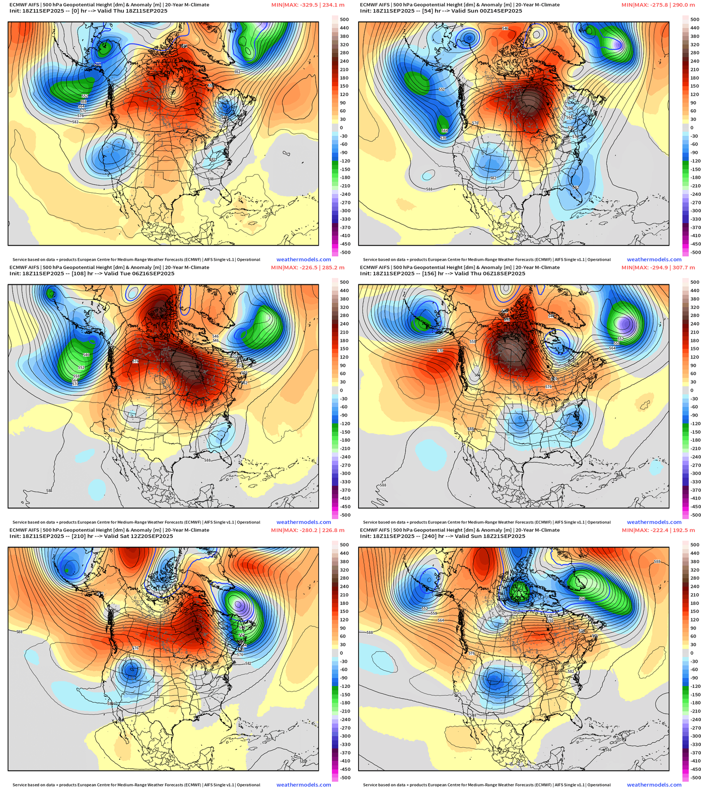
Canadian blocking ridge finally breaks down toward Days 8-10 with more “polar vortex” influence from the Arctic. Troughs and cut-offs dominate the Lower 48 under the ridge until then.
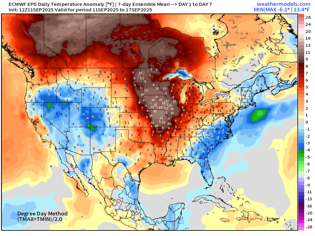
ECMWF EPS 12z | 7-day Temperature Anomaly | Week 1 (Sept 11-17)
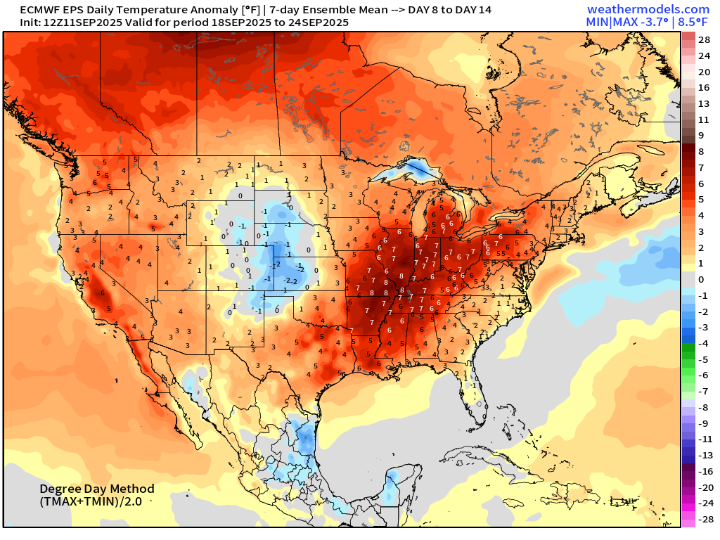
ECMWF EPS 12z | 7-day Temperature Anomaly | Week 2 (Sept 18-24)
Atlantic Hurricane Season
2025 Season to Date: 6 named storms, 1 hurricanes, and 1 majors | ACE = 40 ACE of Erin: 32.2 (140-knots maximum wind)
ECMWF 12-Days Integrated Vapor Transport | 12z cycle
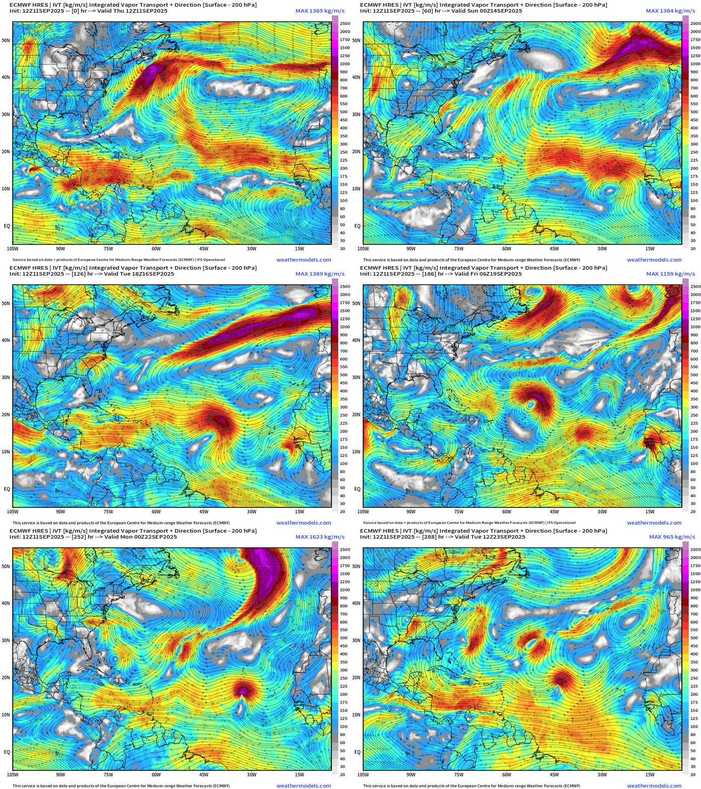
Traffic jam in the MDR from the ECMWF 12z flagship model with 3 candidate tropical waves all squished together by Day 12. Just one scenario of 51 members, but suggests an uptick in TS/H activity next week!
ECMWF 18z | Precipitable Water Next 6-days
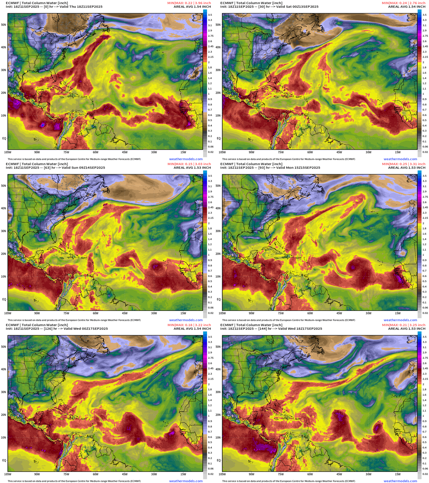
A tropical wave emerging off coast of Africa in the next 24-hours has a 30% chance of development — and another emerges in 4-5 days behind it.
ECMWF 18z | Vorticity 6-day Forecast
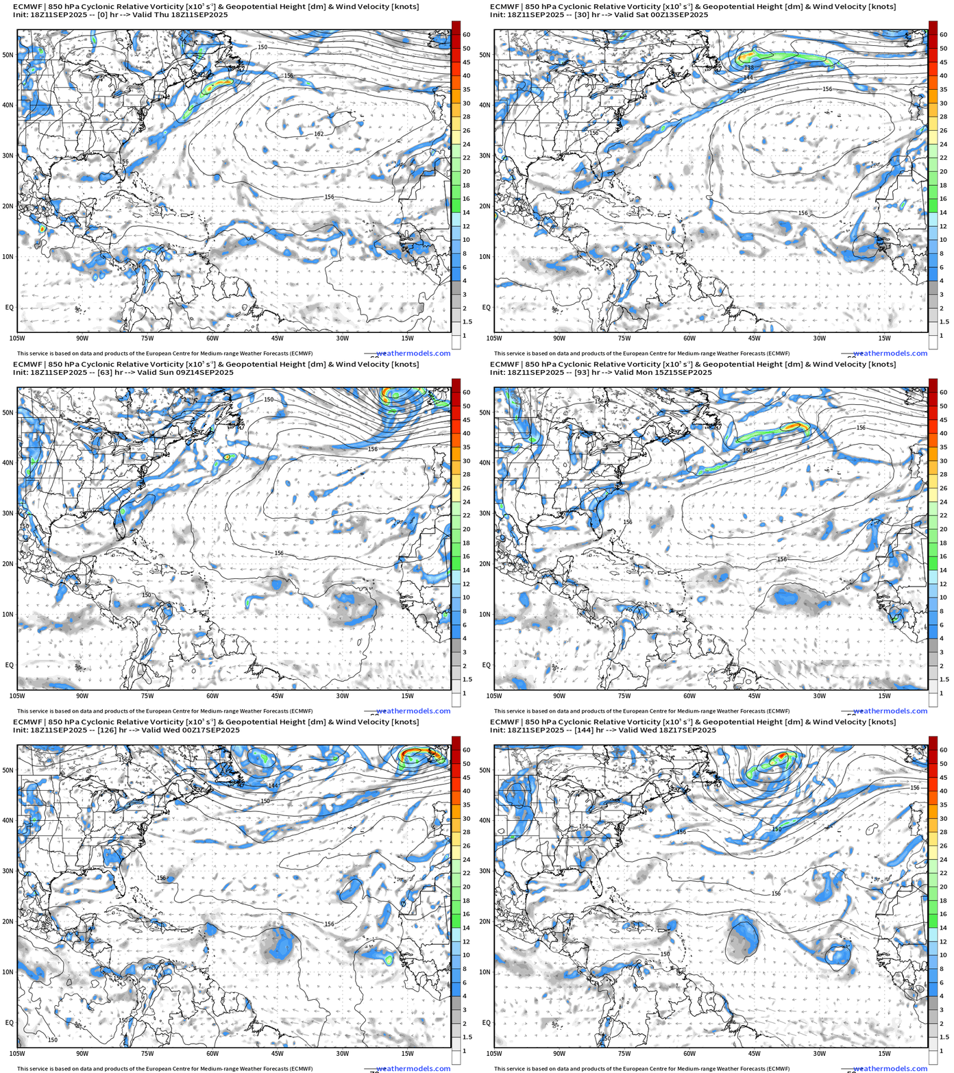
By Tuesday, a circulation makes it to 45°W and will likely develop in a day or two after that … 30% chance from NHC, but we won’t count our chickens before they hatch!
Atlantic Basin Outlook | 8 PM ET Update
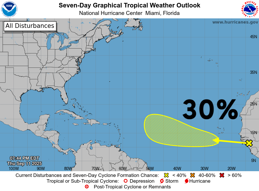
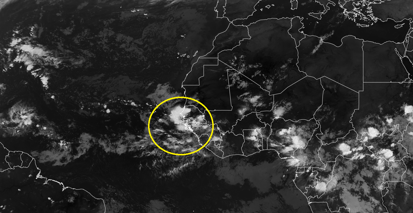
30% chance of development for a tropical wave that will emerge off Africa over next 24-hours.
Atlantic Satellite Imagery | Infrared
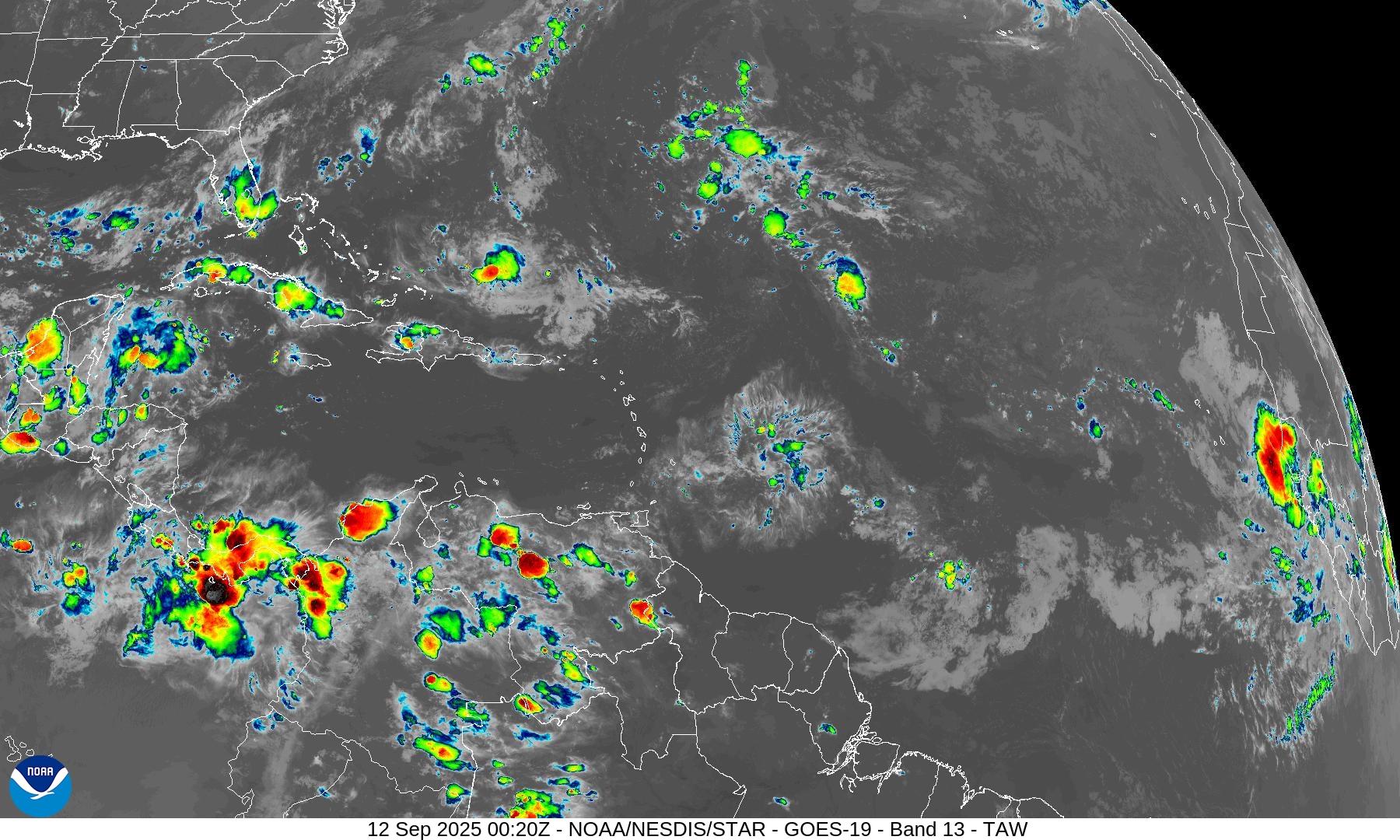
Strong convection with wave just coming off Africa.
Water Vapor | Mid-level
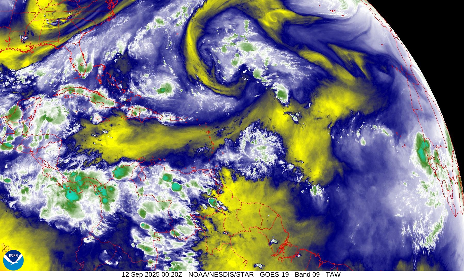
And a nice blob of tropical moisture to work with … not a yellow moat of negative dry air and descent
SST and SST Anomaly | ECMWF 12z analysis
NOAA Tropical Surface Analysis | 18z
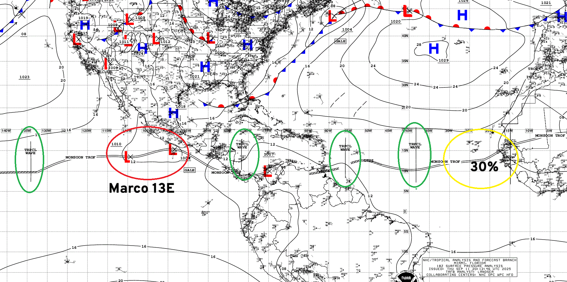
Atlantic Tropical Waves = 4 with one along 15°W (over Africa) with strong convection
Eastern Atlantic and Africa Infrared Satellite
ECMWF EPS 12z Ensemble | Active Cyclone Tracks Through 7-days
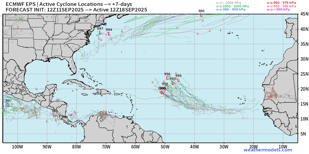
I’d say a 50/50 signal from EPS through Day 7
ECMWF EPS 12z Ensemble | Active Cyclone Tracks Through 10-days
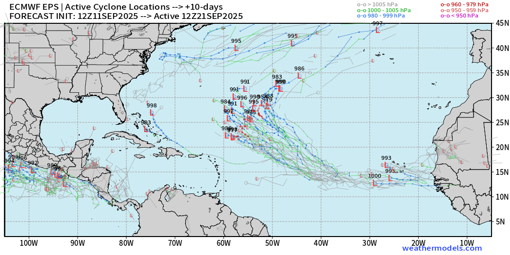
Majority of members feature a hurricane. Another wave on its heels develops right off the coast of Africa.
ECMWF EPS 12z Ensemble | Active Cyclone Tracks Through 15-days
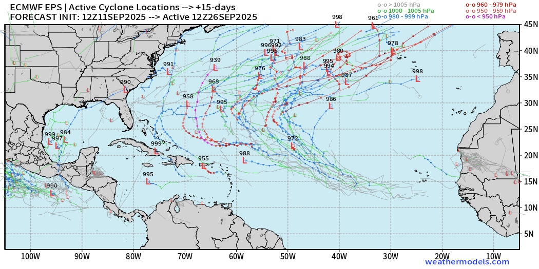
Many major hurricane possibilities — over the central Atlantic (September 26th)
AIFS-ENS Comparison at 12Z | Active Tracks at Day 8
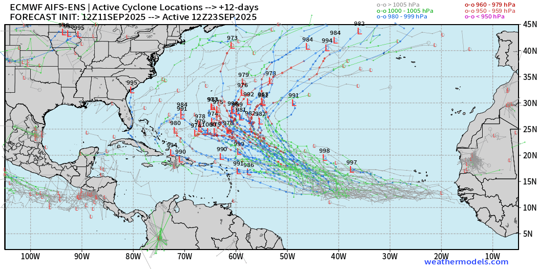
AIFS ENS remains very excited about this tropical wave — high chance > 90%
AIFS-ENS Comparison at 12Z | Active Tracks at Day 15
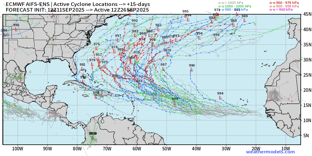
A more active Atlantic basin for sure, but thankfully everything looks to be recurving or staying away off the U.S. mainland.
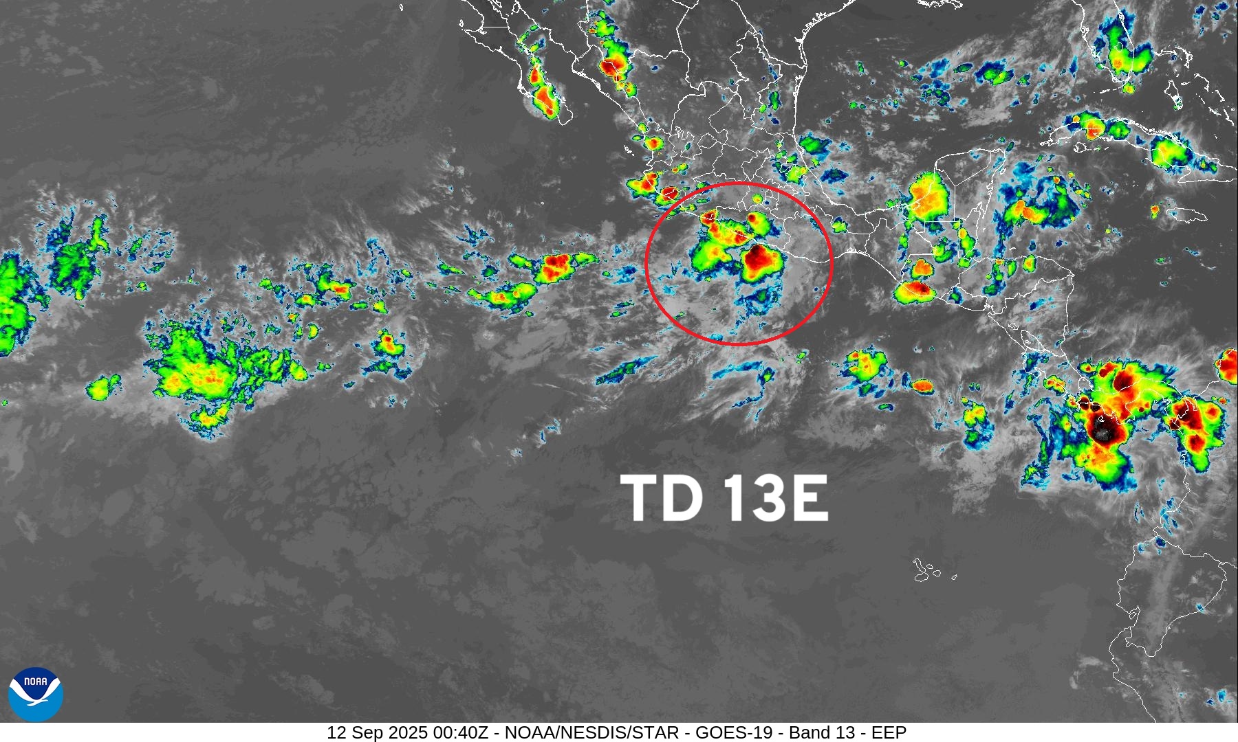
Eastern Pacific Tropical Update | TD 13E
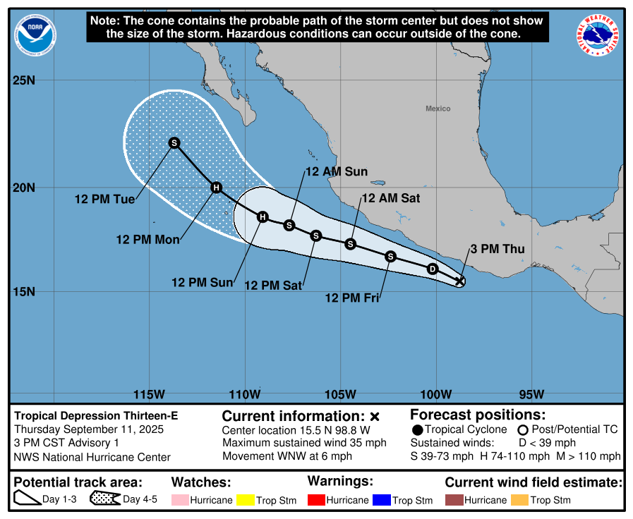
To become Marco by tomorrow afternoon
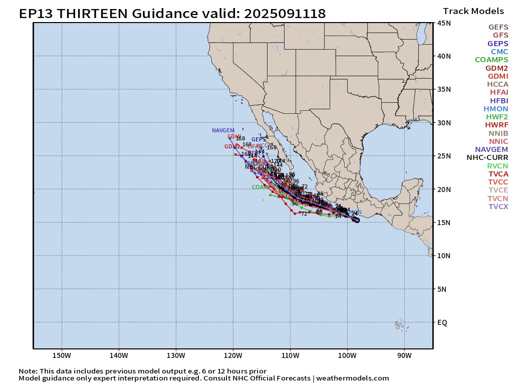
ATCF Spaghetti | TD 13E —> Marco
HWRF 18z — Marco nears hurricane strength at peak
ECMWF 18z shows 1000 mb | Not very impressive — not sure why!
Maps sourced from weathermodels.com designed and innovated by yours truly! Please subscribe there for real-time access to the newest maps, charts from all of the weather models including ECMWF.
- Milepost
- 731 · laid 2025-09-12T01:15:26.202000Z
- Source
- https://weather.substack.com/p/september-11-2025-thursday-evening
- Digest
- d53aa1e5b05fbfe2f186b7a5dd7f80ebb607ea8eb65c73486c2c39bc447c3843
- Machine
- JSON