September 10, 2025 Wednesday Evening Update
NHC spawned a 20% chance yellow hatchling for MDR into next week
September 2025 was the 7th-warmest September in the 131-year national record (1895–2025), at 67.9°F against a 1991–2020 normal of 66.0°F (+2.0°F).
September 2025 was the 15th-driest September in the 131-year national record (1895–2025), at 1.9in against a 1991–2020 normal of 2.6in (-0.6in).
NOAA/NCEI Climate at a Glance, contiguous United States. This is the observed record for the month, not a score of anything said in this piece — the forecast ledger begins 2026-08-17 and cannot reach earlier posts.

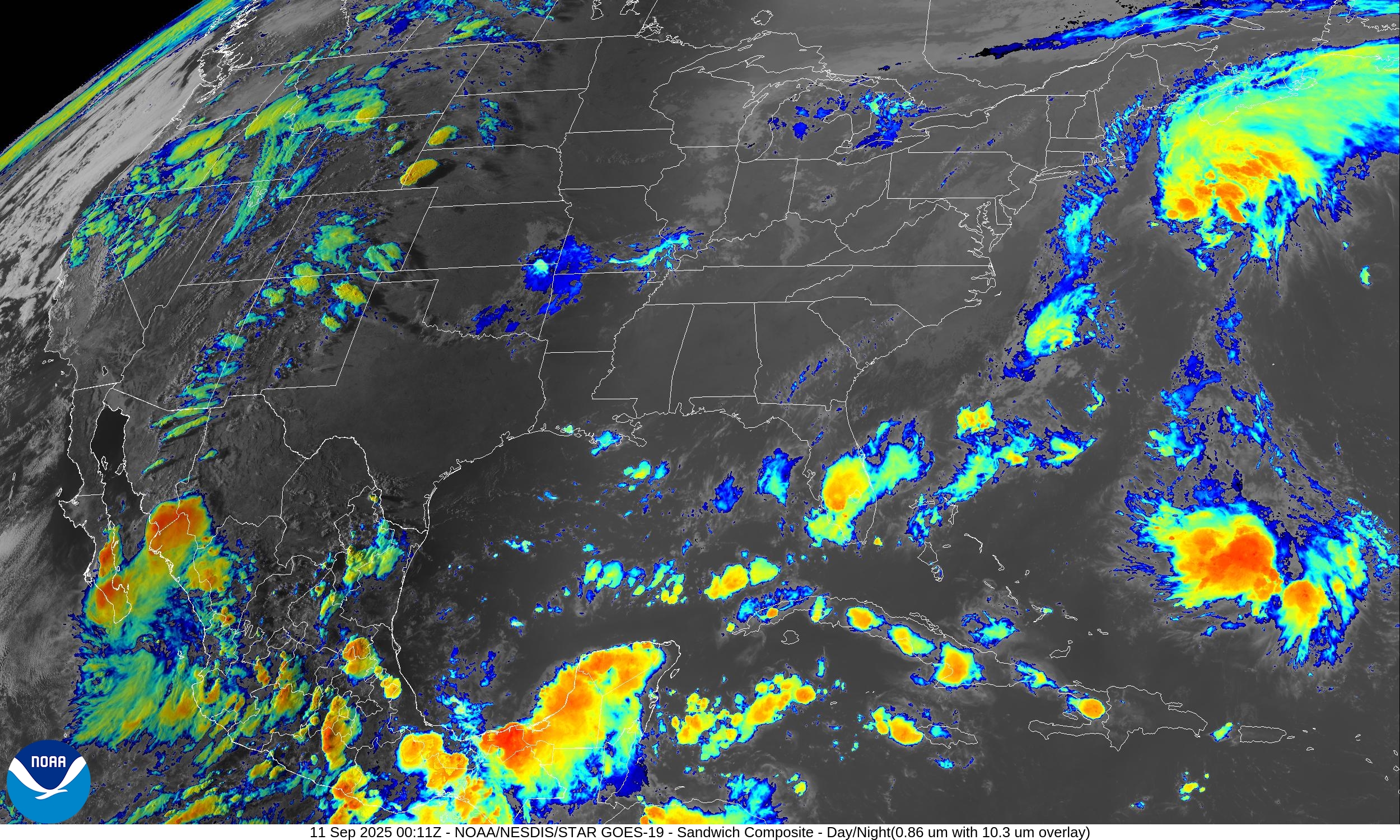
Good Evening! Update to move the maps and models forward.
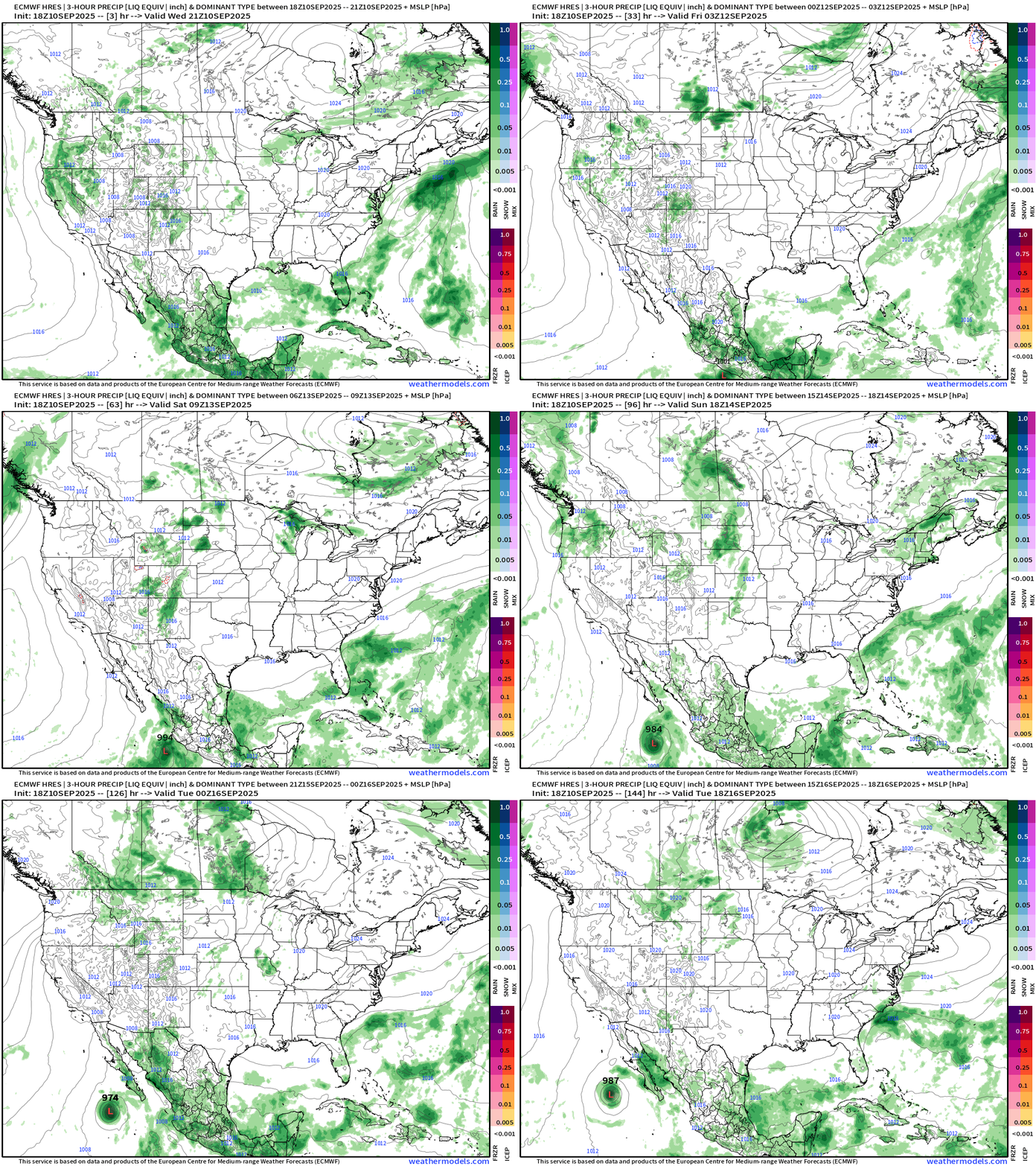
Lower 48 Precipitation Forecast | Next 6-days
Tropical Storm Marco —> Hurricane
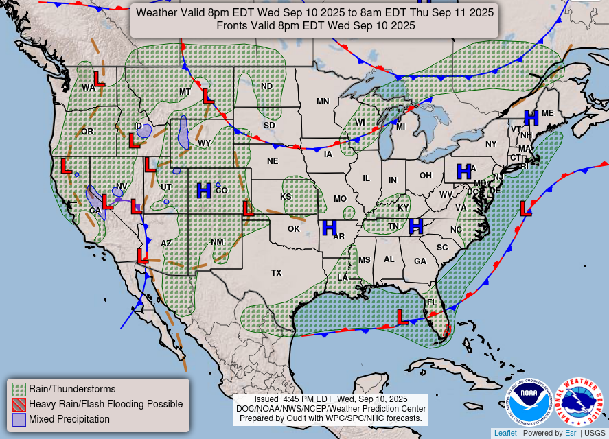
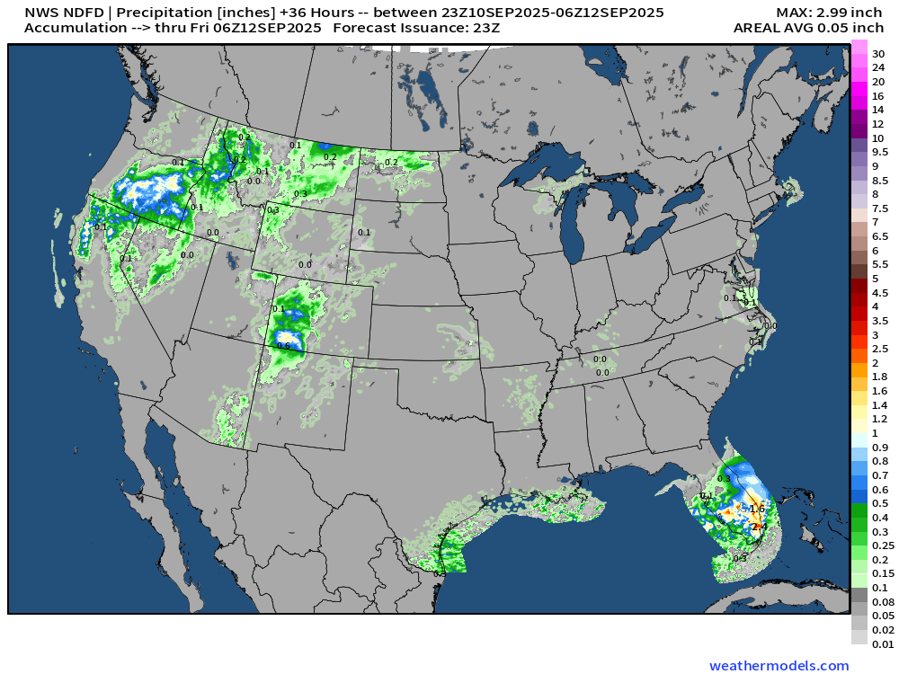
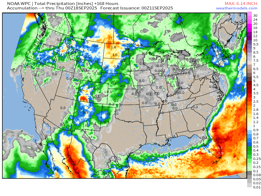
Only scattered showers in the mountain west + easterly flow across Florida peninsula for next several days. The rest of the Lower 48 is under control of more Canadian dry air — but pretty hot after the September sunshine moderated the air mass.
Weather | Fronts this Evening
RTMA Temperatures and Anomaly | 7:30 PM ET
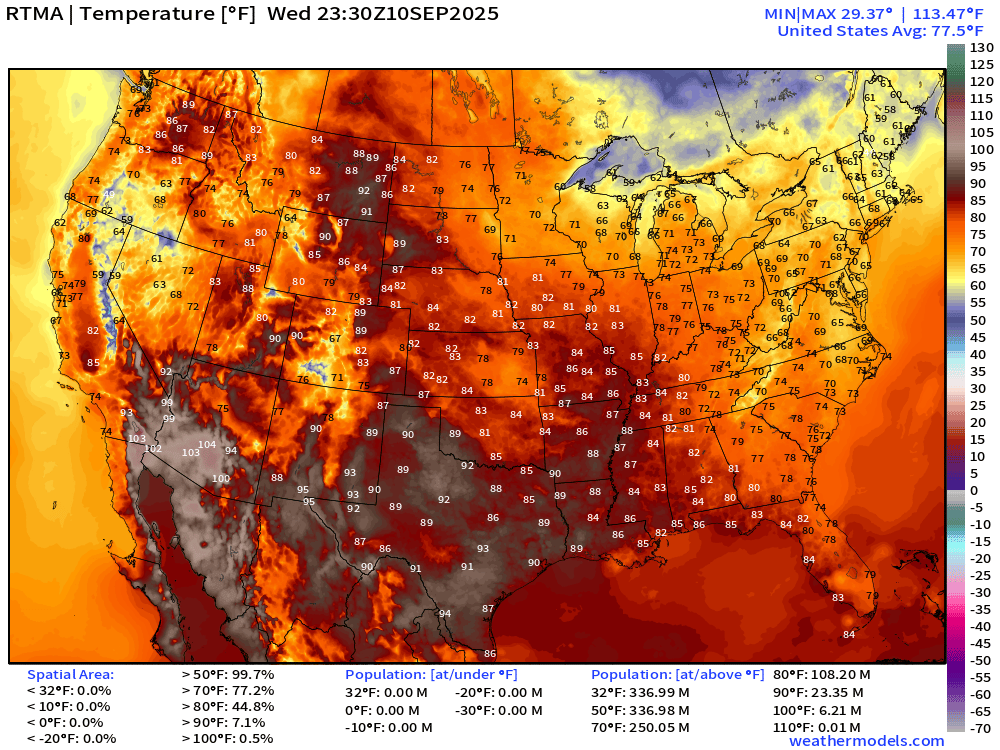
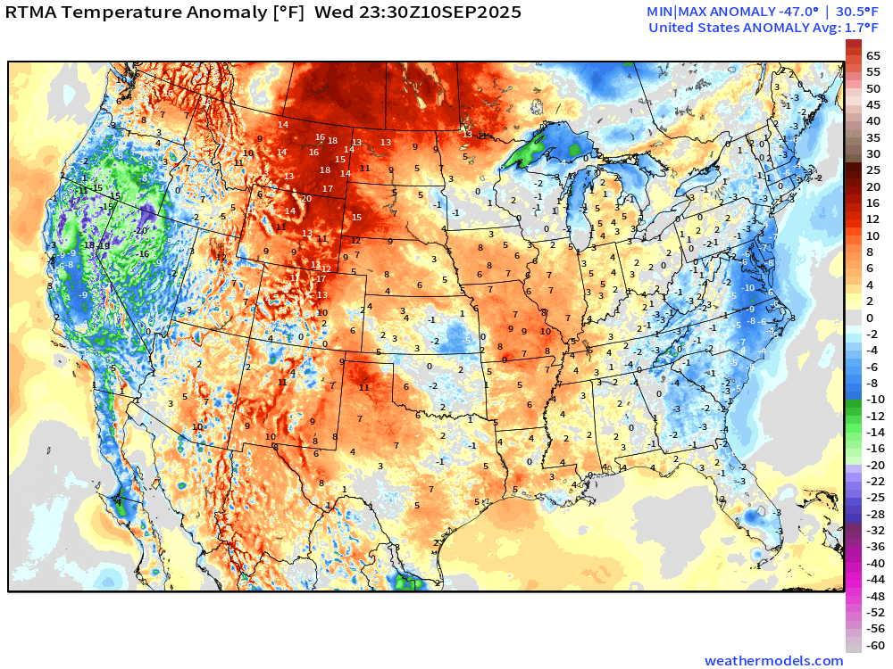
Lower 48 is above normal +1.7°F
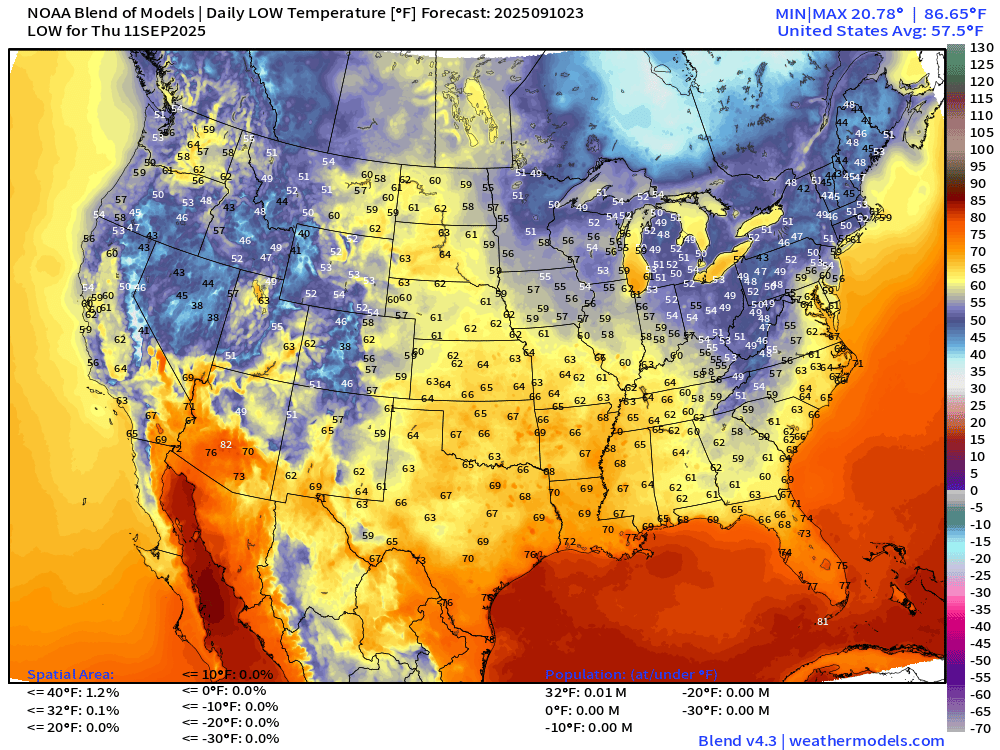
Low Temperatures Thursday Morning
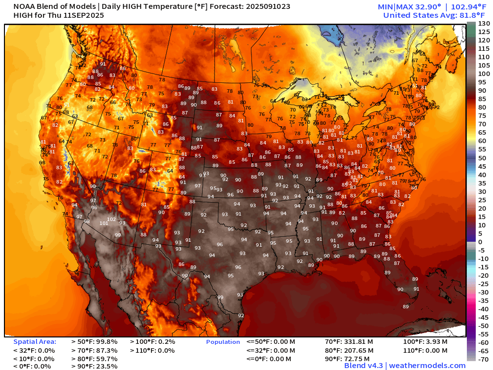
High Temperatures Thursday
Rainfall Next 36-hours | NWS NDFD
7-Day Precipitation from NOAA WPC
North America Upper Level Height Anomaly | AIFS 18z | Next 10-days
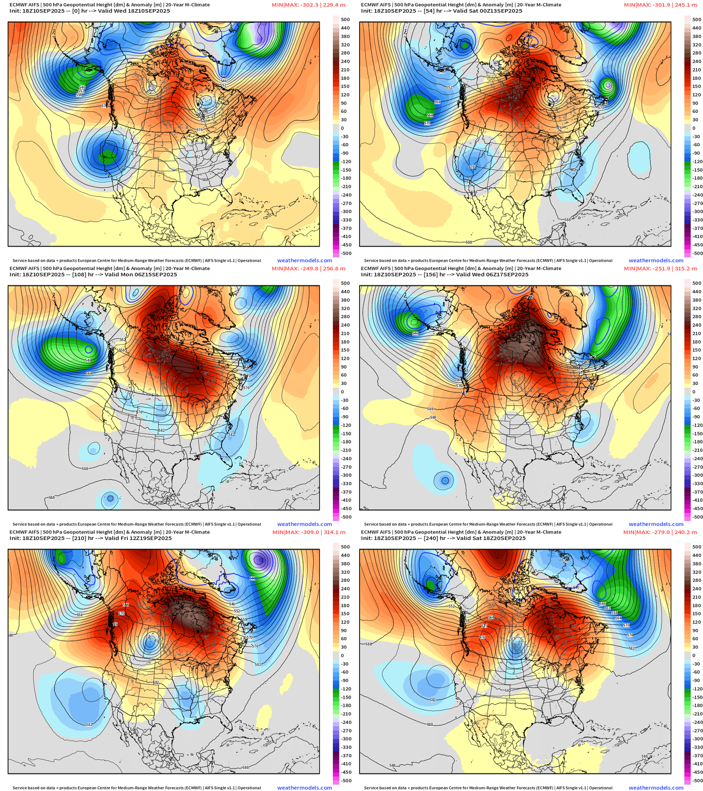
The Canadian blocking ridge is strongly in charge through 10-days — a very persistent pattern for mid-September. On either side, wave breaking events will spawn mid-level or cut-off troughs that will provide unsettled weather for the western u>S> and the Southeast — and a bit cooler as a result.
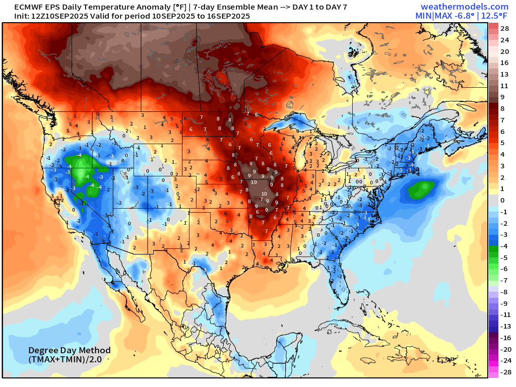
ECMWF EPS 12z | 7-day Temperature Anomaly | Week 1 (Sept 10-16)
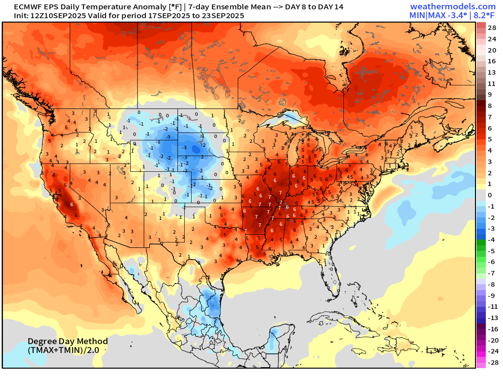
ECMWF EPS 12z | 7-day Temperature Anomaly | Week 2 (Sept 17-23)
Atlantic Hurricane Season
2025 Season to Date: 6 named storms, 1 hurricanes, and 1 majors | ACE = 40 ACE of Erin: 32.2 (140-knots maximum wind)
ECMWF 12-Days Integrated Vapor Transport | 12z cycle
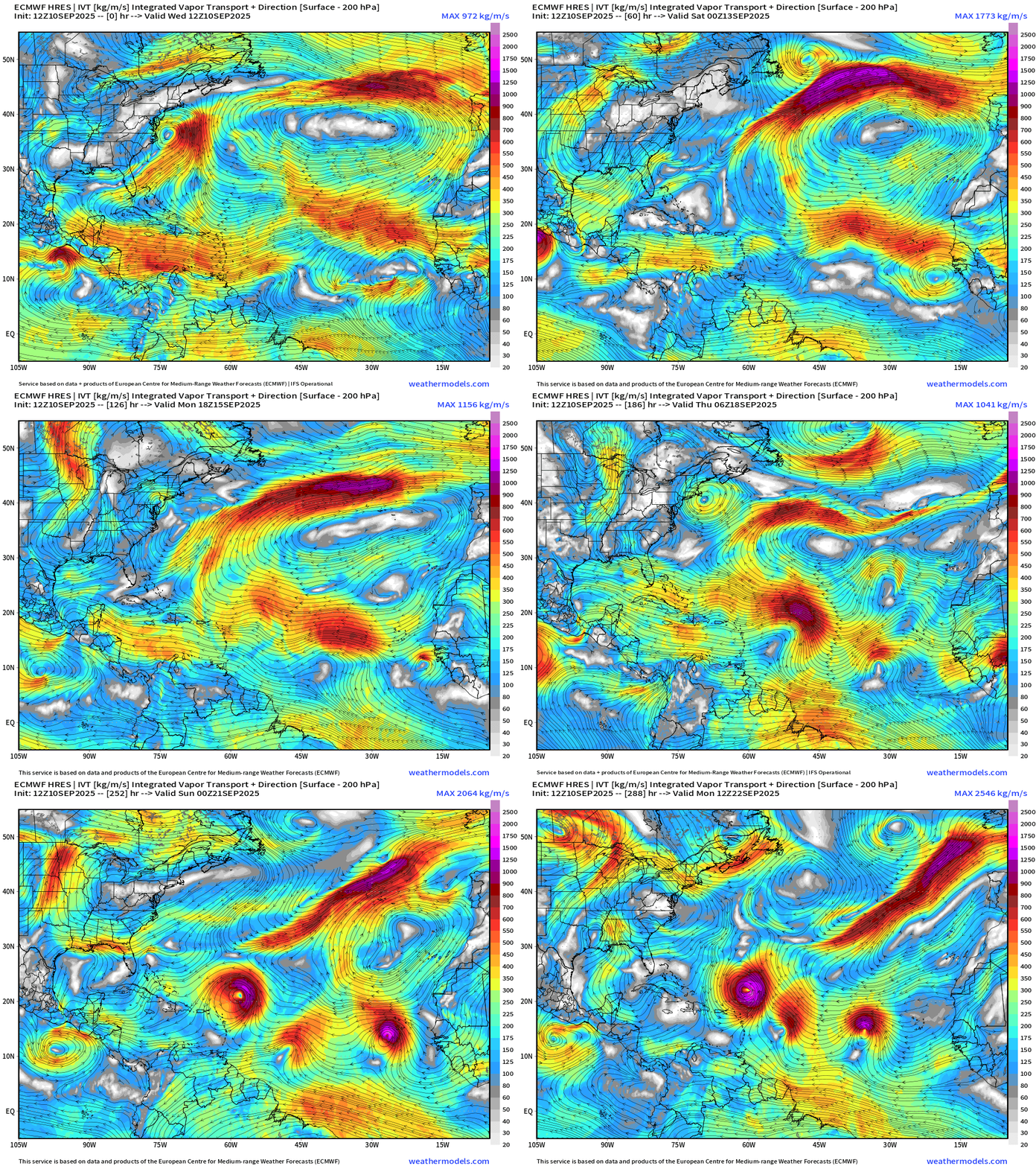
Bit of a traffic jam in the MDR from the ECMWF 12z flagship model with 3 candidate tropical waves all squished together by Day 12. Just one scenario of 51 members, but suggests an uptick in TS/H activity next week!
ECMWF 18z | Precipitable Water Next 6-days
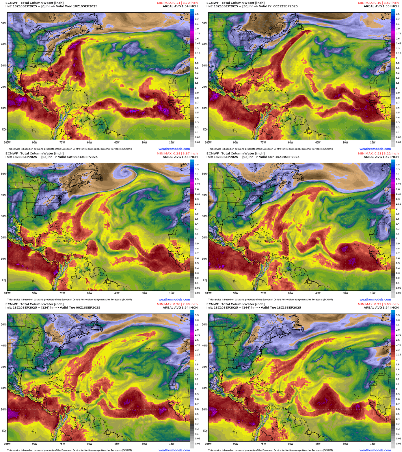
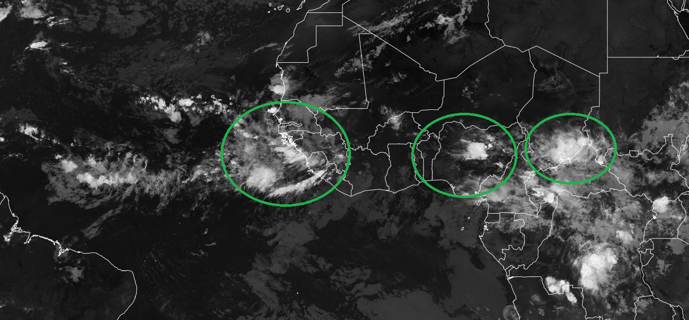
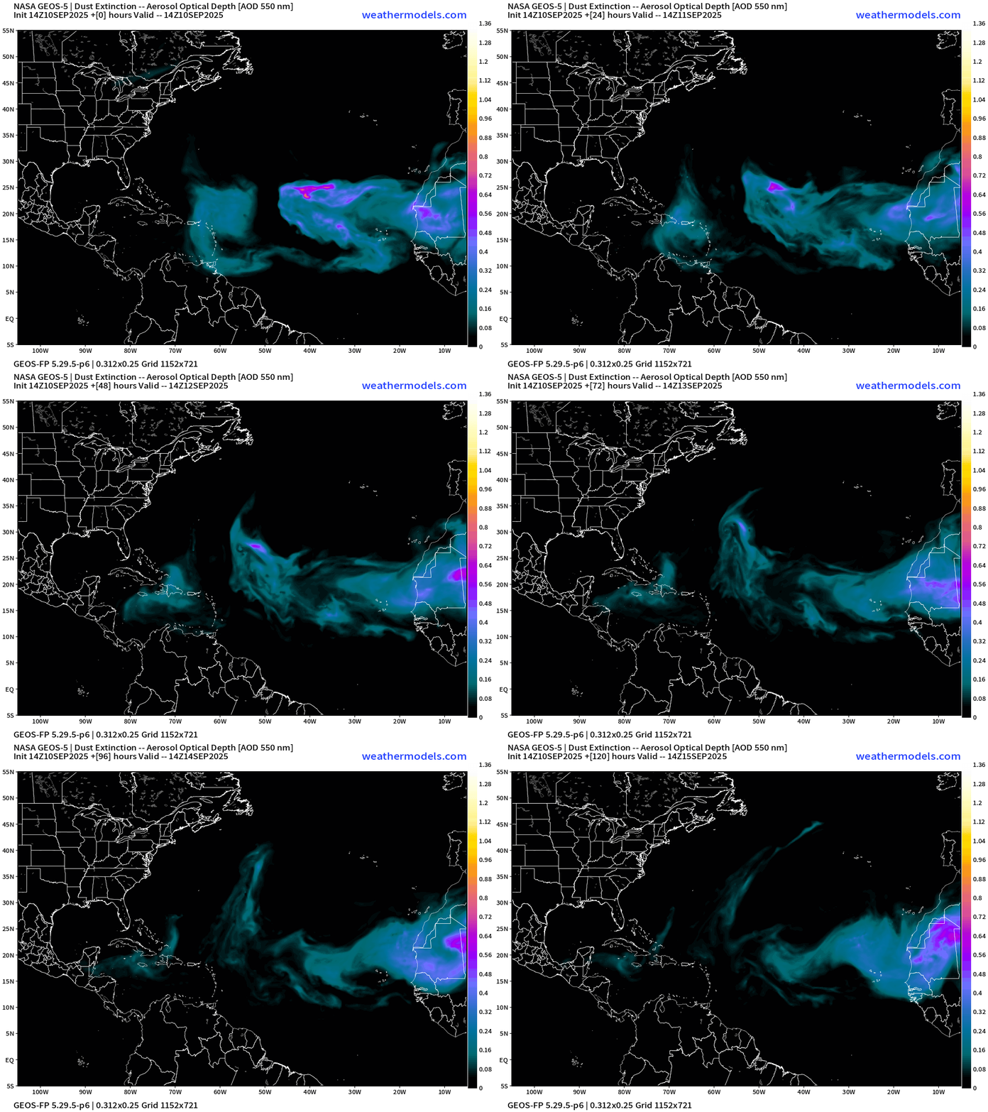
A tropical wave by this weekend coming off Africa is next shot at a tropical system but may not develop into a TD for 7-8 days.
ECMWF 18z | Vorticity 6-day Forecast
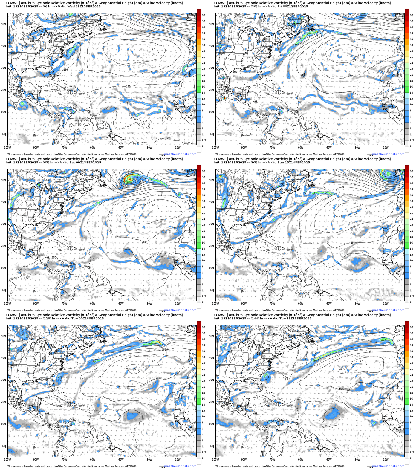
By Tuesday, a circulation makes it to 45°W and will likely develop in a day or two after that … 20% chance from NHC, but we won’t count our chickens before they hatch!
Atlantic Basin Outlook | 8 PM ET Update
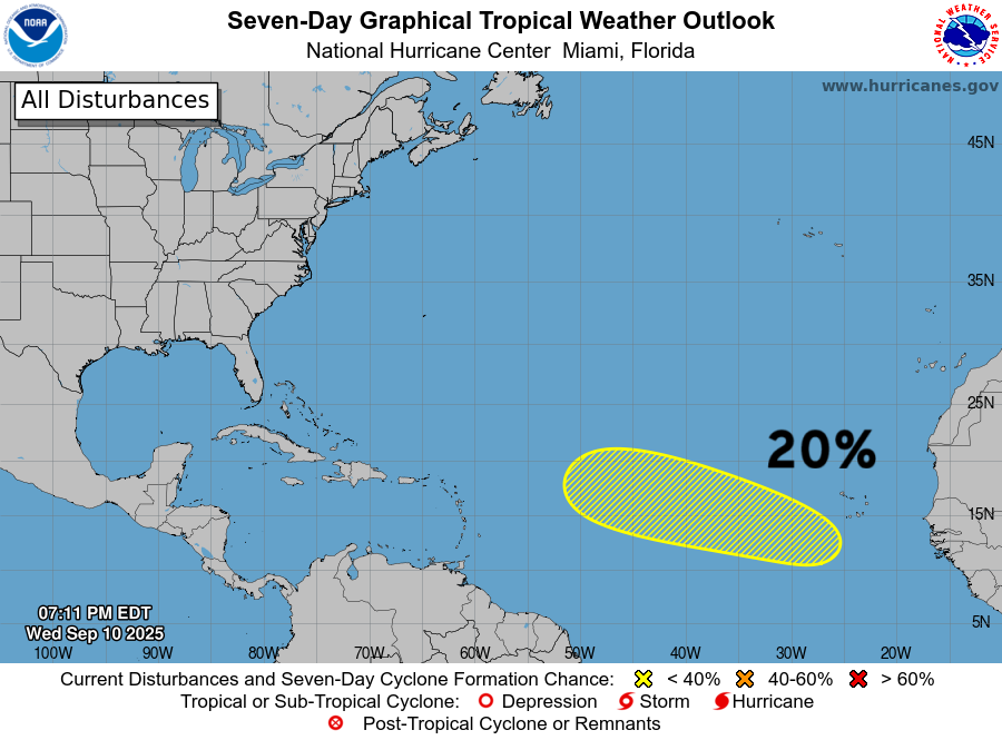
20% chance of development for a tropical wave that will emerge off Africa on Fri-Sat, and head westward over warm waters.
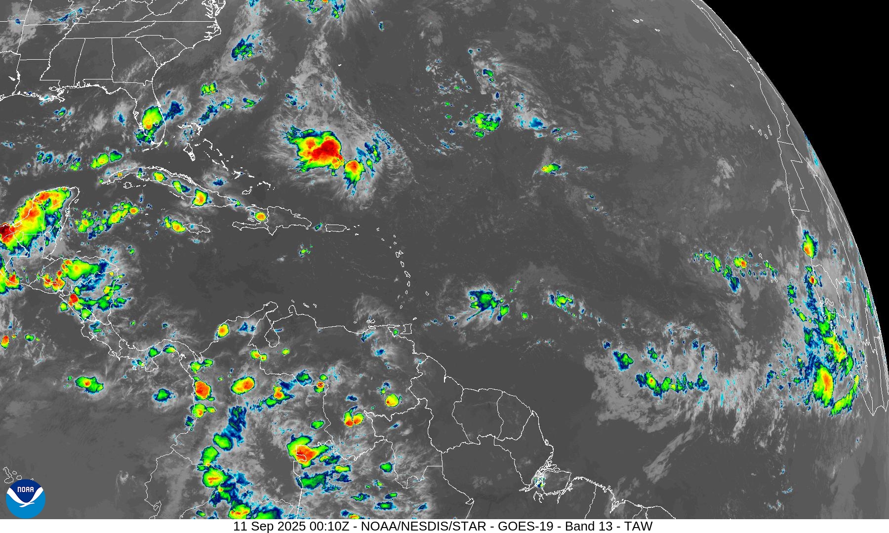
Atlantic Satellite Imagery | Infrared
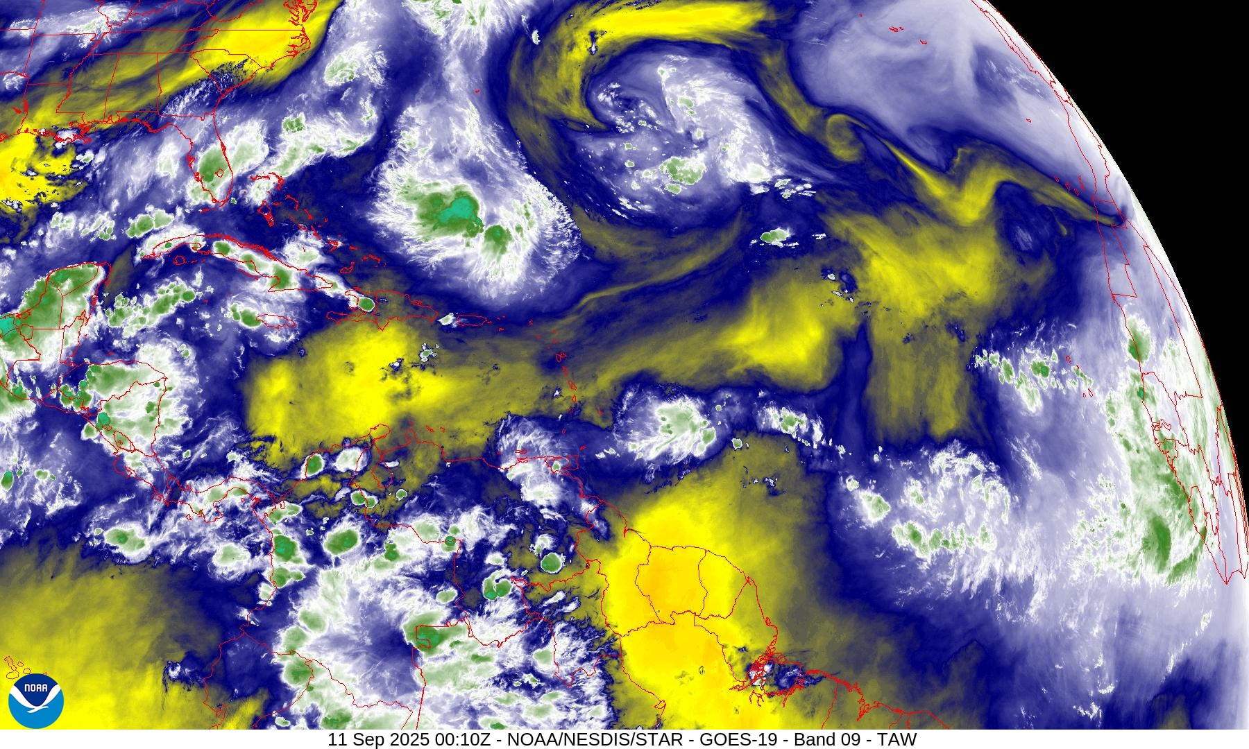
Water Vapor | Mid-level
SST and SST Anomaly | ECMWF 12z analysis
NOAA Tropical Surface Analysis | 18z
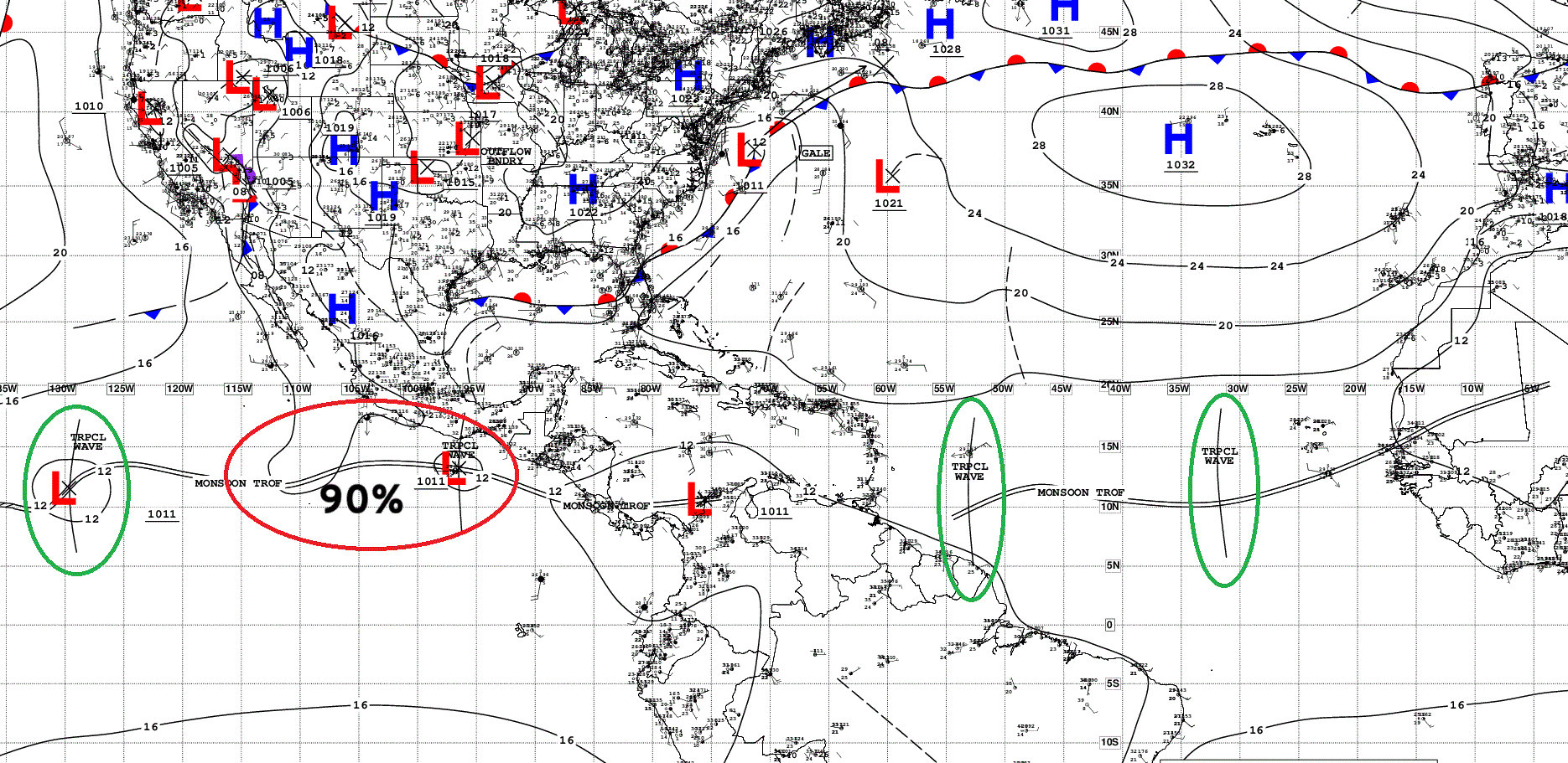
Atlantic Tropical Waves = 2 but not candidates for development
Eastern Atlantic and Africa Infrared Satellite
NASA Dust 5-day Forecast | 12z
ECMWF EPS 12z Ensemble | Active Cyclone Tracks Through 7-days
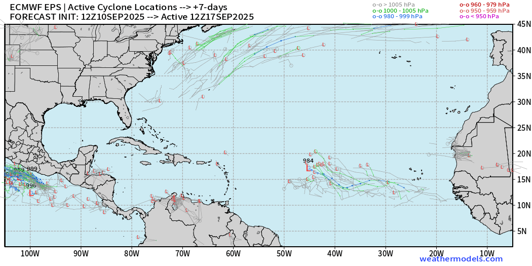
Weaker signal at 12z than previous 00z cycle … corresponds with NHC 20% chance.
ECMWF EPS 12z Ensemble | Active Cyclone Tracks Through 12-days
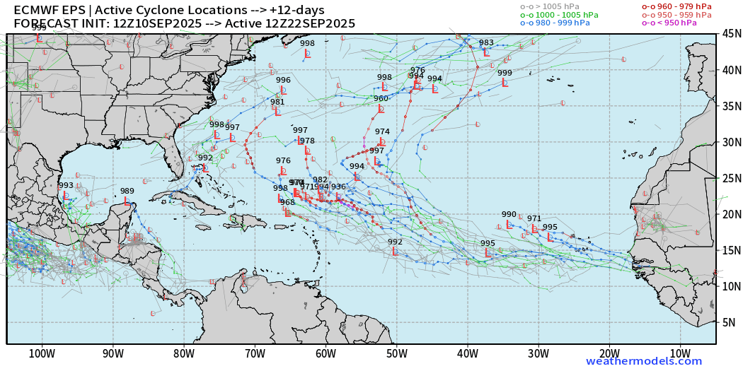
Majority of members feature a hurricane. Another wave on its heels develops right off the coast of Africa.
ECMWF EPS 12z Ensemble | Active Cyclone Tracks Through 15-days
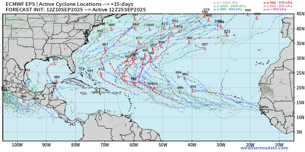
Many major hurricane possibilities — over the central Atlantic (September 25th)
AIFS-ENS Comparison at 12Z | Active Tracks at Day 9
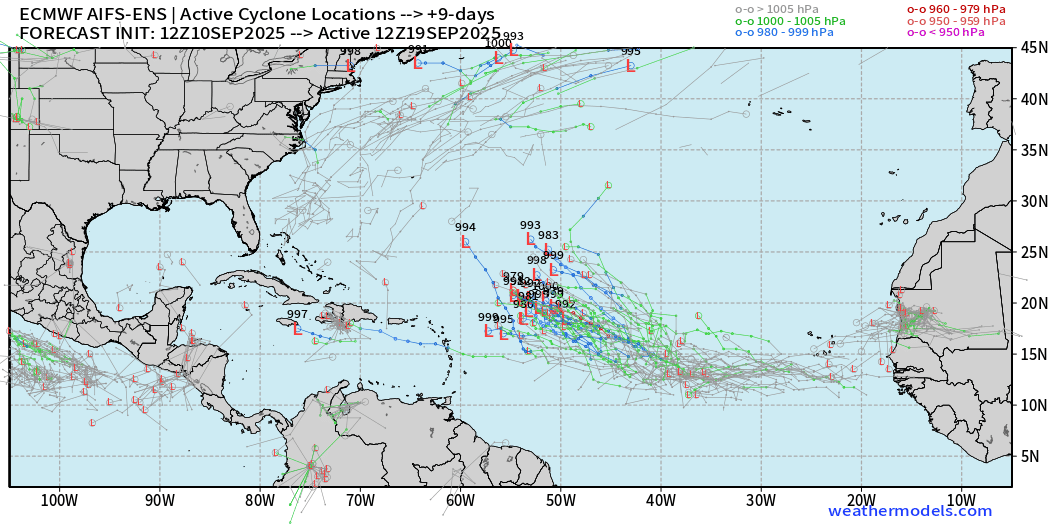
AIFS ENS is very excited about this tropical wave — high chance > 90%
AIFS-ENS Comparison at 12Z | Active Tracks at Day 15
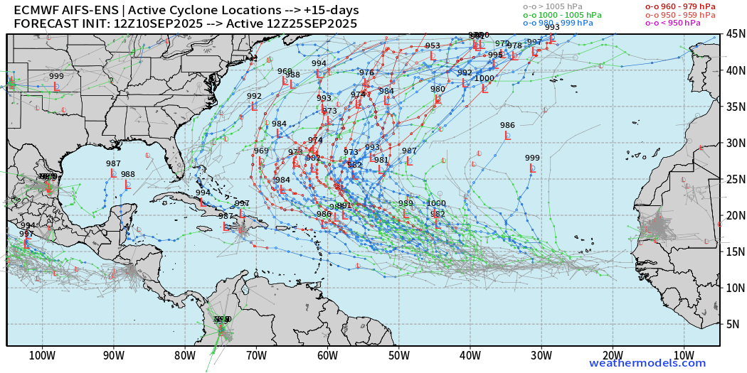
A more active Atlantic basin for sure, but thankfully everything looks to be recurving or staying away off the U.S. mainland.
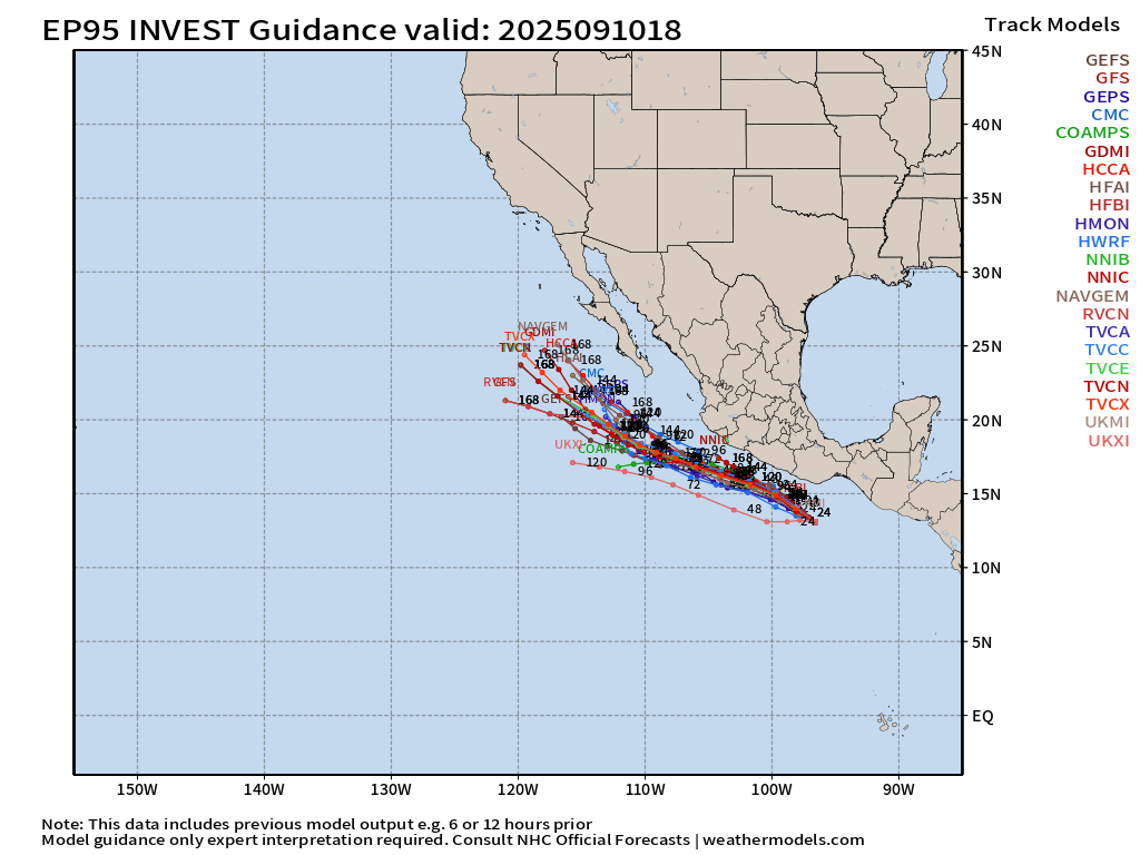
Eastern Pacific Tropical Update
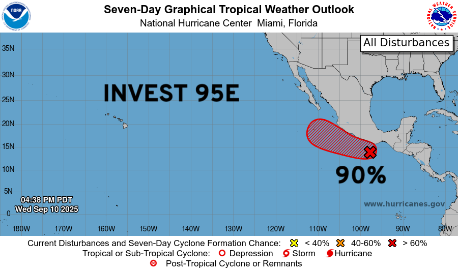
Tropical Storm Marco still scheduled in the next 48-hours, or so.
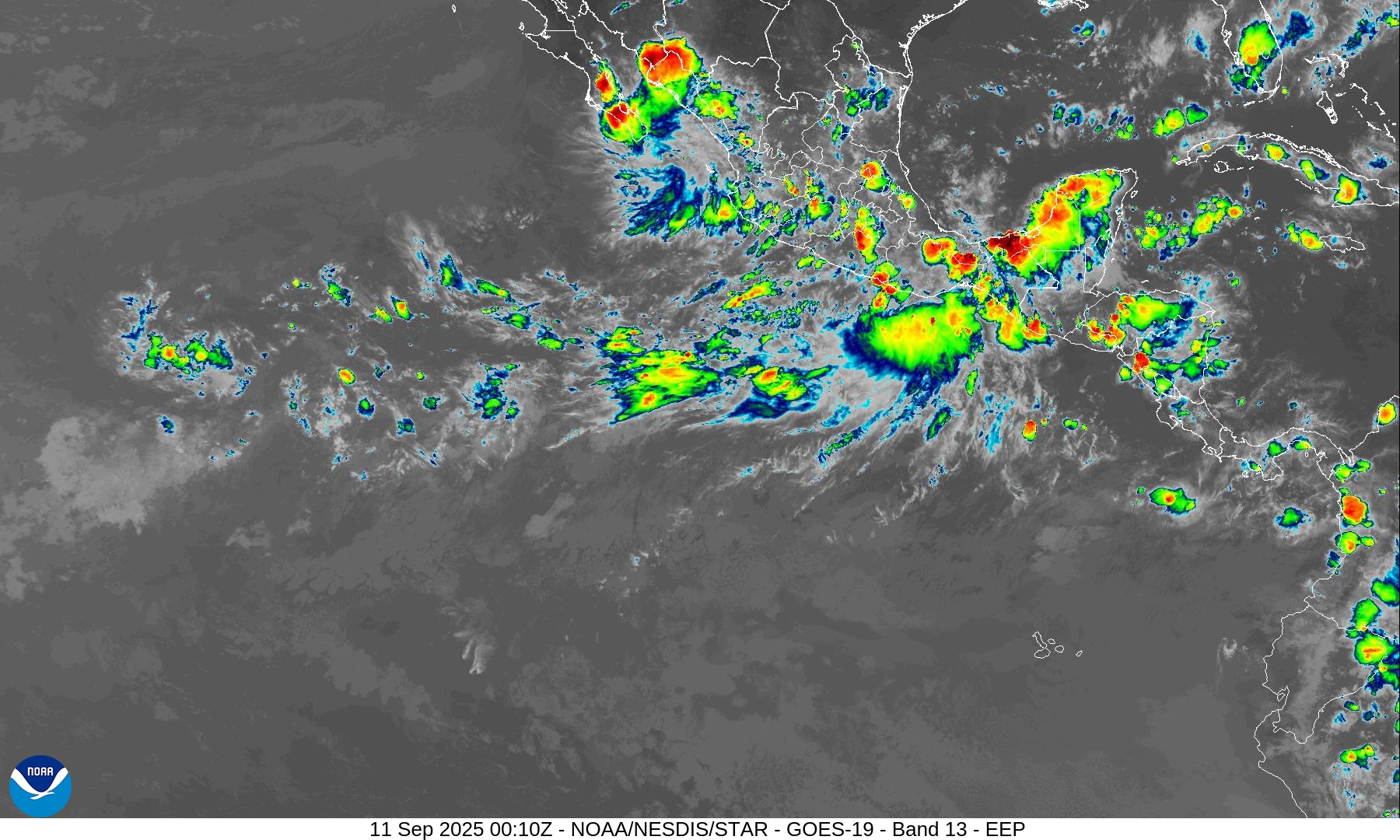
Tracks are over warm water … and should become a hurricane, and potentially a major hurricane.
5-day charts from ECMWF 18z | 974 mb = Category 2
Maps sourced from weathermodels.com designed and innovated by yours truly! Please subscribe there for real-time access to the newest maps, charts from all of the weather models including ECMWF.
- Milepost
- 730 · laid 2025-09-11T00:48:25.182000Z
- Source
- https://weather.substack.com/p/september-10-2025-wednesday-evening
- Digest
- 5740fad0aeba27754f89bec488b732a79eed0e520f280b118b0d5f2215c828c6
- Machine
- JSON