September 9, 2025 Tuesday Evening Update
No Atlantic activity through next week; quietest peak since 1992
September 2025 was the 7th-warmest September in the 131-year national record (1895–2025), at 67.9°F against a 1991–2020 normal of 66.0°F (+2.0°F).
September 2025 was the 15th-driest September in the 131-year national record (1895–2025), at 1.9in against a 1991–2020 normal of 2.6in (-0.6in).
NOAA/NCEI Climate at a Glance, contiguous United States. This is the observed record for the month, not a score of anything said in this piece — the forecast ledger begins 2026-08-17 and cannot reach earlier posts.

Good Evening!
Klotzbach et al. (Colorado State) have published a mid-season diagnosis of the ongoing slump in Atlantic basin hurricane activity. While I have been on the lower side of seasonal forecasts with 14/7/3 — an average season — other folks including the CSU group have forecasted significantly more hurricane activity during 2025.
So what’s going on? Yesterday I highlighted a LinkedIn post from Scott Yuknis from the Climate Impact Company, which described the North Atlantic Warm Hole (cool blob in northwest Atlantic) helping to shift the subtropical (Azores) high southward helping to increase stability and dry air intrusion into the Main Development Region. Saharan Air Layers combine with the prevailing flow out of the ENE across the latitude range 15°N to 25°N pretty much wiping out nascent tropical waves from intensifying. Erin was an exception that perhaps “got lucky”.
From Klotzbach, a related causal chain:
1) a dry and stable tropical Atlantic, 2) a pronounced upper-tropospheric trough in the western Atlantic increasing vertical wind shear and 3) sinking motion over Africa suppressing West African precipitation and likely African easterly wave intensity. We believe that it is a combination of these factors (and perhaps others) that have led to this recent quiet period. We do anticipate the season picking up, however, given that large-scale conditions appear to become more tropical cyclone-favorable later in September.
Historical Rarity of no activity during the peak of the season:
The National Hurricane Center currently is not expecting any TC formations in the next seven days. If that forecast verifies, it will be only the 2nd year since 1950 with no Atlantic named storm activity between 29 August and 16 September. The only other year was 1992.
Of course, the Atlantic season of 1992 featured Andrew but not much else — and it was the year after Pinatubo’s eruption. (I’m always looking for a reason to blame volcanoes!) including Hunga-Tonga from January 2022.
Klotzabach and his team are expecting an uptick of activity into late September and October as the MJO shifts to Africa (more ascent and convective instability in Atlantic). So far the sub-seasonal signals have worked against the Atlantic basin, but removing that lid might allow for a quick succession of African tropical waves to catch fire.
Lower 48 Precipitable Water | Next 6-days
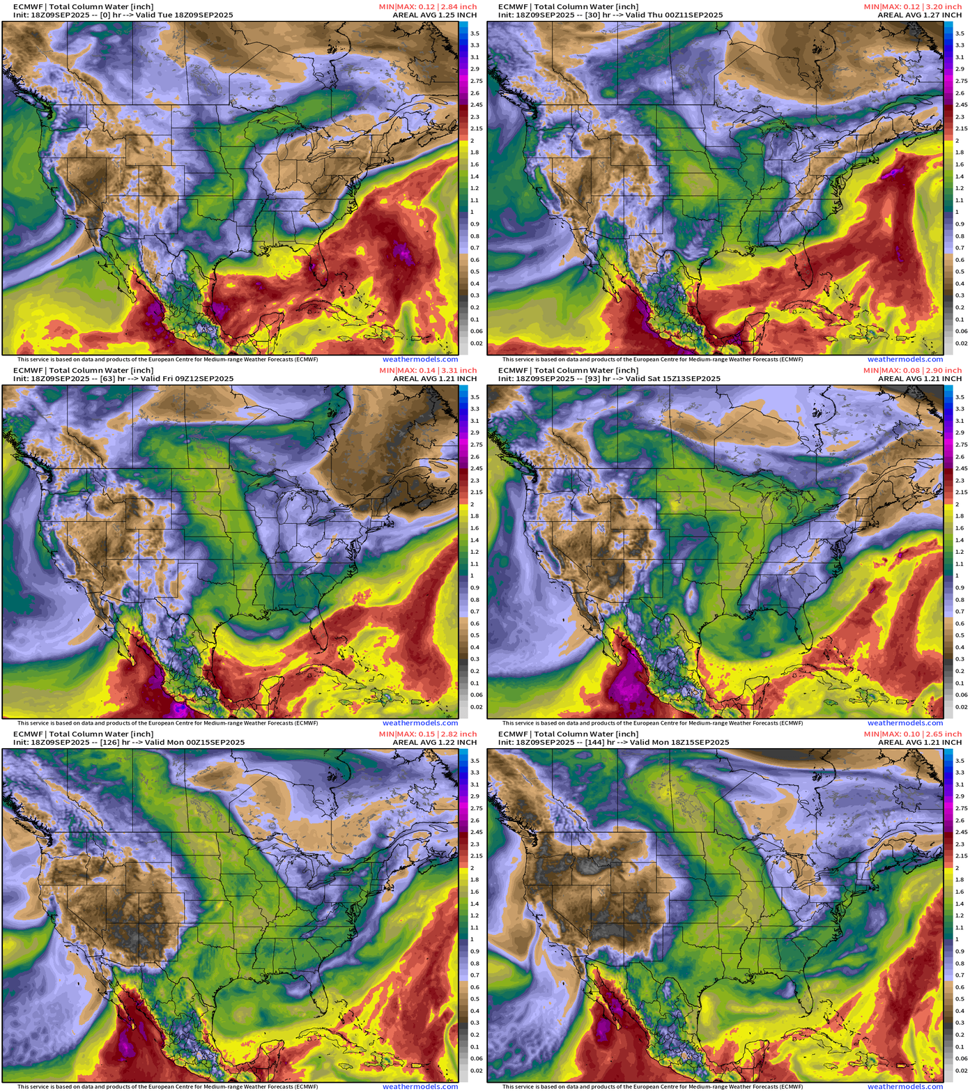
Dry air with the cold front will reach into the Gulf of Mexico with northerly flow finally clearing out Florida. Tropical Storm Marco will development and push monsoon moisture ever closer to the Southwest U.S.
Please Subscribe — or recommend to a friend to increase my reach on Substack!
Weather | Fronts this Evening
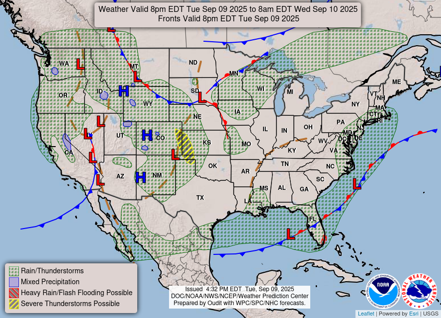
A mid-level trough and cold front swept through California bringing cooler air … and rain up the coast in NorCal and Oregon.
Smoke Analysis | 8 PM ET Tuesday
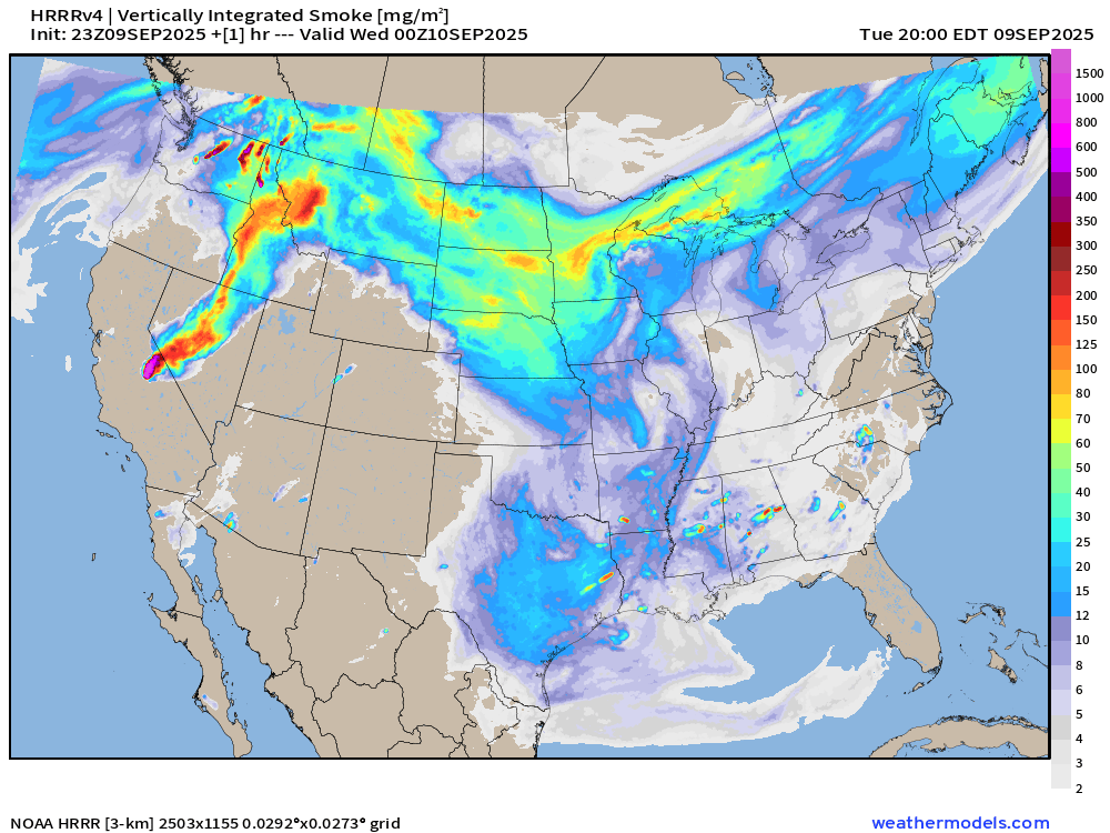
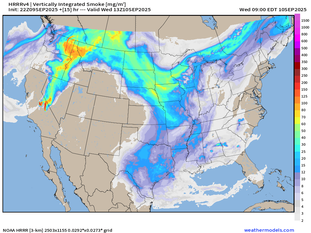
Smoke Forecast | 9 AM ET Wednesday
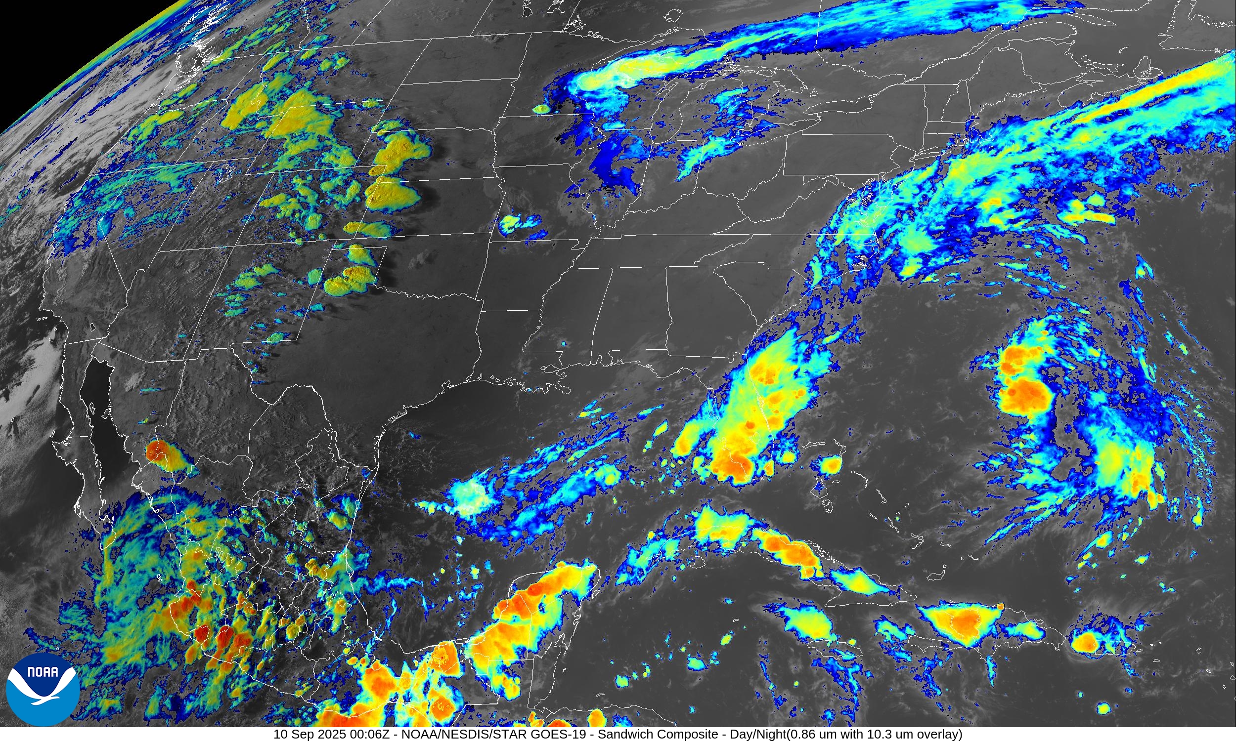
Satellite Image | Tuesday Evening
North America Upper Level Height Anomaly | AIFS 18z | Next 10-days
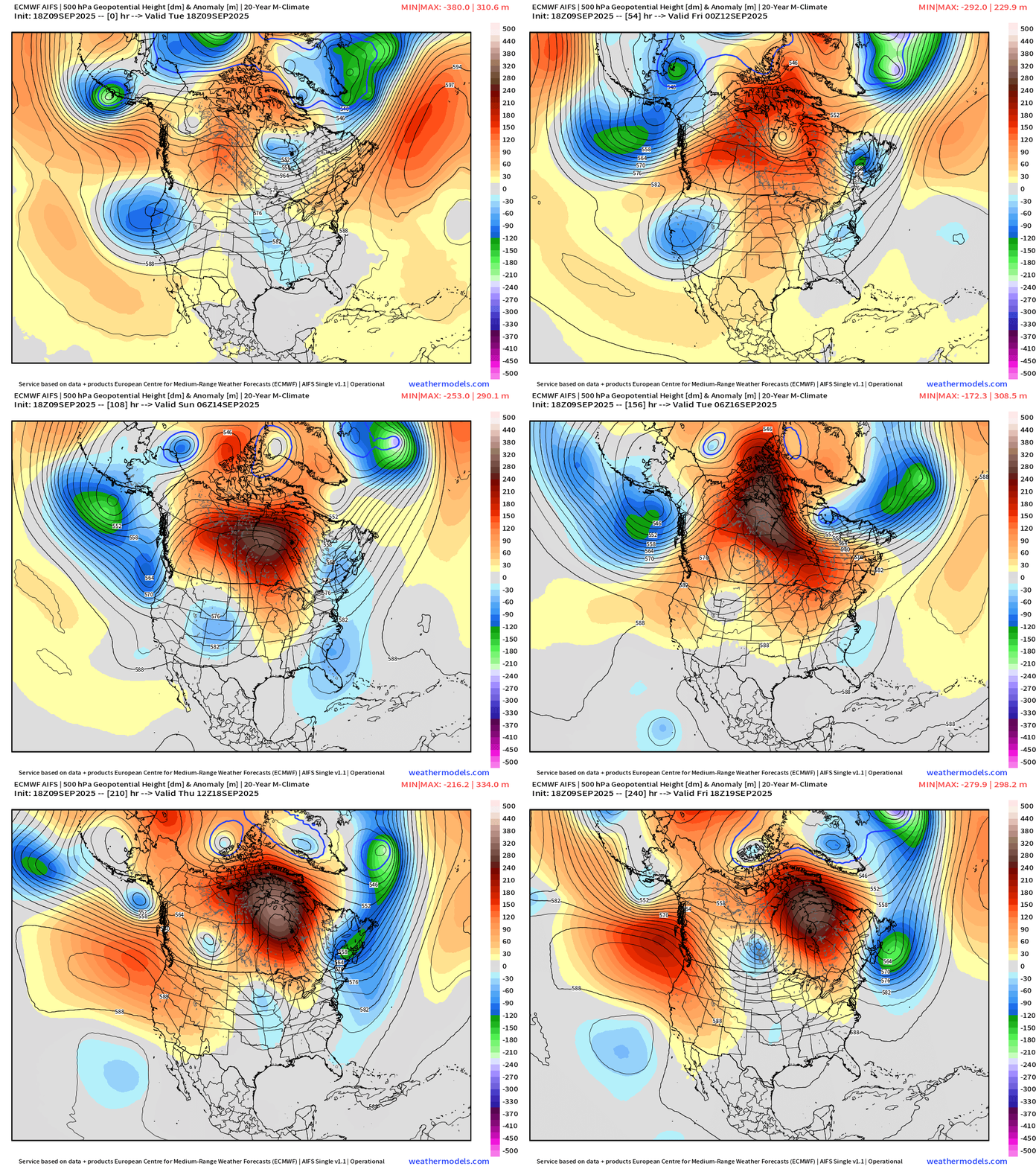
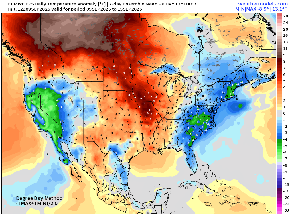
A warming trend in the center of the Lower 48 and into Canada — especially in the western provinces. The troughs on either side of the blocks will filter cooler air from Canada southward into the Carolinas and Southeast — but also very dry.
ECMWF EPS 12z | 7-day Temperature Anomaly | Week 1 (Sept 9-15)
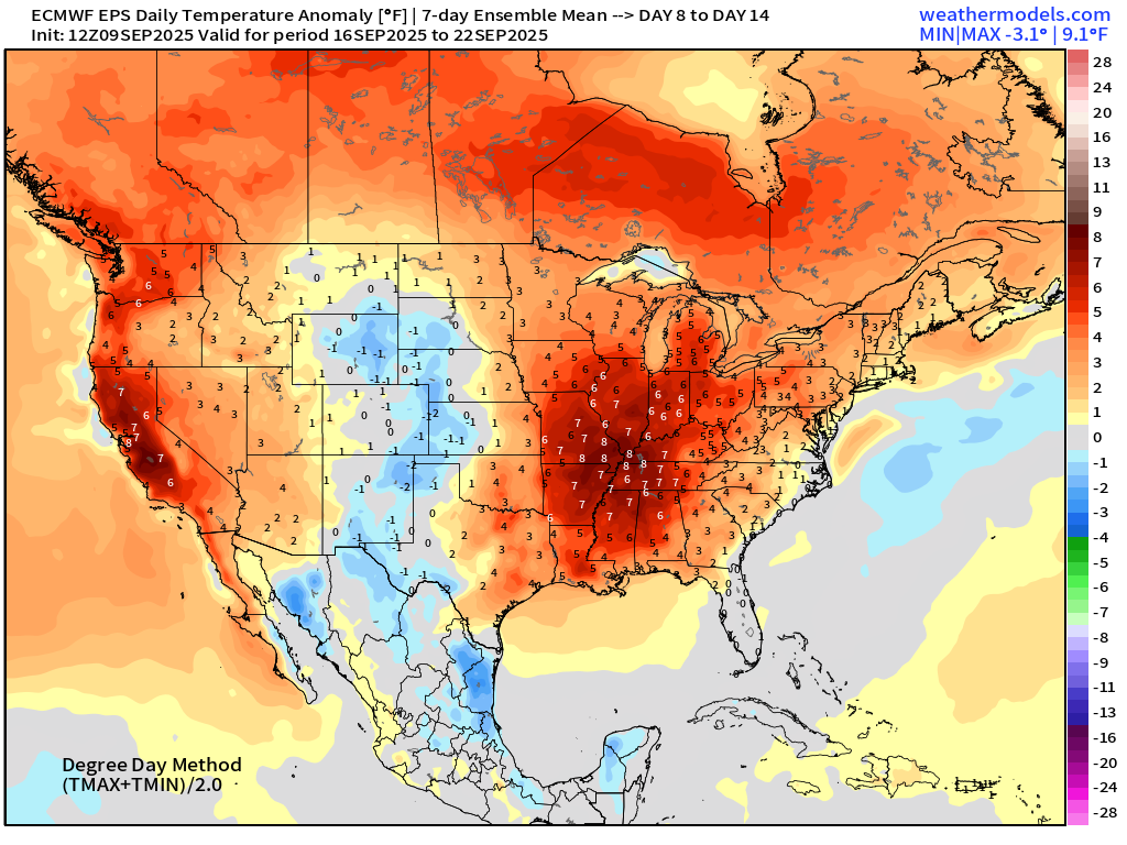
ECMWF EPS 12z | 7-day Temperature Anomaly | Week 2 (Sept 16-22)
RTMA Temperatures and Anomaly | 7:15 PM ET
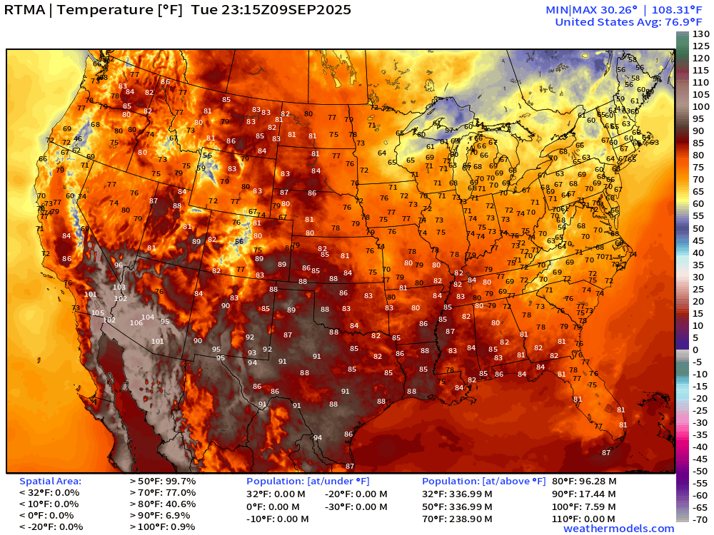
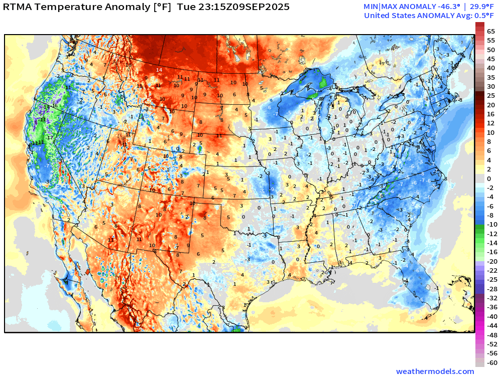
Lower 48 is -0.5°F below normal
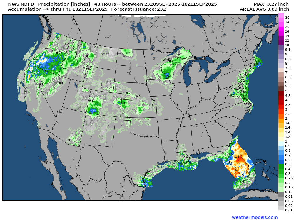
Rainfall Next 48-hours | NWS NDFD
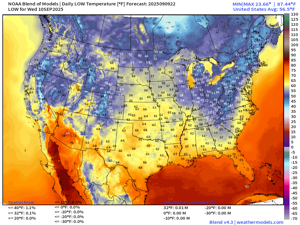
Low Temperatures Wednesday
High Temperatures Wednesday
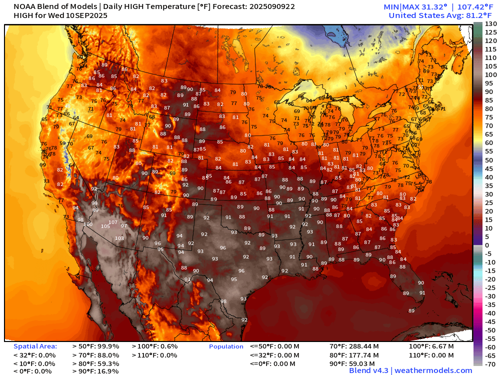
Expansion of hotter temperatures with 59 million at/above 90°F.
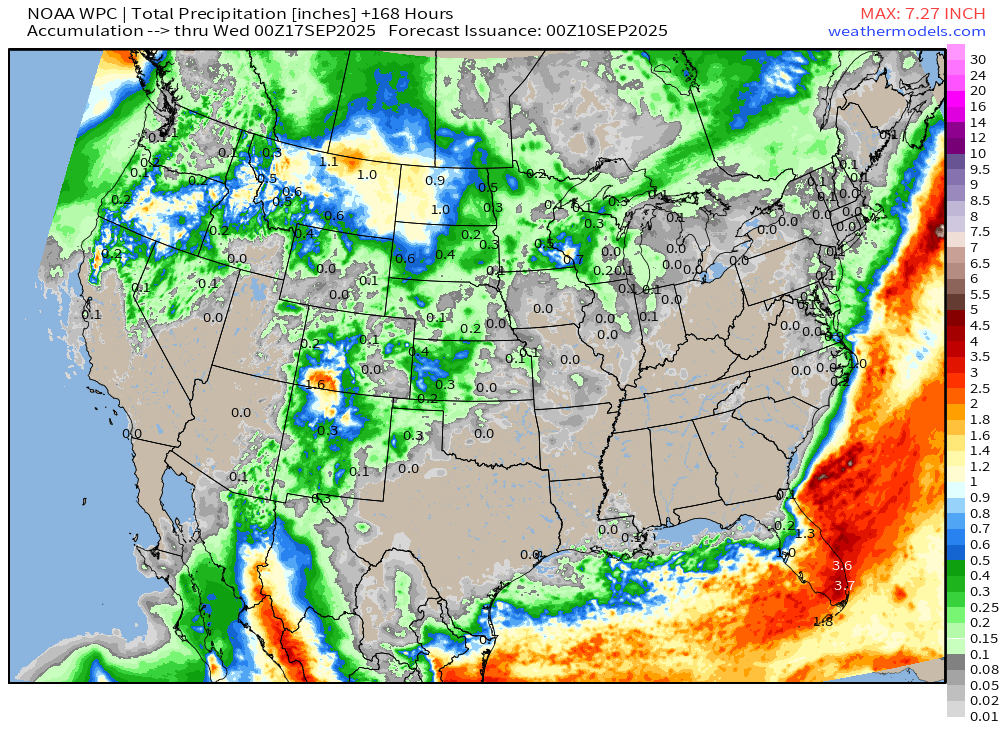
7-Day Precipitation from NOAA WPC
Atlantic Hurricane Season
2025 Hurricane Season [Day 101]. My FORECAST for this year is 14 named storms, 7 hurricanes, and 3 major hurricanes (near average)
2025 Season to Date: 6 named storms, 1 hurricanes, and 1 majors | ACE = 40 ACE of Erin: 32.2 (140-knots maximum wind)
ECMWF 12-Days Integrated Vapor Transport | 12z cycle
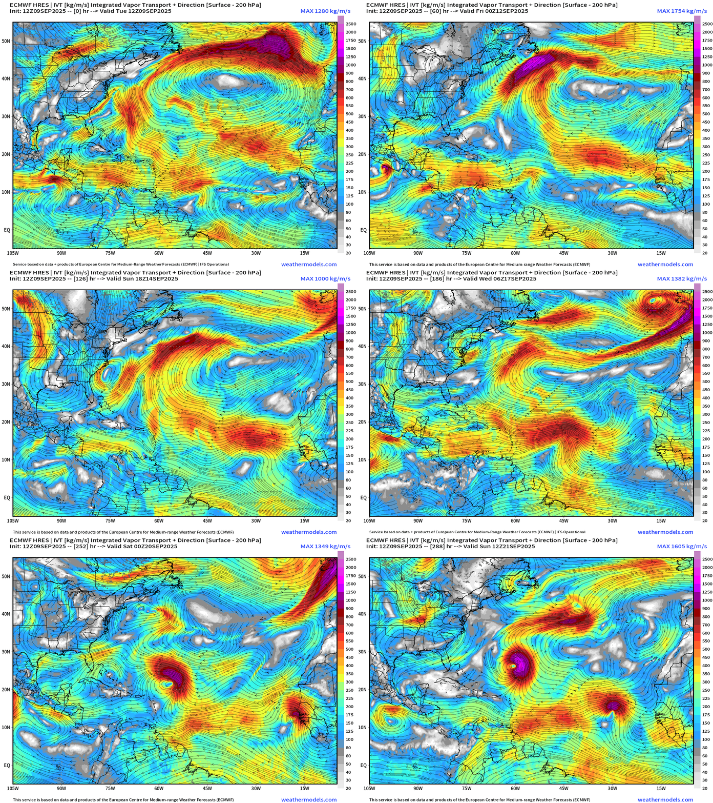
Flagship model simulation shows 2 tropical wave candidates for TS/Hurricane formation: (1) coming off Africa this weekend (2) another strong wave the following weekend. These are spaced 1-week apart, which limits the number of storms we can see in the Atlantic!
ECMWF 18z | Precipitable Water Next 6-days
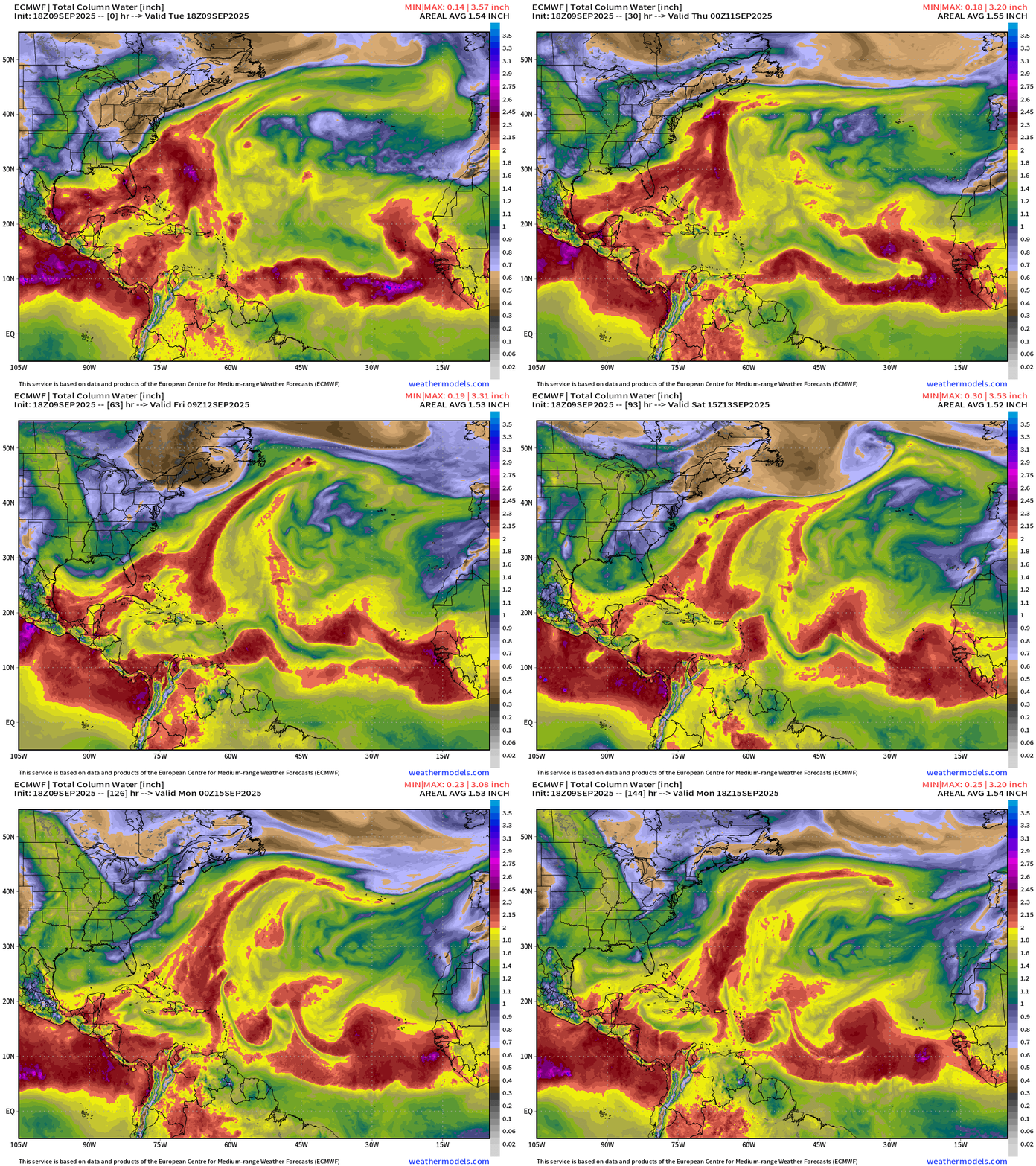
A tropical wave by this weekend coming off Africa is next shot at a tropical system.
GFS 18z Vorticity | Next 4 to 16-days
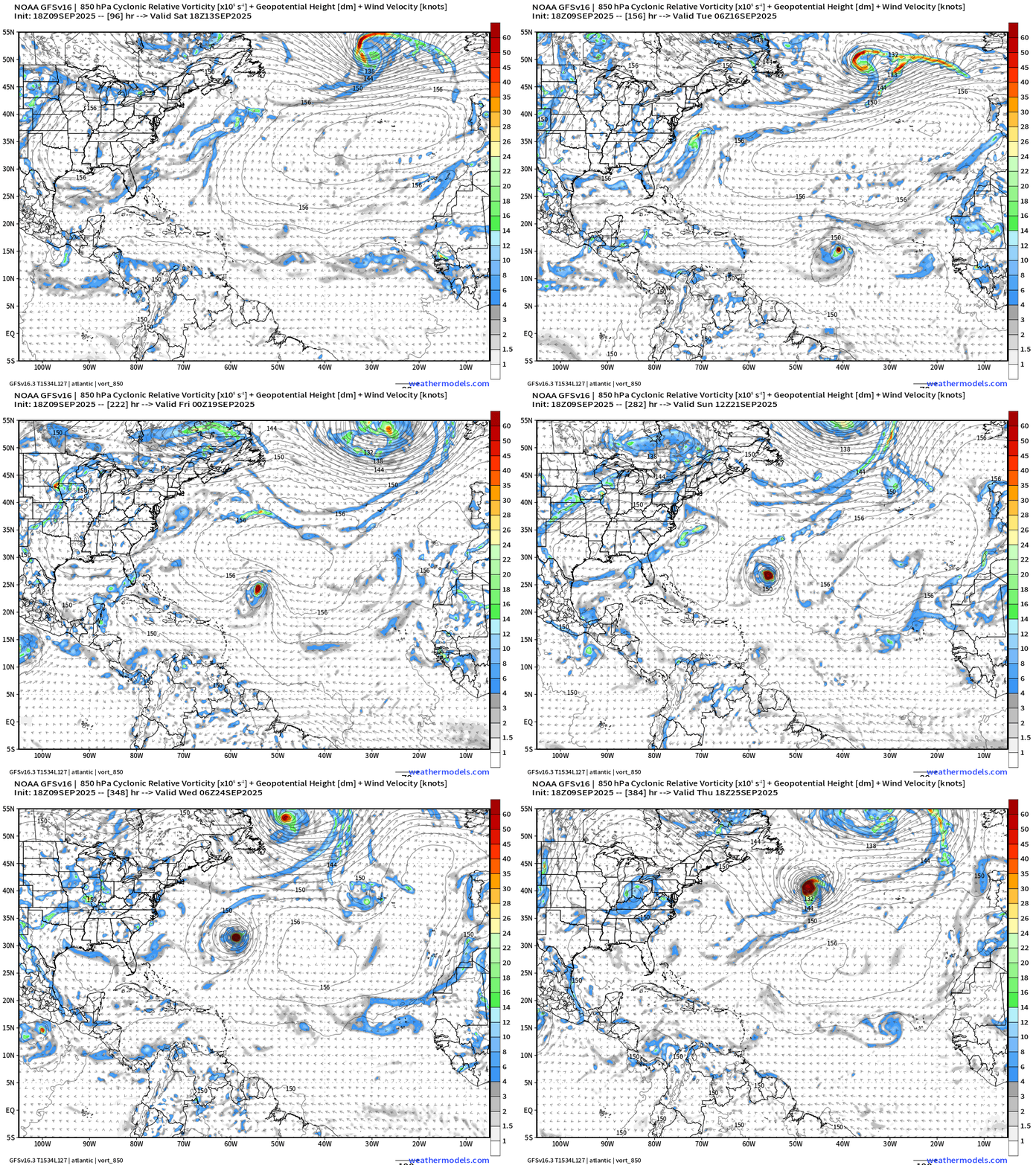
Cool loop of GFS forming “Gabrielle) out of a tropical wave in the MDR — but different (earlier) than the one ECMWF keys upon.
Atlantic Basin Outlook | 8 PM ET Update
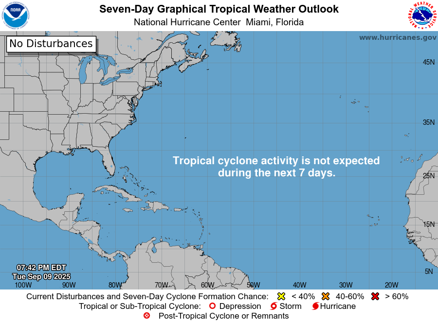
Ghost town!
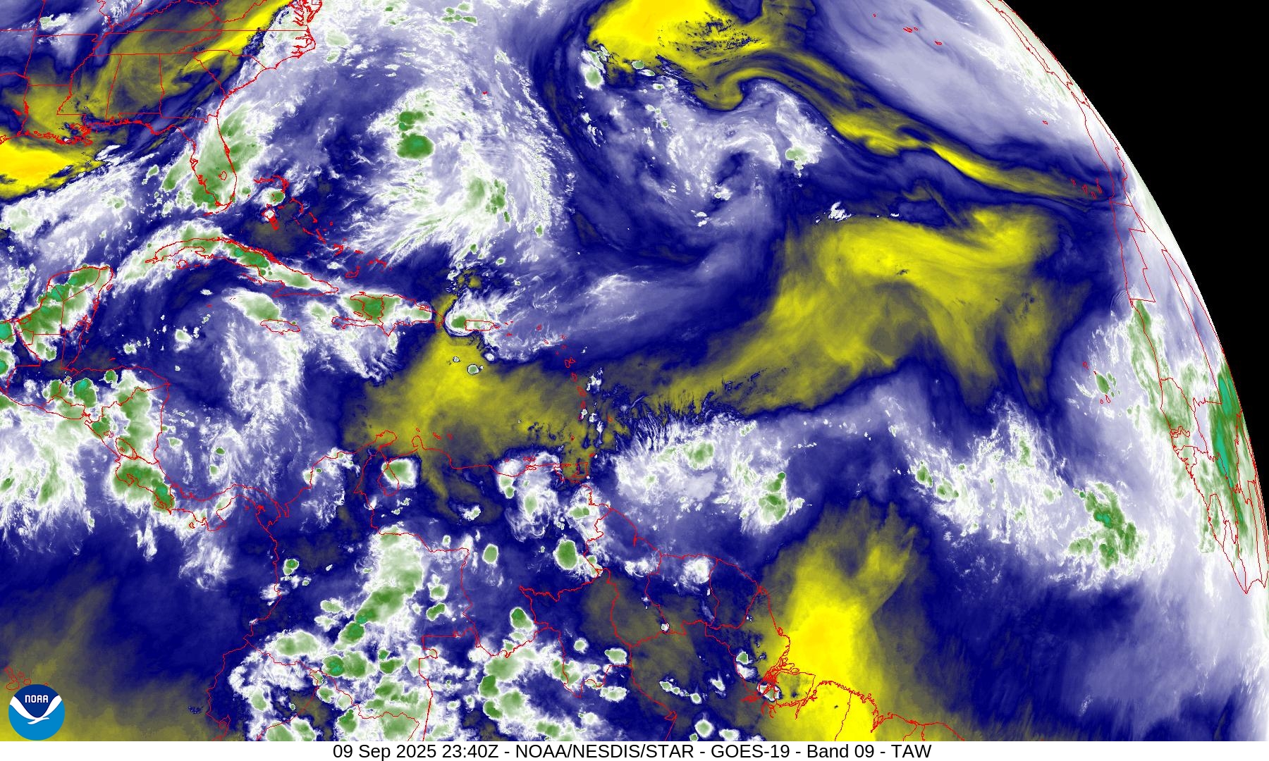
Atlantic Satellite Imagery | Water Vapor
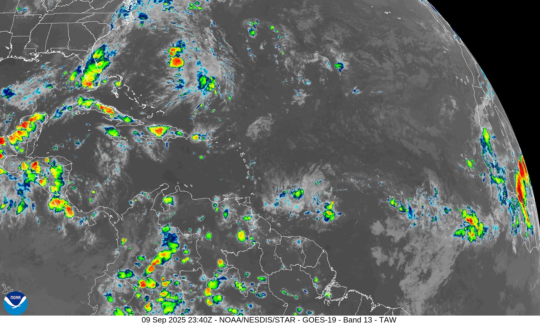
Infrared Imagery
NOAA Tropical Surface Analysis | 18z
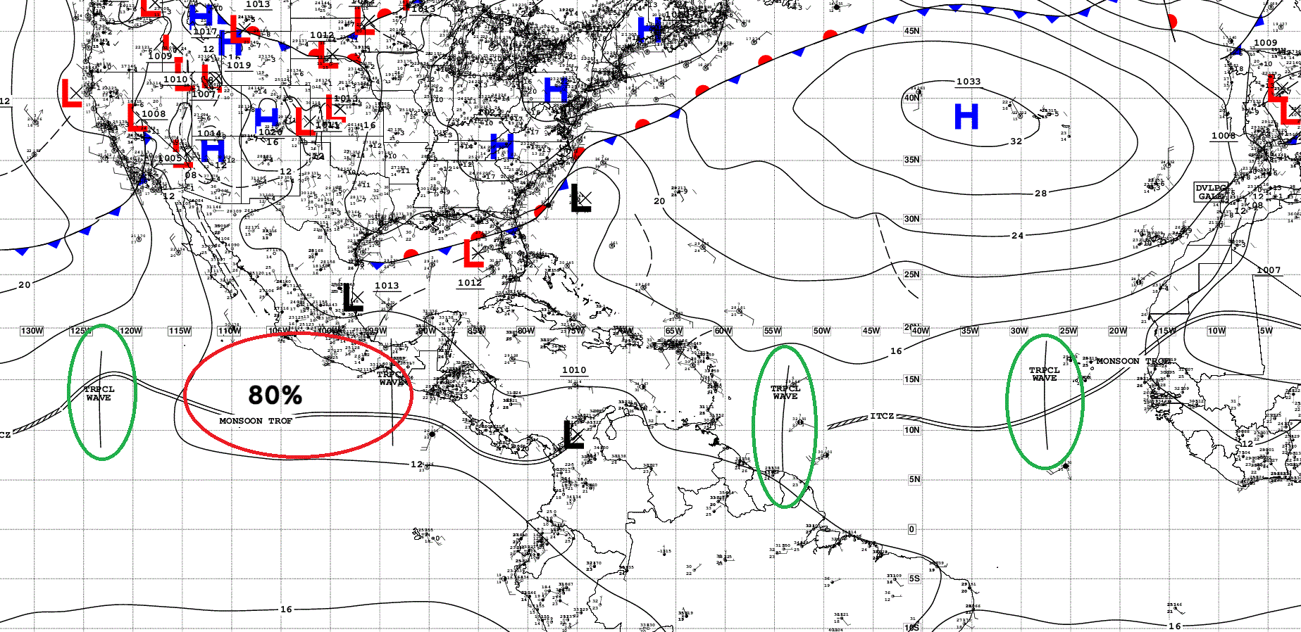
Atlantic Tropical Waves = 2
ECMWF SST and Anomaly | Atlantic
NASA Dust 5-day Forecast
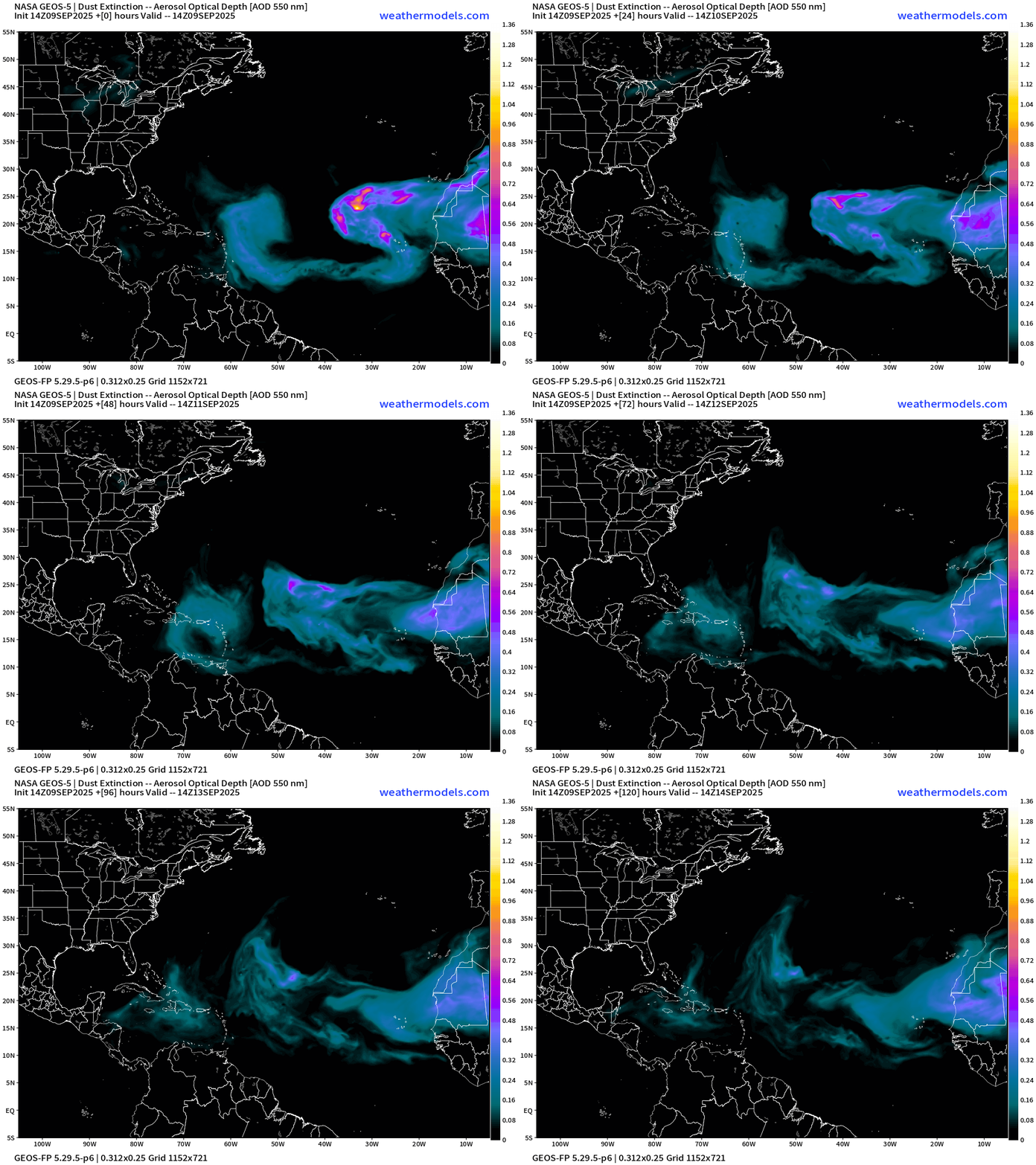
An early September dust plume helped to wipe out Invest 91L creating a dry and stable environment ahead of the tropical wave — and another one is on its heels. The dust is the symptom or proxy of the Saharan Air Layers (SAL) coming off Africa at about 20°N and ruining the chances of tropical storm formation.
ECMWF EPS 12z Ensemble | Active Cyclone Tracks Through 7-days
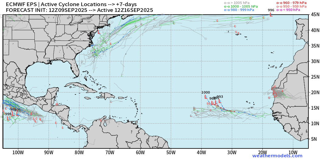
Starting to see a coherent signal from the ensembles at Day 7 (next Tuesday)
ECMWF EPS 12z Ensemble | Active Cyclone Tracks Through 12-days
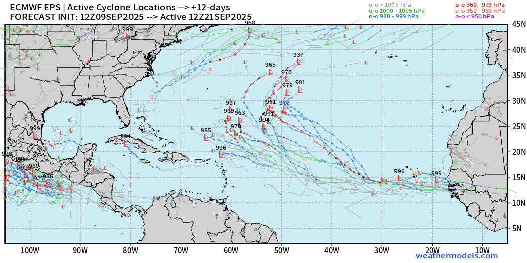
Almost half of the members continue to develop that wave …
ECMWF EPS 12z Ensemble | Active Cyclone Tracks Through 15-days
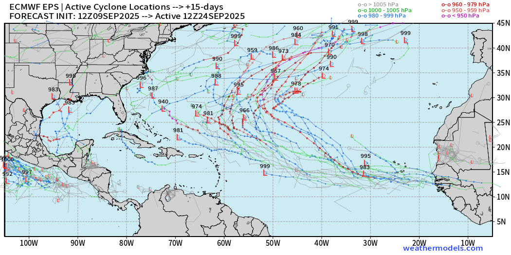
Comparison with AIFS-ENS 12z | Day 7 Active Tracks
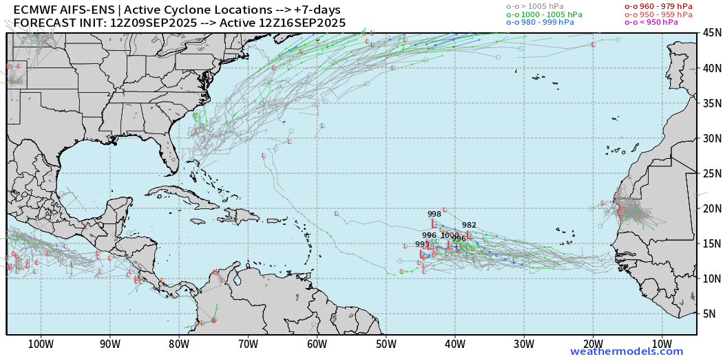
More members than the EPS conventional full-physics
AIFS-ENS Comparison at 12Z | Active Tracks at Day 12
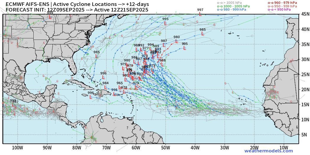
AIFS ENS is very excited about this tropical wave — high chance > 90%
AIFS-ENS Comparison at 12Z | Active Tracks at Day 15
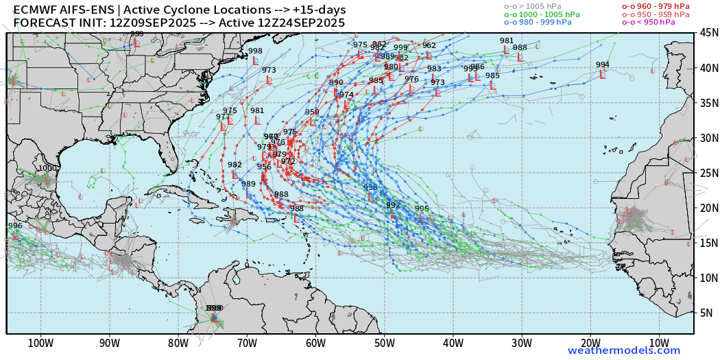
A more active Atlantic basin for sure, but thankfully everything looks to be recurving or staying away off the U.S. mainland.
Eastern Pacific Tropical Update
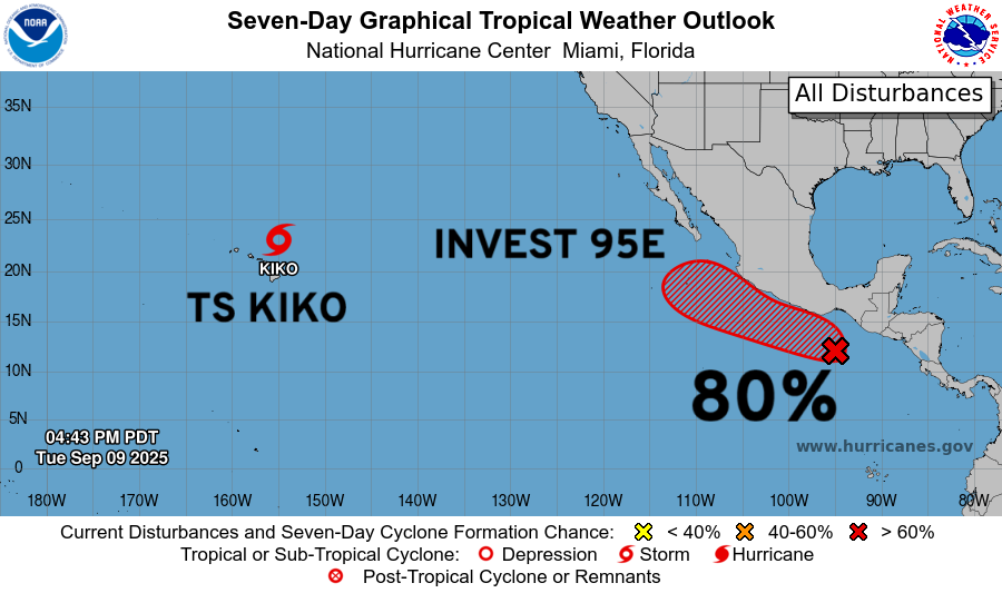
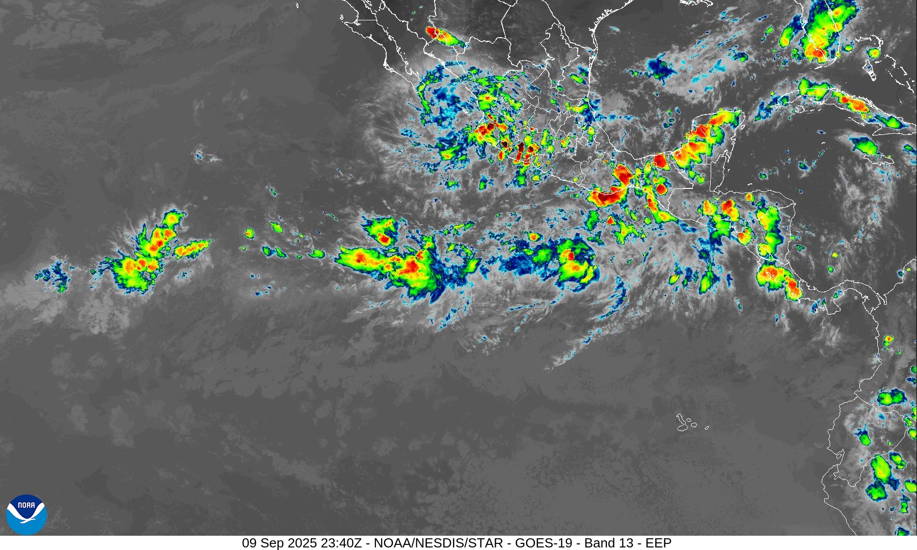
Next system is Marco — coming online in a few days
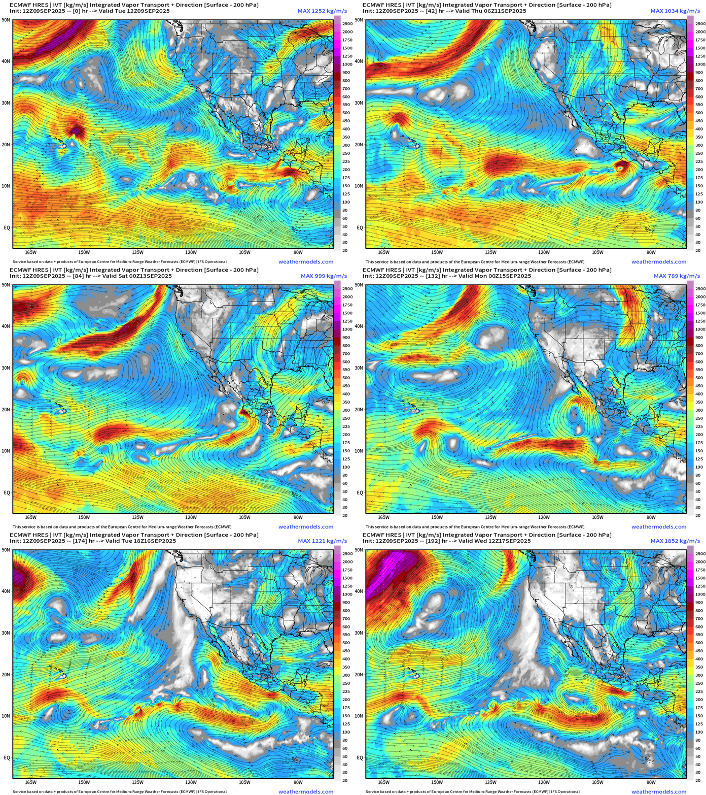
ECMWF 12z bumped Mexico with Marco limiting its development.
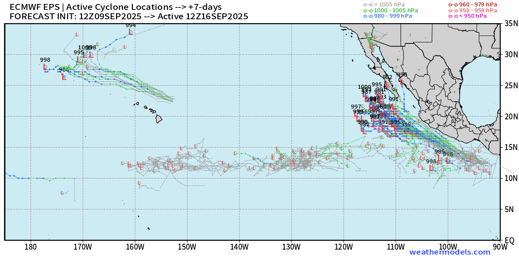
Ensembles are showing TS/Hurricane intensity with Marco and a NW track to where Lorena just dissipated.
Maps sourced from weathermodels.com designed and innovated by yours truly! Please subscribe there for real-time access to the newest maps, charts from all of the weather models including ECMWF.
- Milepost
- 728 · laid 2025-09-10T00:52:42.781000Z
- Source
- https://weather.substack.com/p/september-9-2025-tuesday-evening
- Digest
- c7c42623335d32ebb4a6a47baf6d009dbfd978ab4f8ffbad116115ea33537455
- Machine
- JSON