September 8, 2025 Monday Evening Update
Day 100 of Hurricane Season remains quiet for next week, at least
September 2025 was the 7th-warmest September in the 131-year national record (1895–2025), at 67.9°F against a 1991–2020 normal of 66.0°F (+2.0°F).
September 2025 was the 15th-driest September in the 131-year national record (1895–2025), at 1.9in against a 1991–2020 normal of 2.6in (-0.6in).
NOAA/NCEI Climate at a Glance, contiguous United States. This is the observed record for the month, not a score of anything said in this piece — the forecast ledger begins 2026-08-17 and cannot reach earlier posts.

Monday Evening Weather Update
The Atlantic basin is a disorganized mess of troughs and scattered convection.
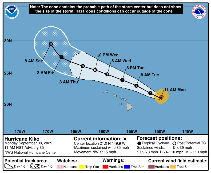
Hurricane Kiko has further weakened to Category 1 on a WNW course well away from the Hawaii Islands. Tropical Storm Marco is coming in 3-days along the coast of Mexico.
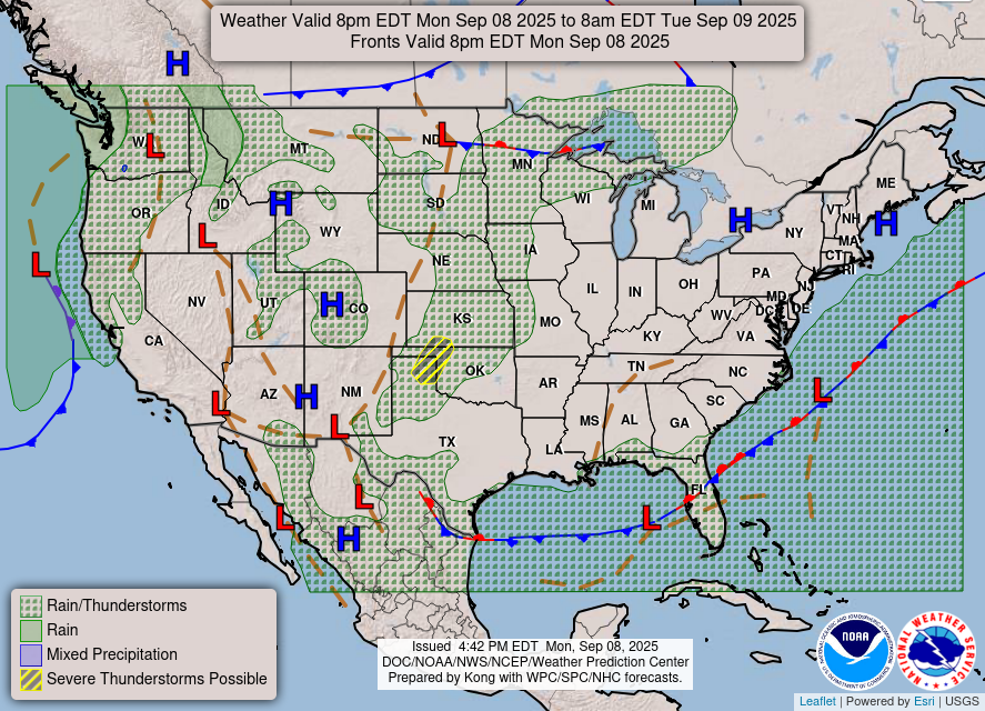
Weather | Fronts this Evening
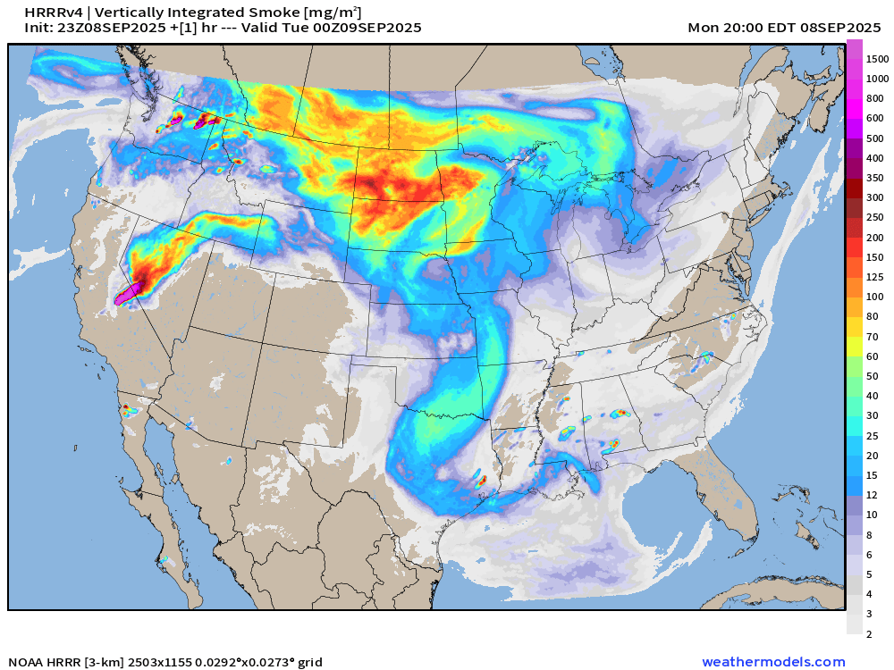
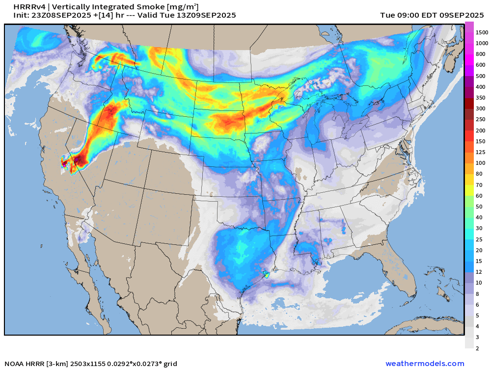
Smoke from a California wildfire is reaching into Nevada and southern Idaho. However Canadian wildfire smoke is spreading across the northern Plains and MIdwest but southerly flow is mostly keeping it bottled up.
Smoke Analysis | 8 PM ET
Smoke Forecast | 9 AM ET Tuesday
Satellite Image | Monday Evening
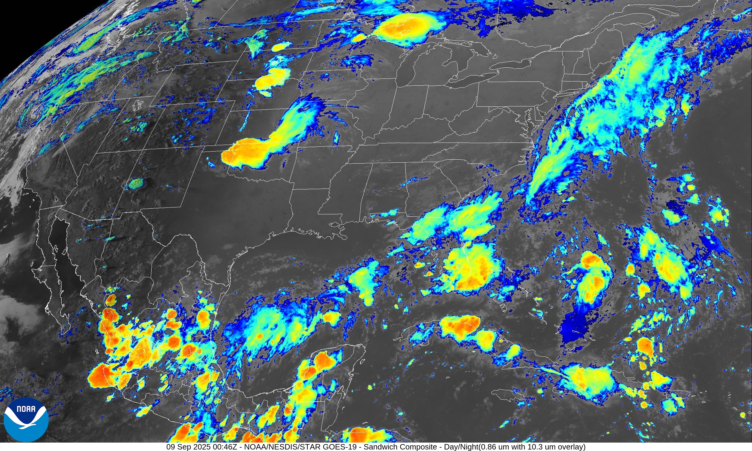
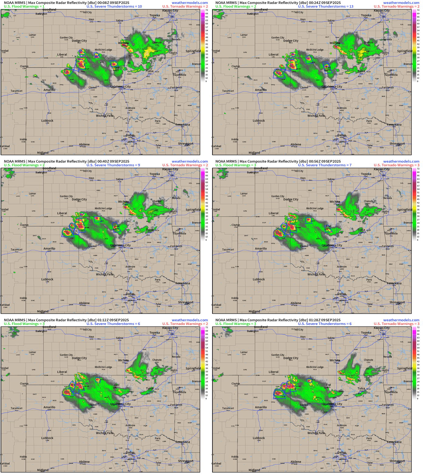
Severe storms ongoing in Oklahoma and Texas panhandles this evening
North America Upper Level Height Anomaly | AIFS 18z | Next 10-days
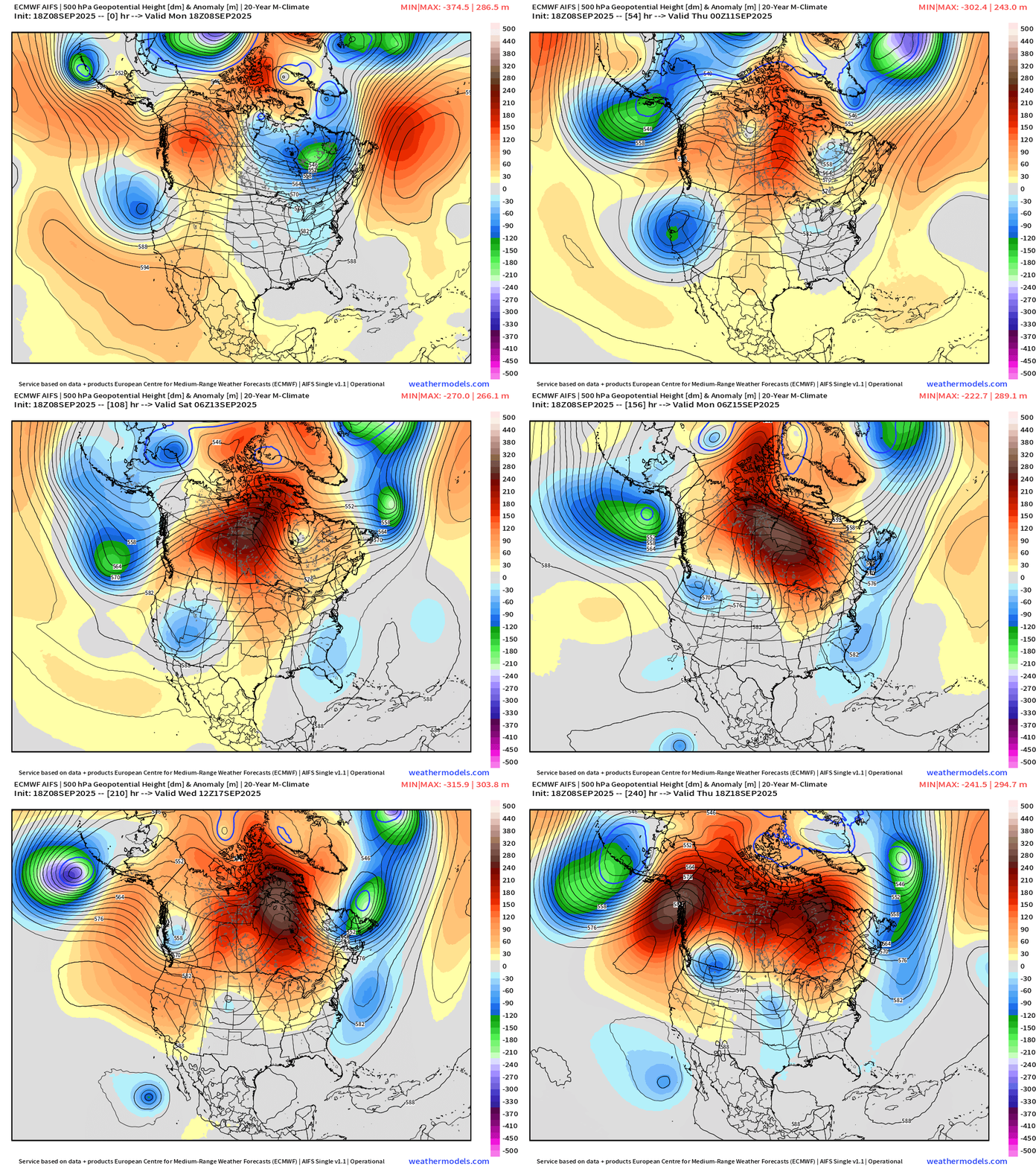
A strong and persistent blocking ridge builds across Canada over the next 7-10 days for a much warmer pattern across the Lower 48. Hard to get any Arctic air to flood southward. However, unsettled weather will result from several cut-off troughs that necessarily have to go around the ridge + wave breaking.
Day 10 Temperature Anomaly + Height Anomaly
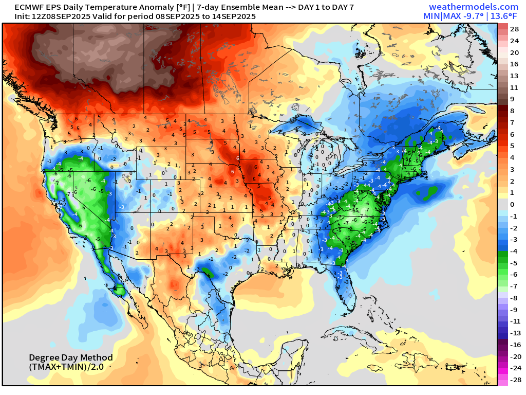
ECMWF EPS 12z | 7-day Temperature Anomaly | Week 1 (Sept 8-14)
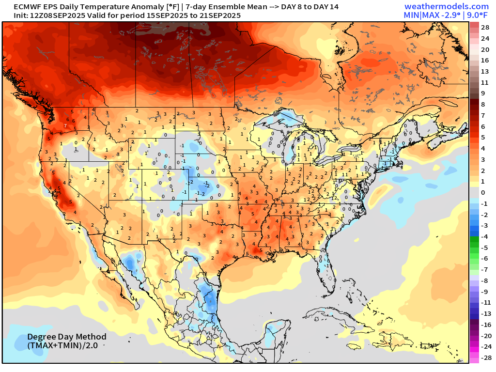
ECMWF EPS 12z | 7-day Temperature Anomaly | Week 2 (Sept 15-21)
RTMA Temperatures and Anomaly | 8:30 PM ET
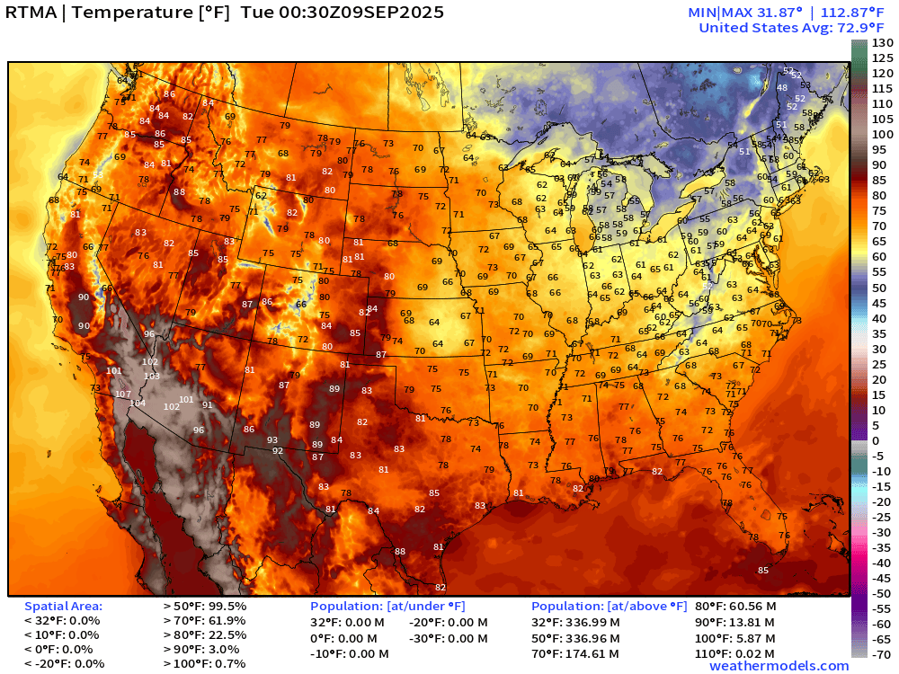
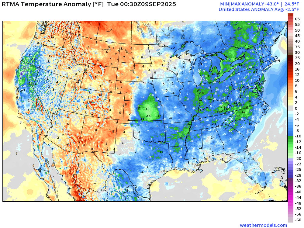
Lower 48 is -2.5°F below normal
HRRR Radar Simulation Next 48-Hours
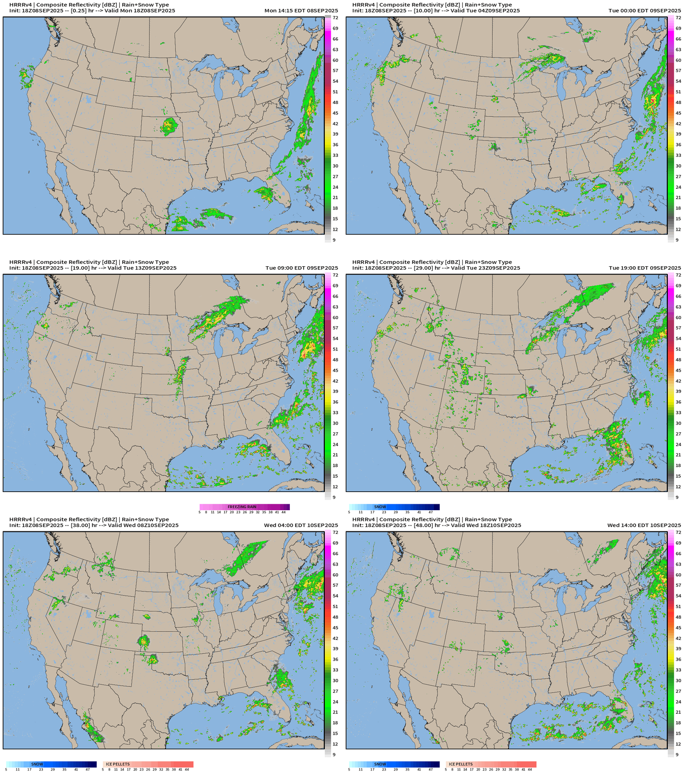
Heavy rain along the frontal boundary in Florida + showers in the Great Lakes through Tuesday
Rainfall Next 48-hours | NWS NDFD
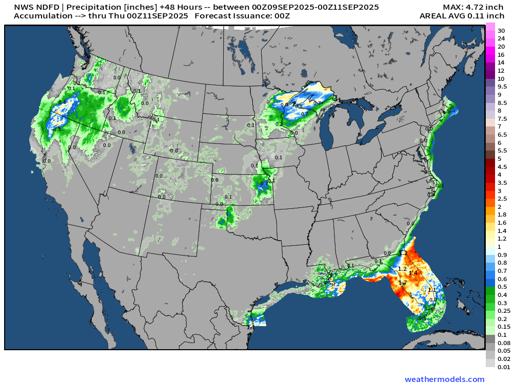
Showers return to the Pacific Northwest including 1-inch or more along the coast in Oregon
Low Temperatures Tuesday
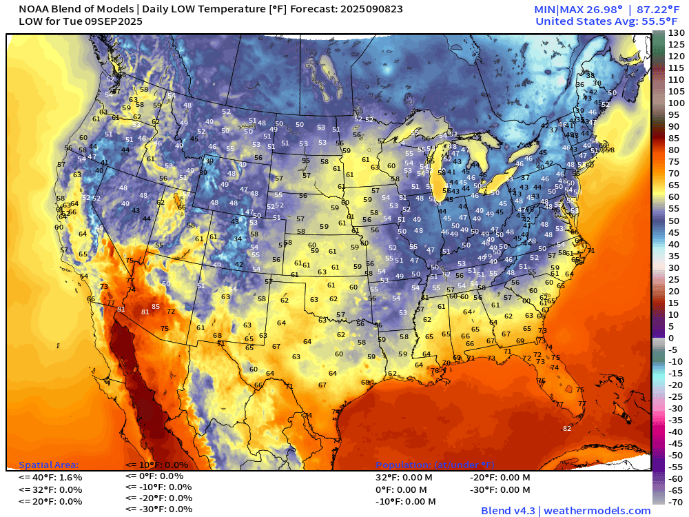
High Temperatures Tuesday
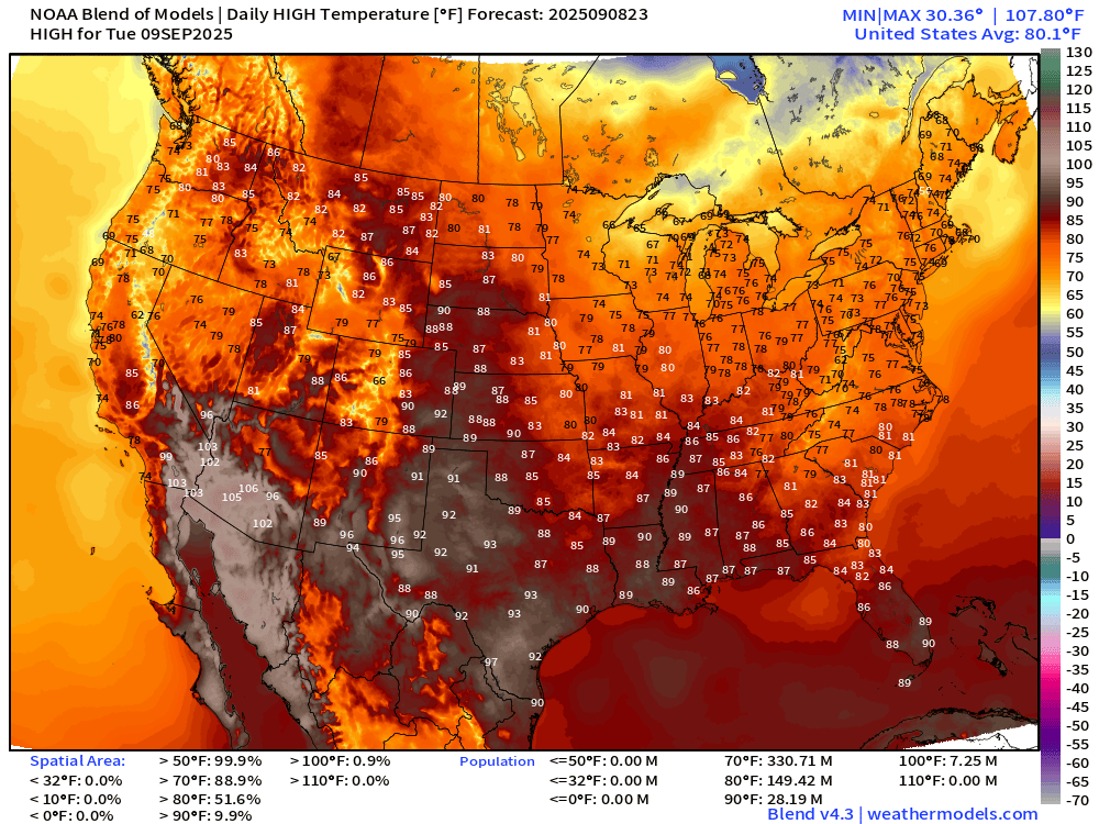
Very comfortable across much of the Lower 48 with only 28 million at/above 90°F.
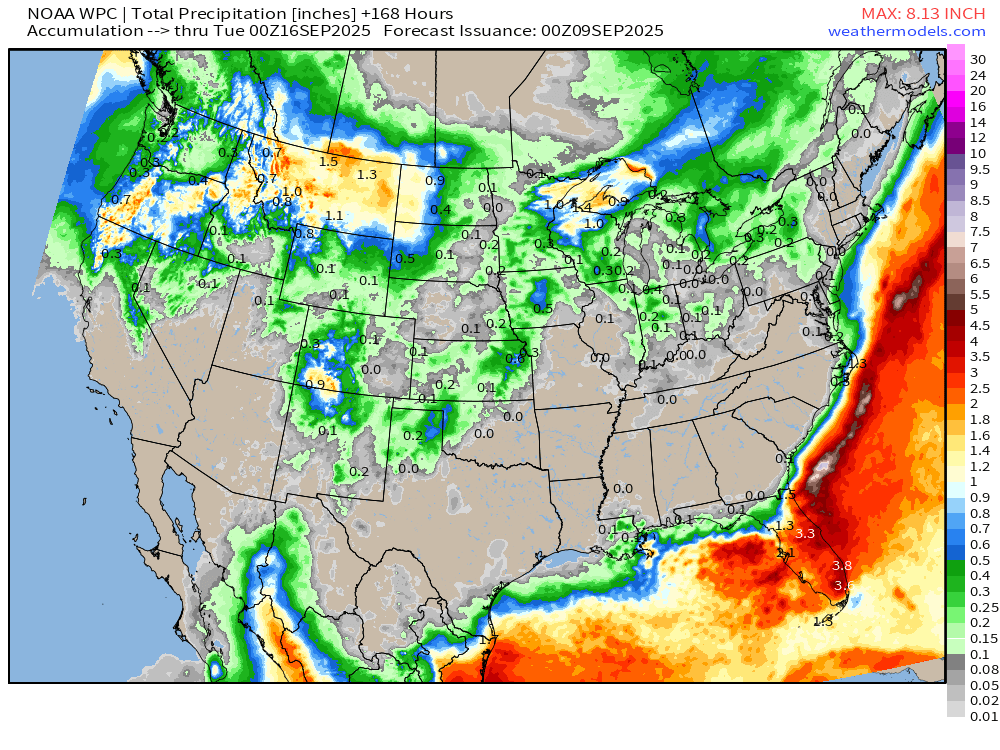
7-Day Precipitation from NOAA WPC
Atlantic Hurricane Season Day 100
2025 Hurricane Season [Day 100]. My FORECAST for this year is 14 named storms, 7 hurricanes, and 3 major hurricanes (near average) BUT that might be generous
2025 Season to Date: 6 named storms, 1 hurricanes, and 1 majors | ACE = 40 ACE of Erin: 32.2 (140-knots maximum wind)
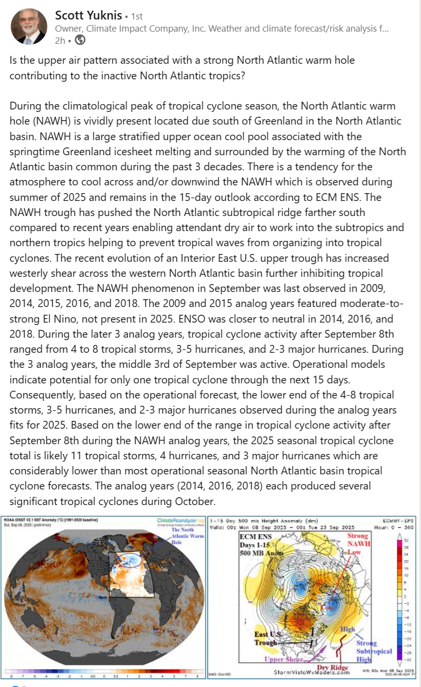
I’d like to highlight this post by Scott Yuknis on LinkedIn — a valuable resource for weather and climate analysis by professionals.
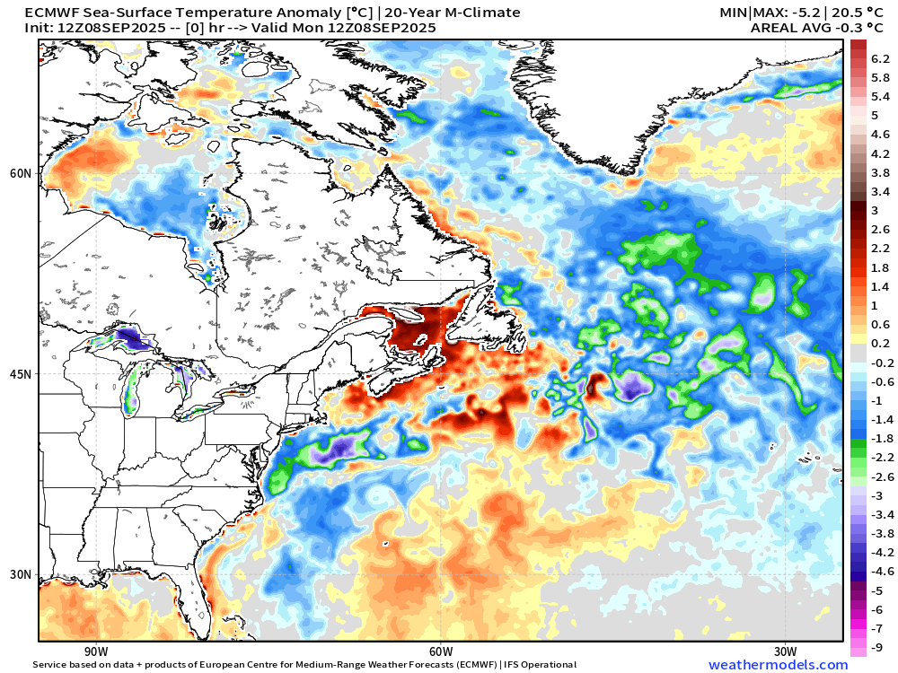
He diagnoses the rather inactive Atlantic hurricane season as being a consequence of colder SSTs in the North Atlantic due to the “North Atlantic Warm Hole” … leading to the subtropical ridge pushed farther south into the vicinity of the MDR. This allows Saharan Dust Layers, dry air from the Azores, and subtropics to infiltrate the tropics and increase wind shear and stability.
His thinking makes sense, of course! The impact of this weather regime on African Easterly Waves seems to be deleterious especially with the monsoon trough and ITCZ nudged southward while waves come off Africa at higher latitude (20°N) crossing cooler waters. It’s all connected!
ECMWF 12-Days Integrated Vapor Transport | 12z cycle
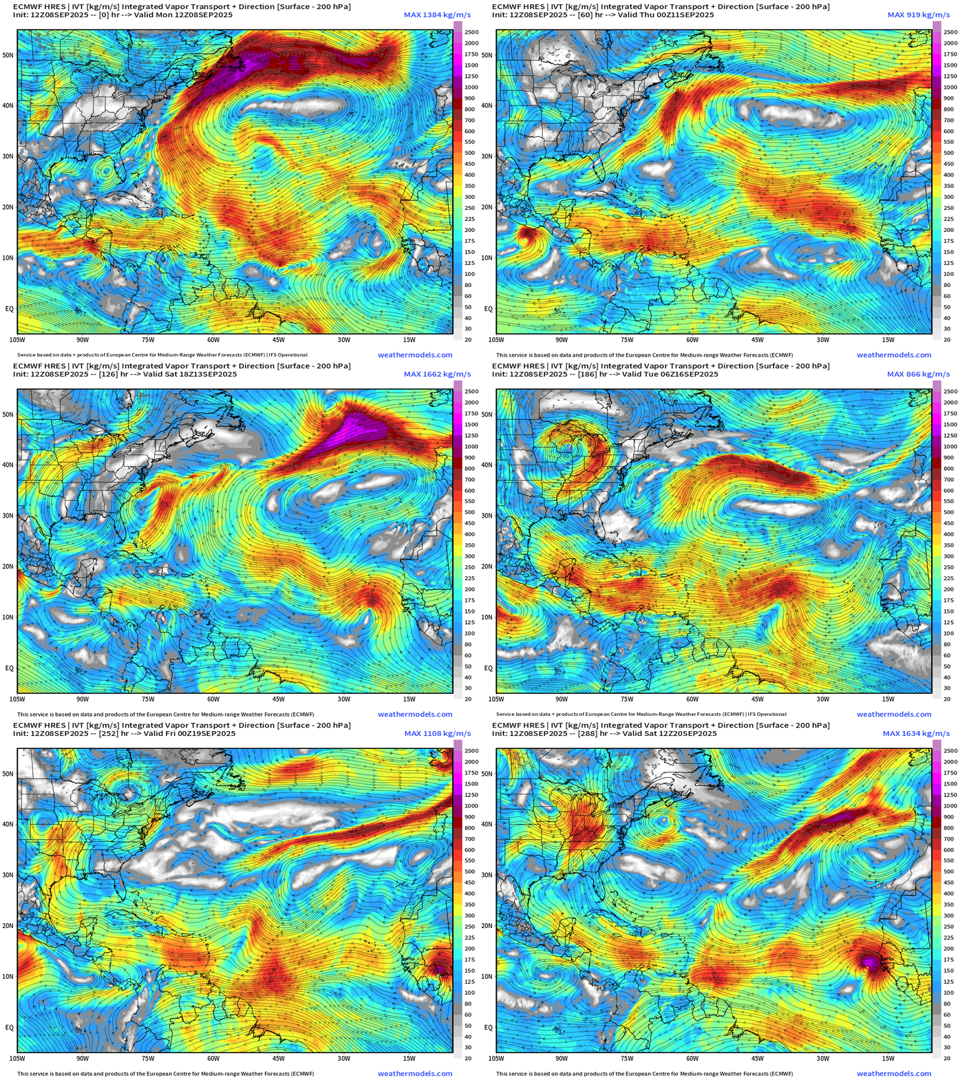
Flagship model simulation for next 10-days — low chance for “something” is STILL a wave that emerges next weekend.
VERY quiet — dormant Atlantic —> ghost town! I think we’ll need to dial back the seasonal forecasts a little bit mainly because we’ll sail through the peak of the season with NOTHING.
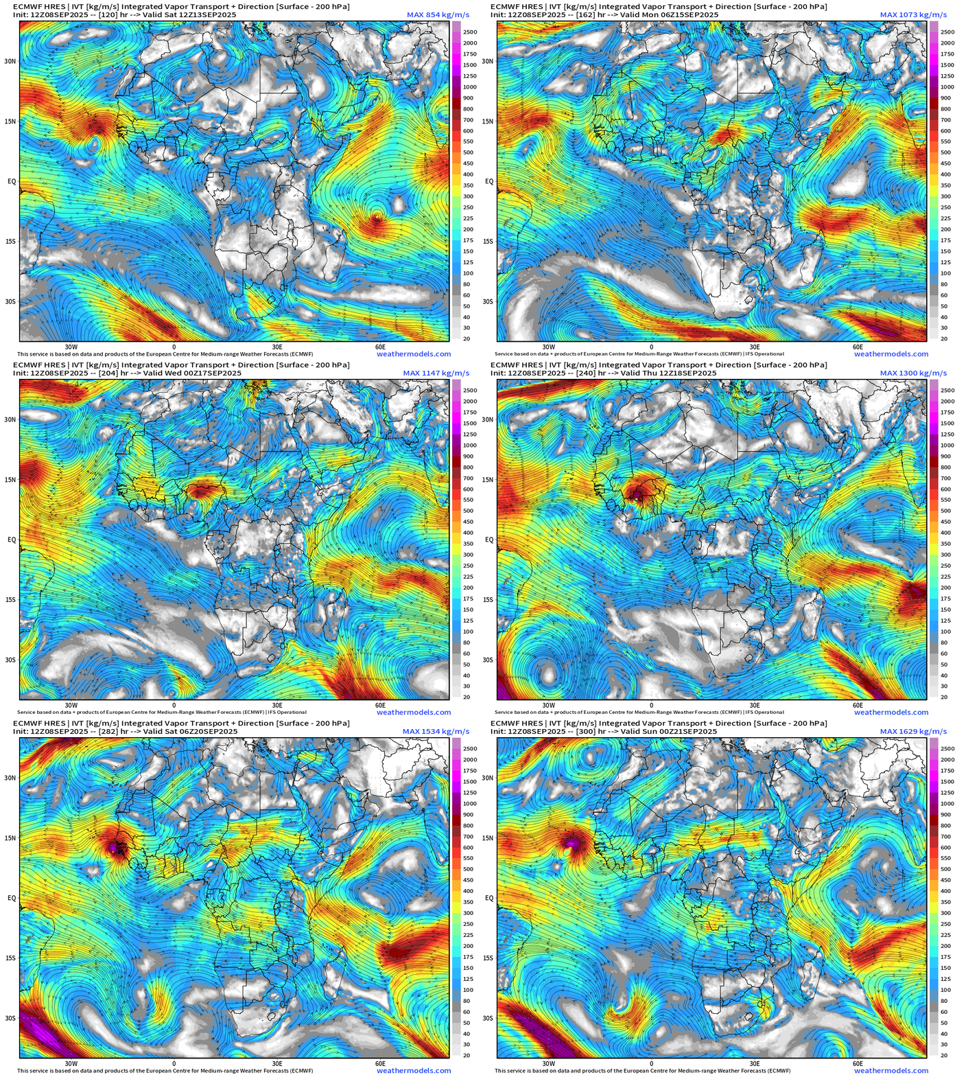
Let’s look at another tropical wave in the 12-13 day range — more robust. However, that’s way down the road — but we can use this model scenario to remind folks that Atlantic hurricane season is NOT over, just taking a little break.
ECMWF 18z | Precipitable Water Next 6-days
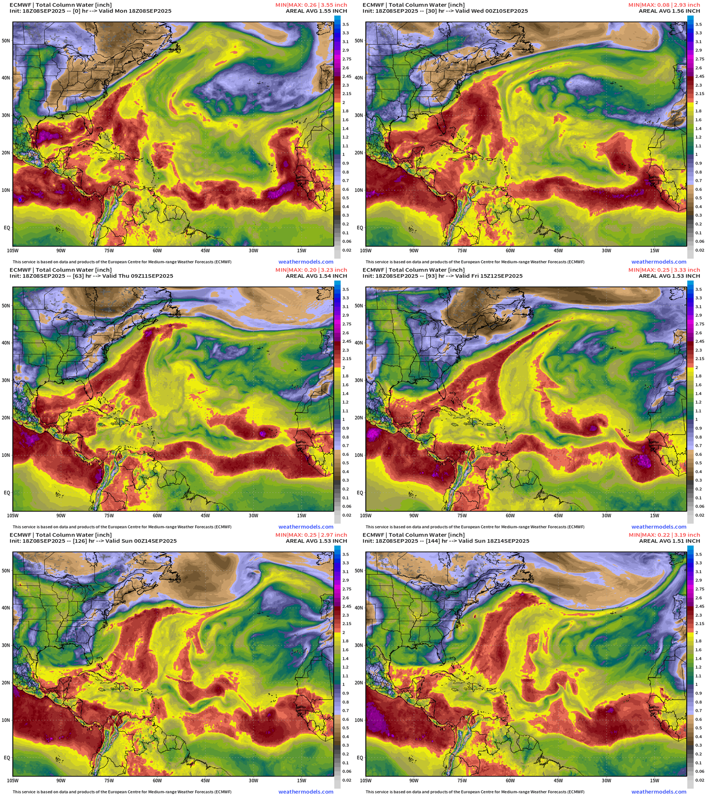
A tropical wave by this weekend coming off Africa is next shot at a tropical system.
Atlantic Basin Outlook | 8 PM ET Update
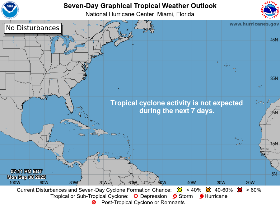
Ghost town!
Atlantic Satellite Imagery | Water Vapor
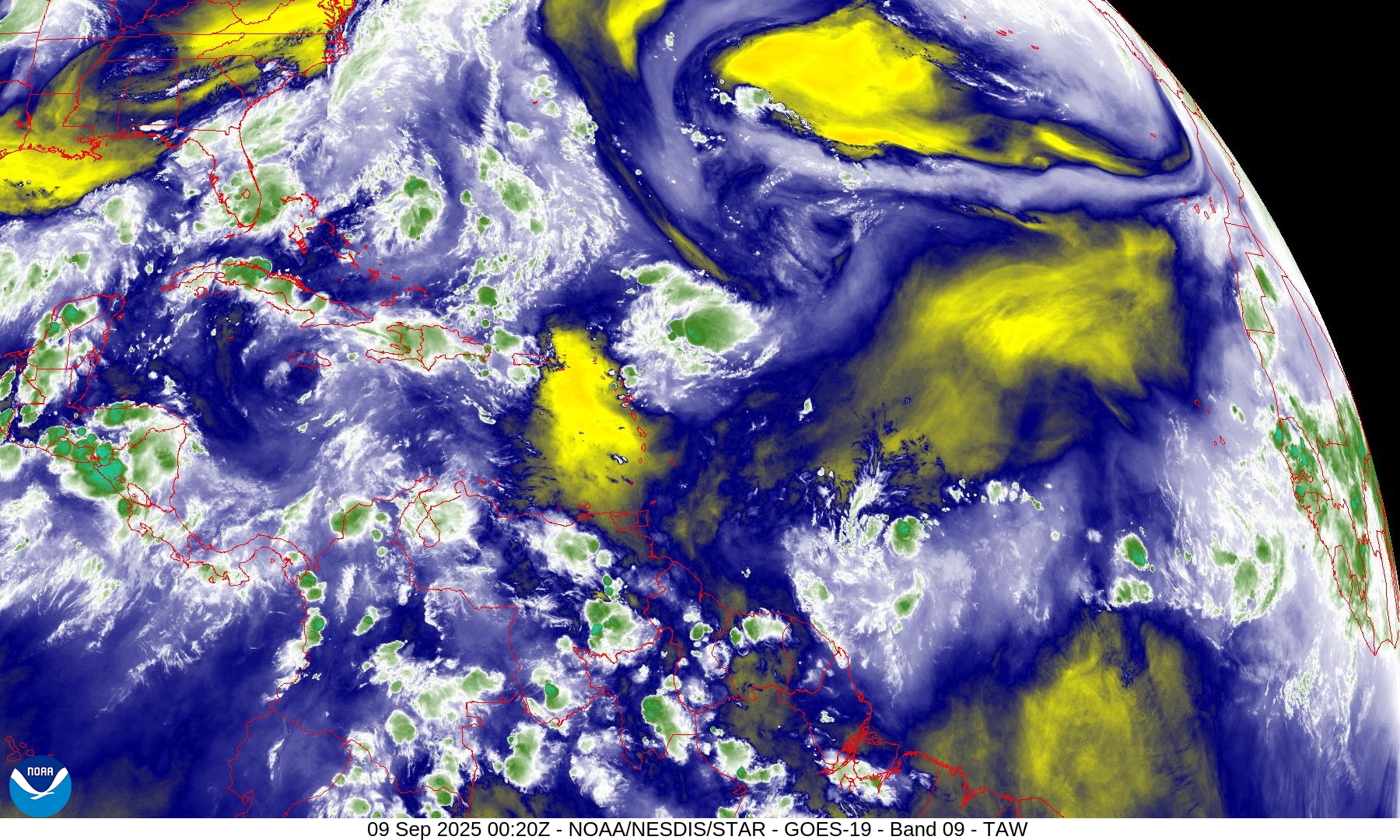
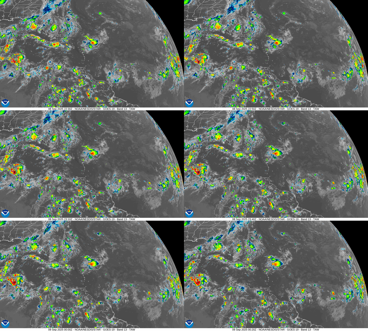
The wave formerly known as Invest 91L continues to generate convection NE of the Caribbean. We’ve lost some of the yellow dry blob coverage.
Infrared Imagery | Loop
NOAA Tropical Surface Analysis | 18z
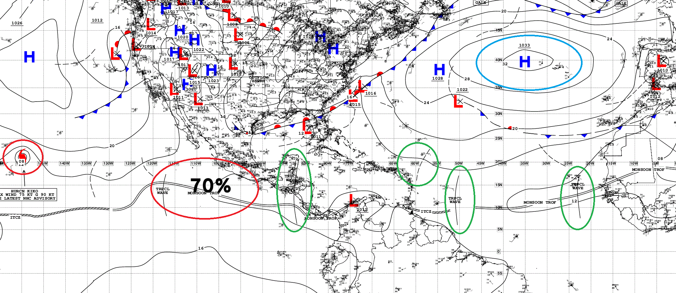
Atlantic Tropical Waves = 3 generating moderate convection + remnants of Invest 91L
ECMWF SST and Anomaly | Atlantic
NASA Dust 5-day Forecast
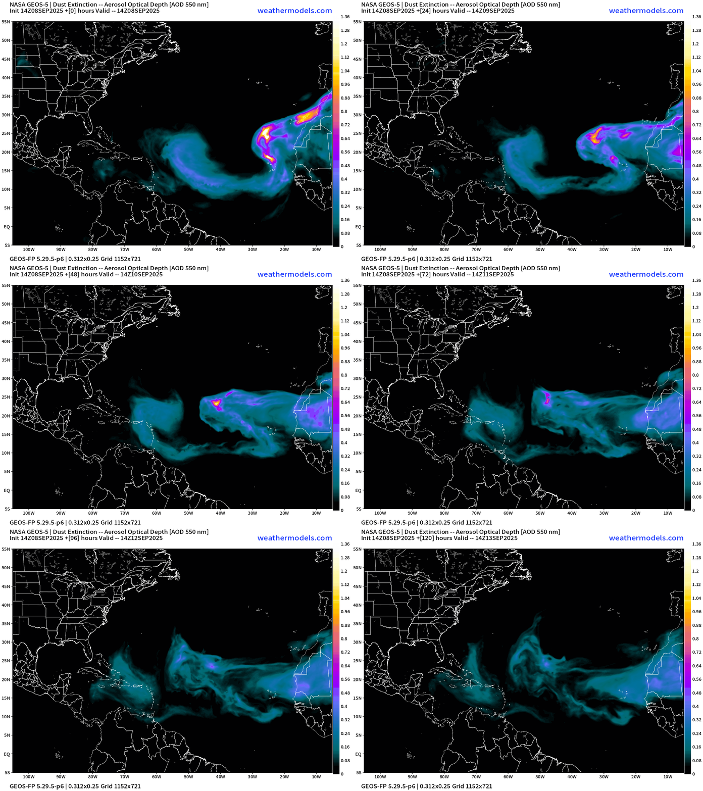
An early September dust plume helped to wipe out Invest 91L creating a dry and stable environment ahead of the tropical wave — and another one is on its heels. The dust is the symptom or proxy of the Saharan Air Layers (SAL) coming off Africa at about 20°N and ruining the chances of tropical storm formation.
ECMWF EPS 12z Ensemble | Active Cyclone Tracks Through 7-days
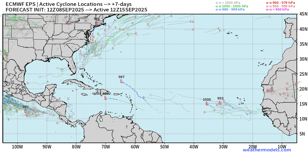
Tiny chance of a development (5%)
ECMWF EPS 12z Ensemble | Active Cyclone Tracks Through 10-days
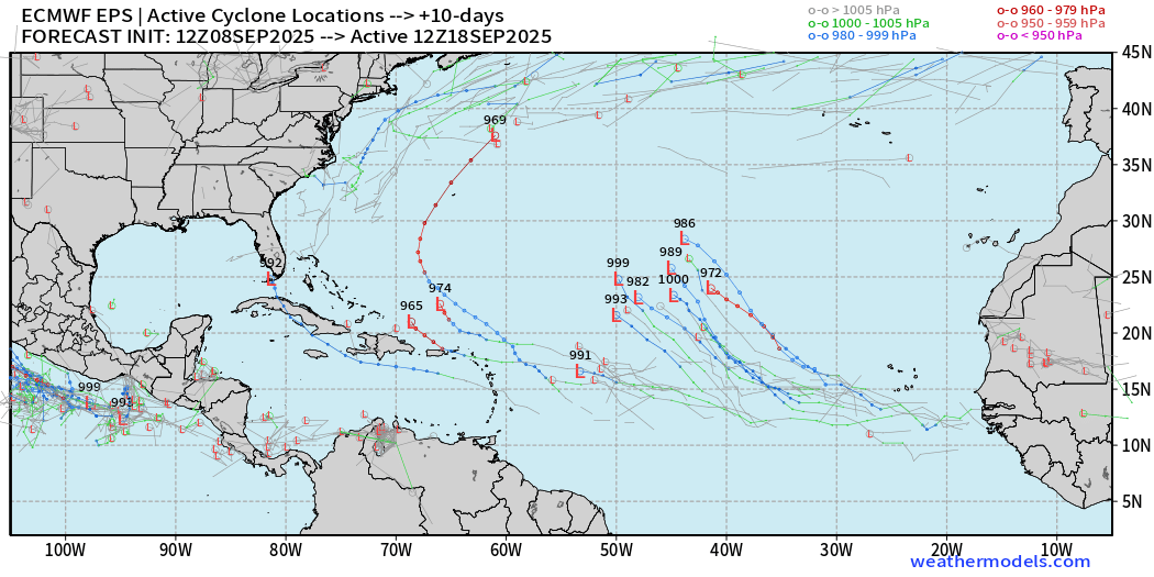
A handful of members with tropical waves that develop — at most 20% — no change from yesterday’s 12z cycle.
ECMWF EPS 12z Ensemble | Active Cyclone Tracks Through 15-days
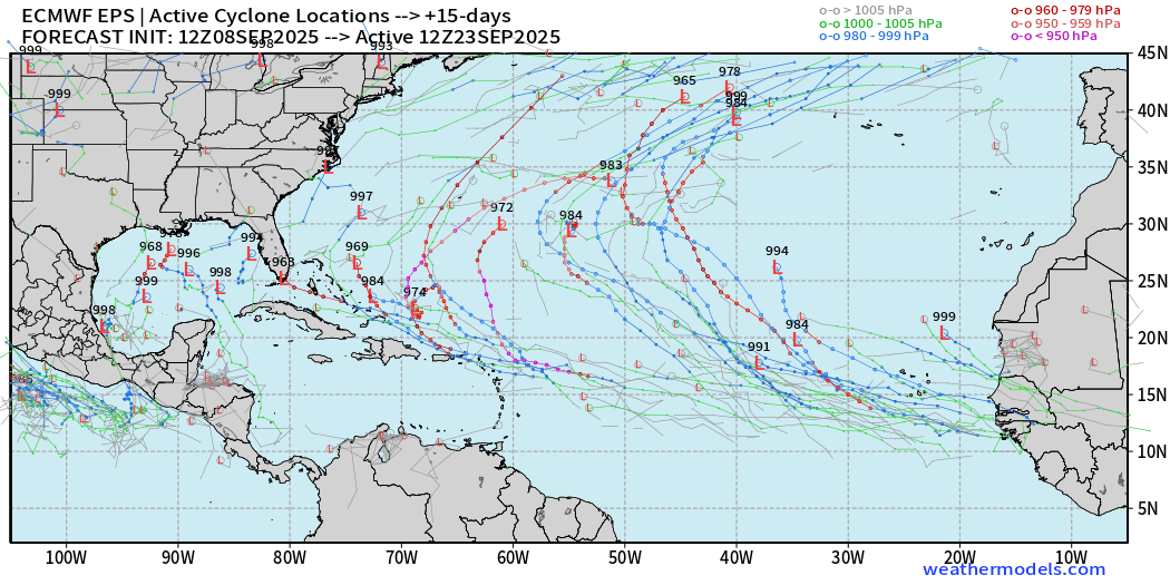
Additional members “catch fire” with tropical waves into major hurricanes — again in the 20% to 30% range, which is near climatology into third week of September.
Interesting to see the systems in the Gulf of Mexico again popping up — likely out of the Central American Gyre. GFS has been hinting at this for the last day in its model cycles.
AIFS-ENS Comparison at 12Z | Active Tracks at Day 10
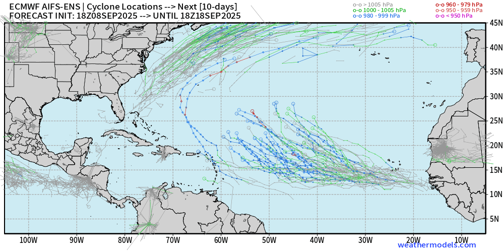
AIFS ENS is excited about this tropical wave — high chance > 90%
AIFS-ENS Comparison at 12Z | Active Tracks at Day 15
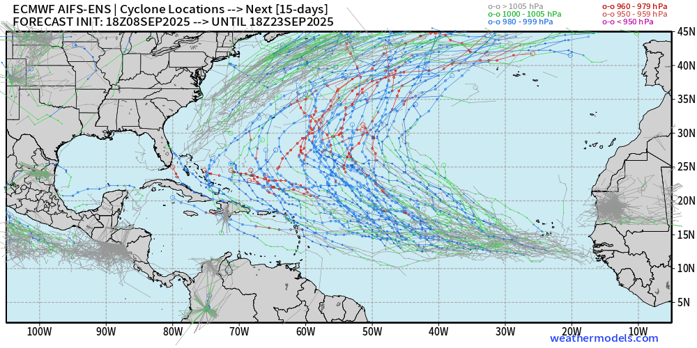
Plenty of options — but, as we saw with Invest 91L — don’t count your chickens before they hatch.
Eastern Pacific Tropical Update| Hurricane Kiko
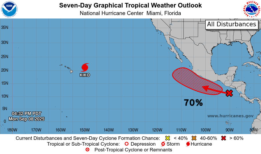
Hurricane Kiko is asymmetric due to wind shear out of the SW but maintains hurricane force winds in the Northeast Quadrant.
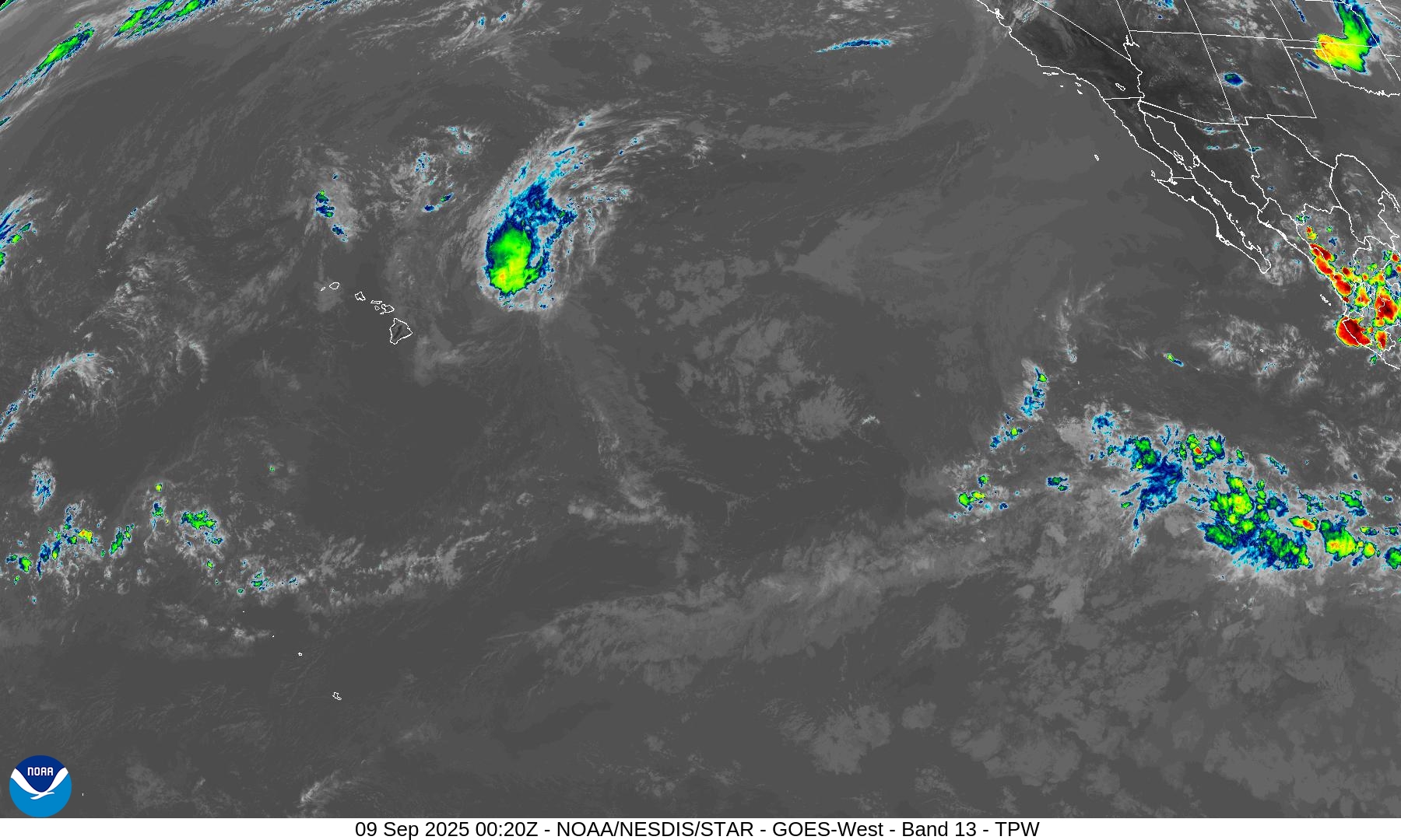
Kiko will weaken to a Tropical Storm but could linger for the next 4-5 days — no threat to Hawaii.
70% chance of next system — Marco
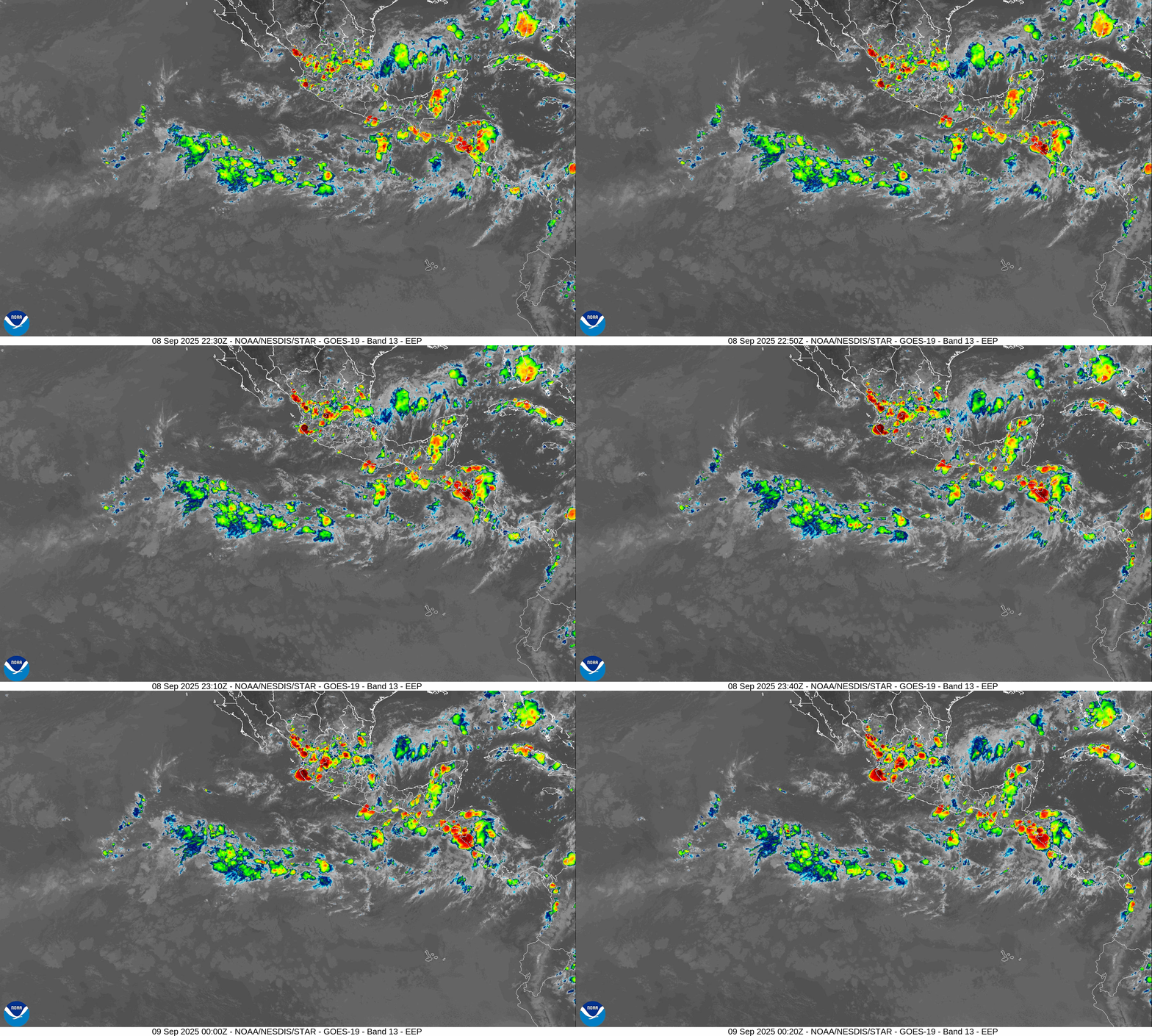
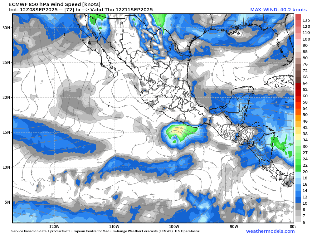
In 3-days we can expect Marco, and it should become a hurricane on a track paralleling the coast but no direct impacts.
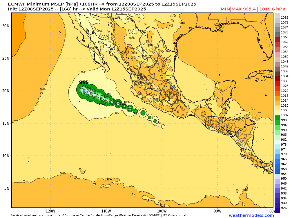
Maps sourced from weathermodels.com designed and innovated by yours truly! Please subscribe there for real-time access to the newest maps, charts from all of the weather models including ECMWF.
- Milepost
- 727 · laid 2025-09-09T01:48:35.700000Z
- Source
- https://weather.substack.com/p/september-8-2025-monday-evening-update
- Digest
- 8b34e24a9f63b39318ab8ccb812749a46c7d5fae02b78e176c70b2b3dfd7a369
- Machine
- JSON