September 4, 2025 Thursday Evening Update
Invest 91L up to 90% chance of becoming Gabrielle in coming days
September 2025 was the 7th-warmest September in the 131-year national record (1895–2025), at 67.9°F against a 1991–2020 normal of 66.0°F (+2.0°F).
September 2025 was the 15th-driest September in the 131-year national record (1895–2025), at 1.9in against a 1991–2020 normal of 2.6in (-0.6in).
NOAA/NCEI Climate at a Glance, contiguous United States. This is the observed record for the month, not a score of anything said in this piece — the forecast ledger begins 2026-08-17 and cannot reach earlier posts.

2025 Season to Date: 6 named storms, 1 hurricanes, and 1 majors | ACE = 40 ACE of Erin: 32.2 (140-knots maximum wind)
Thursday Evening Tropical Update
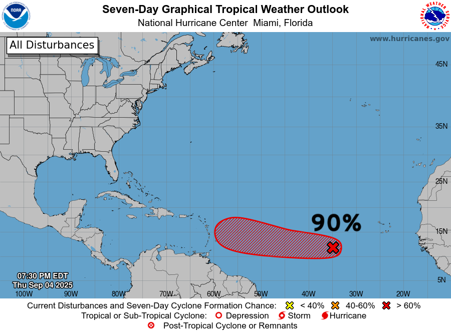
Invest 91L in central MDR at 90% chance of development but not in a hurry with marginal background environment (dry air)
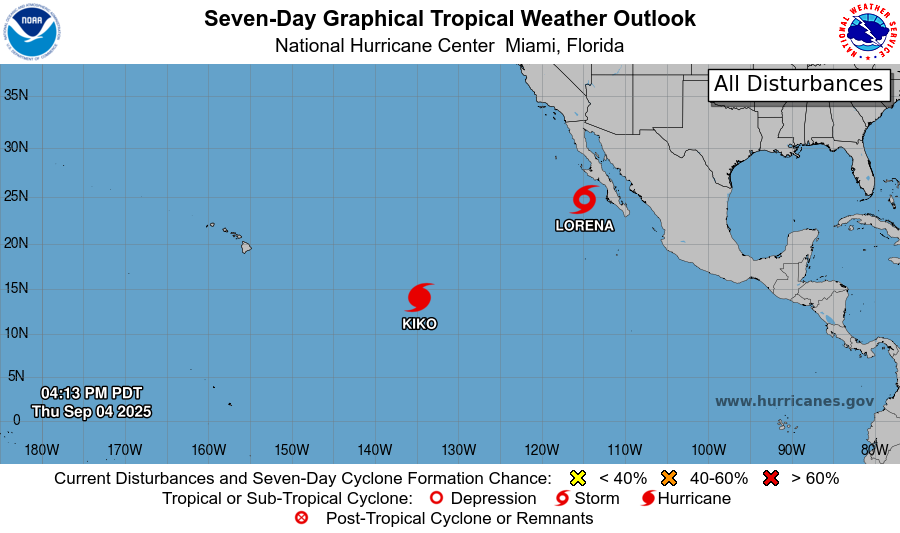
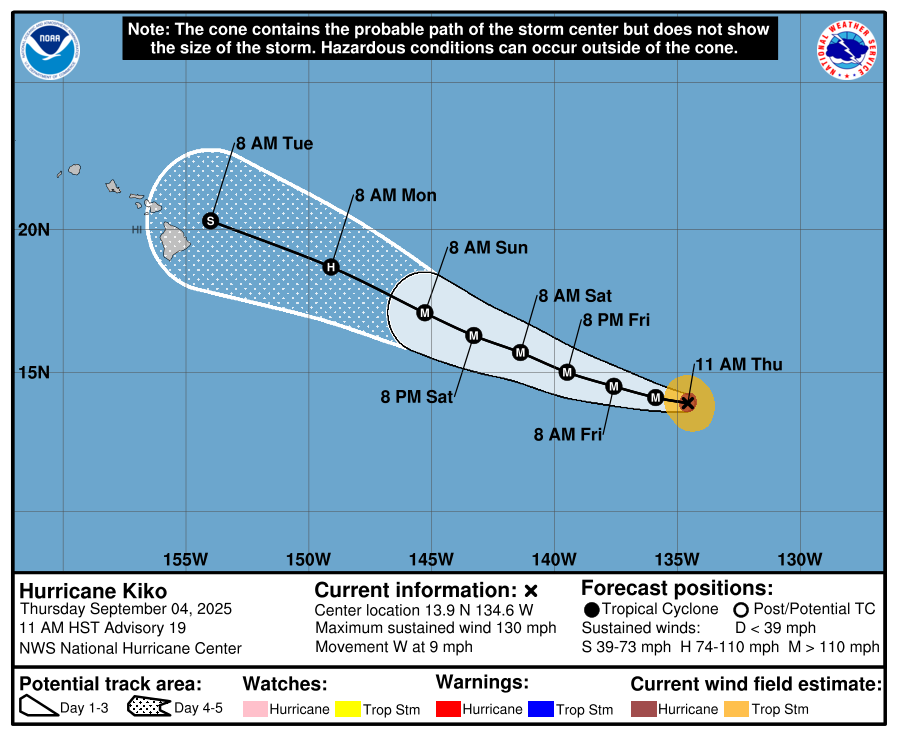
Hurricane Kiko remains Category 4 but has entered another eyewall replacement cycle. The storm should skirt just north of the Big Island of Hawaii over cooler water.
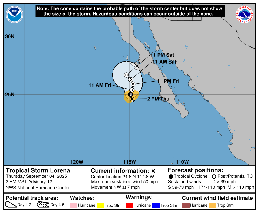
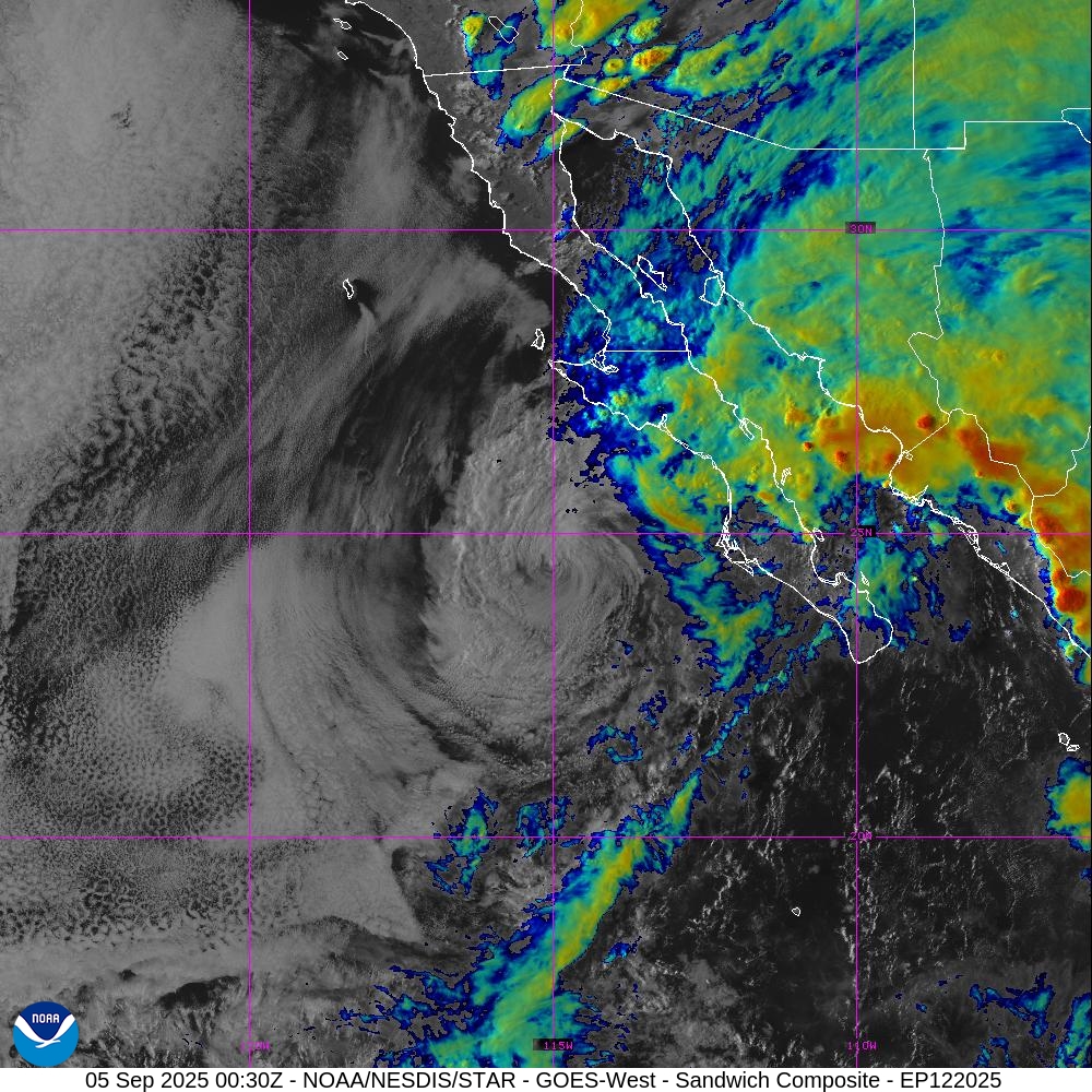
Tropical Storm Lorena decoupled and fell apart. The moisture went into Mexico while the low-level circulation remains behind.
Invest 91L has a nice curved band of thunderstorms (convection) but it a very small system compared to Erin earlier in August, which was a sprawling monster circulation.
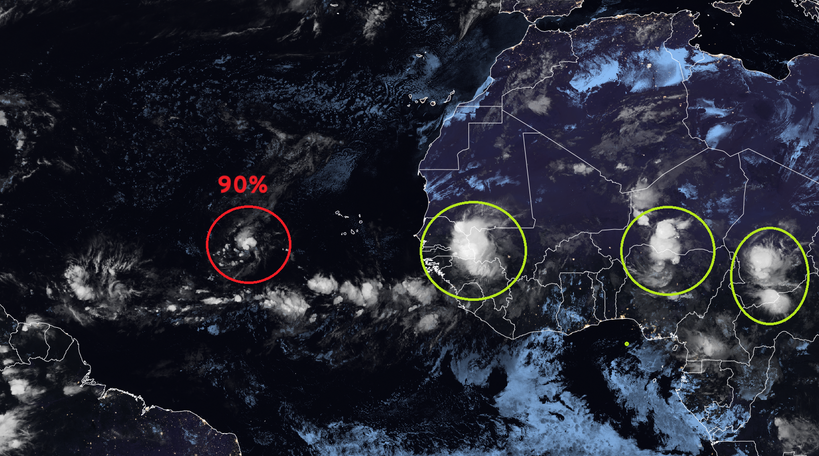
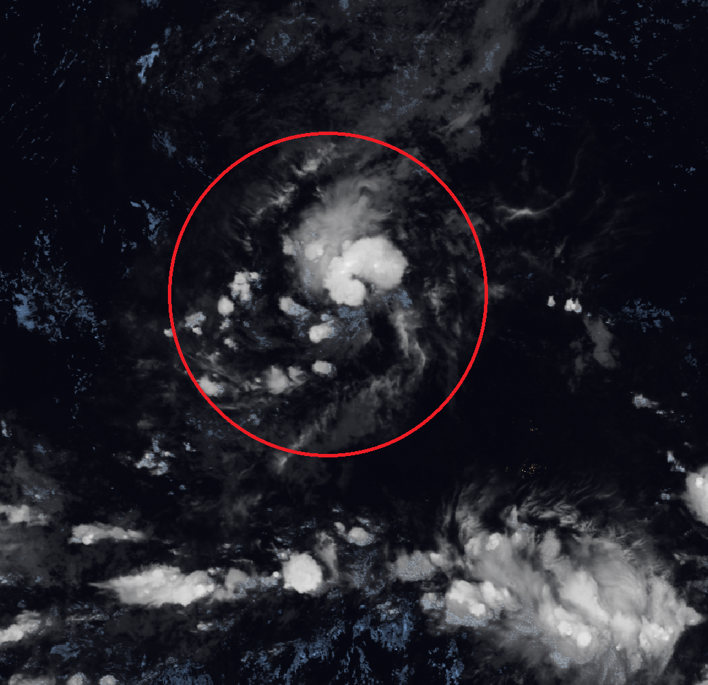
We may have a tropical depression in the next 24-hours if this curved band can remain coherent and initiate the “heat engine”
RTMA Temperatures and Anomaly | 8:15 AM ET
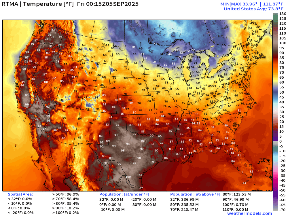
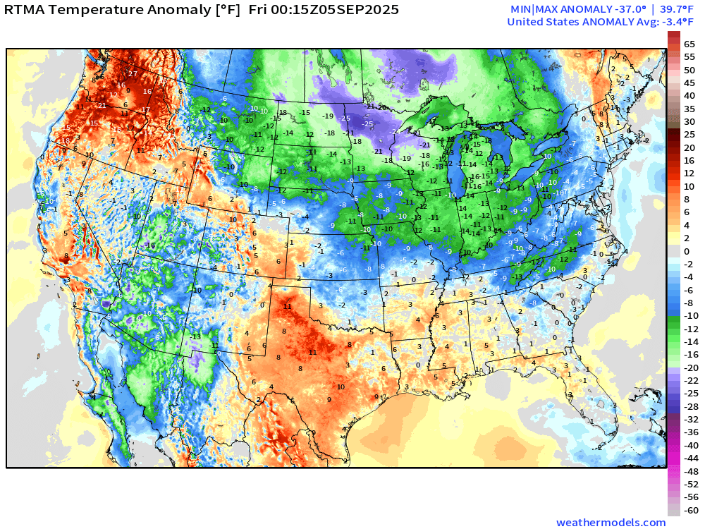
Cool / chilly air across the Midwest and Great Lakes. Lower 48 is -3.4°F below normal.
Low Temperatures Friday
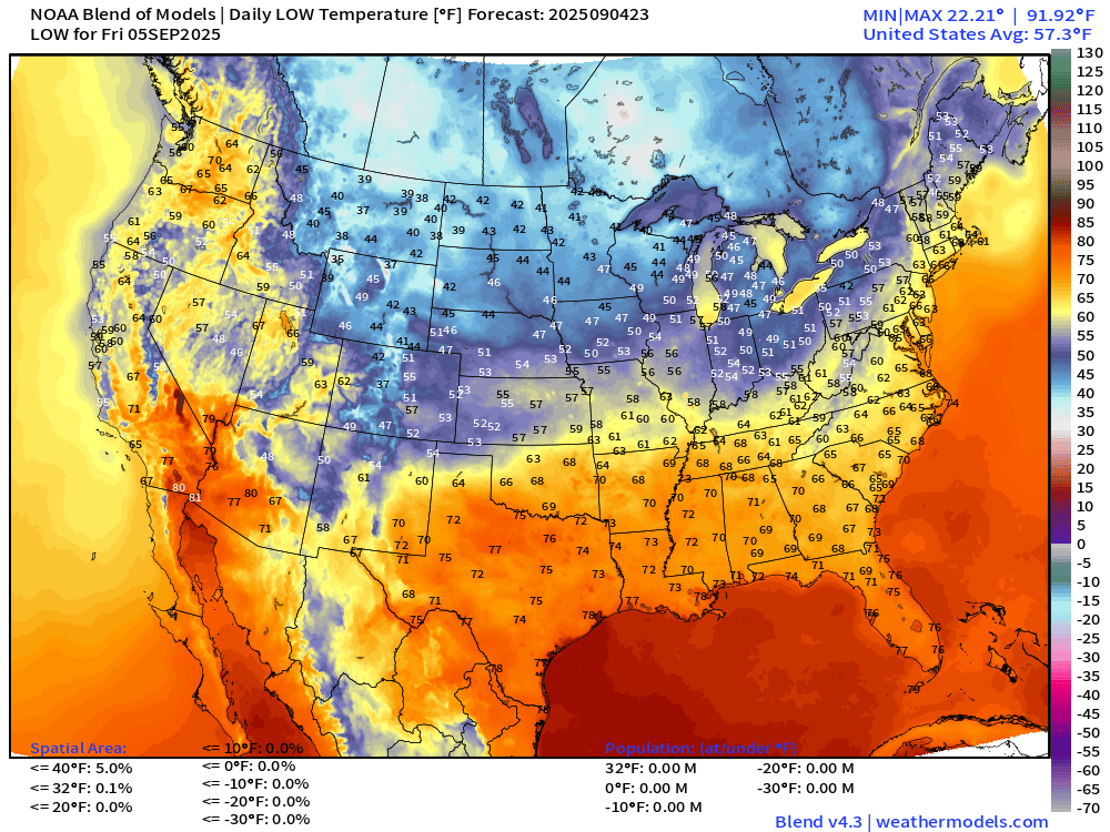
5% of the Lower 48 is under 40°F but only 0.1% below freezing.
High Temperatures Friday
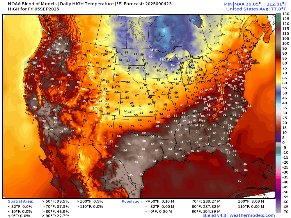
Hot across Texas again — and 90s into Nashville and Atlanta and perhaps as far north as Washington D.C.
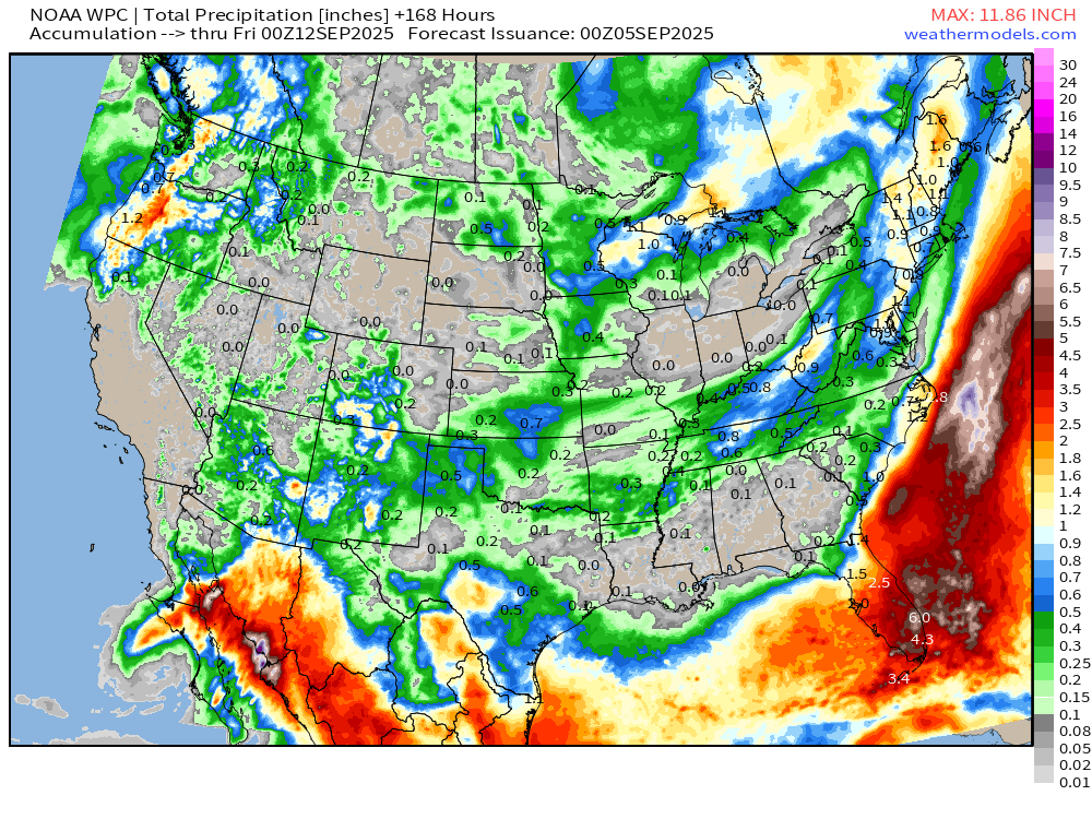
7-Day Precipitation from NOAA WPC
Atlantic Basin | ECMWF 18z | Precipitable Water Next 6-days
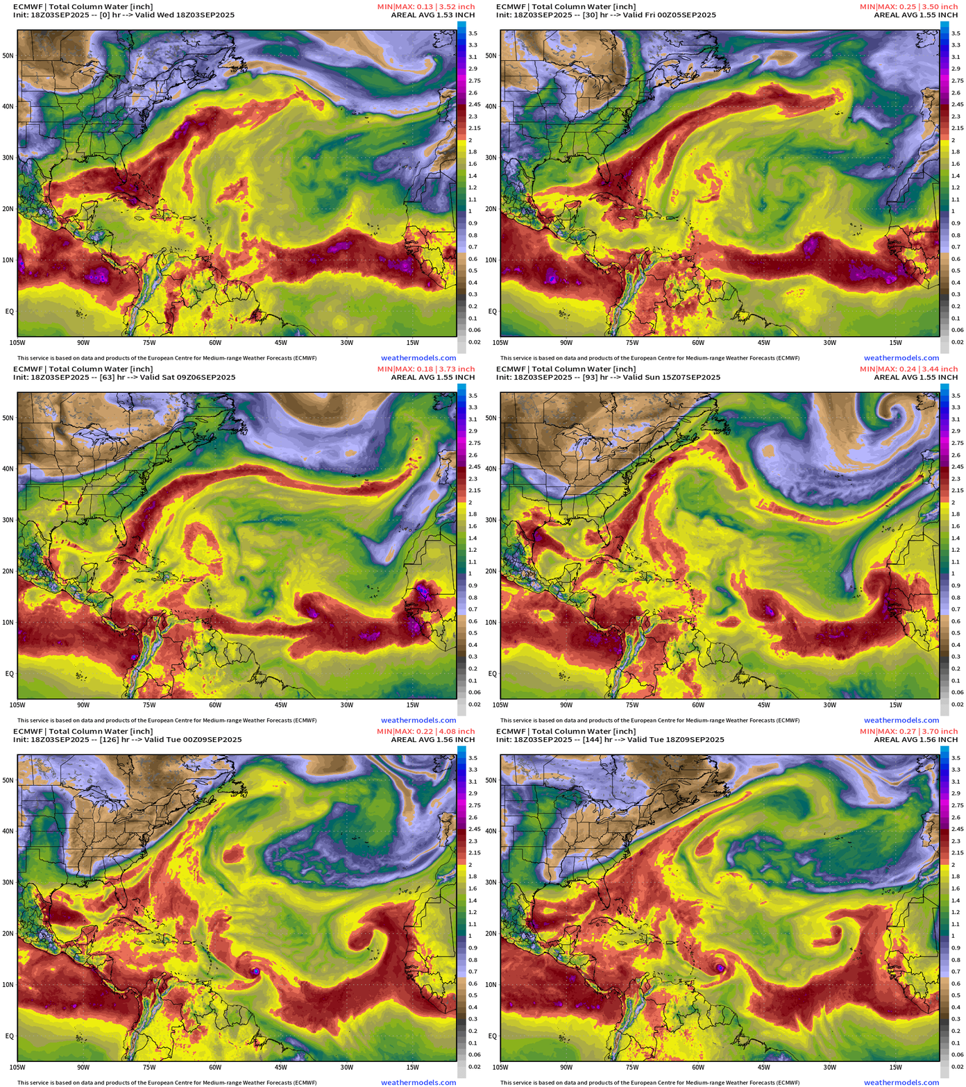
90% chance of development of the tropical wave becoming Tropical Storm Gabrielle in the next 3-4 days, most likely on a much LOWER latitude course — almost due westward for 6-7 days, and then it could jump northward.
Atlantic Basin | ECMWF 18z | Vorticity Next 6-days
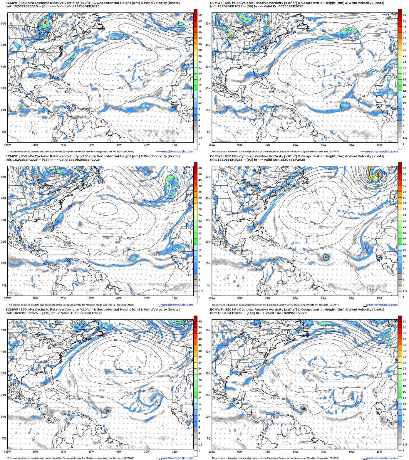
Due westward course during the next 6 days — scenario with ECMWF 18z but VERY slow — up to 7-days to reach the Islands.
ECMWF 12-Days Integrated Vapor Transport | 12z cycle
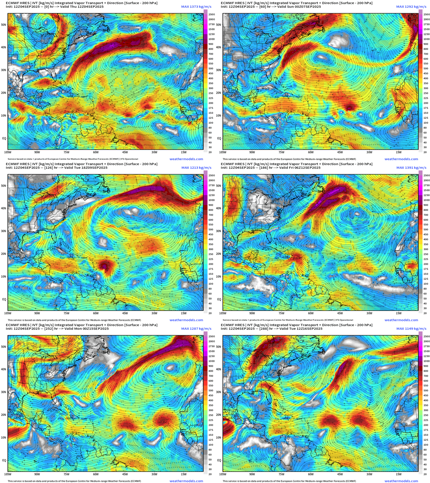
This is just one model scenario — but the ECMWF flagship model solution. Note that Gabrielle is wiped out by Hispaniola and has significant trouble organizing thereafter. Two more tropical waves invade the MDR.
Atlantic Basin Outlook | 8 PM ET Update
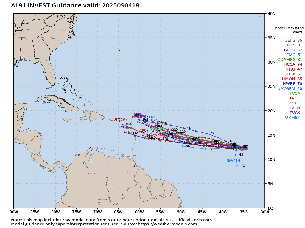
Invest 91L ATCF Spaghetti through 7-days
HAFS at Day 5: poorly organized but probably TS
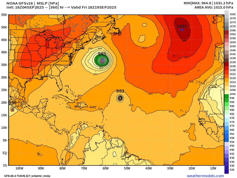
GFS 18z Happy Hour Solution
near Major Hurricane in 7-days into the Lesser Antilles
Then at Day 12 … major hurricane east of the Bahamas with “Humberto” next up in central MDR
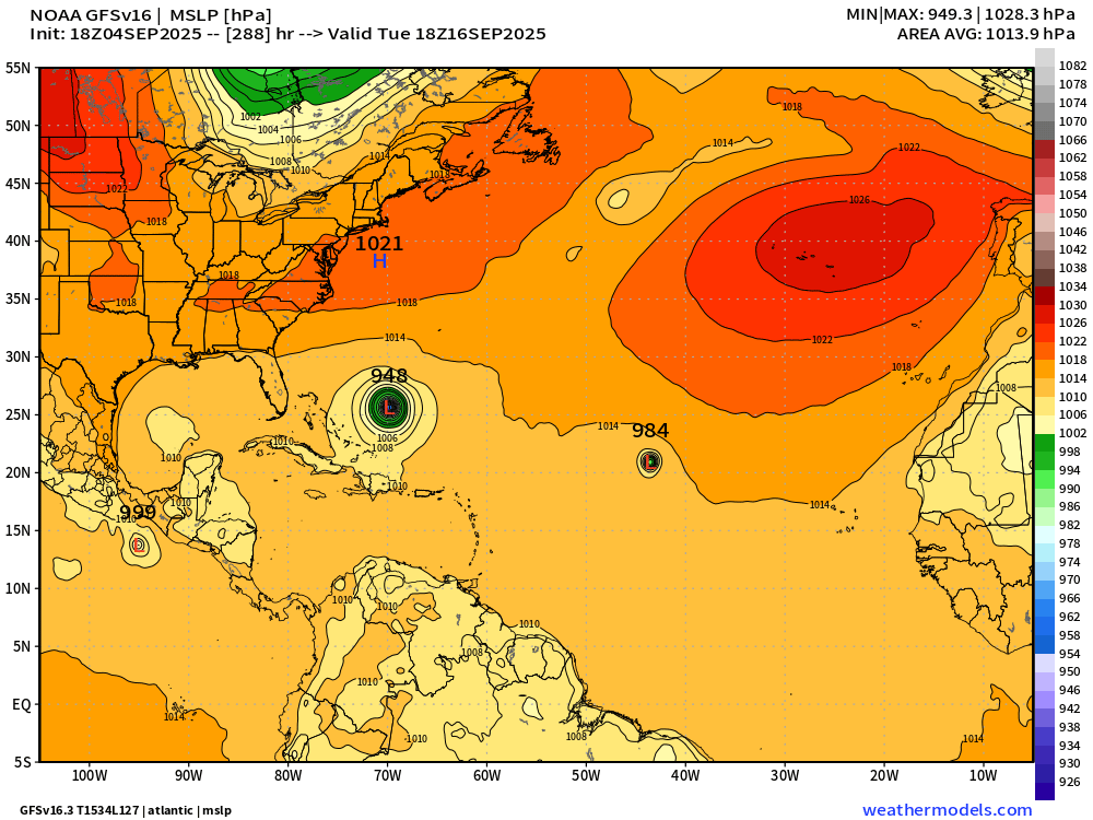
Way out at Day 15 — Gabrielle curves northward out to sea — while Humberto drifts westward.
Atlantic Satellite Imagery | Water Vapor
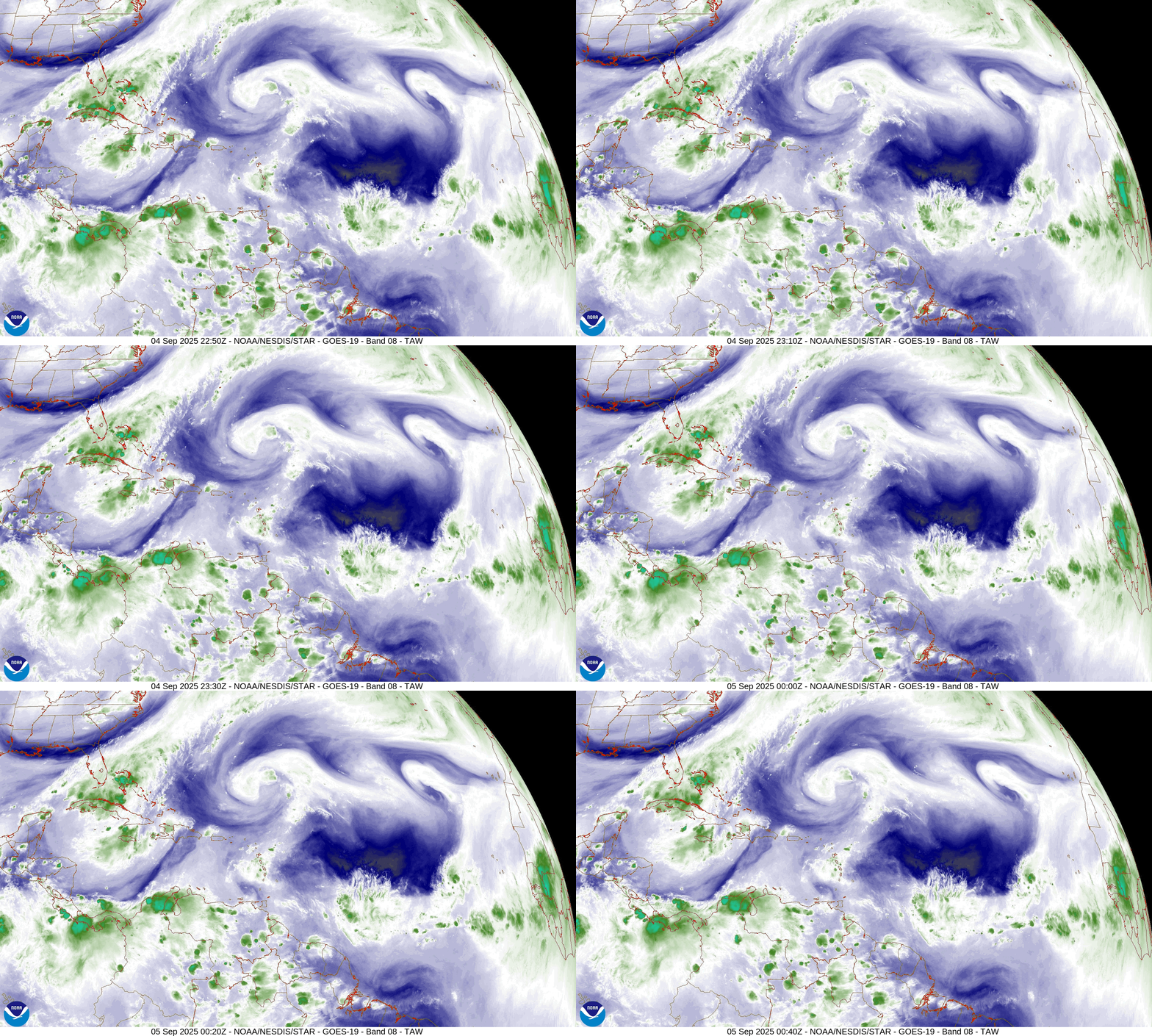
Huge dry spot in the water vapor over the central Atlantic tropics and subtropics with Invest 91L right on the eastern edge of the huge yellow/orange dry spot (color enhanced water vapor imagery) — but it is a small vortex/circulation so the dry air may be effectively walled off.
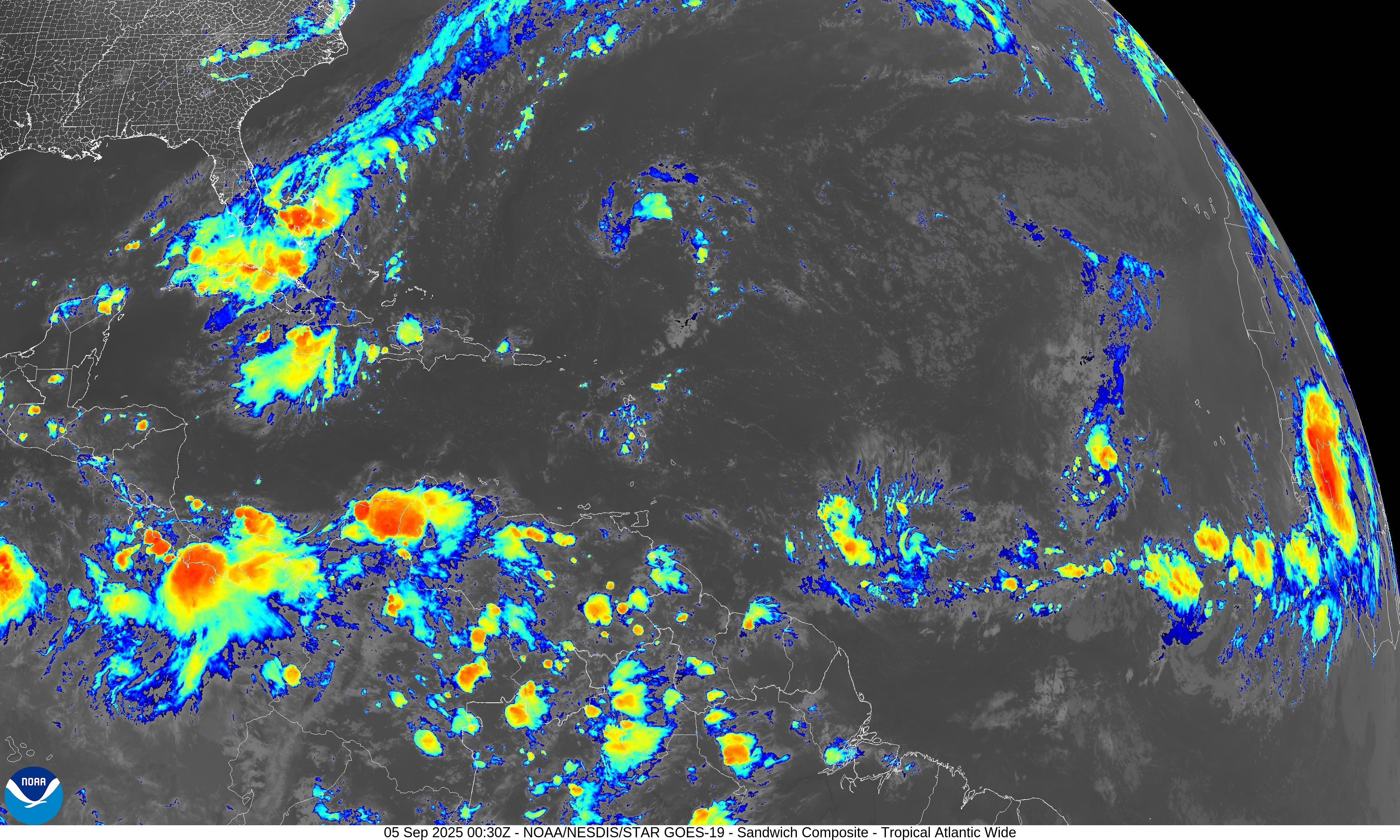
NOAA Tropical Surface Analysis | 18z
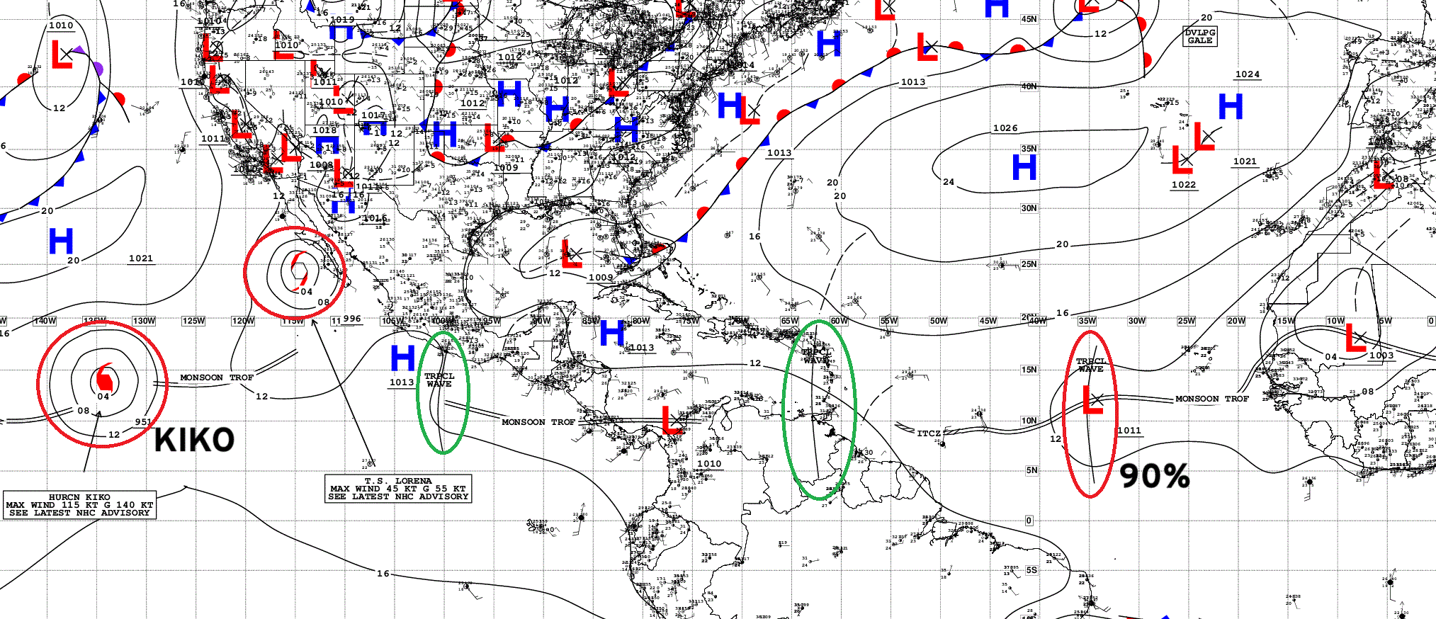
Atlantic Tropical Waves = 2 including wave in monsoon trough in Central MDR (90%)
ECMWF 12z SST and Anomaly
ECMWF EPS 12z Ensemble | Active Cyclone Tracks Through 8-days
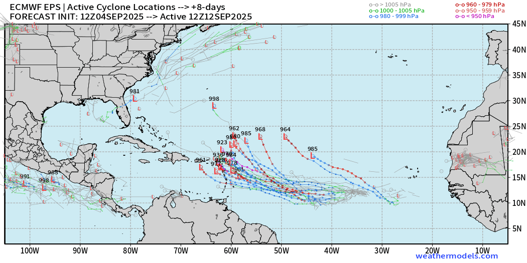
Gabrielle could be a hurricane threat to the NE Caribbean
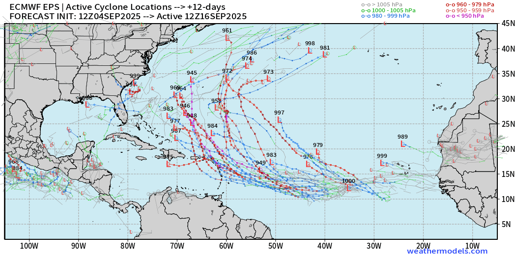
ECMWF EPS 12z Ensemble | Active Cyclone Tracks Through 12-days
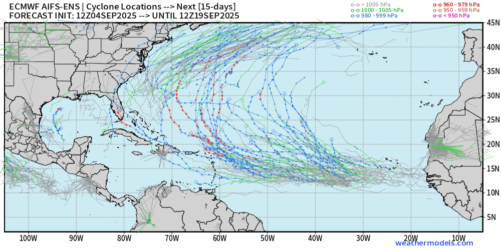
ECMWF EPS 12z Ensemble | Active Cyclone Tracks Through 15-days
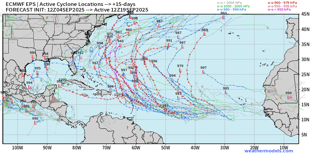
And, we can’t discount yet some impacts to the Bahamas and East Coast of the U.S. but that’s over the horizon.
We’re seeing ancillary development of a hurricane in the Gulf of Mexico. Low chance but worth watching.
ECMWF AIFS Ensemble 12z
Eastern Pacific Tropical Update| Kiko and Lorena
Kiko at Category 4 but now undergoing another eyewall replacement cycle.
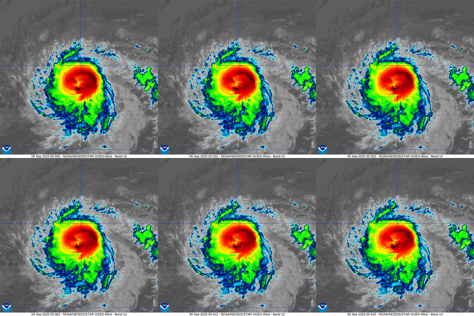
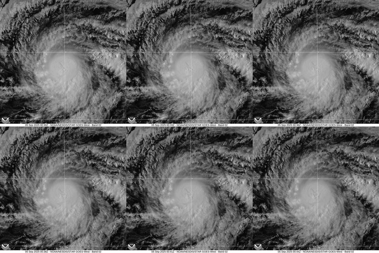
Track by NHC is just north of Big Island of Hawaii but much weaker as a tropical storm due to cooler water.
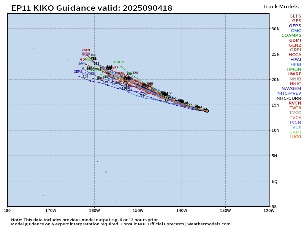
ATCF guidance is clustered right over the Hawaii Island chain.
HAFS-A and HAFS-B (18z) for Kiko at Day 5
Could be surprising intensity — maybe a weak hurricane that remains resilient to the cooler SSTs.
Tropical Storm Lorena fell apart.
Maps sourced from weathermodels.com designed and innovated by yours truly! Please subscribe there for real-time access to the newest maps, charts from all of the weather models including ECMWF.
- Milepost
- 724 · laid 2025-09-05T01:12:30.342000Z
- Source
- https://weather.substack.com/p/september-4-2025-thursday-evening
- Digest
- 2ae850088c8b8153f11e77b02dccac1bf6f215a033f1bb5b89fe966fc5c505fb
- Machine
- JSON