September 3, 2025 Wednesday Tropical Update
Tropical wave remains poorly organized
September 2025 was the 7th-warmest September in the 131-year national record (1895–2025), at 67.9°F against a 1991–2020 normal of 66.0°F (+2.0°F).
September 2025 was the 15th-driest September in the 131-year national record (1895–2025), at 1.9in against a 1991–2020 normal of 2.6in (-0.6in).
NOAA/NCEI Climate at a Glance, contiguous United States. This is the observed record for the month, not a score of anything said in this piece — the forecast ledger begins 2026-08-17 and cannot reach earlier posts.

2025 Season to Date: 6 named storms, 1 hurricanes, and 1 majors | ACE = 40 ACE of Erin: 32.2 (140-knots maximum wind)
Wednesday Evening Tropical Update
Tropical Wave in east central MDR up to 80% chance of development, but it not well organized.
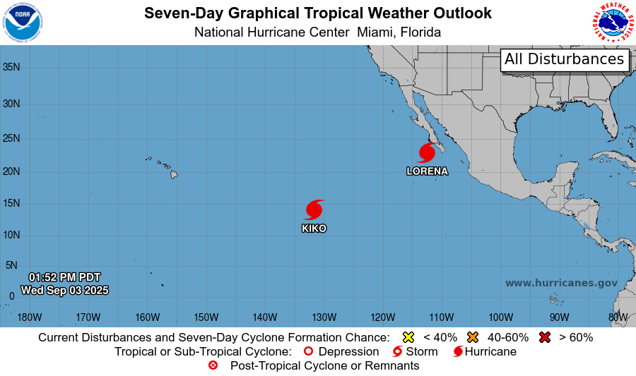
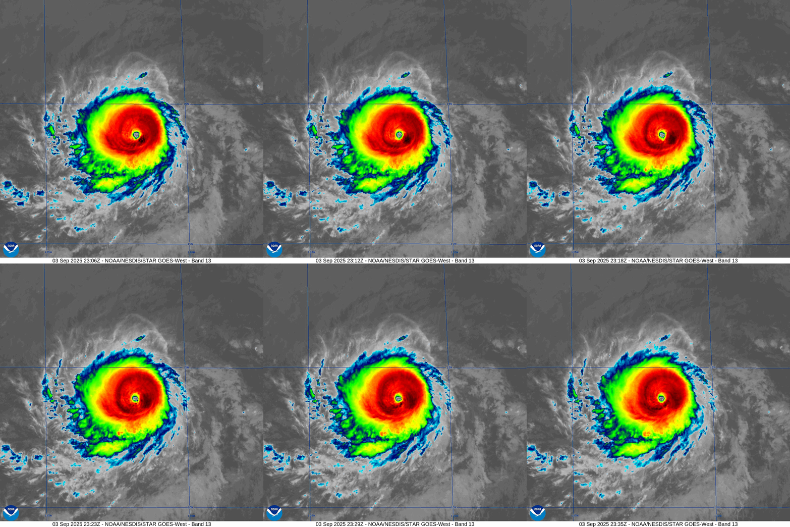
Hurricane Kiko is now Category 4 and looks very impressive on satellite. It is making a run at Category 5 well east of Hawaii.
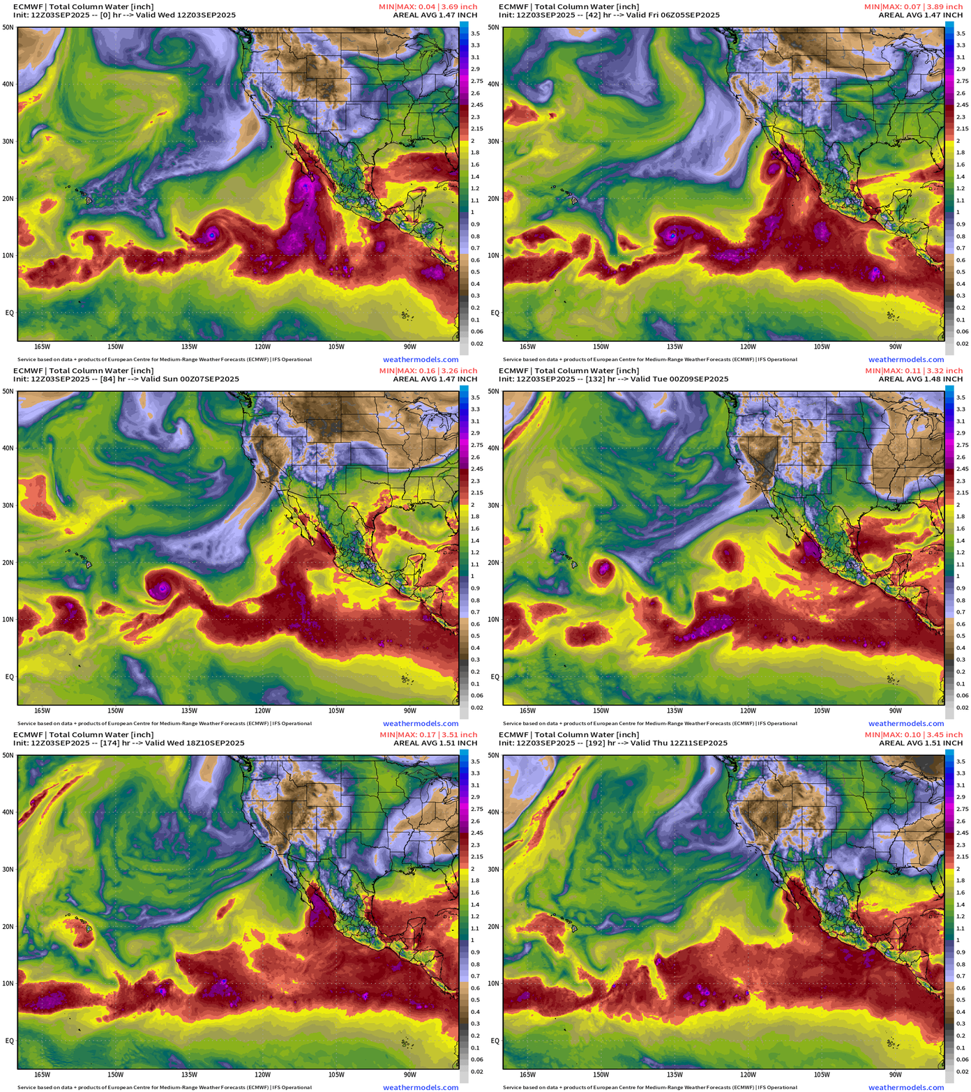
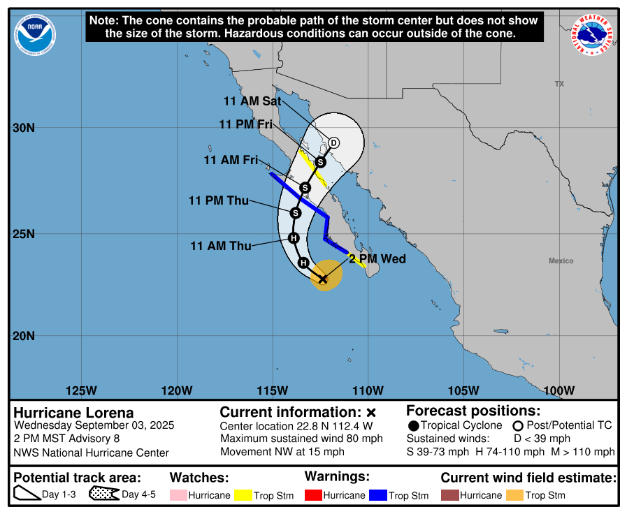
Hurricane Lorena off coast of Mexico is a tricky forecast because it could be sheared apart prior to reaching Baja California Sur. However, heavy rain will accompany the moisture blob into Mexico and the U.S. Southwest.
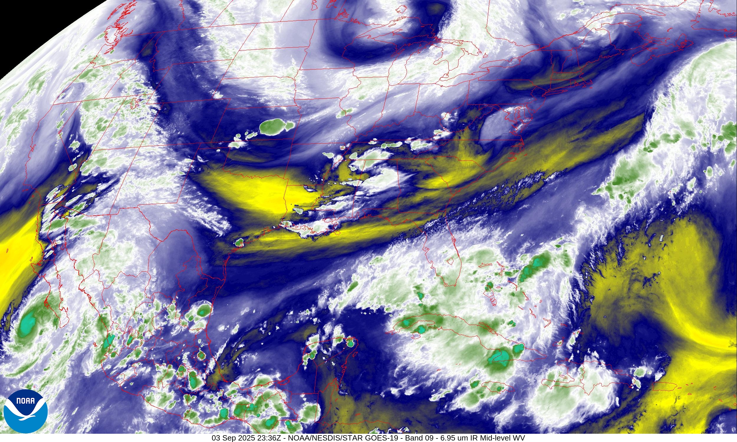
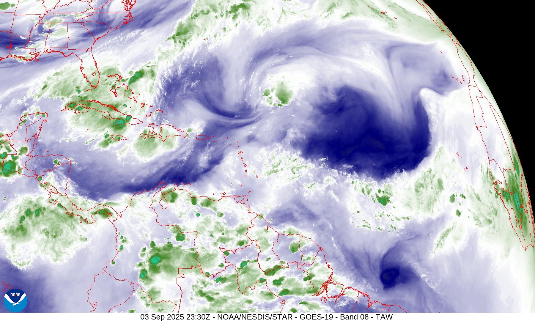
Water Vapor imagery shows the trough “dry air” moat centered over northern Minnesota. It will intensify further into Thursday.
Temperatures 7:15 PM ET
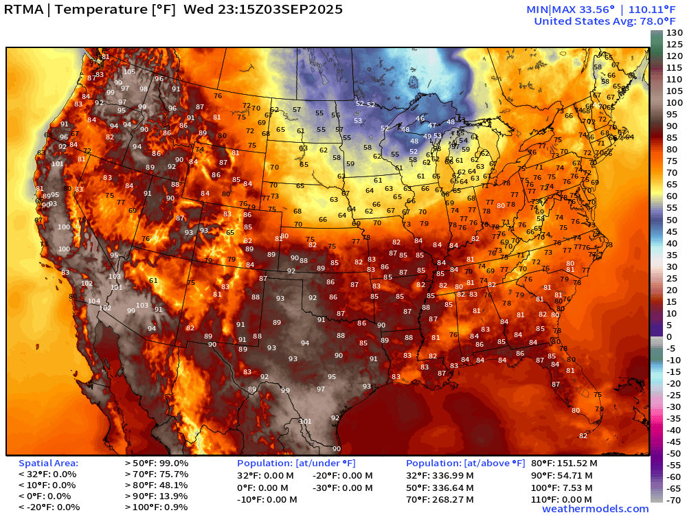
Only in the 40s and 50s across northern Minnesota, Wisconsin, and Michigan. Still pretty hot in eastern Washington, Texas, and the Southeast.
High Temperatures on Thursday
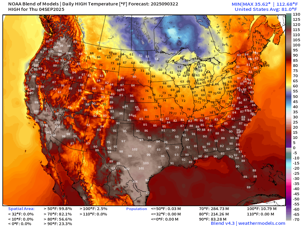
Hot again in Texas — the last gasp of summer with temperatures pushing 100°F in Dallas. 90s expand into the Southeast with 83 million at/above 90°F
High Temperatures on Friday
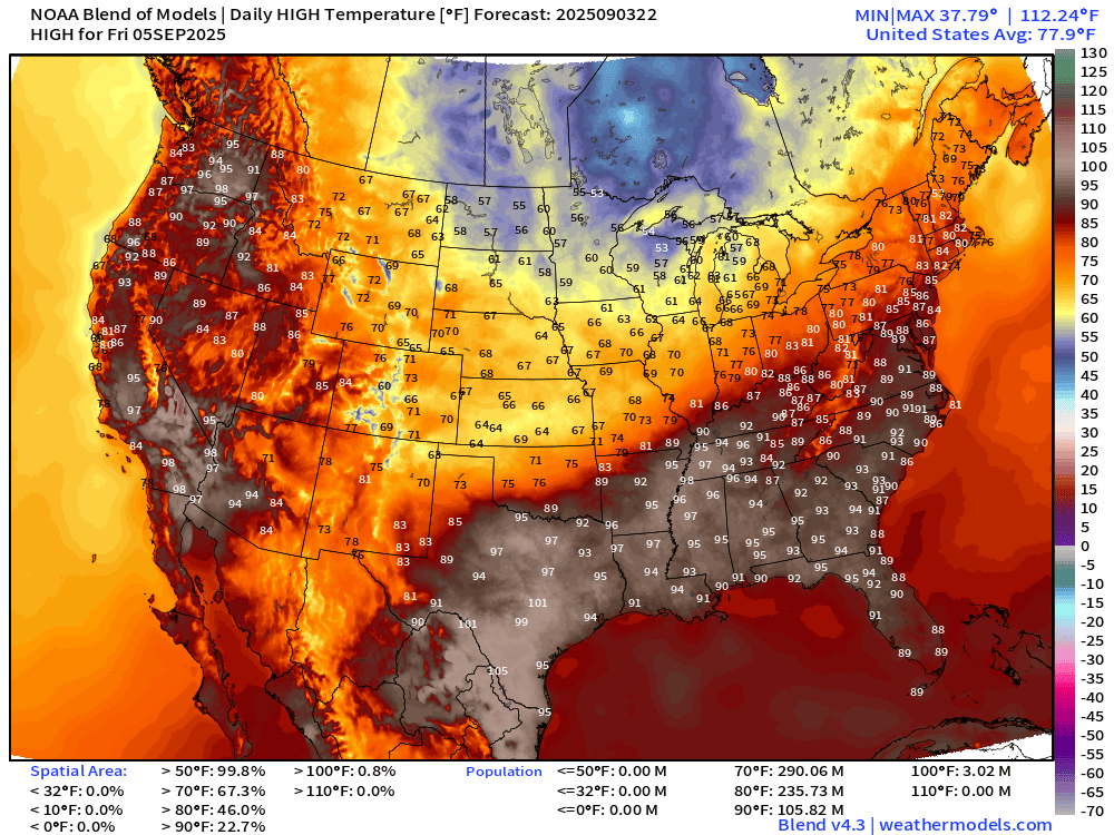
The heat expands into Nashville — mid-90s and Atlanta back into the 90s. Even a decent chance at 90°F in Washington D.C. and 106 million at/above 90°F
7-Day Precipitation from NOAA WPC
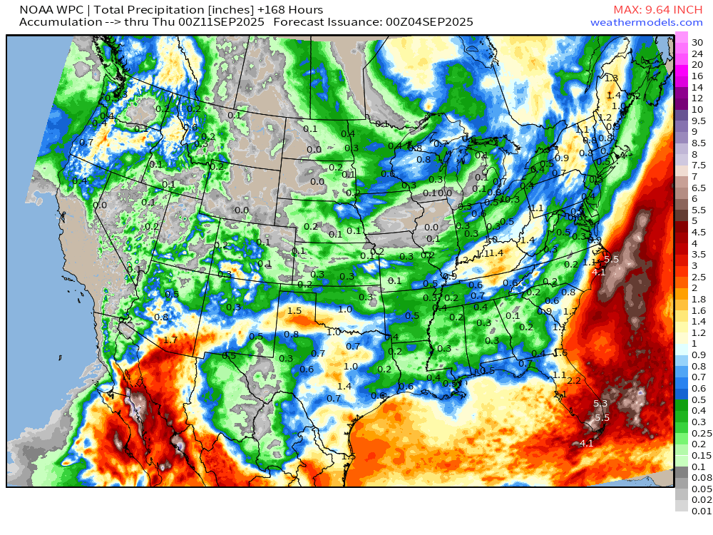
Heavy rain from remnants of Hurricane Lorena will spread into Mexico and southern Arizona including Tucson.
Frontal boundary hung up along the Gulf coast will continue to drench central and south Florida.
Atlantic Basin Simulated Water Vapor Satellite Next 10-days
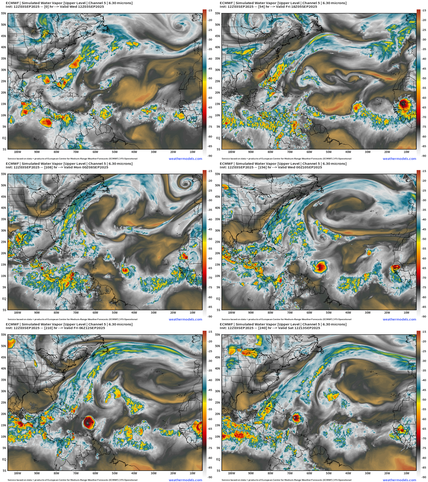
Tough sledding across the Atlantic Main Development Region (MDR) for any tropical waves with HUGE mid-level troughs, Saharan air layers, and strong vertical wind shear. The tropical wave we’ve been watching for a few days finally moves westward enough to detach from the monsoon trough and attempt to “fire up” the sustained convection necessary for tropical storm formation. However cyclogenesis does not look imminent.
Atlantic Basin | ECMWF 12z | Precipitable Water Next 10-days
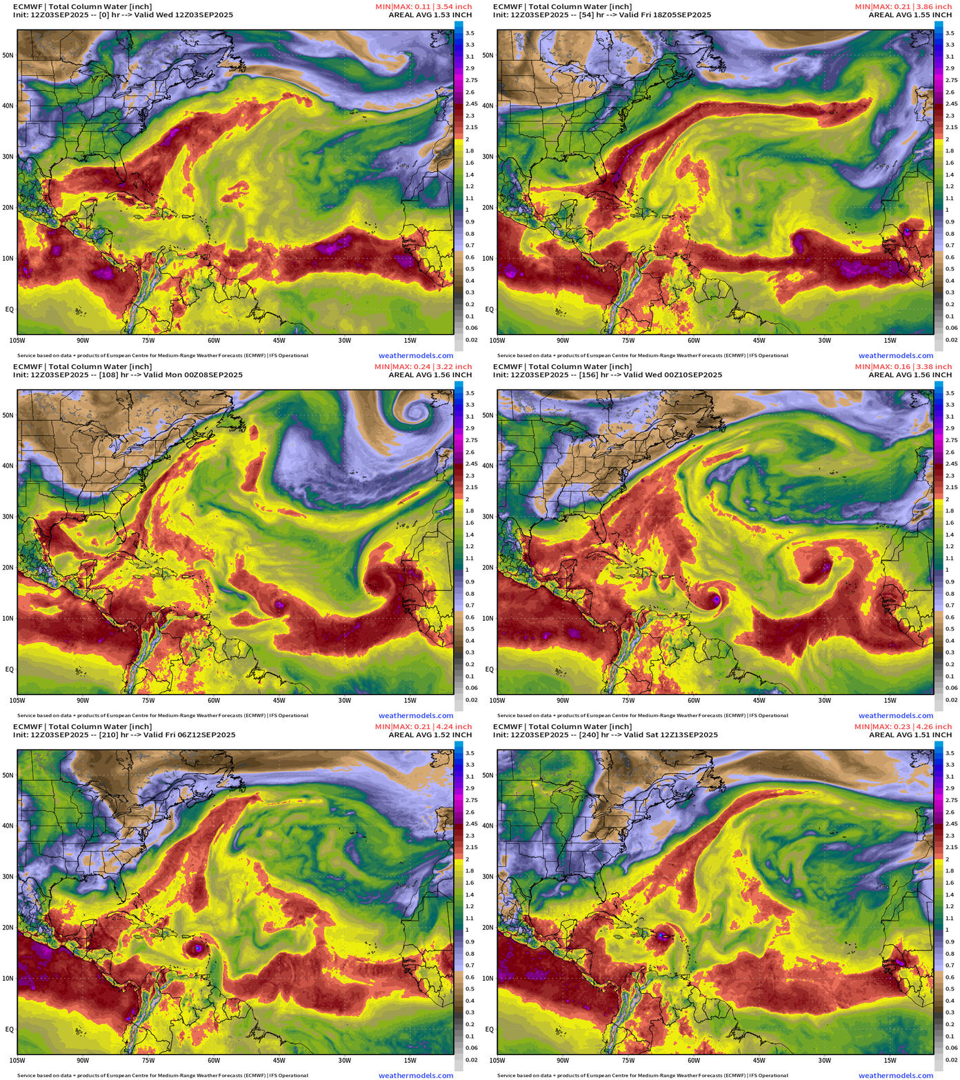
80% chance of development of a Tropical Wave coming off Africa (in the next 7-days) — and moving into the central MDR. The next system will be named Gabrielle in the next 3-4 days, most likely.
Atlantic Basin | ECMWF 18z | Vorticity Next 6-days
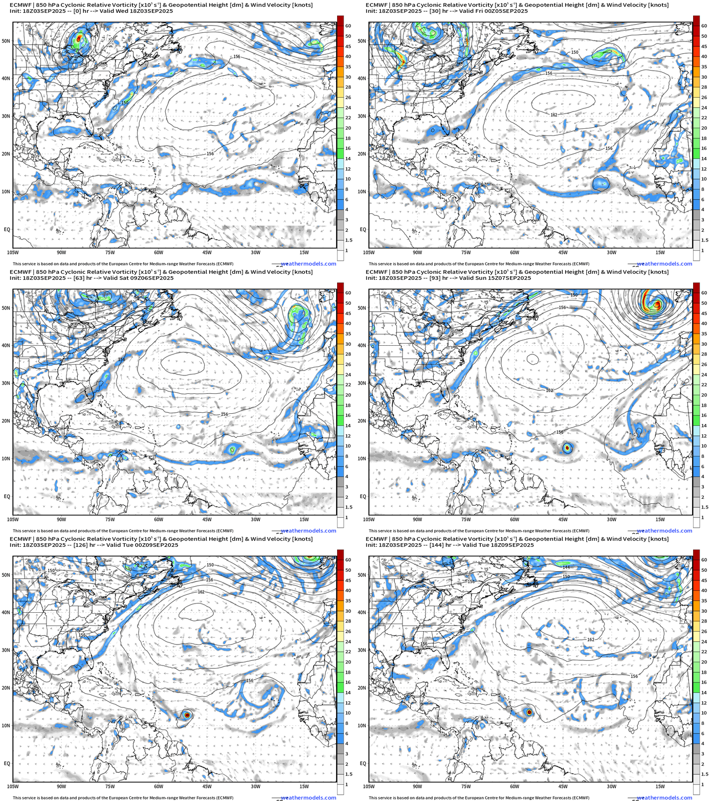
The storm leaves the monsoon trough at about 15°N latitude and heads west. Depending upon the intensity of the storm — as the track is a function of intensity — due to the interplay between the depth of the vortex and the strength of the subtropical ridge = steering currents — we could see the TS/HU come close to the Caribbean. Indeed, the most recent guidance at 18z shows a much further southward track that anticipated days ago — as the subtropical high is stronger, and the vortex weaker.
Note — much slower movement westward of these waves heading into early September as the steering currents have become much weaker. However, it’s tough sledding in the MDR with pesky troughs nearby dumping dry, stable subtropical air + wind shear equatorward.
ECMWF 10-Days Integrated Vapor Transport | 12z cycle
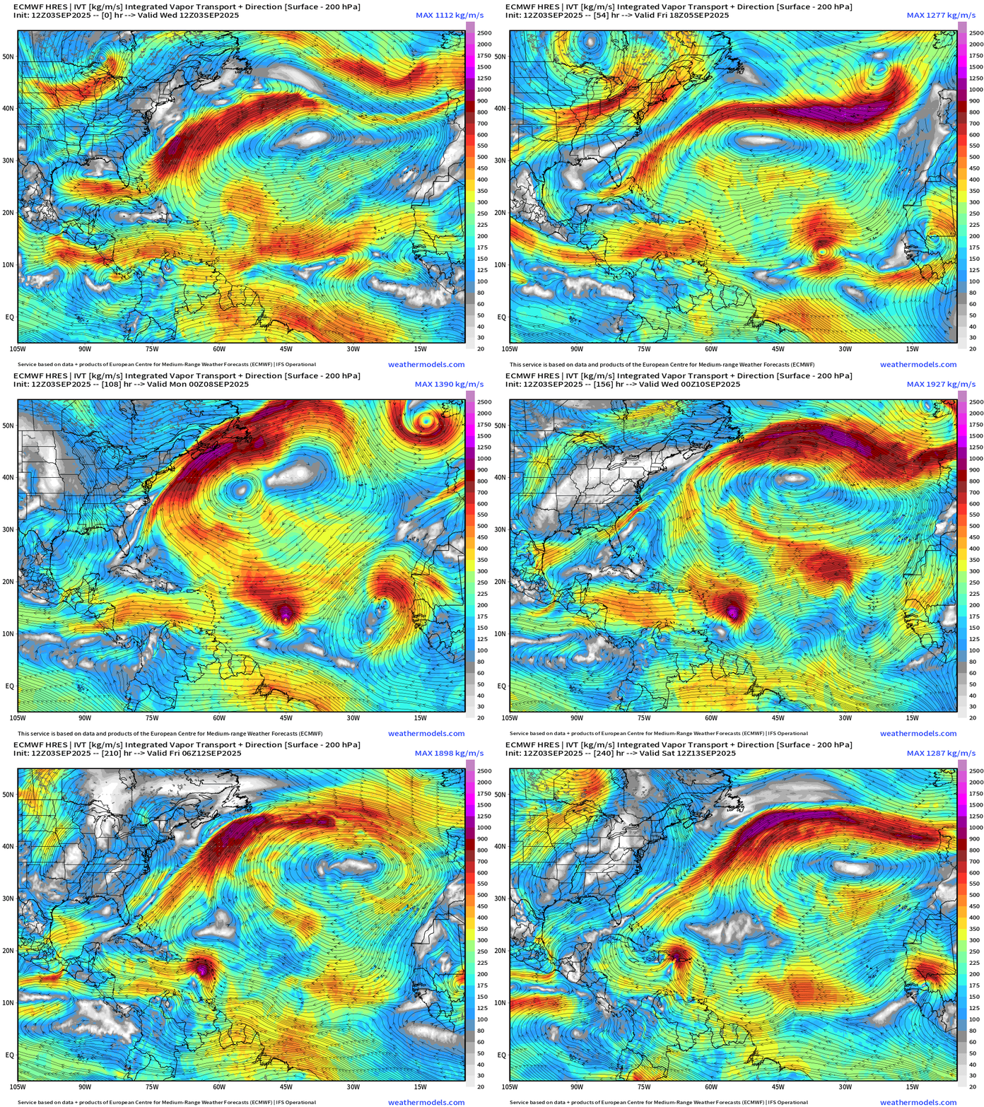
Just one model scenario — but highlights the tough sledding that likely TS Gabrielle will have approaching the islands and Hispaniola. There’s high uncertainty in the intensity and track past Day 7, so don’t want to commit to any particular land impacts at this time (if any).
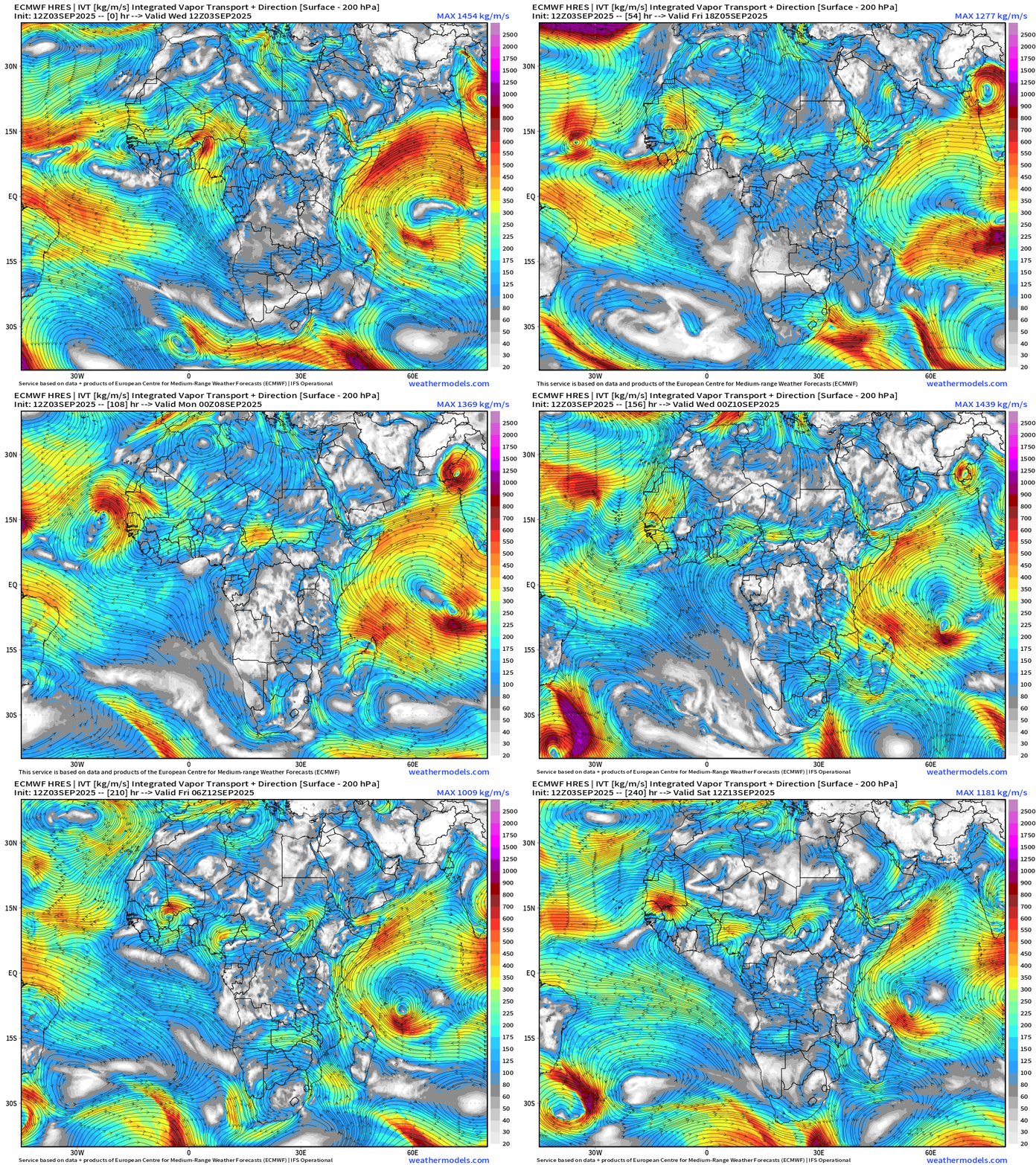
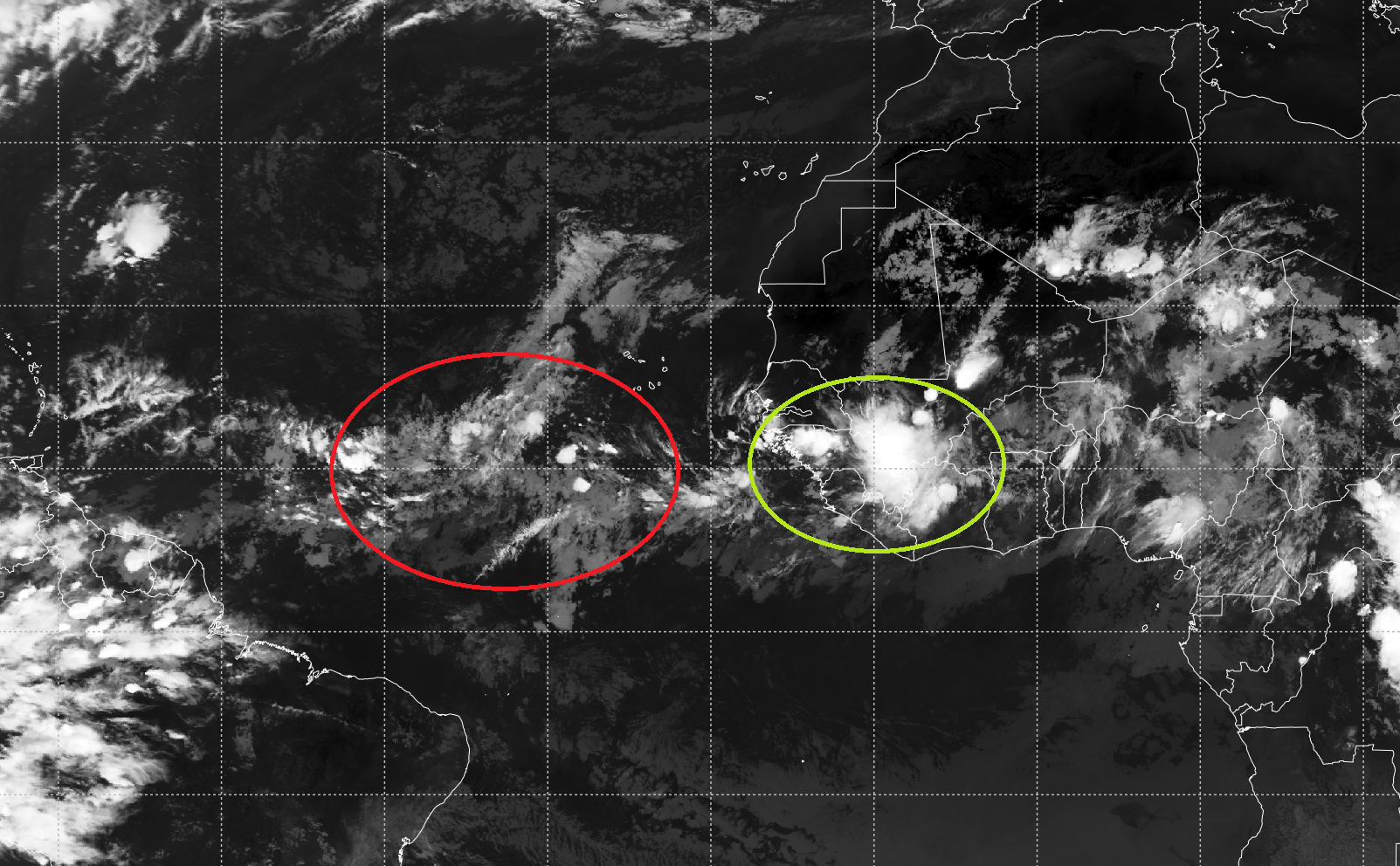
Over Africa, the tropical waves are noticeable but not particularly intense coming off at higher latitude (20°N) and over cooler water around the Cape Verde Islands. That’s not a recipe for tropical storm formation.
GFS 18z Solution = Category 4 Hurricane
And, the last two cycles of GFS show a major hurricane impact to the East Coast. Also, don’t panic — this is the GFS. Just documenting here.
Atlantic Basin Outlook | 7 PM ET Update
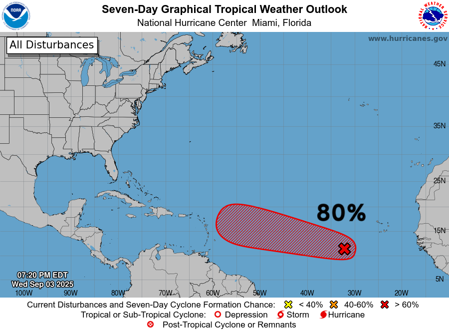
80% but poorly organized!
Atlantic Satellite Imagery | IR & Water Vapor
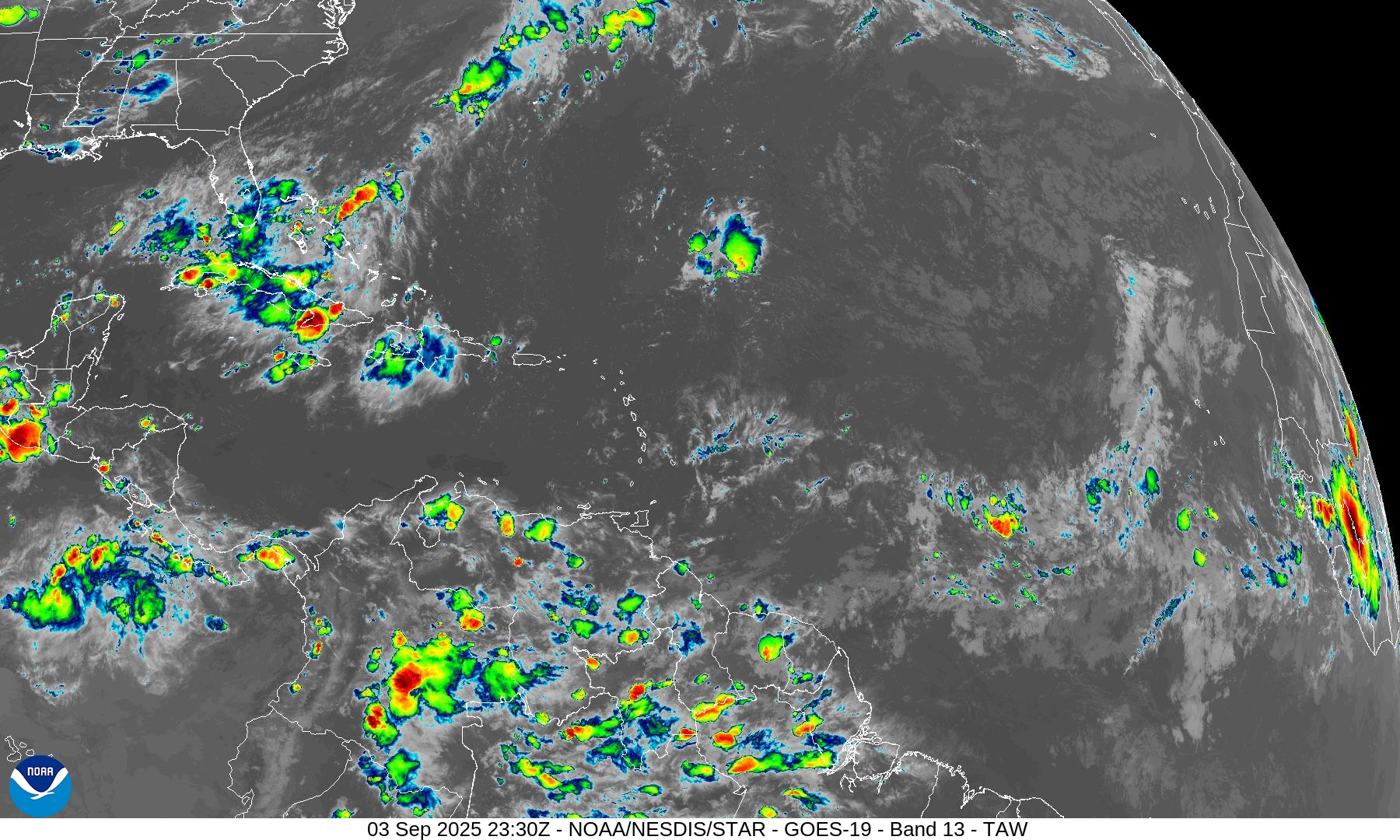
Huge dry spot in the water vapor over the central Atlantic tropics and subtropics.
SST (°C) + Anomaly (°C) | ECMWF 12z
The tropical wave will have plenty of warm water to work with on a westward track depending upon where it detaches from the monsoon trough as it undulates.
Erin really did a number on the Gulf Stream Wall. I’m not sure this recovers in 2025 to its regular climatological warmth — until the winter comes along and meets it again.
NASA GEOS-5 | 10-day Dust Extinction
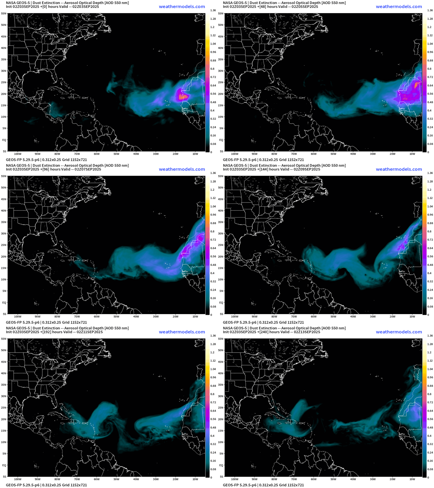
\STILL a persistent plume of dust coming off north Africa into the Atlantic into the MDR for next week+
NOAA Tropical Surface Analysis | 18z
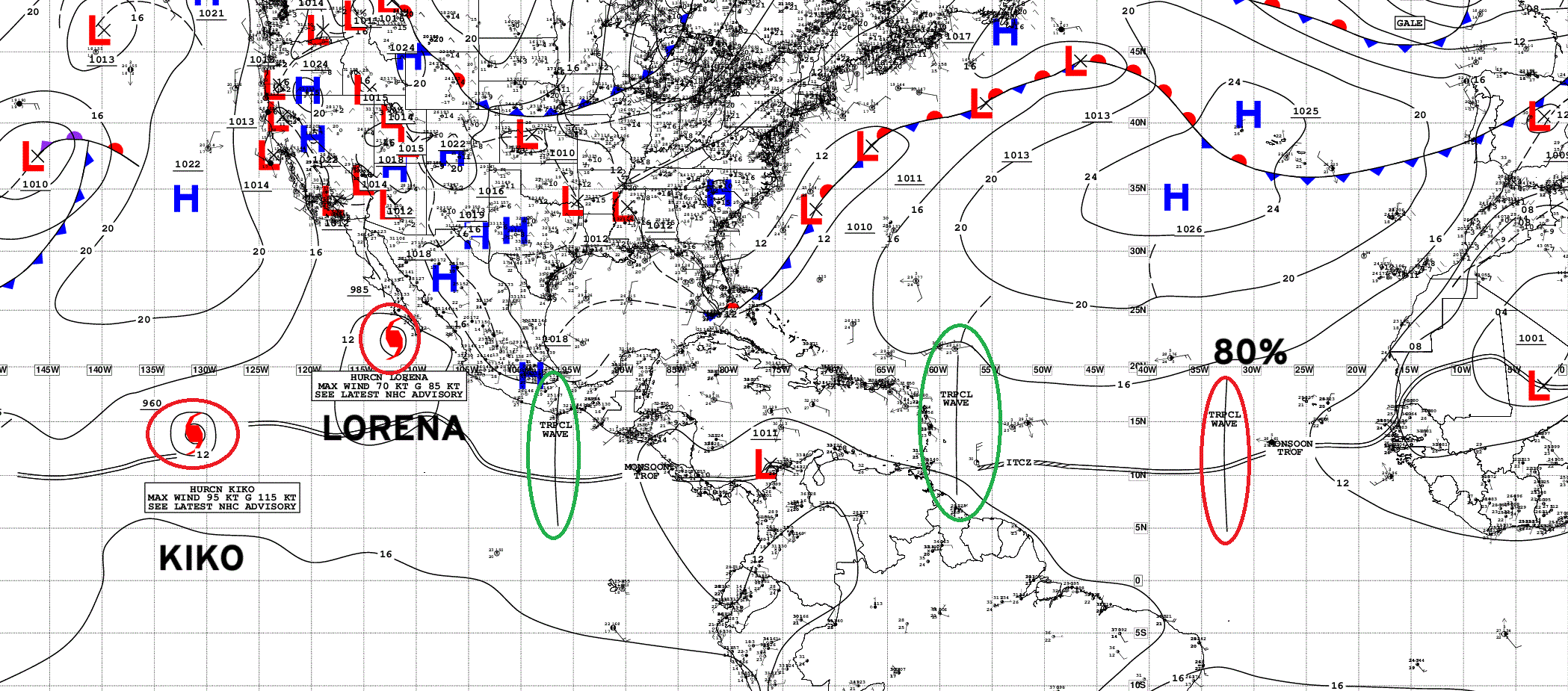
Atlantic Tropical Waves = 2 including wave in monsoon trough in East Central MDR (80%)
Eastern Atlantic Visible Satellite
ECMWF EPS 18z Ensemble | Active Cyclone Tracks Through 6-days
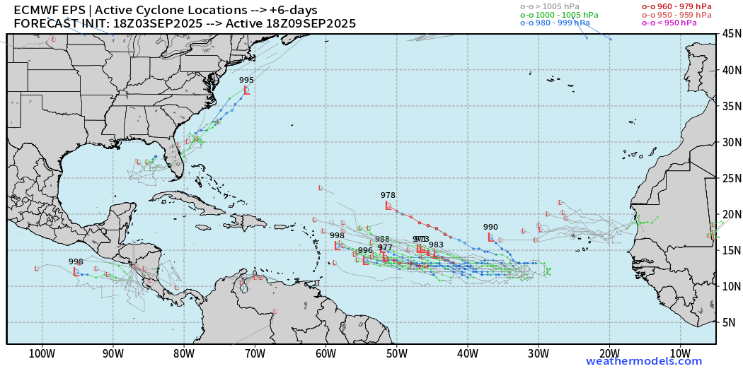
Many more “southerly” tracks (and weaker) in the most recent 18z full-physics update from ECMWF.
ECMWF EPS 12z Ensemble | ALL Cyclone Tracks Through 15-days
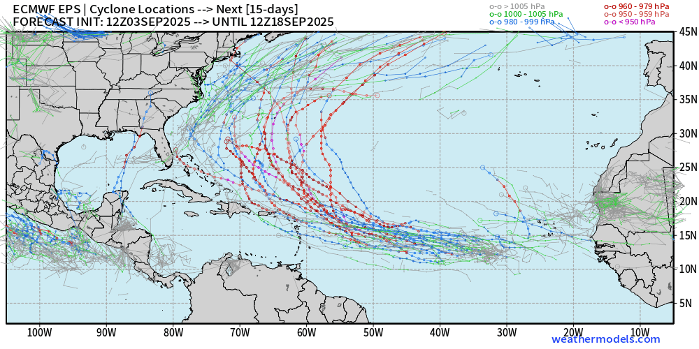
Good news is that any of the major/intense hurricane track members recurve out to sea. The Gulf of Mexico / Caribbean outlier developments have mostly poofed.
ECMWF AIFS-Ensemble | A.I. Trained 12Z | Active Tracks at Day 7
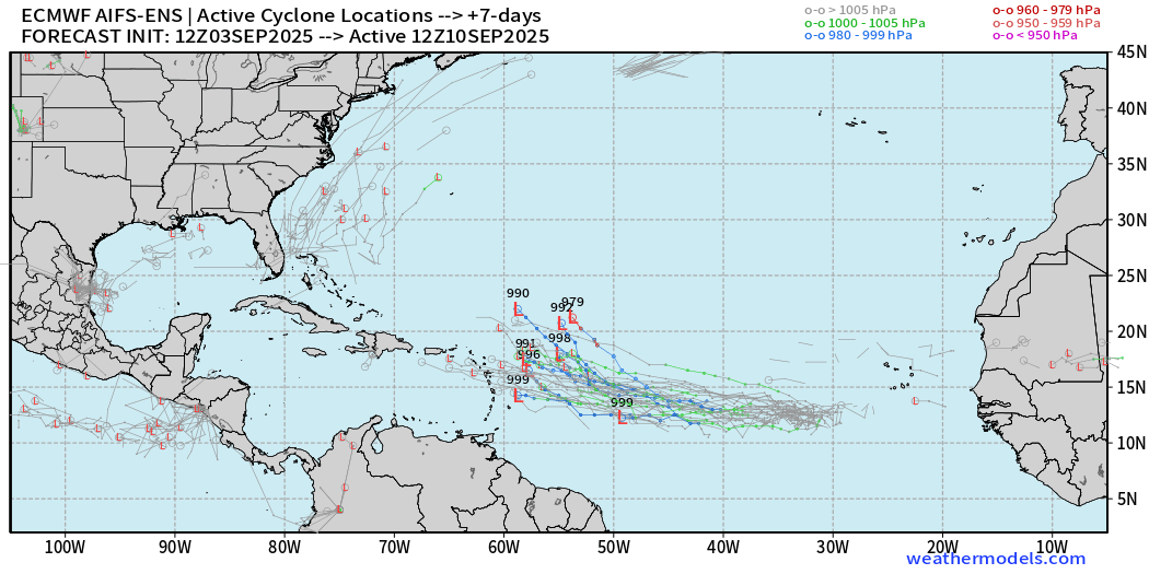
ECMWF AIFS-Ensemble | A.I. Trained 12Z | Active Tracks at Day 12
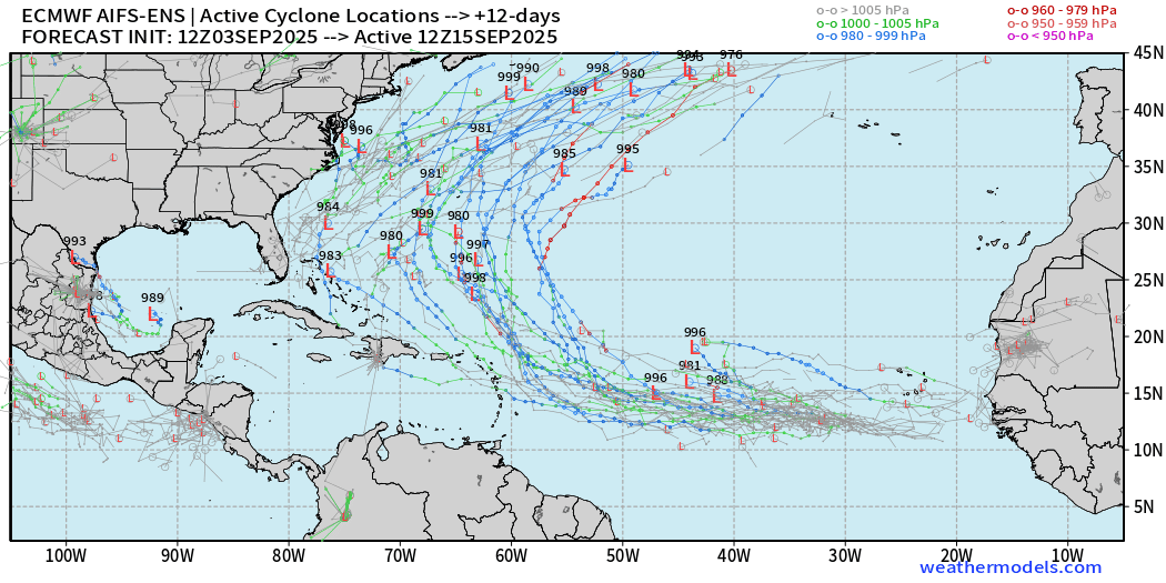
Gone are the plethora of major/intense members solutions from AIFS-ENS.
Another wave appears on the horizon in the MDR at Day 12 suggesting more potential development opportunities in the pipeline.
Eastern Pacific Tropical Update
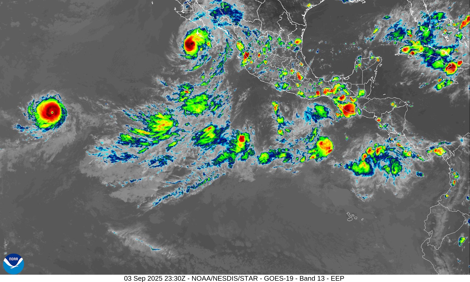
Kiko and Lorena
Category 4 Hurricane Kiko
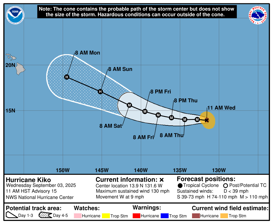
Very impressive eye!
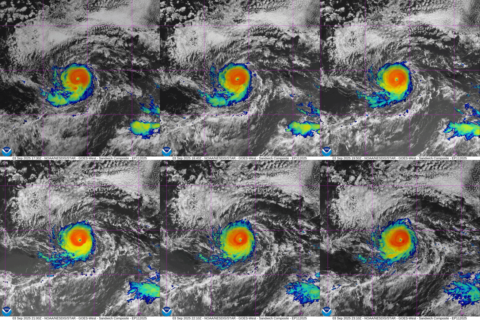
Making a run at Category 5
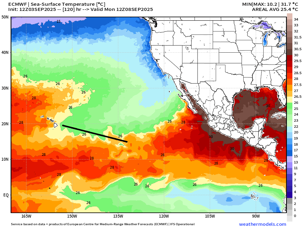
Hurricane Kiko will reach cooler waters and be mostly knocked down by time it arrives near the Hawaiian Islands.
Cooler water along the track is bad luck for Kiko to maintain its impressive structure.
Hurricane Lorena is Category 1 — but could dissipate prior to landfall due to wind shear and colder waters. The resulting moisture would continue into Mexico and the U.S. Southwest.
Maps sourced from weathermodels.com designed and innovated by yours truly! Please subscribe there for real-time access to the newest maps, charts from all of the weather models including ECMWF.
- Milepost
- 722 · laid 2025-09-04T00:43:31.659000Z
- Source
- https://weather.substack.com/p/september-3-2025-wednesday-tropical
- Digest
- e856551951c10fb10116cbff365aaa74ae208f0d84c17b5e73bb1ff2fbbcdcfc
- Machine
- JSON